
Early March 2023.
Following on from our previous post, where we ventured into the Chilean aspect of southern Patagonia’s second highest mountain, Monte San Lorenzo, this chapter covers our efforts to visit the mountain and surrounding national park from the east, via the Patagonian steppe of Argentina.
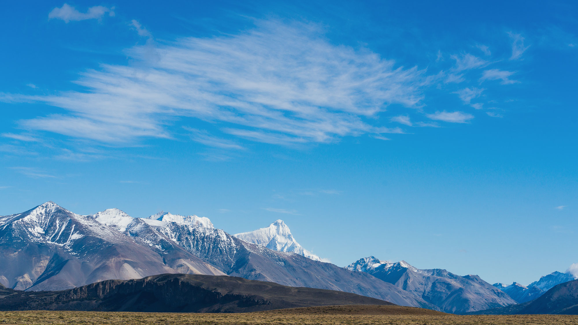
Within Argentina a large section of Monte San Lorenzo and its range lie within Perito Moreno National Park, which is Argentina’s oldest park. This park sprawls over a vast area that includes empty steppe, endless lakes, stunted southern beech forest and the abrupt eastern wall of the Andes.
It’s a region of weather extremes, with very cold winter temperatures and notorious wind. Most days are windy and the chinook that sweeps down the mountains from the west has little to slow it, leading to wind speeds that can make cycling dangerous, if not impossible. If the wind’s behind you – viento a favor – on an average day, speeds of up 30km/h+ across even the rough ripio can be expected, but progress into it or with it to your side can be painstakingly slow, with single digit speeds and difficulty maintaining a rhythm.
Aside from visiting this park, crossing back to Argentina would add some more diversity to our route, and that’s one of the attractions of cycling the Andes; when you’ve enjoyed one type of terrain, culture or cycling for a while, you can cross a pass and freshen the journey up again. We planned to cross Paso Roballos from Cochrane, follow the remote Ruta 41, visit the park, and then cross back to Chile and the Carretera Austral again via the infamous Paso Mayer, which will be the topic of the next blog.
From Cochrane we backtracked north on the Carretera Austral for 17km, turning off into the Valle Chacabuco/Parque Patagonia, and backtracking through there on the road we had followed out from Sector Furioso nearly 10 days earlier. We hadn’t left town until midday, but with a vigorous westerly wind we covered the 80km and 1200m of climbing quite fast and arrived at the Chilean carabineros post early evening. By the time we got there the wind was close to gale force and it was hard to stand.
When we enquired about our exit stamp, they told us the Argentinian post (12km away) would be closed by the time we got there, so they could not stamp us out (as you have to stamp out and in on the same day). So it looked like we would need to stay the night.
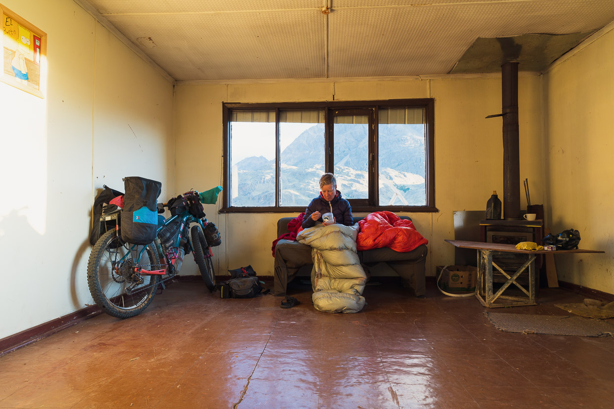
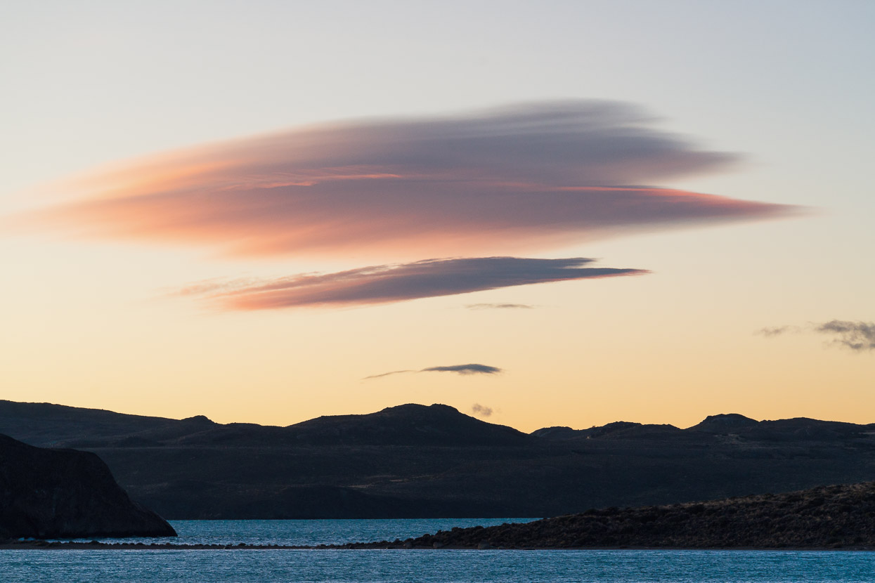
At first they seemed to expect that we would ride back down Valle Chacabuco more than 10km into the gale wind to a park campsite, but when we said that it was more or less impossible and unsafe there was some to and fro with the jefe and they agreed to put us up. At the end of their complex was a run down old staff quarters that they gave us for the night. We were quite happy not to have to pitch the tent, and be out of the howling wind. When we optimistically asked if it might die down in the evening, the policeman’s eyes widened and he shook his head, “no, it usually gets stronger!”
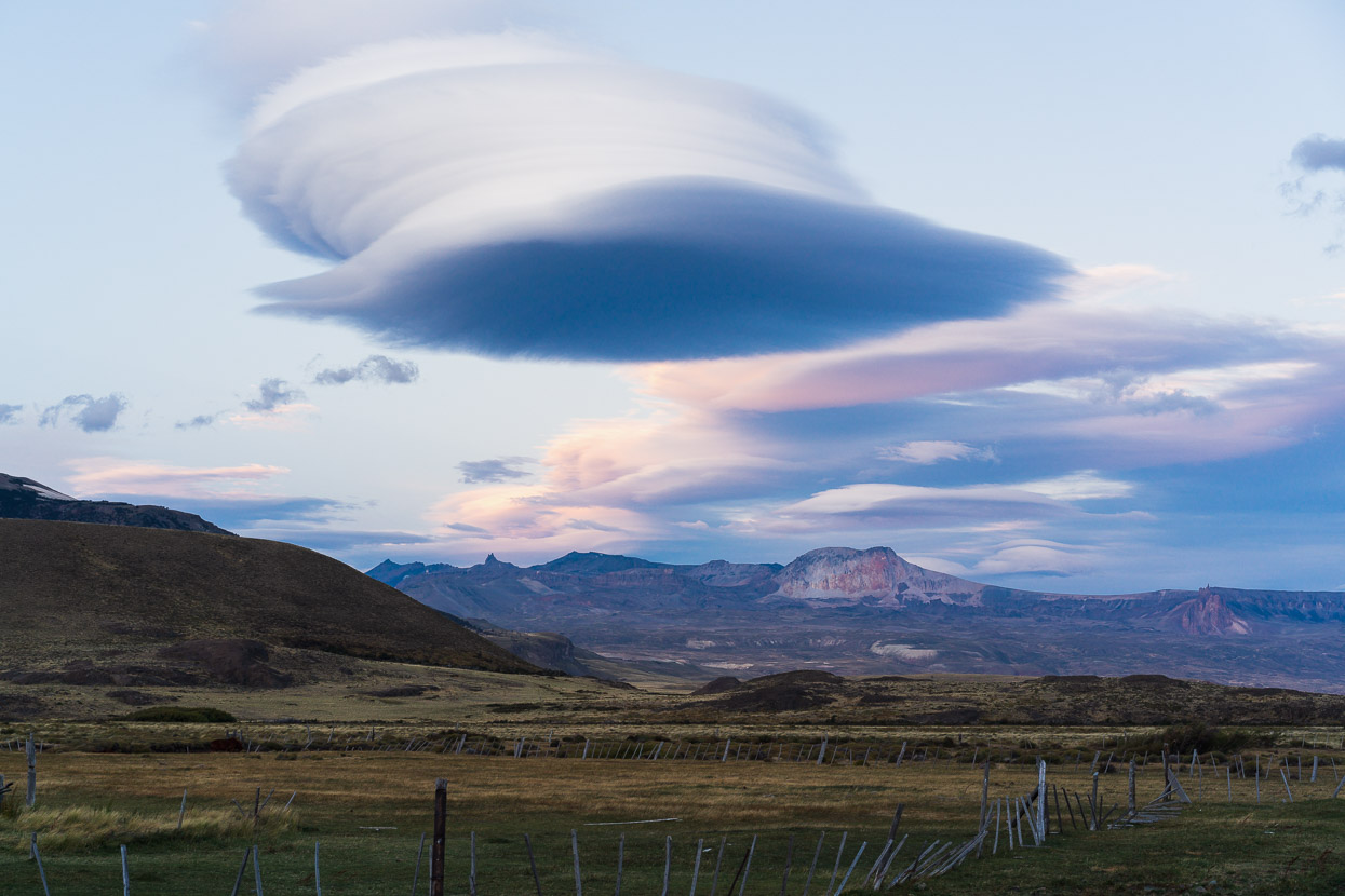
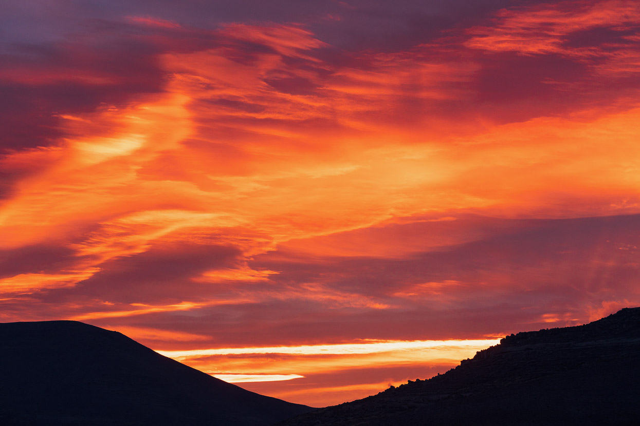
The wind didn’t relent, as these lenticulars will attest, and in the morning it was still roaring through the alamo trees.
The post was supposed to open at 8am, and of course we were raring to go with no one in sight. After waiting for about 15 minutes Hana got impatient and knocked on a door around the back, where the carabineros were all tucking into their coffee and breakfast. Someone reluctantly got up to come and stamp us out.
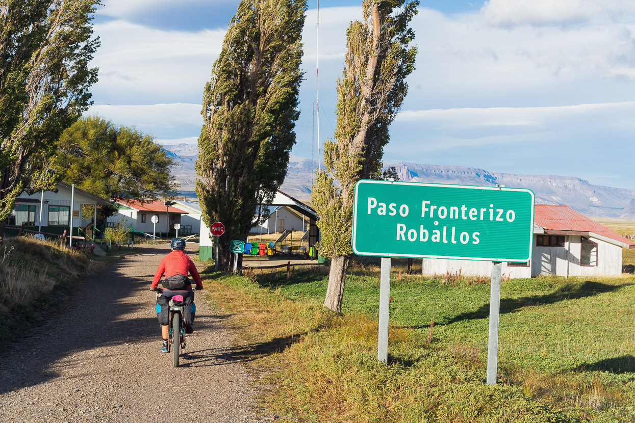
Beyond the carabineros post we left Valle Chacabuco behind and the wind blew us out into the open pampa.
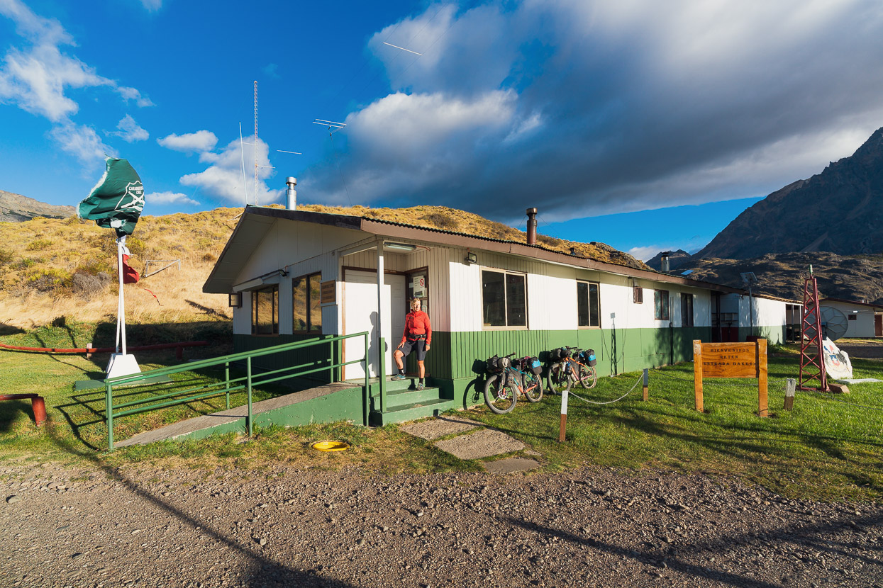
Typically, the Argentinian gendarmerie post was a more humble affair. After pleasantries, the officer wrote our names and passport numbers down in a ledger (no satellite tech here) and stamped us in. Pass crossing number 10 between Chile and Argentina complete!
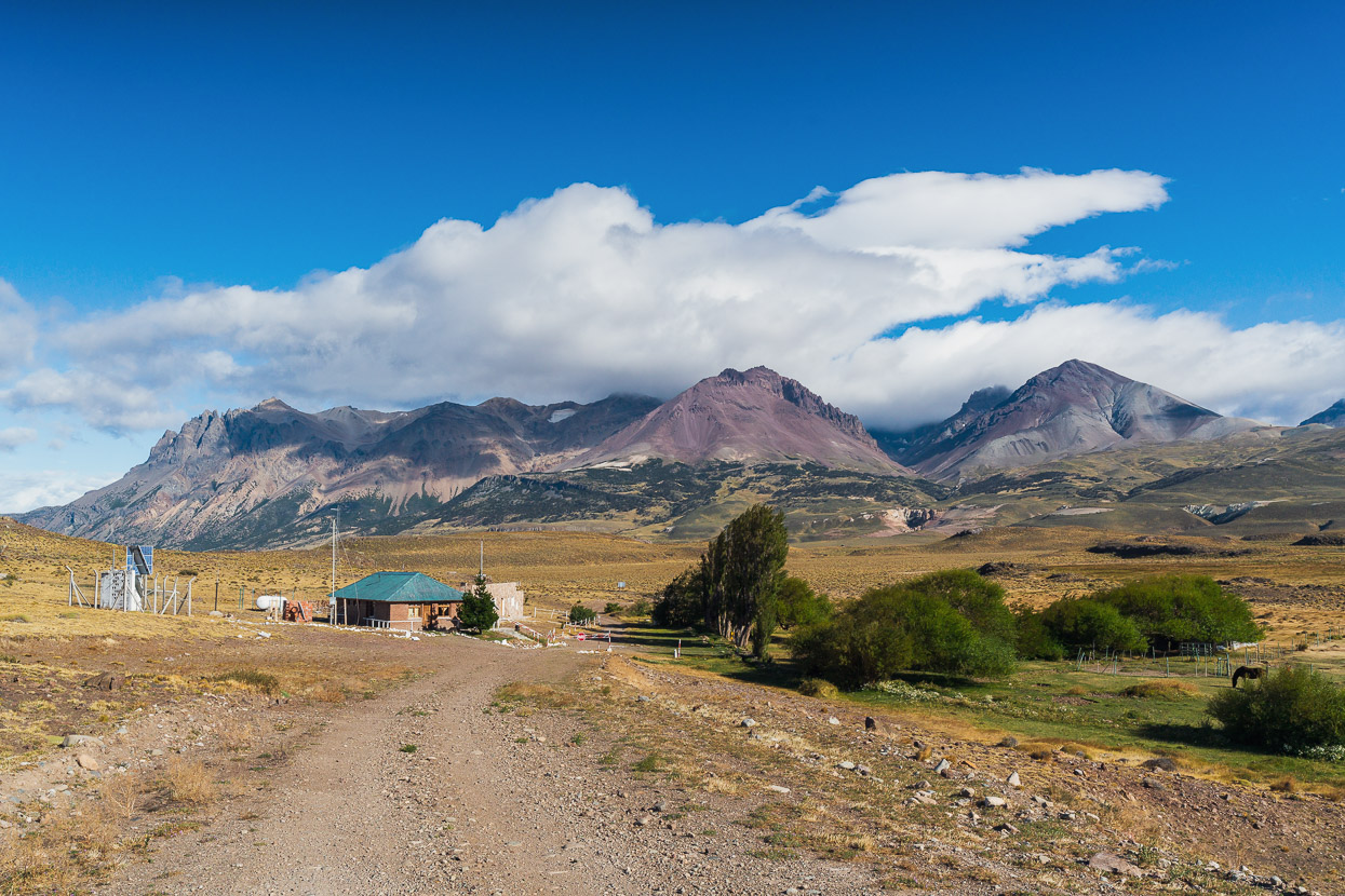
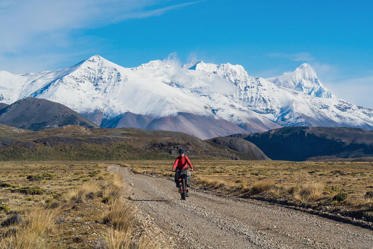
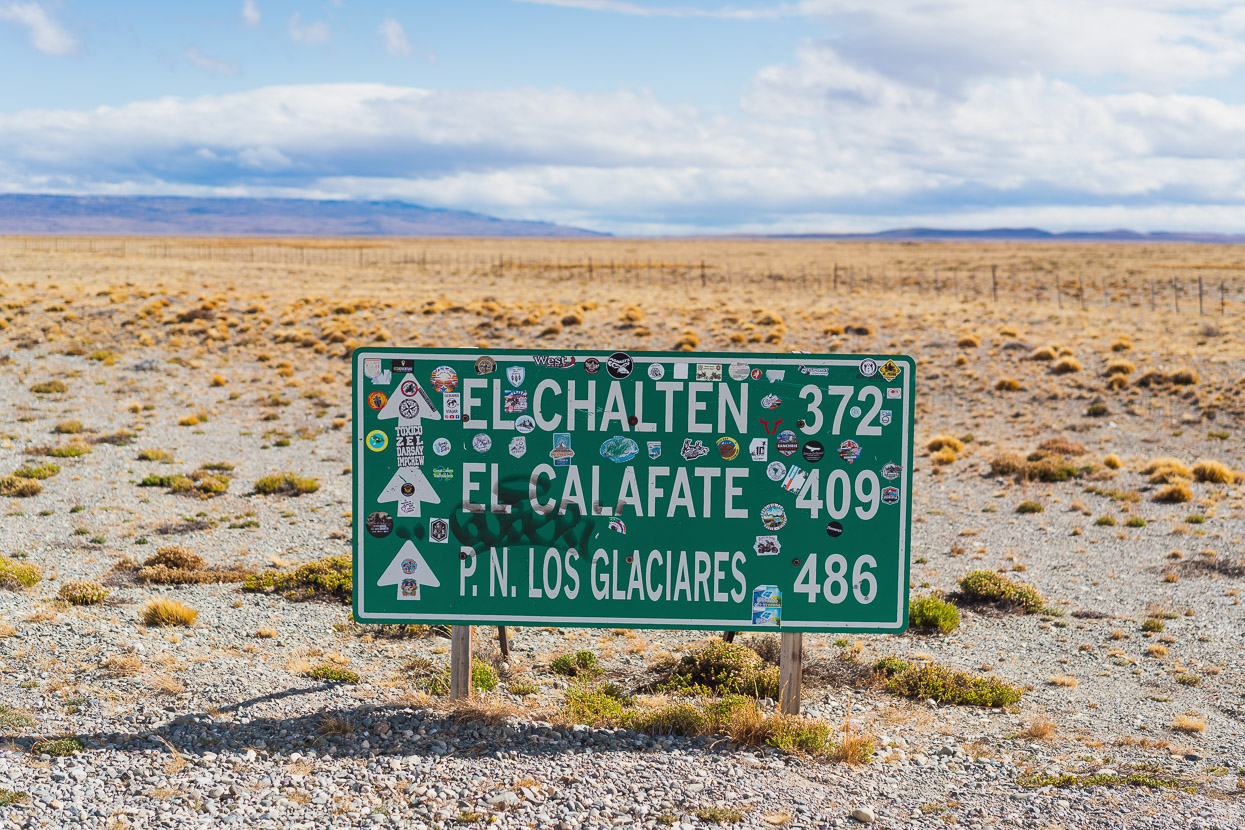
Just 2km further down the road we reached a junction with the Ruta 41 which is a remote secondary road that runs N-S down the foothills of the Andes. In sections it’s very much 4WD and dry weather only. There’s an AGVP (road maintenance) post there. Juan worked there 15 days on, 5 days off, alone in the middle of nowhere, although he sometimes takes in cyclists who arrive there late in the day, as it’s the only shelter for a long way. There’s free wifi and he can fill water bottles. Strangely, Juan told us there would be plenty of ground water between there and Lago Posadas (62km away), but there was actually none! So we were glad we filled bottles.
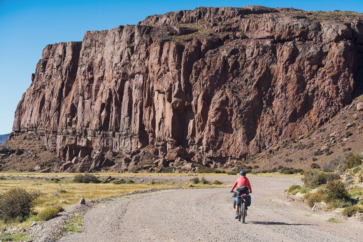
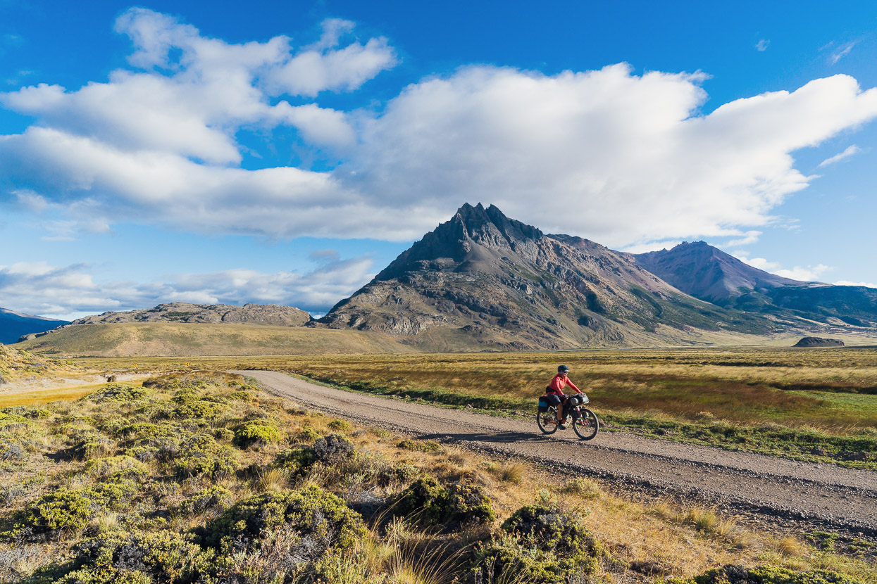
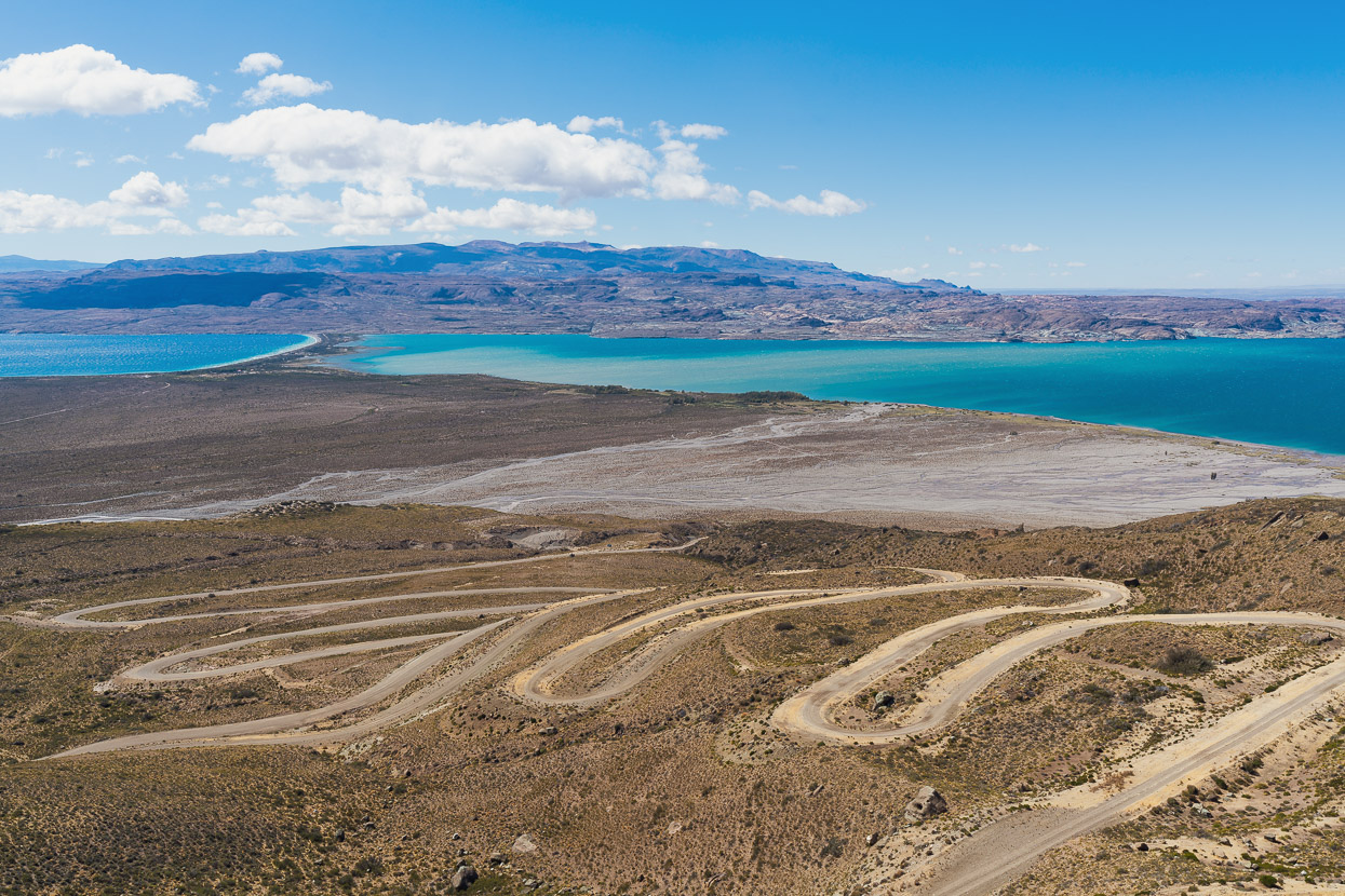
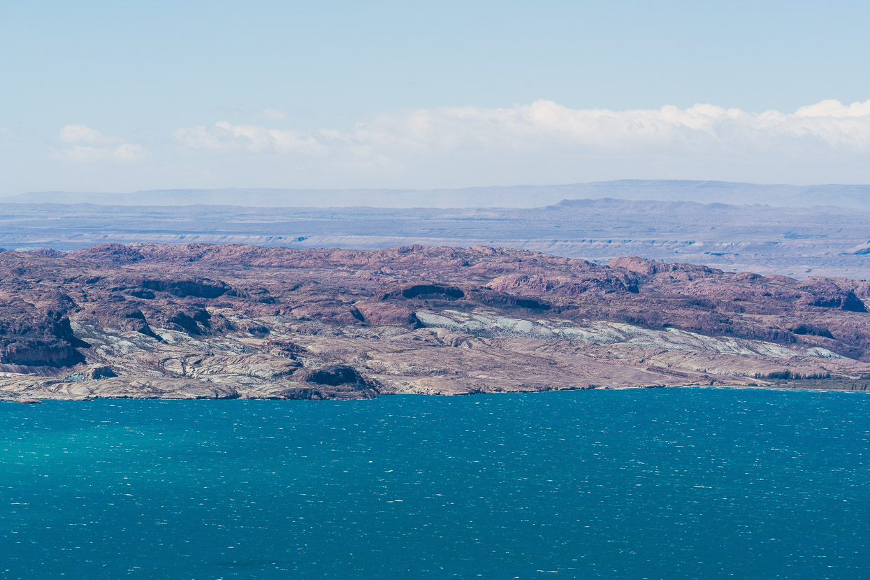
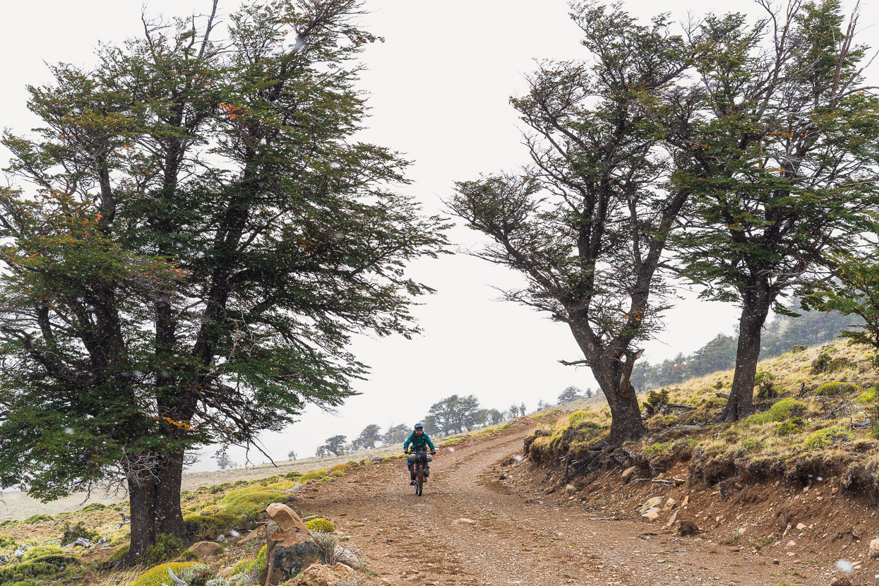
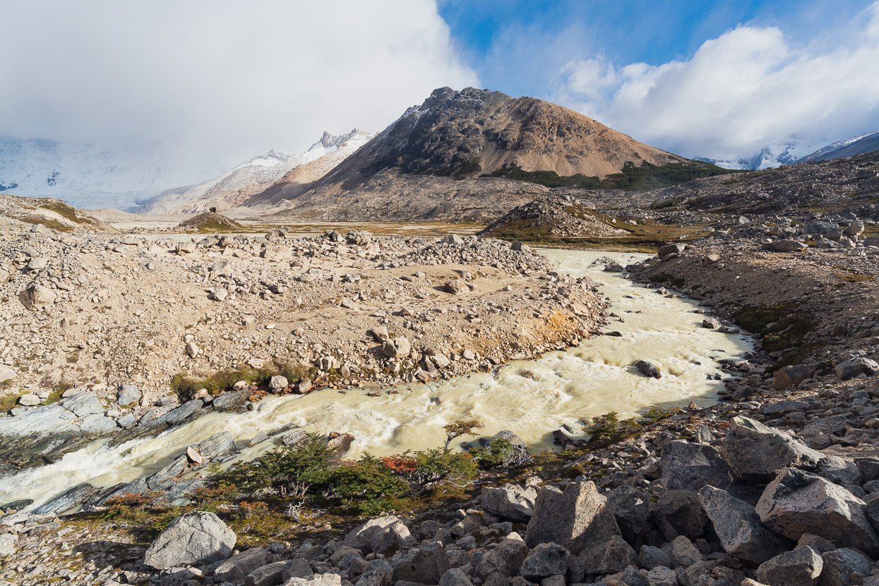
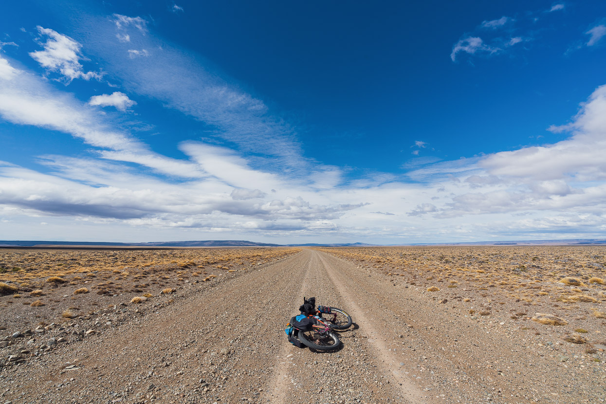
It was still super windy, but it was to our side or just behind us most of the day and we made good progress much of the time, only having to get off the bikes a couple of times. The scenery was fantastic, with cliffs, volcanic outcrops, evaporated lakes and rolling pampa. It’s an all-weather road through to Lago Posadas.
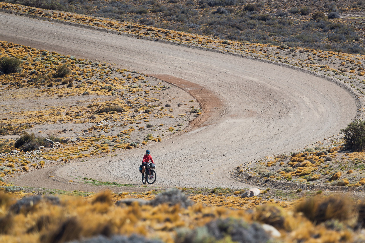
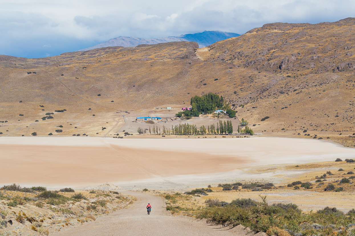
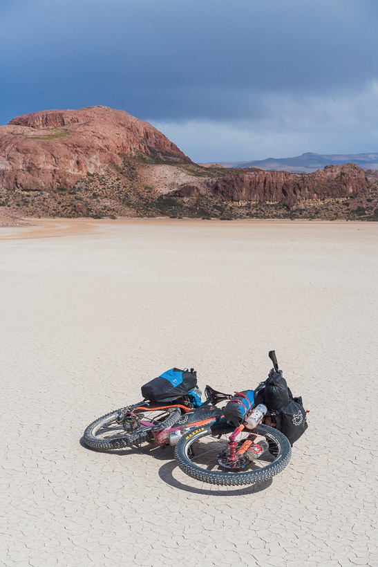
Crossing this lake bed the wind was so strong we had to ride in the ditch.
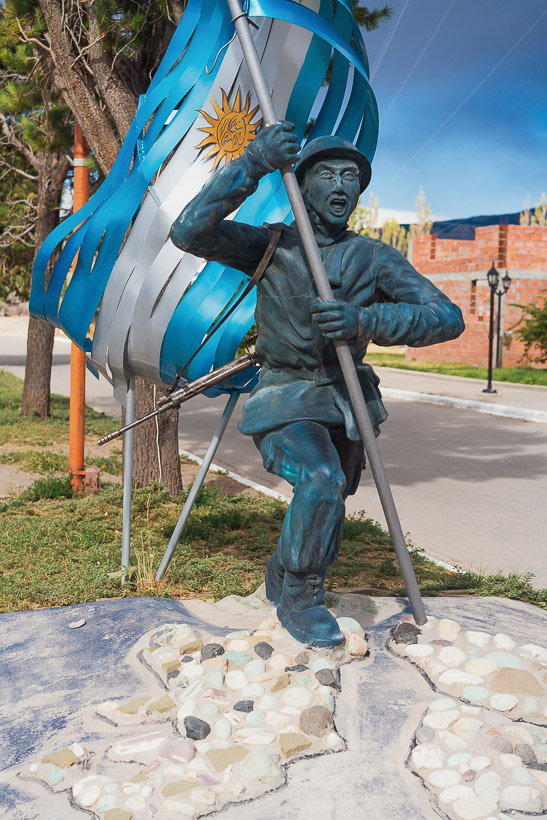
Lago Posadas was a typically random, remote Argentinian town with the main street adorned with a Malvinas (Falkland Is) memorial (the soldier stands on an outline of the islands) and a concrete choike (Rhea), an ostrich-like native bird. It’s a long way from anywhere, but there is a small amount of tourism and hence some reasonable services. There was excellent cake in the kiosko at the petrol station.We checked into an hospedaje and set about resupplying for eight days between the town’s two mini markets, which resulted in a lot of heavy food because there was not a lot of choice.
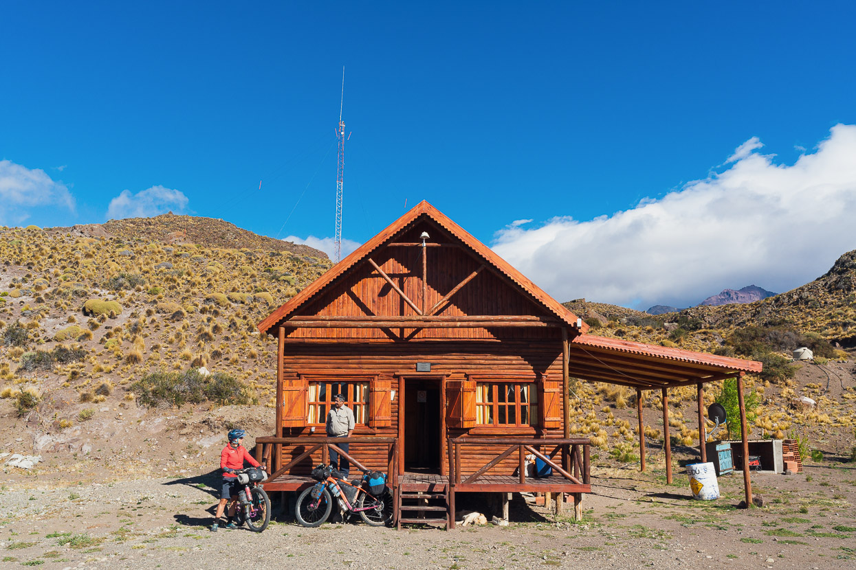
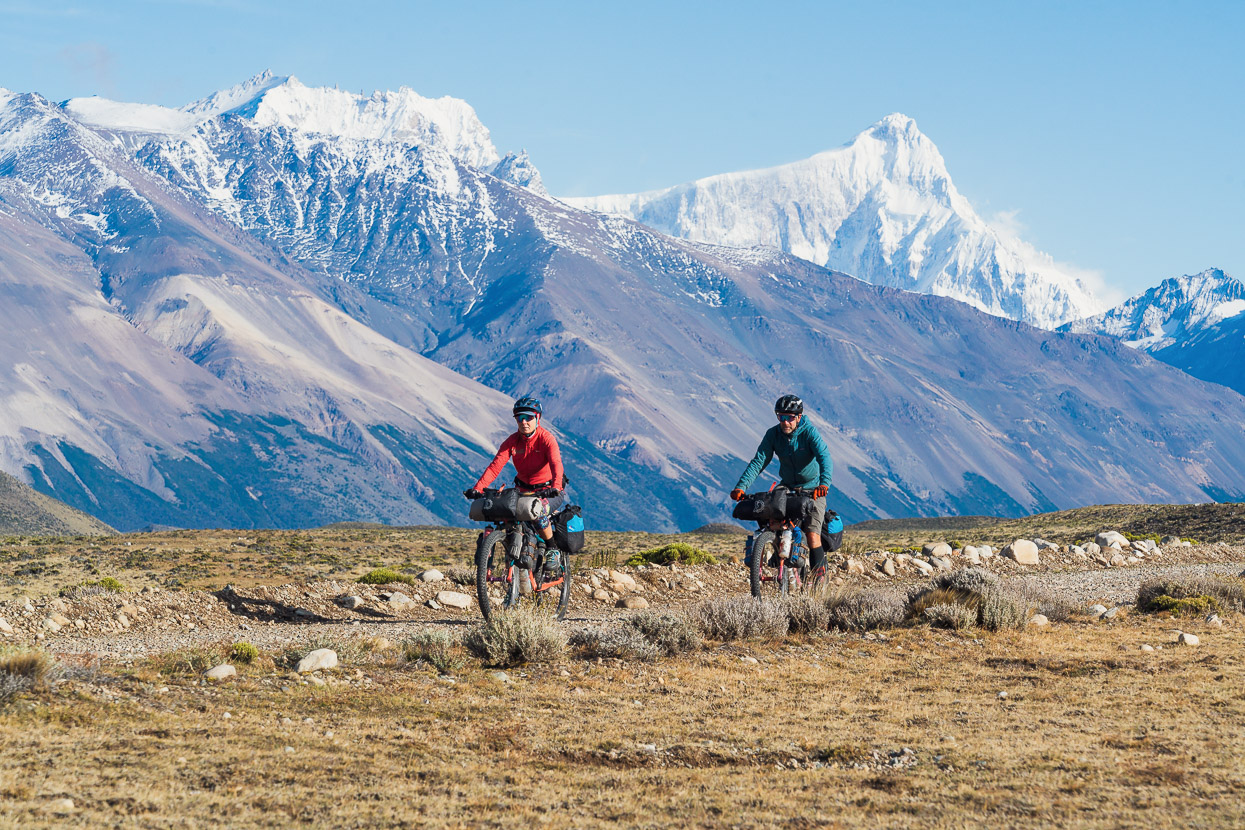
Loaded up with eight days food and fuel and ready to venture over the high section of Ruta 41 to Perito Moreno National Park.
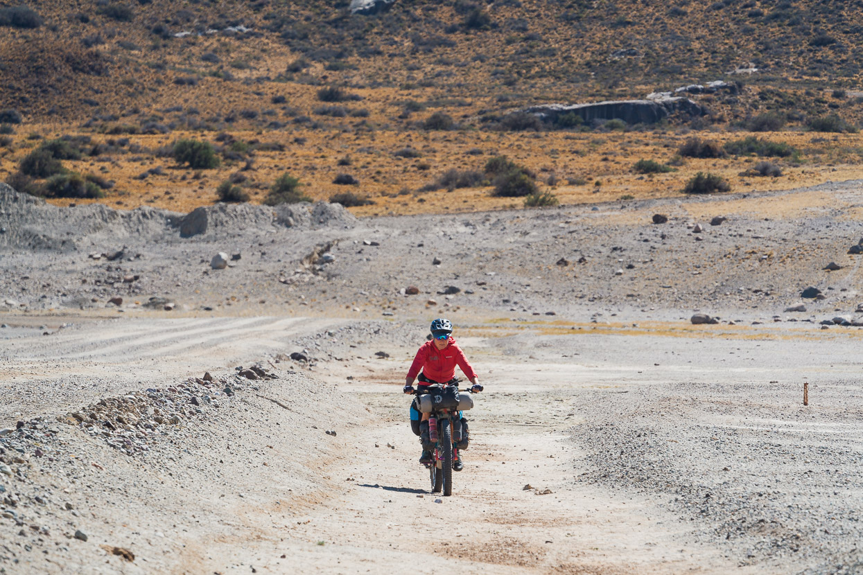
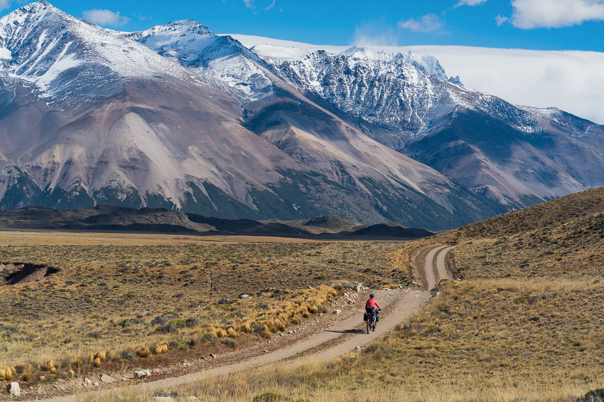
Beyond Lago Posadas the route follows the edge of the lake for a while, but unfortunately we had a fearsome headwind for the 15km to the base of the over 1000m climb so made really slow progress. Once on the climb’s amazing caracoles, the wind at least alternated as we climbed the switchbacks. At at stop earlier in the morning I’d leant my bike on a fence and unwittingly punctured our 1L plastic bottle of spare bencina blanca (white gas). It wasn’t until we climbed the first switchback and the wind came from behind us that I smelt the leaking fuel for the first time, by which time 3/4 of it had gone.
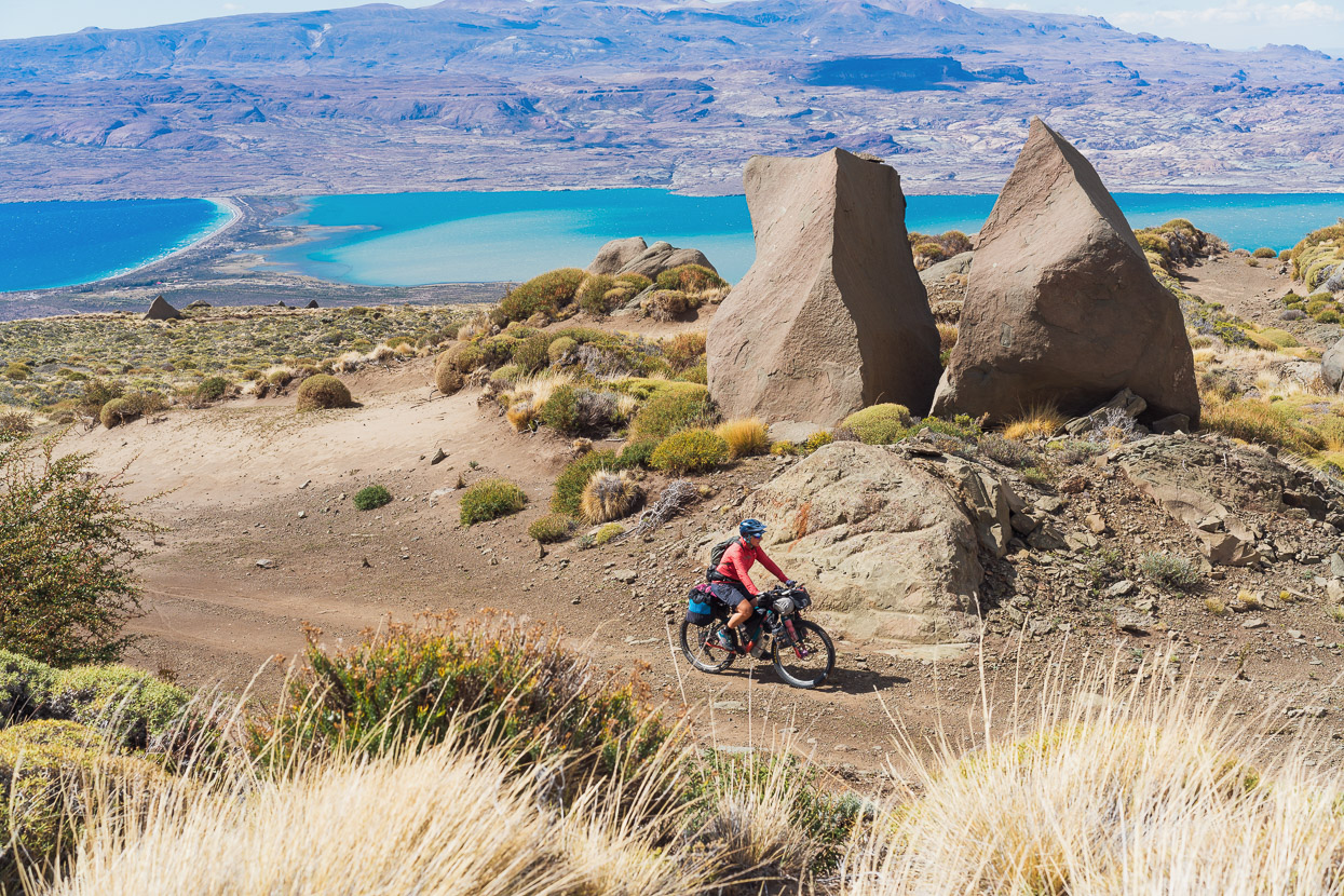
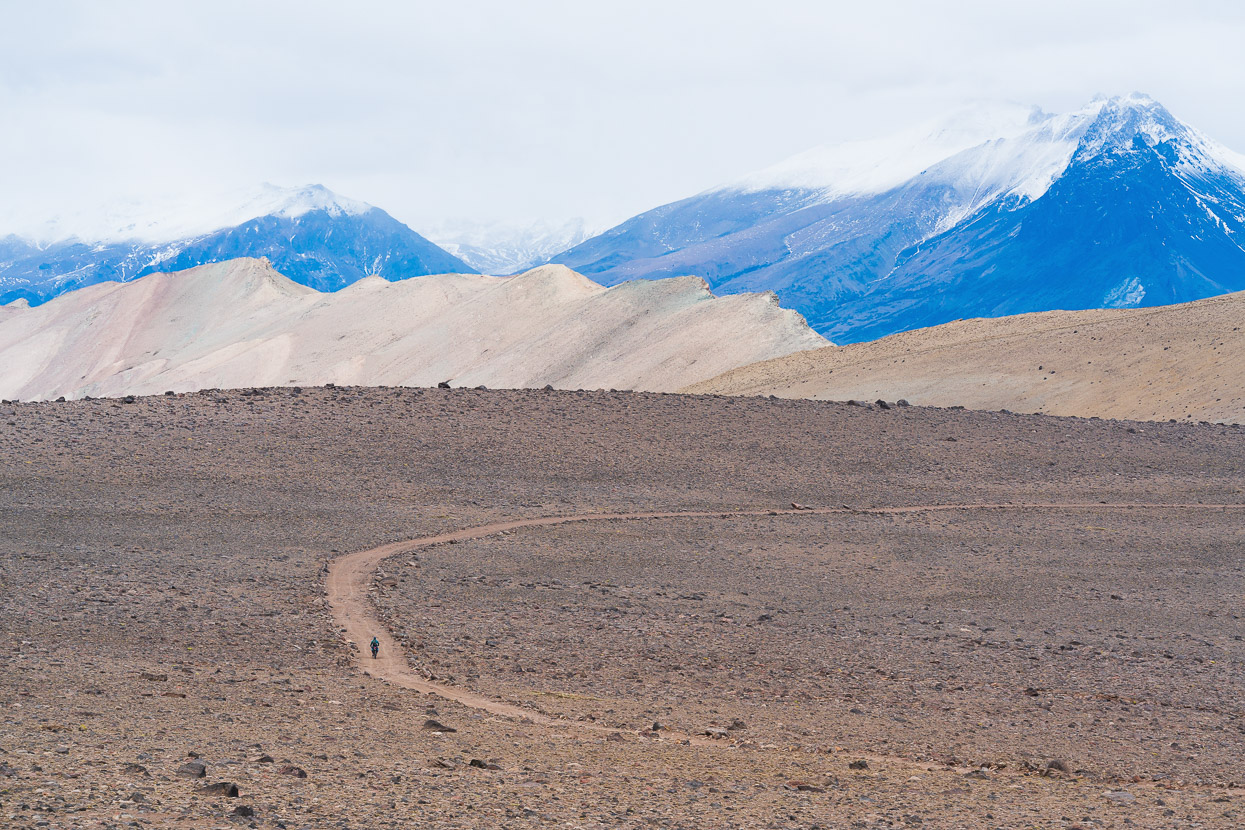
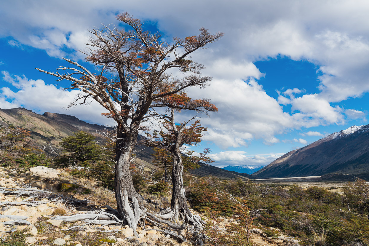
As we climbed higher the views became more incredible, with the barren rocky landscape reminding me equally of parts of Utah, and the high altitude desert of northern Argentina and Chile. But the wind increased too until we were forced off our bikes in a few places. It was forecast to gust up to 70-80km that day, and it felt like it.
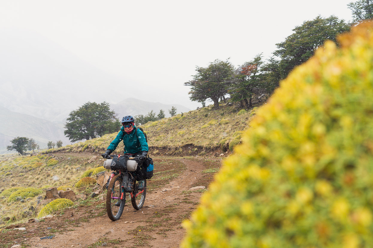
After climbing just under 1000m the route eased off, and then entered some more sheltered basins and valleys, but by then cloud had rolled in and it started to snow lightly. It was freezing cold in the wind and we were soon in extra layers and overpants.
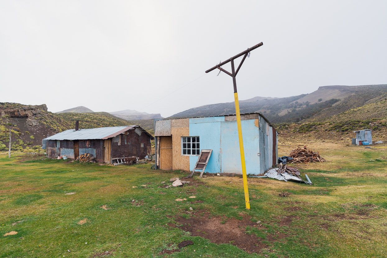
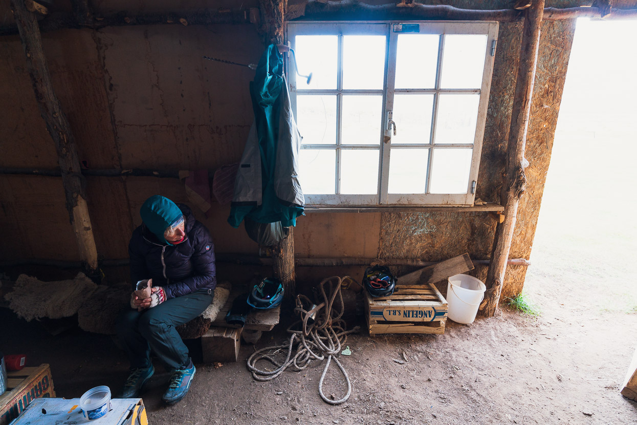
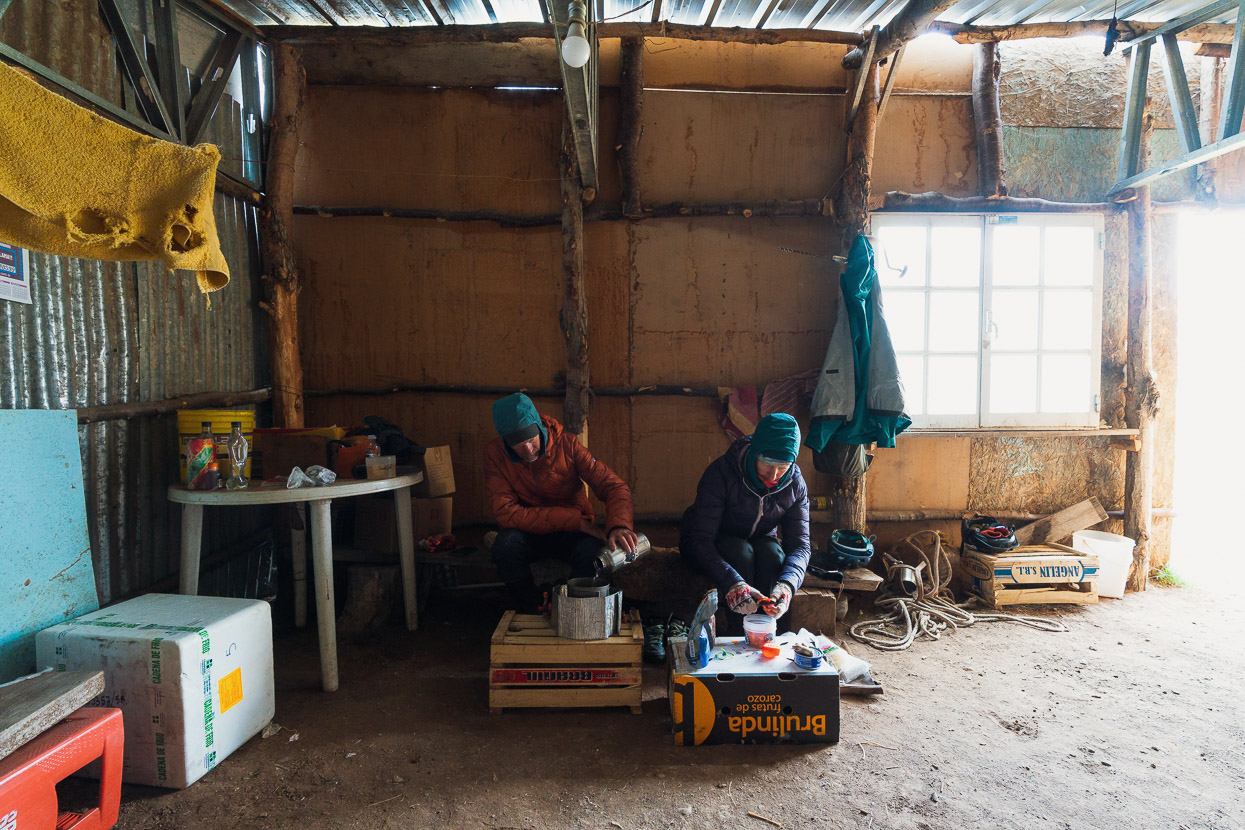
A small climb and descent dropped us into a bigger basin in the late afternoon as the light snow continued. We’d spotted some farm buildings on the satellite map, so we detoured a short distance to those and found them uninhabited. The galpon (shed) wasn’t locked, so we decided to help ourselves for the night and take shelter there.
A blazing sunrise in the morning gave way to more grey and overcast, but at it least it wasn’t precipitating any more.
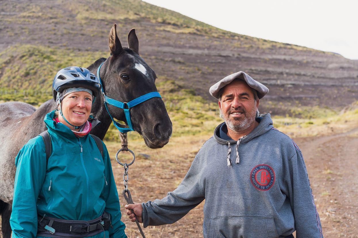
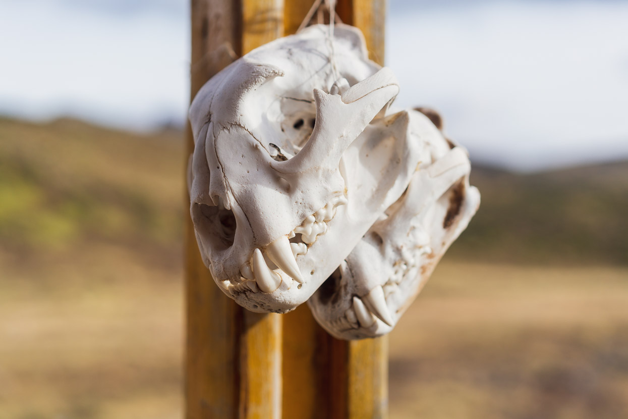
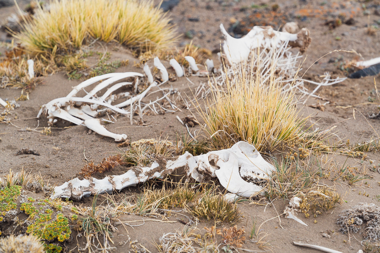
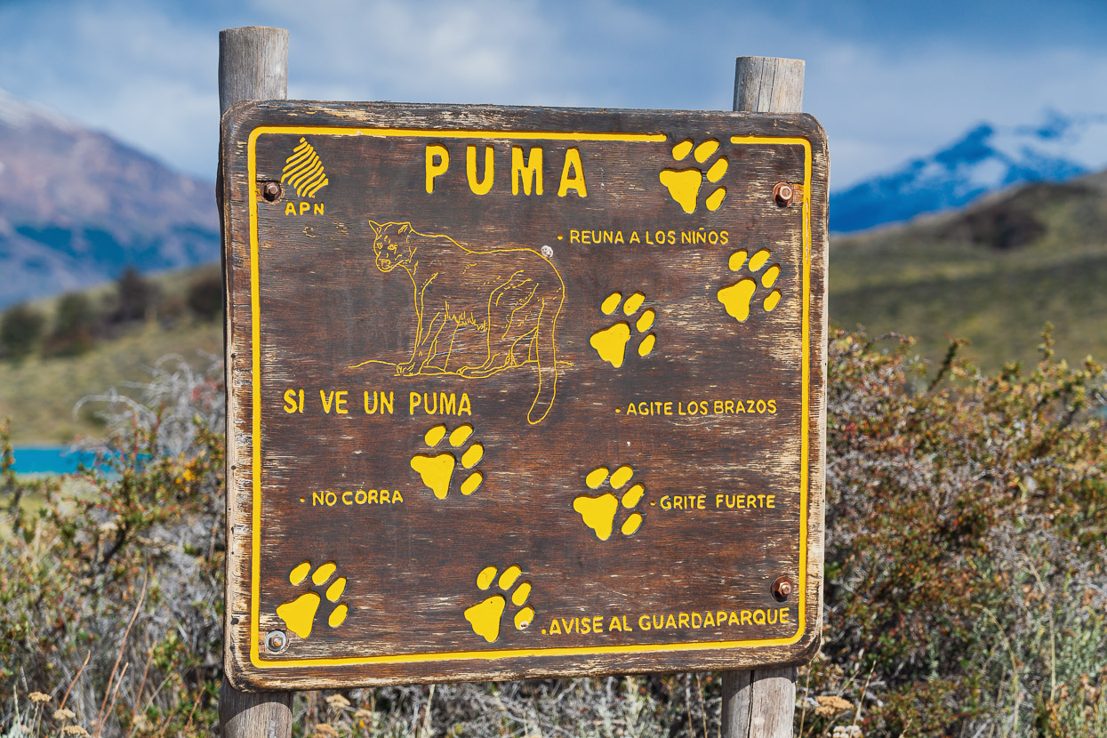
We didn’t ride far before we came to another pair of buildings, these ones occupied by Martin, who lives here permanently shepparding the livestock on this huge estancia. Martin was great to chat to and gave us a big bag of homemade fried bread (torta frita). On his porch hung a pair of puma skulls, male and female. Martin commented that because pumas are protected in the park, numbers are growing, and often stalk his cattle, so they do get shot here.
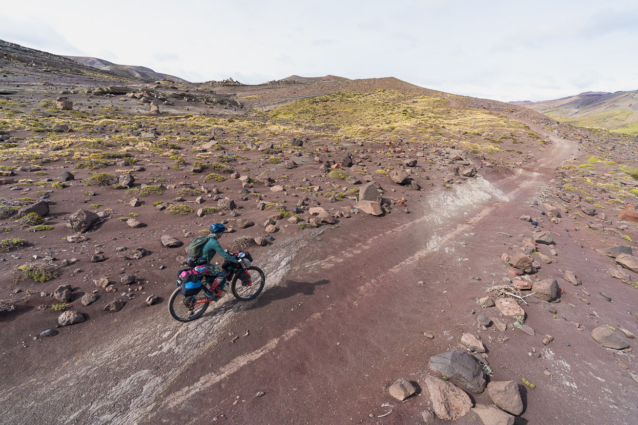
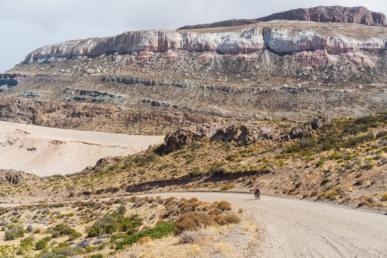
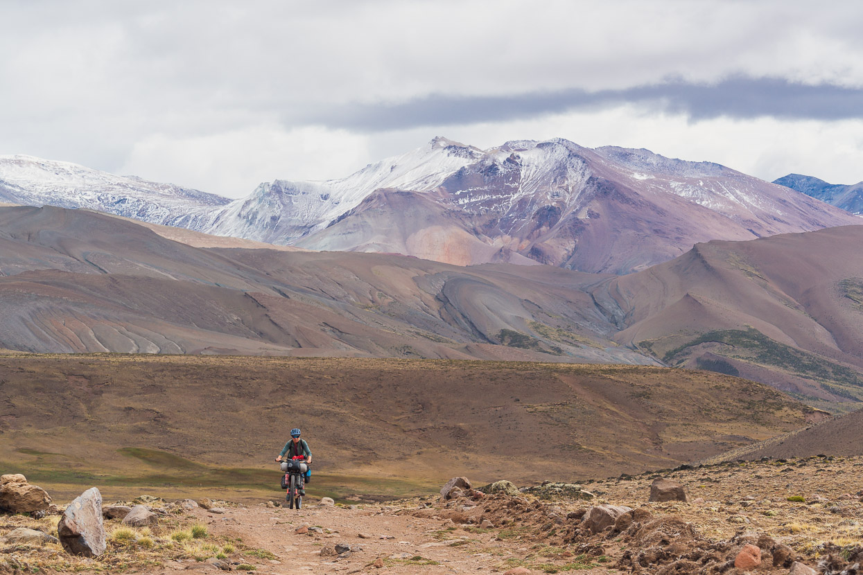
This section of the road is basically 4WD and had been since about halfway up the big climb from Lago Posadas. It’s a fantastic bikepacking route, with no traffic, fun riding and amazing scenery. But it was hard work with 7-8 days food on board.
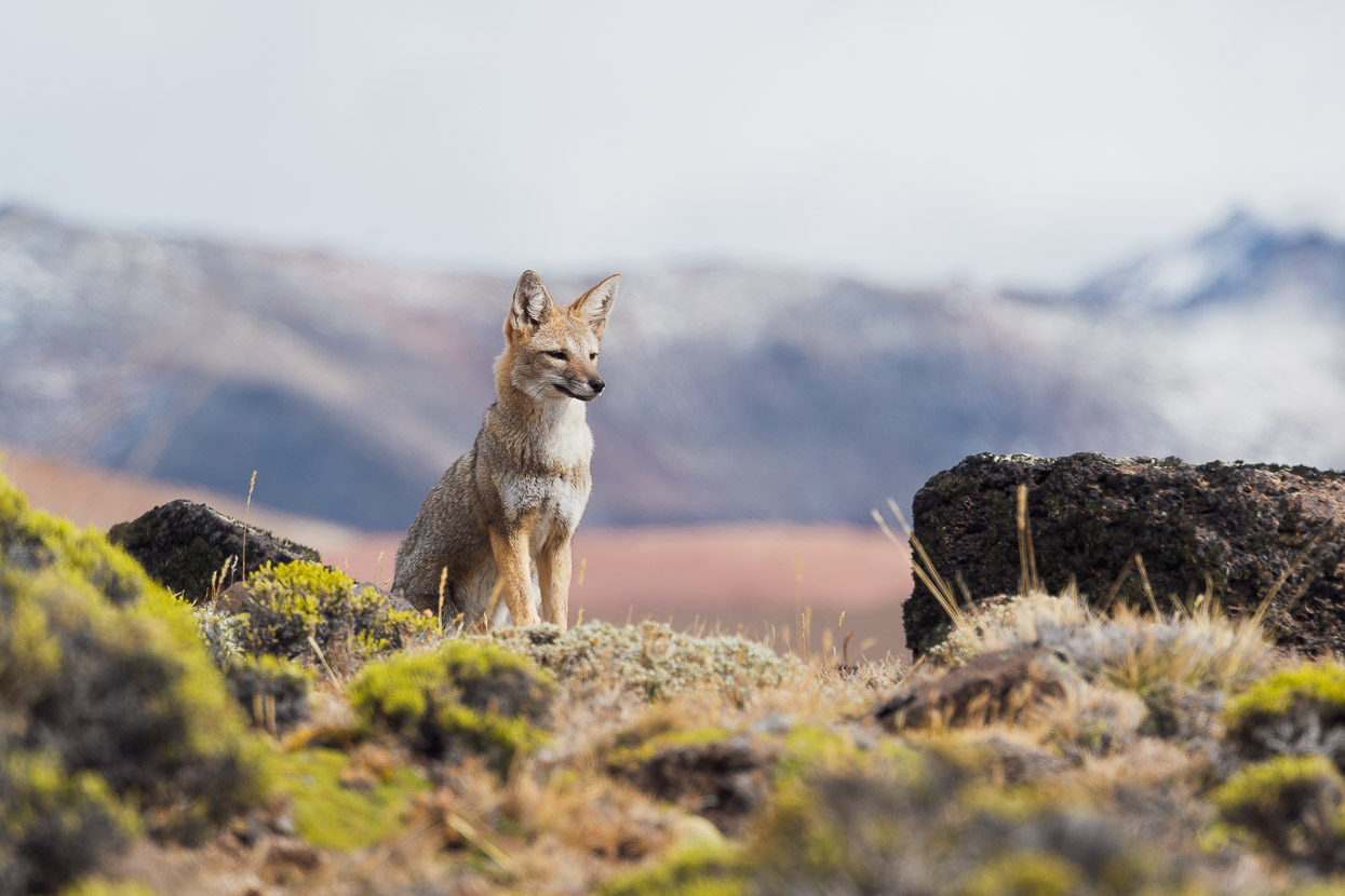
At the top of one climb I startled this Andean fox, who then settled down and hung out while we snapped photos. They are often quite relaxed around humans.
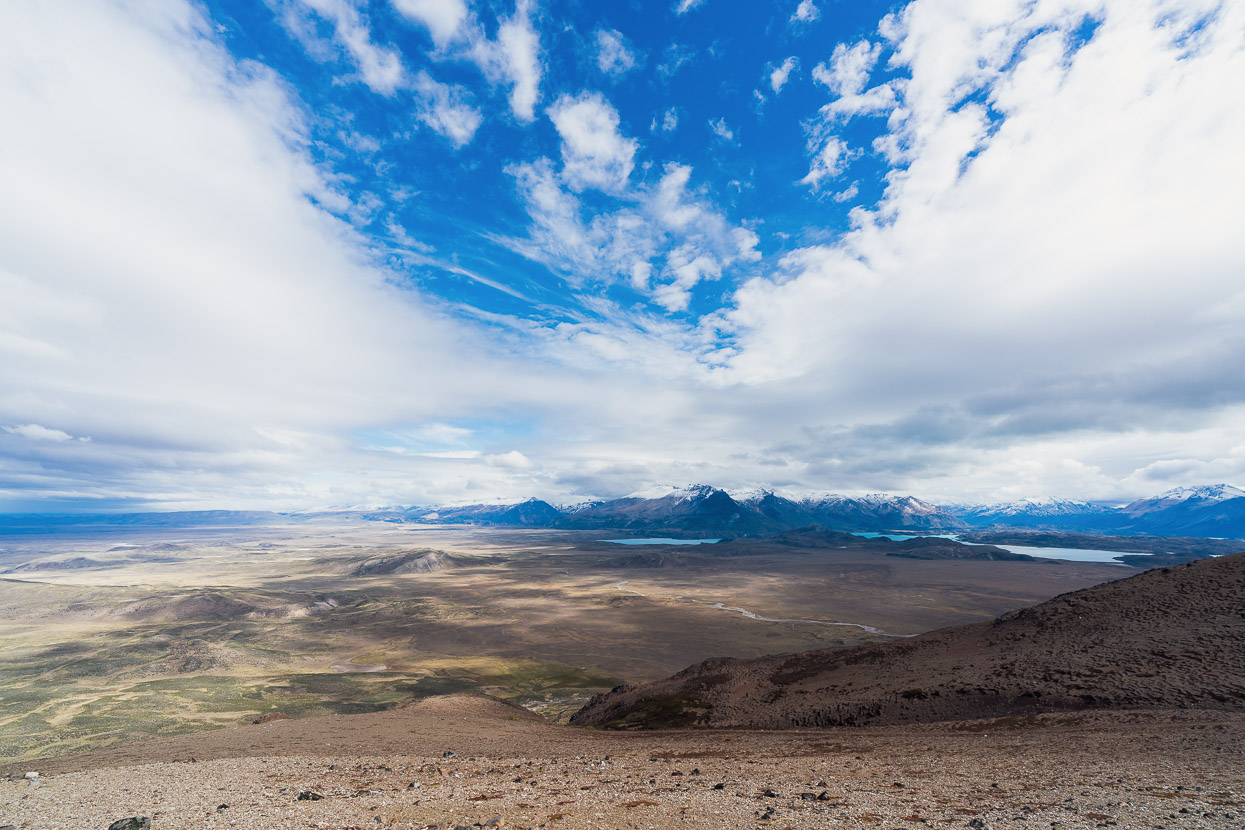
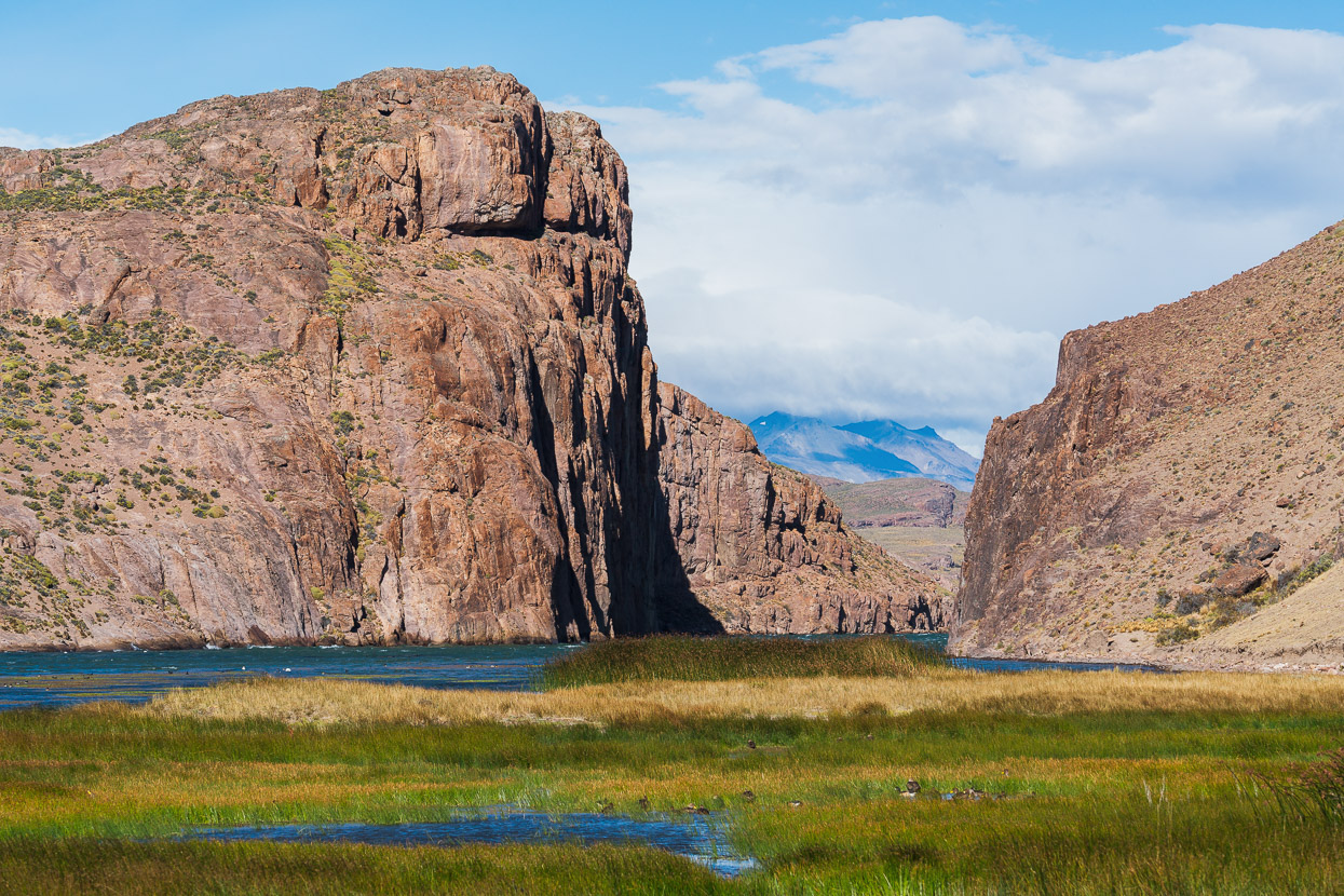
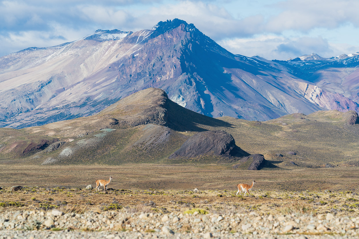
After a full afternoon we reached the top of the big descent down into Perito Moreno National Park. To the left is open pampa and the east, while to the right (west) is Laguna Belgrano and the Andes.
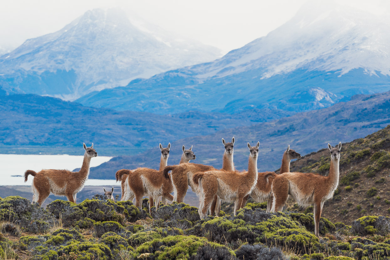
Already there were large herds of guanaco around, curious but keeping their distance while we photographed them.
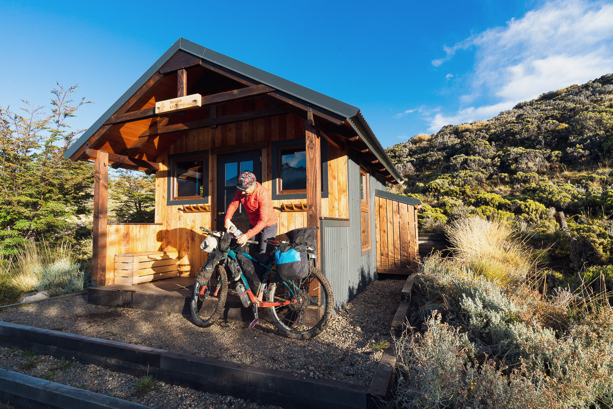
The park entry office was just a short distance from where we joined the park road (Ruta 37). Registration to enter the park is mandatory. There are a several beautiful refugios, which are a relatively recent addition, along with a hiking track network. The refugios are as close as 15 minutes walk from trail heads, to a few hours away and are operated on a reservation basis. Some of them also have formed campsites nearby.
The park office has water and free wifi (essential for keeping up with the forecast) but don’t expect to find them open before 9.30-10am.
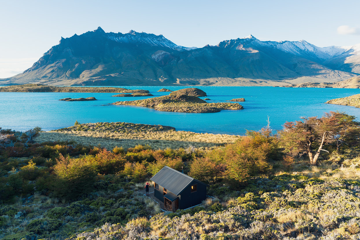
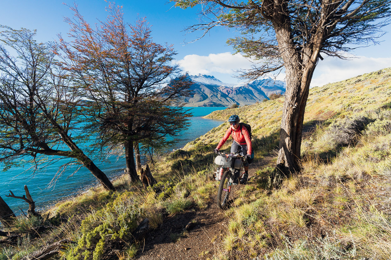
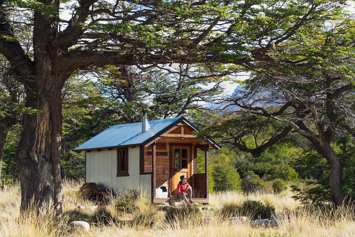
There was an incoming storm bringing rain all day the next day, so we booked for two nights at Refugio Archipielago (pictured) with intentions to venture further into the park and closer to Monte San Lorenzo after the storm. The refugio is in a beautiful spot on Peninsula Belgrano which juts out into a lake of the same name, and is just 3km from a parking area. Technically it’s on a hiking trail, but we asked if we could ‘push’ our bikes there and the rangers said that was fine.
We waited out the wet day, reading and enjoying a break, and the next day dawned dry and clear. We rode 14km back to the park office, to arrange entry for Refugio Kris and Doug, up the Rio Lacteo, only to discover that the park’s roads were closed for the day due to surface flooding. So 14km back to Archipielago it was…�� and then a walk on the peninsula in the afternoon to stretch our legs a second time!
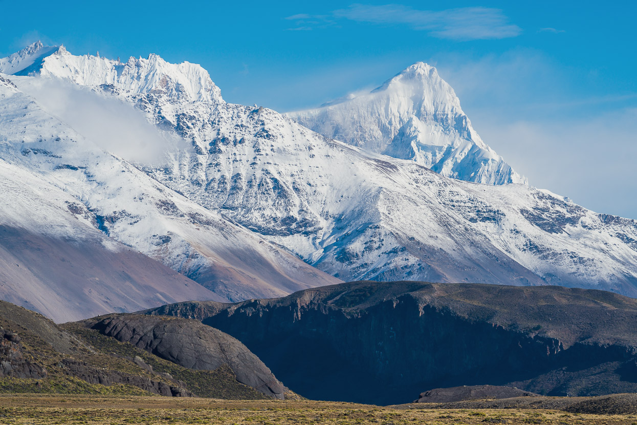
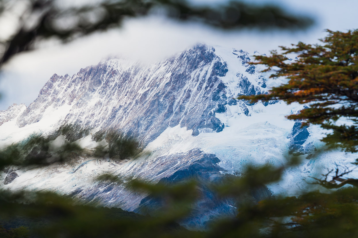
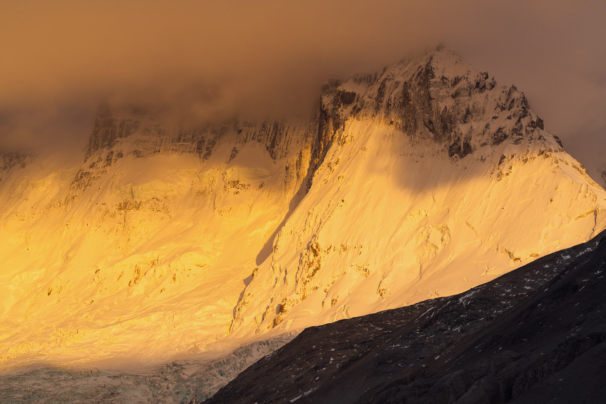
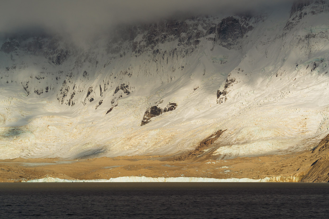
The following day also dawned clear, so we headed back to the office again, optimistic that the road might be open. Monte San Lorenzo (above) was ice clad and standing proud into the blue sky.
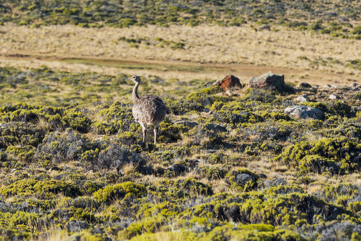
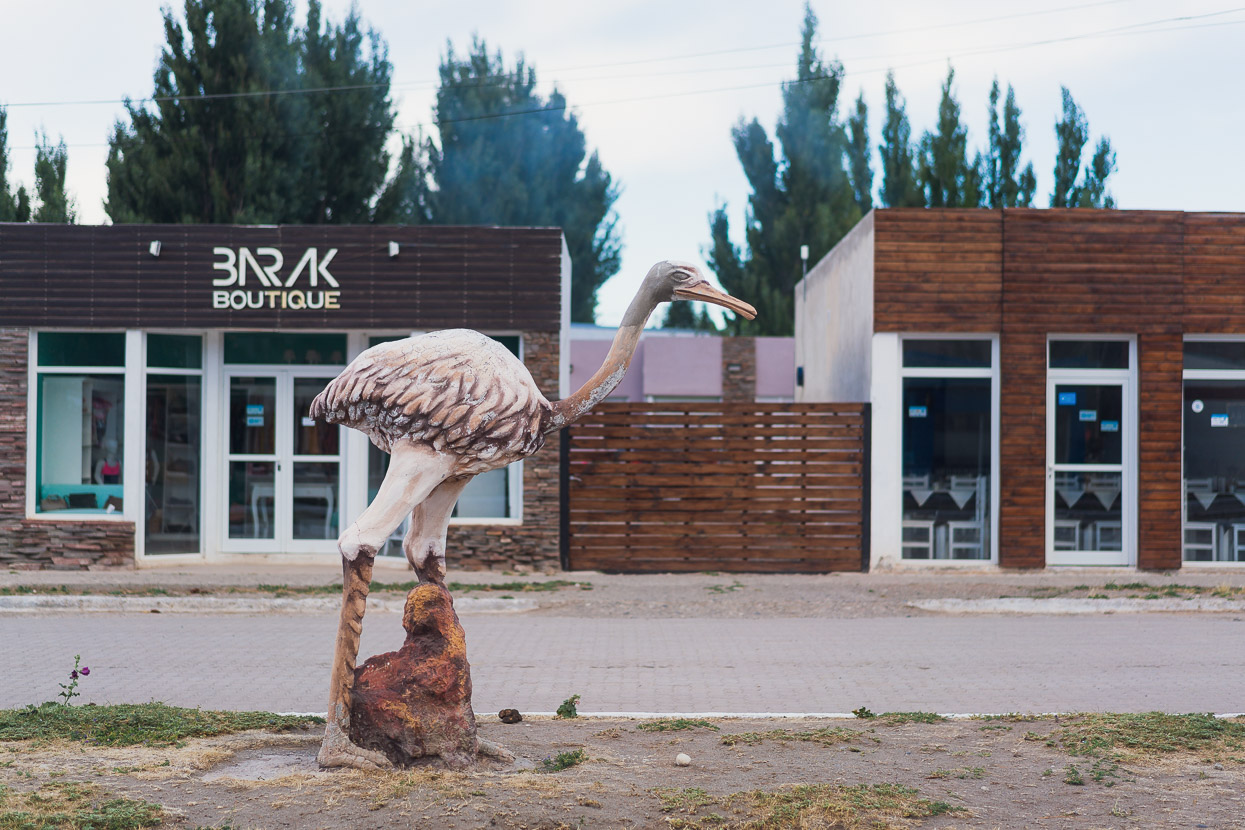
We caught sight of a real choike on our way to the park office.
After bad weather and a closed road we had no problems getting a reservation for Refugio Kris and Doug, which is sited at the historic base camp Puesto San Lorenzo, from where climbers access the east and north east face. It’s also the base for the 6km walk up to Laguna de los Tempanos, a glacier fed lake full of icebergs below the mountain’s massive east face. From the park office it’s a 22km ride up to a parking area and shortly beyond that, Refugio Gilberto, where we left our bikes, intending to stay the following night.
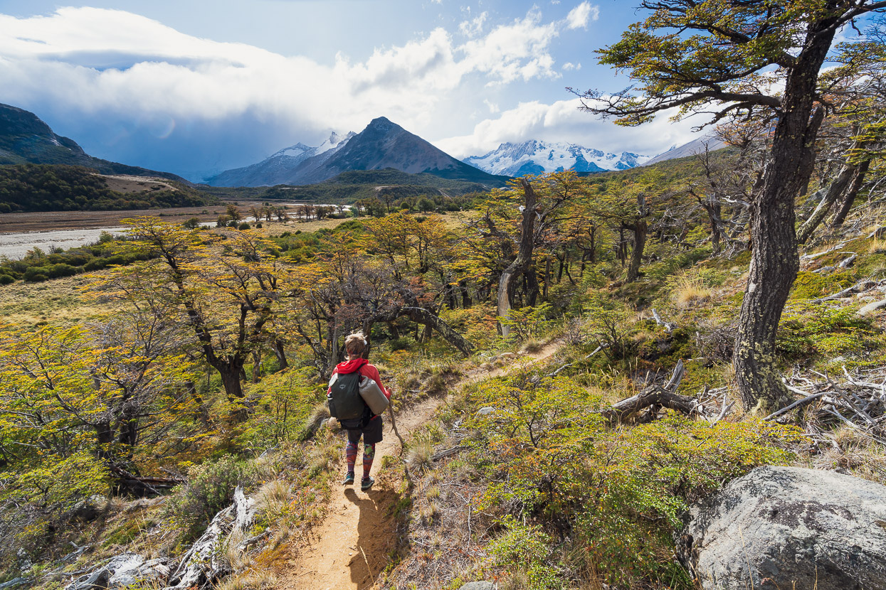
From Refugio Gilberto we were on foot for the 12km walk up to Refugio Kris and Doug. It’s an easy track, with no significant climbs and a good surface all the way.
The refugio is named for Kris and Doug Tompkins, the philanthropists to whom this corner of the national park can be credited. Kris is a former Patagonia CEO, while Doug Tompkins was the North Face and Esprit founder. Between them the pair have been responsible for massive conservation efforts in Chile and Argentina by purchasing parcels of former estancia for donation back to the people. Doug sadly drowned in a Patagonian lake in 2015 after his kayak capsized.
The recent park infrastructure, such as the refugios and some of the tracks, is credited to the national park administration and not-for-profit conservation organisations, Banco de Bosques and the Butler Conservation Fund who have done an incredible job on the refugios, which are very well built, insulated and equipped with wood burning fires. Notably, in contrast to Chile’s expensive parks, all these facilities are free – and you’re likely to have them to yourself because park attendance averages somewhere around 2000 people per year, in contrast to Torres del Paine’s 300,000 plus.
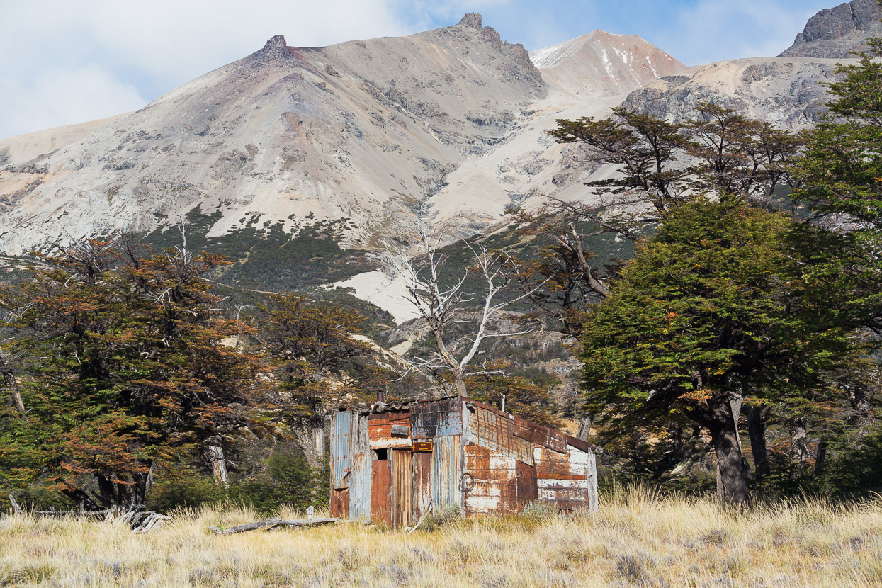
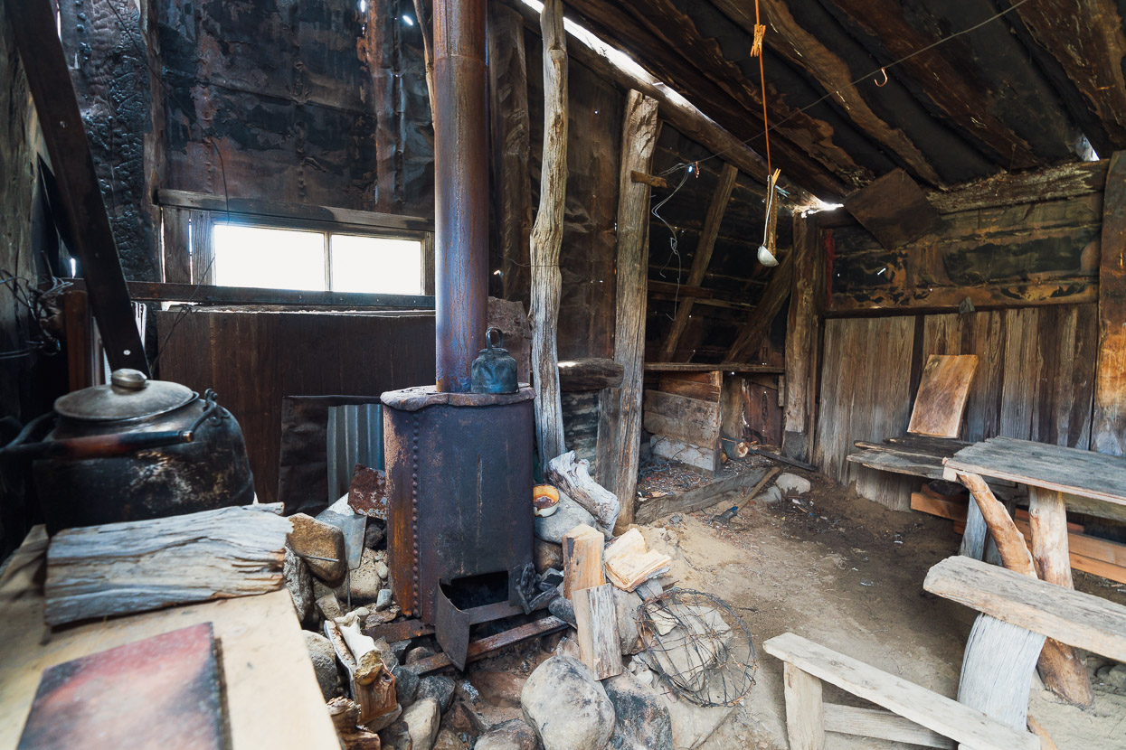
The old refugio for the puesto (farm) still stands nearby, having sheltered many a climbing expedition too over the years.
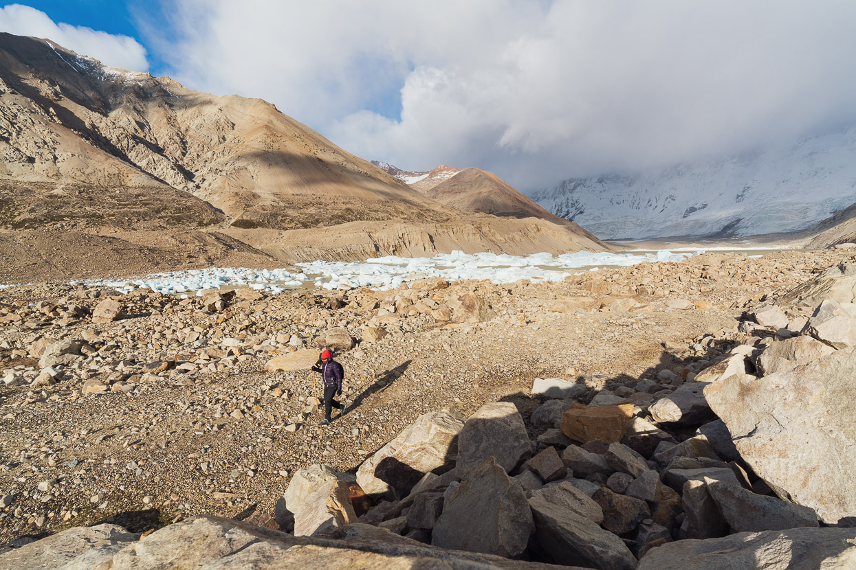
Through the trees we could see Cerro Hermoso (~2370m), but Monte San Lorenzo remained hidden by a huge bank of cloud. Optimistically, we left the refugio at around 5.45am to make the walk to Laguna de los Tempanos for sunrise. This started with a freezing wade in the pitch dark through the Rio Hermoso, which was still quite high after the rain. We warmed up on the rest of the hike up through the moraine to the lake edge. The track has been well marked with cairns and formed in places with rocks.
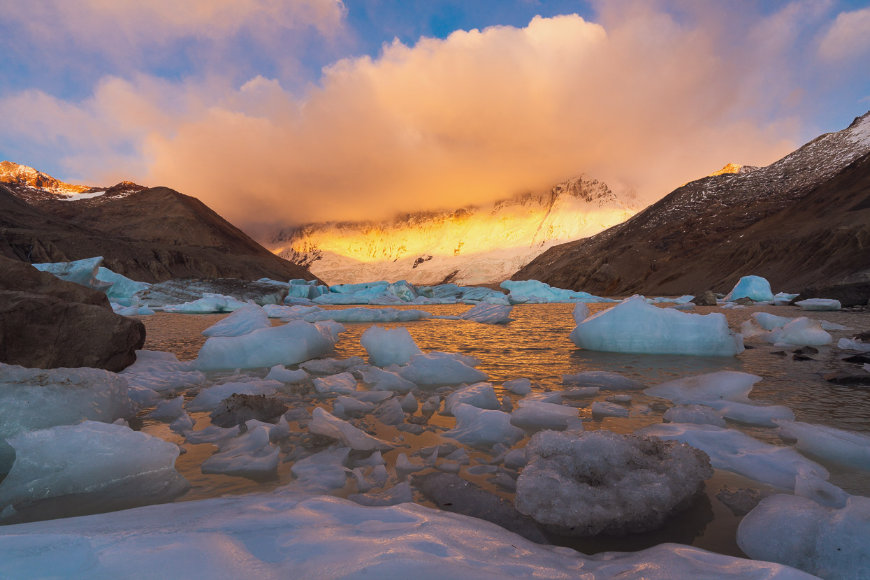
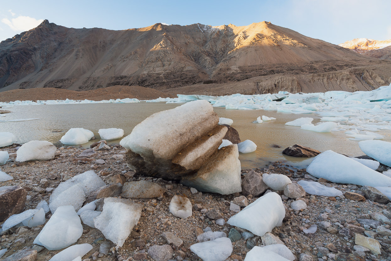
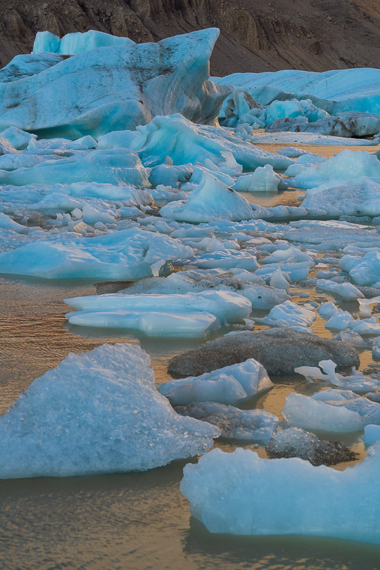
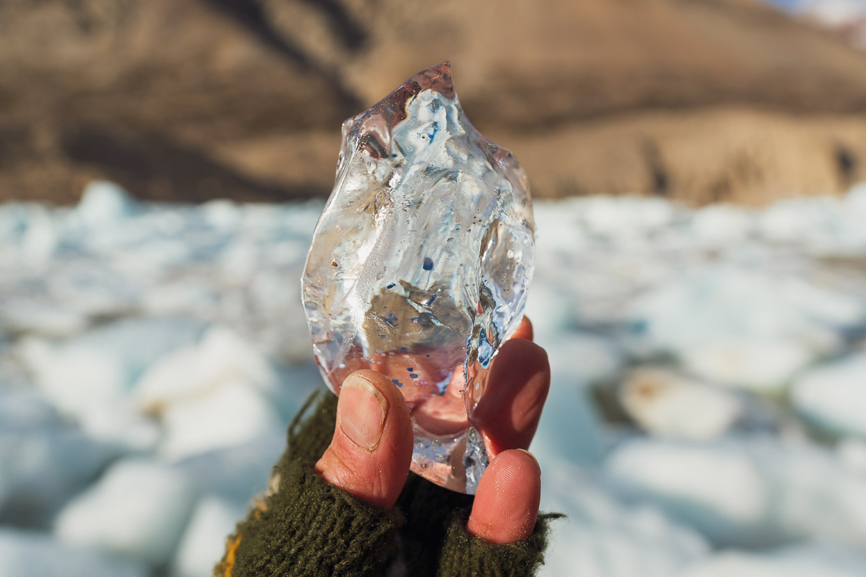
In time for sunrise we were, but no view of the summit was to be had, sadly. But even without summit views it was an amazing place to behold. Stark moraines and scree slopes terminate in a huge lake and a chaos of tempanos (icebergs) both afloat and deposited all over the shore. At the head of the lake the glacier’s terminal face soon rises into steep slopes that climb 2400 metres up the east face.
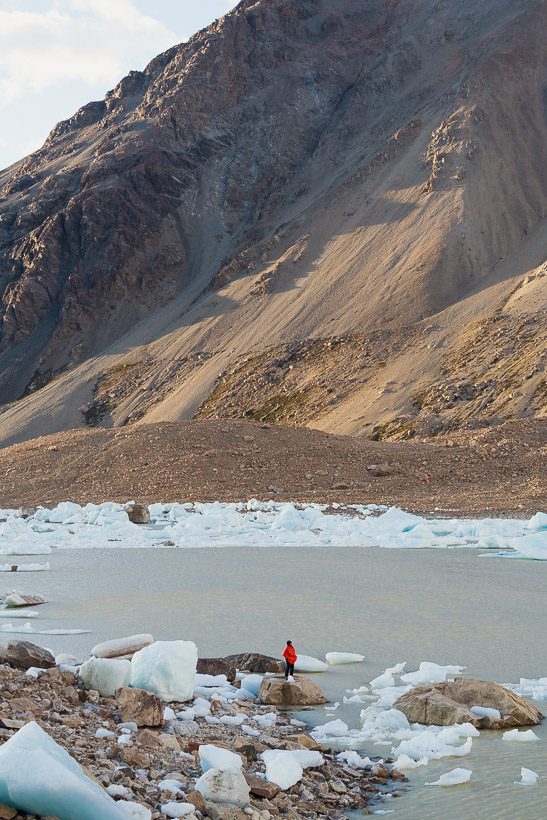
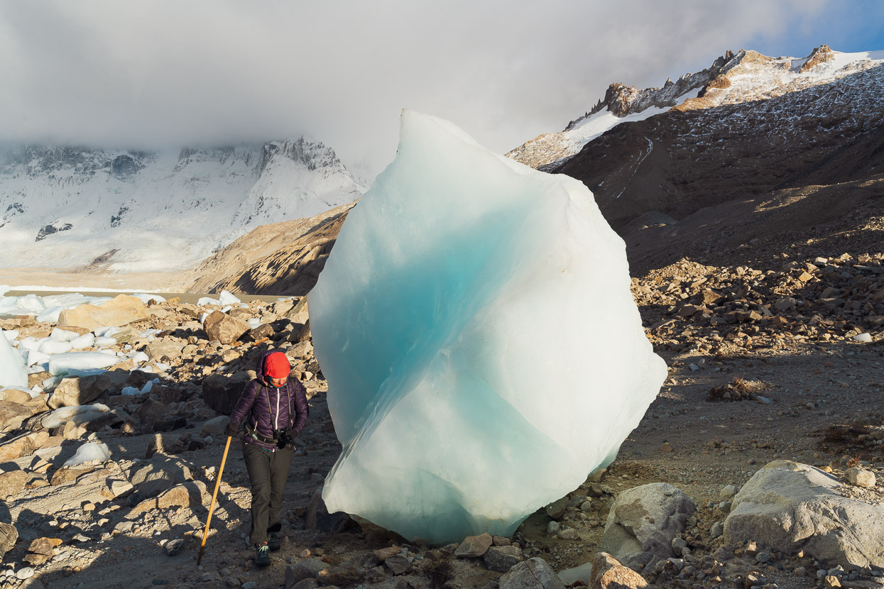
We felt very small. And despite a freezing wind, spent quite a long time there exploring different perspectives and absorbing the place.
And on the way out we had the bonus of seeing the the scenery we’d missed in the dark on the way in.
Back at the refugio we had an early lunch, packed up and walked back out to the bikes at Refugio Gilberto, arriving in time for a lazy late afternoon and evening by the fire.
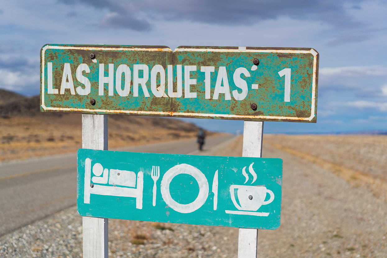
We were quite low on food by this point, and out of fuel, having lost our surplus a few days back. The only thing that saved us were the fires in the refugios which we used to heat water. So it was time to leave and make the 108km ride across the pampa to the roadhouse at Las Horquetas on the Ruta 40. Of course as we rode out of the park, San Lorenzo was once again piercing the sky with its ice clad profile instead of being shrouded in cloud. According to the park staff, we’re lucky we saw it at all.
Very soon the mountains were absent from our view as the fierce westerly wind swept us across the steppe at high speed.
Ruta 40, still very far from anywhere…
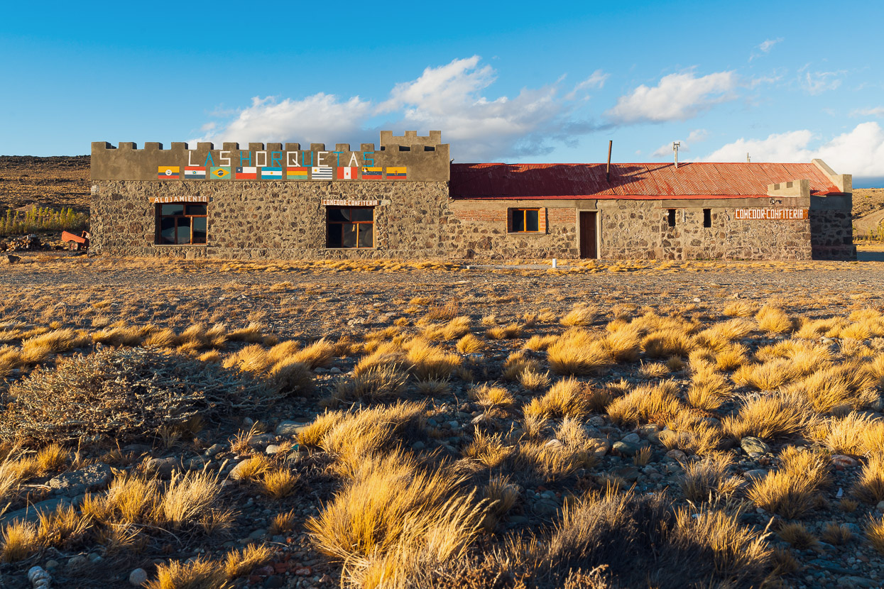
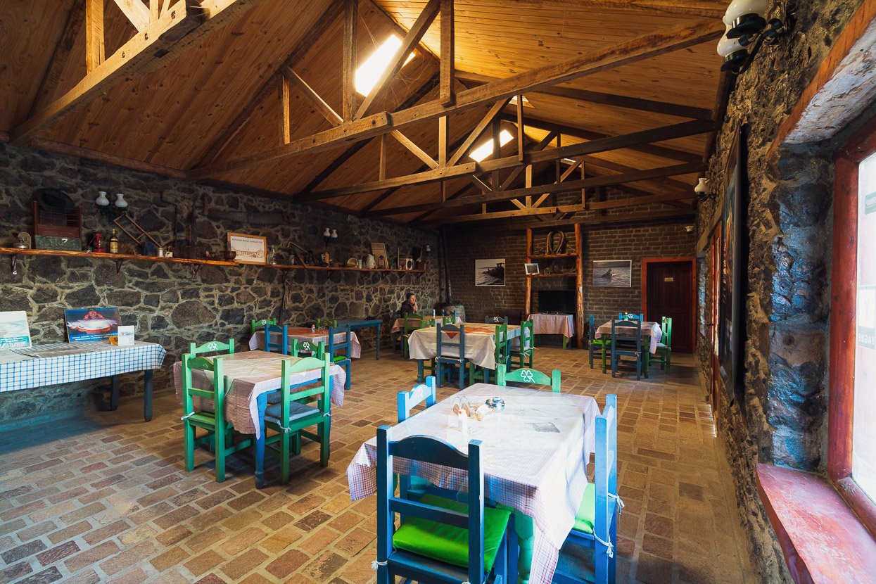
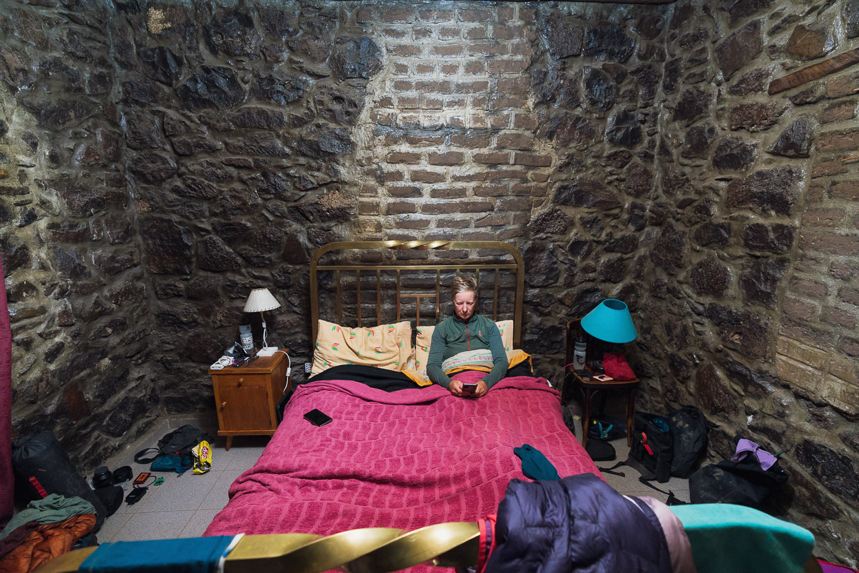
But salvation lay in the form of Las Horquetas, an isolated roadhouse with no further services for over 100km in either direction. Apparently this austere building is 200 years old, built to survive the savage winds. As we swung open the door it smelt strongly of mothballs, but the Bolivian staff had empanadas, beer and basic meals available. We took a room, but could not make use of the wifi (or lights) as there was no electricity until generator time at 7.30pm so we promptly fell asleep instead.
The next morning we left our bikes there and hitchhiked to Gobernador Gregores (a town 160km away across infinite pampa) to resupply for the next stage; crossing the pampa back in the other direction to Entre Rios/Paso Mayer and Chile once again.
Say thanks with a one-off donation, or check out our Bikepacking guide.
If you enjoy our content and find it informative or inspirational, you’re welcome to show us some love with a donation or a book purchase (US$19.99). The services we use to create our Bikepacking routes and host the website cost money, funds that we’d rather be spending on the road, creating bikepacking routes and content to share with you. Thanks for reading!


I greatly enjoyed these last two posts about the two sides of San Lorenzo. The Argentine side in particular sounds like my kind of place, and makes me want to return to Patagonia despite the clear but understated hardship required. Do you know how those giant icebergs end up way up on dry land? Does the level of the lake change that much?
Thanks Sean, glad you enjoyed them, and thanks for putting the idea in our heads! We were onto Ruta 41 already, but getting right in to PMNP was fantastic. Y’know we did wonder about those icebergs too. Lake levels varying that much? Hard to imagine. Wind maybe? Massive calving events causing waves perhaps? I even wondered if they were fragments of the original ice mass still melting away (seems unlikely). Maybe a glaciologist can comment.
Another great post I enjoyed.
I found an agreement between Argentina and Chile from 2011 that talks about new and improved connections between the two countries in Patagonia. There is glacial work on some mainly or maybe exclusively by the Chileans. One is via Largo Brown, a branch off your route into Monte san Lorenzo and it would shorten the trip between the two sides considerably. The road is mostly along the largo Brown now so that’s good progress but the end is still a number of years away I suspect.
We met Doug Tompkins briefly at the Amarillo entrance to Parque Pumalin – nice chap, fit and lean – not much fat for insulation. When I heard he had died from hypothermia I couldn’t help but think that if anyone would be vulnerable to that it would be him.