
Late February 2023.
As we’ve cycled south from the Argentina Lakes District the mountains of Patagonia have been a continuous theme; distant, glacier clad and ice capped massifs that drift in and out of view between windswept clouds as we pedal along the road. On rainy days they’re hidden completely, lurking above the beech and rainforest, while on clear days they cut crisp shapes into the sky. Although the Andes have surrounded us as we have cycled south, crisscrossing their passes, opportunities to get deeper into the alpine environment have been few, given the limitations of our gear and schedule.
Monte San Lorenzo (3706m) is the second highest mountain in southern Patagonia, but being both remote and often cloud covered this isolated and impressive peak sees little of the limelight that its more famous neighbours such as Monte Fitz Roy and Cerro Torre (190km distant) experience. A chance encounter with United States peak bagger Sean O’Rourke (Dr Dirtbag) back in Araucanía and subsequent correspondence led to Sean putting this mountain on our radar. Sean suggested that attempting to access the mountain’s climbing base camps might be our sort of bikepacking adventure. The Chile/Argentina border traces a line across the middle of this mountain, and it’s climbed from both countries, with base camps in each, which, as the crow flies, are only 17km apart. But to travel between them legally is a journey of 330km. While the map suggested that a 4WD track crossing the border fairly close to the two camps might be a convenient shortcut, we weren’t keen to make an illegal crossing. Entering via this route might have been easy enough, but then you’re forced to either cross back again, or cross at another illegal point so as to not be caught when you leave at an official border without an entry stamp.
Monte San Lorenzo offered the opportunity to get away from the gringo trail of the Carretera Austral as well as a chance to get a bit closer to one of Patagonia’s mythical mountains. So we decided to firstly explore the Chilean side of the mountain as a 140km out-and-back from Cochrane, and then cross Paso Roballos to the steppe of Argentina to check out another of the mountain’s towering aspects – including it into our southbound route.
But in Patagonia it’s really the weather that dictates your plans, so we had no more than a three day window to go to Chilean base camp (Campamento D’Agostini) and back to Cochrane, or face rain and strong headwinds on the return journey.
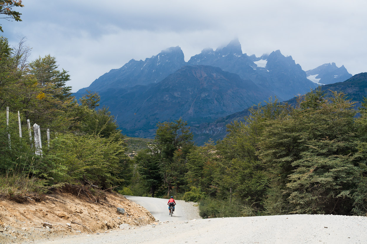
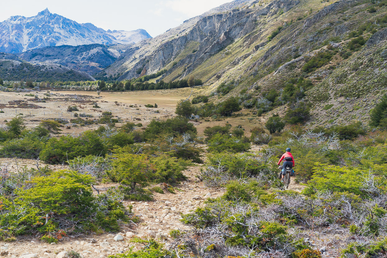
There would be no services for the next three days, so we left Cochrane with the requisite food and fuel. For the first 47km the route follows good quality, if not badly corrugated at times, gravel roads. It’s a very scenic ride, with the sprawling post glacial landscape of roche moutonees, southern beech, swamps, lakes and braided rivers reminding us of Alaska. Eventually the range containing San Lorenzo came into view, but cloud hid the bigger peaks.
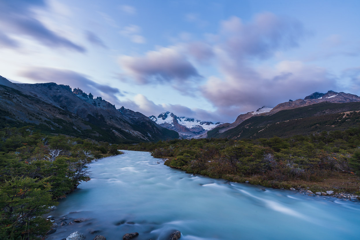
Crossing the Rio Tranquilo, the source of which is two glacier-fed lakes high on Monte San Lorenzo – one of which we’d visit just past base camp.
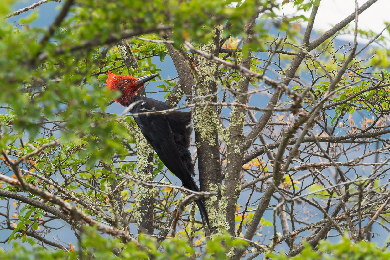
We finally caught sight of a carpintero gigante (Magellanic woodpecker) too, which was a treat. These huge woodpeckers make quite a racket, beating the bark off trees and pecking holes in trunks in search of larvae to eat.
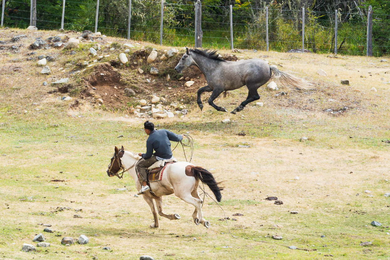
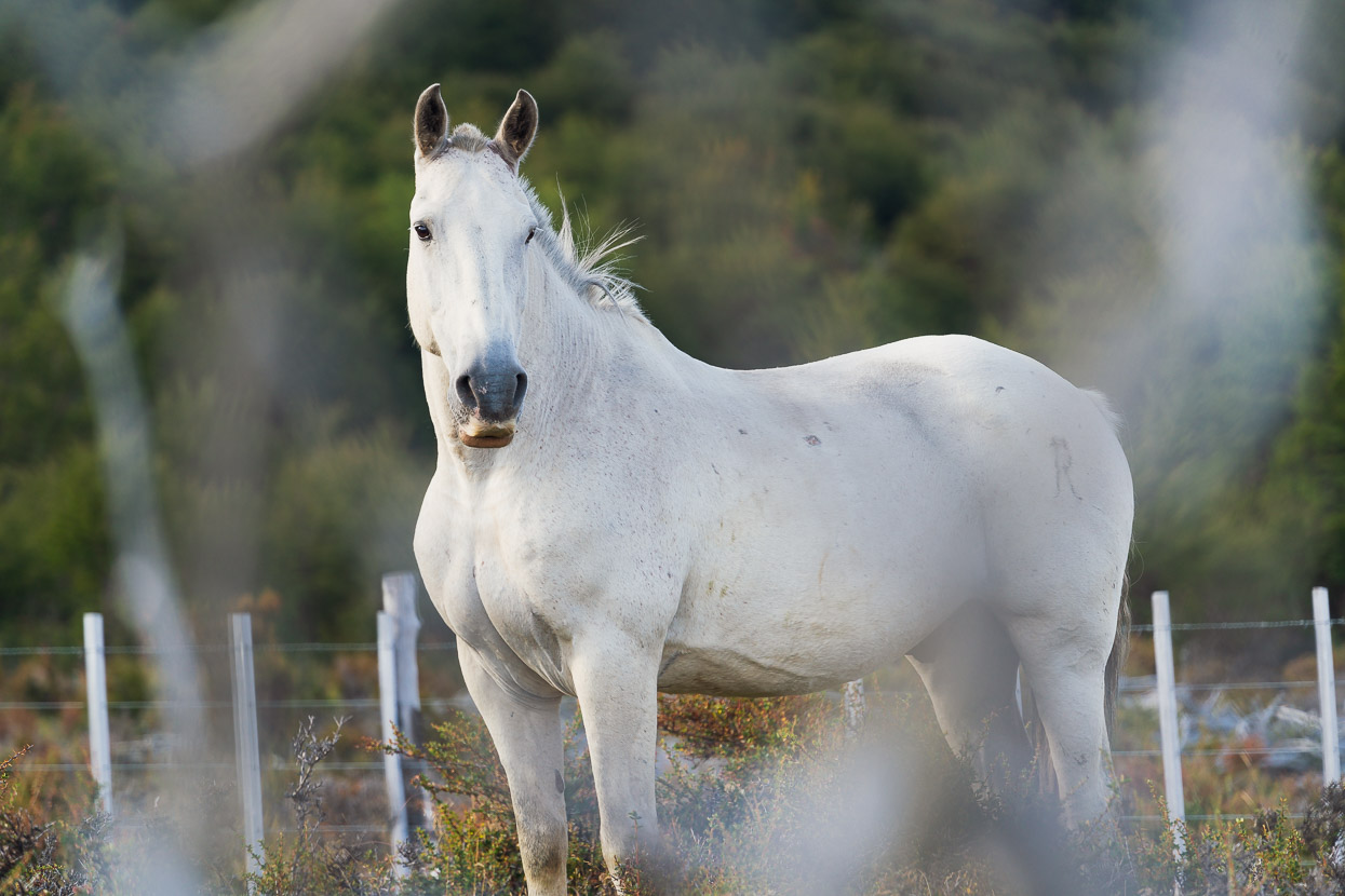
We even saw a sight quite fitting for gaucho territory as this young guy tried to lasso a flying horse (unsuccessfully).
After 47km we began the long climb up the ‘driveway’ to Fundo San Lorenzo, which is a large private estancia that owns land quite high up the mountain’s valleys.
It was raining as we made the descent down into the valley where Fundo San Lorenzo is based.
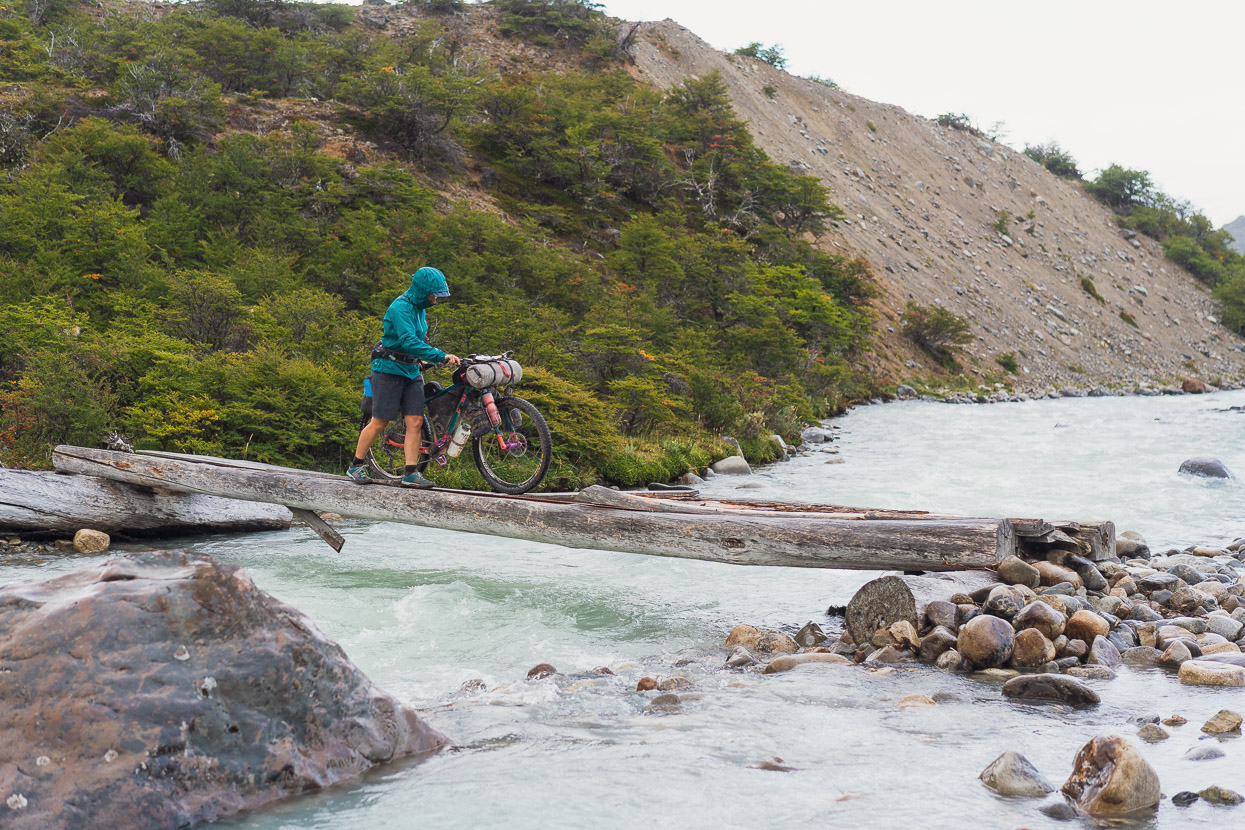
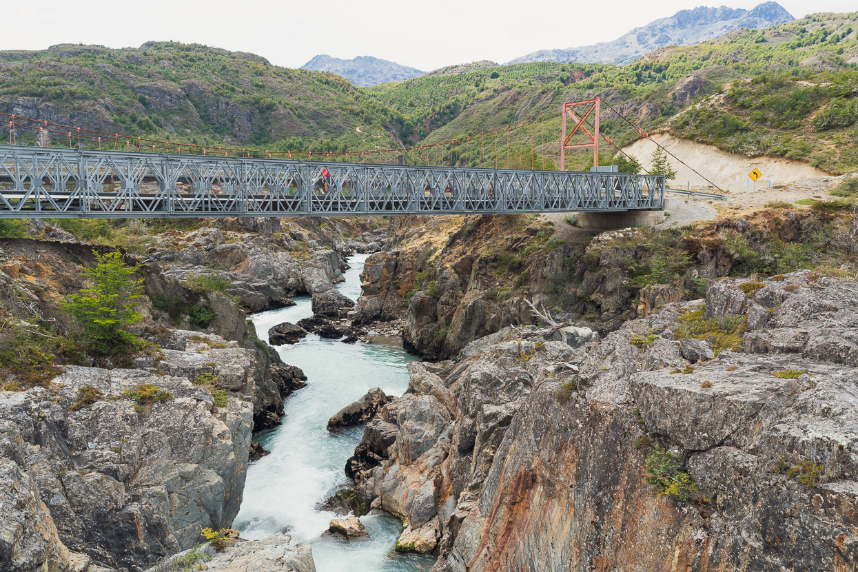
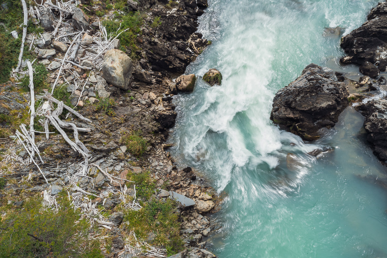
Nearly there, with just a dicey narrow bridge to cross, which we were grateful for nevertheless.
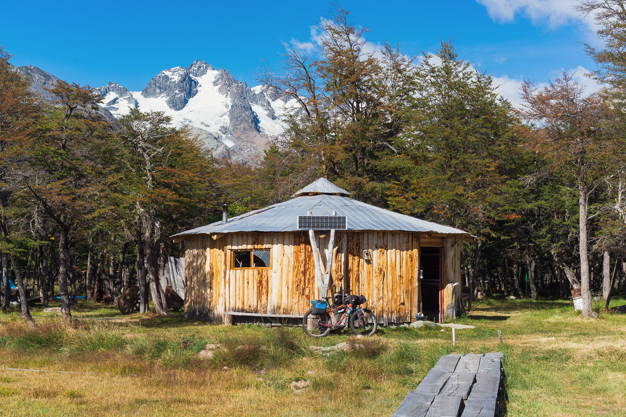
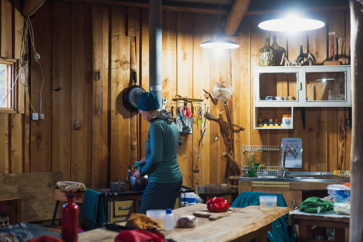
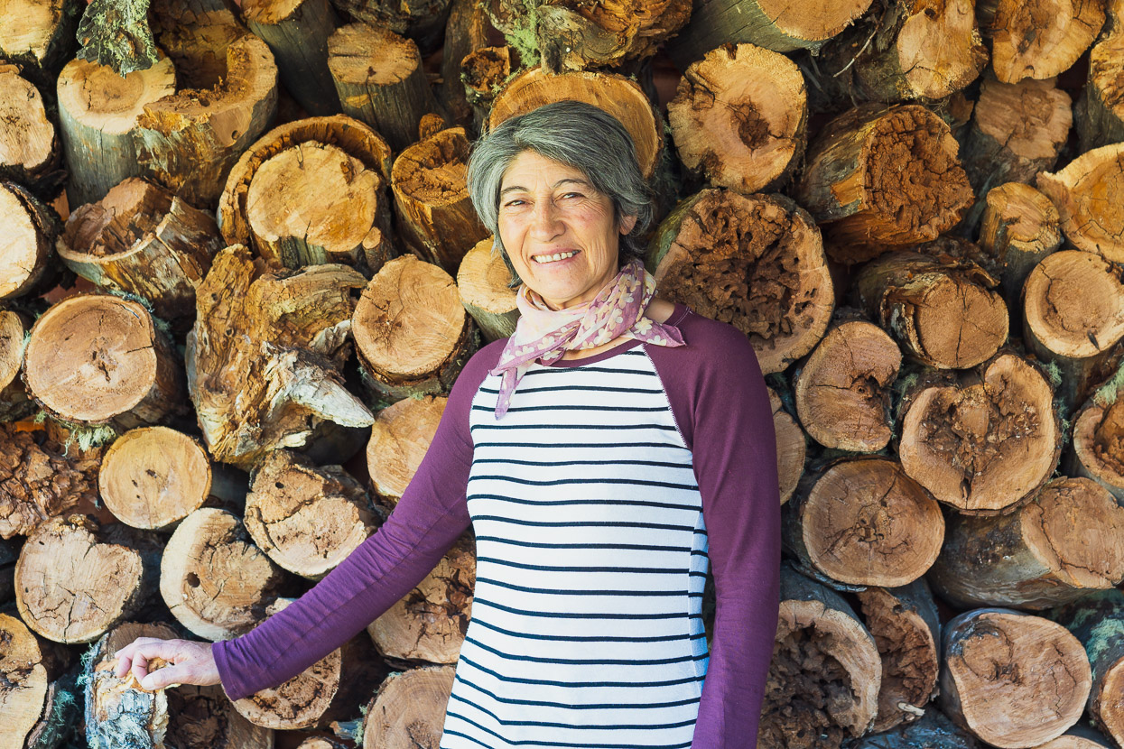
This photo was taken in the sunshine of the following morning. Fundo San Lorenzo is owned by the family of Don Luis and Doña Lucy Soto who have farmed the valley for decades. These days they also run the estancia as a trekking and mountaineering base, and a rural get away for people looking for some quiet mountain time. The valley containing Campamento D’Agostini (base camp) is part of their property, and they collect fees for camping at their farm and staying at the base camp refugio.
Luis and Lucy are very friendly, welcoming hosts – Lucy came out into the rain to open gates for us as we arrived, lit us a fire and brought us some postre (dessert). The building in this shot is a large cocina (kitchen)/common room. And with no-one else around Lucy offered it to us to sleep in the night we arrived. Leaving gear here while you head deeper into the hills is no problem. They also have bunk room accommodation.
We went for a brief walk up-valley in the predawn the next morning, hoping to catch some good light and views. The light was nothing sensational, but we did get good views of Cerro Los Mellizos which is just west of Monte San Lorenzo. There’s a track from the estancia up the edge of the moraine wall to view a hidden lake, Laguna Tranquilo (yes – one of the river sources and tributaries), but we didn’t have time to check this one out.
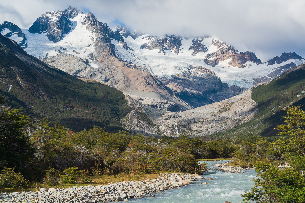
A closer look at Cerro Los Mellizos. The glacial retreat here is very obvious.
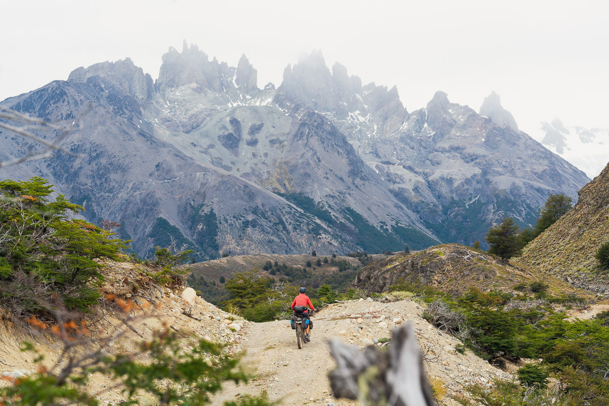
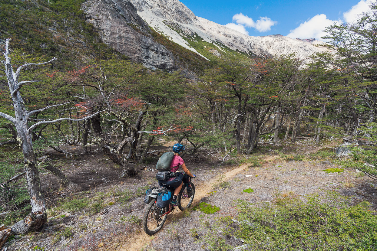
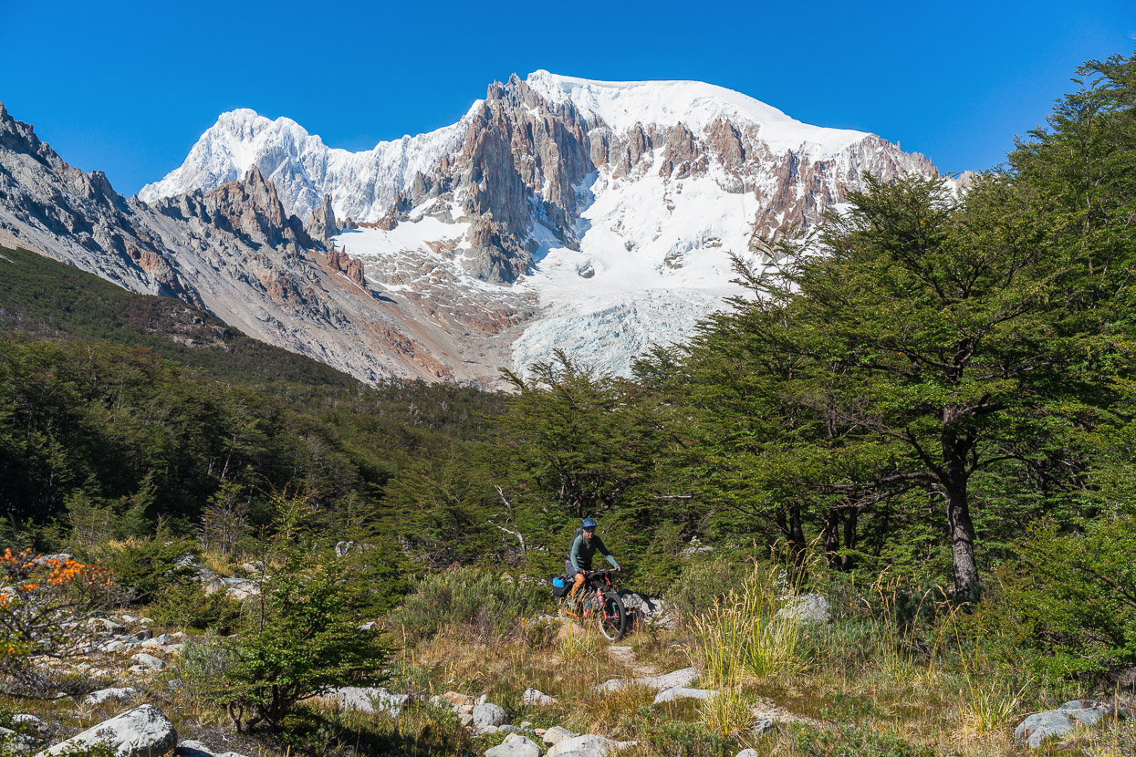
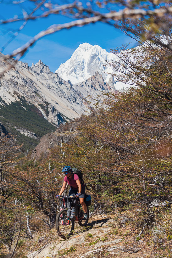
After breakfast we stashed some of our gear to lighten our loads and set off to try to ride/hike-a-bike the 9km to Campamento D’Agostini – San Lorenzo’s base camp. Although the majority of this route is a hiking trail, Lucy was quite happy for us to give it a go. At least one other cyclist had been in there, although possibly unloaded. We climbed away from the farm on a steep track and then followed a combination of farm tracks and singletrack for the next few kilometres.
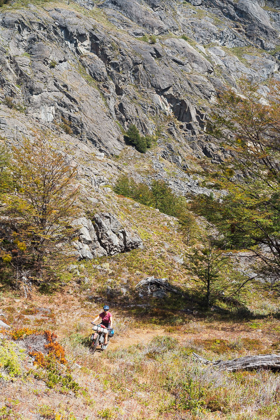
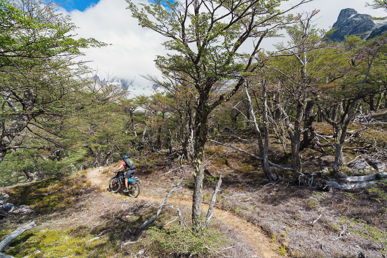
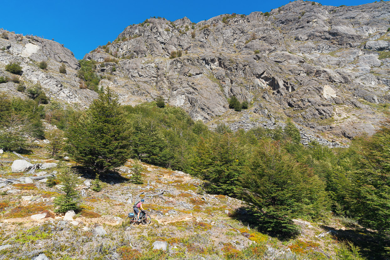
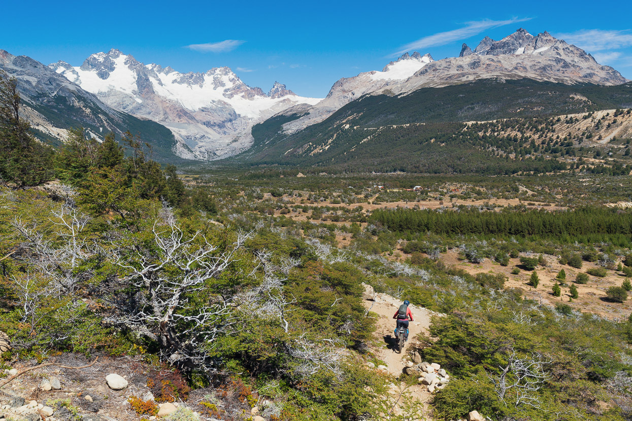
After about 5km the singletrack begins to climb more steeply into a narrowing valley. It’s mostly rideable – and great riding at that – until about the 870m contour, where it becomes a gorge, with the river vanishing into a deep cleft. Here there are three short steep ‘steps’ that took two to a bike to surmount.
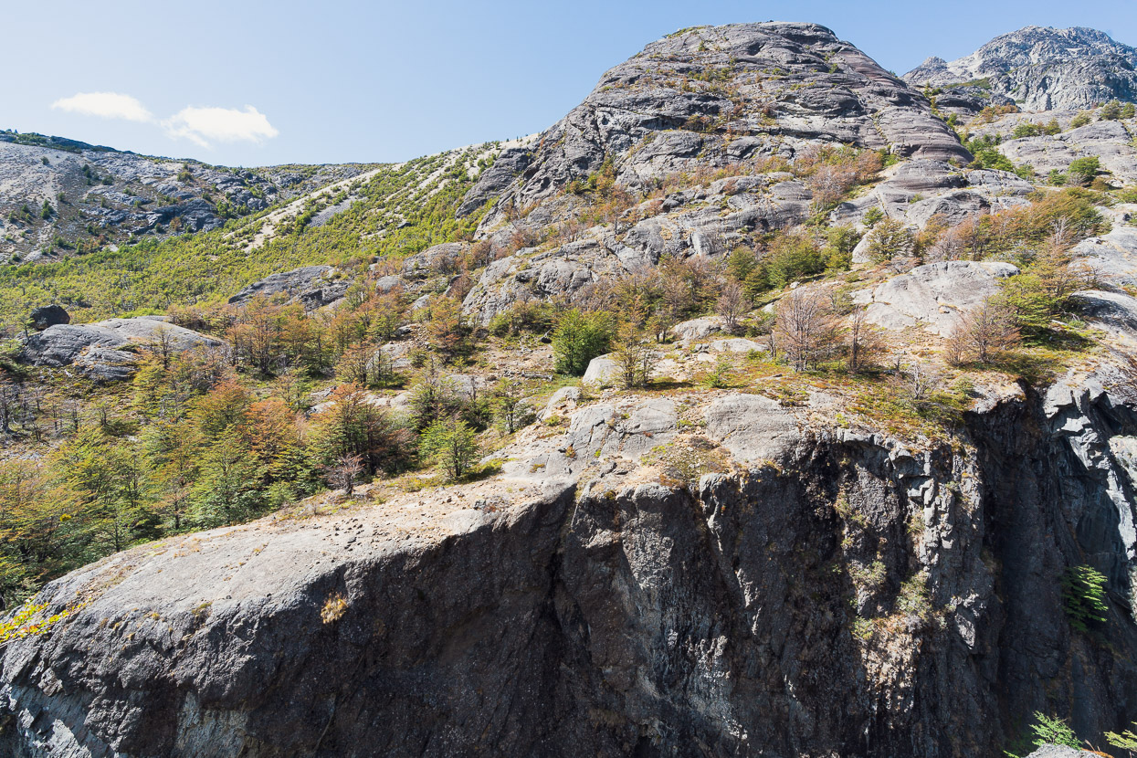
A glacier-buffed landscape. During the last ice age a huge ice sheet covered this entire region.
Hana’s looking into Argentina here, with the border just 200 metres away from the track. Close to here a track crosses the border into the Rio Oro and out to Lago Posadas, Argentina.
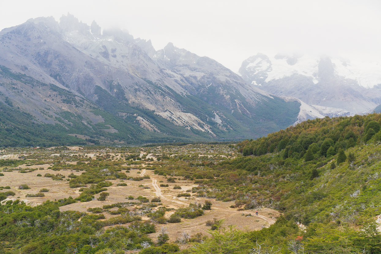
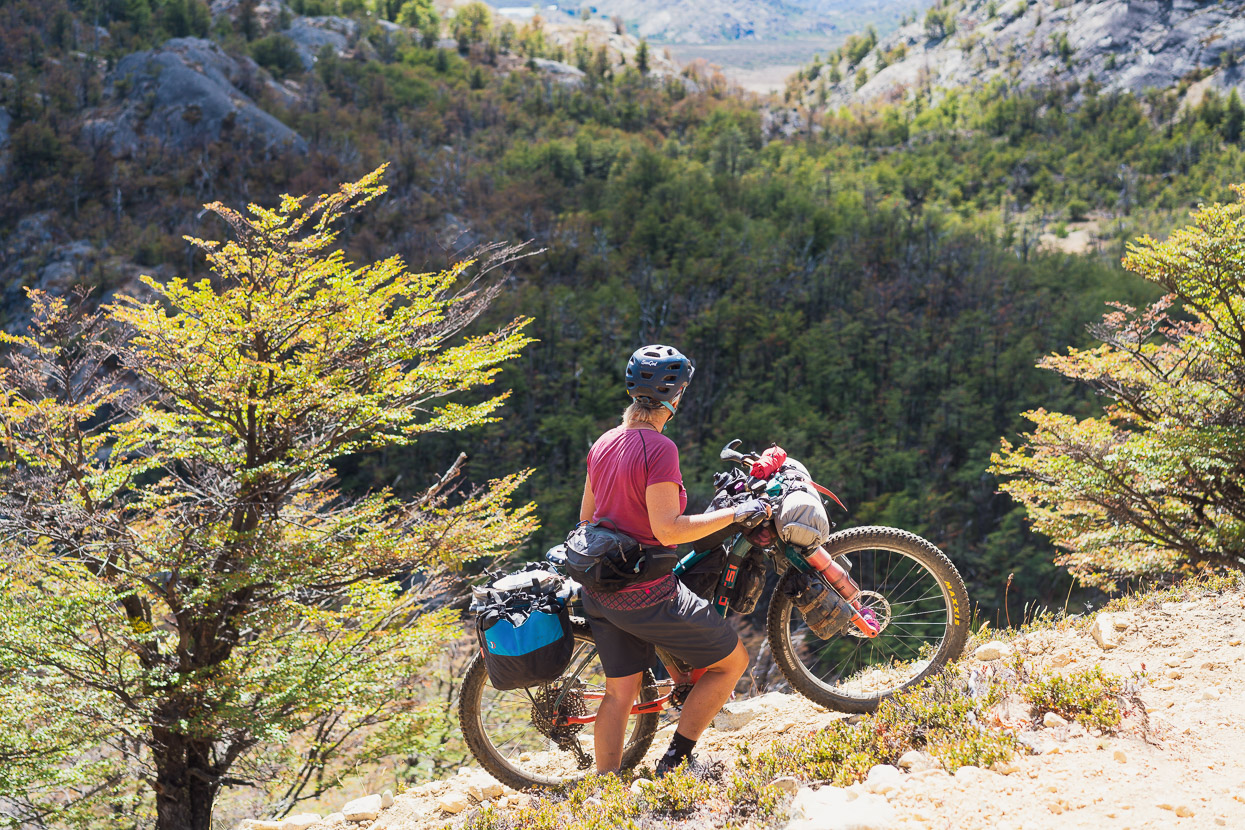
After the three ‘steps’ there’s another roughly 3km to the camp and refugio, that has quite a lot of good riding, but also quite a lot of on and off for fallen trees and unrideable bits.
If you are travelling light, like technical riding and aren’t afraid of a bit of bike hefting, it’s well worth it, especially for the more downhill return ride. Otherwise, it’s best done as a hike.
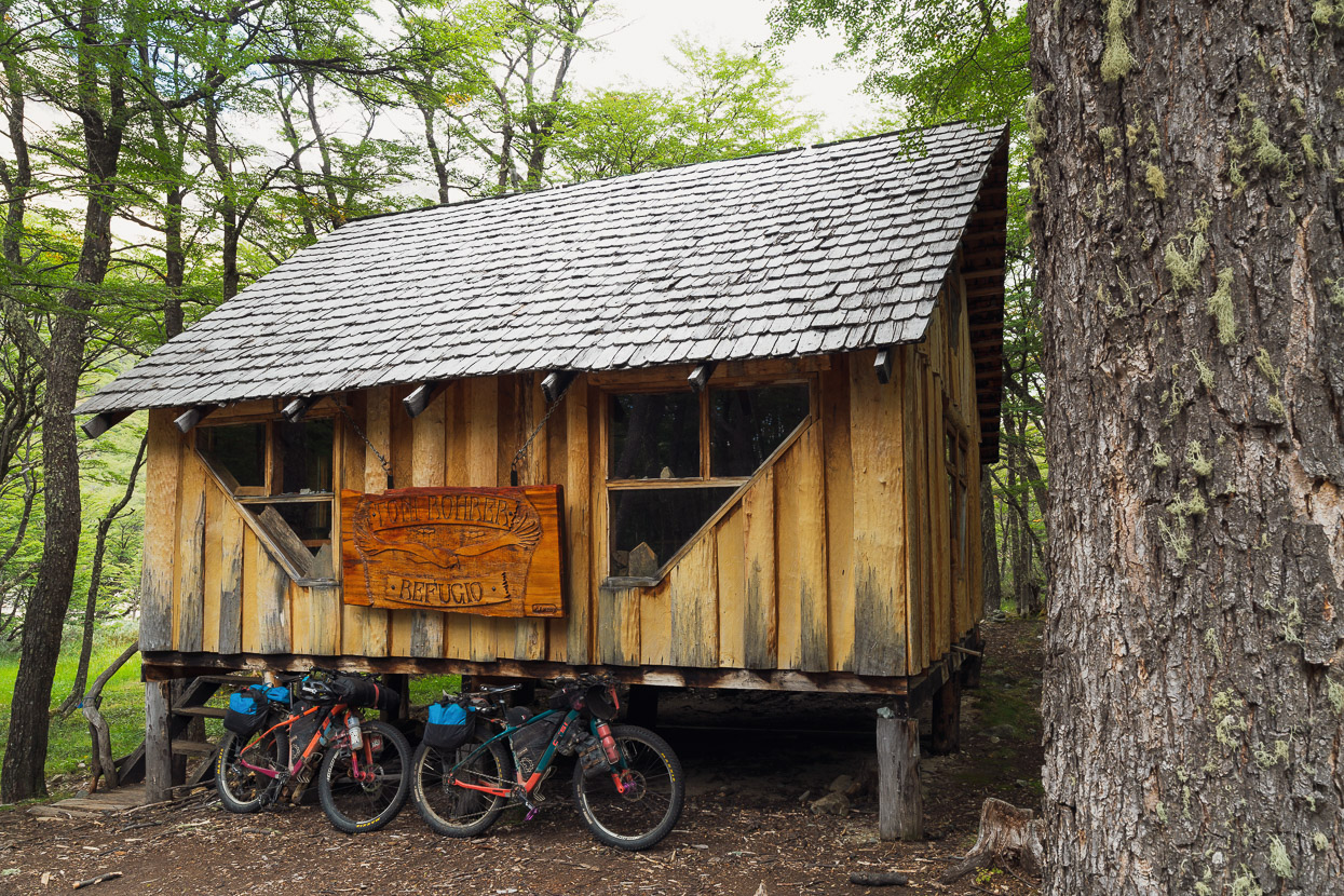
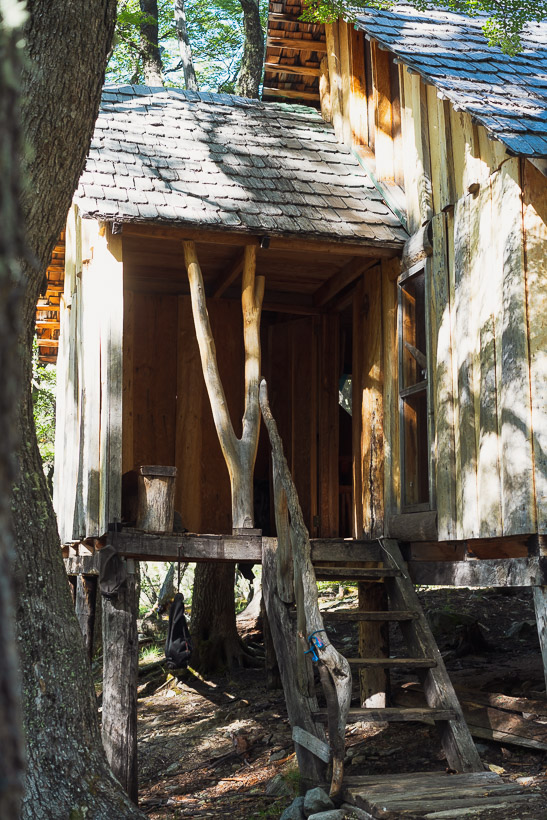
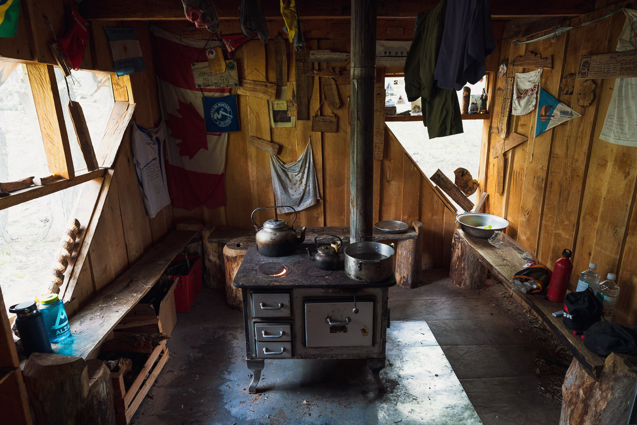
Named in memory of Toni Rohrer, a mountaineer who died attempting to climb the San Lorenzo summit ice mushroom, the Toni Rohrer refugio is a real gem and one of the most unique mountain huts we’ve seen. The materials were all carried in on foot and by mule and there is a lot of character to the design and woodwork.
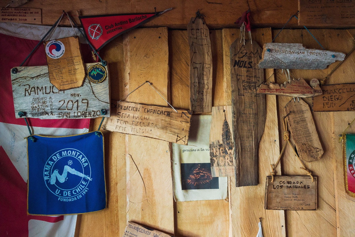
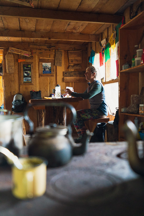
Small wooden plaques from various expeditions adorn the walls. There was a small group of US students and two guides also there so we had some great company.
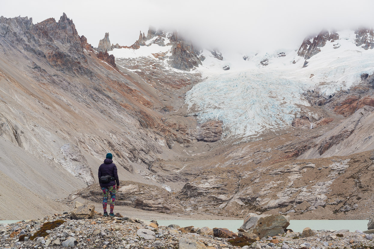
From the refugio/Campamento D’Agostini it’s just 600 metres walk to the first of two small glacial lakes below the north east face of Monte San Lorenzo. But the peak remained hidden in the clouds and a strong wind tore down the valley.
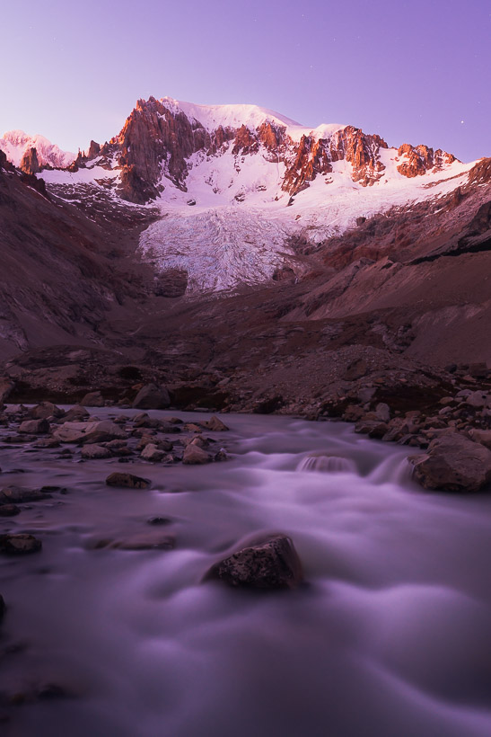
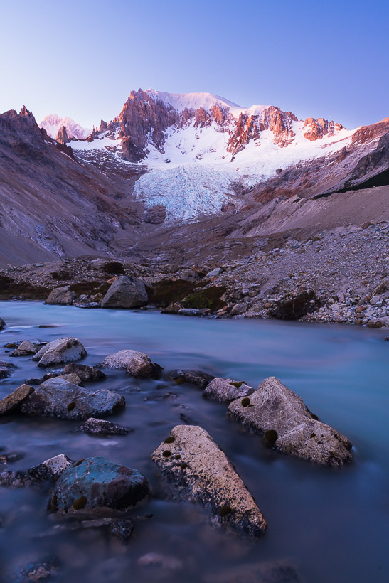
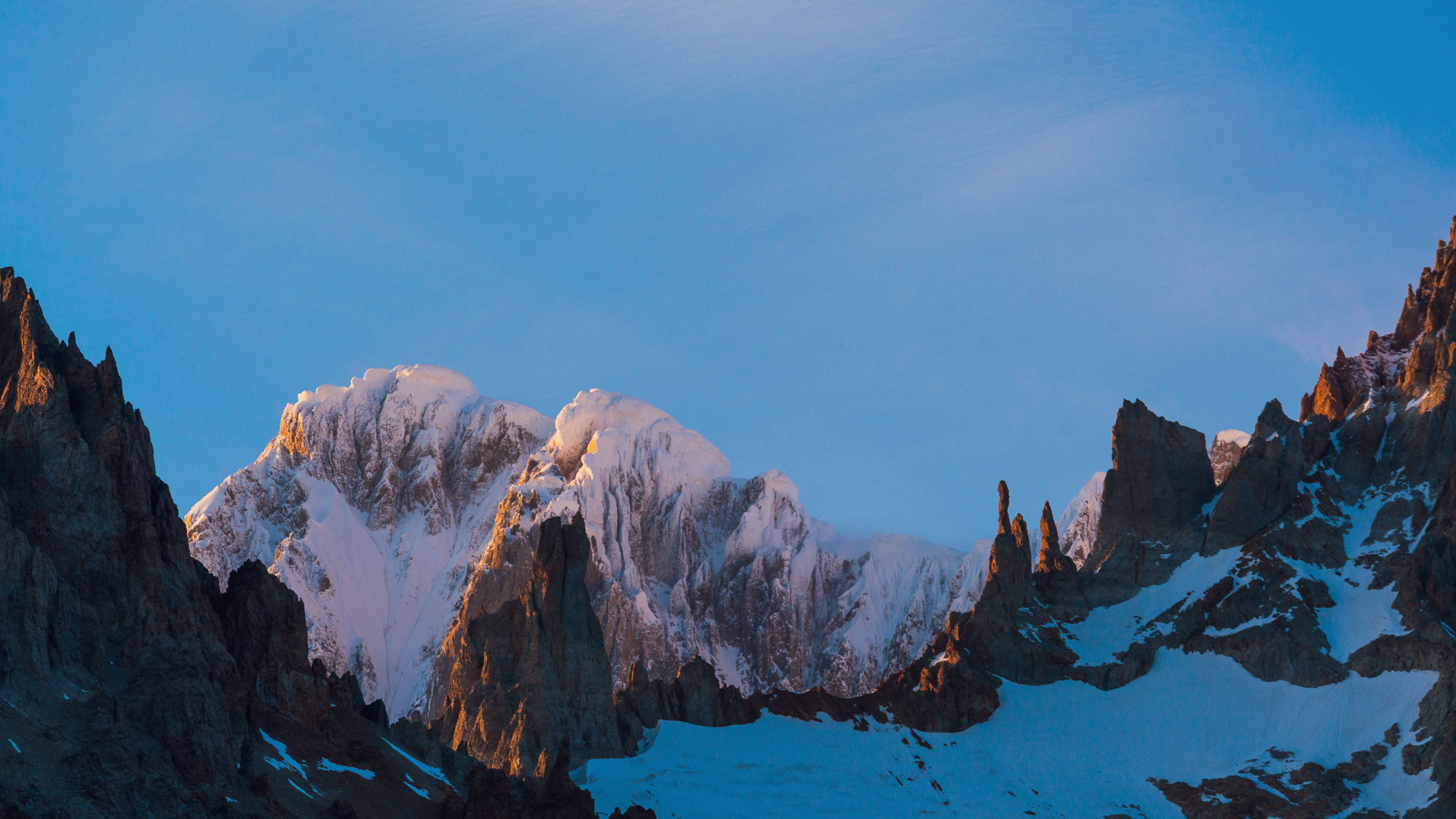
I headed back early the next morning, catching the light as it shifted from the purple of an hour before dawn, through to blue.
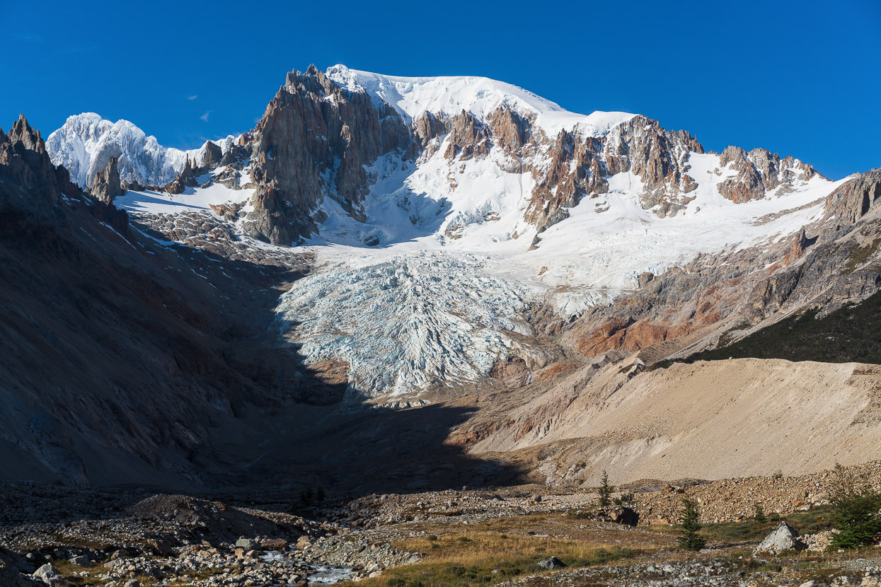
There are a few climbing routes on this face (see Pataclimb), but the mountain has three summits and a very long (several kilometres), steep east face. To the left you can see the heavily iced Cumbre Principal (main summit).
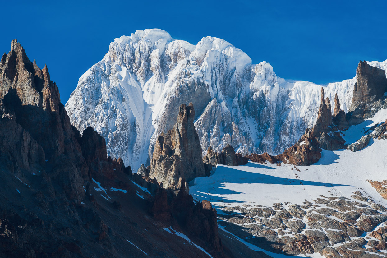
And a closer look…
After getting some good mountain appreciation time with a sunny morning, we had to make tracks, so we packed up and set off down valley. Planning to ride all the way back to Cochrane that day.

Heading out the ride had a lot more flow and we made good time back to the farm.
Dropping back down to the fundo buildings (just right of centre). There we packed up and made the 56km return ride to Cochrane for a well earned few days off. We’d been riding nine days in a row by this point and were beginning to feel it!
Next chapter, we cross to Argentina for another look at the mountain and Perito Moreno National Park.
Say thanks with a one-off donation, or check out our Bikepacking guide.
If you enjoy our content and find it informative or inspirational, you’re welcome to show us some love with a donation or a book purchase (US$19.99). The services we use to create our Bikepacking routes and host the website cost money, funds that we’d rather be spending on the road, creating bikepacking routes and content to share with you. Thanks for reading!


Wow looks amazing guys! Always wanted to get to South America and Tierra del Feugo…safe travels you two 🌸
Thanks Andrea! Nice to hear from you. It’s definitely a part of the world that’s worth making the effort to visit. El Chalten (Fitz Roy etc) in particular is just fantastic for scenery and hiking and it’s all quite convenient, with overnight trips right out of town. Hope all’s well with you guys!
Hi Mark. Thanks for your very interesting article, full of useful information. I have a question: how did you pay the fee to access the Refuge Toni Roher to the Soto Family at the fundo San Lorenzo? Did you pay them in cash or there is maybe a website where to pay in advance? Thanks a lot!
Hi Fabrizio, thank you, great to hear the info is helpful. We paid in cash to the Soto family at the end of our stay. 1 night for camping and a second for the refugio. Have a great time!
Thanks for your reply. May I ask you how much did you pay for both camping and the refugio?
No problem – but I do not recall how much we paid sorry.