
Mid–late February 2023.
As I write this post, we’re actually at the end of the Carretera Austral, and about to make the short leg that includes a couple of ferry crossings and a notorious (depending who you talk to) hike-a-bike through to El Chalten, Argentina.
Apologies for the sporadic blog updates – we’re about two weeks behind, but waiting for weather windows in El Chalten will give me plenty of opportunity to catch right up. Good internet has been increasingly rare these past weeks as we’ve hopped a couple of remote borders, and rest days do not always coincide with a signal or wifi. But for now, here’s the latest chapter.
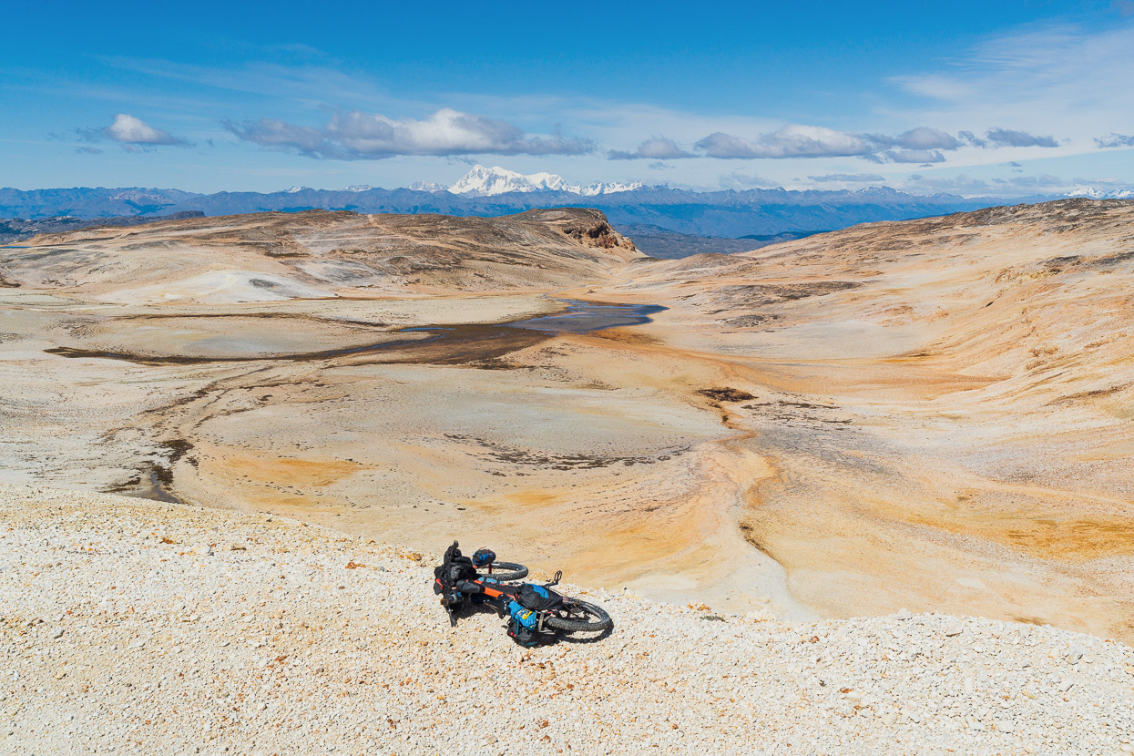
It felt good to be on the move again after five or six days based from Puerto Rio Tranquilo, including our out-and-back into the Valle Exploradores. We left Rio Tranquilo with four days food and a rarely-done alpine crossing of the Furioso Sector of the relatively new Parque Patagonia planned in the GPS.
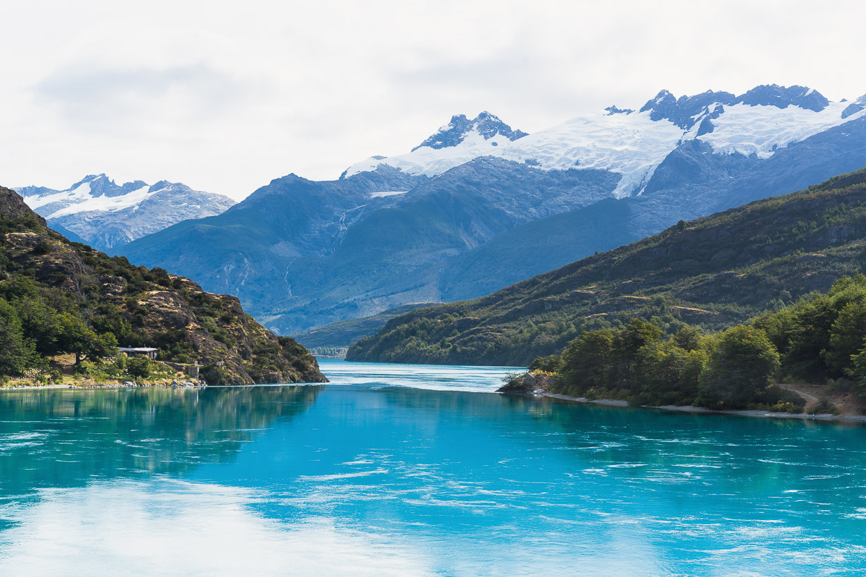
After the previous days of unsettled weather we finally had a longer fine spell coming up and it was in sunshine and light winds that we pedalled around more of Lago General Carerra’s gargantuan shoreline.
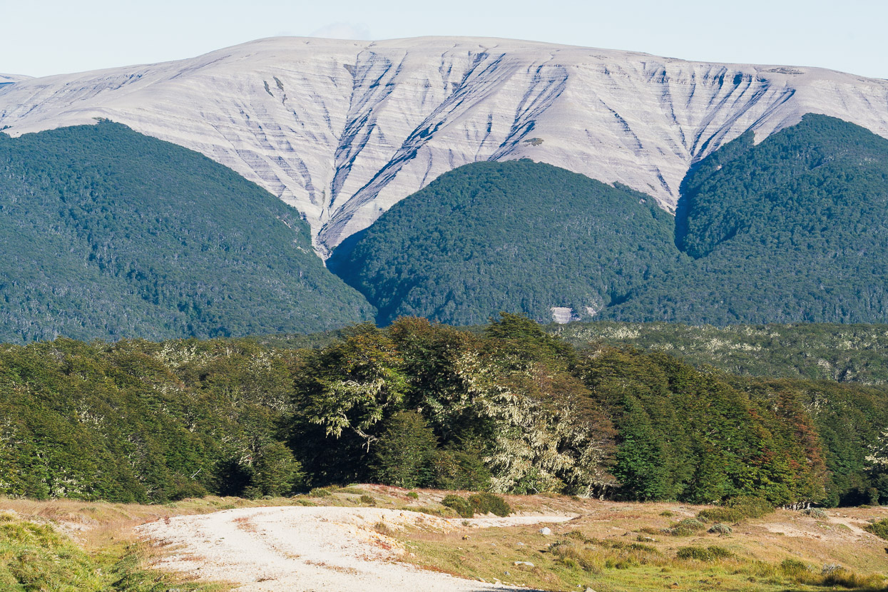
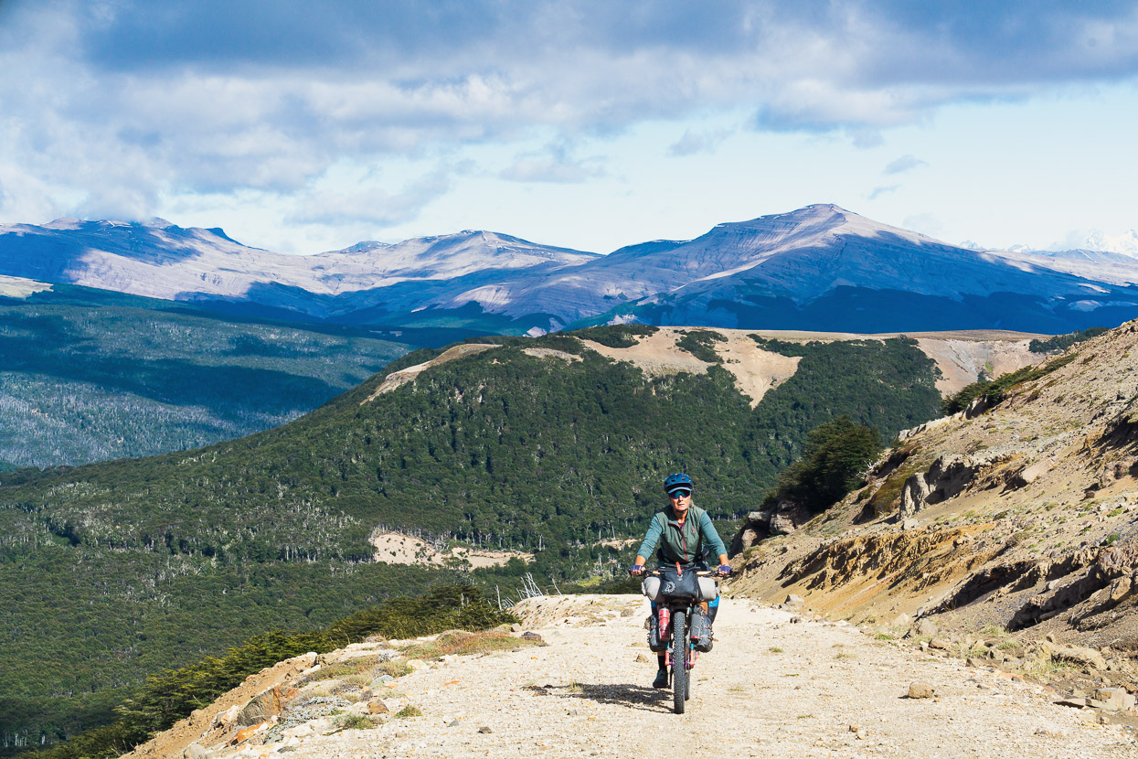
The further south we go, the Carretera Austral becomes increasingly quiet and the views reliably spectacular.
On the first day out of Rio Tranquilo we stopped for lunch at the Lago Leones junction on the carretera, and over lunch returned to discussing the idea of detouring and riding and hiking in to see Lago Leones, where you can catch the sight of some wild mountain landscapes and distant glaciers that flow from the Northern Patagonian ice cap to the lake.
We’d sidelined plans to ride in there because of conflicting information about the right for public to access the lake shore (the track crosses a few tracts of private land that’s under varying ownership) and whether you could visit independently rather than with a tour group. But from a browse of social media we could see a handful of people were going in there independently.
The photos of the place looked amazing, so in a snap decision spurred on by overwhelming FOMO we decided to try and take a look for ourselves.
But, we’d do it step by step, and with the tried and true maxim of travel: if in doubt, ask the locals.
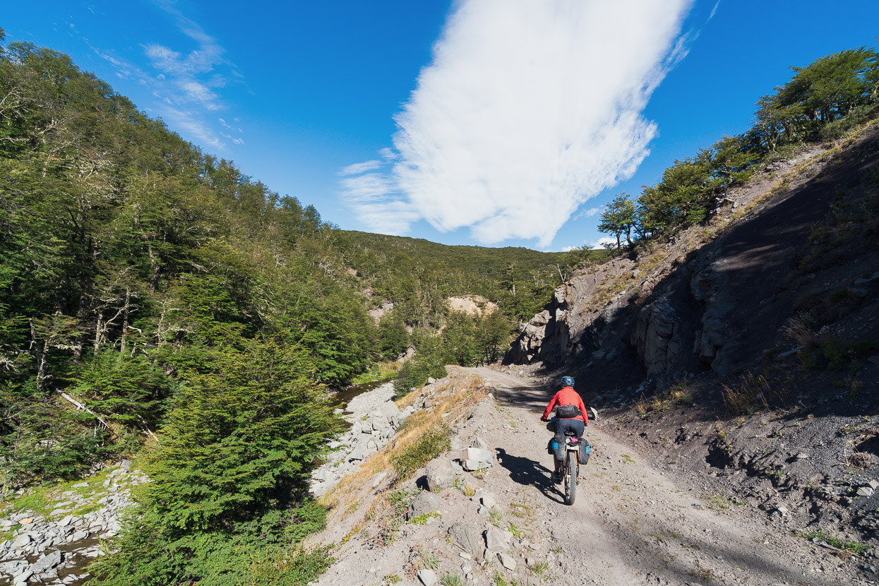
So we turned right down the Lago Leones road, which rapidly degraded (or upgraded, if you’re a bikepacker) to double track/4WD. We stopped at the first house we came to and knocked on the the door, eager to see what their stance was on public access to the Lago.
Queríamos ir a Lago Leones. Esta possible a pasar en esta momento? Esta prohibido o no?
The answer was clear; no, no problem. Just follow the road, and then there’s a walking track. A second local we talked to further down the road also said access was not prohibited. For more clarity on access, please see my notes at the end of this post.
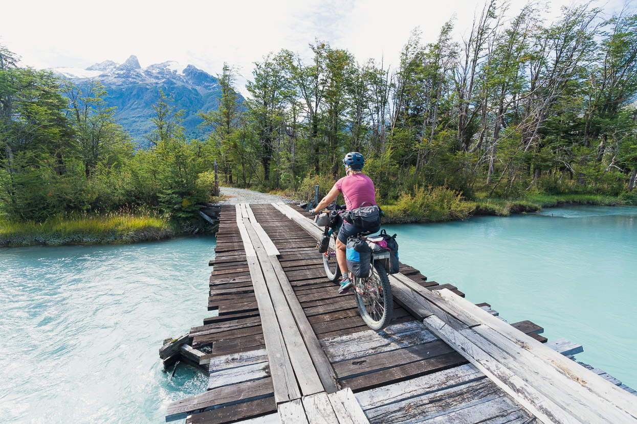
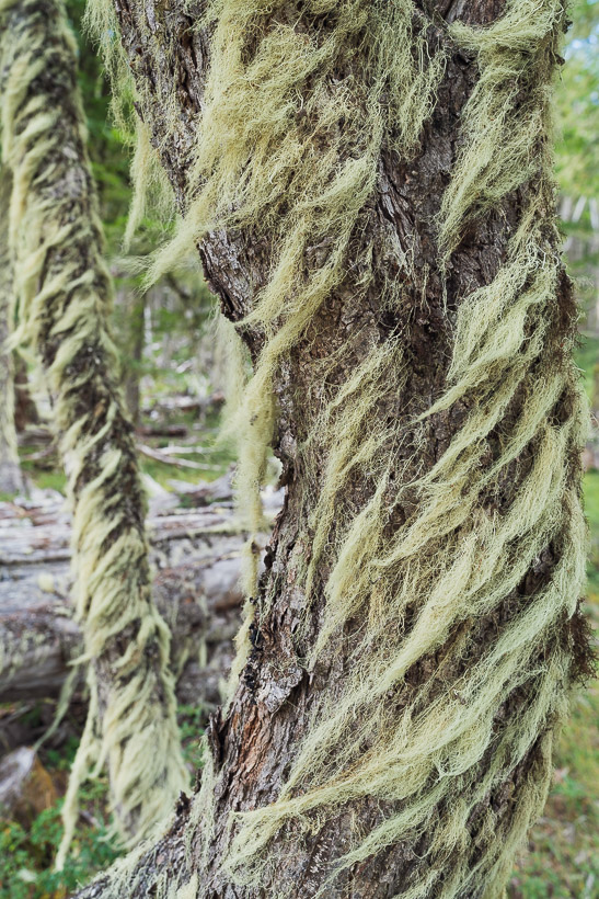
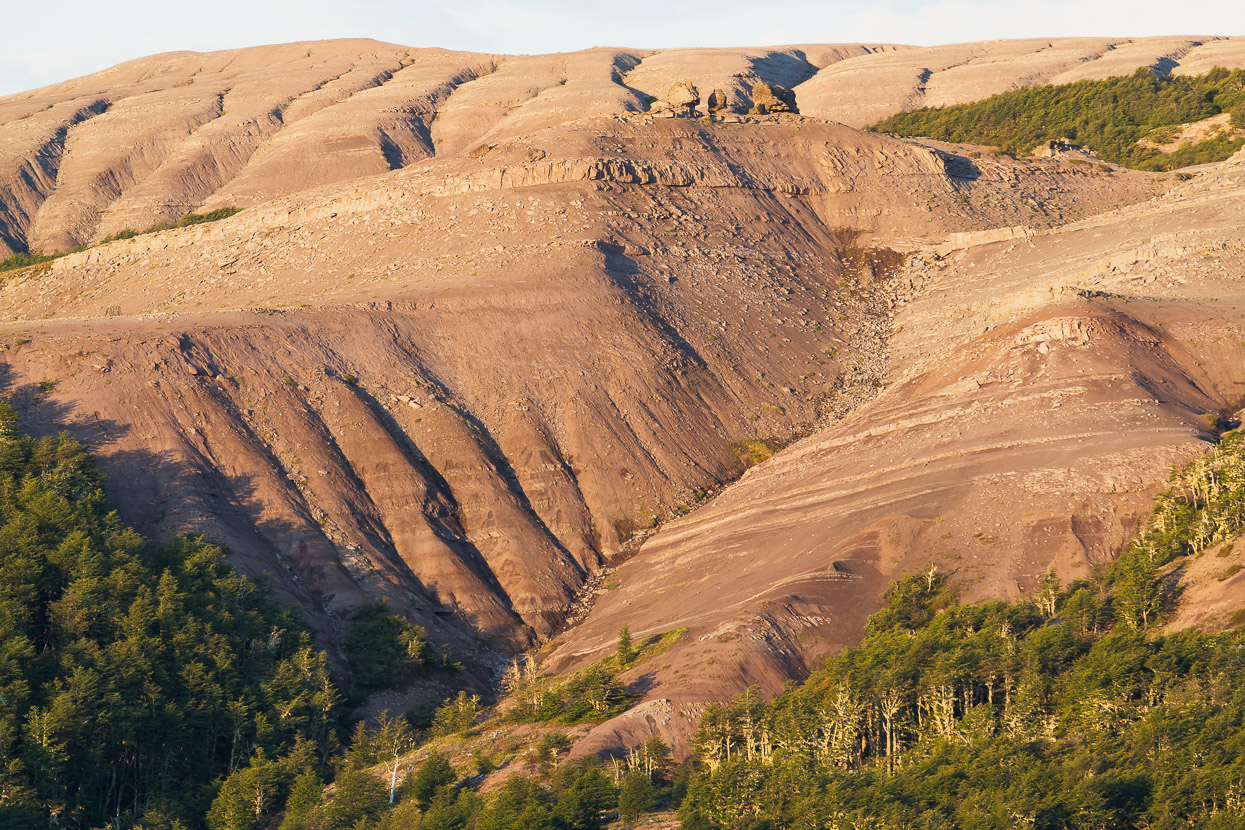
We had the road to ourselves as we made the easy 17km ride up the valley to where the walking track begins. The valley was burned in the colonial era so much of what you see riding up the valley is regenerating forest, as well as some stands of exotic forest. A large section of the valley, several kilometres before the lake, is now part of a substantial restoration project.
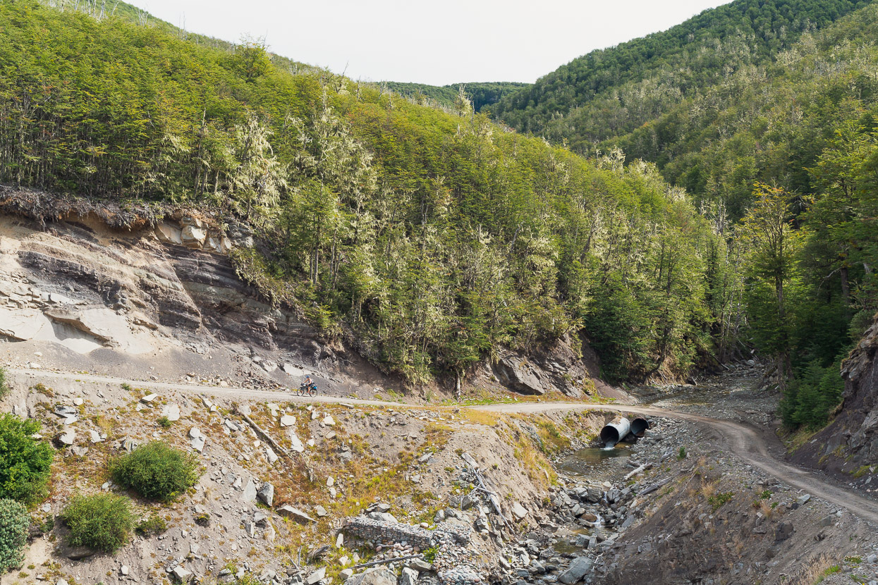
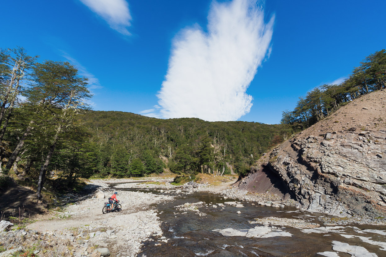
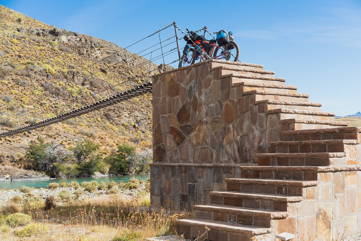
We passed a parking area, ducking under a V-shaped steel gate with the bikes, and followed the road another 800m past the first walking track sign, as the track rejoins the road anyway. Where the track finally leaves the road, there was also a cycling sign, which we were surprised to see. We followed the 100% rideable singletrack for about 3km until just before the stream in this photo and then stashed the bikes in the bushes.
We only have very small, ultralight day packs, but slinging our Revelate Designs front rolls over our shoulders works well for carrying the light bulky stuff for quick overnight hikes.
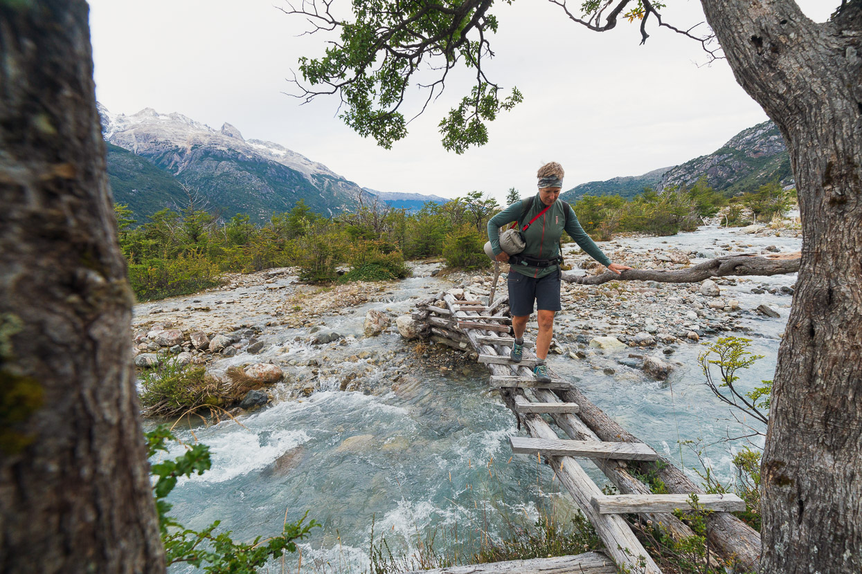
Just before the stream was the right place to leave the bikes, because beyond here the track is completely unrideable as it traverses up and over a steep bluff.
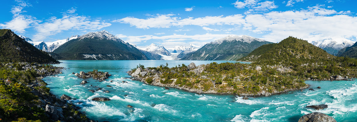
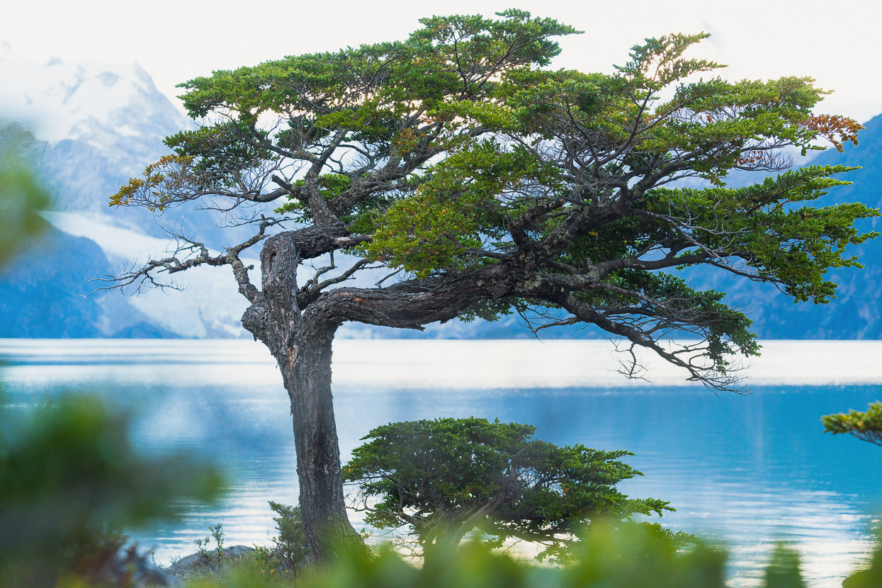
From where we stashed the bikes to the first view of the lake is 6.5km. For the duration of the walk there are no clues as to the vista you’ll see when you arrive at the lake, as it remains hidden by a large moraine wall until the final moment. Finally, just 50m from the lake outlet you crest a small hill and the most amazing panorama fills your view.
In the distance, glaciers flow from the ice cap below Cerro Tronco. Remote peaks interrupt the skyline and the powerful Rio Leones rushes down to its confluence with the Rio Fiero, just out of sight. The glacier has left boulders large and small strewn about, and covered with beautiful lenga trees. It’s an unspoiled and awe inspiring place.
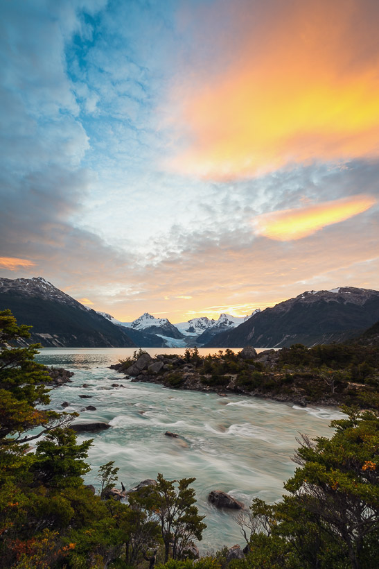
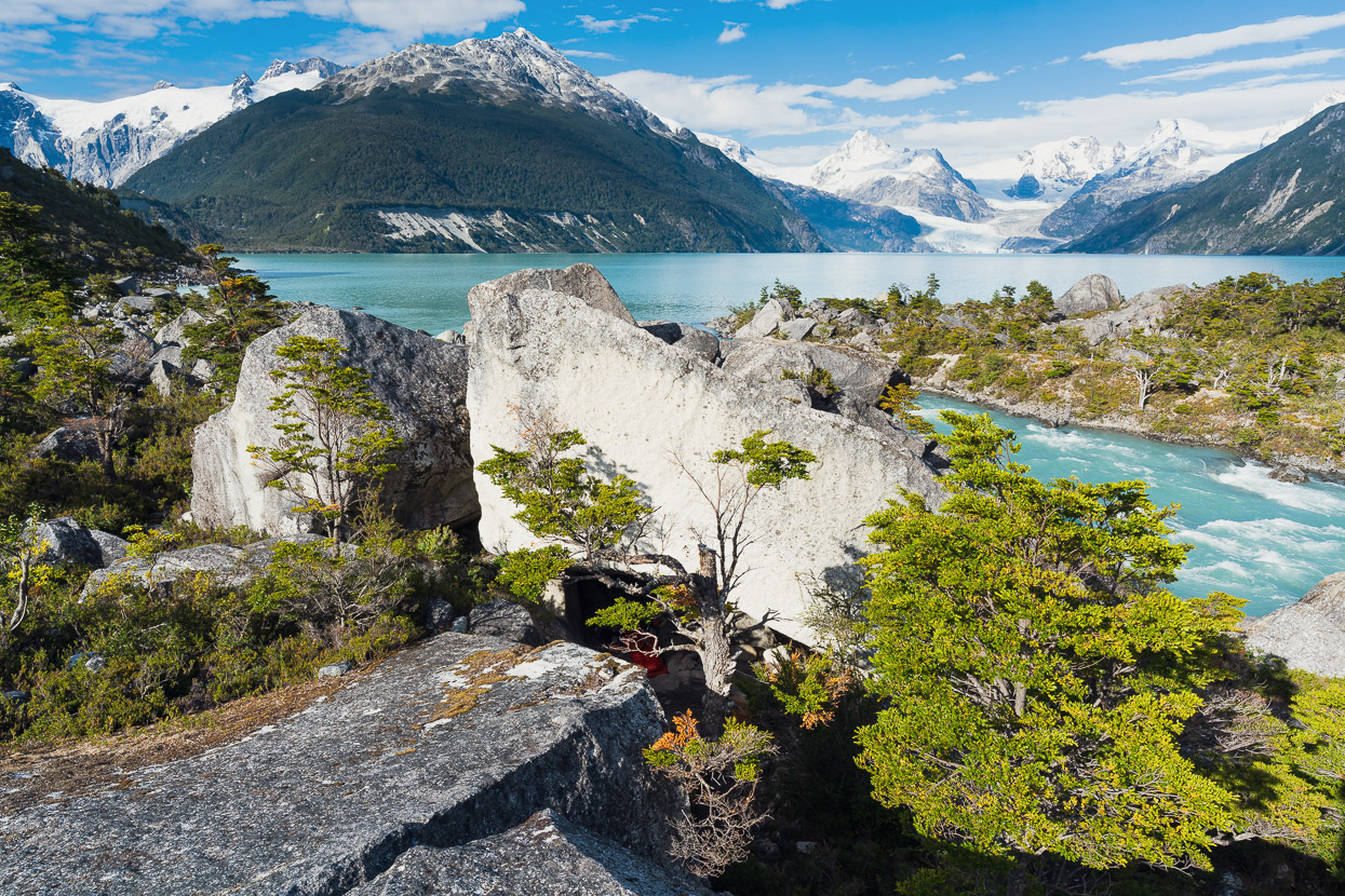
There’s a good rock bivouac just a stone’s throw from the river (under this prominent white boulder and marked on OSM) so we dropped our gear in time to chase some sunset photography.
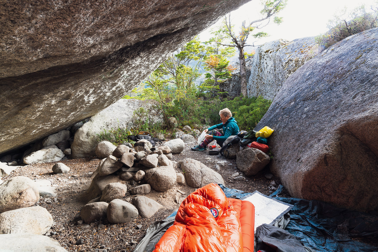
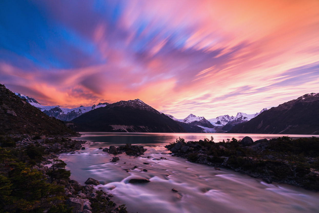
Fortunately we got a good one! Nice light is often down to chance, especially when you are only visiting a place for one night, so this was a special one to get lucky with.
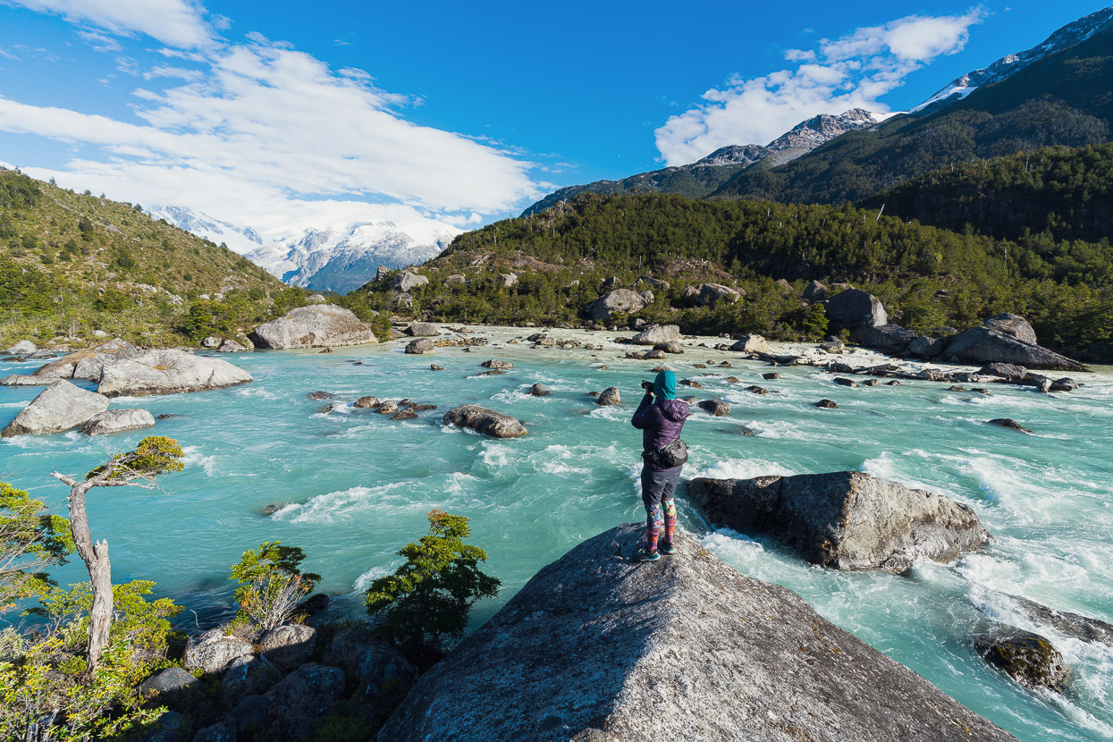
The pursuit of compositions continued in the morning as we explored this magical place a bit more. It’s worth checking out the confluence where the turquoise waters of the Rio Leones mix with the heavily silted grey waters of the Rio Fiero.
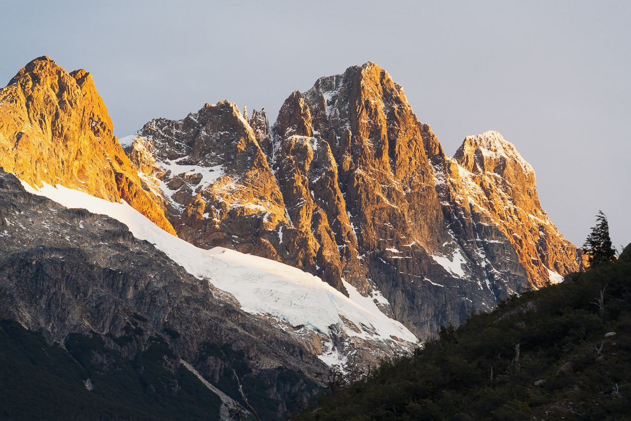
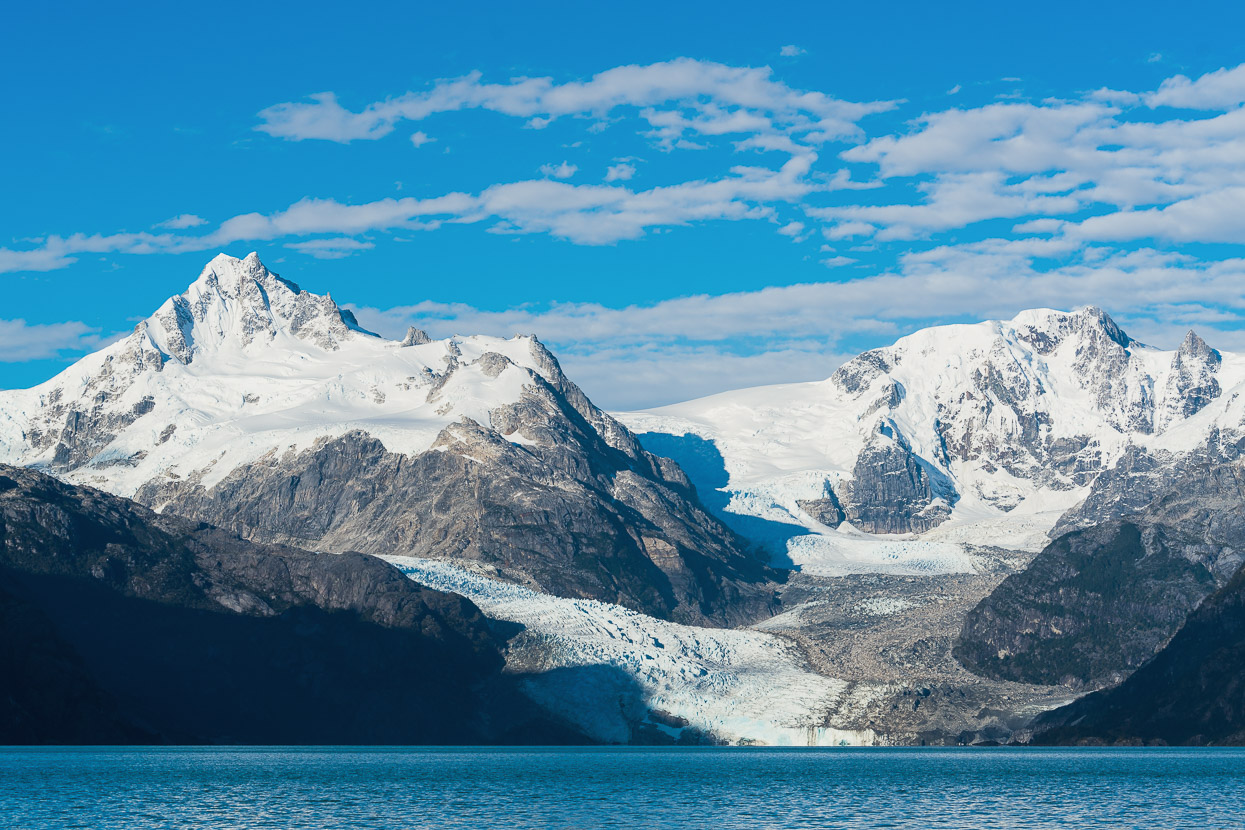
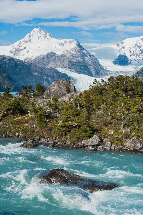
Across the lake the Leones Glacier flows and tumbles steeply down to the water’s edge.
And a closer look at the peaks beyond. Behind these mountains lies the widest section of the Northern Patagonian Ice Field, which is one of two remnants of a gigantic ice sheet that used to cover the entire region through to western Argentina. Now separated, the northern ice field is the smaller of the two but still sprawls over a massive 4,200 square km, making it the second largest continuous mass of ice (after the southern field) outside of the polar regions. 28 glaciers exit the icefield.
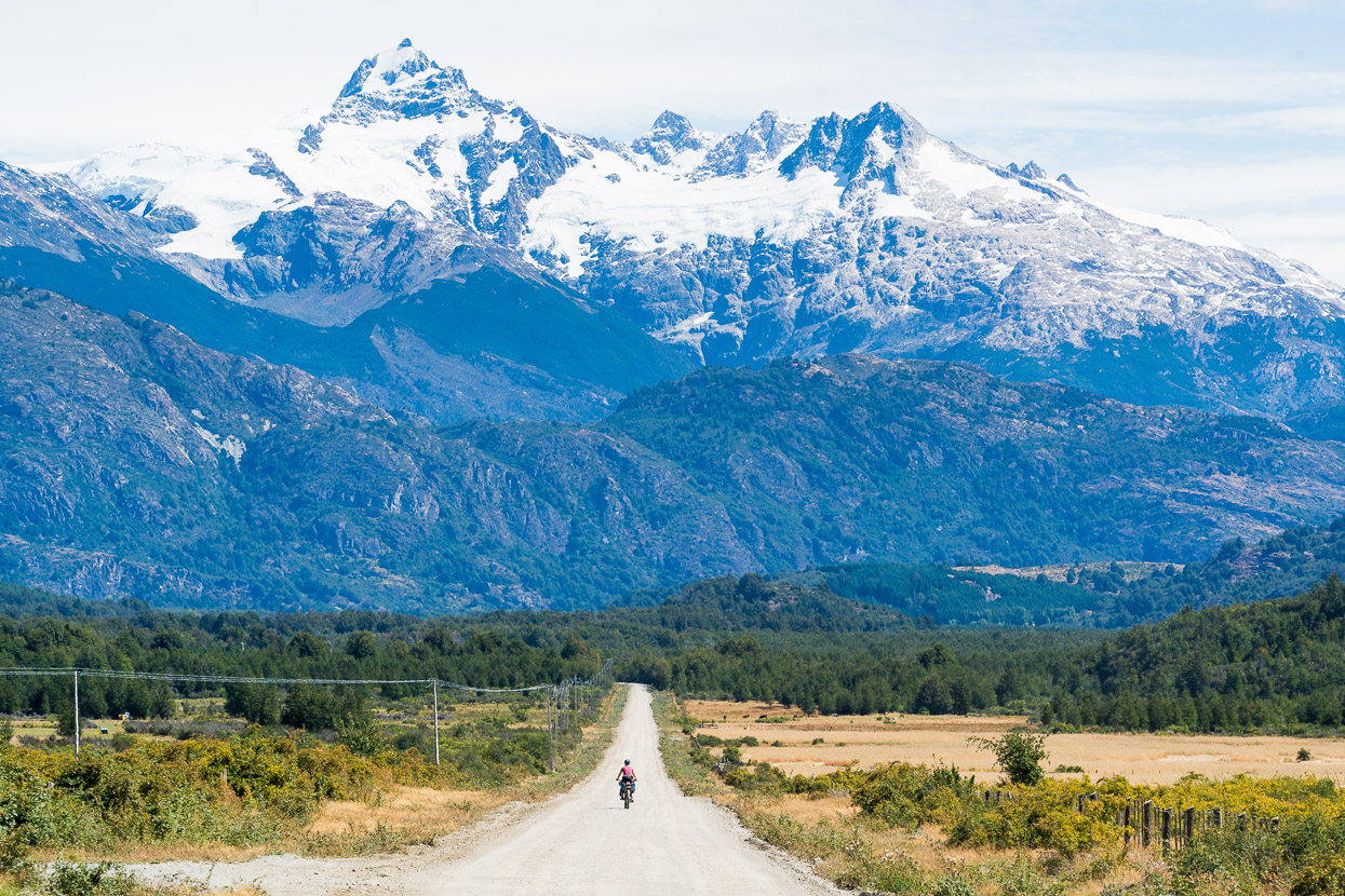
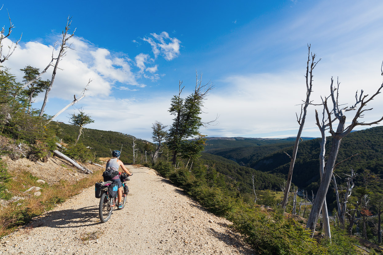
By lunchtime we were back at our bikes and, after a repack, rode back out of the valley and continued our original plan. While most cyclists continue south on the Carretera Austral, we’d been given a good tip by fellow bikepacker Daan about a relatively recently opened route that crosses the high ranges east of the Carretera Austral, which we were keen to check out.
This shot’s of Lago Bertrand, which is separated from Lago General Carrera by a narrow neck. Shortly after this we turned off the CA on the Ruta 265 towards Puerto Guadal, where we camped for the night and resupplied at a great little mini mercado.
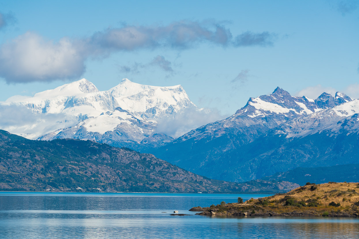
In the morning we had more great views across Lago General Carrera towards more big mountains of the ice field.
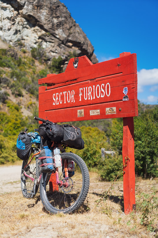
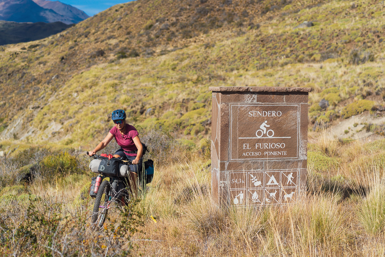
The route we were aiming for crosses Sector Furioso of Chile’s newest national park, Parque Patagonia. This new park was previously a huge estancia, but was purchased and donated to the Chilean government by a foundation led by Kris Tompkins (former Patagonia CEO and wife of North Face and Esprit founder Doug Tompkins). Once we turned off from the main road the route climbed steadily, at first through lands still currently grazed, and then eventually to the park boundary and old growth forest that hadn’t been selectively logged, like much of the lower forest.
It was excellent riding, and once we were past the first few farms we saw no one else for 36 hours.
After the initial big climb the route undulates, following the floor of the valley at times.
With a few stream crossings.
And another very steep climb up towards the tree line
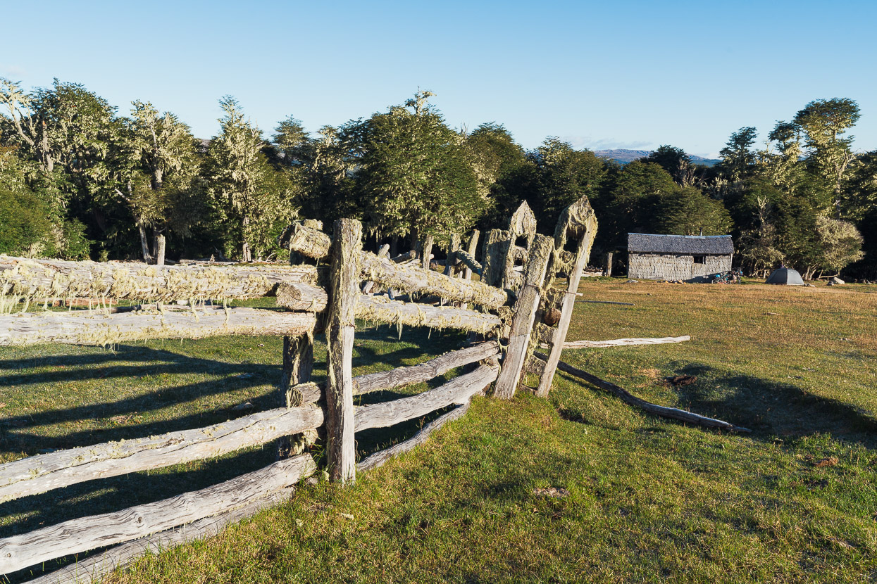
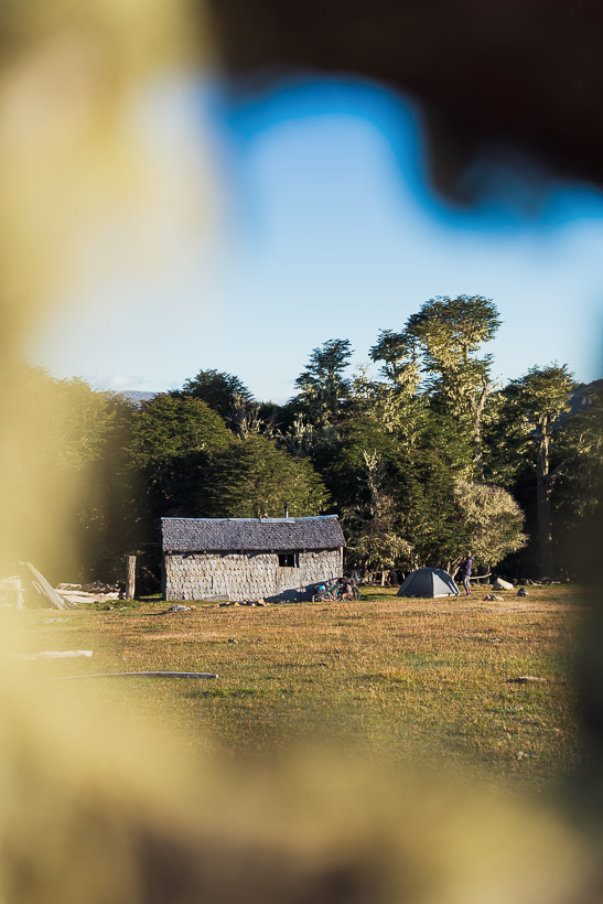
Earlier in the day we’d stopped to get water at a farm and been given a tip about this old shepherd’s refugio, sitting on the edge of the forest at 1070m.
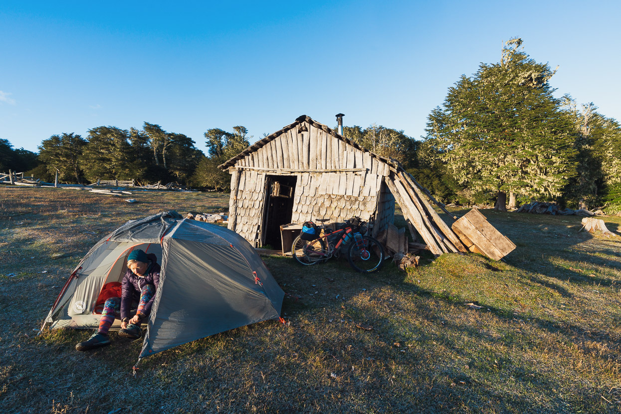
With the old wooden building sadly on the verge of collapse we opted to camp outside, just in case the wind blew it over overnight.
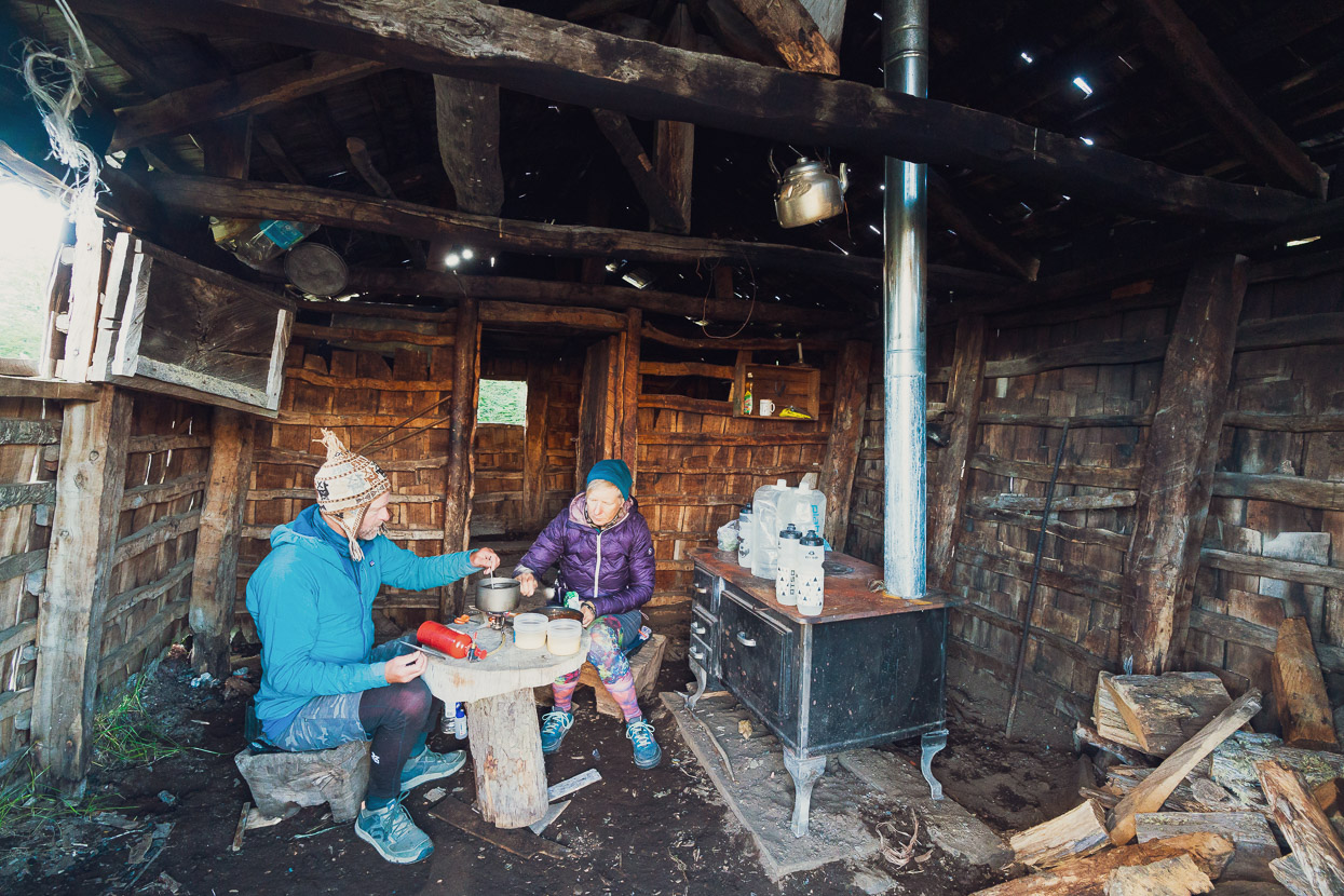
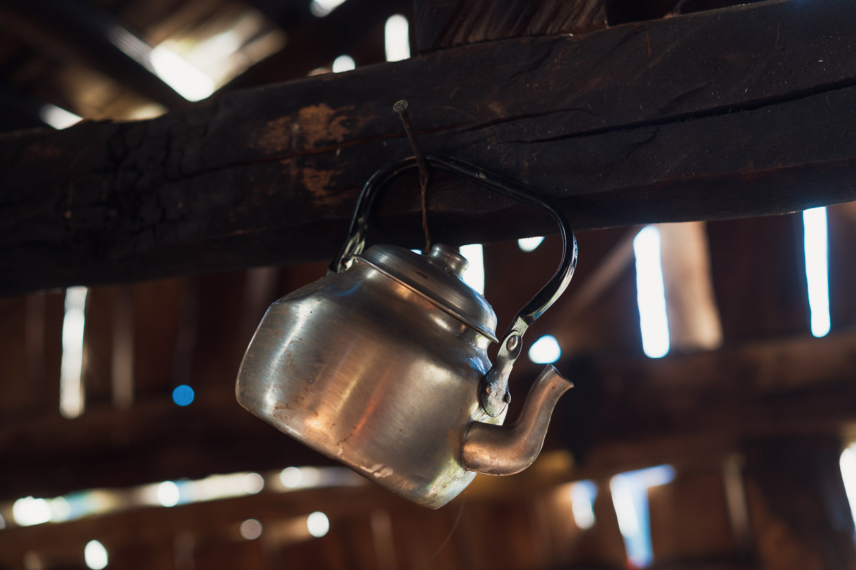
But it made a great cooking shelter. The fireplace is a much more recent installation than the rest of the refugio and will no doubt outlast the building that houses it!
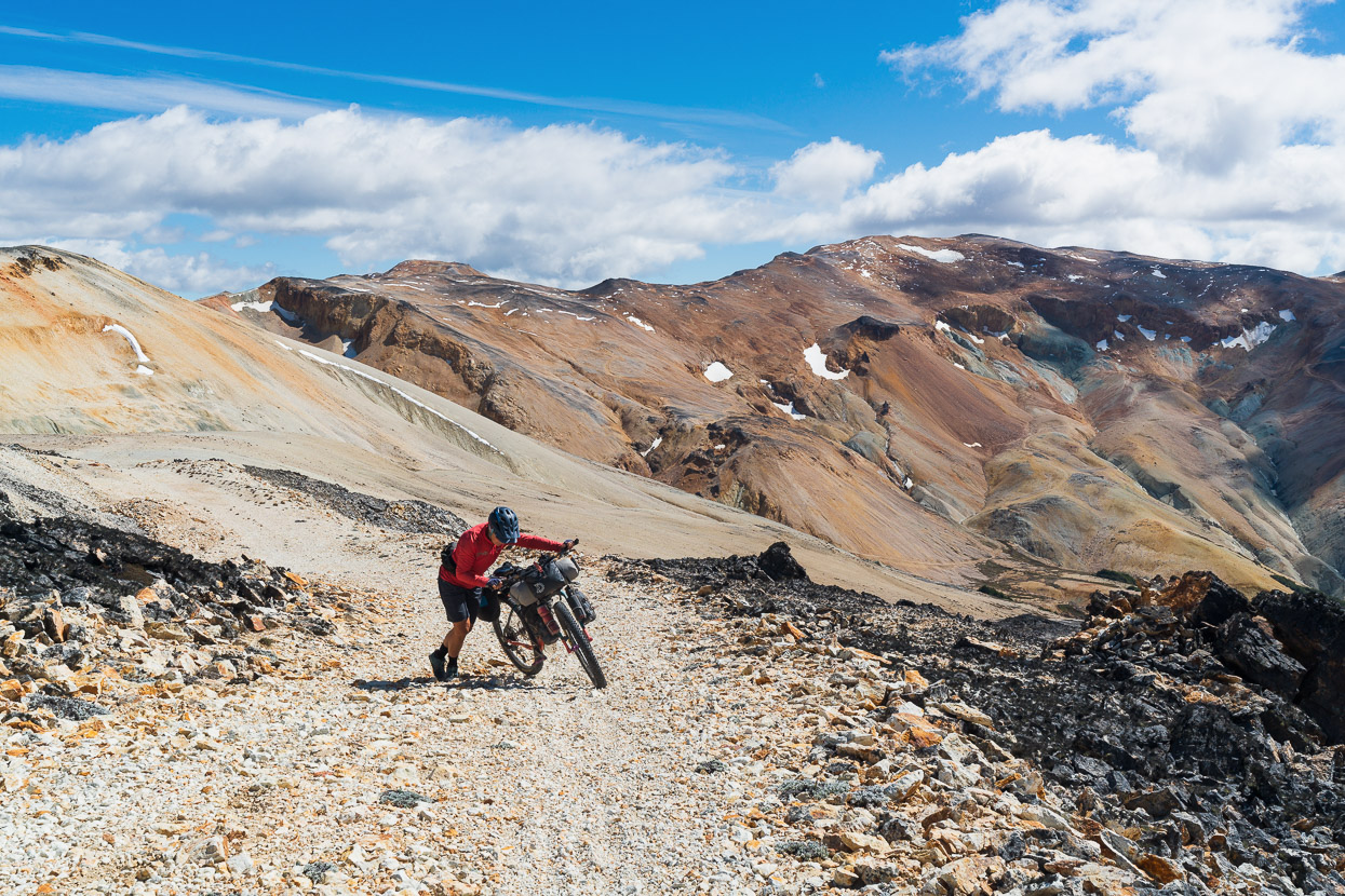
A fantastic day of weather followed and we could not have had a better day for this high crossing. The route climbs to 1440m, which is quite high for southern Patagonia and is exposed in its upper reaches – if you’re going to do it, keep an eye on the weather. It’s no place to be in high winds or stormy conditions.
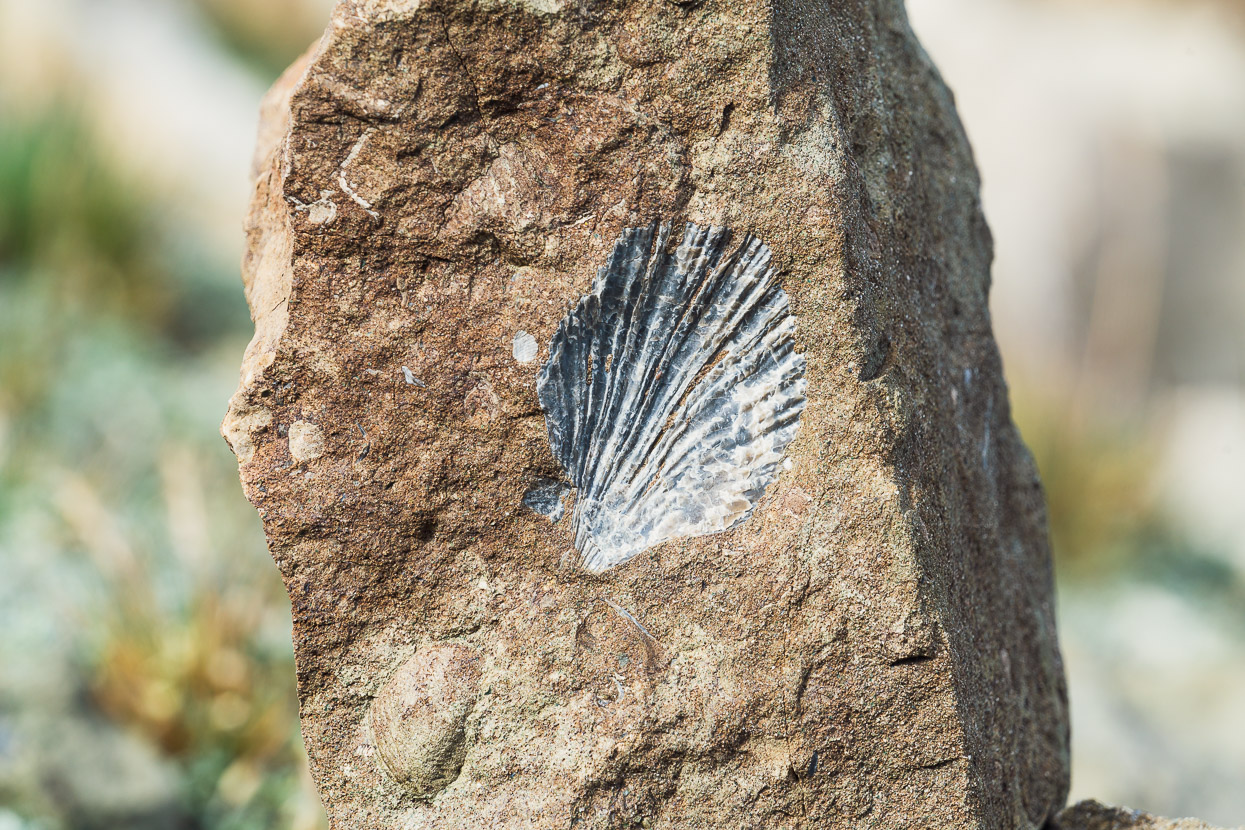
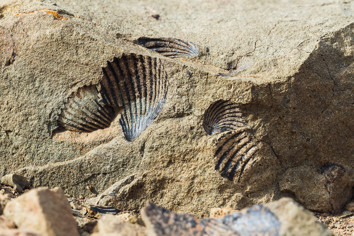
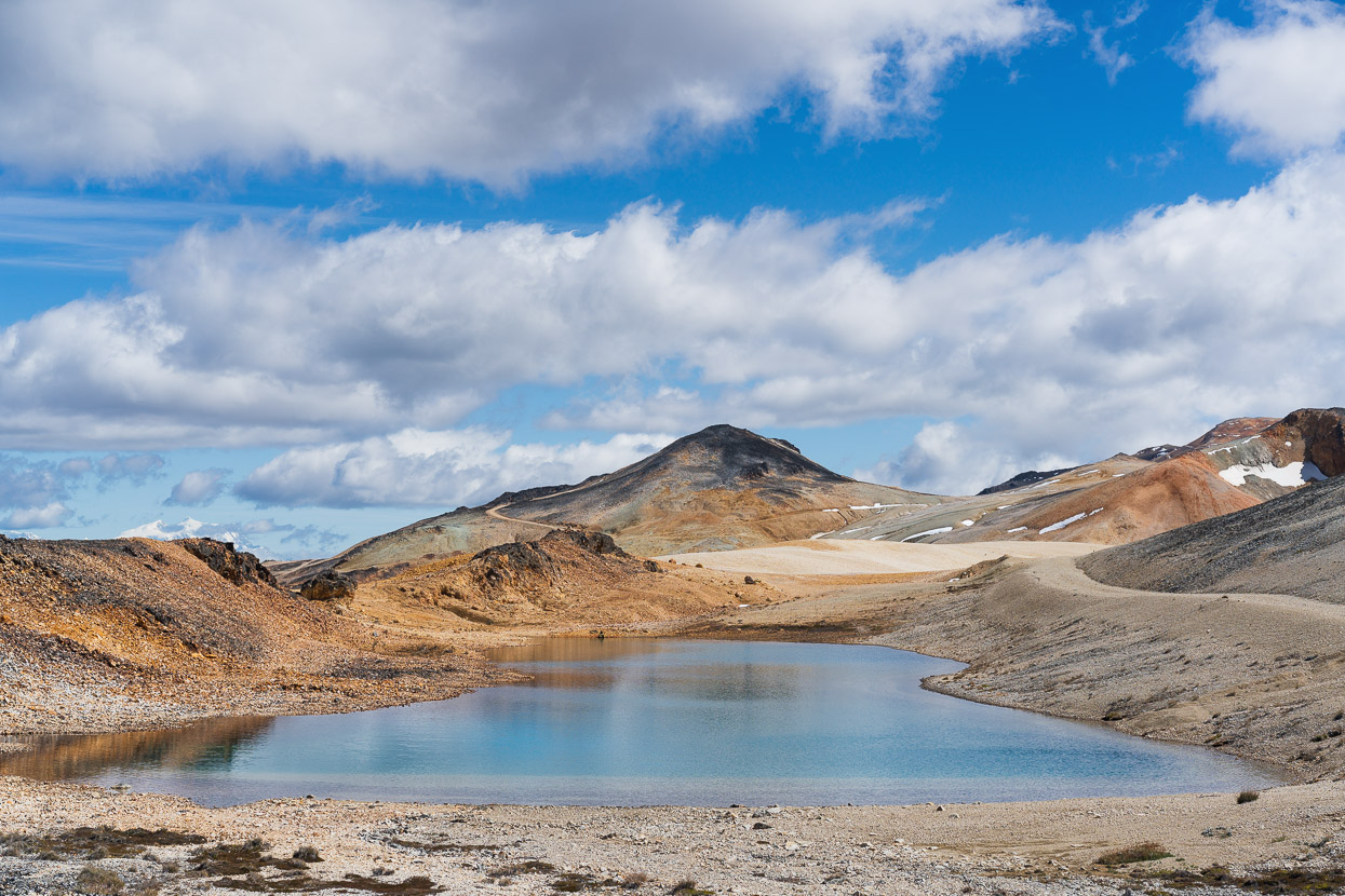
Unlike the granitic terrain we’d spent the past week in, much of the rock we were riding through was sedimentary; ancient sandstone and limestone, which turned out to be rich in fossils.
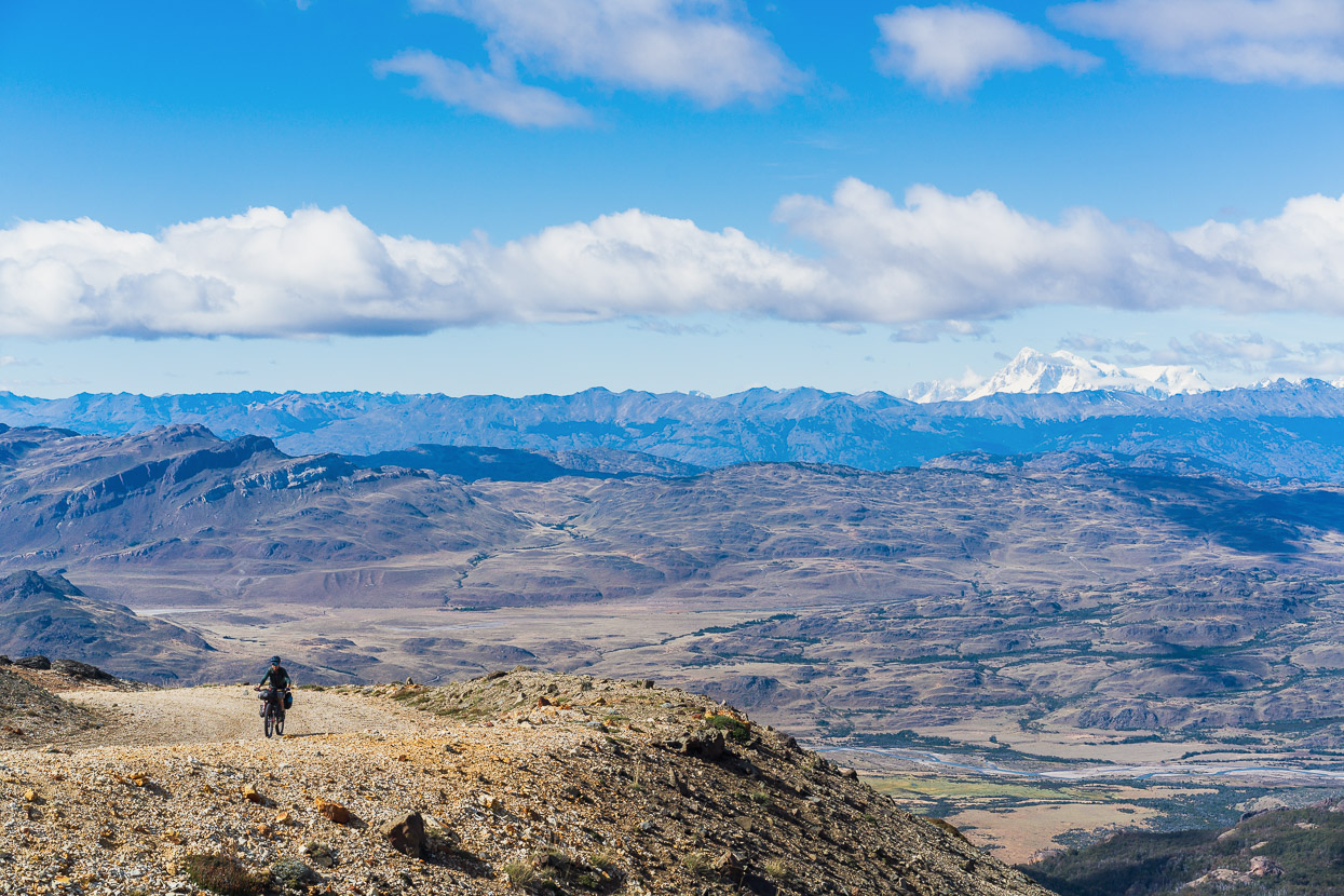
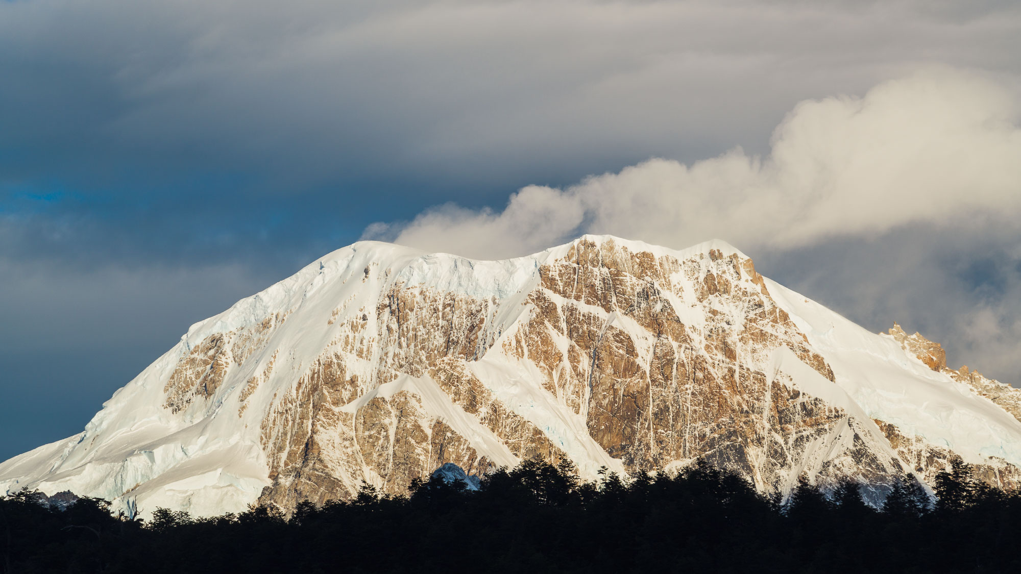
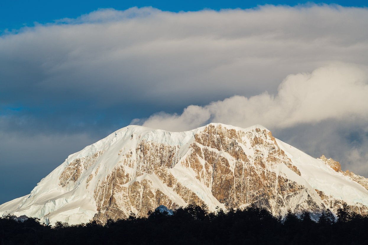
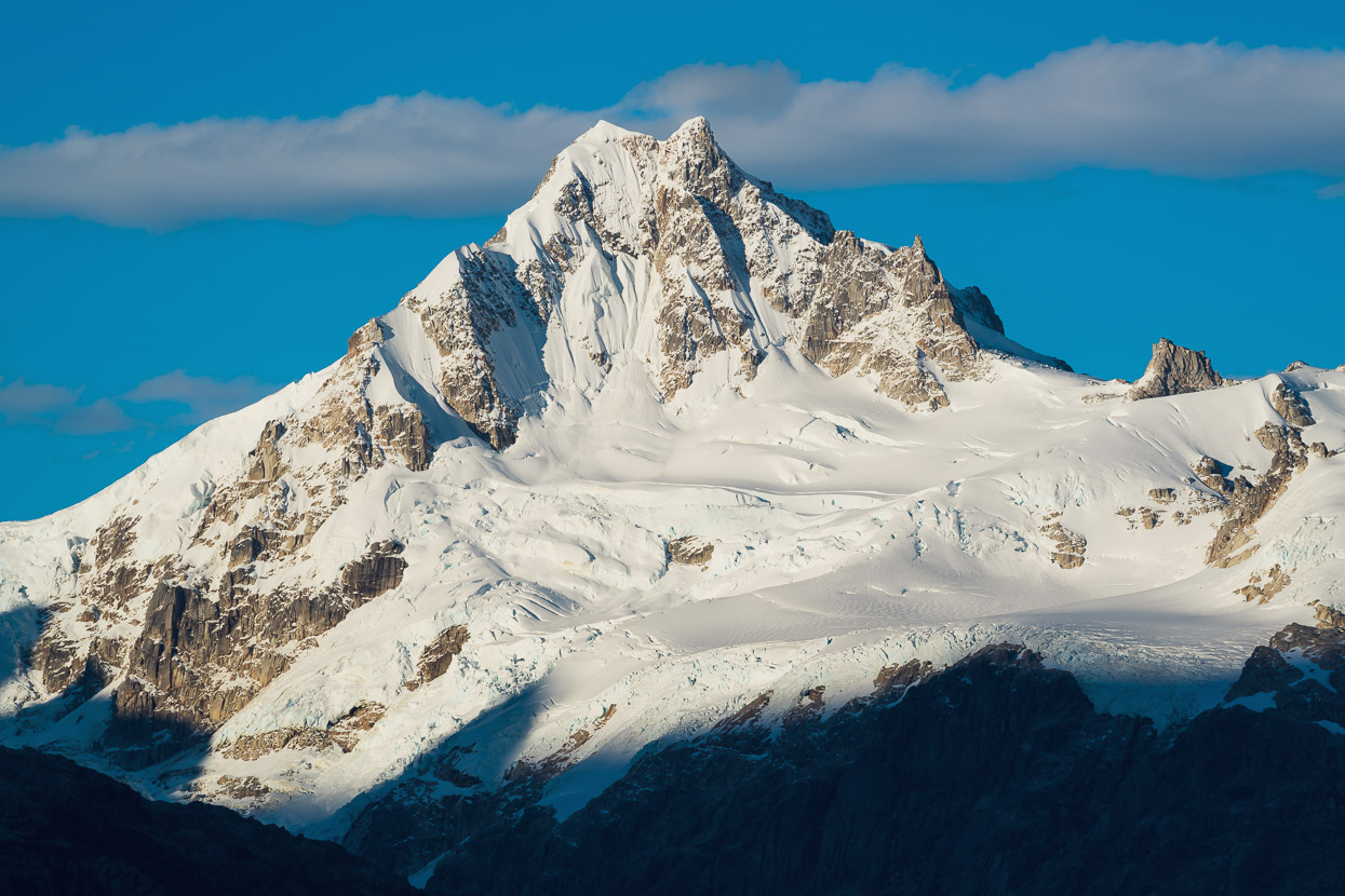
Higher we climbed, until the view began to really open up; to our immediate south the glacier-carved landscape of Parque Patagonia, and in the distance the ice clad massif of Monte San Lorenzo, the second highest mountain in Chilean Patagonia at 3706m.
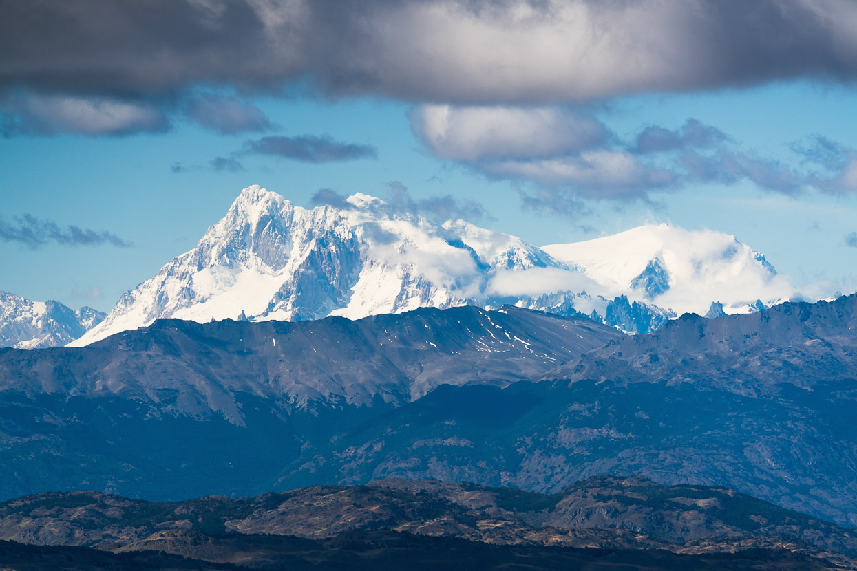
A closer look with the 300mm lens… Monte San Lorenzo straddles the border with Argentina.
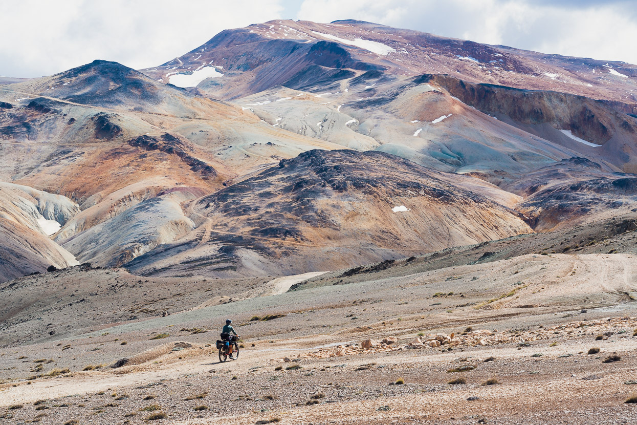
As we rode higher we could have been back on the Peru Divide or the Puna de Atacama, with the red, orange and yellow hued hills, still with traces of mining roads. Minerals are the very reason for the road we were riding on.
We crossed the highpoint and then a 800m descent dropped us right down back down into the forest.
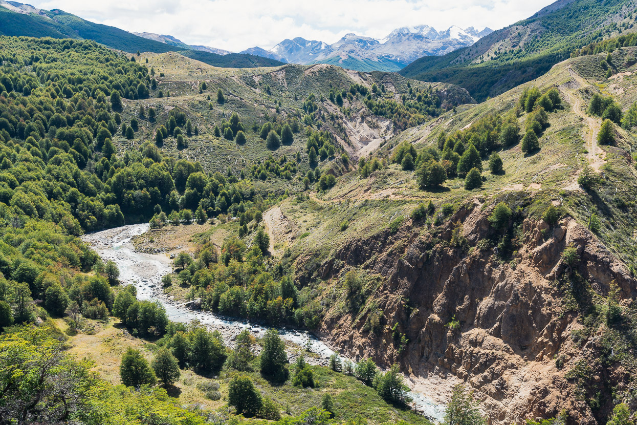
A good footbridge (bottom left of photo) led us into one more steep climb, before a final descent down into the Valle Chacabuco – the main valley spanned by Parque Patagonia.
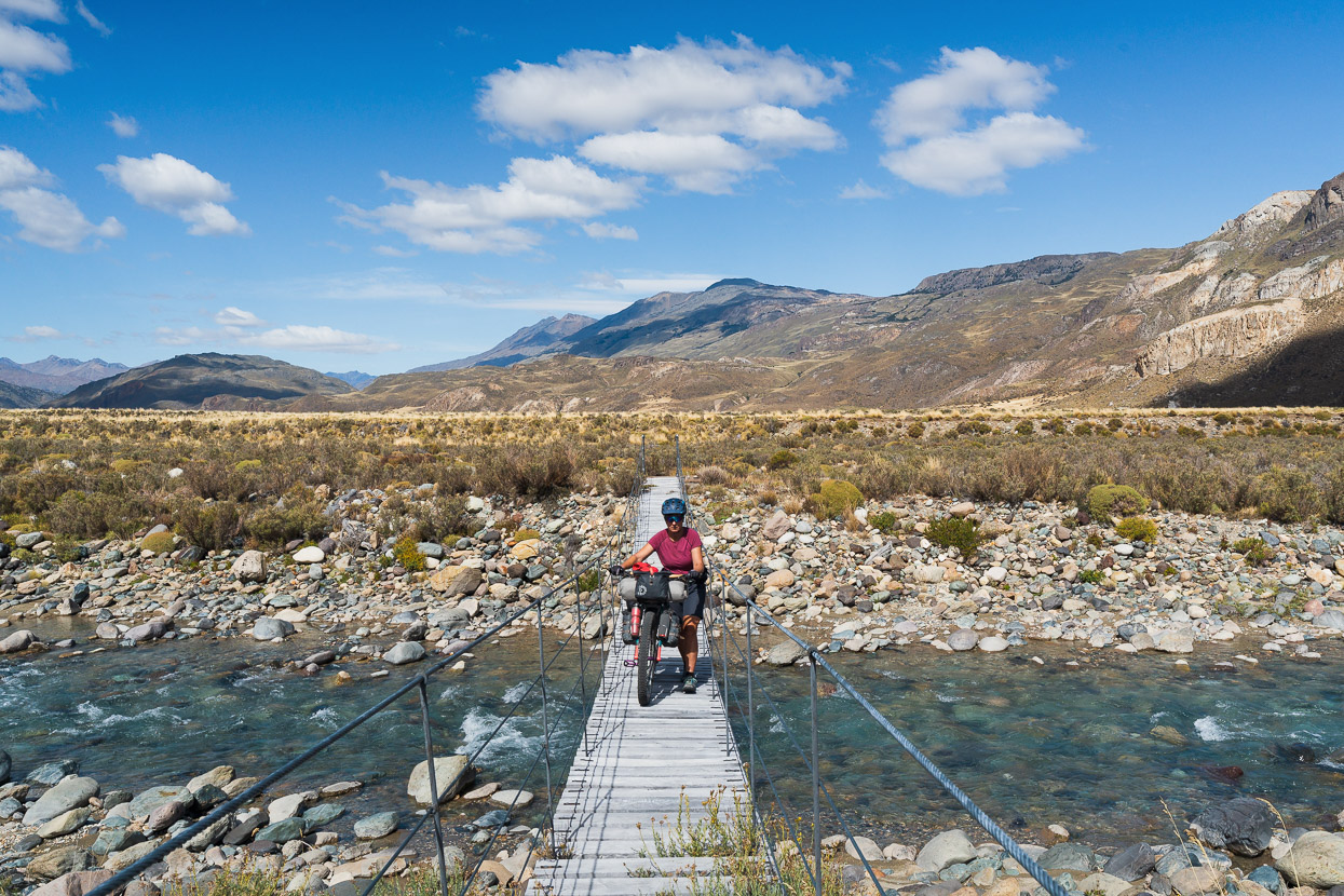
This was a day of big transitions, as we crossed the alpine, rode through forest and then eventually emerged to the pampa of the Valle Chacabuco. The route continued east-bound into a strong headwind towards the Carretera Austral. The park authority have installed bridges across all major streams and rivers.
Although they didn’t think through the approaches very well! Especially considering these old farming and mining roads have been designated as a cycling route in the park plan.
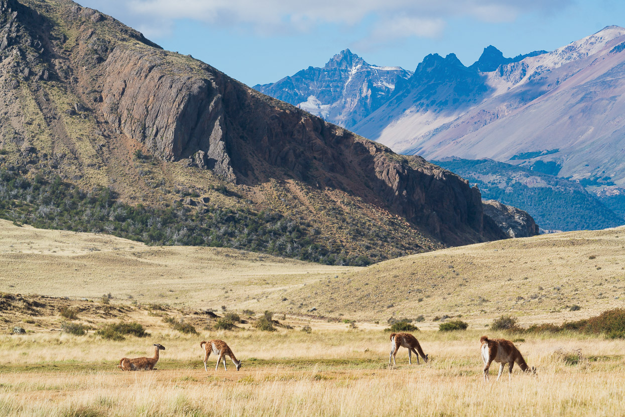
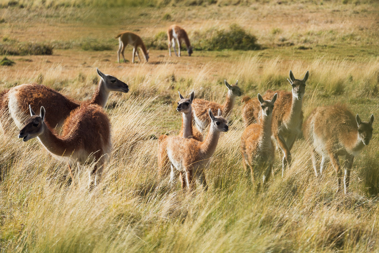
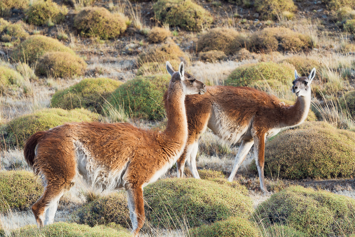
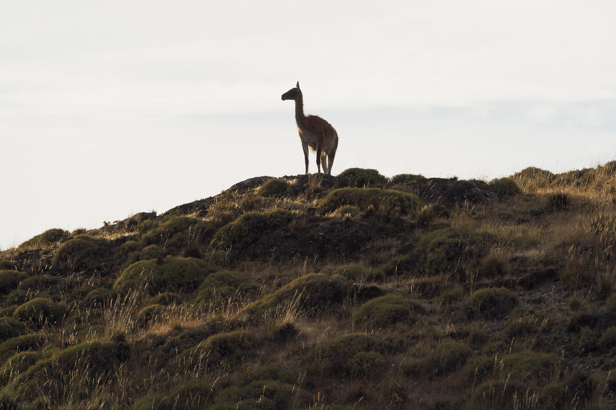
Nicknamed the Serengeti of the Southern Cone, the Valle Chacabuco is famous for its large herds of guanaco, which are increasingly habituated to tourist traffic. So we got to see a few reasonably close. Normally they are quite flighty.
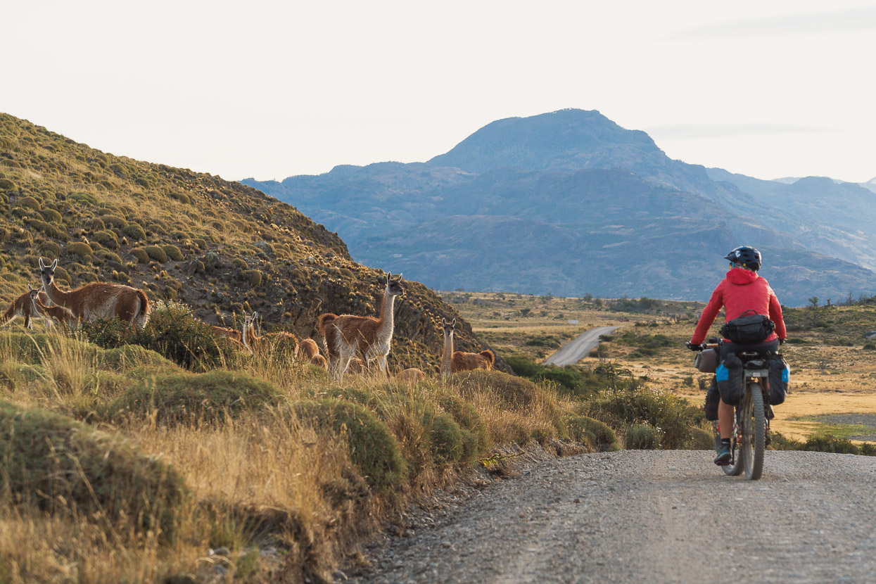
The day grew long as we joined the gravel road that follows the Valle Chacabuco from Paso Roballos to the Carretera Austral. The strong headwind continued and it was just before dark when we eventually reached the CA and turned right to detour a couple of kilometres down to a wild camp by a highway bridge and water source.
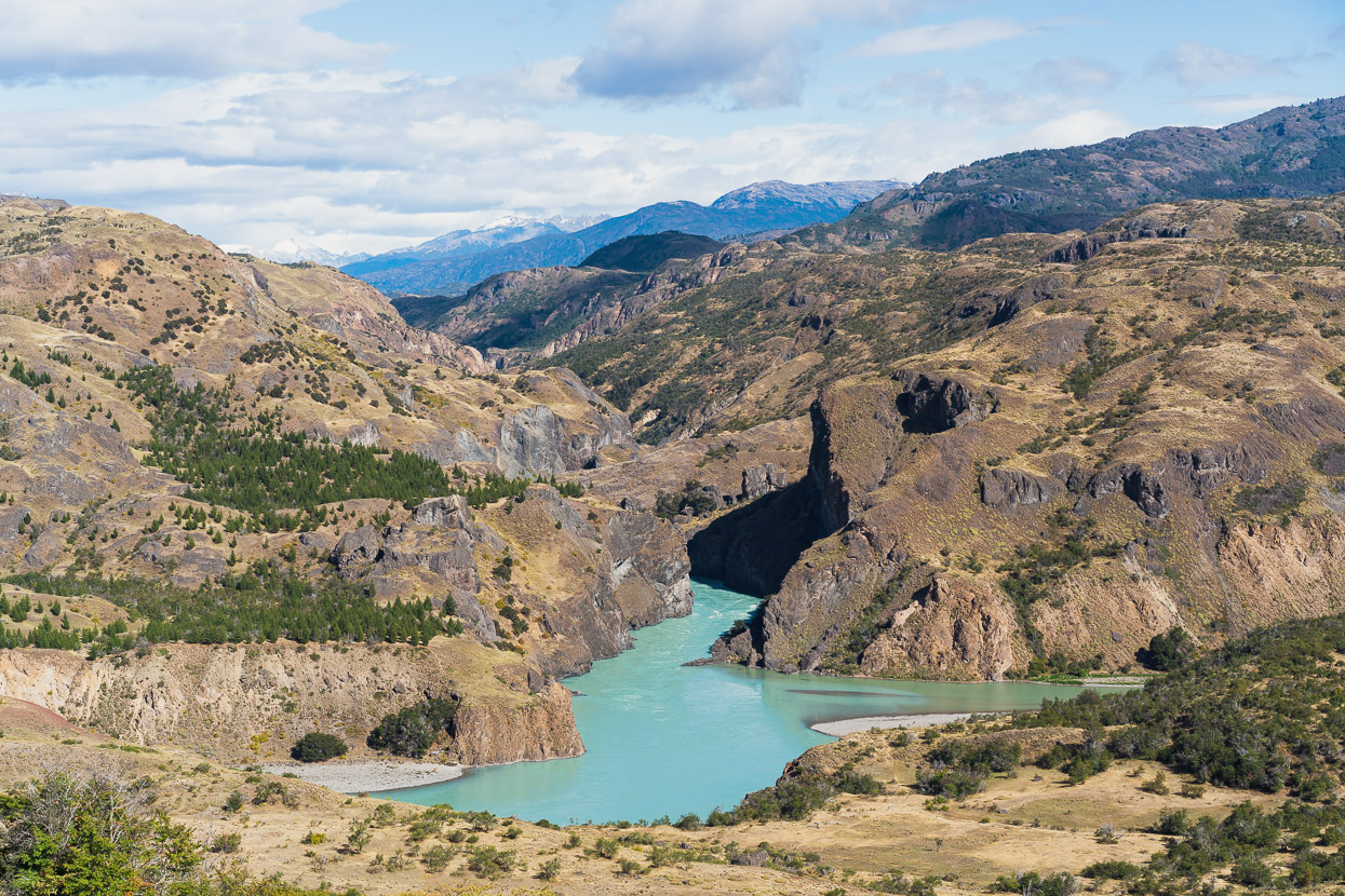
In daylight, the confluence of the huge Rio Baker and Rio Chacabuco made a great sight from the CA as we headed the remaining 19km to Cochrane.
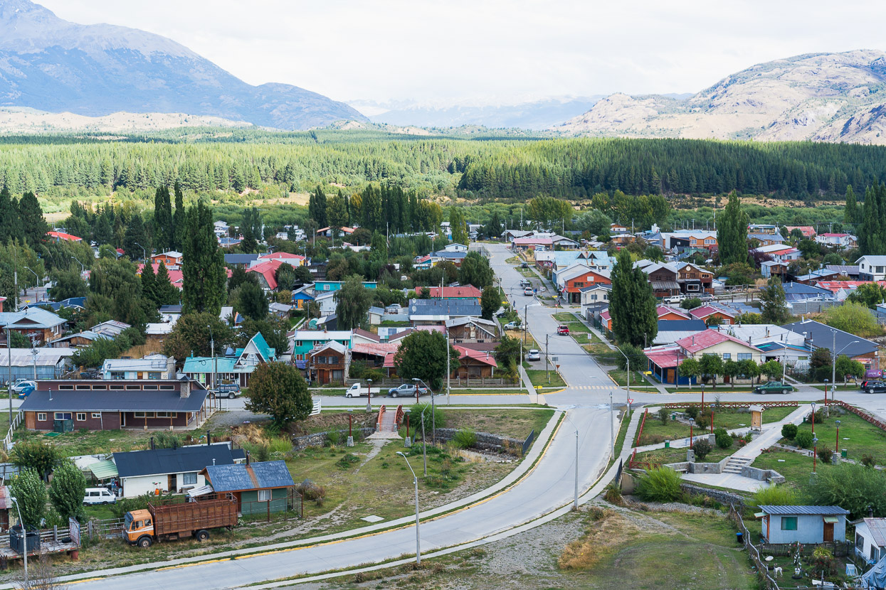
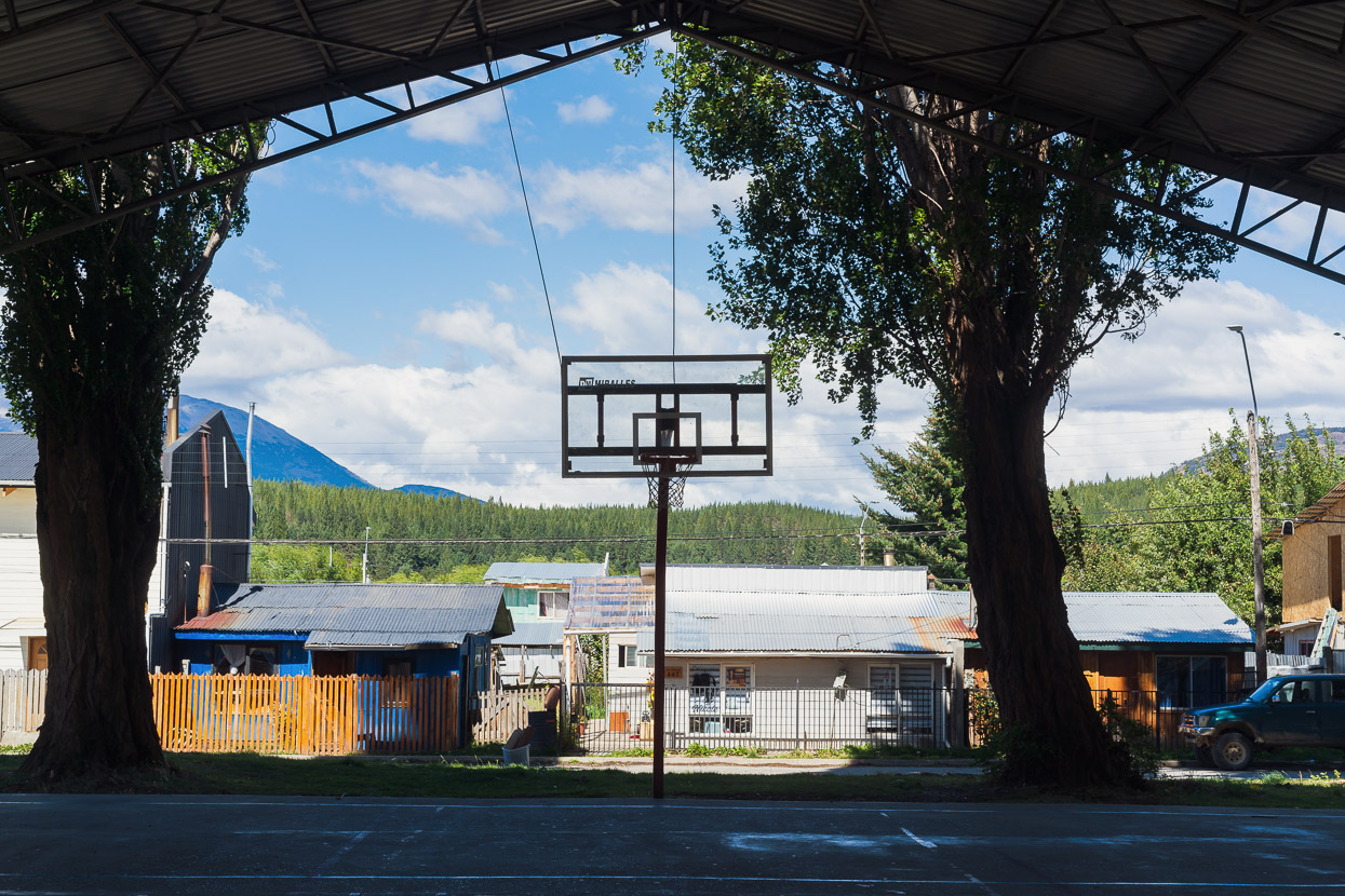
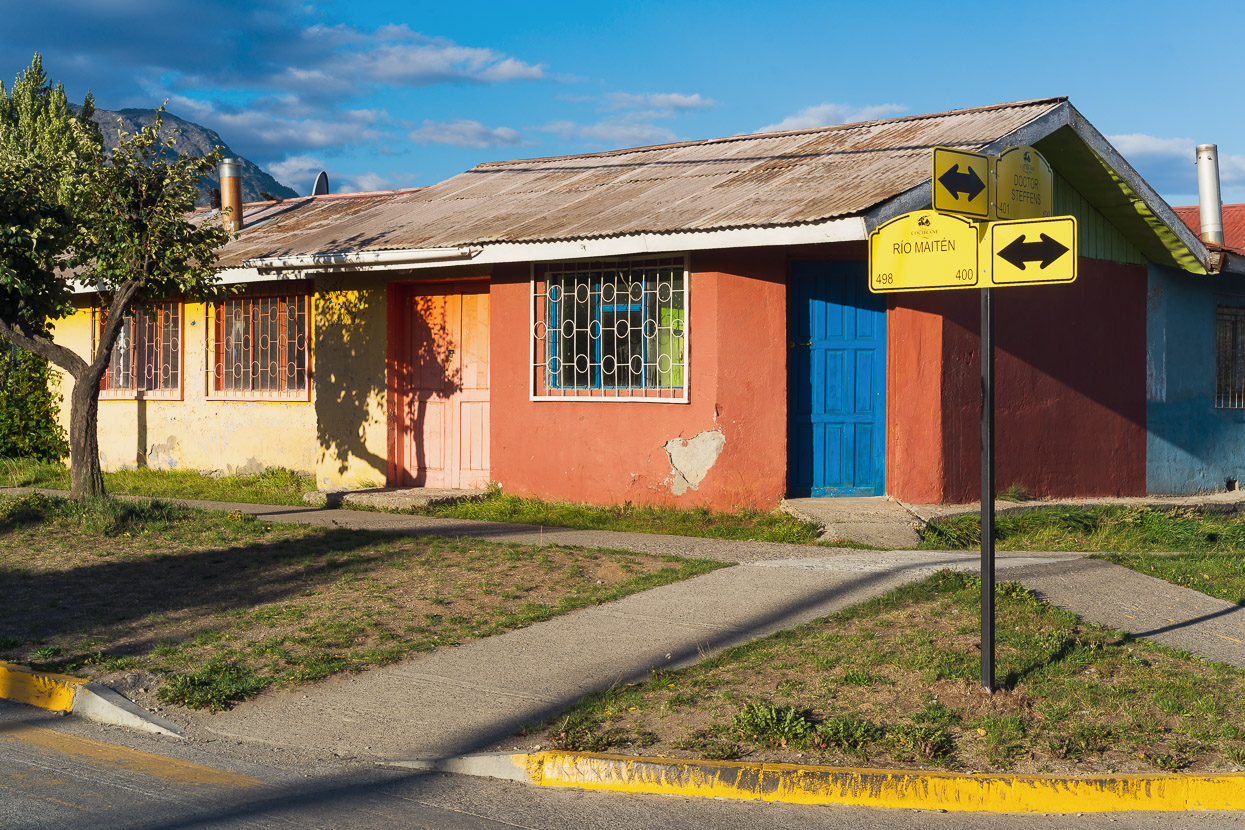
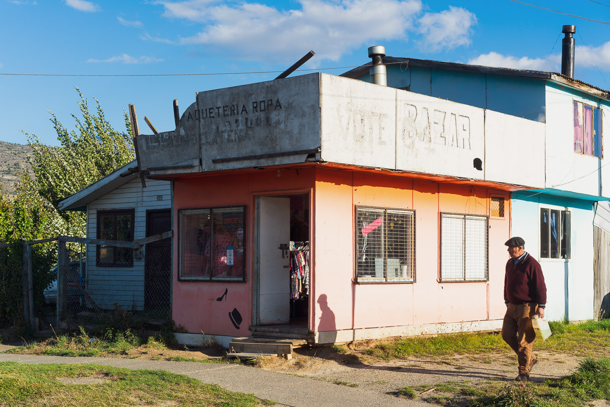
Cochrane is the last town on the Carretera Austral, with nothing but small farms between here and the village of Villa O’Higgins (the end of the Carretera Austral) 220km away. Sitting just in the rain shadow of the mountains, Cochrane has a ranching and service town heritage and retains a typically rural Latin American rough-around-the-edges feel, but it’s also a tourism nexus for the many travellers passing through by bike, car, bus and hitchhiking to explore southern Patagonia.
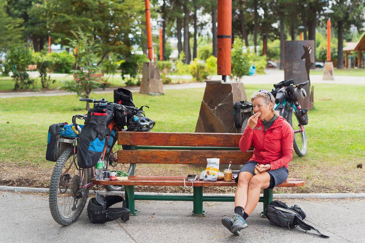
Of course we made a beeline for the supermarket and then the plaza for a picnic lunch.
Next up, we took a closer look at Monte San Lorenzo, but you’ll have to wait for our next post.
Thanks for reading!
Access to Lago Leones
As far as we can establish public access to Lago Leones is not prohibited. Although the national park prohibits entry from the Lago Leones sector (it’s a UNESCO Biosphere Reserve), the park boundary runs along the lake shore and the NW side of Rio Leones, near the lake outlet, so you’re not entering the park by visiting the lake edge.
To reach the lake edge from the Carretera Austral you follow a private road (Ruta X-732) which is open to the public. The road crosses several parcels of land with varying ownership. We passed through a couple of gates in the first few kilometres, and there were some ‘no camping’ signs.
Further in, there is a large tract of private land which is under the stewardship of the Pichimahuida organisation. The road and some of the hiking trail crosses through the middle of this. Pichimahuida are running a land restoration project here to attempt to rewind some of the colossal damage the land suffered during colonial era fires and subsequent grazing. The organisation has thoroughly signposted its land with its restrictions: such as no camping, no leaving the trail, no fires. Although they do not encourage tourism, they do not block access, so please respect their rules when you cross their land to reach the lake shore, which is not subject to any particular access restrictions, as far as we can tell.
Say thanks with a one-off donation, or check out our Bikepacking guide.
If you enjoy our content and find it informative or inspirational, you’re welcome to show us some love with a donation or a book purchase (US$19.99). The services we use to create our Bikepacking routes and host the website cost money, funds that we’d rather be spending on the road, creating bikepacking routes and content to share with you. Thanks for reading!


I’m so glad to see the Rio Furioso route in words and pictures as while I discovered it a few years ago it’s unlikely I’ll ever get to do it. Well done.
Thanks Alec. Feel free to include the blog link with your excellent list of alt routes at: https://www.crazyguyonabike.com/doc/page/?o=3d2&page_id=484259&v=Aj
Fabulous! We tried to find a route out of Chacabuco in 2014 but it didn’t seem possible then so we just rode an out and back. We may have to return 🙂
Indeed you might – it was an excellent route and a real treat to see some Patagonian diversity. It’s definitely easiest and most fun cycled north-south.
The lake Leones is located in the Laguna San Rafael national park. Entries to the park are regulated by Conaf (management of the national parks) via its platform aspticket.cl. The project (mainly of legal nature) mentioned in the blog, is cooperating closely with Conaf in the monitoring of the access route to this sector of the park and information exchange on the issue.
Professional and tourism-promoting photography in national parks is subject to licences and authorisations, issued by and paid to Conaf for the park in question.
The information posted above on the legal status of the used access through at least 16 private properties of at least 12 landowners is wrong. Also, de facto only 2 landowners are mentioned, the rights of the other landowners are ignored.
The information about the project Pichimahuida is not correct. Besides, the condition, also posted in valley, requiring not to, under no circumstances, advertise this project in social media, blogs or otherwise in public space, is not met.
“Talking to locals”: almost all rural properties in the valley where the access was used are second or third homes. The land steward of the mentioned project is registered as permanent resident (main residency) in the valley Leones and lives there, he speaks English, or rather Australian.
Attention should be paid to the compensation of ecosystem services provided by the rural landowners who built and maintain this exclusively private road for their private access, using only their own financial resources.
Regards.
Thank you for sharing your trip to Lake Leones. I tried going today and there is a new fence that has been erected that strictly prohibits tour operators or the public from entering. it spans the entire length of the road and the only way to get past it is to climb over it. You were fortunate to be able to experience this jewel of a place/
Hello Cindy, I appreciate you posting the update, thank you. It’s a shame to hear that and that the organisation responsible cannot utilise a more reasonable access protocol for visitors. How else do people appreciate what they are attempting to restore?
I tried to go there in January 2026. A little bit after the bridge there was a metal gate, (as far as I remember, unlocked), but with many signs strictly prohibiting entrance of both tour operators and persons, apart from local residents (land owners). The signs were mentioning heavy fines. There was a camera too (don’t know if it was functional or no). I decided to not risk passing and turned back. General impression of riding CA – mixed feelings. I got lucky to have only 4 days with some rain from Passo Mayer up to Chaiten, the rest of it was sunny and hot. But that luck had also a bad side – a lot, and I mean really lot of dust on the unpaved parts. 16 years ago I hitchhiked most of it and the traffic was probably up to 7-10 times less than now.