
Mid-late March 2023.
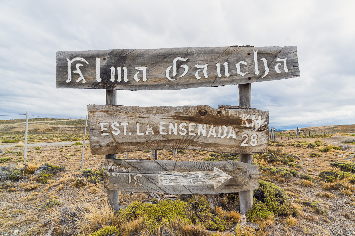
Our last post left off at the lonely roadhouse of Las Horquetas on Argentina’s Ruta 40. During the previous week we’d crossed Paso Roballos from Chile and visited Perito Moreno National Park. Our next mission was to return to Chile via Paso Mayer, which would bring us to Villa O’Higgins. From there we planned to take the famous Lago del Desierto crossing, stamping back in to Argentina once again and then onwards to El Chaltén.
Cycling Paso Mayer from east to west is not a trivial option due to the prevailing westerly winds that tear across the exposed, treeless pampa of the Patagonian Steppe. Coming from Chile this wind can make long distances easy work, hence Paso Mayer is most often cycled in that direction. This remote pass, populated only by infrequent puestos and estancias, is generally used by southbound cyclists as a late season back up option when the ferries stop operating in autumn. These normally allow passage from the end of the Carretera Austral at Villa O’Higgins through to the tourist town of El Chaltén, below the towering Fitz Roy massif.
That said, adventurous cyclists, or those looking to save the cost of the ferries sometimes tackle Mayer, and it sees a handful of crossings per year; perhaps more so these days now that some of the aura of this swampy and sometimes trackless pass has been demystified with GPX tracks.
Another couple of southbound cyclists about two weeks ahead of us had attempted to cross Paso Mayer after a visit to Perito Moreno National Park. After battling into vicious headwinds for more than a day, they gave up, short on food, and turned back 40km from the Argentinian gendarmeria, where you get your exit stamp. The 100km haul across the pampa to the relative shelter of the valleys near the border is not to be taken lightly.
Thanks to wifi at the park HQ at Perito Moreno NP and at Las Horquetas we’d been able to track a 12 hour drop in the winds and so timed our run across to Chile perfectly.
After hitching to Gobernador Gregores to resupply, and back to Las Horquetas the following morning, we hit the road at midday.
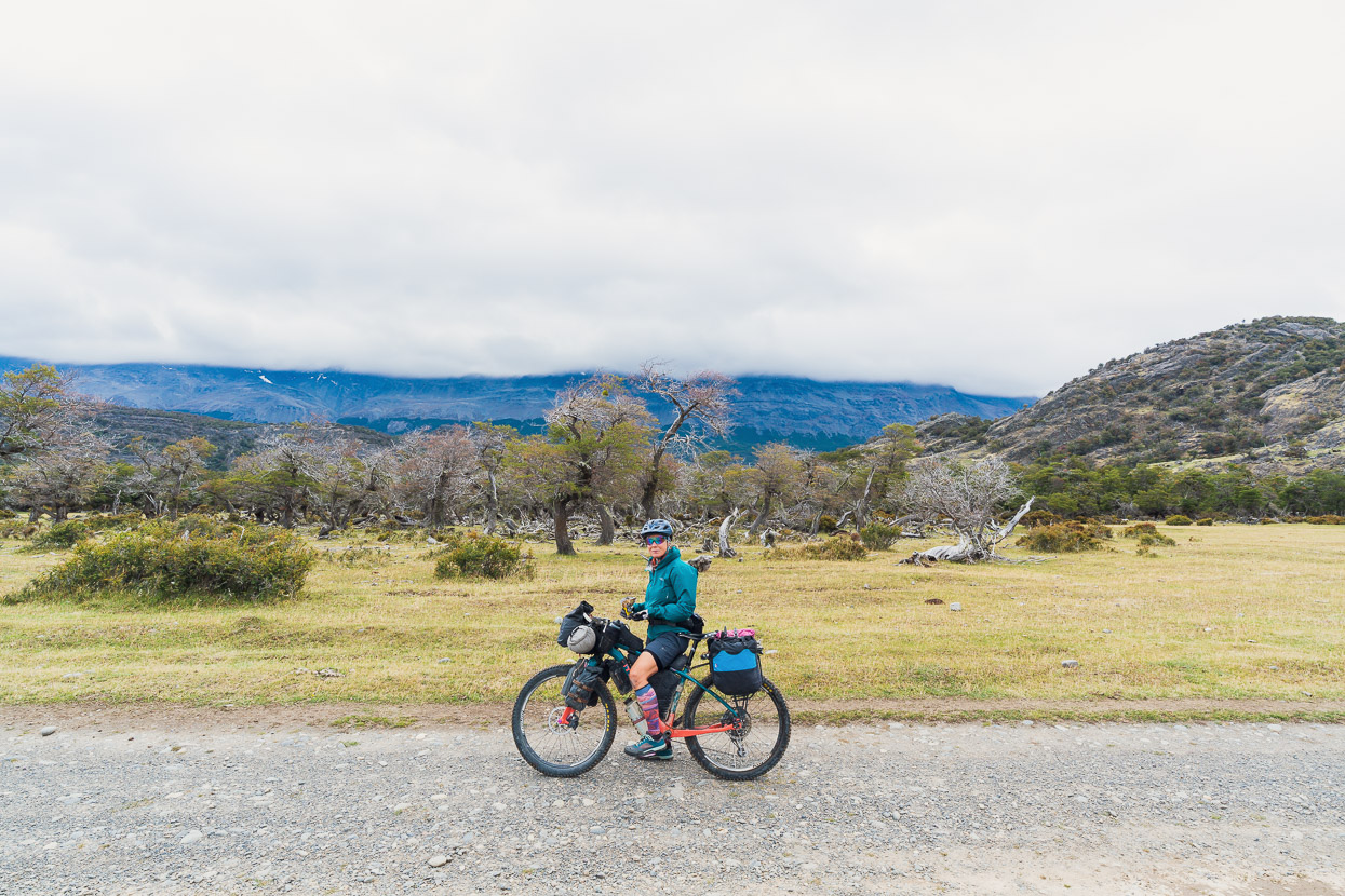
In an unbelievable stroke of luck, the wind wasn’t just lighter than usual, it was non existent. Giving us a great ride across the open steppe.
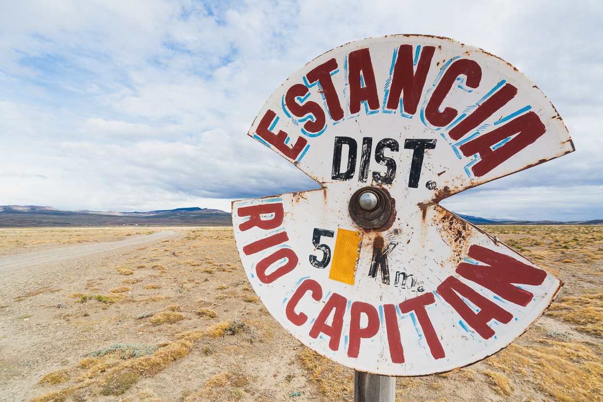
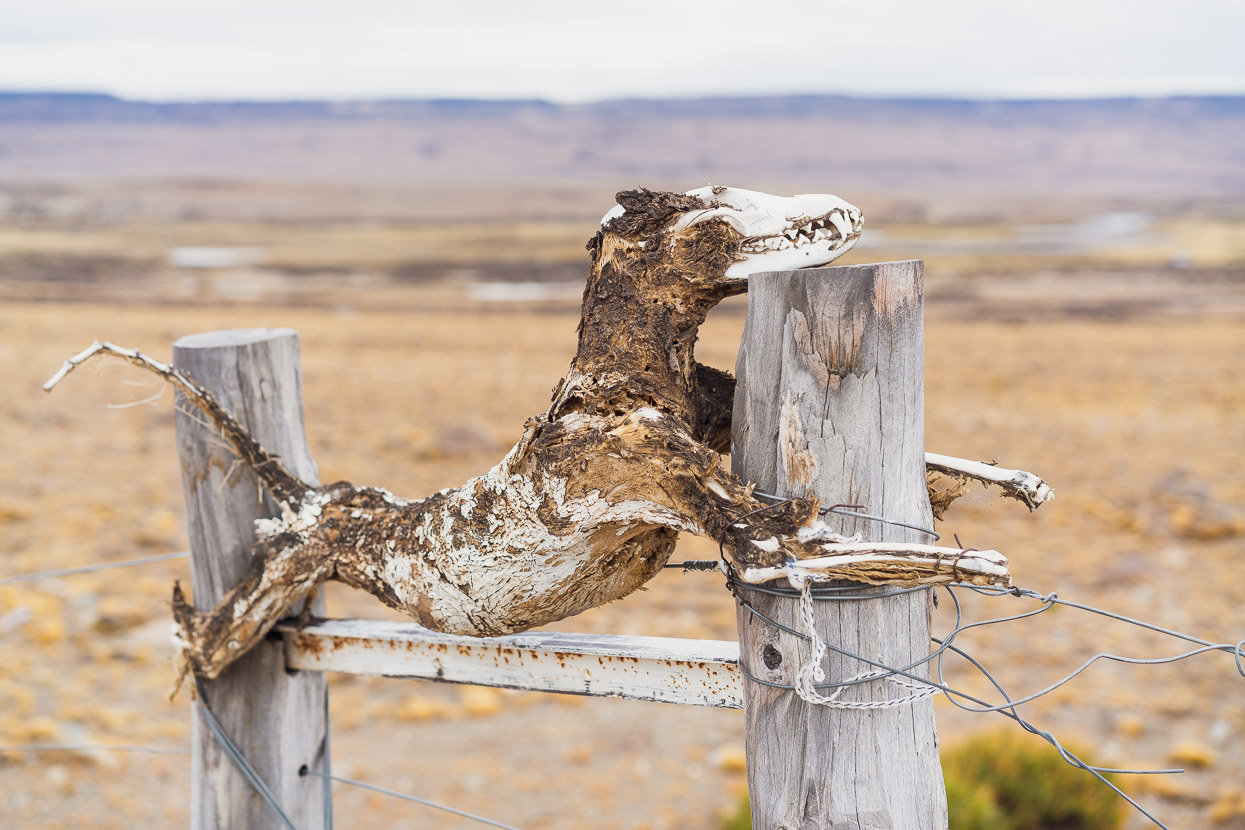
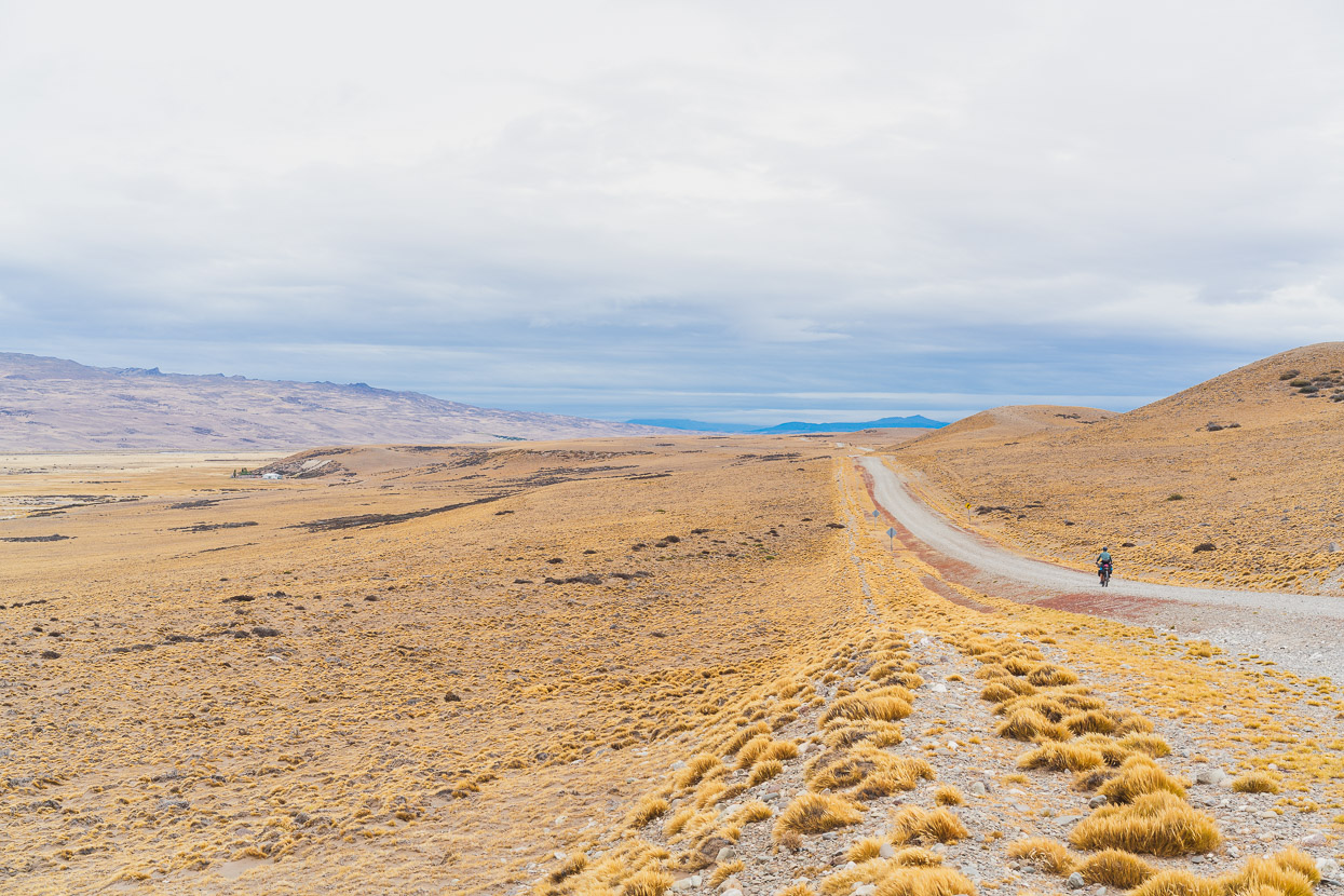
Glancing at the map, you would not believe anyone lives out here, but the occasional signs for estancias hinted that there is a life to be had out here after all. Foxes are clearly not welcome.
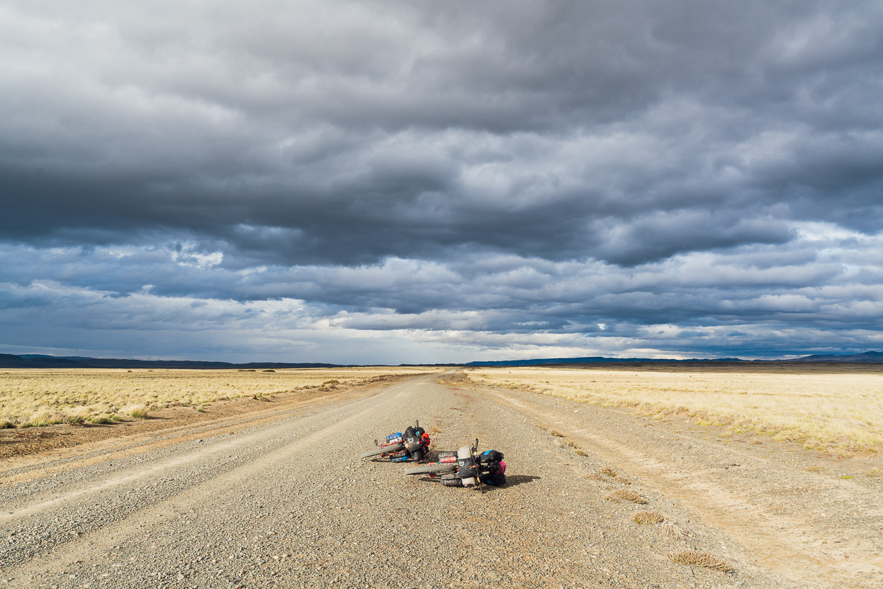
Grey cloud hung over us for much of the day, suggesting rain in Chile, but not on the plain.
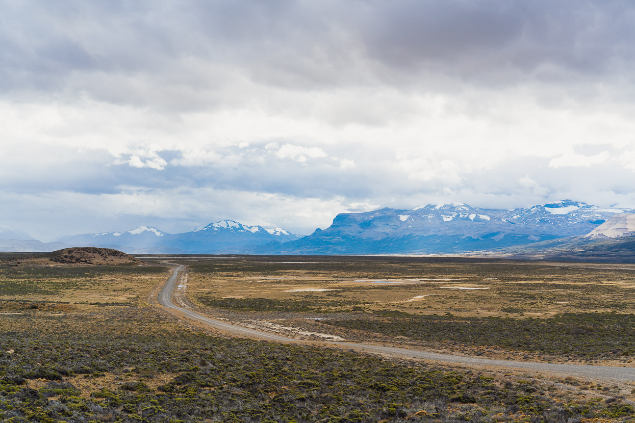
After a few hours of flat riding we began to close in on the foothills of the Andes once again.
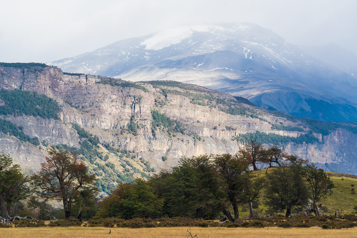
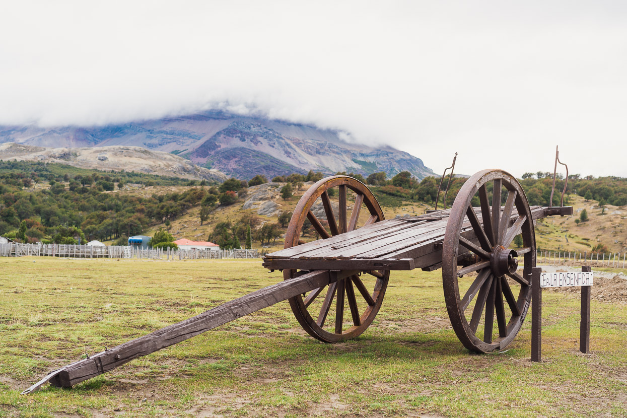
A rugged landscape looms over valley floors that have been cleared for farming.
After 90km we stopped to wild camp and then continued in the morning in light drizzle.
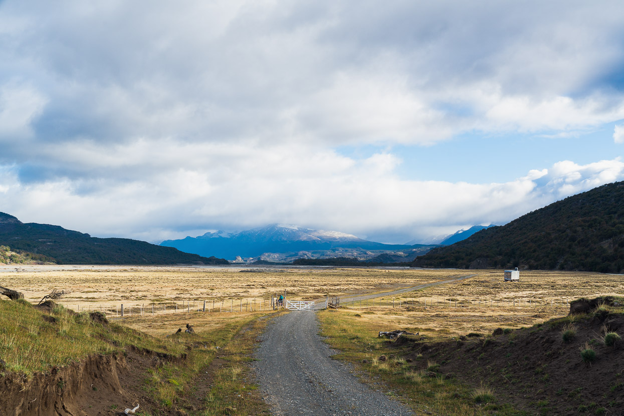
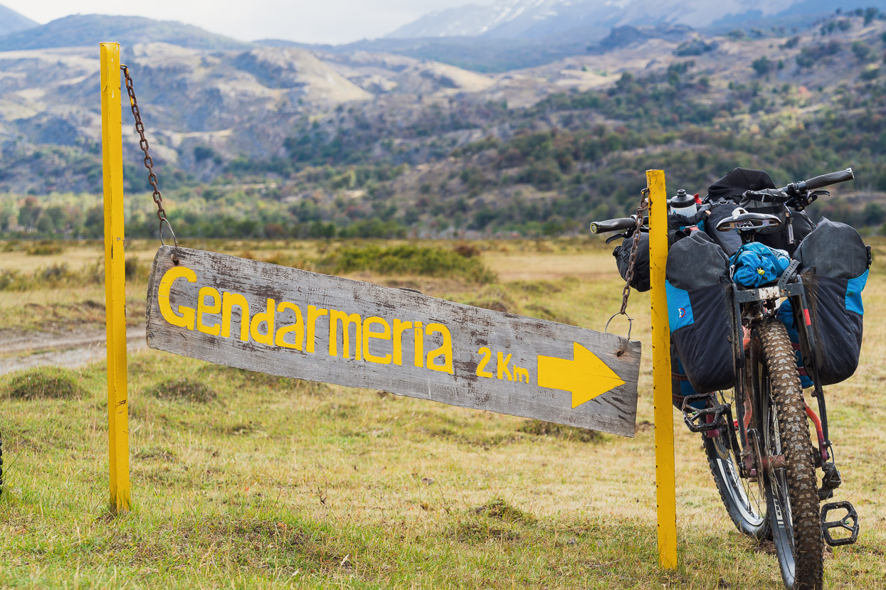
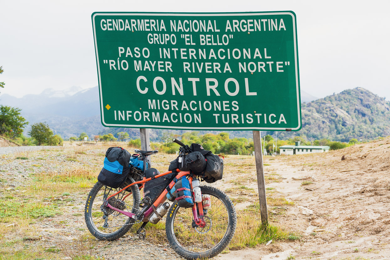
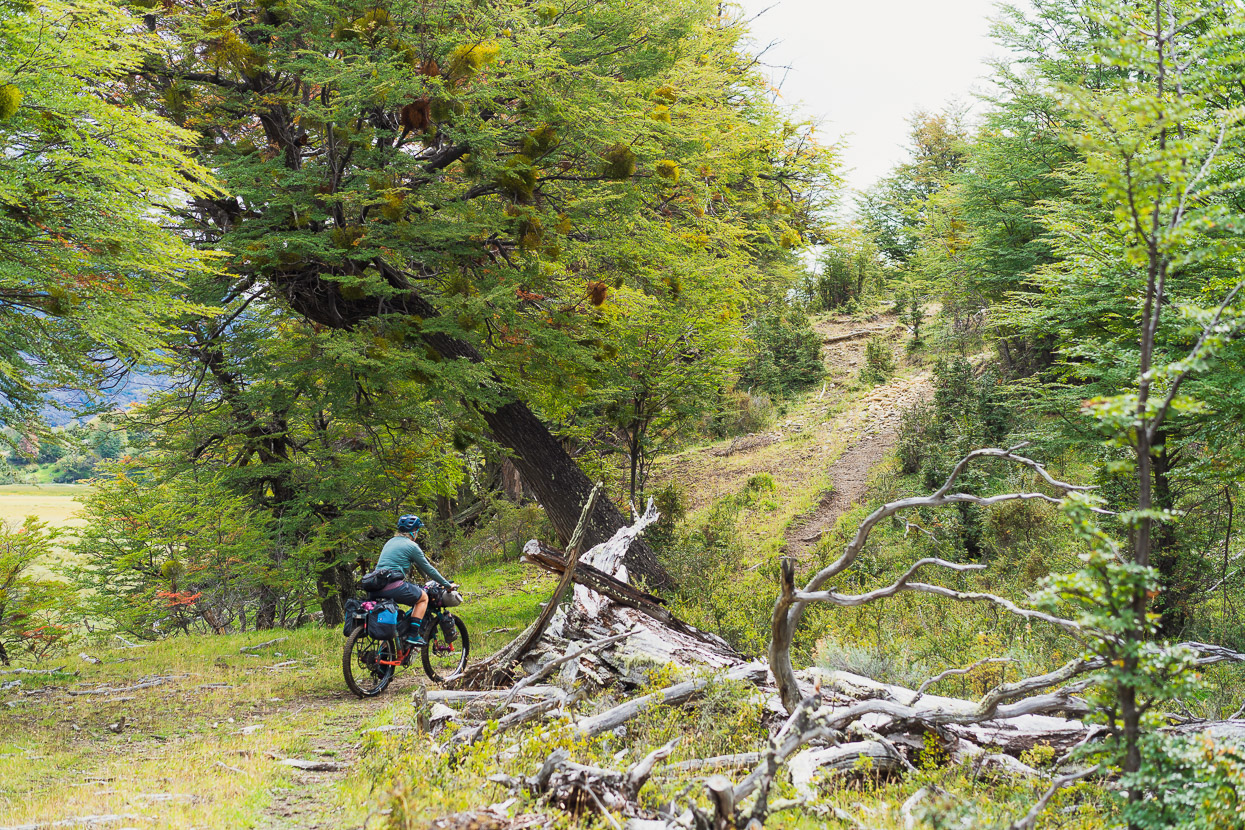
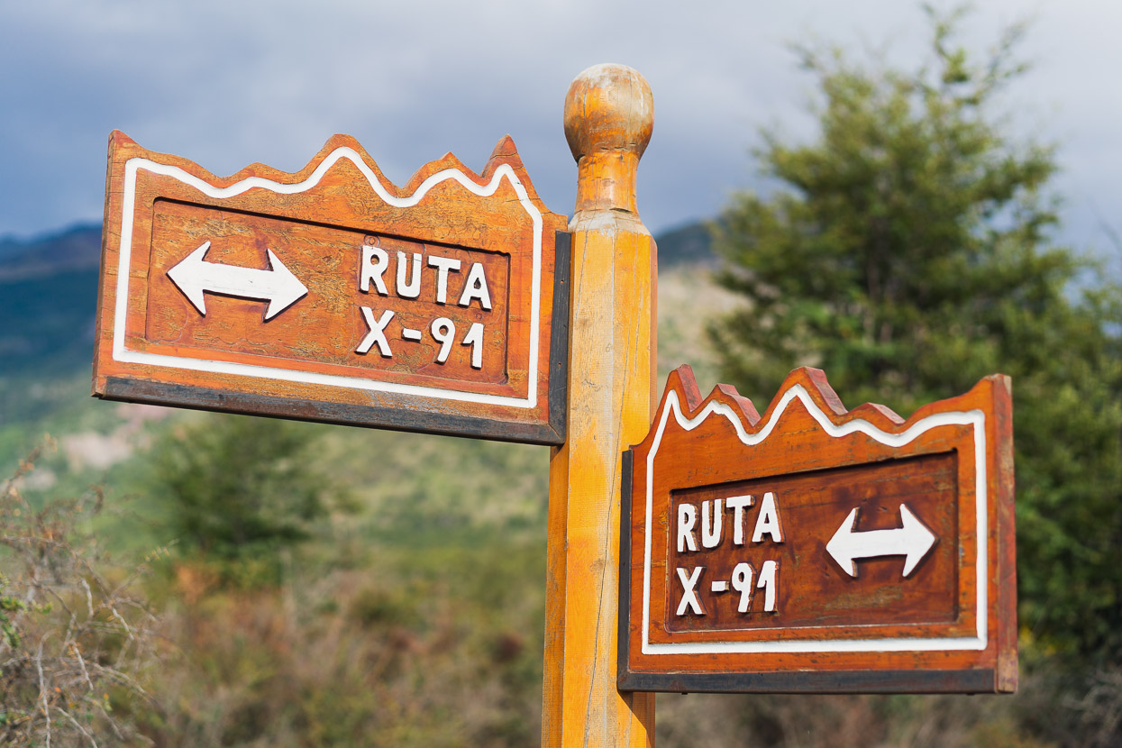
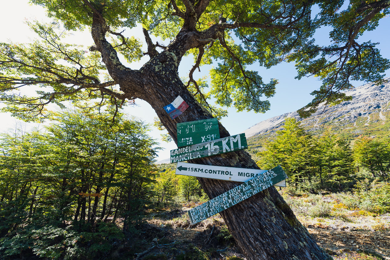
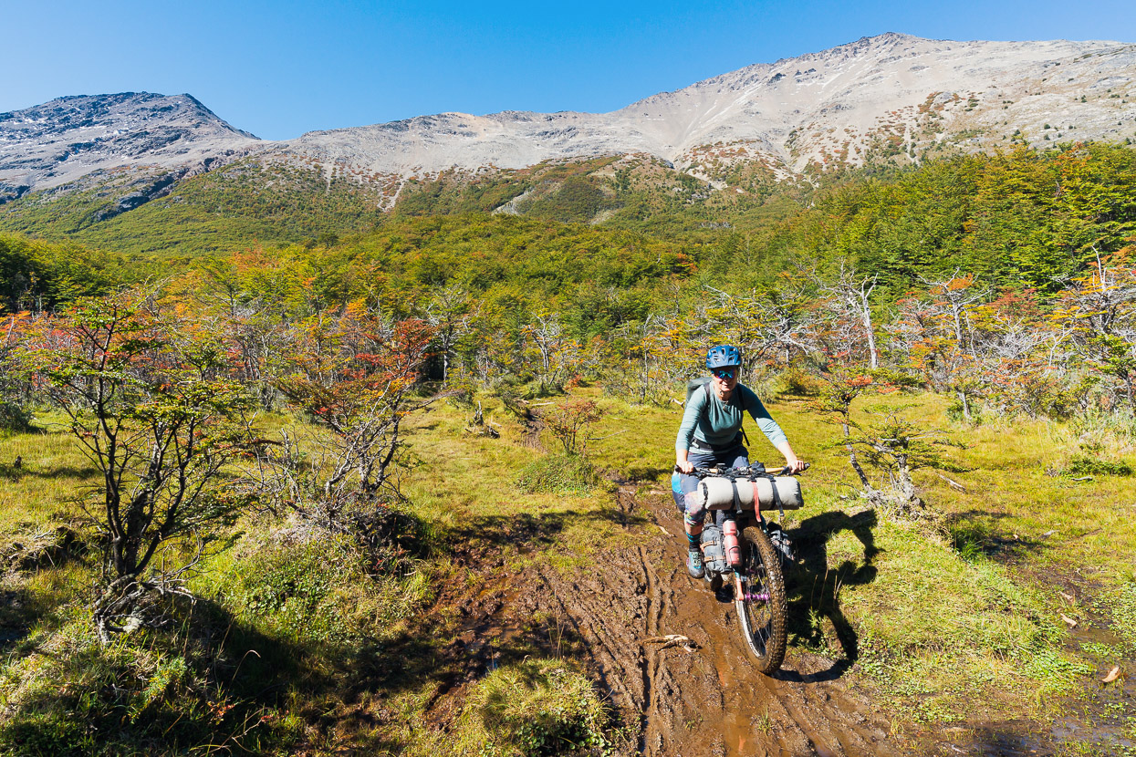
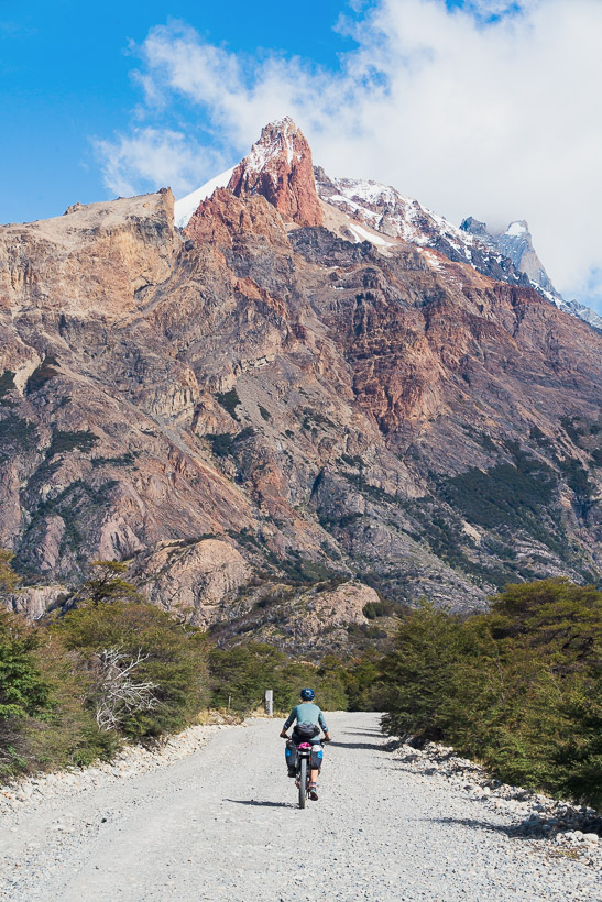
At about the 70km mark the previous day the road had degraded from a wide gravel road to a narrower dirt road. Now as we approached the final estancias in the valley, and the gendarmerie, the road turned to double track. Paso Mayer upheld its esoteric reputation with hand painted signs and an in-obvious route. We were grateful for a GPX track.
The gendarmerie stamped us out of Argentina efficiently, and gave us a run down of what to expect up ahead. It was feo, they said, ‘ugly’.
‘Keep the river to your left and the mountains to your right and you can’t get lost’.
It was nearly midday and a Chilean cyclist who had sheltered in the gendarmeria’s garage for the night was readying to continue east. He said all his gear was wet from the previous day’s rain, looked exhausted and wasn’t interested in chatting. Later that day we did not often see his tracks, so guessed he might have spent some time lost in the scrub and heavy rain of the previous day.
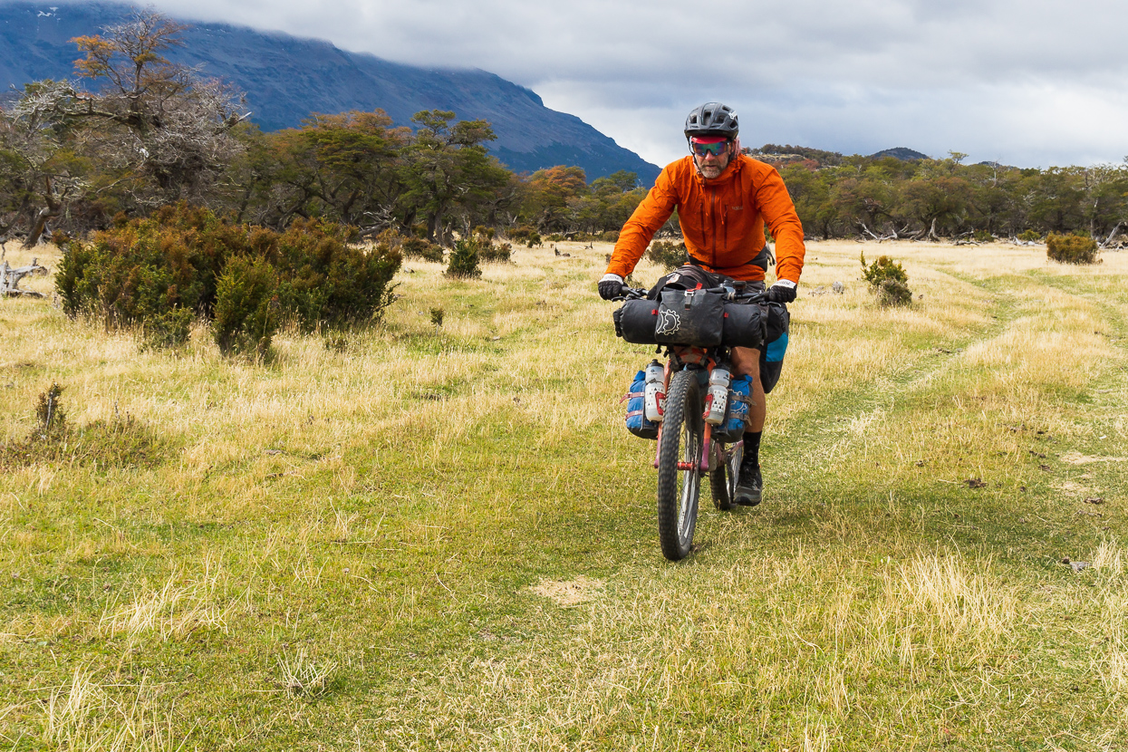
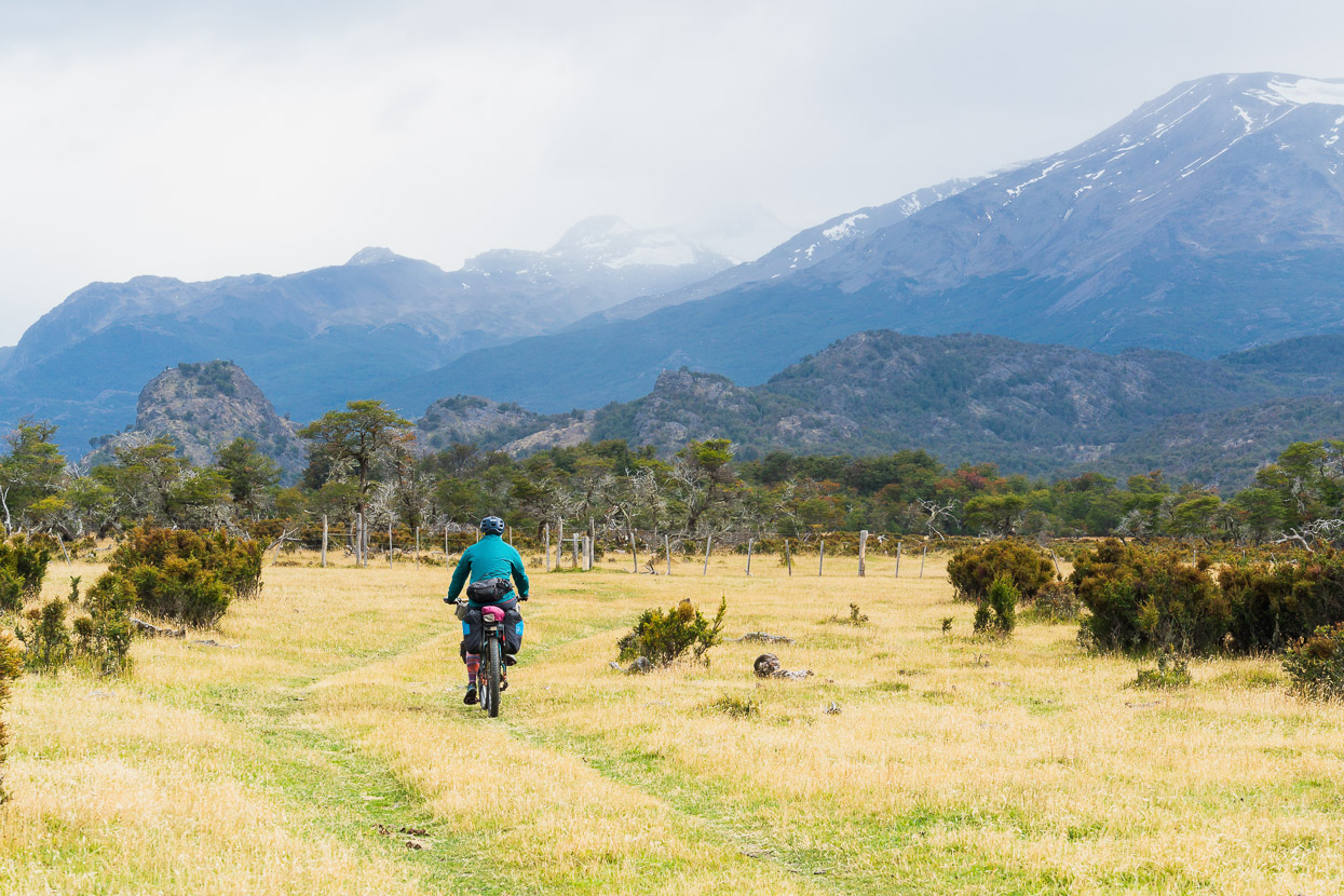
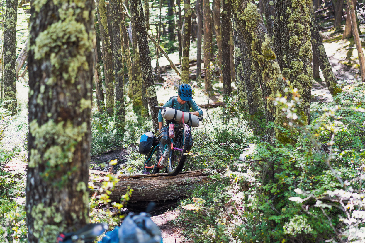
Beyond the border post the route follows meadows for a while before disappearing into beech forest. It’s mostly double track at this point, but the route in the bush wandered around a lot due to windfall.
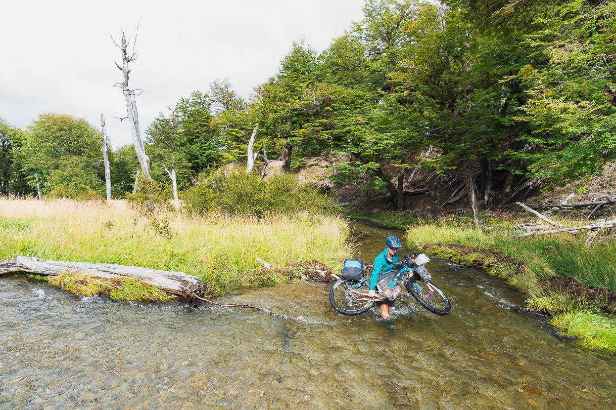
There was one deepish wade across a stream, but no more until much closer to the Chilean post. This might normally be lower, but there had been a lot of rain in the past week.
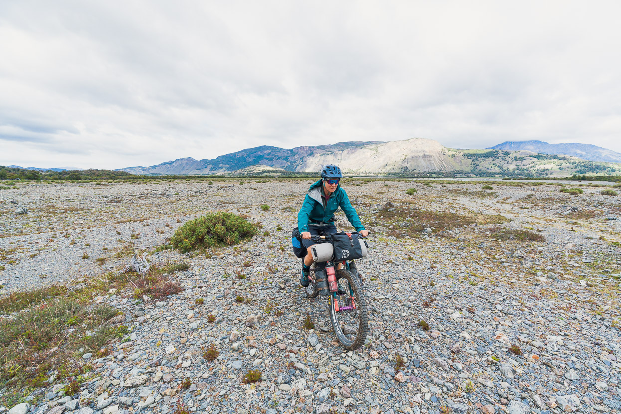
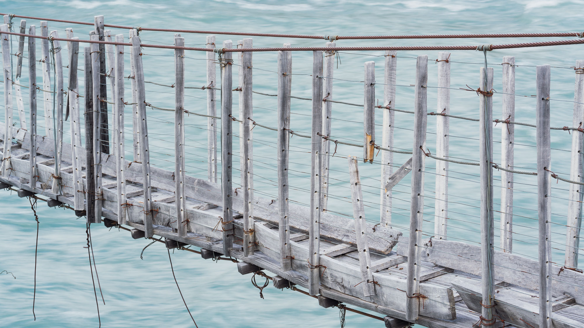
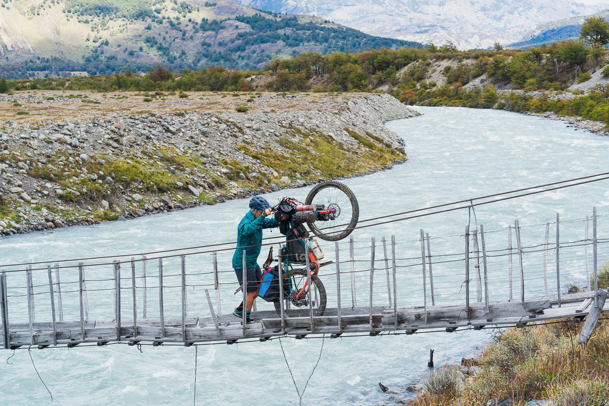
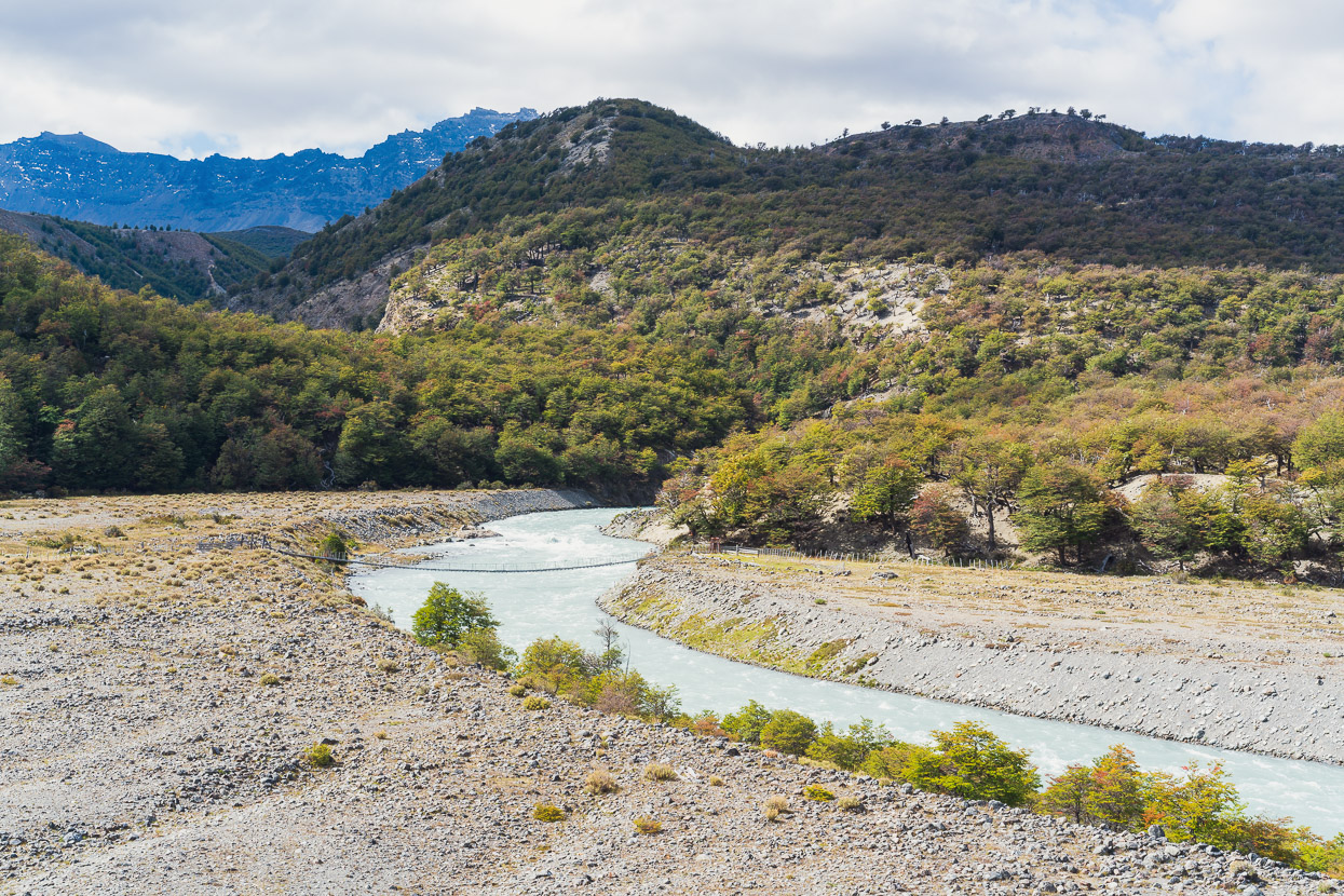
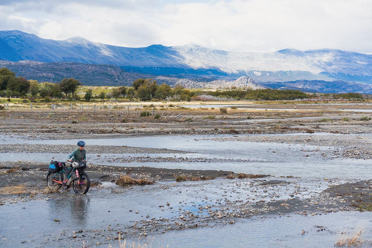
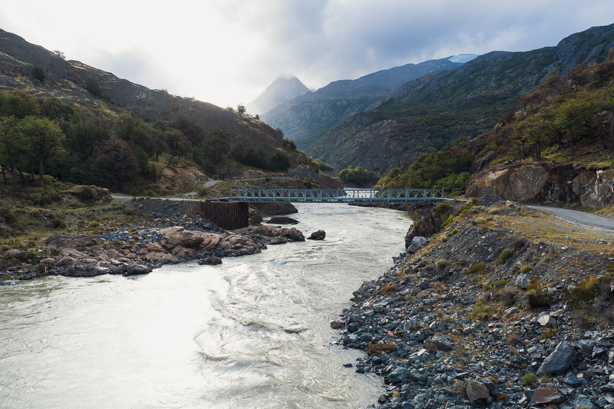
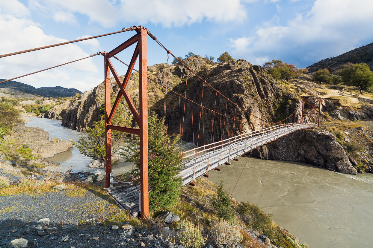
The double track emerged on the riverbed of the braided Rio Mayer near the confluence with the aptly named Rio Carrera. We turned upstream and followed the Carrera’s stony bed up to a bridge, grateful for 2.8 tyres, which made it all rideable.
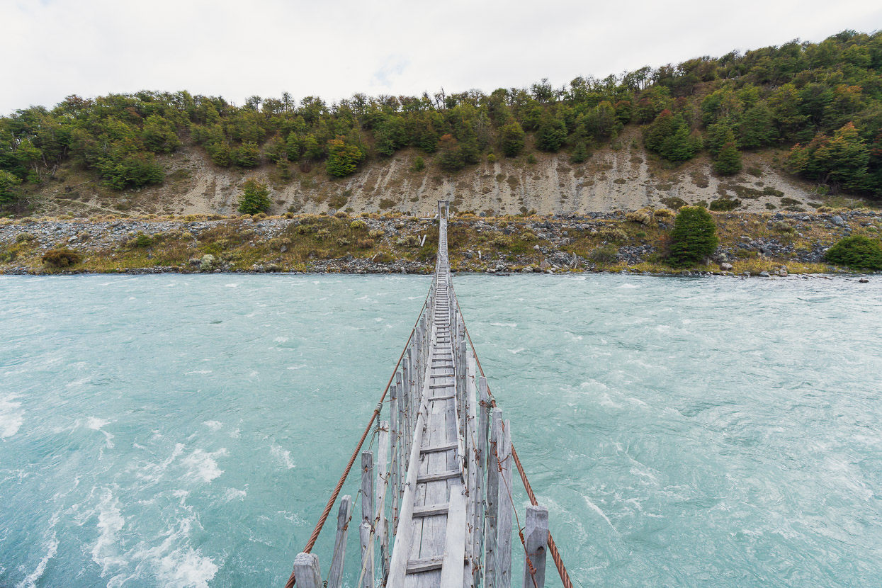
The Rio Carrera originates from the glacial lakes of Perito Moreno National Park, where we’d spent much of the past week. It’s deep, swift and uncrossable except in winter when 4WDs can take advantage of lower levels due to the freeze. This rickety bridge is iconic among a subset of the South American long distance cycling community – a symbol of the Mayer route and the Patagonian wilderness.
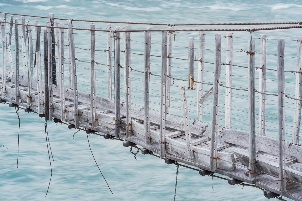
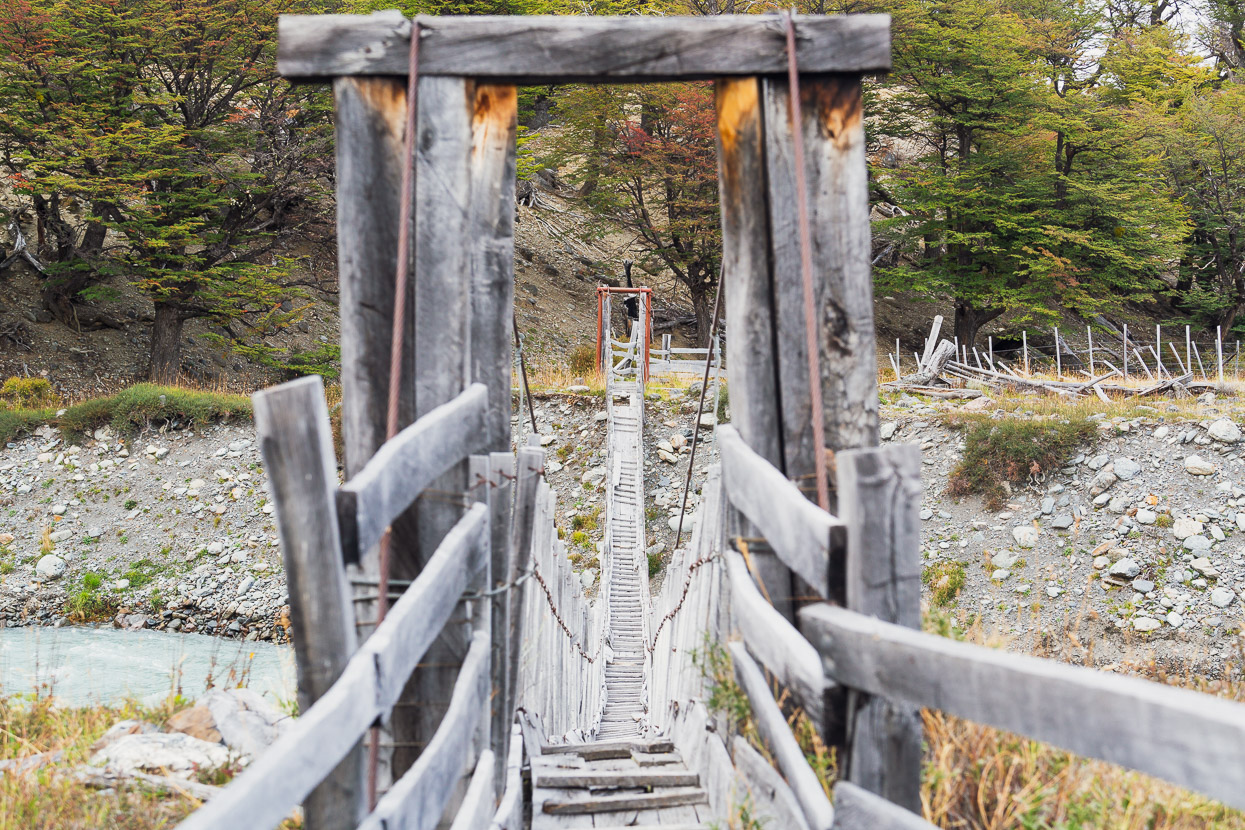
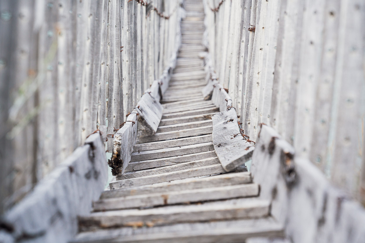
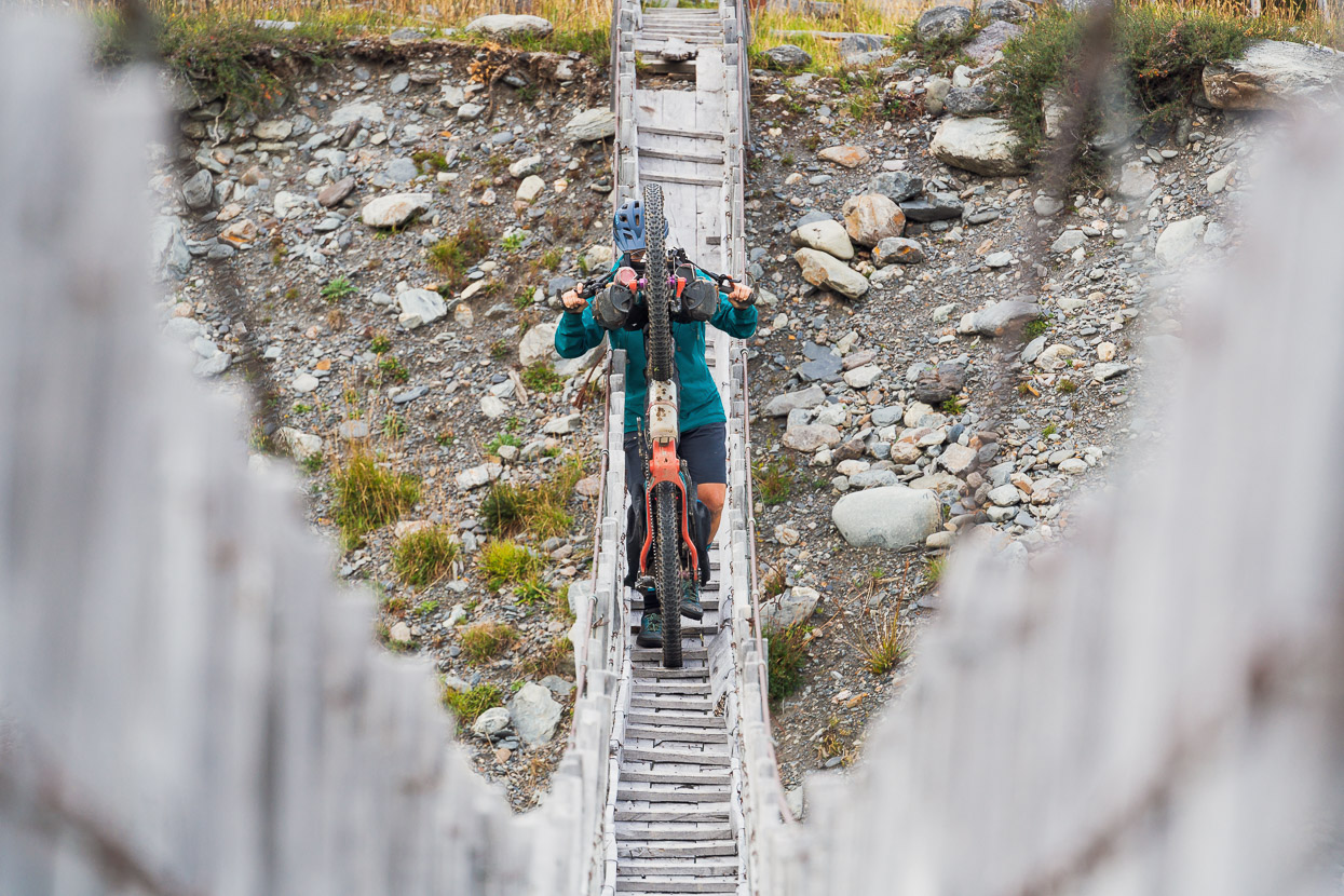
We’re quite well versed with crossing this type of narrow, hanging bridge – we have similar spans, constructed from cable, wire and aluminium stays in New Zealand. The trick with this one was to remove our flat pedals first, and take panniers separately.
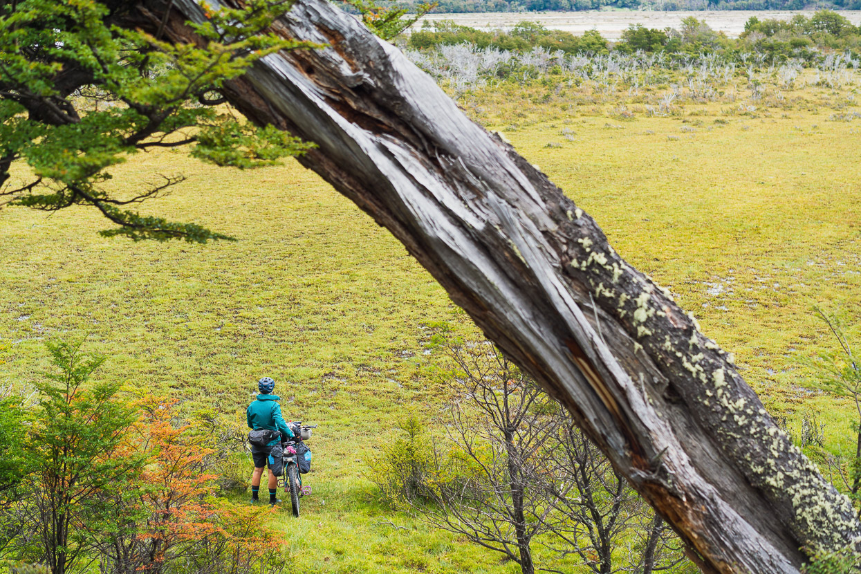
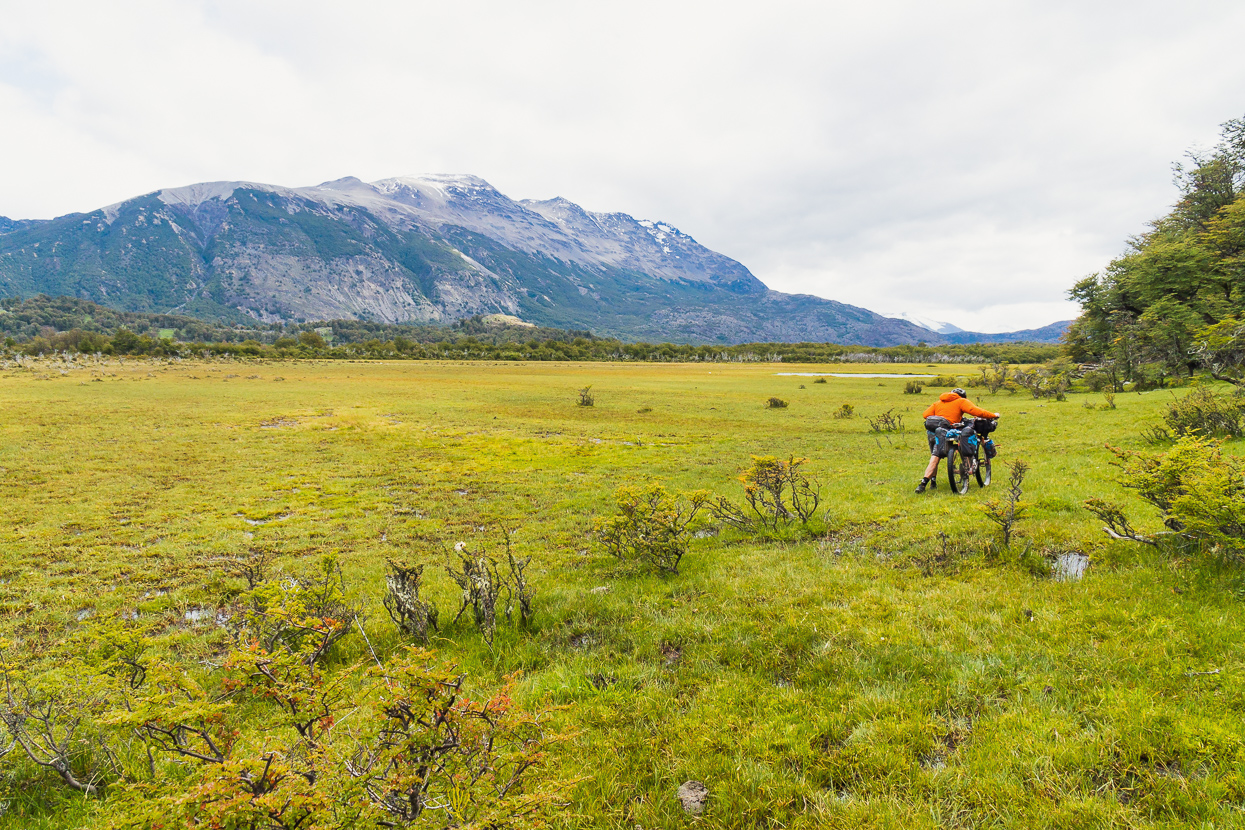
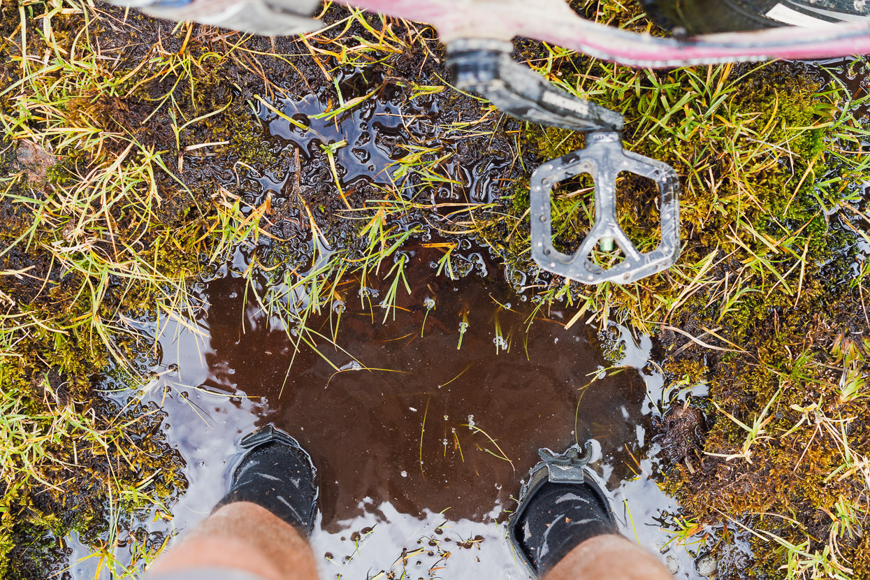
Some scrubby trails and riverbed followed, and then a section of discontinuous animal tracks, which led us to some stream crossings and eventually to the malline. I was sent off across the swamp first (the fate of being the GPS bearer) to test its depth.
We emerged a little wetter and muddier, close to the Chilean post finally.
A final river crossing. It took us 4.5 hours between border posts, and we summarised the ride as equivalent to a beginners-grade mountain bike ride, with a bit of bumpy riverbed thrown in, in terms of overall challenge and difficulty. There was very little hike-a-bike, and where there was it was usually just a very short technical section or a stream crossing.
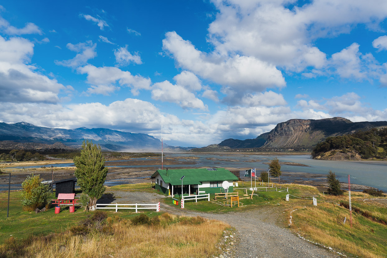
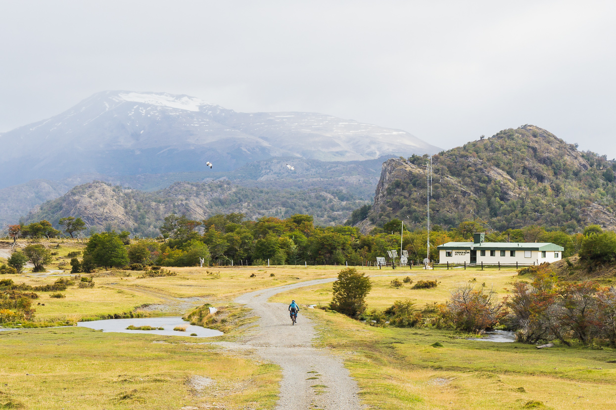
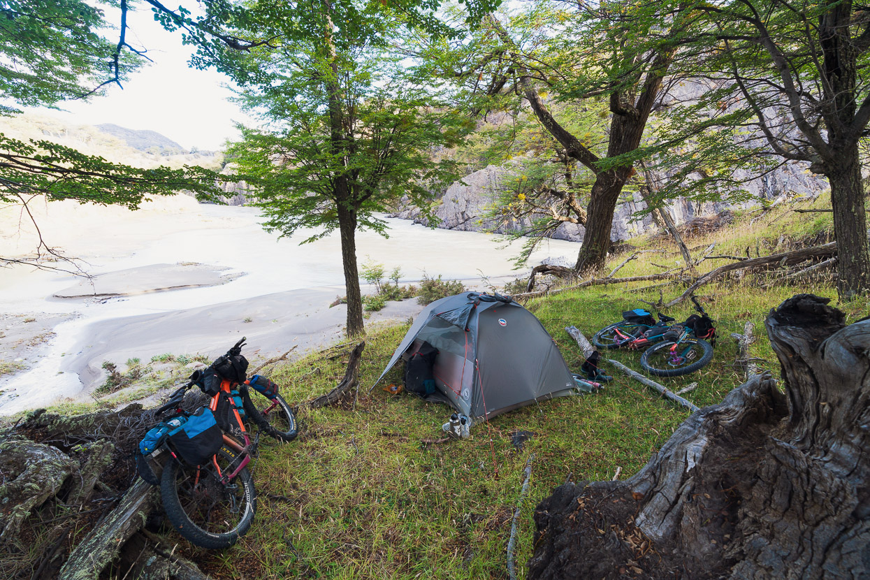
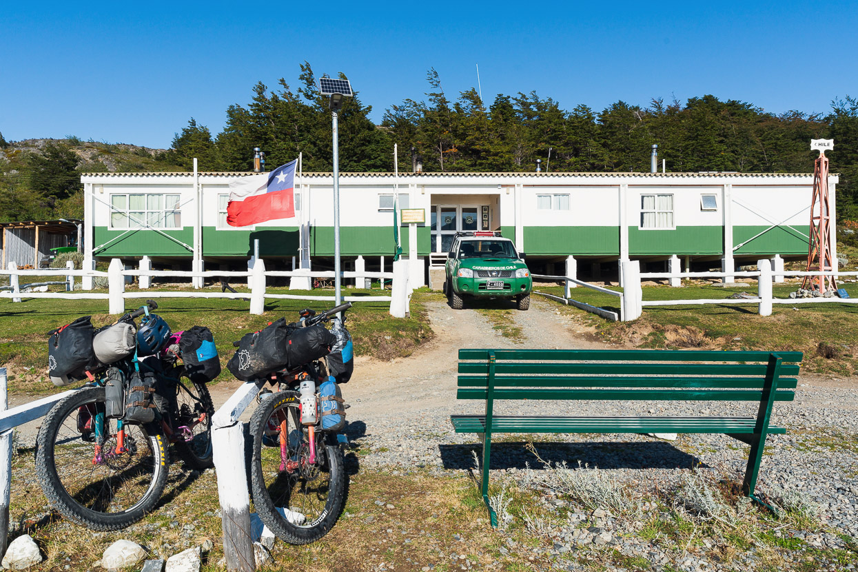
By the time we arrived the wind was roaring down the valley, kicking up great dust clouds from the riverbed. The carabineros at the Chilean post invited us in for shelter and offered us coffee and water while they efficiently processed our entry.
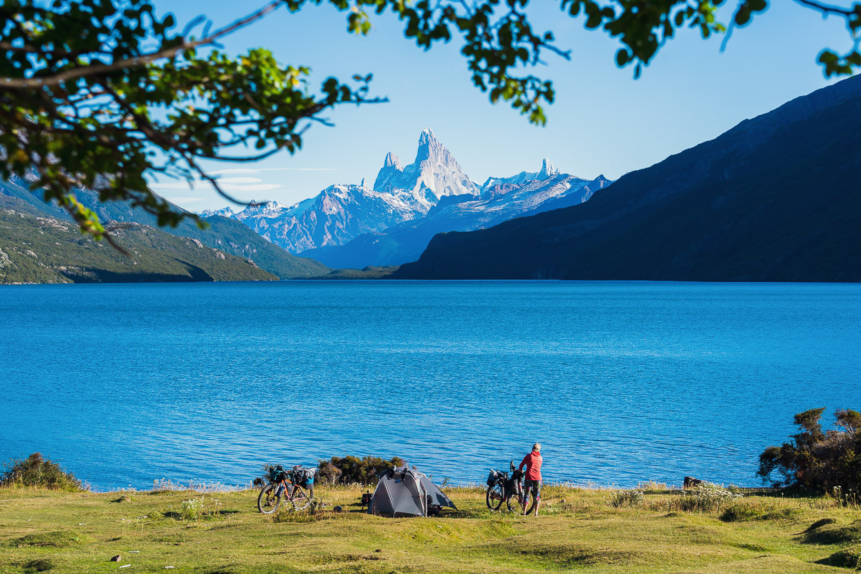
There’s a good, basic cyclist refugio just past the carabineros, but we decided to push on and get some more kilometres in. There’s a second refugio right after the bridge over the Rio Mayer, but we arrived to find it very damp from silt inundation in the recent heavy rain, so we wild camped about 500m back with a view of the river.
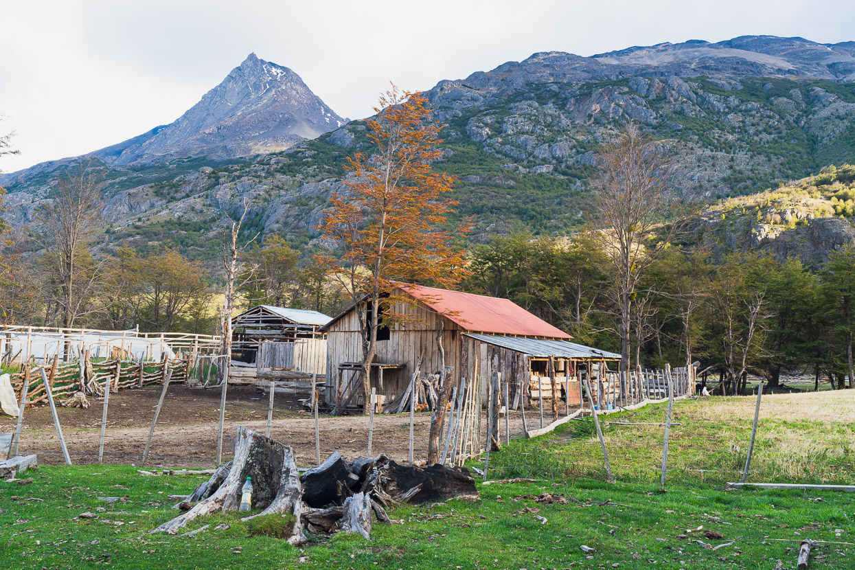
There’s little between the carabineros post and Villa O’Higgins except a couple of estancias.
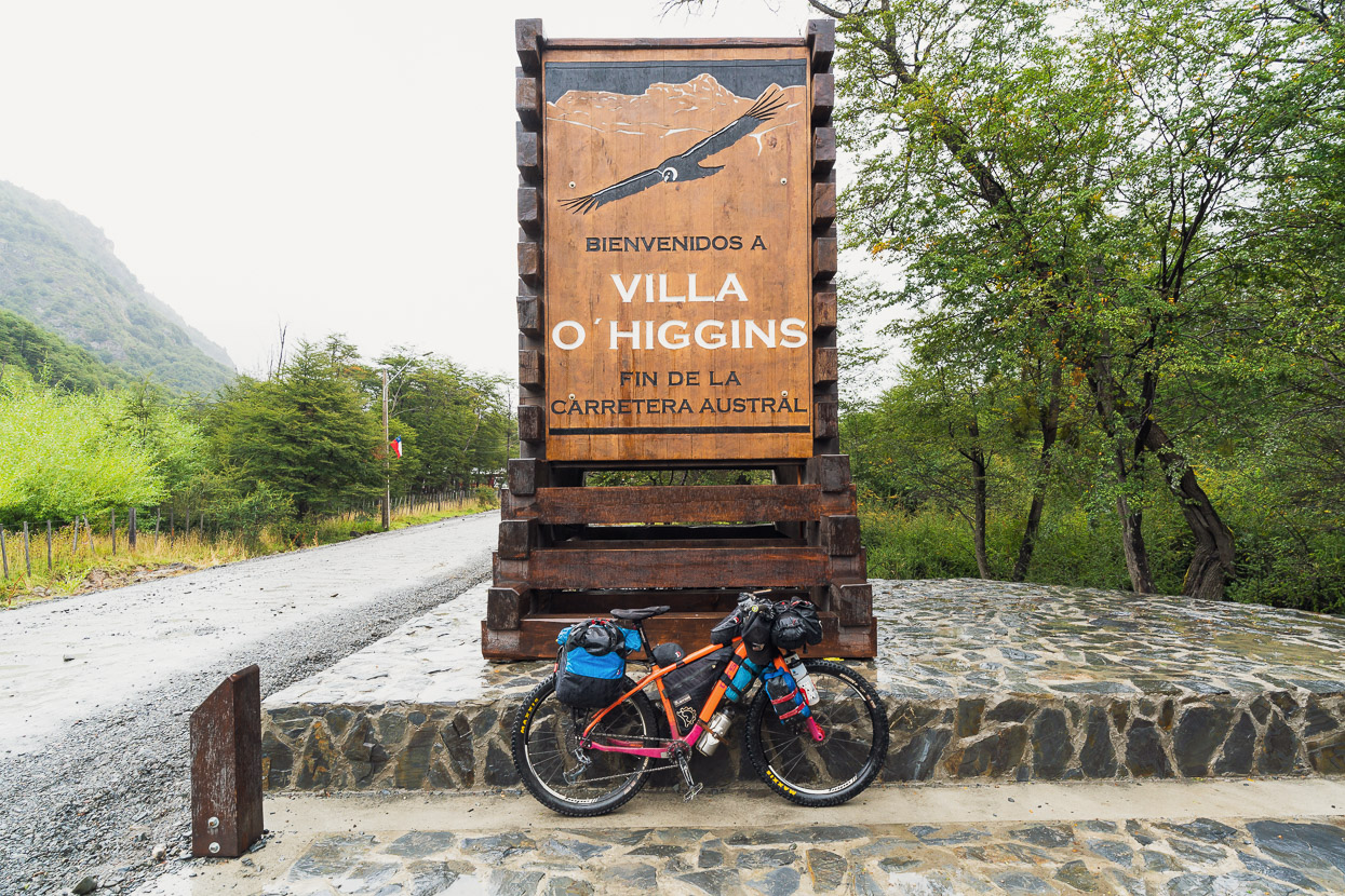
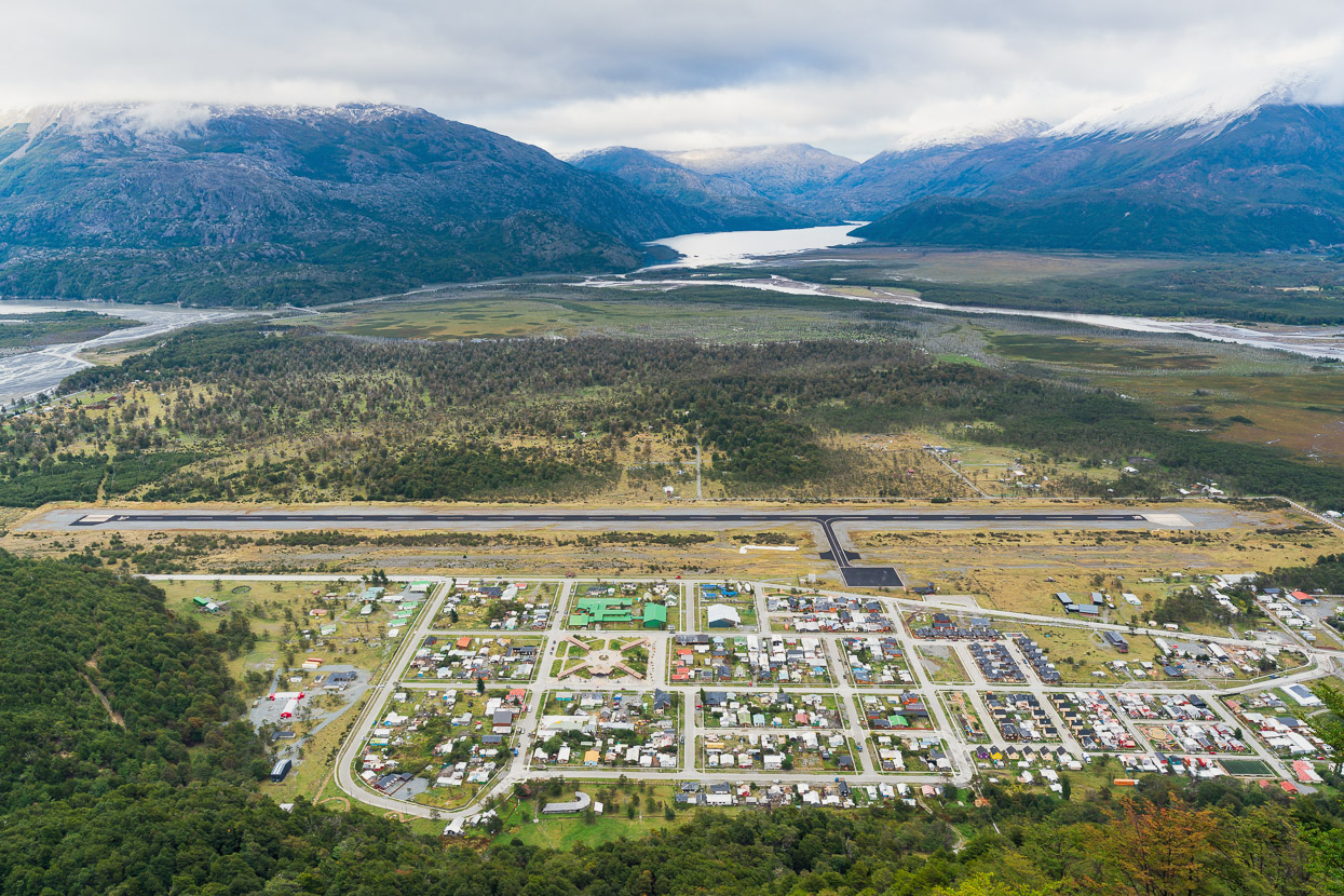
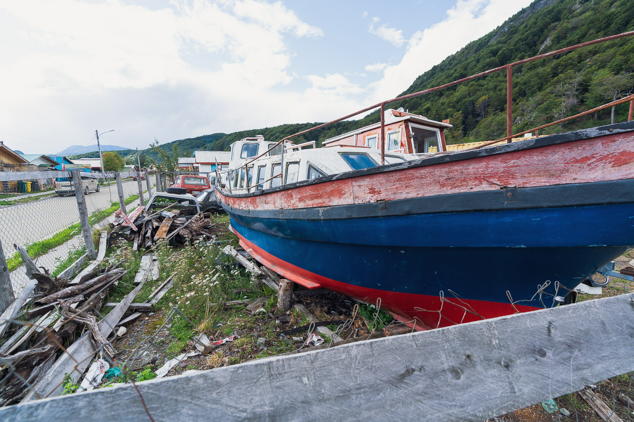
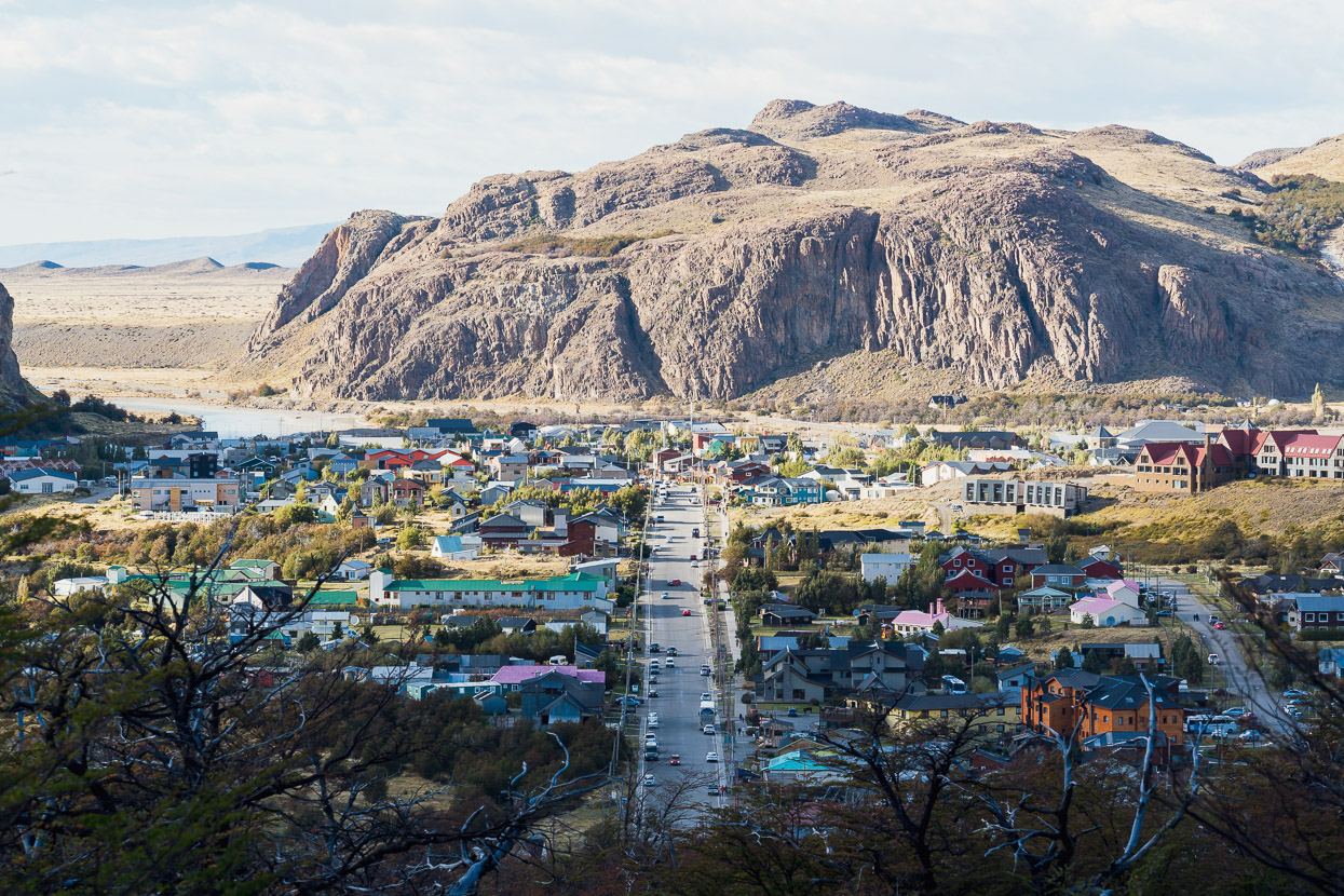
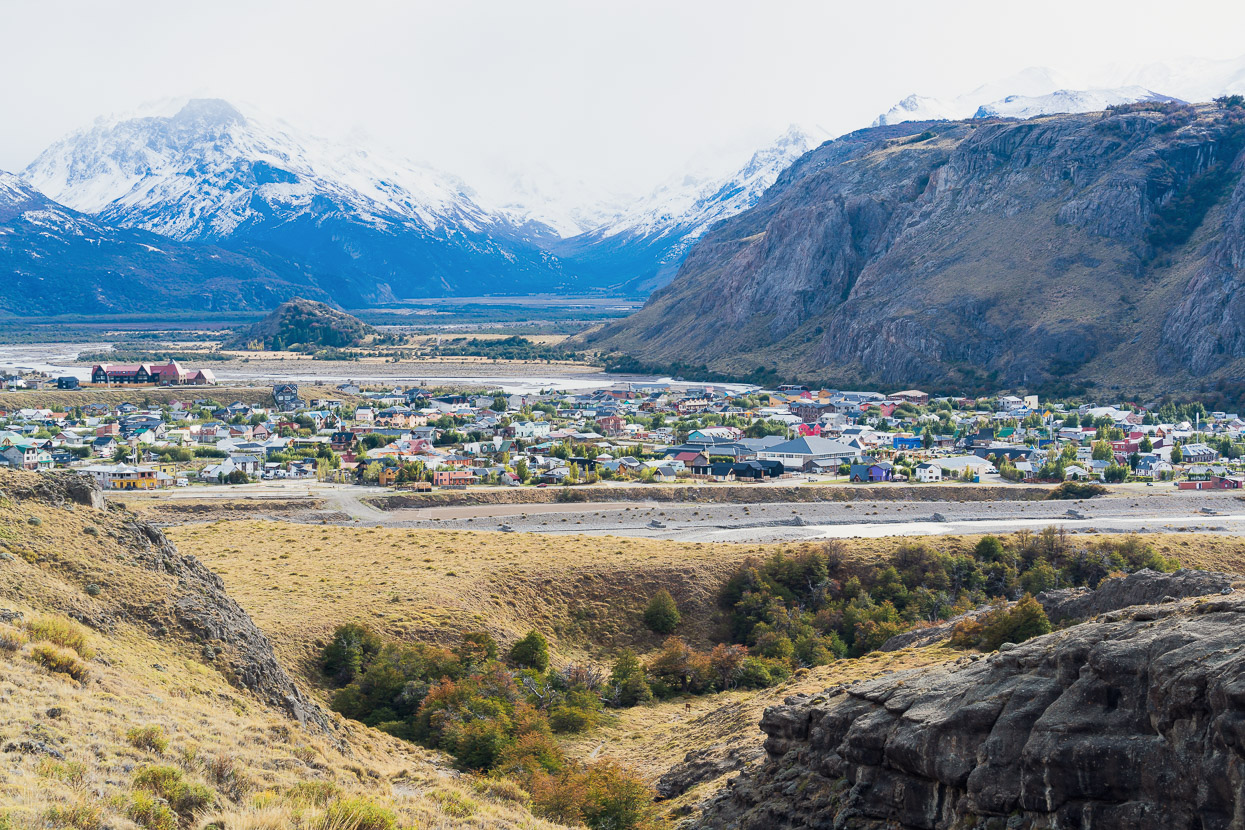
And finally, Villa O’Higgins! There’s only one north-south highway in southern Chile, and it ends here, on the shore of Lago O’Higgins, which is split down the middle by the border.
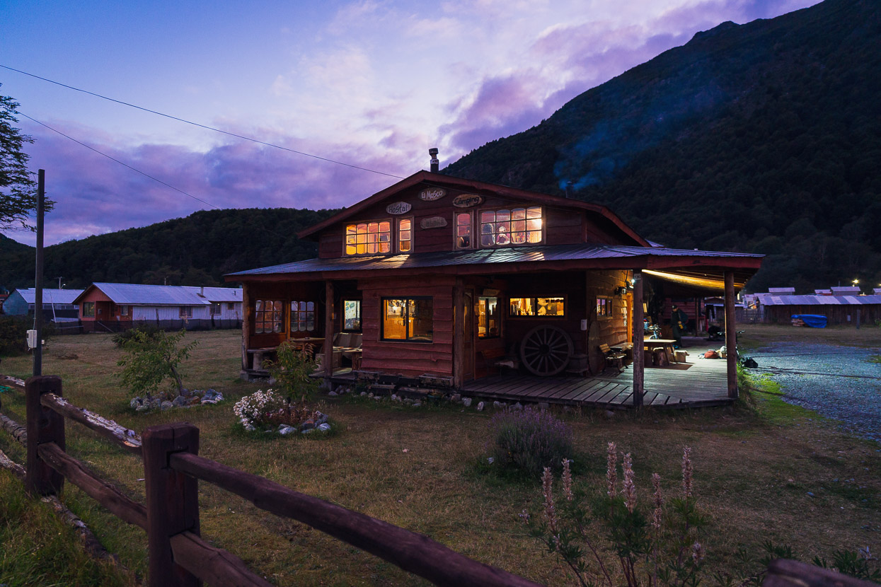
We stayed at El Mosco, which is one of the nicer hostals we’ve stayed in the whole trip; with friendly staff, a good traveller vibe and it was nice and warm in the cooling autumn weather. The next stage was going to involve two ferries, both of which run only a handful of days a week, and all the while at the mercy of the weather, so as most travellers do, we had to wait a couple of days for everything to align for a crossing.
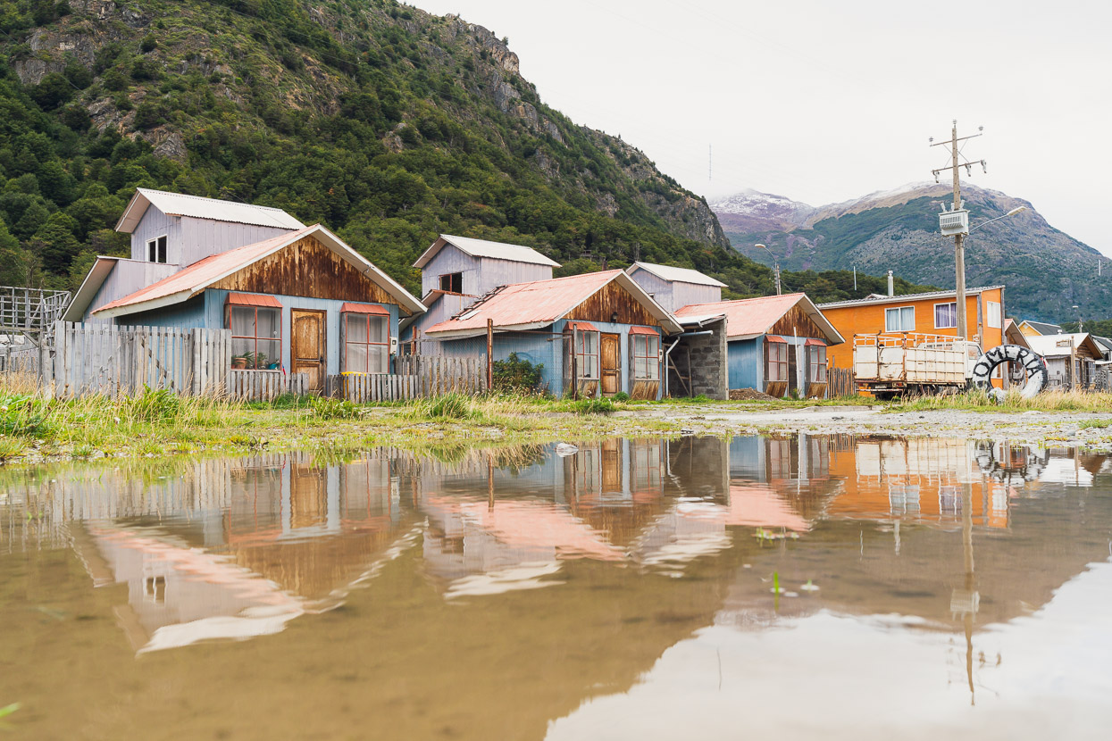
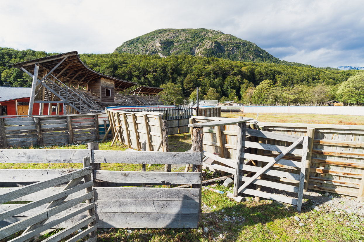
That left us time to explore Villa O’Higgins a little and absorb this frontier town’s rustic charm. Wifi here is extremely slow, but we did find a cerveceria that had StarLink up and running.
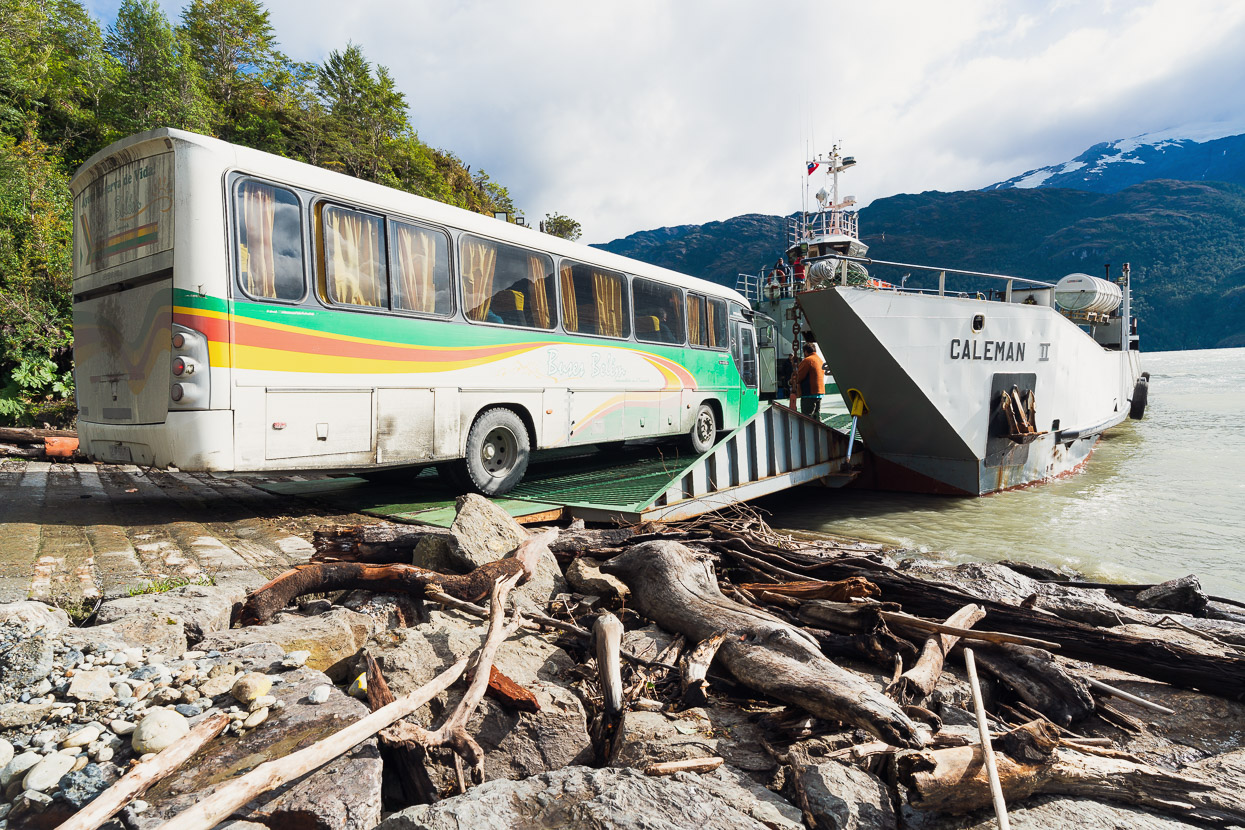
We also had time to go back to Cochrane to collect courier parcels that had not yet arrived when we left for Paso Roballos. So we got to see the sourthernmost section of Carretera Austral that we’d missed. All from the comfort of a 8-hour (each way) bus journey to cover the 220km. Fortunately the bus actually was comfortable, and included the bonus of a ferry crossing across one of the fiords.
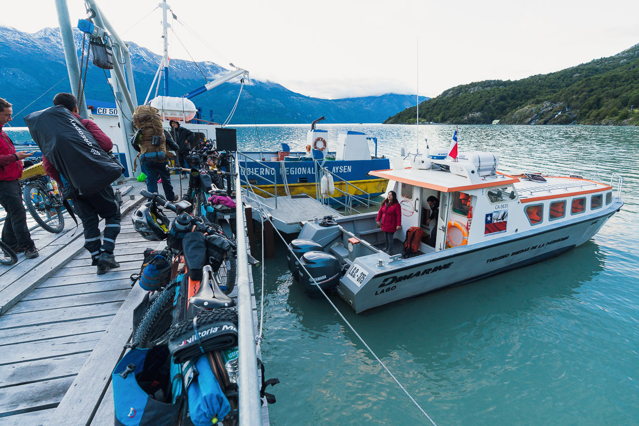
After four days either in Villa O’Higgins or sitting on the bus, it was our turn for the ferry crossing to Candelario Mansilla, leg one of the crossing to El Chaltén in Argentina.
We lucked out with the first clear and relatively windless day here in three weeks. Stories of stranded travellers, cancelled ferries and rough crossings have been legion this summer after a really stormy few months.
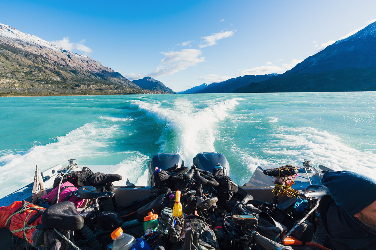
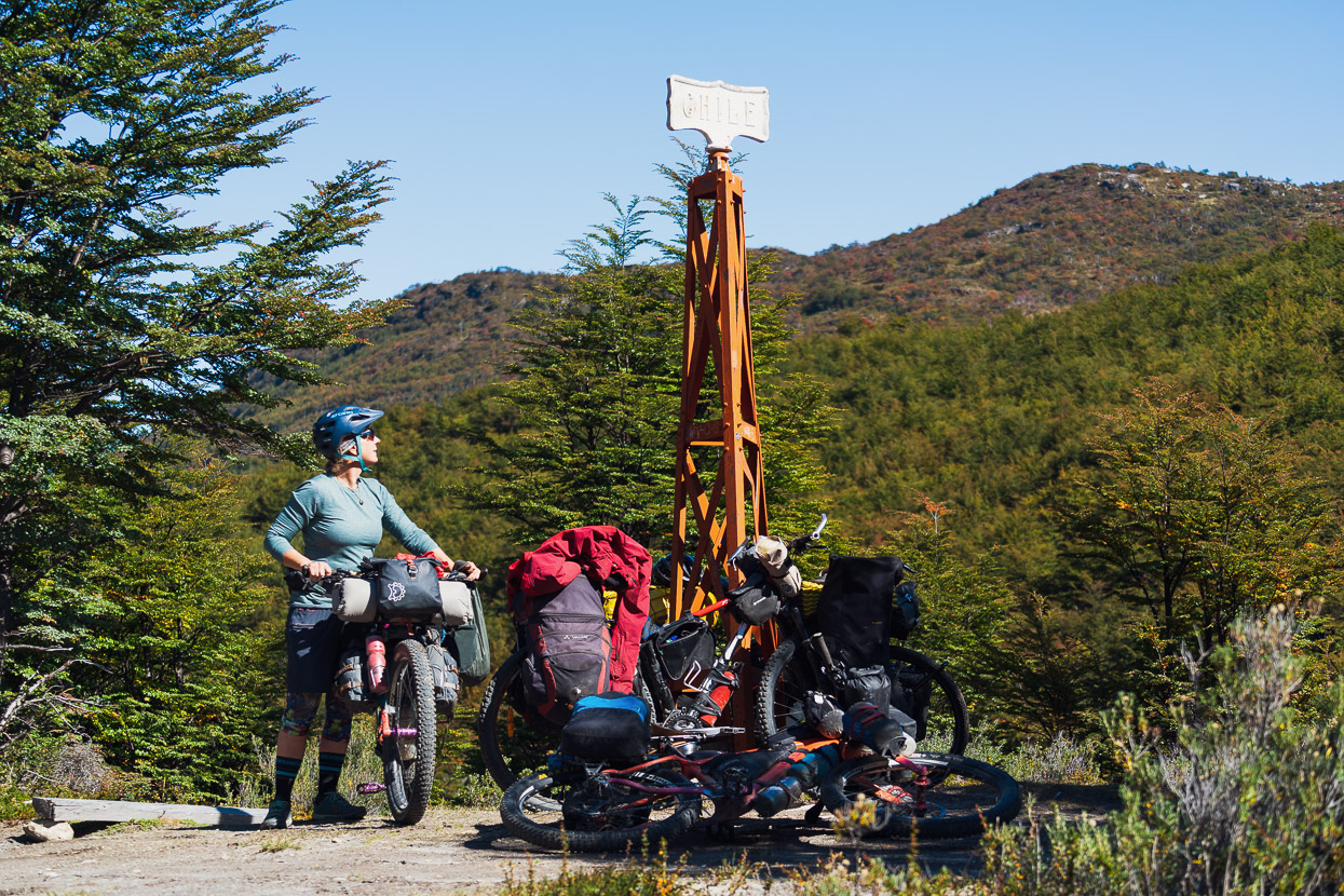
Candelario Mansilla is just a wharf and a carabineros post, so we collected another stamp and headed for pass crossing number 12 that we have made between Chile and Argentina.
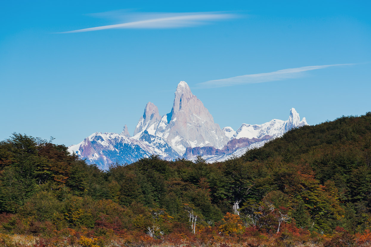
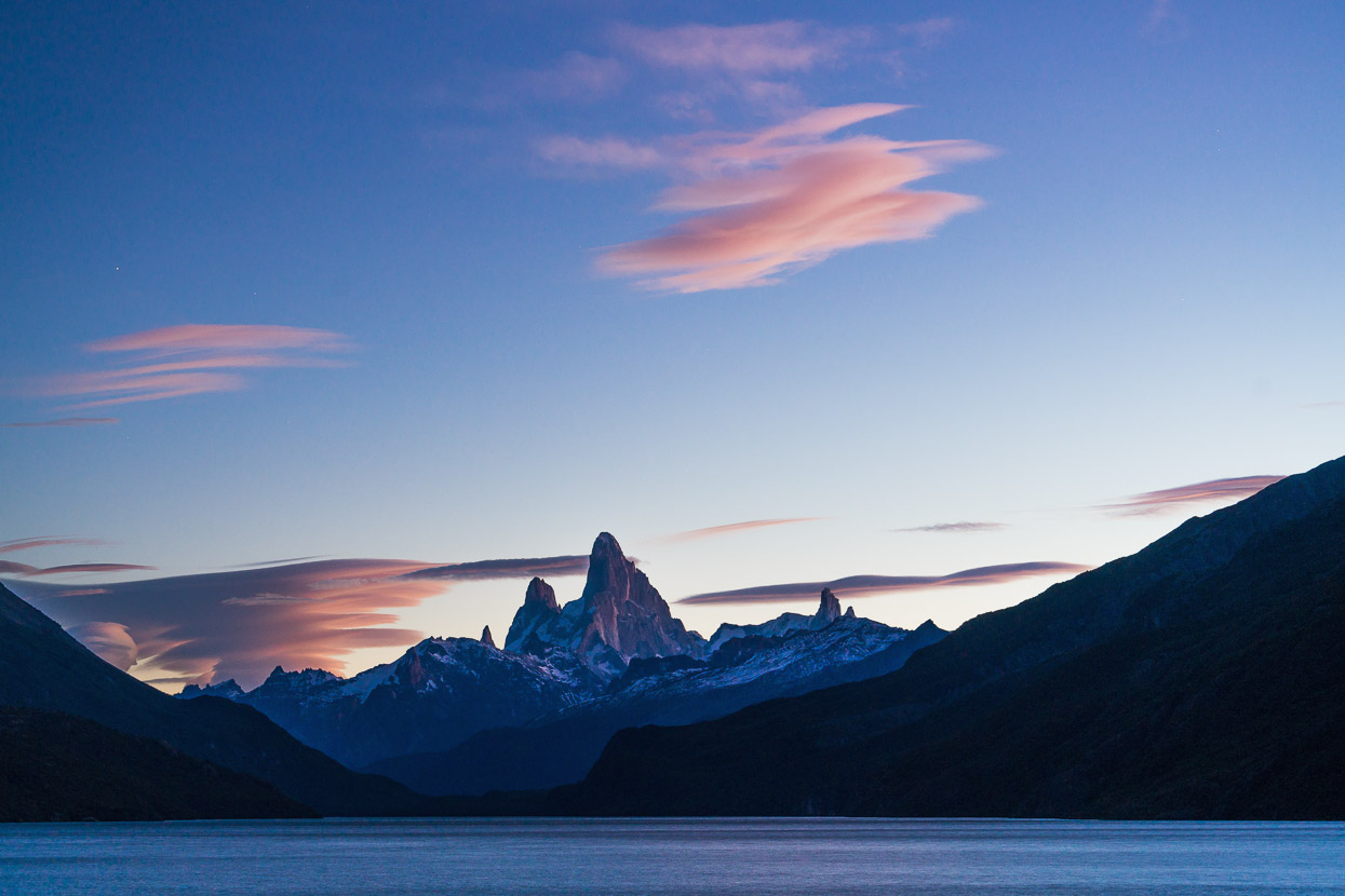
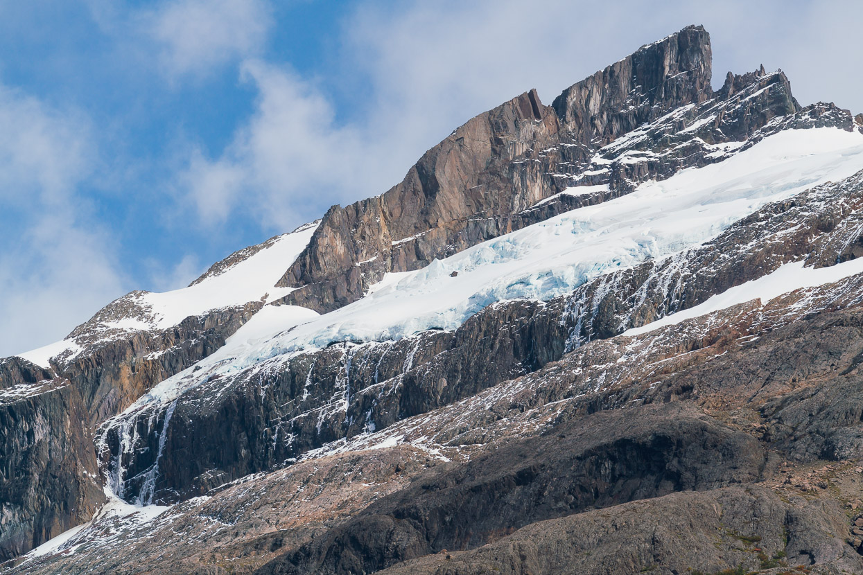
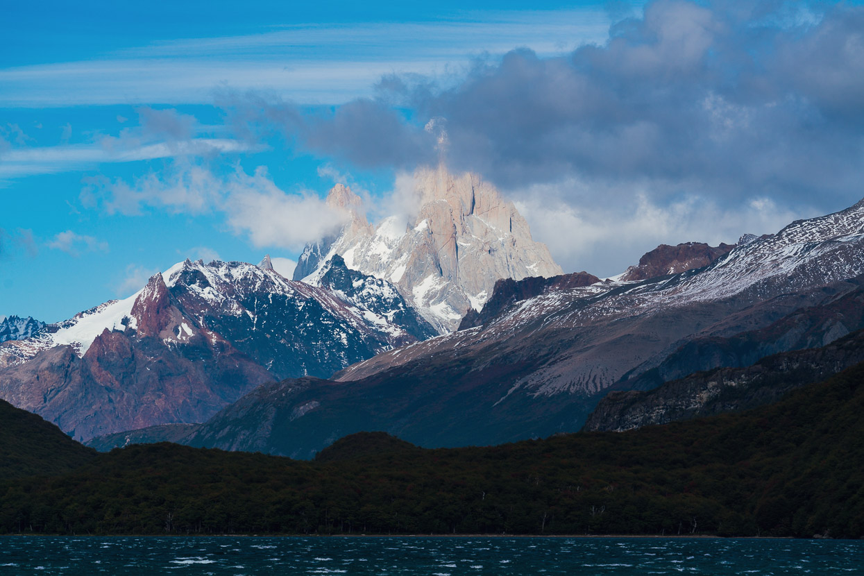
But more than the pass, we were keenly anticipating this special view; Cerro Fitz Roy, Poincenot and Cerro Torre dominating the skyline. Few have seen the mountain from the pass this season, so we consider ourselves extremely lucky to have had a clear and calm day for this crossing.
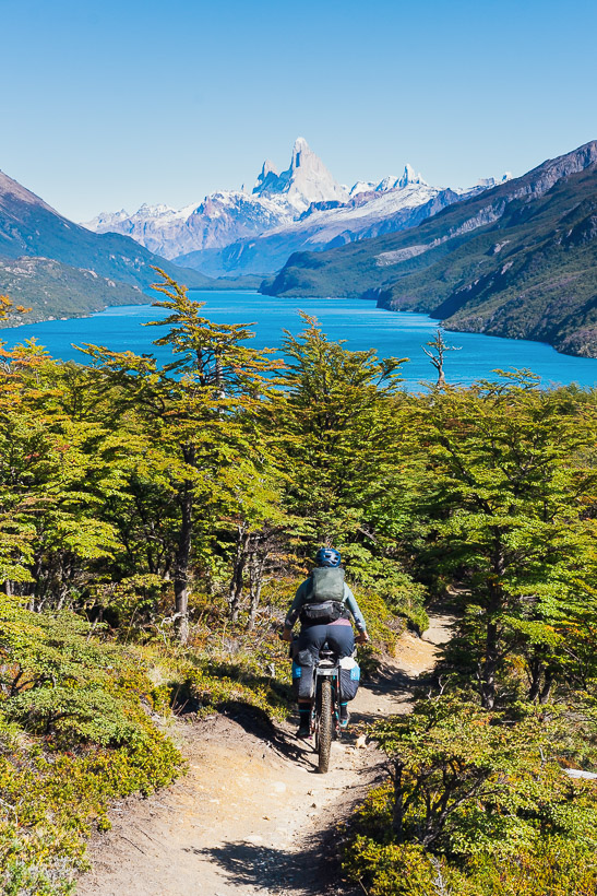
To travel between the two ferry crossings is a ride of 22km. The first section, climbing to the pass and border, is a rideable 15.5km on a dirt road. The next section (inside Argentina) to reach Lago del Desierto is a notorious 6.5km singletrack that cyclists either love or hate depending on the bike they’re riding, how heavily loaded they are, which direction they’re travelling and how wet it is. We were in the former category and really enjoyed it, finding it 99% ridable with our set ups. There were 2-3 fallen logs to cross and the odd unridable creek/gulch. It’s certainly a considerably easier endeavour heading south, as it’s mostly downhill.
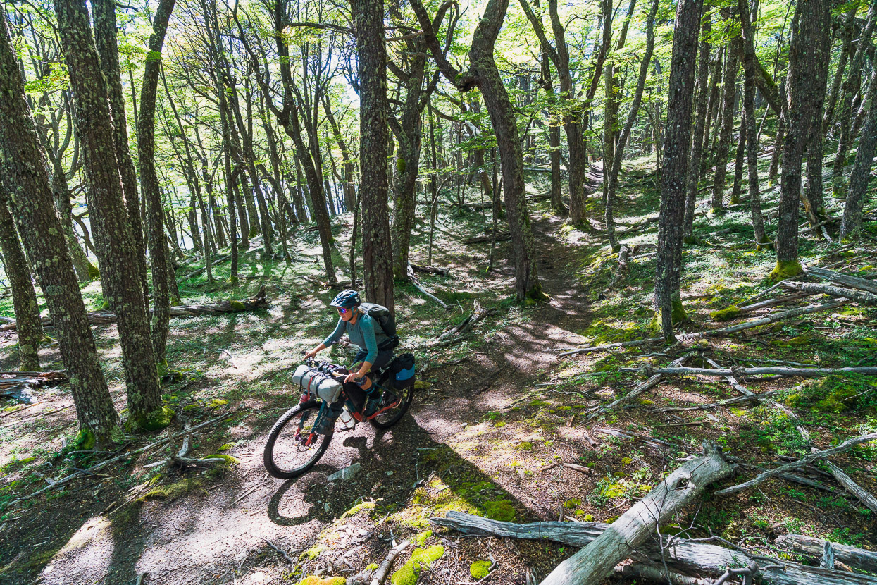
But most of the time is was just pleasant, sometimes technical, singletrack in the trees.
With a bit of mud of course.
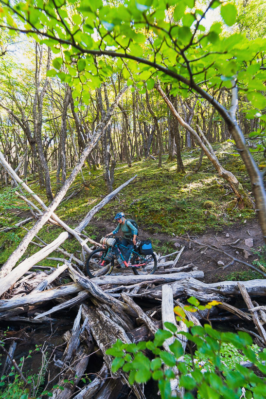
This log jam was the only really awkward bit.
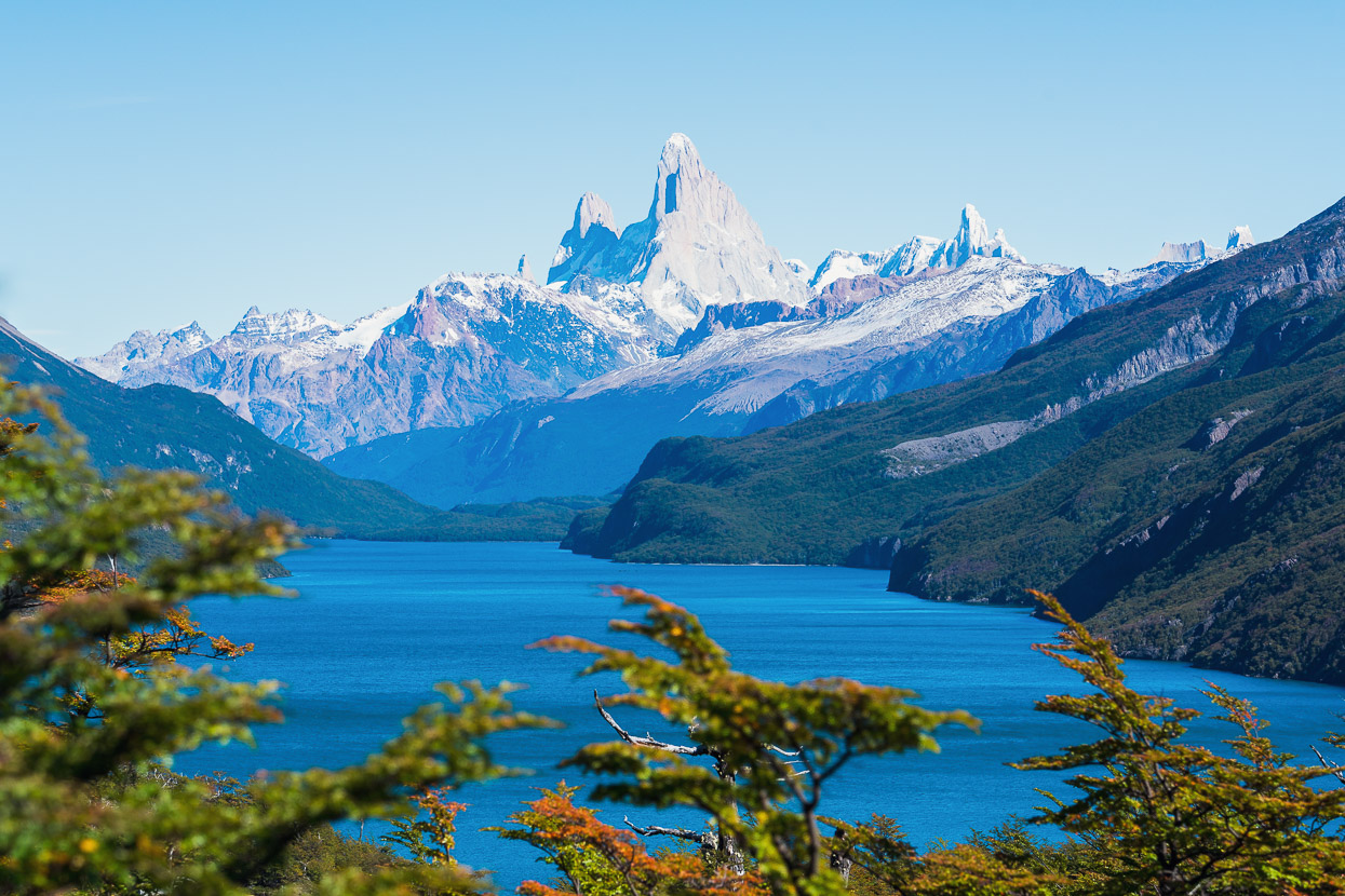
And as the track finally tipped into the fantastic downhill to the lake, this view opened out in front of us. Parque Nacional Los Glaciares and the crown jewels of Argentina standing tall.
What a way to arrive in this long awaited place.
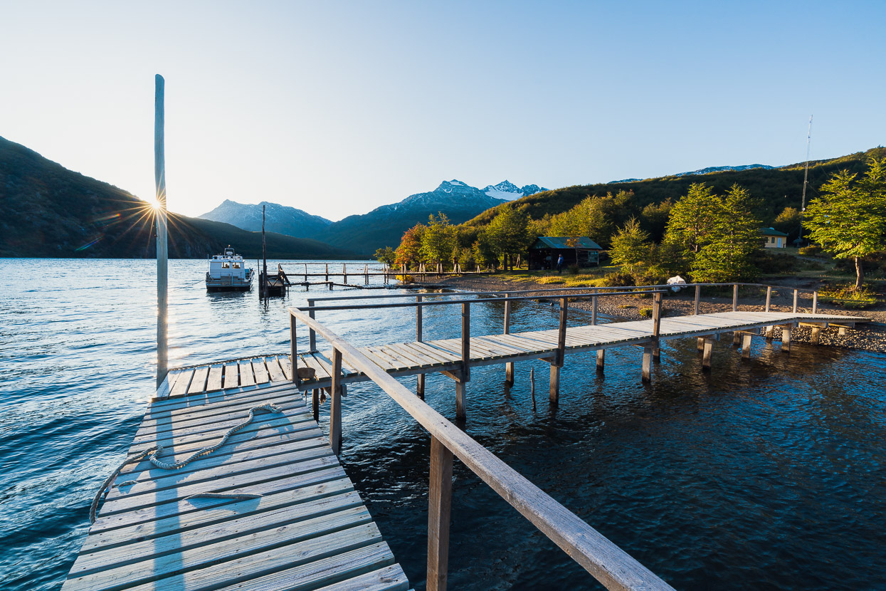
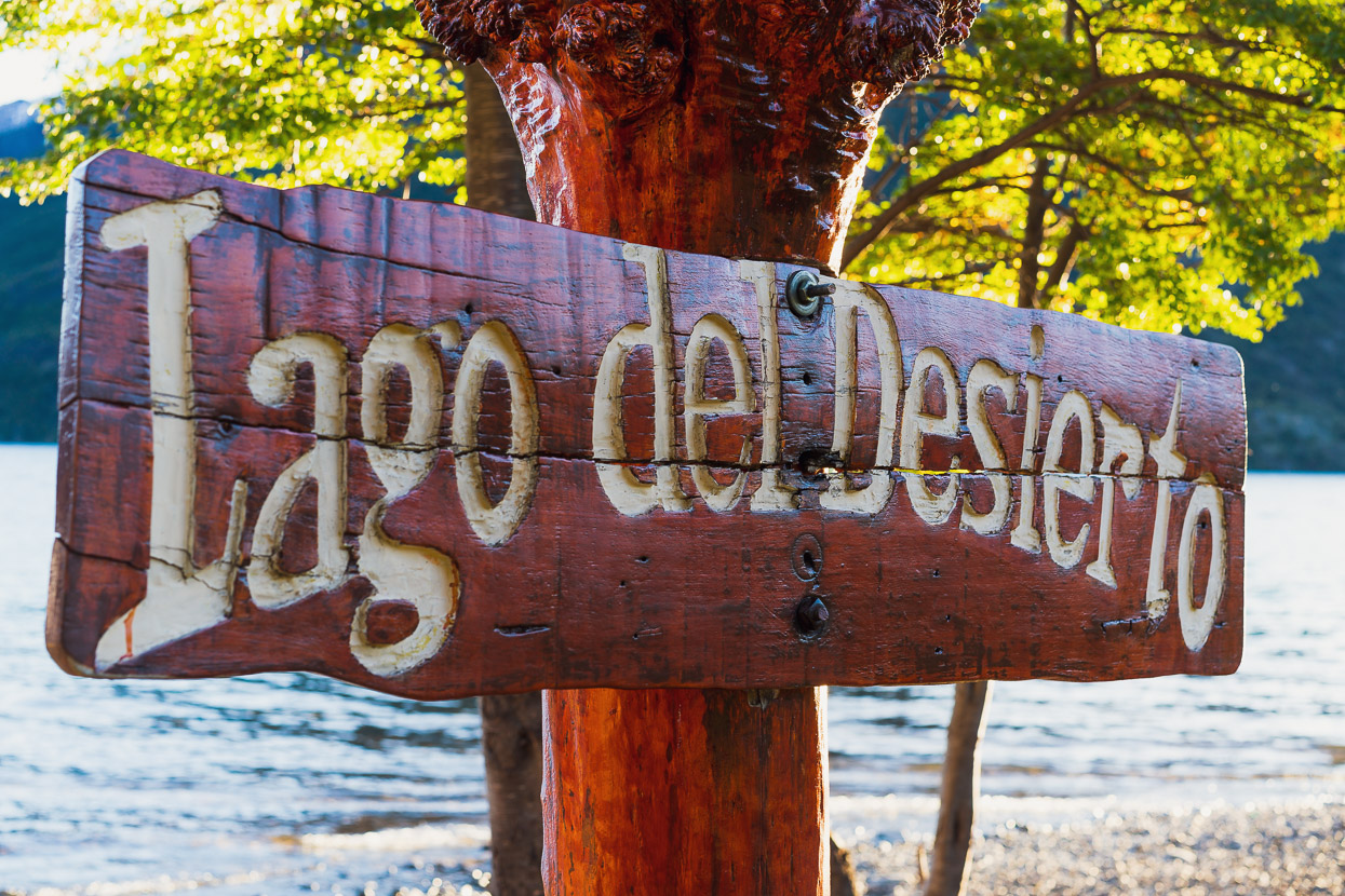
This end of Lago del Desierto is not accessible by vehicle. All that’s here is the Argentinian gendarmeria, a couple of trail heads and a patch of grass where camping is permitted while you wait for your boat, or hike the trails. It was a paradise on this warm afternoon, with no one around except the other backpackers and cyclists who we’d shared the ferry with, slowly trickling in behind us.
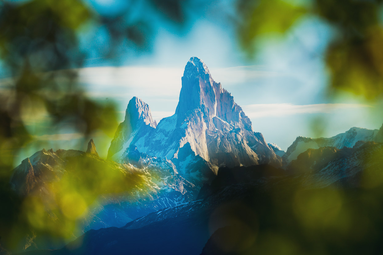
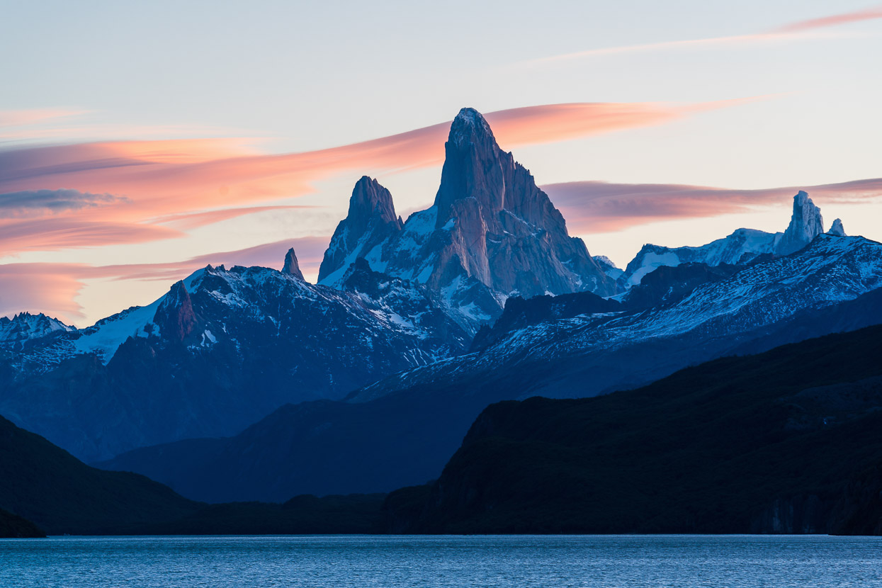
Fitz Roy/Cerro Chaltén looked amazing in the blue evening light as lenticulars slowly formed.
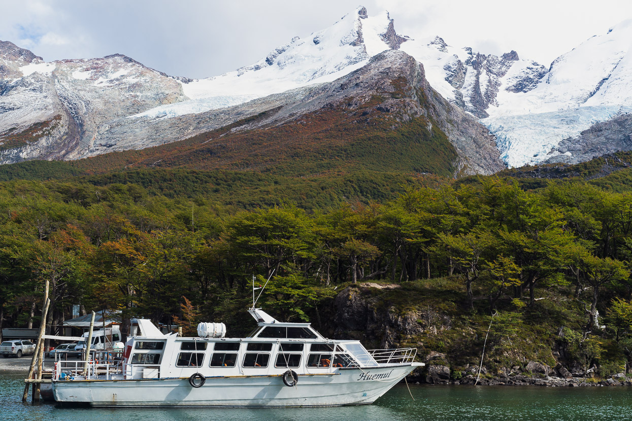
An incredibly scenic final ferry ride followed at 11am the next morning.
And with a strong tailwind we quickly knocked out the final 36km to reach El Chaltén, continually craning our necks to take in the views.
El Chaltén is a tourist boom town, and makes a convenient base for the world class hiking, climbing, nature and photography opportunities that the park offers. We’ve been here for 16 days as I write this, but leave tomorrow (April 5). We’ve had a great run of weather overall, with two 4-day hikes and shorter walks and photography sessions, which I’ll fill you all in on in the next post.
Say thanks with a one-off donation, or check out our Bikepacking guide.
If you enjoy our content and find it informative or inspirational, you’re welcome to show us some love with a donation or a book purchase (US$19.99). The services we use to create our Bikepacking routes and host the website cost money, funds that we’d rather be spending on the road, creating bikepacking routes and content to share with you. Thanks for reading!


Dear Mark and Hanna. Your beautiful posts make me feel like I am there riding with you (I wish) with the sun on my face and wind at my back!
Thanks Greg – glad you’re enjoying the feed. I hope you can make it down here sometime!
Fantastic! Thanks for taking me back there. Can’t believe it’s nine years ago we were there.
Thanks Paul, It’s a pleasure.
So glad to see that you got exceptional weather for this part of the journey. The wind down that way can be atrocious. Stunning shots as always. Nearly there team…. enjoy the ride.
Thanks Gavin, yeah we have had some storms, but overall had pretty good weather for the 18 days there – esp when we first arrived. Two 4 day hikes, one overnighter and couple of day hikes. Pretty good I think. As we leave the weather’s turning REALLY good too! I’m already amping to return.
That series of photos is outstanding (as always) and you two are my hero’s when it comes explorers. Be safe, vic
Thank you Vic!
It’s fantastic that you are still following us after nearly 7 years, since we met back in Canada. Much appreciated!
Take care, Mark & Hana.
I waved to you on your ride out of Chalten! I was in in trekking mode walking into town 😅
Ride safe!
Hi Rik, are you cycling too? We did see you wave. Had you just come of the Huemul? Amazing trek.
Hello to you and first, congratulations for the paso mayer
For the lago del desierto, I have a question. Why didn’t you push the bike along the lake by taking the hiking trail to the east ?
I’m hesitant to do this, but I don’t have too much information on this, by bike.
Knowing that I also crossed the Paso Puelo, I wanted a comparison. Thank you
Hi Gaby, well done crossing Paso Puelo – I heard that it has become overgrown/blocked with trees in some places. Can you comment on this? Regarding Lago Del Desierto, all the reports we heard/read about people who had tried it said that there was not enough rideable track to make it worthwhile. There is a lot of undulating technical trail which is hard work to push and carry a bike over. Some people put their bike on the ferry and walk the track, but it does not sound worth trying to ride, unless perhaps your bike was completely unloaded – and even then I think you would be pushing a lot.
If you do it, please let us know 🙂
thanks for taking us all virtually on the journey..jealous+++