
Early – Mid February 2023.
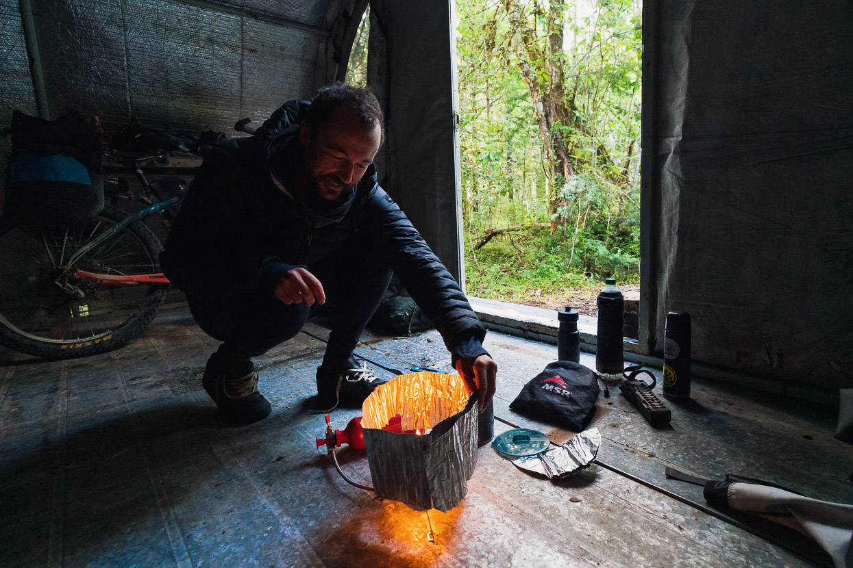
Trevelin to Coyhaique had been an energetic nine day stretch with lots of long days, so we had a welcome rest break for three days in Coyhaique, catching up on admin and blogging. We even treated ourselves to a room in a hostal, which is an exception given Patagonia’s accommodation prices. Sleeping in a bed was a pleasant novelty.
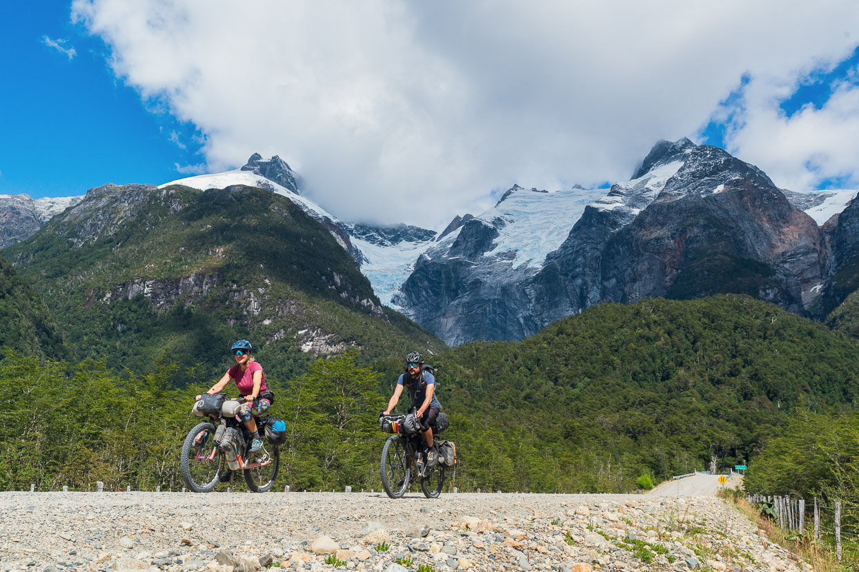
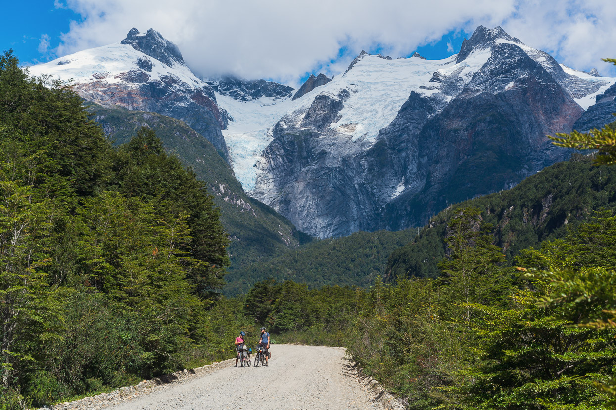
Beyond Coyhaique our route followed the Carretera Austral to the lakeside town of Rio Puerto Tranquilo, with a stop to hike the popular Cerro Castillo on the way. Our arrival in Rio Puerto coincided with worsening weather, so we spent three further days there waiting out the bad weather, which brought widespread rain, strong winds and snow to the ranges. The break gave me the opportunity to complete some chapters for an upcoming Lonely Planet Epic Rides publication. Here’s how that spectacular section unfolded…
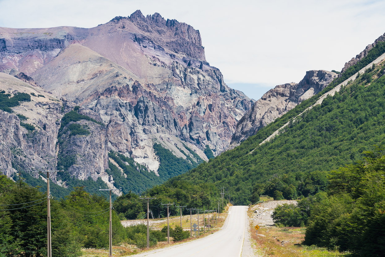
The Carretera Austral’s pavement continued through to Cerro Castillo and the road is notably quieter once you are past the turnoff to Balmaceda airport, which is outside Coyhaique. The highway’s scenery starts to get really interesting again once you climb away from Coyhaique’s rolling plains and up into the mountains of Parque Nacional Cerro Castillo.
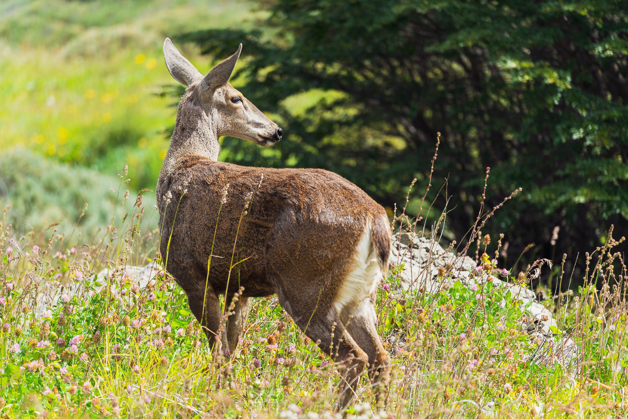
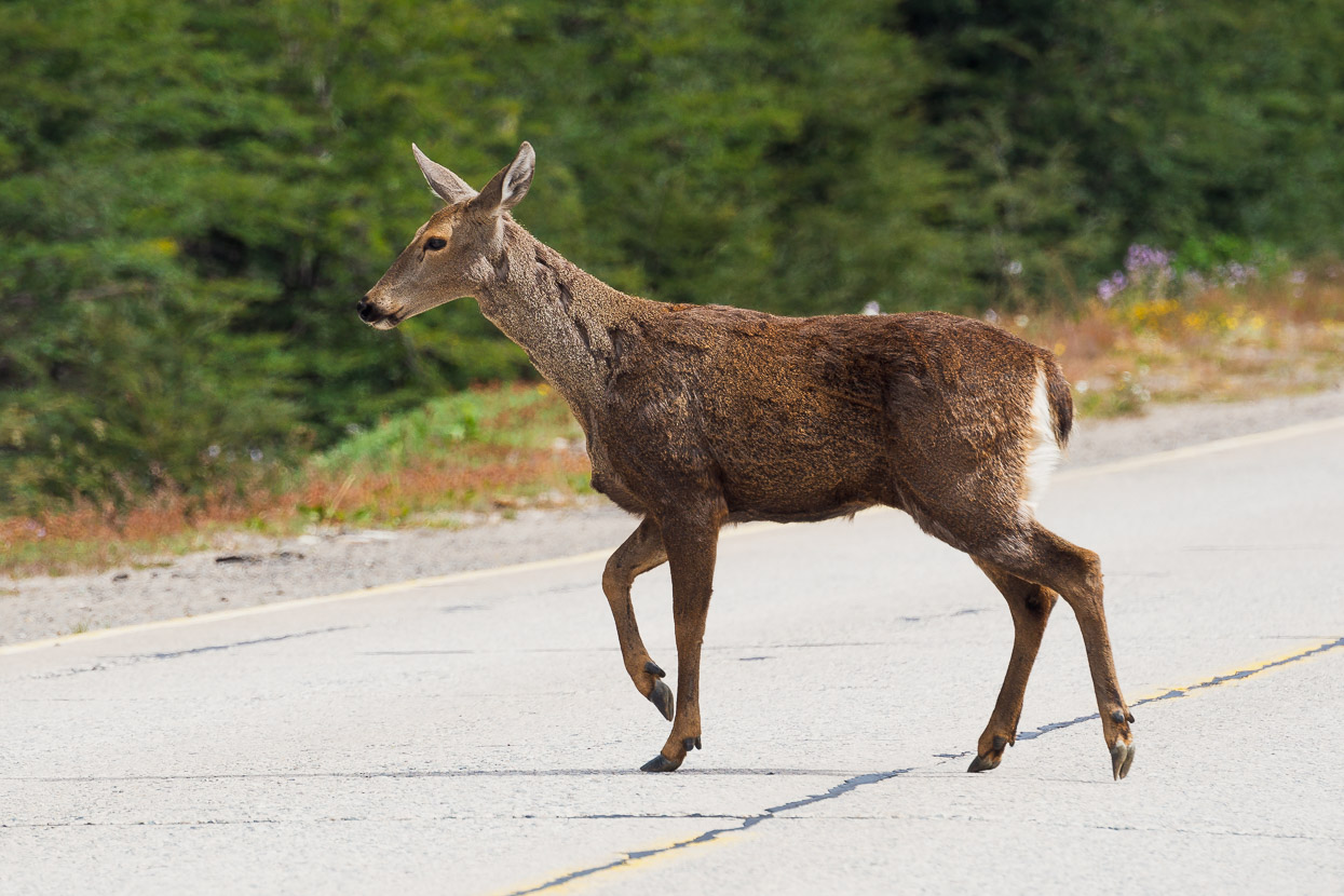
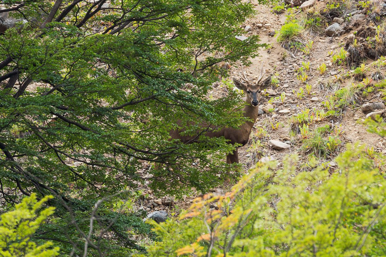
This section of road is well known for its population of huemul deer which are habituated to vehicles and so can be seen close to the road. The huemul (south Andean deer) are native to the mountains of southern Chile and Argentina and are an endangered species.
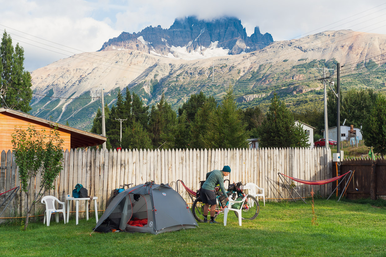
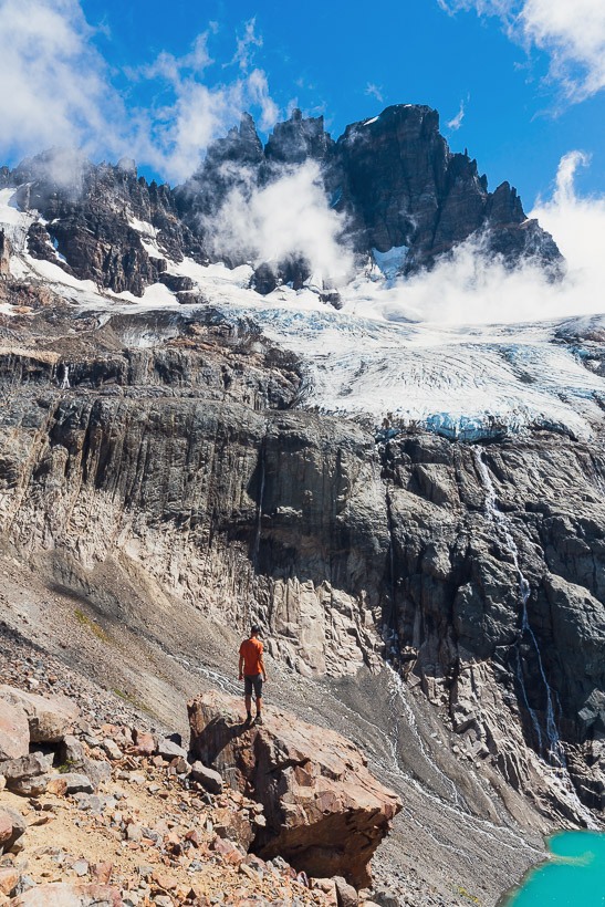
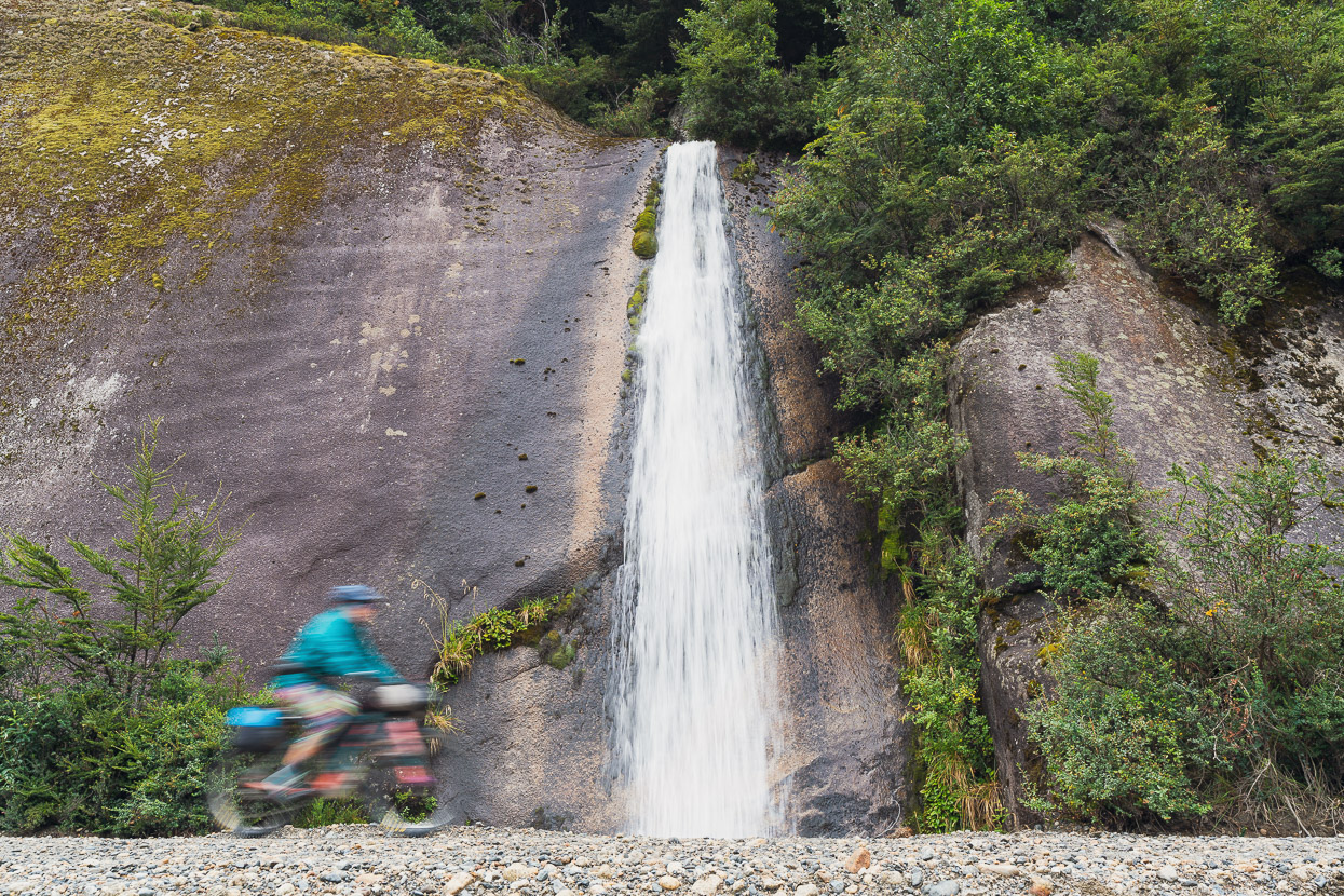
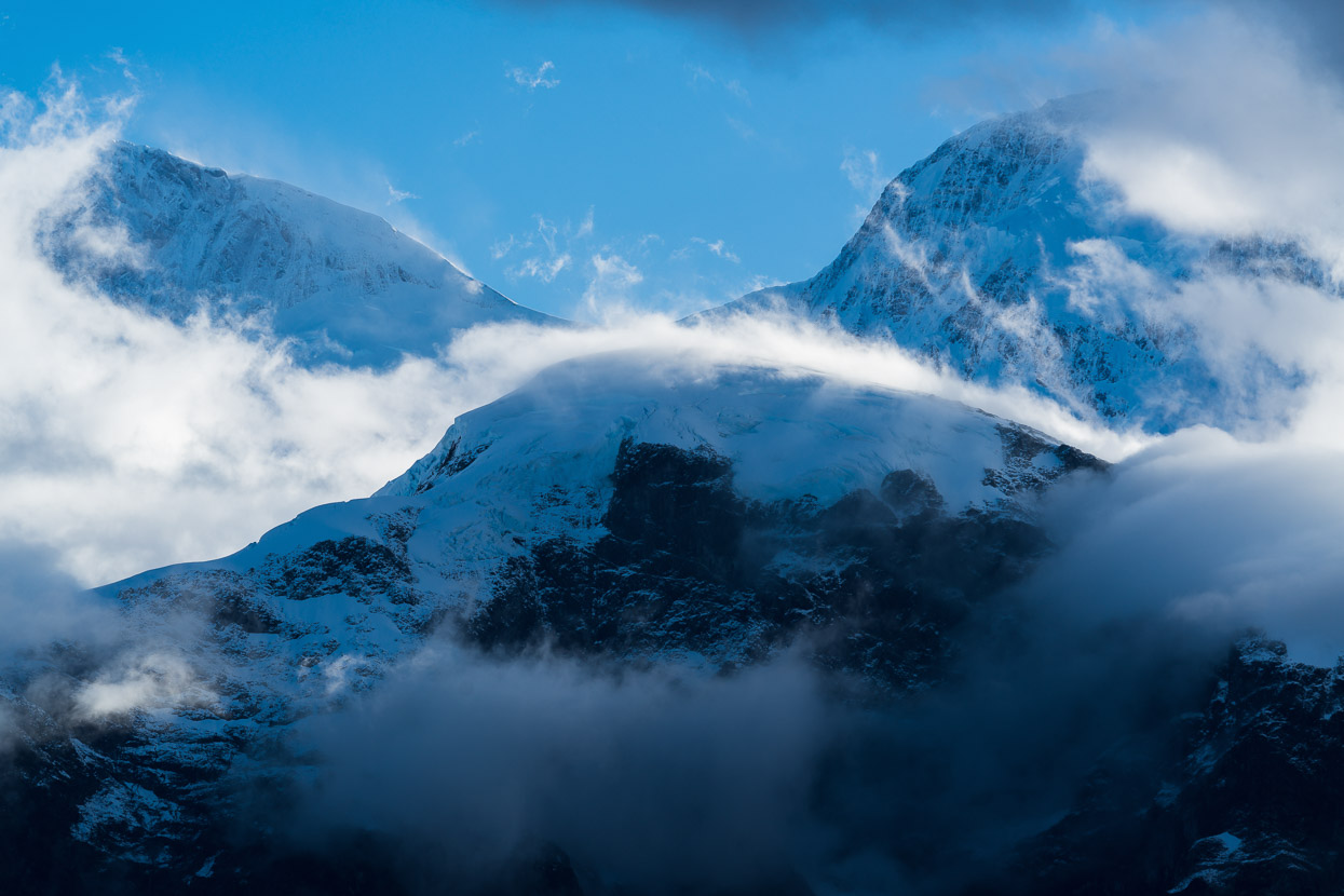
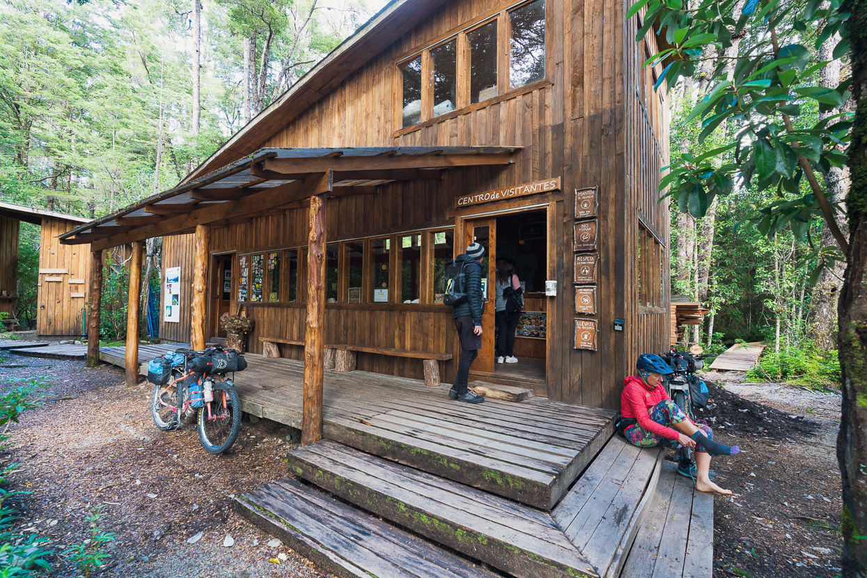
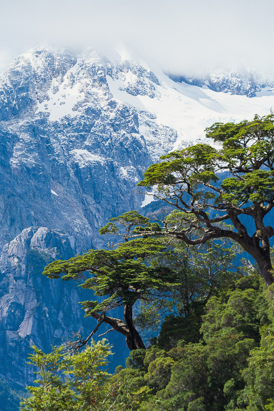
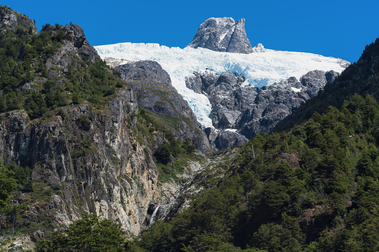
A long gradual downhill dropped us into Villa Cerro Castillo which is another sleepy rural town – like many along the Carretera Austral – that has enjoyed a surge of popularity with the increase in tourism. There’s several campgrounds in town, mostly set up to cater for people who are using it as a base for the very popular Cerro Castillo day hike, or longer hikes through the national park. We stopped there for two nights so we could do the day hike, which climbs 1100m up to a stunning glacial lake below the mountain’s upper tower (looming in the background of this photo).
On the long ascent up towards Cerro Castillo, as usual we were among the first on the track for the day – always keen to get in before the crowds and before the light loses its beauty. It’s not a cheap outdoor experience though, with a charge for the hike that was roughly NZ$40 each, plus $20 each for a night in the campground.
For those interested, we cycled 6km from town to the start of the track and left our bikes with the entrance staff. The ticket office and track open at 7am.
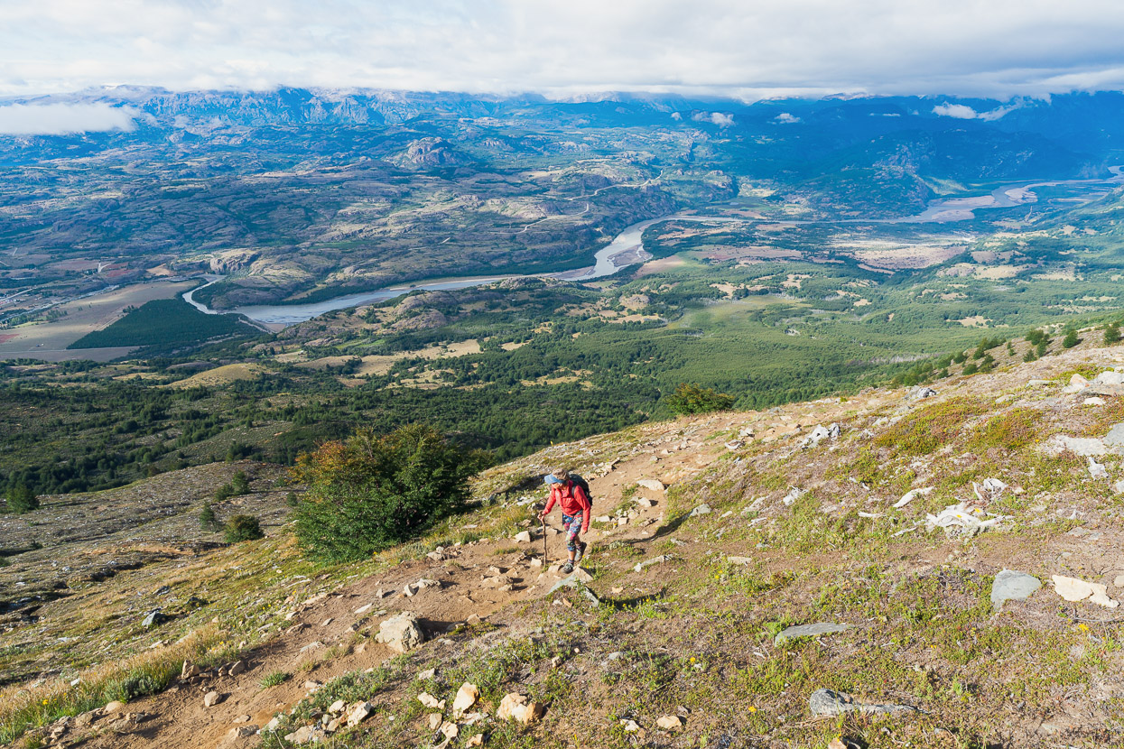
Spot Hana, lost in the huge alpine landscape.
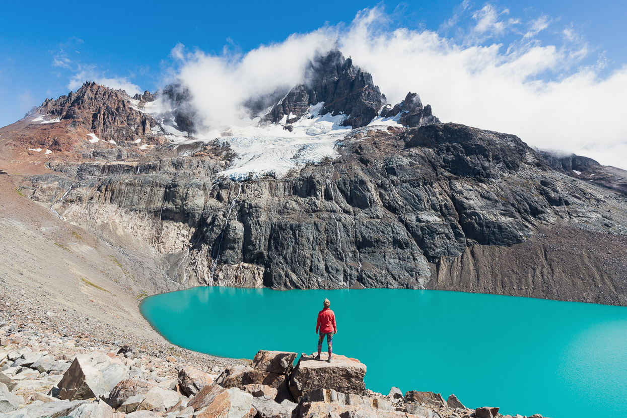
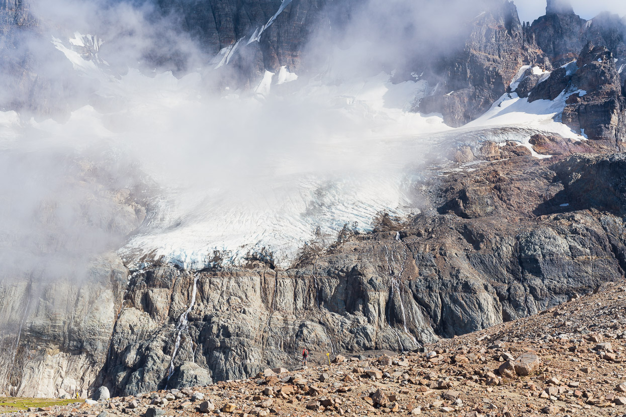
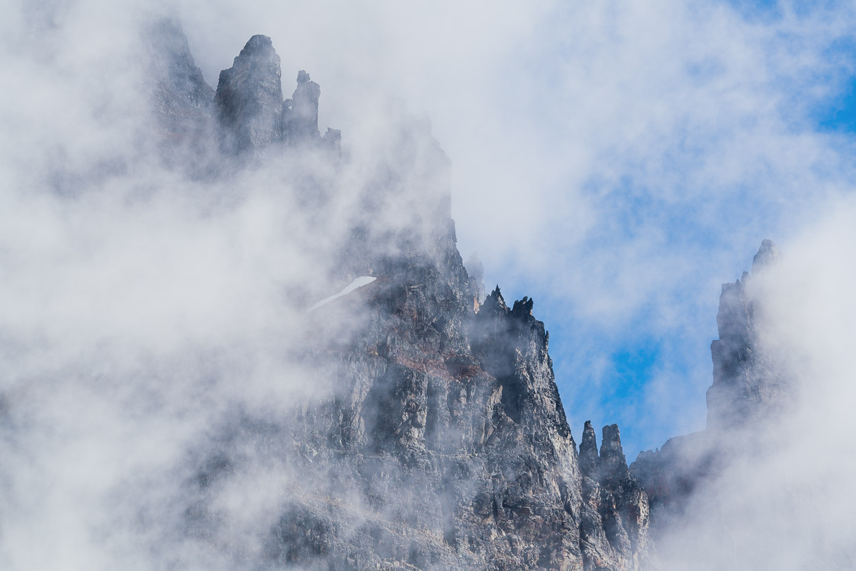
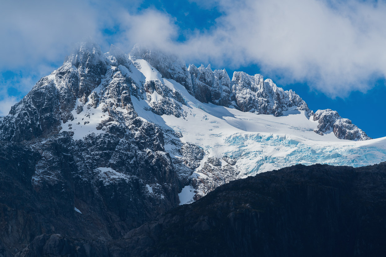
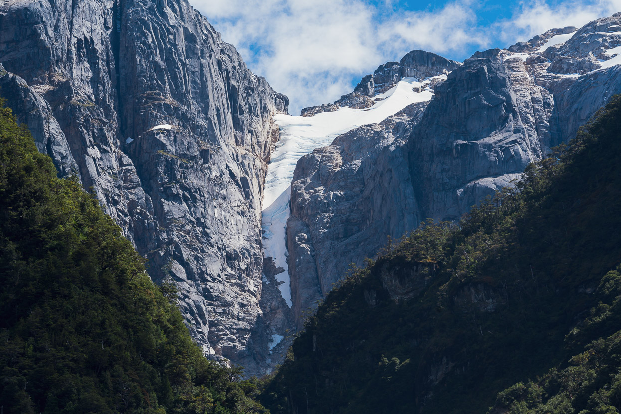
From the mirador, the summit of Cerro Castillo (2675m) towered above a stunning turquoise lake. The hanging glacier on its south east face releasing waterfalls and occasional torrents of ice down the face.
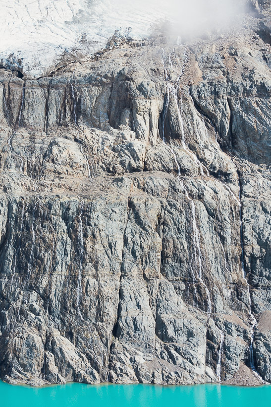
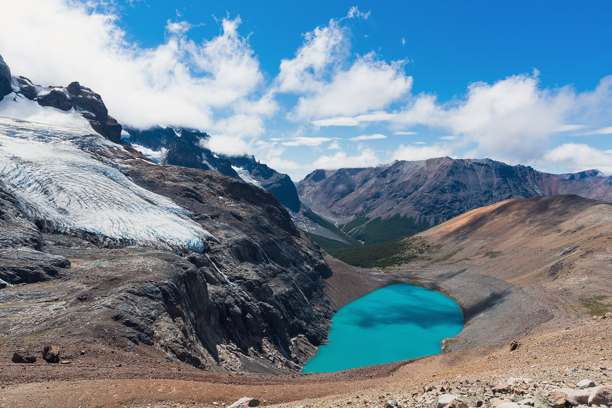
After absorbing that scene for a while, we walked higher west along the moraine for another view of the lake and glacier.
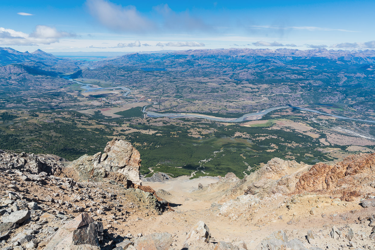
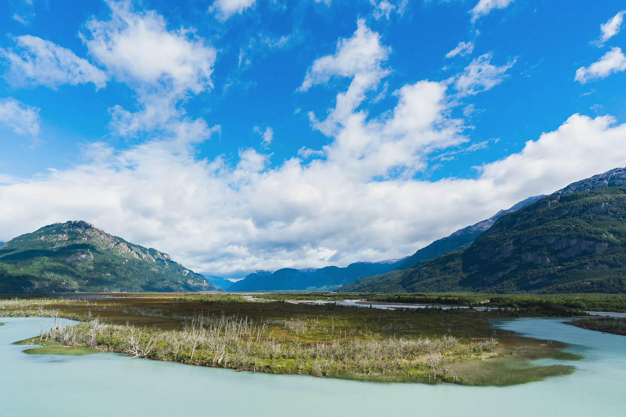
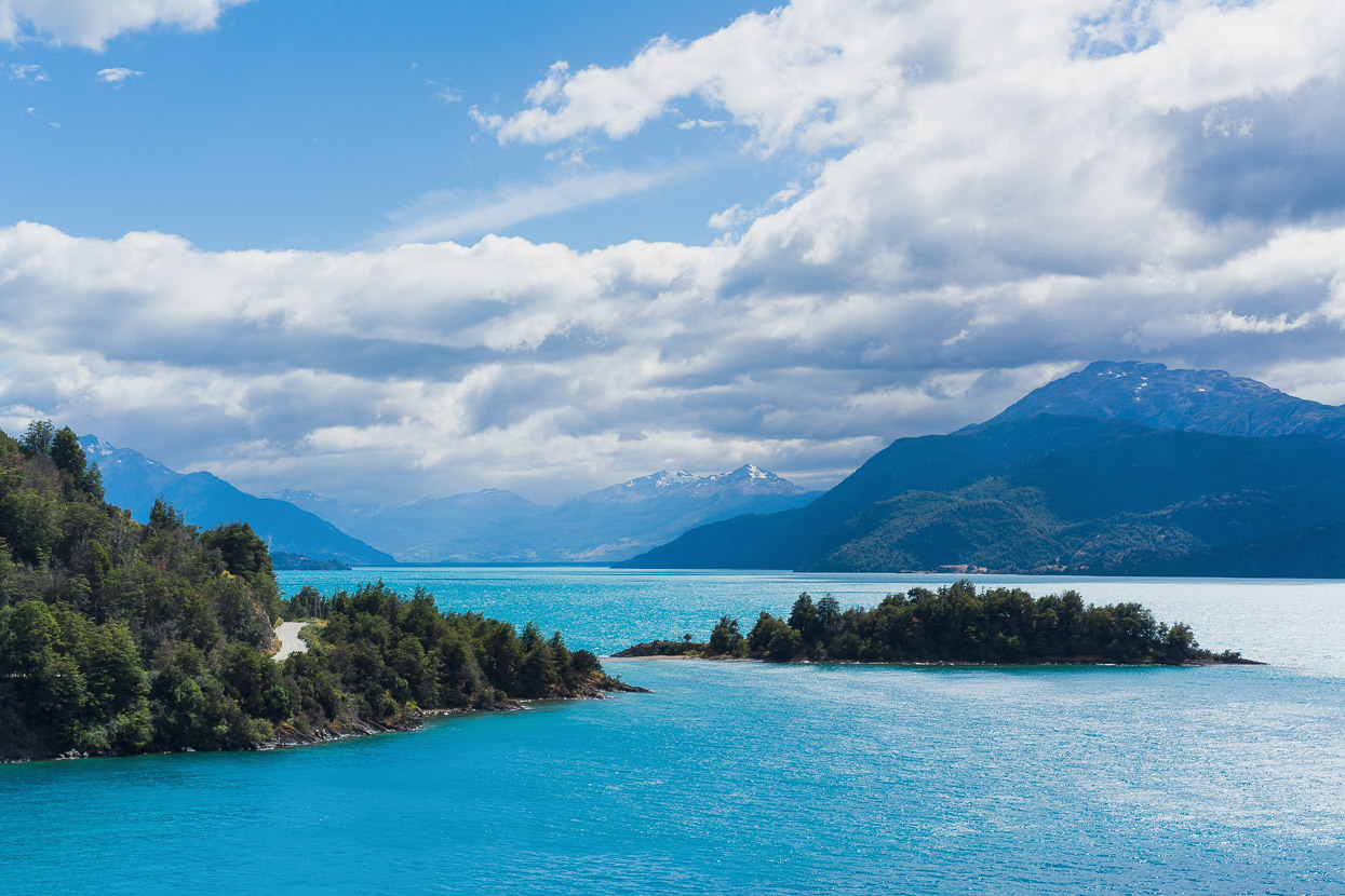
And the view in the other direction: out towards Villa Cerro Castillo, the Rio Ibáñez, and in the far distance, just visible top left, the huge Lago General Carrera/Buenos Aires, which lies in both Chile and Argentina. We’d be spending quite a while following the edge of this lake in coming days.
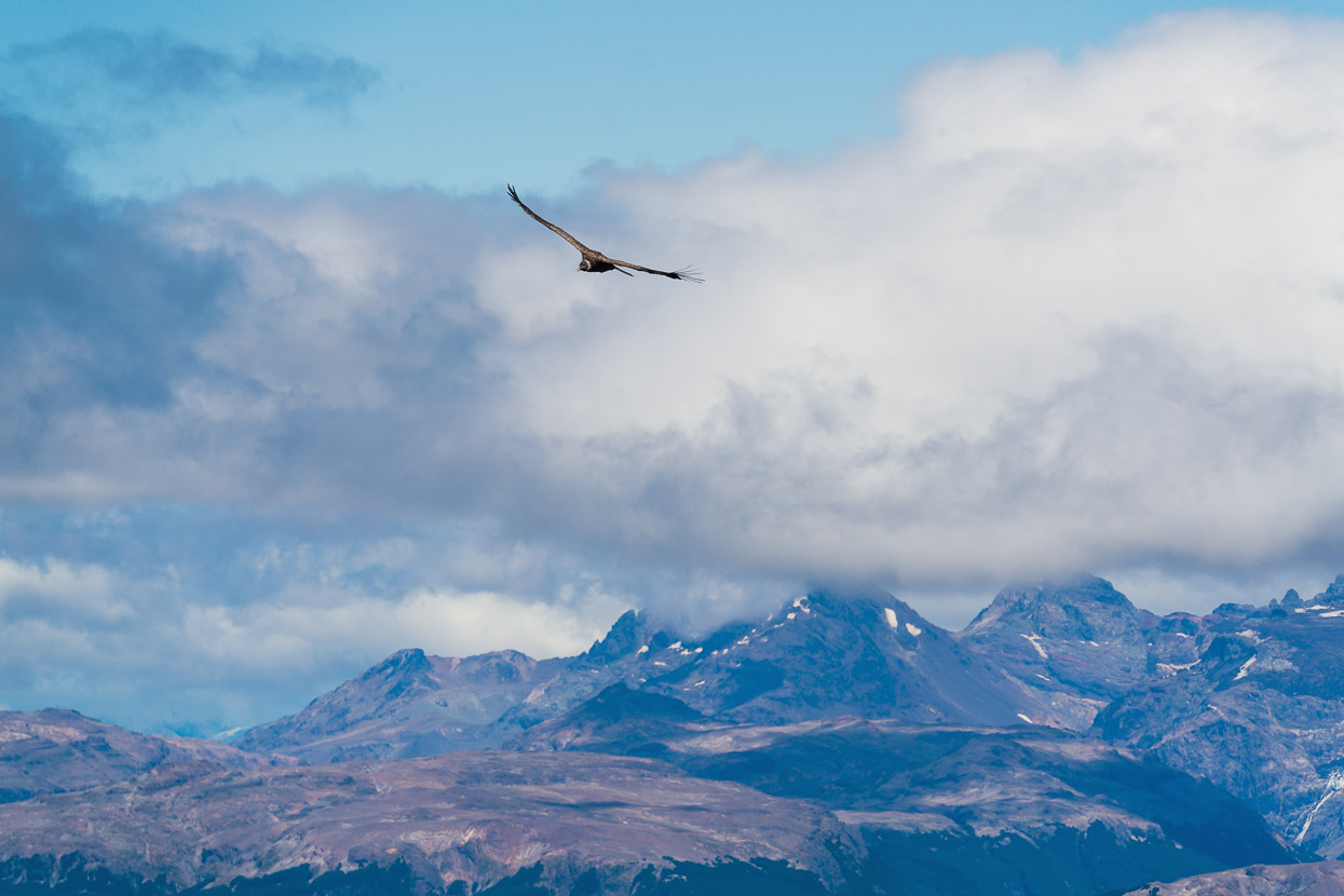
We’ve seen a few condors already on this trip, but this one was keen to take a closer look at us and glided back and forth quite close to us before slowly spiralling up and away on a thermal.
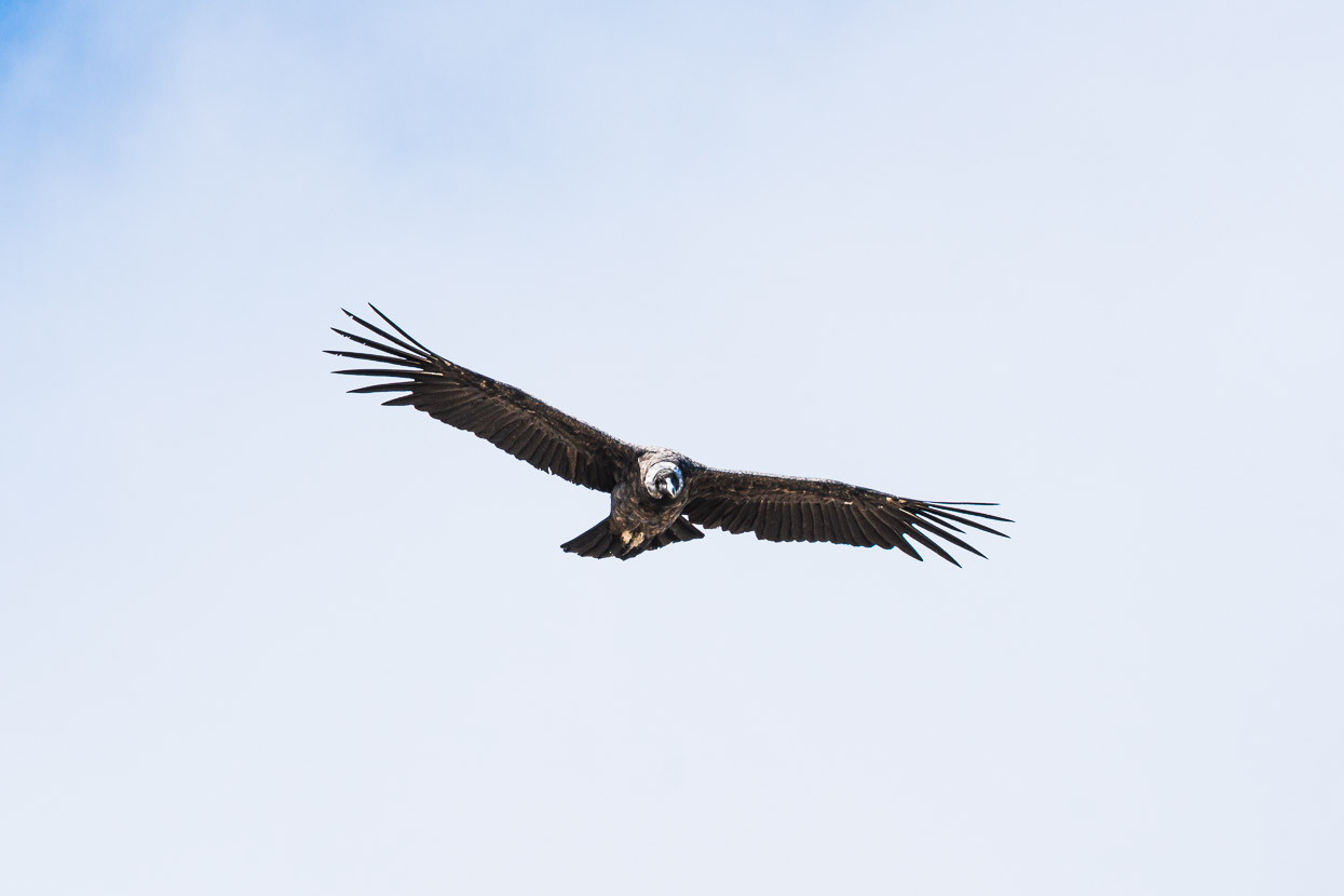
The closest shot I have managed to get of one so far.
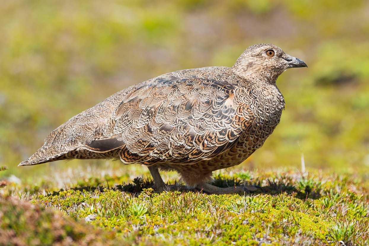
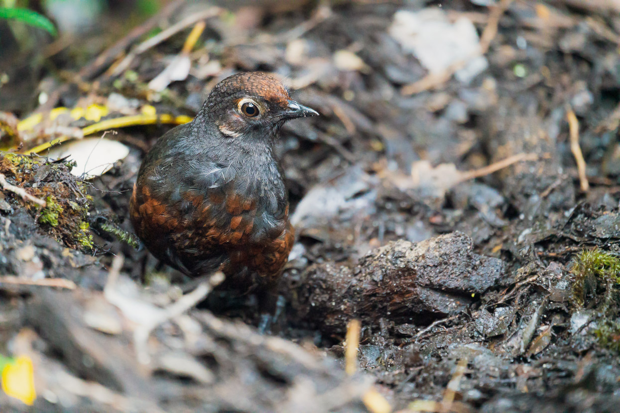
Meanwhile, down on the mat of alpine plants that covered some of ground we spotted a pair of well camouflaged rufous-bellied seedsnipes (attagis gayi). These birds are endemic to the southern Andes.
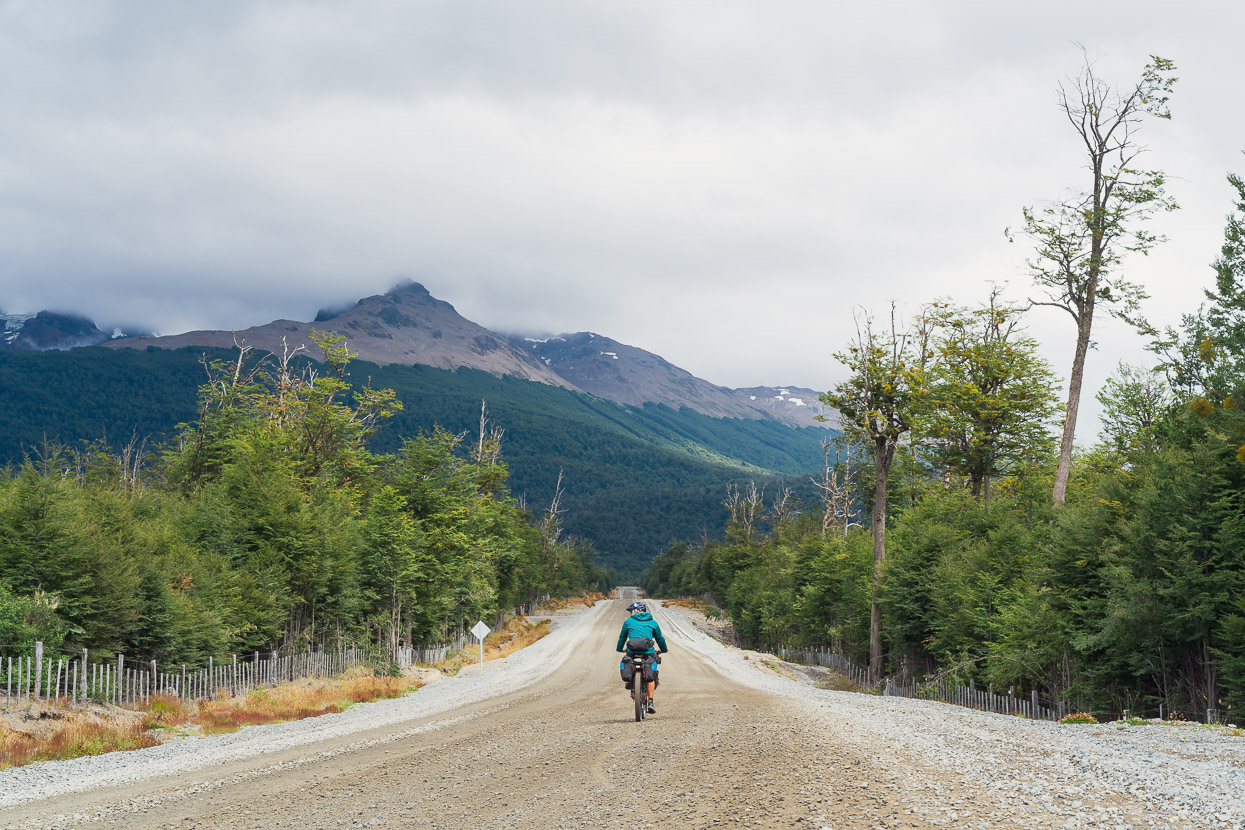
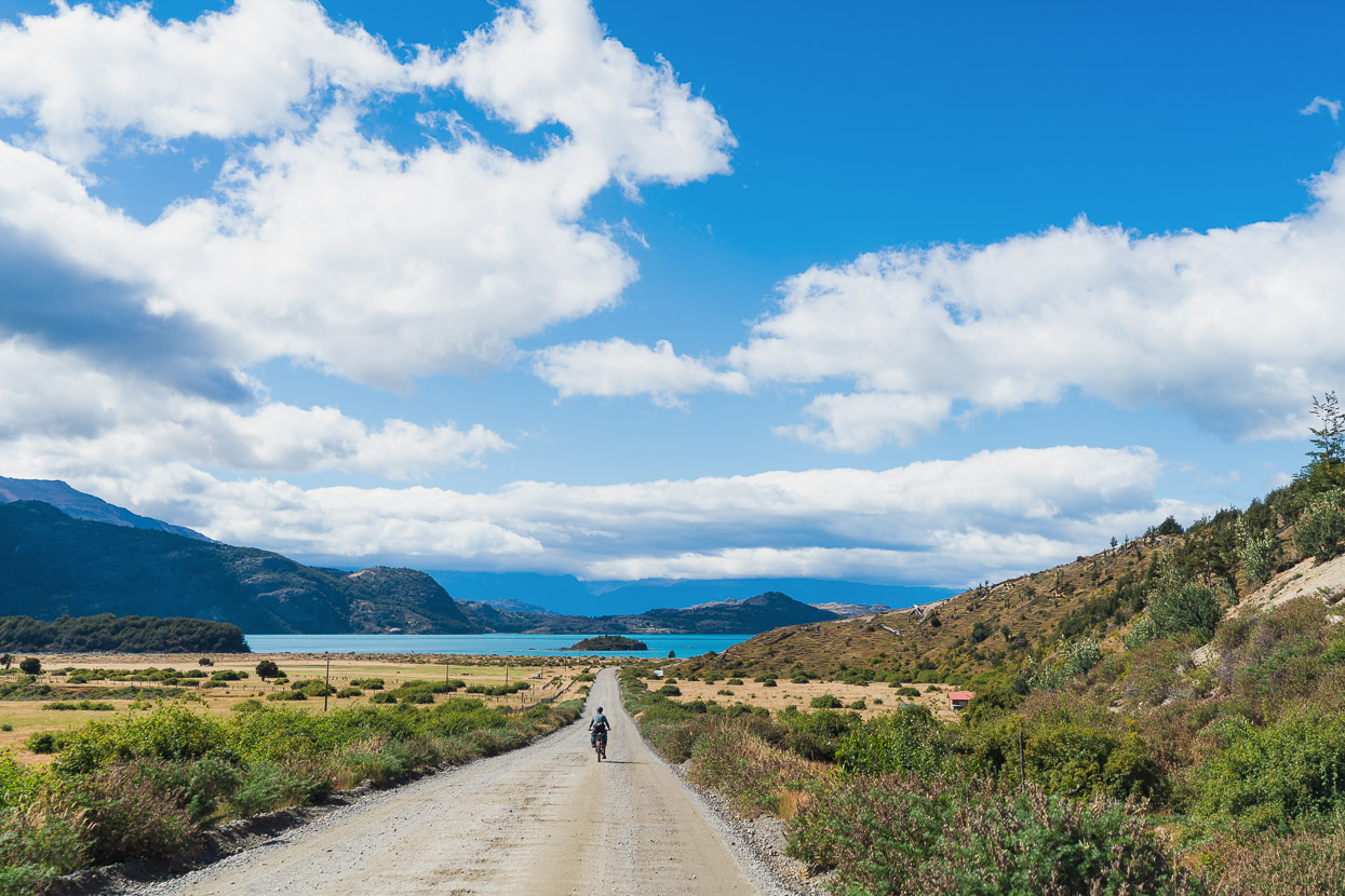
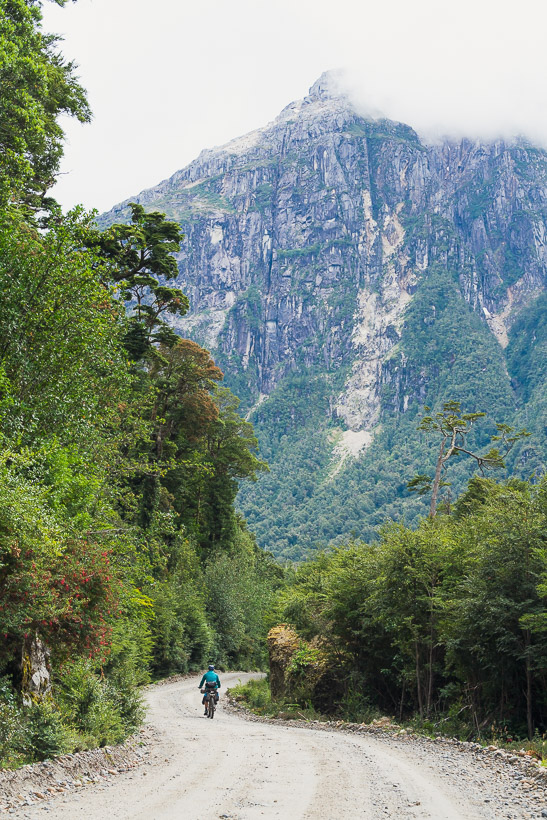
After two nights in Villa Cerro Castillo we left following the Carretera Austral towards Puerto Rio Tranquilo. The first roughly 15km after town are concrete, and then the 450km remainder of the Carretera Austral all the way to Villa O’Higgins is ripio (gravel). Pretty soon after Cerro Castillo the CA began to feel more remote than its northern section. There’s much less farming on this section and the landscape is generally less hospitable. It reminded us of Alaska at times, with broad braided rivers, swamps and stunted forest.
While normally we’d he happy to be on ripio rather than pavement, much of the Carretera Austral’s ripio is not the fun type. Lack of maintenance means its severely corrugated. It’s tedious to ride on 2.8 inch tyres with lowish pressures, let alone the much skinner tyres that the majority of tourers on the road use. We’ll take washboard, we’ll put our heads down and grind into a headwind for as long as it takes, but add the thick dust from passing cars into the mix and despite the scenery and sense of wilderness the cycling experience is pretty mediocre at times.
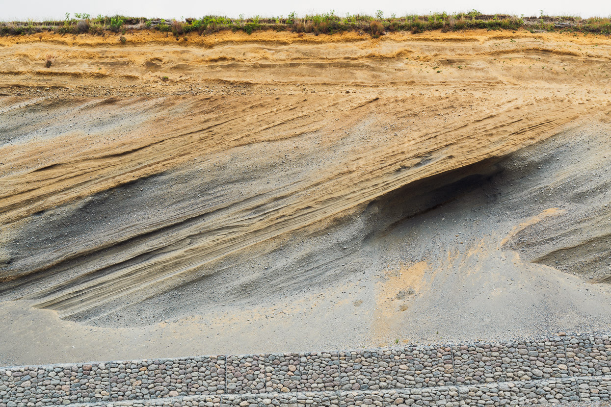
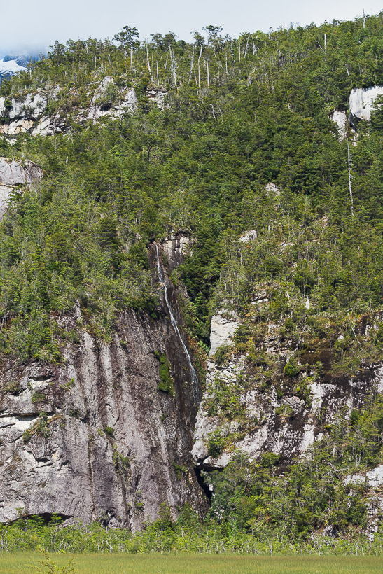
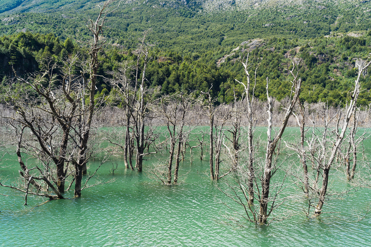
Volcanic eruptions have made their mark on the land here too, visible in this road cut. Nearby Mt Hudson is only 1900m high, but was the site of of one of the biggest eruptions of the 20th century. A 4750 BCE eruption is thought to have wiped out many or all of the human groups living in Patagonia at that time. 1971 and 1991 eruptions caused melting of the mountain’s glacier and huge lahars.
The day of our Cerro Castillo hike had been the end of a good weather window, so it was a drizzly couple of days ride to reach Puerto Rio Tranquilo, but at least once that set in, it settled down the dust. Instead we were coated in a fine later of grey mud.
Morning riding between showers on the final run into Puerto Rio Tranquilo and the lake edge for the first time.
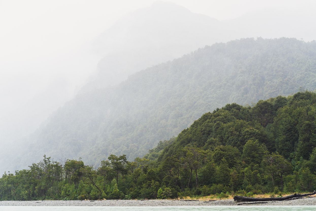
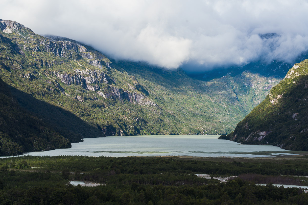
One of Lake General Carrera’s several narrow arms. It’s a beautiful lake, with its glacial blue tone and caught between tall mountains in every direction.
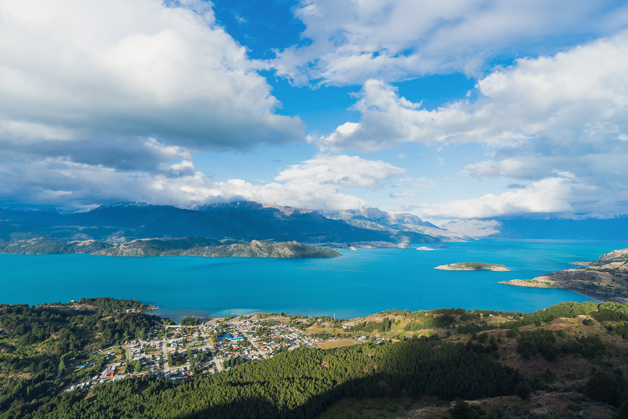
We spent the next three days in Puerto Rio Tranquilo as a cycle of strong winds, heavy rain showers and finally snow passed over the area. I took this photo from the mirador above town once the weather settled down. It was an opportunity to get some work finished, but we were also waiting for the wind to drop so we could visit the famous Capillas de Marmol.
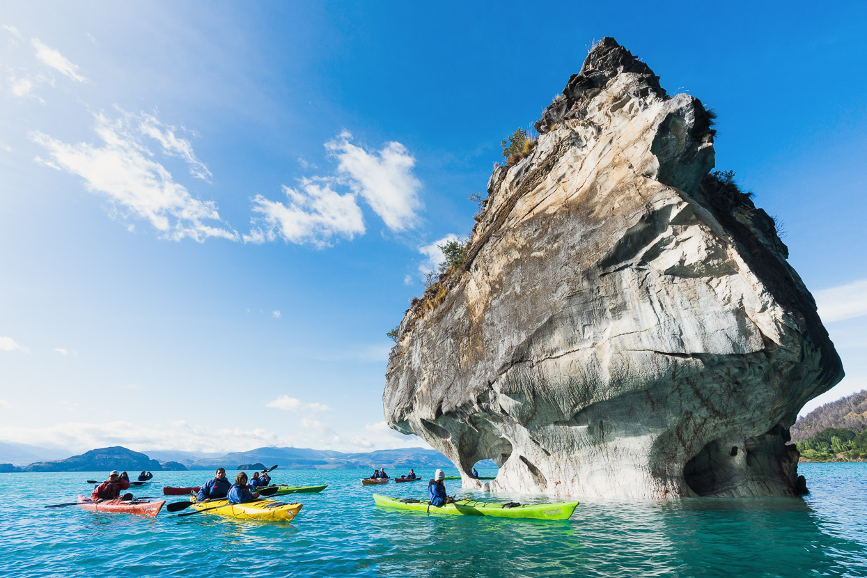
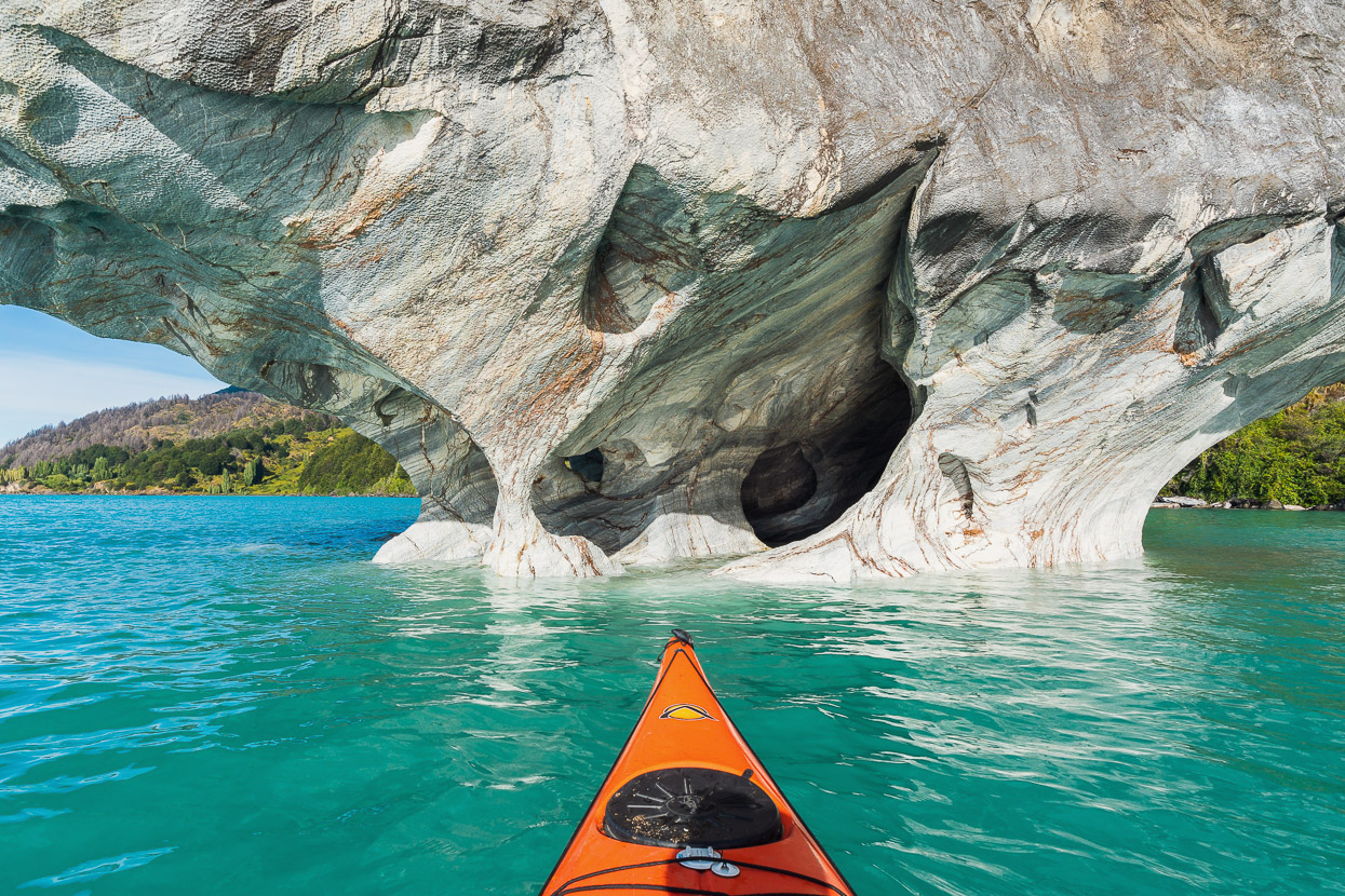
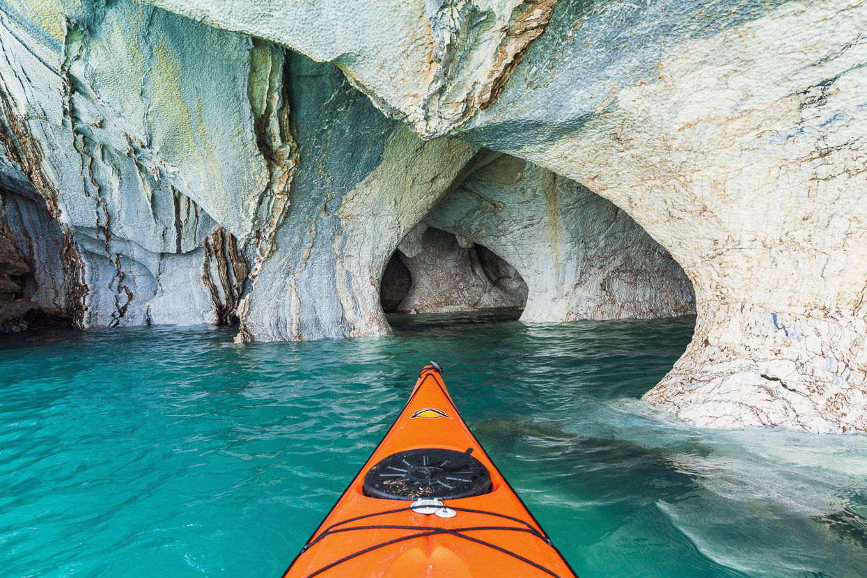
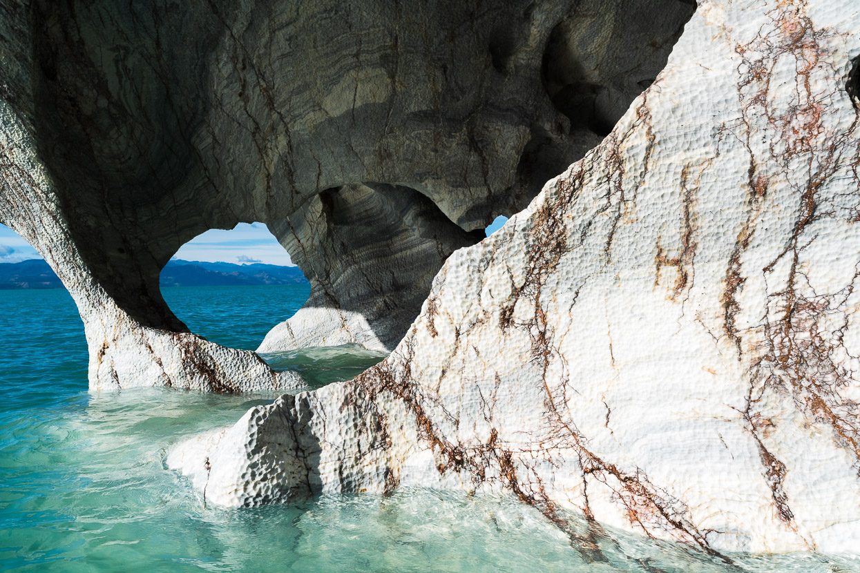
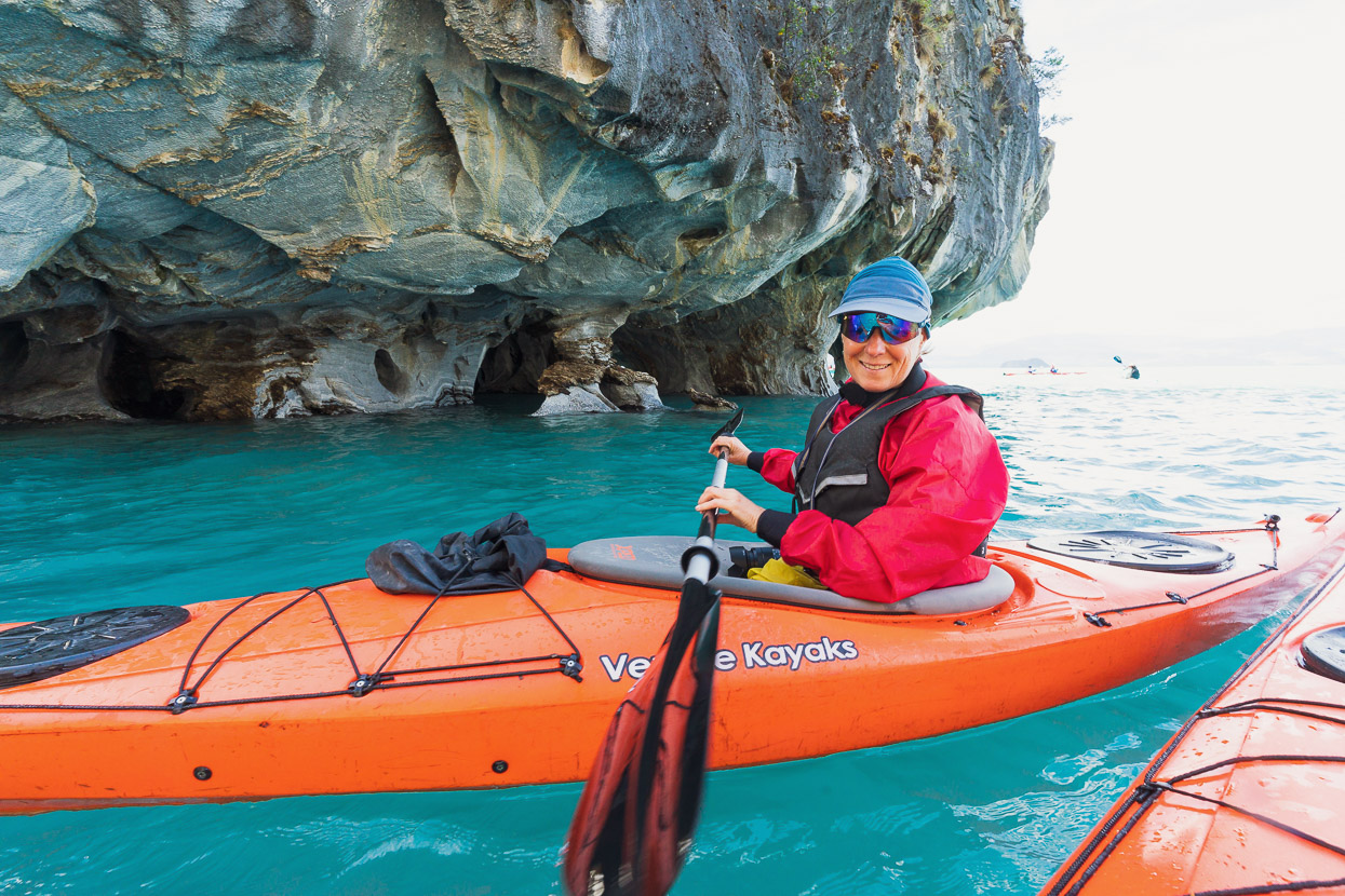
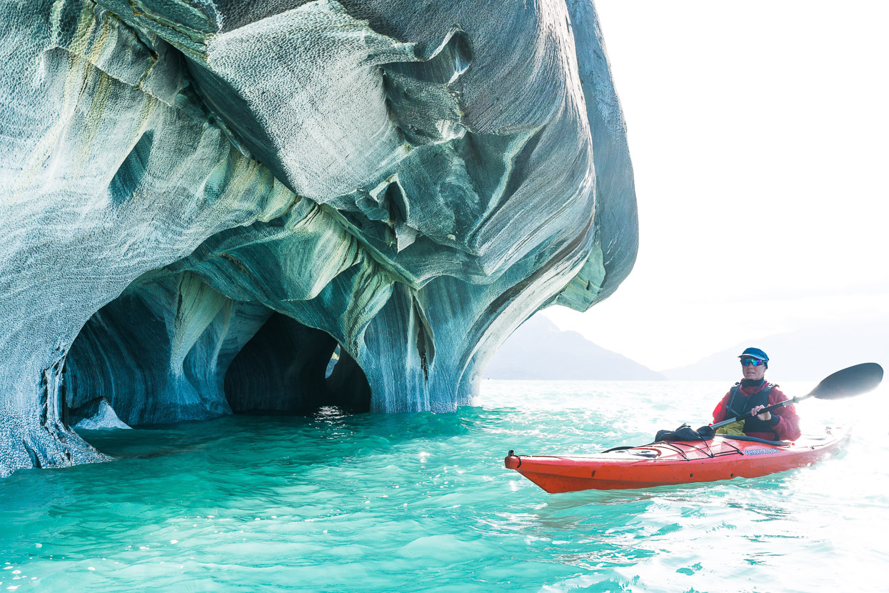
Tourists flock to Puerto Rio Tranquilo to experience a series of marble monoliths which lie just offshore and can be accessed either on boat tours or by kayak. On a fine day dozens (if not hundreds) of people visit this site. We opted for a kayak tour (just us and one guide), but there were many bigger groups on the water, as well as boats constantly zipping through.
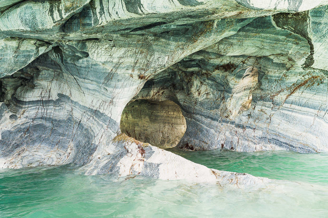
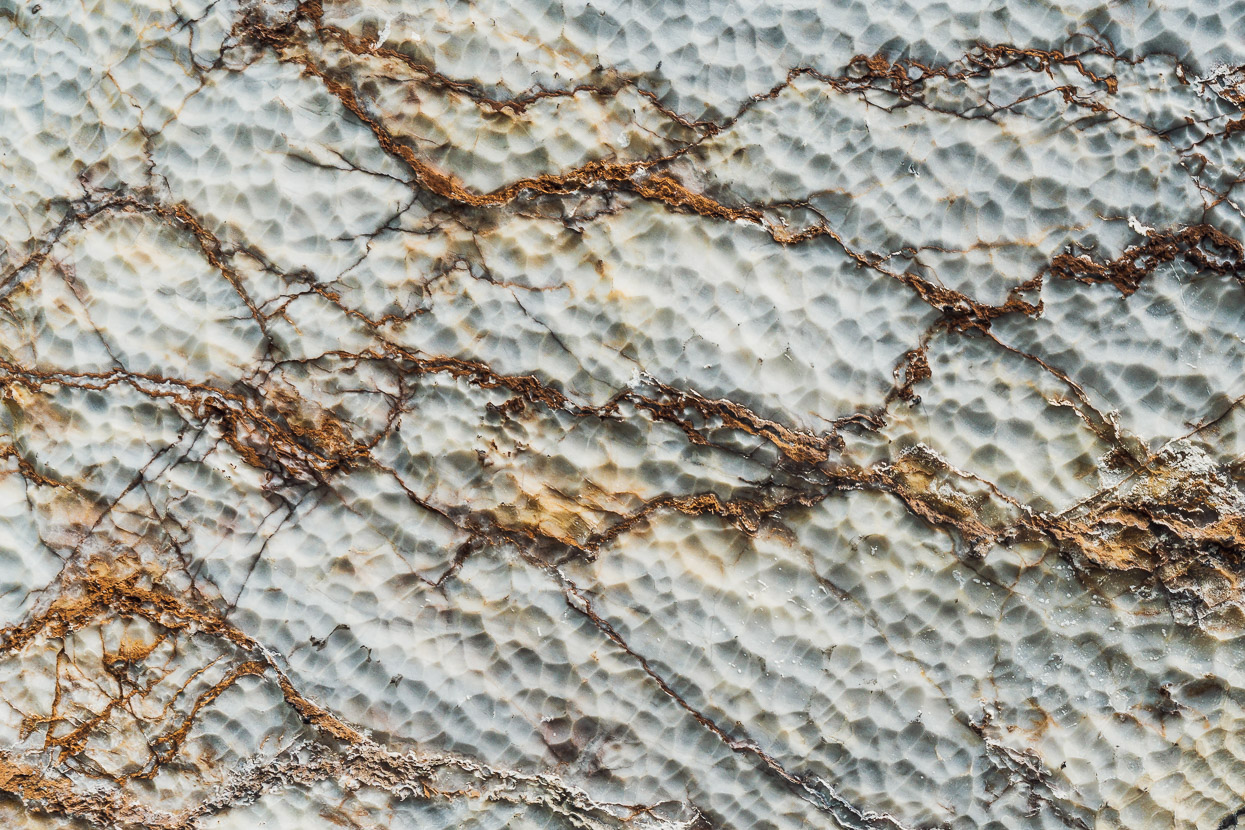
6500 years of wave action has undermined the base of the towers, forming caverns, caves and formations that are beautifully streaked and rippled.
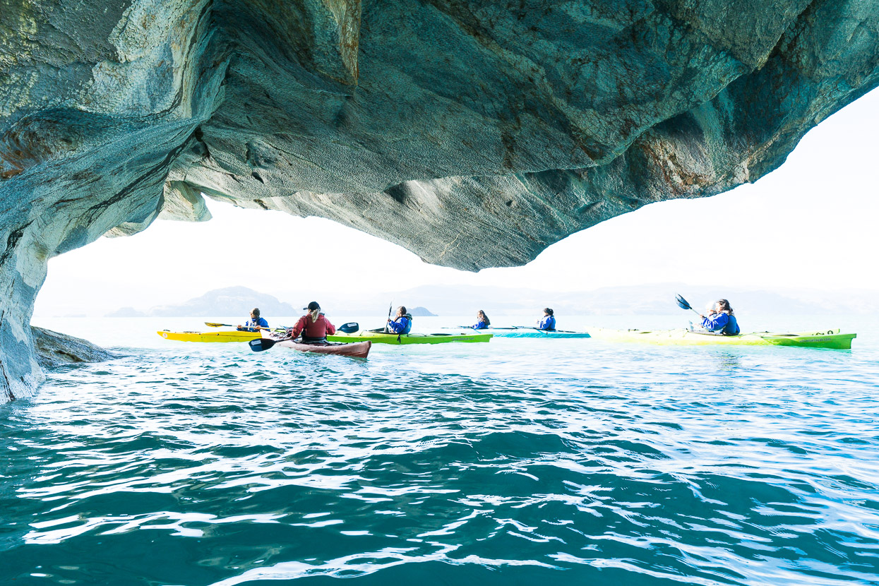
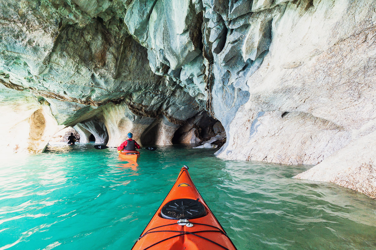
The private kayak tour gave us plenty of time and flexibility to take photos, but it was a tricky exercise on a less than calm day, battling the bobbing kayak, camera, paddle and avoiding collision with either towers or fellow tourists. When we see so many amazing natural landscapes from our bicycles – often for free and usually alone – it did feel odd to visit a mass tourism site, but it was good to do something different. I’d suggest going as early as possible on a calm day for anyone planning on visiting. The guides prefer to go early and afternoons are usually too windy.
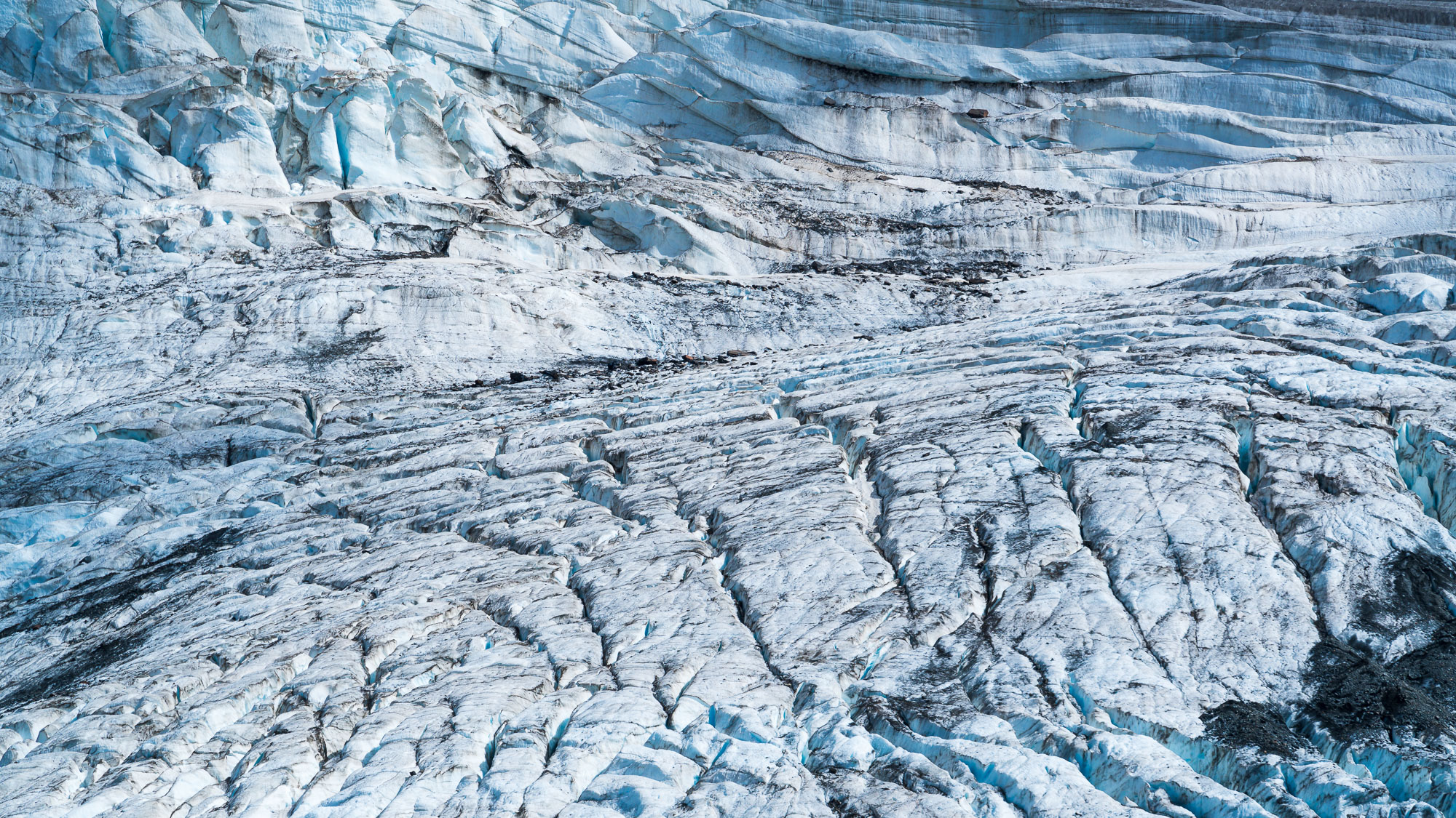
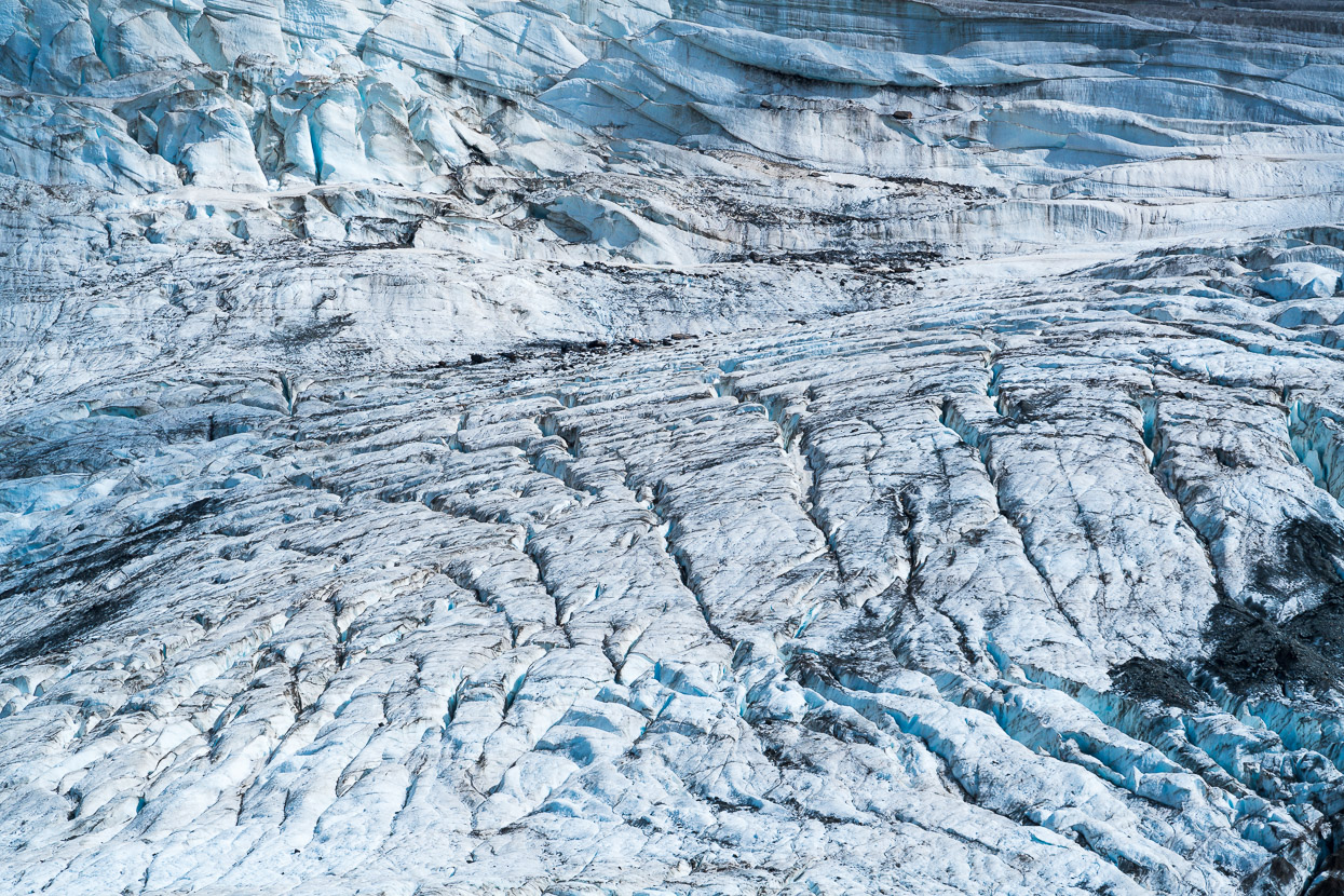
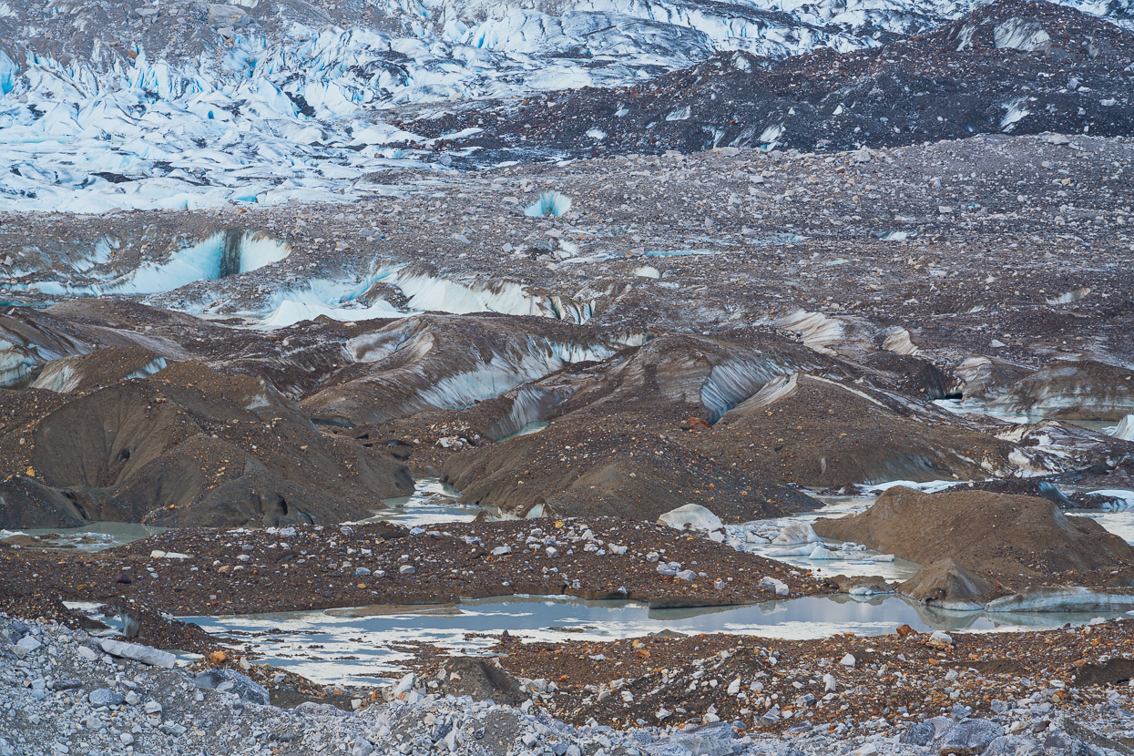
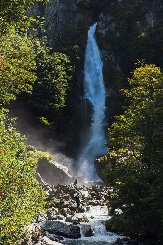
The second big draw for tourists to visit Rio Tranquilo is the Valle Exploradores and glacier. This valley runs from the town for 55km to some viewpoints for the Exploradores Glacier, which flows from the Northern Patagonian Ice Cap. The road continues past the glacier until it reaches close to sea level (and nearly a deep fiord), but we just went as far as the glacier.
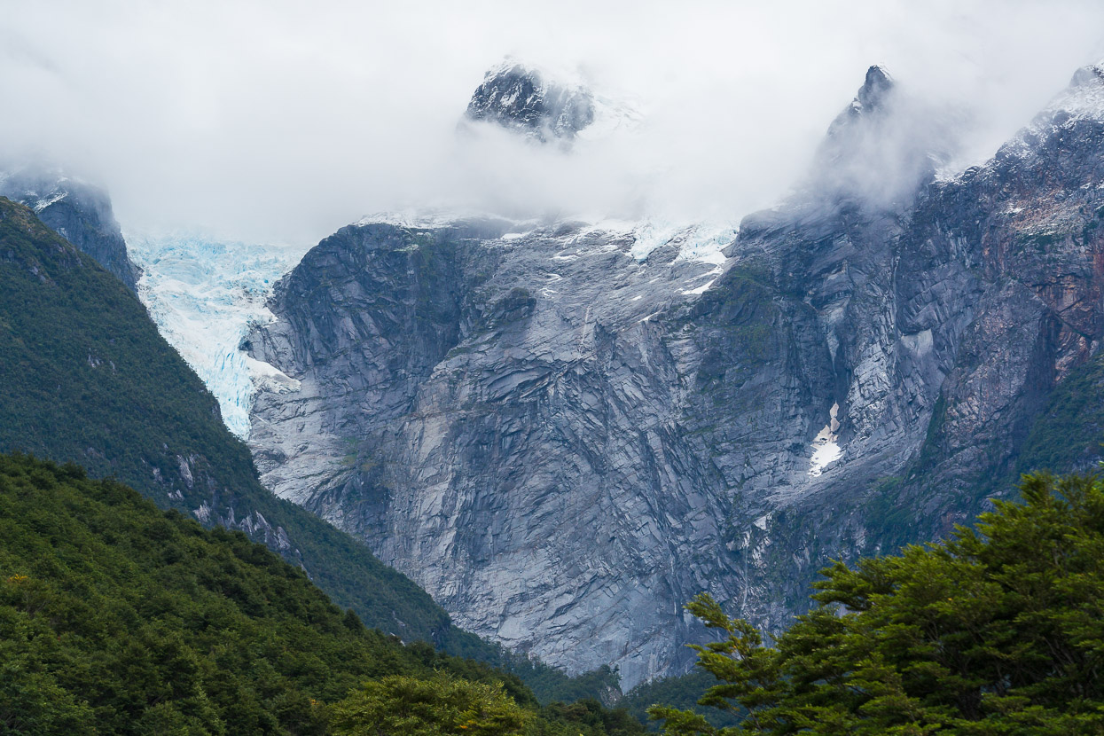
It’s a fantastic ride and is a bit like a gravel version of New Zealand’s Milford Road, with towering peaks, hanging glaciers and thick lowland forest rambling over the valley. We rode in on a rainy day that was slowly clearing so didn’t see much of the peaks, but it was atmospheric.
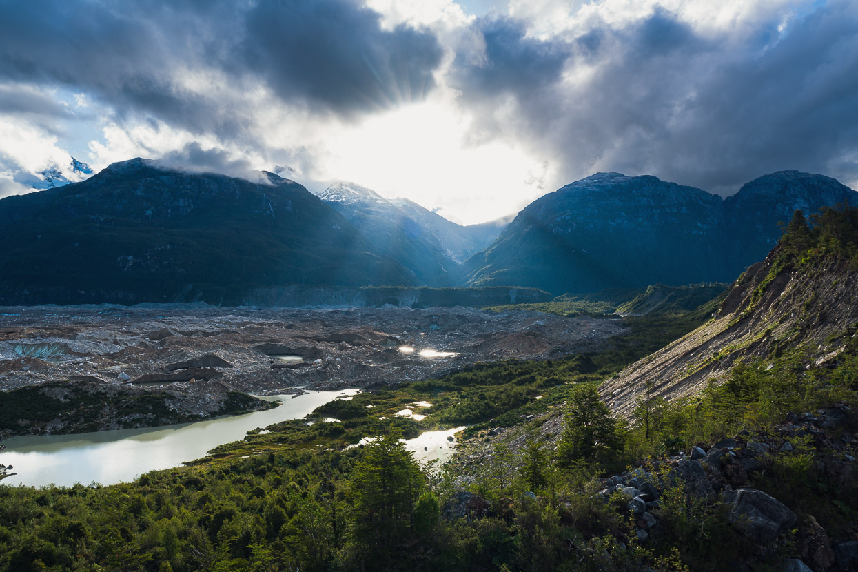
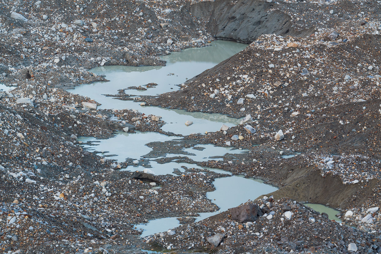
The moraine covered lower reaches of the Exploradores Glacier meet the rain forest at the edge of a tall moraine wall where there are several mirador points.
Commercial tours run guided walks on the glacier and the viewpoints are run by Conaf (Chile’s park authority), (expensive and limited hours) and also by the private Parque Exploradores who have two mirador points and stay open til 9pm. We arrived at about 6pm, walked up and hung out at the mirador til about 8pm and when we enquired about also going early the following morning for more photography they said it was fine to go in on the same ticket. The Parque Exploradores crew were friendly, conservation-minded and run a really nice little operation there.
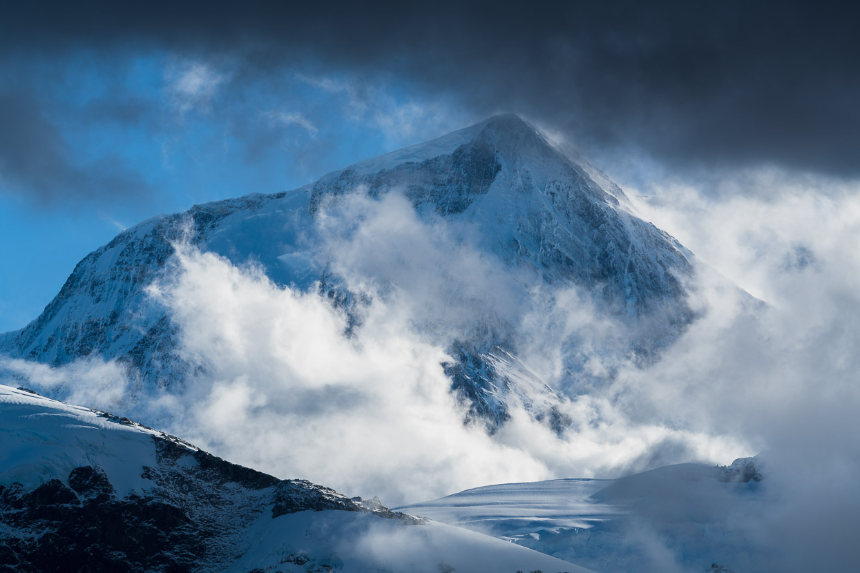
Across the vast stretch of glacier the very remote summit of Monte San Valentin was visible between occasional gaps in the cloud. This is Chilean Patagonia’s highest mountain at 4070m and is the highest mountain south of 37° outside of Antarctica.
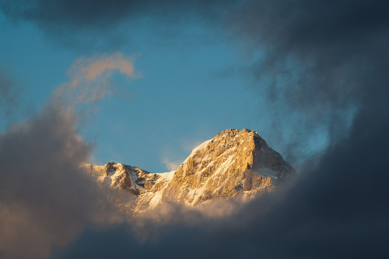
In the morning the freezing wind of the previous evening had calmed, but we didn’t get much of the hoped for light as the sun rose up behind clouds. We did see another distant ice cap peak though.
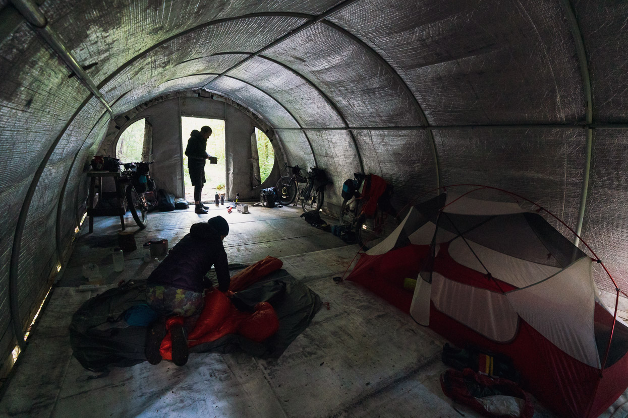
Parque Exploradores run a basic campsite tucked into the bush near their entrance point, but they also have this large shelter which we they offered us to bivvy in. We were joined by Belgian bikepacker Daan Aasma, who is presently riding northbound. Daan is like-minded, great company and gave us a really good route suggestion beyond Rio Tranquilo.
The Parque Exploradores ticket office.
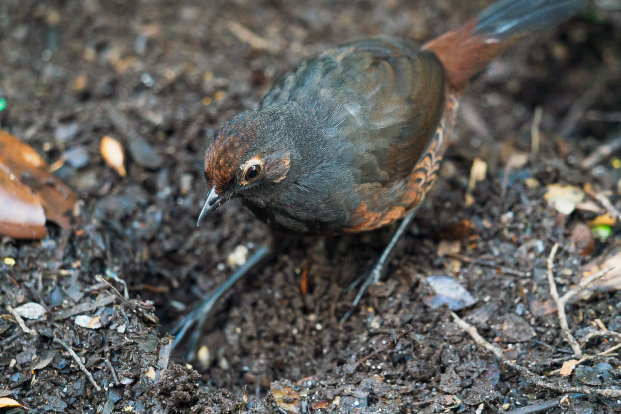
Busily digging holes in the loose dirt surrounding camp was a black throated huet huet. We’ve seen a couple of these now, and while a Google search reveals them to be described as shy, the ones we’ve seen have been quite curious – poking their heads under our tent fly.
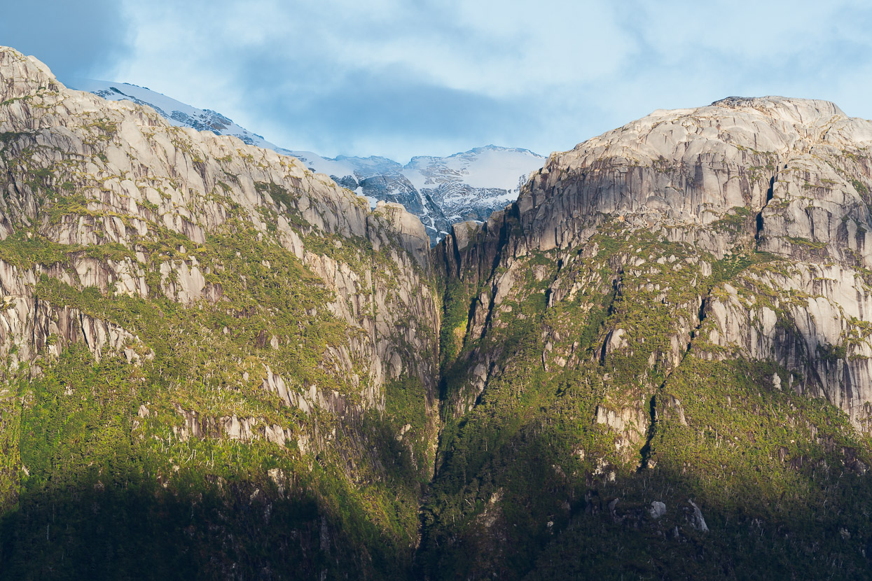
During the ride back out we got the peak views we’d missed on the way in, capped with a touch a snow.
Two became three for a day as we made a slow ride out with Daan, stopping a lot for photos and chats.
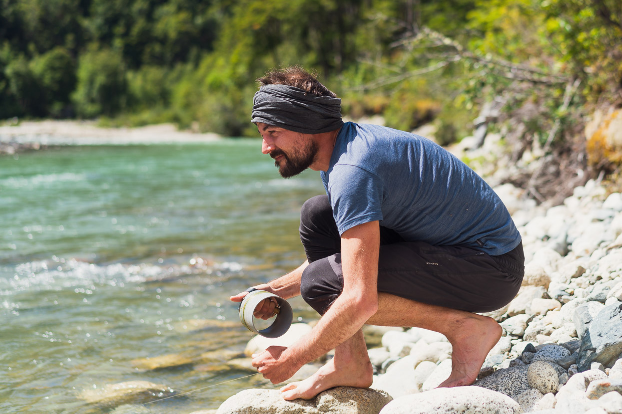
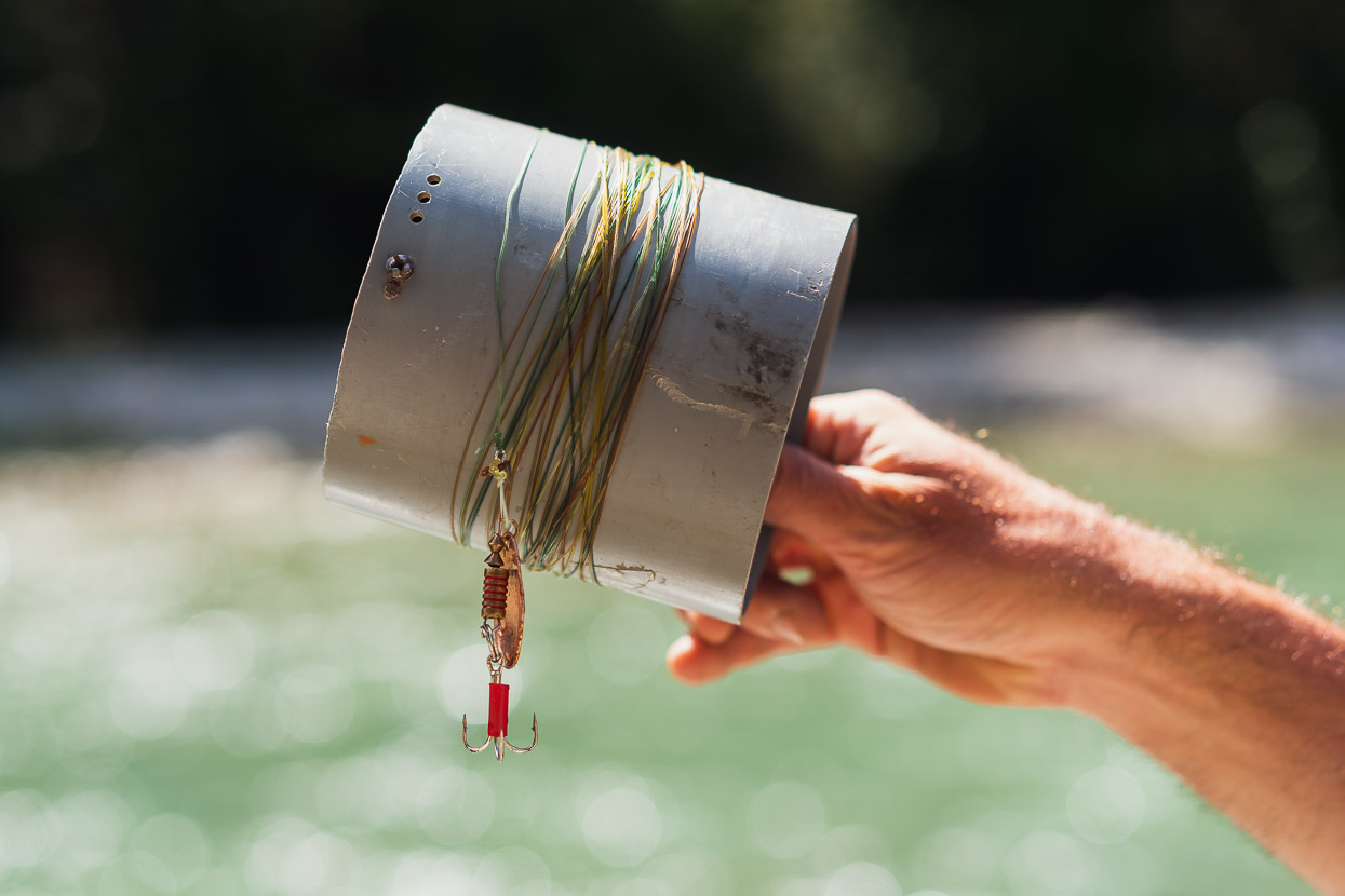
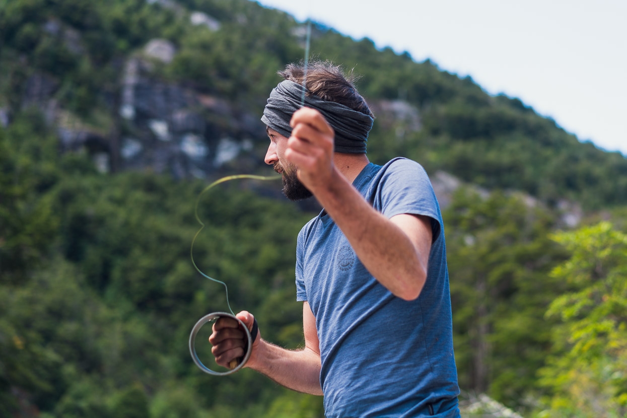
And a bit of fishing too. Daan has become a recent adopter of local trout fishing techniques. He caught one too, but it slithered off the beach right after being landed.
We’d noticed this huge landslide on the way in, but hadn’t thought about the cause, until Daan explained that a huge ice cliff had collapsed into a lake below (hidden from the road) causing a huge lake burst. The landslide completely dammed the river below the road, flooding a large area of forest.
Back in Puerto Rio Tranquilo we spent one more night in the campground, before continuing south for what has been an amazing trio of sights. More soon!
Thanks, Mark & Hana.
Say thanks with a one-off donation, or check out our Bikepacking guide.
If you enjoy our content and find it informative or inspirational, you’re welcome to show us some love with a donation or a book purchase (US$19.99). The services we use to create our Bikepacking routes and host the website cost money, funds that we’d rather be spending on the road, creating bikepacking routes and content to share with you. Thanks for reading!


Your blogs every few weeks are truly a production! So much content and stories. Thank you.
Thanks for the note Dave, it’s a pleasure.
I’m sure you’ve answered this question (many times?), but of South American so far, what section / area is your favorite? We’ve cycled the C.A. in Chile, but looking now for something maybe a bit more adventurous. Adding, we’ve been high in Peru and really liked the areas quite aways south of Machu Picchu (mountain climbing). Altitude is not an issue. Thank you and continued success with your travels…
Thanks Anthony, For us, Peru, Bolivia and northern Argentina (Puna de Atacama) have been best. Peru and Bolivia for the combo of culture, excellent riding and diverse landscapes, and Argentina for the mind blowing landscapes and terrain.
In 2010, when I hitchhiked Carreterra Austral, there weren’t many tourists. I went to the lake under Cerro Castillo using a horse trail that started in the village, and when I got up there I was alone. Then 2 guys appeared. No crowds, no park entrance, nothing. The only thing that was paid around the village was the Cueva de los manos. I even camped for 4 days near the river in the outskirt of the village, just along the road.
Thanks for that history Ivan – yes it’s incredible how quickly mass tourism and social media have changed things.
I’m part of the “mass tourism” crowd but one who has always wanted to visit Patagonia. We enjoyed our travels along the CA as far as Rio Tranquilo. We then traveled to Ushuaia. At age 70 our adventurous travel days are past but we still love the wild nature. Your description of your experience in this region was enjoyable to read. We drove this route to Exploradores during a rainy late morning which cleared in the later afternoon so we experienced some of the same views you did in this area. Just want to drop a comment and express appreciation for your travel blog. Excellent!
Thanks Robert, it’s great to hear you enjoyed our blog and your travels in Patagonia and Valle Exploradores – it’s a beautiful place!