
Late January/early February 2023.
Cycling from Trevelin to Coyhaique has been quite a poignant experience, because it was on this section in 2020 – although mostly via a different route – that the pandemic caught up with us and forced an unexpected end to our journey.
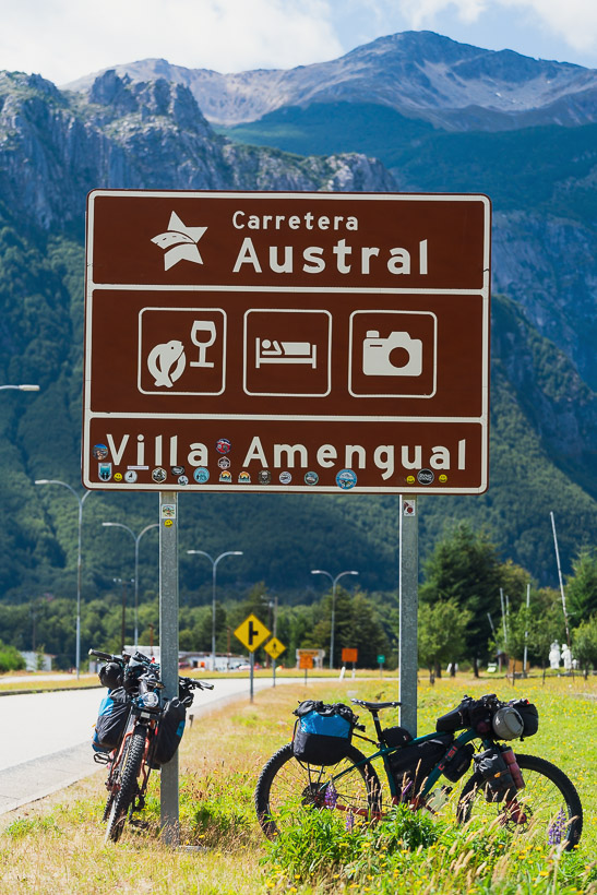
It was also the first time on this 2022-2023 tour that we have been forced to re-ride some parts of our 2020 route in Patagonia, although that has only totalled up to a half day of riding out of Trevelin and then one day on the Carretera Austral. We found a remoter alternative to the central Carretera Austral last time by taking the excellent Paso Las Pampas – Lago Verde – La Tapera route between Trevelin and Villa Amengual, on the CA.
This post covers just over 600km worth of riding, a large part of which has followed the Carretera Austral, but we’ve taken some noteworthy detours off this highway where we could. You might wonder why, considering the ‘remote’ Carretera Austral is one of the world’s most famous highways, and a bucket list item for touring cyclists, but I’ll touch on that further into the post.
Our departure from Trevelin coincided with a rainy spell that perpetuated for a few days, soaking our friends who were already riding on the Chilean side of the border. We had the benefit of being in the rain shadow at first but knew we’d soon be inside the clouds that hung over the Andean foothills.
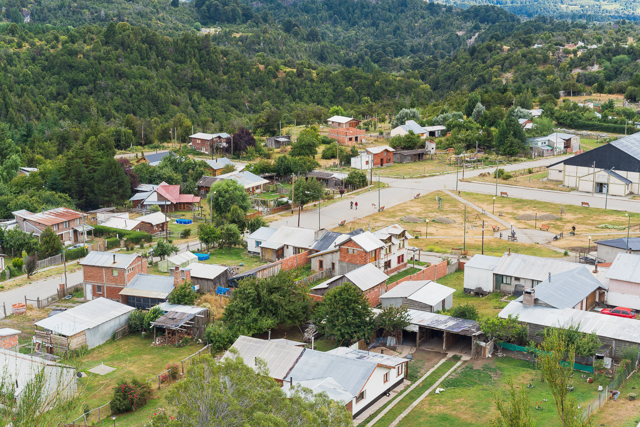
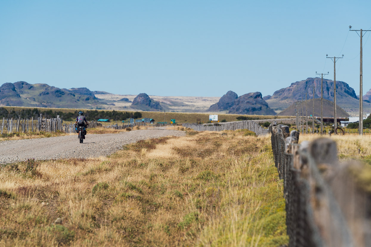
We camped alongside the Rio Hielo after an afternoon of gravel riding and the following morning passed through our last Argentinian town for a while, Carrenleufu.
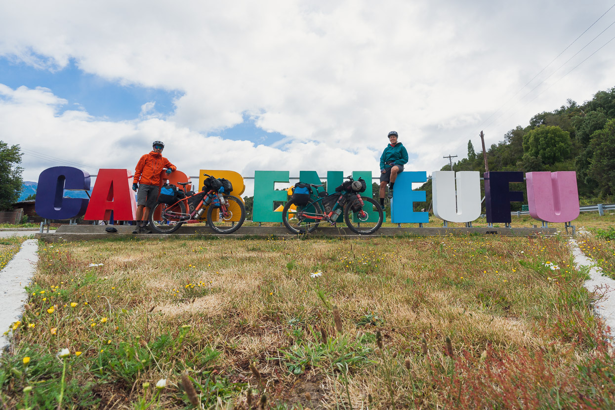
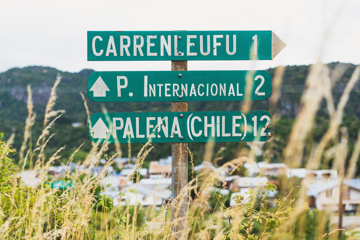
The border is at the river just downhill from town. We stamped out of Argentina for the second time this trip and after a short ride up the hill went through Chilean formalities. A procedure that we are well used to now. While Argentina’s policies are very relaxed, Chile requests that you register your bike (make, model, serial number) every time you enter the country, a procedure that depends heavily on the competence of the officer registering it. Sometimes it can take quite a while.
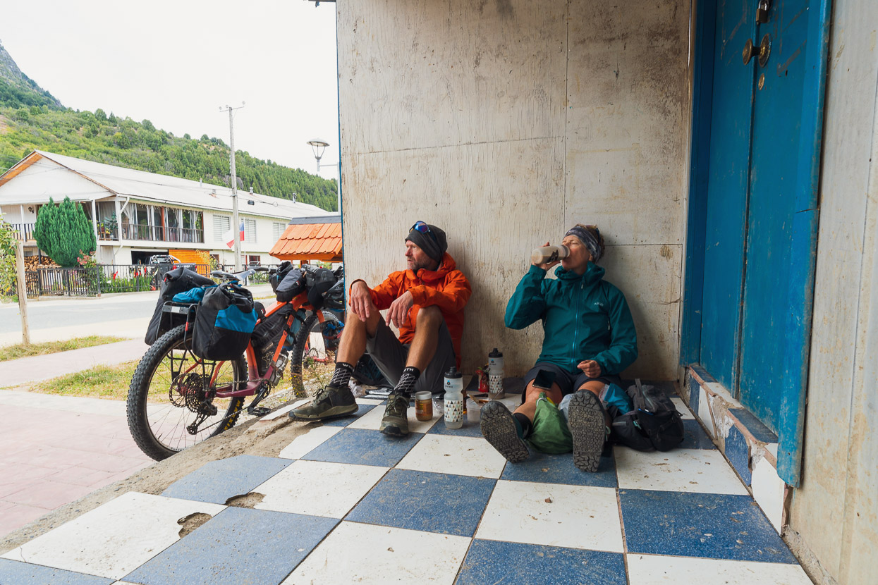
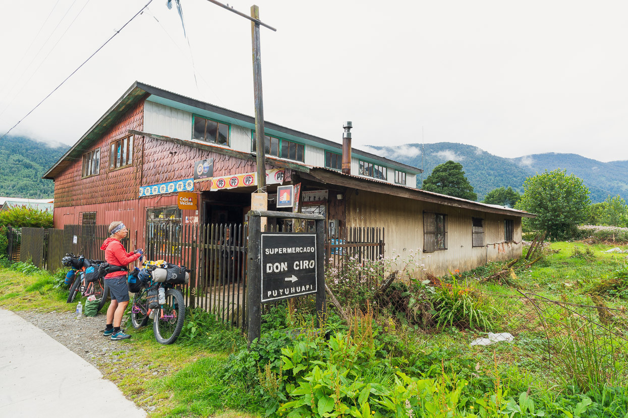
The small town of Palena was our first stop in Chile but a cold wind blew drizzle through the main street so we tucked into an unkempt porch for shelter to eat lunch, as if it were a boulder on the pampa or a riverbank, indifferent to the fact that it was an urban setting. Long term bikepacking has a way of simplifying the way you view your surroundings: shelter is shelter, trees and road signs are useful for leaning your bike on, water is always important, picnic tables are like the King’s dining table and a shop provides the opportunity to buy something that tastes different to the things you’re already carrying that you’ve been eating for the past couple of days. The closer you can position your bike to where you are sitting or lying the better, because the last thing you want to do is waste energy walking back and forth from your bike and belongings.
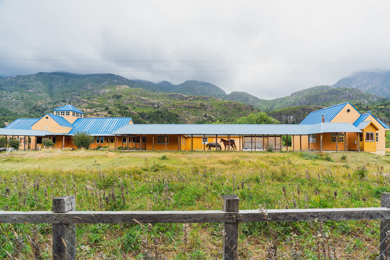
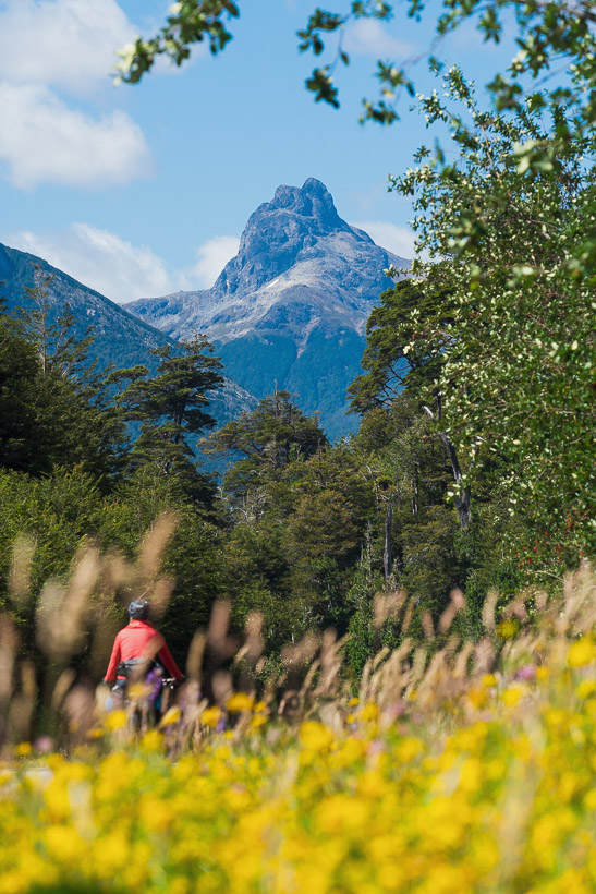
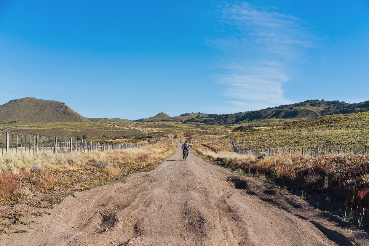
Given the choice of two roads, the smaller one is our usual default. The road that connects Paso Rio Encuentro, Palena and the Carretera Austral is hardly what you’d call busy, but there was an alternative that passed through the temptingly named Los Gatos (the cats) and El Tigre (the tiger). Being cat people, how could we resist that? Rural roads often provide unexpected or quirky scenes – such as the horses at this school which was closed for the holidays.
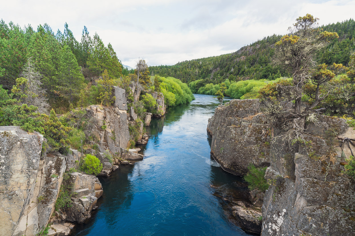
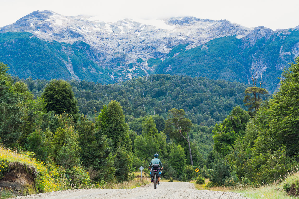
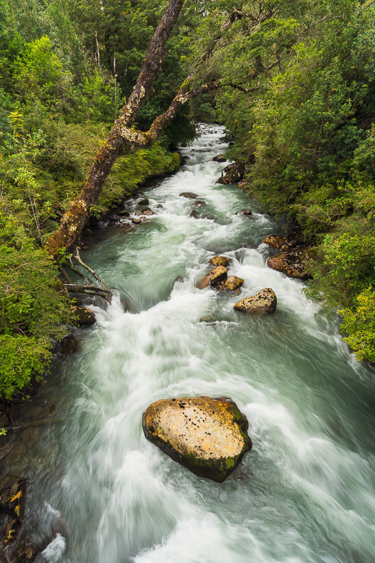
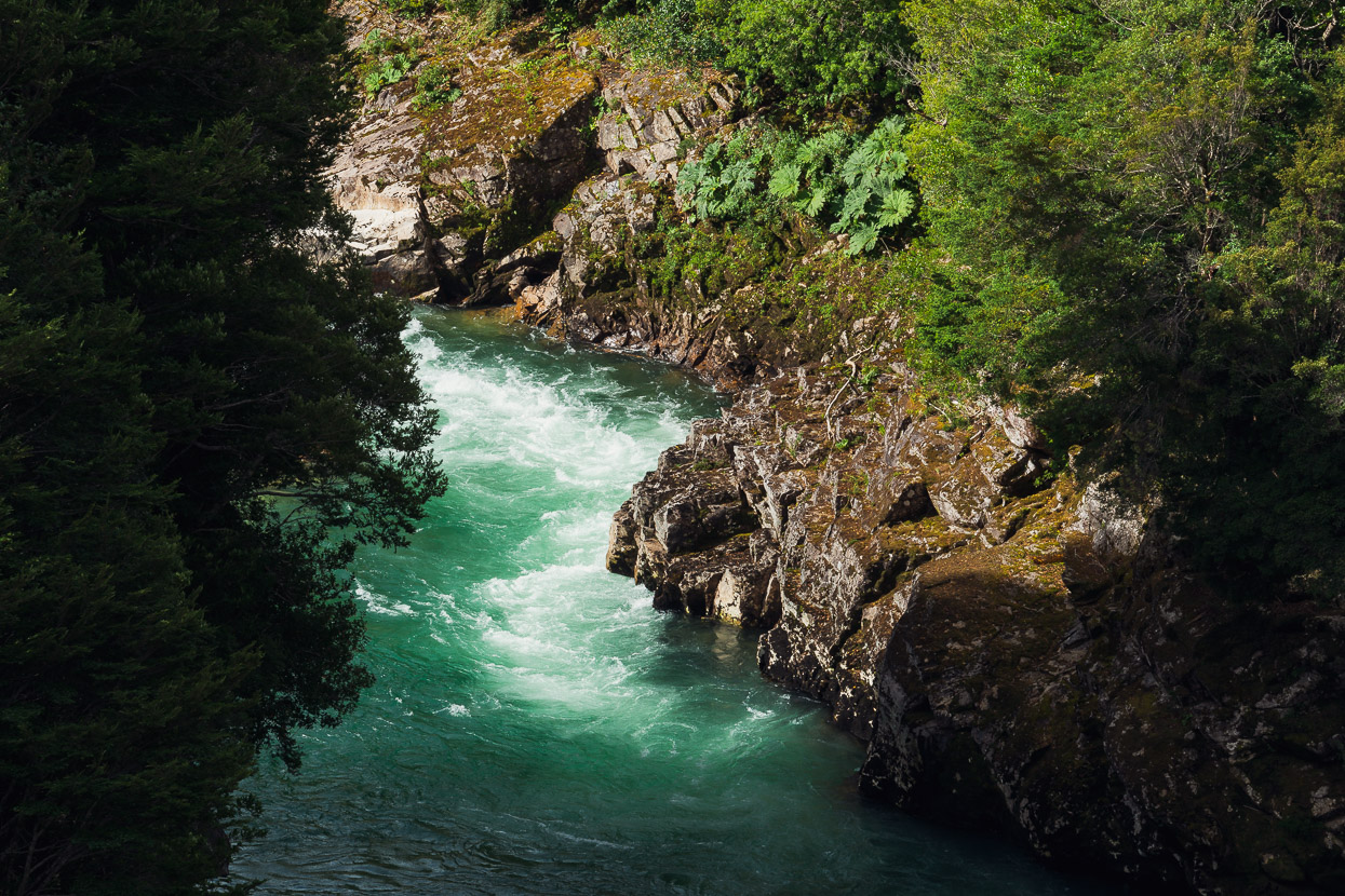
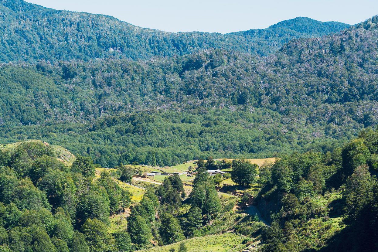
The road was quite good: deserted, scenic and typical for this region, with farms and grazing blocks surrounded by nothofagus (southern beech) forest. Some of the time we followed a crystal clear river.
But then it began a series of super steep pitches as it climbed high around a gorge. This was quite hard work, and I would not recommend it to anyone carrying more gear than us.
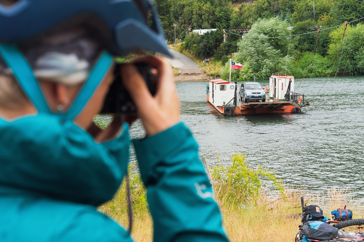
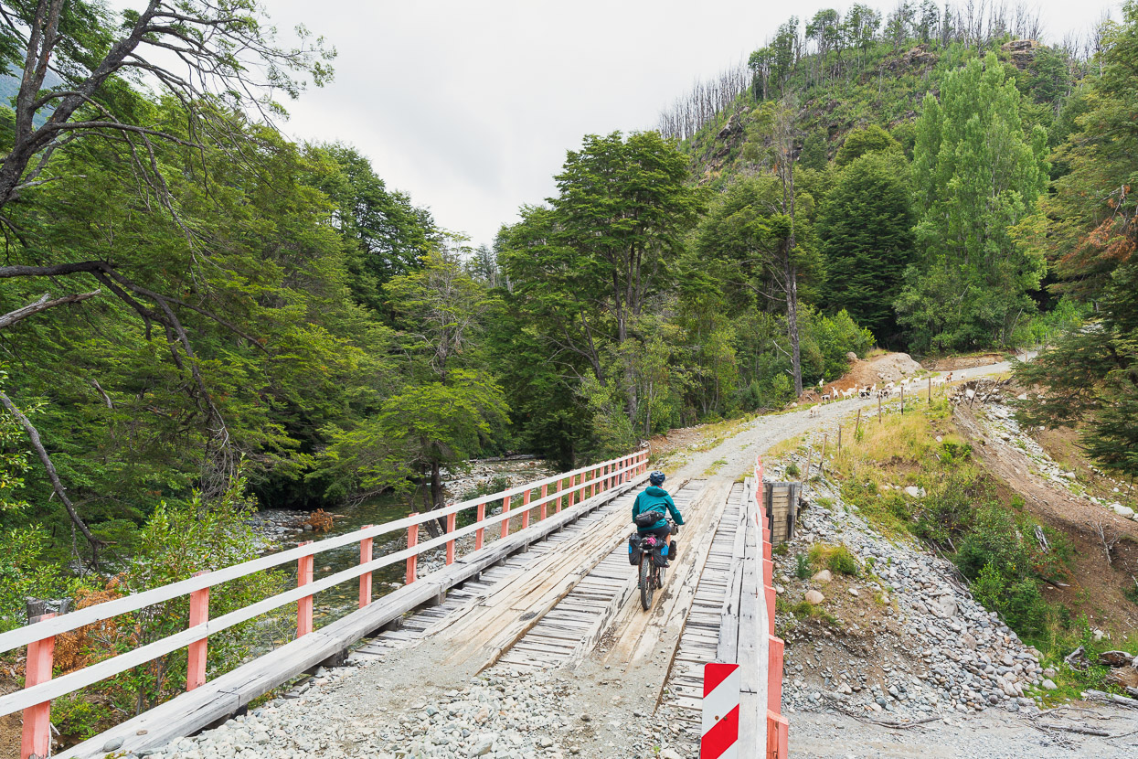
There were no cats to be seen at Los Gatos, and El Tigre is the site of a ferry crossing over the Rio Palena. A pleasant novelty, and it was free too. From the ferry we rejoined the Ruta 235 at El Malito and pushed on into the early evening through rain showers. Already the landscape was a huge contrast to the environment we’d been in just a few days earlier as we’d crossed the pampa of the Patagonian Steppe to reach Trevelin, with abundant water, lichen draped trees and towering granite cliffs.
An ungated (rare) farm track provided the opportunity for a wild camp in the bush that evening and the next day we joined the main road between the Carretera Austral and Paso Futaleufu, passing Lago Yelcho.
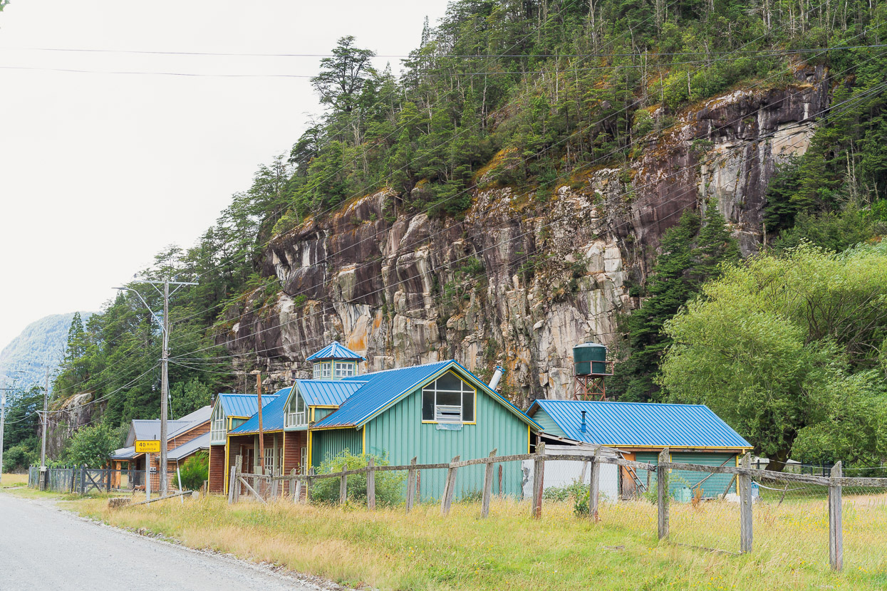
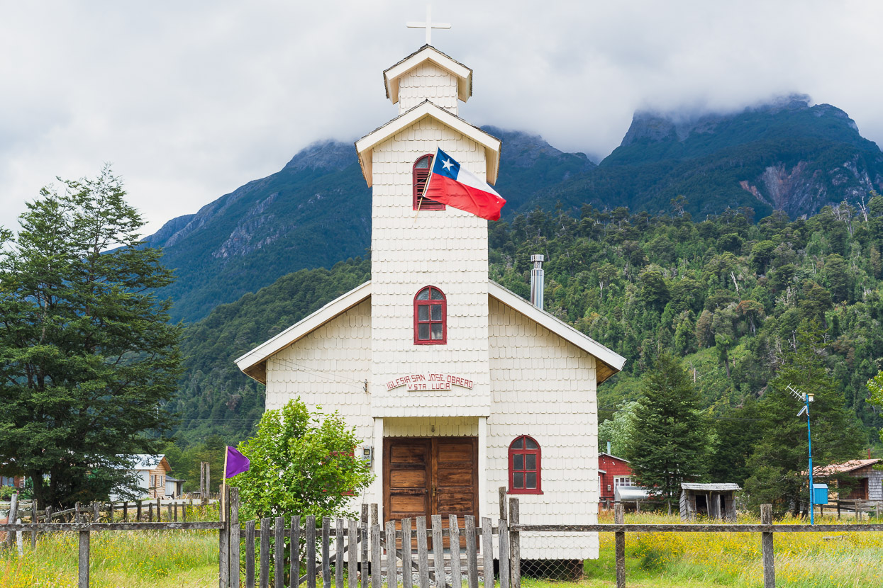
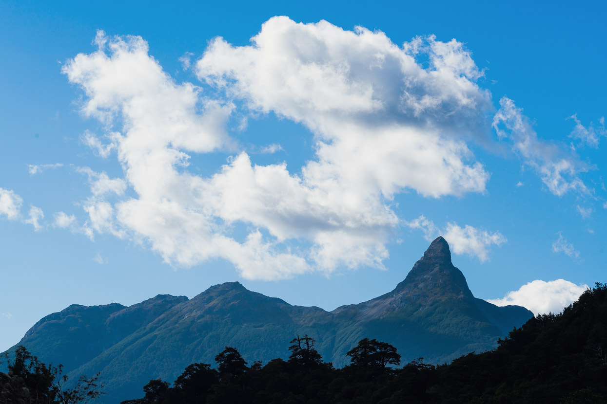
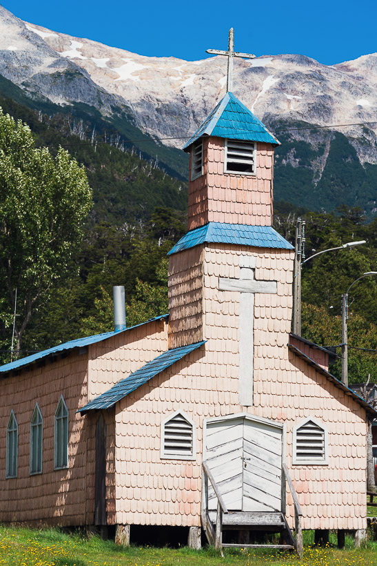
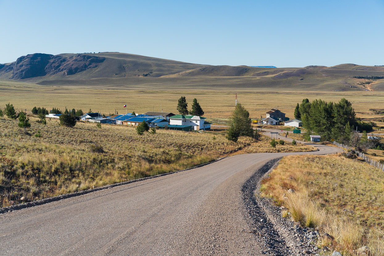
We joined the Carretra Austral at Villa Santa Lucia. Wooden tiled churches, such as this one are a typical sight in the highway’s small towns, and the steep forested mountains are a classic scene on this central section of the highway.
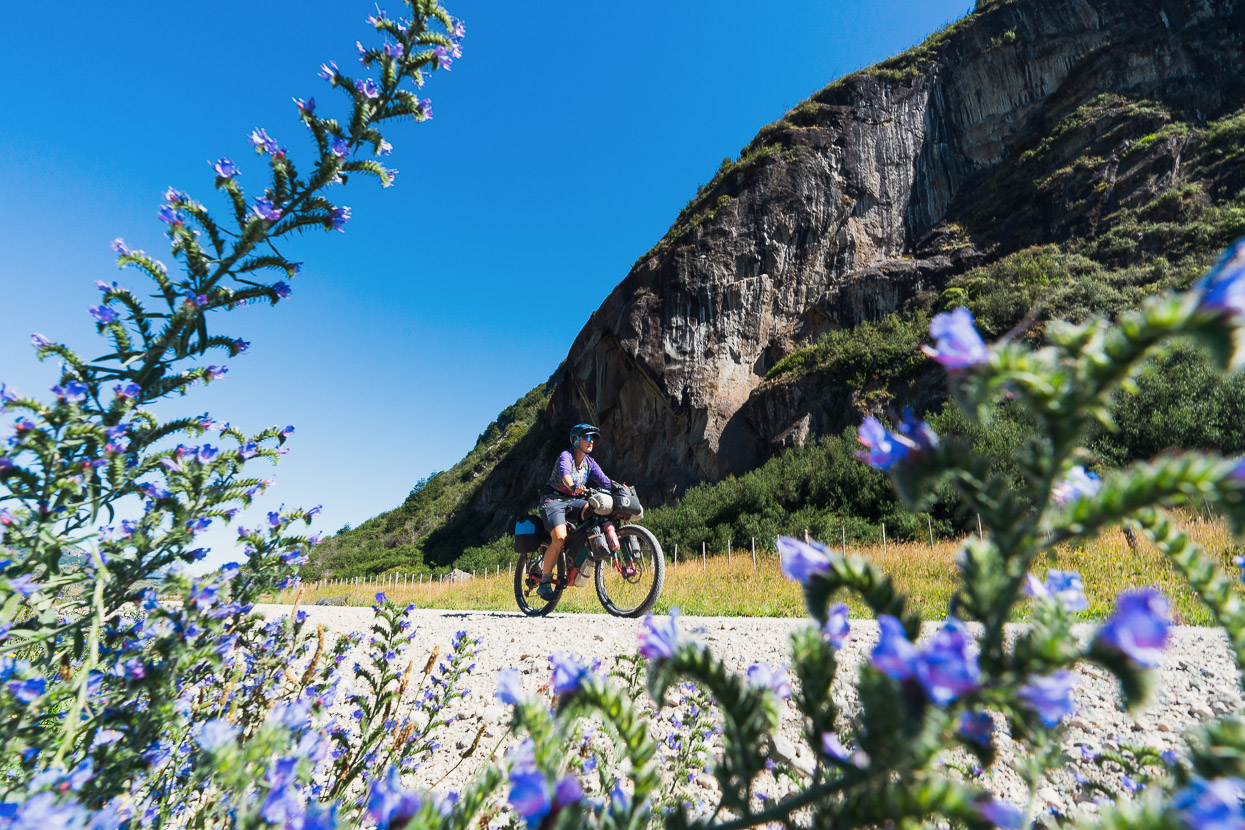
Cycling on the pavement of the Carretera Austral was a novelty, but we soon tired of the traffic zipping past at speed (it’s quiet until about 11am). While the scenery along the road is beautiful, the width of the road, its verges and the occasional margin of cultivated land can make you feel quite far from nature as you cycle along it. An upside though is the fact that every inch of this world famous highway is documented in the iOverlander app, meaning that it’s very easy to plan ahead for wild camps, recommended scenic spots, good supermarkets or campgrounds, etc.
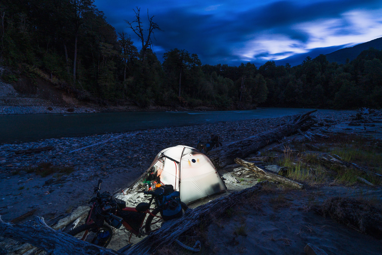
This spot, just outside Villa Vanguardia, was one such place; an idyllic peaceful river, with no-one around except one other cyclist, about 1.5km from the highway.
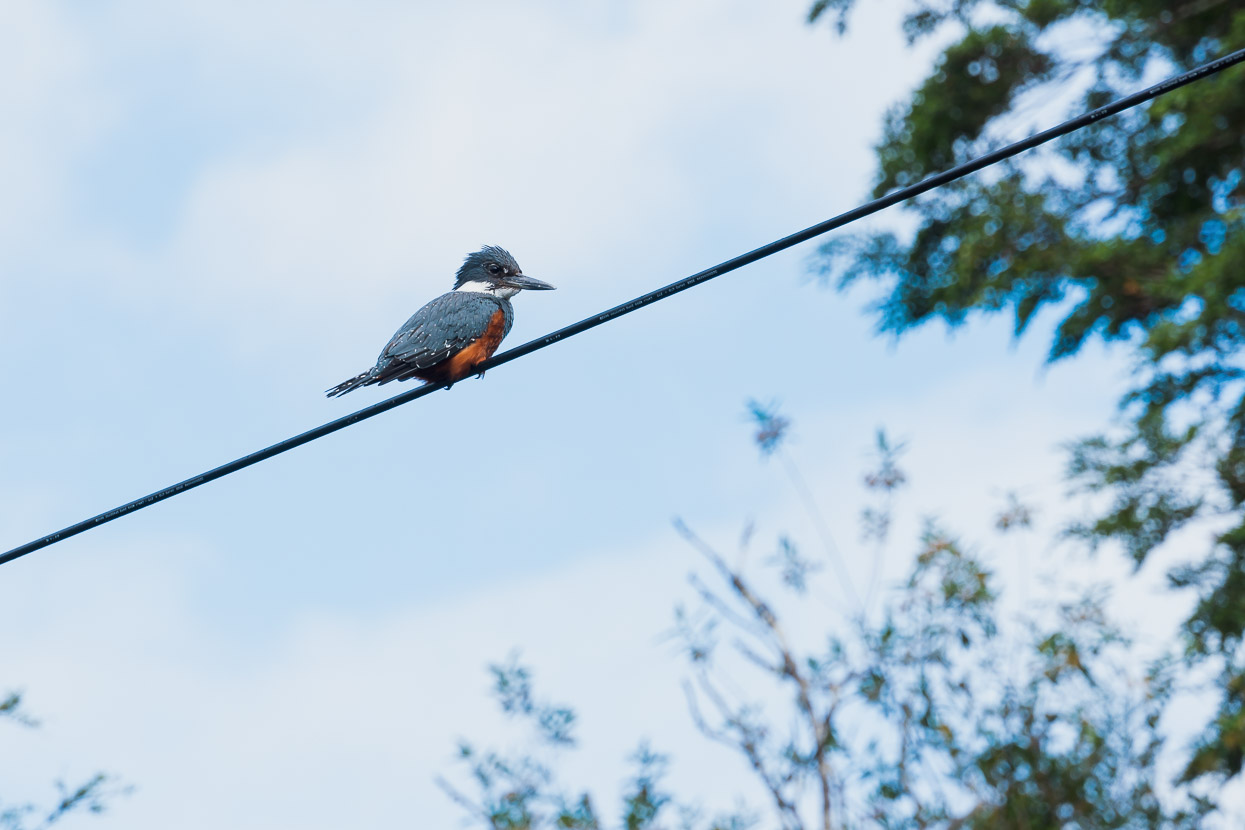
Back on the road in the morning we were happy to spot this large ringed kingfisher (the biggest kingfisher in the Americas) waiting for its breakfast in the river below. We’ve also spotted a couple of native Chilean pigeons, which look much like NZ’s kereru, except brown toned.
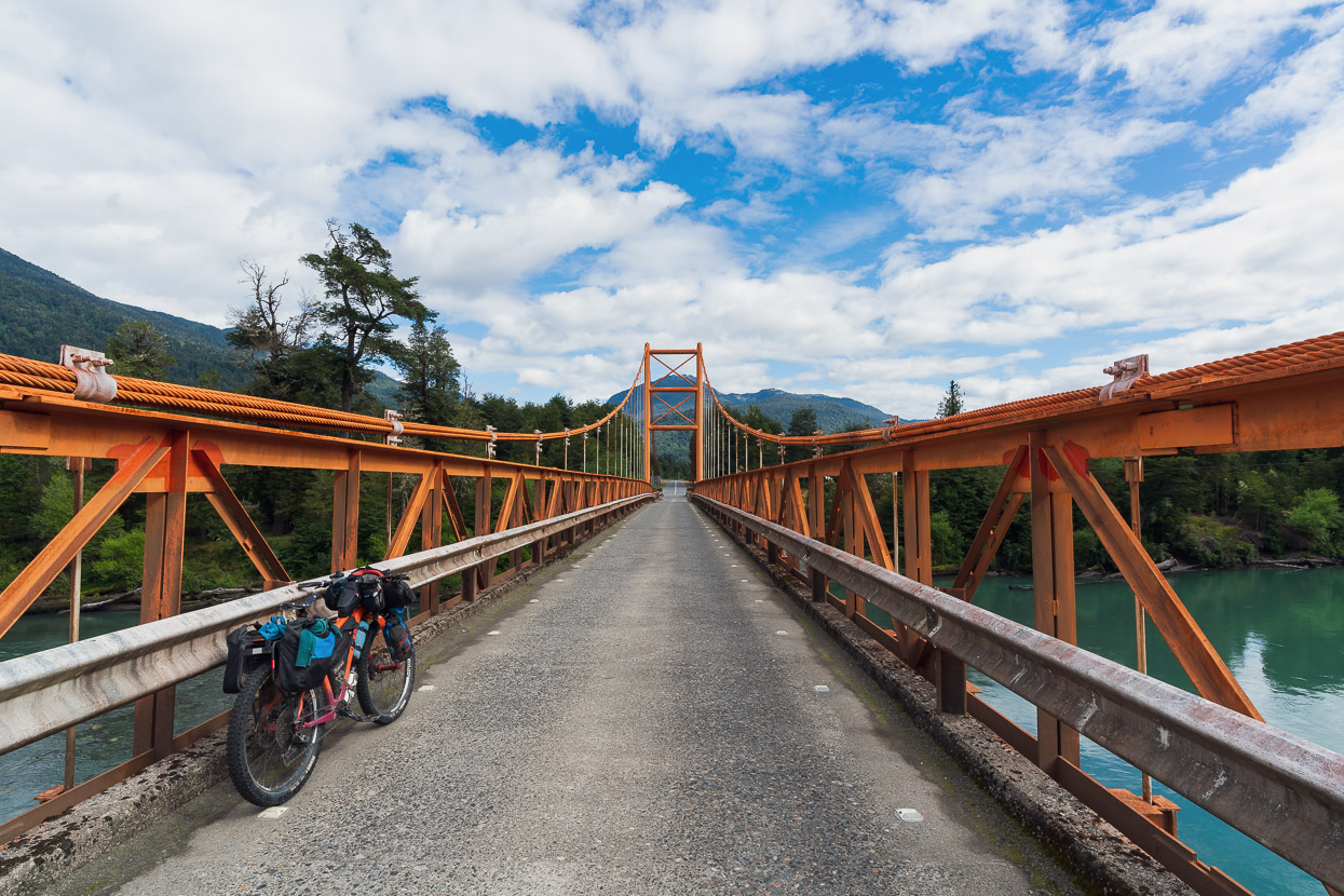
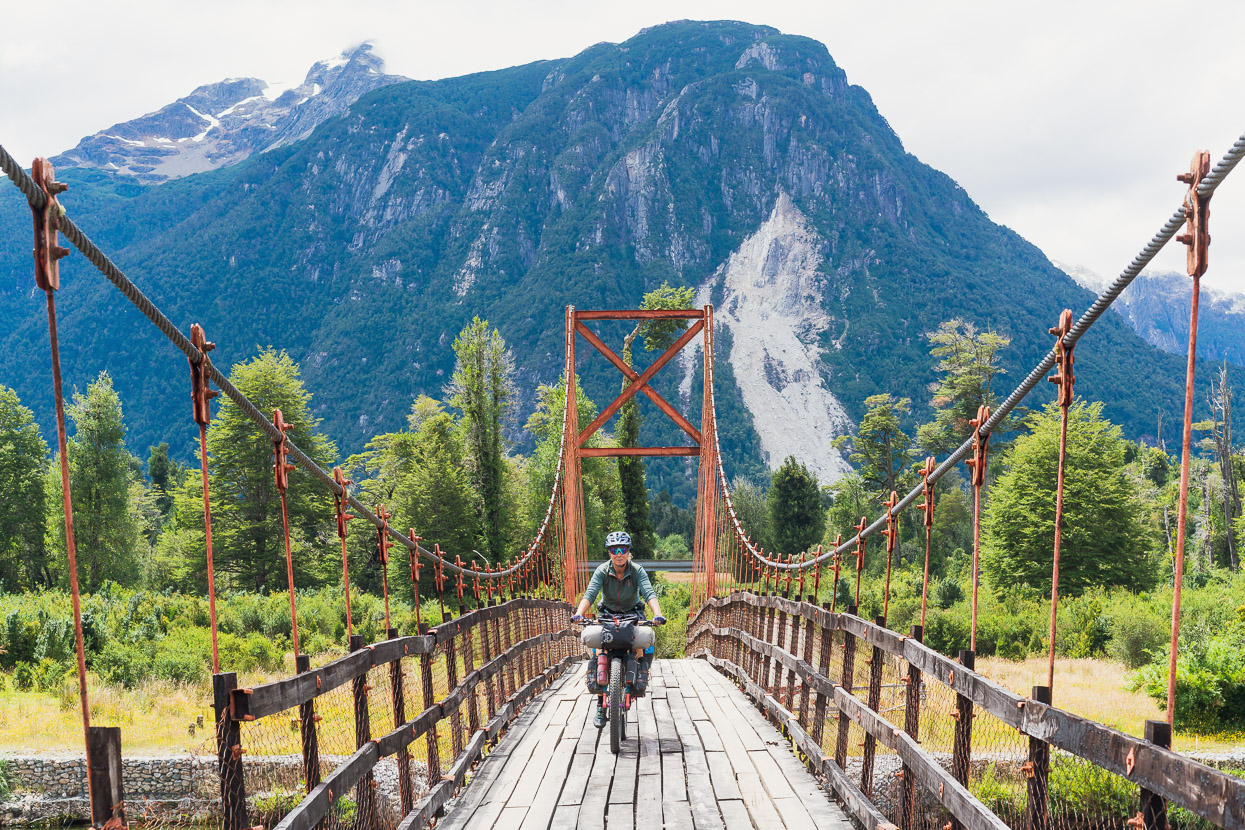
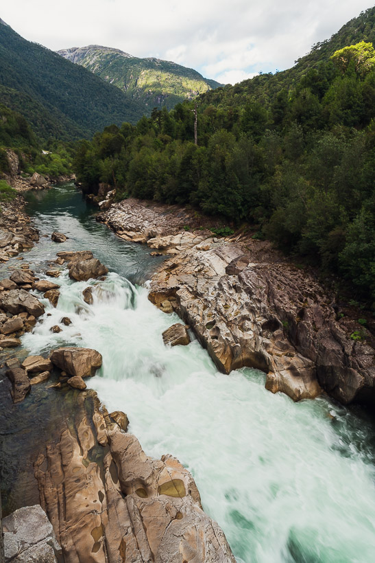
A quiet moment on one of the Carretera Austral’s impressive bridges. The rivers that drain the highway’s valley corridor are fed by numerous large alpine catchments and are consequently huge.
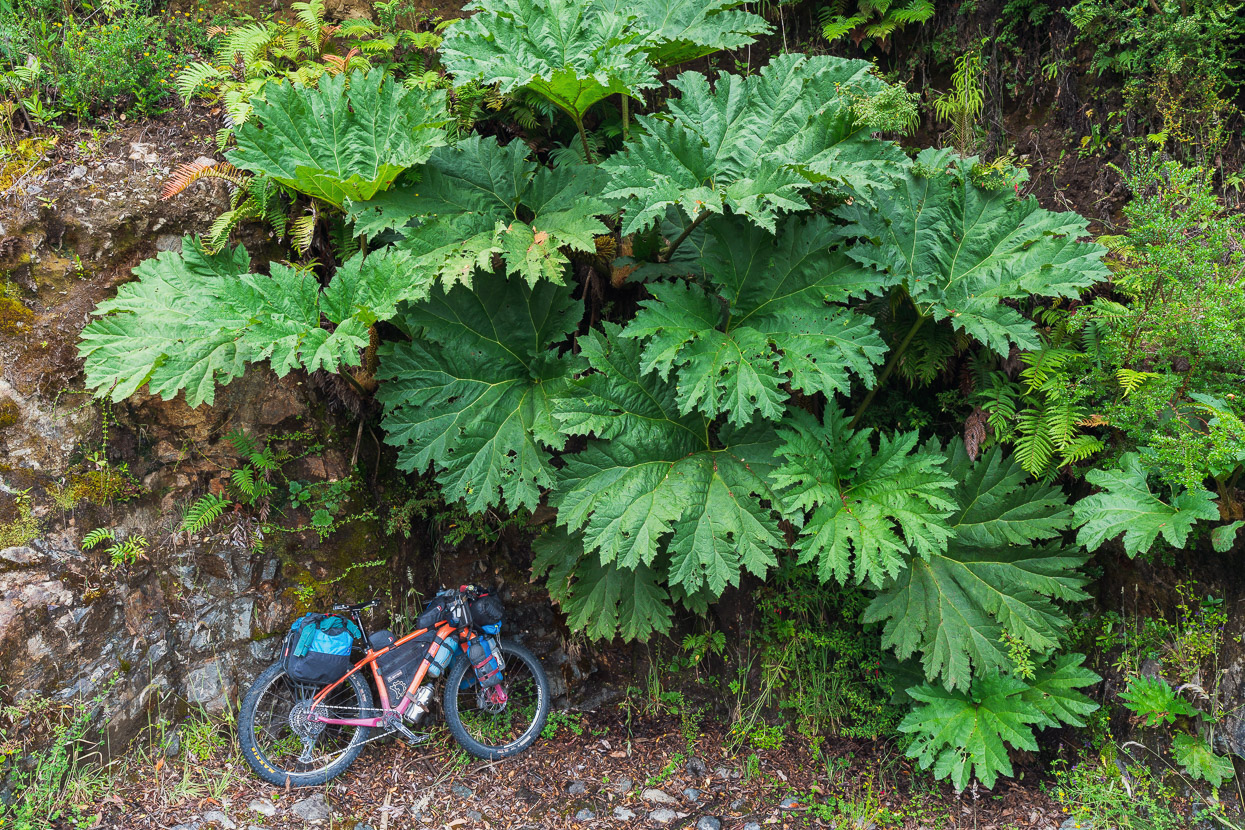
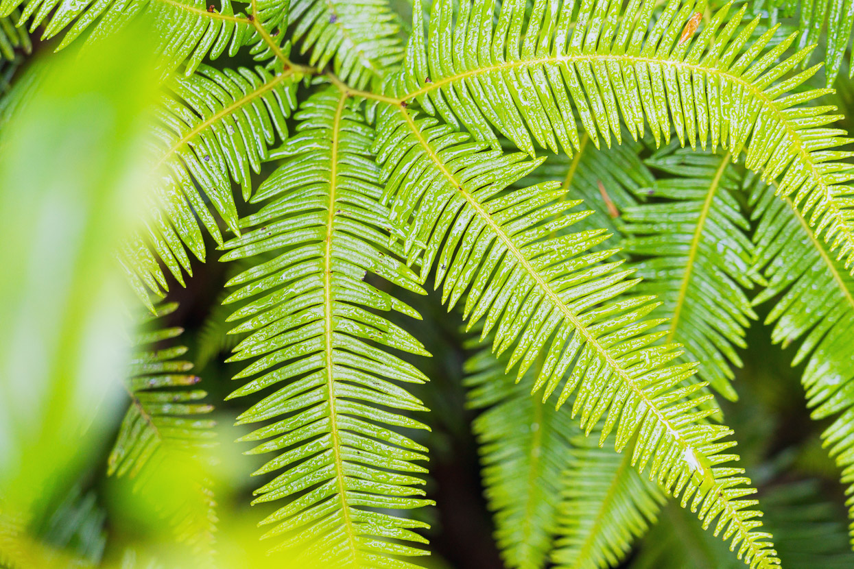
Some of the plants in this high-rainfall zone are huge too, such as the nalca, sometimes called Chilean rhubarb.
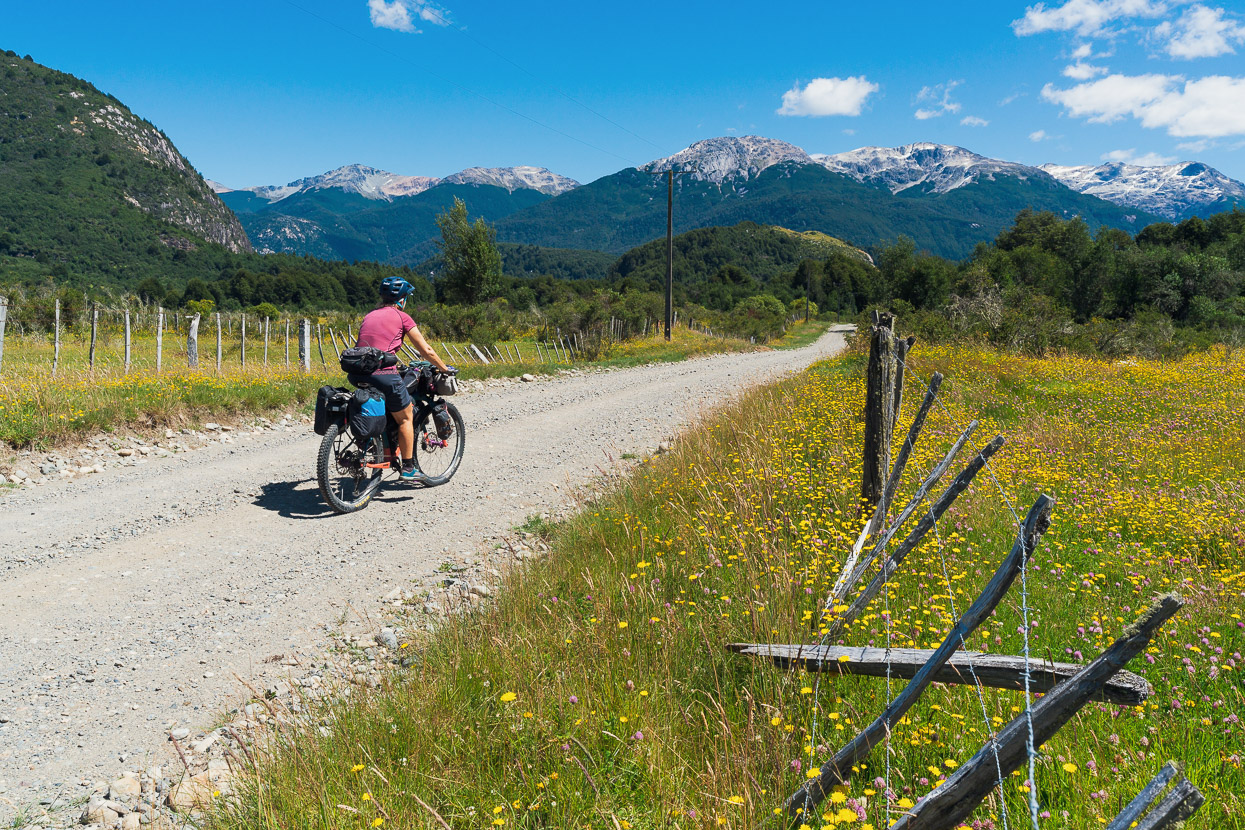
The first diversion we took off the highway was a 40km section which turned off on the X11 about 15 km from La Junta and rejoined the highway just before town. The road climbed steadily but we were immediately rewarded with more intimate mountain views and roads that were more fun to ride, as we passed small farms and Lago Claro Solar. The best section of this road is from the turnoff to the junction with the X13 – after there the scenery is less interesting.
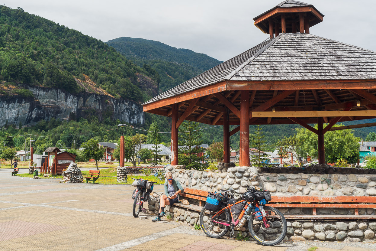
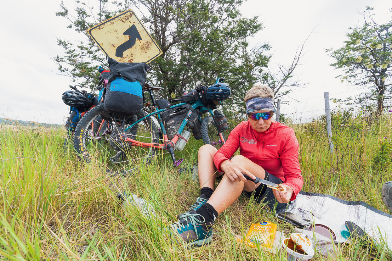
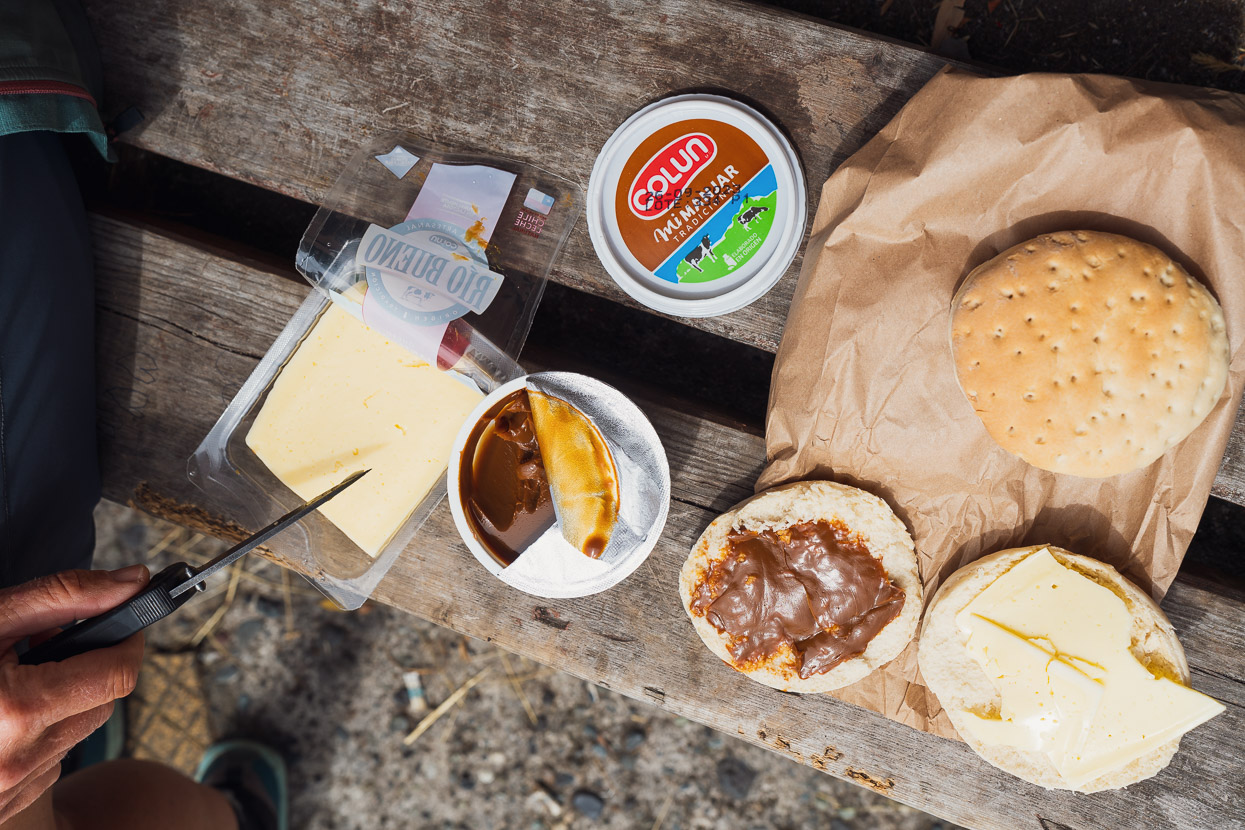
Lunch in the plaza in La Junta after a rare morning off riding for me to catch up on some work. We’d been warned that southern Patagonia was expensive, but it was still a shock to make a resupply in the store here. Treats from a panadería are now just that, rather than the default. And meals out are a once a week (or less) luxury. Lunch most days consists of bread and cheese combined with either manjar (Chilean dulce de leche) or dulce de membrillo, which is a thick (and delicious) fruit paste made from quince.
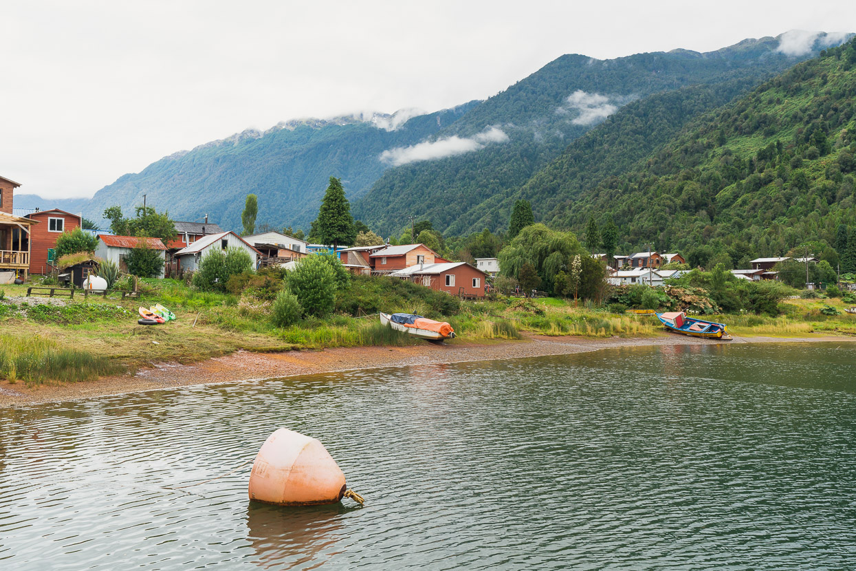
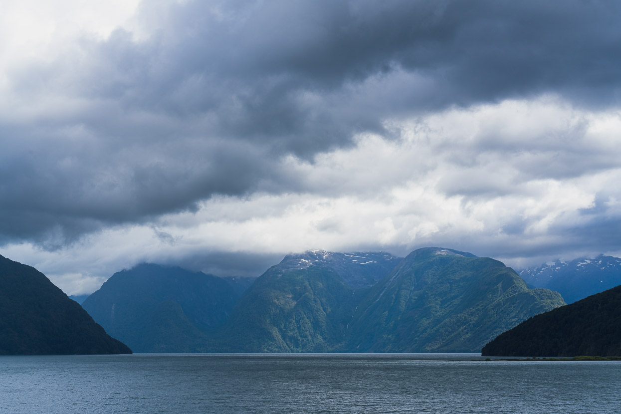
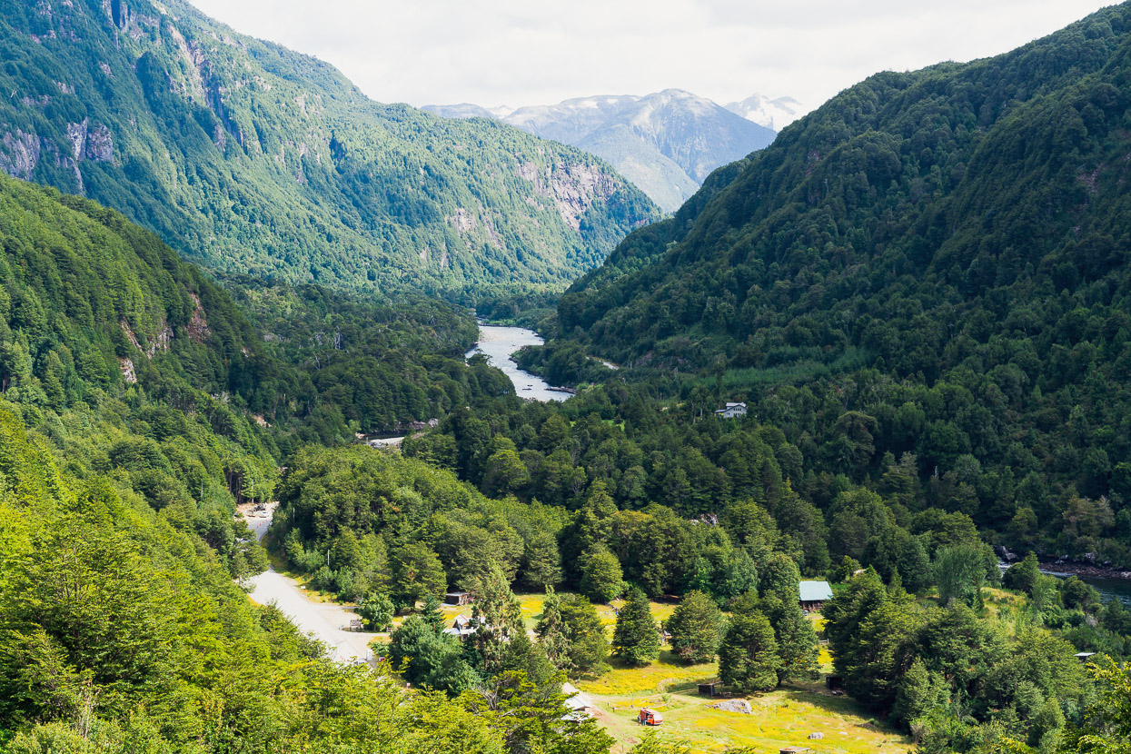
This small town of Puyuhuapi sits on the edge of a very deep fiord and was the first time we’ve seen the sea on this journey. From there we rode on and wild camped in the forest near the Ventisquero entrance to Queulat National Park.
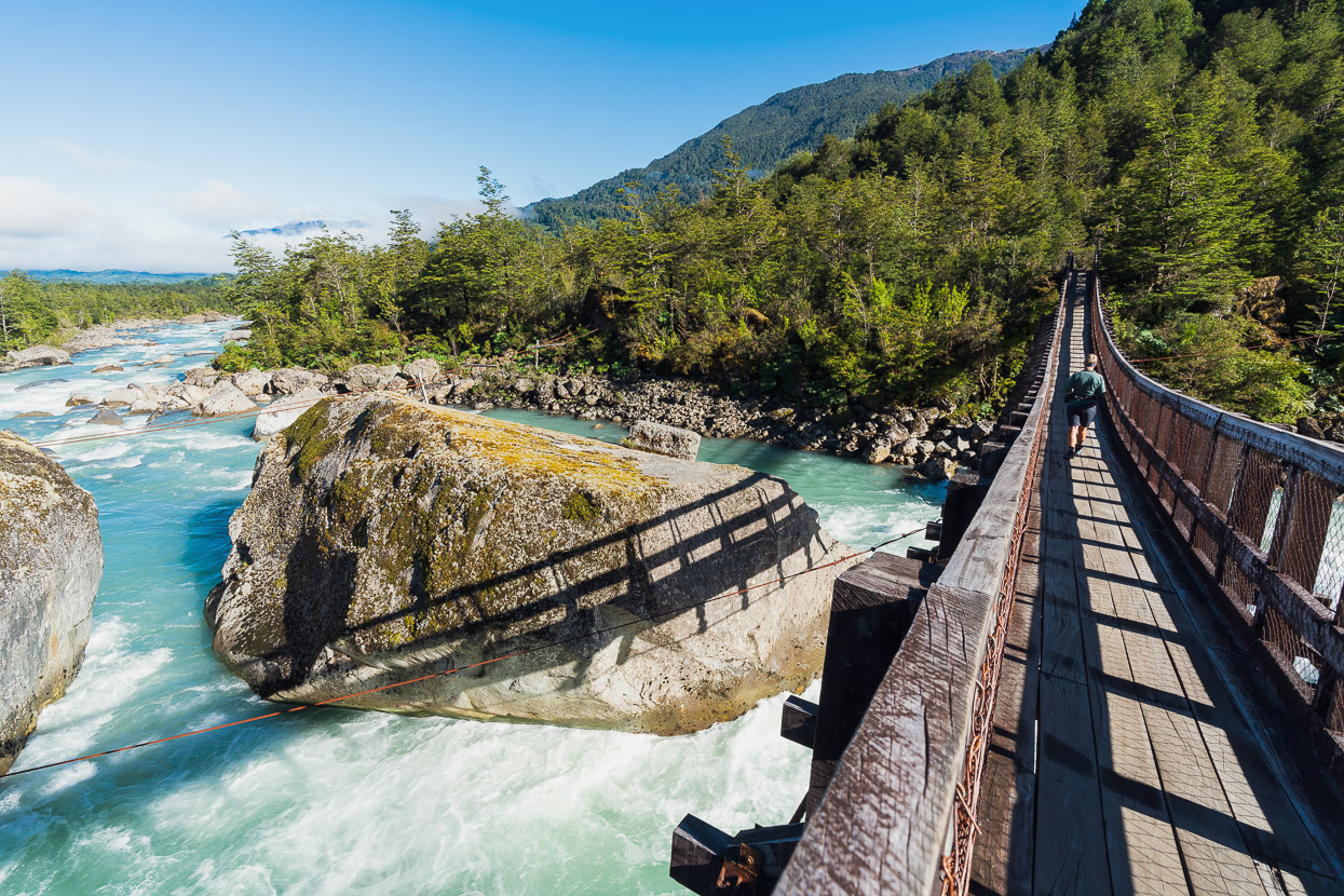
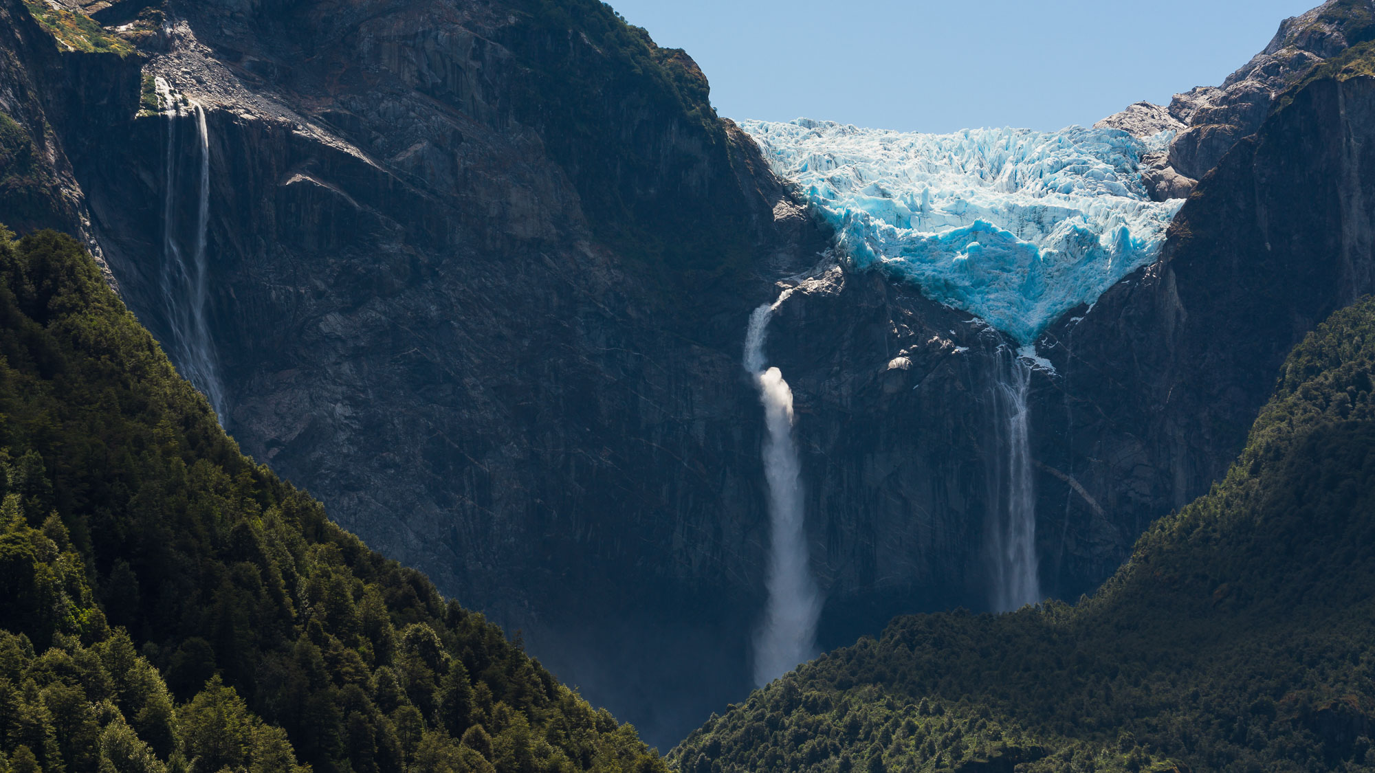
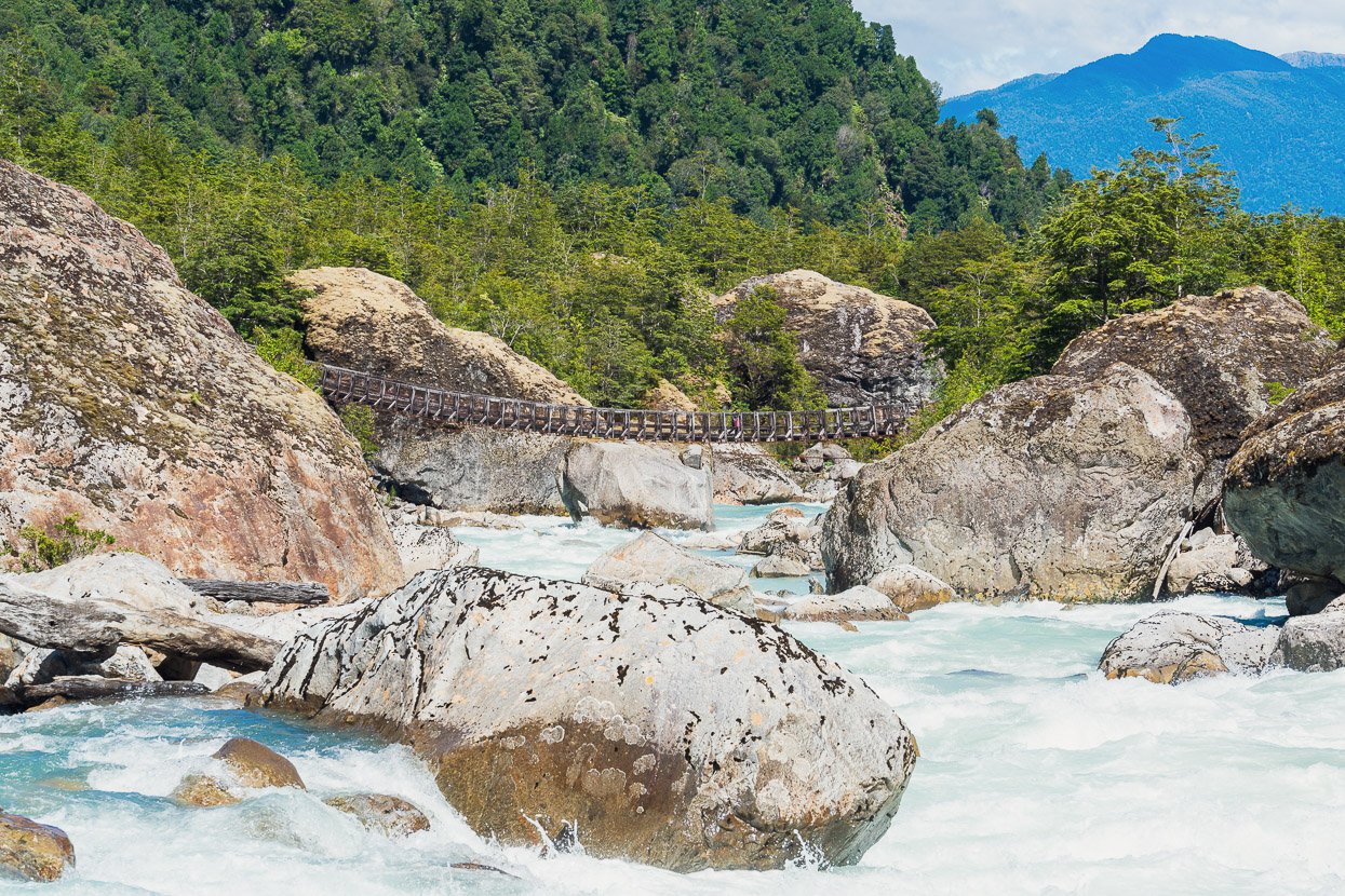
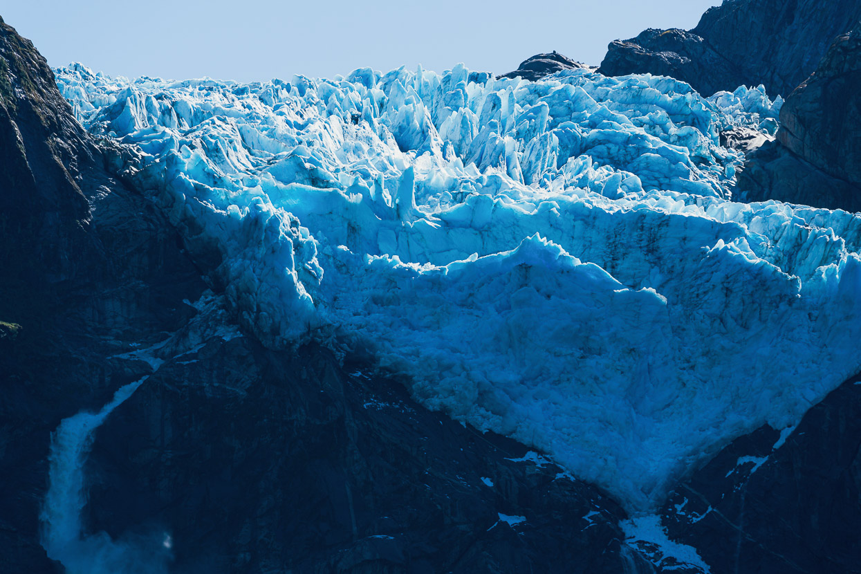
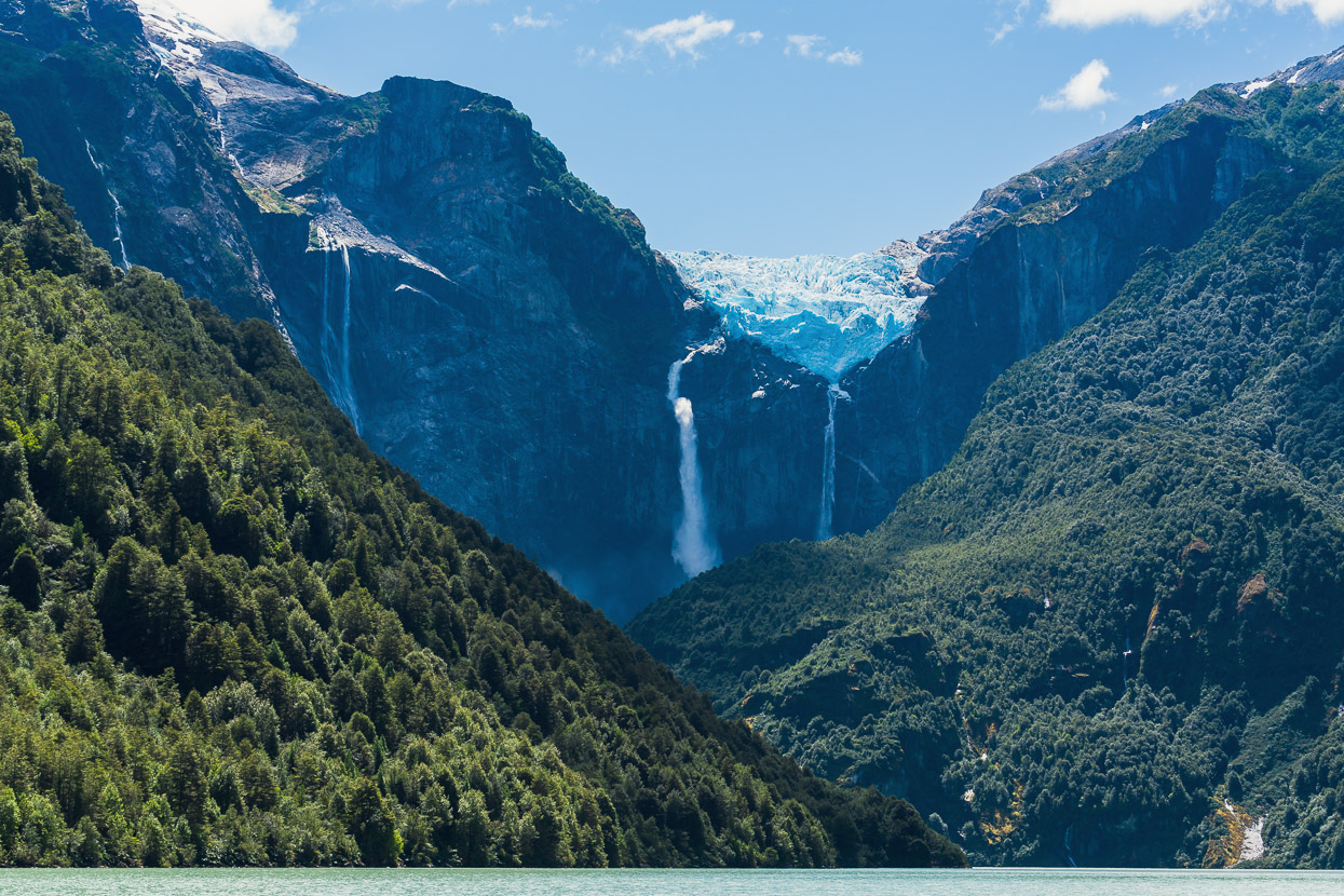
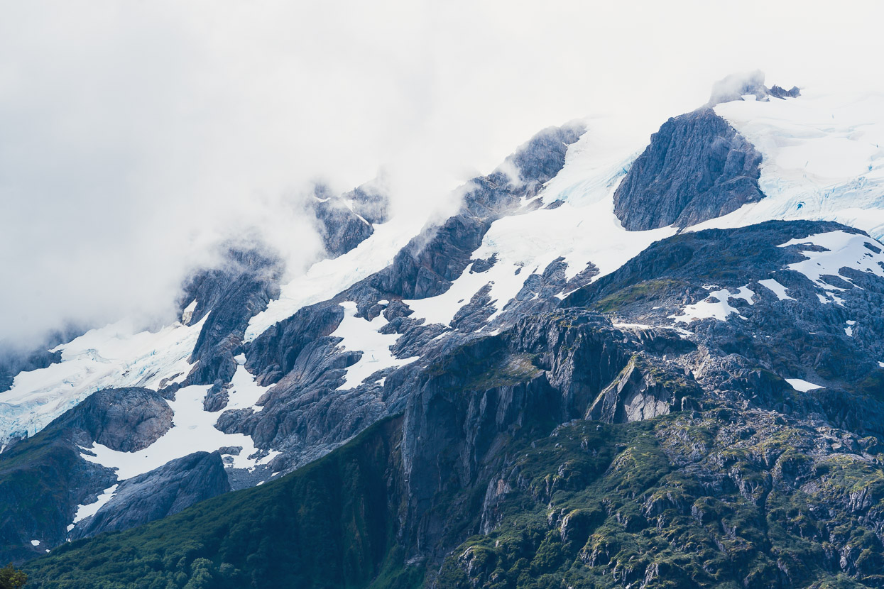
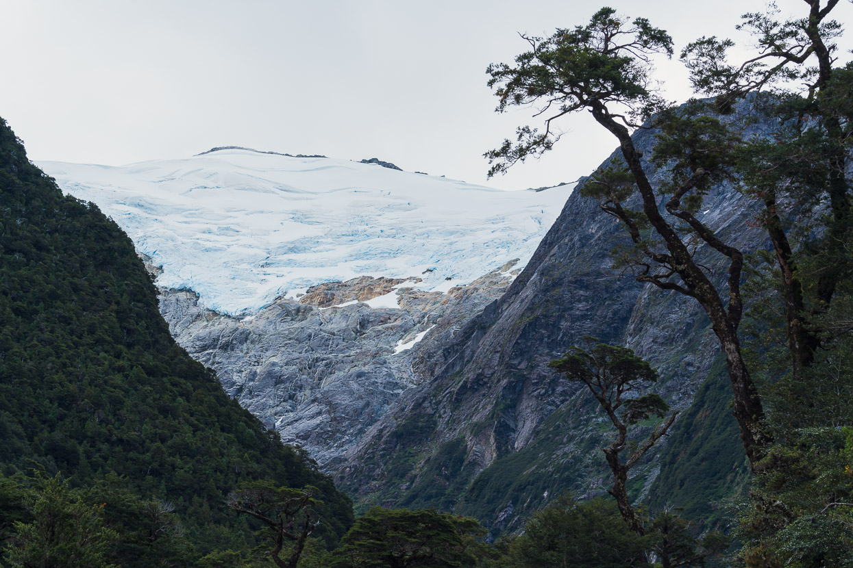
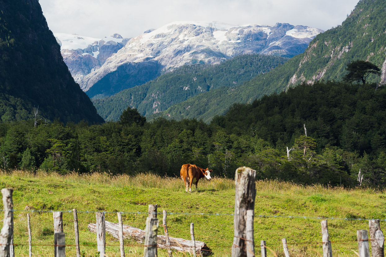
One of the most famous of sights along the Carretera Austral is the Cascada Ventisquero Colgante which is one of the tallest waterfalls in South America. It issues from the Ventisquero Colgante glacier which is part of a large icecap that covers the range. The mirador to view the falls and icefall is accessible via 3km hiking trail. It’s quite an awe inspiring place, right from the start, as you cross a roaring glacial river that’s filled with house-sized boulders.
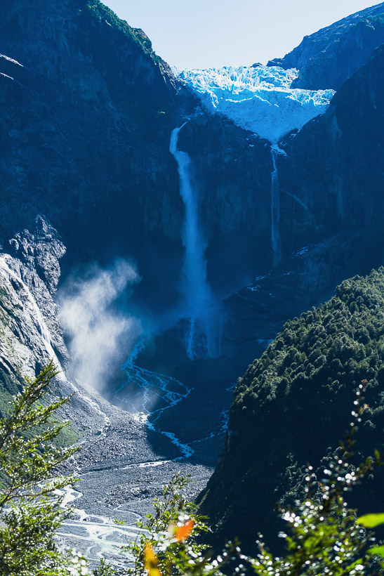
The cascada is indeed a spectacular sight, although we were frustrated by the entry rules that prevent early starts (the trail opens at 9am) or late entries for interesting light. But at least we could see the icefall – it had been overcast and showery for the past day.
There’s a second lower, and shorter, trail that leads to the lake edge, which is worthwhile for a different perspective.
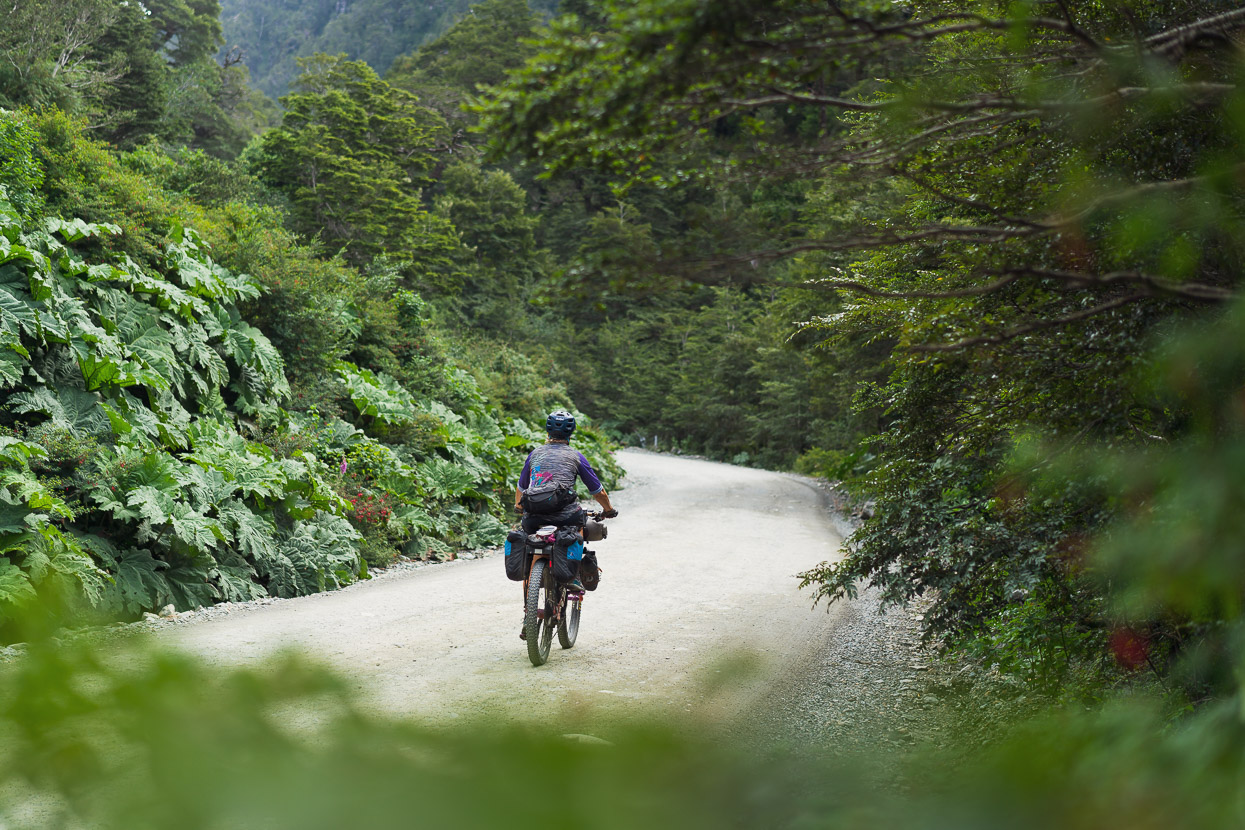
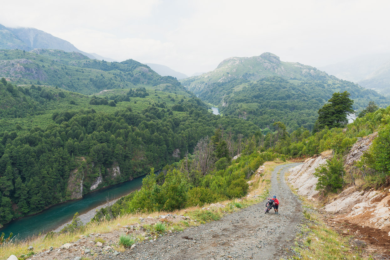
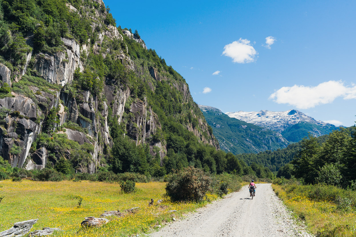
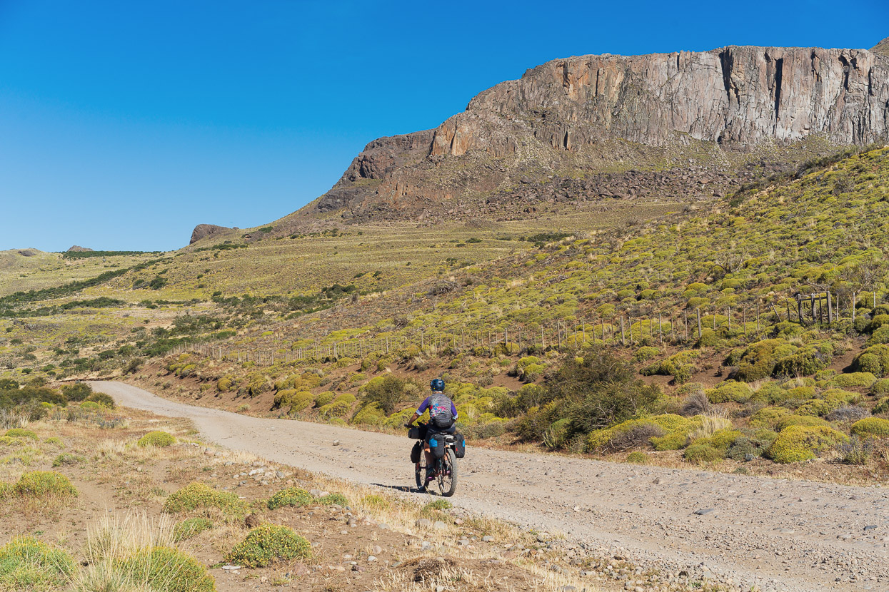
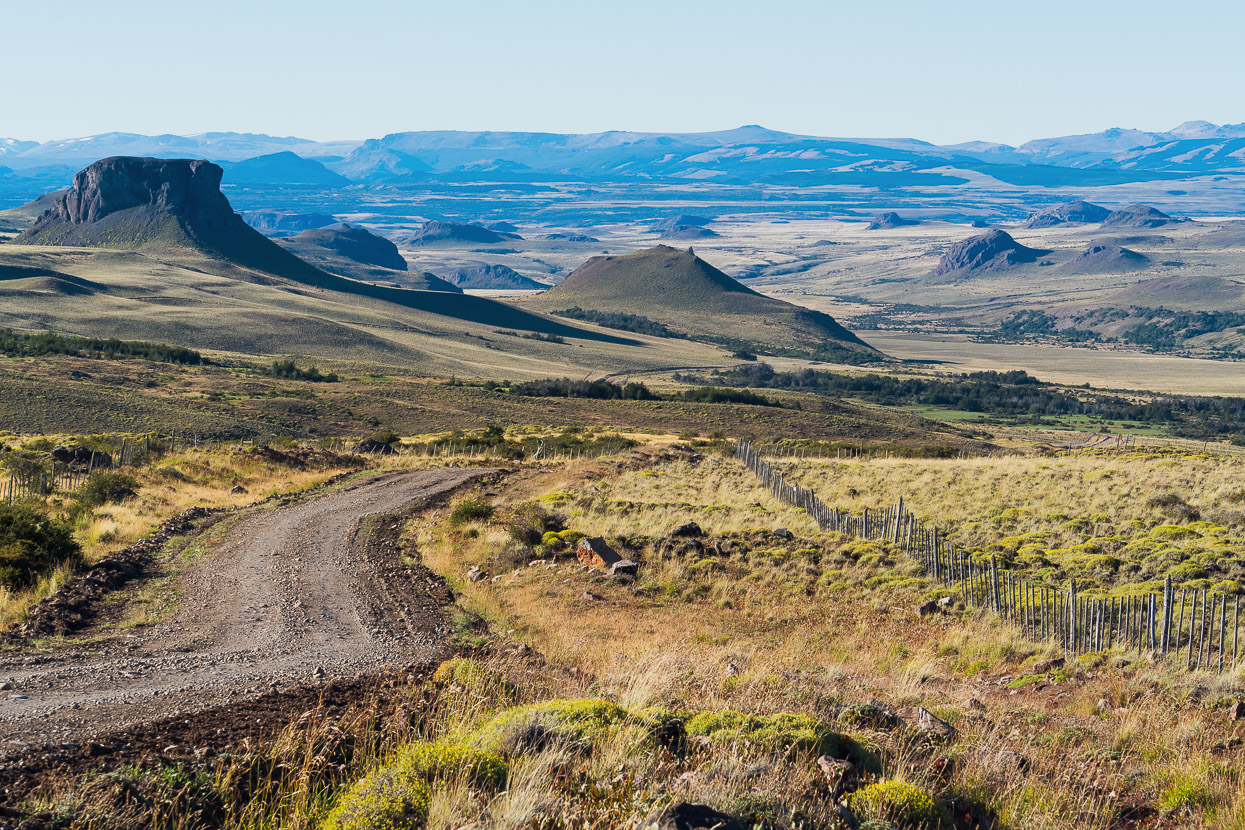
Ironically our favourite part of the Carretera Austral so far is the section that’s most feared by road-based tourers. Between the Queulat NP entrance and the Rio Cisnes, the road turns to ripio and climbs a series of switchbacks over a saddle at about 580m. Although the traffic kicked up a lot of dust, it’s a beautiful stretch of road with some epic views.
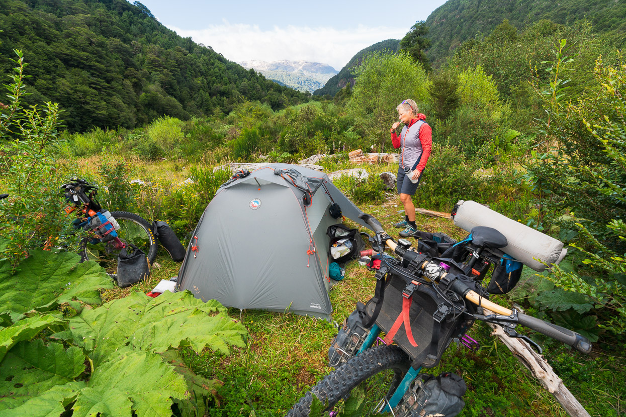
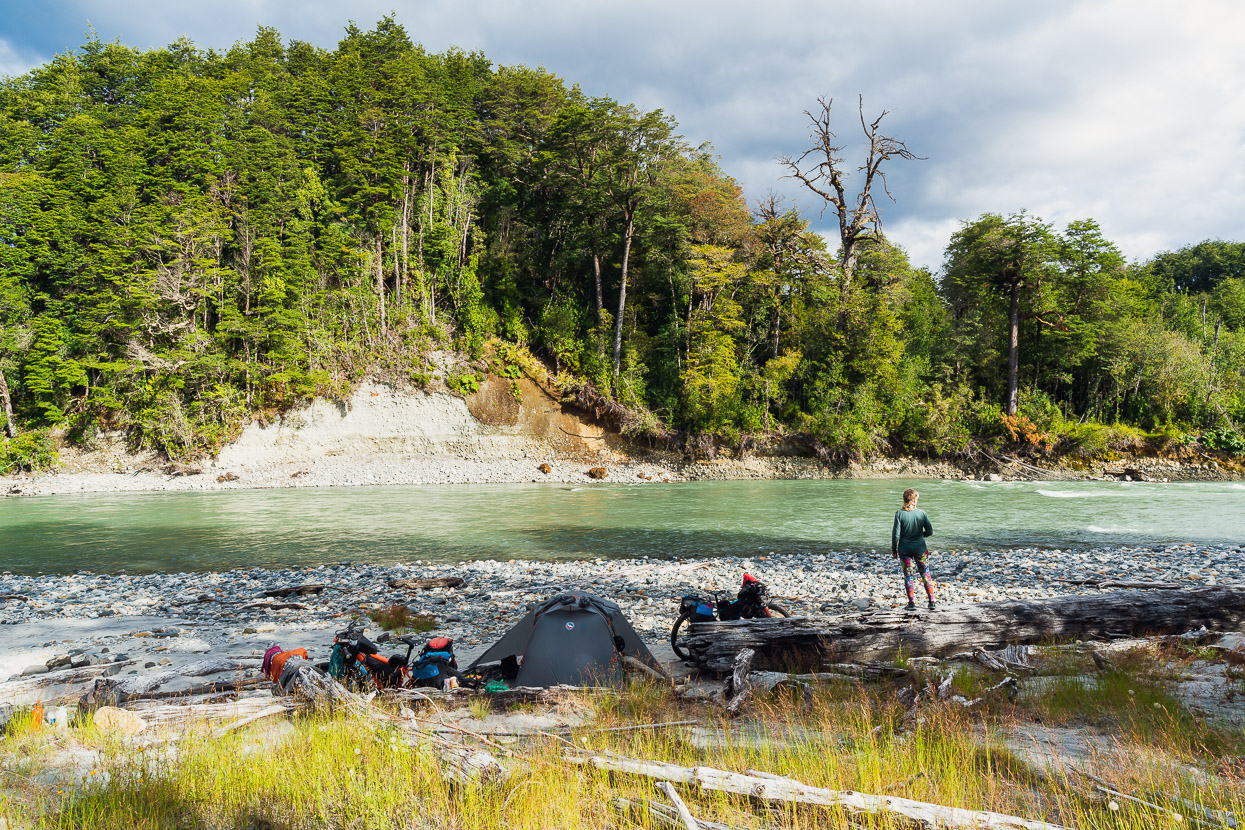
This wild camp was another iOverlander spot – free, and conveniently sited mostly out of earshot from the highway and with water from the nearby Rio Cisnes.
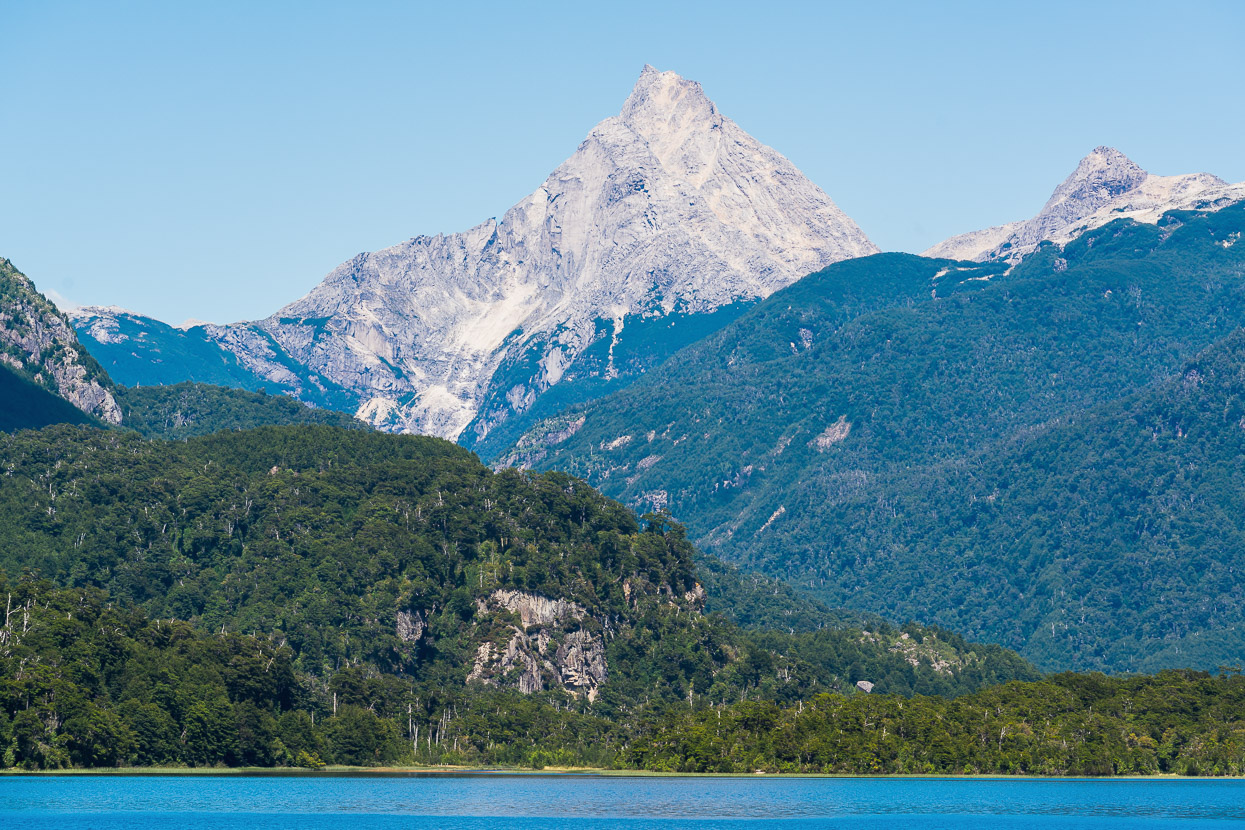
At times we could easily be cycling down New Zealand’s west coast.
Part of the allure of the mythical Carretera Austral is that this 1300km road is one of the world’s remotest highways. For much of the 20th century the province of Aysen was only accessible by boat or plane until this ambitious road project forged further south through seemingly endless mountains. For touring cyclists unfamiliar with Austral forests and seeking a passage between the mountains it certainly offers an unforgettable ride. But the wide, paved road, high speed traffic and tourism development is not what we look for in a bikepacking route. So far we’ve found that the cycling and scenery that has been the most rewarding for us have been the numerous detours and out-and-backs we’ve made off the highway. We’ll report on more of those in future posts.
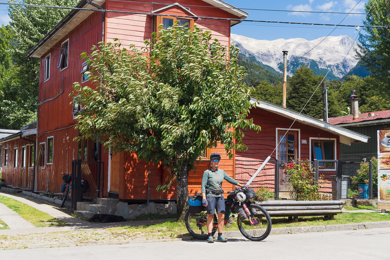
As we proceeded south we wondered how we might feel when we reached Villa Amengual. It was upon arriving there from Argentina and Paso Las Pampas in mid March 2020 that we’d discovered the border had slammed shut behind us, provincial borders were closed and national parks had shut down. The pandemic had arrived in Chile just south of us. While we still cycled two further days to Coyhaique to begin the journey home, Villa Amengual was the spiritual end of our nearly four year ride.
Being here again in 2023 felt like returning to the scene of a crime; we went back to the same cafe where our Colombian bikepacking friends had broken the news to us, and experienced a heady sense of nostalgia. Over expensive scrambled eggs and coffee we sat and reflected on how powerful that moment back in 2020 had been and vividly recalled the events that followed as we realised we’d have to go home, and then navigated the uncertain process of getting from the Carretera Austral back to New Zealand in the midst of the planet shutting down.
We left the scene of the crime in quite a buoyant mood, perhaps because that moment of reflection had given us the chance to really think about how much being back here, after a nearly three year hiatus, meant to us and how lucky we were.
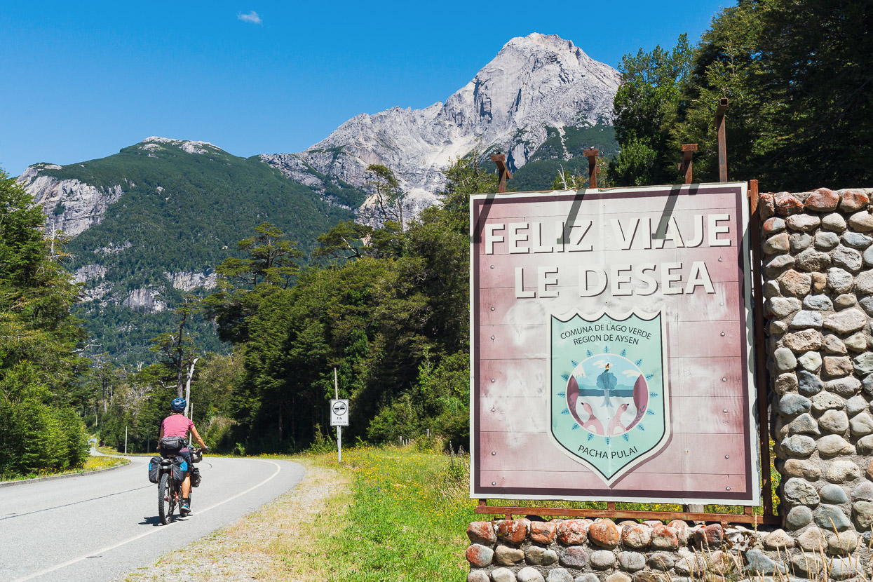
It had rained and mist filled the valley last time we rode south from Villa Amengual, so it was great to experience the same place in a thoroughly different mood and light.
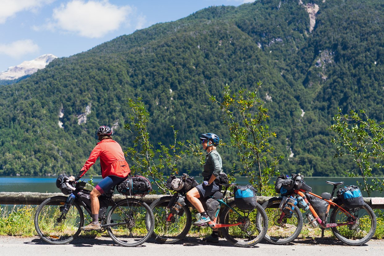
After seeing only six or so cyclists in the first two months of our current trip, we now see about that many daily on the CA. Most are Chilean or European and it’s really interesting seeing the variety of setups and styles people employ.
Detour number two was a 20km stretch of ripio west of the highway (Ruta X510) and was well worthwhile for the peace and scenery.
The road passes cliffs, forest and a beautiful river that had some nice wild camping spots, but we pushed on to a campground in Villa Mañihuales to make use of some wifi before disappearing off the grid for another couple of days on another detour.
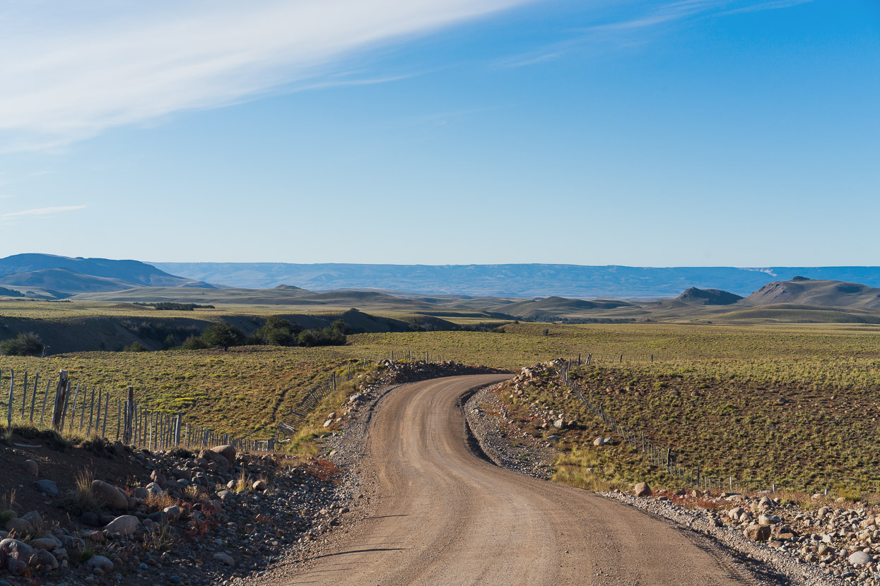
The route to Coyhaique via Ñireguao and Valle de la Luna is quite well documented by other cyclists looking for CA alternates and seeing as we’d already cycled to Coyhaique in 2020 via the CA it was an obvious choice. Turning off from just north of Villa Mañihuales the road is immediately ripio and climbs steeply alongside a deep forested gorge before emerging into more diminutive lenga forest which is typical for the eastern side of the mountains.
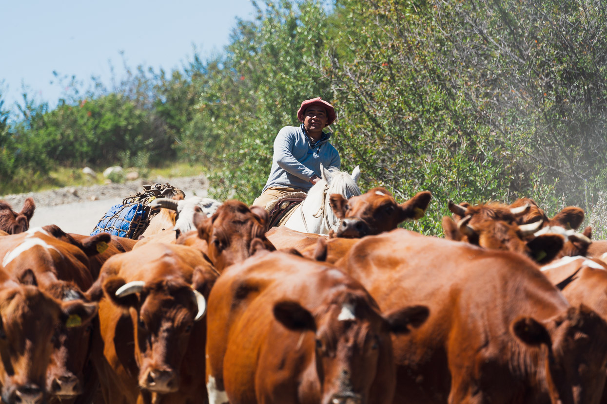
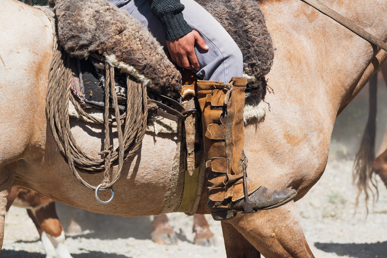
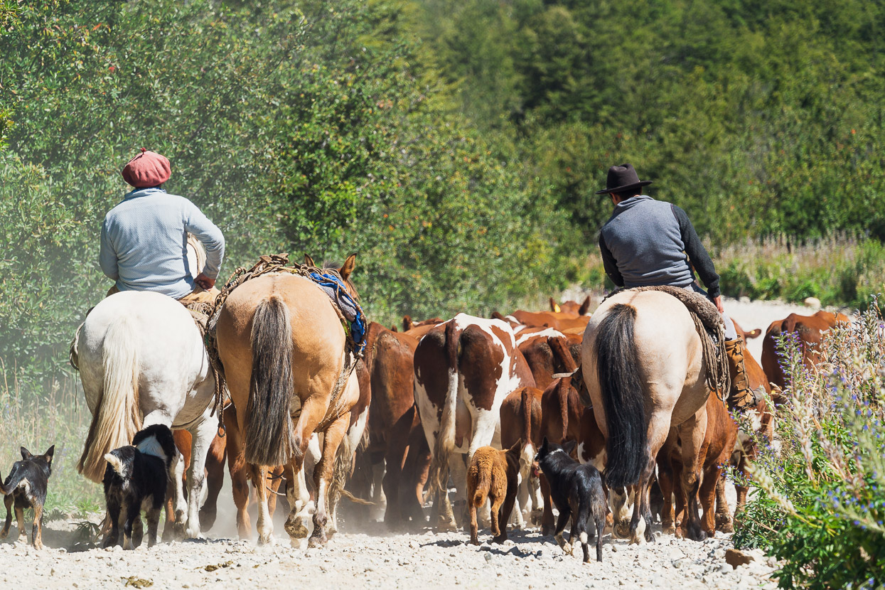
In a stark contrast to the environs of the CA this route heads quite far east as it carves a big curve around to Coyhaique, coming within just 500m of Argentina. With pampa style country comes pampa culture and we had to move out of the road as these gauchos drove their cattle down the camino.
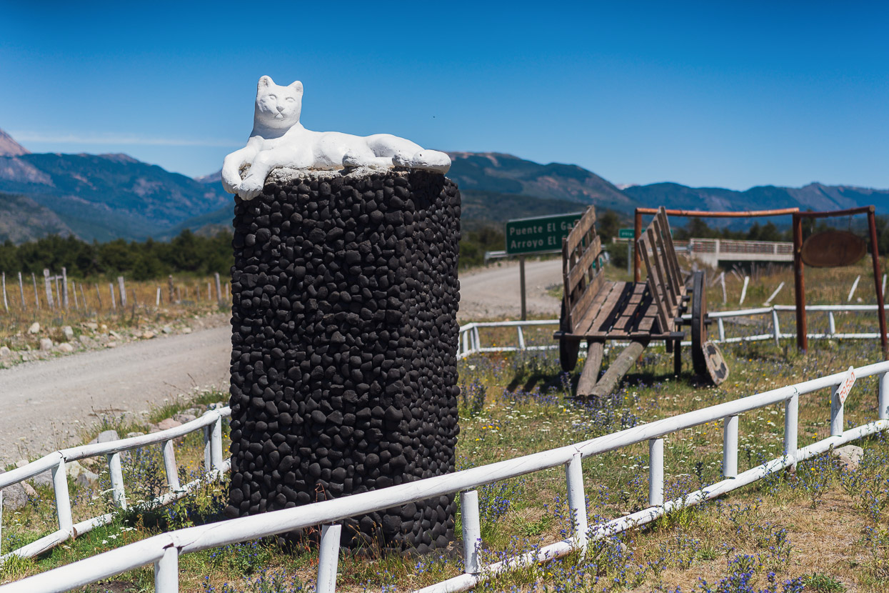
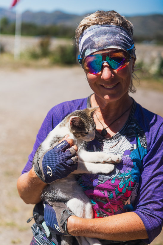
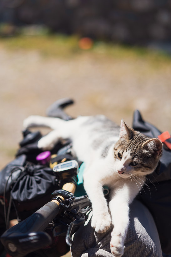
This chapter contains not just one place named after cats, but two, and at this one there actually was a cat. Arroyo El Gato is named for a mountain lion which survived a massive wildfire many decades ago by sheltering in a nearby riverbed. There’s a small shop here and a very small community with a school.
As we rode east the terrain turned to typical pampa but this time with the unique rock formations of the Valle de la Luna filling the horizon.
Ñireguao is in Chile, but culturally it seemed more like Argentina – in the early afternoon town was completely dead as people enjoyed their siesta and finding an open shop proved impossible until we stumbled upon a small heladería on our final lap around town. The ice creams were not cheap but they were damn good. This place had set up to cater for staff from a nearby mine, who the owner reckoned had ‘heaps of money’.
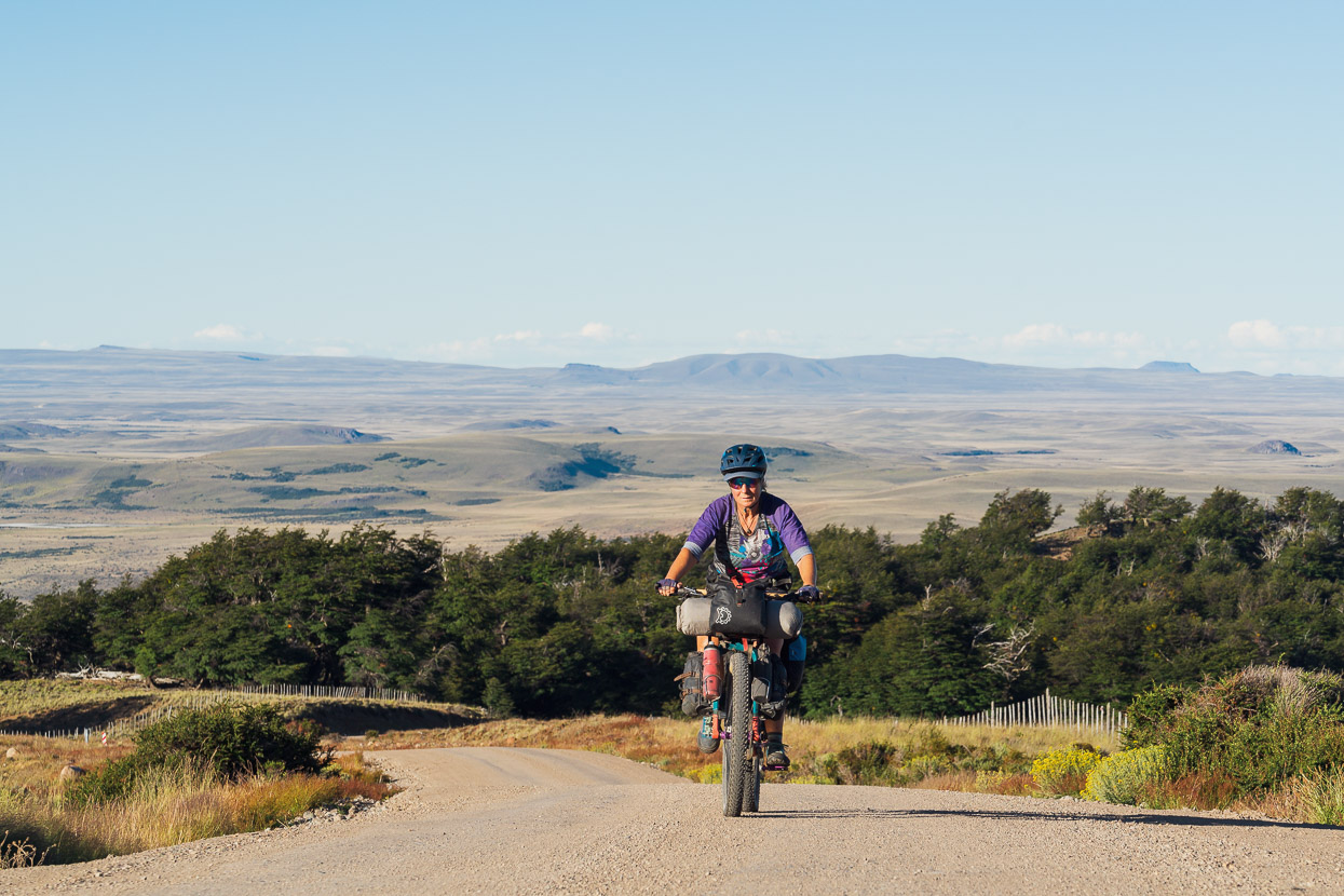
Into the early evening we climbed away from the Valle, enjoying expansive views across the pampa and into Argentina. It was here that for the first time we truely appreciated the transition of the Patagonian Steppe as it descends towards the lower coastal valleys of the west.
We wild camped in the Estero Casa de Piedra where there’s a small stream and the next day enjoyed a final half day’s easy ride to reach Coyhaique.
Morning views before we turn back west.
Coyhaique Alto, which is just a post for the nearby border crossing.
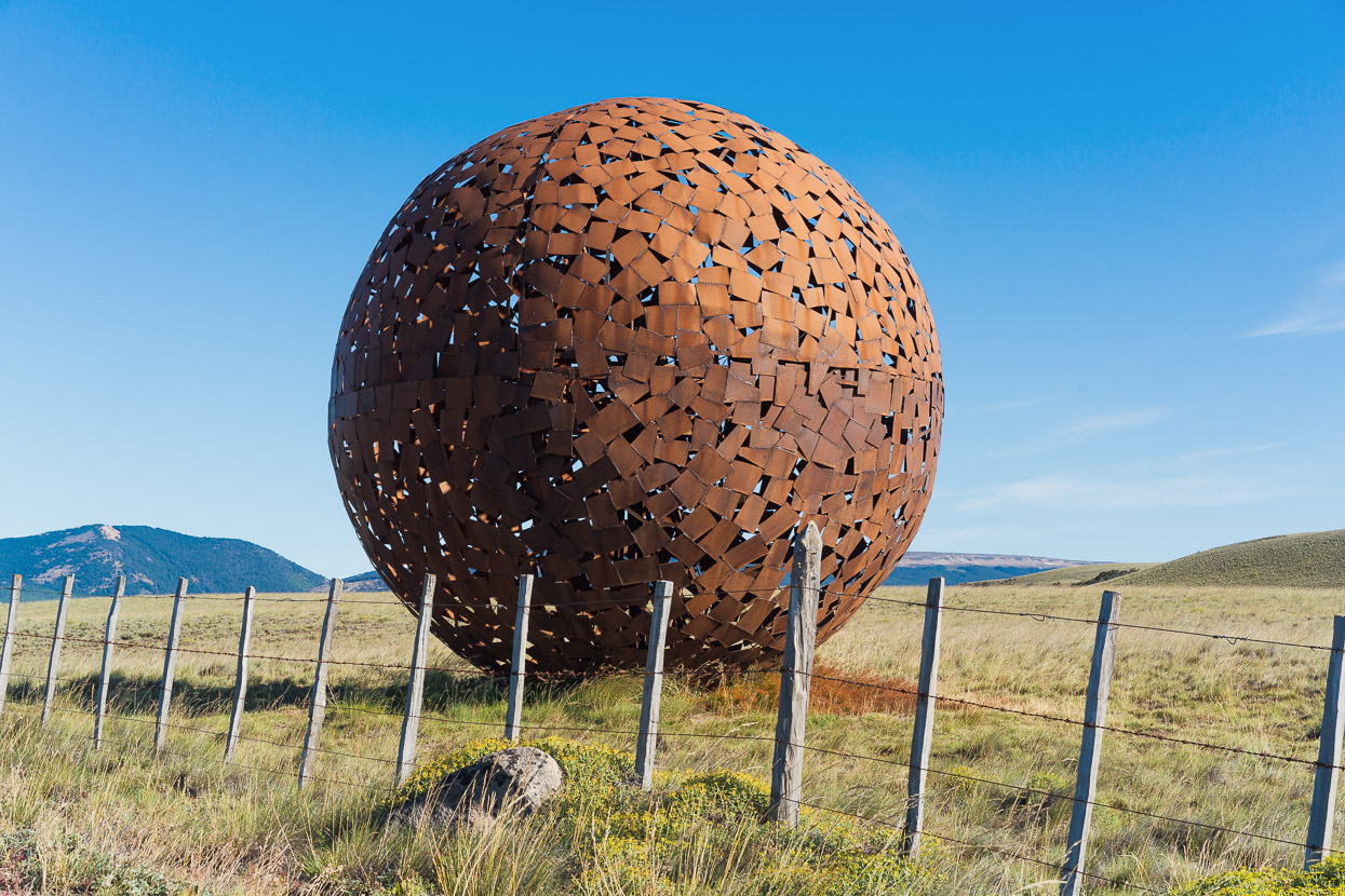
As the pampa transitions back to lenga forest en route to Coyhaique there were a pair of these amazing steel sculptures either side of the road. It’s unexpected to see such nice artwork alongside the road.
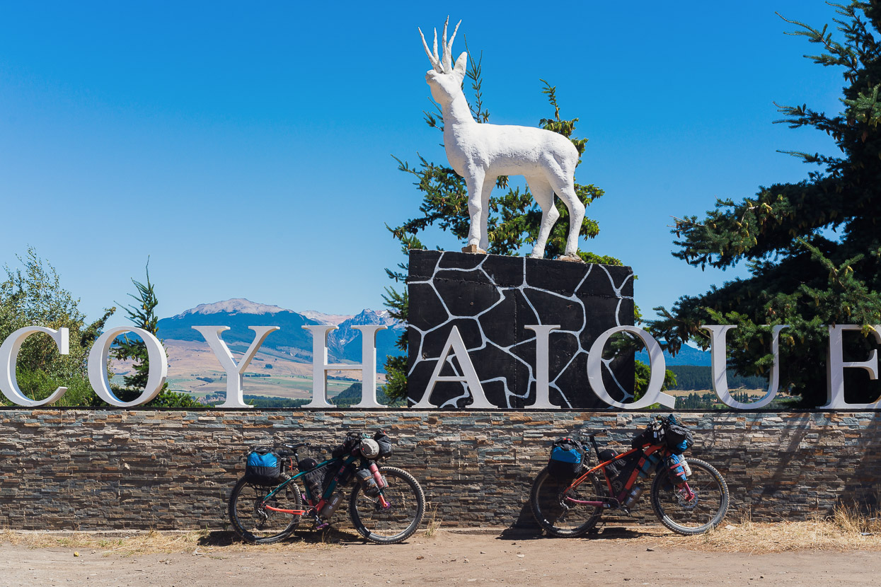
And finally we’re back as far south as we’ve been in Chile.
We hope you enjoyed this one, more soon from further south in and around the Carretera Austral.
Say thanks with a one-off donation, or check out our Bikepacking guide.
If you enjoy our content and find it informative or inspirational, you’re welcome to show us some love with a donation or a book purchase (US$19.99). The services we use to create our Bikepacking routes and host the website cost money, funds that we’d rather be spending on the road, creating bikepacking routes and content to share with you. Thanks for reading!


Thanks for this great post and help us reminisce about that southern part of the CA we rode 9 years ago. Only one section was paved at that time and the place felt pretty wild with little traffic along the CA although signs of increasing development were visible in many places. We began in Punta Arenas and rode north through the “backdoor into Chile.” We did multiple out and back detours off the CA but not as many as you’ve done. It was challenging on heavy bikes with 2-inch tires. Thanks for helping us relive that fabulous journey. Looking forward to further updates. Buen viaje.
Great to hear you’ve enjoyed the posts! 9 years ago would have been a great time to be here and no doubt would have felt more adventurous. We didn’t ride the final section from Cochrane to Villa O’Higgins in the end because we crossed to Argentina via Paso Roballos and then back over Paso Mayer, but we had to bus back to Cochrane to collect some parcels, so saw that section twice. I can report that it’s probably unchanged from 9 years ago looked so good we have pledged to try and ride that bit too! Certainly the most spectacular and natural section of the CA.
Thank you for this wonderful detailed post! Can I ask how long it took you to complete this section? (I think in 2020 you mentioned 8 days?). Also what bike and tires are you using in the photos? Is it the Salsa Beargrease fat bike? Thanks so much. We completed a more remote version of the Beer Trail last year and looped back north to our starting point in Bariloche. We are hoping to continue south from Chaiten to Coyhaique and avoid as much of the CA as possible and stick to more rugged/remote detours as well. Thanks!
Hi Bria – yes I have just checked on Strava and it was 8 days from Trevelin to Coyhaique. The bikes are Otso Voytek carbon plus/fat bikes. We had them set up with 3-inch Maxxis Chronicle tyres, which sadly are not made any more. On the most recent leg back in South America we used Maxxis Rekon 2.6 (good for really rough roads and more technical riding) and also the Vittoria Mezcal 2.6, which is fast rolling and a good Chronicle alternative, but not quite as wide. This is the tyre I’d use for future bikepacking on mixed roads and tracks. If you look at our more recent posts, you’ll see some good alternates/detours from the CA. Map here: https://ridewithgps.com/collections/1843755?privacy_code=3H3dhFAXrVkIoqQm (each section of track is linked to the relevant blog post).