
During February and March I spent two weeks down in Fiordland, climbing and scrambling in the Darran Mountains. My last post covered the first part of that trip, which was a six-day excursion into the central Darrans, while this one covers an ascent of Mount Christina via the Original Route, from the upper Hollyford Valley.
Ever since my first trip to the Darrans back in 1997, Christina’s been a mountain I have wanted to stand on top of, but my attention has usually been focused on more technical routes, or further from the Milford Road.
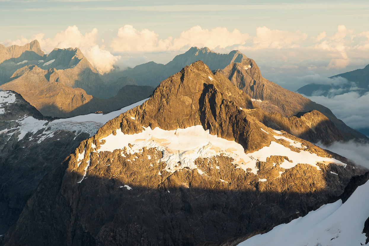
Mount Christina (2474m) is the huge massif that confronts you and fills a large part of your view as you drive over the Divide and down towards the lower and upper Hollyford junction. It’s hard to appreciate the mountain’s actual scale from there though, as you tilt your gaze upwards from thickly vegetated slabs, to beech forest and blocky ridges that often disappear into the cloud.
From Homer Saddle a much better view is had, as the mountain stands prominently next to its neighbour, Crosscut and the sheer amount of its rise from the Milford Road is much more obvious. Christina is a big mountain, 200 metres higher than Crosscut, and its bulky summit can be spotted from many places in the Darrans, jutting up behind closer peaks.
Although doable in a long day from Homer Hut/Milford Road, Tom and I decided to climb it over two, giving us a bit of time to hang out at a high camp and appreciate a novel view of Fiordland.
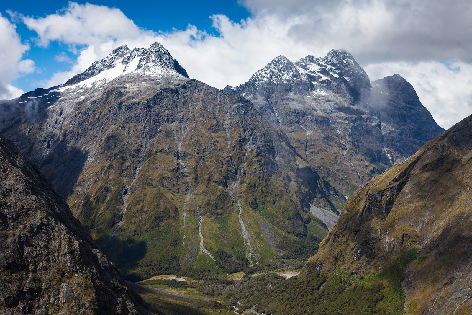
Mount Crosscut and Mount Christina (right) from Homer Saddle. That’s Gertrude Valley on the left and Hollyford Valley/Milford road on the right. Our route headed up to the snowfields in the centre of the summit pyramids. This photo was taken in 2009 and those ‘permanent’ snow fields have shrunk a lot since then.
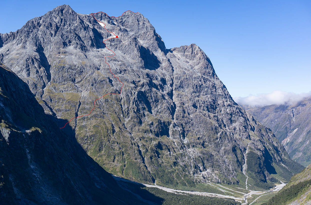
And this is a shot by Hugh Van Noorden taken from the Belle bluffs. The route starts up Cirque Creek for about an hour, before you break out right up a vegetated fan and then begin a long rising sidle. Our bivvy site is marked.
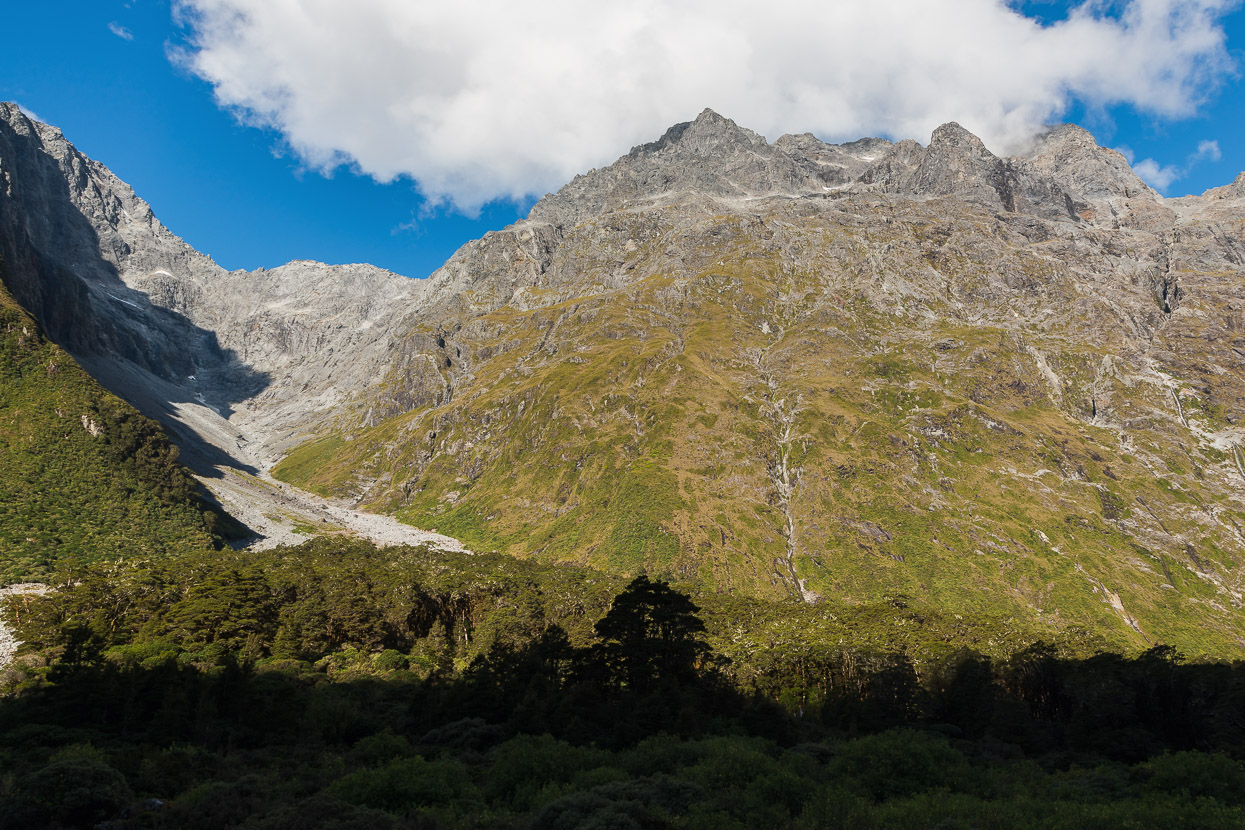
Looking up Cirque Creek, with Christina on the right.
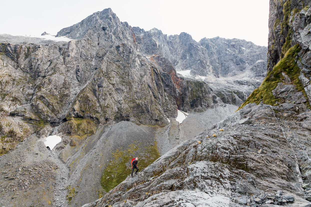
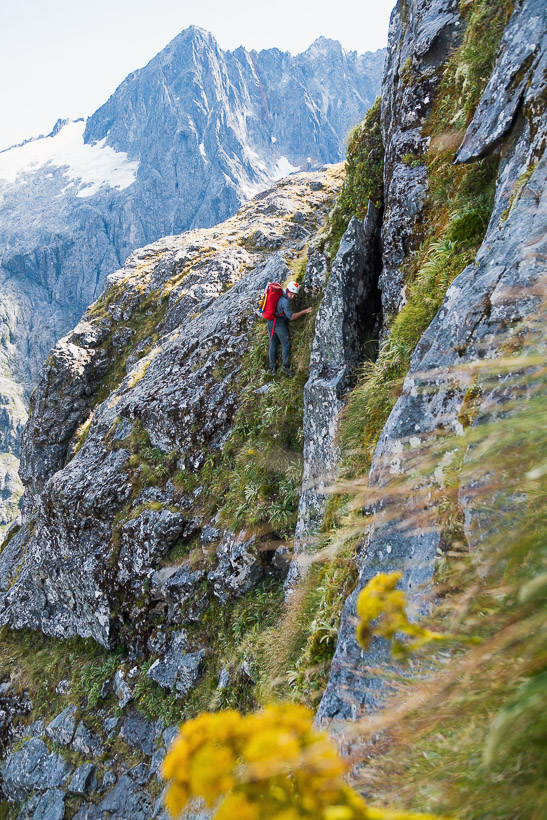
Once you get started out of Cirque Creek the route is relatively easy to follow, as once you reach a certain height, steepening walls force you to keep sidling right, gaining height when you can. This shot’s taken at the first of the two prominent water courses that you cross. That’s Mt Crosscut in the background, with the Cul de Sac gully diagonalling up from the left hand snow patch.
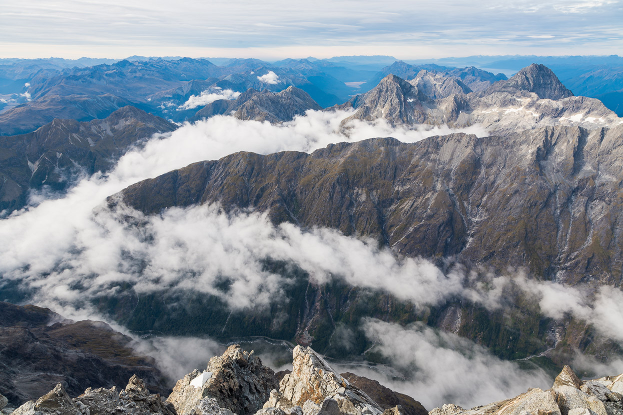
We had a warm, calm day for it and plenty of time to take in the views. Homer Saddle is upper centre of this photo.
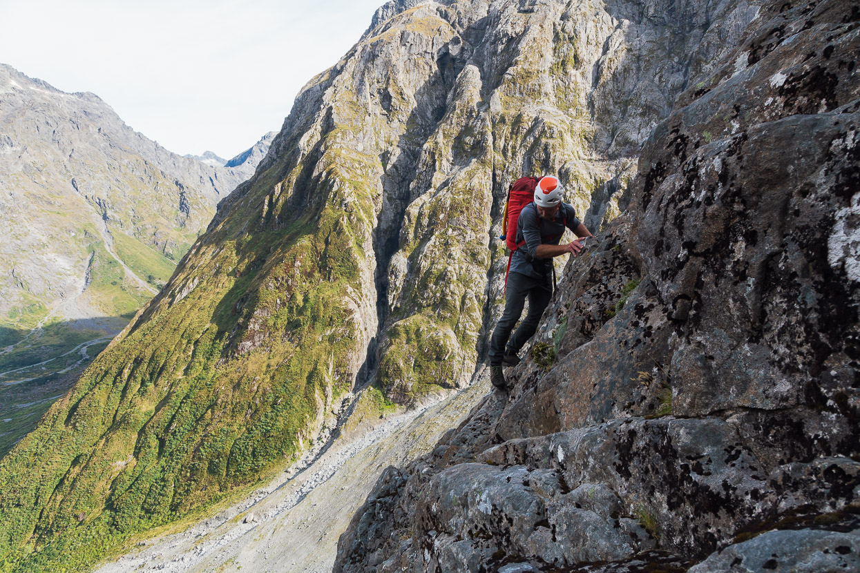
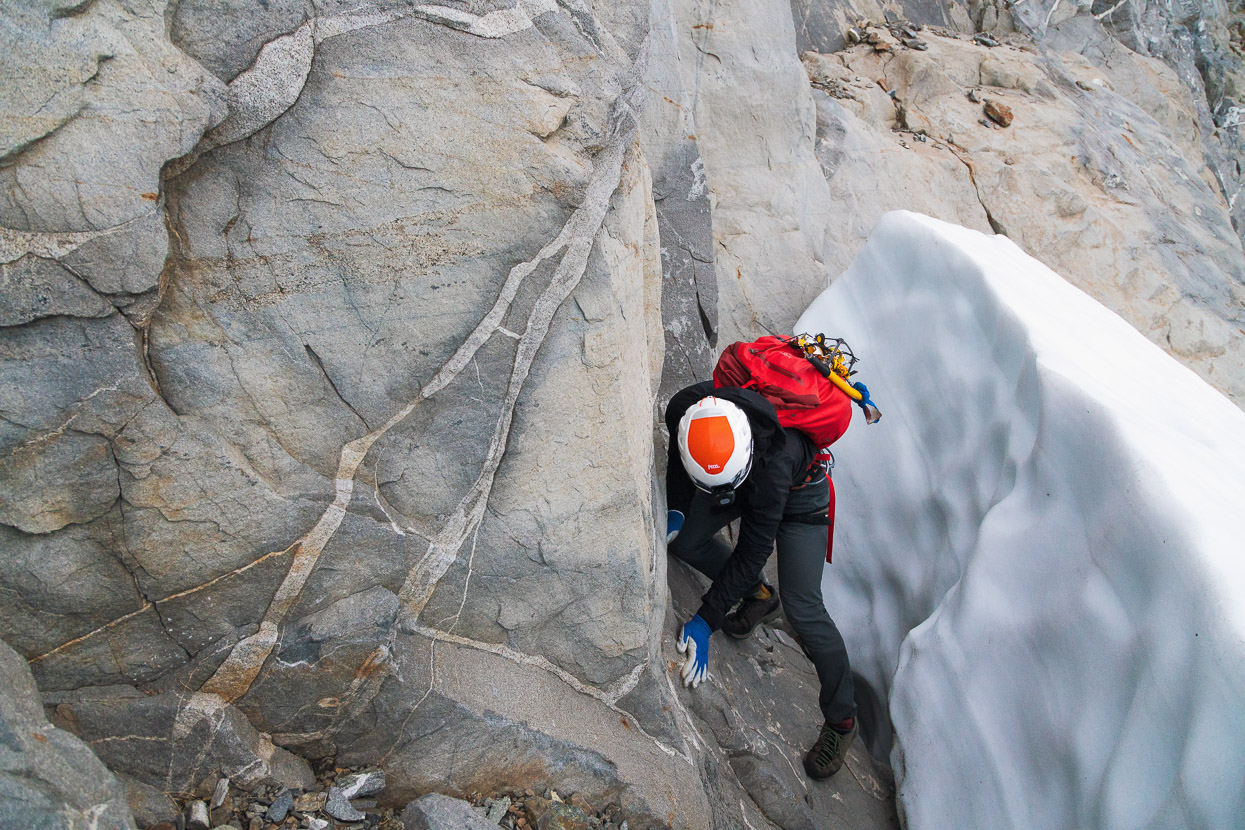
The crux of the approach route came after the second watercourse, where the terrain becomes a bit steeper and more complicated. We spied an abseil sling up high and tried to climb a buttress to reach it, but it felt a bit steep for soloing with overnight packs, so we skirted beneath it.
An exposed but secure down climb and sidle on sturdy plants led to easier ground and a clearer view of where we needed to go.
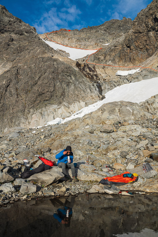
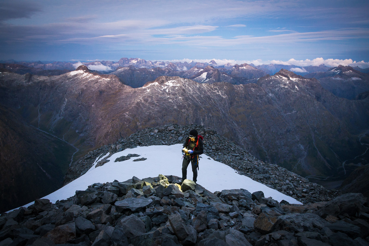
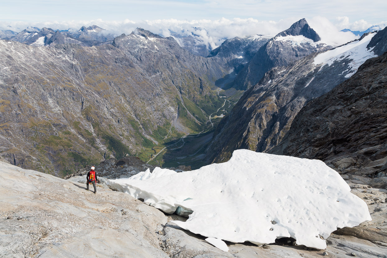
We gained a broad terrace, that once held a snowfield, at about 1750m. This was the spot we’d planned to bivvy at, but it was still early and there was nowhere very appealing to lie down, so we pushed on higher up sprawling talus and nice rock slabs until we reached the top of what looks like quite a prominent knob from below. This spot was at 1970m and had two little niches we could lie in, an amazing view and a water supply. Perfect.
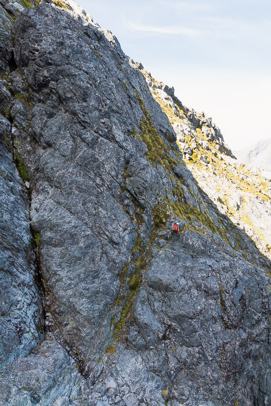
The next morning’s route is marked above Tom.
Not bad at all. We’d got there quite early, so both had a snooze in the sun and then dinner and a brew while the sun crept slowly down behind endless Fiordland mountains. The prominent peaks in this shot are Talbot (centre) and Crosscut West Peak (far right).
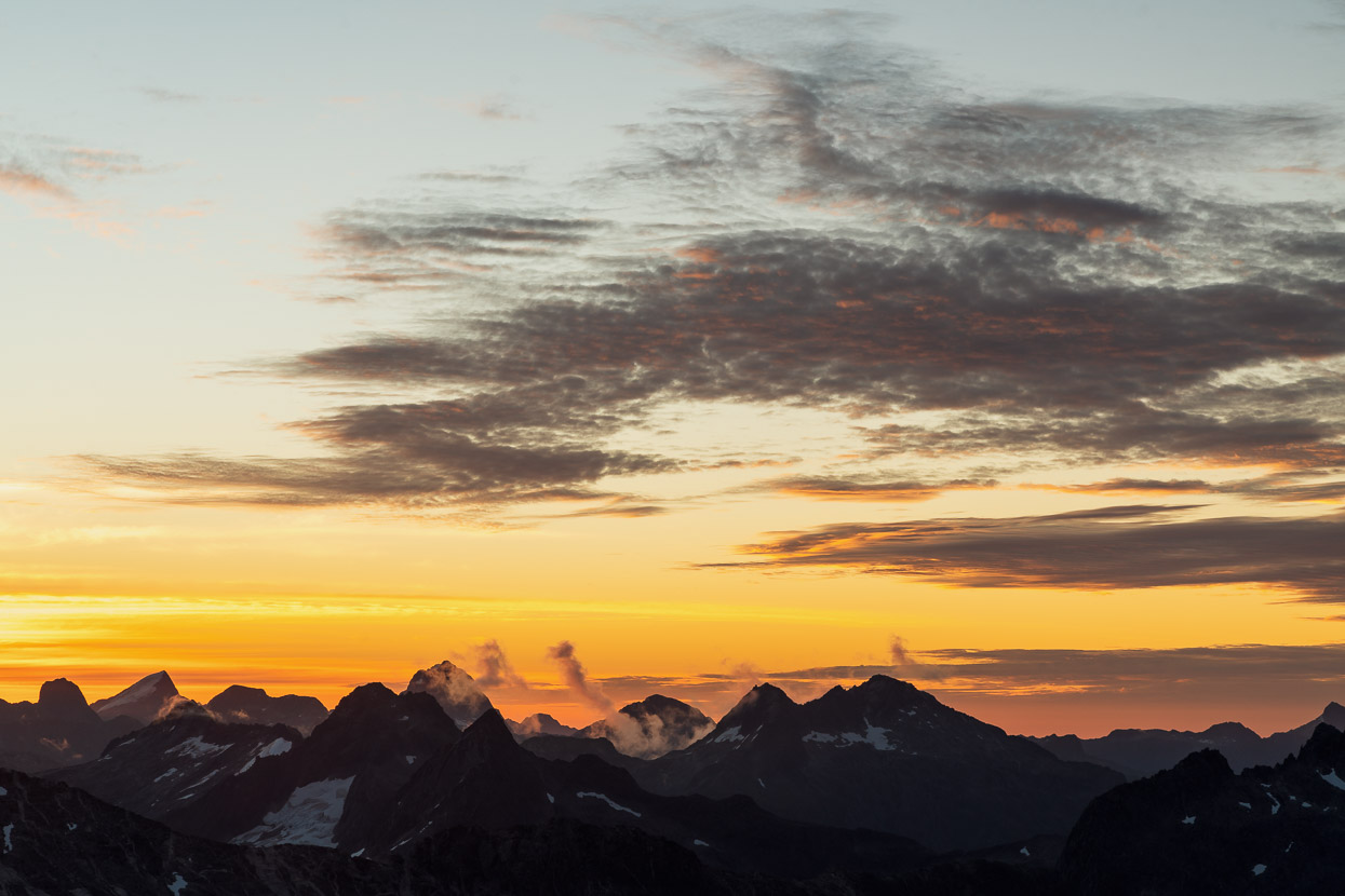
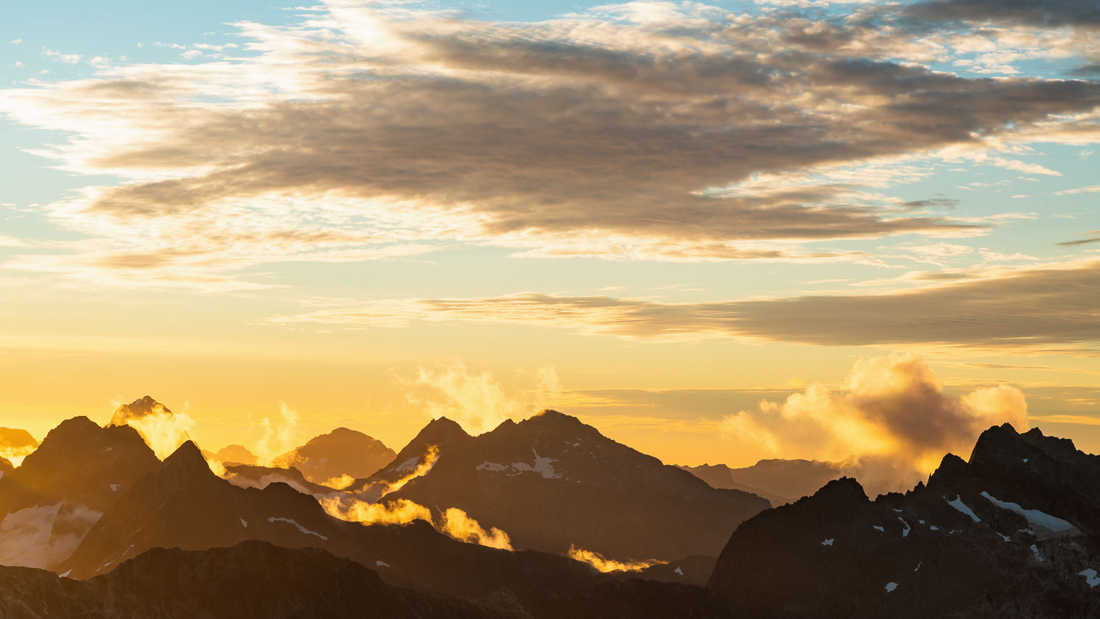
The colours of the sky turned rich hues as the cloud drifted and morphed.
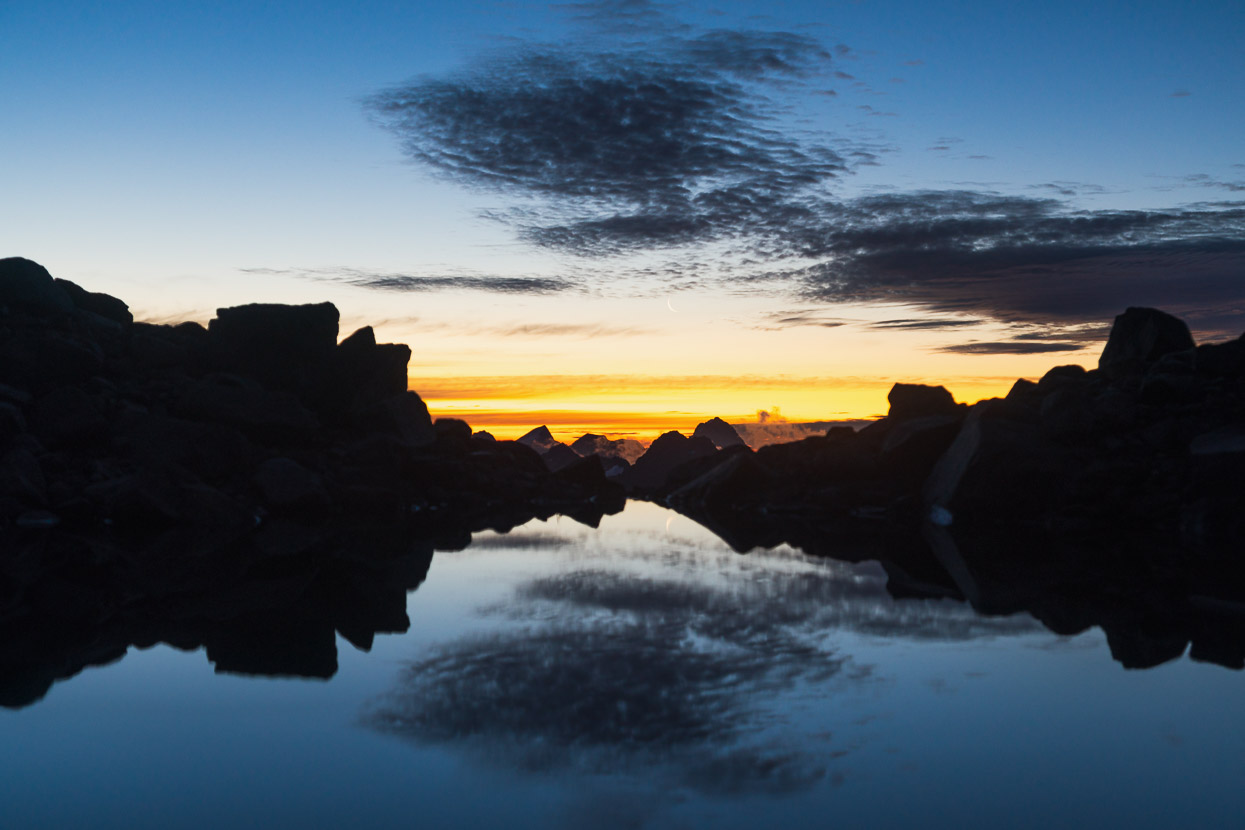
And a teeny fingernail of moon appeared.
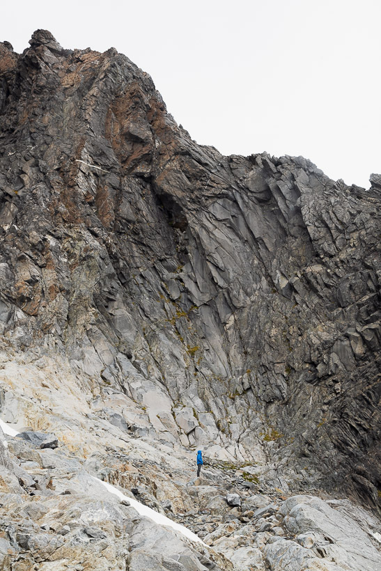
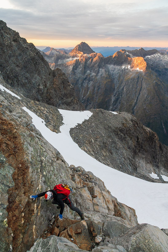
We woke in the dark and left camp by torchlight, gaining height quickly on steep slabs and talus and crossed a tongue of hard névé with crampons.
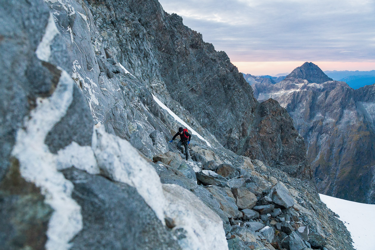
Then a rising sidle led us towards a saddle in the ridge connecting the north and high peaks.
We opted to climb the rock above the highest, bullet hard, névé, smearing our way along carefully sideways until we could climb up to the ridgeline.
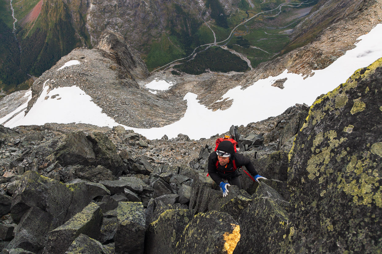
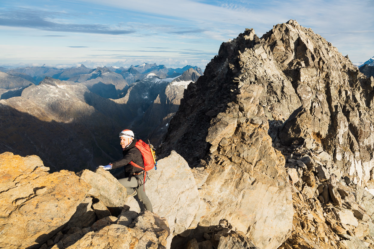
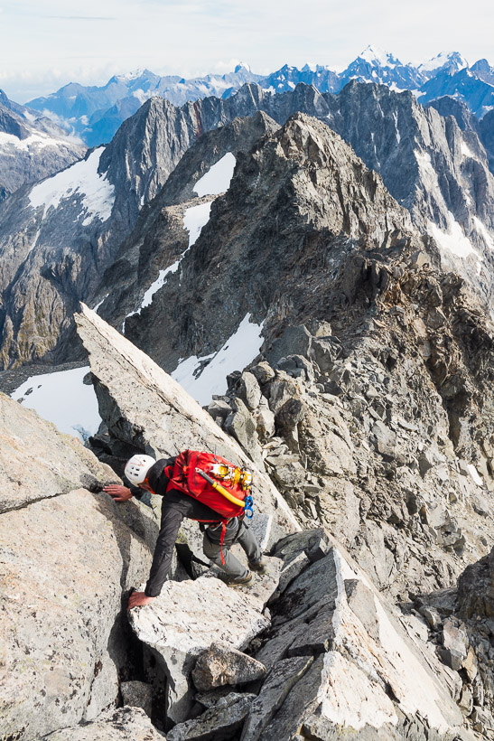
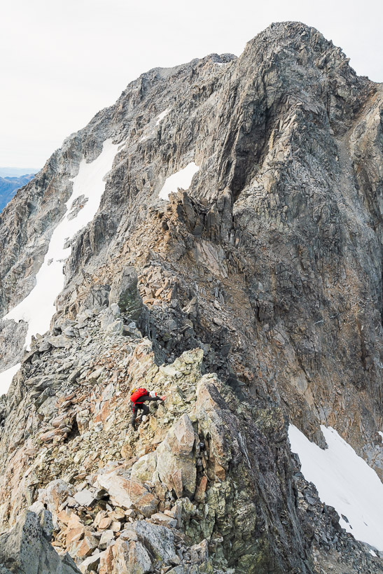
Once on the ridge, we skirted or climbed over some small gendarmes and wove our way along between big blocks. This was the crux, an exposed section on loose rock, to sidle beneath a steep gendarme, while the whole climb fell away beneath our feet to the Milford Road, 1700m below.
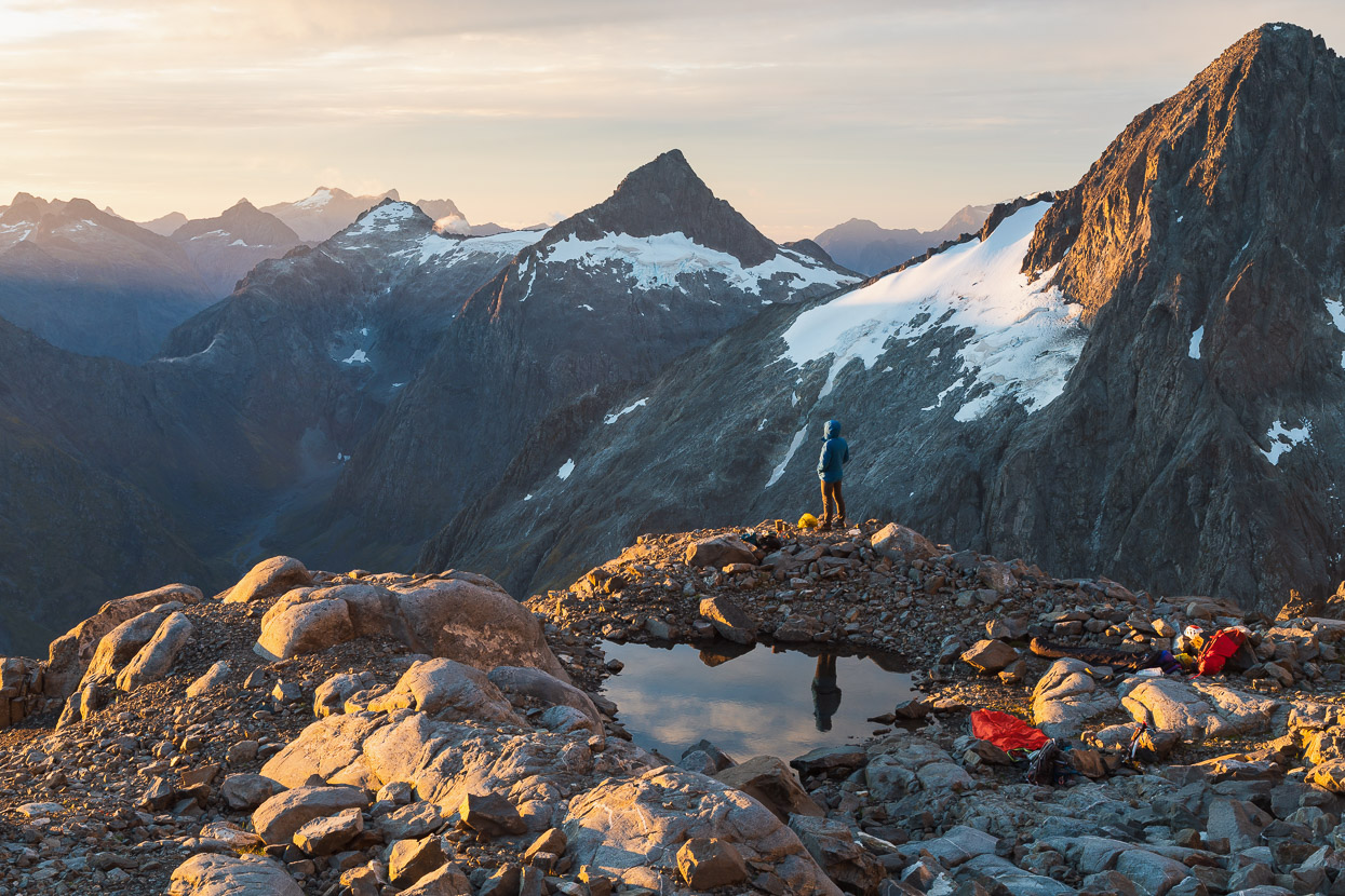
Once the sun began to rise we were in for a treat. Although the calm of the previous day was now replaced with a steady and cold wind.
The east face of Talbot looked fantastic.
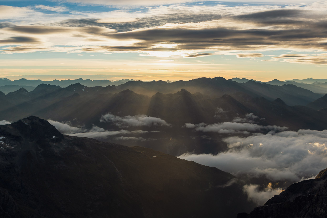
And the opposite direction, towards the Ailsa Mountains.
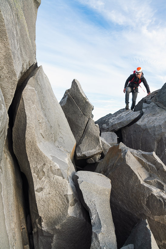
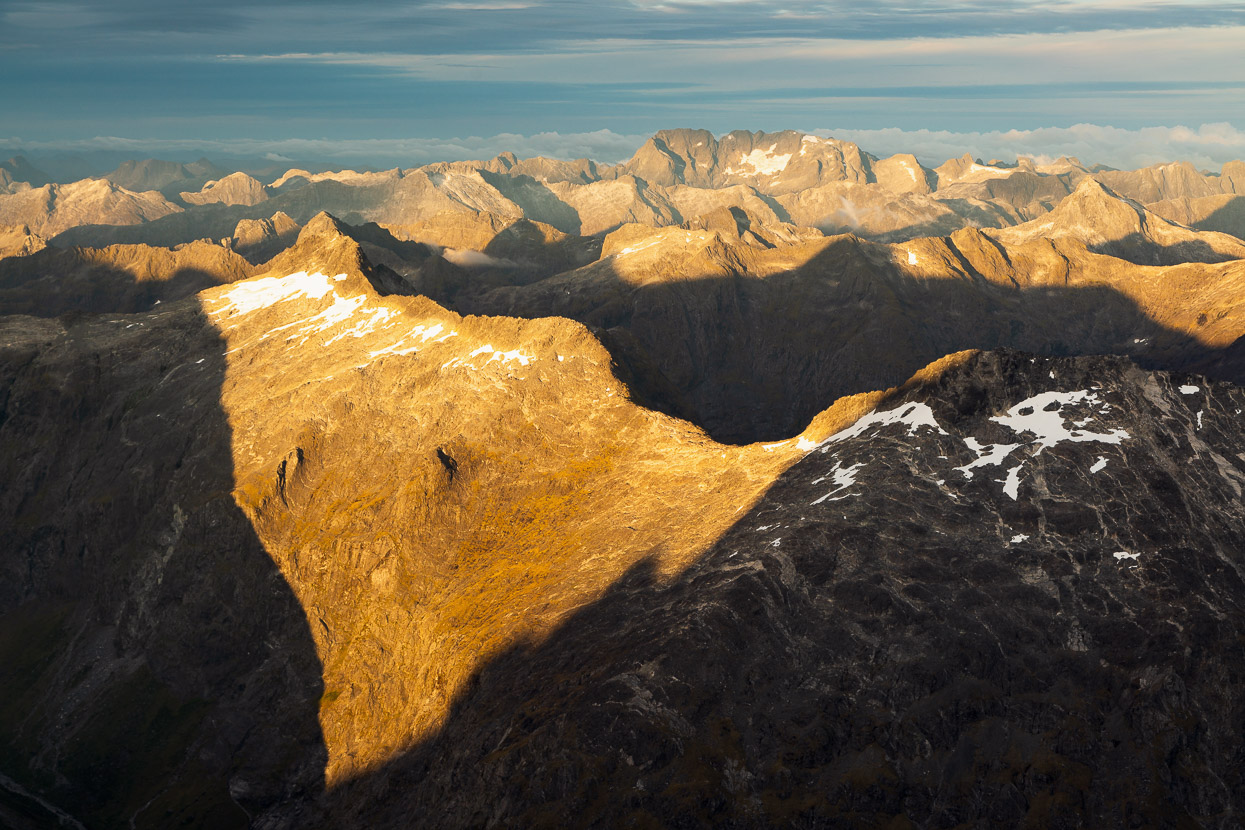
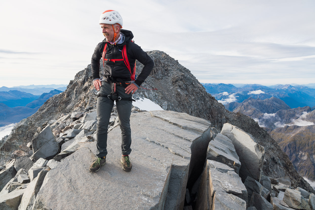
After a long upward scramble, ever careful of loose rock, the ridge rolled off finally and views opened in all directions. This shot is looking towards the Divide and the Eglinton.
The only near miss had been me dislodging a large block which slid down a ramp and missed pinning my leg in a wide crack that it fell into by mere millimetres. It ripped my pants but not my leg fortunately. It would have been a miserable (and maybe fatal) end to the morning, pinned by a block in cold wind on the summit ridge!
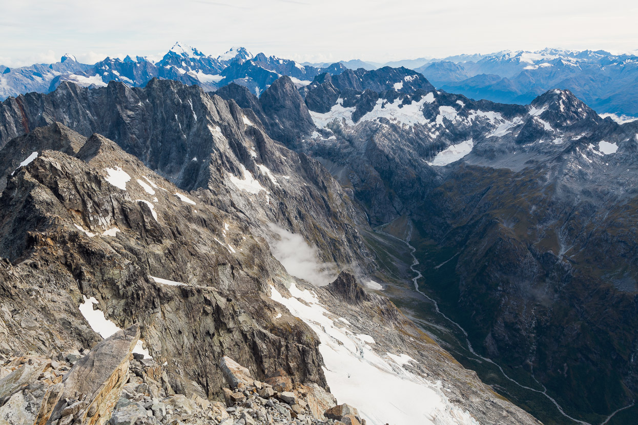
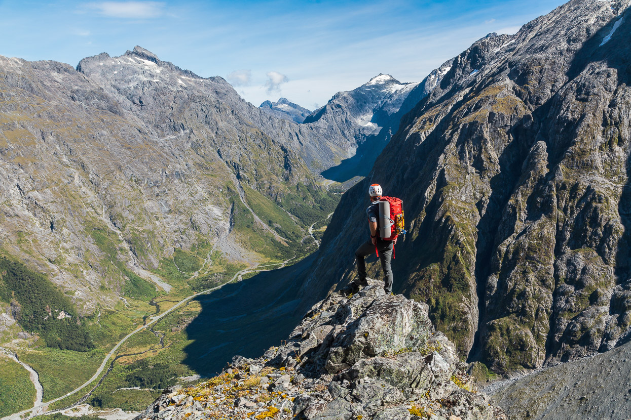
This view is into the interior of the Darrans; with the Marian Valley below and Marian, Sabre and Adelaide at its head. Crosscut on the far left, middle distance.
Maintaining our care and concentration we returned the way we’d come, back down and along the ridge and down to camp, for an early lunch, before the long descent back to the road.
Say thanks with a one-off donation or a regular subscription
If you enjoy our content and find it informative or inspirational, you’re welcome to show us some love with a donation or subscription. The services we use to create our GPS tracks and host the site cost money, funds that we’d rather be spending on the road, creating bikepacking and tramping routes and content to share with you. Thanks for reading!


Hi Mark, Loved reading this and the photos. Wow! A mate and I are spending a week down there in mid-Nov. Christina is one of our options. Did you guys solo everything? Assuming from the harness in photos that you carried a rope and some pro?
Hi Matt, thanks! Yeah we did carry a single 60m ~8mm rope, but didn’t use it. Had super light alpine harnesses and a very simple rack and some 120mm slings and cordelette too. Unless you get off route, the climb is essentially a ‘scramble’, without any gradeable climbing as such. That said, the crux down climb/sidle we did on the way to the biv was probably not something everyone would want to do unroped – but I don’t think we were on the best route there. One of the towers on the ridge was loose and exposed too. If you don’t know the Darrans well, its advisable to take a rope and light rack I reckon.
Thanks Mark. We are comfy scramblers. My mate is a stronger load-carrier and generally fitter than me, but I am a little more “climby” than he. We climbed Mitre Peak in a day in March and that felt all good all the time. The next day we did the Talbot-McPherson classic and there was one place I led up Talbot’s ladder and found a bolt I used to belay my mate up. He has 30m of 8mm that I reckon we will prob take up Christina – getting off route will be so easy I’m sure and it sucks if you get to a short little downclimb that being able to rap down will make all the difference (esp if it’s wet!!).
Have you guys climbed Pembroke?