
A Change of Mode
Deep in the Cordillera Vilcabamba and only accessible by foot or mule, Choquequirao is perhaps one of the more mysterious of the Inca ruins accessible from Cusco.
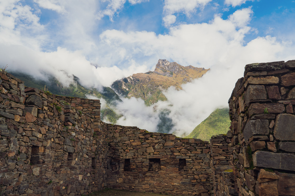
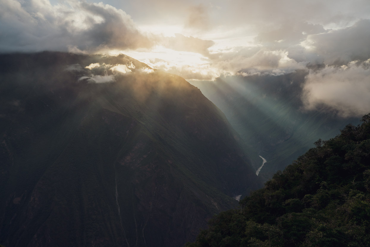
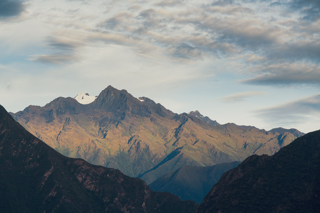
Choquequirao’s inaccessibility is probably, for a lot of people, one of its biggest charms. On an average day this site sees between 10–20 visitors, while the likes of Machu Picchu is visited by several thousand people a day. This former Inca mountain retreat has a well deserved reputation for atmospheric ruins in a peerless location. The site is surrounded by jagged peaks and the exposed ridge top ruins seem to float in the clouds high above the churning waters of the Rio Apurimac.
The site was founded in the 15th century by Inca emperor Pachacuti Inca Yupanqui, and during the 16th century expanded and remodelled by his son Tupac Inca Yupanqui. Its remote and hard to reach location made it ideal as one of the last bastions of resistance to the Spanish for Manco Inca Yupanqui who fled Cusco after his siege to retake the city from the Spanish failed in 1535. The site was probably fully abandoned about 1572.
For most people, it’s a two day hike (also doable in one very long day) to reach Choquequirao. The most popular entry point is Cachora, from where you can take a 10km taxi ride to the trail head and begin hiking. Some people access the site from the other side of the range, at Yanama, which is an even more impressive sounding walk, but Yanama is remoter and takes longer to reach. Walking in the way we did, from Cachora, it’s possible to continue right out to Yanama and even all the way to Machu Picchu or Espiritu Pampa if you have time. A less common entry point, but on the same side of the Rio Apurimac as Cachora, is from San Ignacio in the next valley west. But Cachora is best if you want to hire equipment such as packs or poles.
We bought four days’ supplies and hired packs and a pole each in Cachora and left our bikes with a hostal owner. We started our first day with the 10km taxi ride to Capuliyoc, where the road ends and the trail starts. You could also ride this section and leave your bikes safely at one of two small restaurants at Capuliyoc, but at the time we had no idea what was there.
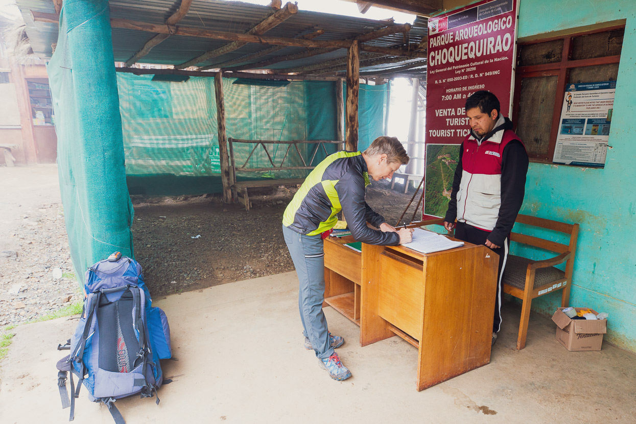
At Capuliyoc there’s a couple of small restaurants/souvenir shops and a check point to enter the park. Entry opens at 7am, and we were required to sign in, show our passports and pay the the entry fee.
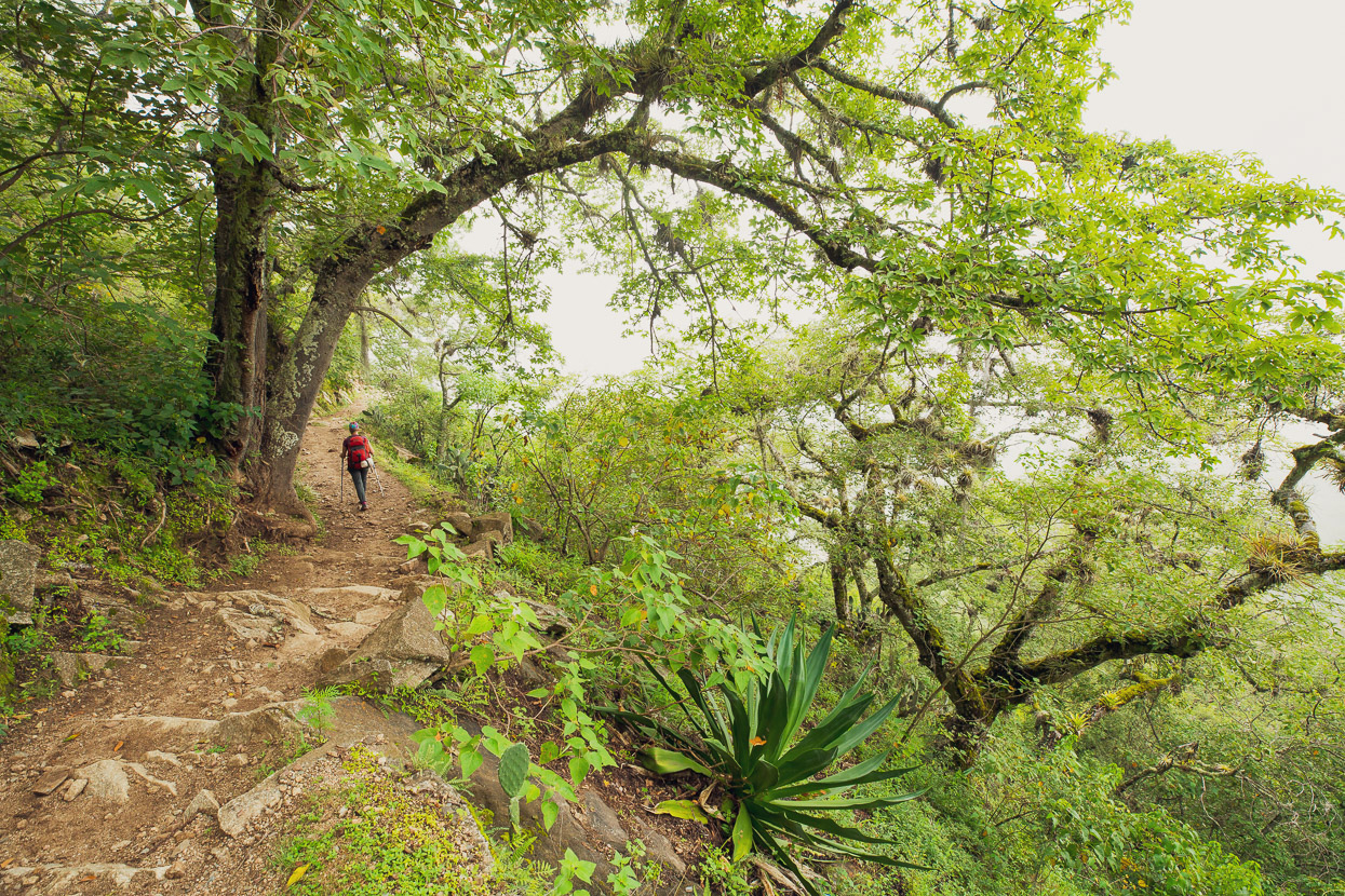
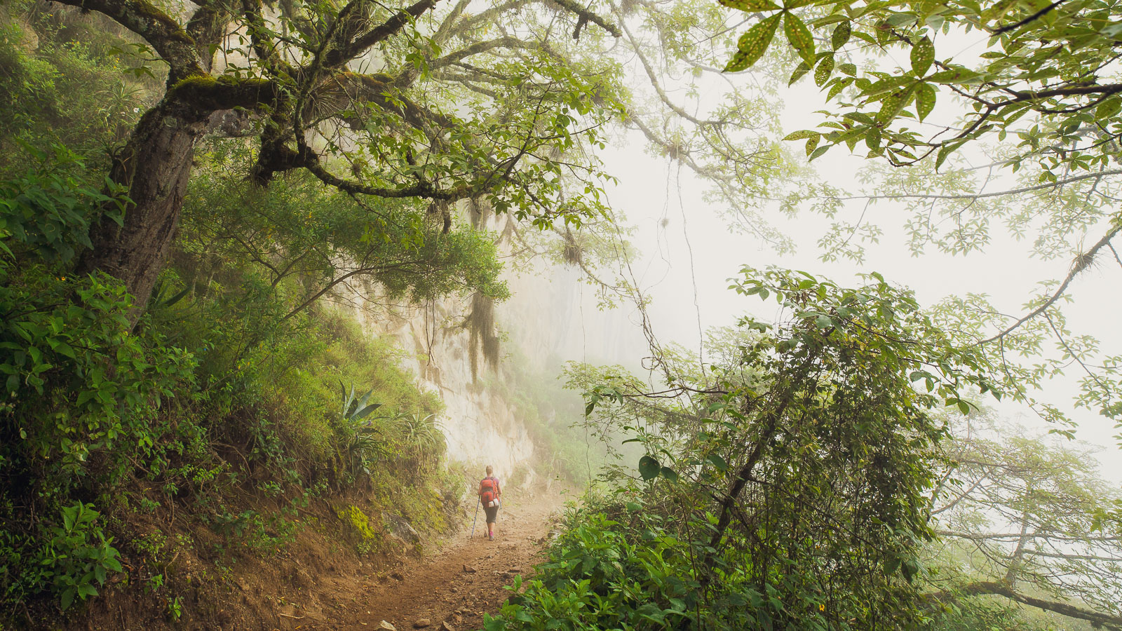
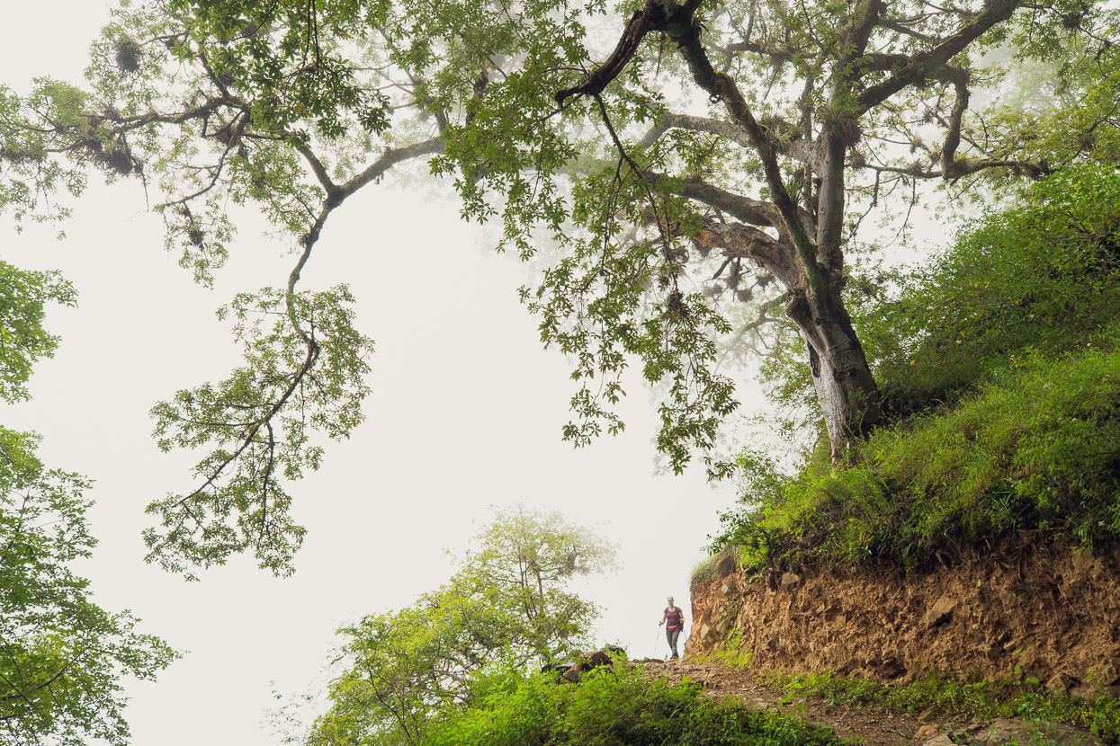
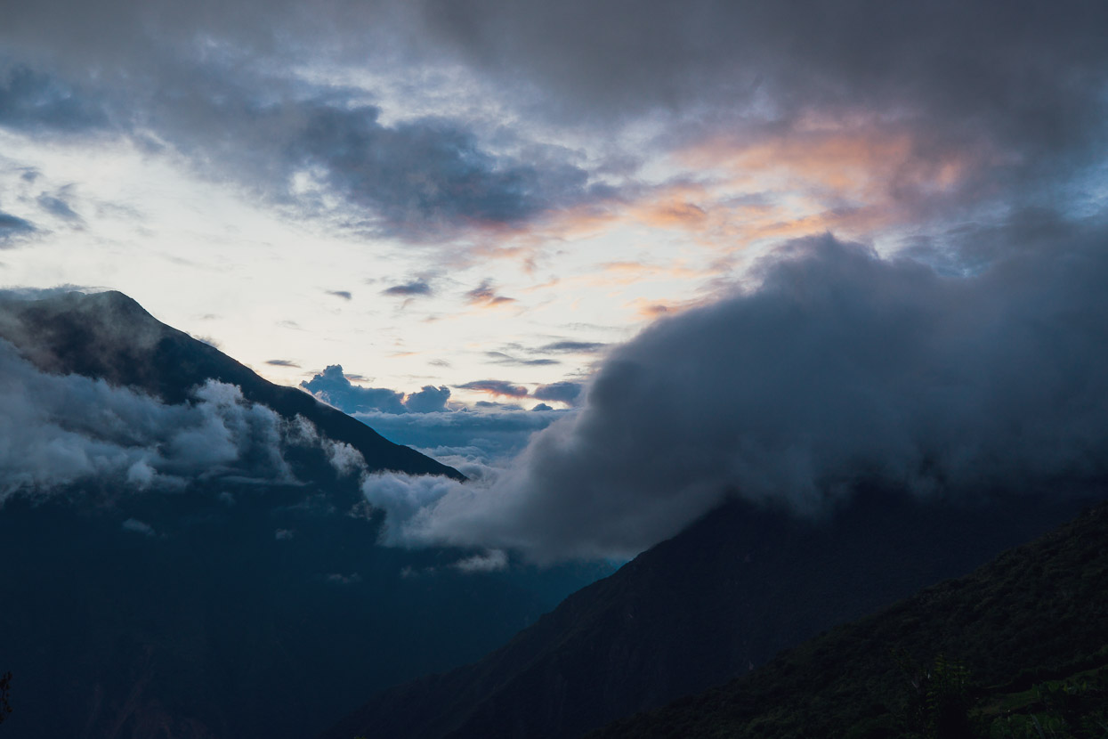
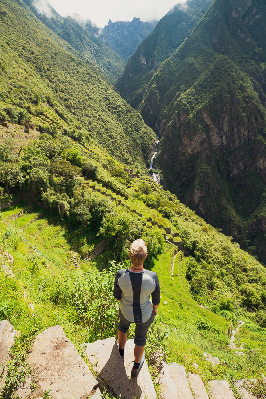
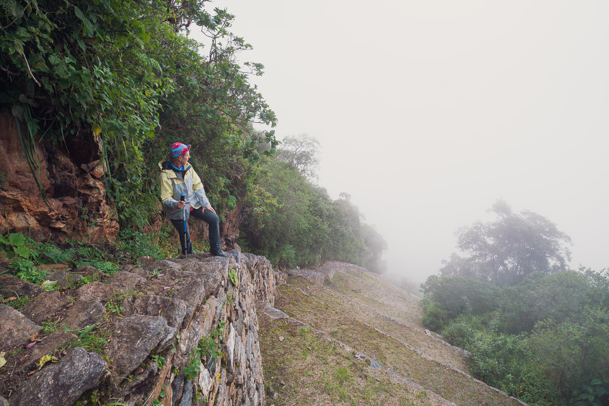
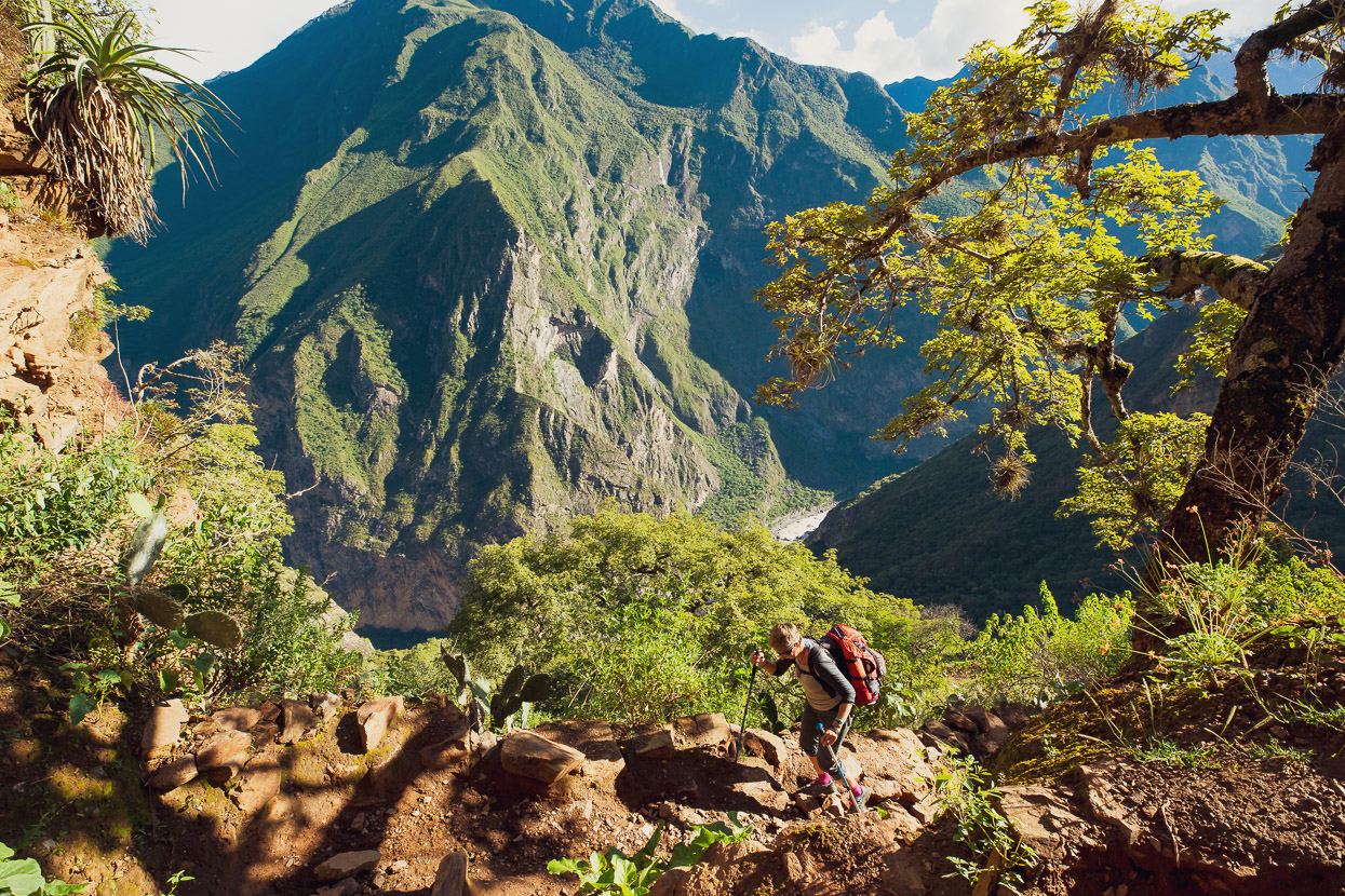
The trail climbs a short way to a saddle and then winds its way down a long, sometimes switchbacked, 1450m descent right to the Rio Apurimac. There’s two places along the way where you can collect water and buy snacks and refrescos, or even meals. Chiquisca is the most well stocked and has a great campsite. For most of the hike down the views were obscured by heavy mist, but we loved the atmosphere of the walk through pockets of forest that gradually changed as we lost altitude.
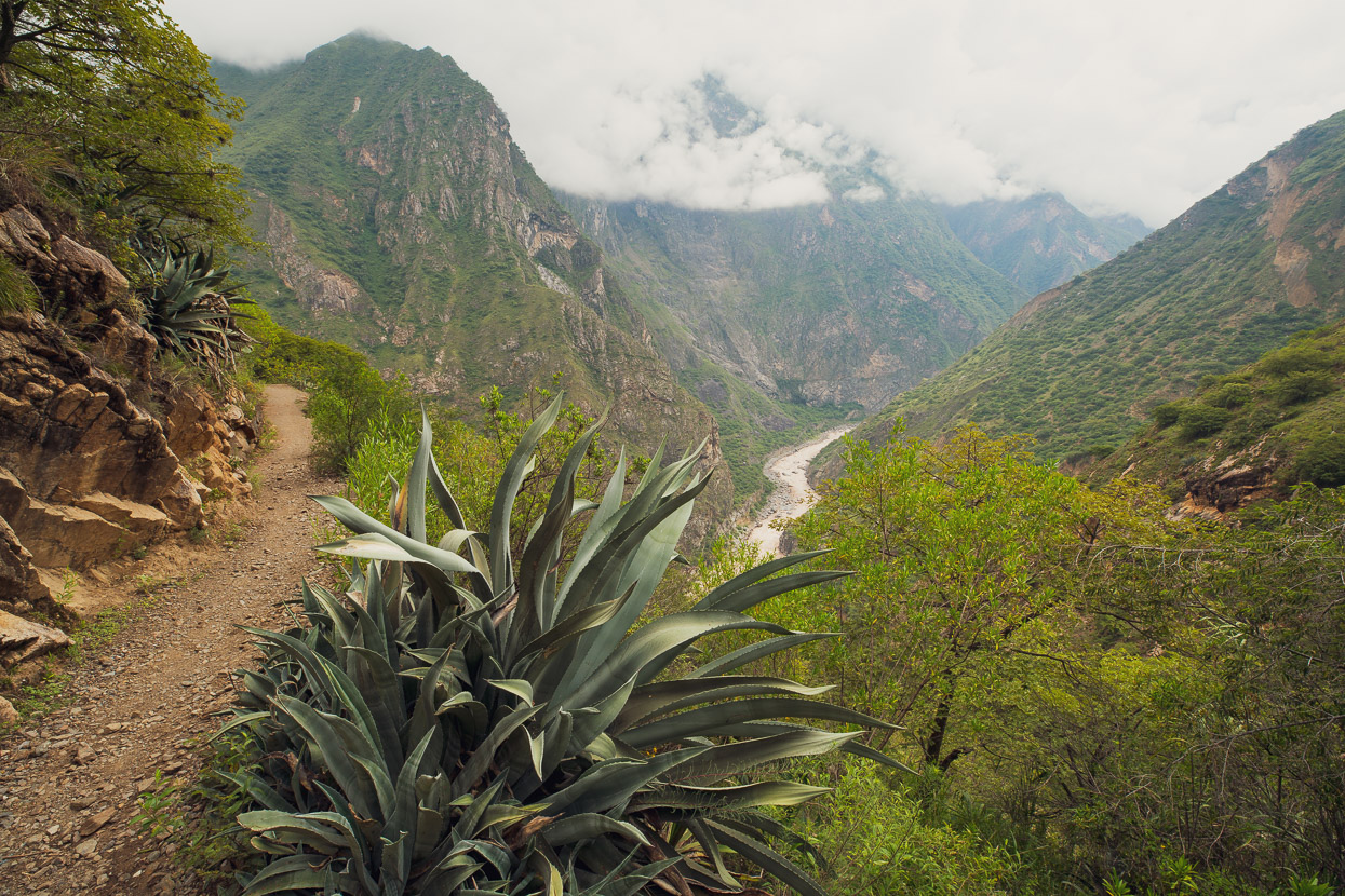
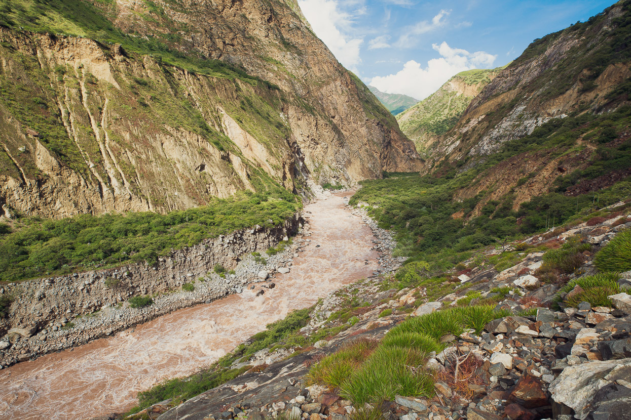
Eventually the morning mist began to burn off and we got views of the Rio Apurimac as it courses its way down the steep canyon. By this stage our surroundings were becoming increasingly dry. Cactus, thorny plants and agave replaced the ferns and greenery of higher up.
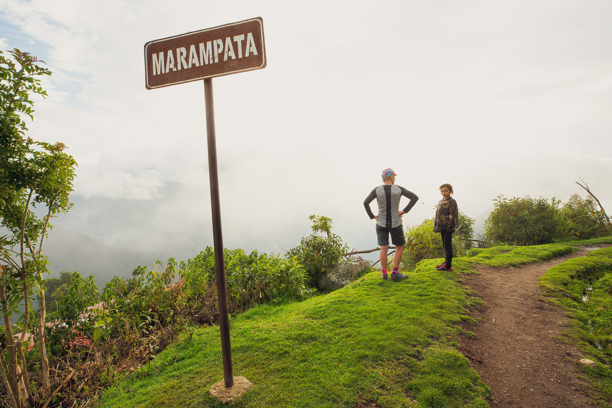
Finally we dropped right into the sweltering dry heat at the river and took some shade at the small camp at Playa Rosalina. You can camp here and buy water and basic meals. We drank some coffee and ate some pan y huevo (fried eggs in buns) before beginning the long hot climb back out up the other side of the canyon. It was the hottest time of the day at 1pm in the afternoon and in the high 20s for the nearly shadeless climb. We were aiming for the hamlet of Marampata, 1450m higher.
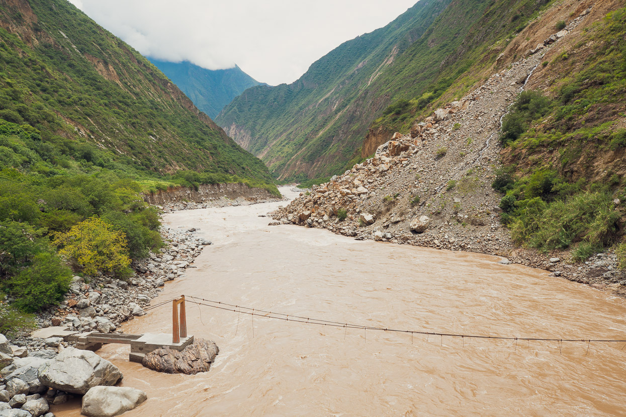
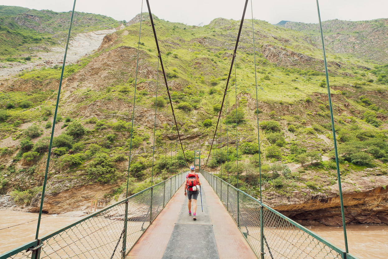
As we crossed the sturdy new bridge the ruins of the former swung in the breeze above the surging flow of the river.
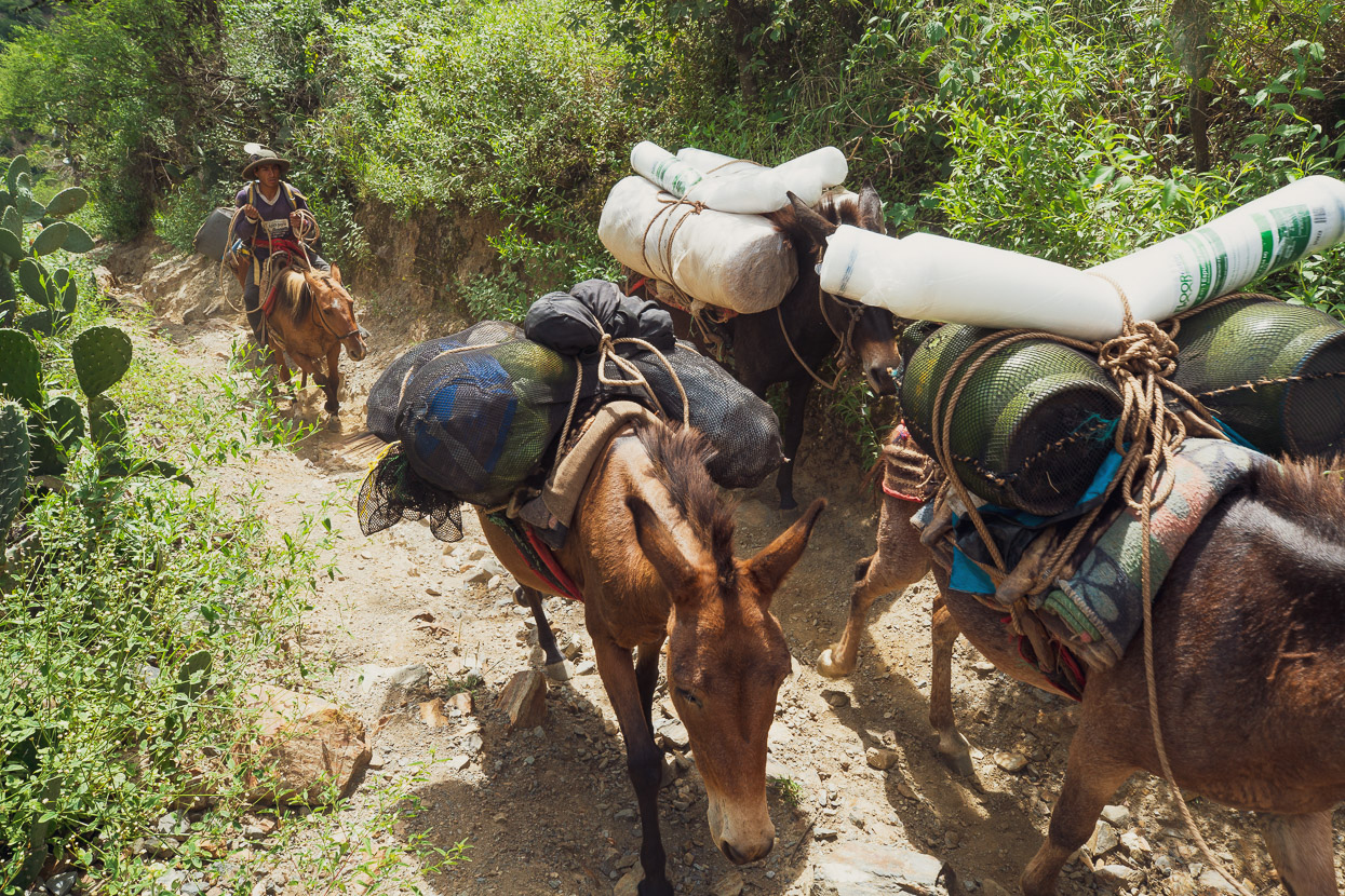
All provisions, fuel and construction supplies for the hiker camps, the hamlet of Marampata and the archaeologist/worker camps at Choquequirao are brought in by mule train and several passed us each day we were walking.
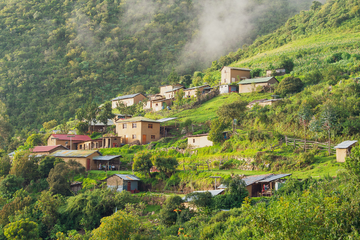
Although there are a couple of lower camps with water and (sometimes) food at both Santa Rosa Alta and Baja, we wanted to maximise our time at the ruins so made a long day to Marampata, arriving after 10 hours of hiking in the late afternoon.
We spoke to the first family we saw, who said they had sheltered camping space and could prepare us a meal. In the meantime we watched the deep valleys fall into darkness while we sat drinking powerade to try and rehydrate after a punishing day. For legs that are used to cycling and not loaded hiking its fair to say we found the walk quite tough and the following morning our unaccustomed muscles were very sore!
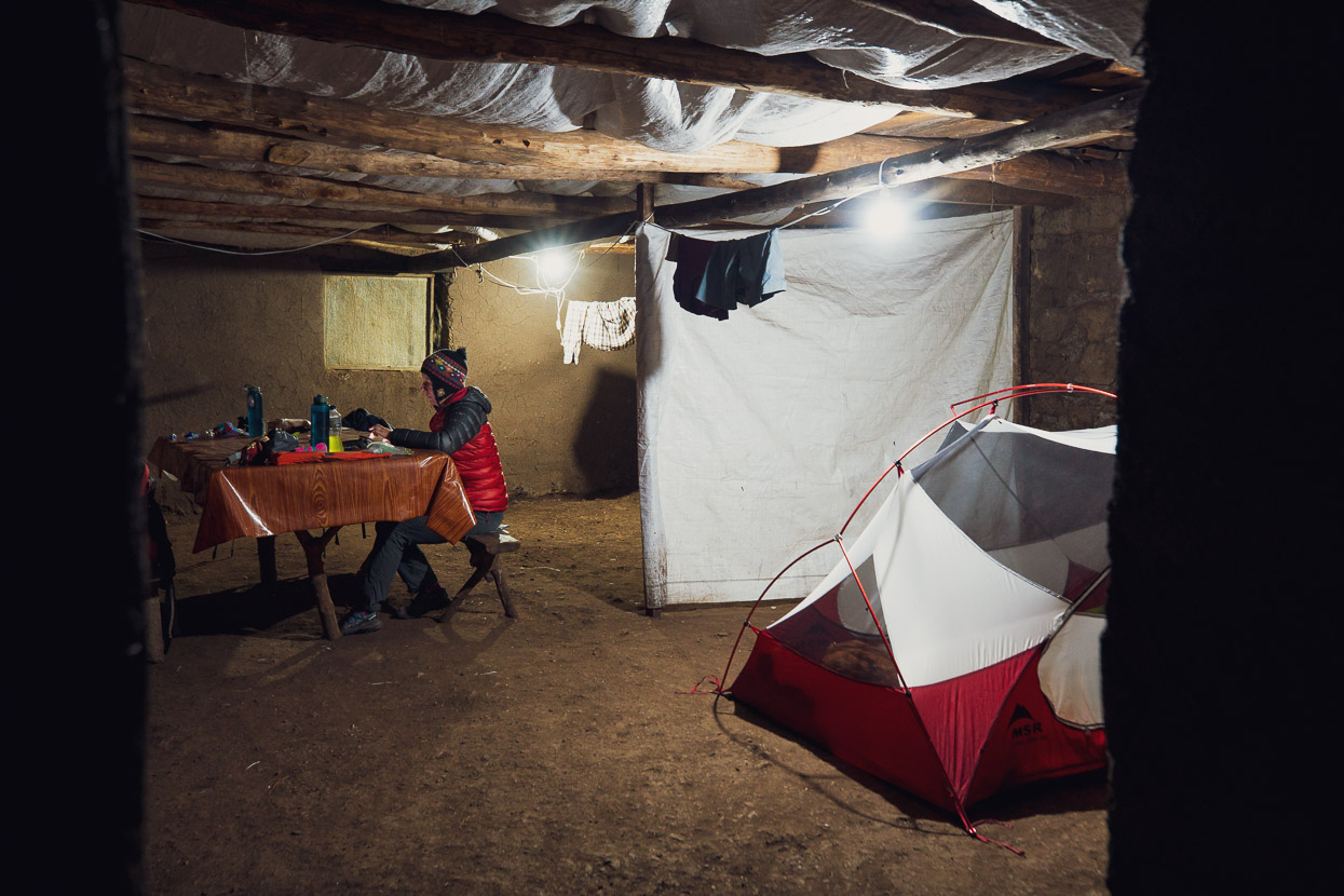
We camped inside an old adobe farmhouse, quite happy to have some shelter from the nightly rainfall.
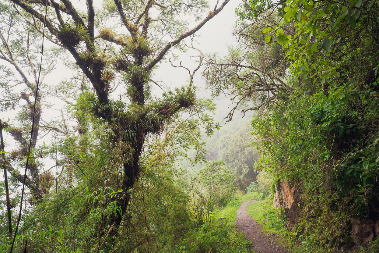
Beautiful cloud forest set the tone of the rest of the walk in the morning. It was just an hour and a half more to the ruins.
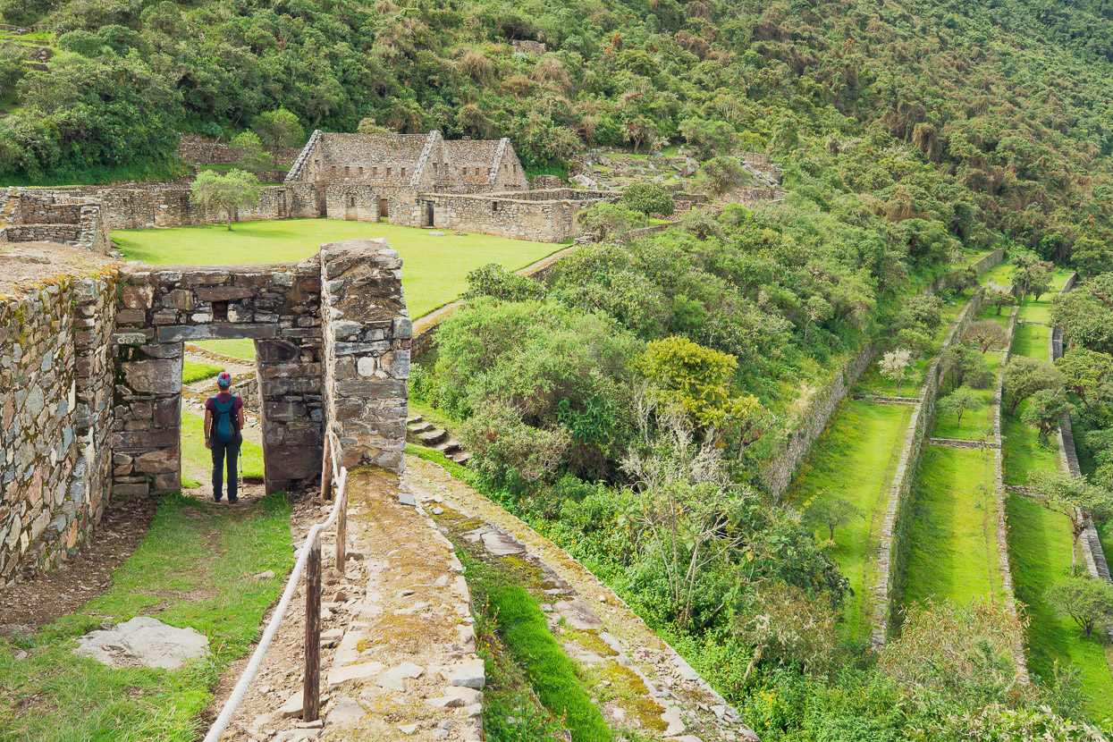
We set up camp on some ancient Inca terraces, nearby to the only three other people who were at the ruins that day. After a short nap and some lunch we set about exploring. The site is very spread out and to only have a day (or less) to explore here does not do it justice – especially considering the effort it takes to get there. We were happy to have a full day and a half to get around in a relaxed way and take time to absorb the place. If you are a ‘ruins enthusiast’ two full days to explore is recommended.
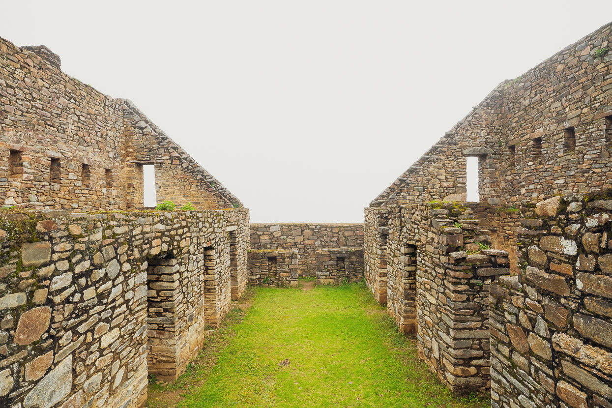
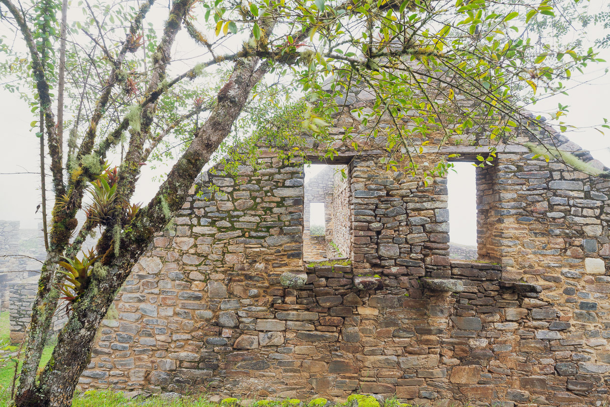
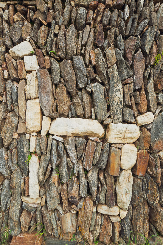
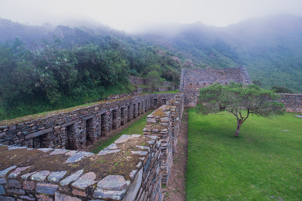
Unlike the granite and limestone grandeur of Machu Picchu and Sacsayhuaman, the rock at Choquequirao is metamorphic and more friable, so the structures do not have the ‘classic’ Inca look about them. Interestingly much of the stone work resembles that of a much earlier site called Kuelap near Chachapoyas, thousands of kilometres to the north. So it’s assumed ‘imported’ workers were used to lead the construction of Choquequirao. Such was the reach and collective strength of the Inca Empire.
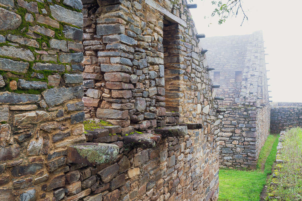
The cylindrical forms protruding from the edge of the roof line are all carved from solid rock and were used to tie down wooden roof beams, which would have been in place to support the original thatch roofs.
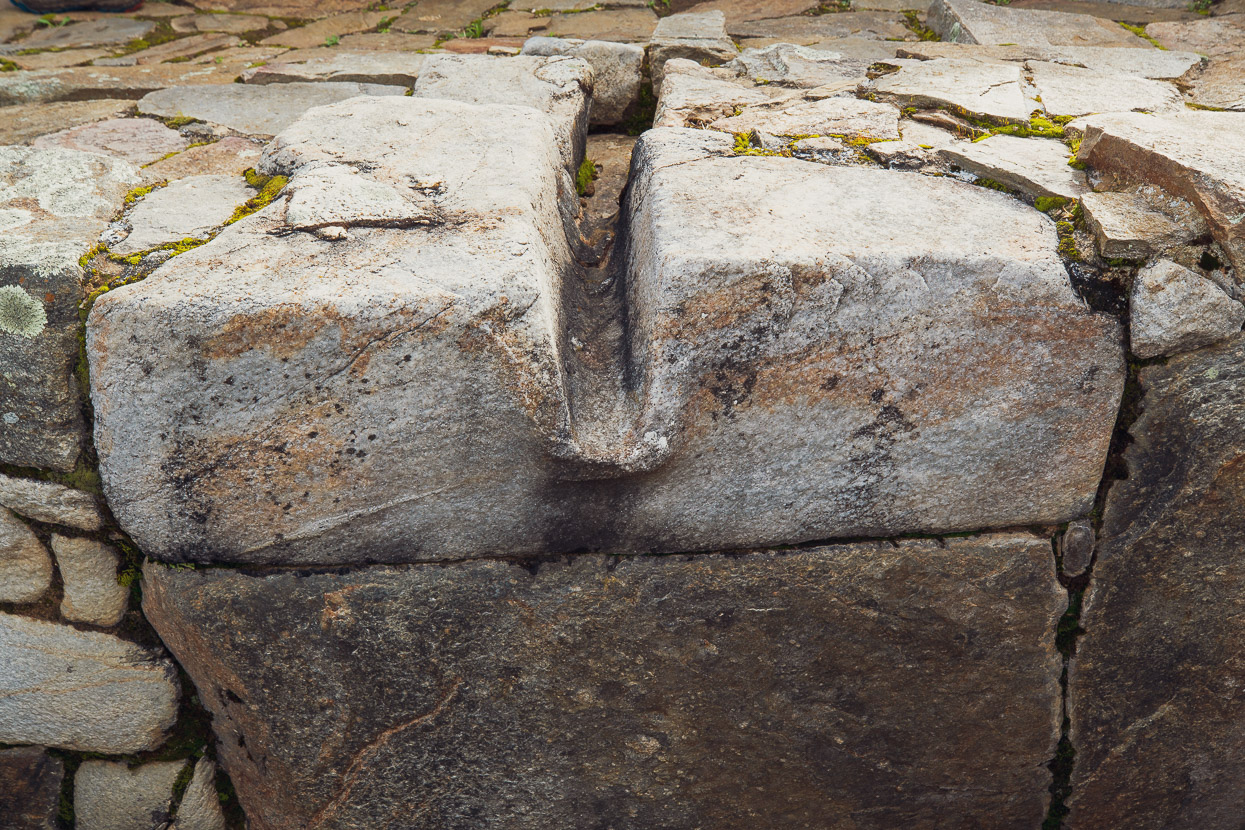
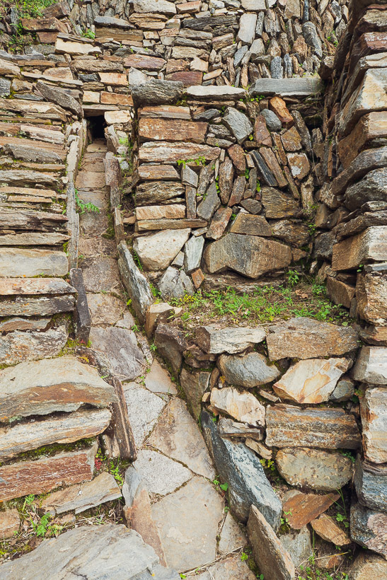
The Inca were masters of hydrology and Choquequirao has some good examples of their aqueducts, which distributed water not only for cultivation, but bathing and drinking. The bottom left photo shows part of what was probably a bathing structure.
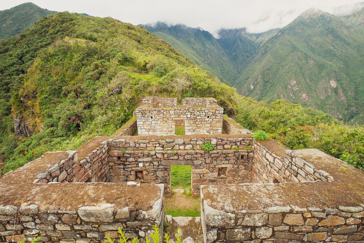
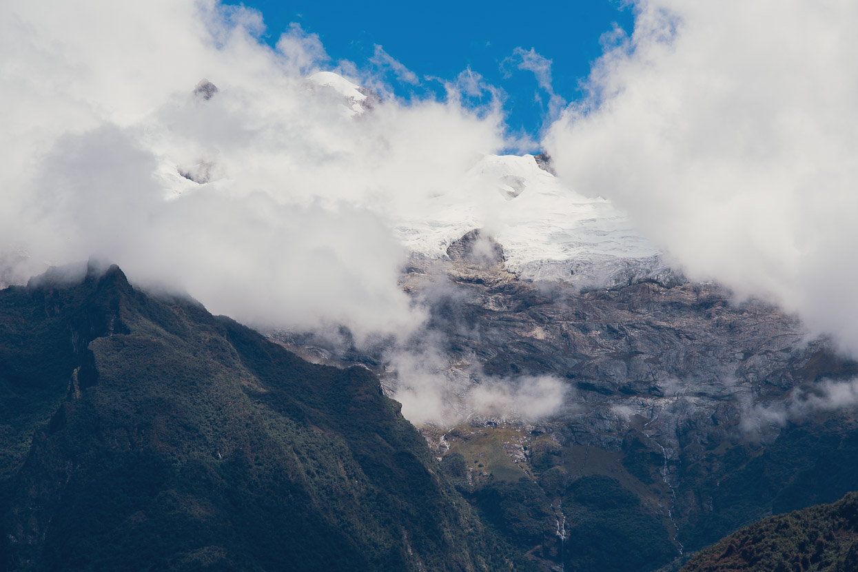
Even though the site sits at 3000m, the surrounding flora and fauna is considered Amazonian, and during its heyday the site would have provided a trading link between the jungle and the mountains. Choquequirao’s surroundings of granitic peaks, with the odd glimpse of the glaciated peaks higher up, lend the place an amazing atmosphere.
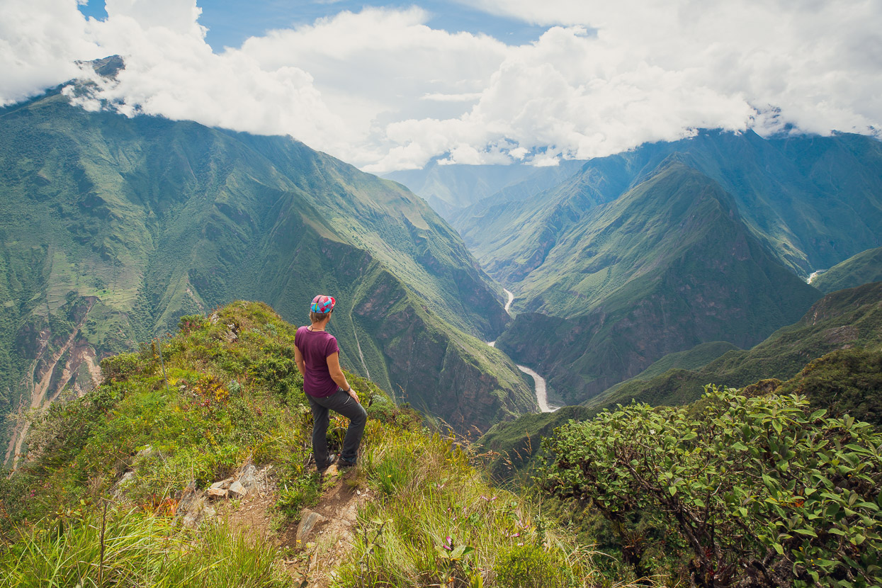
And even though the Rio Apurimac is 1500m below, we could hear the surge of the river.
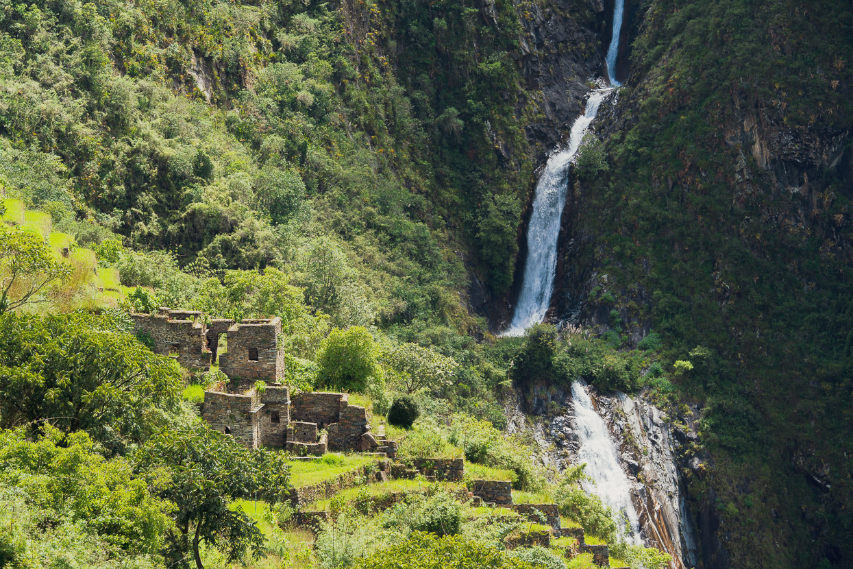
One of my favourite spots was the Casa de la Caida de Agua (roughly House of the Waterfall), which is perched at the end of a long series of agricultural terraces, with a beautiful cascade as its backdrop.
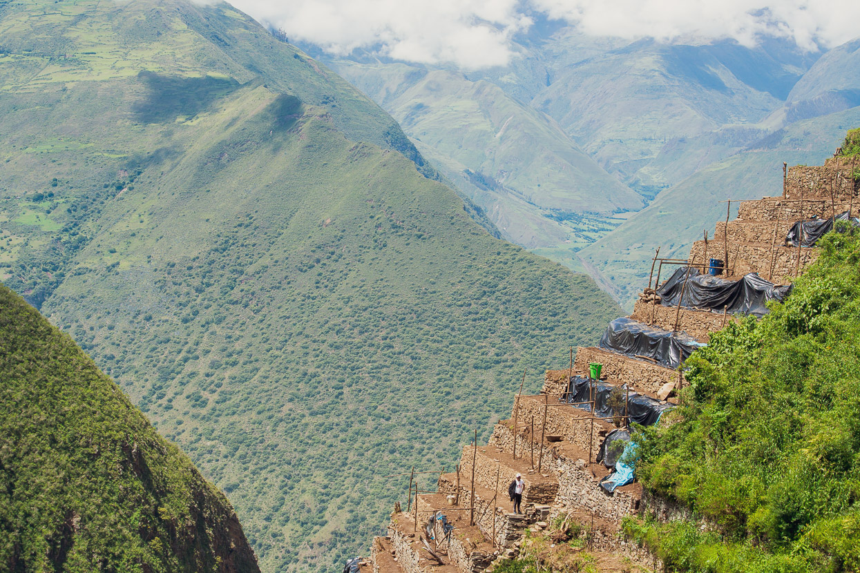
A lot of archaeology work and restoration is still underway at Choquequirao. Apparently only 30% of the site has been excavated.
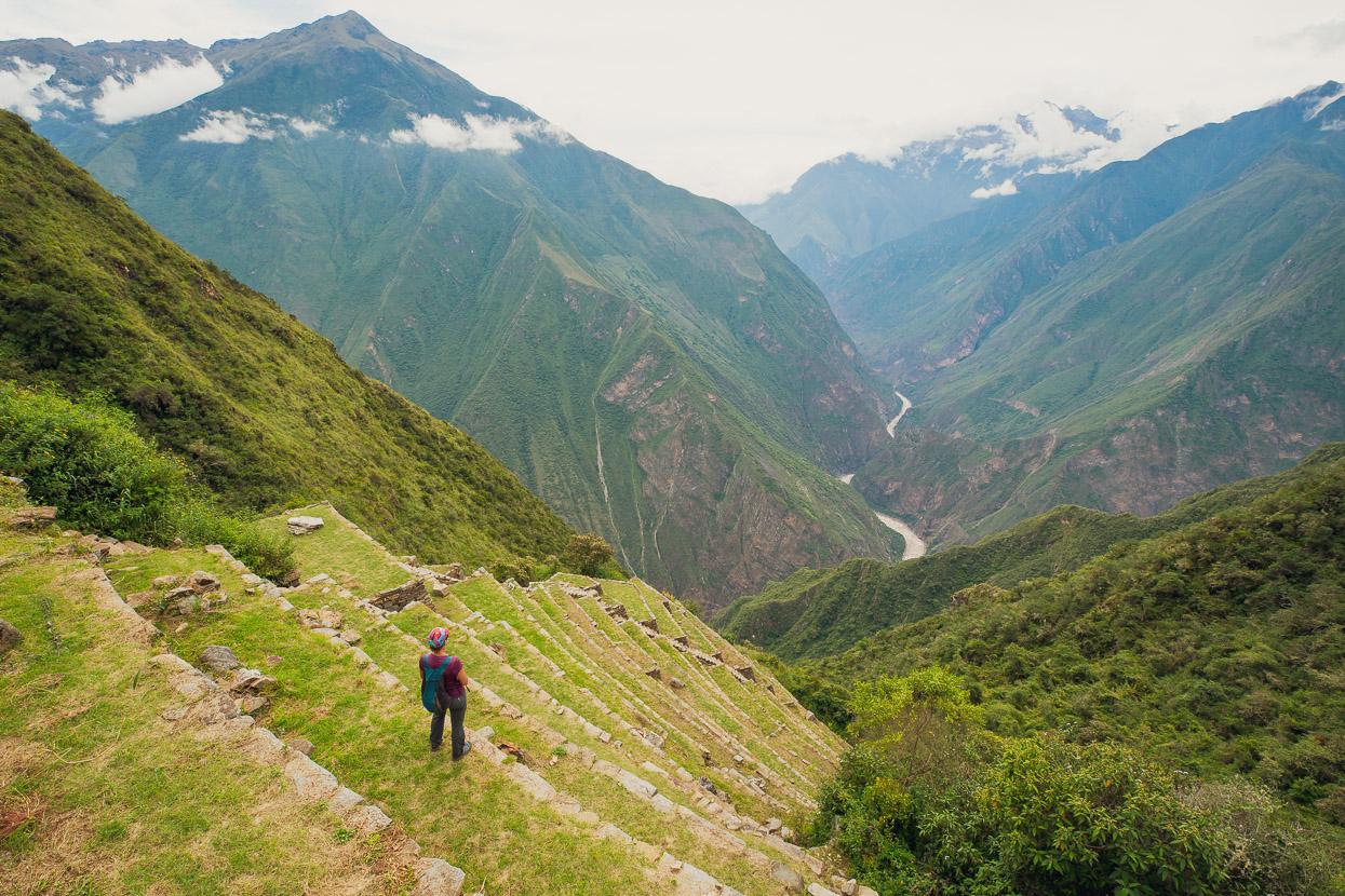
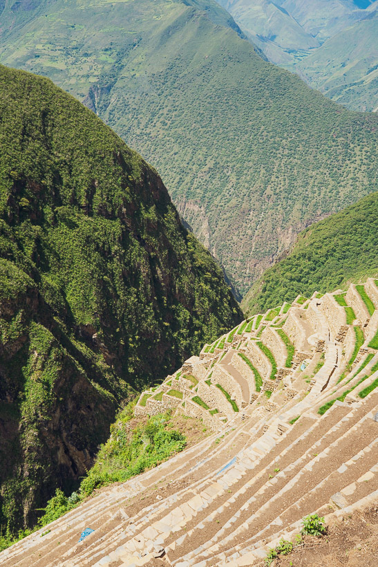
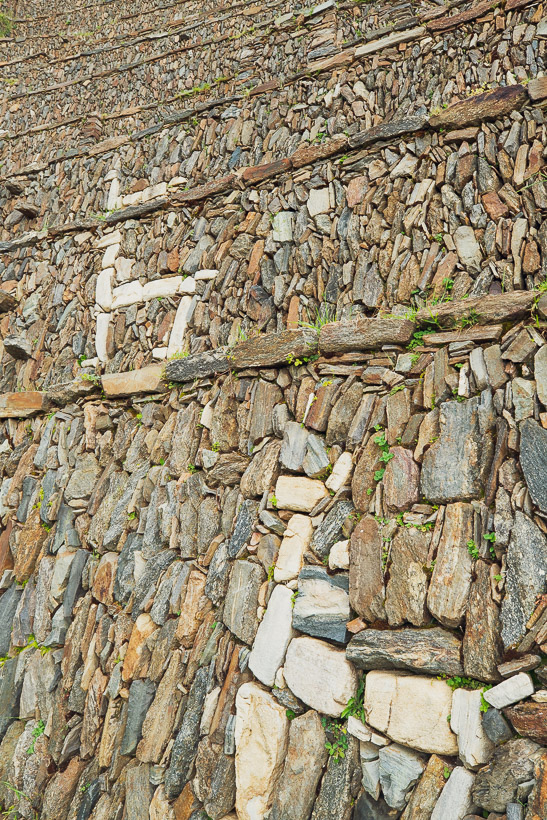
But the most impressive and unique find there so far has to be the Llama Terraces.
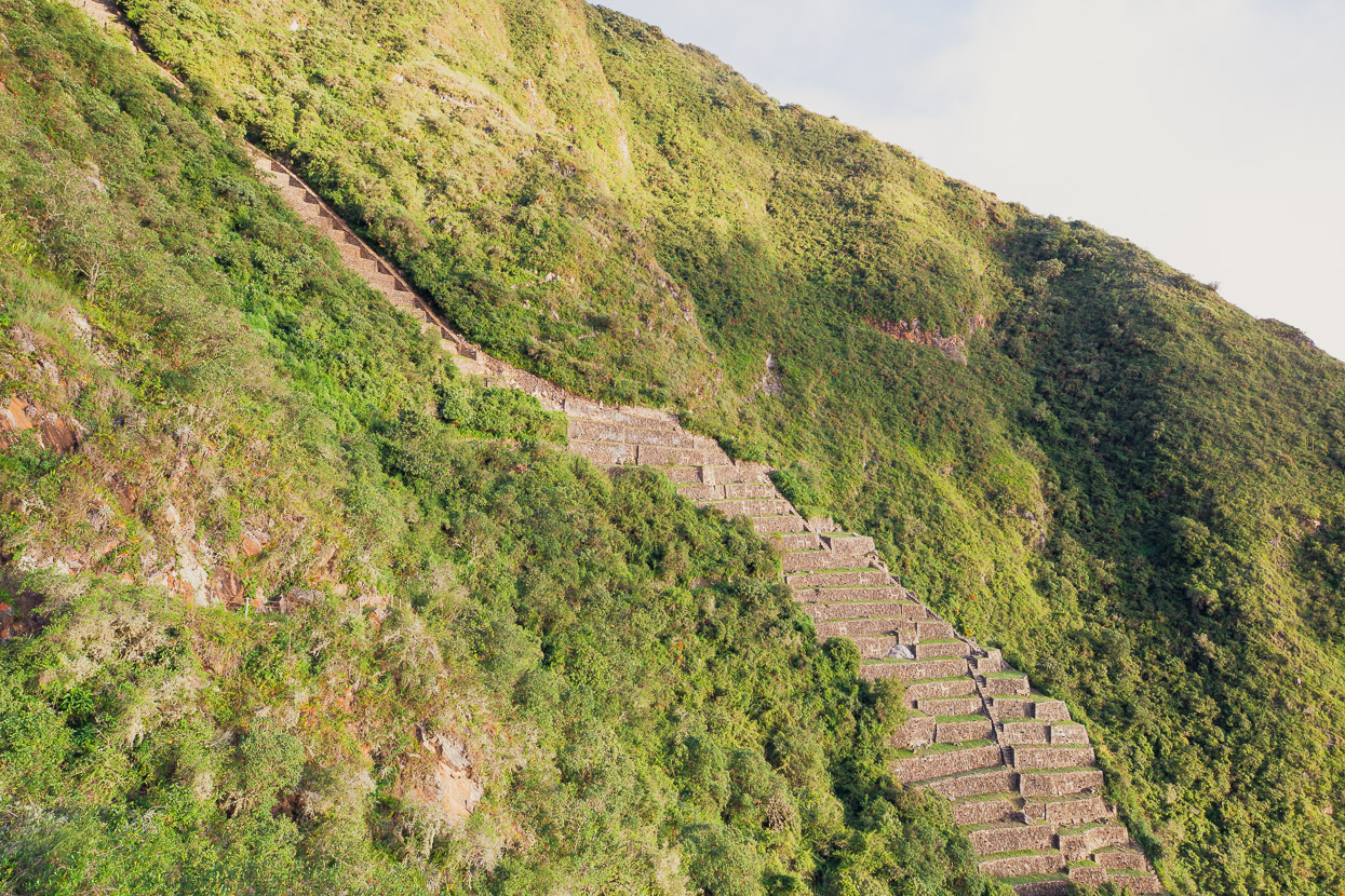
This incredibly steep set of terraces flows like a glacier down a gully on the western side of the ruins, with a dramatic view down to the Apurimac. Made with incredible stone work, and featuring an intricate aqueduct, the terraces are decorated with large white stone llamas. They’re a fantastic example of the Incas conscious effort to not just create things crucial to their survival that were functional and efficient, but beautiful too.
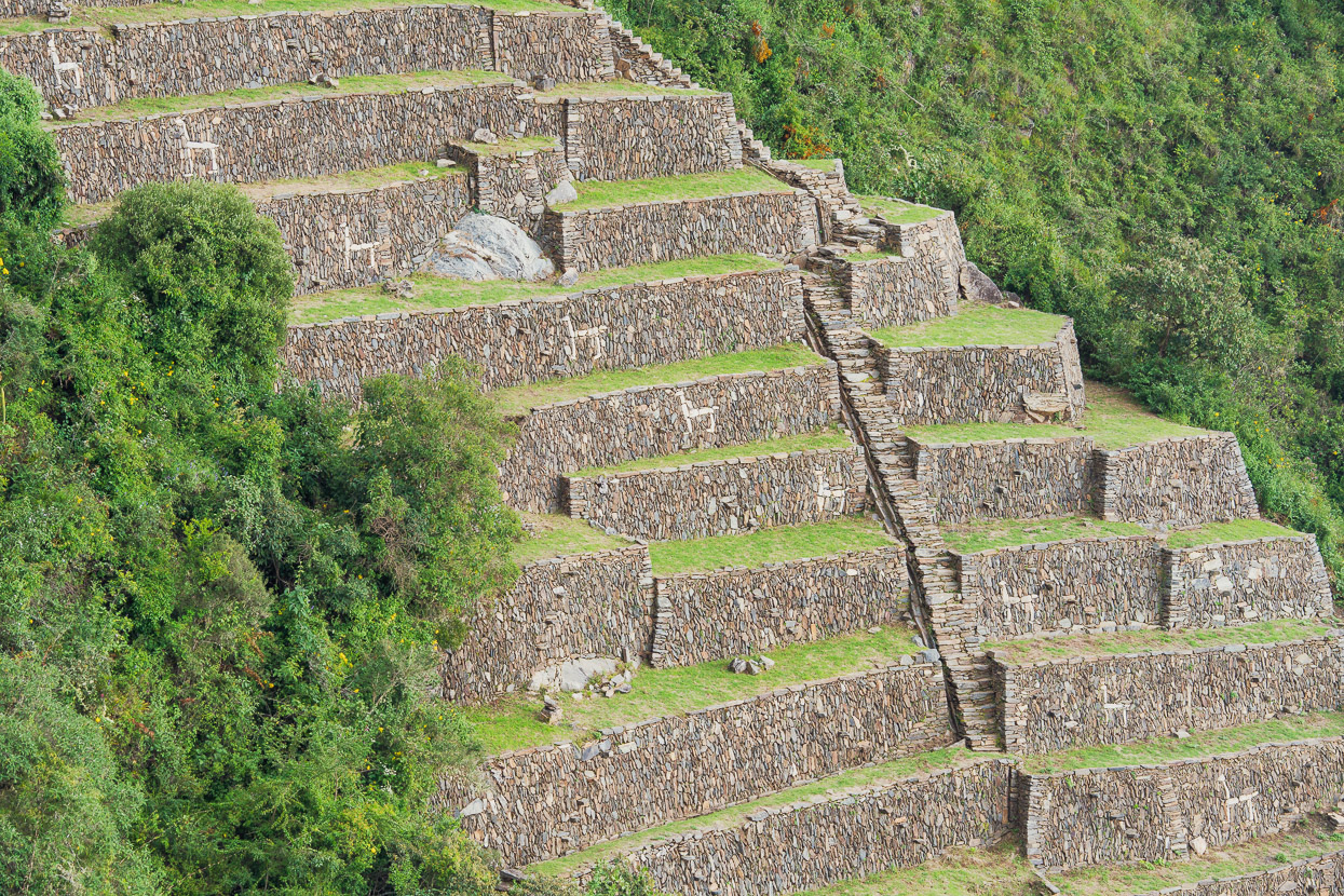
We spent a long time admiring the terraces and the location in general, watching the cloud boil up from the valley below and come and go, until finally we were swallowed by it and chased out by encroaching darkness. It was a good one to save until last.
So as to not give our legs such a hard time as we did on the way in, we made the first day of the walk out a bit shorter. Dropping down to the river and then just hiking up as far as Chiquisca where we drank a well earned beer and lay around in the sun admiring the view.
A thousand metre climb still remained for the morning, but it was a beautiful day and we didn’t rush.
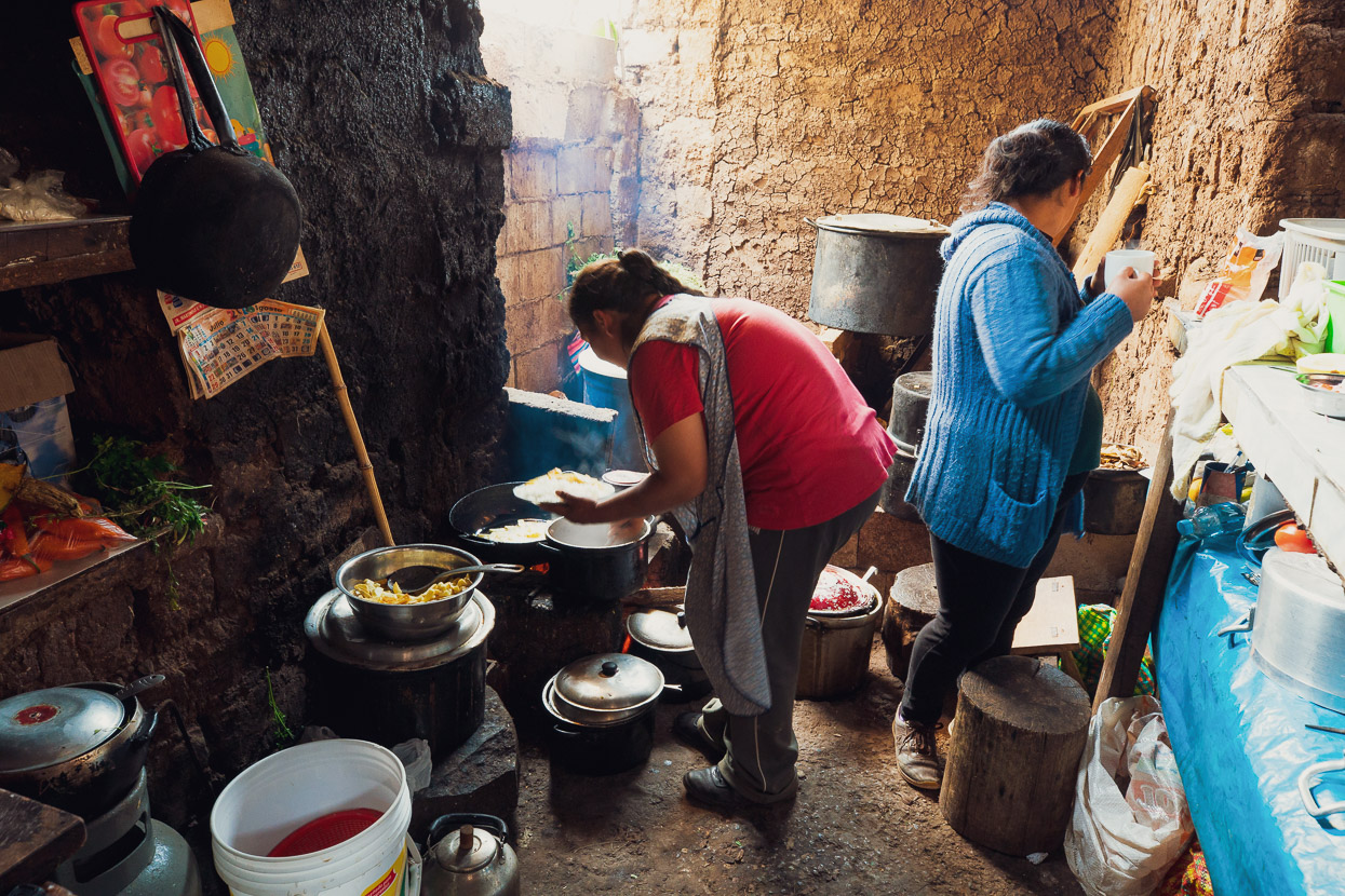
We were still out to Cachora in time for lunch, cooked of course in the most rudimentary of kitchens. The rest of the day was spent repacking our gear and catching a collectivo ride back up the 1000m climb we’d ridden down from the highway. From there we got back on the bikes and coasted down to Curahuasi where we checked into a hotel and took a well earned rest and laundry day the next day.
Next leg: Salkantay Pass to Machu Picchu.
This website has some quite useful and more detailed info regarding the trek, distances and camp/supply stops.
Some of you might be wondering why we didn’t ride this one, looking at all that tempting singletrack. Certainly we were curious before we headed in there, and the consensus from our research was yes you could do it, but there would be a huge amount of hike-a-bike involved. The first descent from Capuliyoc to Playa Rosalina would be 95% ridable for skilled riders and pretty amazing as a ride, but you’d then face a 1550m 99% unrideable climb up to the site. And sadly that same unrideable climb would be a pretty mediocre (albeit mostly ridable) downhill as its rocky and quite steep.
If you were to venture in here with a bike, dual suspension (or at least a suspension fork) would be best, and coming from Yanama would be the logical thing to do to make a traverse out of it as that’s a higher starting point. You’d want to travel extremely light, be a masochist and be prepared to buy as much of your food from the camps as you could, to save weight.
Do you enjoy our blog content? Find it useful? We love it when people shout us a beer or contribute to our ongoing expenses!
Creating content for this site – as much as we love it – is time consuming and adds to travel costs. Every little bit helps, and your contributions motivate us to work on more bicycle travel-related content.
Thanks to Biomaxa, Revelate Designs, Kathmandu, Hope Technology and Pureflow for supporting Alaska to Argentina.


Would’ve been an amazing spot to live. I’m keen to return now and check it out, I didn’t visit on my trip to the area two decades ago now.
Thanks Richard. Yes it was a real treat to visit this place, especially with it being so peaceful. Apparently the Peru Govt has plans to install a gondola here, which is very sad news. So visit while it’s still got the magic!
Those Llama terraces are unreal.
Indeed – really happy to have seen those! An incredible structure for its time.
Hi, really like your story and website, very inspirational! I am looking to bikepack the sacred valey on an enduro bike, and would love to do cachora-choquequirao-yanama-santa theresa. Is the first part at all possible? Pperhaps with renting a mule and driver for the uphill? Or is it unauthorised by bike / too technical / too steep?
Hi Joris, thanks for your comment. This note at the end of the post sums it up pretty well: Some of you might be wondering why we didn’t ride this one, looking at all that tempting singletrack. Certainly we were curious before we headed in there, and the consensus from our research was yes you could do it, but there would be a huge amount of hike-a-bike involved. The first descent from Capuliyoc to Playa Rosalina would be 95% ridable for skilled riders and pretty amazing as a ride, but you’d then face a 1550m 99% unrideable climb up to the site. And sadly that same unrideable climb would be a pretty mediocre (albeit mostly ridable) downhill as its rocky and quite steep.
If you were to venture in here with a bike, dual suspension (or at least a suspension fork) would be best, and coming from Yanama would be the logical thing to do to make a traverse out of it as that’s a higher starting point. You’d want to travel extremely light, be a masochist and be prepared to buy as much of your food from the camps as you could, to save weight.
We did not see the section from Choquequirao to Yanama, but the contour lines are telling: you’re looking at massive climbs and descents. Because I have not seen that section (I heard it has a lot of steps), I do not know for a fact which direction is best to do it in. I did think about doing the whole traverse as a separate trip, and my strategy would be to go without a mule and super light (no sleeping bag or tent), eating/sleeping and resupplying at the rest stops along the way. You’d need to be prepared to carry your bike (for efficiency) for quite long sections. And the heat would be challenging – very early starts would be recommended.