
On the Trail to Machu Picchu
After our Choquequirao hike the next Inca ruin on our list was the ancient citadel of Machu Picchu.
But between our location in the Apurimac Valley and Machu Picchu lay the mighty Cordillera Vilcabamba, not a minor barrier, but one that we had a plan for. Most people get to Machu Picchu from Cusco or Ollantaytambo by train, which takes you to Aguas Calientes, the small town at the base of the ruins. Others trek there from Ollantaytambo on the famous ‘Inca Trail’ (there are actually many ‘Inca trails’) but this, like the train, is expensive and a guide is mandatory. It’s also possible to get there via several hours in a colectivo from Ollantaytambo, as long as you are prepared to then make a 2-3 hour hike along the railway tracks to Aguas Calientes.
The Salkantay Trek, which crosses the Cordillera Vilcabamba via a 4600m pass is an unrestricted alternative to the official Inca Trail. You can hike it independently, or with guides, and if you do the classic version it terminates pretty close to the Hidroelectrica, where the railway track hike starts.
The other convenient aspect of the Salkantay Trek is that bikes are permitted there. Sometimes downhillers do this trek with mule support, so they can ride the 3000m downhill from Salkantay Pass to Santa Teresa. As a bikepackers’ crossing it has a reputation for being quite tough and we had only heard of a few other people doing it, but we’ve become quite accustomed to tramping with our bikes (aka hike-a-bike), to use the Kiwi vernacular, over the past couple of years, so it was an easy decision for us to go this way. The route promised alpine single track, spectacular views and a high pass right underneath the hanging glaciers and icefields of the singular peak of Nevado Salkantay. Who could say no?
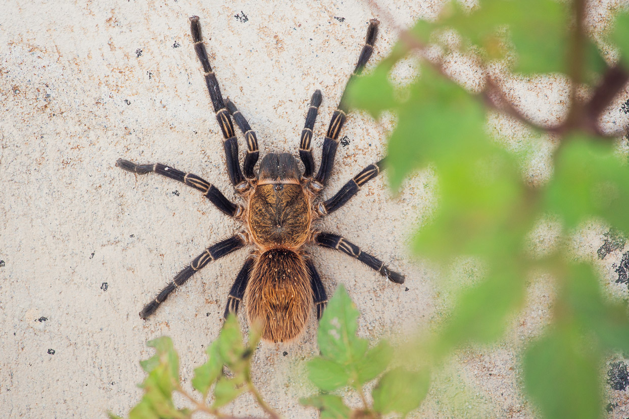
The ride up to Mollepata, which is the official starting point for the Salkantay Trek (many parties start higher at Soraypampa), was uneventful except for an encounter with this amazing tarantula. This was easily the biggest one we’ve seen in Peru – as large as my outstretched hand.
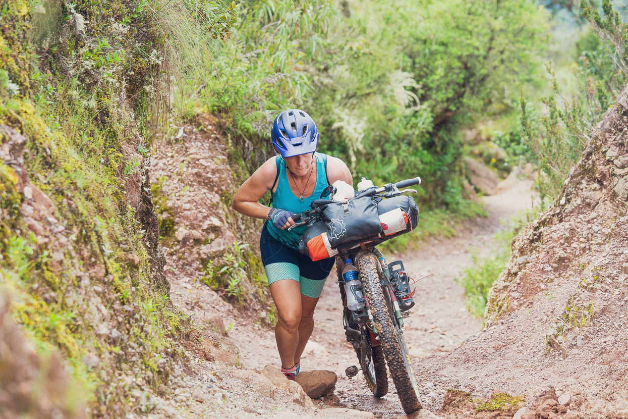
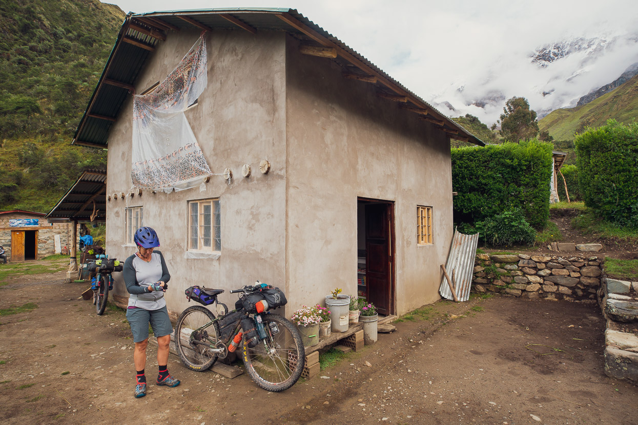
We spent the night at a basic hospedaje in Mollepata, bought some supplies for three days, and left early the next morning. We climbed for a couple of hours on quiet single lane dirt roads and then turned off on to the first section of singletrack and hike-a-bike. It’s also possible to just stay on the dirt road to Soraypampa, and while the singletrack option is definitely harder, it offers some great riding and nice views higher up, before it rejoins the road.
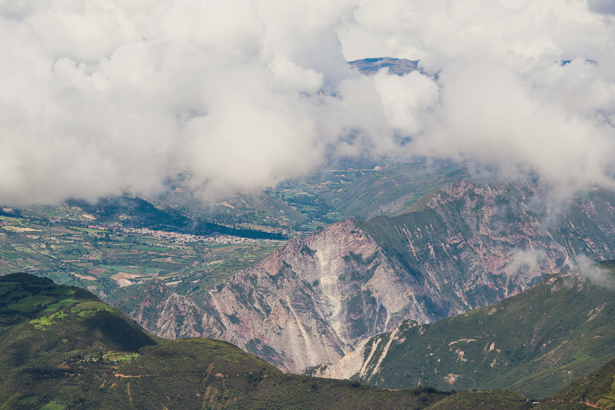
The views were a good distraction from the uphill pushing: this is looking back to the Rio Apurimac canyon and Curahuasi, where we’d had a rest day.
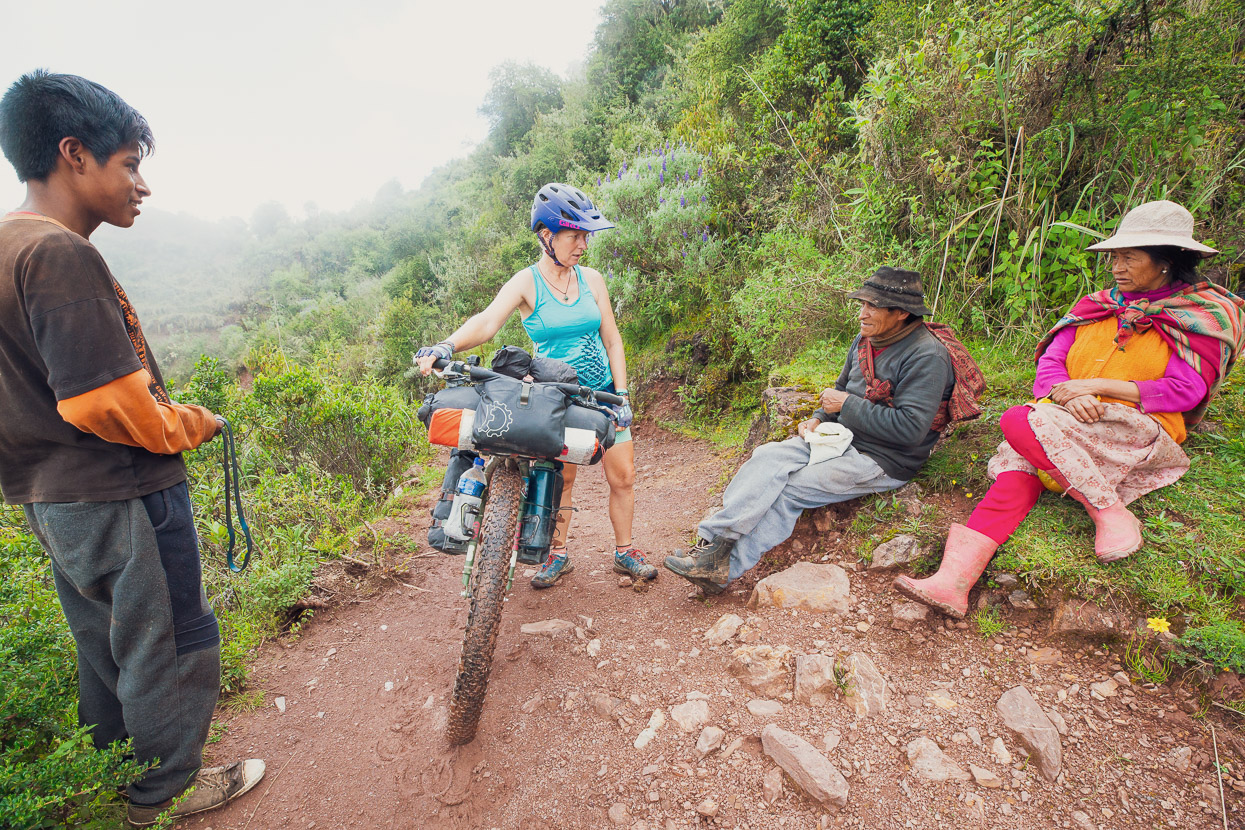
This quechua family were quite bemused to see us riding along their local footpath. They were walking higher to check on their cows, but insisted on staying behind us on the track, while they watched with interest and chewed their coca leaves.
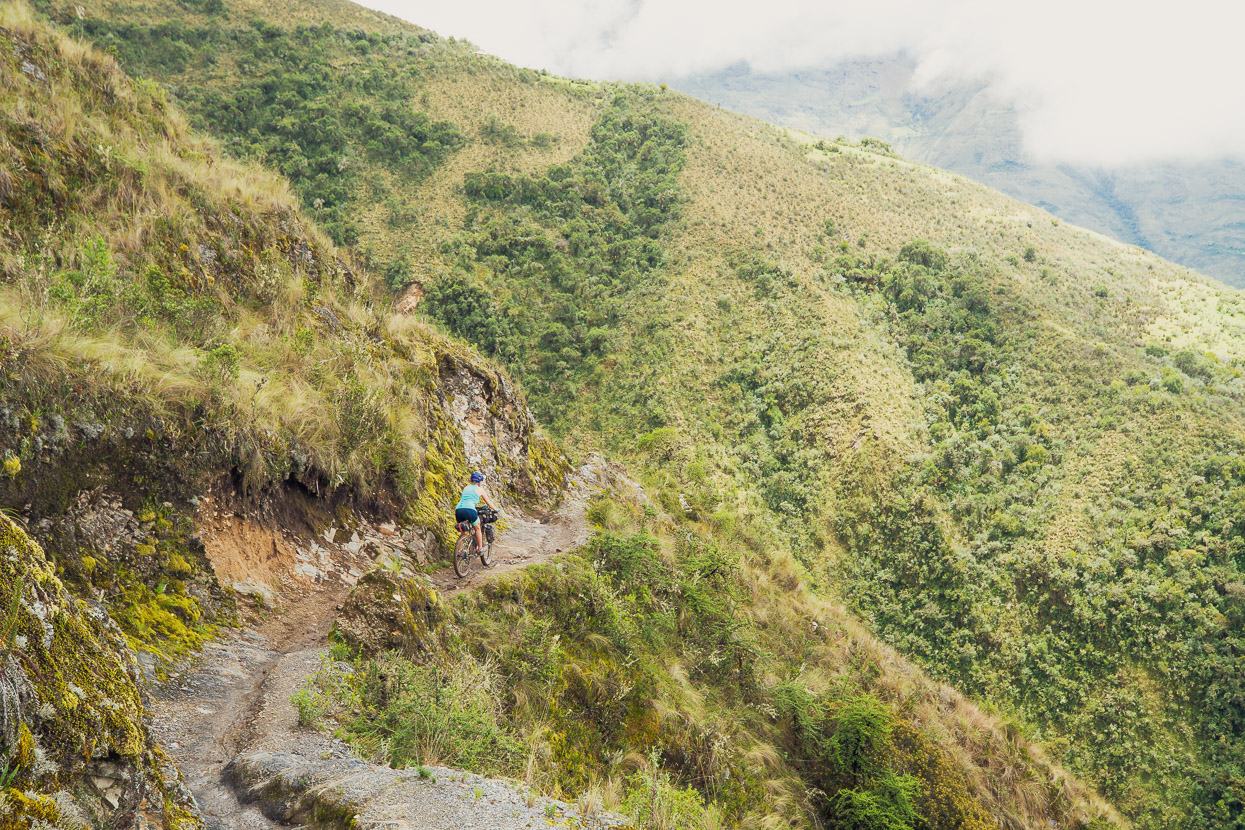
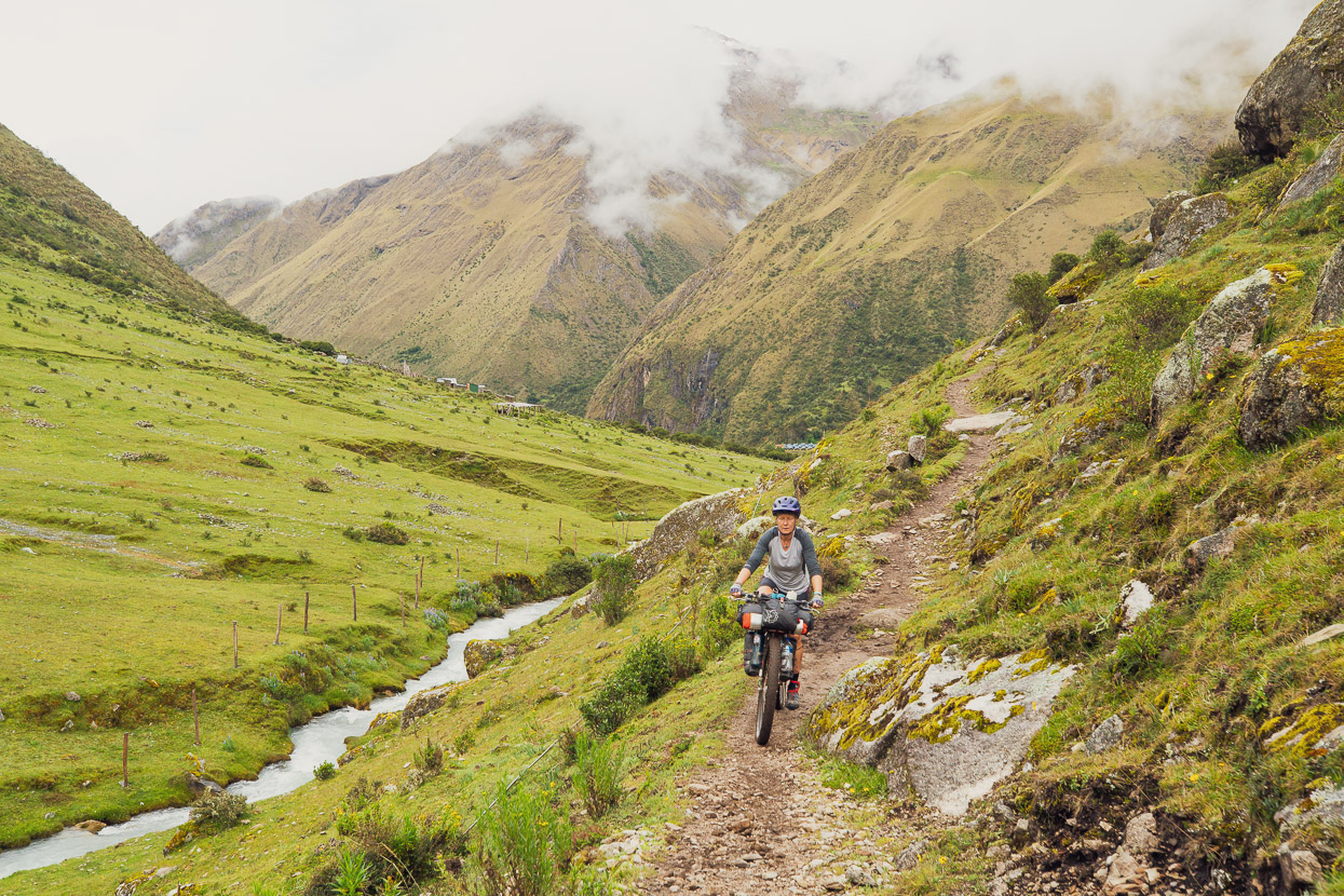
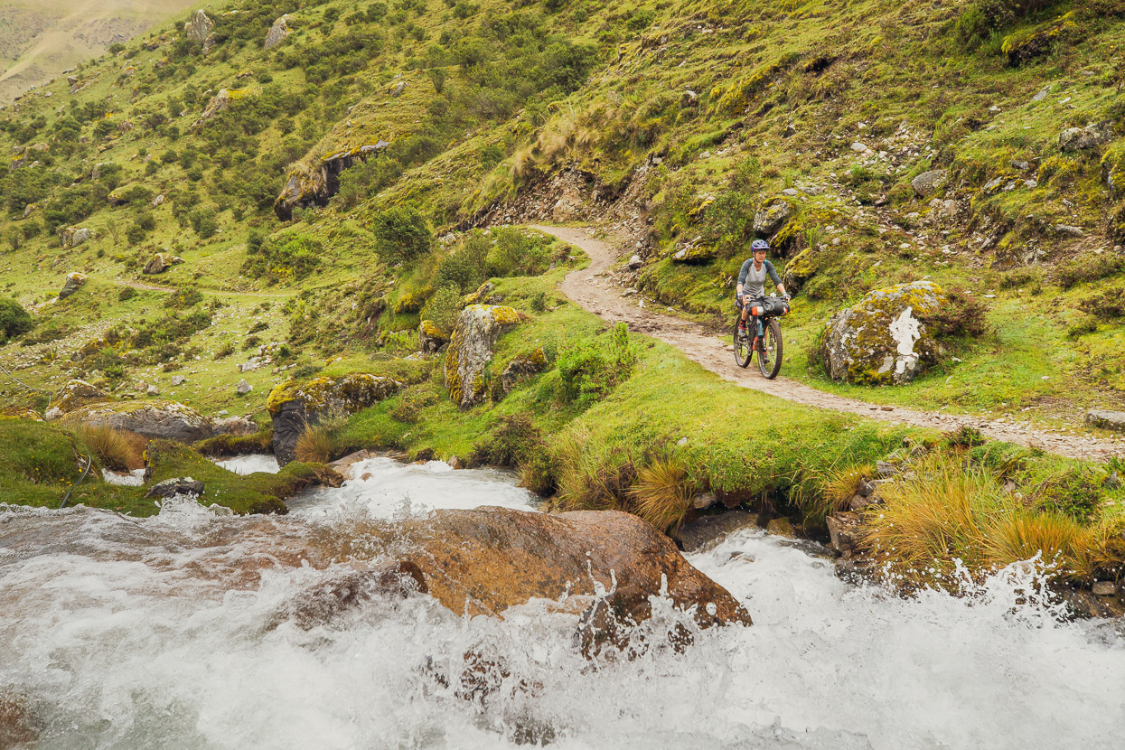
After a while the track changed from mostly unrideable to mostly rideable, and made some great singletrack riding.
Just one dicey slip to cross…
And then the views towards our destination begin to really open up, with Soraypampa ahead.
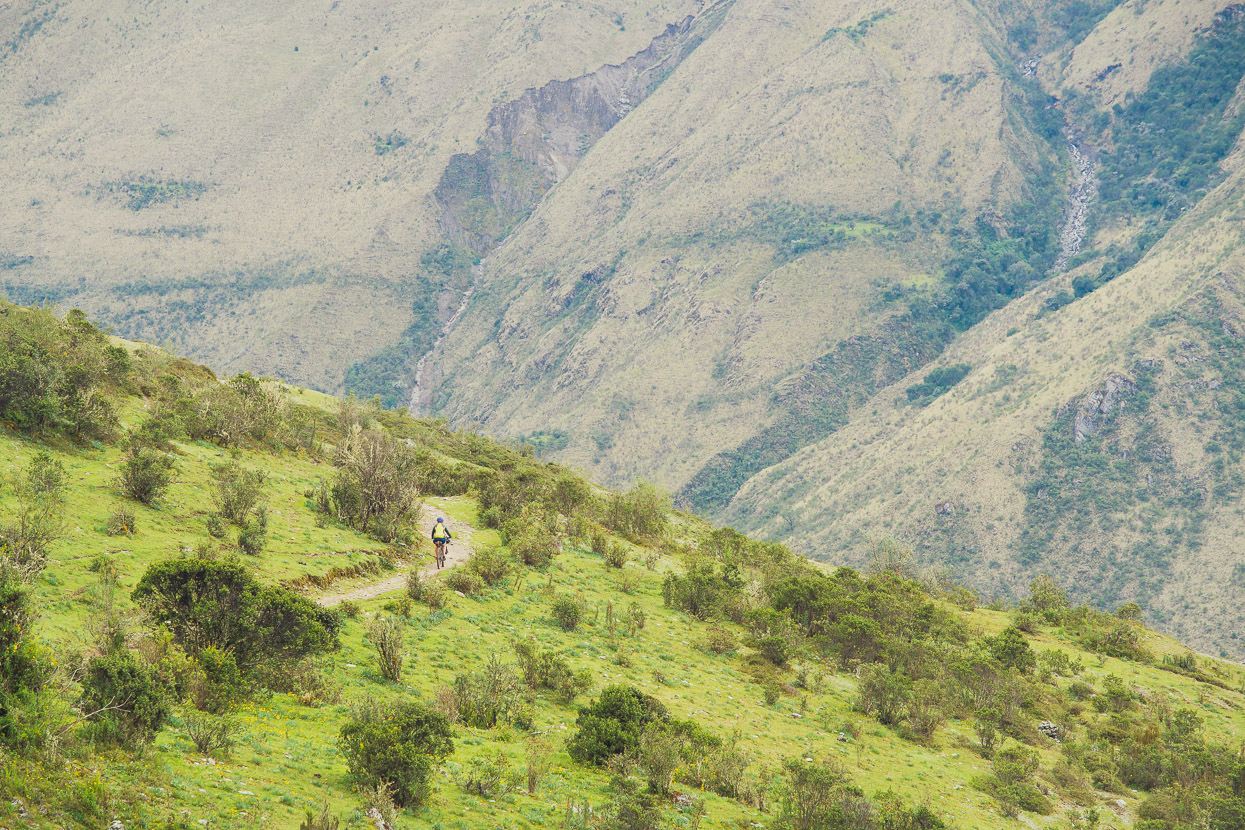
The singletrack joined the road and we had an easy spin the rest of the way to Soraypampa.
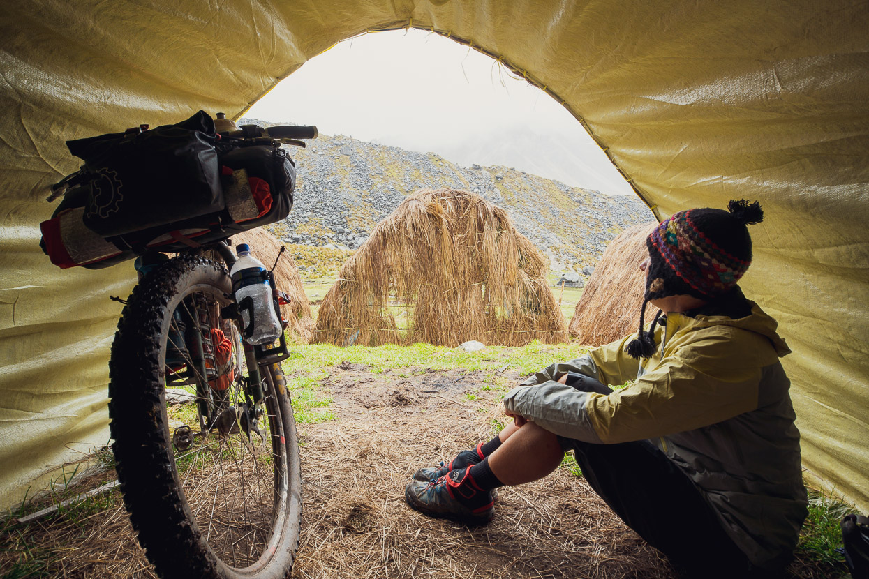
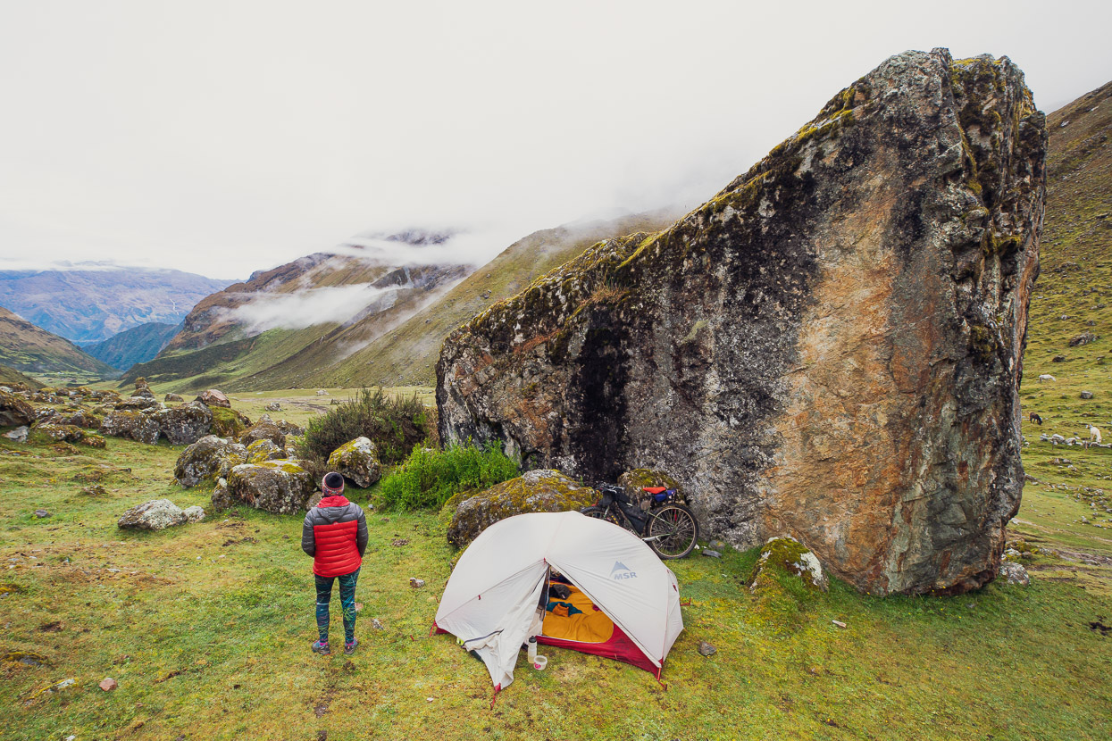
Soraypampa’s a small, spread out, village with a mix of accommodation to cater for the various tiers of trekking party who pass through. We pitched our tent in someone’s backyard for 10 soles, and left our bikes there for the rest of the afternoon while we hiked up to the famous Laguna Humantay.
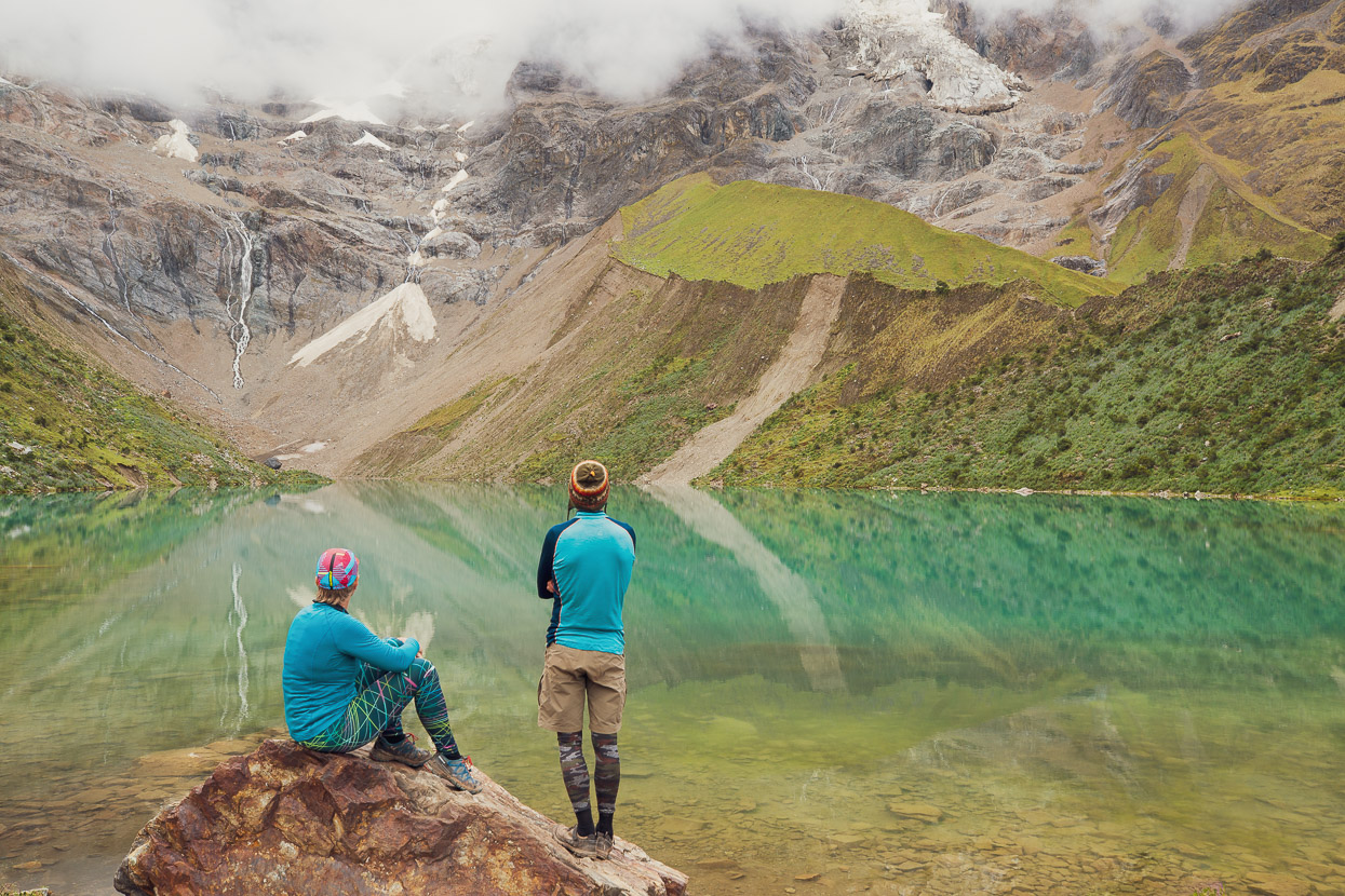
This beautiful turquoise lake is nestled in the moraines below a huge mountain face. It has become a very popular day trip from Cusco, as well as being visited by most of the trekkers as a side trip from the Salkantay trek. It takes about an hour to an hour and a half to walk up there from Soraypampa.
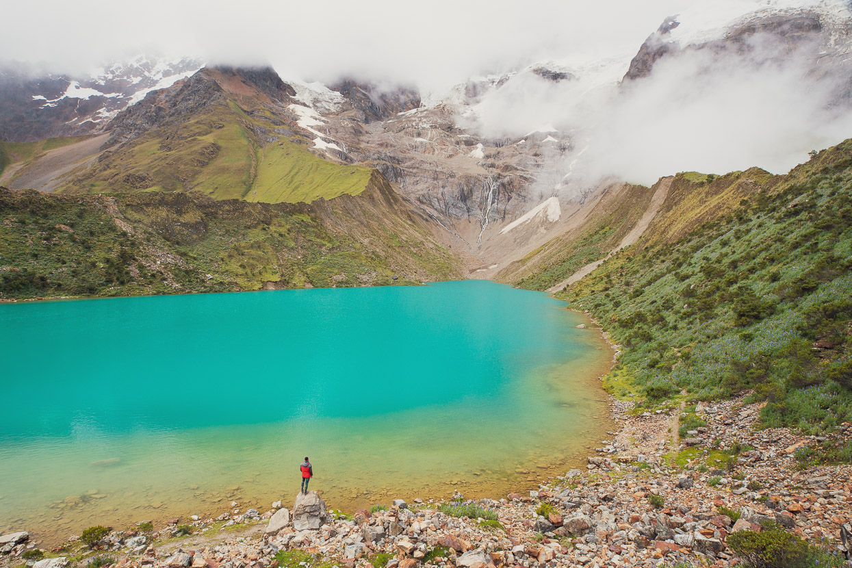
My photos portray an illusion of tranquility though. There were maybe 30 other people also hanging out around the lake outlet, admiring the view, taking selfies and posing on the rock, just as we did.
The annoying aspect was a ‘guard’ from the local community who is in situ at the site all day, every day. Armed with a whistle, he would blow it as soon as anyone did anything he considered to be breaking the ‘rules’. Not that we saw a sign with any rules. So if someone attempted to walk around the lake edge or up a well worn trail on the moraine wall, the whistle would go. If anyone stood on the wrong boulder, the whistle would go. One poor young guy wanted to take a dip in the lake, but by the time he had half his clothes off the guard marched over and told him off. I can appreciate certain rules being applicable on what is (I think) tribal land, but it was all a bit ridiculous. Not being allowed to walk anywhere away from the edge of the lake is simply an insult to 99.9% of the site visitors intelligence.
Excuse if me if this sounds like a rant, but this information might be useful to other visitors. Anyway, it got worse. We’d brought torches and warm clothes, and had the GPX for the trail up from the village in our phones. We’d planned to stay until just after sunset, in hope of good light. But come 4.20pm, the guard started marching around telling everyone they had to leave at 4.30. I couldn’t believe it and of course resisted. I politely explained our level of preparedness and our 30 years experience in the mountains, but it was to no avail. We lingered, took more photos and tried to ignore him, but then his phone came out and he started taking photos of us and threatening to call the police on his radio. I was super pissed off, but acquiesced in the end purely because we didn’t want any obstacles to crossing the high pass the following day.
We started down, with the guard close on our heels making sure we didn’t double back. But then further down he drifted off to check another trail so we decided to go cross country and walk down slowly to enjoy the rest of the evening up there. Of course as soon as we got down a bit, the afternoon cloud started to vanish as the air cooled and the peaks came into full view. The reflections at the lake would have been a magnificent sight, if it weren’t for their overzealous rules. Nevertheless, it was a pretty nice place to be.
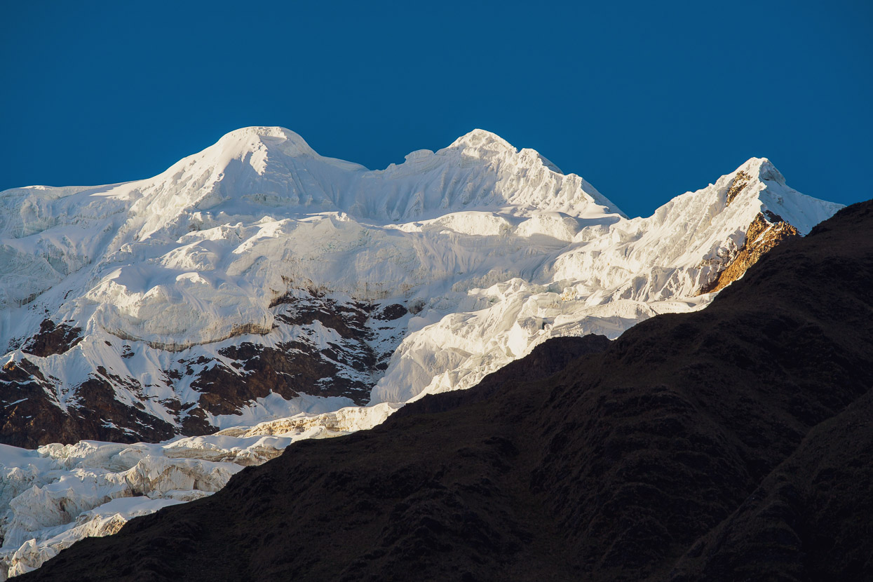
Towards sunset the air cleared completely and the peaks came into sharp clarity against the sky.
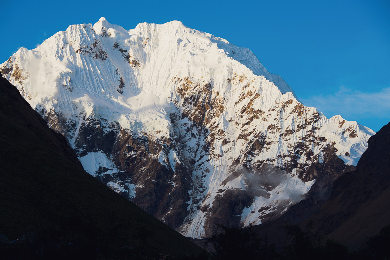
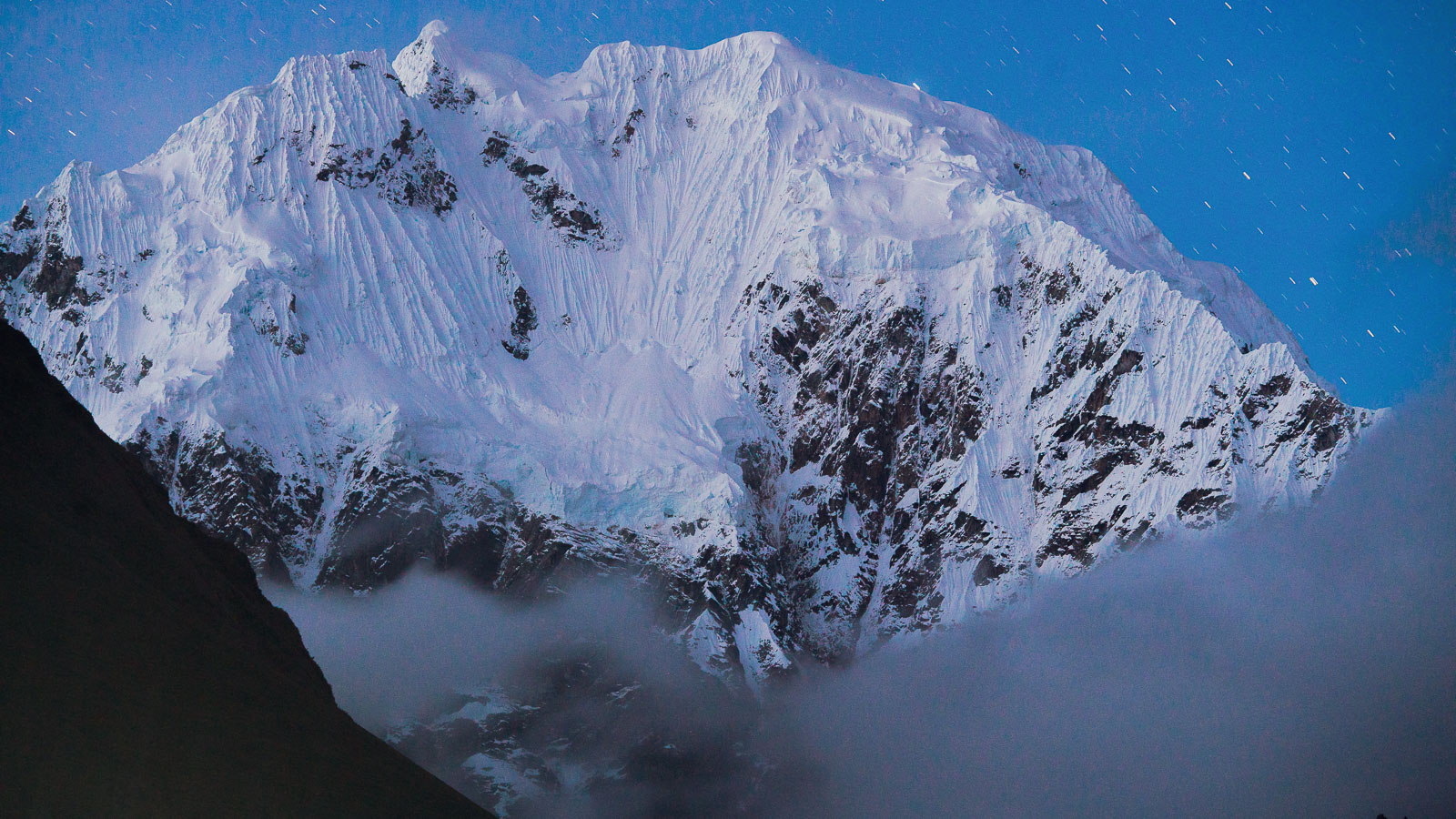
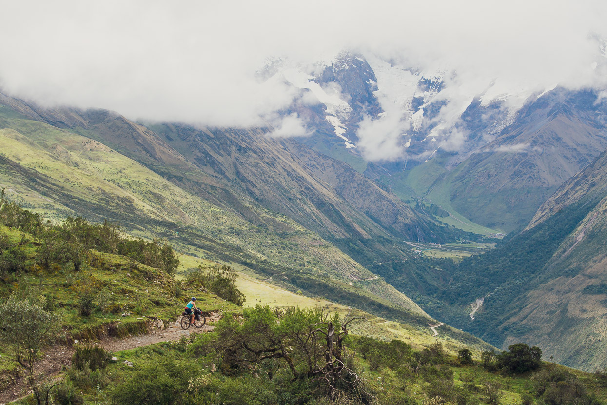
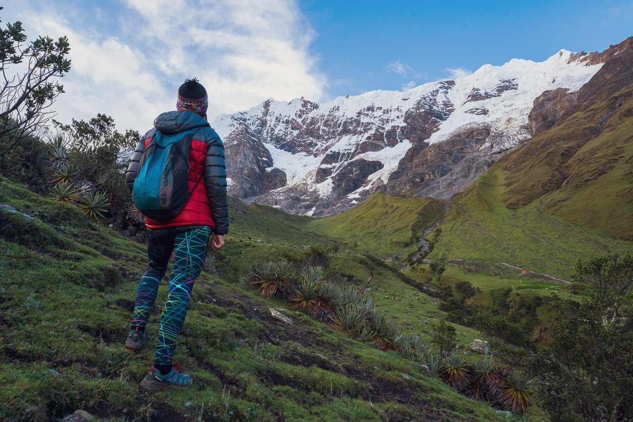
Further down we rounded a corner and the big one, Nevado Salkantay (6271m) came into view at the head of the valley we were riding up in the morning.
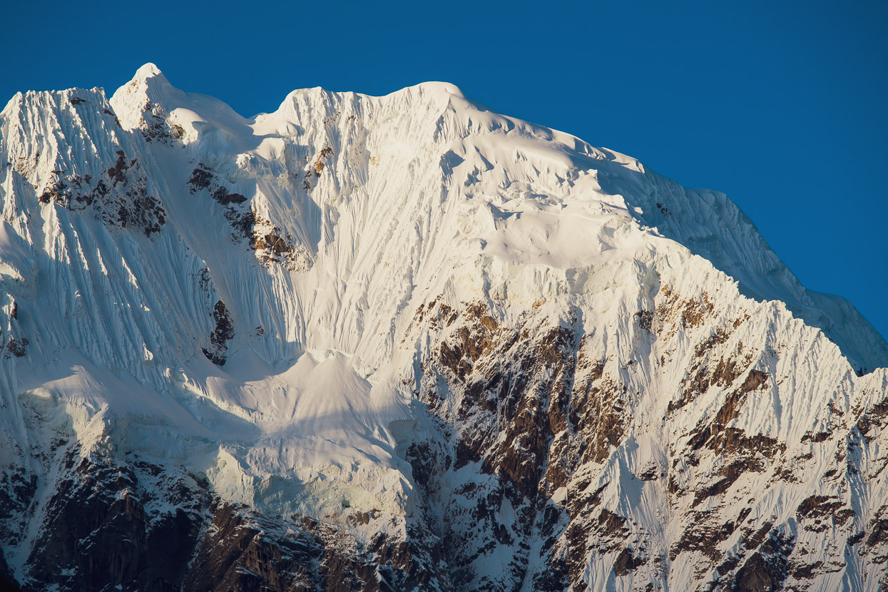
The south face looked awesome in the evening light.
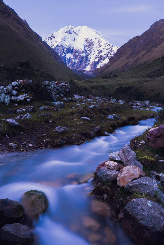
And again right back at valley floor level from Soraypampa.
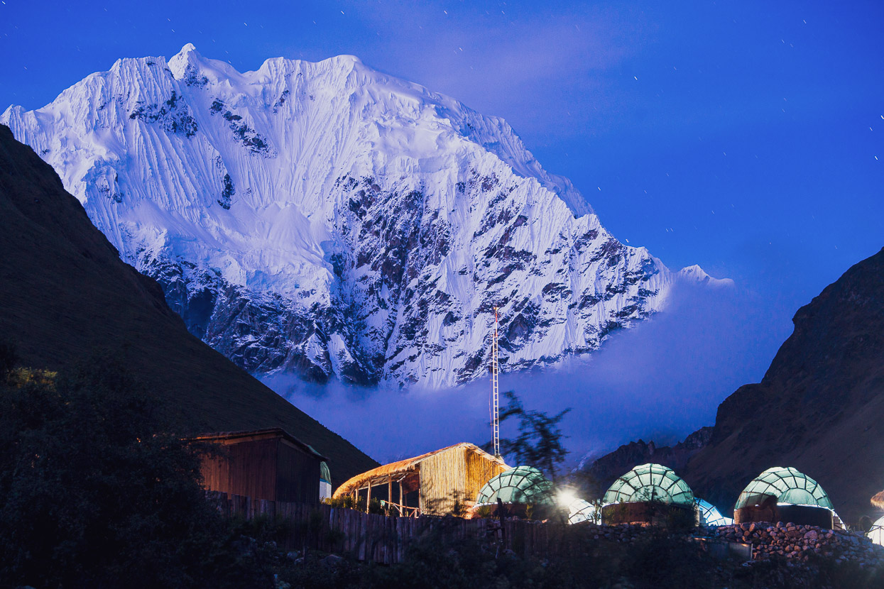
Nevado Salkantay looming behind the lights of the trekkers camps as the stars start to come out. There’s several of these camps established in the valley now, with these permanent dome-type tents and support buildings. It’s good to see money coming into the local community, but very sad to see the unregulated development that can happen when there is no park authority managing the area.
We were away about 7 am, looking foward to seeing more.
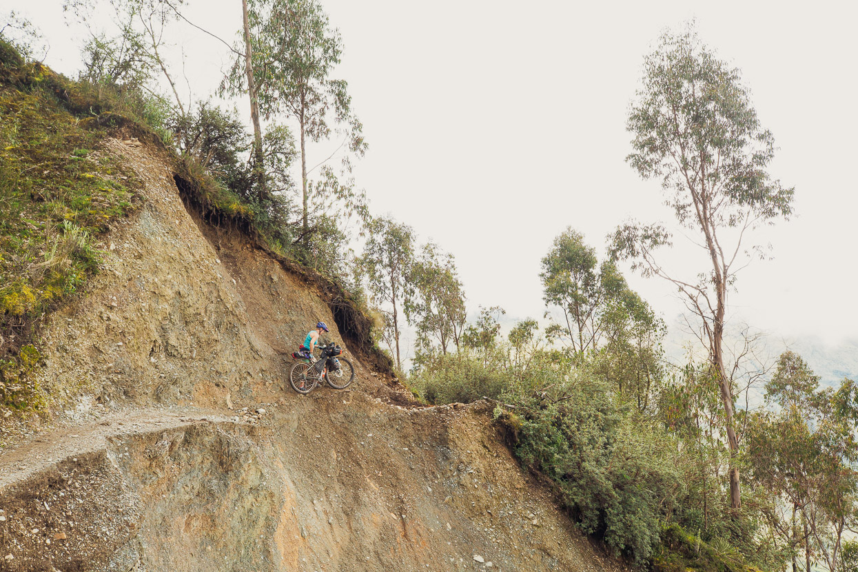
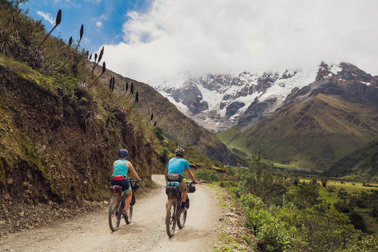
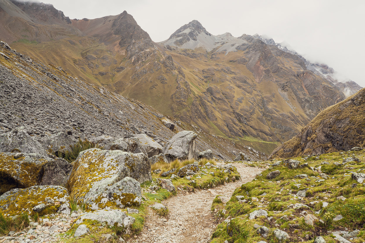
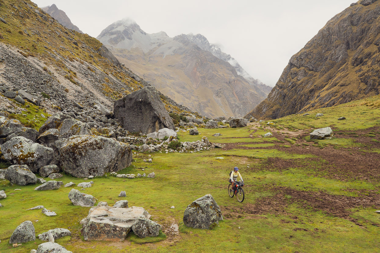
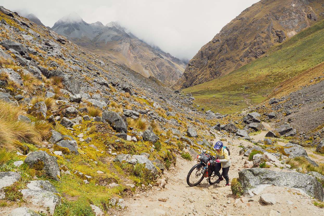
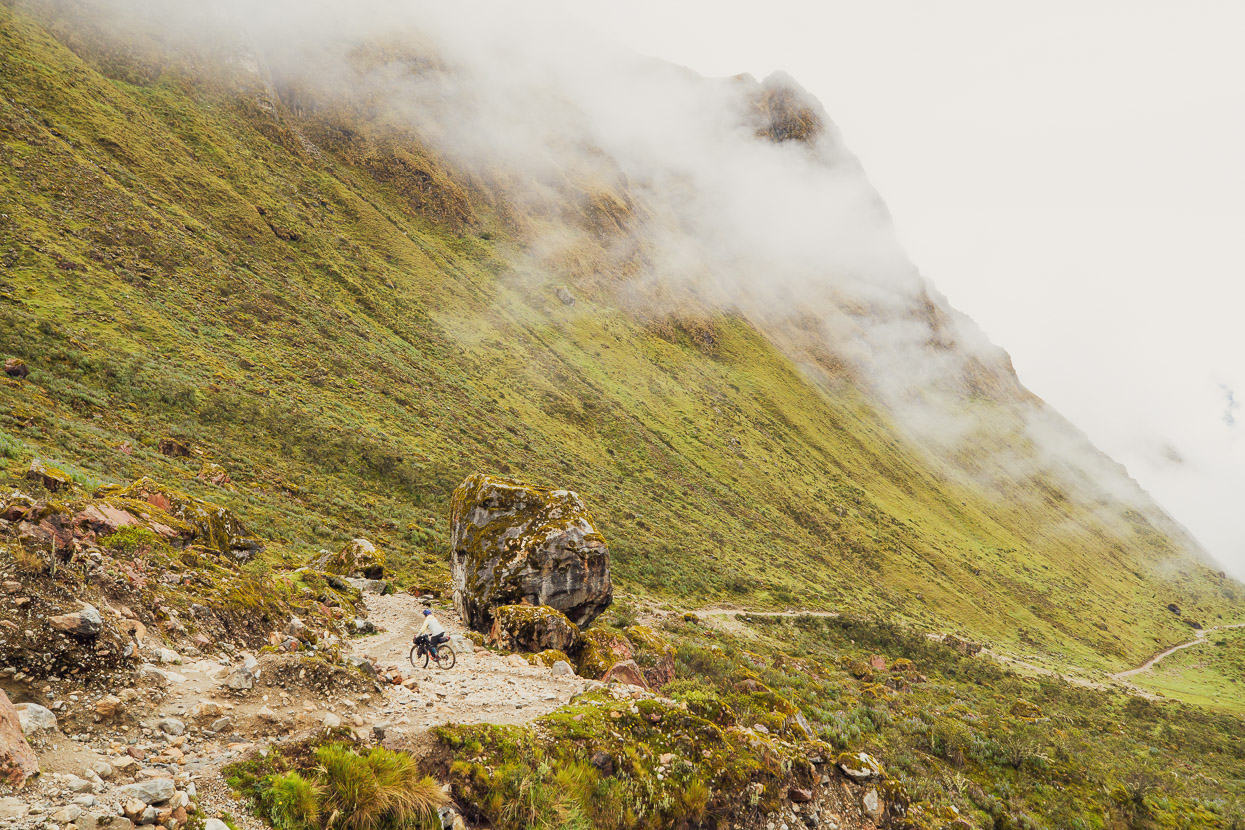
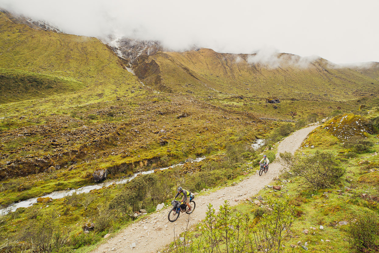
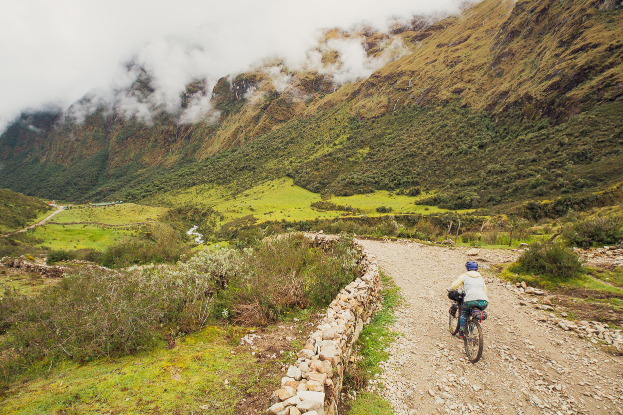
The route is rideable most of the way to Salkantaypampa 550m higher.
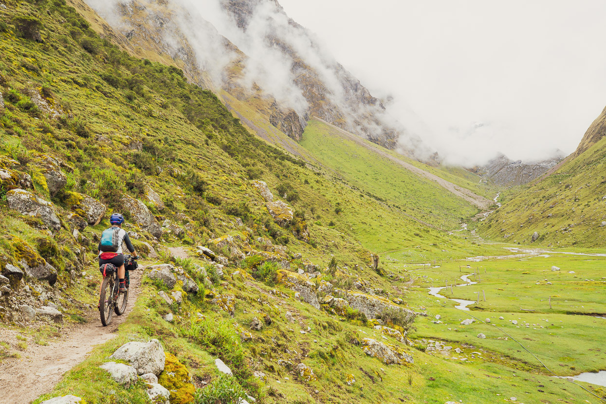
Classic bikepacking country. Now and then it gets too rocky or loose to keep riding, but overall a really nice track. There’s a mellower-looking, wider, mule trail on the other side of the valley, which may offer easier riding, but it could also be all pugged up from hooves. The routes rejoin at Salkantaypampa.
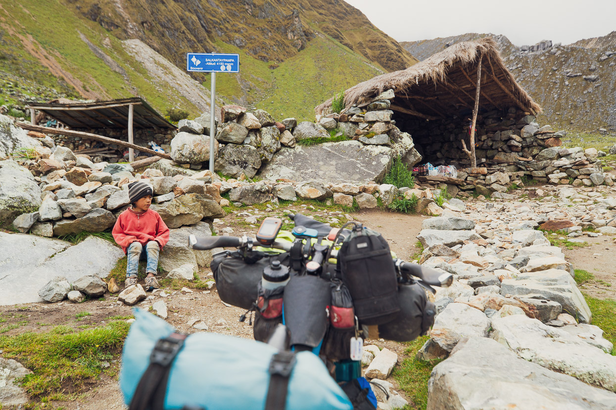
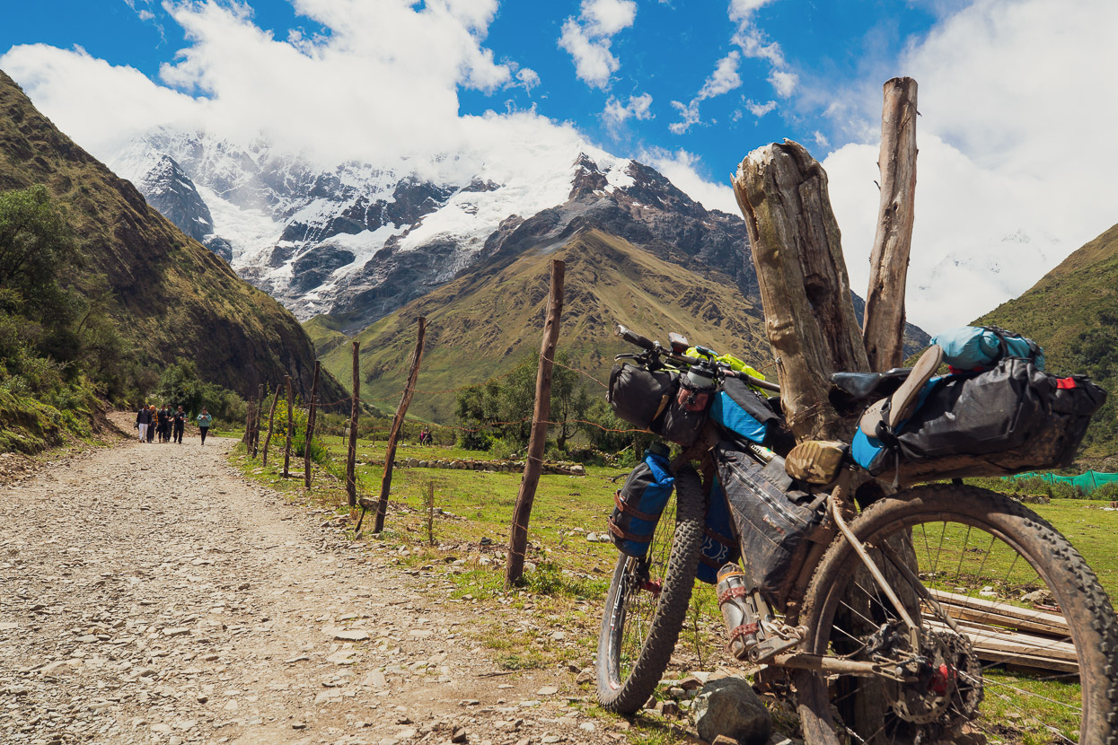
At Salkantaypampa there was a small souvenir shop that also sold soft drinks and bottled water. There were two young kids in attendance who walk up each day from Soraypampa.
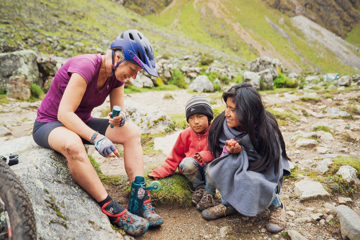
They were quite fascinated by our magic blue light-emitting wand that we dipped in the creek water before drinking it. The Steripen Ultra is such a quick way to treat suspect water and gives us a lot of peace of mind.
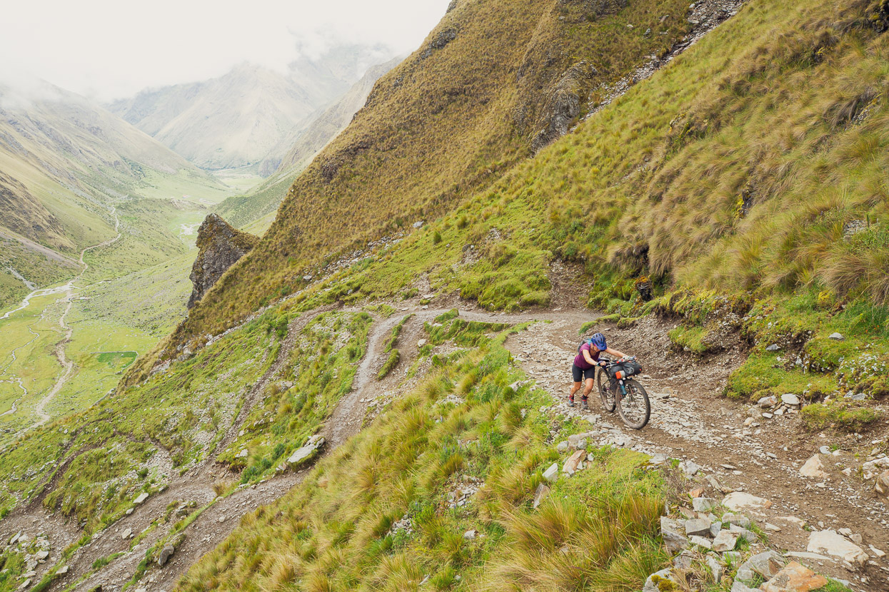
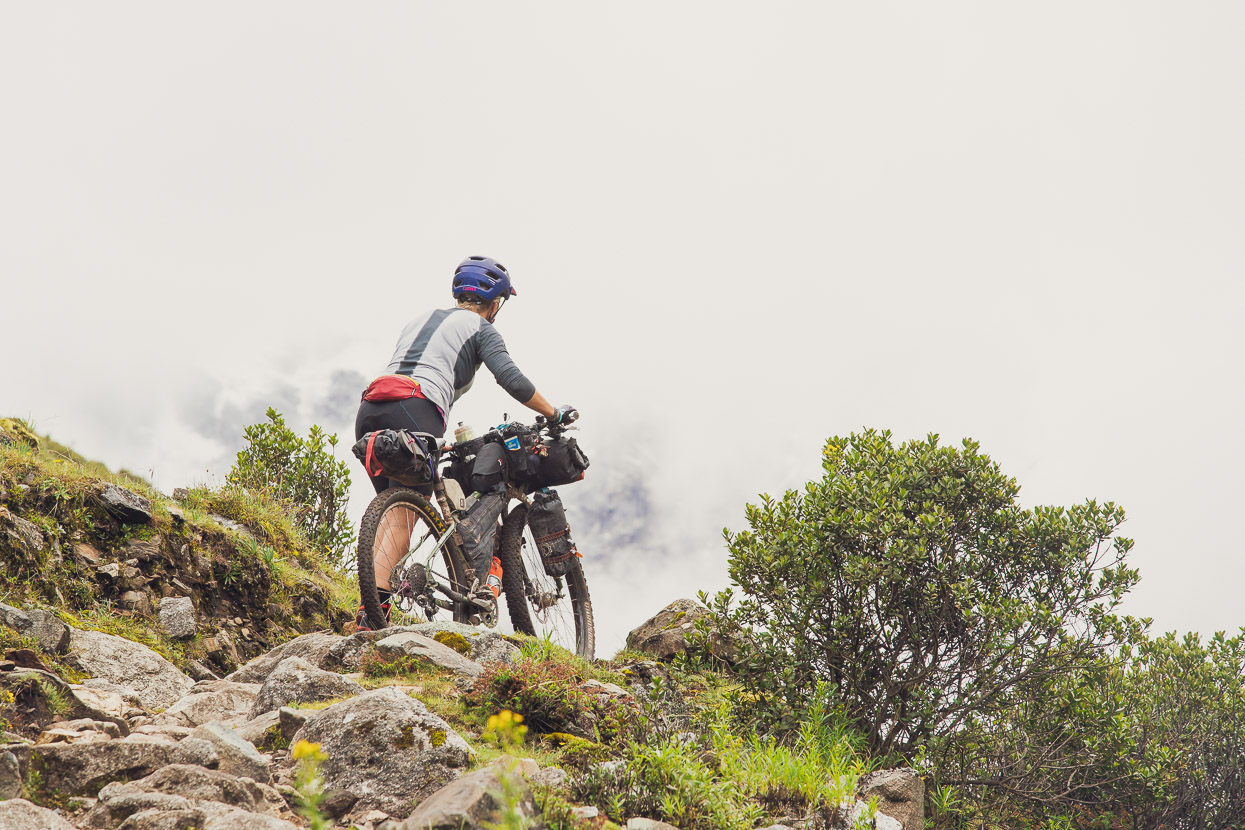
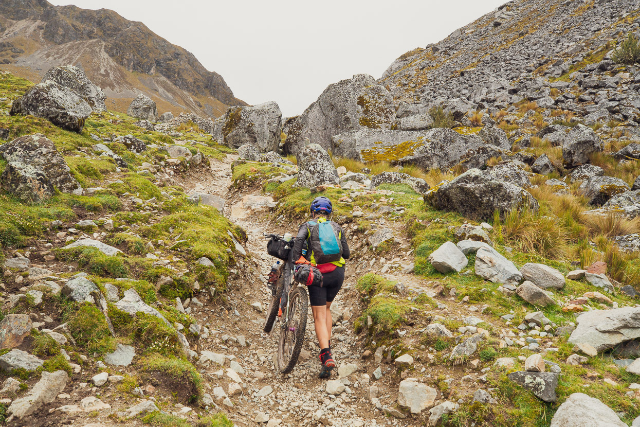
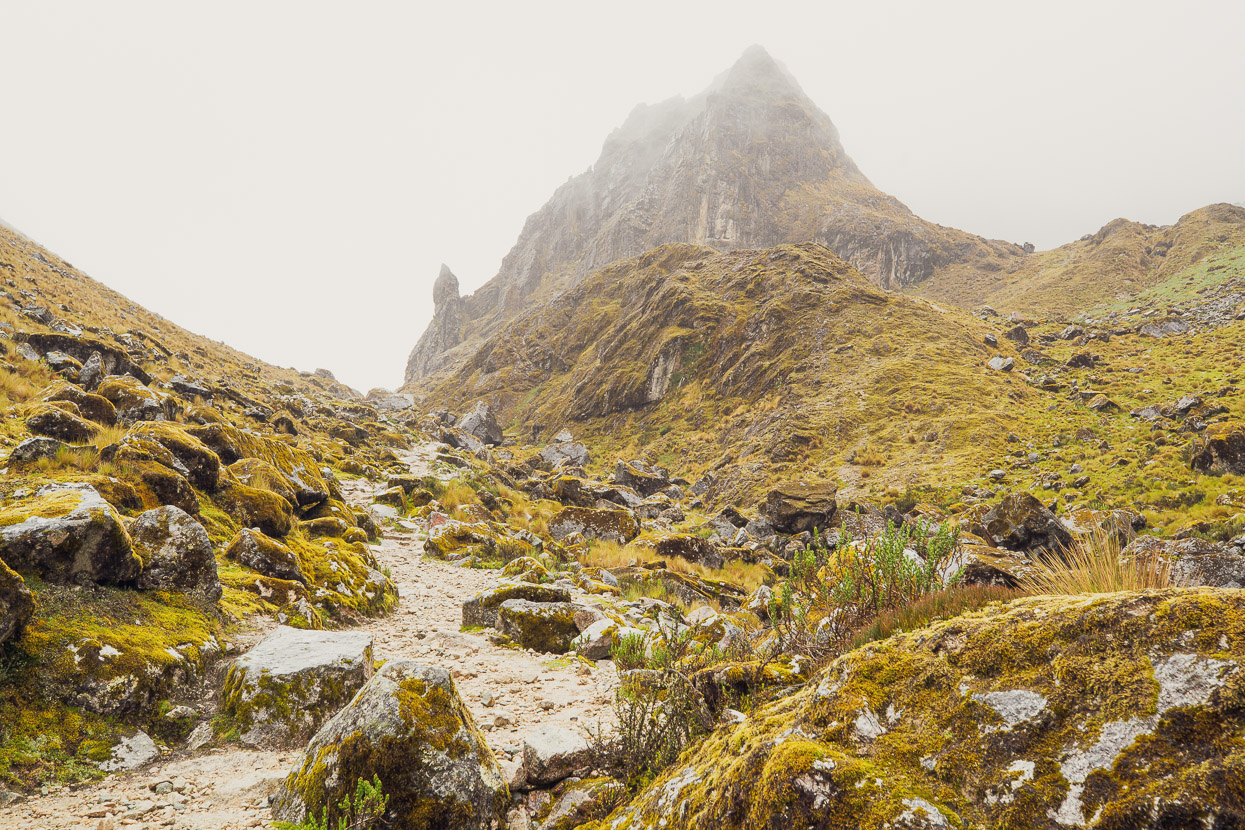
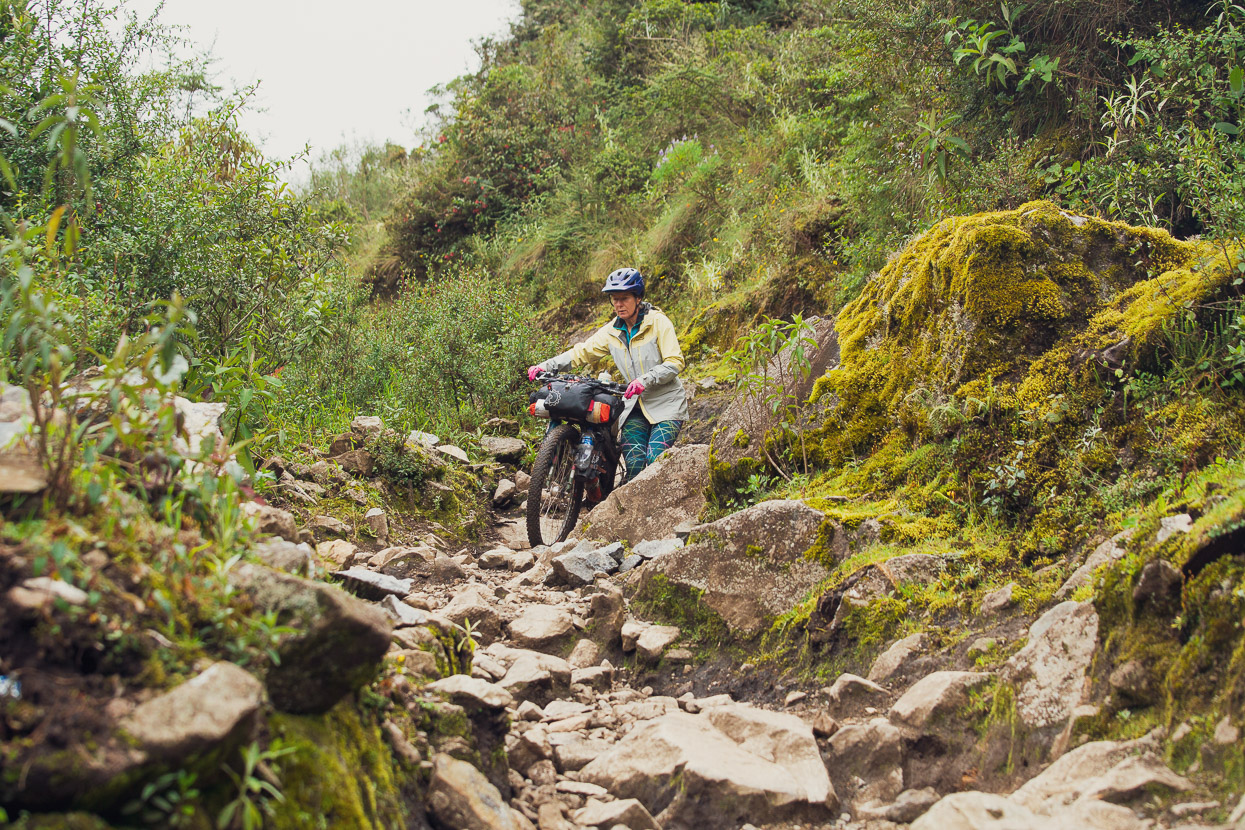
From Salkantaypampa onward to the pass the hike-a-bike really kicks in. For the following 500-odd metres we mostly pushed the bikes up steep and rocky hiking trail.
The first hard grunt up some switchbacks got us to a small, boulder-dotted flat where there’s a trekking camp. It started raining, so we decided to take shelter in one of the tent covers and took an early lunch.
After a while it eased to drizzle so we pushed on up the final, hardest section, to the pass.
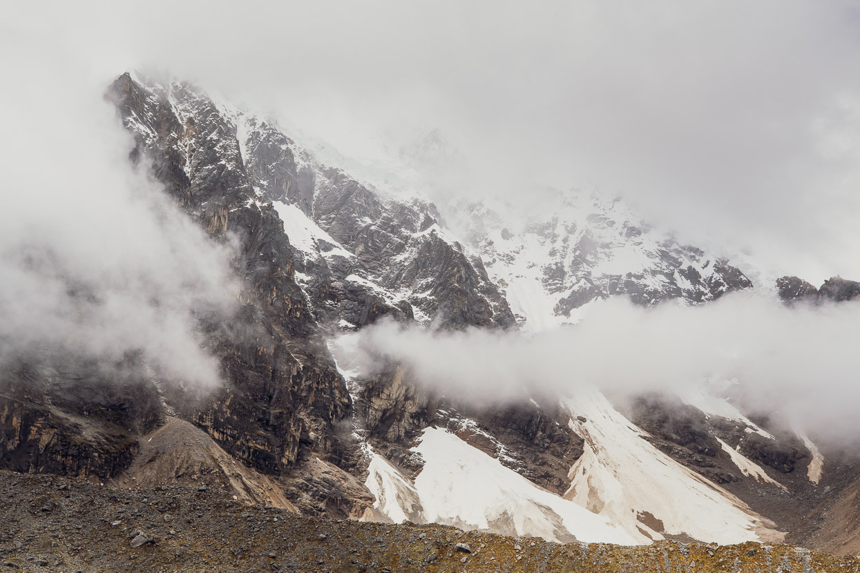
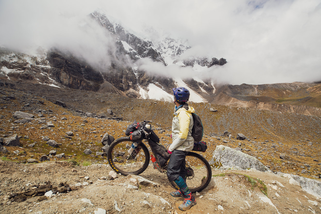
Most of the mountain was lost behind swirling cloud and mist, but we were happy to be there nonetheless. The hike-a-bike was a challenge, but even considering the altitude, a very doable one. The kind of thing I’d go back and do again, rather than ‘never again!’
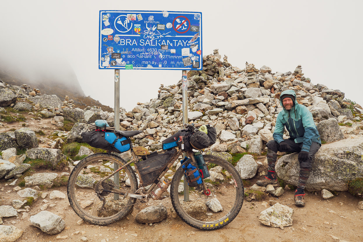
4630m on Salkantay Pass. It must have been colder than I remember, looking at the clothes I’m wearing.
We’d planned to camp in the vicinity of the pass, for some hoped for mountain photography, but it started raining more heavily and wasn’t showing any sign of abating. So we started descending.
The first 300 vertical metres of the descent is pretty rough, with loose rocks and a rutted washed out trail, but in general it improves as you descend. You might ride most of it on a full suspension bike in the dry, but for us it was very on-off.
The trail started to improve just before we reached a small flat, with a rock-walled farm building and a few cows about. There was running water too, so we camped nearby in a boulder field. It was still drizzling persistently and didn’t clear overnight, so we were glad not to have tried to camp at the pass. After an effort like that you recover better sleeping a bit lower too.
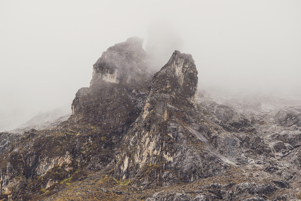
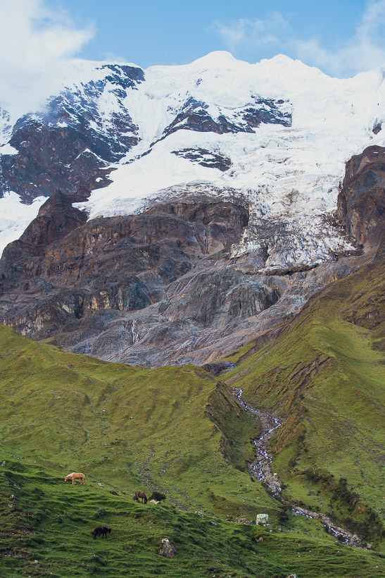
Above us some impressive bits of mountain loomed out of the mist.
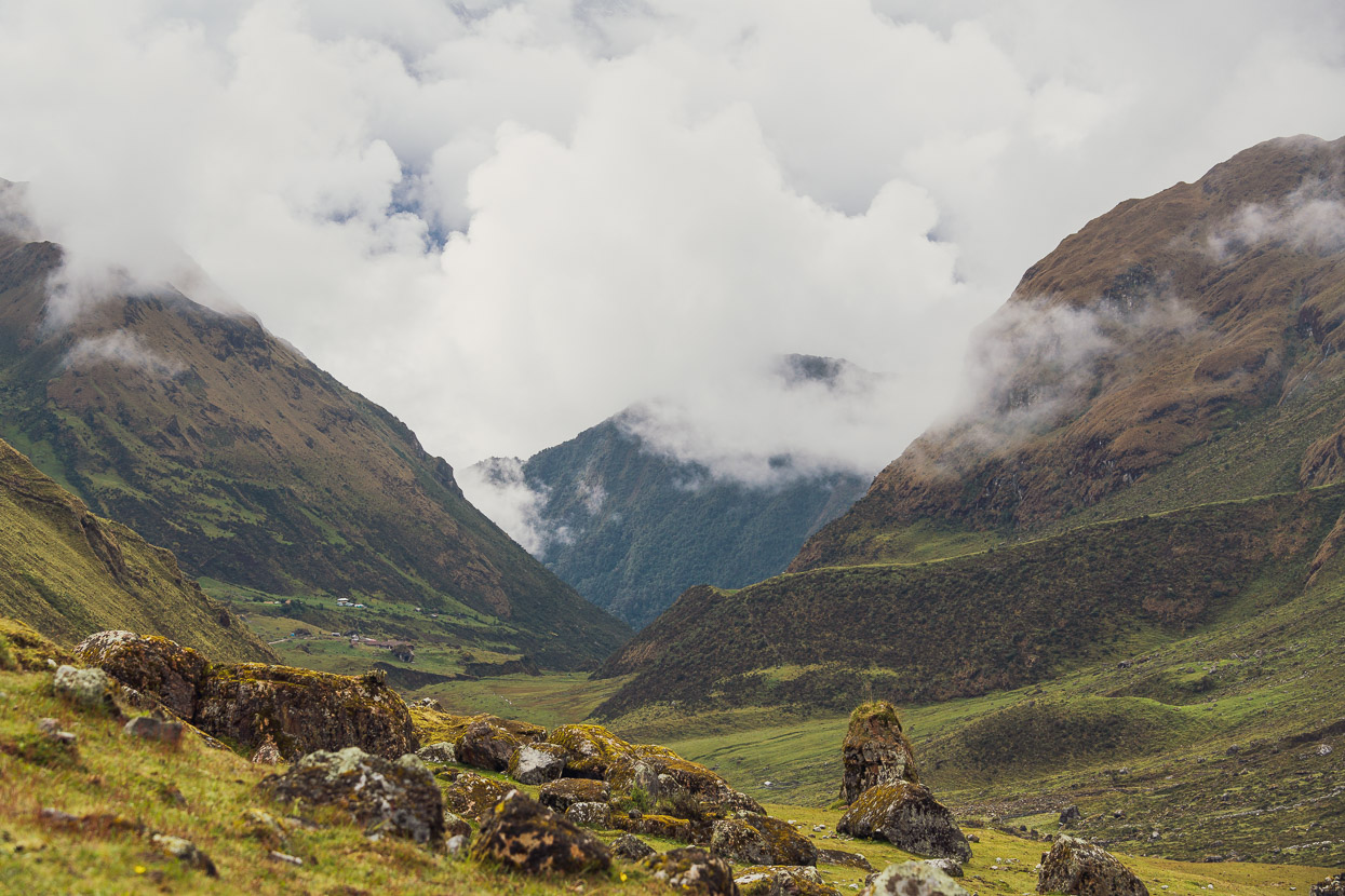
While the cloud boiled up from the warmer valleys below.
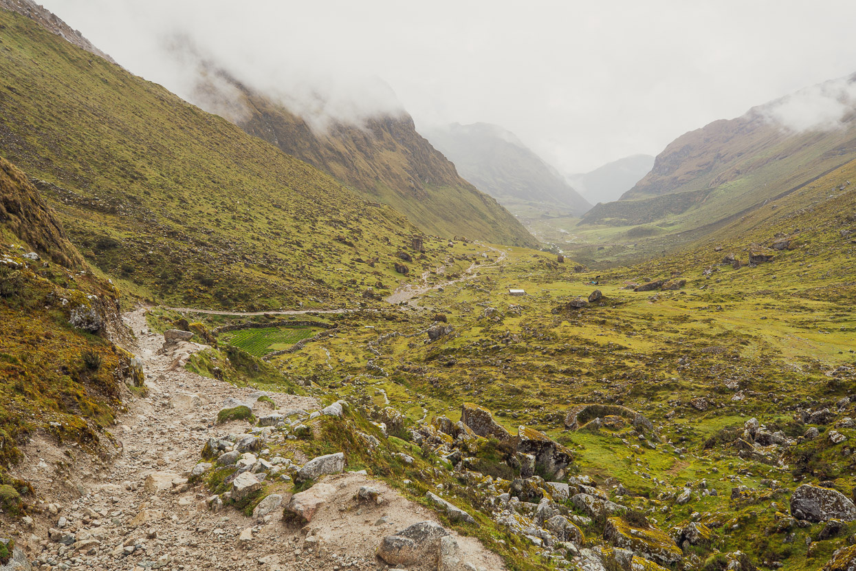
The weather was still moody in the morning, but we were happy, knowing we had a 3000m descent to reach Santa Teresa that day.
The riding gets better as the trail nears Huairaspampa, where there’s another trekkers camp and a few campesinos’ dwellings.
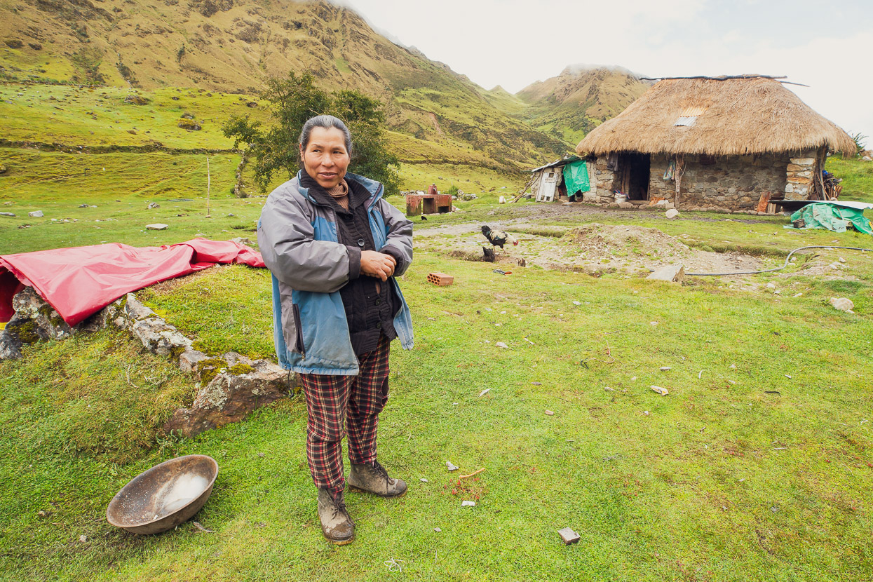
I was a few hundred metres ahead of Hana as I reached the hamlet. A woman was standing leading against a stone wall. She gave me the usual greeting and asked if we wanted coffee. We hadn’t been going long, so I declined, but we started to chat anyway. She asked if the person in the distance was my compañero.
‘Si,’ I replied, ‘Mi esposa’ (my wife).
At this she was amazed.
As Hana approached she exclaimed ‘Ella is muy fuetre!’ (She is very strong!), and looked at Hana with admiration.
‘Ustedes son muy guapo.’ (You are both very brave), she said.
She was a nice lady, so we decided to accept the offer of coffee, knowing she’d appreciate a couple of soles. Besides, it’s always nice to have contact with these hardy, mountain-living types. She was the tough one in our minds, living on a damp, windswept valley flat at 4000m.
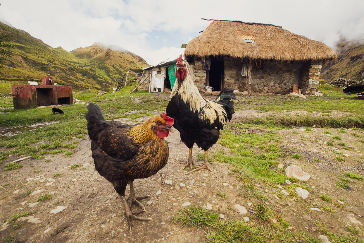
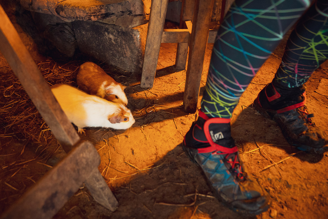
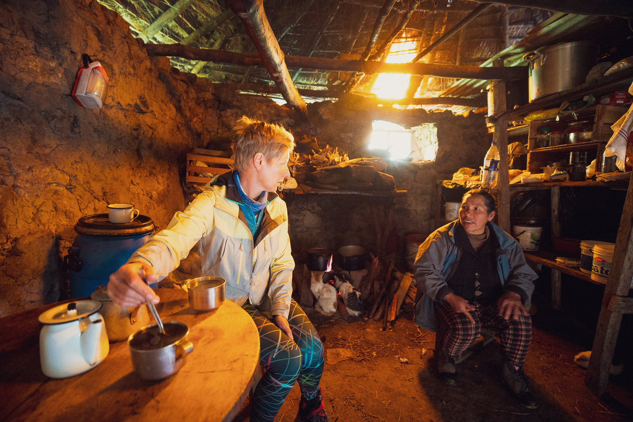
She took us inside her concina (kitchen), which with thick, adobe lined, stone walls, thatch roof and a fire burning inside was nice and warm. Two cats were curled in front of the fire and darting all over the floor were guinea pigs (cuy). In rural Peru it’s quite customary to keep the guinea pigs loose inside dirt floored kitchens. You’d think it would be a health hazard, but Peruanos and cuy have lived hand in hand for thousands of years now, so perhaps they have developed genetic immunity.
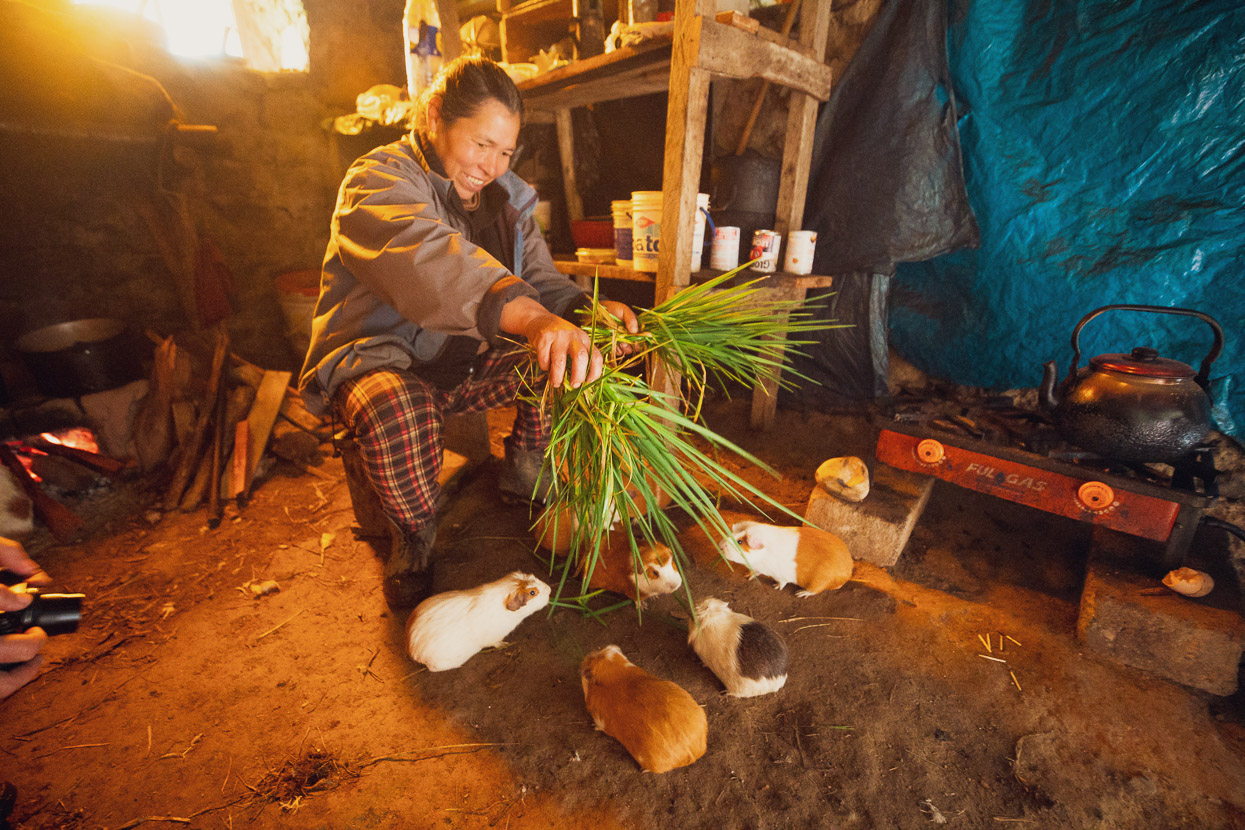
We sat in the warmth drinking hot coffee, talking about our respective lives, while the guinea pigs got fed. It was a really nice exchange and we were glad we stopped. But the singletrack called…
The trail led on, dropping quickly from the pampa, but we’d only been going 10 minutes when I crashed on a rocky corner and snapped my front brake lever off. There was not even a stump of the lever left to use, and with nearly 3000m of descent to go, not having a front brake wasn’t going to be good. With cable disc brakes it was an easy change though: we just uncoupled the rear brake cable from the rear lever and coupled the front brake cable there. Simple. I couldn’t exactly shred, but got me down the hill more safely.
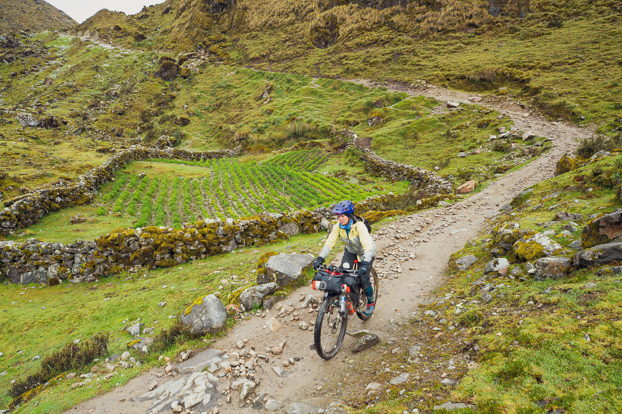
The rest of the singletrack descent until you reach Collapampa is on/off rocky, with some sections of very nice flow, but others where you are on the brakes (or brake!) a lot.
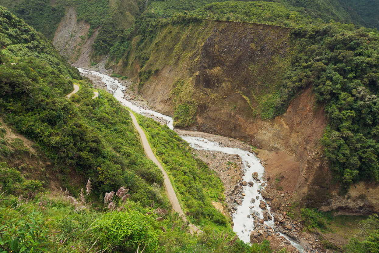
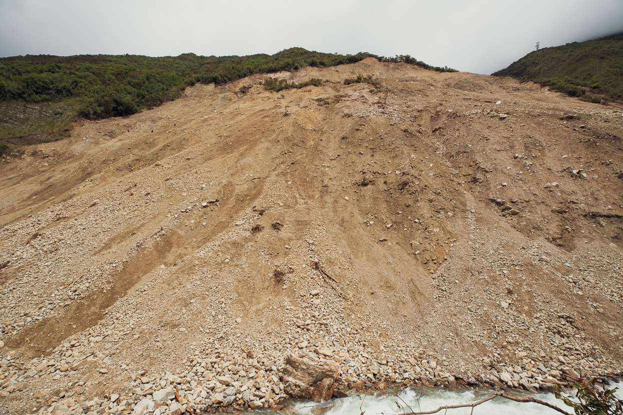
By the time we reached Collapampa our surroundings had completely changed. The scrubby alpine plants were long gone, replaced by the greenest landscape we’d seen in months. After a short section of road, it’s possible to pick up more singletrack right down to Sahuayaco, but we were warned off it due to numerous slips. We were told there was a big landslide on the main road too, but that it would be ok to pass.
A fast, windy single lane road dropped us down to the landslide, which was absolutely huge. We parked the bikes and took a closer look at it. People, including a couple of hikers were nervously picking their way along an unstable goat trail. While above the huge open slope might throw down more rocks at any moment. With bikes to carry across it looked like an extremely dodgy prospect.
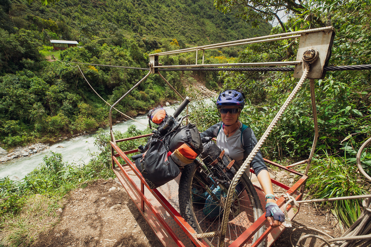
Fortunately there was an alternative! Just before the landslide we’d spotted a cableway across the river that would put us back on the Salkantay track. The single track might have had more landslides too, but it seemed a better option than the big landslide, besides, why ride roads when you can ride singletrack!
I voted Hana to go first, and fortunately there was a fellow on the other side to hand-haul the rope to pull her up the slope to his side.
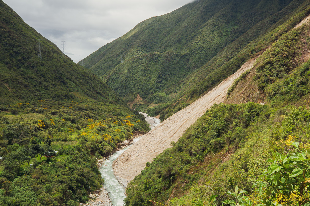
We got riding again, but not without a quick peer back up at the landslide. You can just see the dots of three people on the left hand side. We were told that it would be left like this until the end of the wet season, when they’d get the bulldozers in and open it back up, normal, as they like to say here.
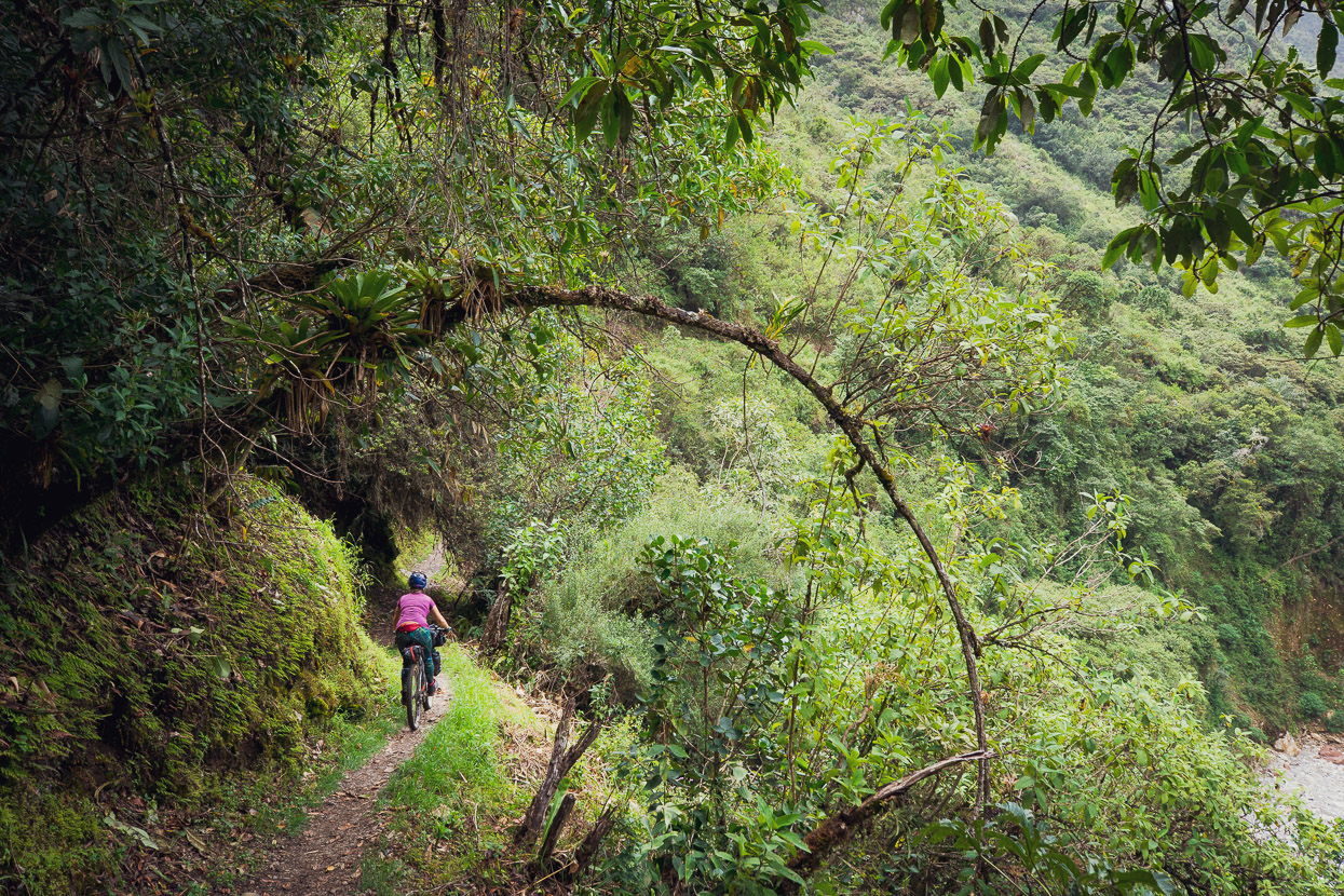
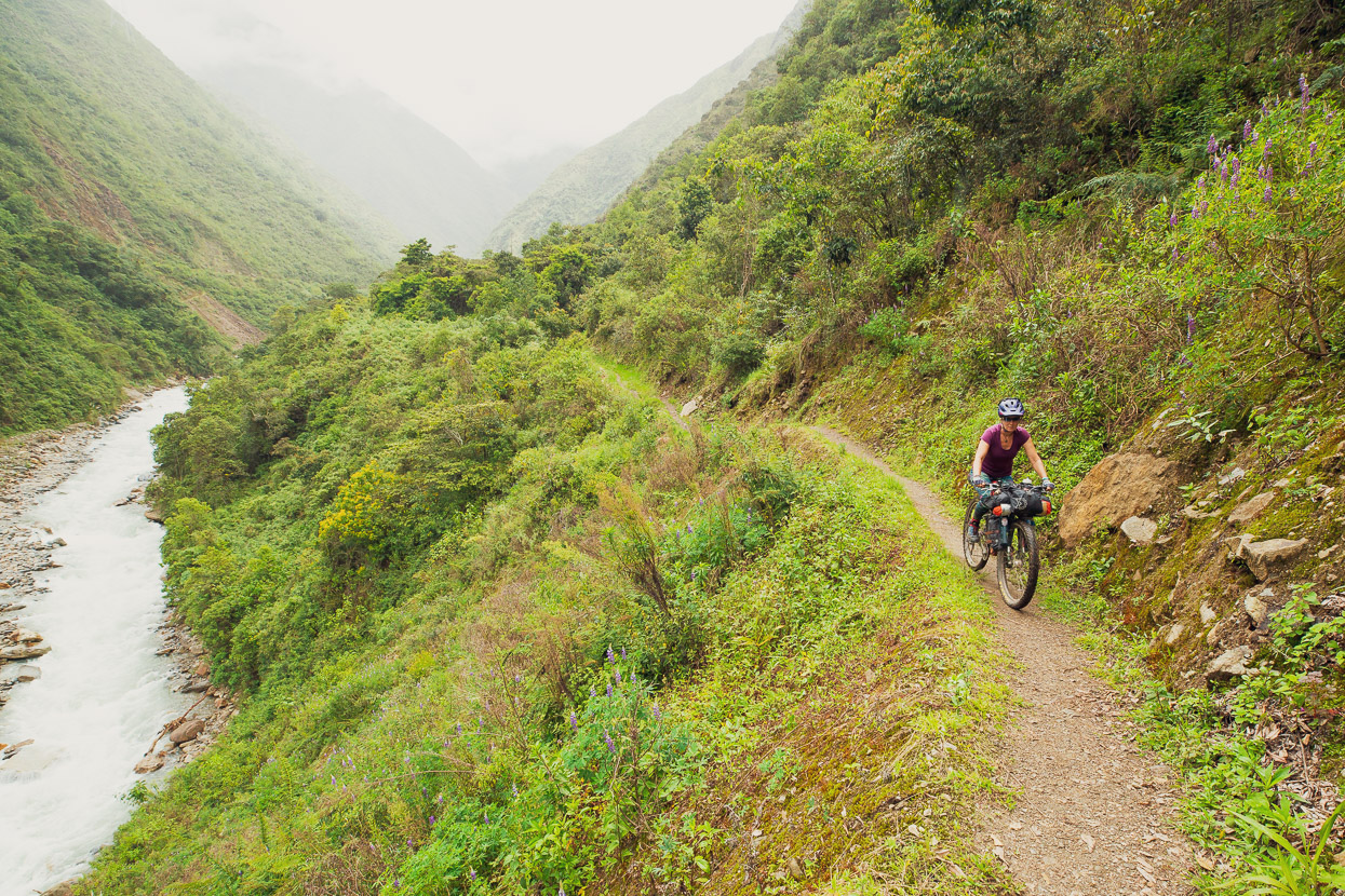
Immediately we felt like we’d made a good decision, as the trail undulated down valley.
With plenty of Peruvian mountain character still…
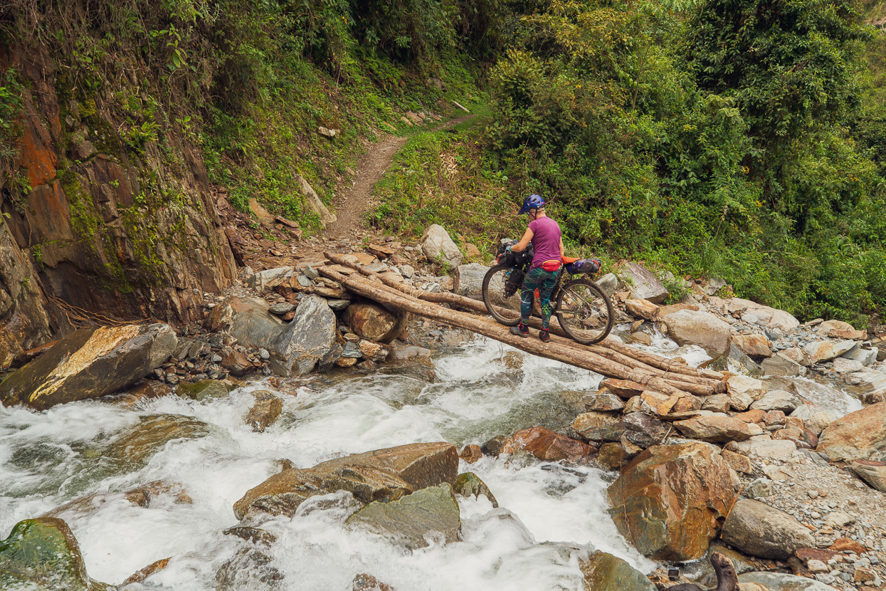
We crossed a couple of very small, fresher, landslides, but then got to an unstable and well established one, where a detour, a bridge and a steep push got us back onto the road on the other side of the river.
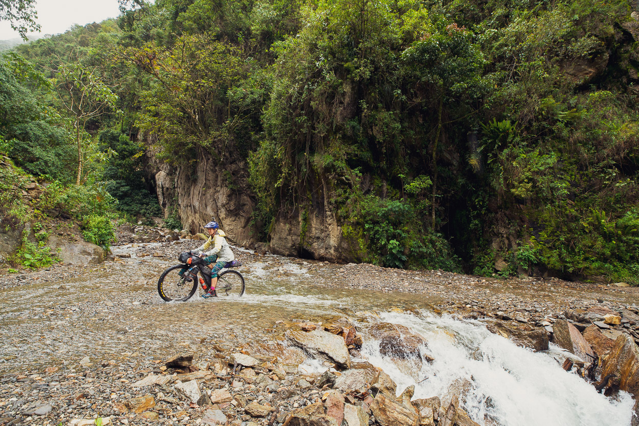
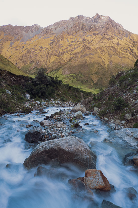
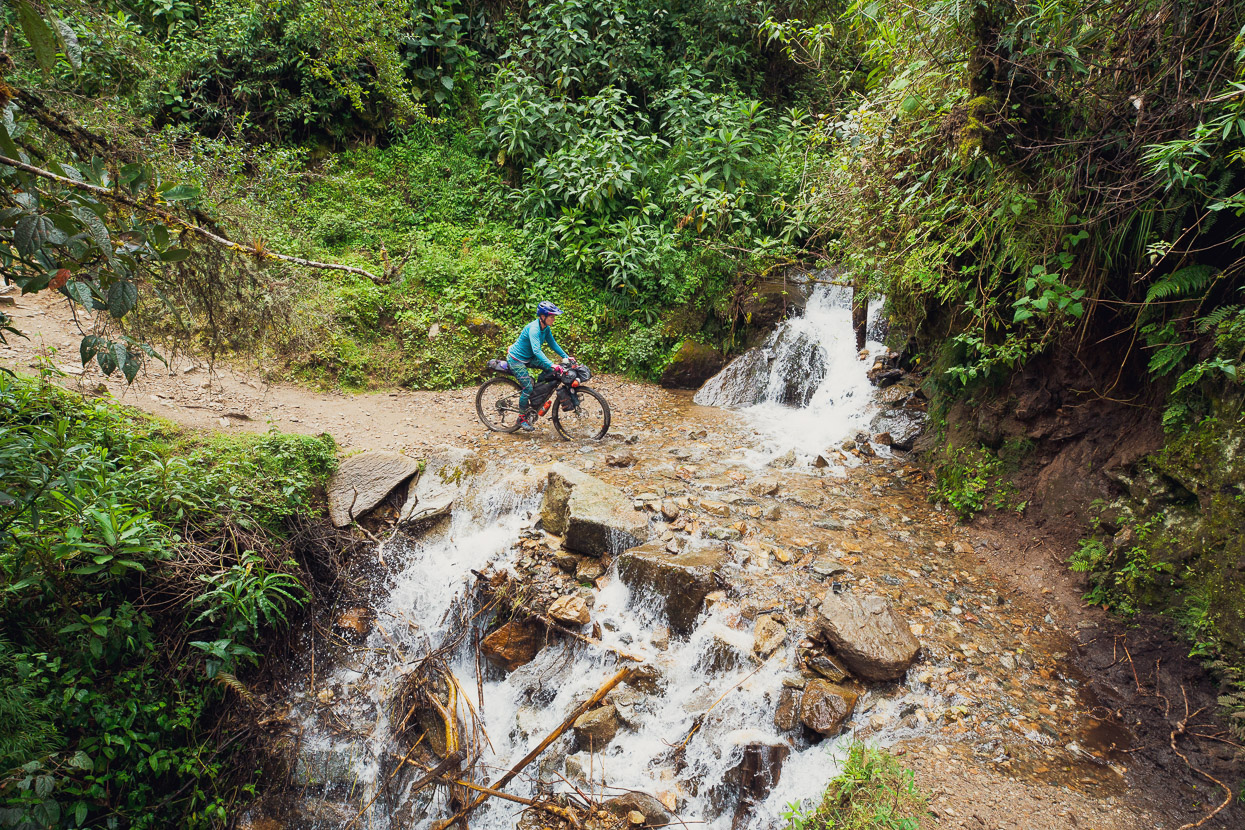
Down and down we rolled, crossing numerous crystal clear fords.
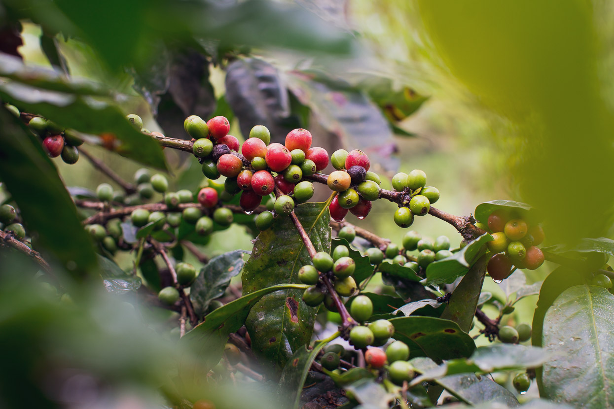
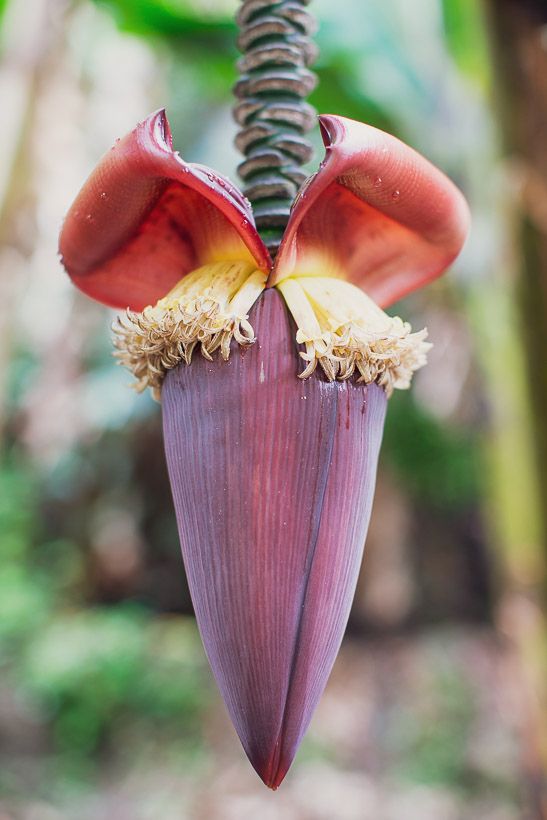
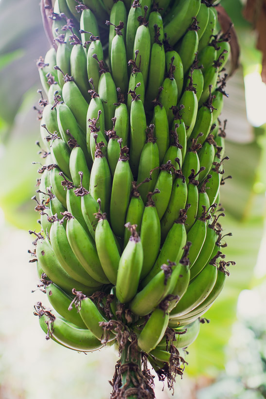
Once below 2000m we started to see coffee plantations and groves of banana plants. The air was steamy and alive with chirping insects. We’d hit tropical country again finally.
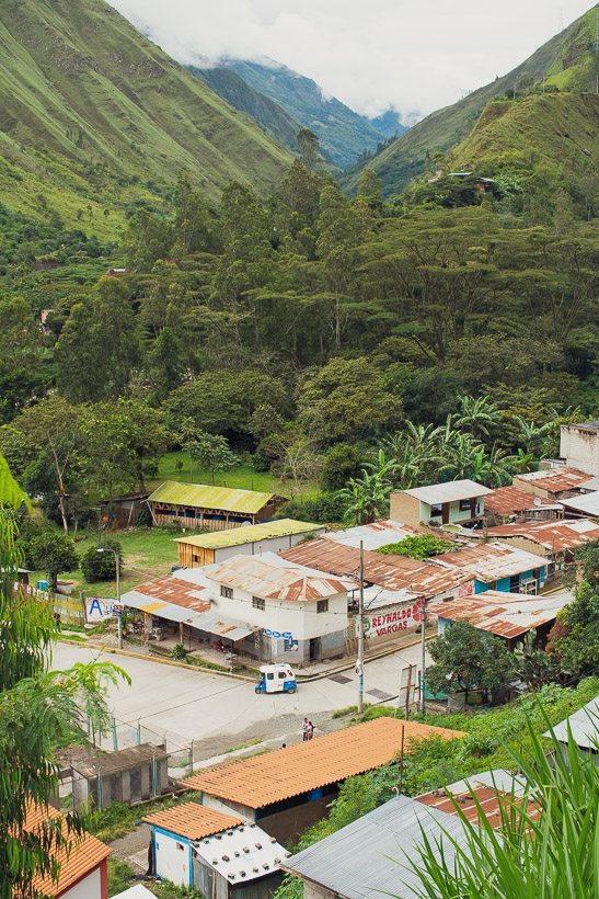
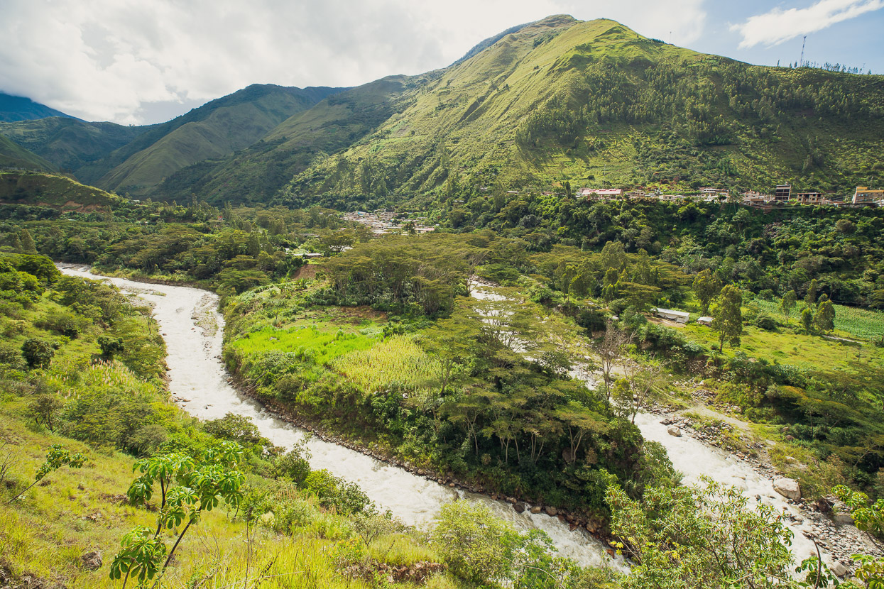
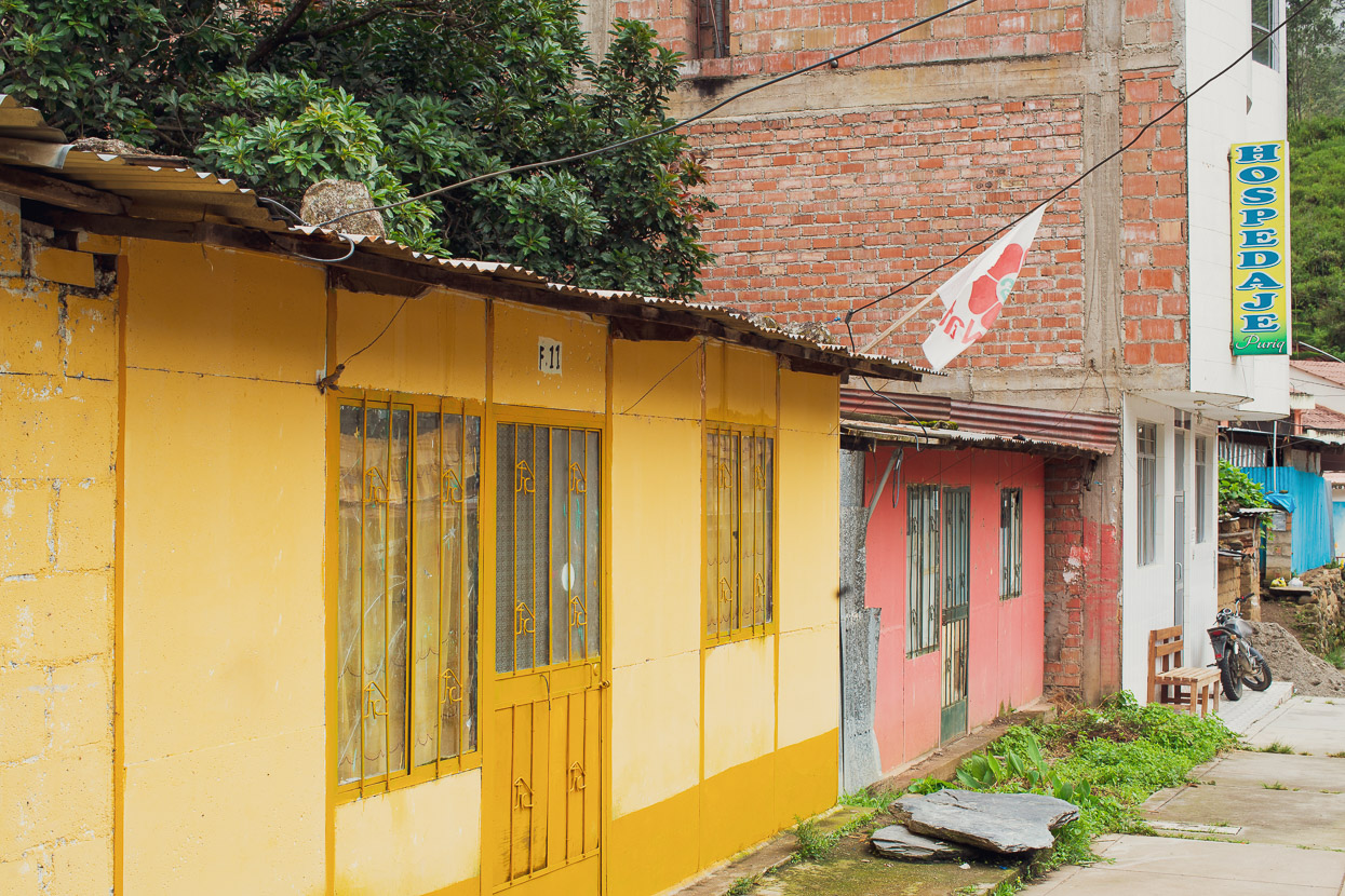
The township of Santa Teresa, and its neighbouring village Huadquiña, sit at the confluence of three rivers. After months spent mostly at higher elevations, being at only 1500m felt like a real novelty. It was humid and warm, and the nights pleasant. The modern town is located on a terrace high above the river and has haphazardly replaced the original town which was almost totally destroyed by flooding from the trio of rivers in 1998. Even today some of the homes in Santa Teresa are still the disaster-relief pre-fabs that were installed after the flood.
Even though it’s a small town, we were able to find a replacement for my broken brake lever the next morning, and in the afternoon left to ride to the road end for the two and a half hour hike to Aguas Calientes. We were looking forward to seeing Machu Picchu the following day.
Do you enjoy our blog content? Find it useful? We love it when people shout us a beer or contribute to our ongoing expenses!
Creating content for this site – as much as we love it – is time consuming and adds to travel costs. Every little bit helps, and your contributions motivate us to work on more bicycle travel-related content.
Thanks to Biomaxa, Revelate Designs, Kathmandu, Hope Technology and Pureflow for supporting Alaska to Argentina.

