
Part II: San Miguel Acatán to Chichicastenango.
We’d originally planned a slightly shorter tour for our ride through the Cuchumatanes but from the compelling taste of this place we’d experienced in our first few days we knew we wanted more.
With wifi in Todos Santos we pored over satellite photos and maps figuring out where various roads went and hatched a plan to ride to the northern limit of the range. Here lay a Chuj Maya town that the digital edition of the Rough Guide to Guatemala I was carrying on my phone described as ‘spectacularly located and deeply traditional’. With a description like that it was an easy decision to add a couple more days to the ride.
At an elevation of 1770 metres the only way out of San Miguel Acatán for us was up, but the gradients were mercifully reasonable as we spun our way on tired legs up the side of the canyon. It was the auspicious day of Hana’s 46th birthday (we have a good record of middle-of-nowhere birthday locations…) so she was hoping for an especially awesome meal in the evening – wherever we might be.
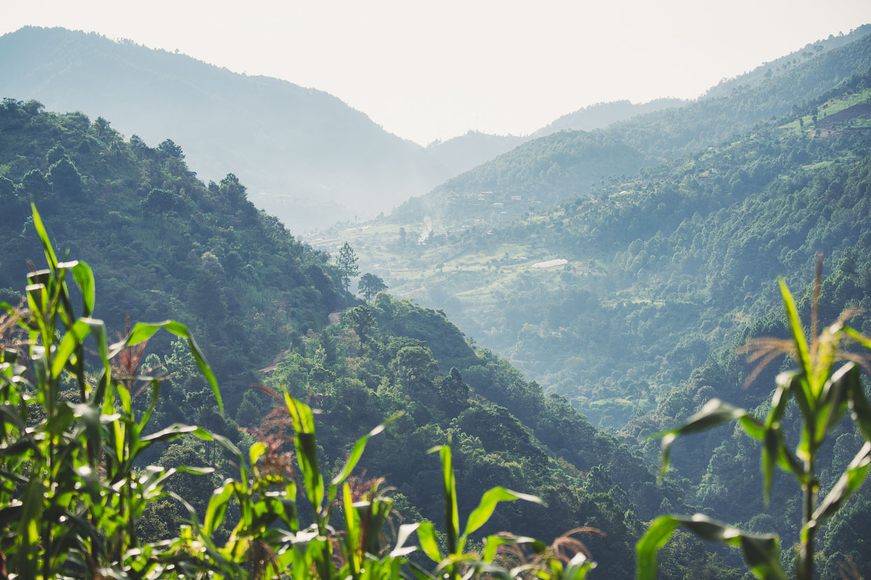
Further up we crossed the river and the road switchbacked up a steeper spur towards the next town, passing cultivated fields. Mornings are not clear for long here and even by 9am the cumulus begins to boil up from the sizzlingly hot lowlands, cooling and condensing as it reaches the upper slopes of this 3000 metre range. Rain is as sure a thing every afternoon as the sun setting at night.
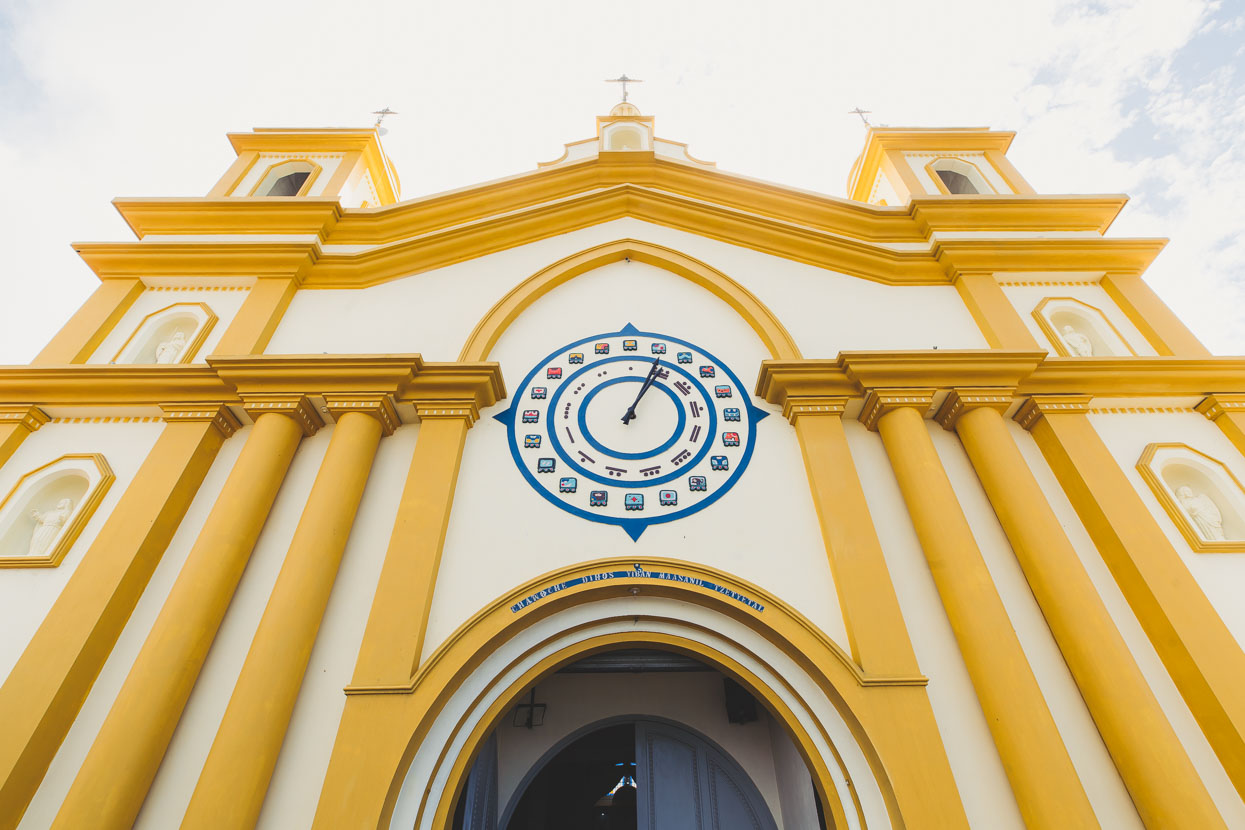
After about 11 kilometres of climbing we reached San Rafael la Independencia, a relatively non-descript town with an impressive church that had the Mayan Calendar painted on it.
We pushed on past San Rafael, climbing more towards the Pett Junction at the only paved highway that crosses the ranges. The single small comedor had one thing on the menu: eggs with frankfurters, frijoles and tortillas. Not the best birthday lunch but it went down well all the same.
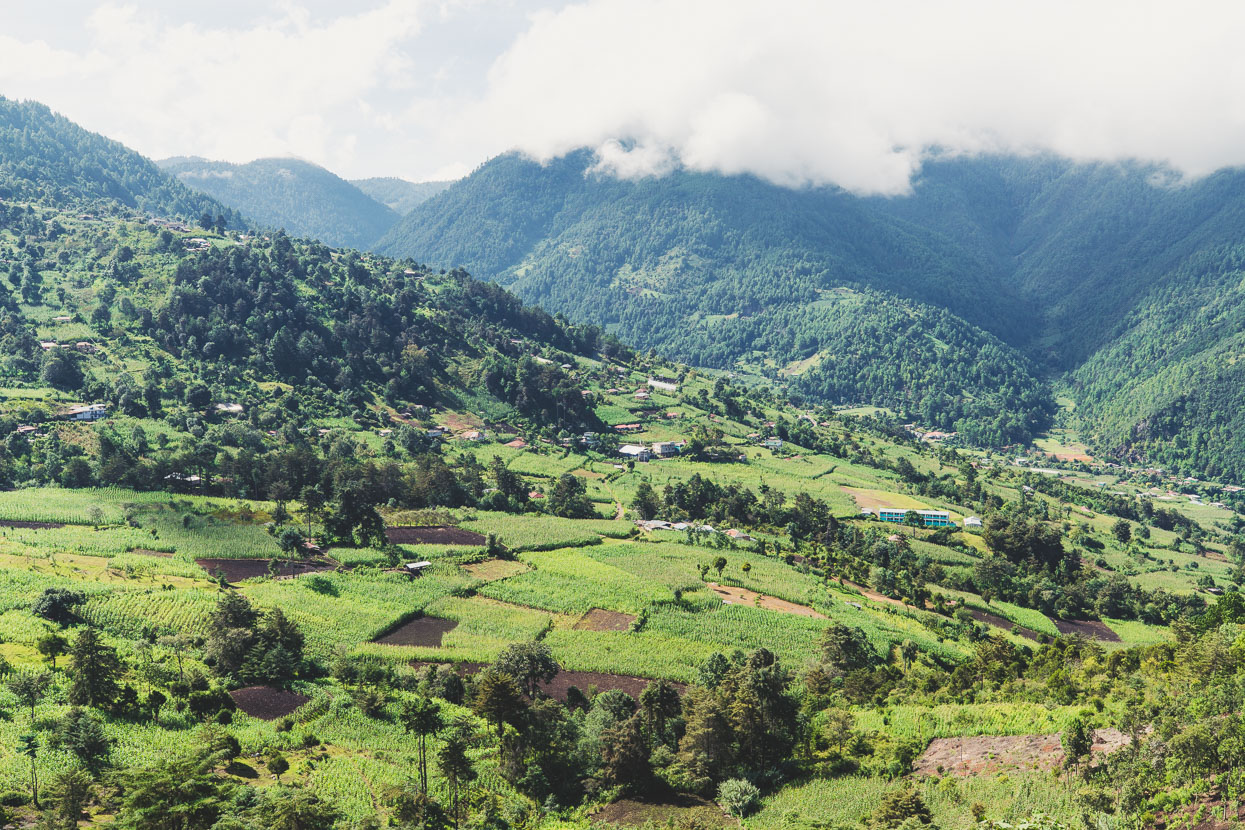
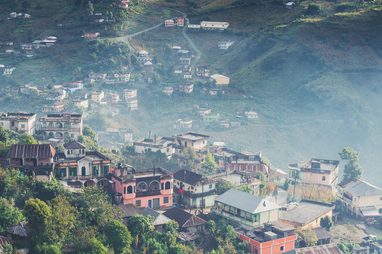
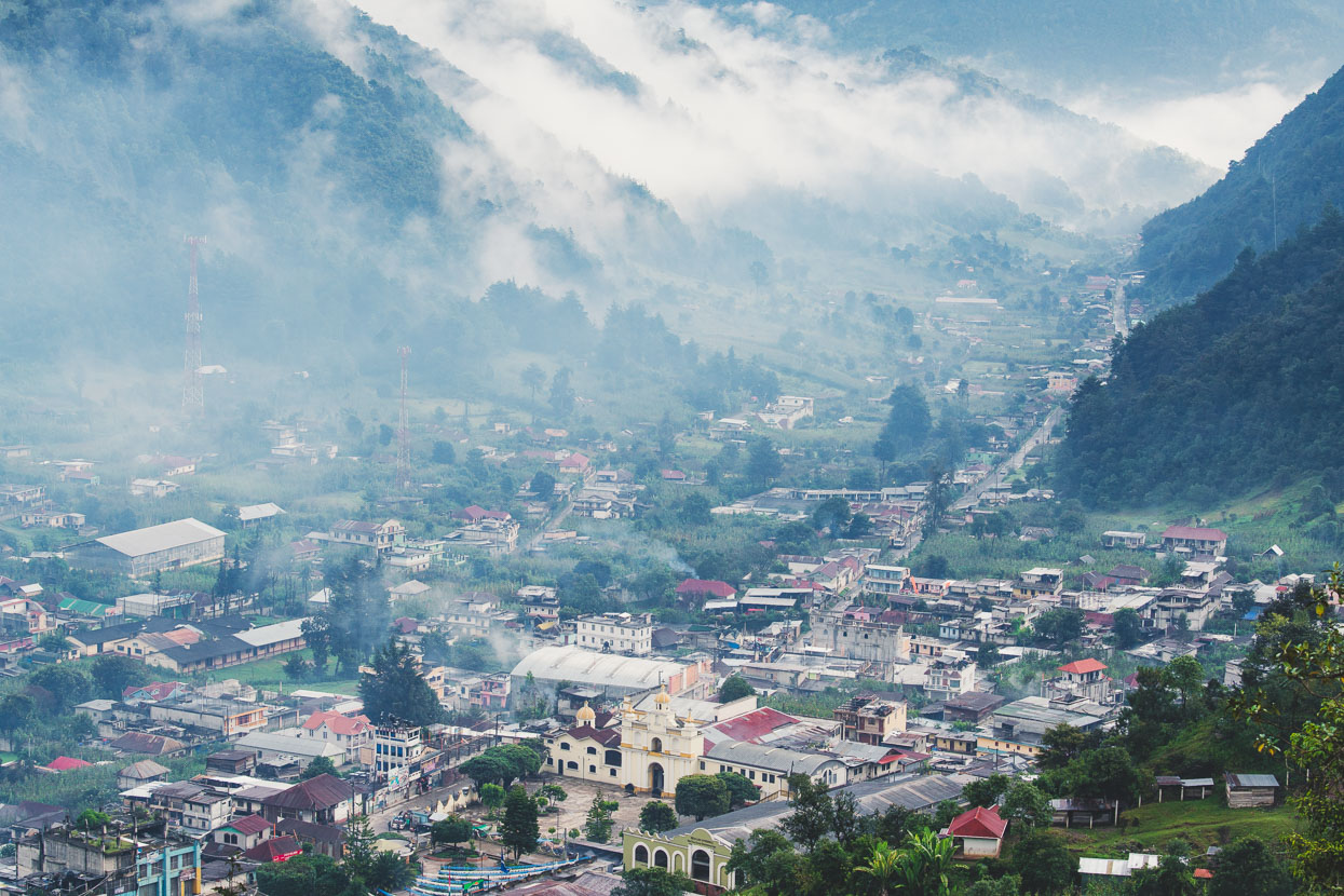
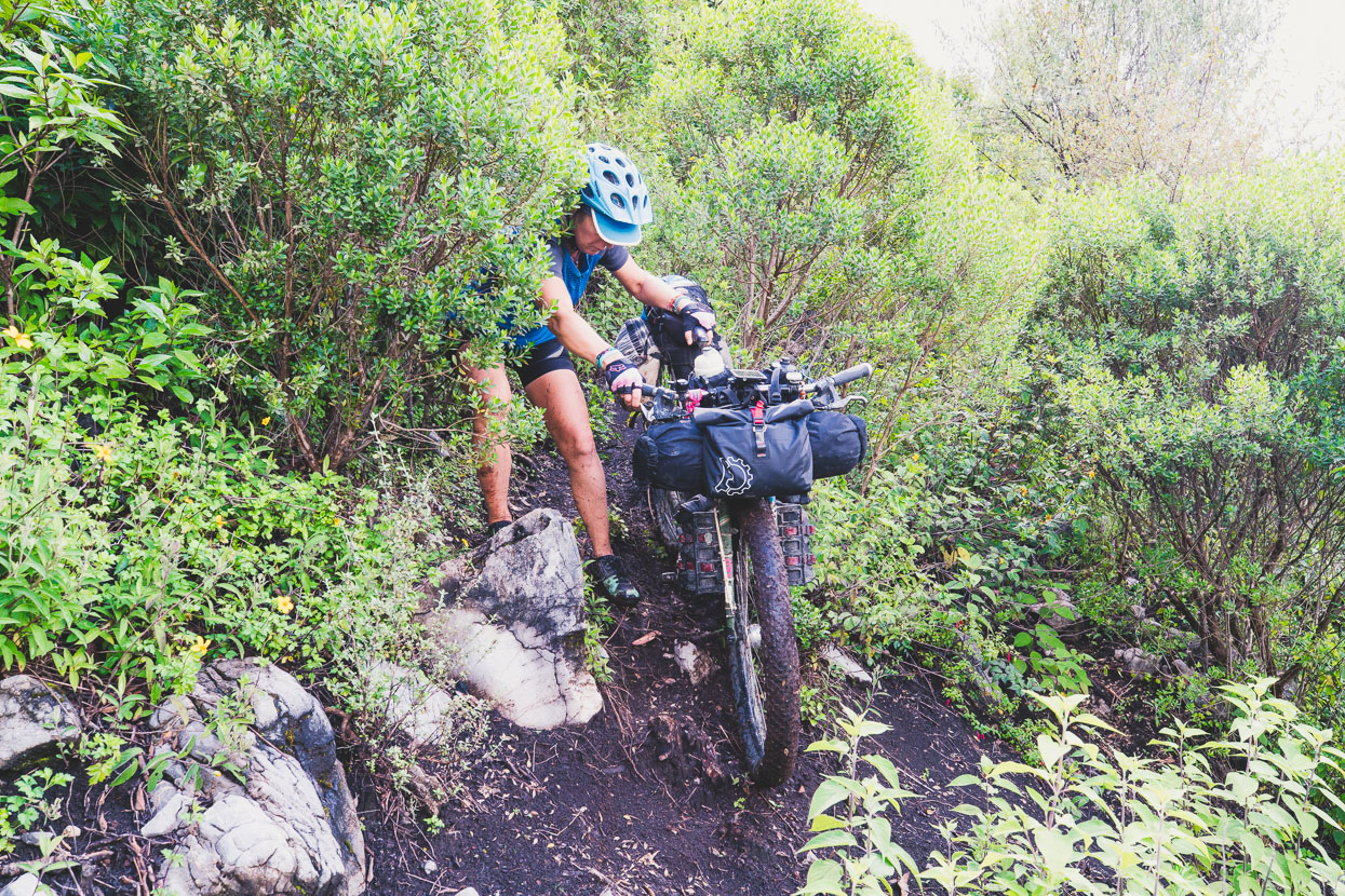
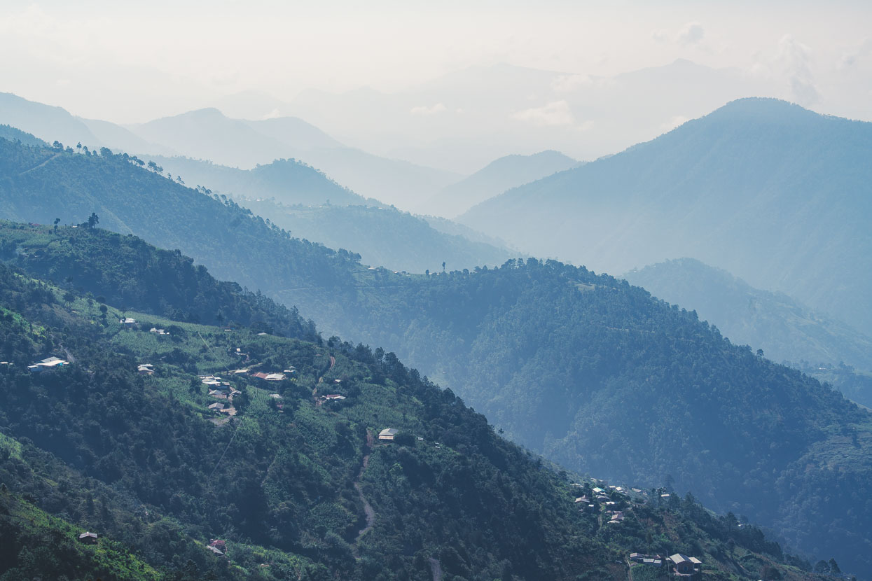
There we turned north and rode along the high rolling ridges of the top of the range. It started to rain as we passed through open grassy basins ringed with pine forest and the cloud base dropped cloaking the forest in mist. It was really pouring rain by the time we reached the high point of the road around 3160 metres before dropping down a rough and muddy road to San Mateo Ixtatán. San Mateo’s isolation – like Todos Santos – has allowed this alpine town to retain much of its tradition and language. The towns of the Cuchumatanes aren’t far apart as the crow flies but there are distinctive linguistic zones here, and in an area crossable by bicycle in a day three different languages are spoken; Chuj, Q’anjob’al and Akateko. The town is scattered along a main ridge and the valleys either side and below the landscape plunges steeply down into canyon territory.
While San Mateo is rich in tradition, it’s poor in wealth and education, with up to 70% of adults illiterate, like some of the indigenous towns we visited in Mexico’s mountains. There’s some income from family working in the USA – mostly young men who brave the trials of the long journey through Mexico and illegally across la frontera to the USA – but those remaining here eke out a living with simple work and very low pay.
The entire Cuchumatane region suffered in the extreme at the hands of Guatemala’s military during the civil war and massacres were commonplace here in the 1980s as a disconnected society carried out its own version of ethnic cleansing in the guise of combating rebel activity. A great many Maya fled to the lowlands and to Mexico and many only returned as recently as the mid 1990s to rebuild their lives in their homeland.

On a truncated ridge top just below town the remains of a post classic Maya temple sits, the original stelae alongside Catholic crosses. Isolated and independent the Maya here were among the last to be overthrown by the Conquistadors, but in many cases were never fully subjugated.
With this place to call home, who would want to live under another’s rule?
Whitewashed and decorated with small exterior figurines, the church – the focal point of town – was like a larger version of the one we saw in Concepcion Huista (previous post). In front a plinth burned constantly with candles, copal and offerings.

For Hana’s birthday dinner we ran through cobbled streets awash with muddy water and found a Mexican restaurant. The waiter was almost beside himself with excitement to see a couple of gringos in his restaurant and a drunk man sat at the table next to us and blabbered away for longer than was welcome, while holding the hand of his young son beside him. We felt sorry for the boy. Along with illiteracy, alcoholism is a big problem in these towns and at least once a day we see a hombre collapsed in drunken repose on the edge of the road.
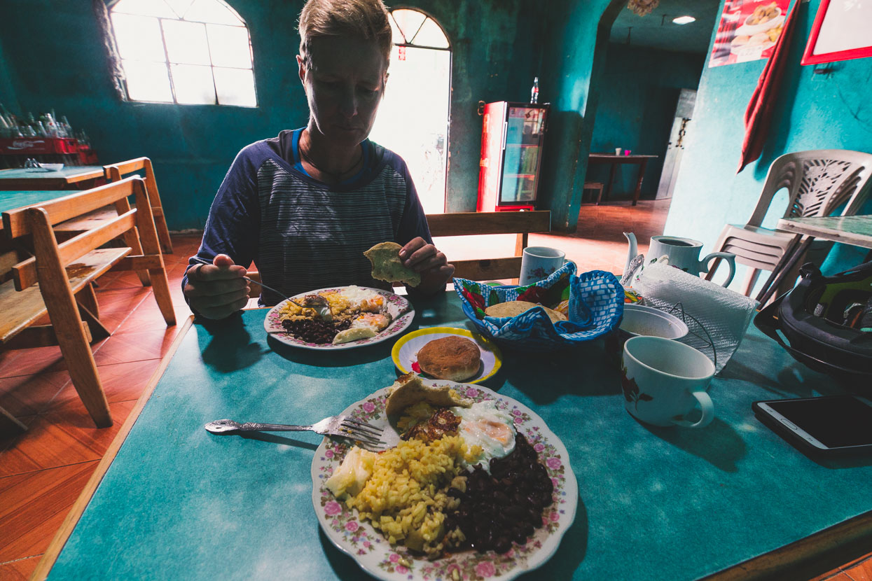
In the morning the rain had finally stopped and we spent a couple of hours exploring town and taking photos. A stop in an inviting looking restaurant for a licuado turned into ordering the best breakfast we’ve had in Guatemala, for a ridiculously cheap price. The benefits of a US trained chef returning to his home town we figured.
In a rare use of public transport (we didn’t want to backtrack up the mudpit of a road) we threw our bikes on the roof of a minivan at about 11am and caught a ride back to the Pett Junction on the highway, from there riding on to San Juan Ixcoy for the night.
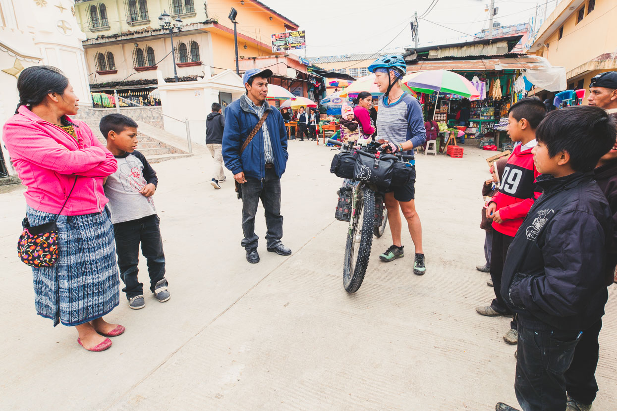
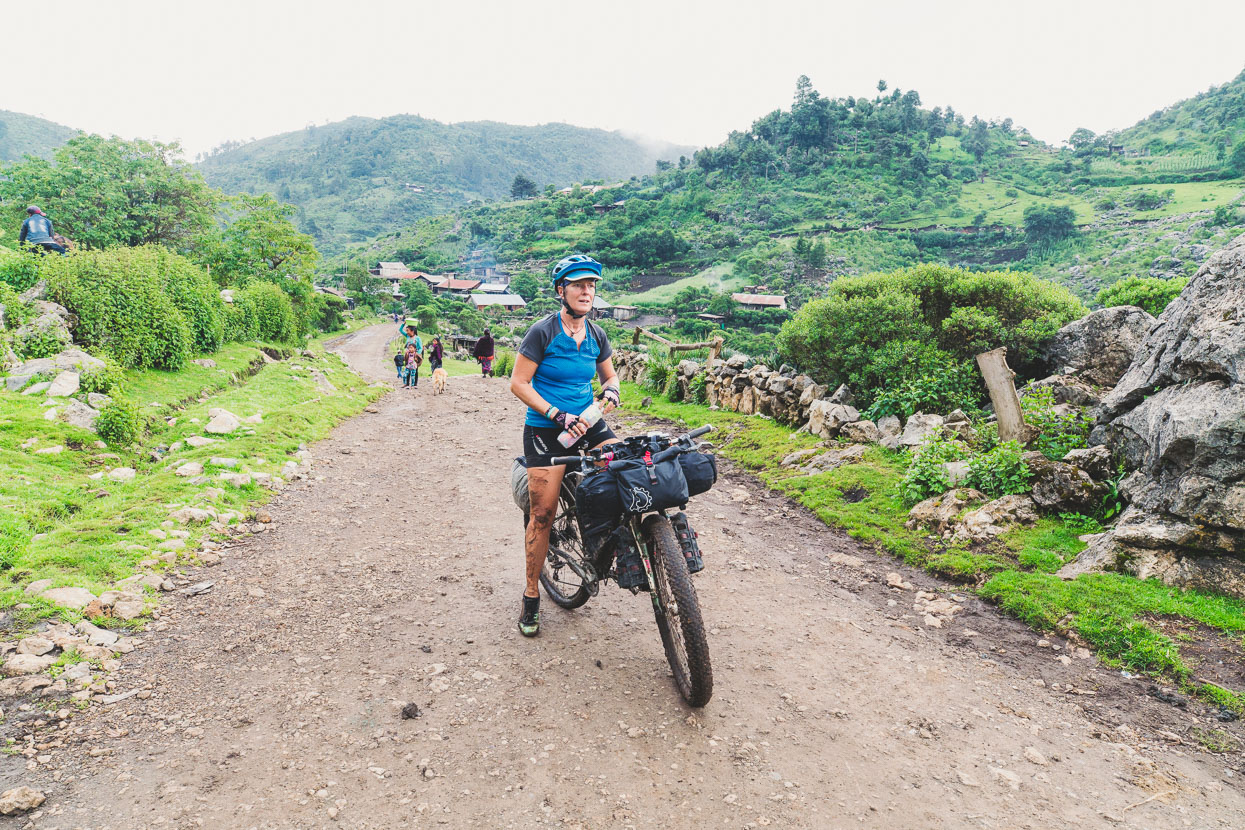
Piquing the curiosity of locals in Santa Eulalia on the way to San Juan Ixcoy.
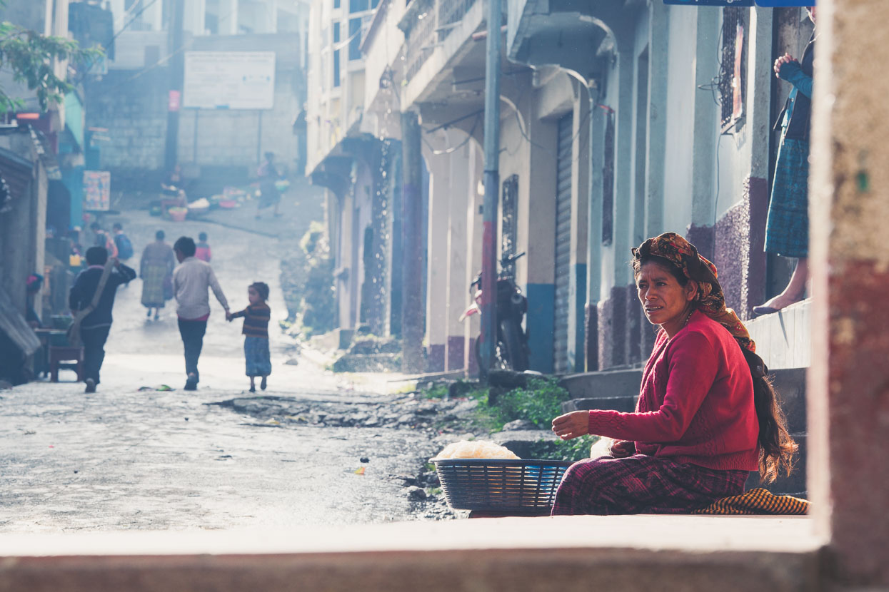
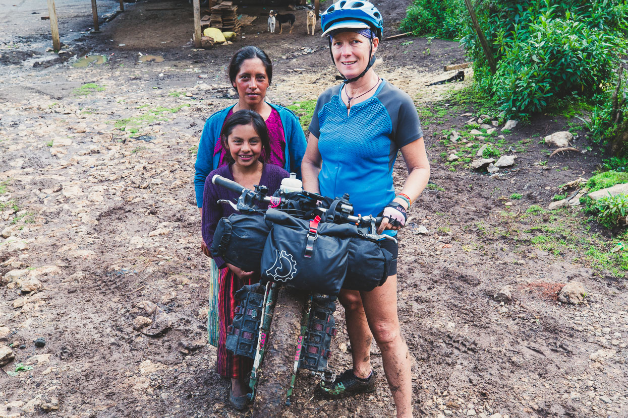
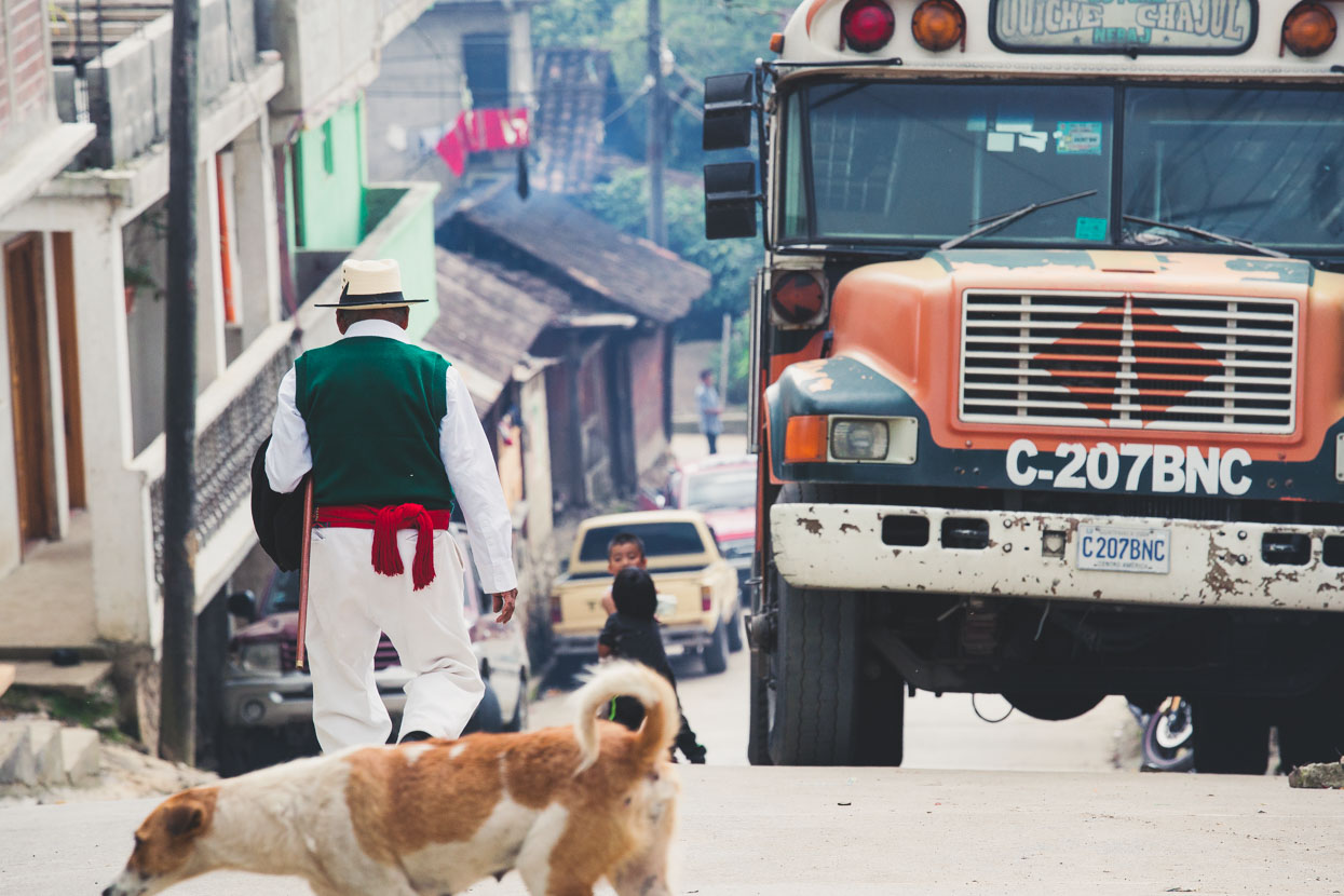
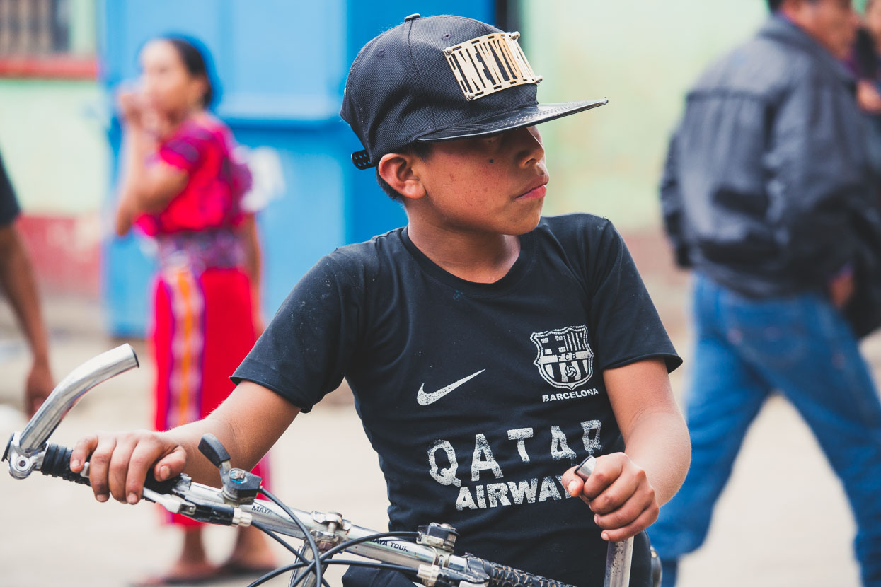
Vaya bien! (go well!) is the phrase that we hear multiple times a day and probably best sums up the warmth and welcome we have experienced from people in the Cuchumatanes. When we stop in small towns it’s very common for people to stop and talk to us, but often it’s us that initiate the conversation too. A simple buenos días can be followed with como está (how are you?) which usually breaks the ice and leads to a longer conversation – a connection with locals that feels valuable and at times can be very insightful. Putting in the extra effort to talk opens opportunities to take photos too, which people will usually shy away from without the introduction first.
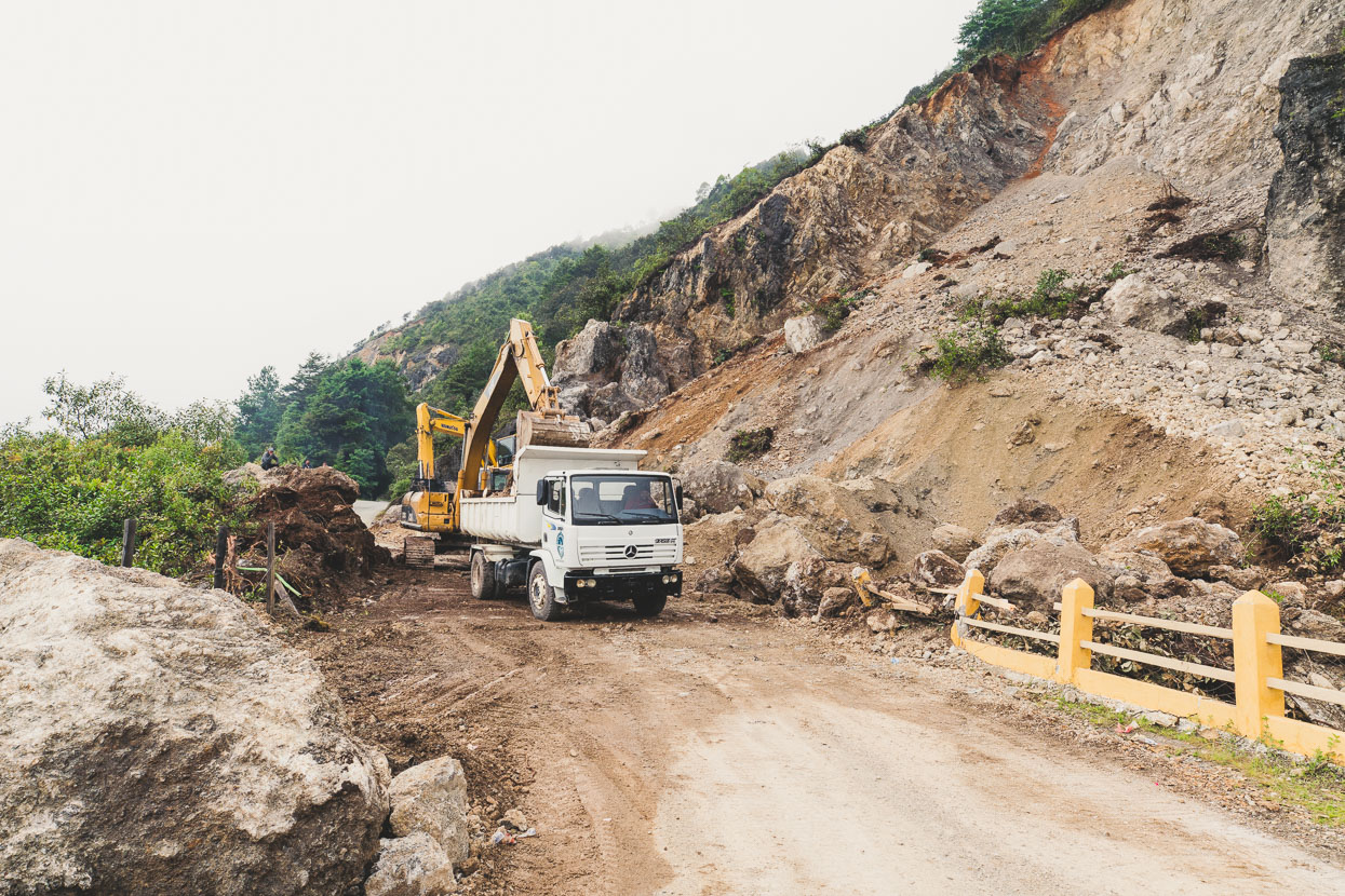
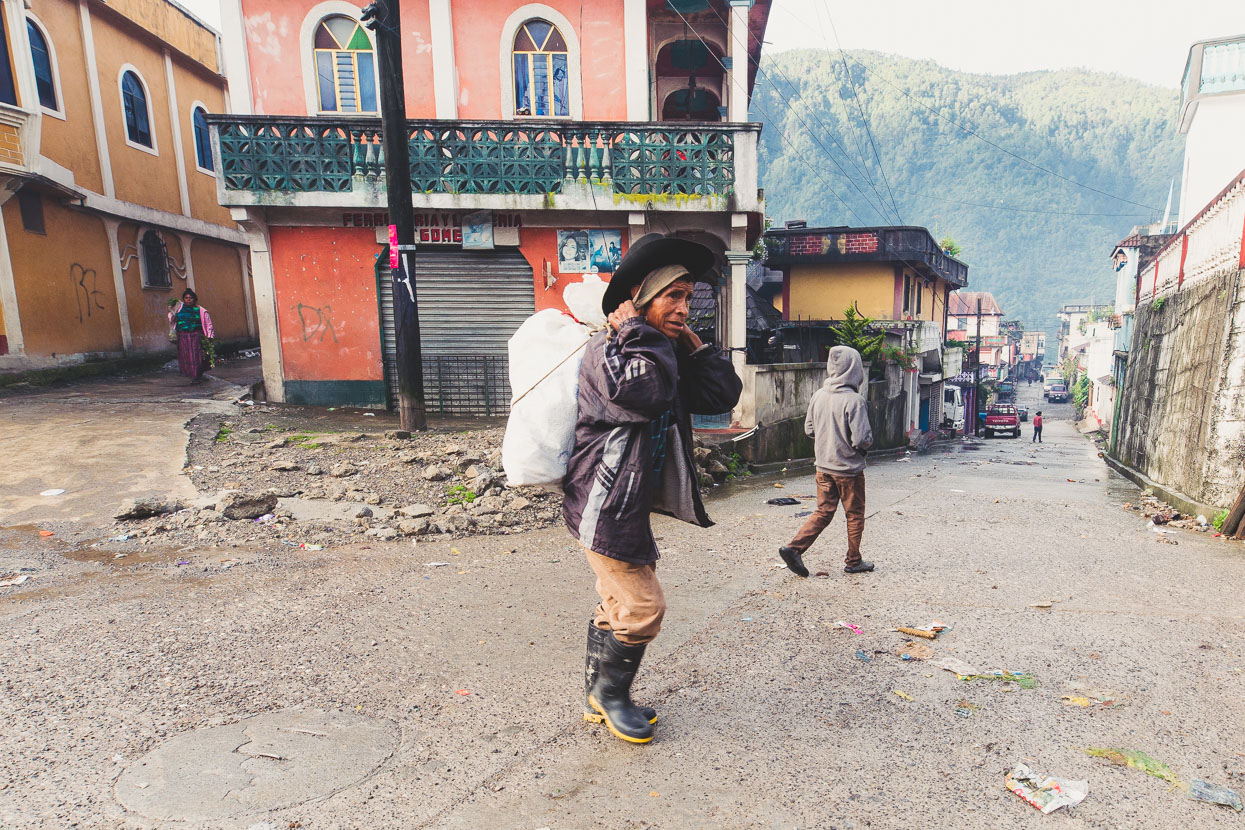
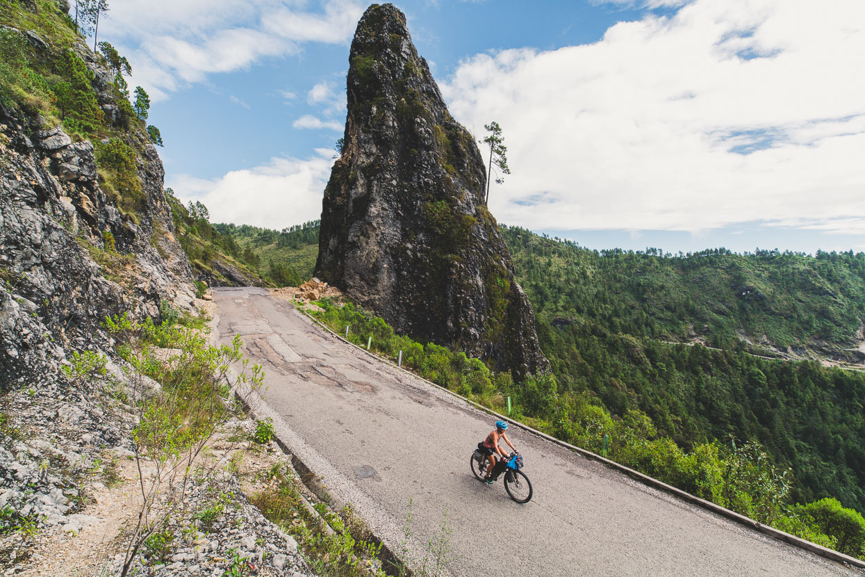
Along with a few cracks in stone and brick buildings, we encountered some slips and dislodged boulders across the road as a result of the September 7 earthquake.
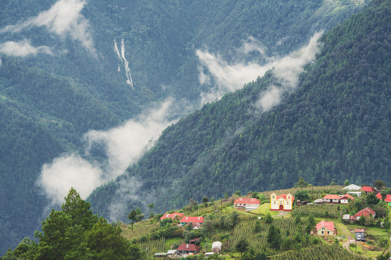
San Juan Ixcoy wasn’t particularly memorable, but it’s in a nice location deep in the valley; surrounded by forest and misty ridges.
It was a 1200 metre climb straight out of town in the morning to gain the high plateau of the Cuchumatanes again – the plateau we’d crossed the western edge of five days prior en-route to Todos Santos. But on tarmac, with legs rested from only a half-day of riding the previous day, it was an enjoyable spin.
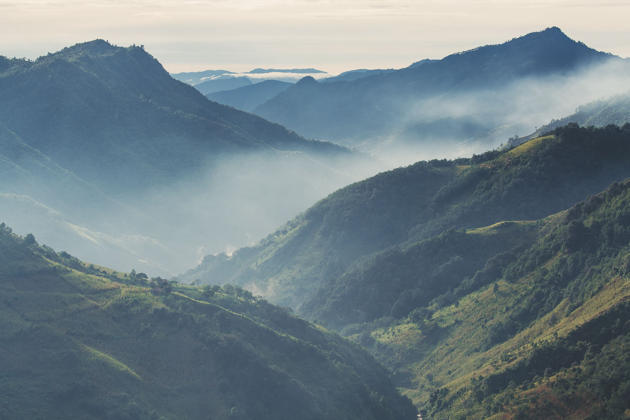
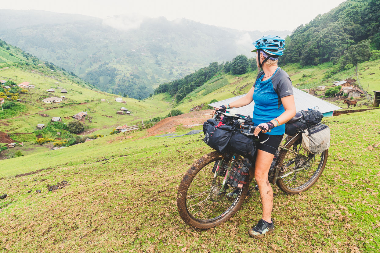
As we gained height the landscape began to fall away below. Villages dotted the hills and layered ridges marched away, soft with greenery and cotton wool cloud.
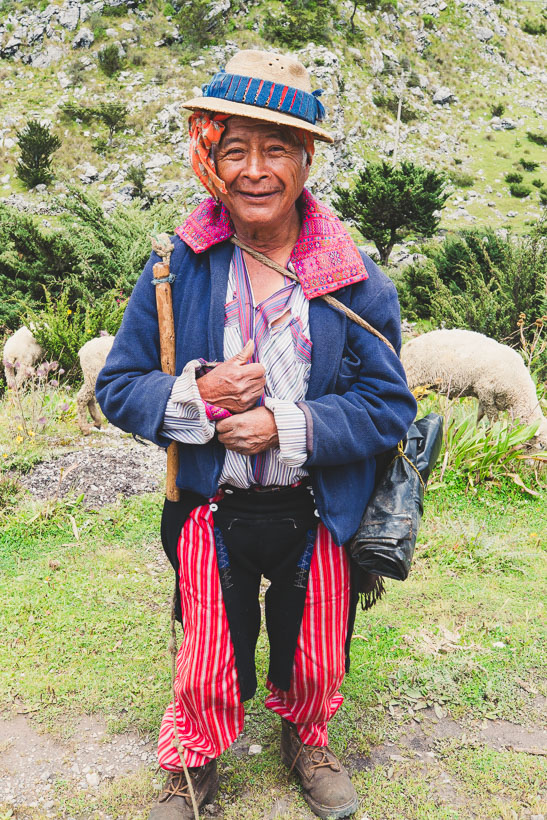
We topped out into the seemingly relentless cold wind that blows on the plateau and crossed 3400 metres before dropping into a long low sided valley. Unkempt, aged by the land and amable Juan was keeping an eye on 75 sheep, his whip over his shoulder. After a few words I asked to take his photo. Juan cannily rubbed the tips of two fingers together in a universal gesture and I nodded in agreement – happy to pay a few quetzales for a photo to remember this character with.
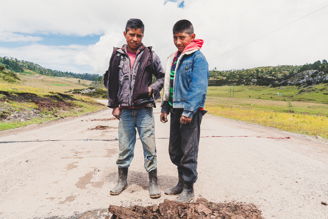
These two boys, Juan and Pedro were quarrying rocks and earth from the roadside to repair pot holes in the battered highway. Collecting their ‘toll’ by stopping traffic with a rope drawn across the road.

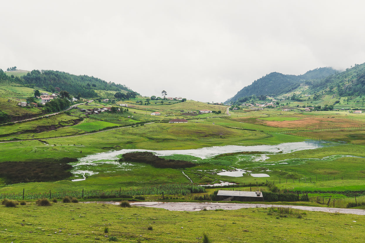
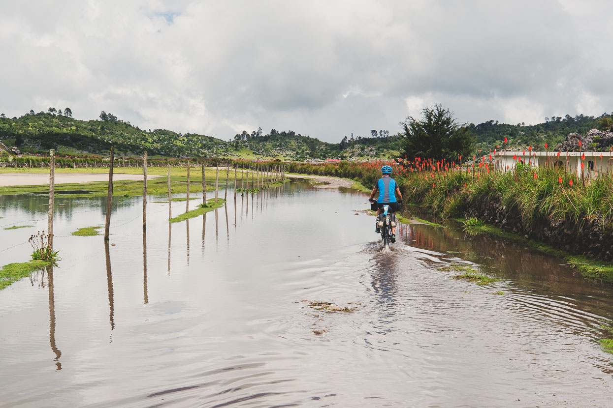
The relentless wet season here has left the ground on the plateau saturated: puddles, lakes and mud.
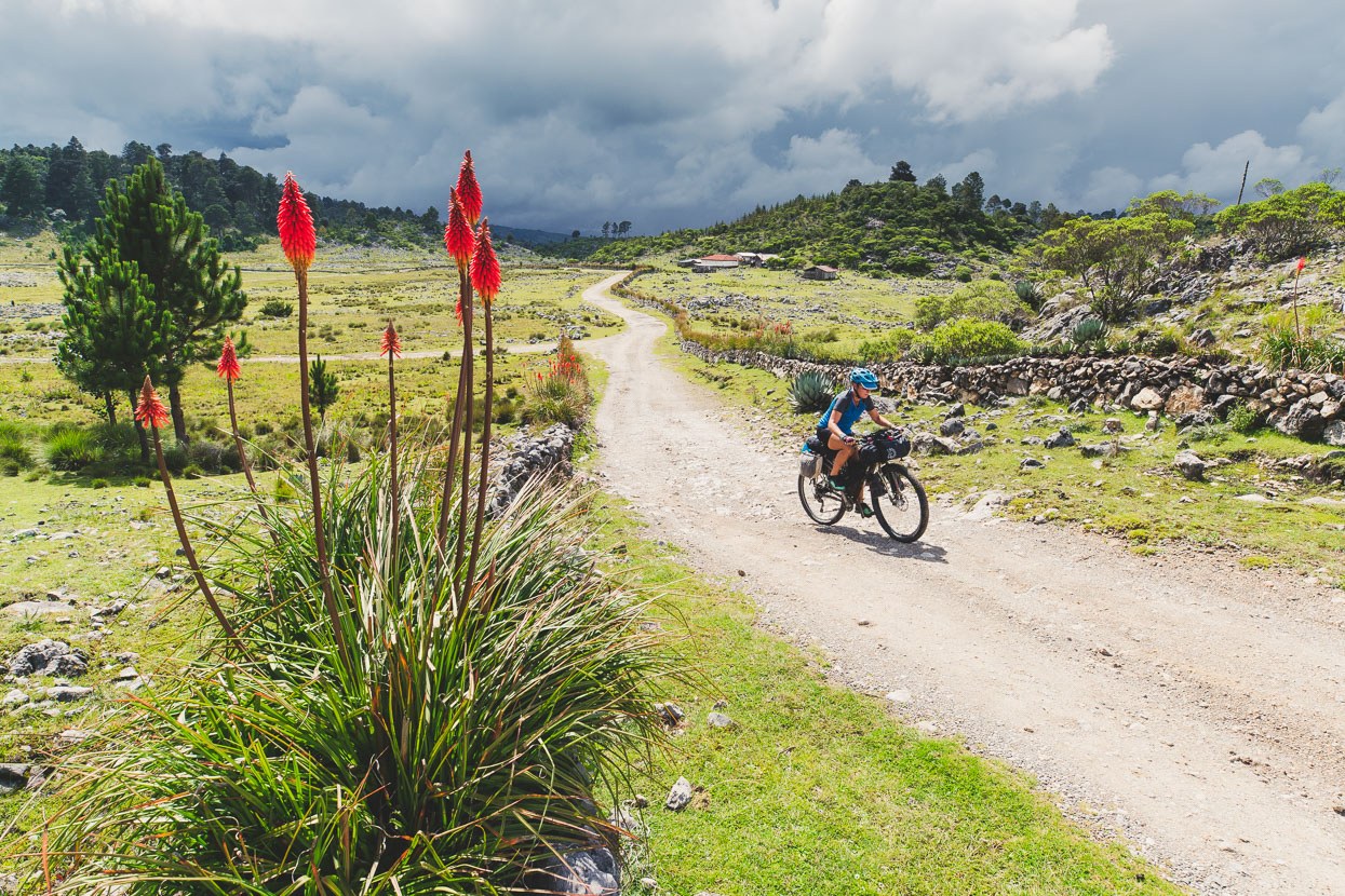
On a tip from Brendan James we decided to stay high on the plateau for a little longer taking an alternative, remoter, route further south east, across another canyon, before dropping straight down to Aguacatan, out of the range. It was a risky call late in the day but the temptation of some promised singletrack and villages only accessible by horseback was strong so we decided at the last minute to give it a go.
We were rewarded at first with a great landscape and nice light as an afternoon thunderstorm buffeted the range not far west.
Unfortunately the track that might be a great dry season ride was a greasy mud fest, but we pushed on in the optimistic hope that at the next village it might improve. I could see what looked like a wider road on the satellite map.
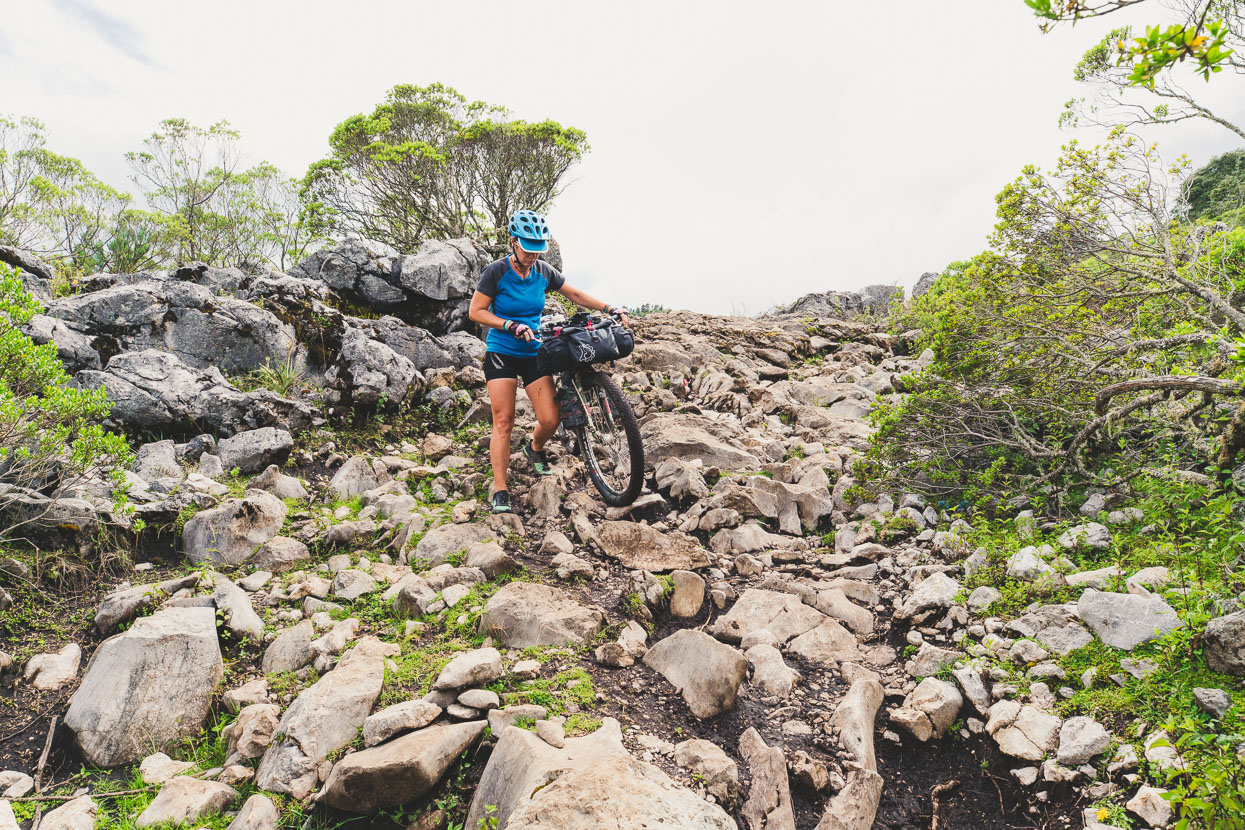
We emerged to farmland and more mud, above a few houses, and caught sight of a tacky looking mud-track with several recent slips across it that led down into the canyon we’d need to drop into and climb out of before reaching a better road. It was all looking a bit unlikely.
Some friendly women in the hamlet were surprised to see us, but we optimistically asked about the track on. The report was a shake of the head: El camino es muy malo. One of the women gestured to knee level when describing the mud further on.
If I hadn’t cached a satellite map for the area in my phone we’d have had a muddy battle in the dark, and the upside was that we could backtrack on a 4WD road back to our original route, but the downside was that it was 20 kilometres. So with a sense of haste we set to it – keen to be off the plateau before dark.
We closed a loop back to our original route on the cusp of sunset and dropped into a misty 1500 metre descent all the way down to Aguacatan – arriving well after dark and glad to find a hotel and a hot meal.
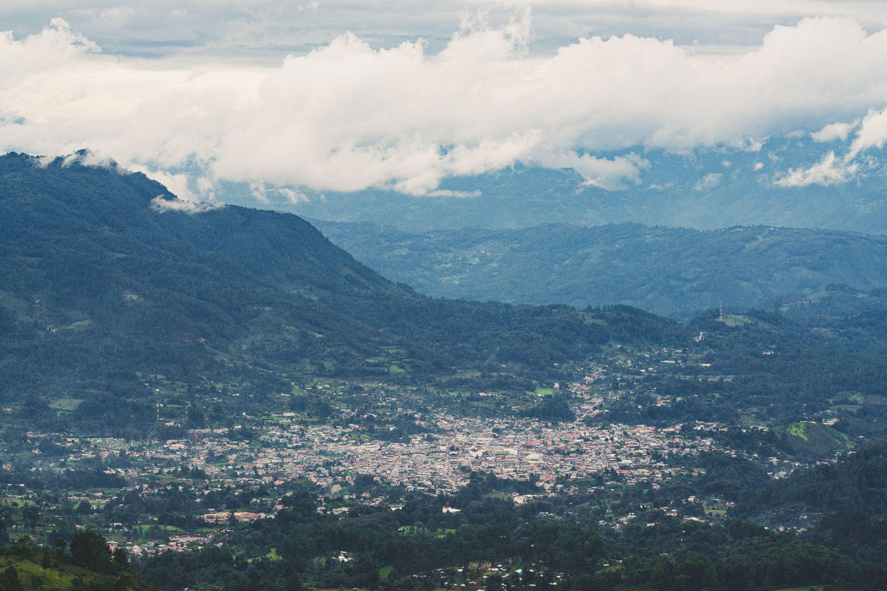
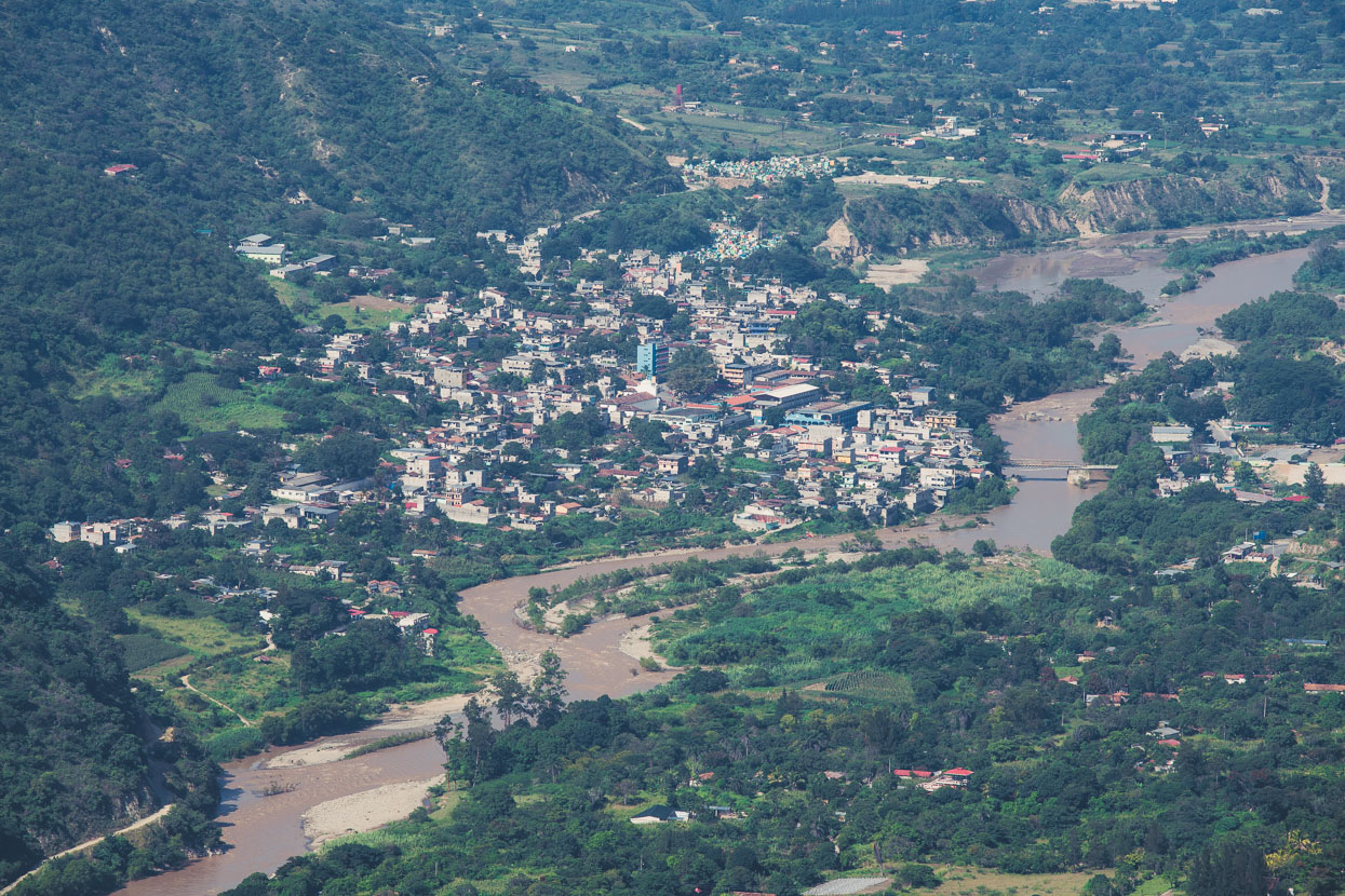
The next morning we were right back into it (after briefly stopping at a car wash to hose the mud off the bikes), and rode a nice ridge top highway over to Sacapulas – way down at a nearly tropical 1180 metres. From there we had another far flung Maya outpost in our sights: Nebaj (pictured) only 33 kilometres away, but with a 1400 metre climb on the way.
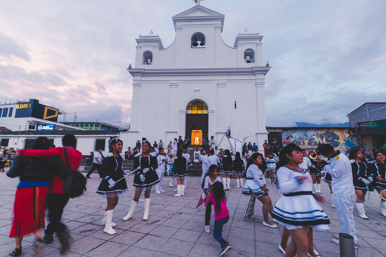
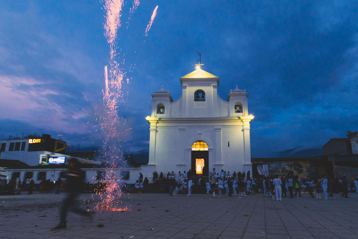
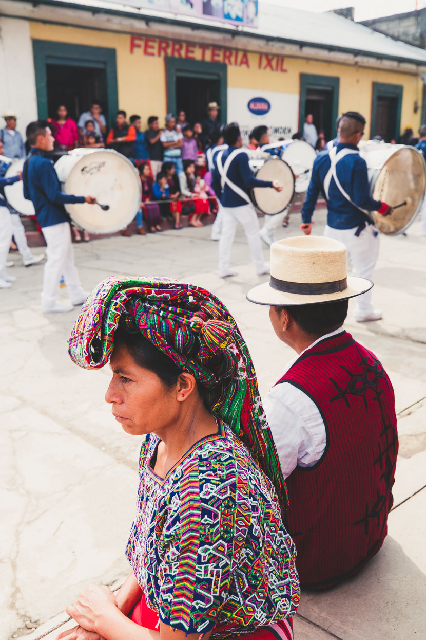
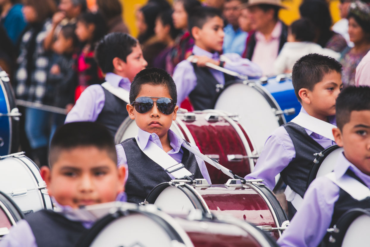
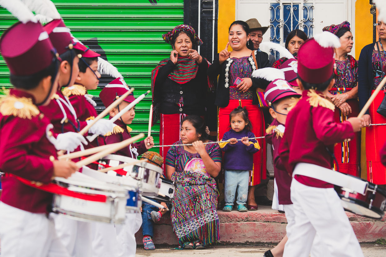
It was the eve of Guatemalan Independence Day and that evening Nebaj was alive with the boom of fireworks and the thumping drums of brass bands. The atmosphere was lively and the square was filled with young people waiting for their performances.
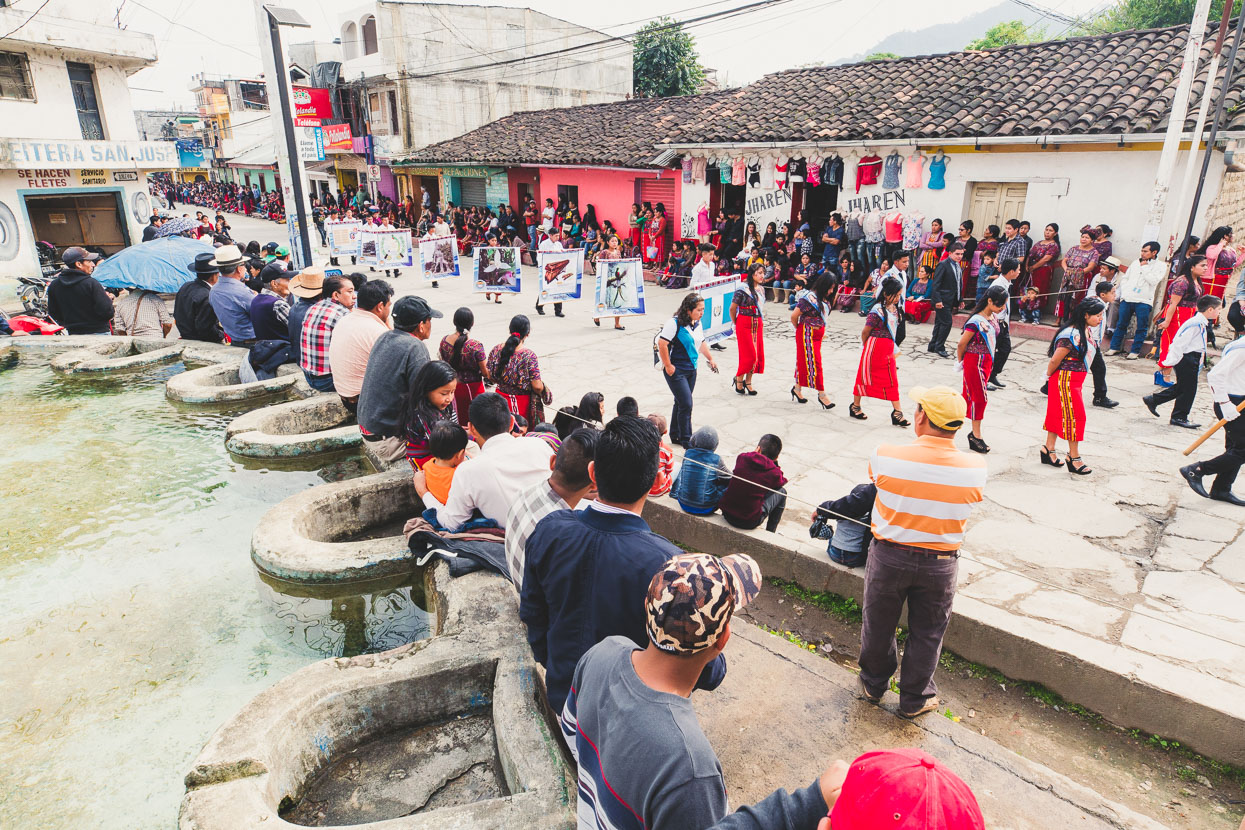
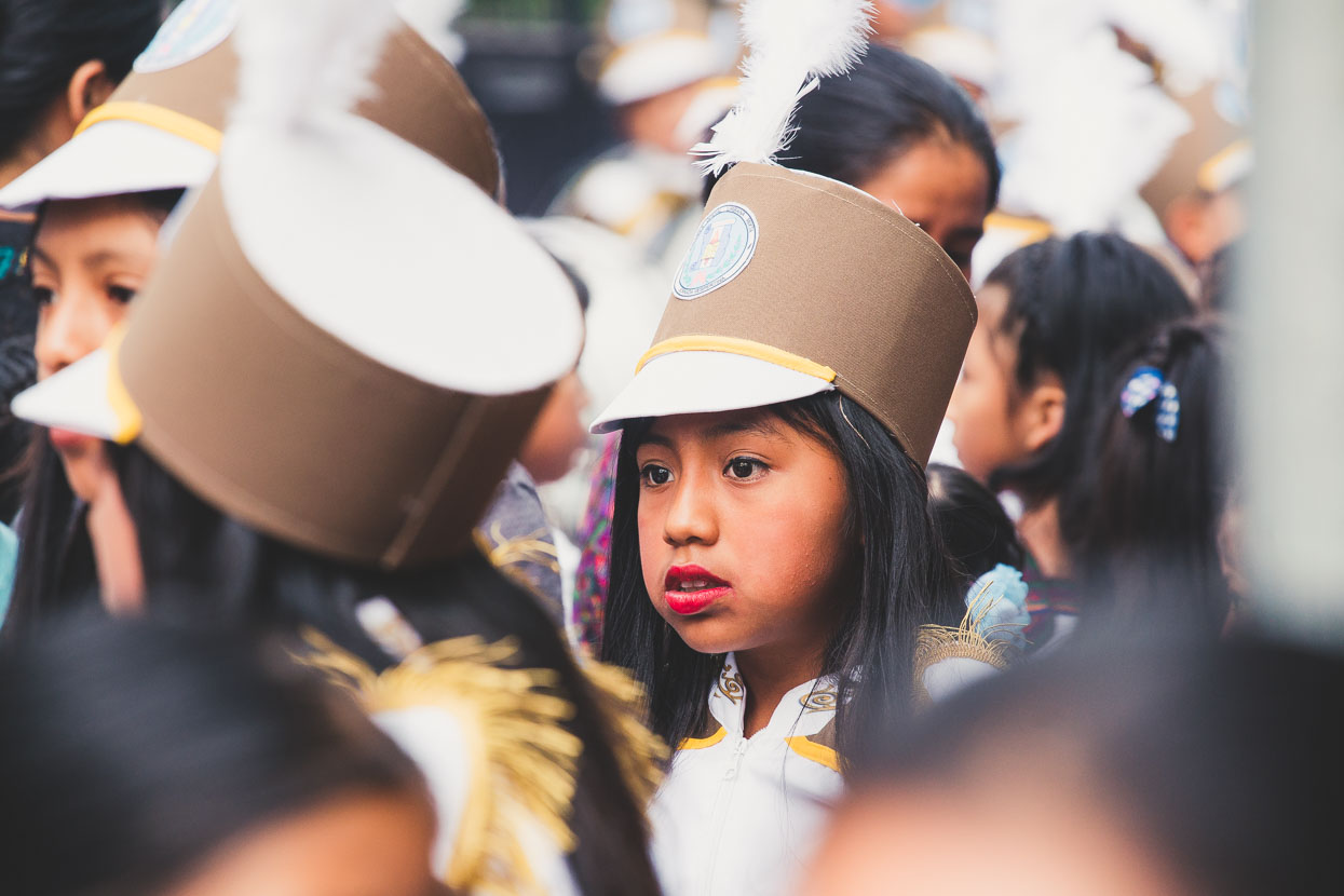
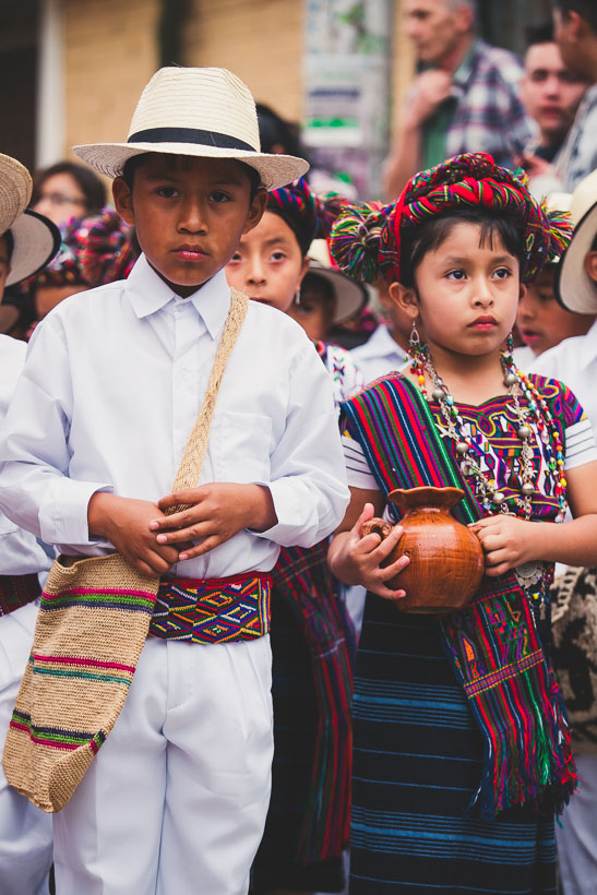
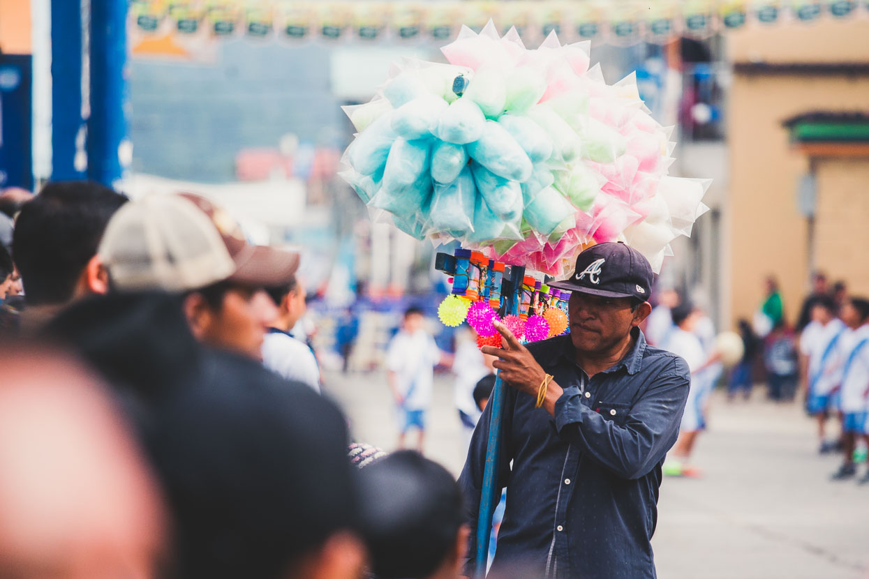
The next morning we took our second day off of the trip (the first was in Todos Santos) and spent the morning watching the street parades. Every local school, organisation and government service was out in force, drumming, dancing or marching their way down the street.
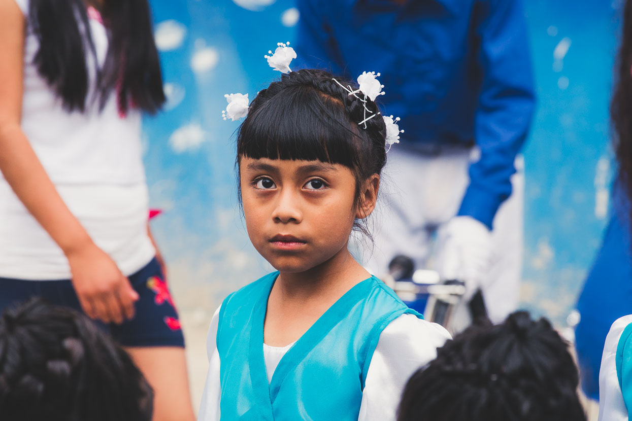
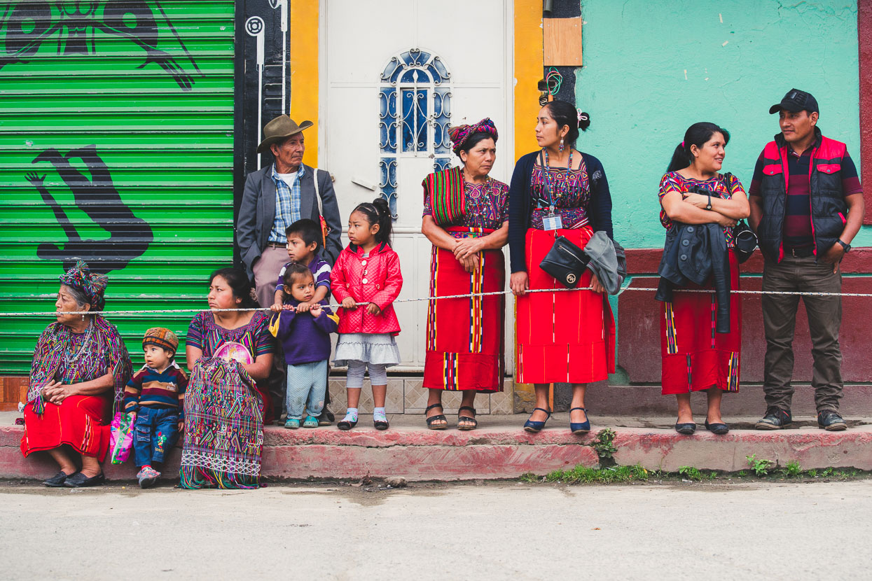
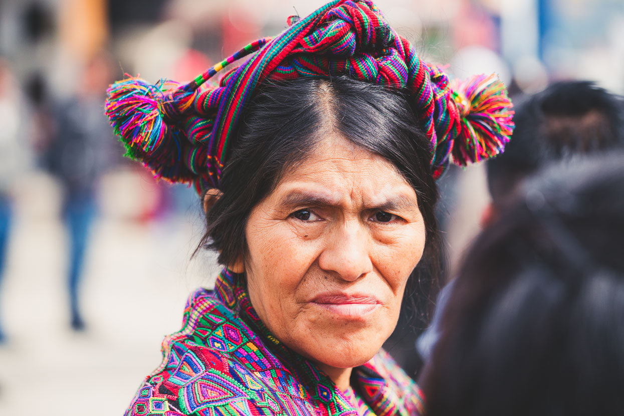
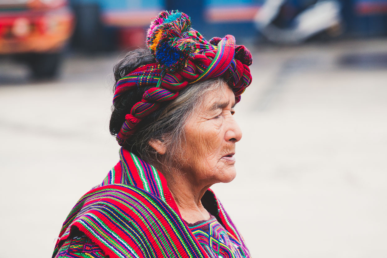
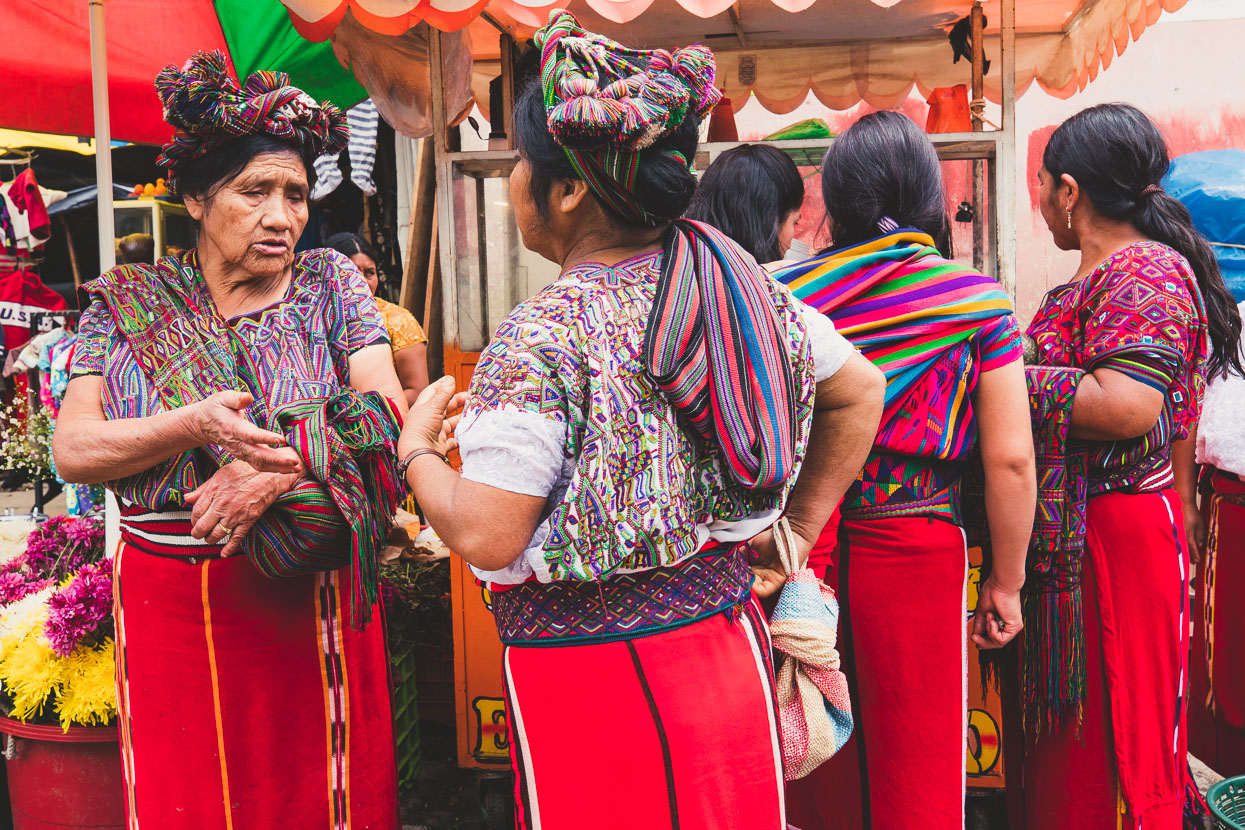
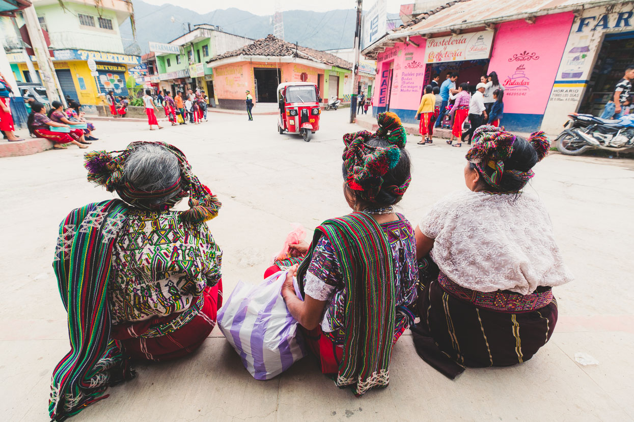
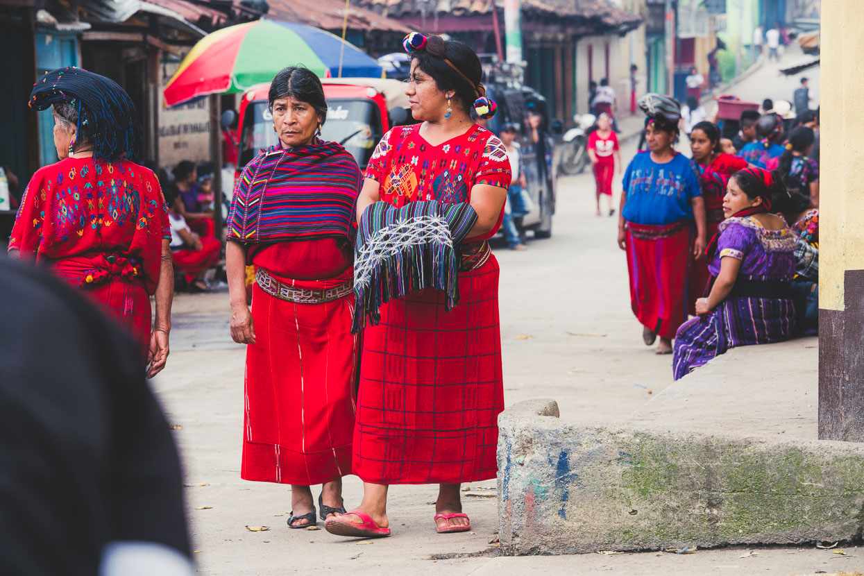
For us it was a great chance to people watch and check out the local culture. Notable in Nebaj are the red striped skirts worn by women, along with the distinctive headwear.
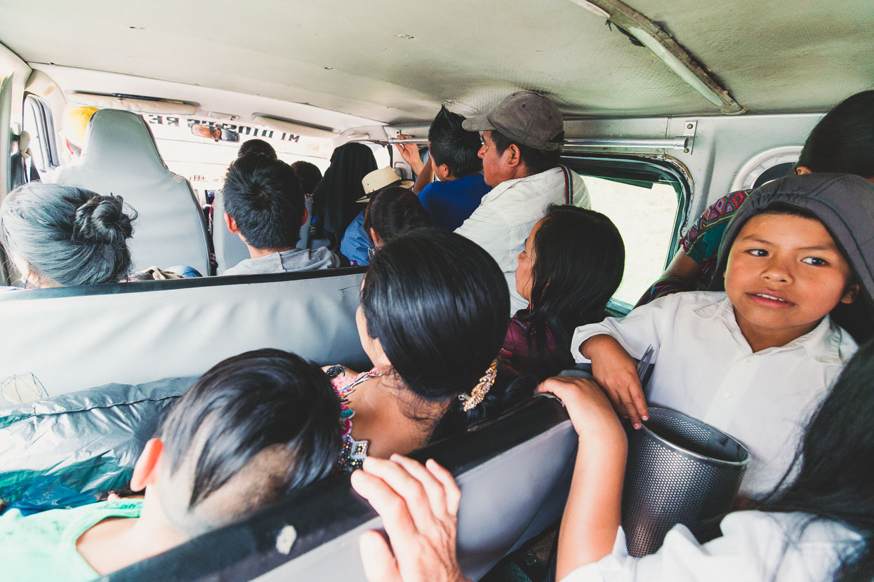
For the afternoon we decided to head to another, even more isolated, village deeper into the hills. Sans-bikes, we caught a mini-van in typical Guatemalan style – crammed in with 21 other people!
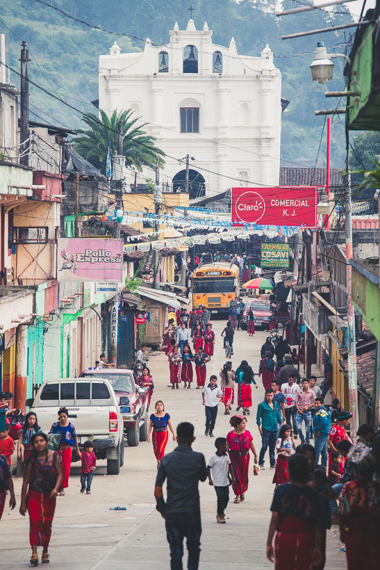
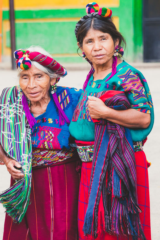
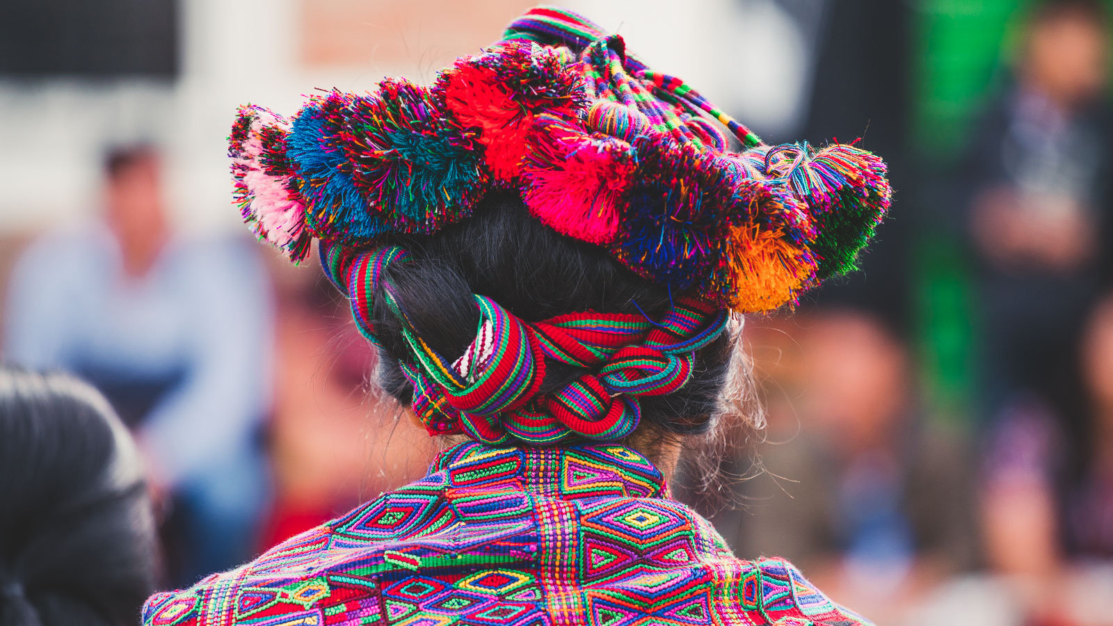
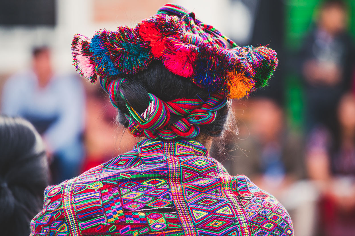
Chajul was fascinating and different again from Nebaj, with many of the men wearing red embroidered jackets and the women’s hair wrapped with embroidered cloth and pom poms.
Unlike everywhere else we’ve been in Guatemala though, the reception here was less friendly and a couple of women made faces at us or ushered their children away, making a point to avoid us in the street.
Despite an unwelcoming – or at best indifferent – vibe from some of the locals, we persisted with exploring town a little. Walking the streets, and managing to chat to a few curious people. It was cool to see a lot of old mud brick and tile roofed homes still here.
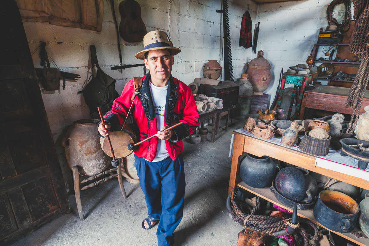
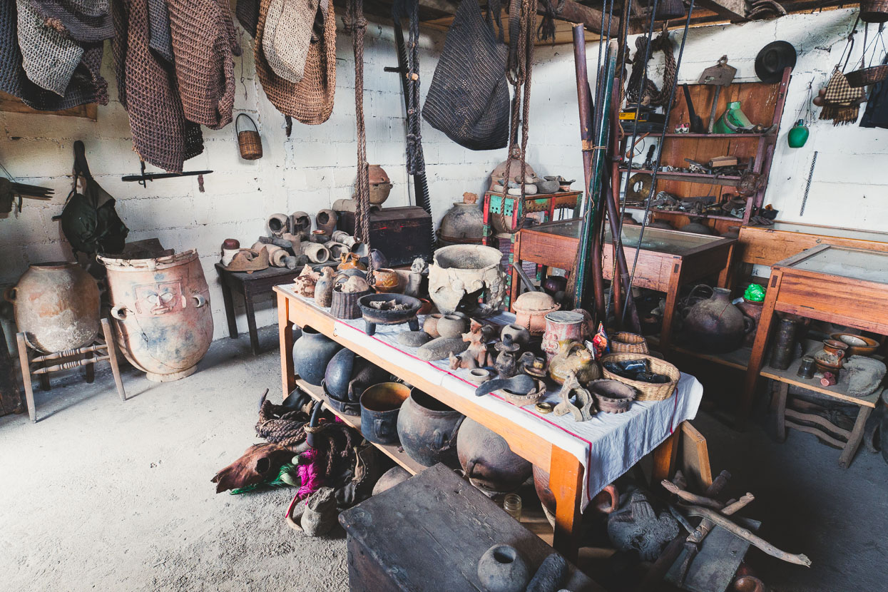
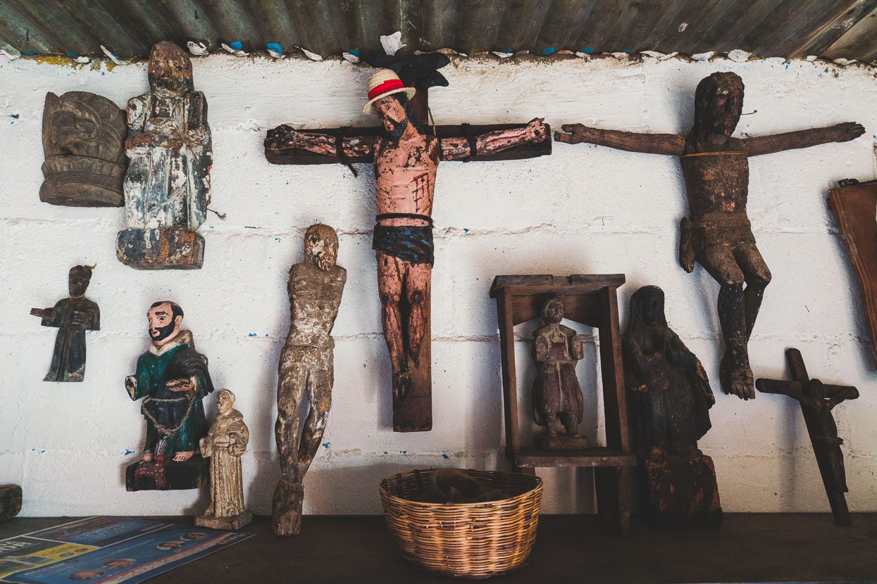
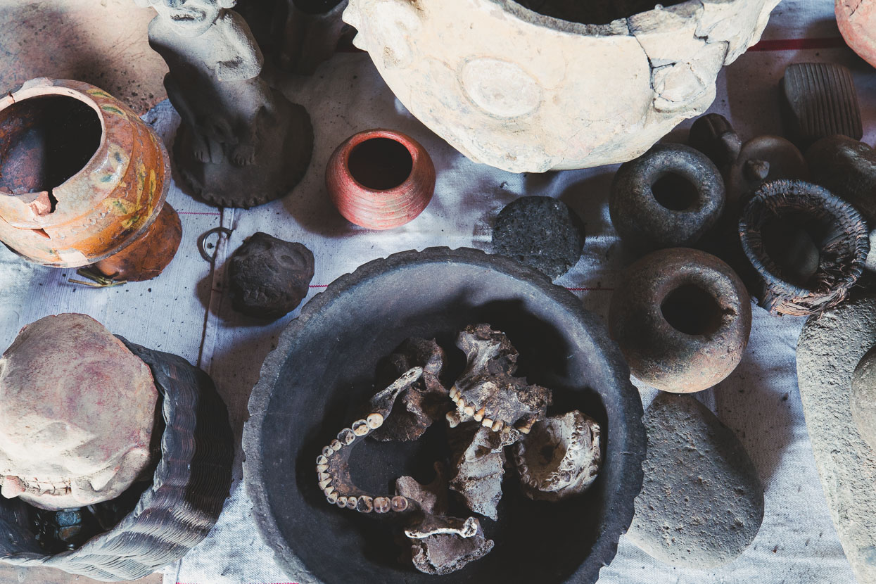
Felipe, the custodian of the town’s rustic museum approached us in the town square and invited us to come and have a look. It was a fascinating place to check out, with various dusty exhibits including Maya archeological finds, a bowl full of human jaws, pottery, homemade rifles, religious objects and other odds and ends.
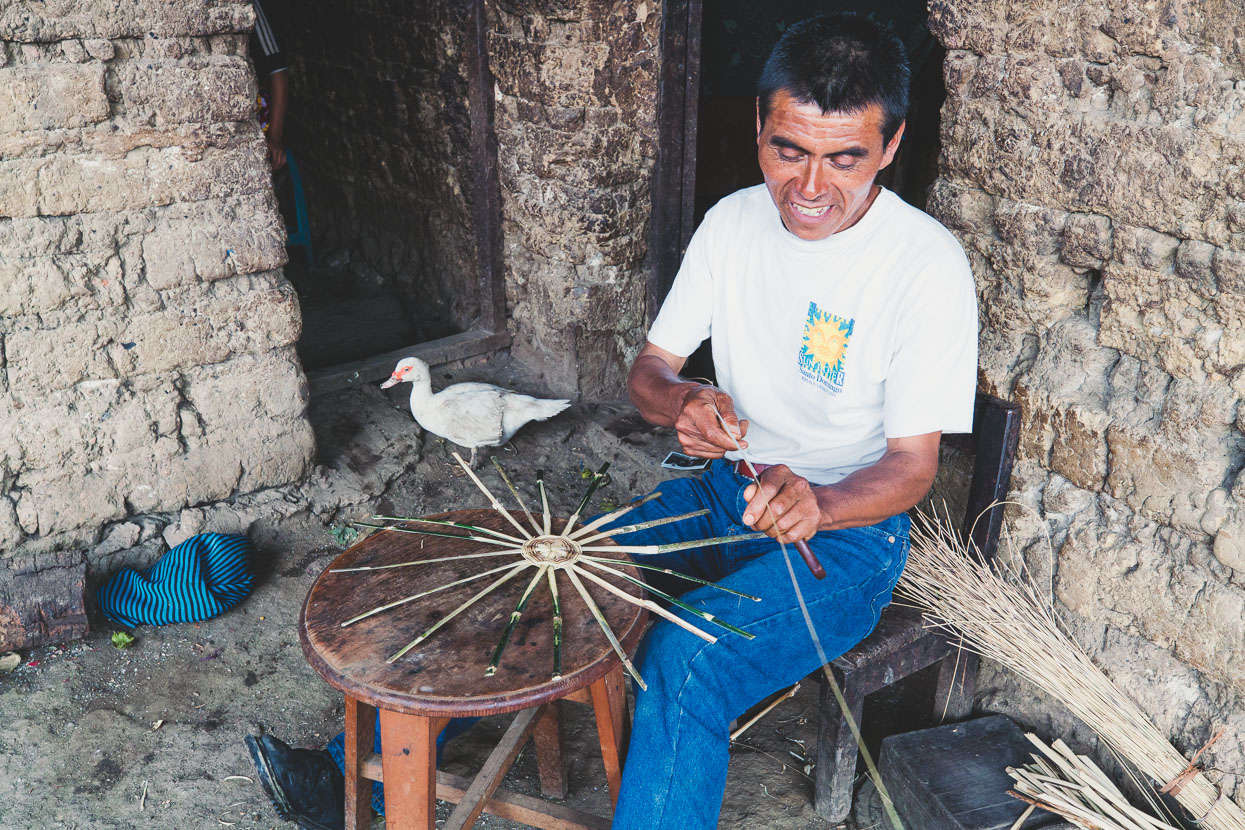
Sepiamo was another friendly man who hailed us over. He sat weaving in front of his house, making baskets, while ducks waddled about, in and out of the house.
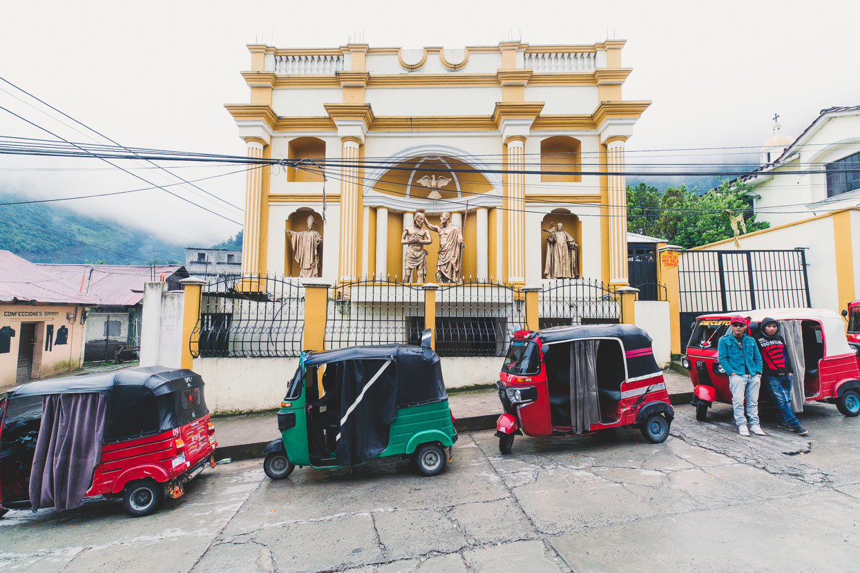
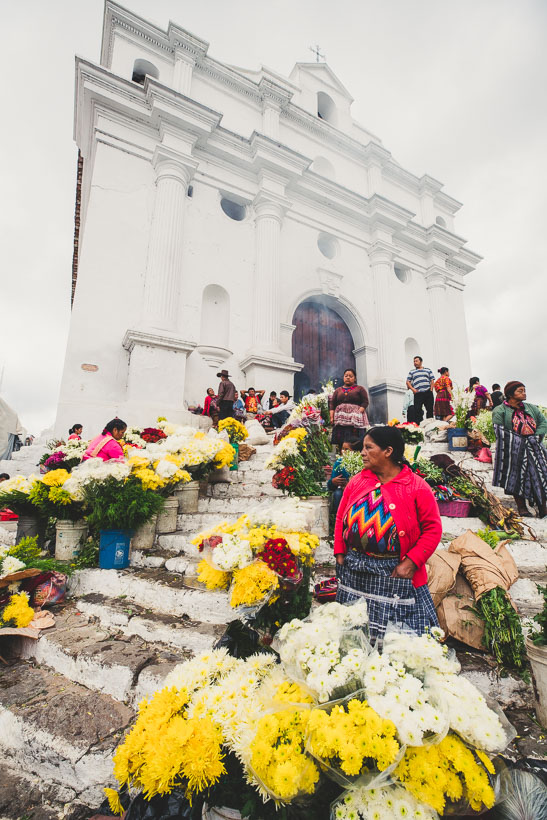
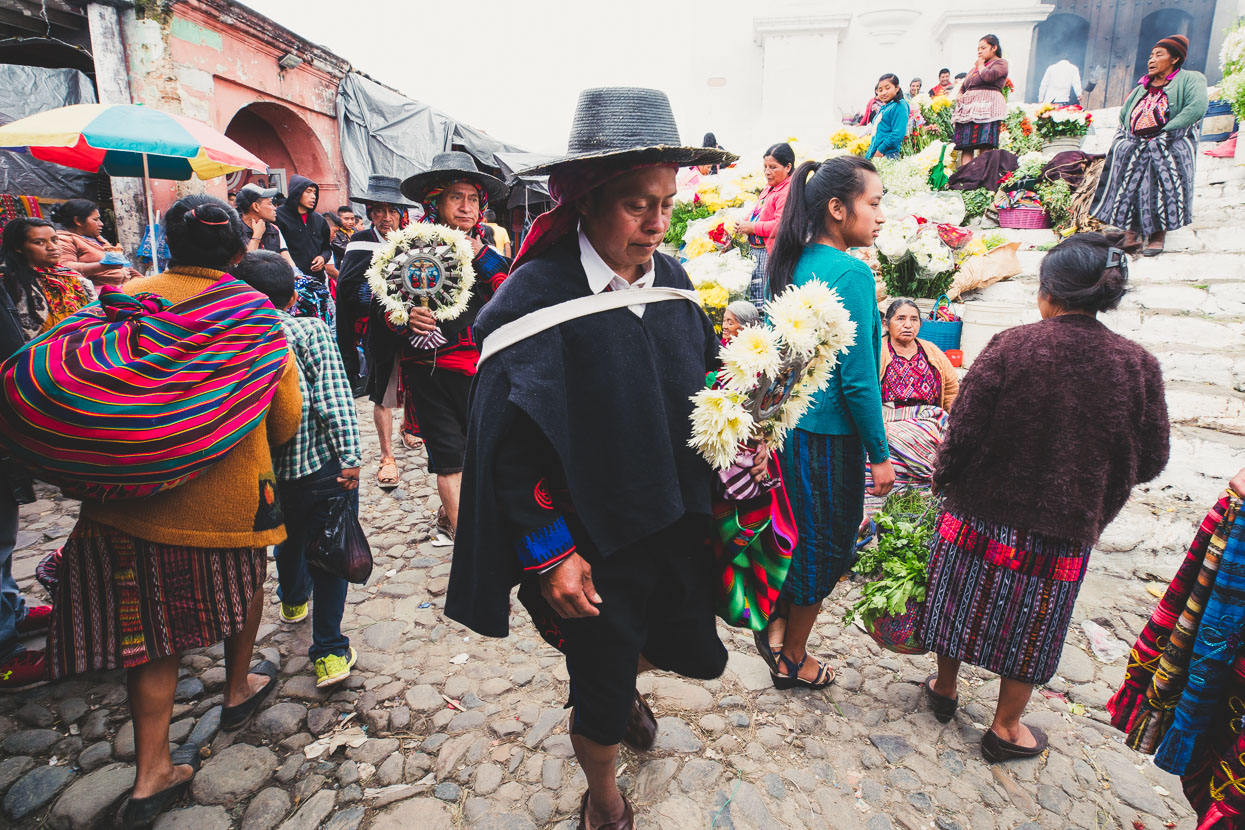
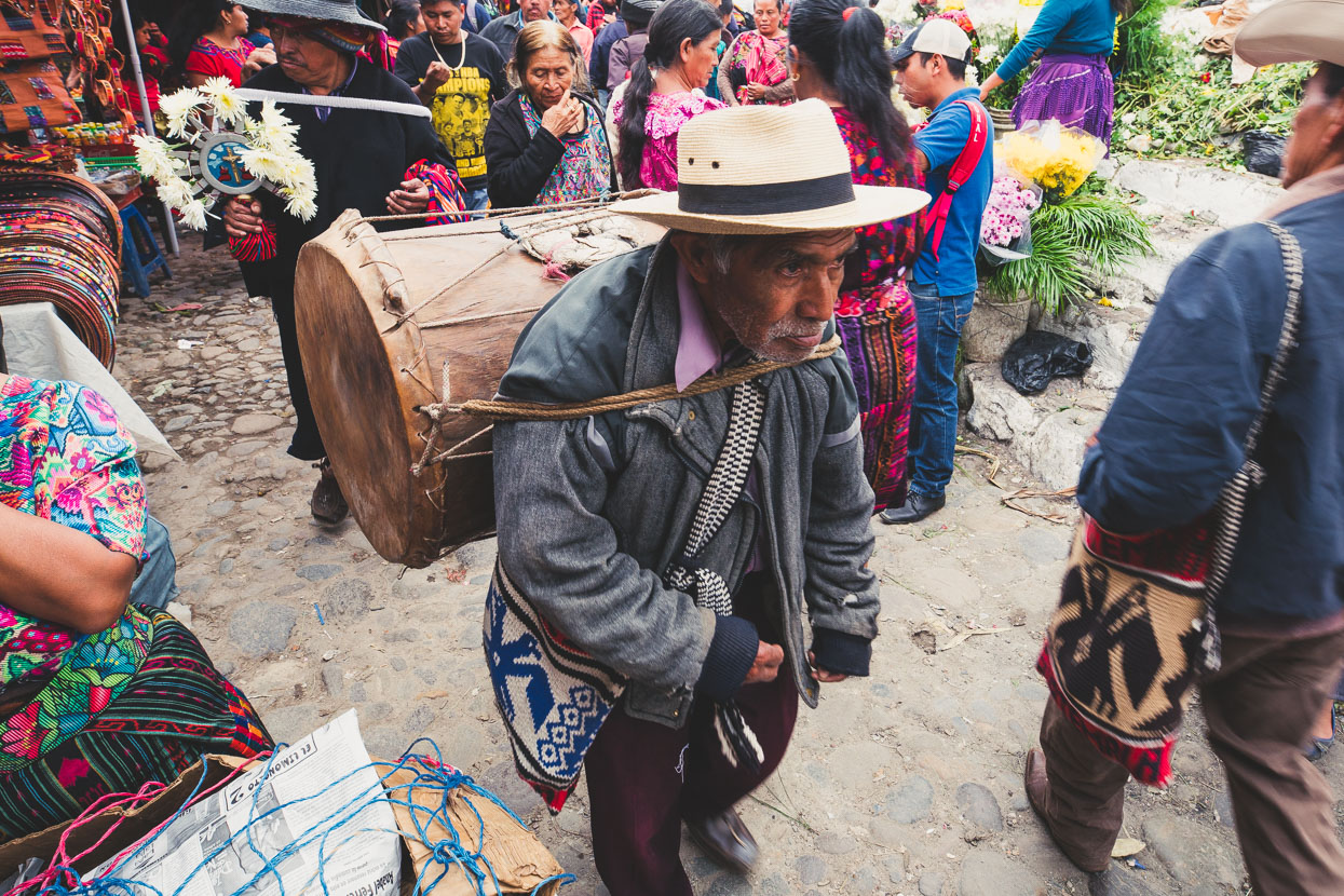
In the morning we caught a chicken bus (to avoid more back tracking) a few kilometres up to the top of the road we’d ridden in on and enjoyed a long and fast coast back down into Sacapulas (above). We restocked water and food in town and then headed right into another 1000m+ climb on the road towards Santa Cruz del Quiche, and then onto Chichicastenago, which made a satisfying end to an 11 day tour. We’d stopped for a night in this town about six weeks previously en route to Lago Atitlan and love the energy and almost medieval spirit of its market and church area.
In the end the photos only tell part of the story, for there are so many more moments that can’t be captured: the brief chats; waves and smiles; the way the road feels and sounds under our tyres; the nip of the cool alpine air; the smell of cooking fires and bbq chicken on the roadside; the thumping drums from school courtyards and the way we jump when fireworks explode without warning. Those experiences are consigned only to our memories and it’s the desire to create more – experience more and learn that keeps us pedalling, and looking.
Thanks for reading.
Do you enjoy our blog content? Find it useful? We love it when people shout us a beer or contribute to our ongoing expenses!
Creating content for this site – as much as we love it – is time consuming and adds to travel costs. Every little bit helps, and your contributions motivate us to work on more bicycle travel-related content. Up coming: camera kit and photography work flow.
Thanks to Biomaxa, Revelate Designs, Kathmandu and Pureflow for supporting Alaska to Argentina.


Brilliant! Have been following adventures for some time and enjoying revisiting parts of the planet and seeing the Great Divide in autumn ( Jo and I did it in spring). Mexico and Guatemala jolts me back almost 40 years to when I was traveling solo as a naive kiwi with no maps and negligible Spanish. Some places were edgy and because Guatemala City had bombs going off I turned back north after Chichicastenango and Lake Atitlan. Really looking forward to South America blogs. Love your travel philosophy. Enjoy some beers – should get you weeks supply. Alan
Brilliant! Have been following adventures for some time and enjoying revisiting parts of the planet and seeing the Great Divide in autumn ( Jo and I did it in spring). Mexico and Guatemala jolts me back almost 40 years to when I was traveling solo as a naive kiwi with no maps and negligible Spanish. Some places were edgy and because Guatemala City had bombs going off I turned back north after Lake Atitlan. I recall a crazy van ride from Chichicastenango with 32 people and a couple of pigs on top! Really looking forward to South America blogs. Love your travel philosophy. Enjoy some beers – should get you weeks supply. Alan
Thanks for the beer! Going down well right this minute at a nice spot just shy of the Honduran north coast. We’ll be in La Ceiba tomorrow and hoping to head around the coast to Trujillo (oldest Columbian settlement in the New World), before heading back inland towards Nicaragua. We’re hoping to keep the route adventurous but it will depend on wet season conditions. That said the coast here seems way drier than it was inland.
Guatemala 40 years ago would have been a heady time to visit. Good on you. I would love to have seen it back then, although it still seems to have so much mystique that perhaps not a whole lot has changed in some places. Though I doubt you’d recognise some of the towns around Lago Atitlan!
Thanks again, Mark.