
Part I: Quetzaltenango to San Miguel Acatan.
In the north of western Guatemala’s highlands lies a landscape thrust high; a plateau of former seabed now residing at the chilly elevation of 3000 metres. It’s a place where the humid lowland jungle is forgotten, instead it’s a land of pine, oak and cypress trees and where impossibly large maguey grow amidst rocky outcrops. Relatively isolated, the people living here have retained traditional beliefs, customs and dress, lending many of the villages of this mountain range – Central America’s highest – a distinctive look and a reputation for toughness and pride.
It’s a fascinating – and challenging – place to ride a bike. Our Antigua-based American friend and Guatemala cycling enthusiast Brendan James describes the Cuchumatanes as the ‘Peru of Guatemala’ for their sheer relief and sense of isolation. With a description like that we just had to go and take a look.
Despite a fair bit of exploration by bike in northern Petén and then a fascinating – mostly dirt – ride west across the country from the Caribbean we still felt as if we had unfinished business in Guatemala. A nagging urge to explore more before we continue our route south into Honduras. As we are discovering more and more, Guatemala is all the things we seek in international cycling adventures: it’s mountainous, but diverse and characterised by some of the richest indigenous and post Columbian culture you can find anywhere.
We planned a 520 kilometre route that would take us from Guatemala’s ‘second capital’ Quetzaltenango, across the rolling granite and pine country of Momostenango to Huehuetenango to the base of the Sierra de los Cuchumatanes. From there we made a circuitous ride in and out of the range twice before heading back south again to finish in Chichicastenango – in total a trip of eleven days.
It’s quite a lot to cover so I have split the trip over two posts – enjoy!
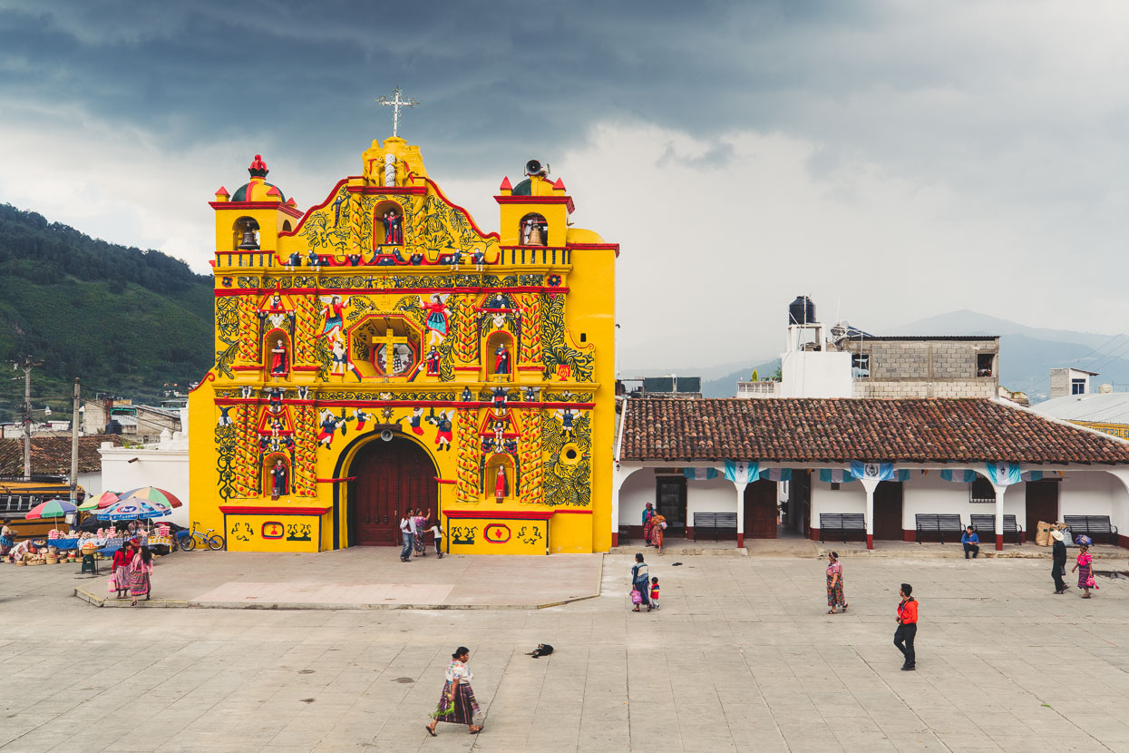
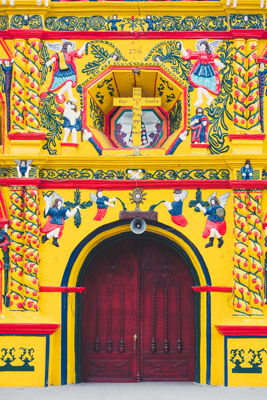
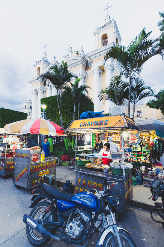
From Antigua we caught a minivan to Quetzaltenango (Xela) and late morning we were on our way out of the city following a GPX track we’d pre plotted back in the city. Ever since seeing a photo of the gaudily painted church of San Andres Xecul in a travel guidebook I’d wanted to check it out, so we included this interesting little village in our plan as we rode roughly north towards Huehuetenango.
Out of San Andres Xecul the road begins to climb into granite and pine dotted uplands as it heads towards Momostenango, looking back here towards San Francisco El Alto with the perfect cone of Volcan Santa Maria (3772m) in the background.
Pouring rain and drizzle was the flavour of the afternoon, but we got to the valley town of Momostenango in time for some people watching and a wander through the town as they packed up the market.
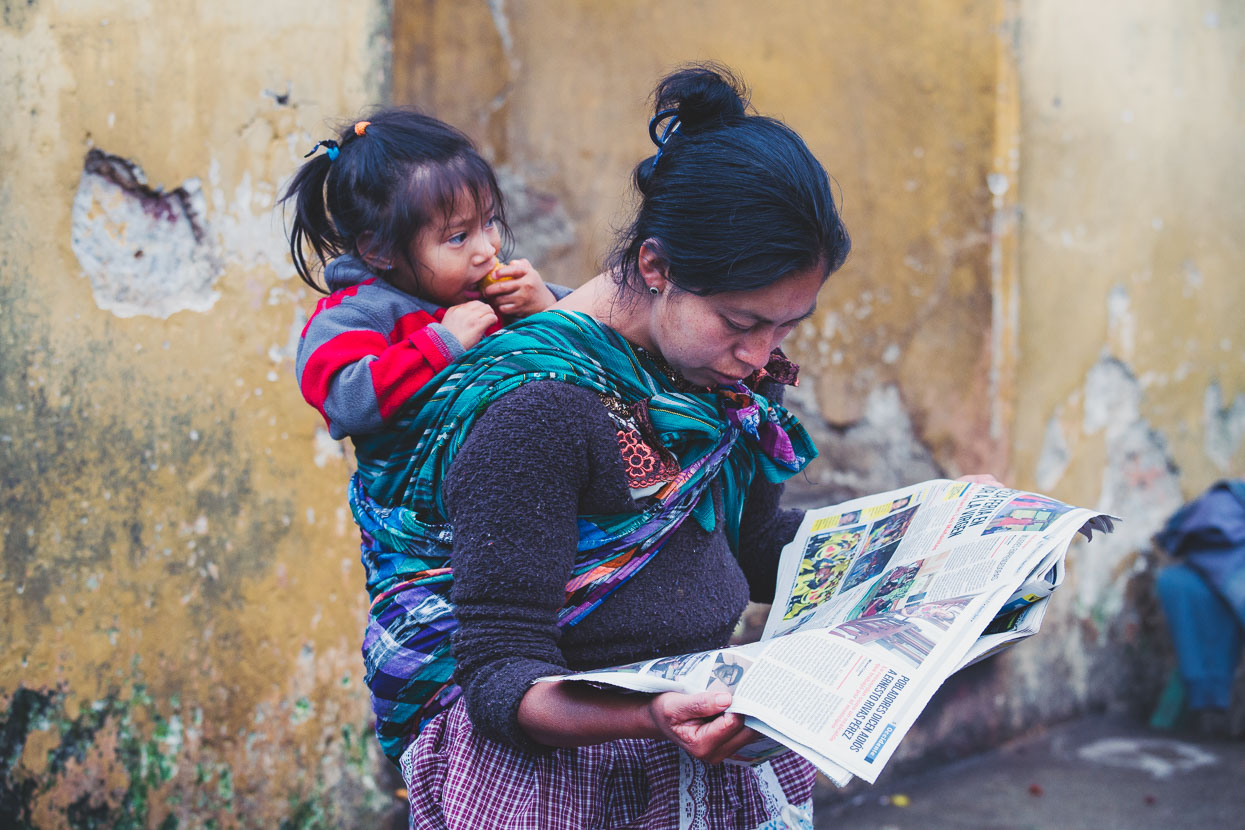
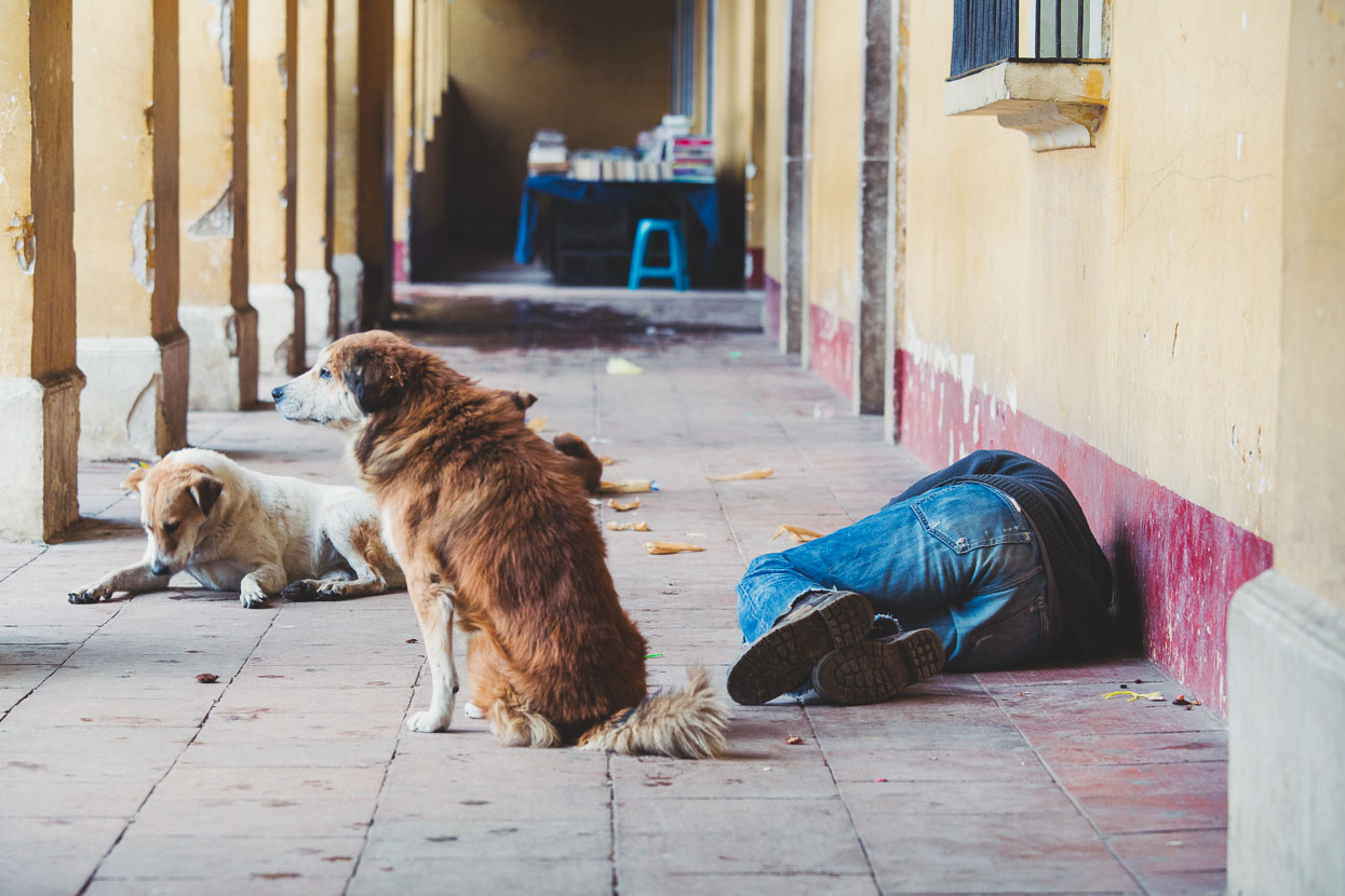
Perros and borrachos (dogs and drunks) are themes of Guatemala as much as tortillas and chicken buses. A NZ$20 hotel room with wifi served us well for the night.
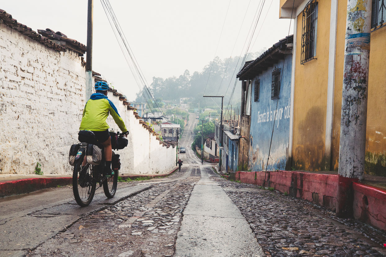
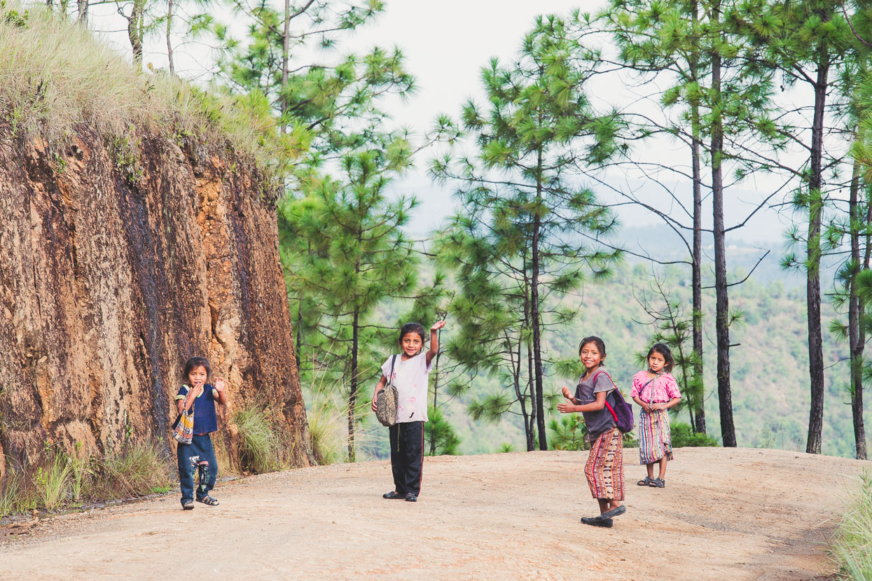
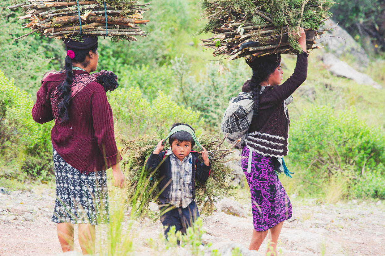
The road onwards to Huehue was hard-pack dirt, with no traffic except the odd pickup and battered bus. These kids were on a 30 minute walk to school and were curious and chatty but fled to a safe distance when the camera came out.
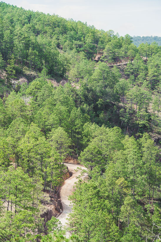
Our hilly road through endless pines and small settlements – perfect dirt touring.
As we approach Huehuetenango the Cuchumatanes rise like a wall in front of us; a great barrier range forced up by the relentless activity of Guatemala’s plate tectonics.
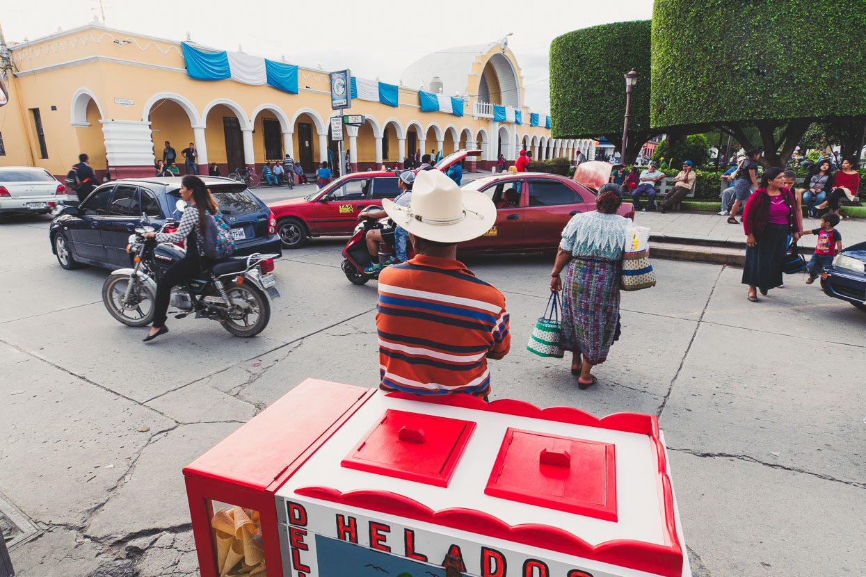
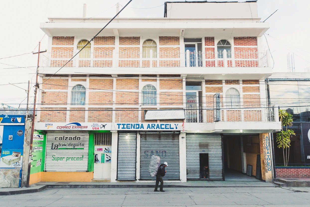
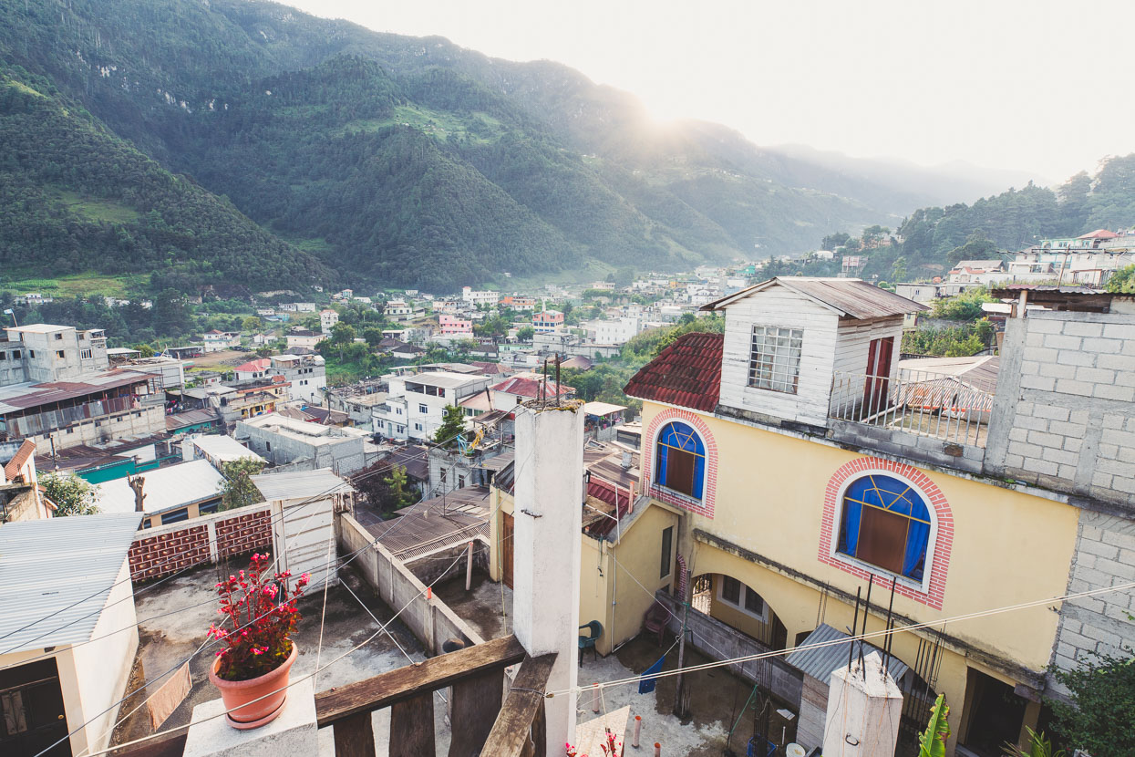
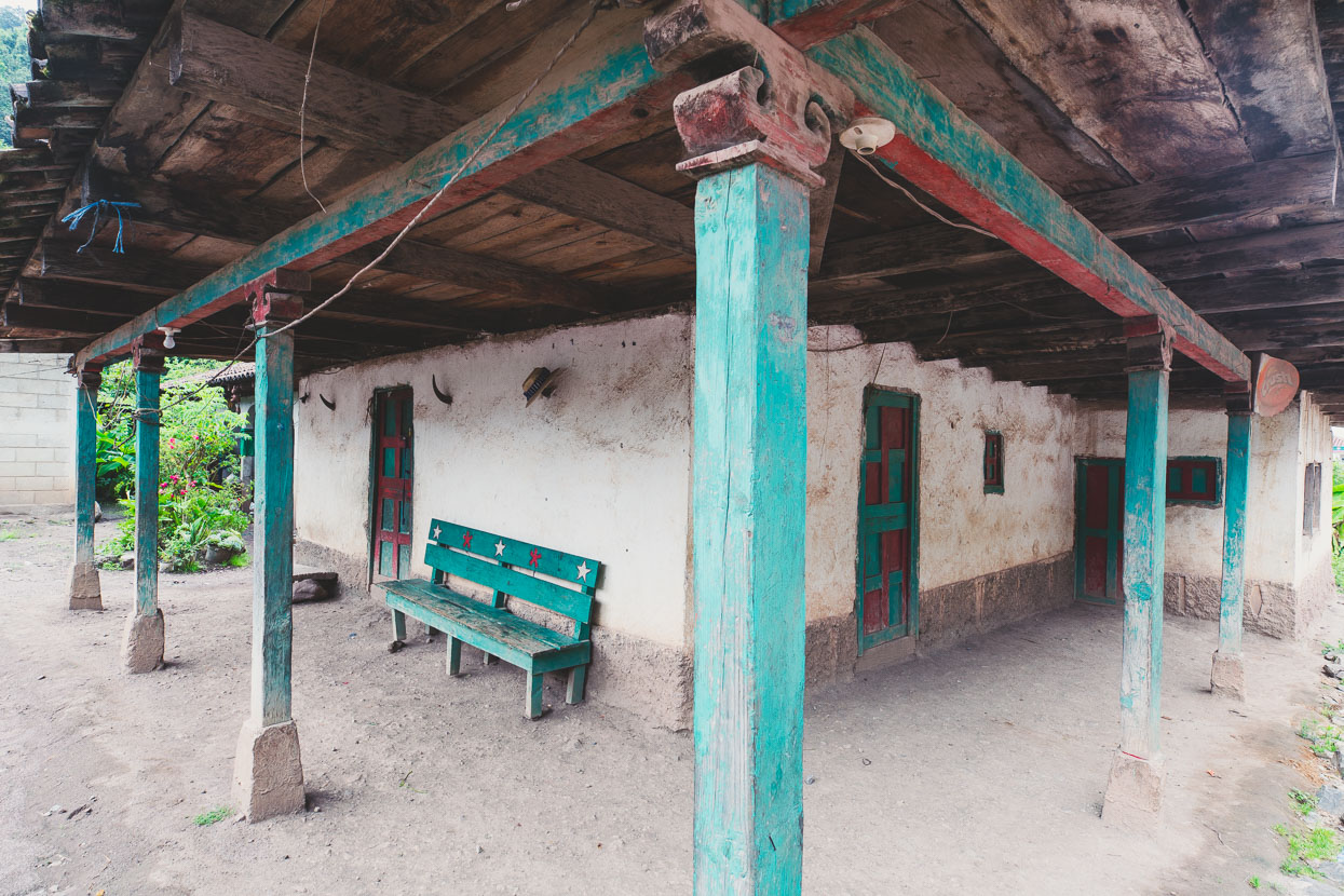
Huehuetenango’s a large and bustling provincial town, mostly ladino, with a few interesting colonial buildings, a busy square and lots of cowboy hats.
During the night we were woken by steady swaying of our second floor room (above) as the 8.1 earthquake of September 7 cracked churches all over western Guatemala and destroyed buildings in Mexico. 93 seconds long, it was certainly long enough to make you think ‘is this going to get worse?’ but in my drowsy state I barely got out of bed while Hana was busy throwing on clothes and packing her bag, getting ready to take shelter. Alarms rang all over the town and lots of people ran out into the street as the motion slowed but I just went back to sleep!
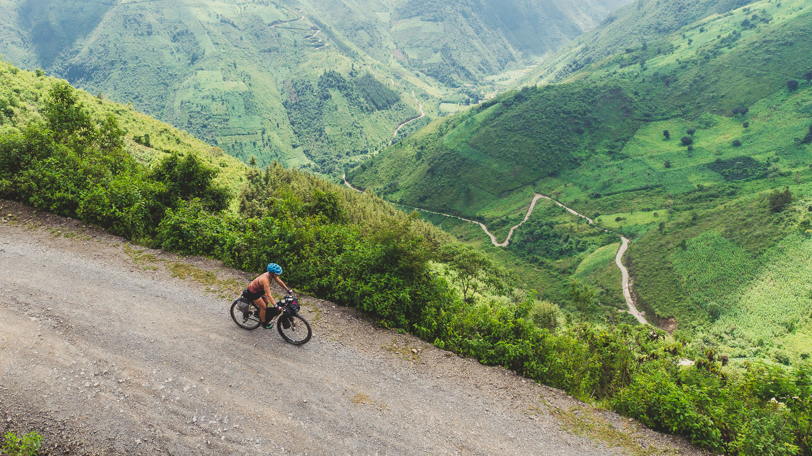
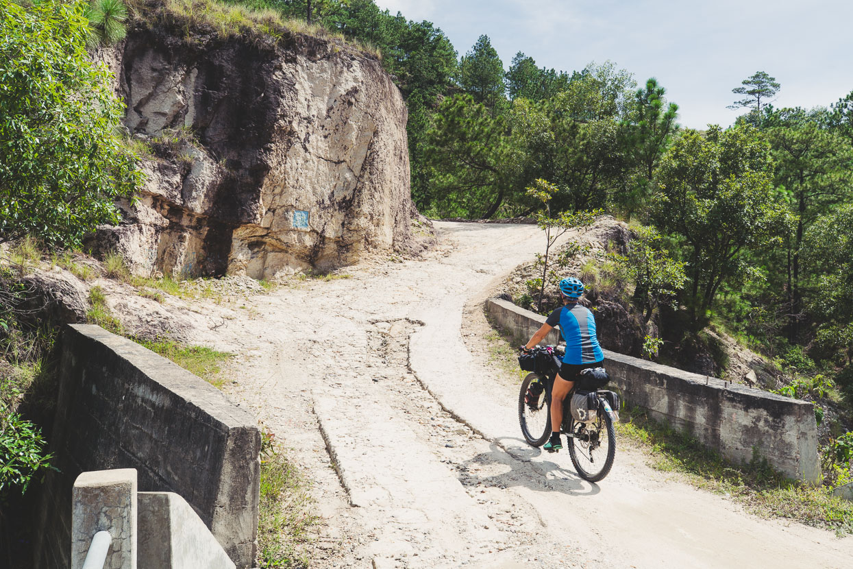
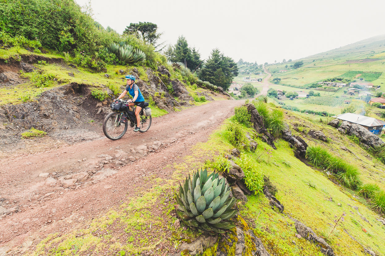
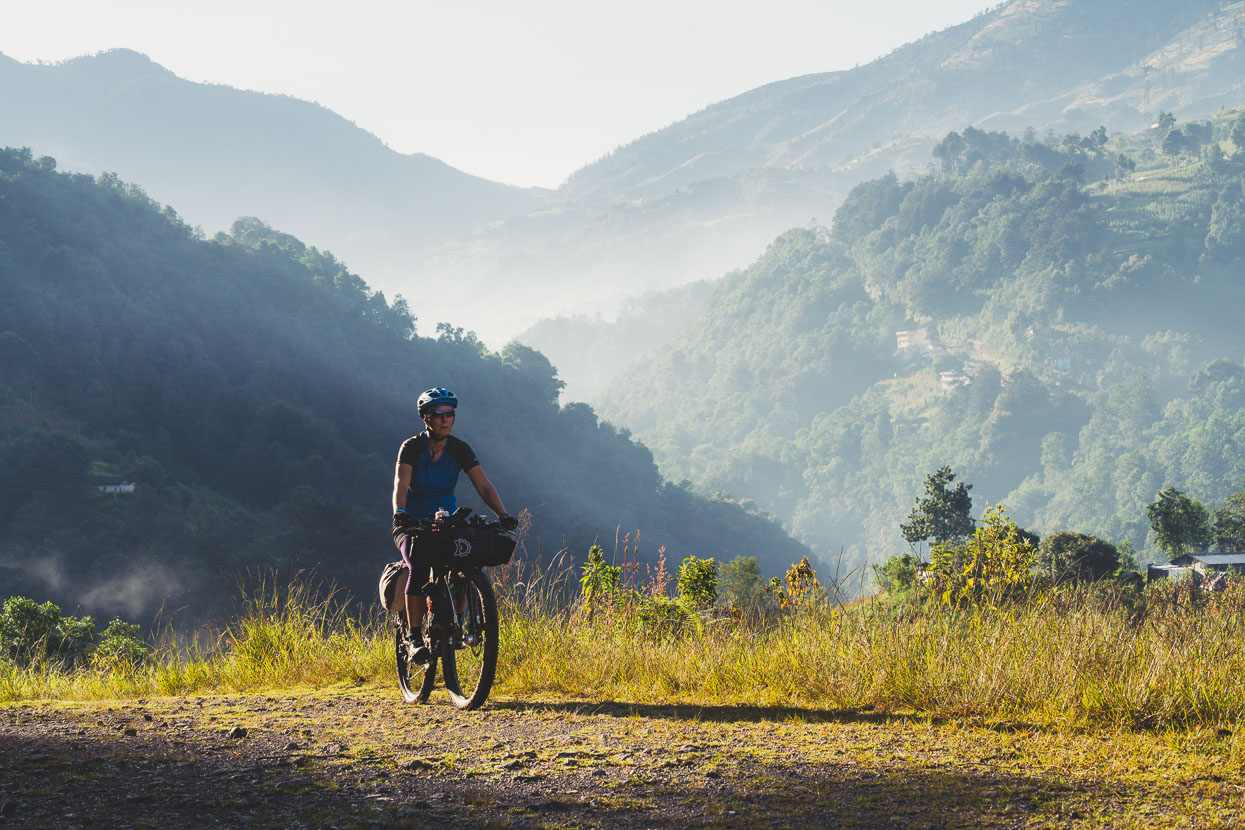
On the recommendation of Brendan we followed a dirt road and single track out of town in the morning towards the base of the 1300 metre Las Manzanas climb – a beast of a dirt road climb that takes you to the high plateau of the Cuchumatanes in a single push.
The rest of the morning was spend steadily grinding away up the rough road, which by Guatemalan standards isn’t super steep – just very long. I’d been under the impression that the climb would be a 4WD track with no traffic – but of course like lots of roads in Guatemala it’s definitely a 4WD track, dotted with villages – and also a public transport route for the hard-working chicken buses.
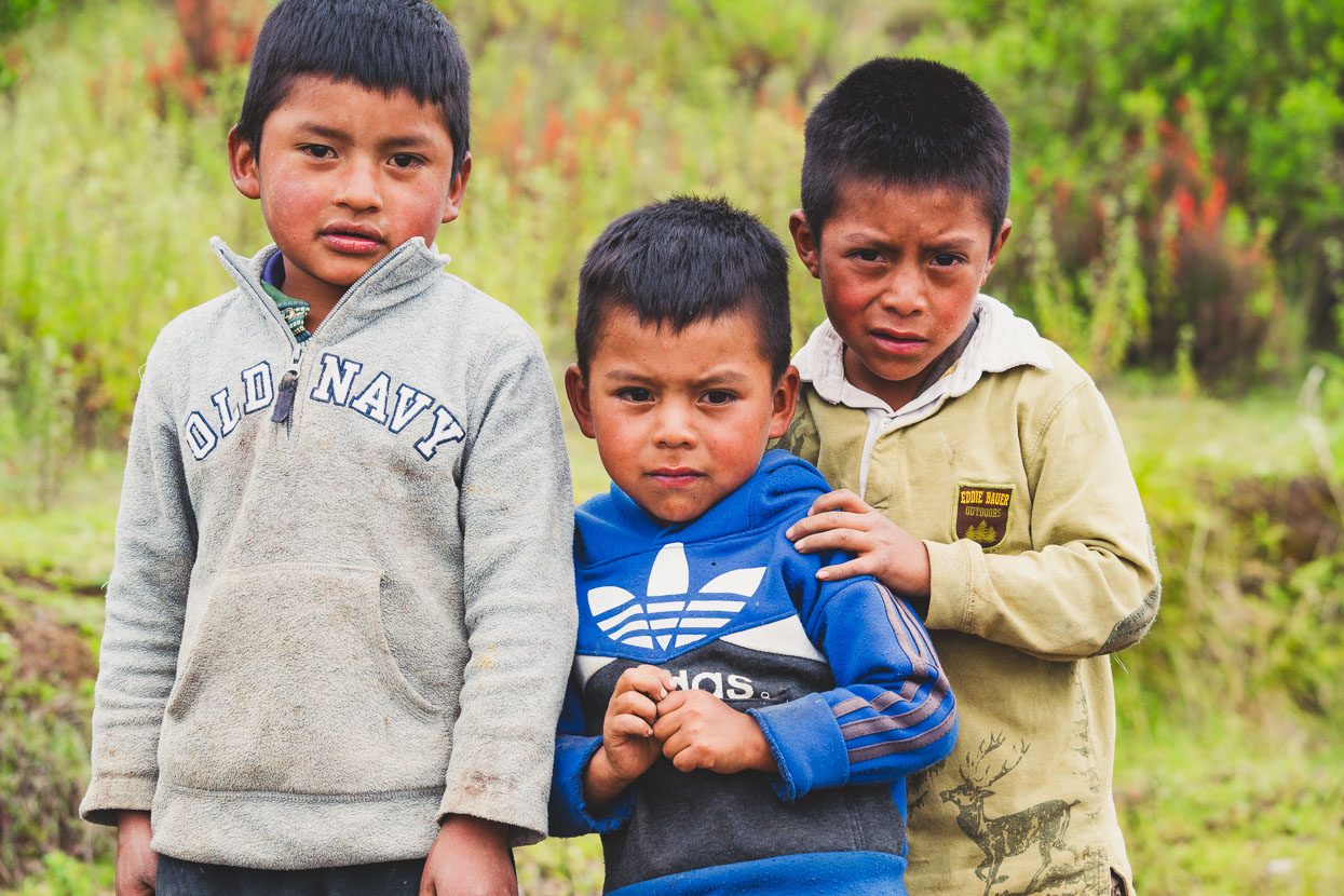
Three brothers asked me for candy, but I negotiated first in return for a photo (a great tactic with young people) and gave them a couple of granola bars. They actually flinched when I pointed the camera at them though like they thought it might send out some killer beam.
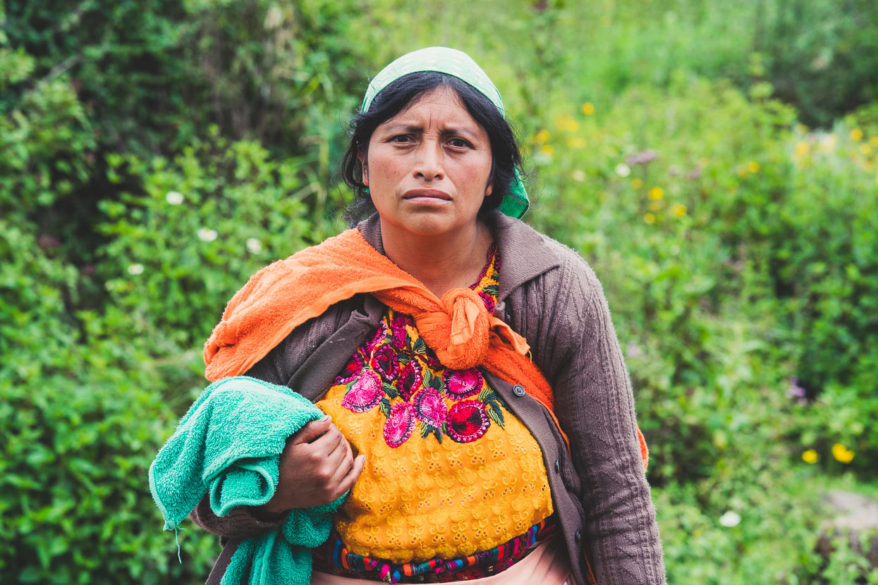
We stopped on the saddle at the top of the climb, much to the interest of people returning on foot from the market at a nearby village. We chatted to the husband of this woman for a while, before another guy came along on a motor bike and started asking us lots of questions. We spent about 15 minutes talking while the original couple stood in silence and fascination listening to our story. While part of our impetus to visit these places is to see different people and cultures – especially indigenous minorities – it’s a reciprocal exchange, with us ourselves as equal ‘objects’ of interest to the local gente (people).
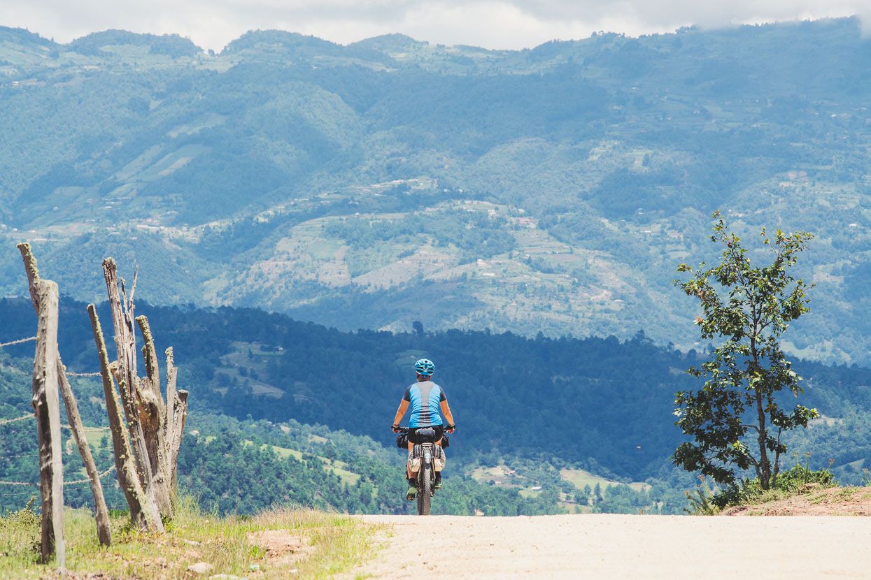
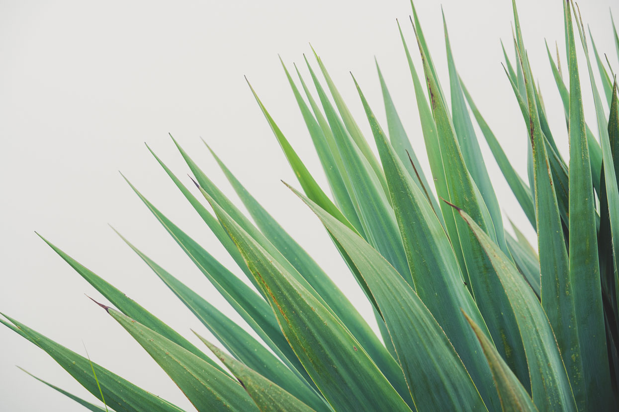
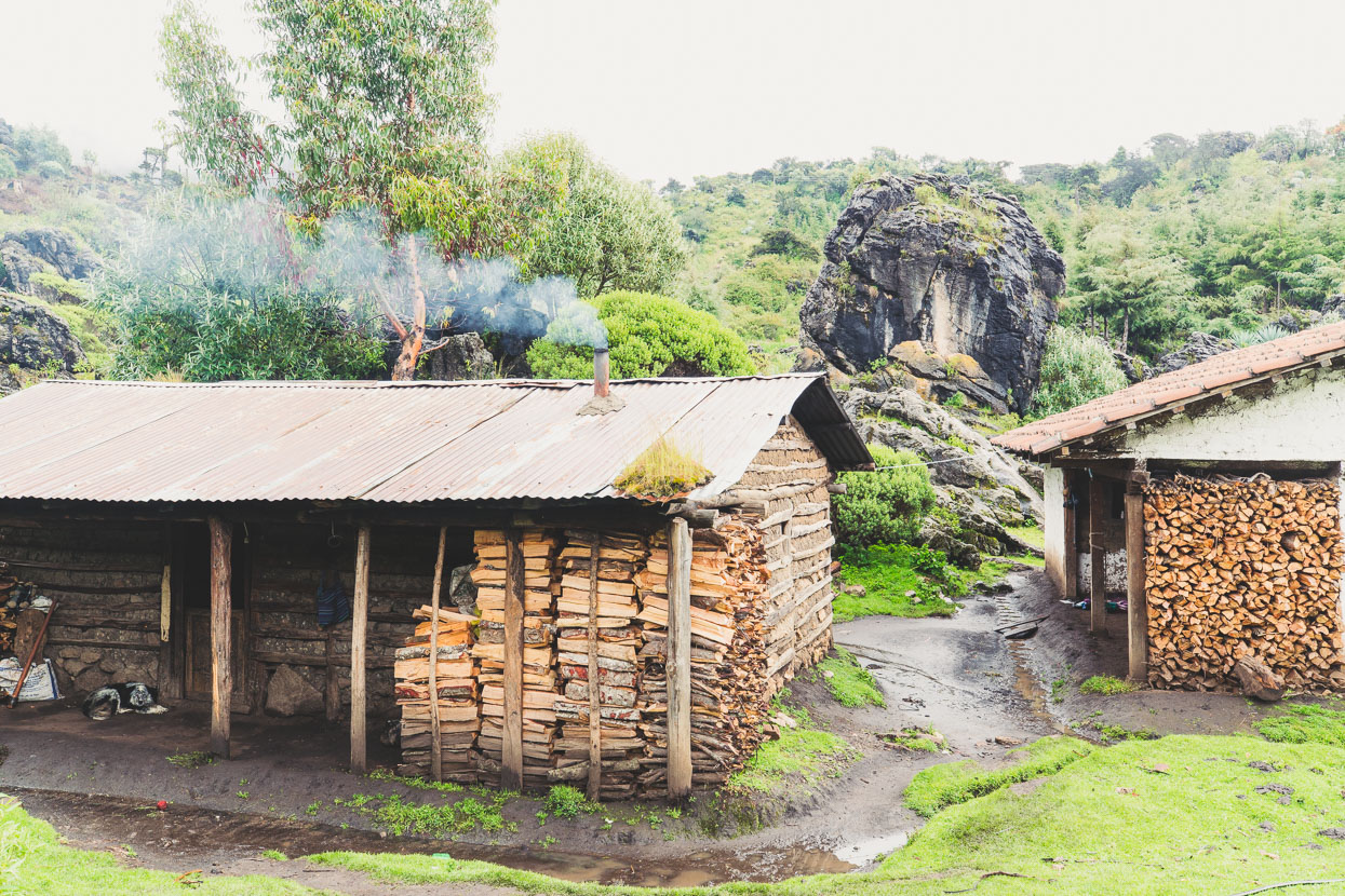
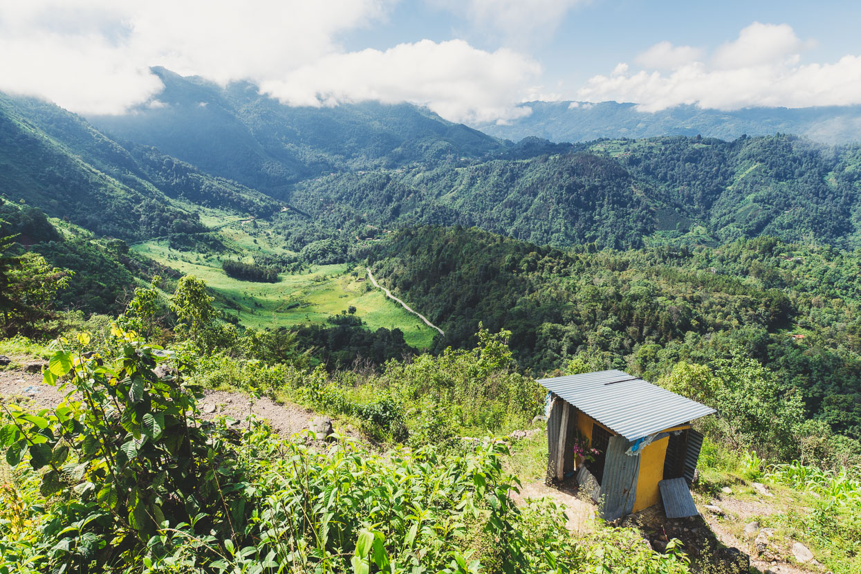
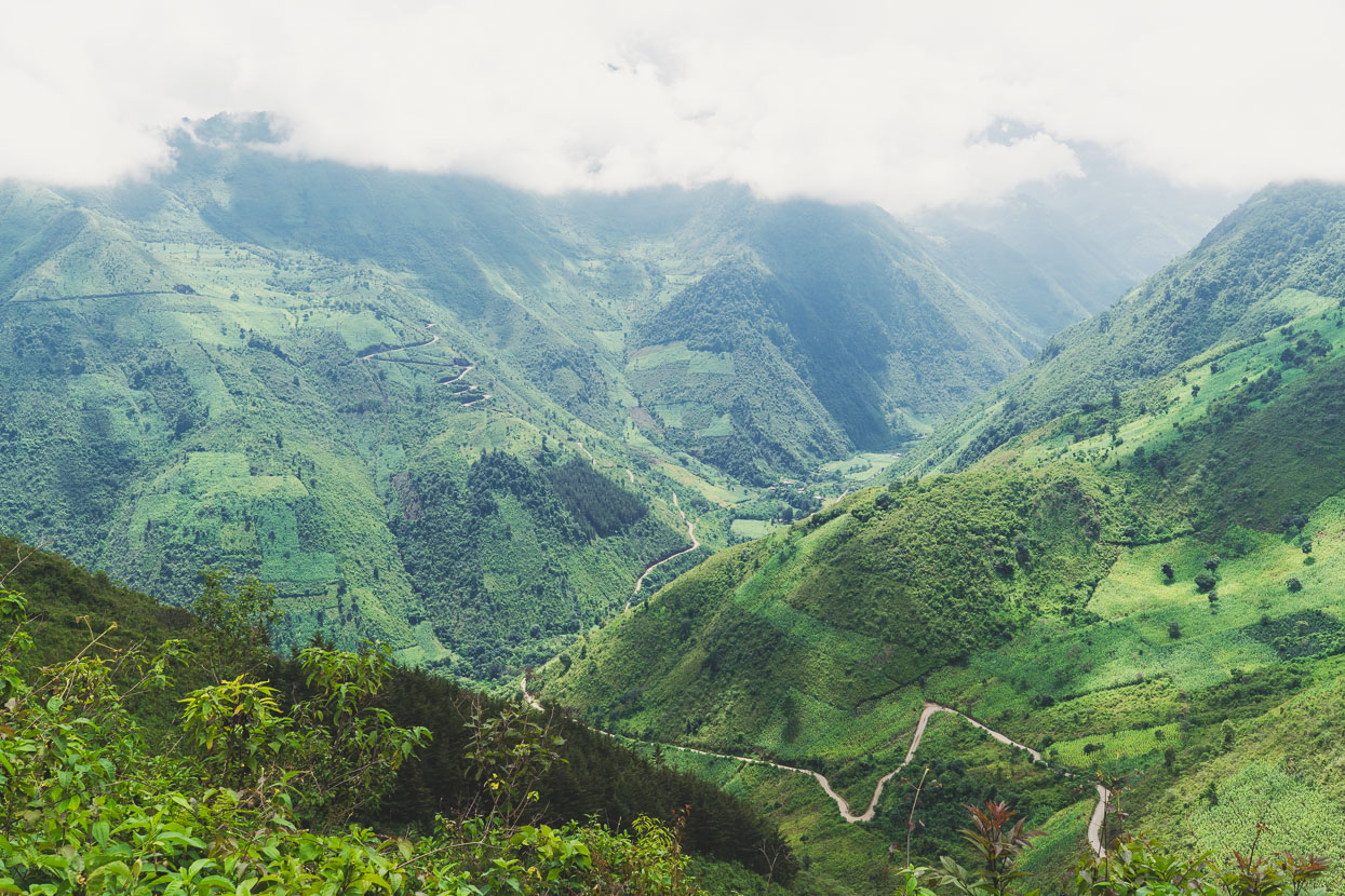
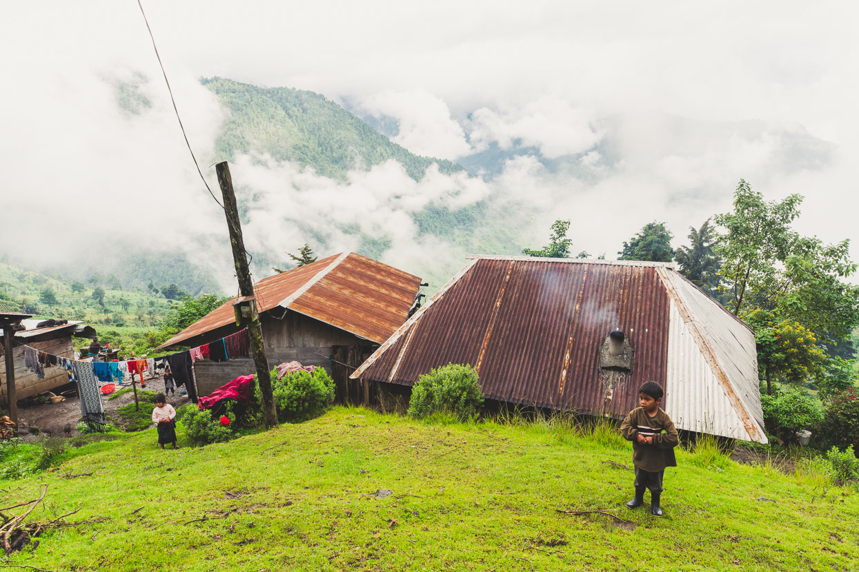
The top of the Cuchumatane’s limestone plateau is different to anywhere else we’ve been in Guatemala: scattered karst outcrops and boulders are features of the land along with great maguey (like agave) and twisted cypress trees. The settlements are small, scattered and smoky. And the people hardy, living through two seasons a year: a cold and wet one and an even colder dry one. We’re strongly reminded of the landscape around Creel in Mexico’s Copper Canyon, although this place is 1000 metres higher.
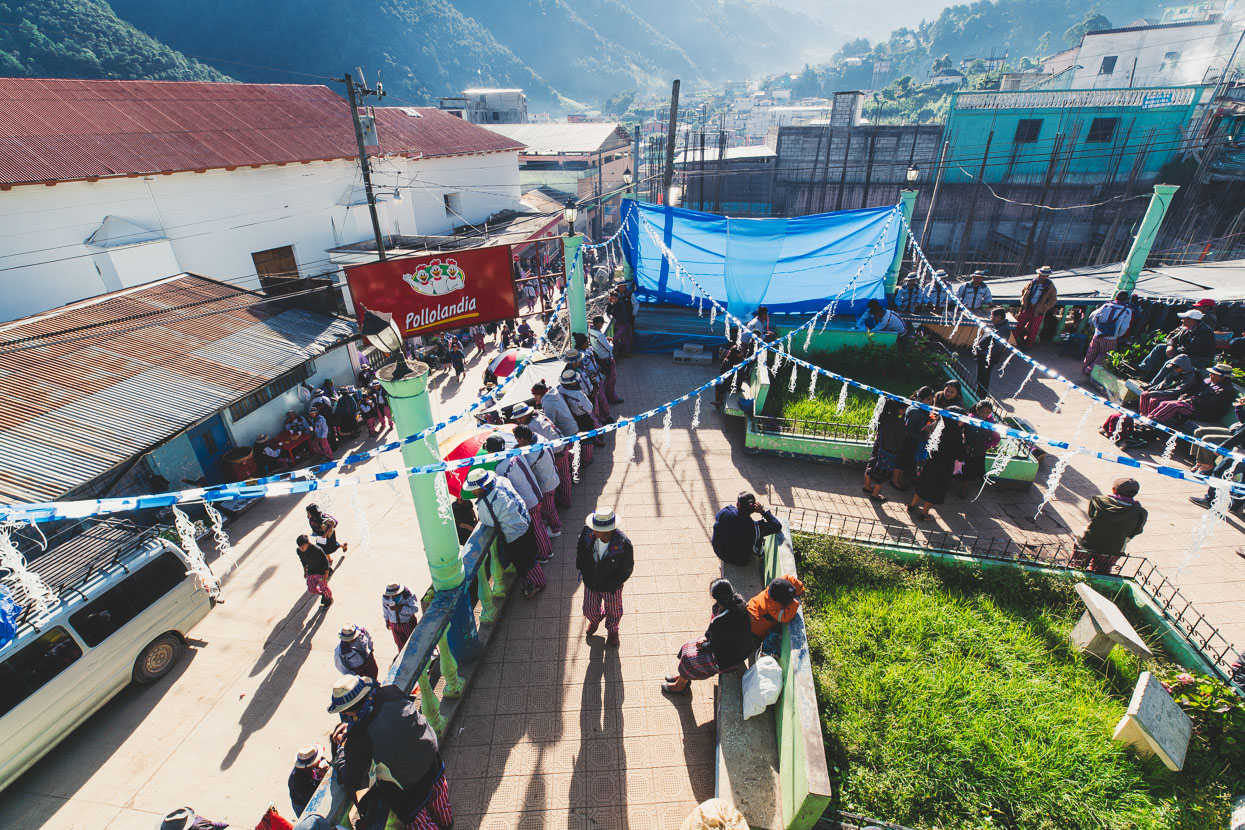
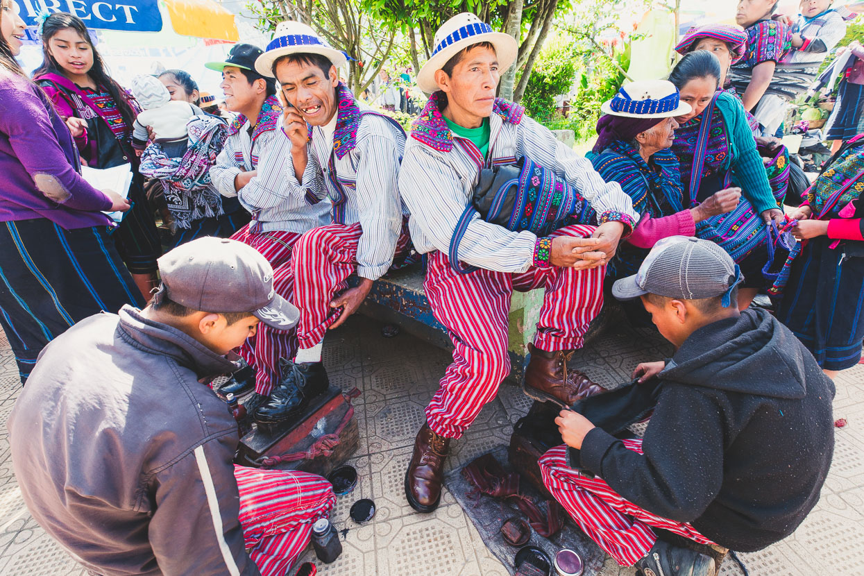
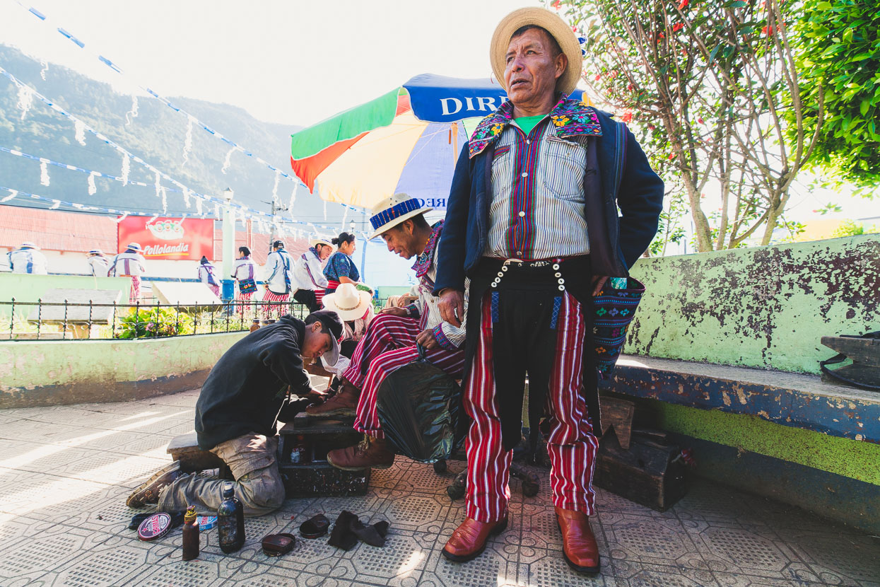
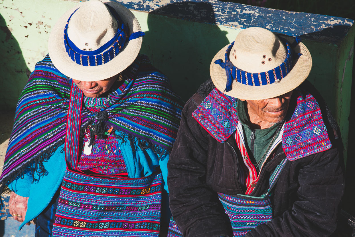
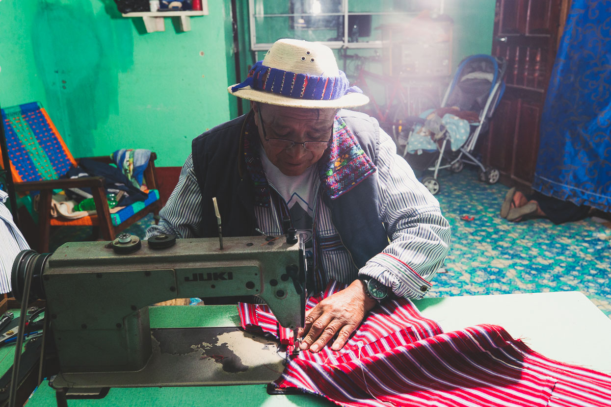
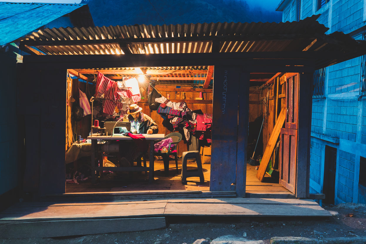
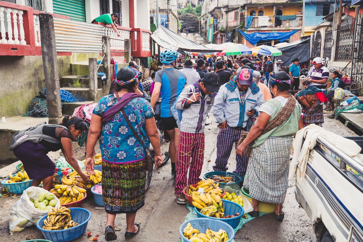
After a drizzly ride across the edge of the plateau we drop off it and into a long and deep valley that descends north west all the way towards the low country of the Mexican Border, but we stop high, in the famous town of Todos Santos Cuchumatan. All Saints Cuchumatan is a place of strong Maya traditions and dress, in particular the striped pants and richly embroidered jackets worn by the men. The town’s well known also for its perilous annual horse race and its weekend market, and we’re lucky to be here for the latter. Everybody in town is out and about, buying, selling and arriving by the bus load from satellite villages. The small plaza, elevated above the street is the focal point: three men play a marimba above the noise of people announcing their wares: everything from snake oil to zapatos, the elderly sit, boys shine shoes and people congregate to chat.
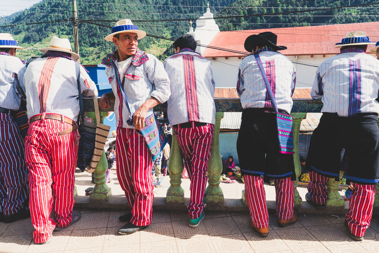
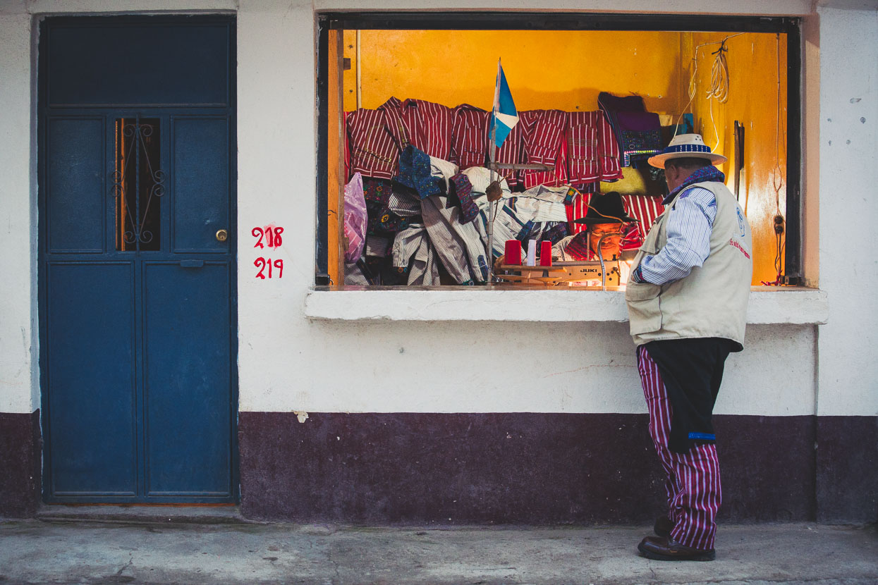
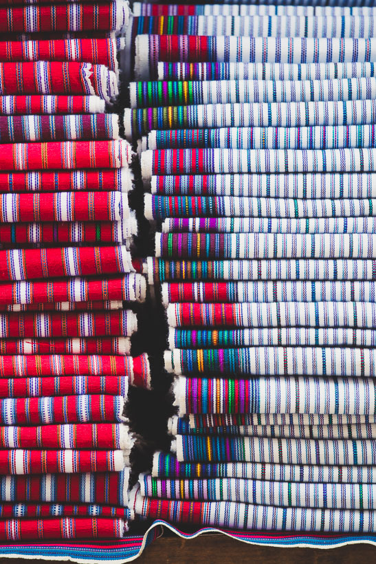
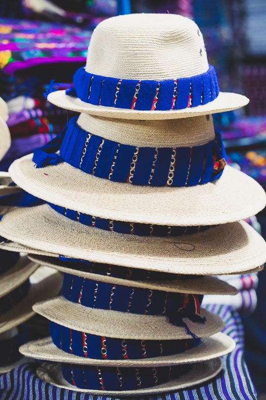
It seems as if every other shop is a tailors, all making the same thing: the classic striped pants and jackets. Other shops sell the tightly woven cloth and the hats. Nowhere do we see anyone selling complete trousers – they’re something people cut and sew themselves or have made for a custom fit or style. But the sewing machines are extra busy as Guatemalan Independence Day is coming – which customarily means a fresh pair of trousers for those that can afford it.
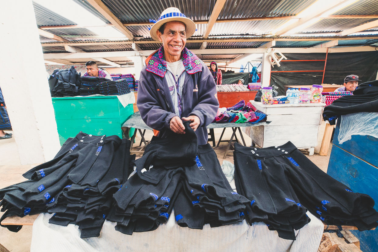
This man was selling felted wool shorts which men of a certain status wear over the striped pants.
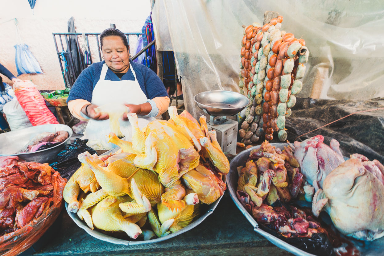
Elsewhere the typical market wares were on sale…
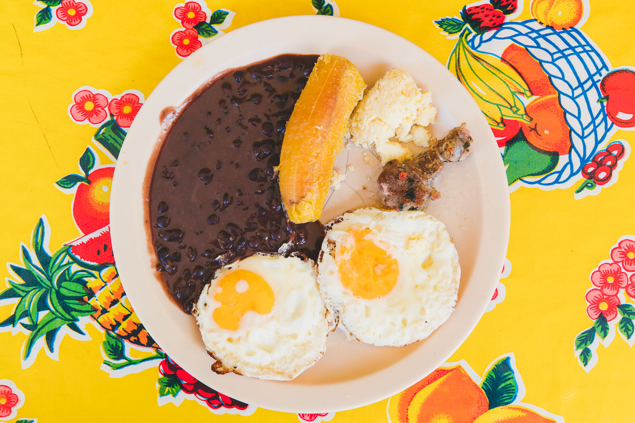
A tipico lunch in the comedor costs around NZ$3-4. This one eggs, frijoles, queso, platanillo (banana) and longaniza (sausage). A meal like this always comes with a pile of steaming fresh corn tortillas and a drink of sugary juice.
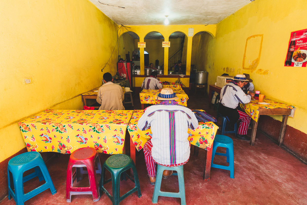
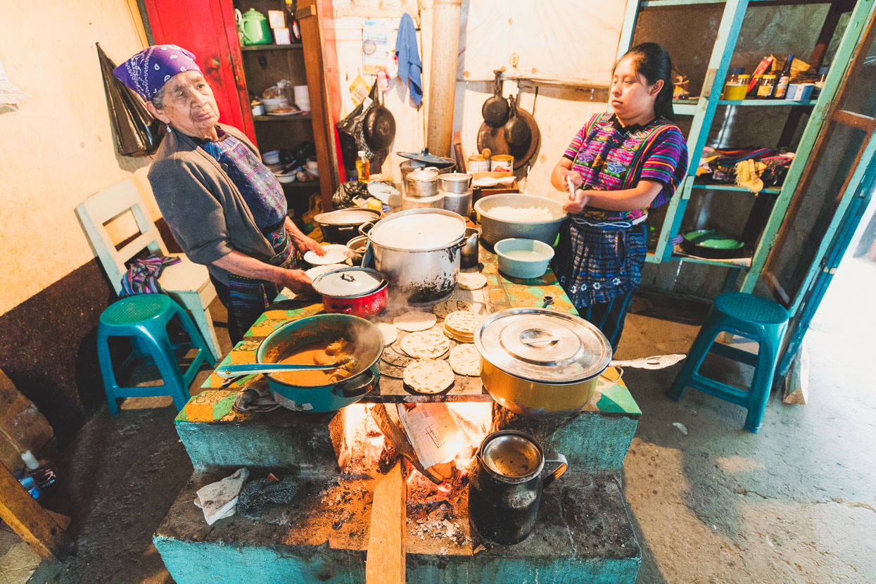
We ate in this comedor for dinner, cooked a meal by the woman on the left who had run this kitchen for 50 years in the same place. The smoke stained adobe walls, dim lighting and wood stove took us back in time.
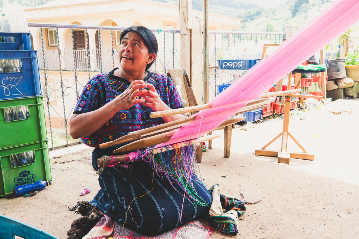
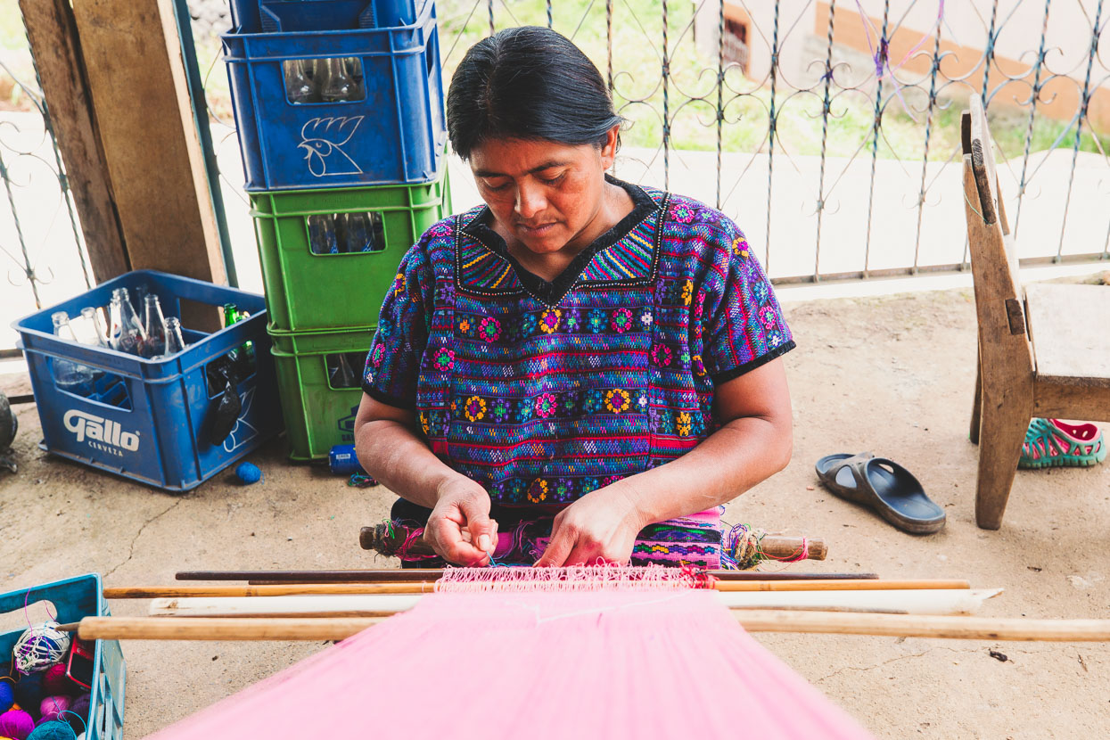
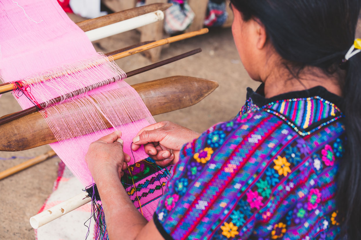
Todos Santos was one of the friendliest towns we’ve visited in Guatemala, despite its isolation. The town has a relative prosperity due to a huge number of the town’s men who work in the USA and send money home. The standard of housing in town seemed quite good compared with many other mountain villages we’ve seen and most men speak a bit of English. Walking around town away from the bustle of the market we stopped to chat to this woman working on some typical weaving with a backstrap loom. She said her blouse, typical of those worn by the town’s women, took two months to embroider.
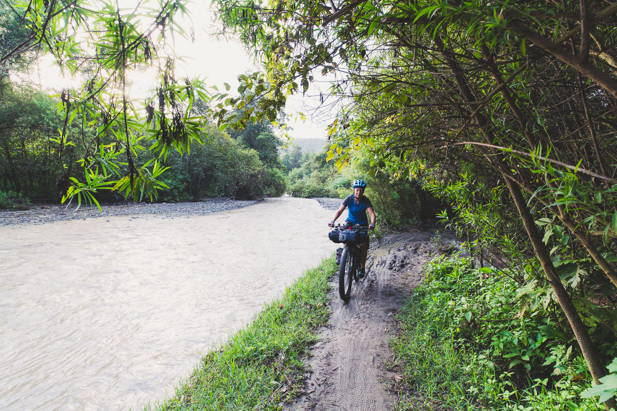
We left early in the morning and after a couple of bends in the deep valley the magical Todos Santos was gone from sight. We followed a dirt road down valley through small settlements and one larger town.
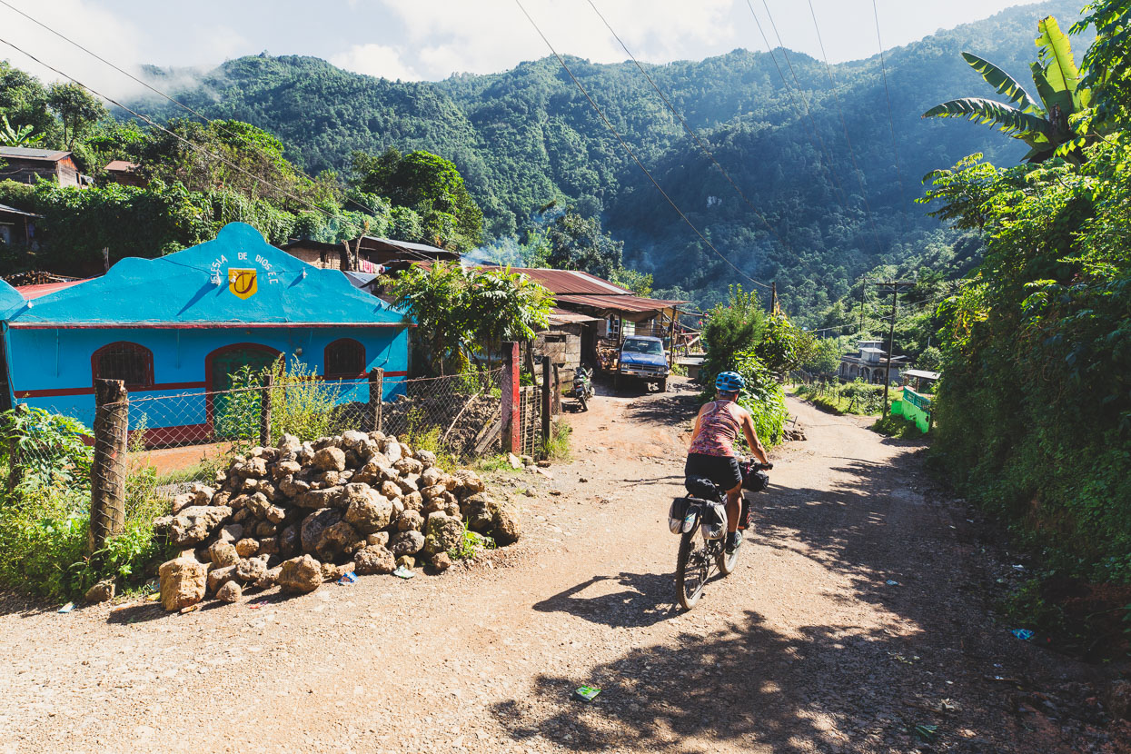
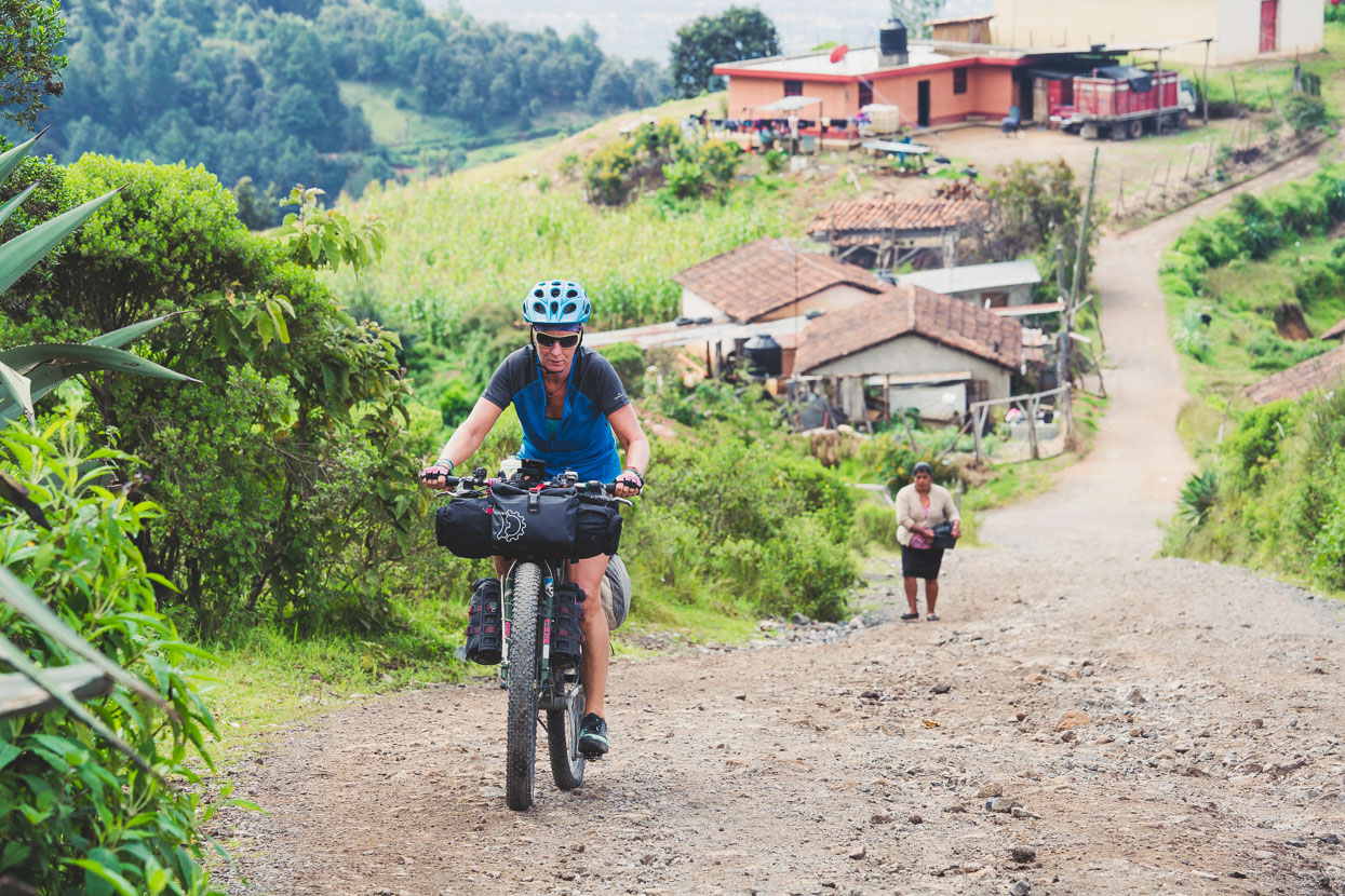
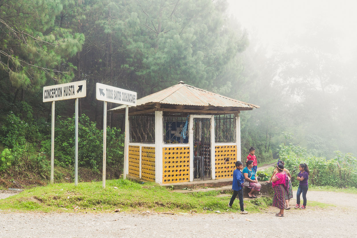
With a few small ups and downs along the way we got down to about 1800 metres before climbing back up towards Concepcion Huista. This day became one of those in which you feel as if you have experienced a week’s worth of experiences in only 12 hours.
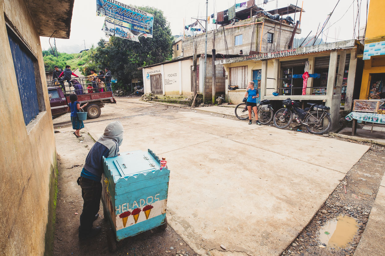
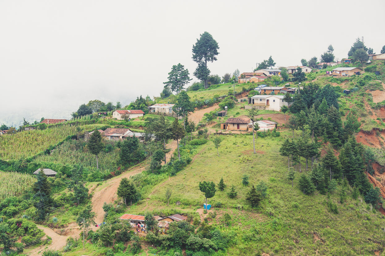
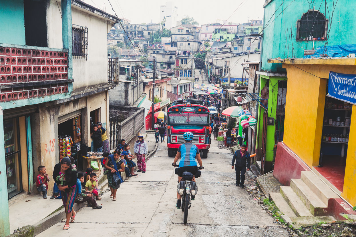
Concepcion was a misty scruffy place that looked as if a greater beast had thrown the houses over the hillsides of town like dice. Steep and narrow roads funneled us down, squeezing between chicken buses and before we knew it were walking our bikes though the middle of the (fortunately small) market.
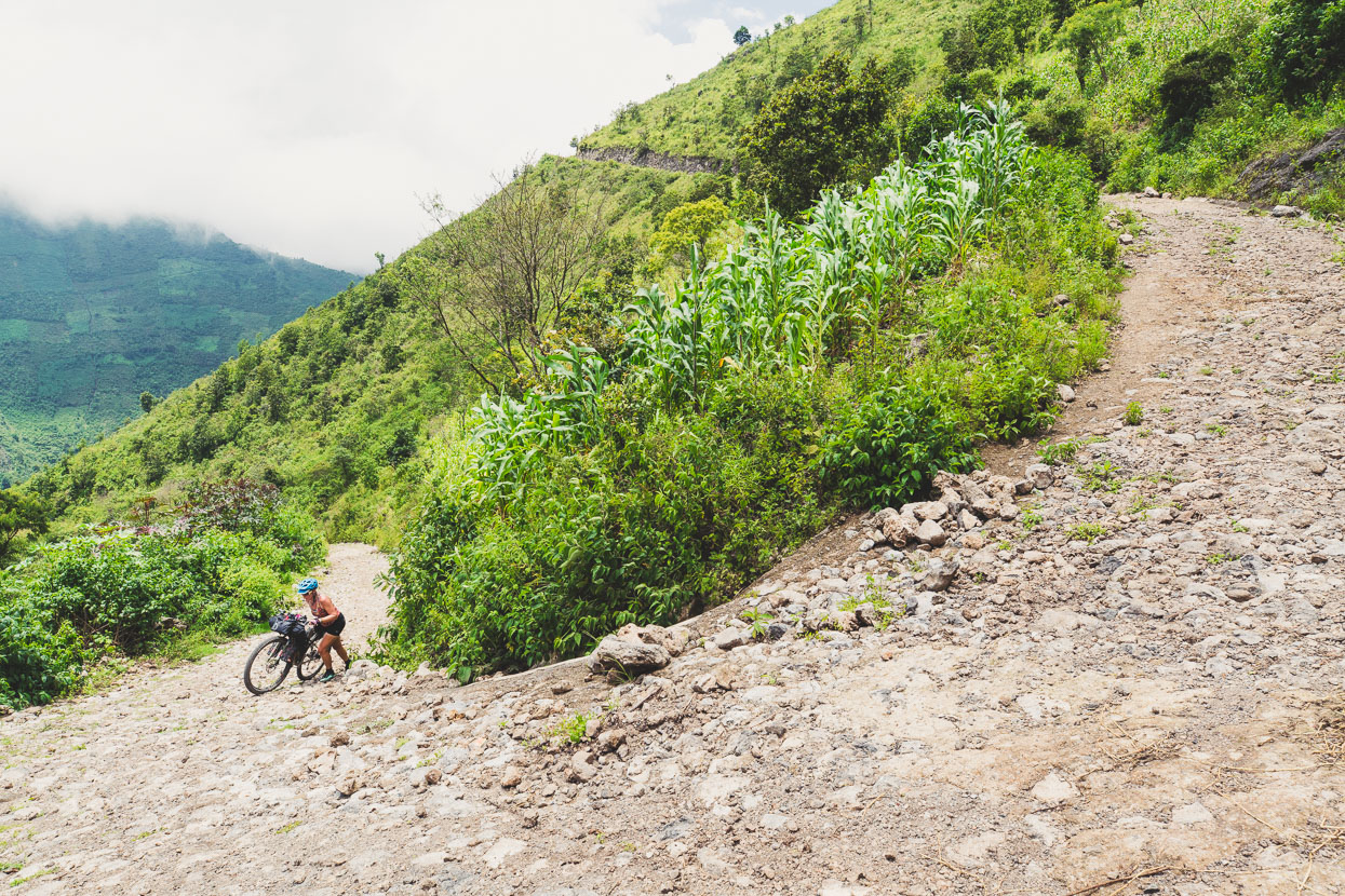
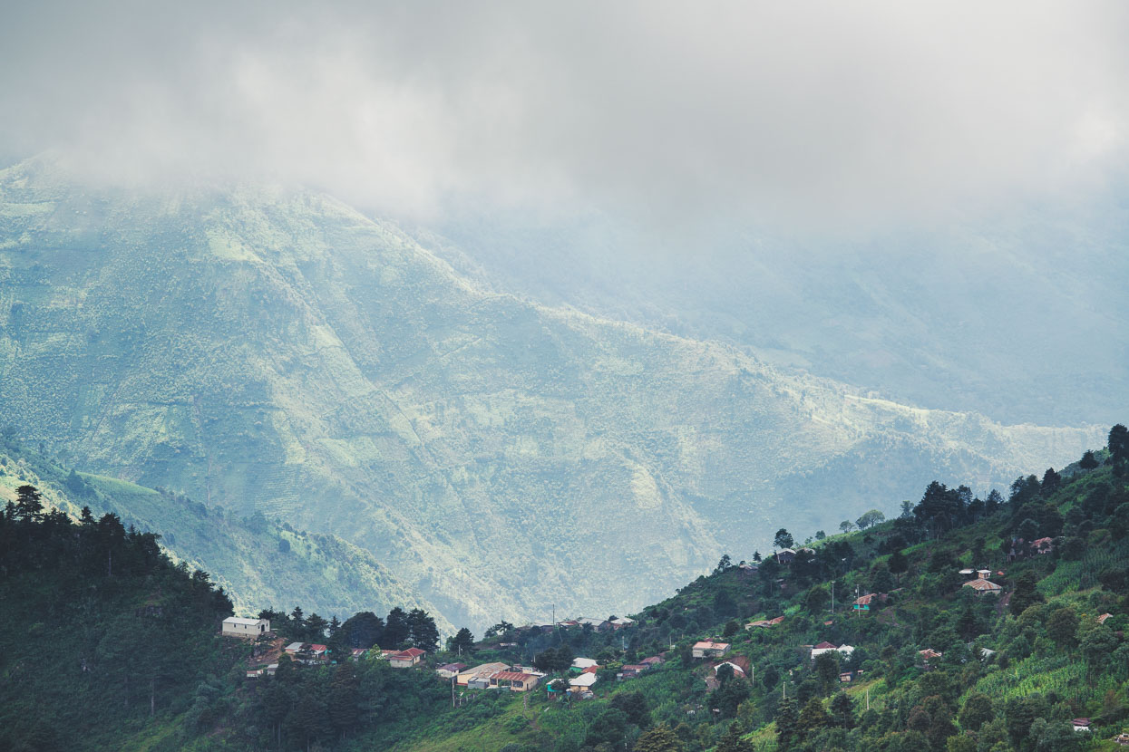
Shortly after town the road plunged into a huge valley. We stood in amazement for a while taking in its scale. Tracing the dirt roads that zig zigged their way improbably up its sides through a giant patchwork of cornfields. We dropped down to a balmy 1675 metres, before beginning the mother of all climbs back out – walking and riding our way right back up into the cloud and drizzle at 2990 metres.
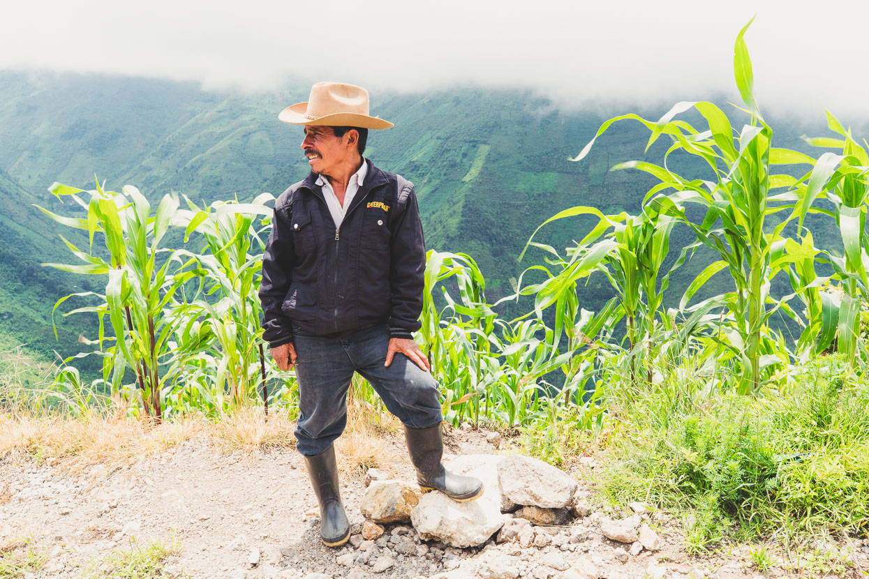
This friendly guy popped out of the milpa to say hello and ask what on earth we were doing.
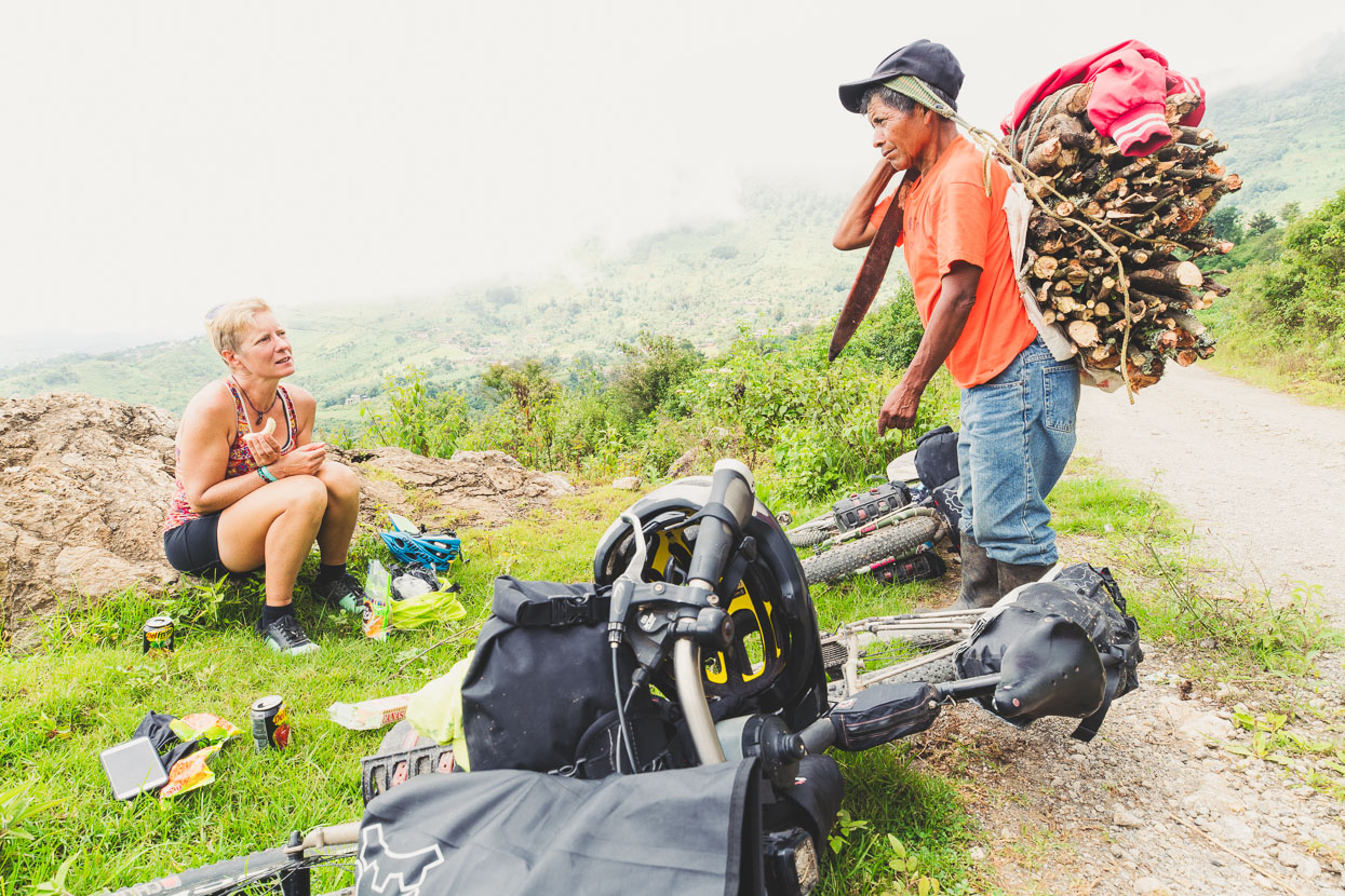
We got a paltry few bits and and pieces for lunch from a village tienda about a third of the way up the climb, and provided a good point of interest for firewood gatherers walking past.
Eventually we topped out and then descended a short way to Cheche, where some nice people were cooking papas fritas, which we gobbled hungrily and washed down with coke. Like everybody else these guys were incredulous to see us there, and when we said we were headed for San Miguel Acatán for the night they expressed quite a lot of concern, mostly because they couldn’t believe a couple of gringos on bikes could make it that far (another roughly 20km of mountain riding), and because the people in the next village (also called Concepcion Huista) ‘kill people and steal their money’. The ‘It’s safe here, but not in the next village’ concept is one that we have experienced often in Mexico, but not so much in Guatemala. Regardless, we politely acknowledged their concerns and rode off with a sense of urgency as it was getting late in the day.
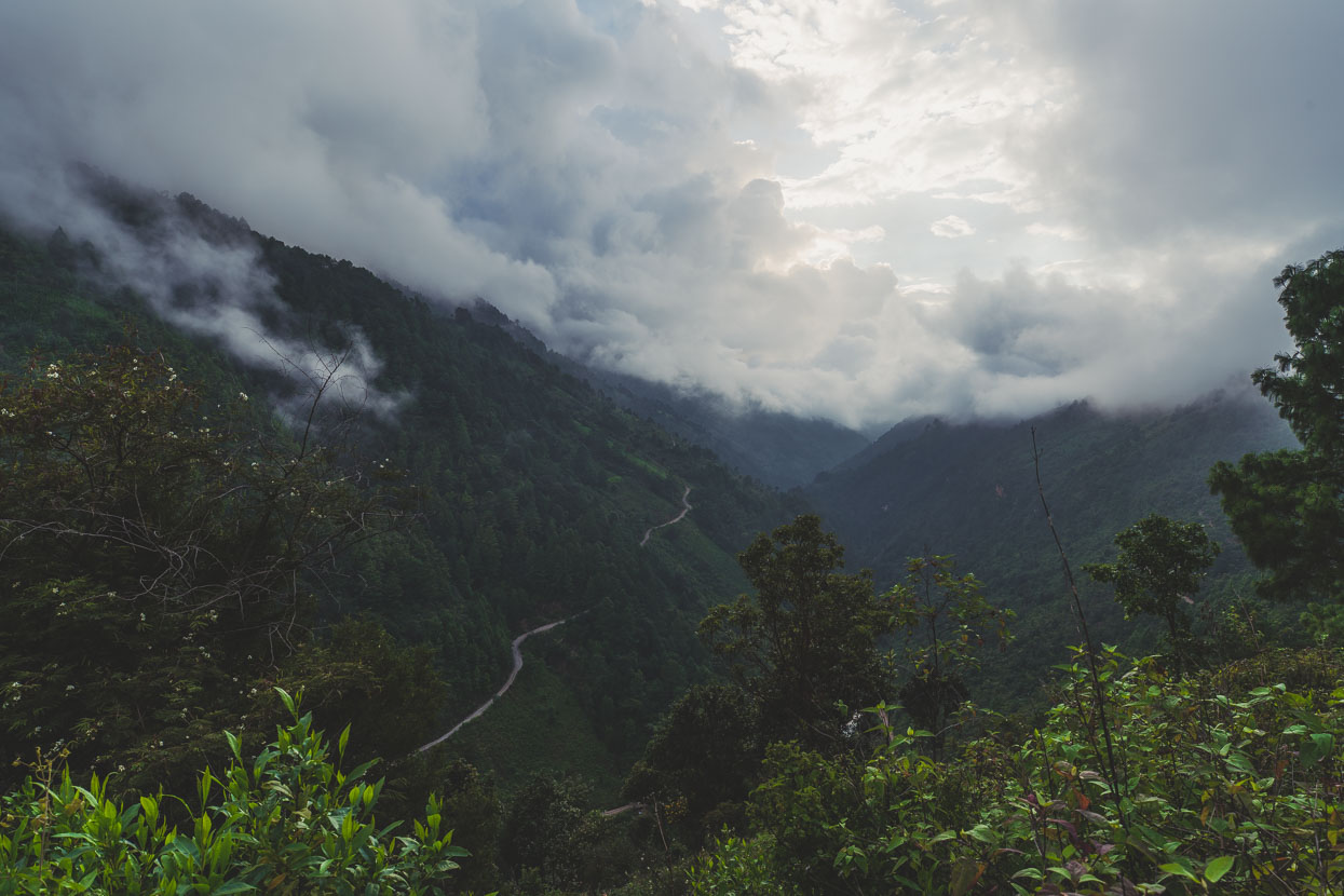
We hustled down a long, rough and winding descent into another deep valley, crossed a bridge and began a final 350 metre climb to bring the day’s total climbing to 2900 metres (the most we’ve done in a day on this tour we think). Looking back into the canyon here on the way up.
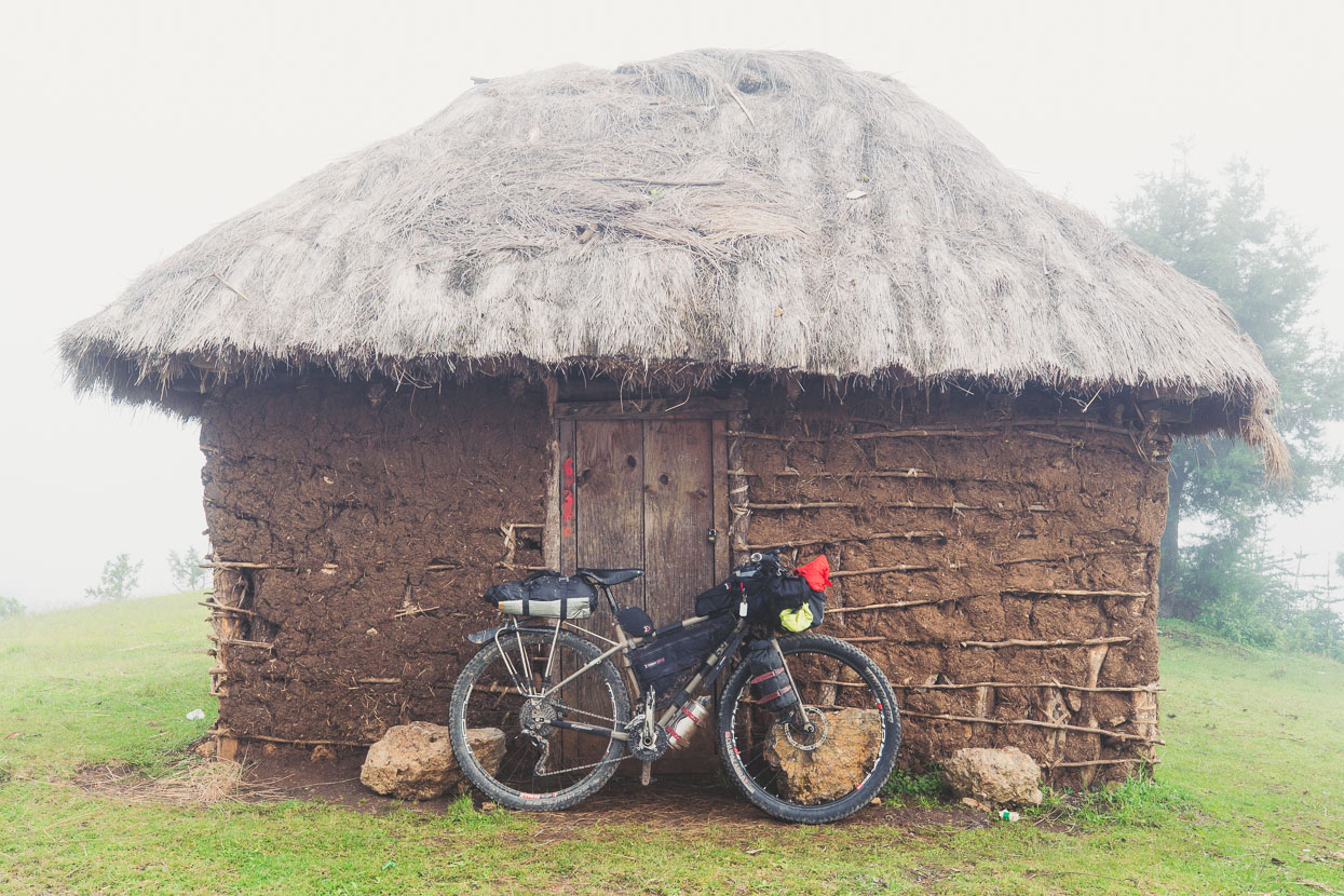
Topping out in mist and fading light we kept the cranks turning except for a quick break at this mud walled thatch hut. We were on the outskirts of the village the previous family had warned us about.
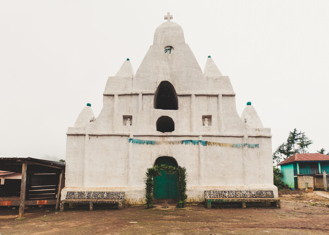
We were going to ride by and into the final down hill to San Miguel but we caught sight of the thatched roof of this church from behind and couldn’t resist riding into the village square to check it out, and we were glad we did – it’s a remarkable church and unlike anything else we’ve seen. It faced into a village square that was dirt and ringed with squalid buildings of mostly timber. There were quite a few men standing around the edge of the square, doing very little, as people do in Guatemala. Before I took this photo I scooted my bike over to the most senior looking of the men standing there and asked if it was ok to take a picture. He glanced at his friend beside him for a moment, looked back at me, and said yes.
I took the photo, looked back at him, and said ‘Venimos de Todos Santos hoy. Doce horas!’. (We came from Todos Santos today. 12 hours!) He looked amazed and turned to his friend, repeating what I said in clearer Spanish, before they both looked us up and down with smiles and nods of congratulations. Everybody else in the square just stood and stared at us like we were aliens. We turned and rode back down the rubbish littered dirt track out of the square and along the road towards San Miguel as the sun finally set.
It was dark and the streets were wet from afternoon rain as we struggled up the last steep road into the town. Load music came from the church as Sunday evening mass got underway, people hurried up the broken concrete roads, dodging tuk tuks and drunks looked emptily at us from seedy drinking dens. We found a room in a run down hotel on the main street and dropped our bags on damp and saggy beds, exhausted.
We headed out to hunt for food and a drunk man with a fleshy hole where one of his eyes used to be followed us, muttering unintelligibly but we outwalked him and found the safety of a comedor where more men drank raucously at one table. We ate, slept the sleep of the dead and left early in the morning while the streets were still quiet.
To be continued… Part II coming soon!
Do you enjoy our blog content? Find it useful? We love it when people shout us a beer or contribute to our ongoing expenses!
Creating content for this site – as much as we love it – is time consuming and adds to travel costs. Every little bit helps, and your contributions motivate us to work on more bicycle travel-related content. Up coming: camera kit and photography work flow.
Thanks to Biomaxa, Revelate Designs, Kathmandu and Pureflow for supporting Alaska to Argentina.


Fantastic! Thanks for another excellent travel narrative! B
Thank you for the wonderful blogs on your route. I am bikepacking in Guatemala now, and I hope to ride a significant portion of what you wrote about.
Thanks Deanna – sounds great – good luck with your ride! Let know know if you need any info. We loved it.
Do you think it would make any difference if I rode the loop clockwise like you did, or went around the other way? I am currently working my way south & west via Raxruja, Laguna Lachua, Coban, and then across 7w to Sacapules.
Hi Deanna,
Basically once you’re up on the plateau you could go either way as the route we took nearly meets near Paquix. But I would say that going the way we did means you have the harder climbs/riding first (with the exception of the climb you’d do from Aguacatan that we rode down) and the pavement sections/easier gradients when you’re tired later in the loop – which is better. But it would work either way. Good luck! It’s amazing in there.
Mark.
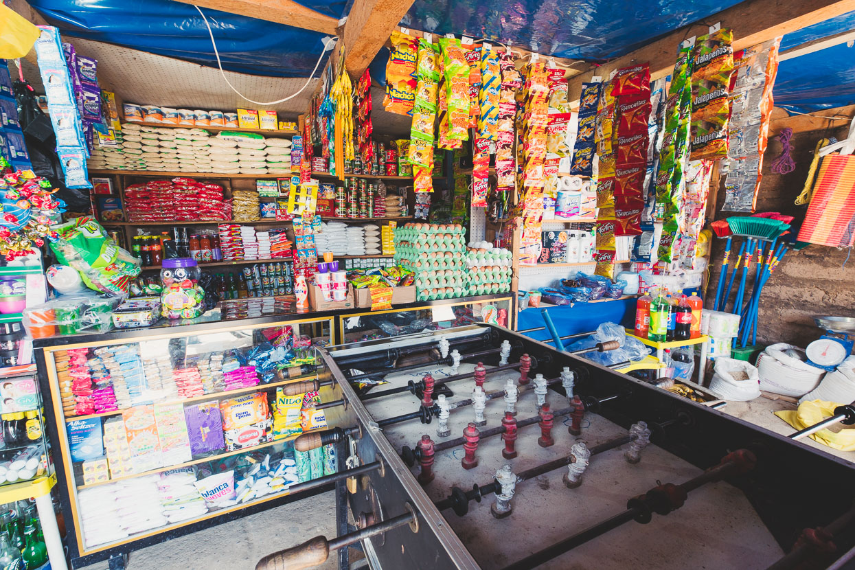
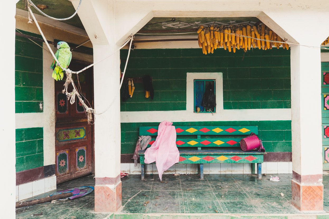
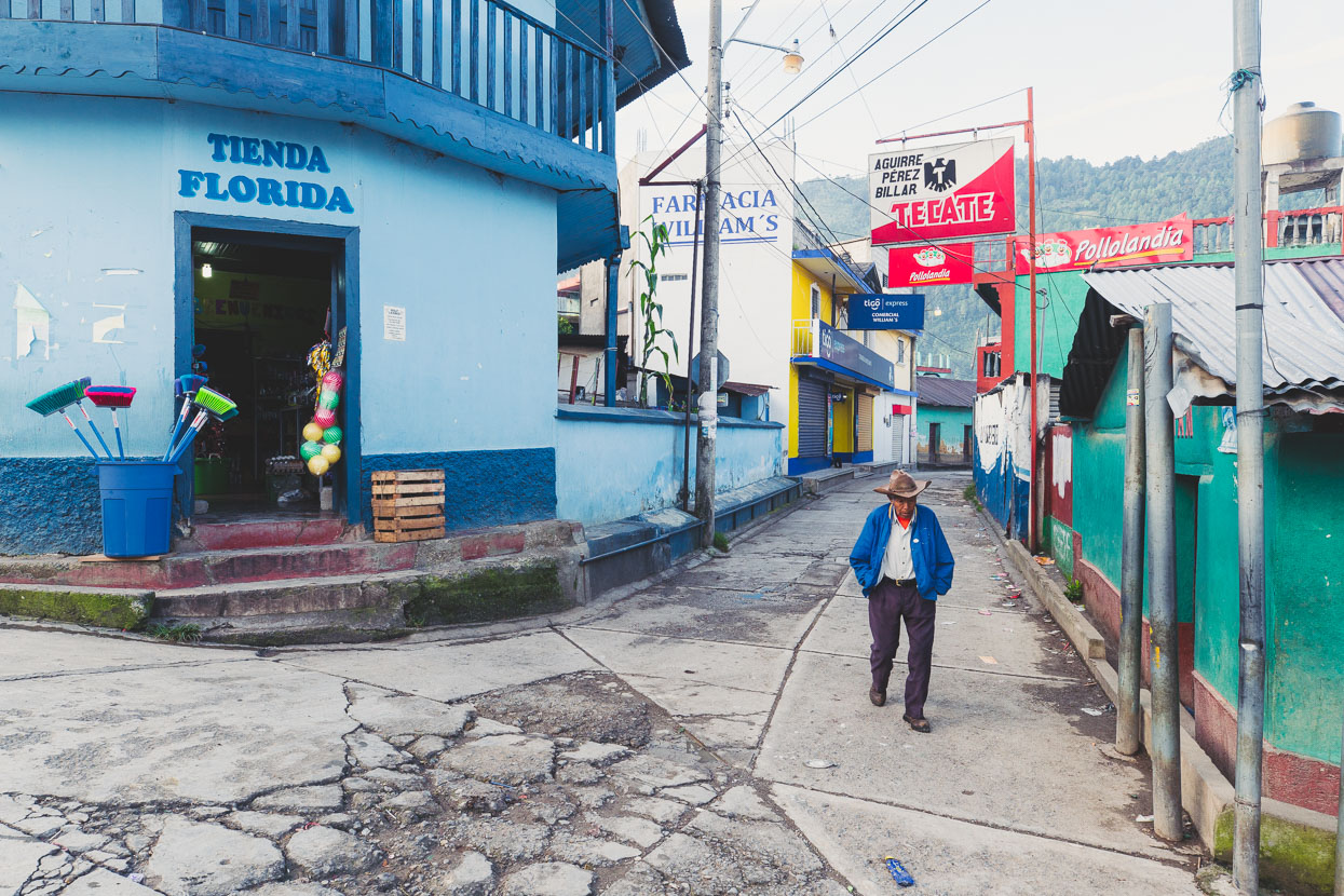
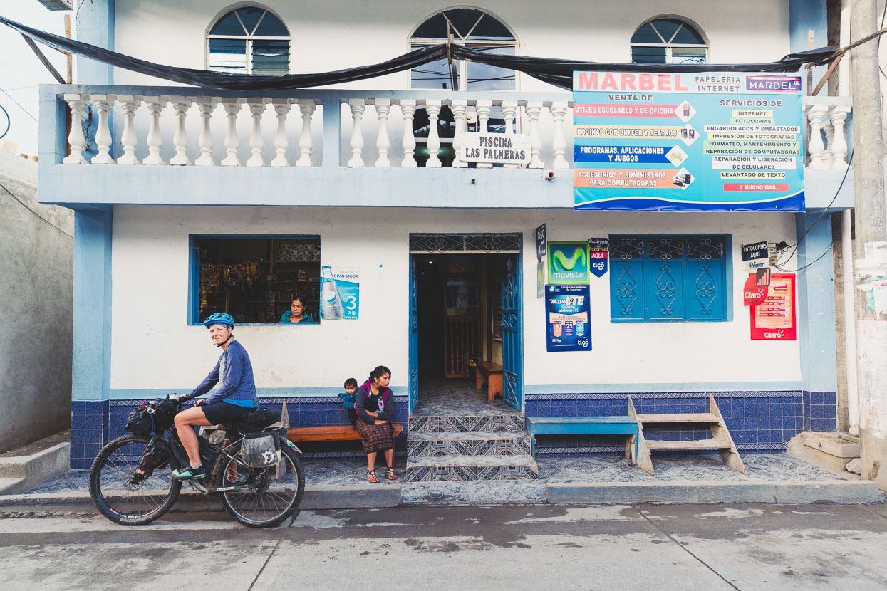
Hi Mark. I found this by accident while looking for a picture of a particular house in San Miguel Acatan. In this first part, the second to last picture, Tienda La Florida, is the house I was looking for. It has its history and that of its owner back in 1981, at the height of Guatemala’s civil war. It was also a general store back at that time. Many of the towns and hamlets you biked through have their side of history with the civil war which the pictures themselves can’t tell. It’s great photography and tourist attraction. I’m aware that’s your purpose and not being a historian. I still appreciate it.
Hi Mark.
I had left you a short message about one of the pictures on this blog. The one about Tienda Florida. During the civil war in Guatemala the owner of that house was killed by a leftist guerrilla sympathizer, one of the several killings in town during that time, 1981 the height of the civil war. It’s what i meant about how the towns you visited have their own history to tell. I was born and raised in San Miguel and that’s how i know these places; they certainly bring memories. Thanks.
robepalas@gmail.com