
Late Dec 2022/Early Jan 2023.
Since we crossed into Chile from Argentina via Paso Pichachen, the theme of the landscape and our journey has been defined by volcanoes. This post covers a brief trip into Conguillo National Park and then a circuitous ride that has flowed between (and over) the snowcapped cones that shape this region, before crossing back into Argentina at Paso Carirriñe.
As I mentioned in the previous blog post, we’re in the middle of the Southern Volcanic Zone of the Andes, where the landscape has borne the brunt of millions of years of eruptions. Successive layers of eruption material form the ground upon which we ride, lava flows cut impregnable black swathes across the countryside and basalt cliffs keep me craning my neck looking for climbing lines. Were we equipped with hiking and basic alpine gear, Araucanía would be a peak bagging paradise, but instead we’ve incorporated a walk to a world class vista in Conguillo National Park, along with a hike-a-bike high up the slopes of Volcan Quetrupillan, in search of alpine singletrack. But of course we could not resist tagging the crater rim too. Here’s a summary of our 385km ride through this corridor of volcanoes.
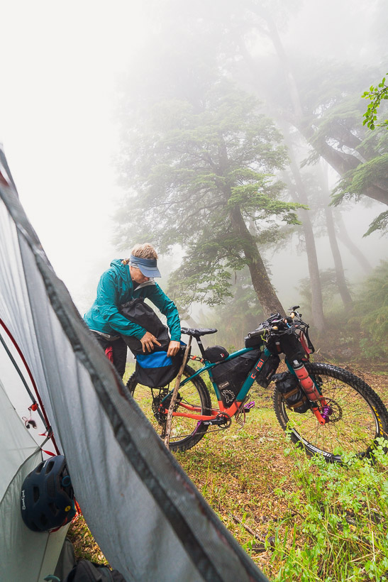
We remained based in Melipeuco after our compañera Rachel headed home, spending a day on blog and admin, before making an overnight trip into Conguillo National Park to do the Sierra Nevada hike, which promised a unique vista and one of the best views in Chile. We left some of our gear in Melipeuco and rode 30km into the park, to camp for the night before doing the hike early the next day.
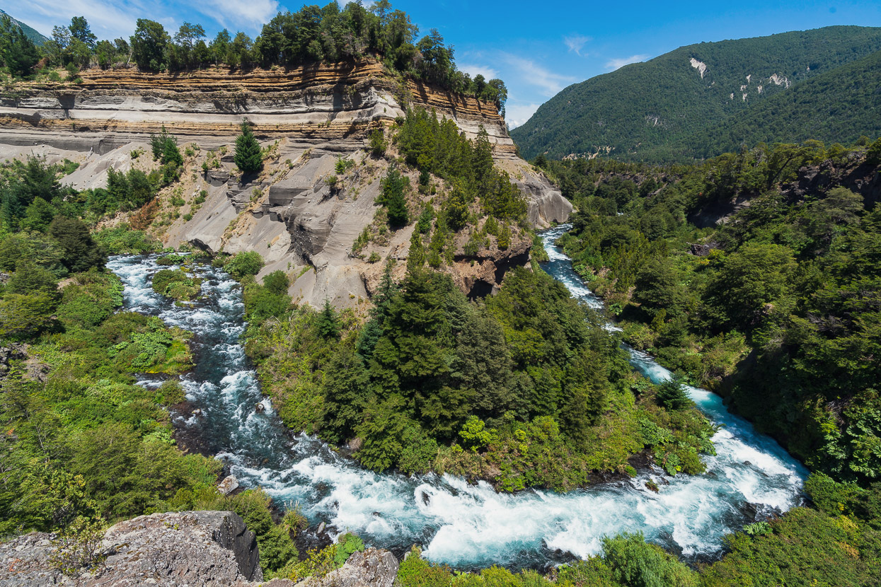
The views on the way in were impressive. This is from a short walking circuit to Cascada Truful Truful, near the national park entrance.
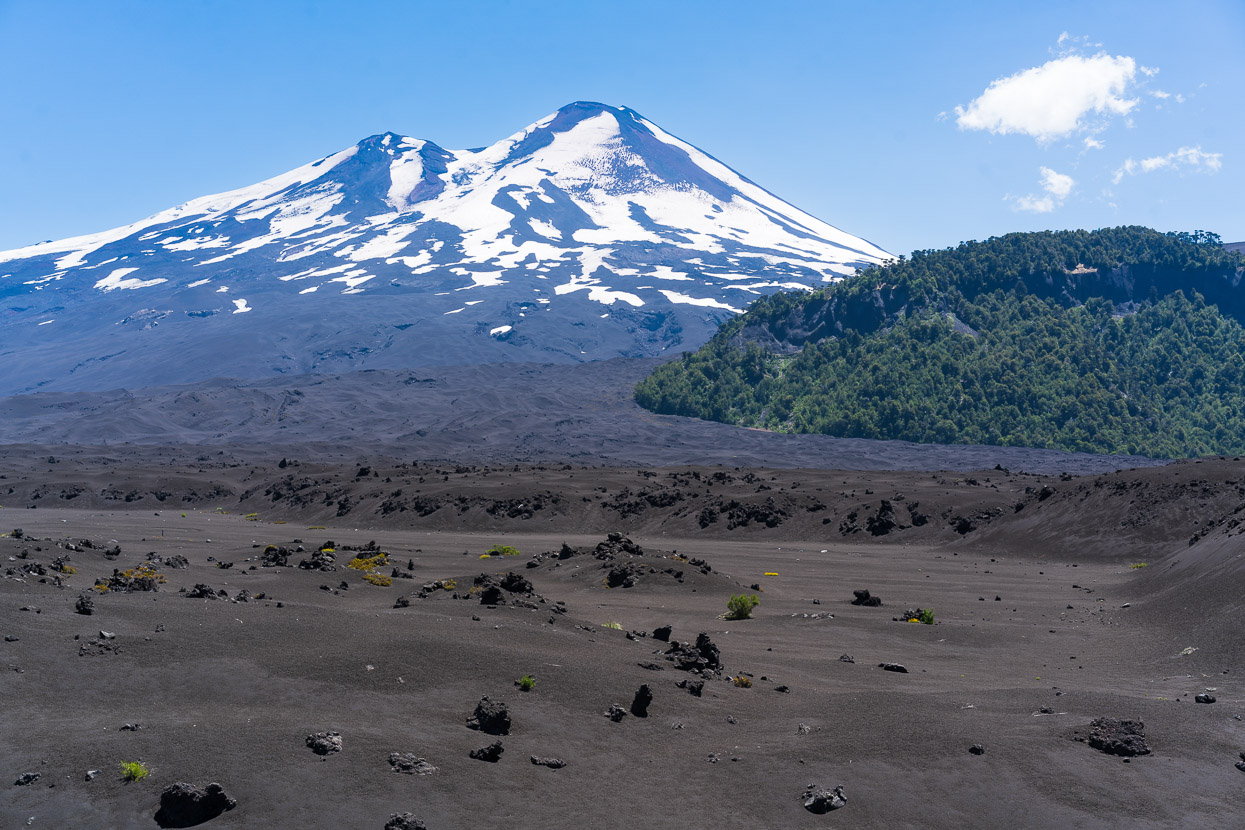
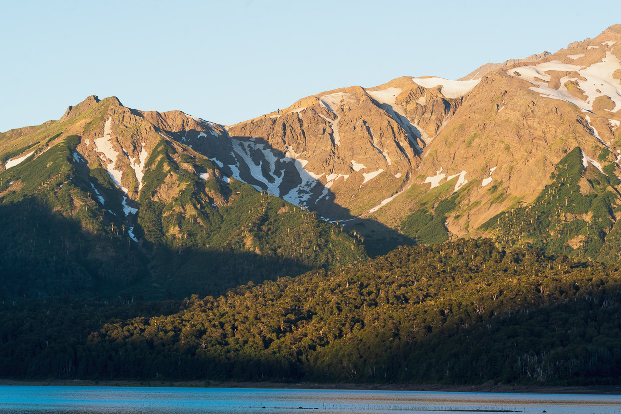
While on the other side of the road stood the barren slopes of Volcan Llaima (3125m), which last had a major eruption in 1994, but has had a couple of smaller eruptions since, the most recent being 2009.
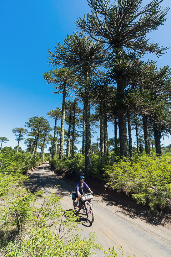
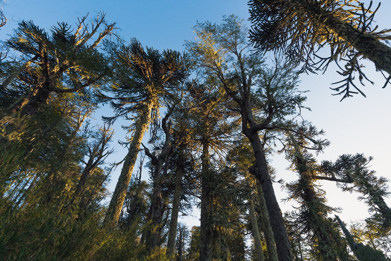
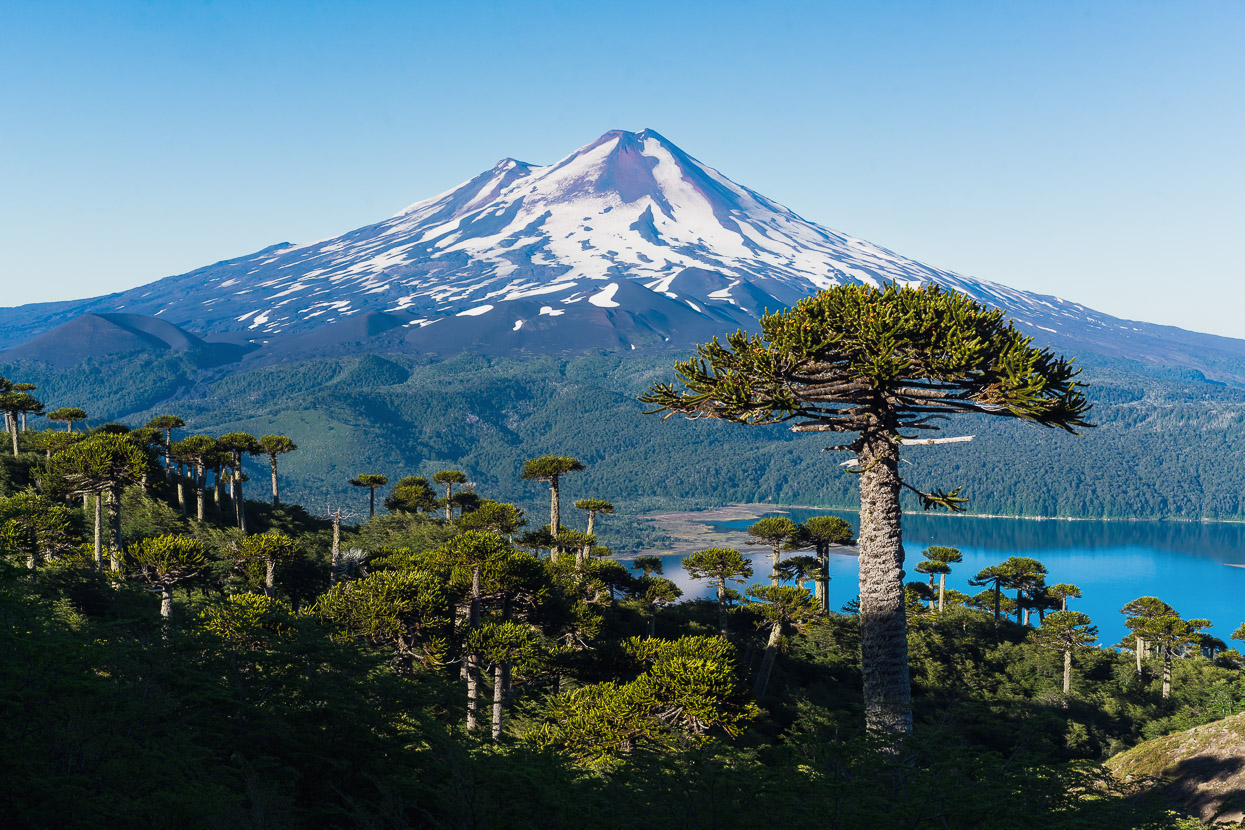
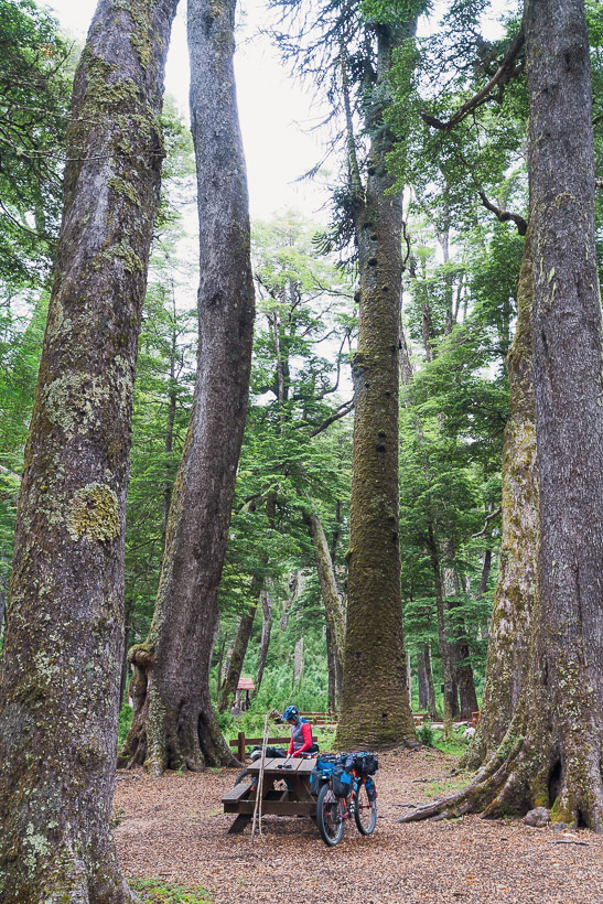
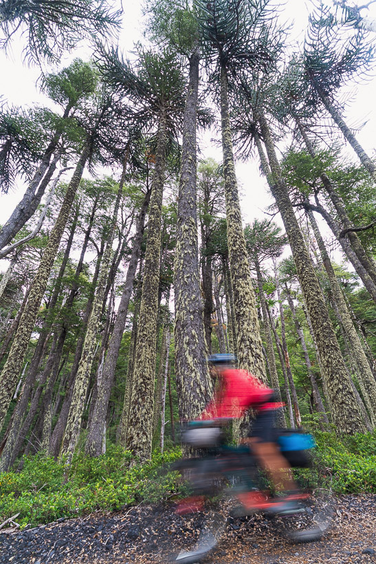
If there’s one other defining feature of this region, it’s araucaria trees (pehuen) and they’re a major feature of this park, creating a unique skyline and forest canopy.
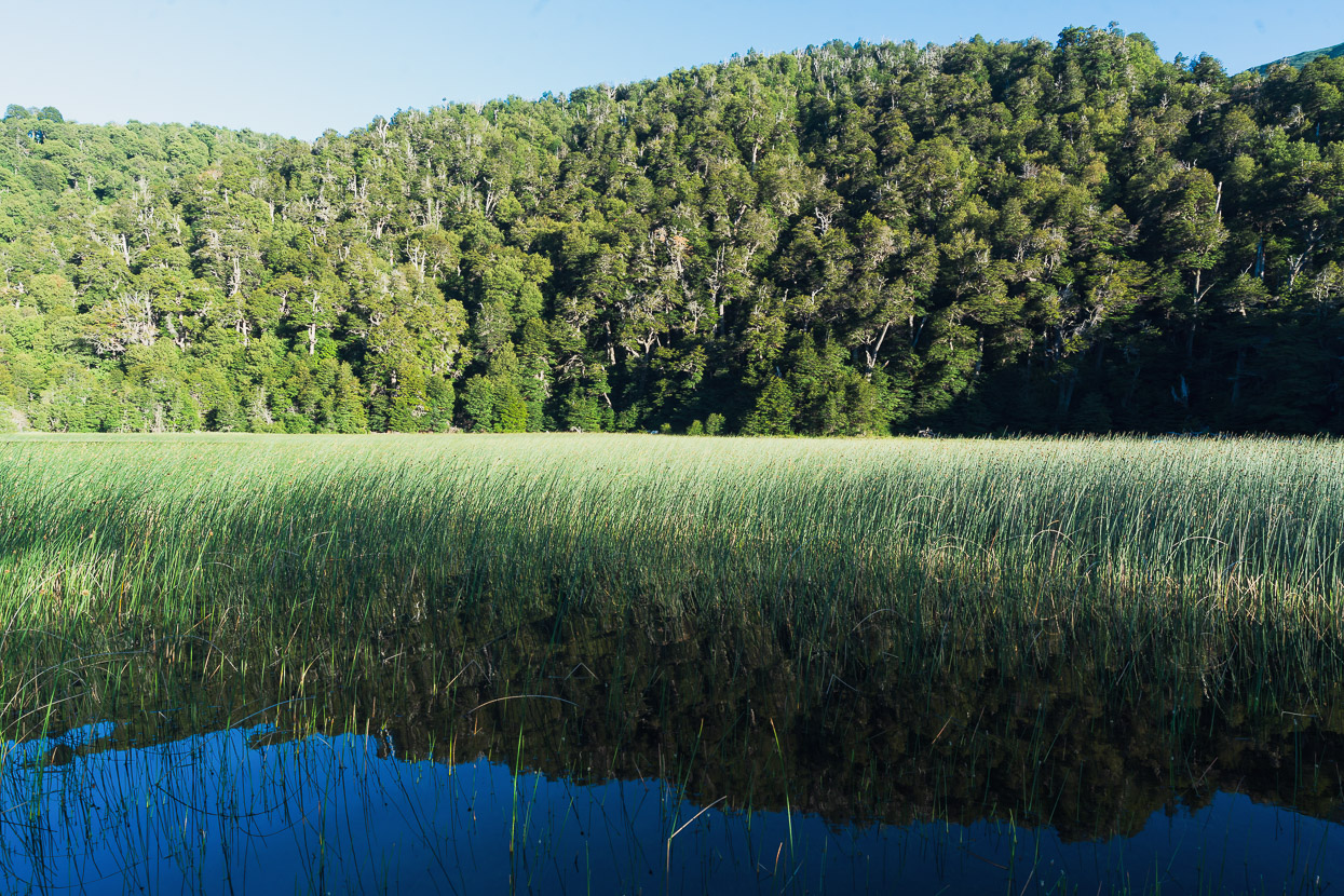
We set up camp at the mochileros (backpackers) camp near Playa Curacautin on the edge of Lago Conguillo. There’s a cafe and ranger base building here where you can pay your camp fees. Note that entry tickets to the park must be bought online, in advance and shown at the park entrance.
In the late afternoon we explored the lake edge. The lake is cradled between Volcan Llaima and Sierra Nevada, providing amazing views in every direction, and was formed by a lava dam blocking the Rio Truful Truful. This view is towards Sierra Nevada, with the summit just out of view to the right.
The sun slowly drifted down behind Volcan Llaima as we wandered the lake shore and lava flows.
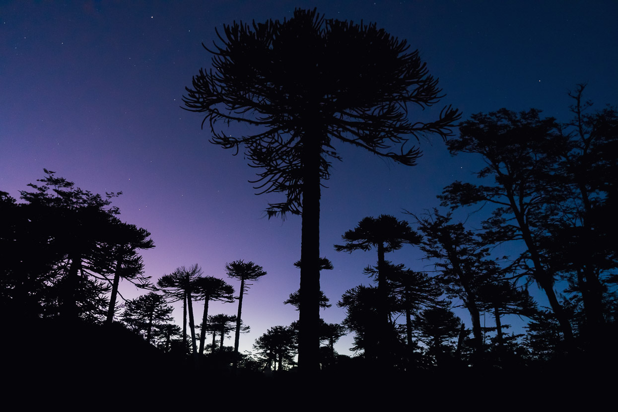
We wanted an early start for the two and a half hour hike up the Sendero Sierra Nevada, and when we left camp to ride 4km back to the trailhead the stars were still out. We left our tent pitched in camp, and stashed our bikes in the forest opposite the trailhead parking.
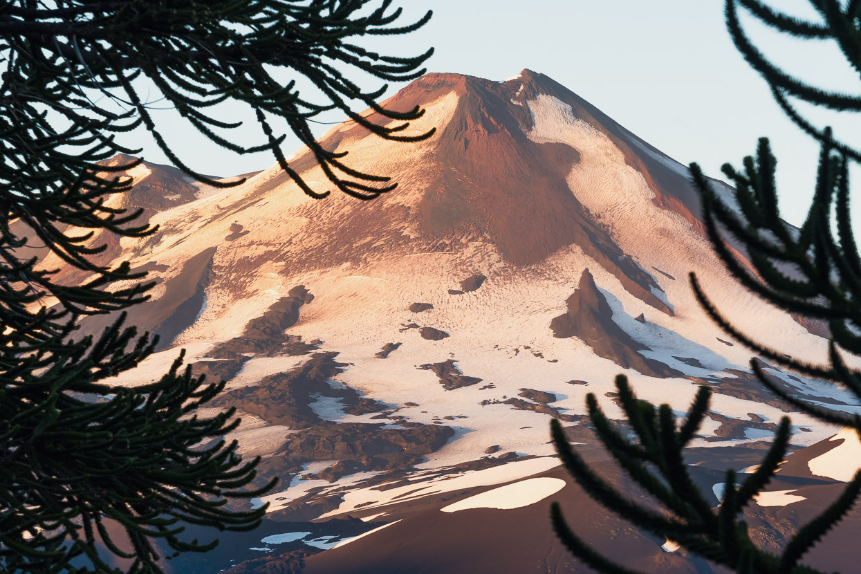
After 90 minutes or so the sun was up and bathing Llaima in nice light. The track climbs steeply at first through nothofagus forest before following a ridge where the araucaria trees become more prominent.
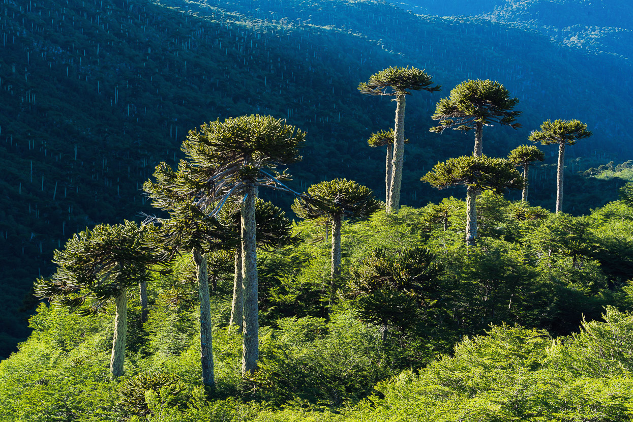
The trail is 5.5km (575m vertical metres) and stops just above treeline, where it provides an amazing view over the araucaria canopy towards Lago Conguillo and Volcan Llaima.
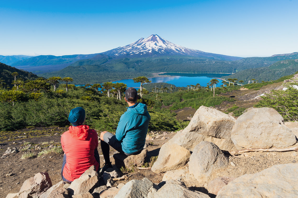
Being early birds we had the trail to ourselves on the way up, and just one other couple turned up while we were absorbing the unique view. The crowds were only just heading up as we got back towards the bottom of the track around 10.30am.
After lunch back at camp we packed up and rode the 30km back to Melipeuco for one more night there.
Our plan from Melipeuco was to ride 25km to the national park entrance for Volcan Sollipulli. This 2292m volcano is distinctive for having a 4km wide glacier-filled caldera, and you can climb it via a hiking trail that climbs its slopes for 1000 vertical metres or so. We left Melipeuco in the afternoon on New Year’s Eve, intending to climb the next day.
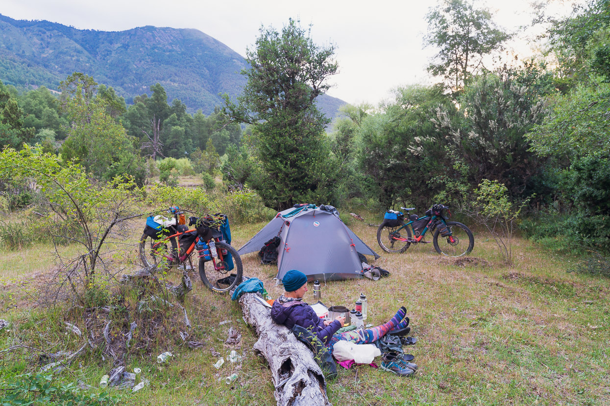
A few years ago you were allowed to camp right at the base of the trail, at the park office, but sadly this is now prohibited. We rode on another 1.6km to a lodge, hoping we might be able to camp there. The lodge was fully occupied (expensive!) and not equipped with banõs for dirtbag bikepackers, but the owner offered us a nearby site on his land that was both scenic, sheltered and close to the river. The lodge owners also own a huge swathe of land on the slopes of the volcano and have developed their own network of tracks for horse trekking, hiking and riding.
So we set up for the night tucked under the trees on the right of this photo – it could have been New Zealand.
We knew there was a chance of a rain the following day, so we planned to wake at 2am and make a very early climb to beat the incoming weather. Sadly, when the alarm went it was already drizzling and totally clagged in, so we reset the alarm to see how it was at 6am. By then it was raining more steadily so we went back to sleep and had a New Years Day late (and wet) start instead.
From Sollipulli there is a section of the Greater Patagonian Trail that follows a seldom used 4WD road around the east side of the mountain to Tres Esquinas and Maite Centro. Our Colombian friends had gone this way in early 2020 and it’s a useful link to Parque Nacional Villarica via back roads.
It’s an excellent route, with some beautiful sections of forest after you leave the formed road right after the lodge (there’s an unlocked gate here). We took few photographs because of the rain, but it’s a highly recommendable section of riding.
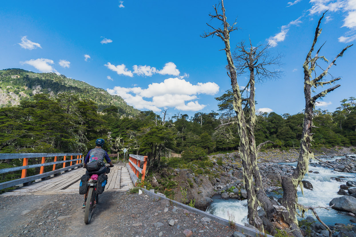
After some steep climbs and descents that take you very close to the border it descends steadily out into more open farming country. After Tres Esquinas we kept to the road on the true left of the valley and saw almost no vehicles all the way to Maite Bajo, where we crossed the river on a footbridge.

It wasn’t the safest bridge we’ve seen.
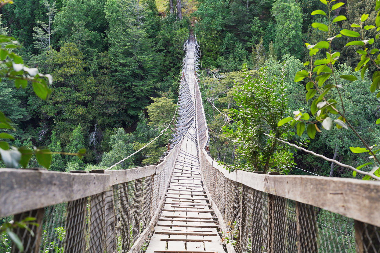
But we’re glad we didn’t have to cross this one!
We bought a couple of NY beers at the small tienda in Maite Bajo and the owner recommend us a spot to wild camp just a couple of km back up the main road (S965). Although Chile has a reputation for being harder to wild camp in than Argentina (there’s more fences and locked gates), some careful studying of the map (particularly satellite map, which we always cache in OsmAnd+), and use of iOverlander, usually reveals potential spots and we’ve done pretty well as I write this month later.
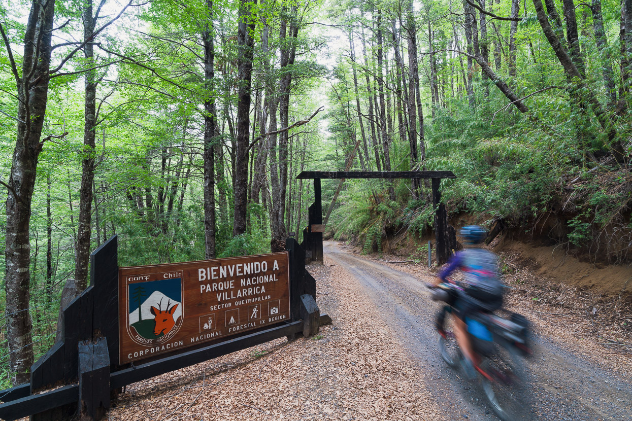
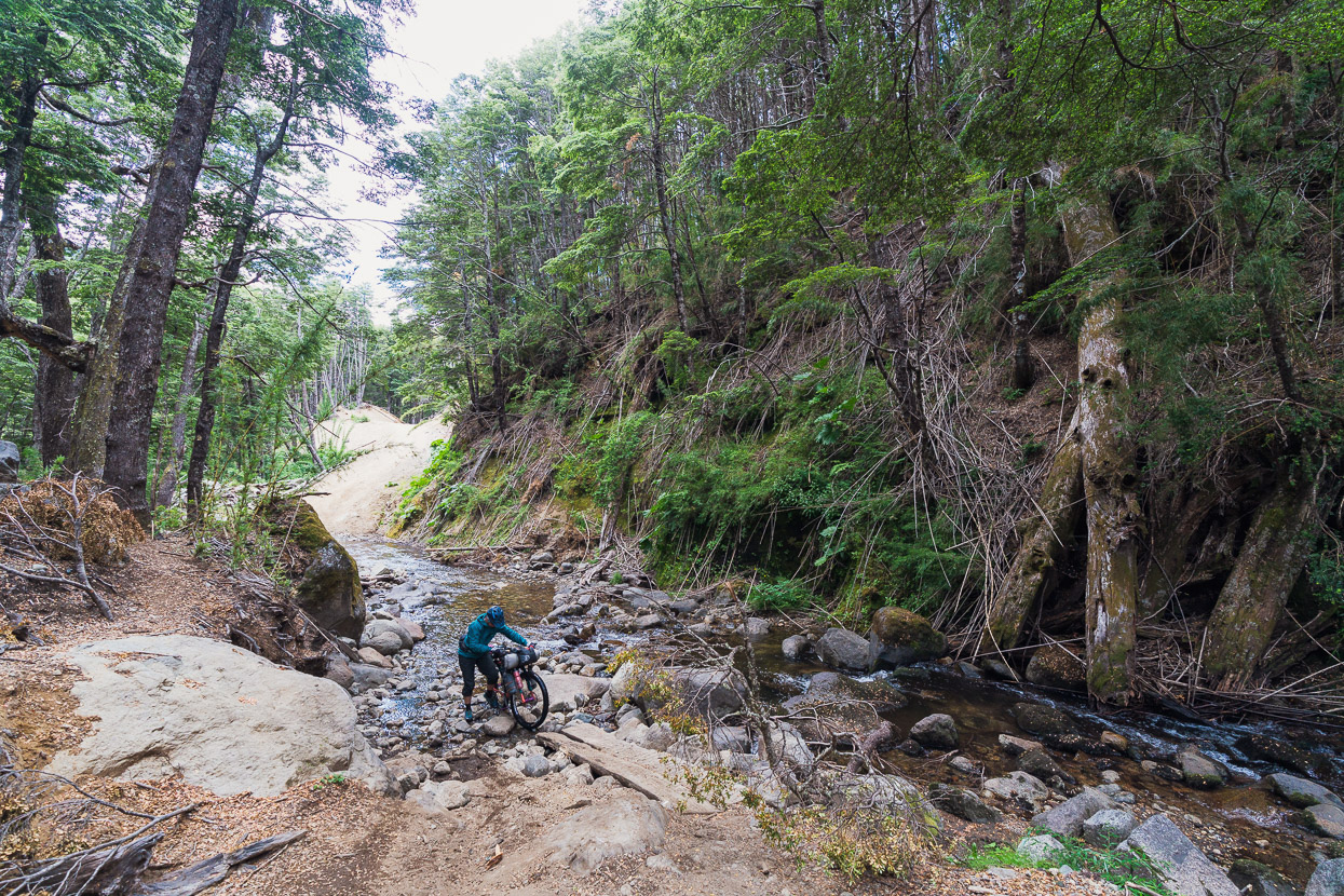
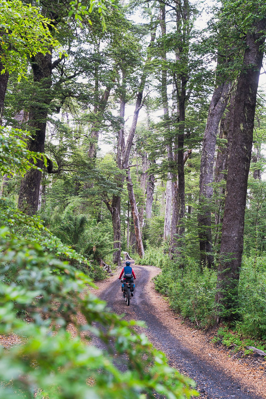
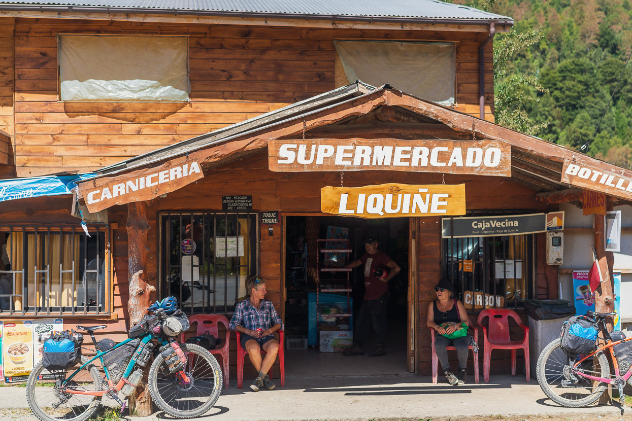
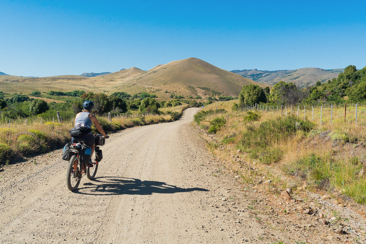
Mostly paved roads took us on to Curarrehue the next morning, where we resupplied for two days. We rode on to Catripulli on the main road and then followed back roads to the big climb up into Parque Nacional Villarica, which was the next volcano fix on our itinerary.
This beautiful road is quite well known among more adventurous cyclists and crosses a pass that is pinched between the forest covered flanks of Volcan Villarica and Volcan Quetrupillan.
Most people who follow this road southbound descend to the tourist town of Coñaripe, but it’s also possible to deviate and follow 4WD and singletracks to Lago Azul (de los Patos) high on Volcan Quetrupillan, then joining the Greater Patagonian Trail and descending to near Liquiñe. Our friends Andy and Eileen had taken one such alt, and another duo we follow, Dan and Gina (Fatcycling) had also made a slightly different crossing that they had written up in detail, so we followed their GPX.
Before turning off onto the route we camped at the southern park entrance. Technically camping is not allowed there, but we turned up at dusk and the attendant ranger was very reasonable and said we could camp as long as we left early.
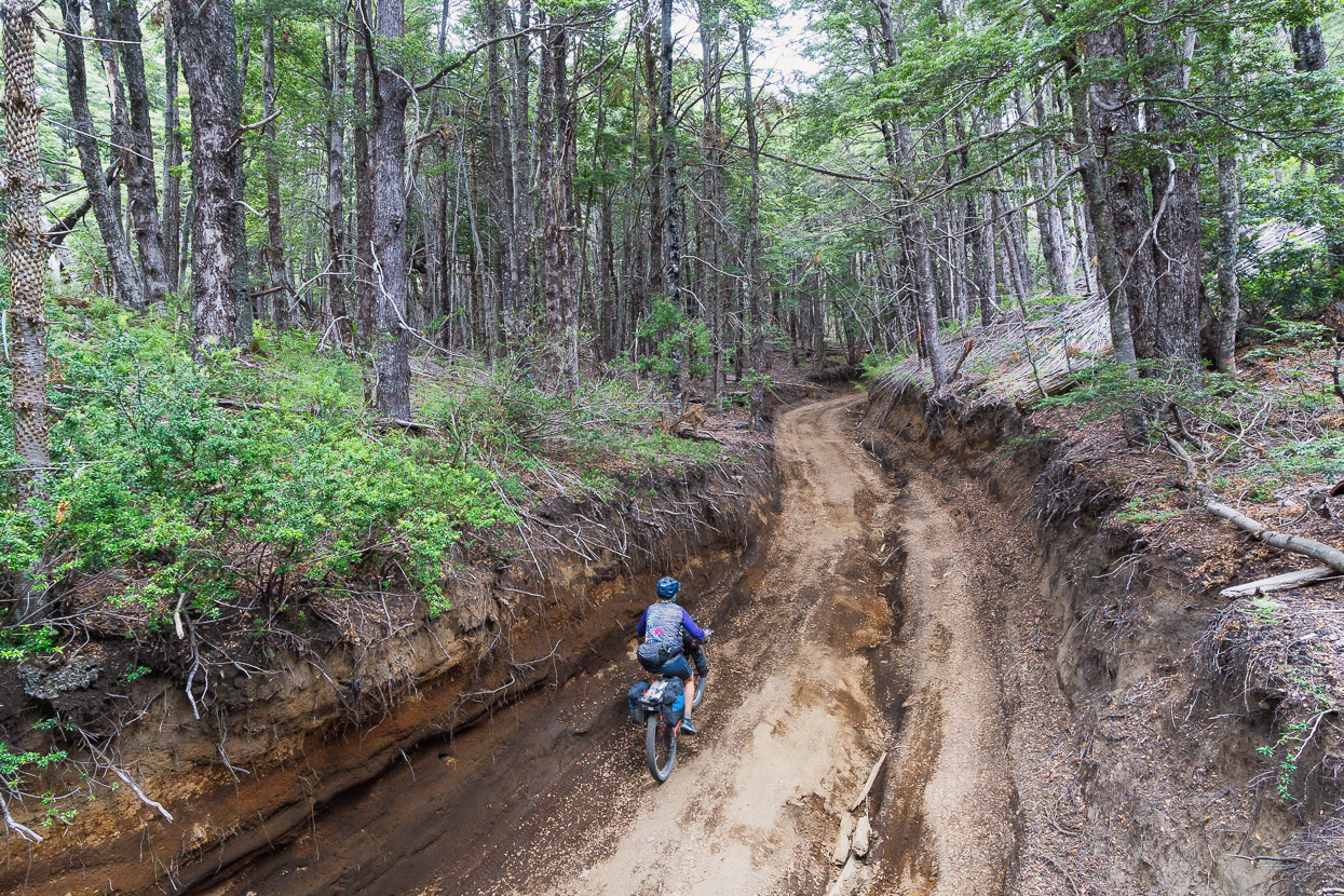
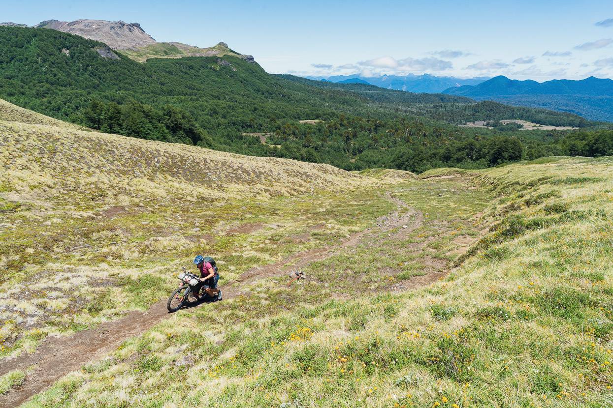
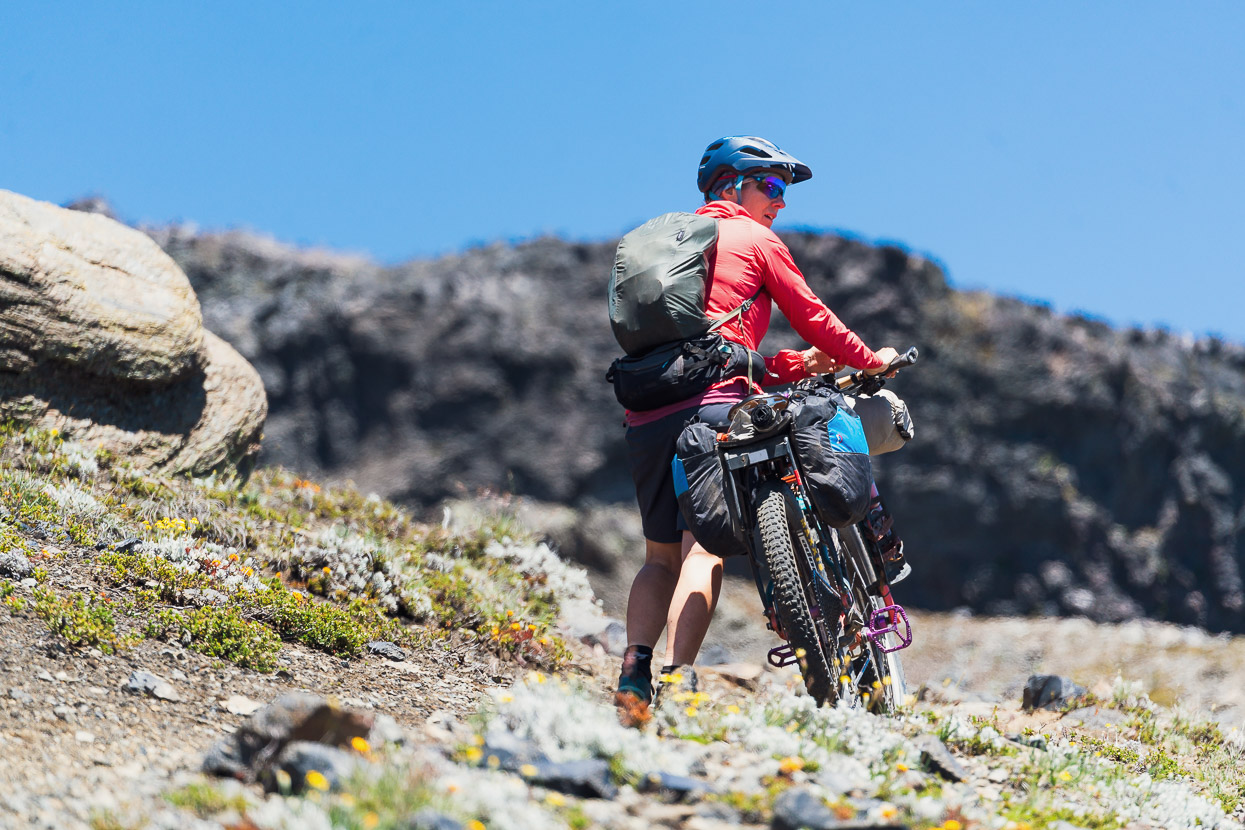
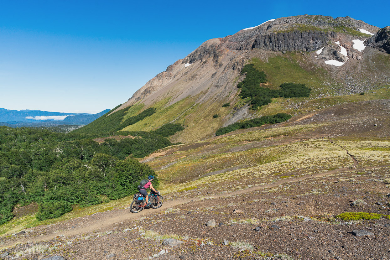
Between the northern and southern park entrances the road turns into a very steep 4WD road – so if you’re crossing this road on a regular touring set up, expect to push for a while. The fun descent makes up for it.
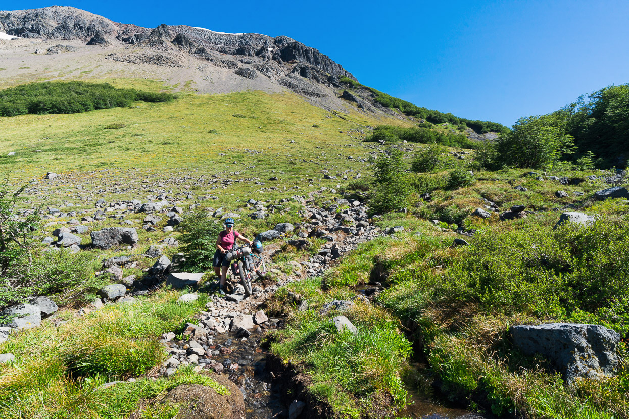
From the southern park entrance we descended 4.2km, climbed over a locked gate (there to keep motorbikes out), and followed a dirt road for a few kilometres. Eventually the dirt road peters out at a clearing and we took a singletrack that drops into a creek and climbs back out to join a quadbike/horse trail. We followed this all the way to the treeline.
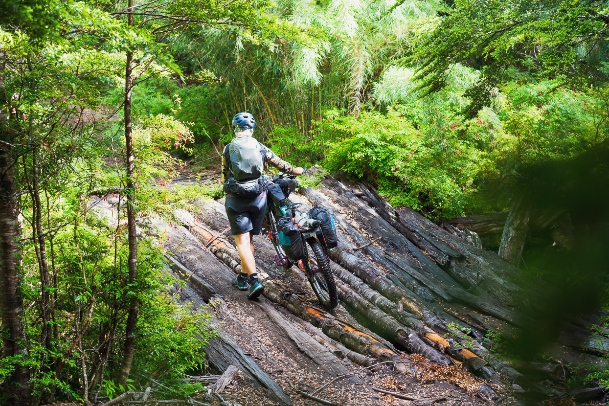
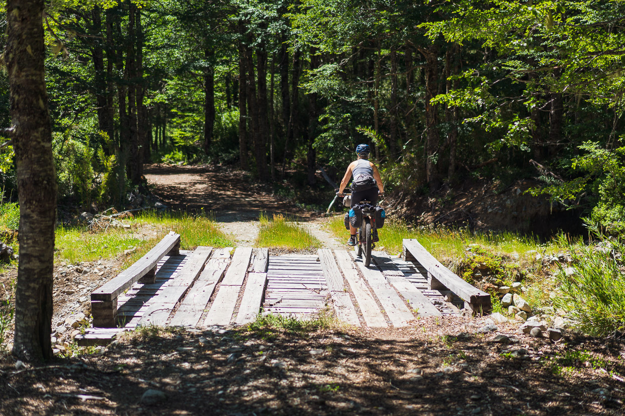
There were a couple of ‘bridges’.
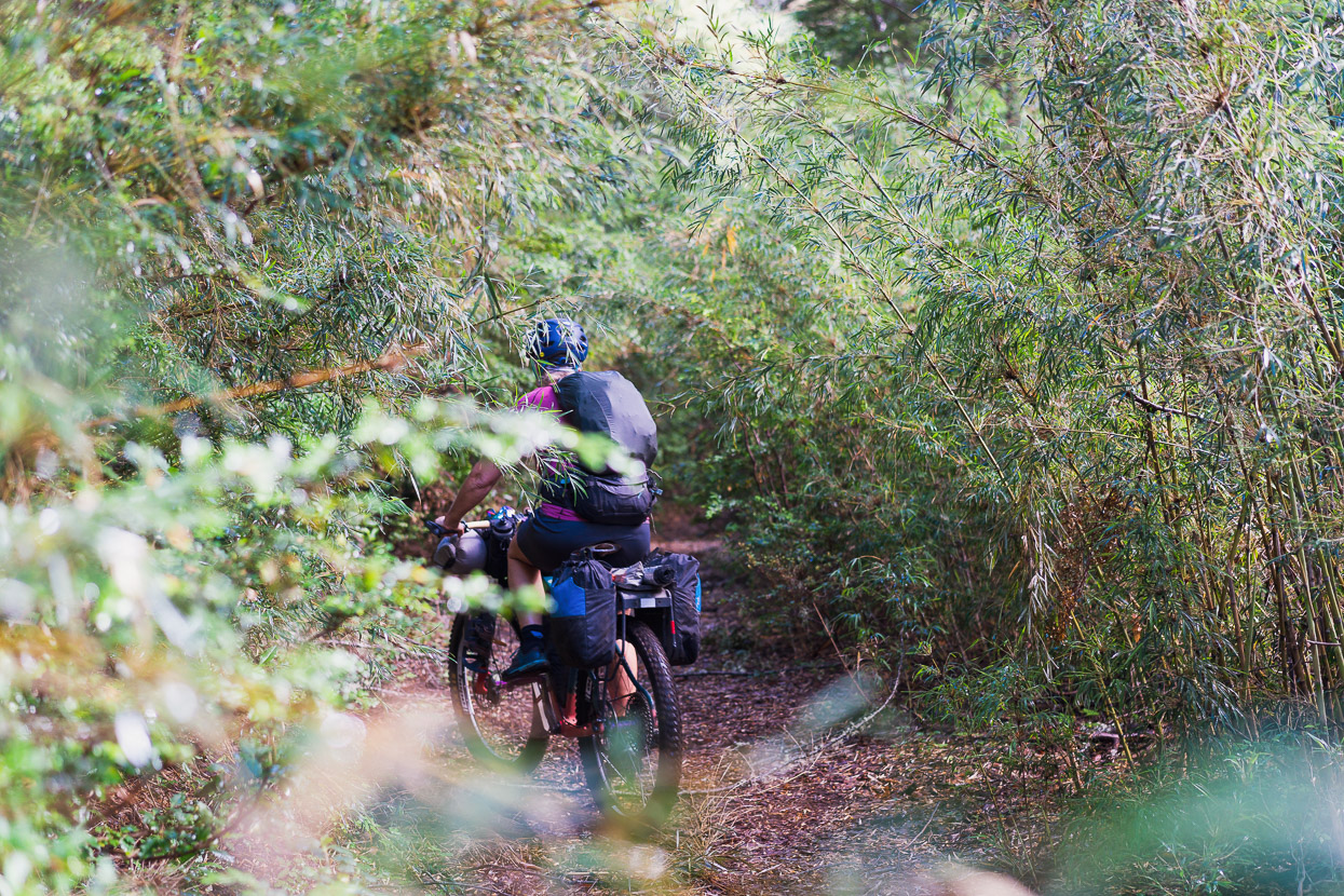
And lots of bamboo tunnel riding.
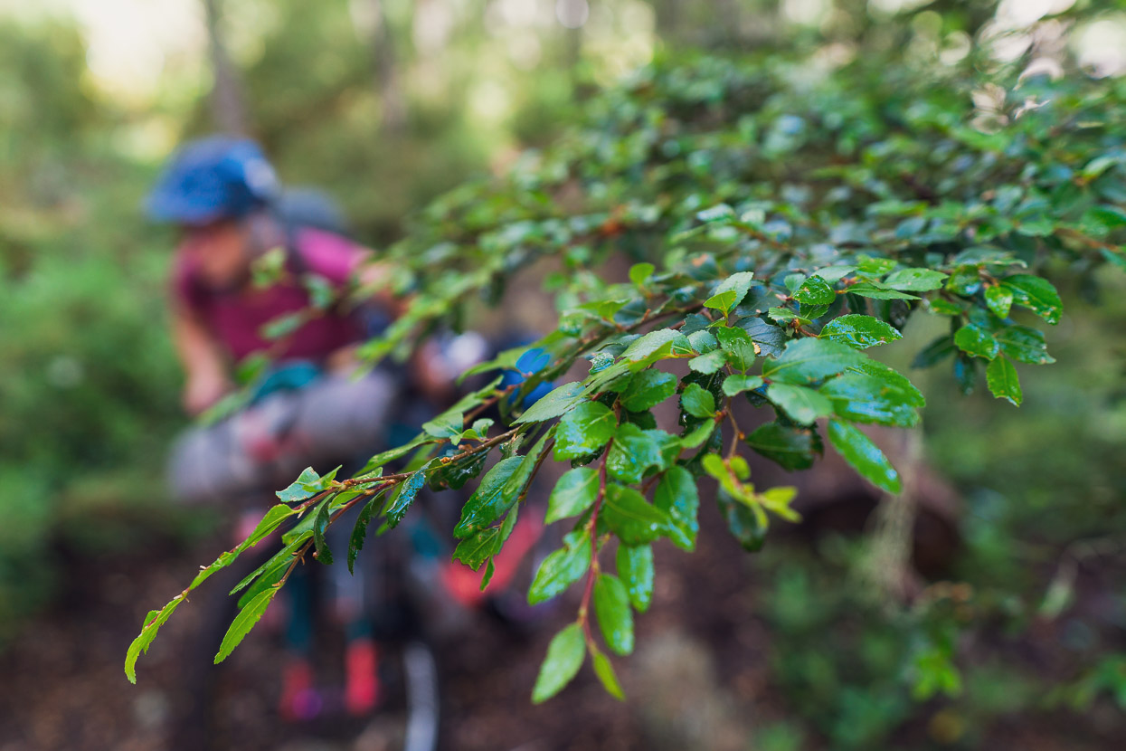
Further up the trail climbs steeply though nothofagus forest. We rode a few short sections, but from about 1050m to 1400m we were mostly pushing the bikes. As far as hike-a-bike goes, it’s steep, but quite agreeable because all the pushing is on a smooth trail surface. There’s no jumble of roots and rocks to negotiate, making it less tedious, and easier work.
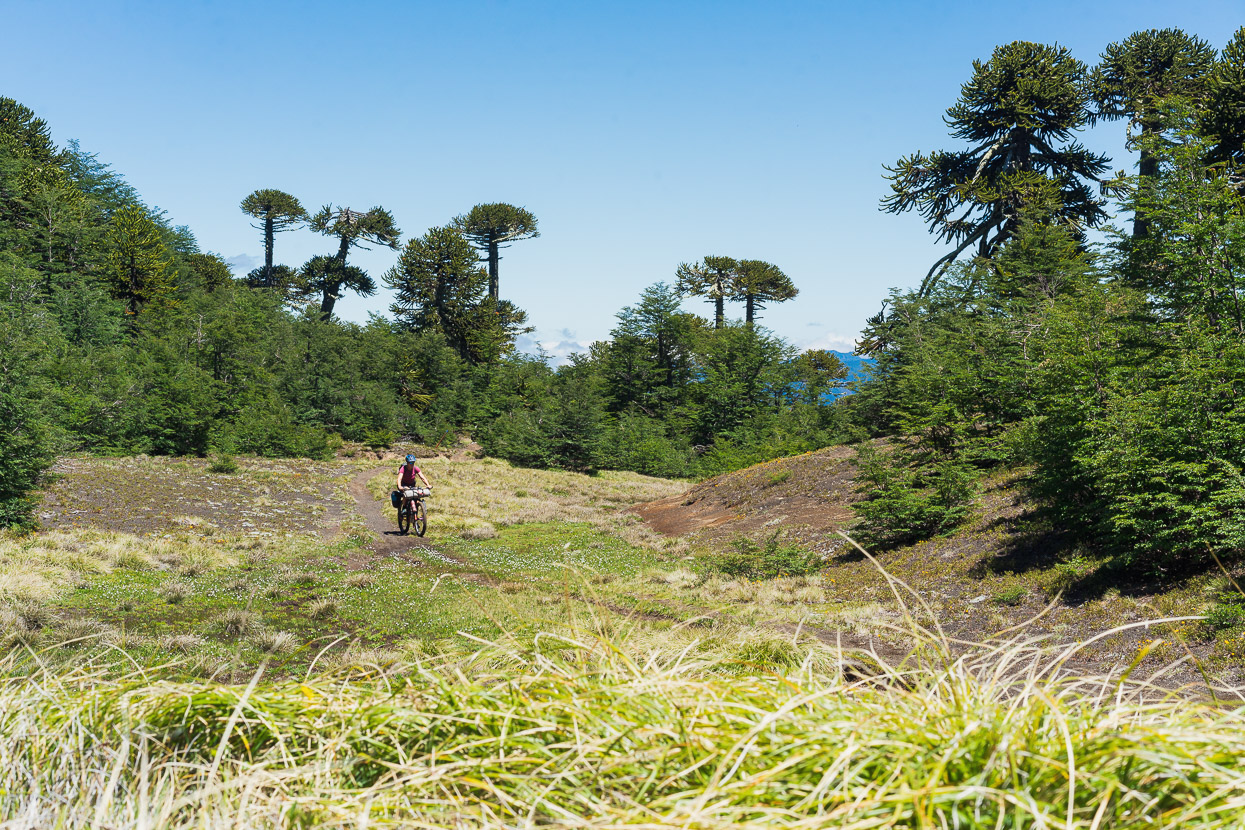
At 1430m the route crosses a big open flat and then intermittently passes though forest until 1580m.
From here the steep pushing continues, but it’s punctuated with mellower sections.
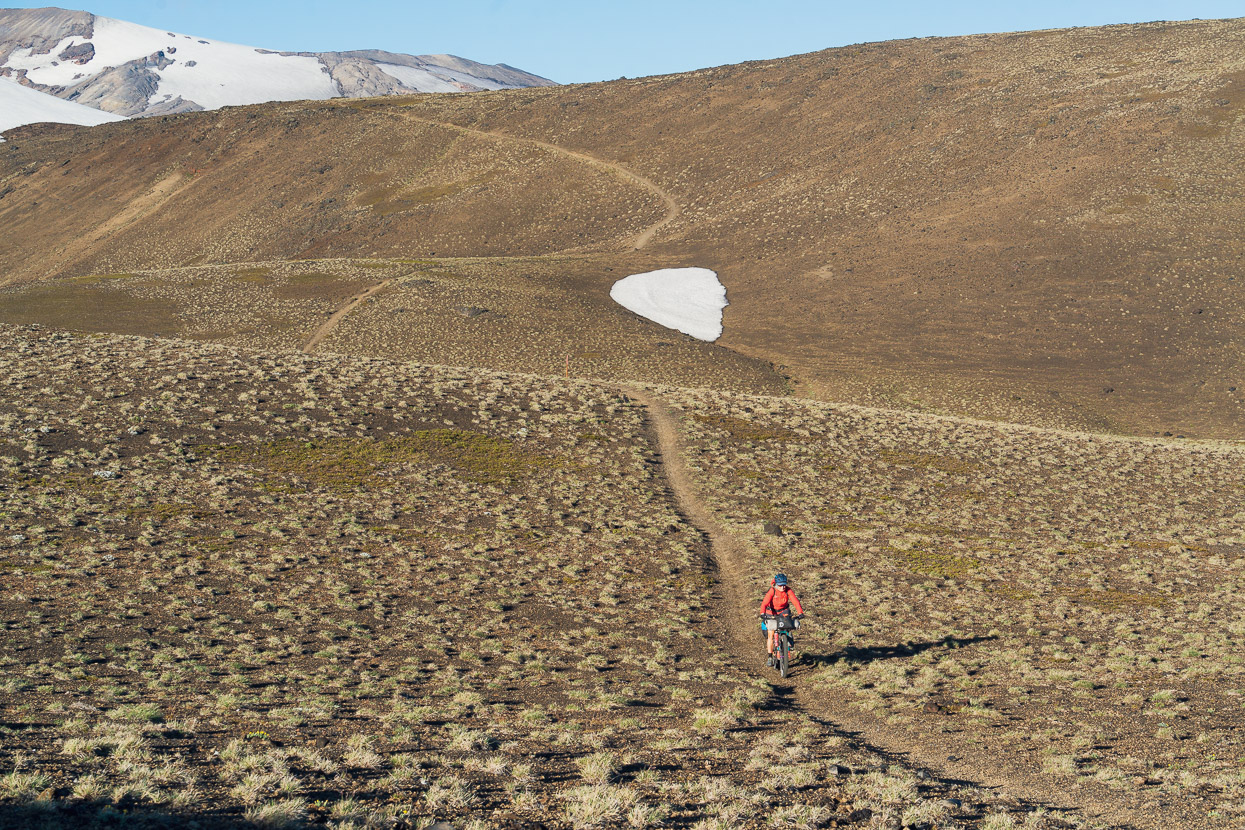
Higher, the route sidles a lot and much of this section is ridable.
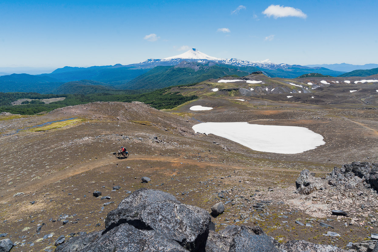
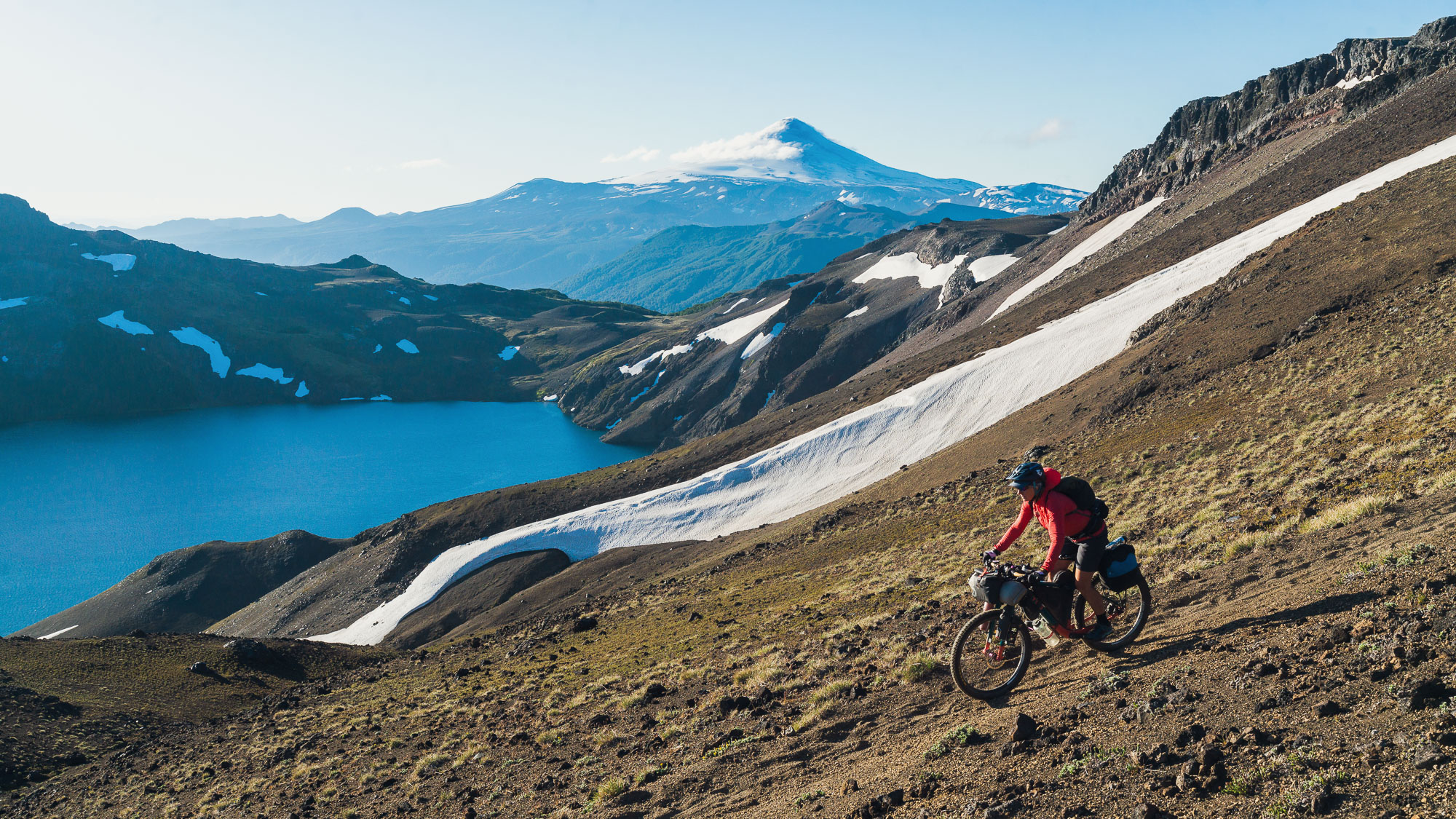
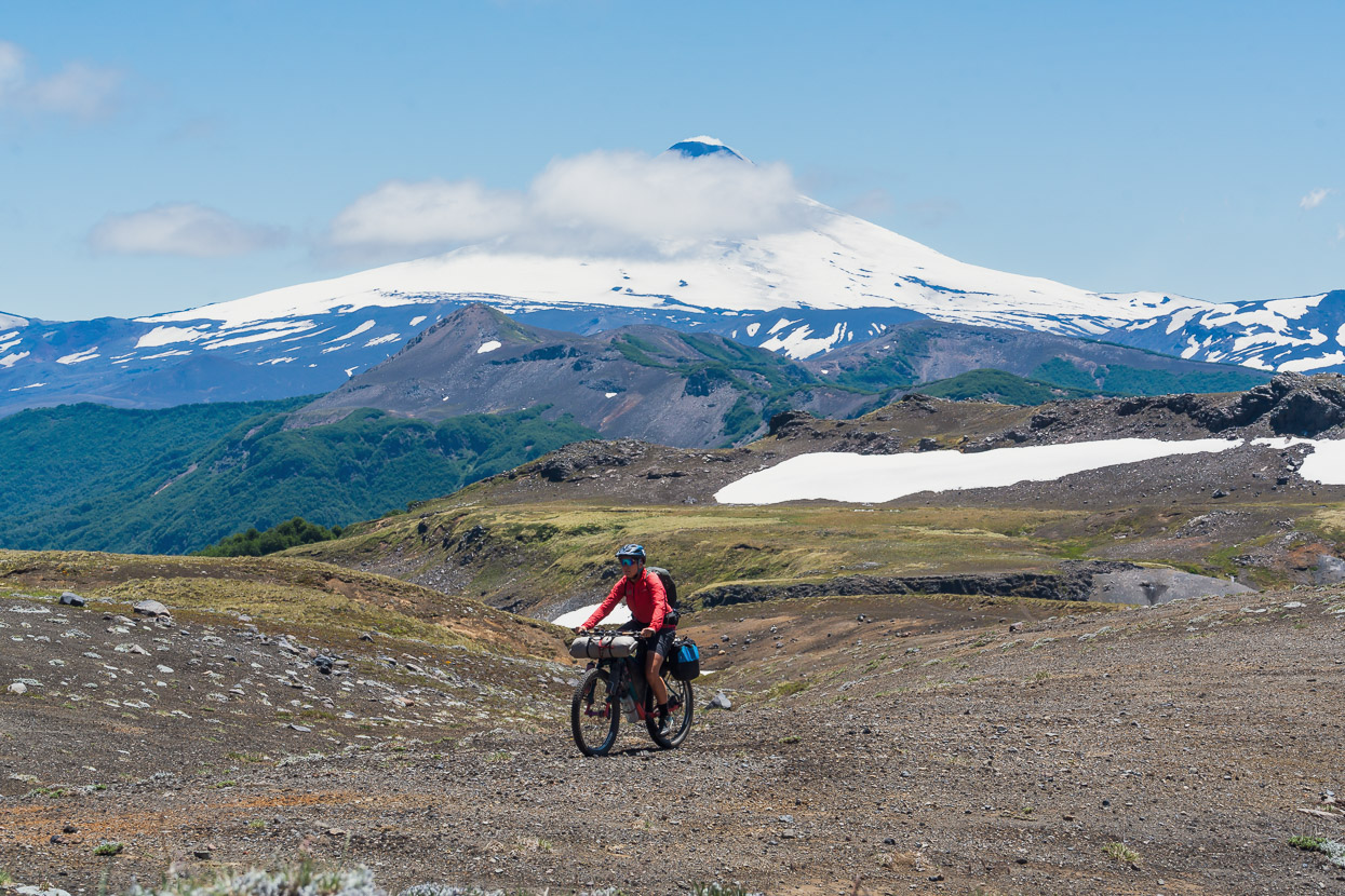
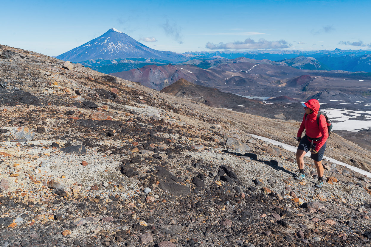
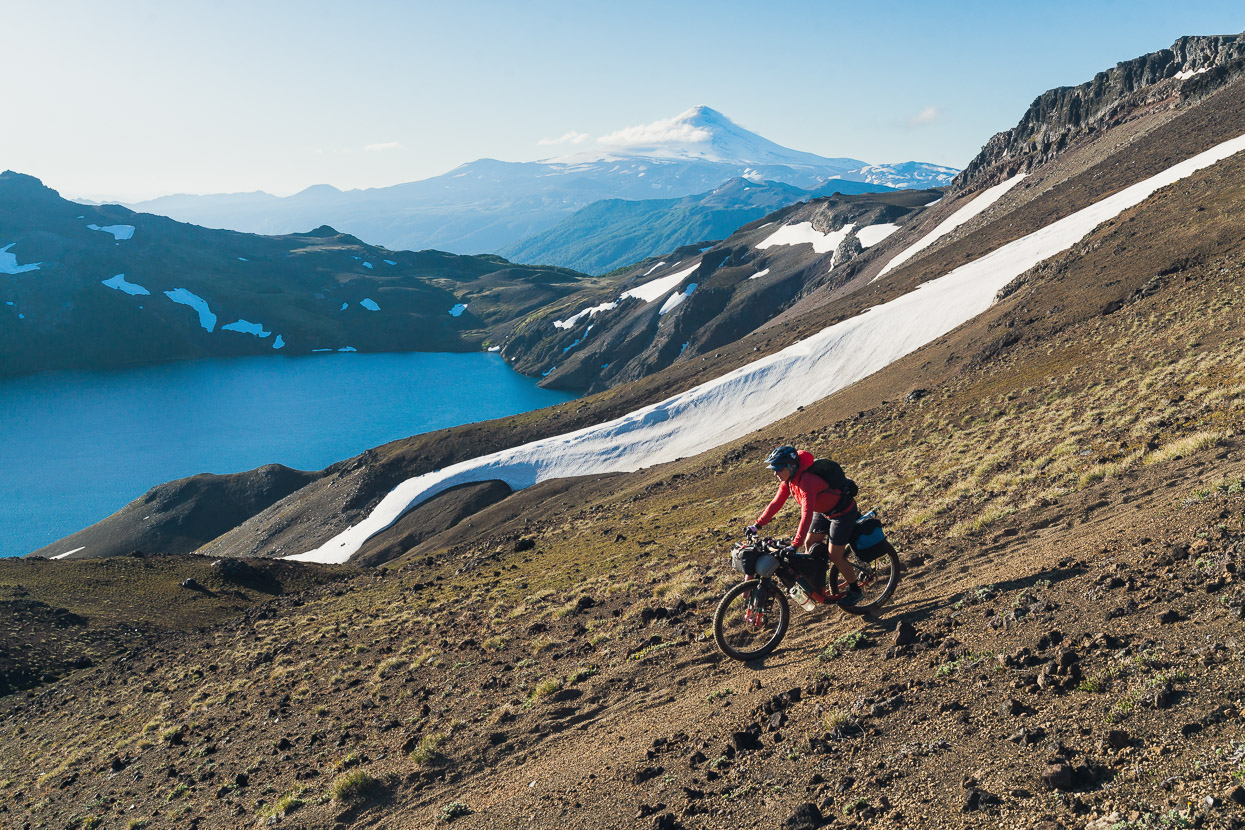
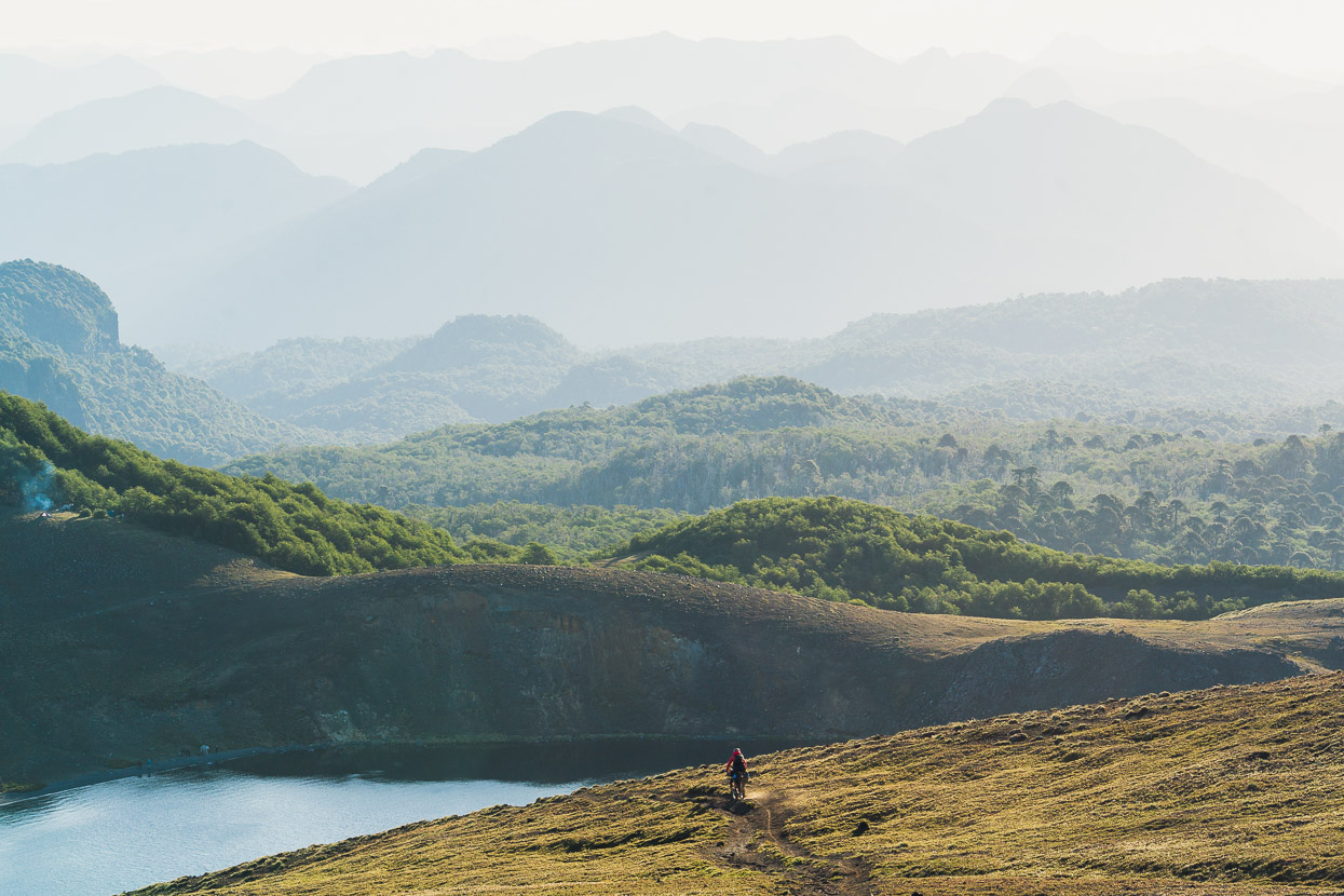
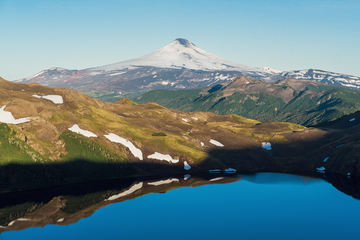
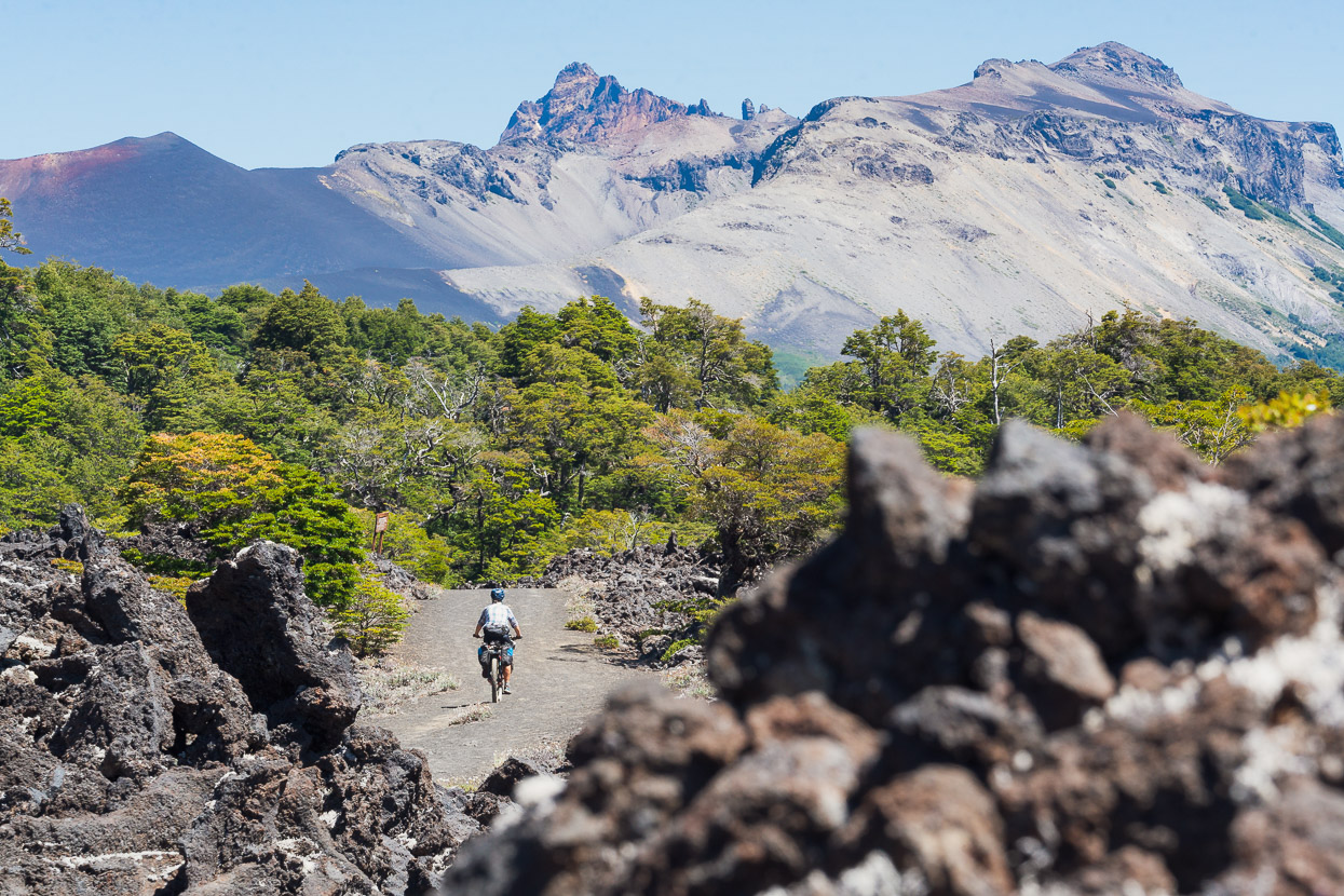
And what a place to ride a bike! Volcan Villarica (recently active) was looking amazing in the background.
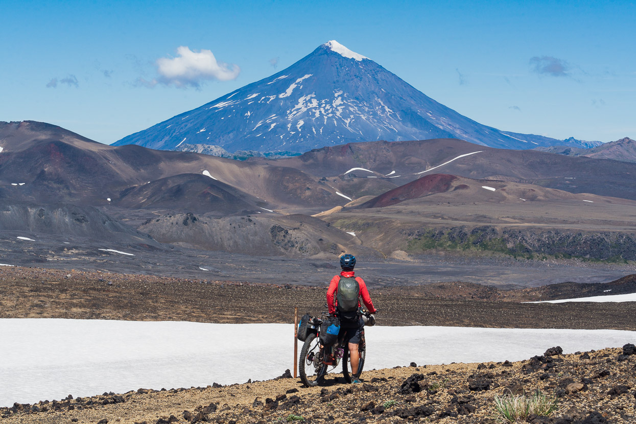
We crossed a saddle and Volcan Lanín, the highest in the region at 3747m, came boldly into view. This impressive volcano straddles the border, but most of the mountain is in Argentina.
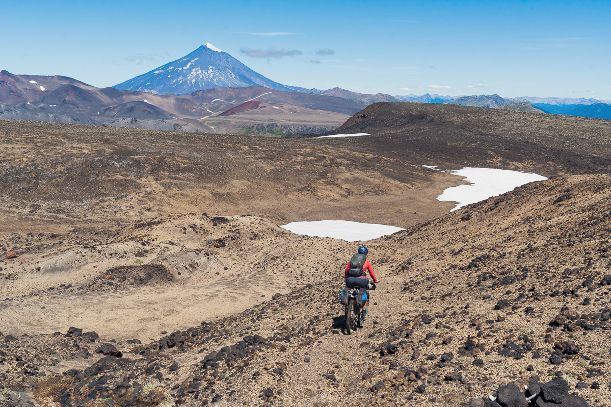
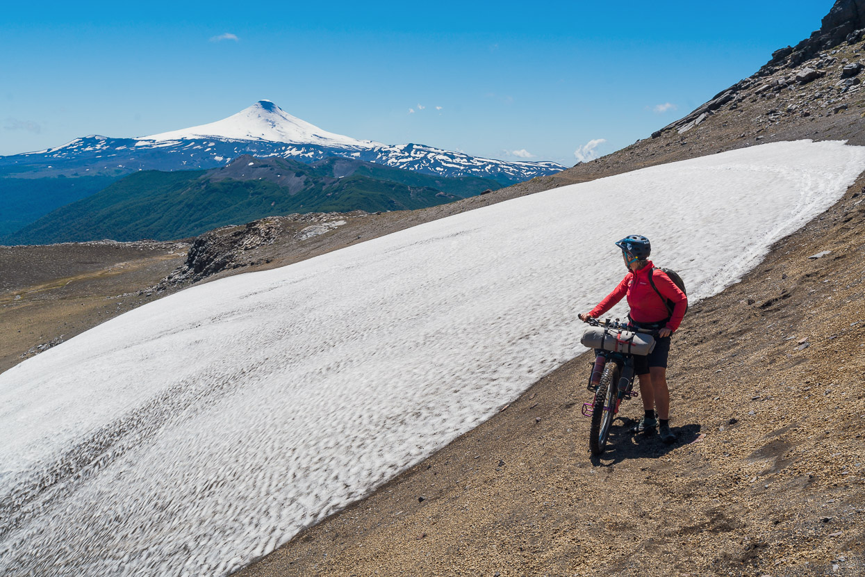
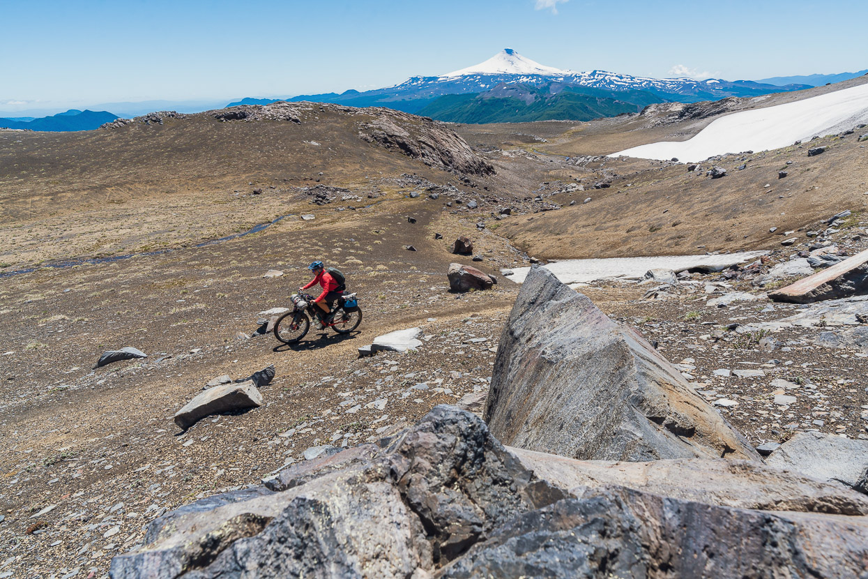
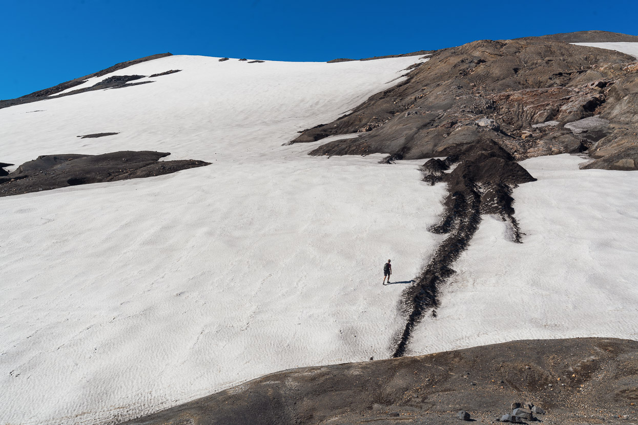
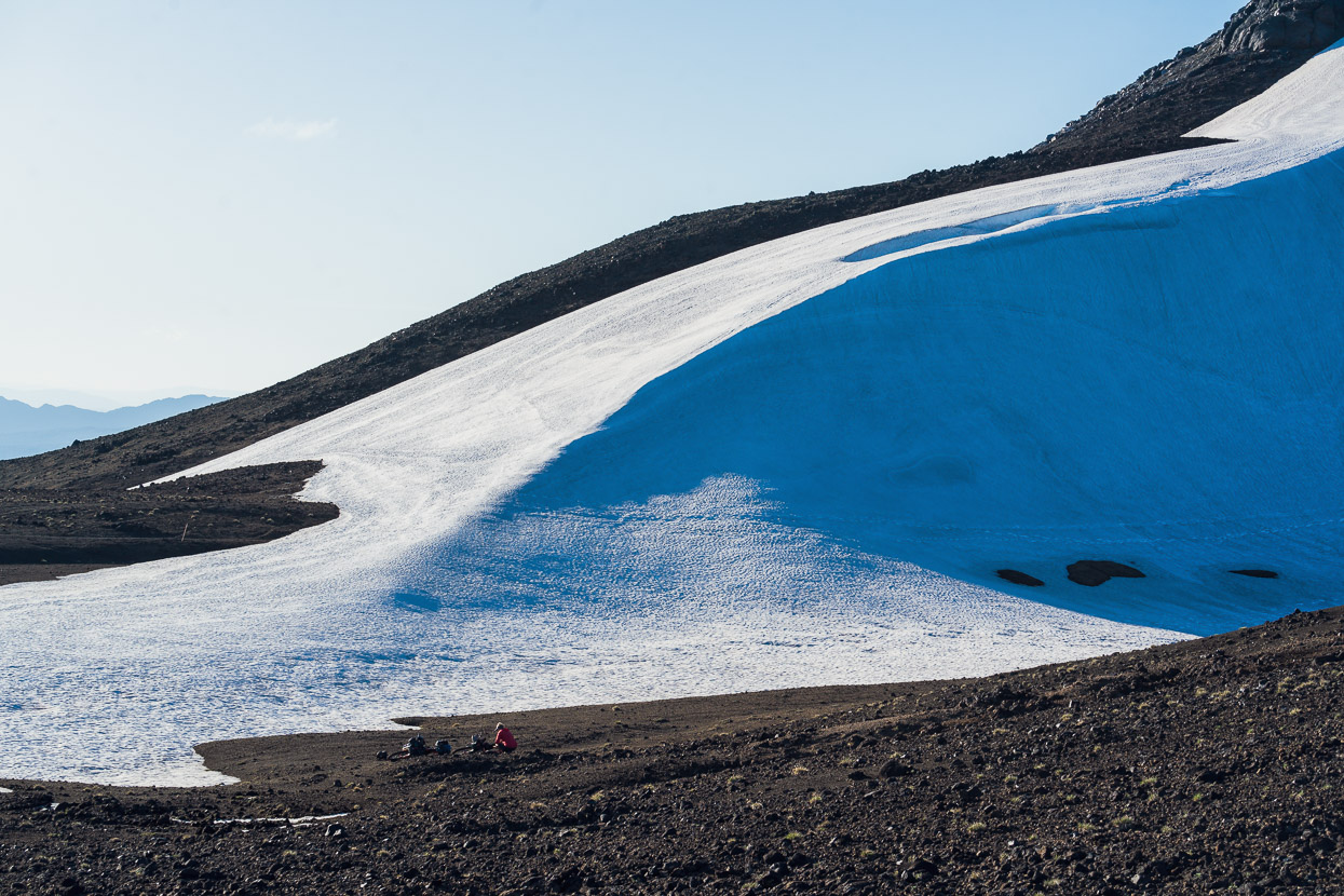
Down we go into a moonscape… all ridable except for a couple of snow patches (which we glissaded).
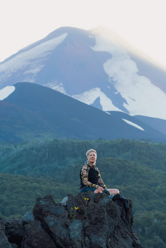
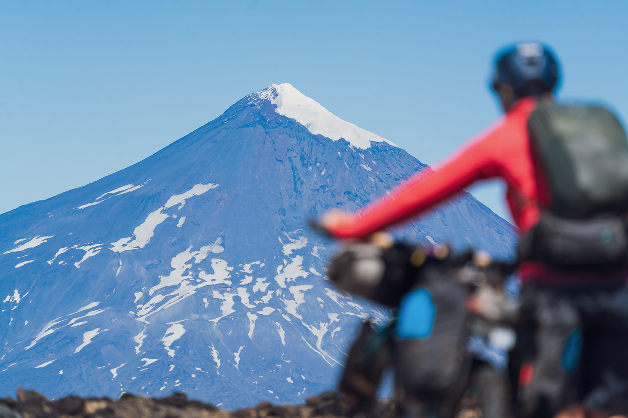
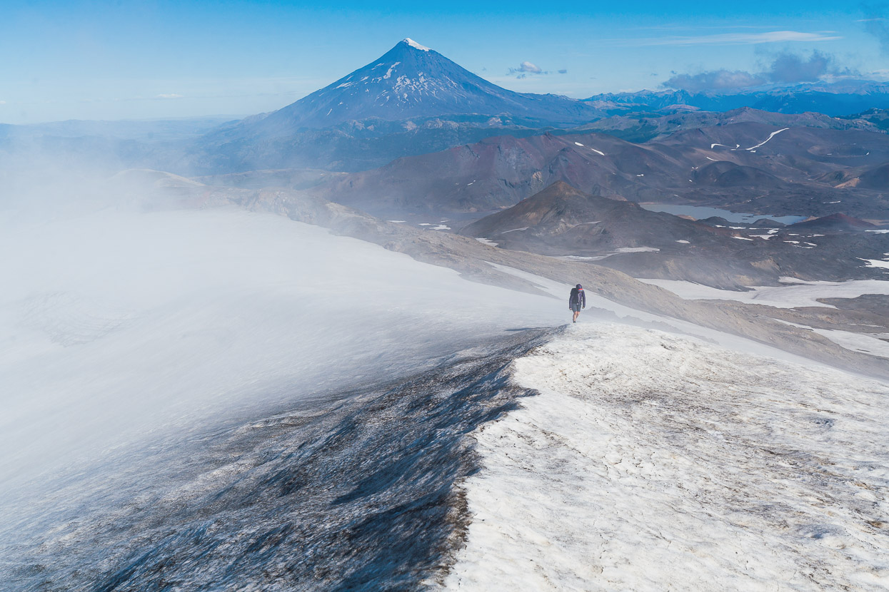
It was about 4pm by now, but with the hard work out of the way and just the descent to the lake to come, the summit of Quetrupillan (pictured above) looked temptingly close, just 500m above us and 4km away. We hadn’t been considering going to the crater rim at all, but the day’s 1000 vertical metres had taken less time than expected, so we decided to dump the bikes and go for it.
Unladen and with easy walking we covered the ground quickly.
On the upper slopes the snow was just soft and mellow angled enough to walk on safely, as long as we didn’t linger too late into the day.
The crater rim was like a wind tunnel though and we soon felt like we were on the slopes of a much bigger mountain as the wind buffeted us. But shorts and ungloved hands cut it, just. We stopped on a small peak on the crater rim, just 50m vertical metres shy of the true summit. Blocks of choss and the late hour prompted us to turn for home.
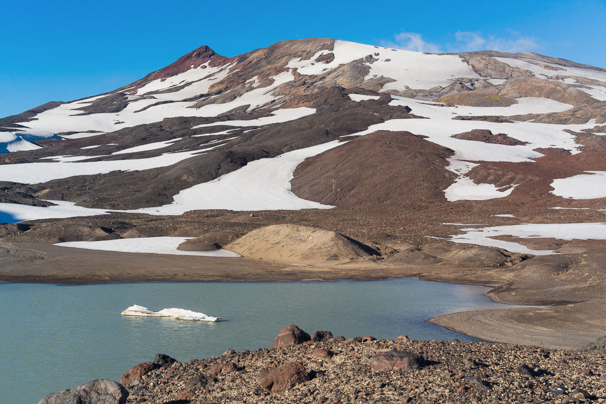
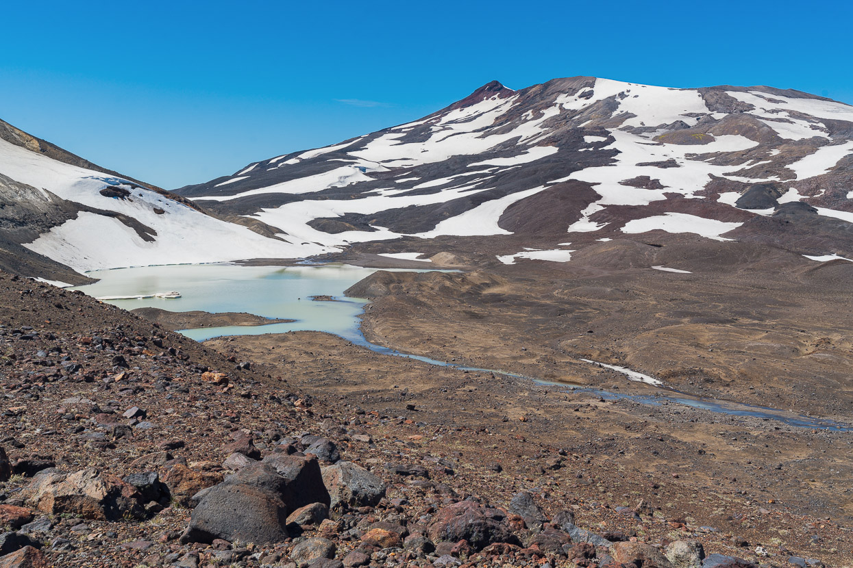
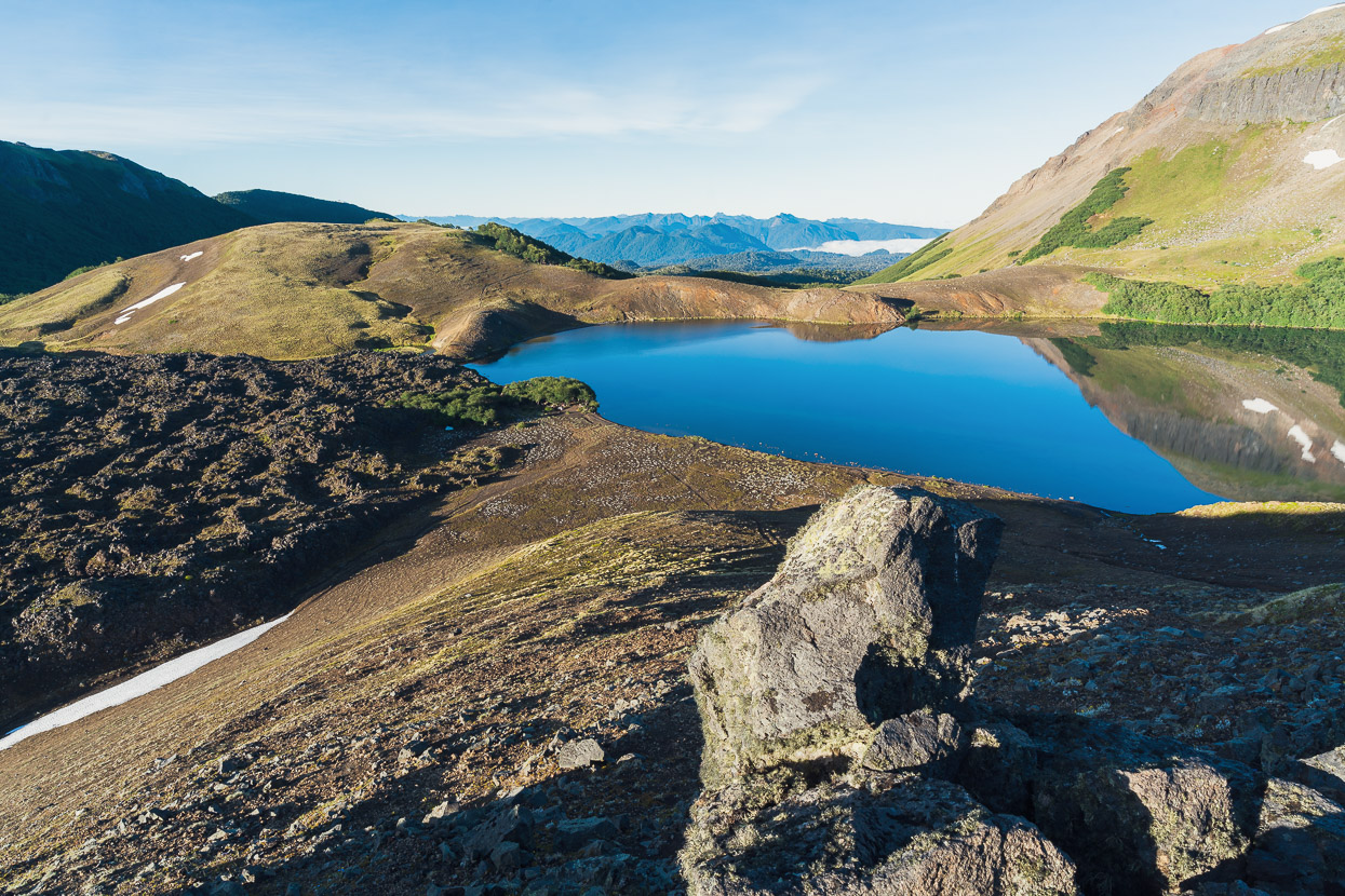
The snow was still soft enough to glissade, so we were back down at the lake quickly, out of the wind and enjoying the late afternoon light. Our highpoint was the highest point in the photo, right of the red pyramid, which is the true summit.
The bikes were waiting patiently where we’d left them, and we saddled back up for the descent to the lake.
Which was about as good as adventure bikepacking gets… perfect singletrack in the early evening with amazing views in every direction.
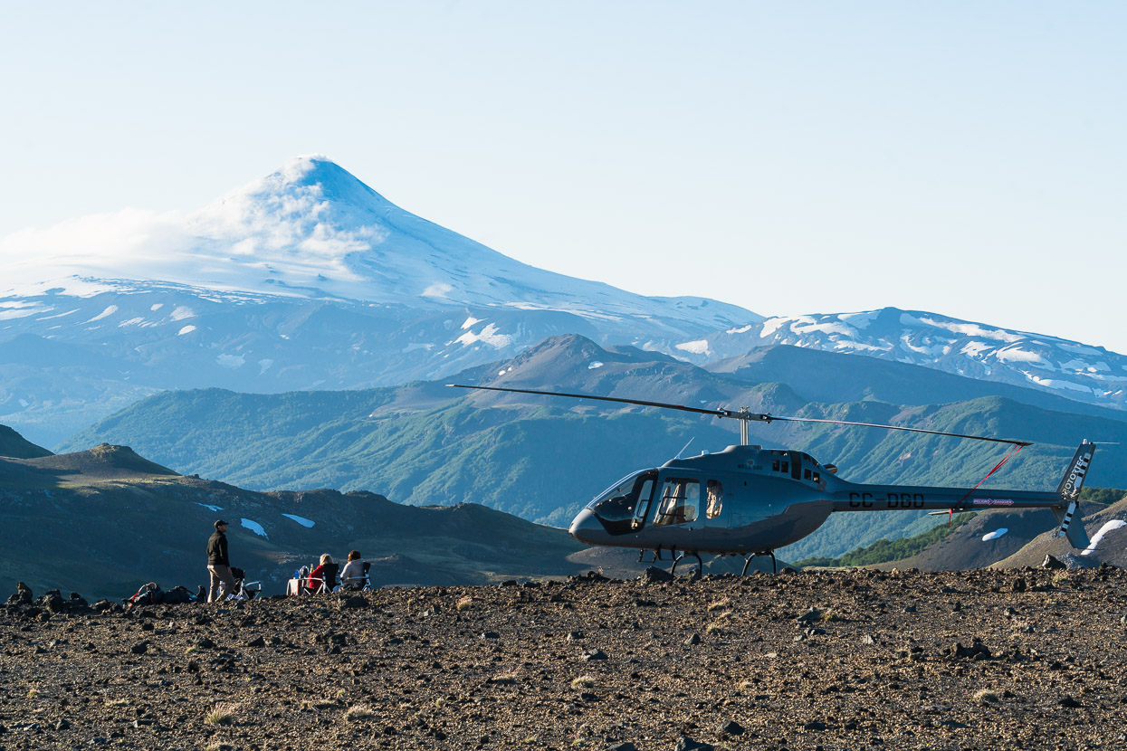
What we didn’t expect to see was this! Two tourists and their pilot, who had flown from a hotel somewhere to sit and enjoy sunset with a glass of wine. They were just as surprised to see us as we were them! Two backpackers had joined in with the sundowners too.
But we were too busy making our own fun…
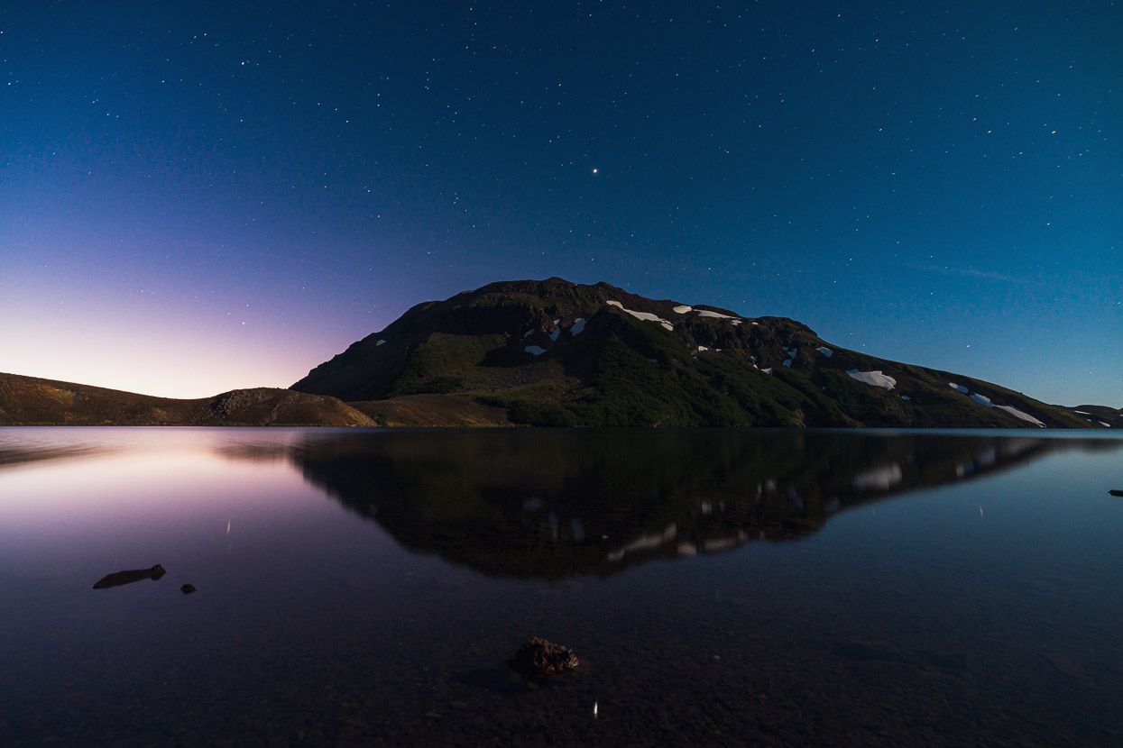
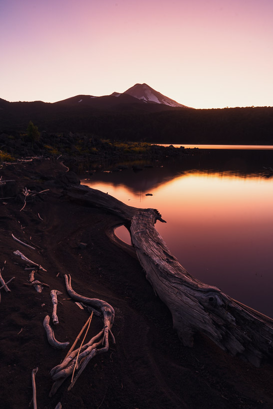
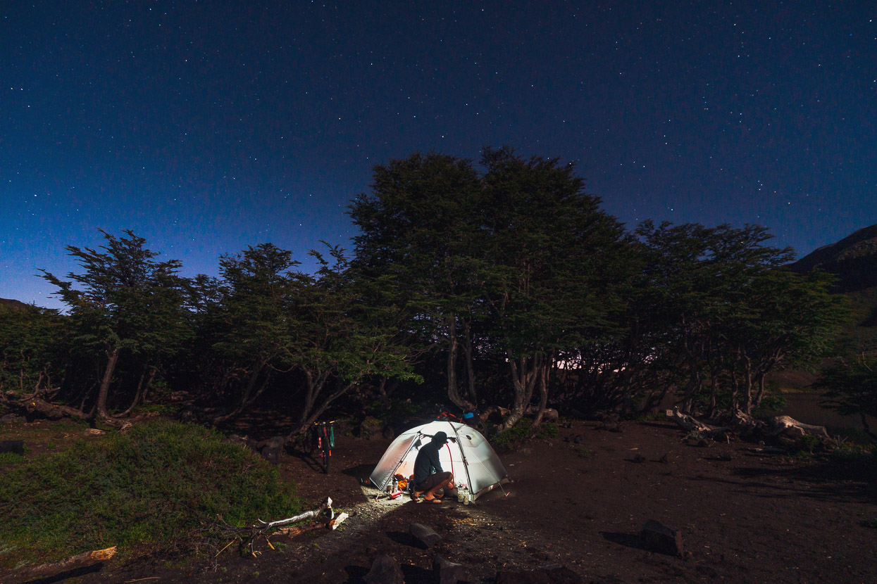
We set up camp by a small stand of montane beech trees near the lake shore and ate dinner feeling stoked with the day – it had been some amazing bike travel to a very special place.
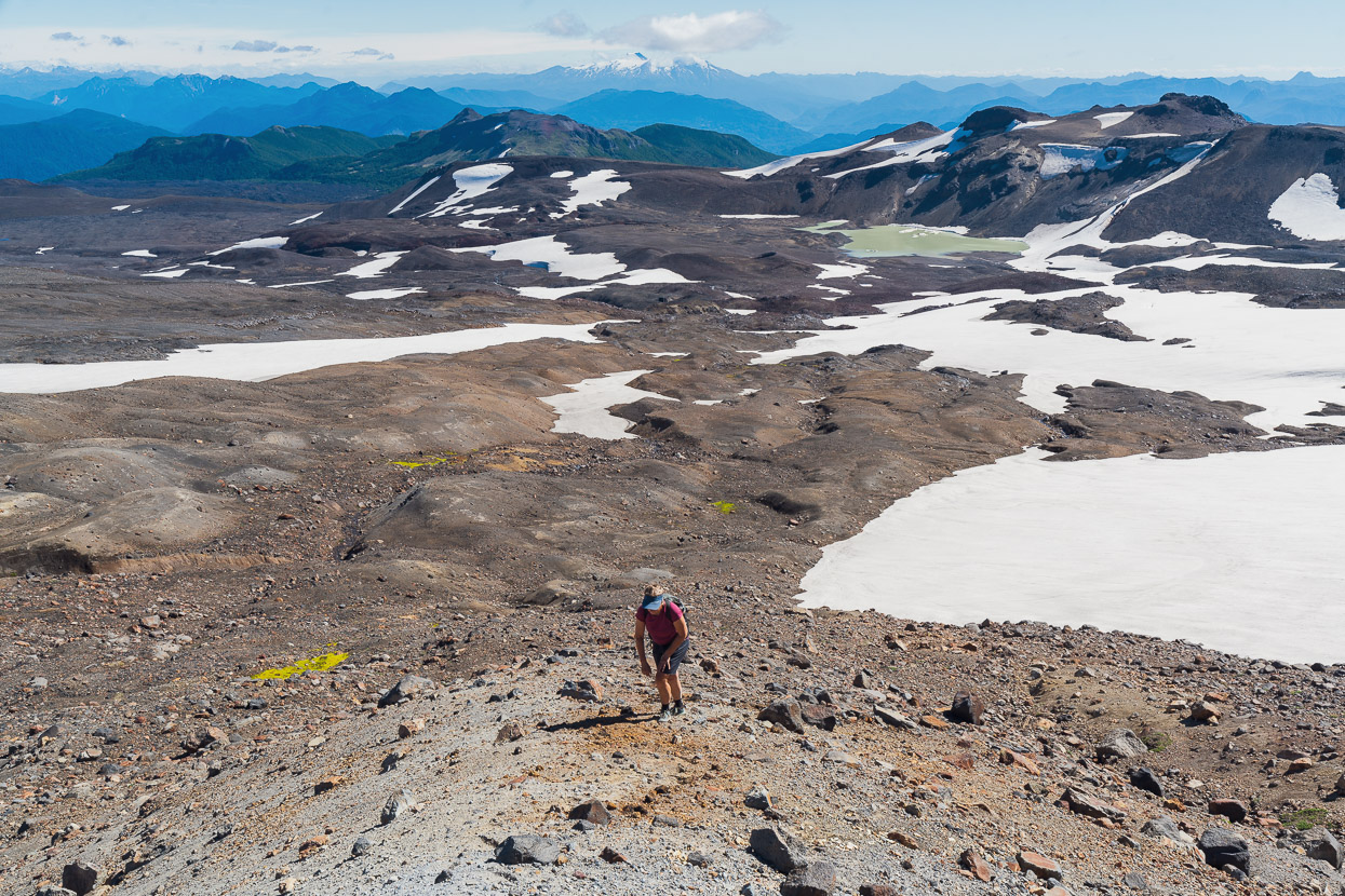
I got up extra early in the morning and walked back up the hill for this view over the lake to Volcan Villarica.
And looking back down to the trees and campsite by the lake edge. Note the big lava flow!
After breakfast on the beach we were back into it.
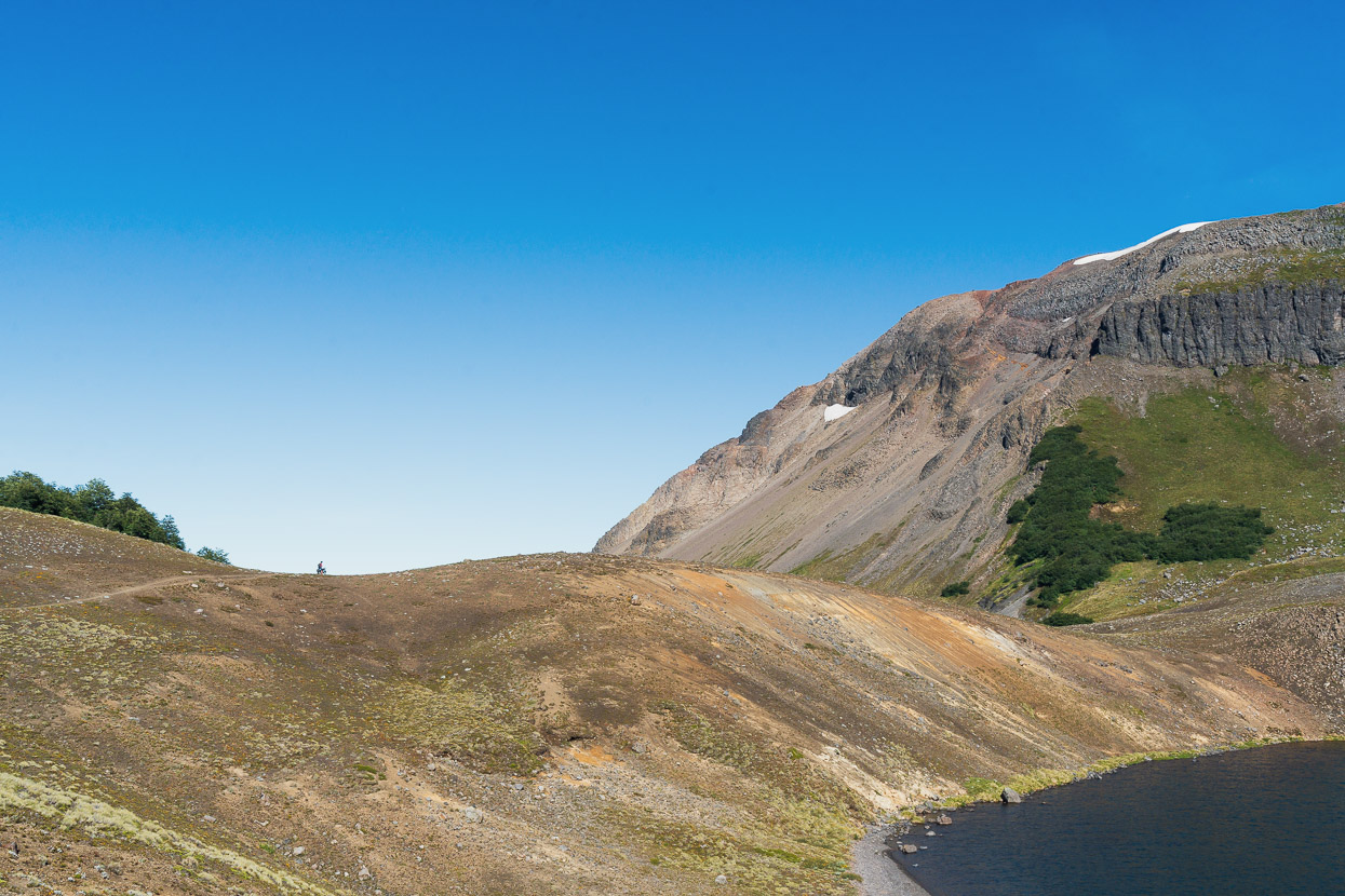
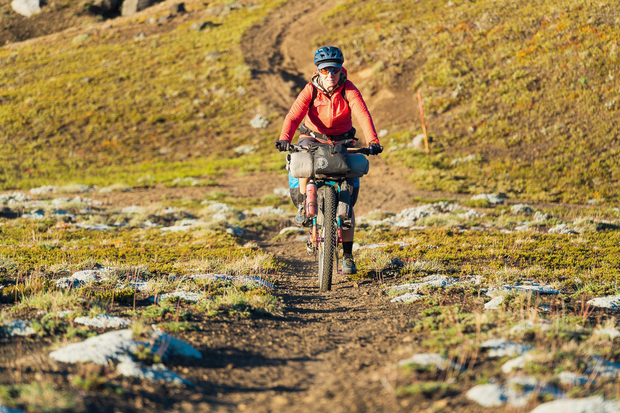
Spot the rider…
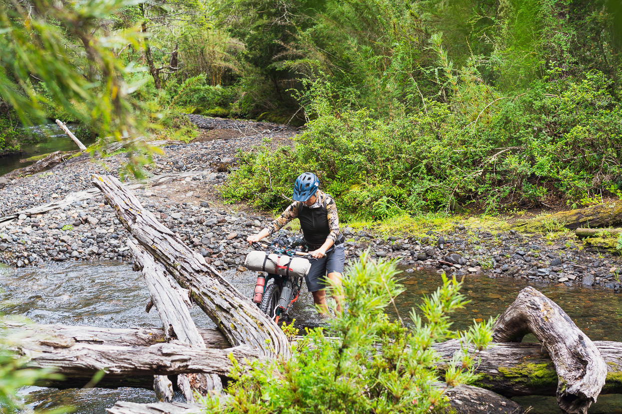
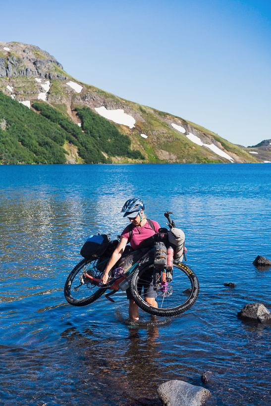
A wade in the lake, a short push, and we were soon on the good singletrack again.
But it didn’t last long, turning into a rock garden and a muddy section.
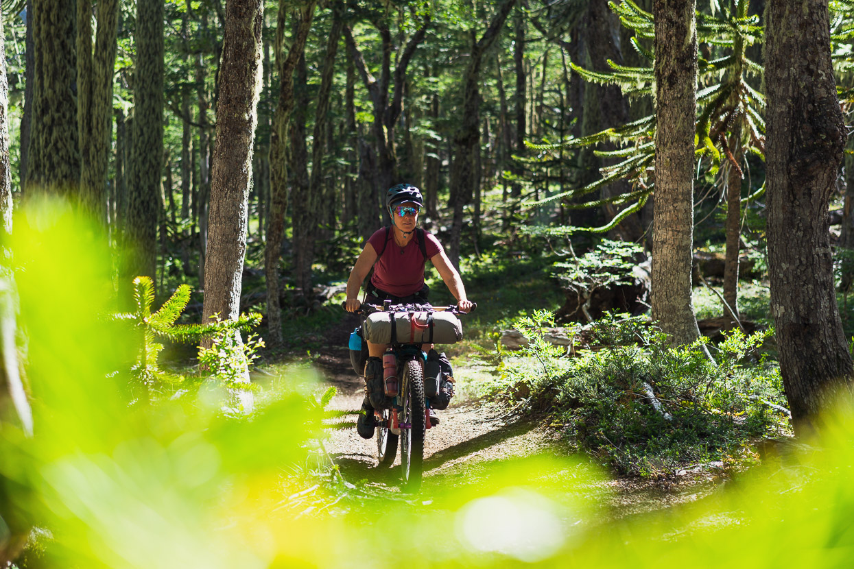
Back below treeline the riding gets really good for a while, but as you descend and undulate along a long ridge there is intermittent treefall (with detours, thanks to motorcyclists) which upsets the flow. It’s a 25km, 1500m descent from the lake to the road, and as it descends it turns from singletrack, to horse trail, 4WD and then gravel road for the final kilometres.
At the highway we got our first phone signal in a couple of days. The next objective was to cross back to Argentina and a quick check told us that Paso Carirriñe had just opened the day before (our other option had been Paso Huahum), but Carirriñe promised to be the quieter of the two, being 4WD-only) and with nice scenery, so we decided to go that way.
We had a welcome afternoon coke and ice cream in Liquiñe but ended up spending so long there dicking around resupplying and trying to buy petrol for the stove (we never did find any) that we ended up having a sit down meal too, which is a rare treat with Chile’s food prices. Sometimes you know you need a decent meal and this was one of those occasions after a very long day the previous day.
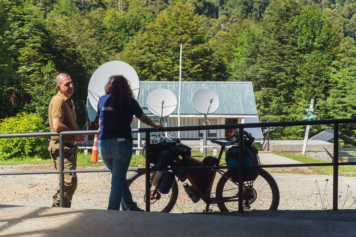
We wild camped on the way to the pass and then crossed early the following morning, to discover that we were the very first people to cross since the pass had closed for the pandemic. Quite an honour. All the staff from the three immigration departments came to check out the two gringo cyclists. There was a bit of pressure when we left as the road goes straight up a very steep 4WD track and they were all watching keenly to see if we’d make it or not.
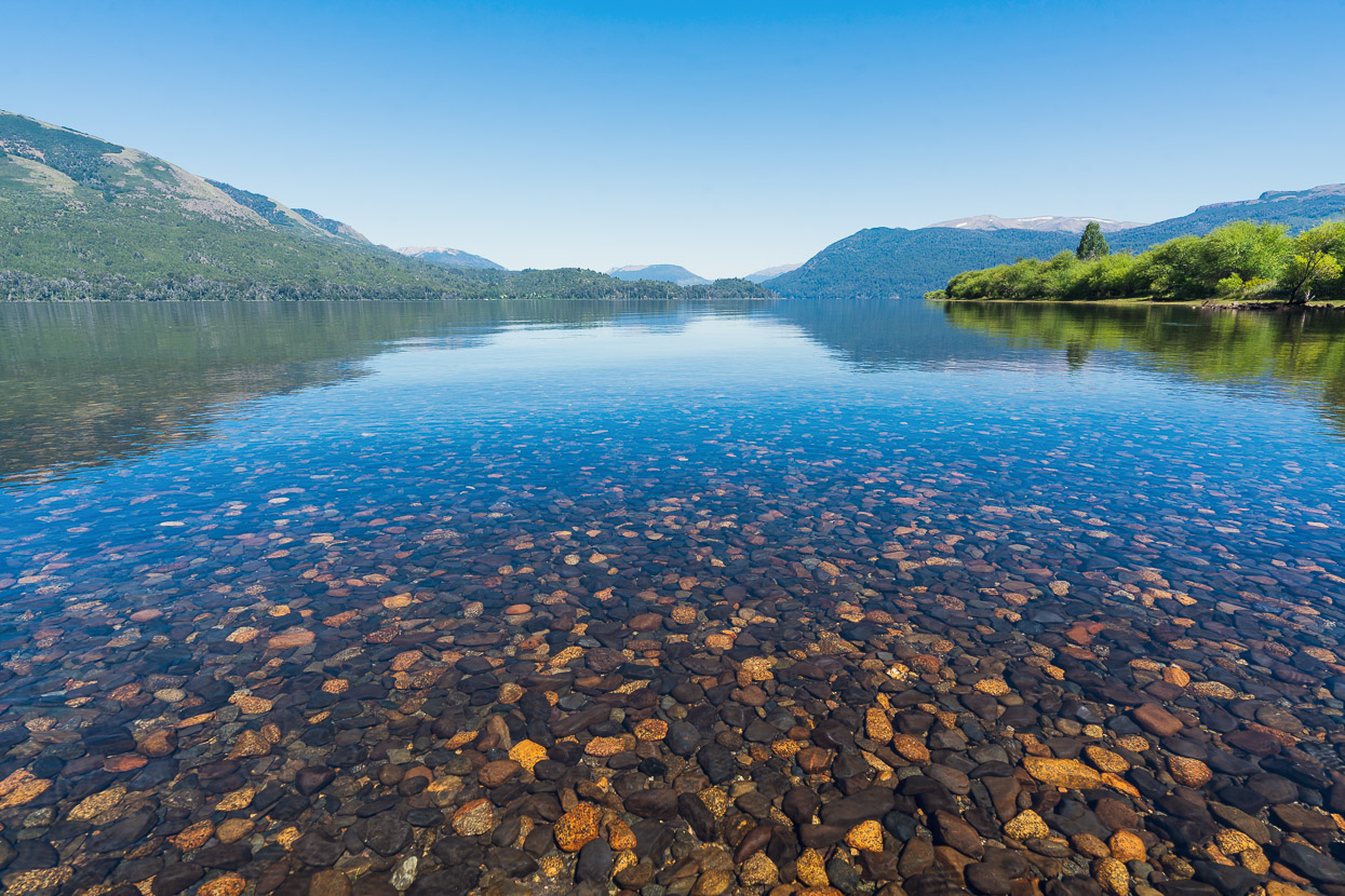
As usual there were a few kilometres of no mans land between border posts. Once we were past the Argentinian post the road stays pretty rough, but as you get closer to Lago Epulafquen it improves, along with a gradual increase in Argentinian holiday traffic that comes in from Junin and San Martin.
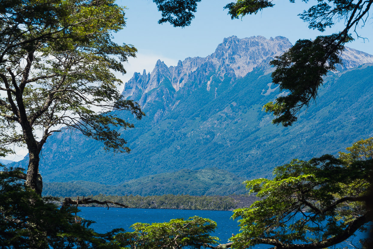
We’re starting to see some of the pointy agujas that Patagonia is famous for.
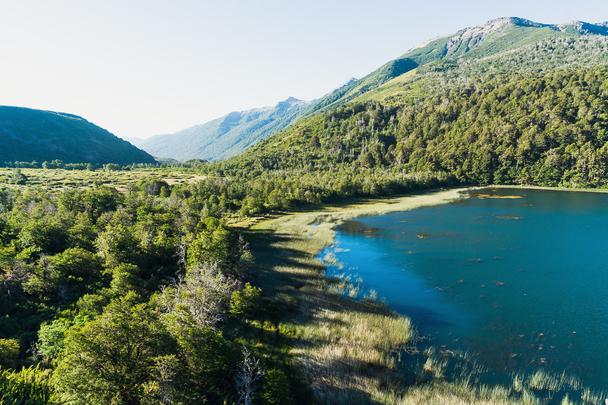
But we haven’t left behind the volcanoes completely yet… this was a huge lava flow that descends into the lake.
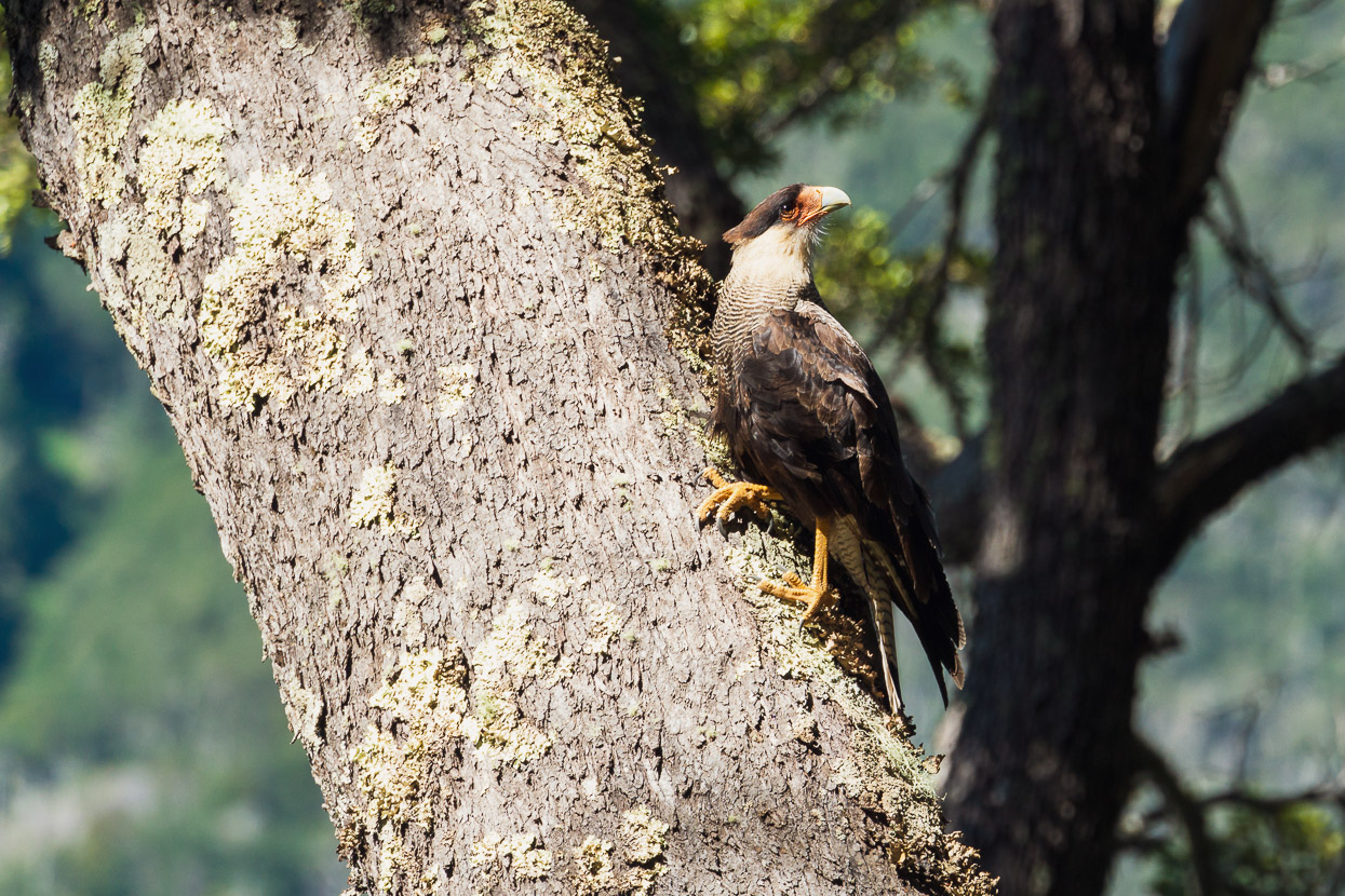
Caracara (a member of the falcon family) are quite a common sight most days.
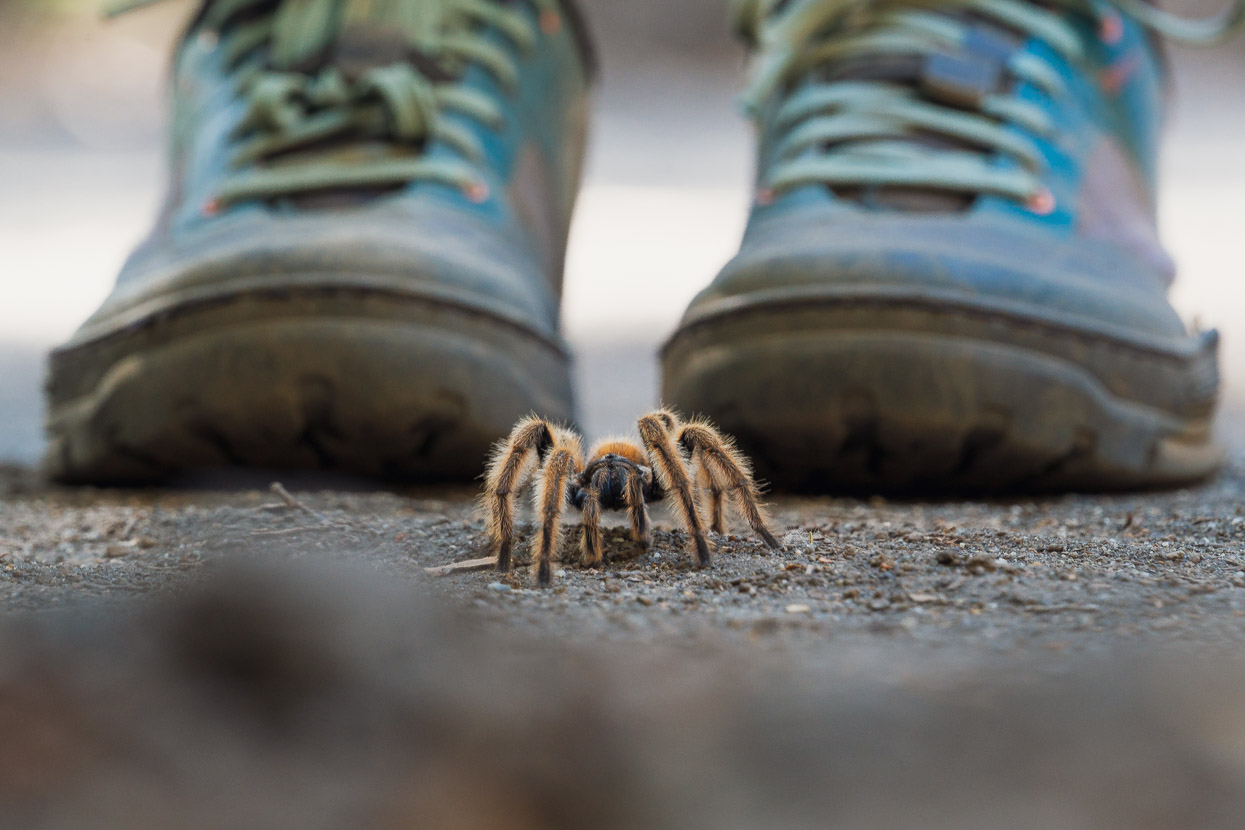
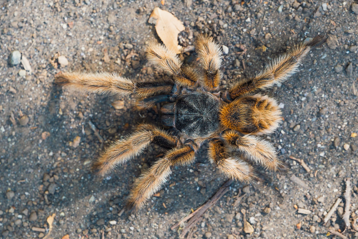
Tarantulas less so! This was a big one, and only the second we’ve seen on this trip. The last time we saw one this size was in Peru.
Paso Carirriñe didn’t disappoint and the scenery was excellent as we headed out towards the Argentinian pampa passing lake after lake. The forest already less lush, smaller and more open than Chile.
A man we’d spoken to the day before had dismissively said of Argentina, once across the border “you have 60 kilometres more of forest and lakes, and then it’s just sand, only sand!” He’s kind of right, but we enjoy the stunning contrast between the two sides of the border.
And sometimes you can just turn your head back towards Chile for a fix of green.
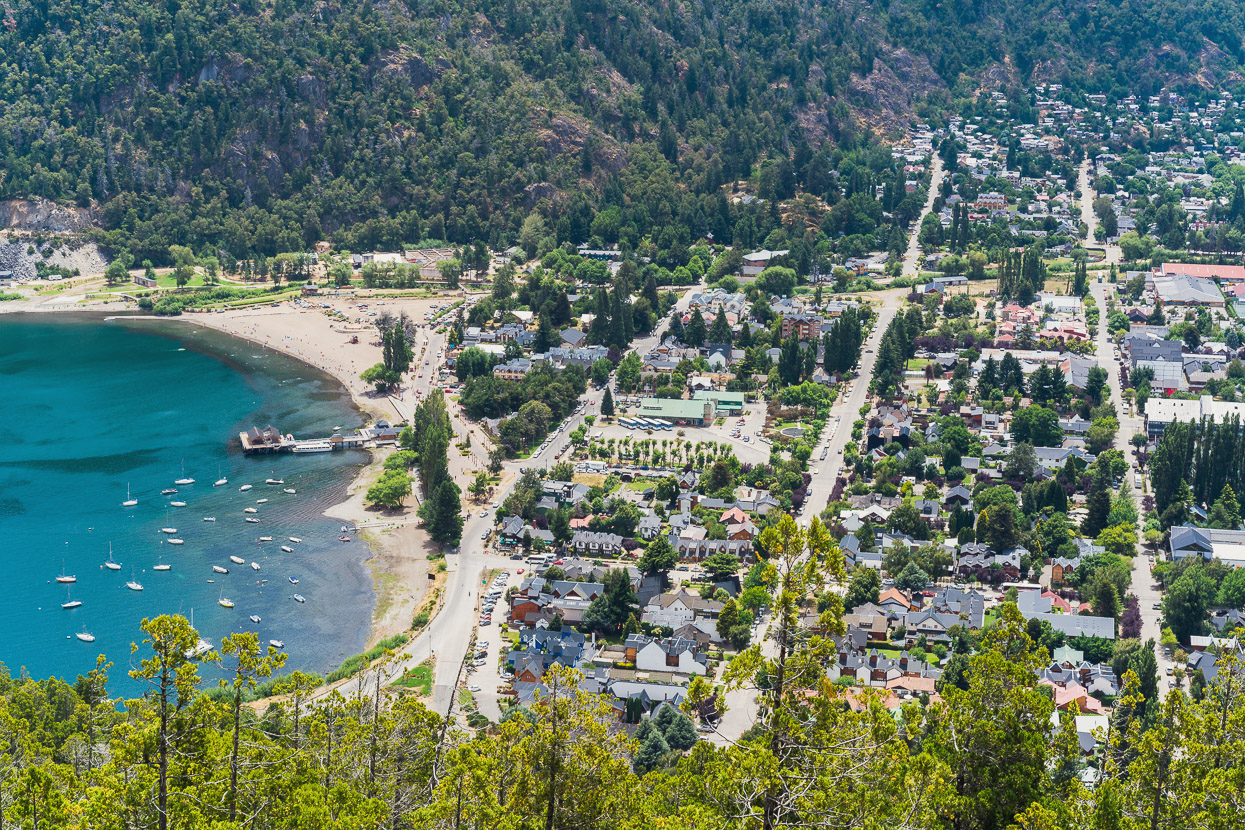
This story ends in San Martin de los Andes, a lakeside tourist town which most trans-Americas cyclists inevitably pass through. It was a place we had been both anticipating and fearing. The Argentina that we have come to love is one of small dusty towns, gauchos on horseback, cheap heladarias (ice cream shops) and decor that takes you back in time. San Martin in peak holiday season is the antithesis of that, with its throb of holiday makers, astronomical accommodation prices and food that’s outside of our long distance dirtbag budget. When you’ve become accustomed to quiet wild camps, small villages and whole days of only seeing a couple of people, places like this can be overwhelming – even though in other circumstances you might enjoy the energy.
We’d optimistically hoped we might find a budget option: needing a rest day and time to service bikes and catch up on blogging, but one night was a budget blowout for us, despite the beer still being cheap. So we bought some expensive chains and tyre sealant and rode on, via Taneli Roininen’s Patagonia Beer Trail to Villa Lago Meliquina, which was much more our style, for three days of rest and catch up.
More soon, thanks for reading.
Say thanks with a one-off donation, or check out our Bikepacking guide.
If you enjoy our content and find it informative or inspirational, you’re welcome to show us some love with a donation or a book purchase (US$19.99). The services we use to create our Bikepacking routes and host the website cost money, funds that we’d rather be spending on the road, creating bikepacking routes and content to share with you. Thanks for reading!


Hi Hanna and Mark.
Another inspiring post of an amazing journey. Congratulations and thanks for sharing.
My wife and me traveled through this área by car from Melipeuco (btw, the town’s name proper) to Junín using mostly dirt roads and crossing the border at paso Mamuil Malal just north. Mind blowing scenery!
Thanks David! That would have been a fantastic drive – I hope you had a good time. The scenery is remarkable indeed – so much like NZ at times, but also so different. We have really enjoyed what we have seen in Chile. Thanks for the Melipeuco correction – corrected now except in the URL.