
Mid December 2022.
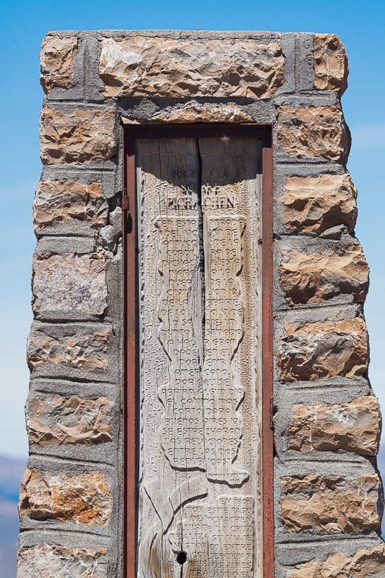
We long ago lost count of the number of times we have crossed the continental divide of South America, but it’s easier to keep track of crossings between Argentina and Chile. This post covers crossing number seven that we have made of the Andes between South America’s southern-most countries: Paso Pichachen (2060m).
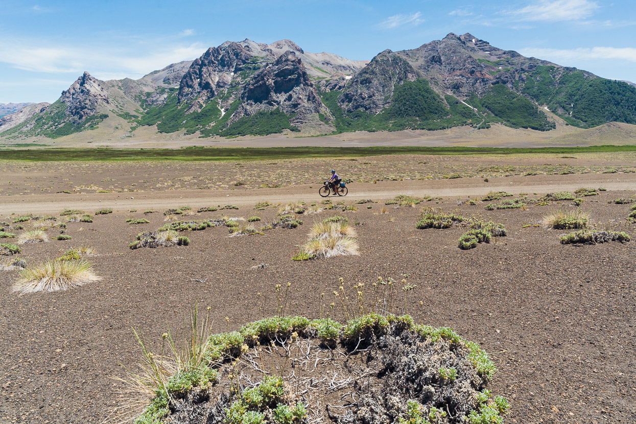
Of all the crossings we’ve made of the border between those two respective countries, this one perhaps best illustrates the extreme transition in climate and vegetation that you experience as you move between the two countries; from the arid Patagonian Steppe of Argentina – in the rain shadow of the Andes – to the moister climate of Chile, influenced by the Pacific Ocean.
Originally we had planned to cross Paso Copahue, which includes singletrack and some hike-a-bike, to reach Chile, but this had still not opened, so Pichachen was the next most suitable option for a nearly traffic free experience and alpine scenery.
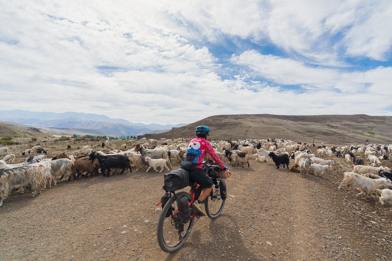
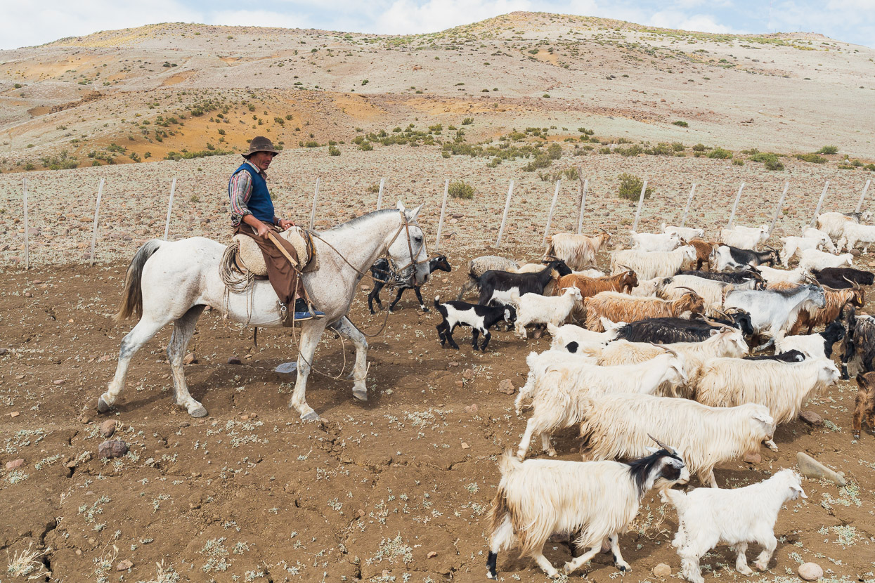
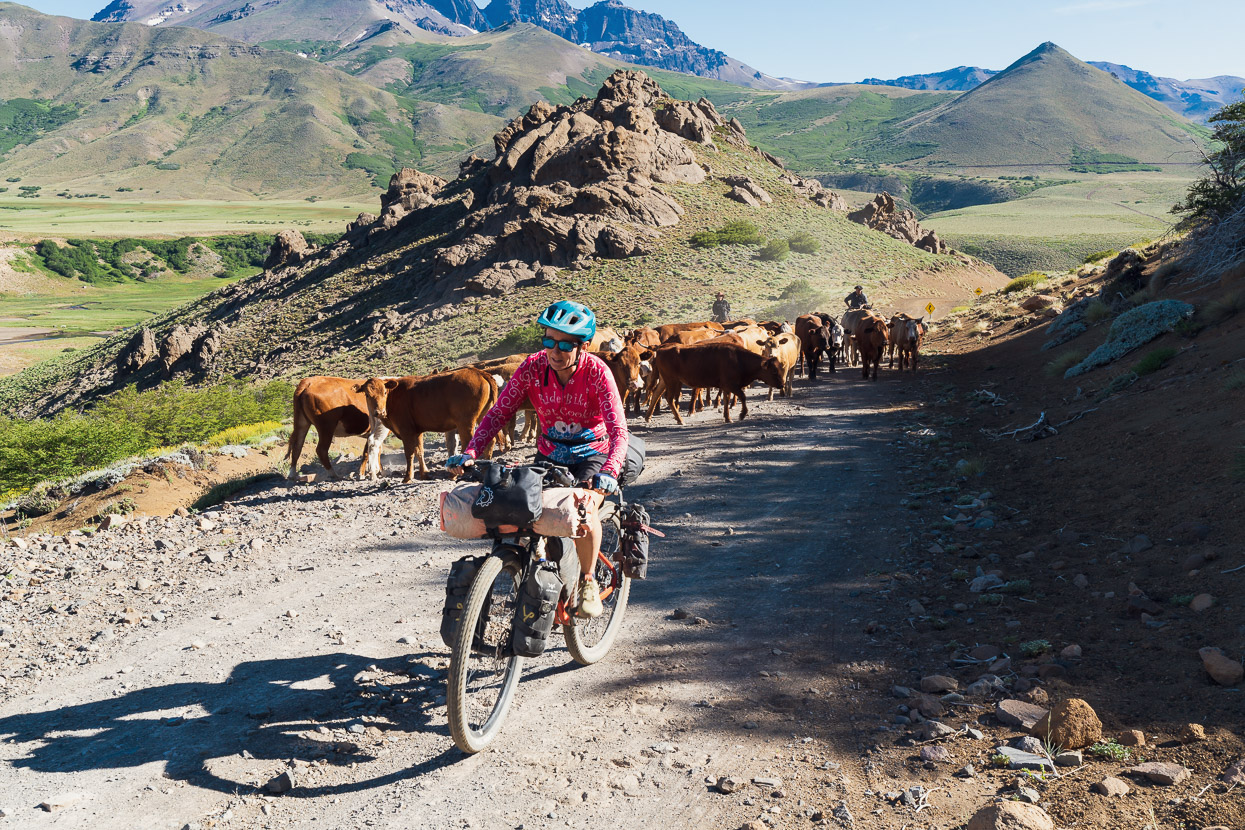
After two days of rest and blogging in Andacollo, we left following very quiet dirt roads through barren hills, passing the settlement of Guañacos on our way to meet the RP6, which gradually climbs towards the border. As per usual for our riding in Argentina the traffic mainly consisted of livestock.
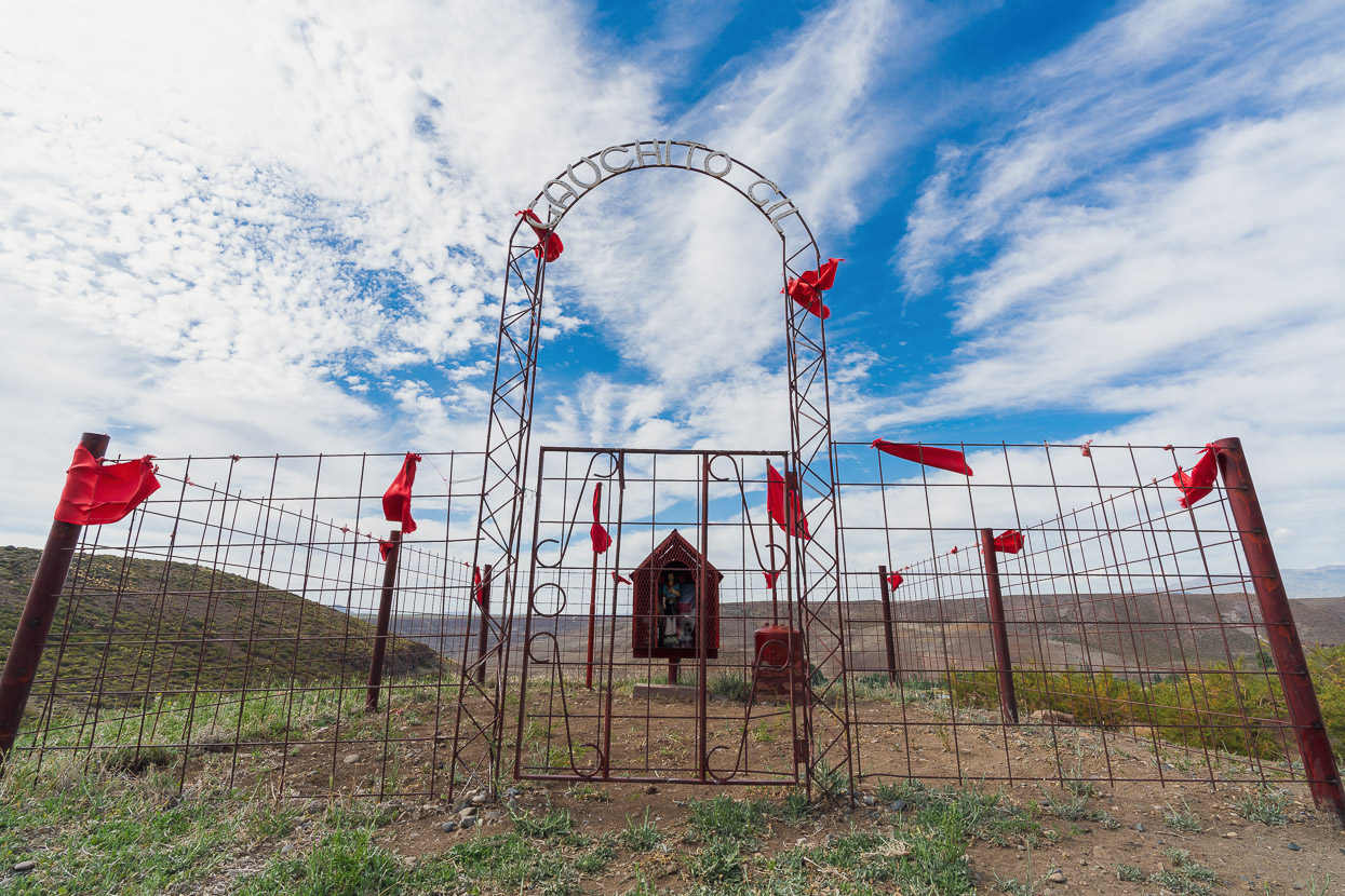
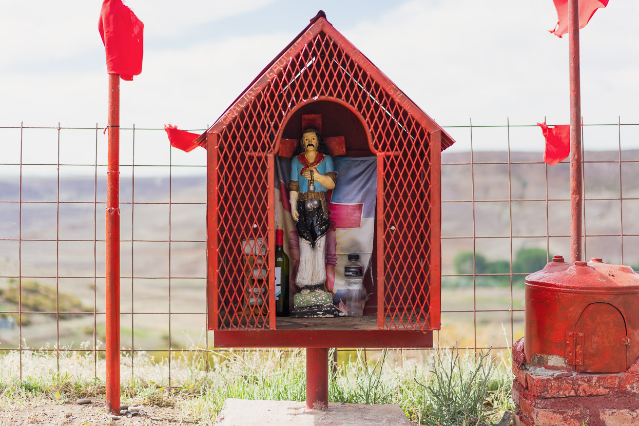
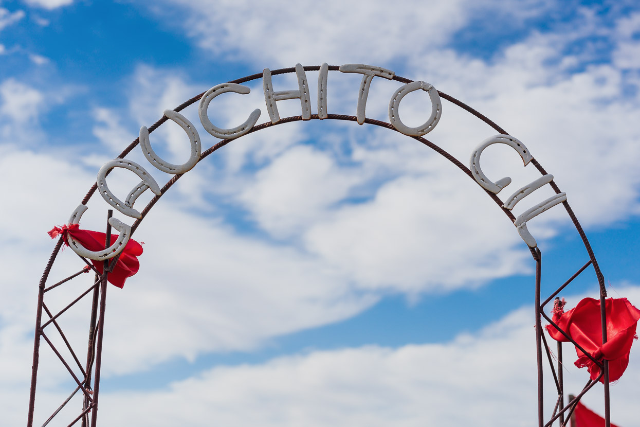
Roadside shrines, dedicated to different saints, are very common and we often spot several in a day – ranging from the most simple to the elaborate or whimsical. This one is to Gauchito Gil – a folk religious saint, popular with gauchos.
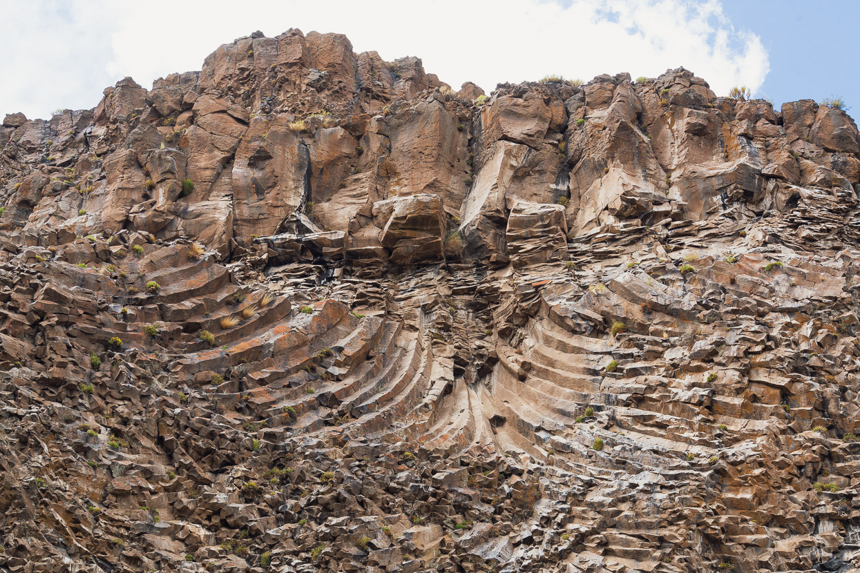
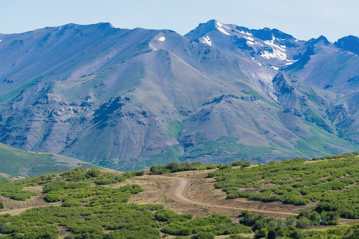
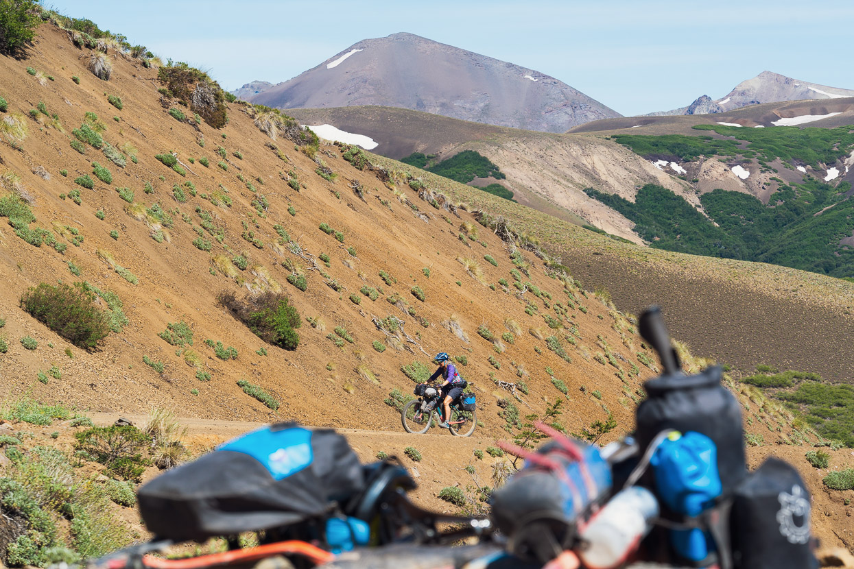
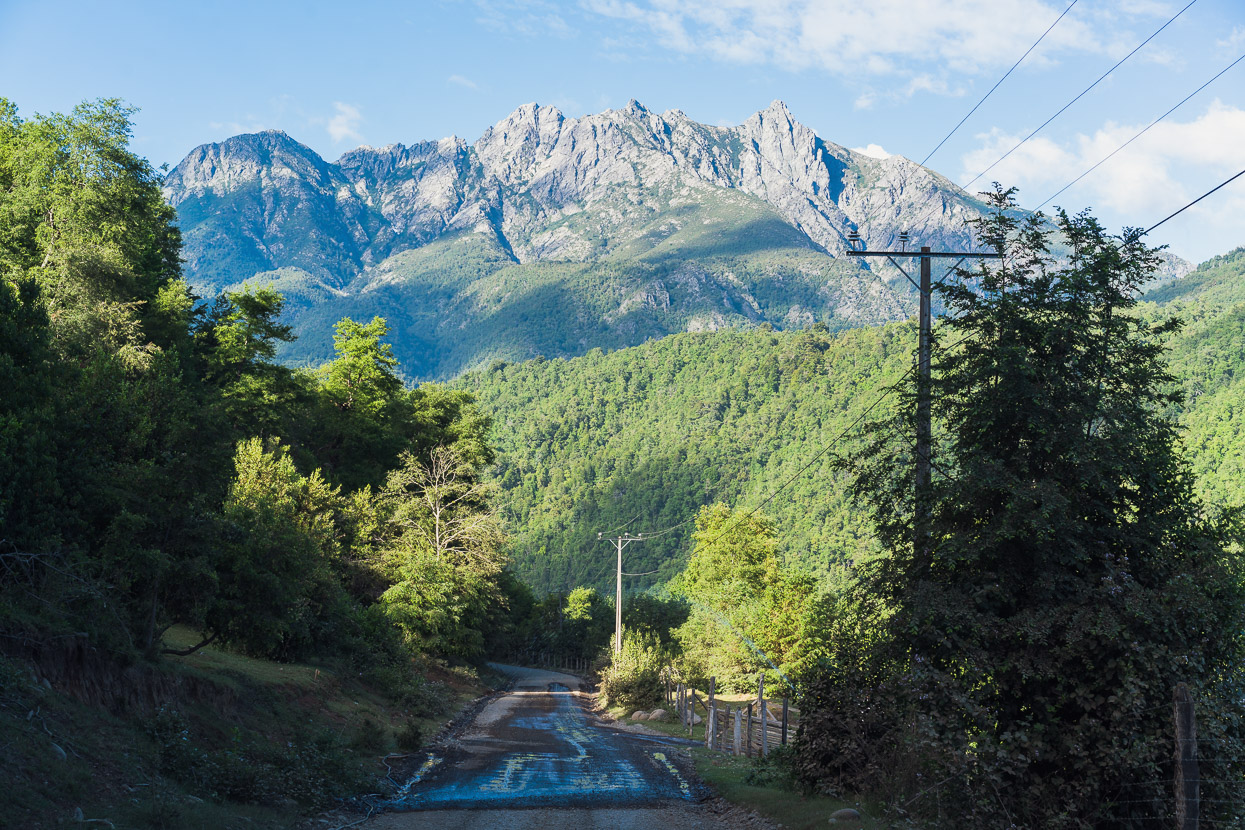
The incredible geology continued, with basalt cliffs forming soaring columns. Once we joined the RP6 (right where this photo was taken), there was occasional tourist and local traffic, but overall it’s a very quiet ripio (gravel) highway. It was perhaps the least interesting section of riding we’ve done, with a corrugated road, a stiff headwind and mostly unremarkable scenery until we got closer to the Argentinian Gendarmería.
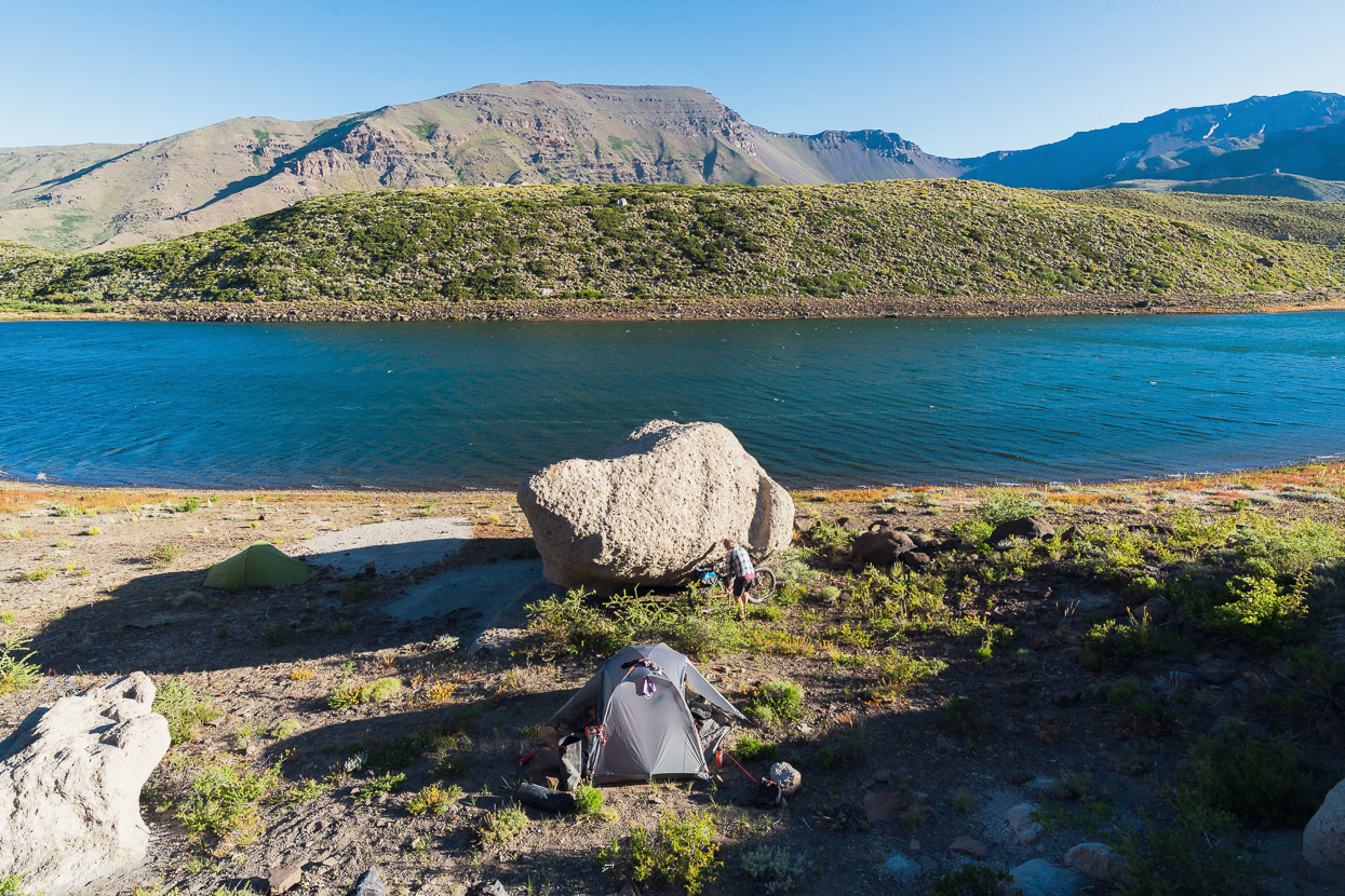
Just two kilometres from the gendarmería we detoured a few hundred metres to the secluded Lago Wolff, which we’d spotted on the map earlier as a potential campsite. Here you can have a flat tent site among the prickly scrub, or one out of the wind, but not both. But it was a really pretty site though and the lake was good for yet another fully clothed swim to wash off the dust. The lake water was ok to drink (treated) too.
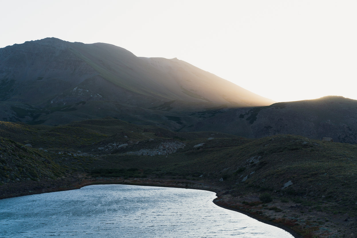
A wander up the small hill behind the lake revealed some nice scenes at sunset, with Cerro Guañaco (2713m) on the horizon.
We didn’t rush to pack up in the morning because remote border posts never open early in this part of the world. All there was to do was roll down the hill, and about 20 minutes later we had our exit stamps, along with the honour of being the first cyclists to cross this border since it opened a few weeks earlier.
From the gendarmeríe we were in no-man’s land for the next ~34km until we reached the Chilean post on the other side of the actual border, along the continental divide.
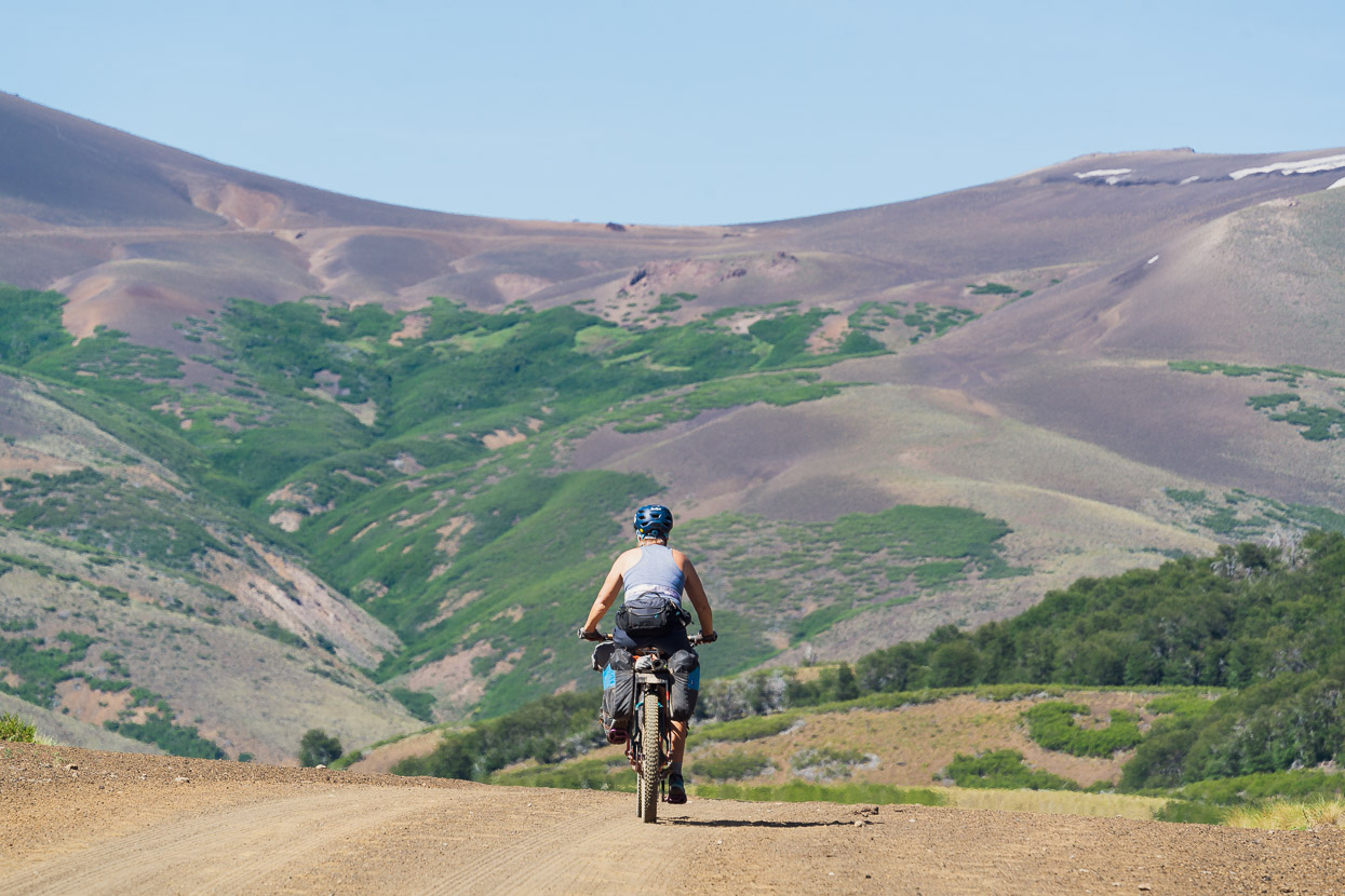
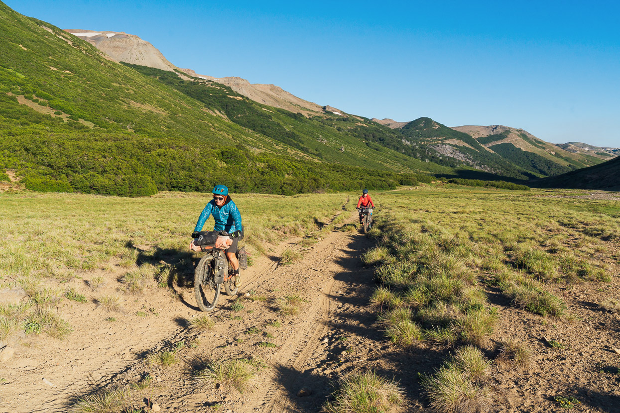
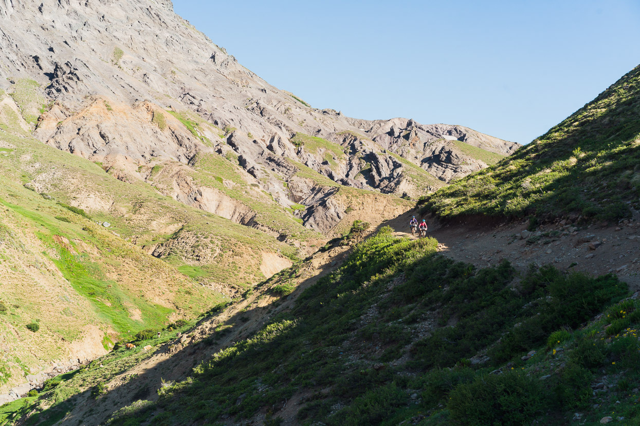
After the Argentinian post the road was generally narrower and less corrugated, and the traffic once again was mostly cows and goats. The scenery got better and better as the valley climbed and narrowed.
Looking back the way we’d come…
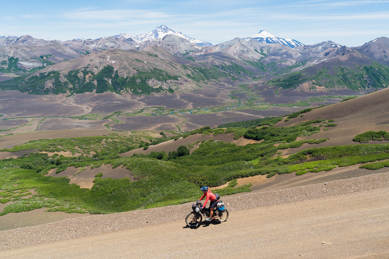
…and up towards Paso Pichachen, at that point around 400 vertical metres above us.
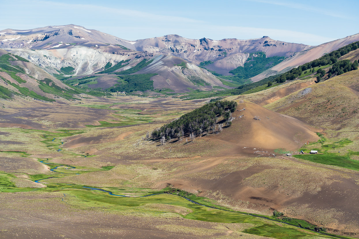
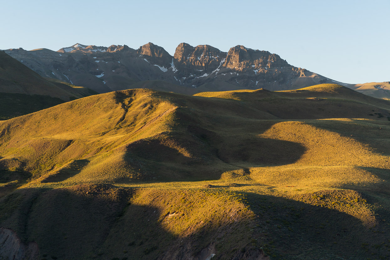
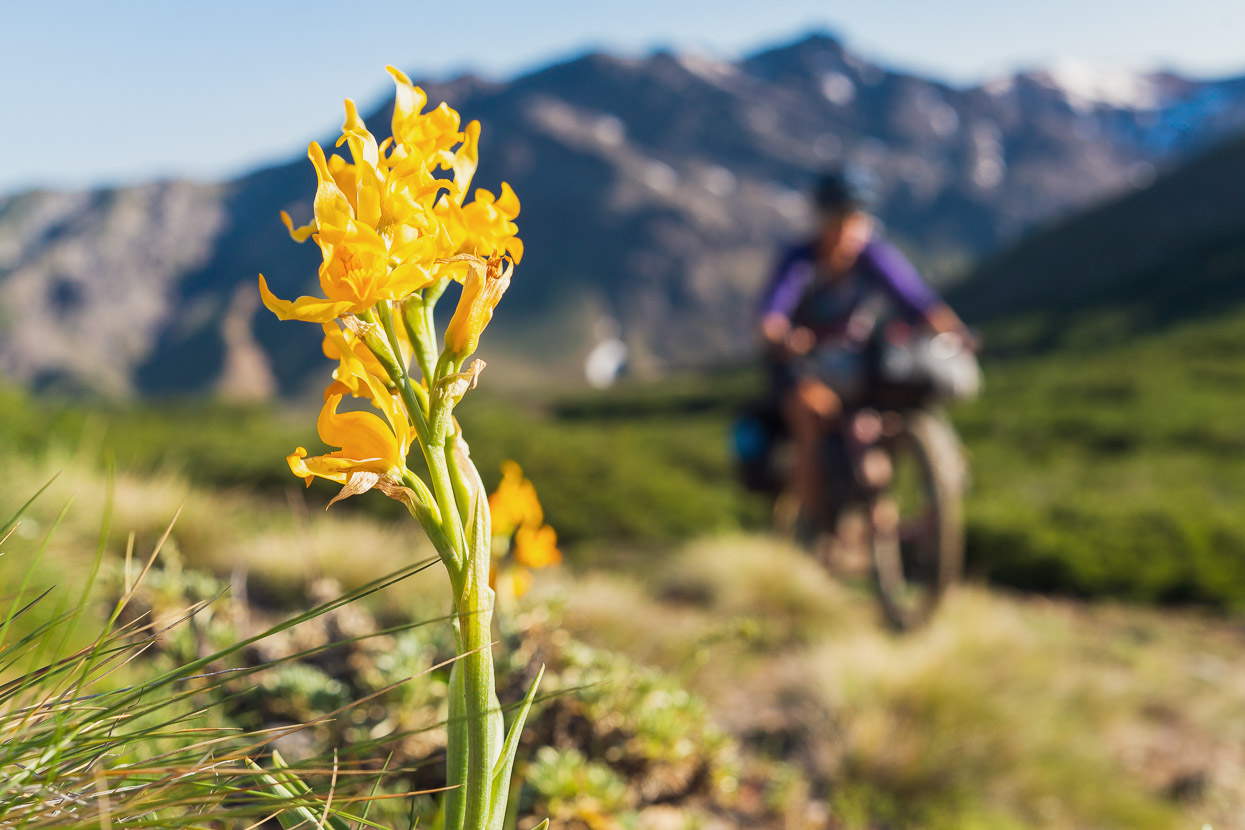
The mountains on the skyline are the continental divide and border. Already the vegetation cover on the landscape was beginning to change – we saw our first araucaria tree (the national tree of Chile), and sporadic low growing beech (known as lenga here) grew on sheltered slopes and gullies. We were quite excited to see trees again!
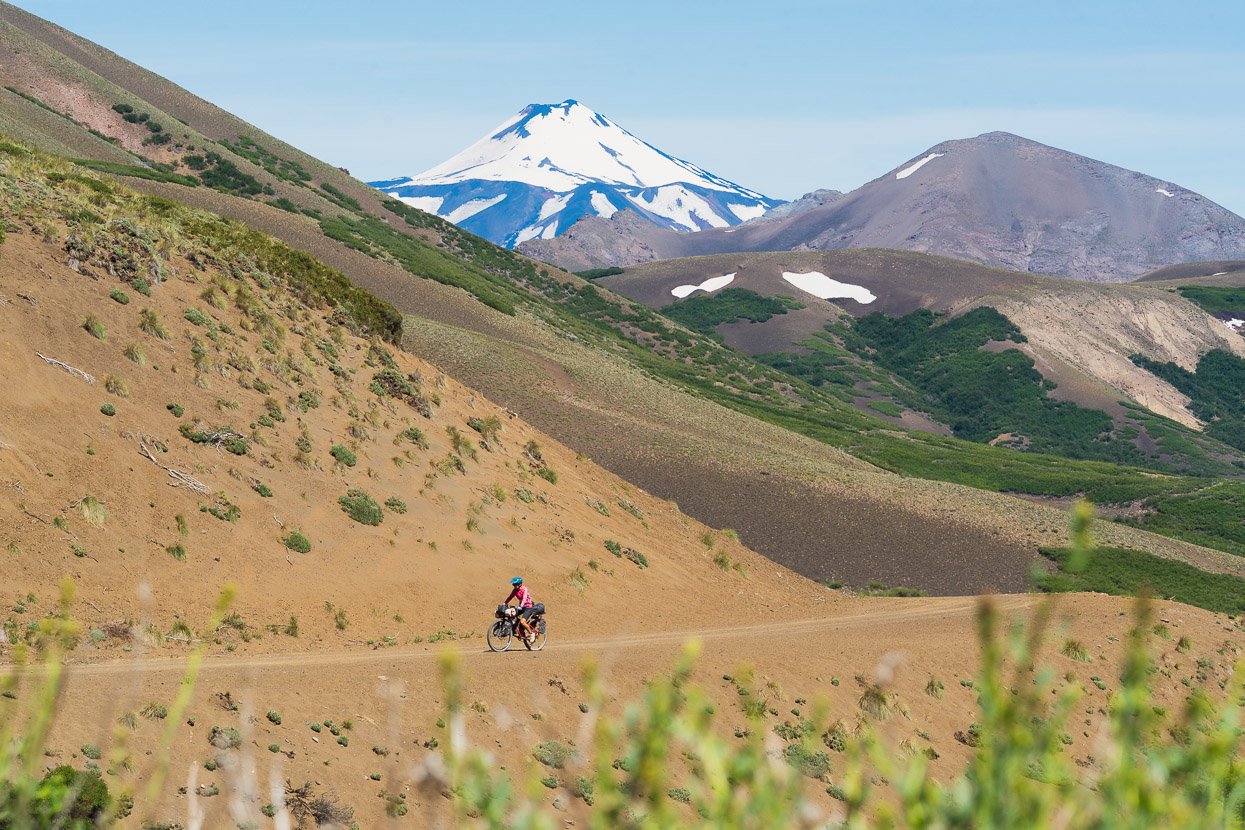
As we gained height, Volcan Antuco (2979m), one of two large volcanoes that lay just over the border became visible.
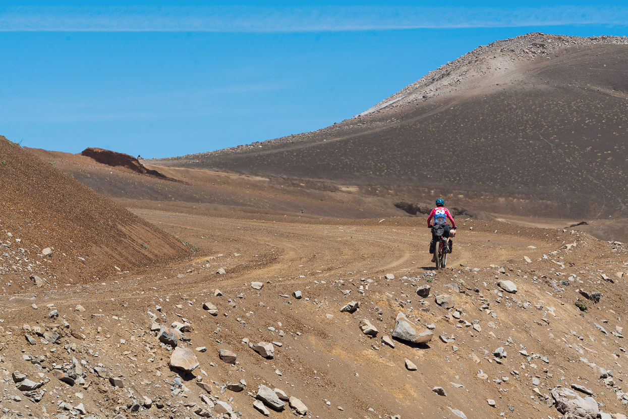
We climbed into a landscape heavily influenced by their eruptions. Either side of the road there was deep volcanic sand and scoria.
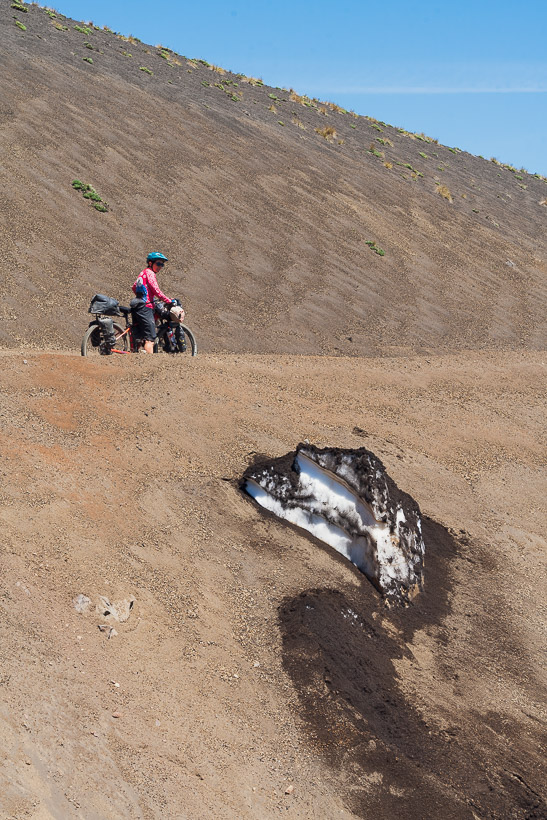
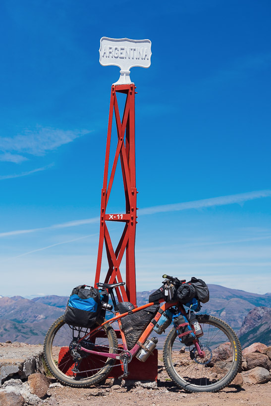
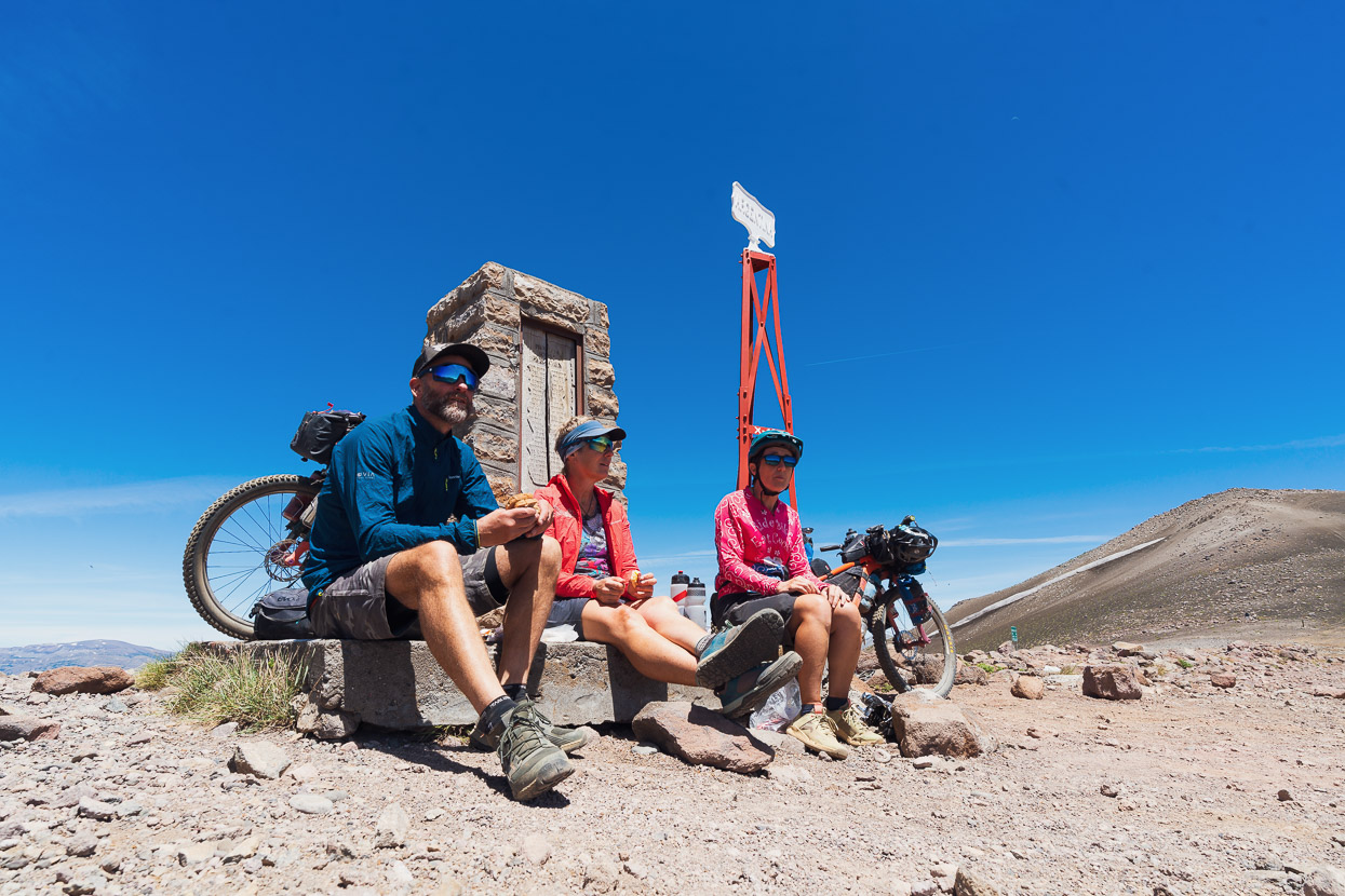
Right on the border at 2065m seemed a perfect spot for lunch, in light winds and sunshine and with a long downhill to look forward to.
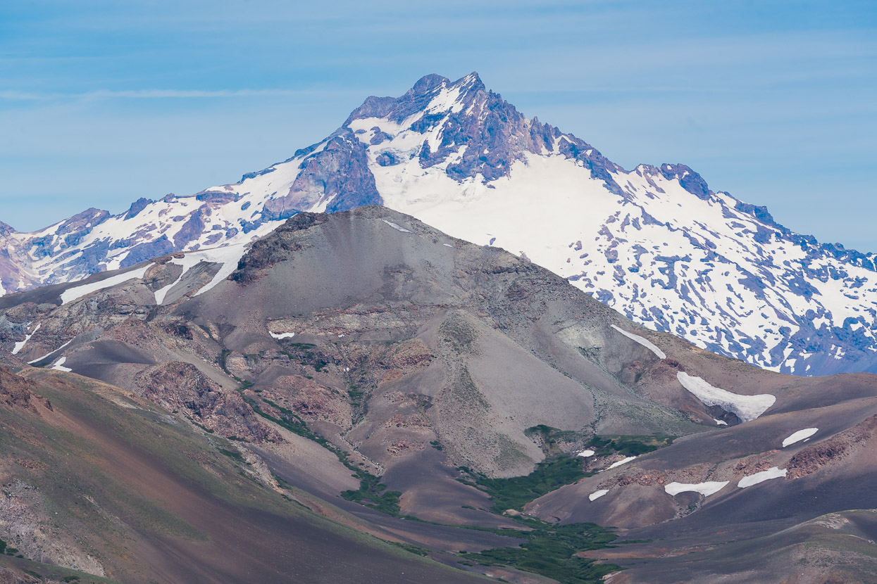
Looking into Chile, the second of the two volcanoes, Sierra Velluda (3585m) cut a starker outline.
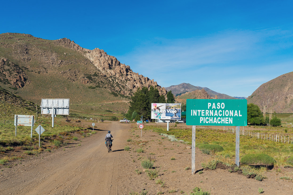
We zoomed off down the sandy road towards the Chilean border post.
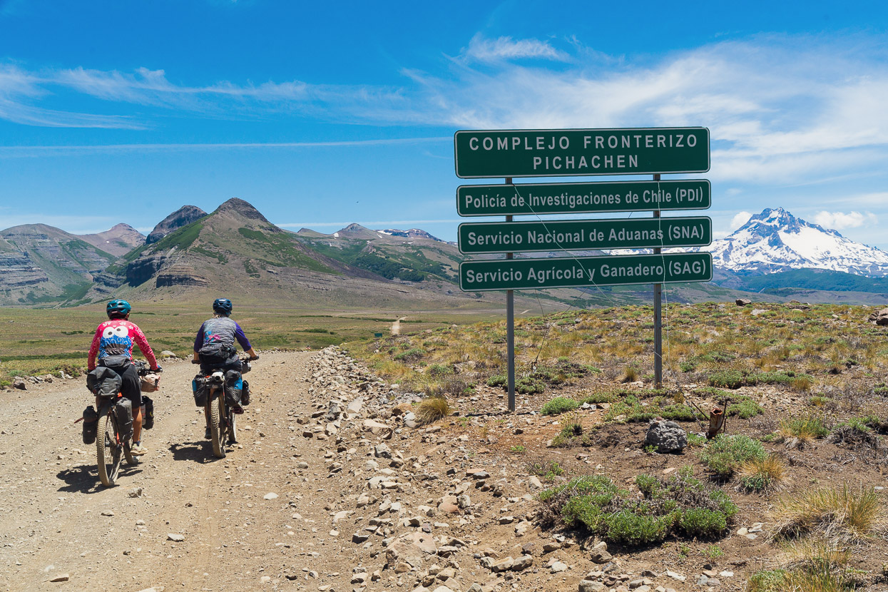
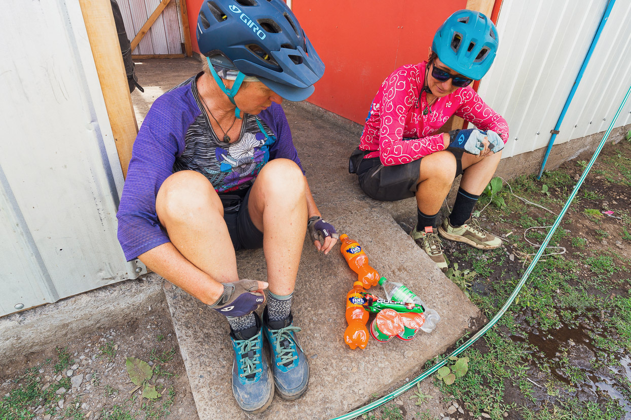
Processing of our entry into Chile took close to a couple of hours, not because it was busy, but because the World Cup final was underway and the staff had the game on the TV. As they admitted, they were far more interested in the match than us, so there was no rush to process us through PDI, aduanas (customs) and biosecurity. Chilean immigration usually register bicycles on entry and require serial numbers and make and model to be recorded. Being the first cyclists to cross for the year compounded the already slow process, because no one seemed to know how to fill out the paperwork. But at least we got to watch Argentina defeat France. We joked that we could hear the Argentines’ cheers on the other side of the Andes.
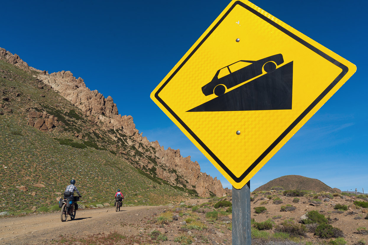
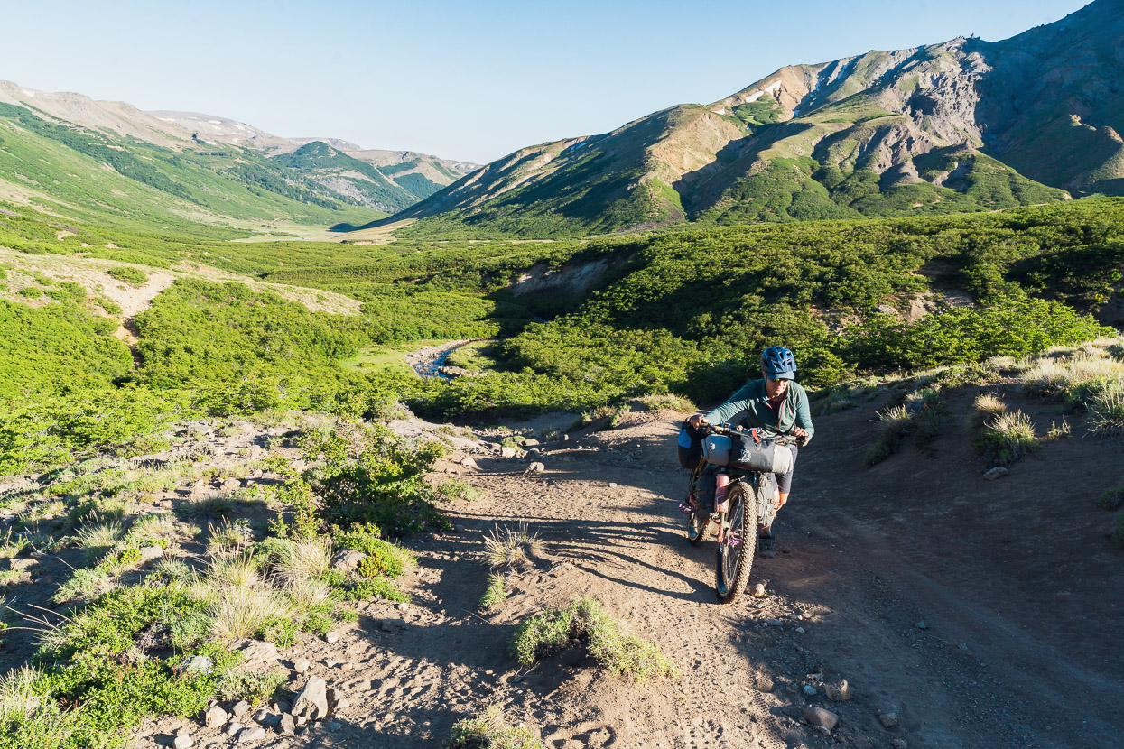
One advantage of crossing Paso Pichachen instead of Copahue, was that it positioned us to ride/hike-a-bike a section of the Greater Patagonia Trail (GPT) which provides a shortcut to reach Trapa Trapa and then Ralco/Alto Bio Bio where the famous Monkey Puzzle Route (our next section) begins. If you don’t take the GPT, a long detour out into less interesting country is required to reach the start of the Monkey Puzzle.
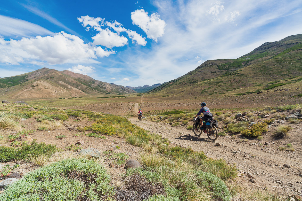
Our Colombian friends, Monteadentro had ridden this way back in 2020, but apart from having their GPX to follow, we didn’t know much about it. So just 2km past the Chilean post we turned left onto the GPT on sandy double track that climbed gently up the Estero de Trapatrapa.
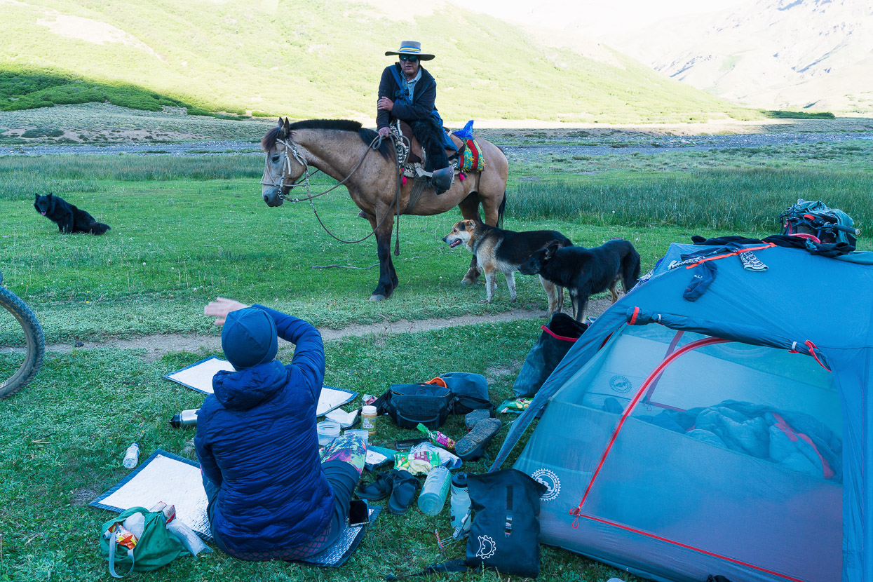
After around 14 or 15 km of peaceful double track, without seeing a soul, we stopped to camp in the late afternoon sun right by the track, alongside some small beech trees. As we cooked dinner a fellow on a horse came into view, trotting towards us and flanked by six dogs. He’d come from Trapa Trapa that day, and was headed to his camp somewhere nearby. We had a brief but entertaining conversation, mostly because he was quite surprised to see three gringos with bikes casually hanging out on the side of the track. His legs were dressed with black sheepskin chaps, essential for the sometimes spiky undergrowth. When we quizzed him about the track ahead he assured us it was ‘bueno bueno‘.
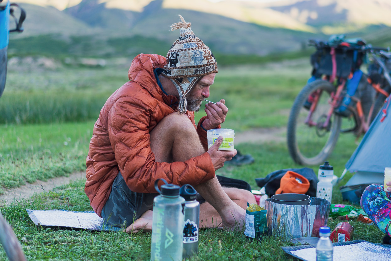
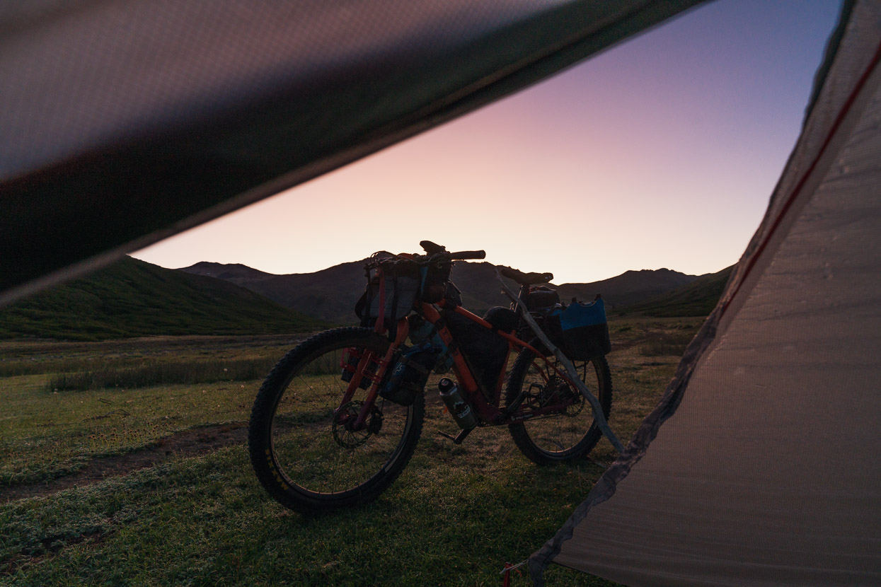
That night a heavy dew had already settled before we went to bed, for the first time on this journey from Mendoza. At dawn it was -1C and we woke to a crisp frost on the tents and bikes. We’d become used to generally quite warm nights, except at the highest camps, and very dry air, but just a stone’s throw from the divide the climate was already very different.
We left camp with warm gloves and quite a lot of clothing on, but the day soon began to warm.
Especially with the effort of riding and pushing up the now steepening track as we climbed towards a saddle.
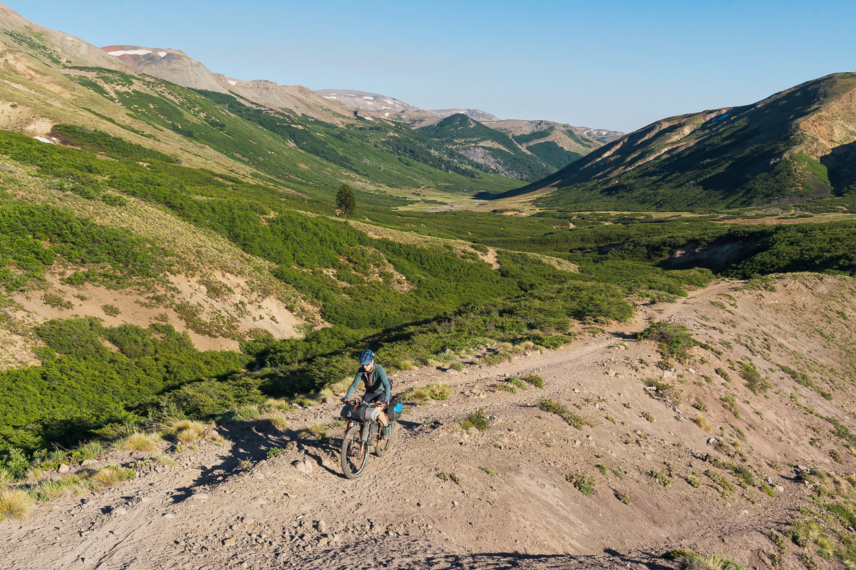
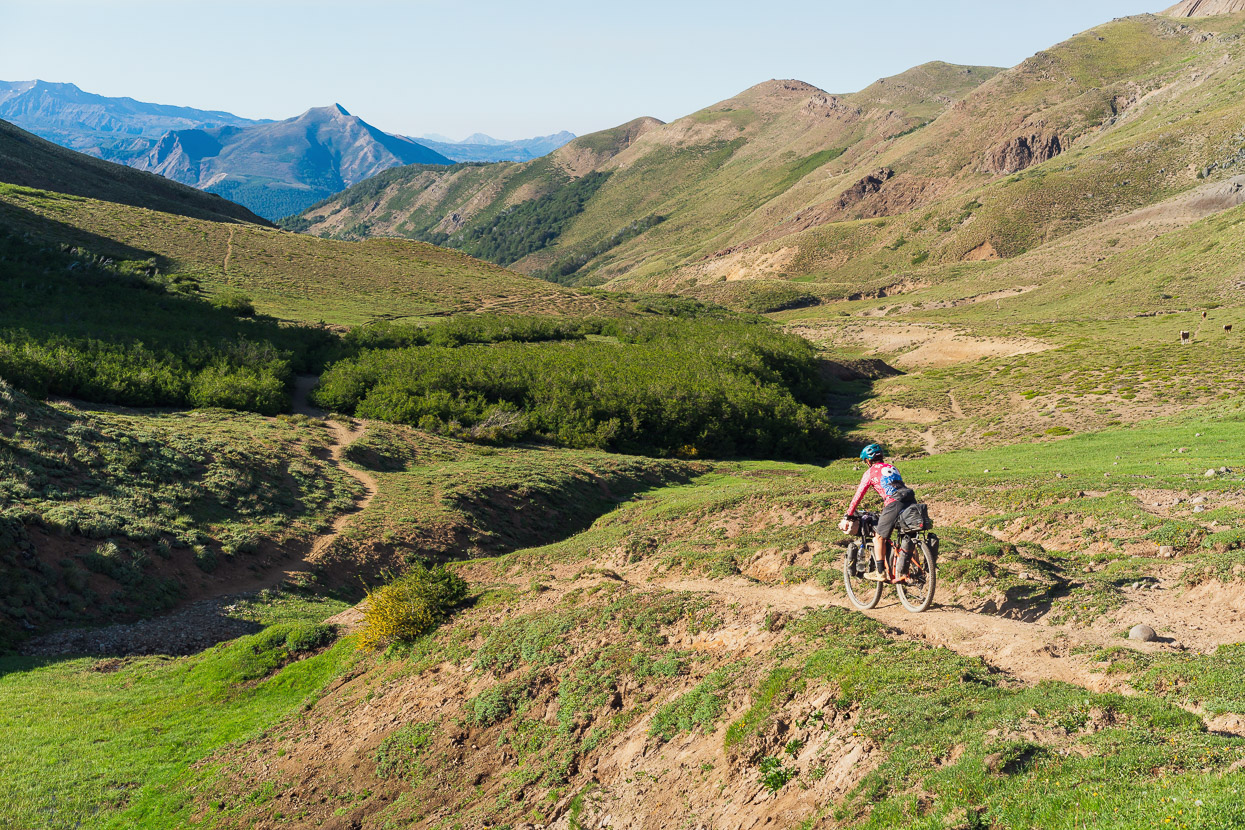
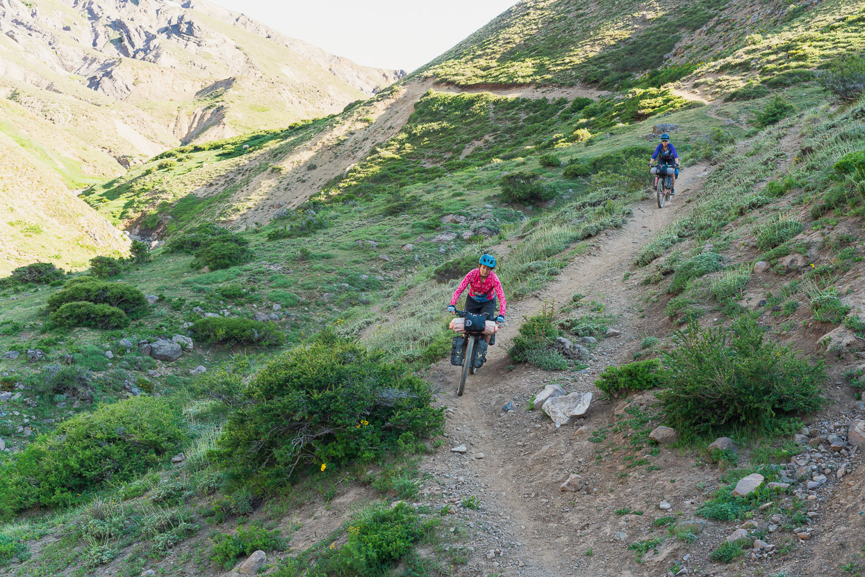
We crossed the saddle, still on mostly non-technical double and single track and then dropped on singletrack down the other side towards the treeline. It was fantastic riding.
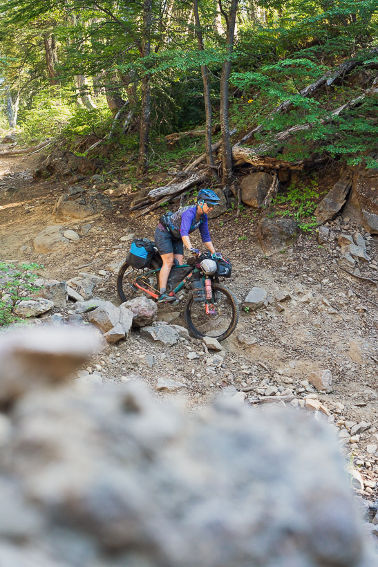
Some deep washouts interrupted the riding after a short while, but they were easy enough to push into and out of.
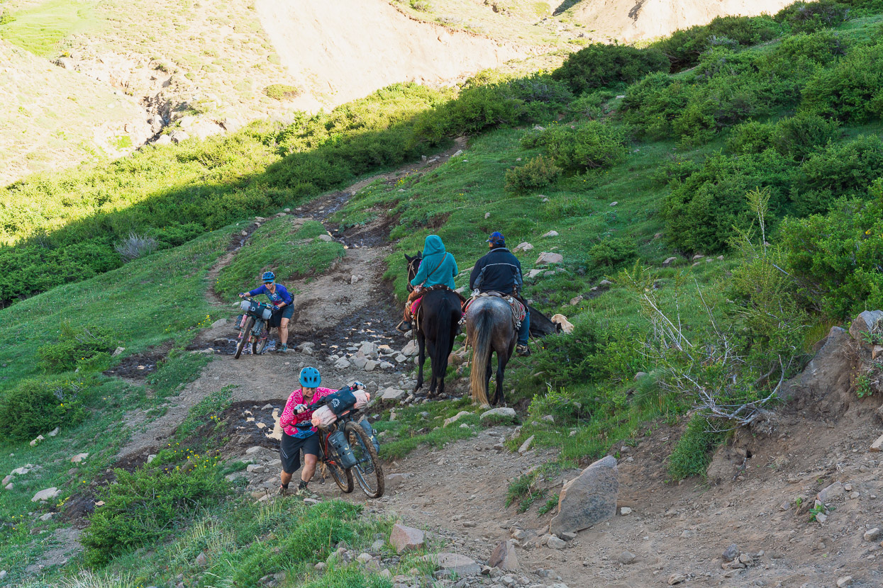
On one rough section we encountered a couple of Mapuche (local indigenous) people on horseback and they cautioned us to be careful further on with a ‘con cuidado’.
Between brief bouts of pushing out of washouts, the riding was superb.
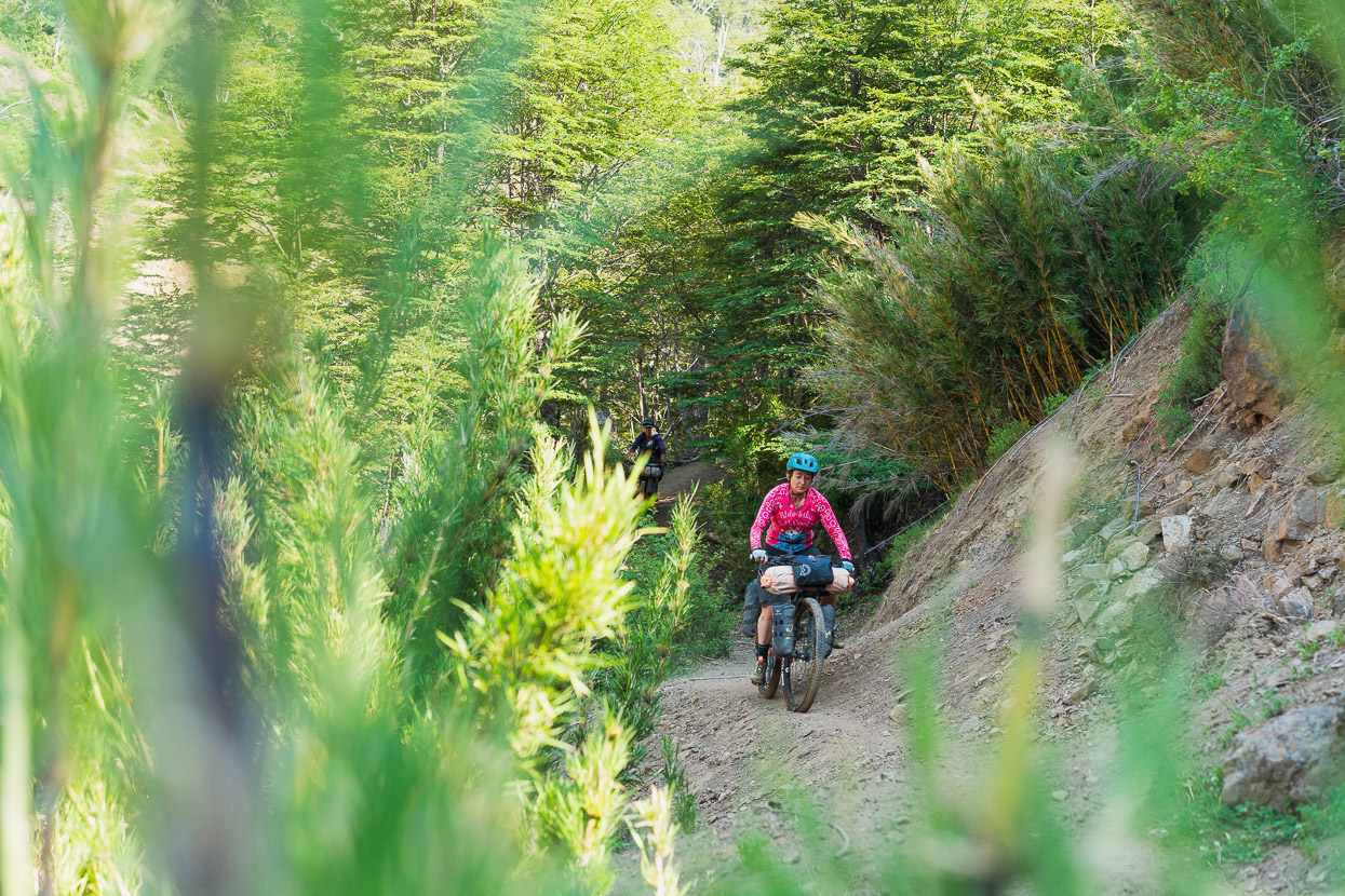
With the beech forest and steep terrain, we could just about have been in New Zealand, except for the exotic touch of a bamboo understory.
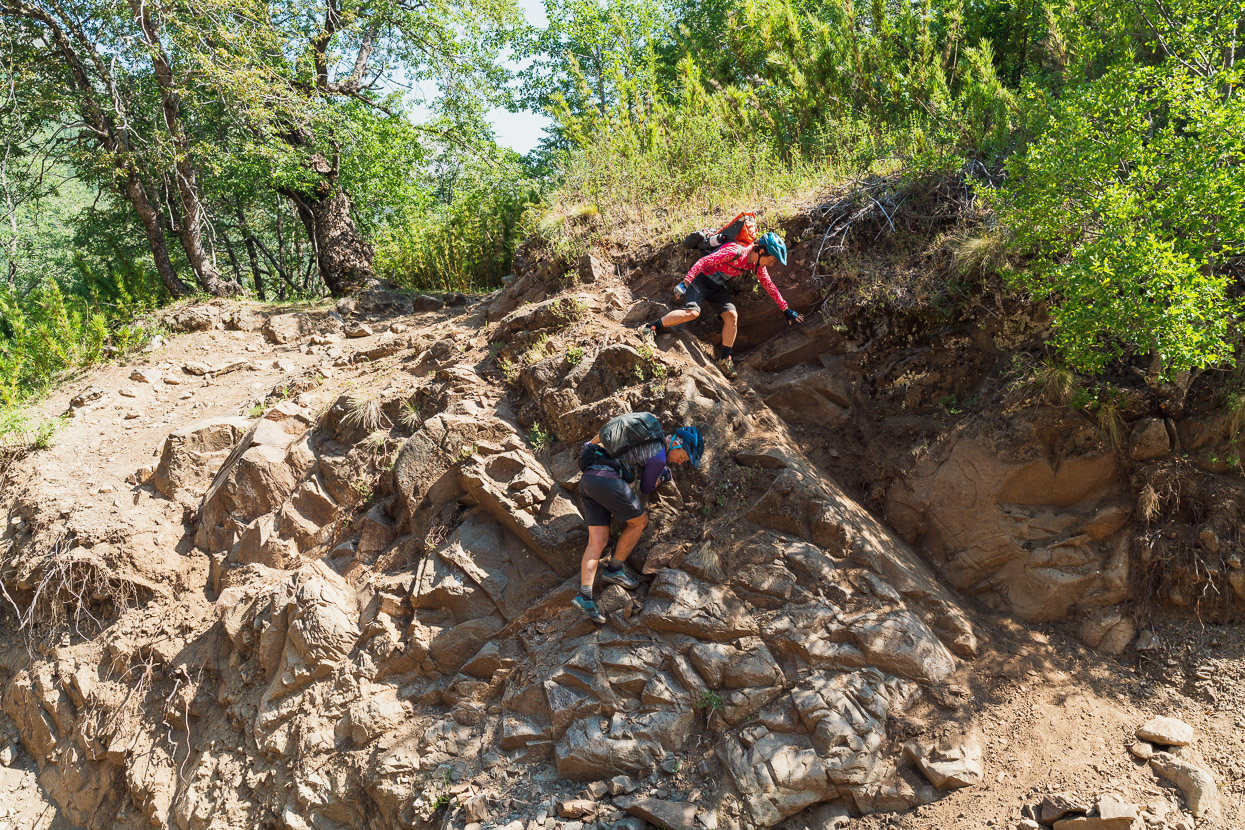
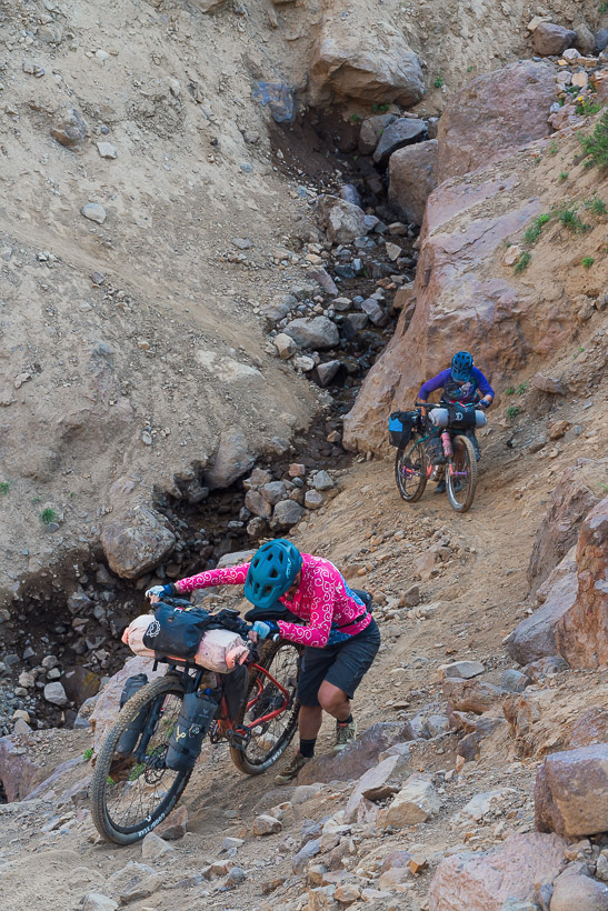
Eventually we dropped into a bouldery riverbed, which was slower going but it didn’t last more than about 500m. When we began sidling again we reached a couple of deeper washouts. This one required care and teamwork to get the three bikes down the cliff. Fortunately the exit was easier.
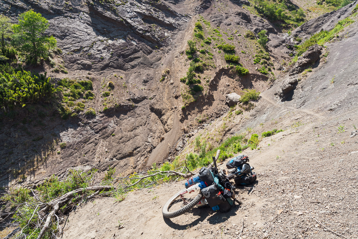
This one was longer and more serious, with loose shaley gravel and an exposed bluff to sidle above on loose soil. In the end I crossed above the bluff first and then cut in below it so Hana could lower the bikes down to me, which we had pushed across the slip together. This was less risky than carrying bikes over the top of the bluff, which looked like it might collapse with enough weight. We had to ferry luggage too, which added exposure and increased the risk of rocks falling on us. Not a great place to be with a bike and best avoided! This view is looking back at it after we’d all traversed across.
A little further on we spied a smaller track descending steeply from the main track which musty be how the locals are bypassing this slip. It was clear it hasn’t been crossed by horse for a long time.
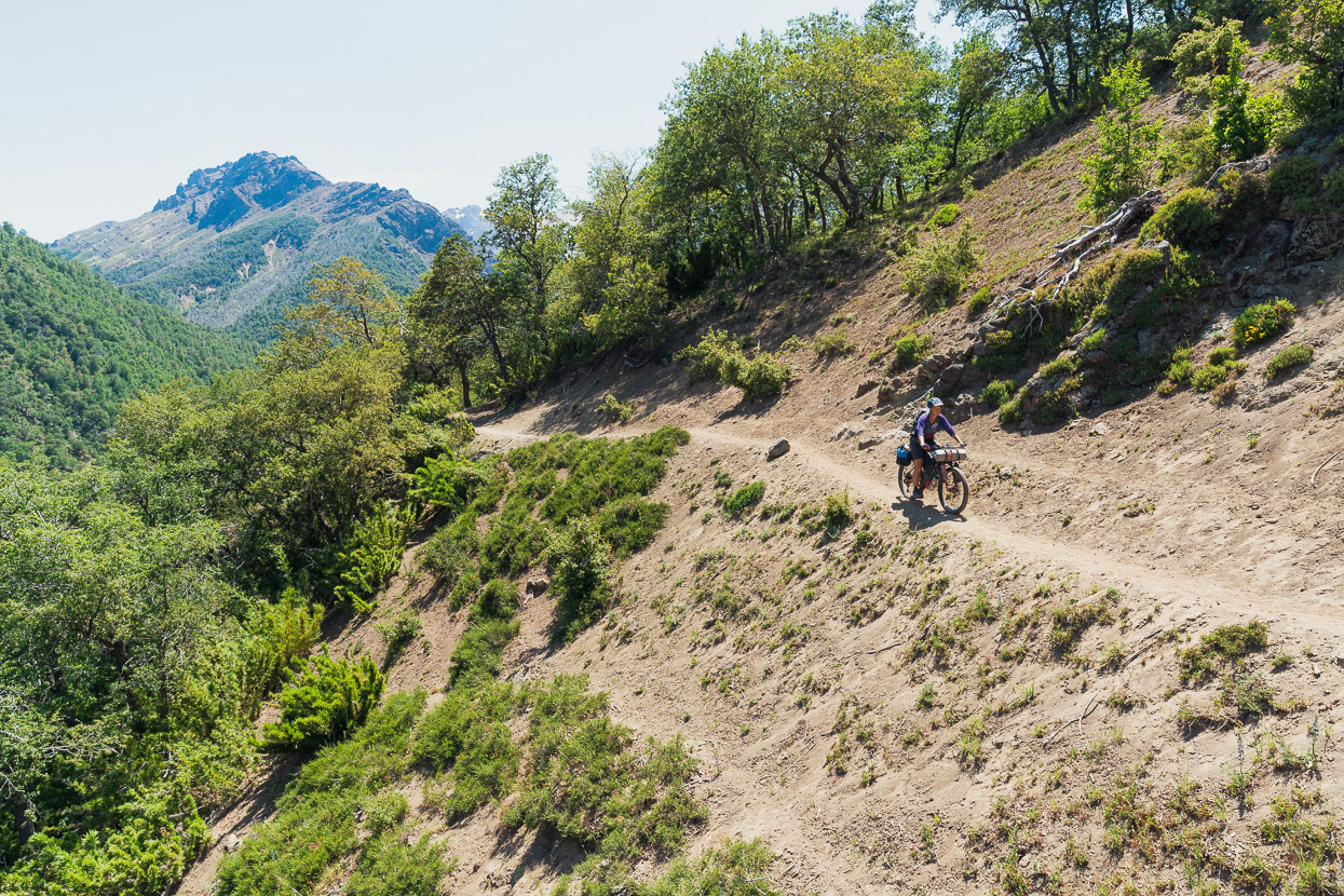
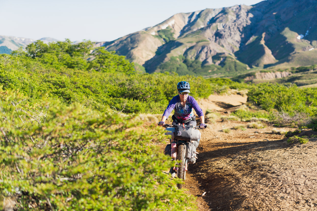
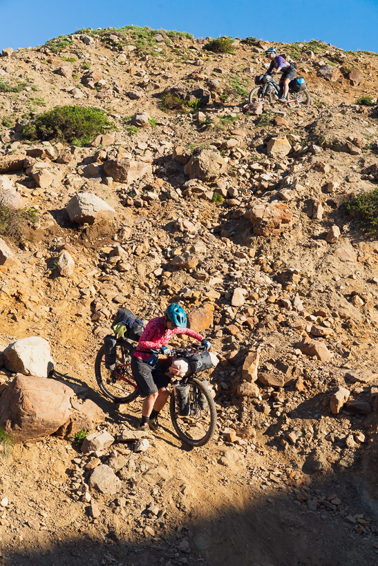
But very soon we were back to great riding again until we reached the mirador point that’s marked on OSM. From there the track descends more steeply to the final easy track into Trapa Trapa. That steep section becomes rockier lower down, requiring short sections of walking once again.
The first thing we did in Trapa Trapa, which is Mapuche community, was stop at a small irrigation ditch and wash handfuls of sand out of our shoes. Then we searched for the small store that we had heard was somewhere in the spread out village. Half a kilometre down the road we spotted a vague sign, that didn’t really point anywhere specific, but we rode up a side track anyway and found it. There was little on offer in the shop but sugar and salt, but that suited us just fine and gave us the energy for the following hilly kilometres as we rode down the long Rio Queco valley towards Ralco. This was a consistently scenic and interesting ride, with lots of small Mapuche settlements along the way that reminded us of rural southern Mexico.
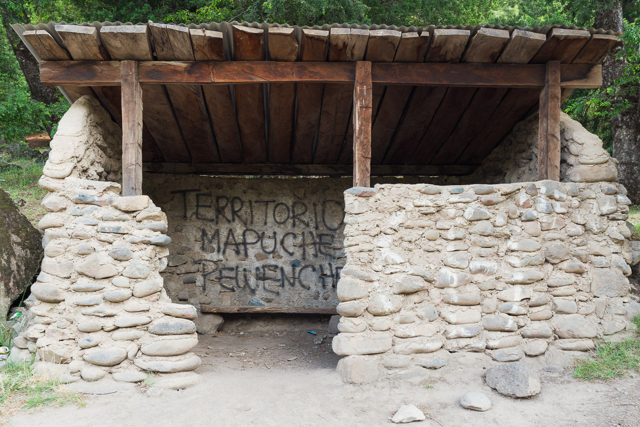
Mapuche are the predominant indigenous group in Chile and Argentina, and their original territory included large tracts of the Argentine pampa and all of Patagonia. These days they hold little of what were their ancestral lands, and they continue to be locked in territorial struggles. We were now in the Chilean department of Araucanía which is home to the biggest concentration of Mapuche people.
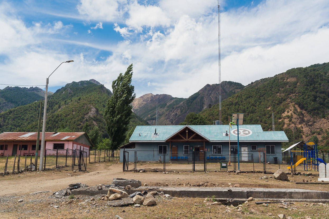
The Trapa Trapa hospital – glad we didn’t end up in there after our morning’s adventures.
When it comes to wild camping, Chile is considerably more fenced than Argentina and you’re far more likely to see ‘private property’ signs. Combined with being in indigenous territory, we ruled out wild camping as an option and asked in the hamlet of Cauñicu instead. After a bit of waiting around for the right person to show up, we were given a nice spot in a paddock by the river for a small fee (after they kicked out the sheep). There was even access to a shower as the farm also had a small hospedaje.
The scenery got even better and the peaks steeper as we continued to Ralco the next day, arriving for an early lunch.
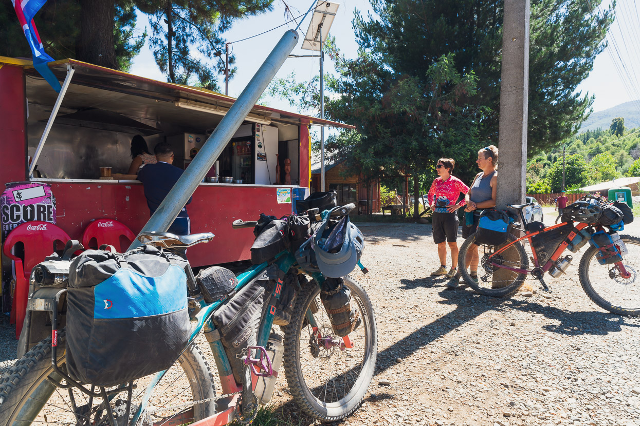
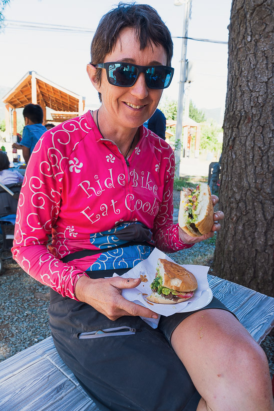
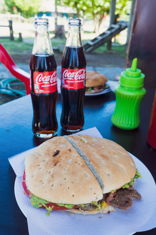
After three and half days without seeing a real shop, the Ralco food cart was an exciting sight. We took the rest of the afternoon off to prepare for the next leg: the Monkey Puzzle Route.
Thanks for reading…
Say thanks with a one-off donation, or check out our Bikepacking guide.
If you enjoy our content and find it informative or inspirational, you’re welcome to show us some love with a donation or a book purchase (US$19.99). The services we use to create our Bikepacking routes and host the website cost money, funds that we’d rather be spending on the road, creating bikepacking routes and content to share with you. Thanks for reading!


Love it! It warms my heart to read your blog. And the photos, omg, perfection.
What an adventure!
Thank you so much for sharing it.
We love receiving comments, so thanks for taking the time to say thanks Mariana!
Oh so envious of your trip. Just wondering if you ever found my article on CrazyGuyonabike.com Patagonian Back Routes http://www.cgoab.com/pbr You’ve given some new ones to add. I thought you might head via Largo Verde to La Junta on your current leg butit seems not
Thanks Alec – actually that list had fallen off our radar – so thanks for reminding us! We were referring to it when we here in 2020. Back then we crossed Paso Las Pampas – Lago Verde – Ta Tapera, so this time we decided to stay east longer and will cross via Paso Rio Encuentro. We’re looking forward to seeing more south of here!
Cheers
Mark.
Wow amazing thank you for the work you put in on this amazing blog.
Ive been looking for a route from Colombia to Patagonia and then by miracle chance I found your blog Mark and team ! Fantastic and inspiring !
Last night I bought your guide I was so inspired.
My first bike packing tour was last year from Cyprus (east Turkey Mercin) and onwards to Hadrians wall in NW England ! 23countries 10,000 km (the northern Roman empire !)
Im now hooked. Yes the most most dangerous thing about bike packing is once you do one ….you can’t stop !
Im thinking late this year (23) or 2024 to follow your trail Colombia to patagonia. Im back in my home in Cayman Islands as I write after spending Christmas traveling in Colombia getting a feel to see if I would feel comfortable…..Spanish lessons have started ! This spring summer I will do the GDMBR to get some more deep experience of wilderness riding. Hope you don’t mind a question now and again as I plan to follow your trail ! and if you know of anyone looking for a buddy to ride your route put them in touch. I think a long epic like yours would increase the enjoyment ! Im male 59 retired. After racing road bikes in amateur competitions most of my adult life I’m blessed to still feel strong on the bike. Can’t wait for your next post !
Hi Steve, it’s great to hear the blog is helpful! And thanks for buying the book – I hope you have found it useful! Your trip last year sounds amazing – well done, and yes – it is addictive 😉 Good luck planning for your Americas journey – there is so much to see out there. We initially thought 2 years for Alaska to Ushuaia and here we are nearly four years later…
Cheers
Mark & Hana.