
Early December 2022.
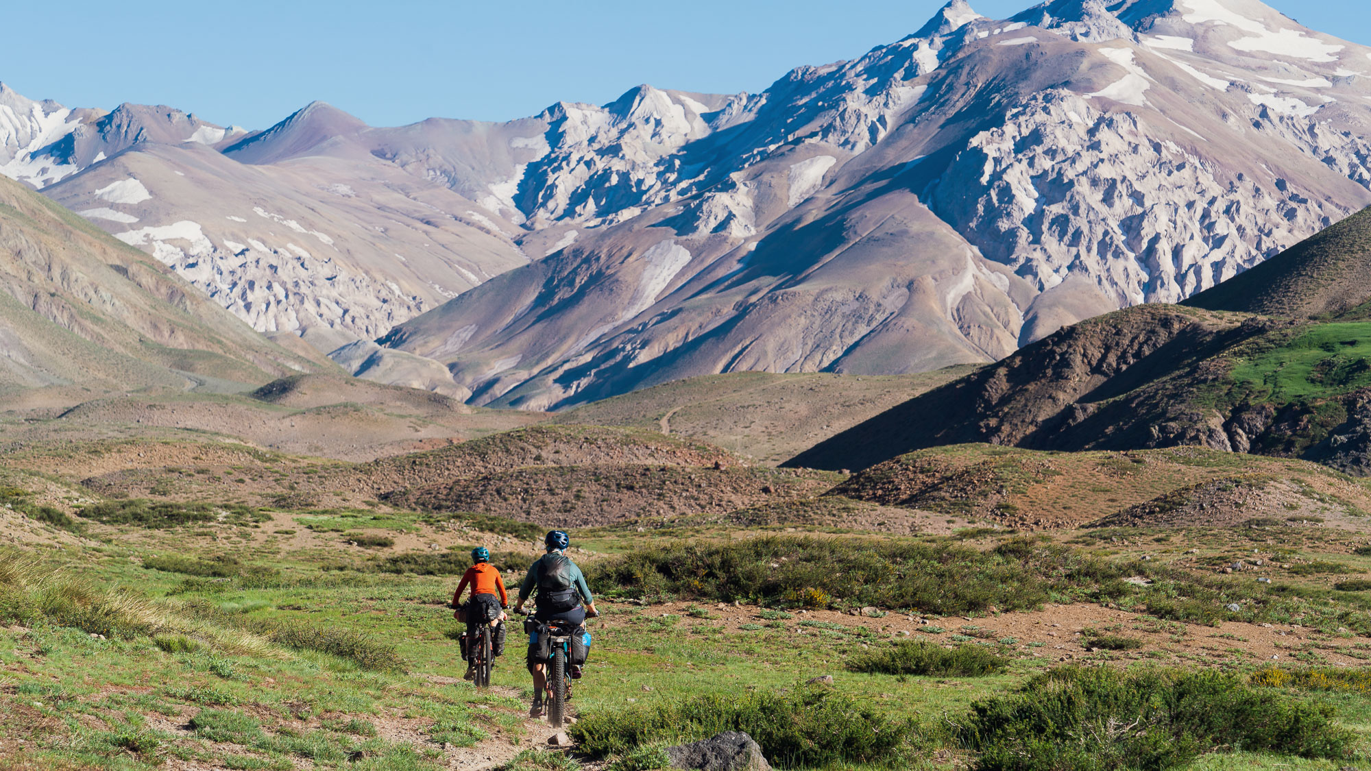
Following on immediately from our last blog post, from El Sosneado our plan was to make a deeper dive into the Andes following a large portion of the Ruta de los Reales before popping back out onto the Ruta 40 at Bardas Blancas. This route involves quite a lot of rugged cross country riding, some hike-a-bike and a pass crossing just a stone’s throw (a few km) from the border with Chile.
The Ruta de los Reales was documented by Argentinian bikepacker Gonzalo Zamorano, who is an enthusiastic explorer and skilled photographer. You can find some of his work at Pedalia.cc Having seen Gonzalo’s photographs from the route it looked like just our flavour of experience, as well as promising some exceptional Andean landscapes and mountain culture. We actually met Gonzalo for an evening while we were in Mendoza and it was great to hang out with a like-minded bikepacker and talk routes and experiences.
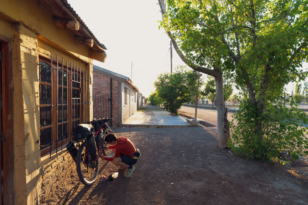
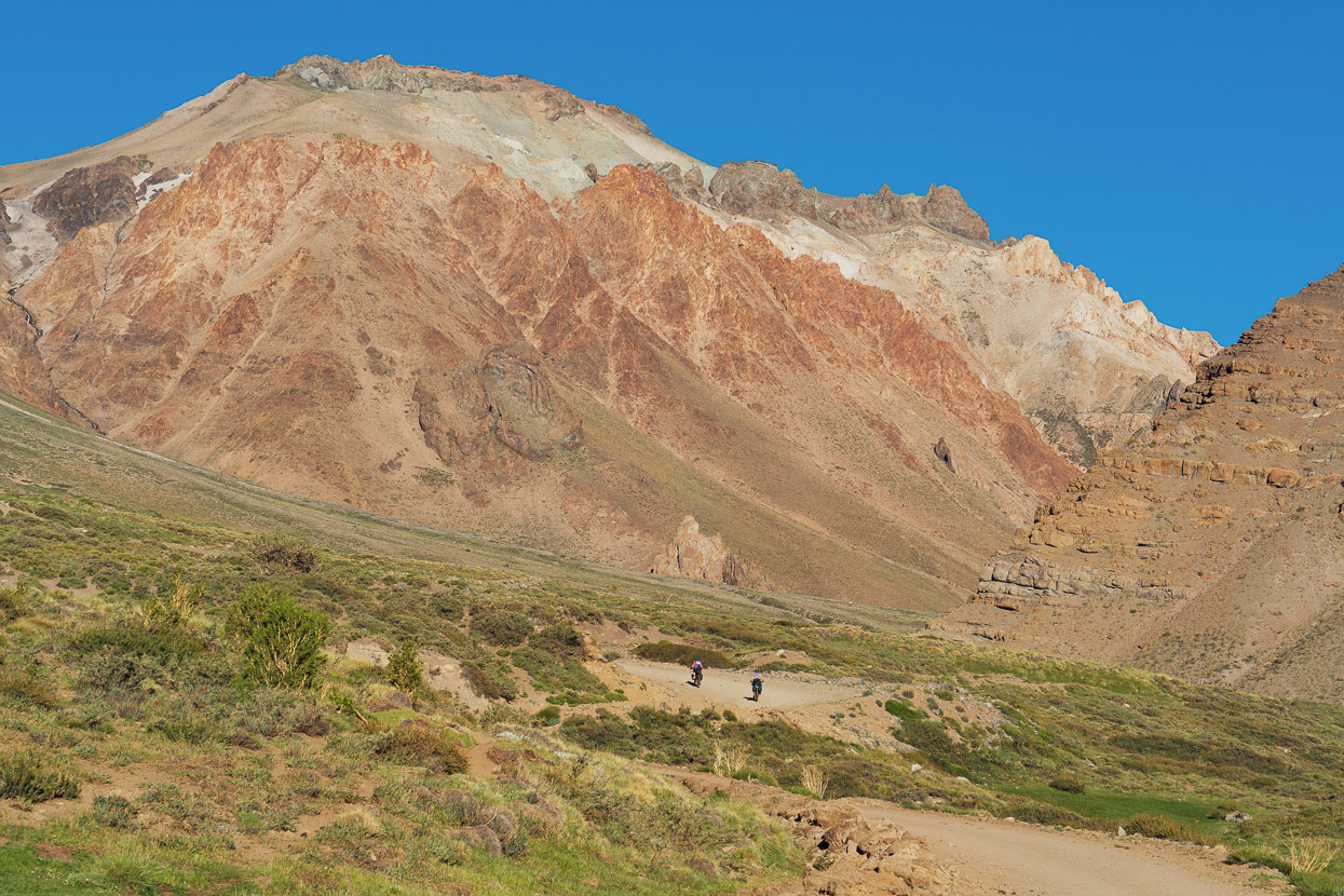
Once again we made an early start from El Sosneado to get some distance in before the day got really hot. For the first 30-odd km we followed the Ruta 40 south until the turnoff to Las Leñas. The road is still paved to Las Leñas, but we only saw a handful of vehicles.
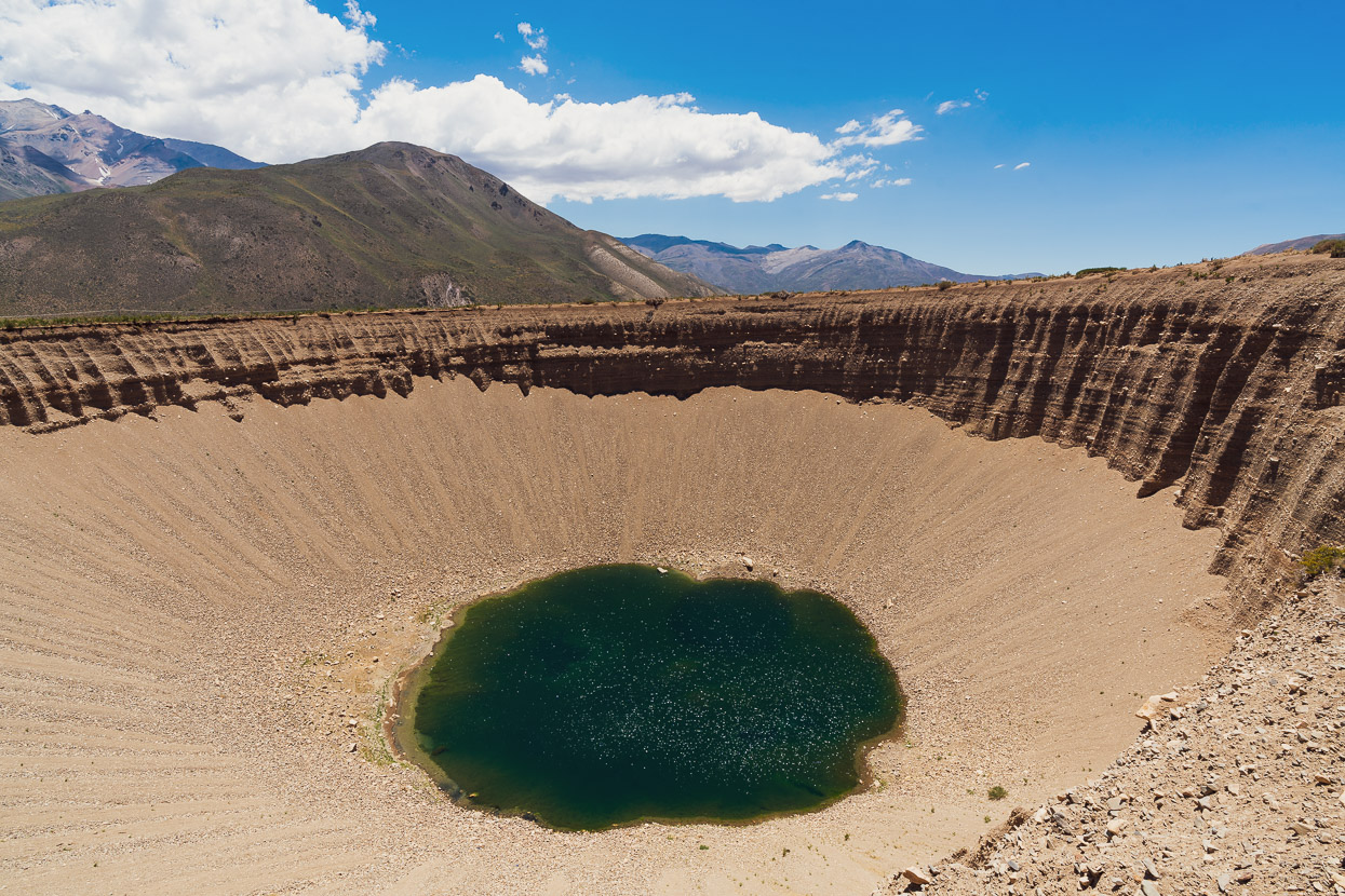
The climb towards Las Leñas wound its way up a spectacular valley, with a mix of ancient sediments and more recent volcanic activity shaping the landscape. The highlight though was the Pozo de Animas (Well of Souls) which is a massive doline with a pool in the bottom. This is just a very short detour from the road.
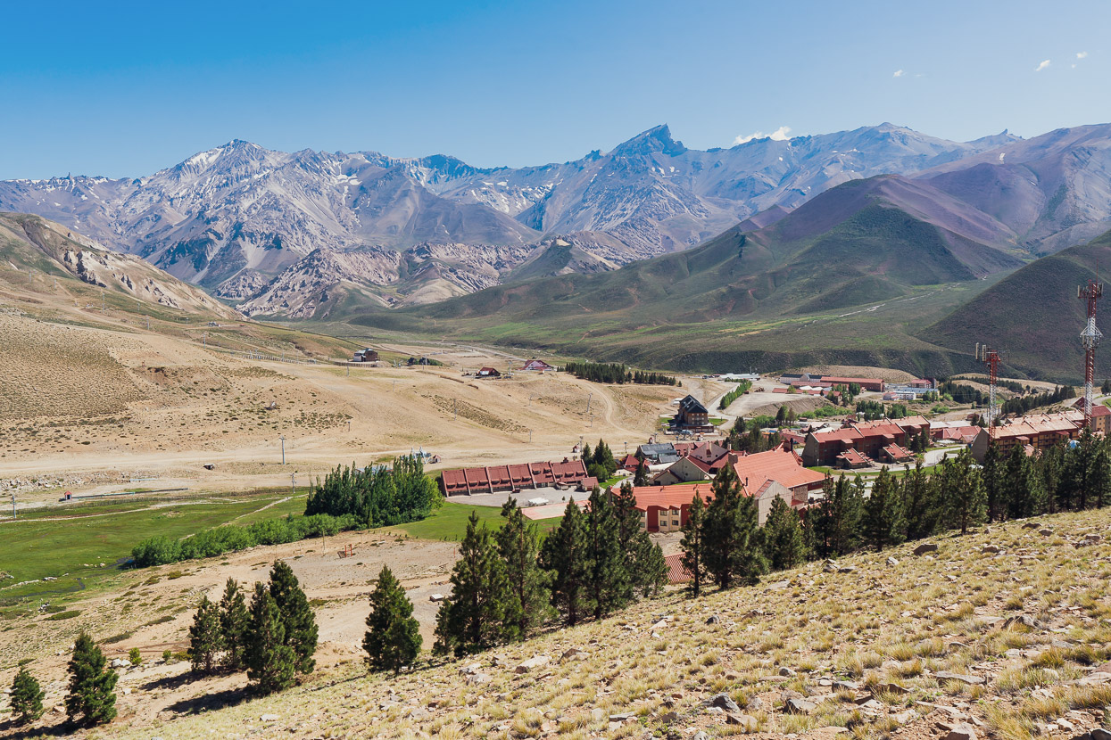
Las Leñas is a ski resort, the highest in Argentina, and attracts visitors from all over Argentina in the winter months, when the resort’s several large hotels can be full to capacity. In summer it’s largely deserted, with only one hotel running at a time. We were ready for a rest day and needed to resupply for the next section, so we took a day off there and spent two nights in one of the massive hotels which only had a couple of other guests. Fortunately the skifield manager negotiated us a great discount, along with meals included.
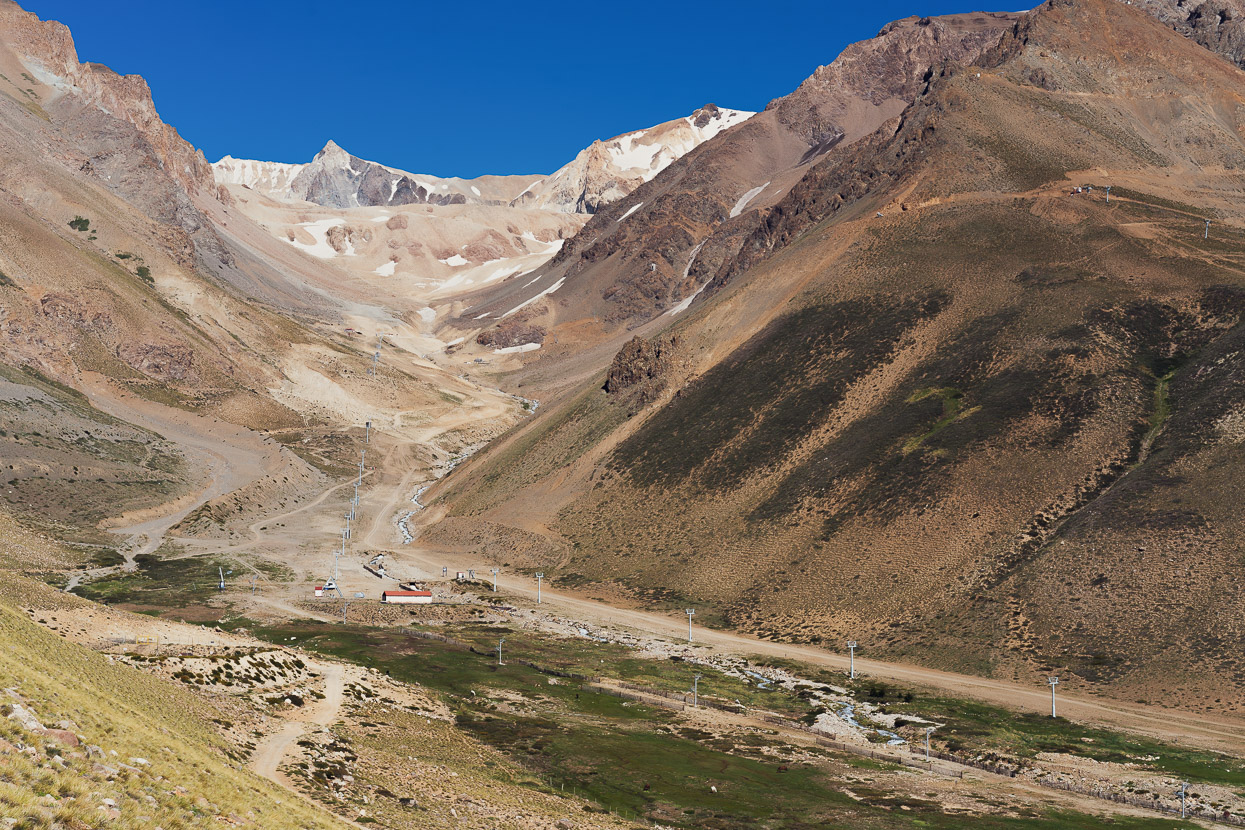
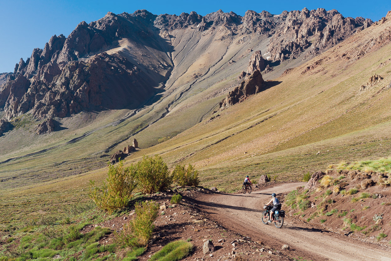
The next day we took a rest day leg stretch and climbed up onto a huge moraine which we followed for a while, giving us some great views of the valley.
There is a small supermercado in Las Leñas, so we stocked up with food for three days, as we’d been able to buy very little in El Sosneado.
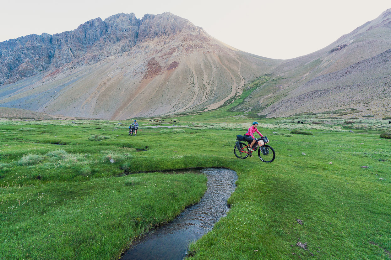
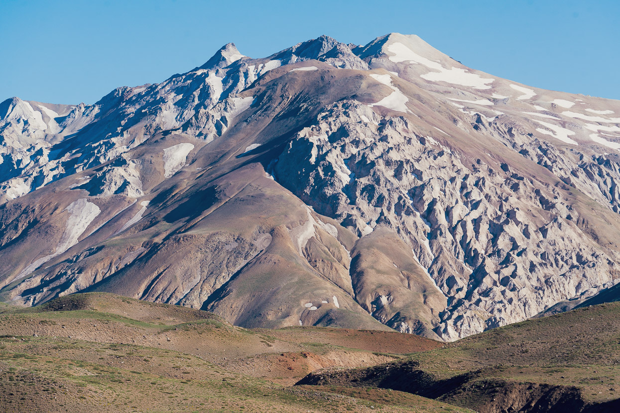
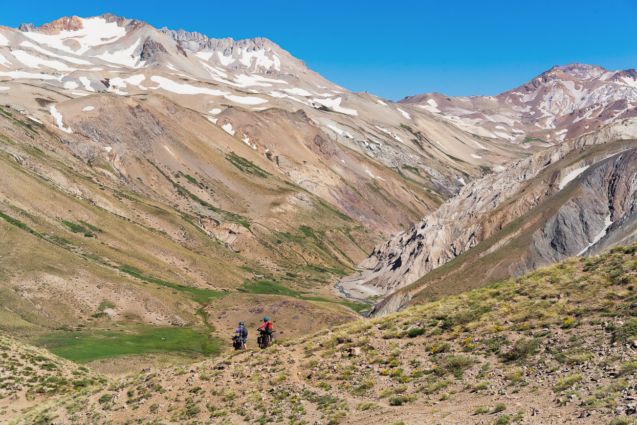
With great light the next morning we made the steady climb to a pass that would take us into the Valle Hermoso.
It was fantastic to be back among the Andean landscapes we’d become accustomed to during our pre-Covid touring here.
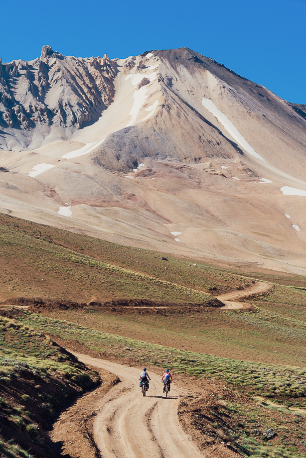
At 2864m, Paso de las Damas is the highest we’ll cross during our journey south, which is quite a contrast to the dozens of 4000m+ passes we crossed throughout Ecuador, Peru, Bolivia and northern Argentina and Chile. While we miss the high altitude experience a little, it’s nice not to have to deal with acclimatisation. For now the heat and readjusting to heavily loaded bikes is enough of a challenge for us.
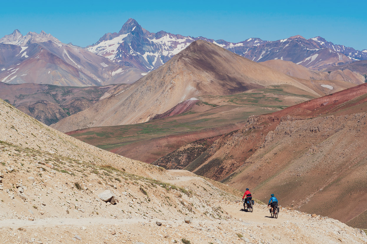
The horizon beyond was studded with the peaks of the Andean divide, and behind them, Chile.
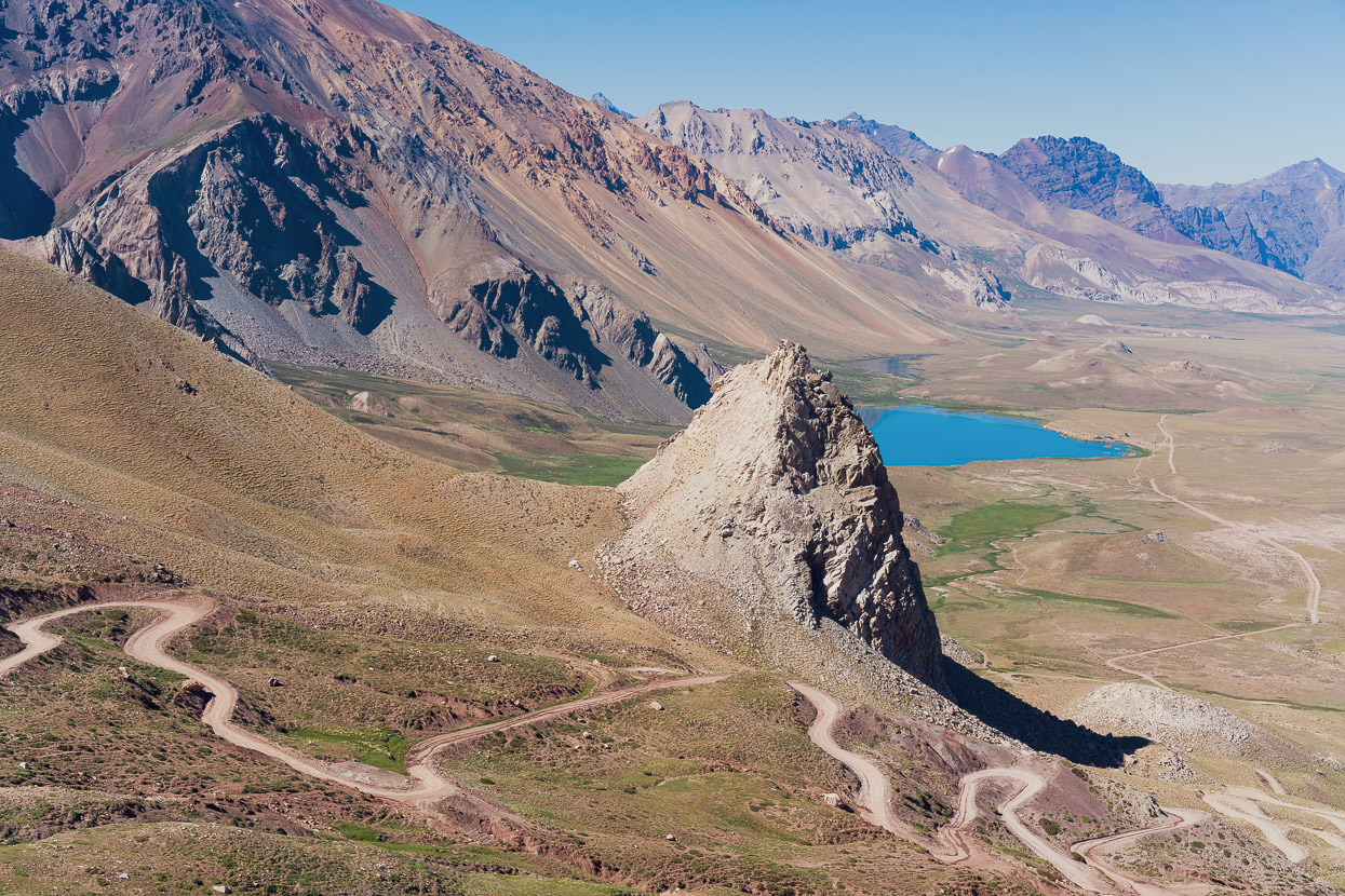
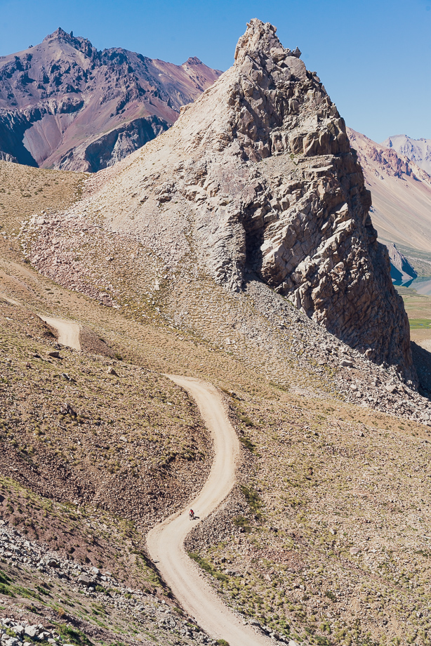
We continued to a spectacular overlook that revealed the aptly named Valle Hermoso. A sinuous and rough descent led to the valley floor and to the lake, where there’s a small eco lodge and camping area.
Un caballo.
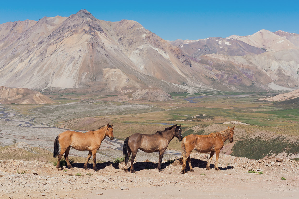
Tres caballos.
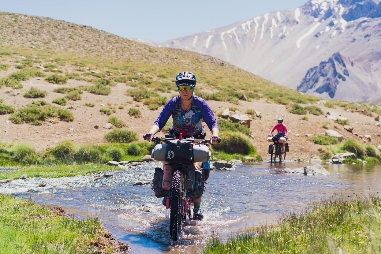
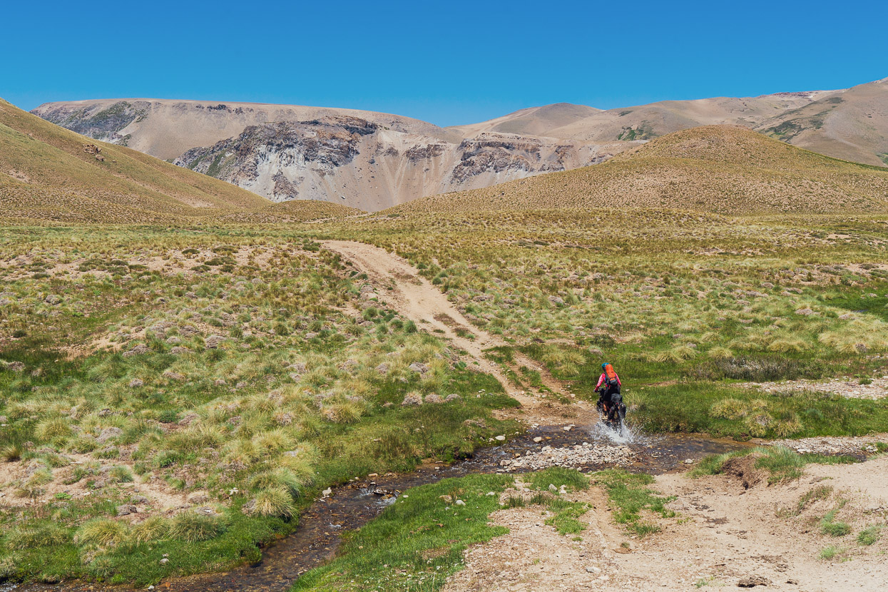
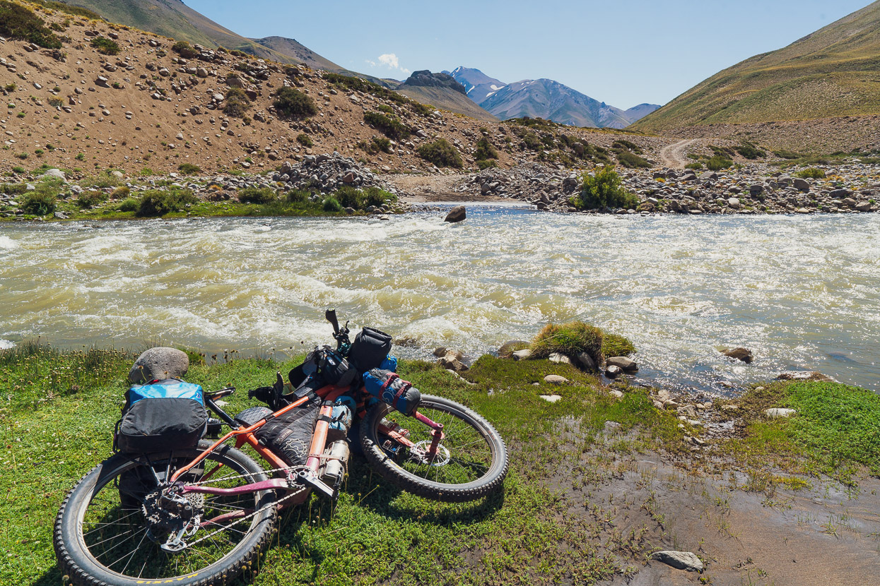
The eco lodge was a good spot for a coffee in the shade, and then we pushed on, further down the valley. We had a river crossing and a hike-a-bike section coming up that the details for were a little vague.
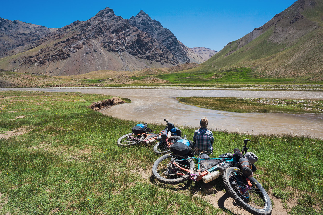
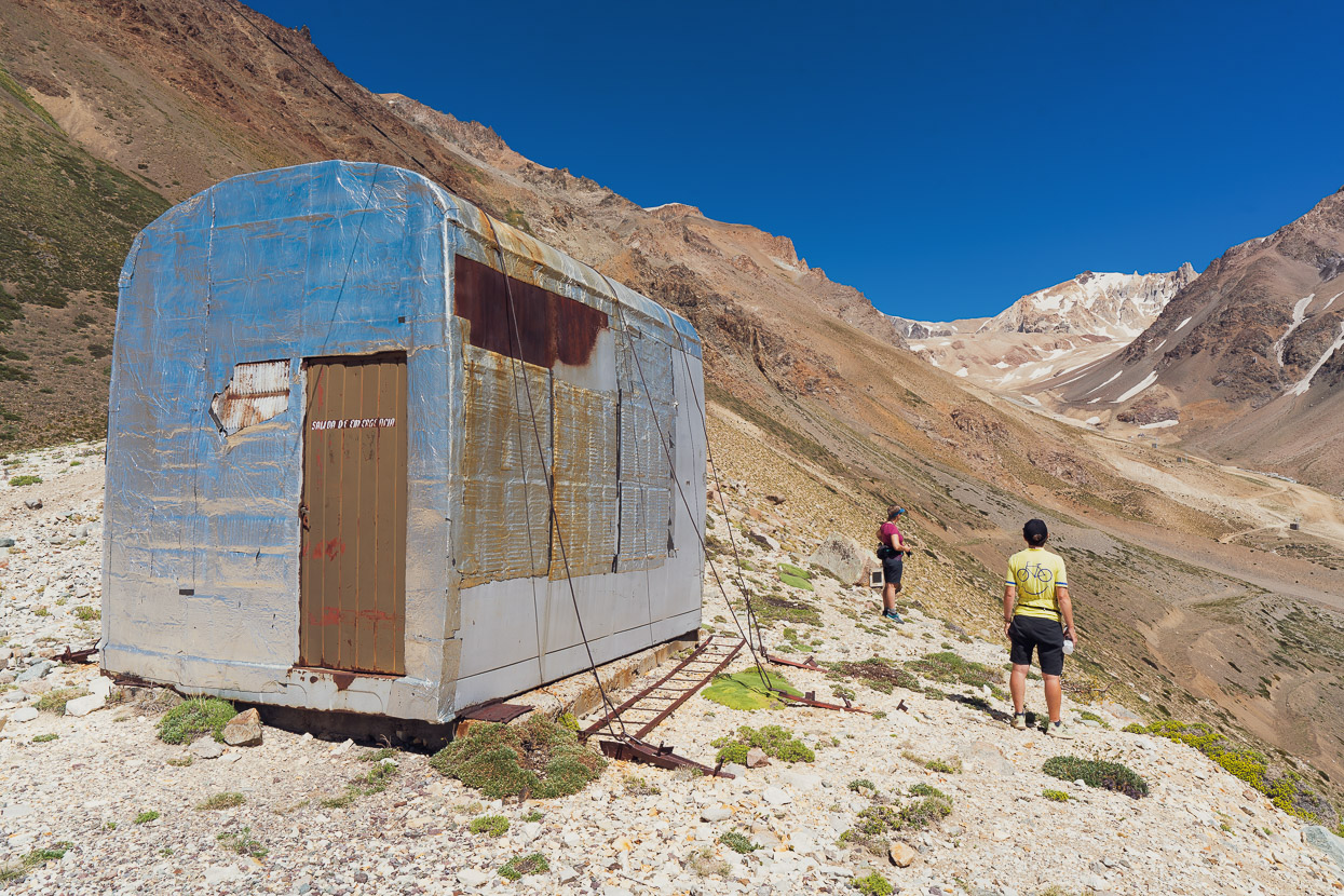
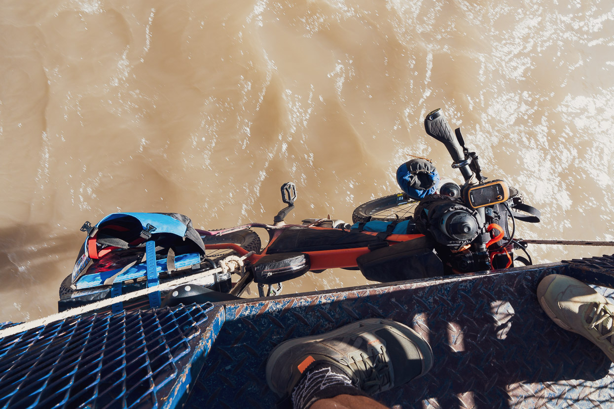
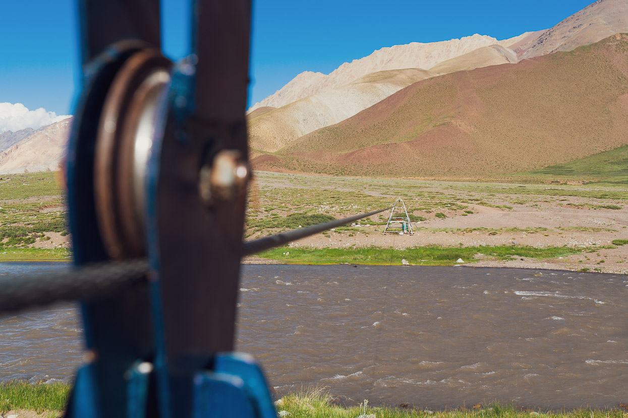
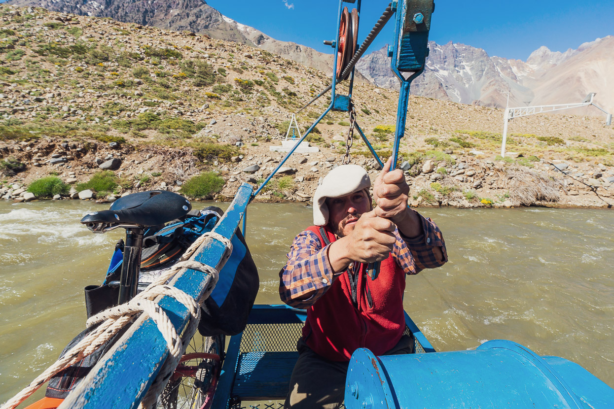
The Rio Tordillo is deep, swift and uncrossable most of the year, especially in the current season when rivers are still high with early summer snow melt. The plan had been to cross at a cableway, as Gonzalo had done, although he had followed this route in the other direction. We’d seen from Gonzalo’s photos that the cableway carriage had no return cable attached to it, but when we spoke to him in Mendoza he suggested that if the carriage was on the other side of the river there would be a farmer around who might be able to bring it across to our side.
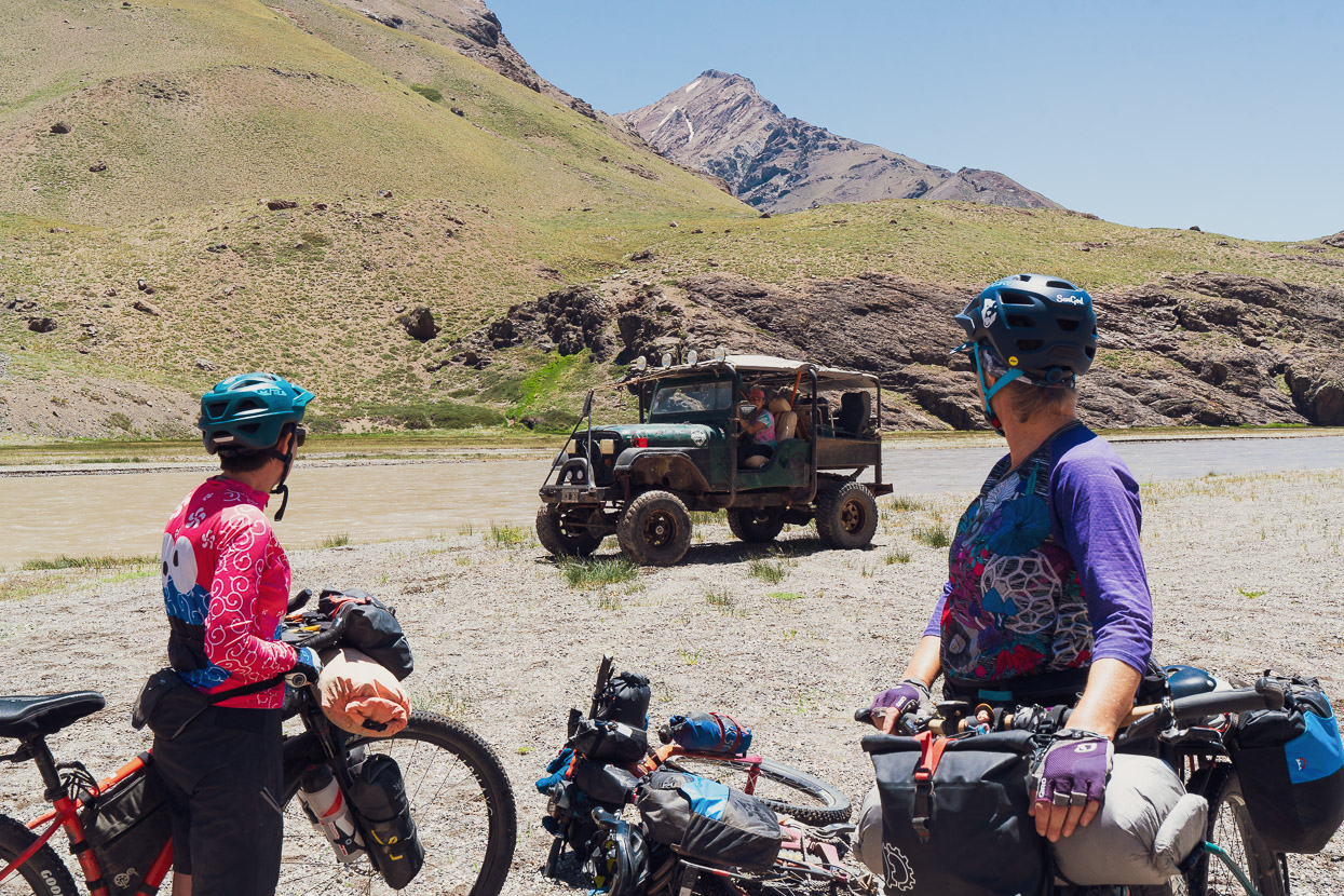
As it was, the valley seemed to be deserted. There was a camp on the other side of the river, but no people in sight. Further down valley there was a small group of 4WDers, so we decided to go and investigate them and see if they could take us across to the other side. But the river was too deep for their vehicles, leaving us with a significant dilemma: did we abandon plans, and ride all the way back out to the Ruta 40, camp in the valley in the hope a farmer might turn up on the other side of the cableway, or persevere with crossing the river?
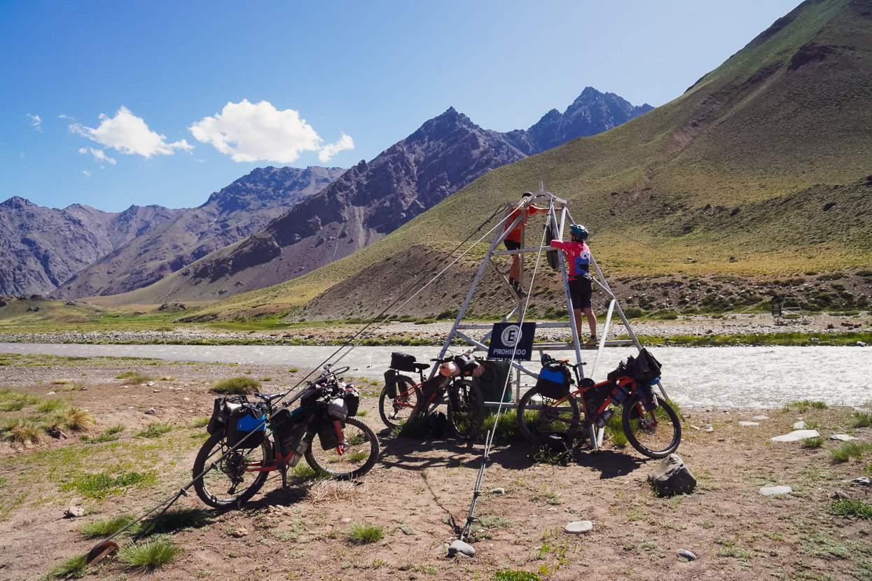
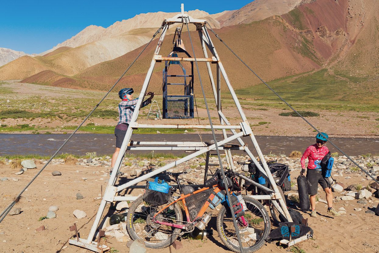
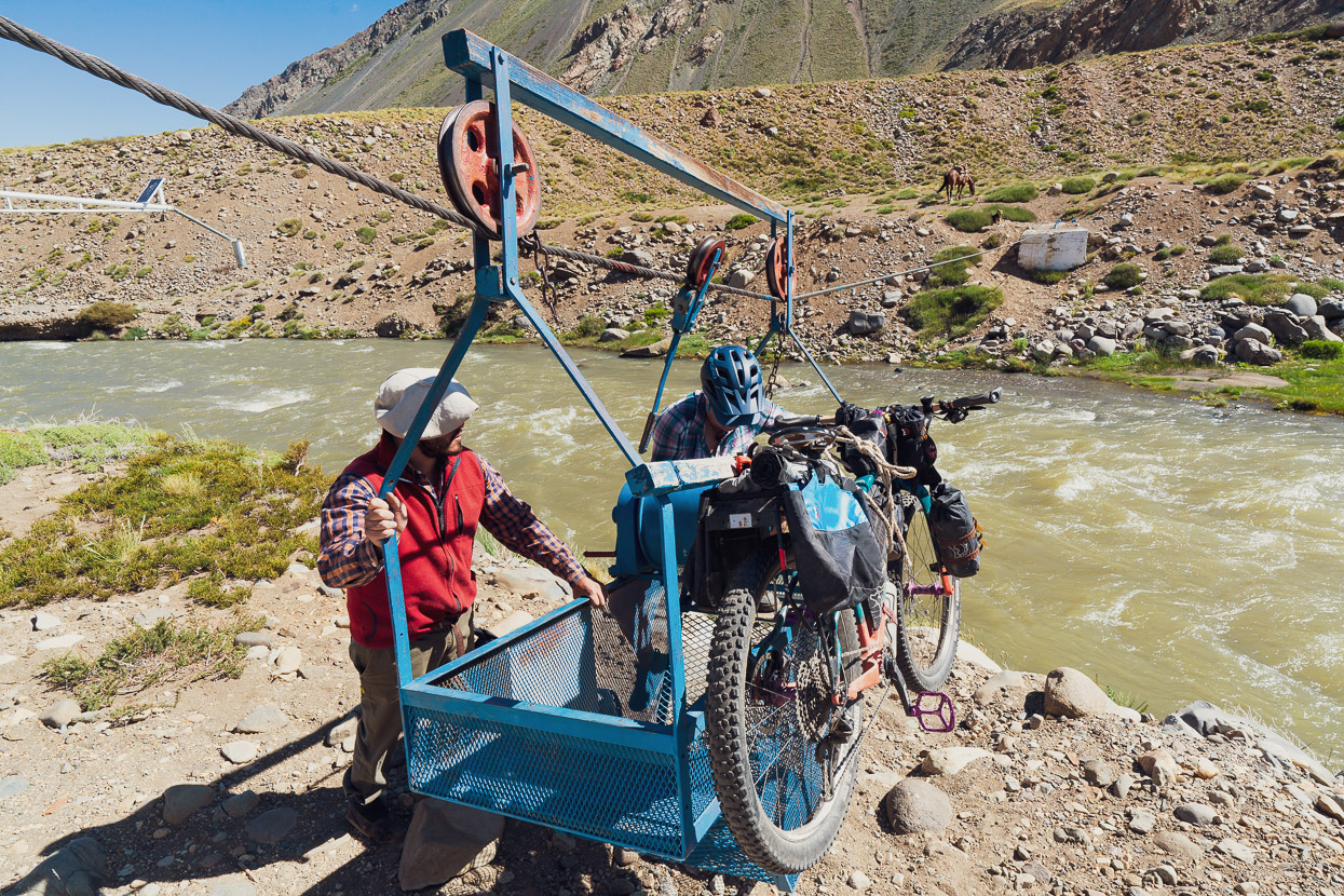
We returned to the cableway. We’d seen nowhere where we’d brave the river and swim across, to bring the carriage to our side for the bikes, so the only option remaining was to tyrolean across to the carriage. At first this appeared a preposterous idea; we had no harness, carabiners, pulleys or anything that might make it a safe and feasible thing to do. It was windy, and I was sick with a chest infection, so the thought of monkeying across the cable unharnessed was quickly rejected. It was too dangerous.
But with some creative thinking a plan began to emerge. Firstly we needed something that would slide on the cable, and secondly we needed a seat of some sort attached to it that was reliable enough that it wouldn’t fail when I was halfway across.
A plastic coated bike lock proved to slide pretty well, so we made two turns over the cable with it and reef knotted the locks cable, then closed the lock. That would be our pulley. Hana suggested using our Big Agnes tent footprint as a seat. Nylon has great tensile strength, especially with multiple layers, so we concertinaed it and tied it closed with a reef knot. We protected the nylon from abrasion at the attachment to the cable with a plastic coke bottle that we cut up. To attach the tent footprint to the bike lock we used a Macpac belt with a climbing harness style buckle that had held up my shorts for our previous stint in the Americas. We backed that up with a camera shoulder strap and backed up the bike lock with a Revelate Designs Egress Pocket shoulder strap, closed with an overhand knot. Being a climber, webbing is something I can comprehend the strength of and understand, so while this sounds totally loose and sketchy, we intentionally built redundancy into the system.
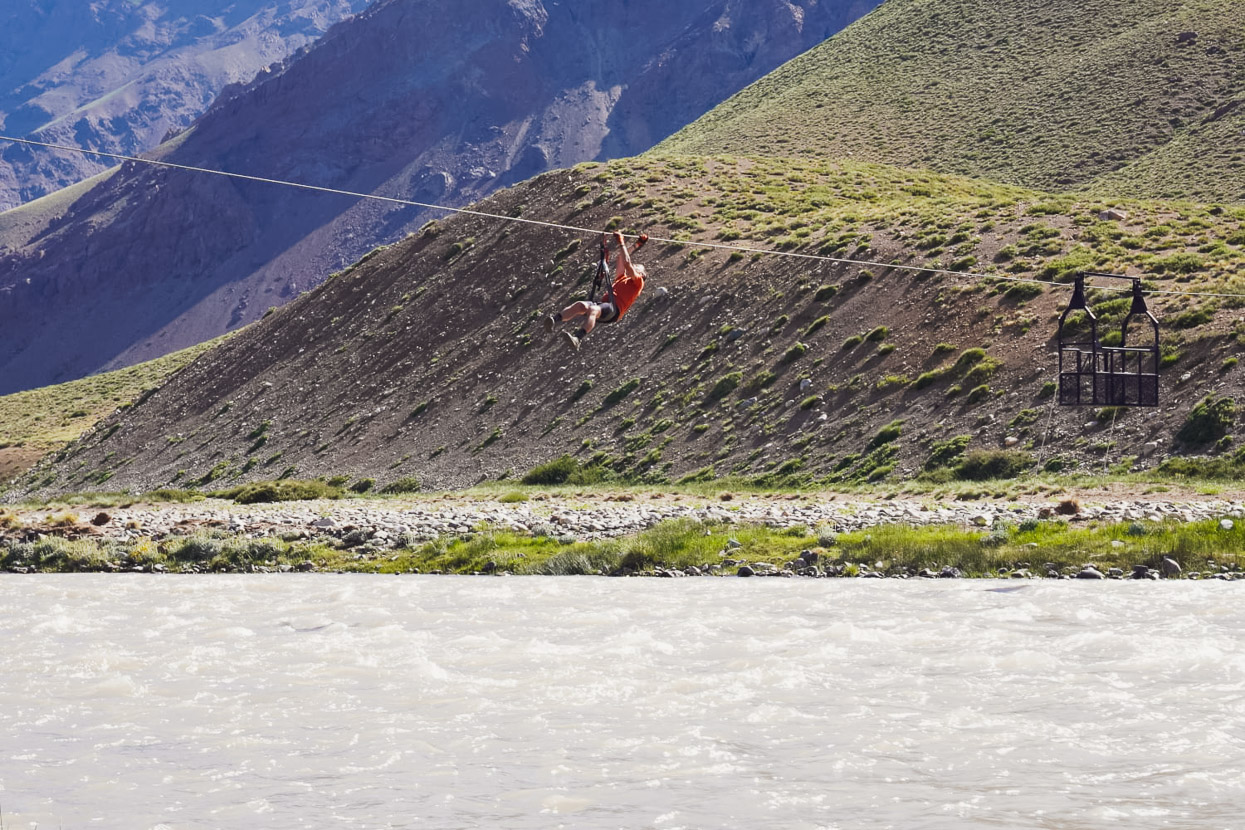
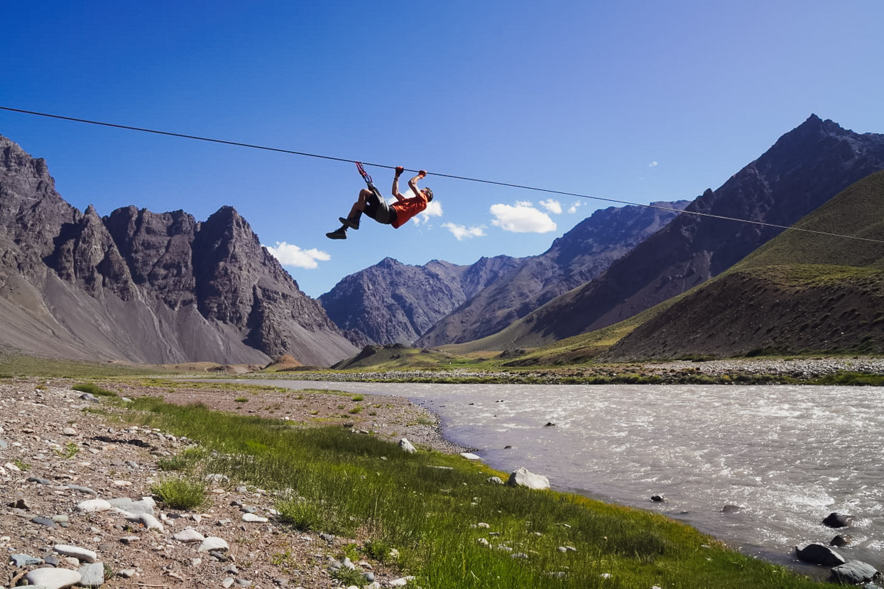
I tested the arrangement for a few metres, and felt comfortable enough. The weakness was the tent floor seat, and the fact I might slide right out of it as I shimmied across. But it actually worked really well. I’d pull myself up into a sort of horizontal lever, and then use my hips and arms to drag the harness along a few inches at a time. It was pretty hard work, but I slowly got there, and when I got tired I could just sit in the harness and rest. There was a definite feeling of commitment to it – dangling alone over a raging river, in the wind, miles from any help. My mouth went completely dry, like it does on a hard rock climb when you’re at your absolute limit and feeling sketched out.
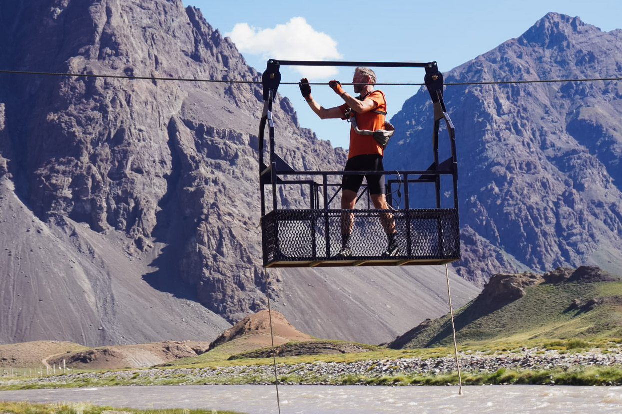
Once I reached the carriage it was easy enough to pivot around and climb in. Hey presto… I carefully pulled the car over, taking care not catch my fingers in the pulleys.
We were pretty excited at having our plans back on, and feeling pretty amped up, so our trio went double time with teamwork getting the bikes tied on and ferried across one by one, with two of us bringing the carriage back each time.
Soon we were all on the right side of the river with bikes and bags. We’d lost six hours with this unexpected turn, so headed off on the road moving as quickly as we could to get some more miles under our belts before dark.
For the first half hour the going was easy, until we reached another small but swift river crossing that required teamwork to cross. From there there were two options: a single track that Gonzalo had followed that crossed some loose screes, or a 4WD track he’d spotted that he suggested might be a better option. We went for the latter, but frustratingly the 4WD track had been obliterated in several places by large slips. So while it afforded good travel for short sections, we had had to push the bikes over a lot of rocks too.
And around the edge of a large pool created by the slips.
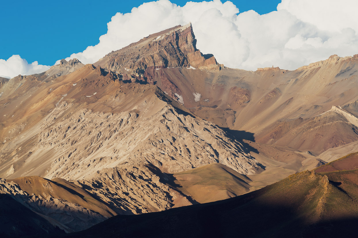
But eventually we reached easier travel as the valley broadened. This was a relief, and also a chance to appreciate the awesome spot we were in.
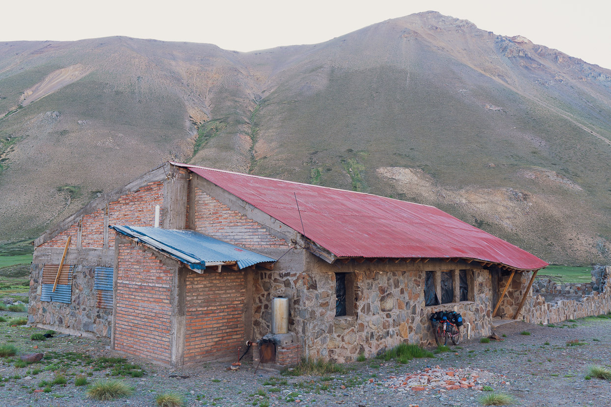
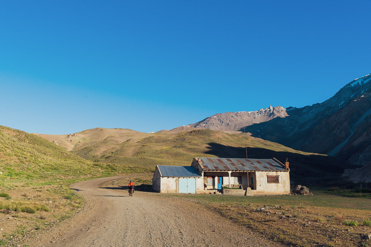
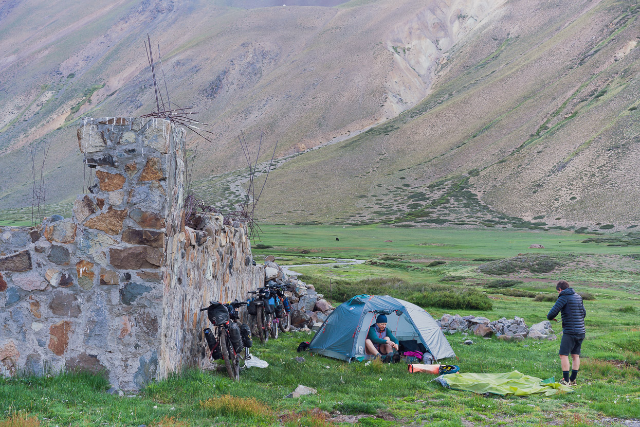
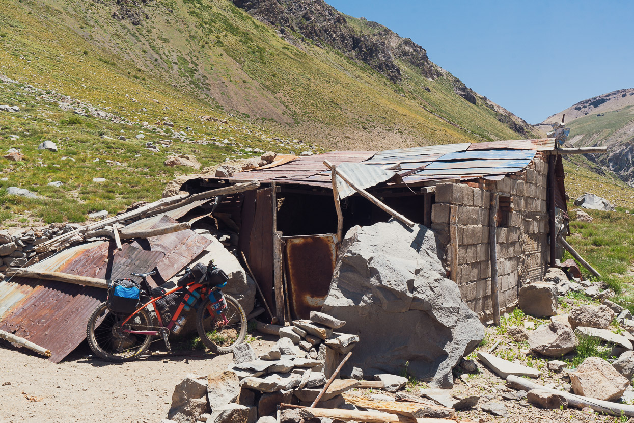
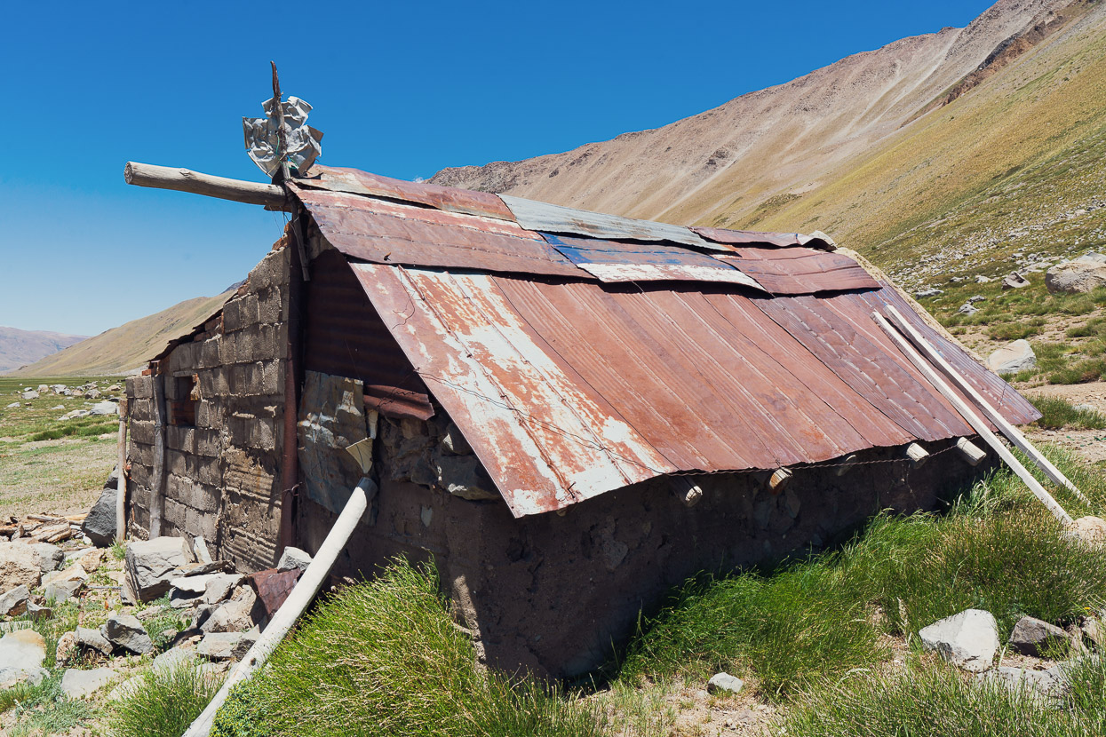
Alone in the valley is an abandoned hotel that must have been intended for horse trekking. The work in getting the materials in must have been considerable, but we don’t know anything about its history. The building was boarded up, but it made a good wind shelter for us, and we camped outside, knackered after a long day.
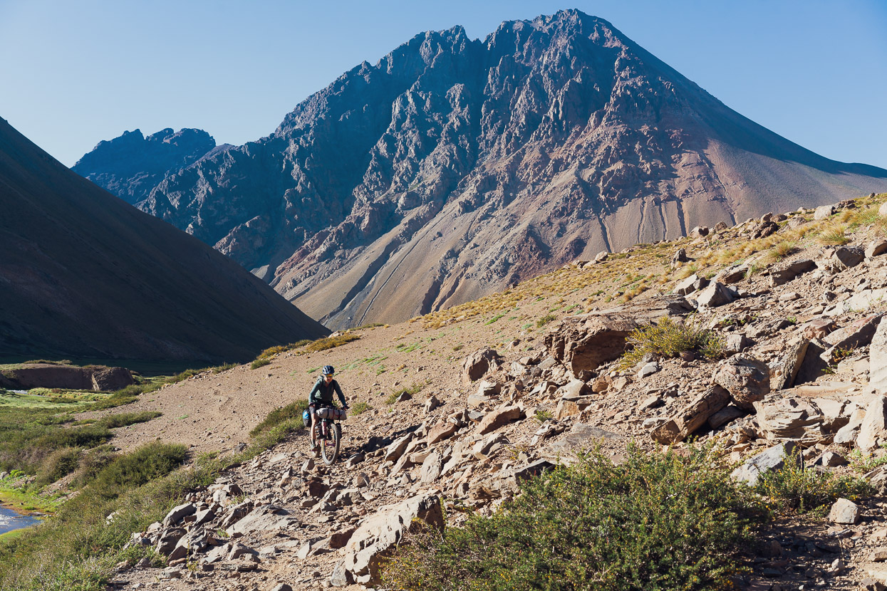
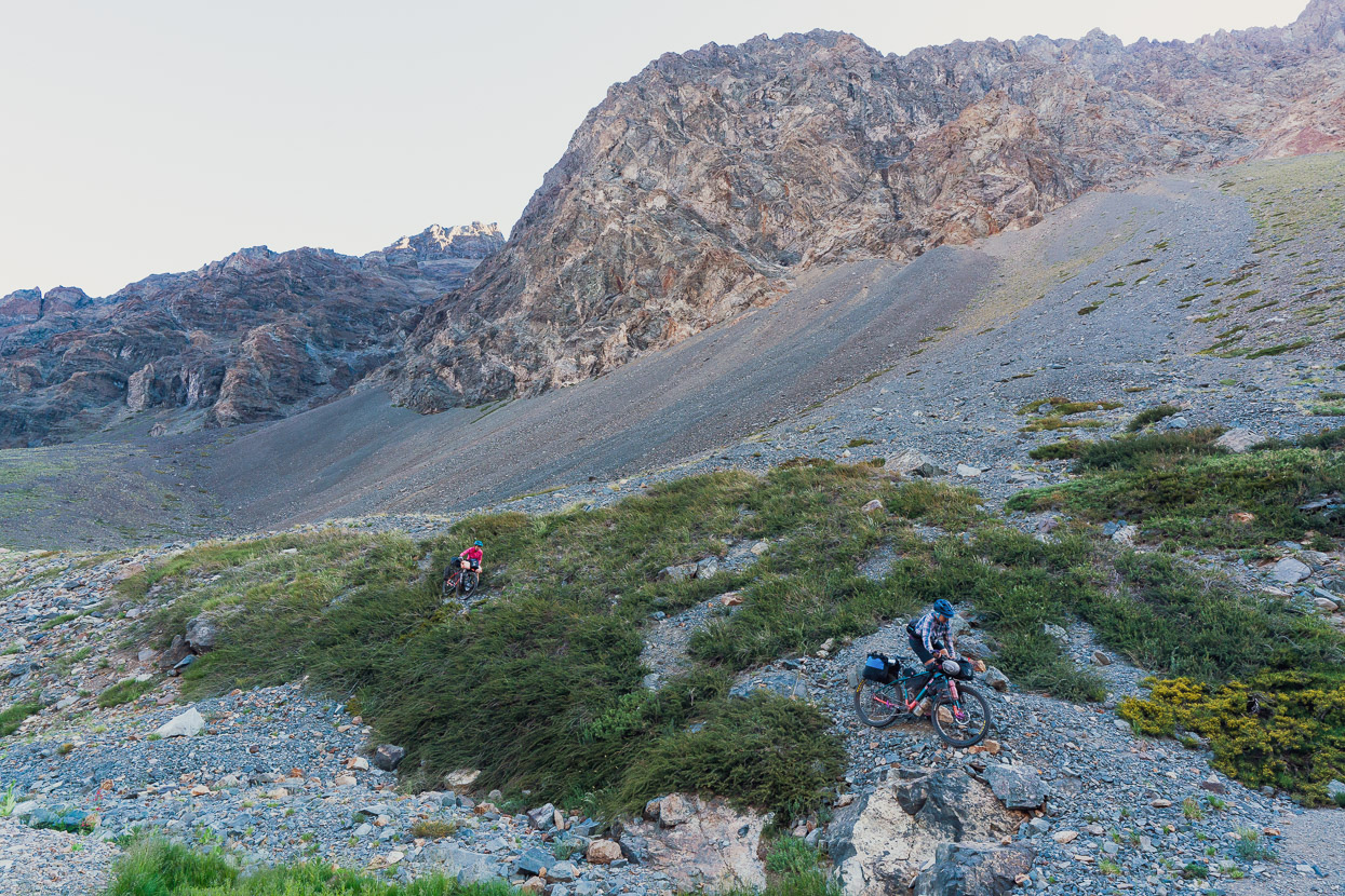
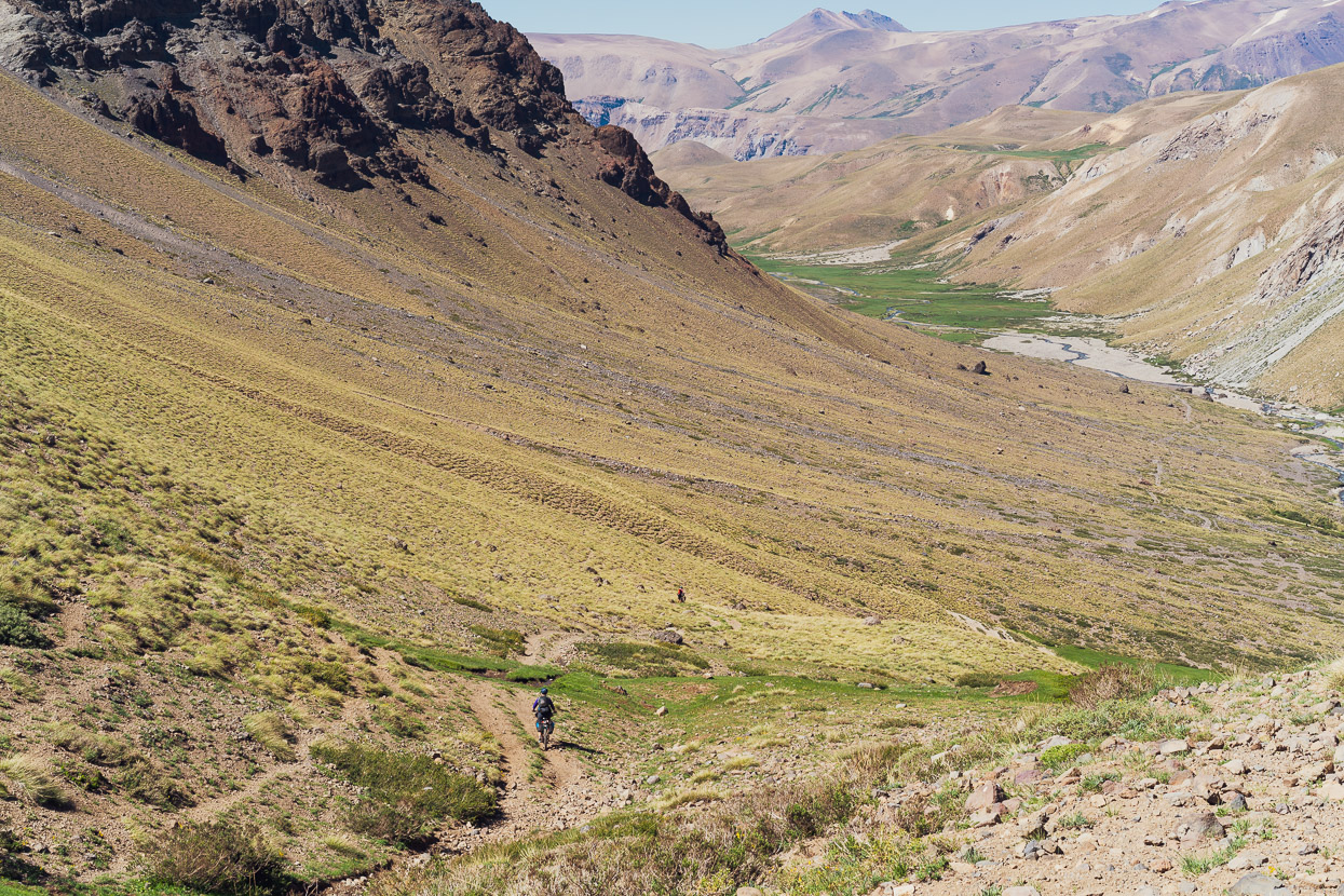
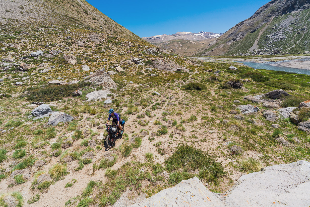
In the morning we were straight onto mostly ridable horse trails which led us up the valley for 2.5km before we began to climb up towards a pass.
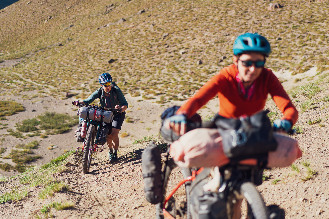
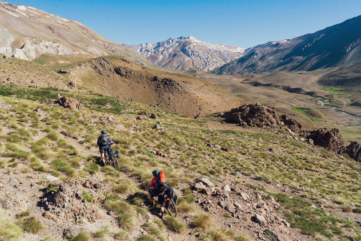
The 200-odd metre climb to the pass wasn’t much height gain, but it was pretty slow because it was often quite steep pushing.
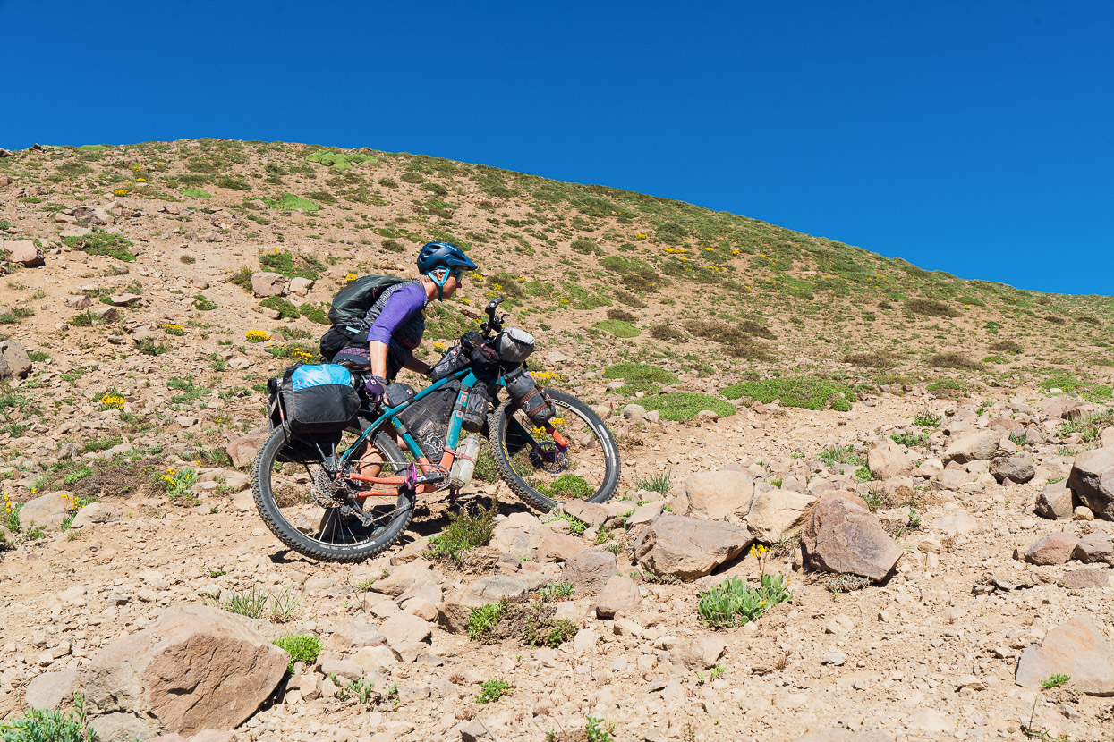
But as far as hike-a-bikes go it was straightforward because there was a good ground trail most of the way with few obstacles.
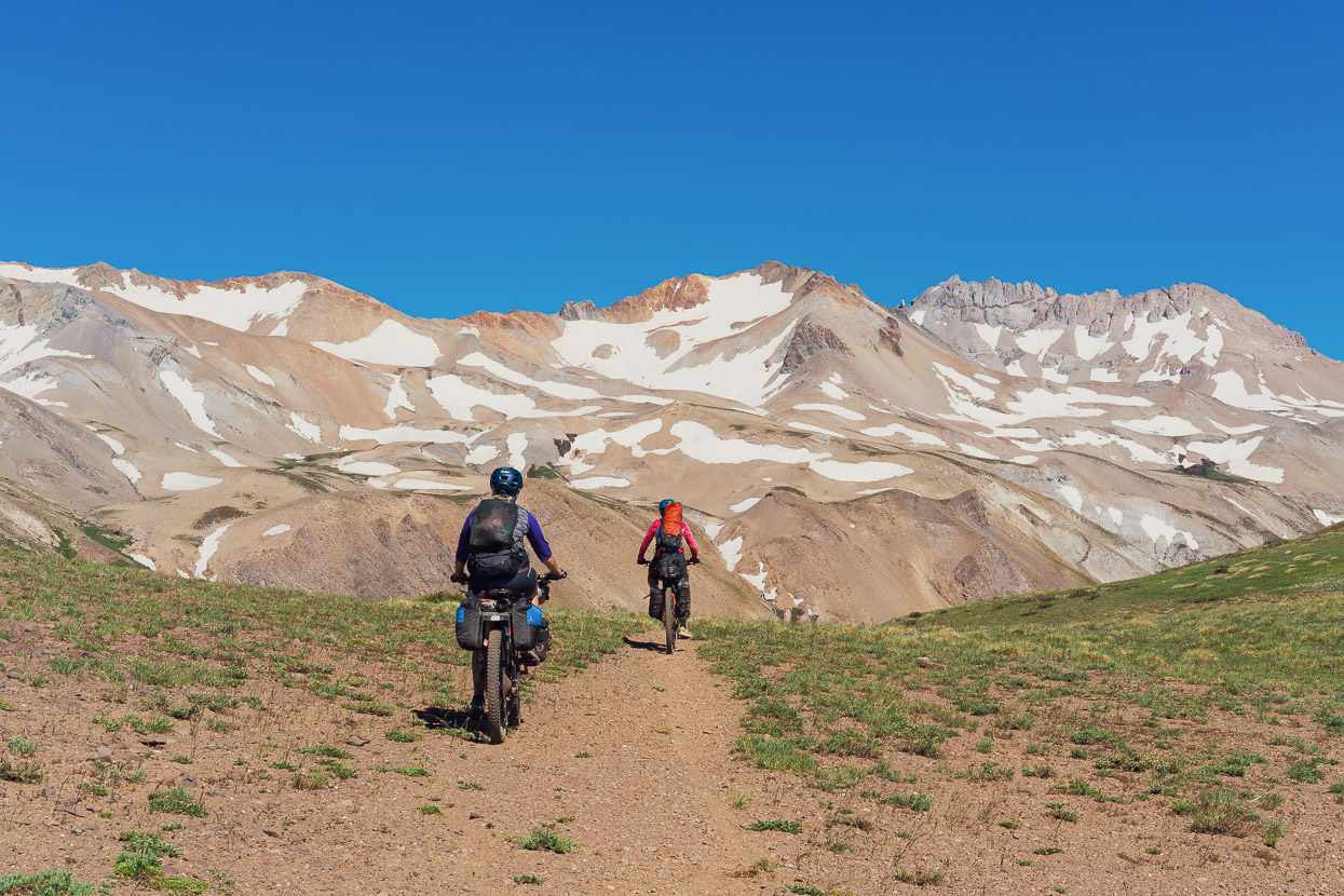
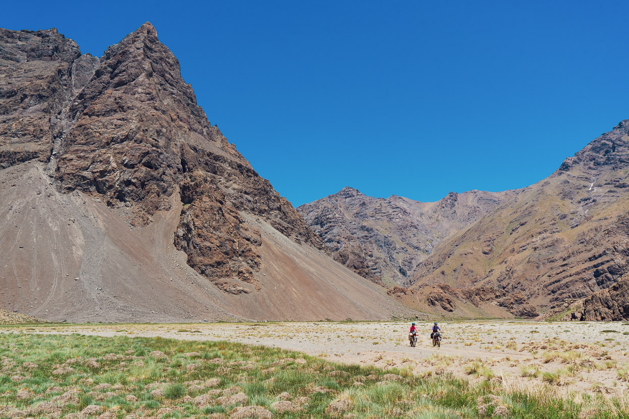
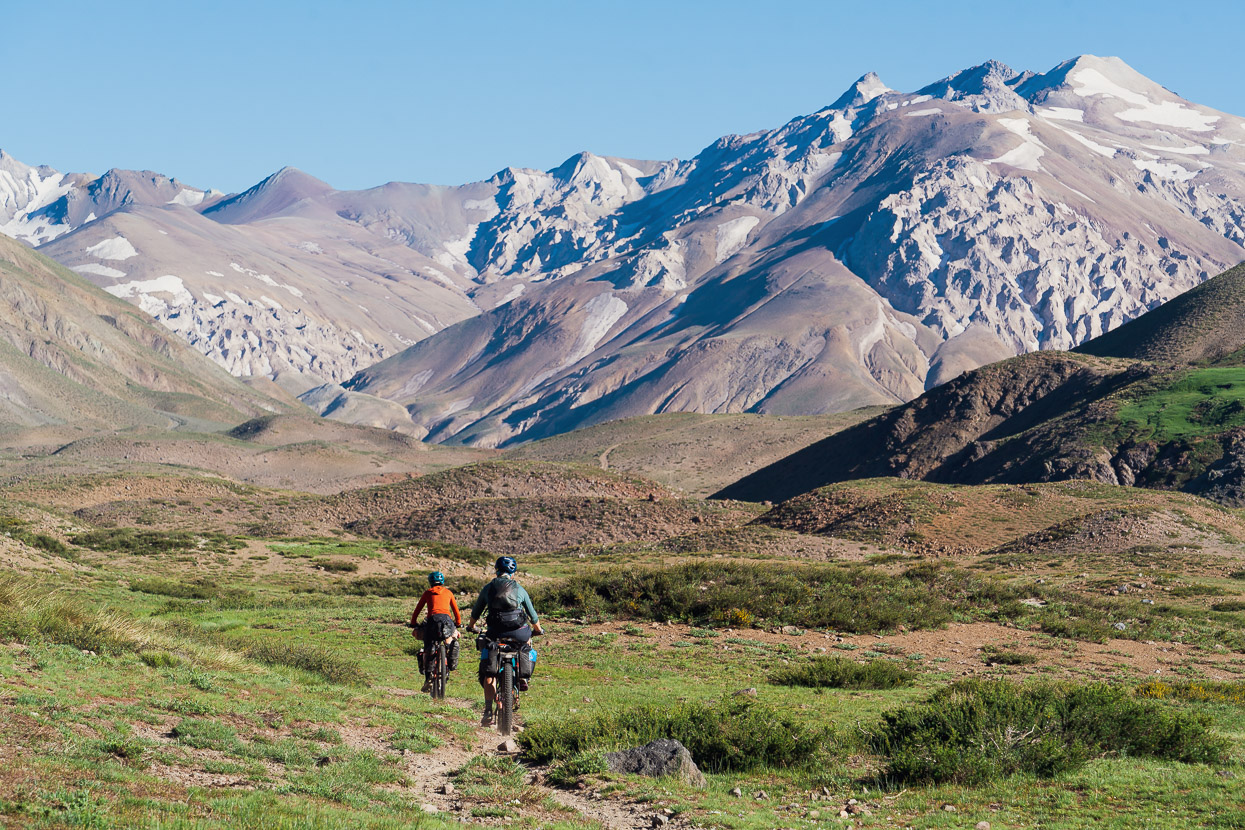
The pass itself was a stunning spot, deep in the mountains and just a few kilometres from the border with Chile.
And the descent to the valley floor was largely rideable, with just a few technical sections.
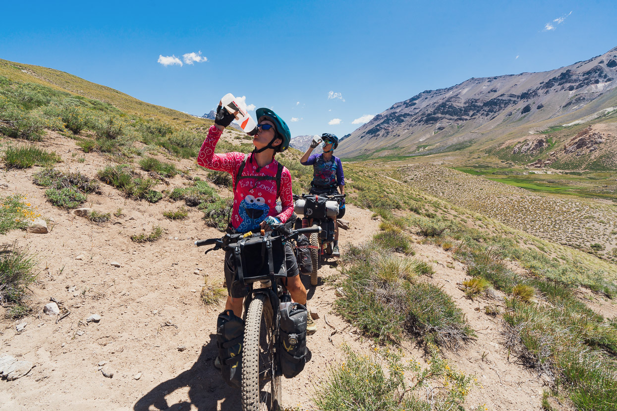
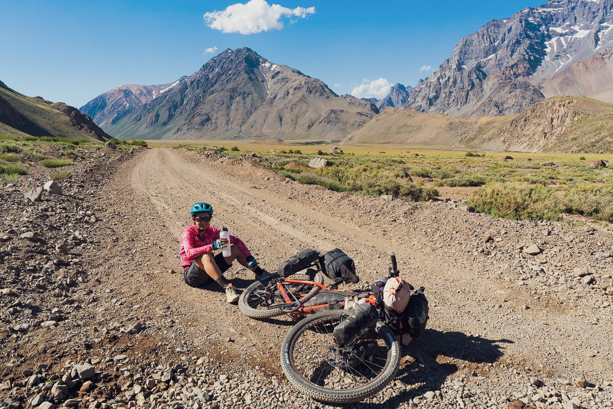
Thirsty work!
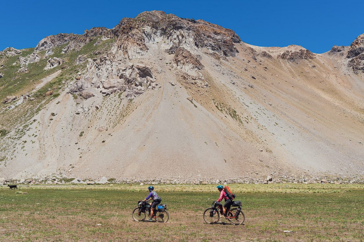
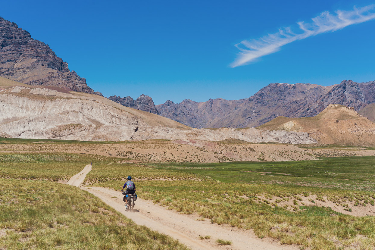
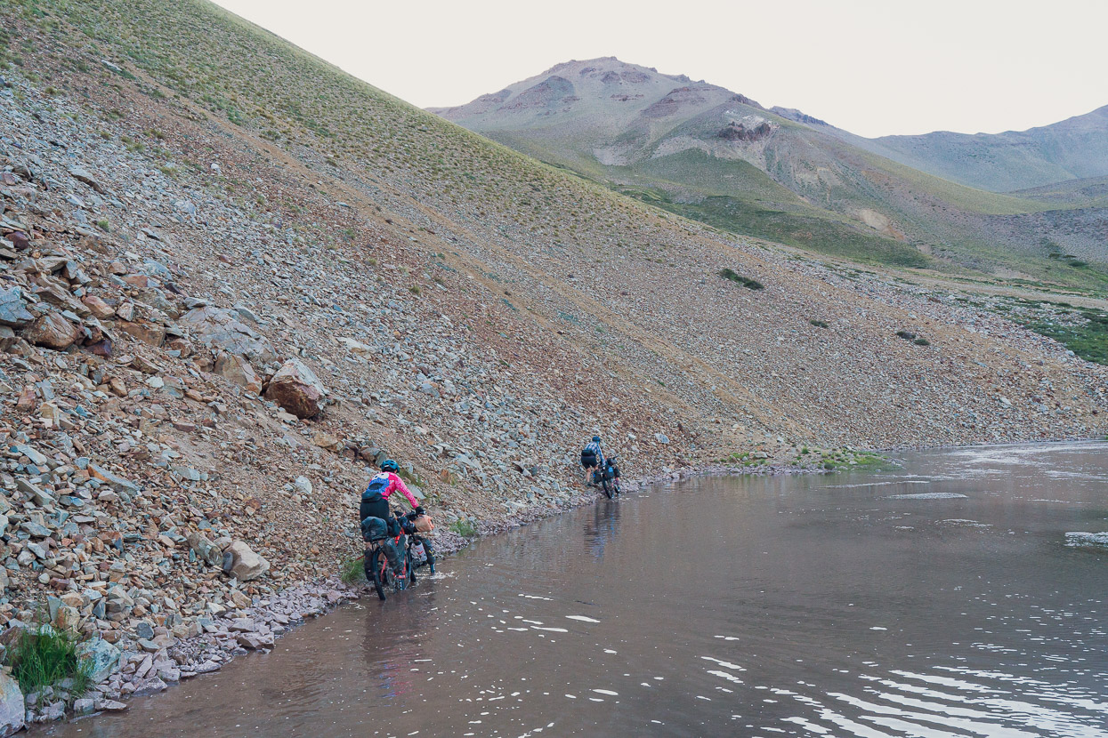
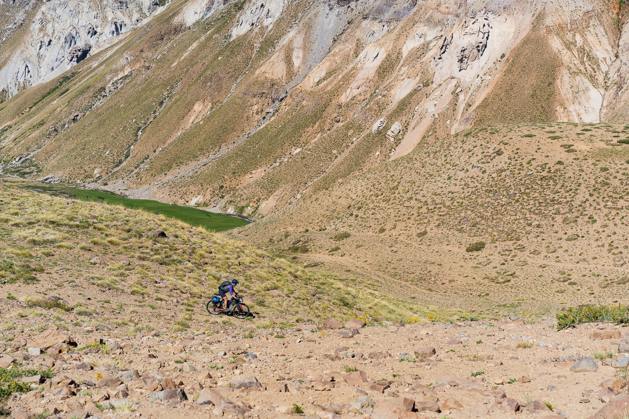
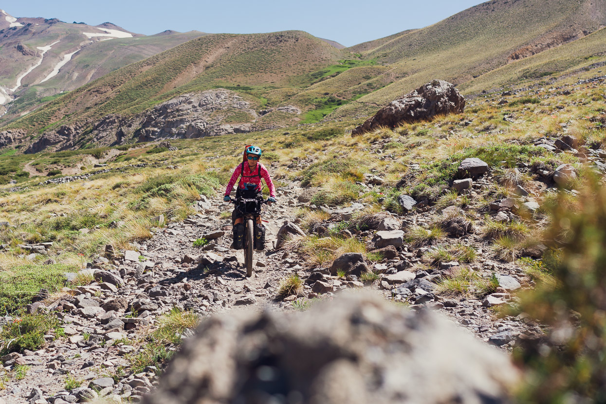
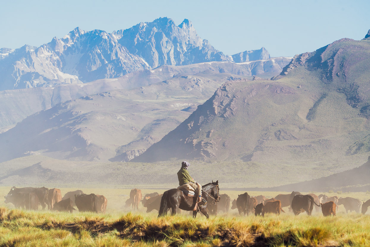
The rest of the ride down the Arroyo del Tiburcio was a mixed bag, with singletrack riding on quite good ground trails, odd sections of double track, open valley riding and the occasional malline (swamp), but we were lucky because the swamps were quite dry and Gonzalo had experienced a much wetter valley.
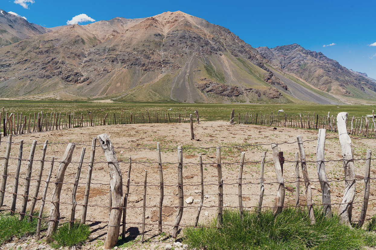
We passed a couple of reales, seasonal goat herder’s camps, for which the route is named. We were expecting these to be inhabited now that it’s summer, but the valley was devoid of other humans.
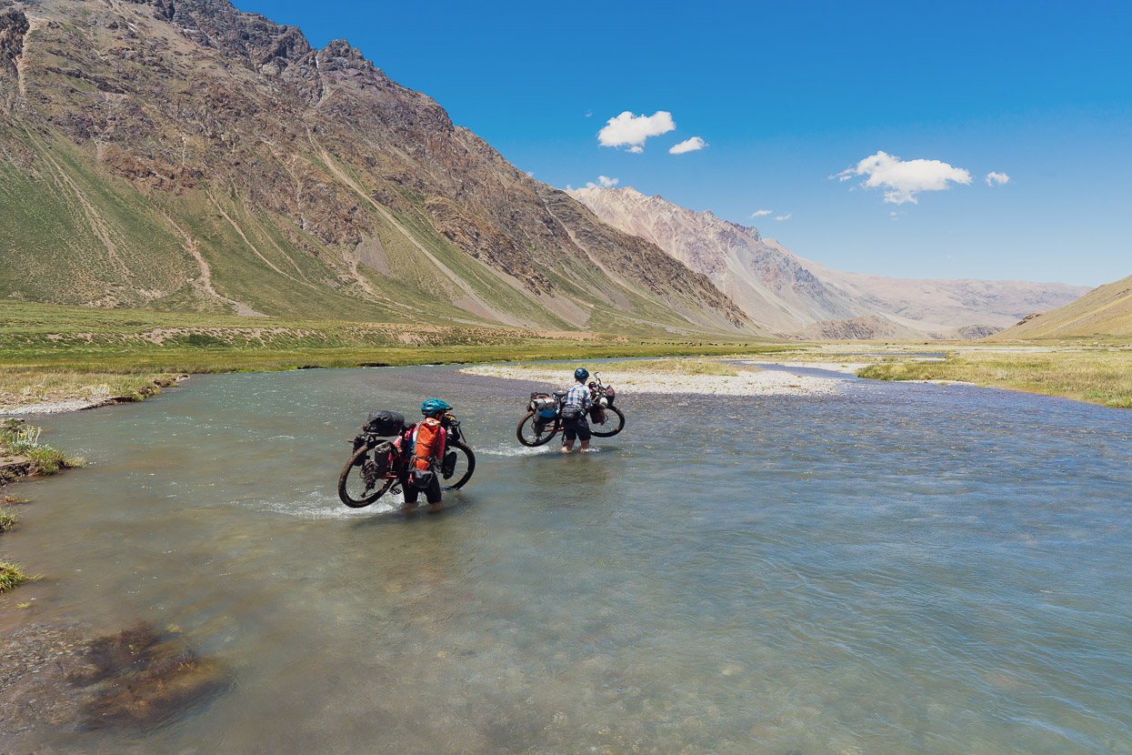
A couple of final stream crossings put us on a faster double track that led out towards the dirt road in the Arroyo de Cura.
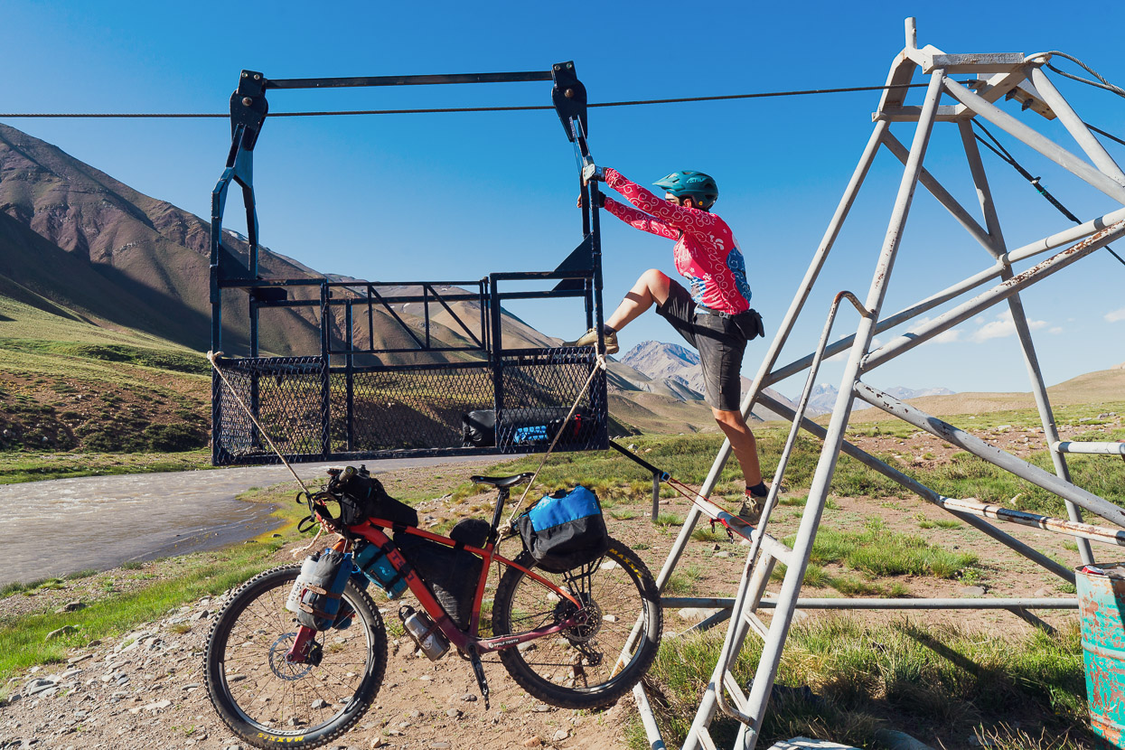
We had intended to cross this fast flowing river on the same goat herders’ footbridge that Gonzalo had crossed, but arrived to find that it was just cables with no deck, and had not yet been deployed for the season. There was also a cableway, but again the carriage was on the other side of the river, and I wasn’t keen to repeat my acrobatics from the previous day. We rode to a vehicle ford, hoping that a fisherman’s 4WD we’d spotted might be able to help when they returned down the valley.
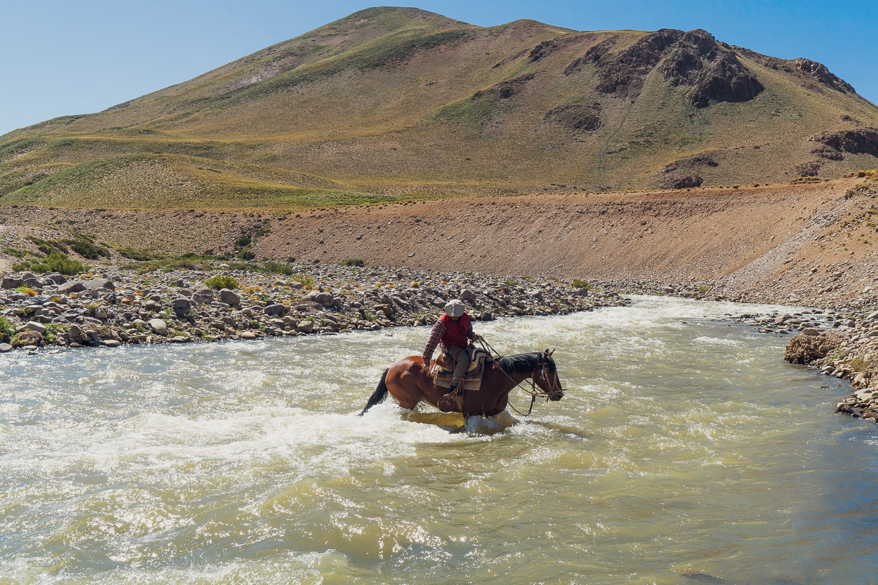
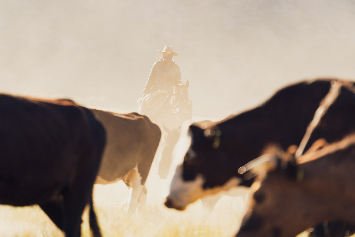
But instead a gaucho arrived. His horse provided a good gauge of depth and verified that crossing here was impossible for us, with or without bikes.
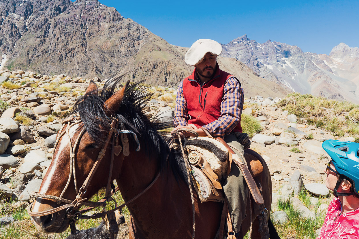
We didn’t know if the gaucho had spotted us and come to help, or if it was a coincidence, but he offered to bring the cableway carriage across to us, and had rope we could tie the bikes on with.
Well versed with this process, we were soon across the river. And our caballero refused a tip, instead galloping off in a cloud of dust into the valley.
The rest of the afternoon was sunshine and tailwinds as the gusts blew us down the valley like leaves until we reached a good place to camp next to the Rio Grande.
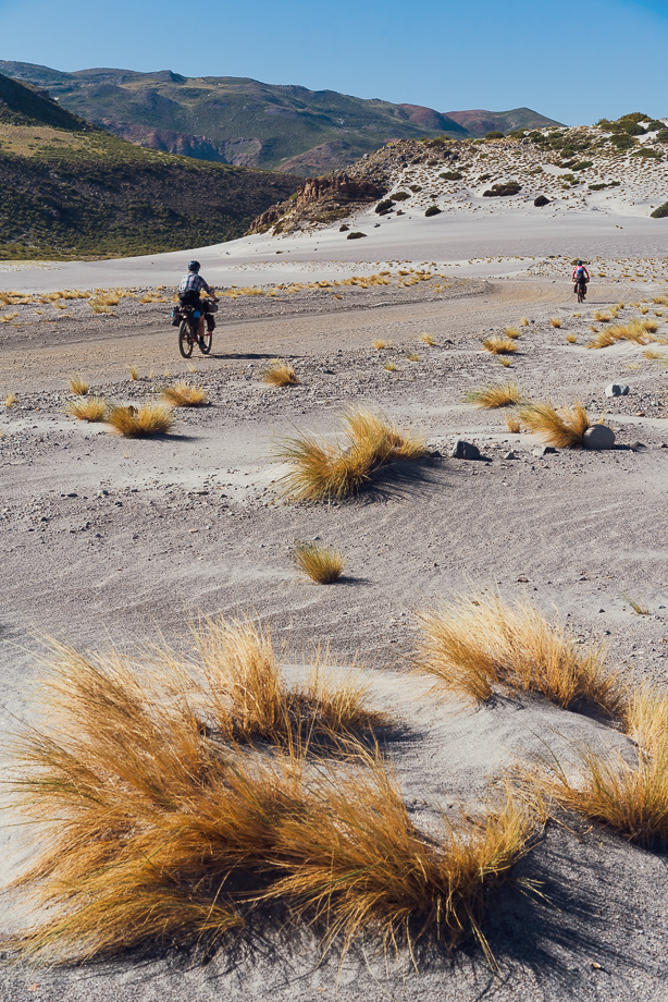
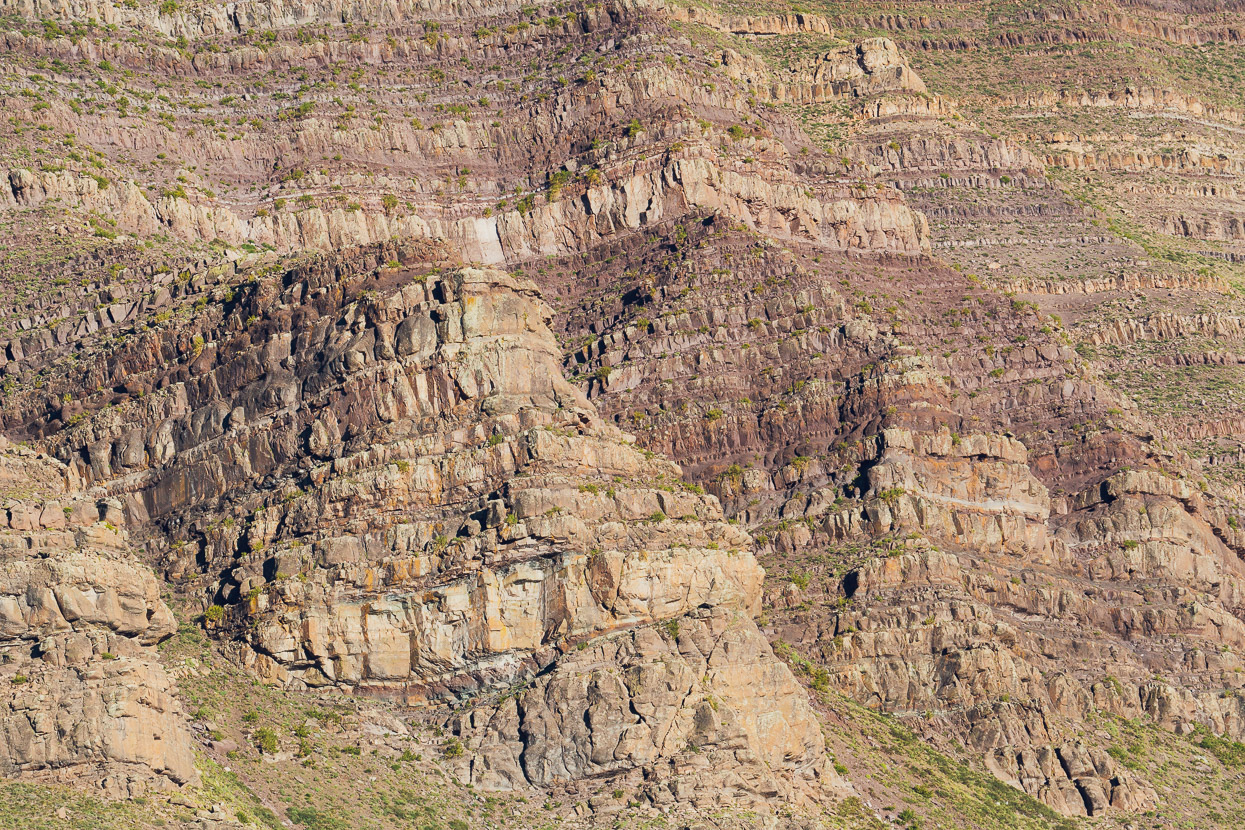
A shortish day remained to reach Bardas Blancas on the Ruta 40, but the morning’s ride was stunning for both the light and the remarkable geology of the valley. Huge basalt cliffs, sand dunes, and beguiling topography kept us turning our heads as we headed down valley.
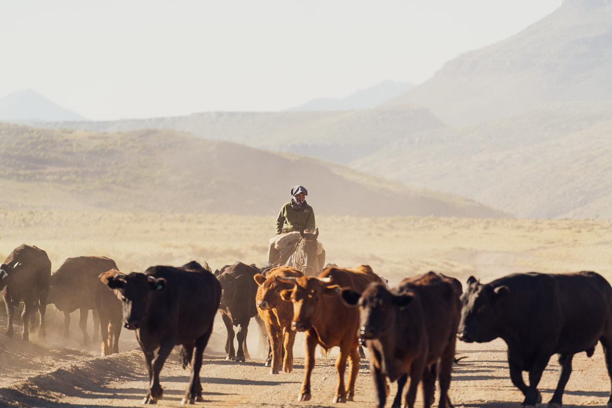
As we rode out, we encountered the crianzeros (herders/breeders) bringing cattle and goats up the valley to higher pastures. Soon they would inhabit the reales we’d seen, and we’d probably only missed the goat bridge deployment by a day or two.
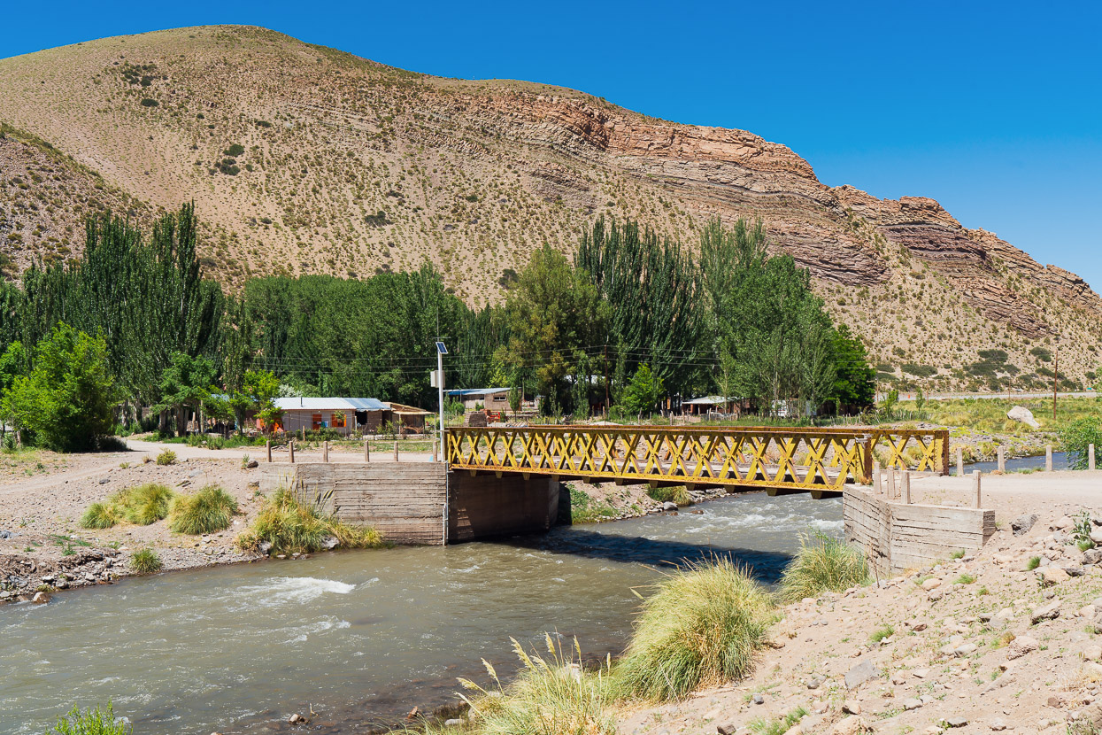
We reached paved road at Las Loicas on the Paso Pehuenche highway (145), where we had a huge feed of empanadas, before pushing onto Bardas Blancas on the Ruta 40.
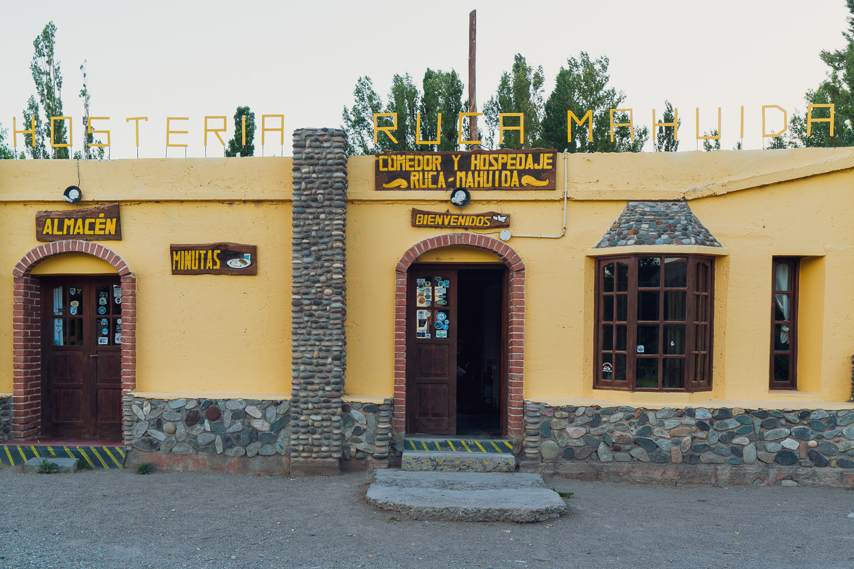
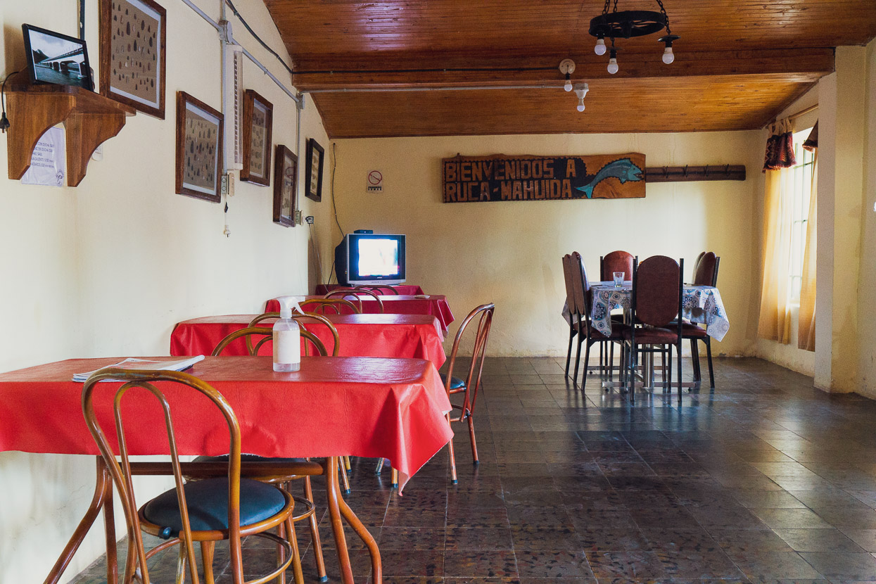
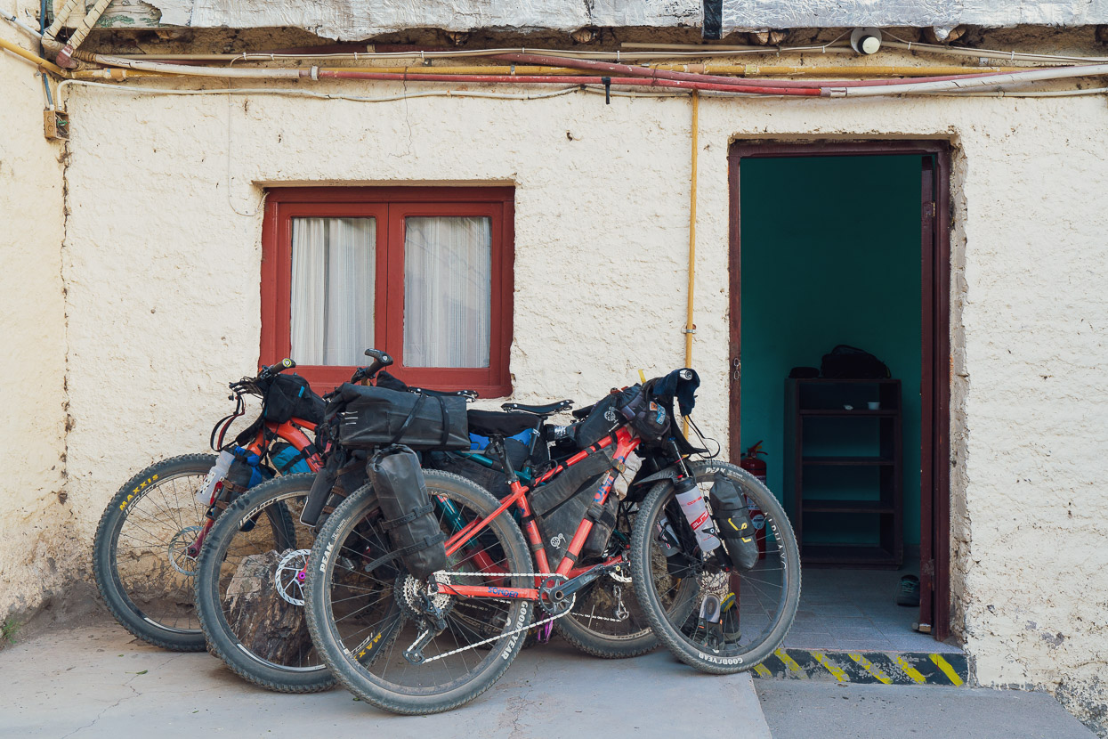
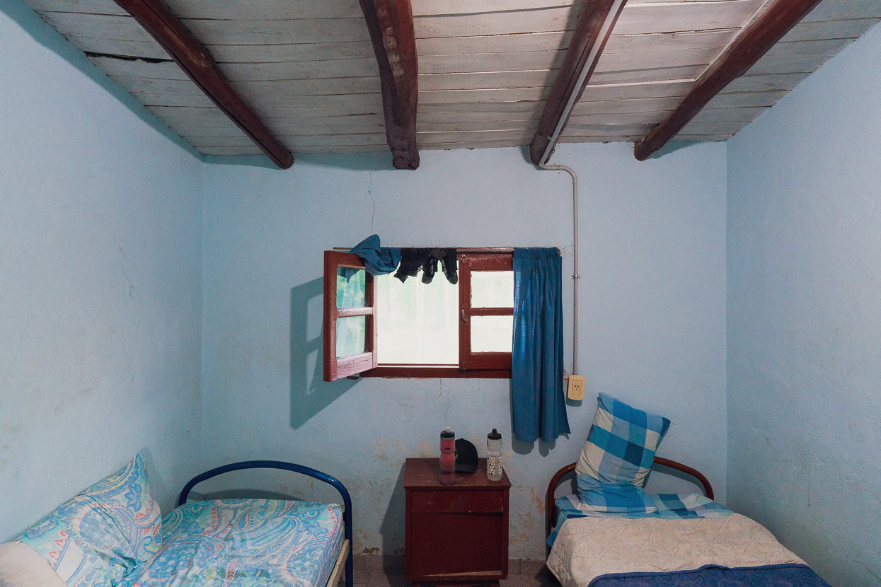
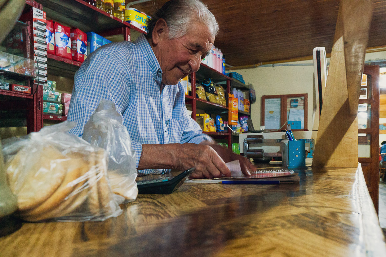
Bardas Blancas is tiny, hot and dusty, but very welcoming. There’s one main establishment there that provides rooms, meals, and an almacen (grocery store) that had very limited supplies. In keeping with most of this region, it was a step back in time, but a perfect place to rest for the afternoon, with the promise of a hot meal for dinner.
Coming next, the Norte Neuquino bikepacking route around Volcan Domuyo, the highest mountain in Patagonia.
Say thanks with a one-off donation, or check out our Bikepacking guide.
If you enjoy our content and find it informative or inspirational, you’re welcome to show us some love with a donation or a book purchase (US$19.99). The services we use to create our Bikepacking routes and host the website cost money, funds that we’d rather be spending on the road, creating bikepacking routes and content to share with you. Thanks for reading!


Mark & Hanna, we’re glad to be back following your adventures. Completing your original goal is a landmark endeavor and one that we were so glad you were able to pursue. We didn’t realize how involved we had become with your goal, until Covid caused the sudden abort with the goal so close in your sights.
It would have been so easy to have given up the ‘goal’ to fate, but we are thankful & happy you were able to restart the ‘engines’.
Be safe and stay adventurous, Vic & Joy
PS it’s been a long journey from our meeting place at Boya Lake in British Columbia, but the best adventure of our lifetime, thanks for making it all possible. Happy Holidays👍😊
Una vez más releo esta entrada al blog y puedo dar crédito que esta fue una aventura increíble! Queria recalcar una cosa. Luego de estar pedaleando nuevamente por el sur de Mendoza y norte de Neuquén, que es donde me encuentro ahora, creo que la mejor fecha para realizar esta travesía, sobre todo en la dirección que ustedes habían tomado, es a partir de la segunda semana de enero, dónde las aguas bajan y los puesteros suben a sus reales. De esta forma sería más fácil poder ser ayudados en los cablecarriles por los mismos puesteros o algún turistas, también las aguas estarían algo más bajas. Los puesteros suelen subir a sus veranadas ( puestos en las montañas) desde sus invernadas (sus hogares) en la primera semana de enero, al menos por esa zona. Me gustaría haber podido saber esto antes 🙏🏼 lo siento😬
Que sigan los éxitos. abrazos !!!! Gonzalo
Muchas gracias por la informacion Gonzalo! Abrazos y buenas aventuras para ti.
Mi próxima comentario será en inglés 😳🙏🏼 Eres mejor fotógrafo que yo ! Si duda !