
| Ticking off Remote Huts |
During the last 15 years or so, Easter is traditionally a time when we try to plan a West Coast tramping trip, when we’re in New Zealand at least. These have generally been based around the river catchments between Hokitika and Hari Hari, but sometimes further afield, as we try to explore and slowly tick off the rugged valleys and remote huts of this region.
Rather than the extended Easter journeys we usually arrange, this year’s trip had to be limited to five days, but that was plenty of time to walk an often off-track circuit in the Toaroha, Mungo and Kokatahi catchments.
While undertaking these trips is very much about appreciating the process of tramping and absorbing the terrain and landscapes in general, if we had a goal for this one, it was to reach Mungo Hut. This 1960s New Zealand Forest Service (NZFS) era cullers’ hut sits in a quiet, isolated valley just a stone’s throw west of the Main Divide of Ka Tiritiri o Te Moana, below Hokitika Saddle. It takes at least two days to reach this seldom visited site, and a further two for egress. With the West Coast’s likelihood for rain, and many unbridged stream and river crossings, there is always the possibility of a forced pit day too, so it’s a trip where you need a few days to play with.
Although we tend to only fit in one multi-day West Coast tramping trip a year, these experiences are something I cherish, because tramping on New Zealand’s West Coast is like no other hiking experience on earth.
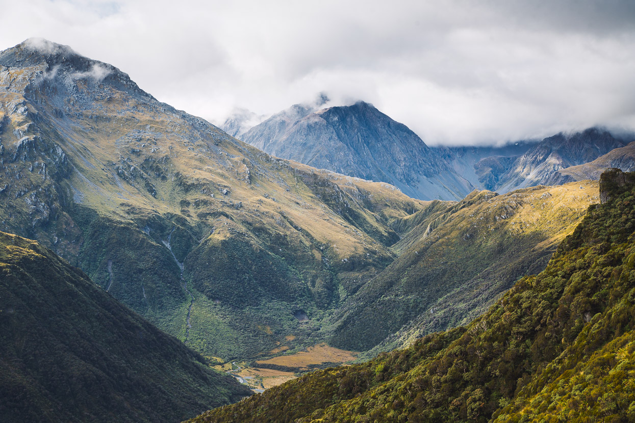
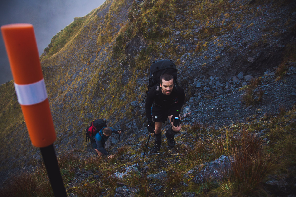
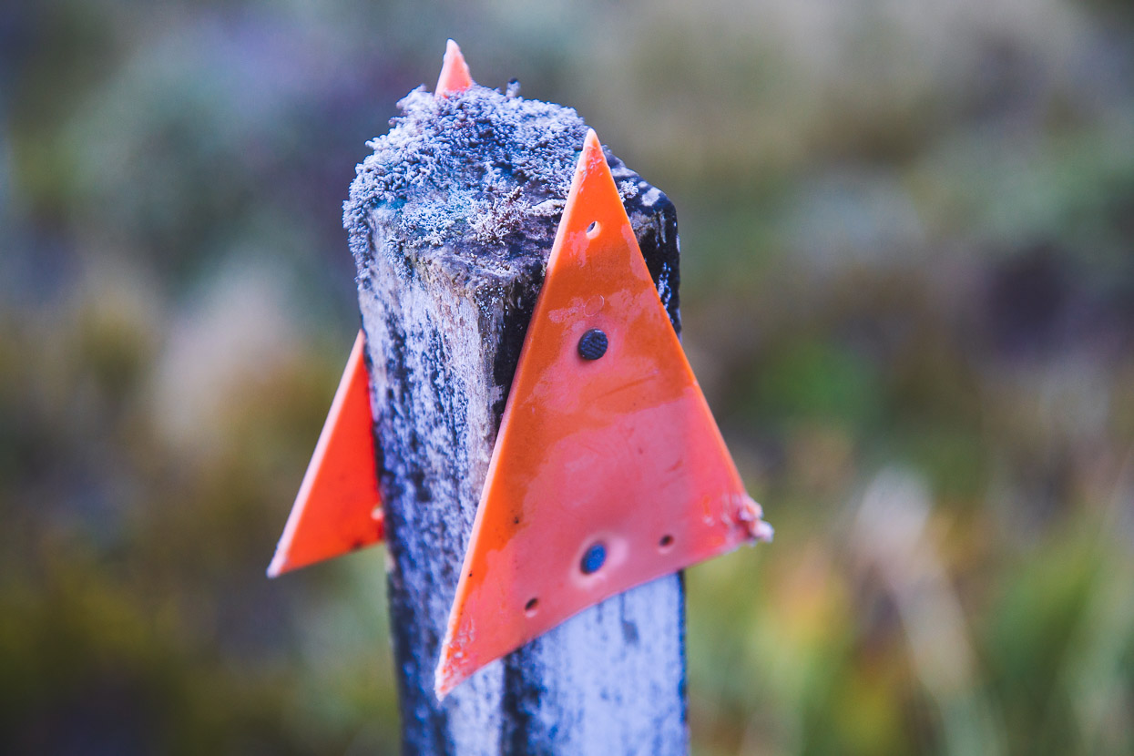
Driving the short distance to the mountains from the coast, and the hub of Hokitika, you pass a few simple rural homes on the outskirts of town, some lifestyle blocks, and then you’re into verdant dairy farming country. There’s an untamed, frontier edge to the land and lifestyles here. Retired farm machinery rusts in paddocks. The hills close in. They’re often cloud capped. Moody. The farmland ends abruptly as it butts up against thick forest and the steep relief of the ranges. The road ends are unfussy: a simple DOC sign with some optimistic trail times, and perhaps an orange triangle nailed to a fence post usher you towards the bush.
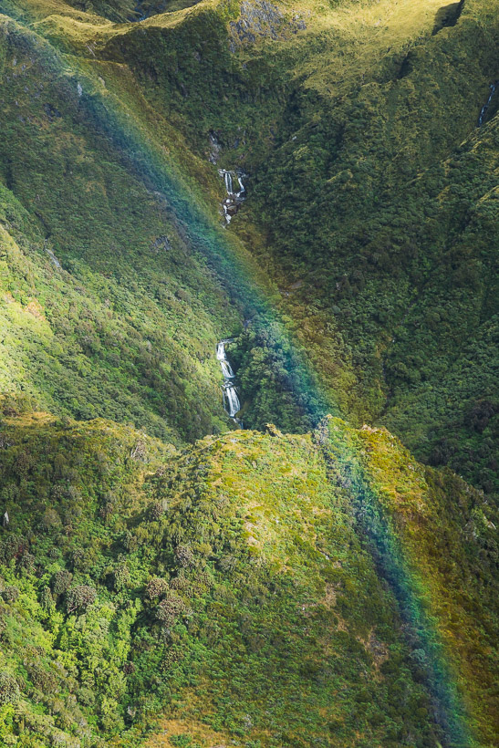
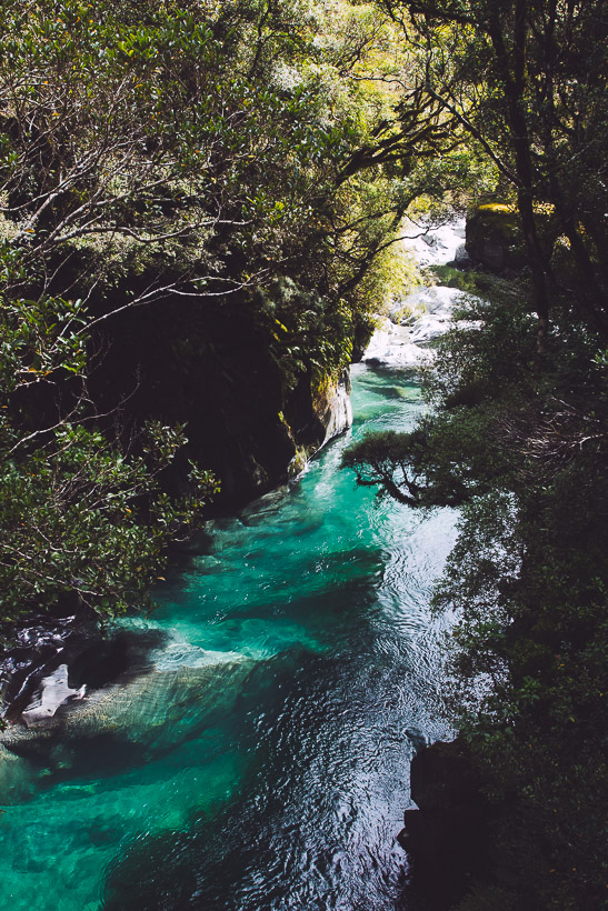
Many of the rivers have hewn deep gorges from the schist bedrock, one day tumbling emerald coloured and the next turgid and brown with floodwaters from the rain. Some stunning forest covers this region; podocarps that connect this bush to ancient Gondwanaland, mountain cedar, tree fern, astelia, dracophyllum and southern rata. It can have you craning your neck in awe one moment and grovelling on your knees through its tangled abundance the next.
It’s a raw and largely unmodified back country, but there has been just enough human footprint here to open up a lot of possibilities. The valleys, ridges and saddles are quite well served with huts and rudimentary tracks. The huts were once key to the wild animal control programs that operated here post Second World War through to the 1970s, when deer cullers required permanent shelters for their long stretches of hunting in this remote country. These days they provide shelter to both hunters and trampers and add a tangible history and cultural depth to the tramping experience.
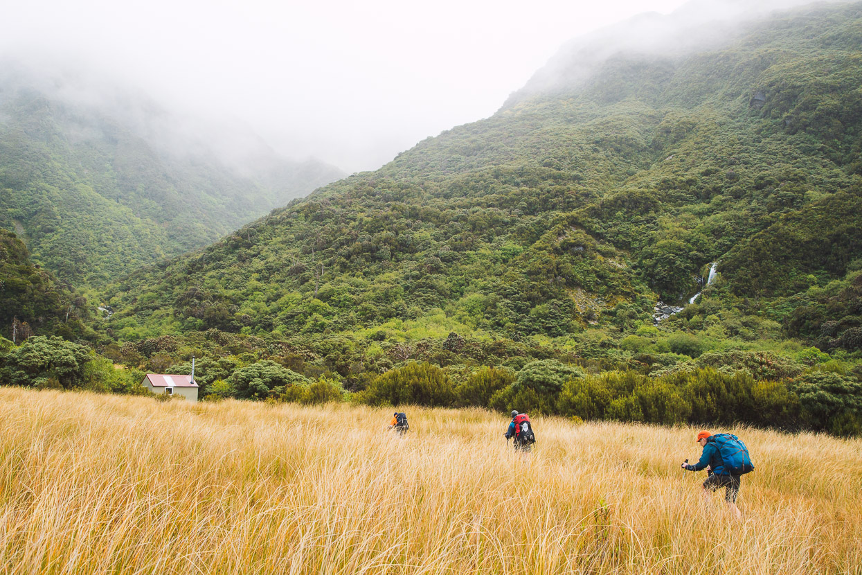
It rained four days out out of five on this trip. And so it was a wet first four hour’s walk in to the huts at Cedar Flat for lunch on day one. We generally don’t let a bit of West Coast rain put us off; you’d never get anywhere if you did that. The issue is more about just how much rain there is, when it’s due to peak and ebb and designing your trip and chosen night stops around that.
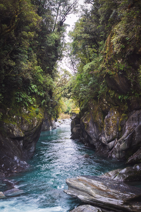
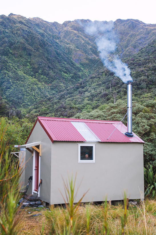
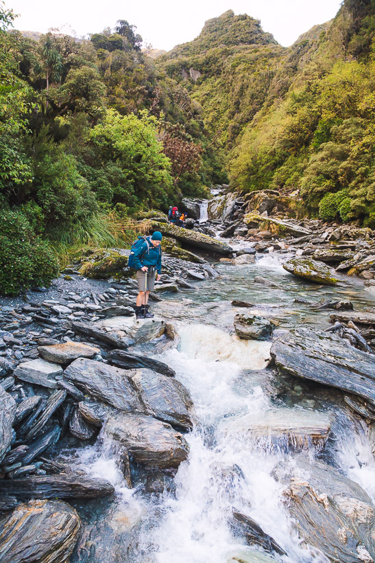
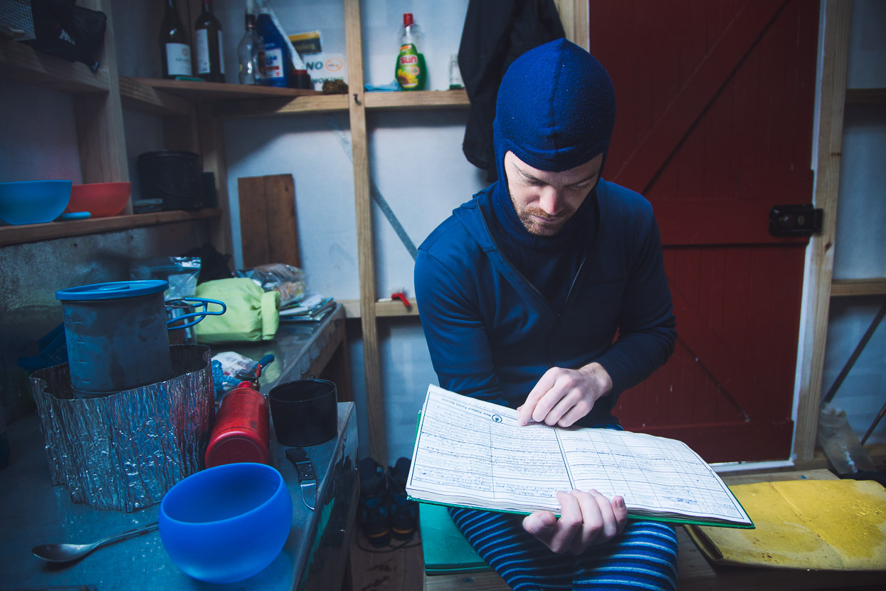
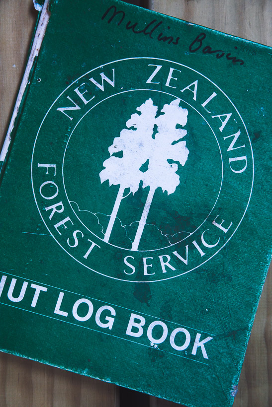
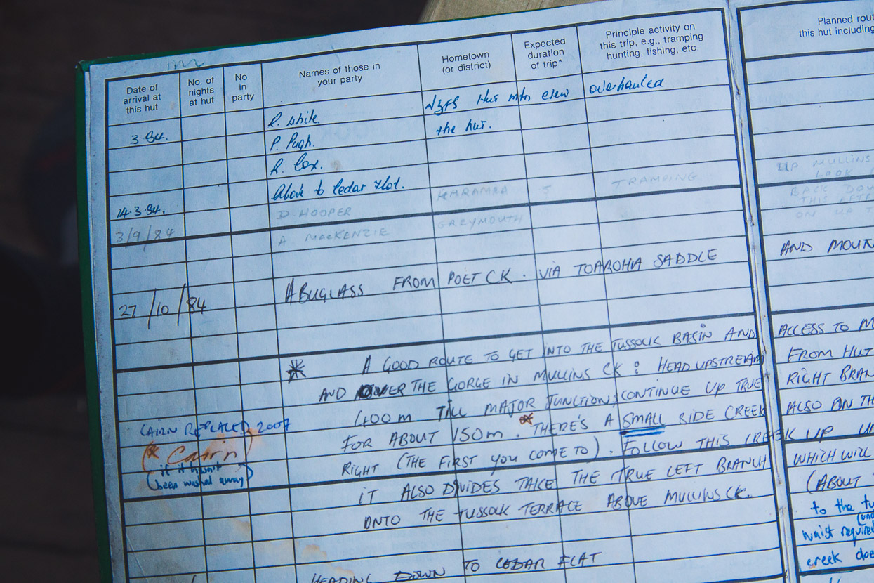
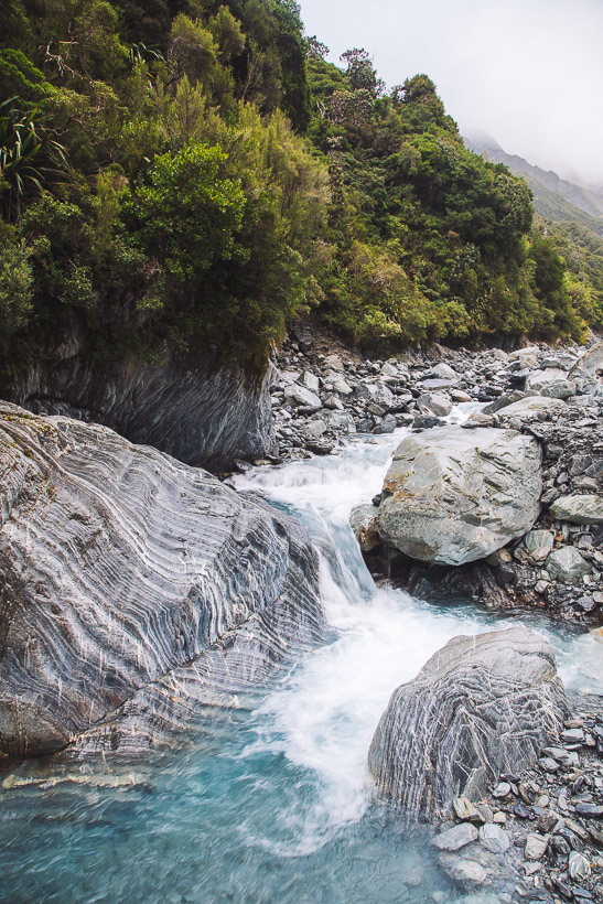
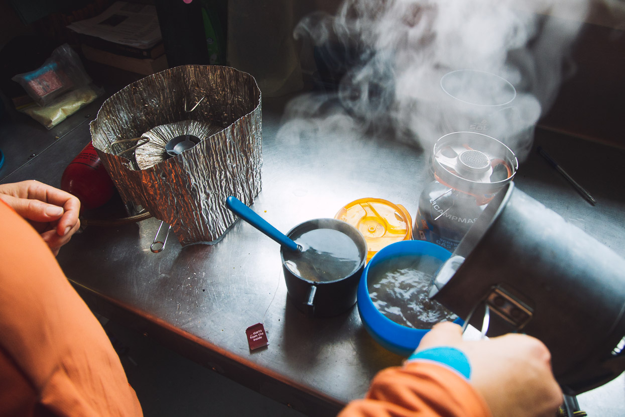
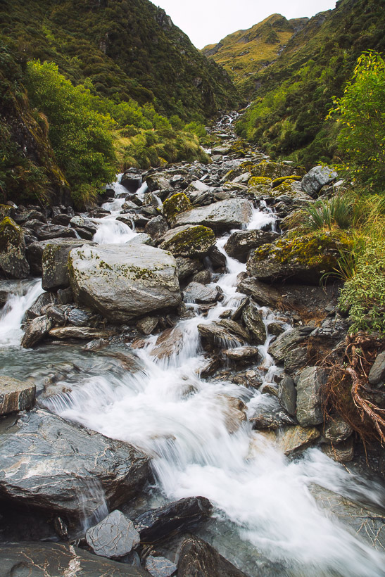
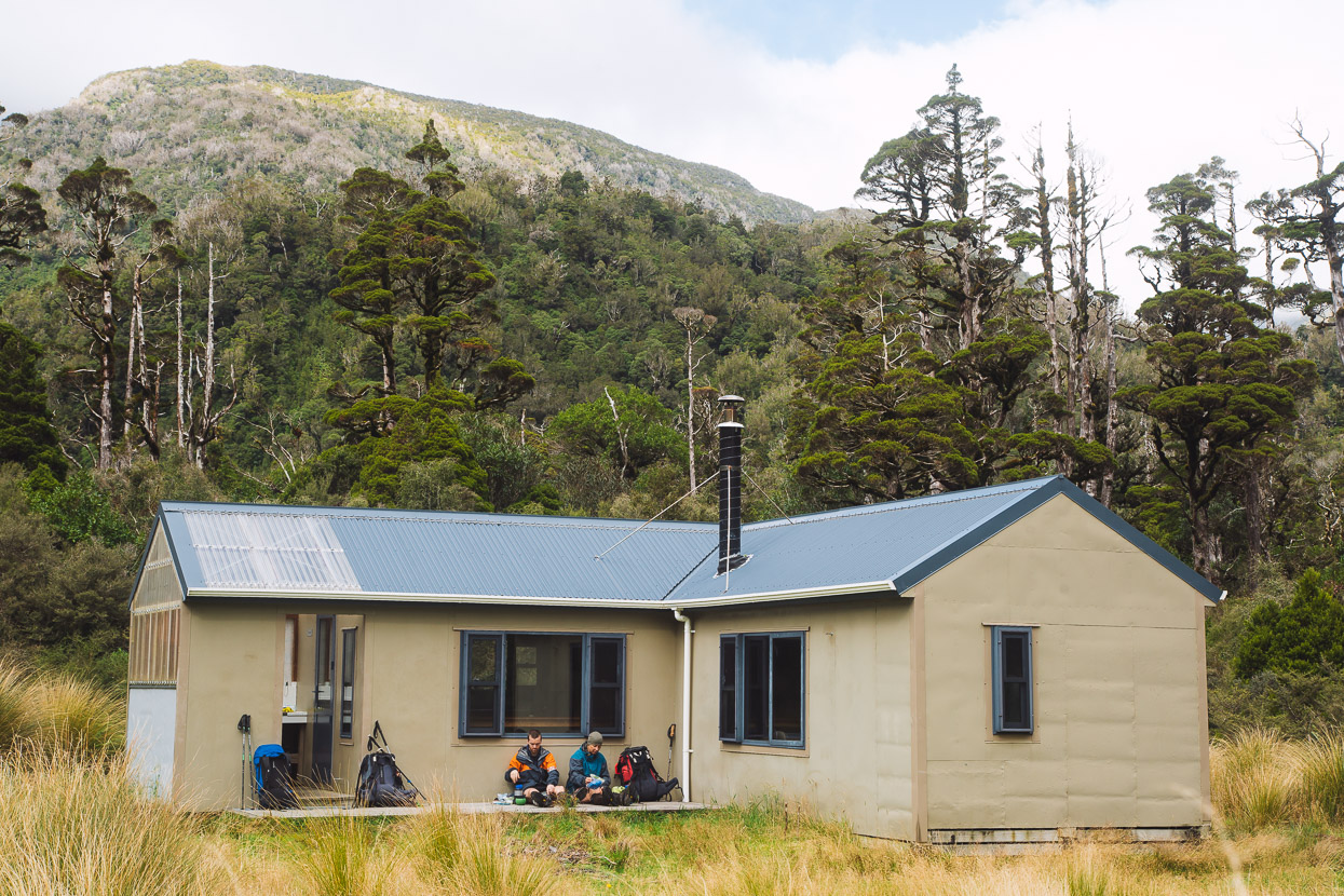
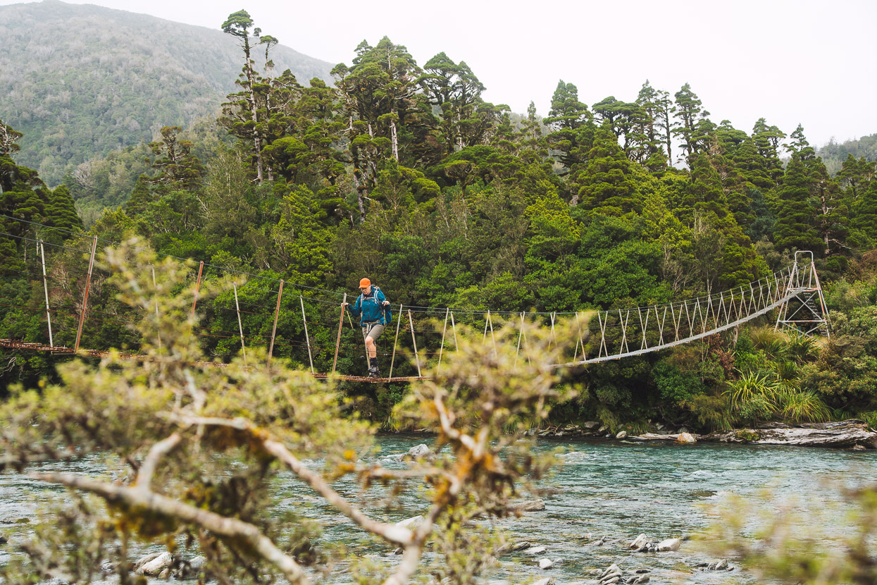
From Cedar Flat we continued up the Toaroha Valley, past its stunning gorged section, before carefully fording the river just below Mullins Creek and climbing steeply up towards Mullins Hut for the night. This hut was recently refurbished by a dedicated volunteer team (thanks to BCT and Permolat). Mullins lies in a tranquil sub-alpine basin and sees few visitors. The hut book (still the old Forest Service one) dated back to the early 80s, and provided some good hut reading for the night with its entries containing past epics, as well as some very handy route beta. While the hut shape is still the same, it’s been thoroughly rebuilt with new framing, cladding and roof and had a wood burner added, so we were able to dry out already wet clothing.
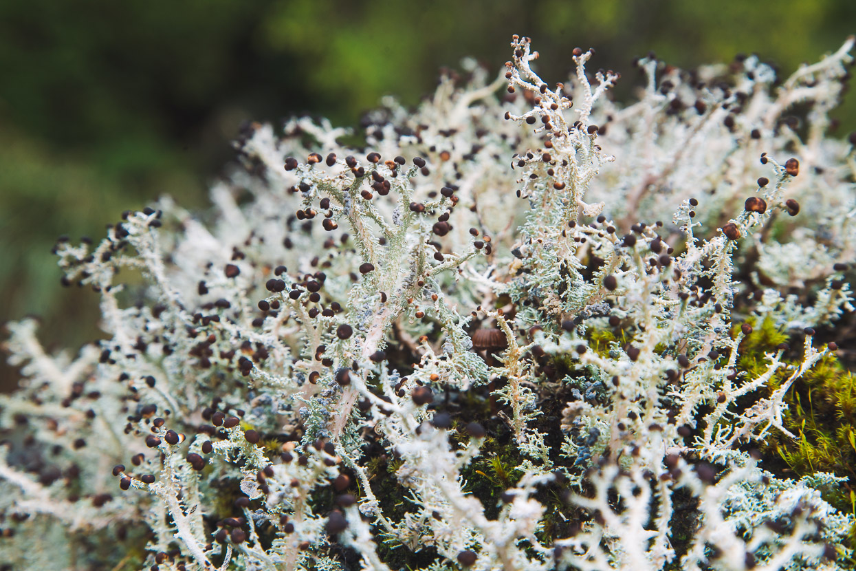
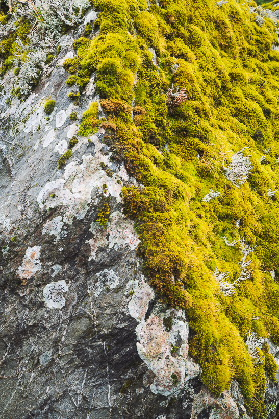
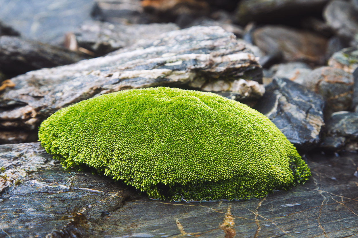
Due to the rain, my camera didn’t come out until after Cedar Flat, so aside from one shot of the Toaroha Gorge, these first seven photos are from around Mullins Basin.
The plan for day two was to reach Mungo Hut via the Diedrichs Range (which runs NW-SE, and lies to the SW of the hut). We’d gain the range and follow it to Toaroha Saddle, and then follow the tops further east, on the flanks of Mt Bannatyne, before dropping down a spur parallel with Topo Creek to Park Stream and Mungo.
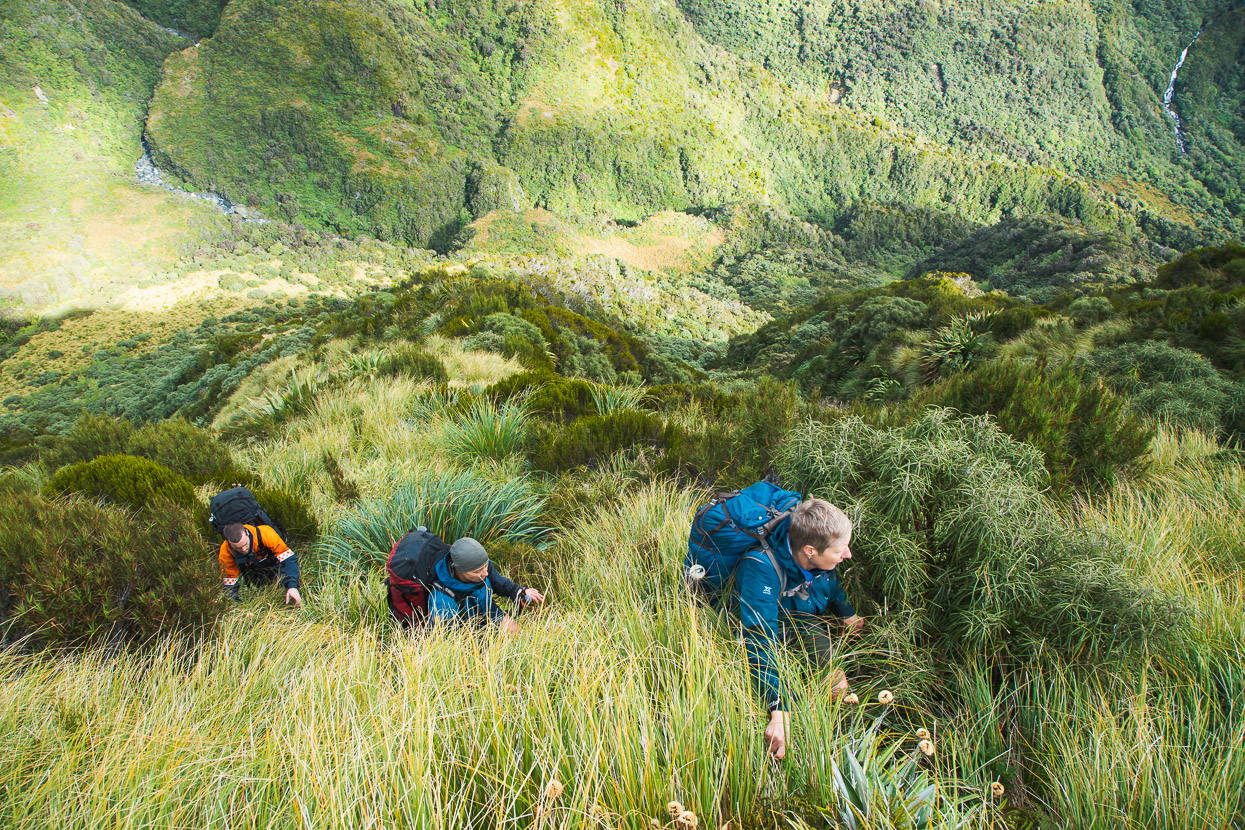
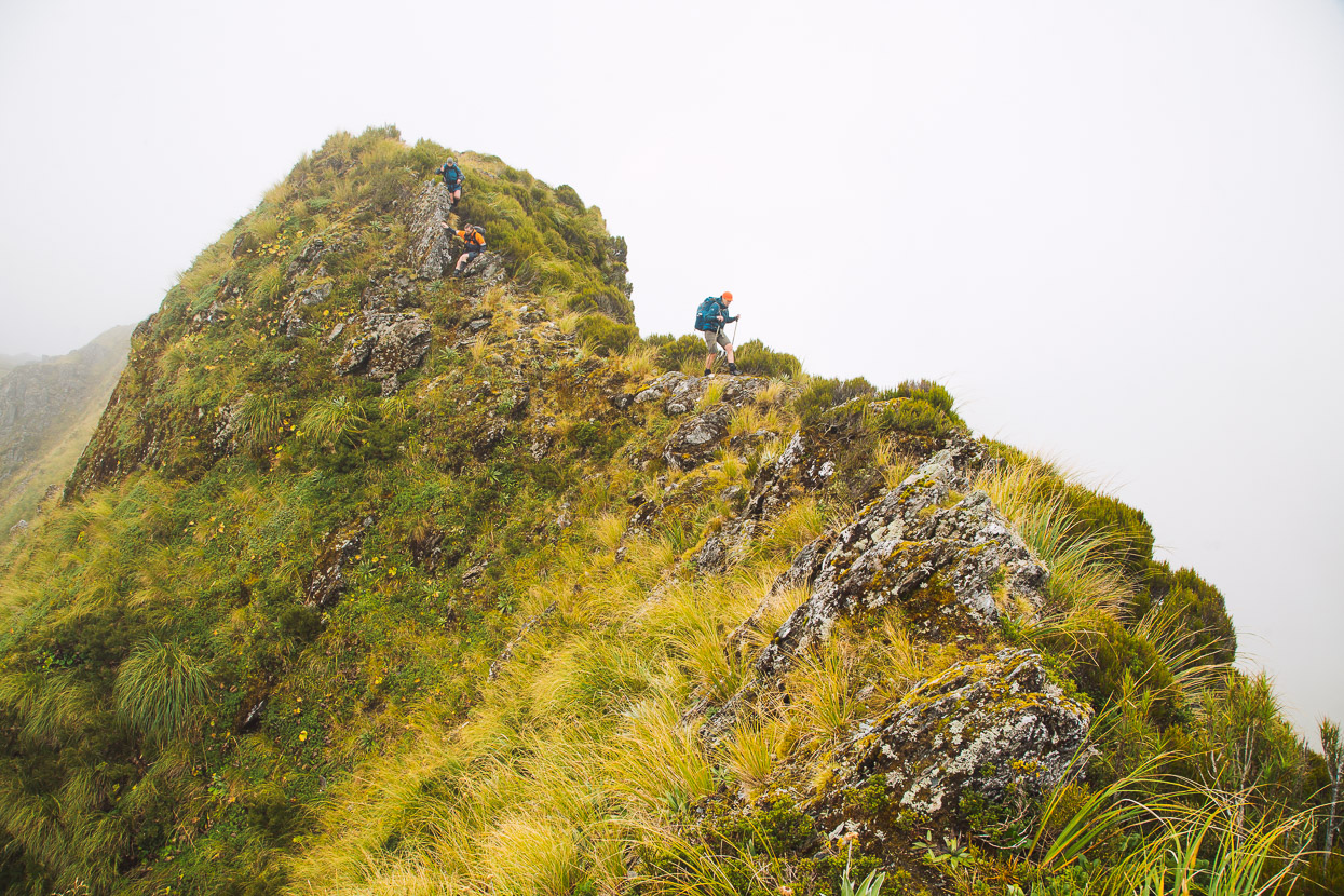
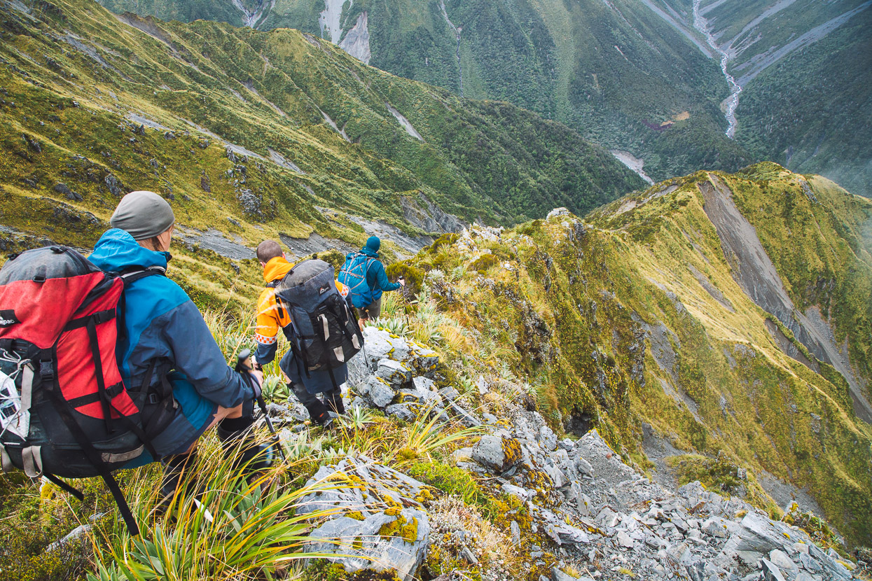
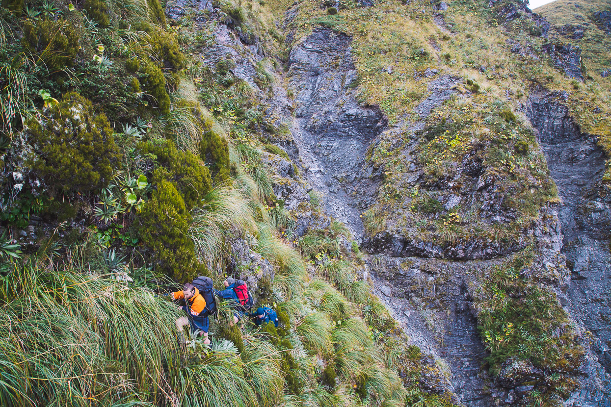
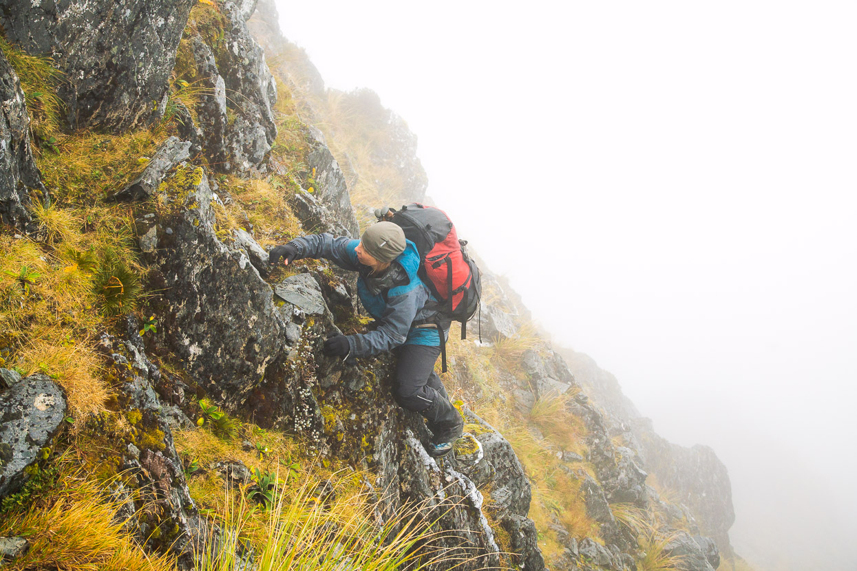
The route from Mullins to gain the range was an unlikely one viewed from afar, but actually worked out pretty well. Shortly upstream from the hut, a bit of permolat marked a tiny creek and a partial tunnel through the scrub. We wormed and crawled and climbed up this creek for a while, including scaling a small waterfall, wondering if we were going the right way, but eventually left the creek, largely by intuition, and popped out in a small tussock clearing. There was a white permolat cross on a tree that we saw once we left the creek (which marks its entrance if you are going the other way). From there it was a relatively trouble free scrub bash and tussock haul up to Pt 1251.
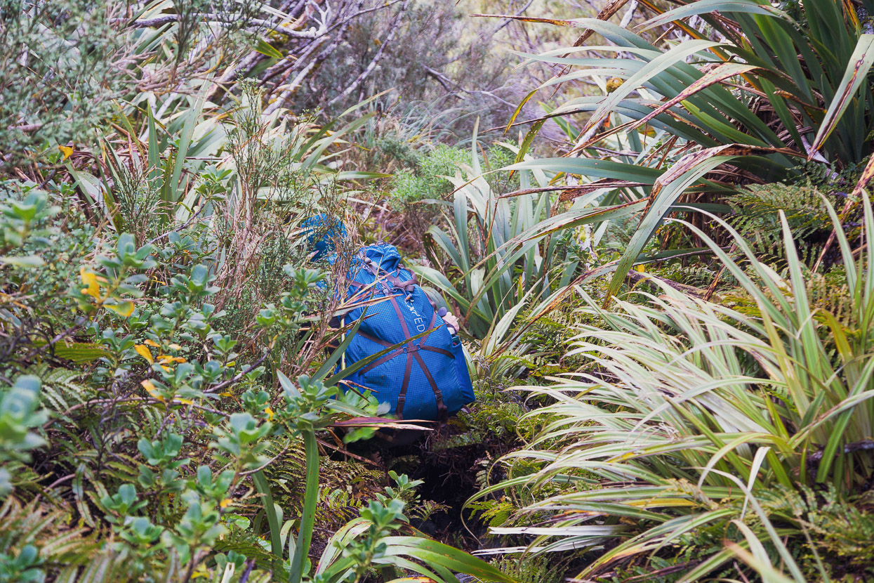
If you’ve tramped off trail on the West Coast before, it was standard fare, but to those uninitiated with the intimate full body tangle that West Coast tramping can be, it might come as a surprise.
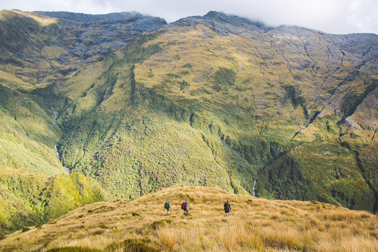
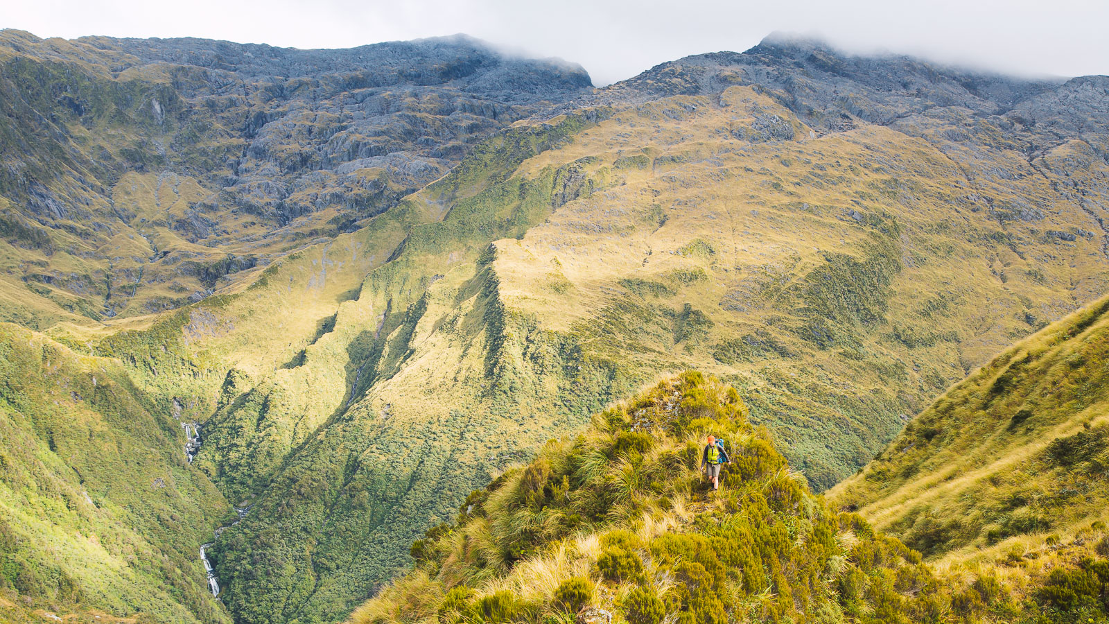
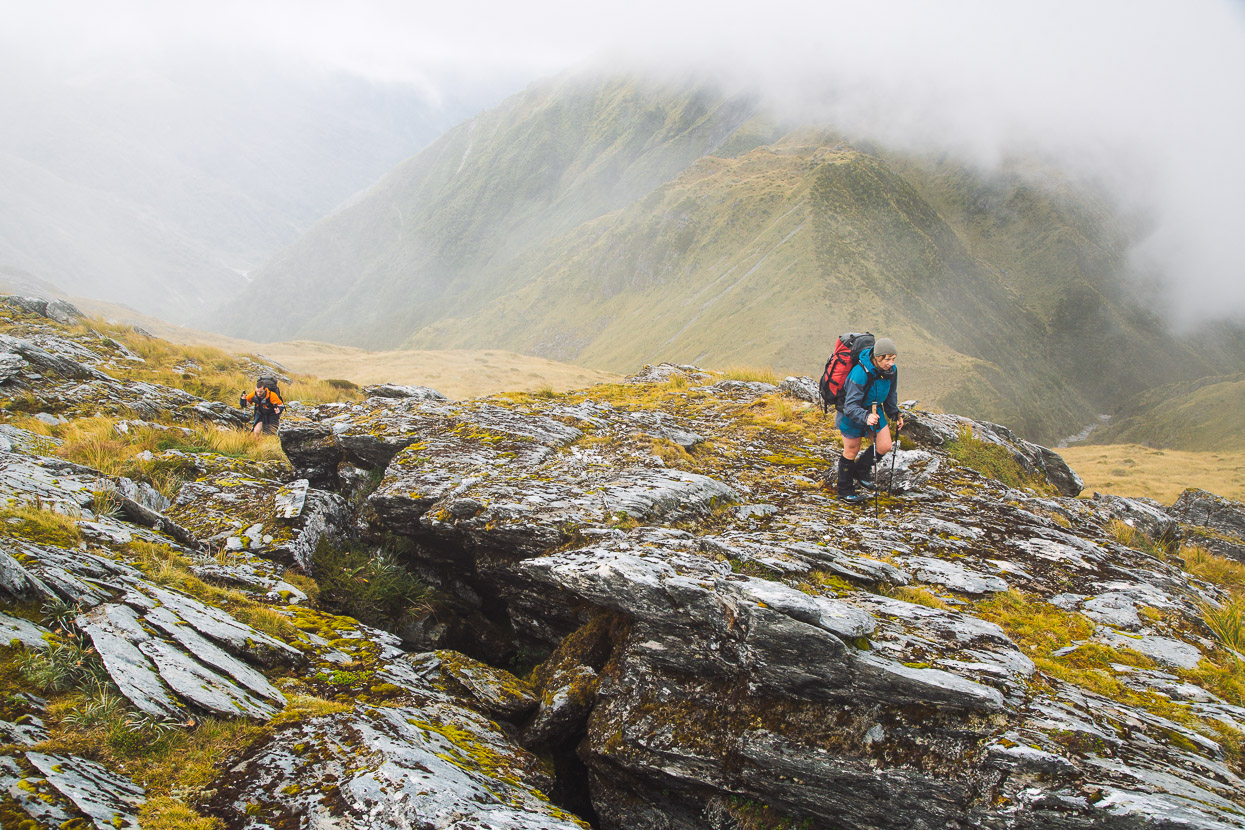
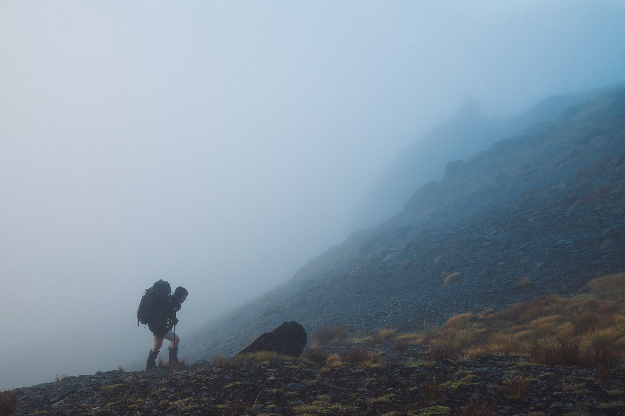
From Pt 1251 travel was much easier along a sometimes narrow ridge and broader tussocky slopes. But it soon began to drizzle and we disappeared into the cloud.
This is the view towards the upper Toaroha Valley and Toaroha Saddle, before the cloud dropped.
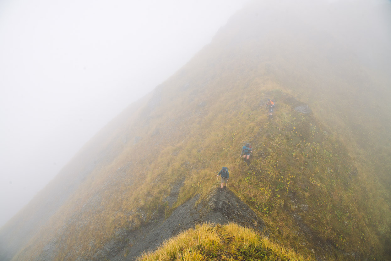
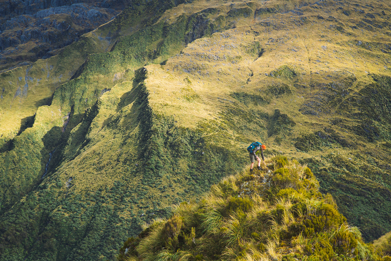
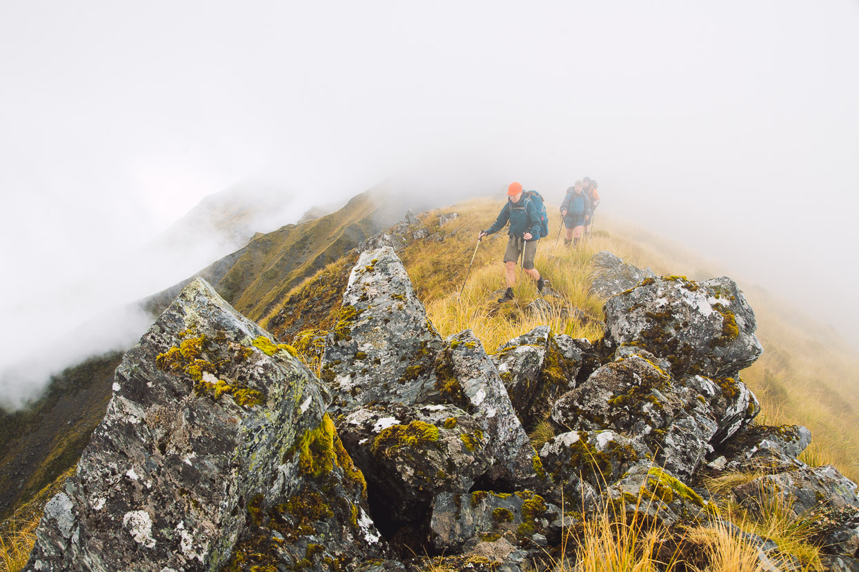
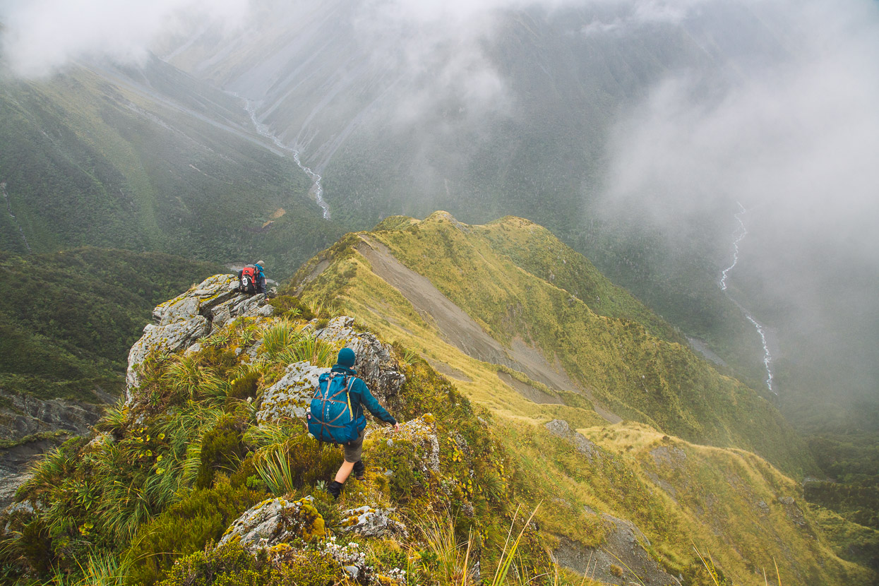
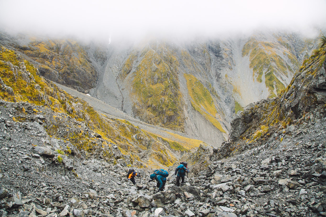
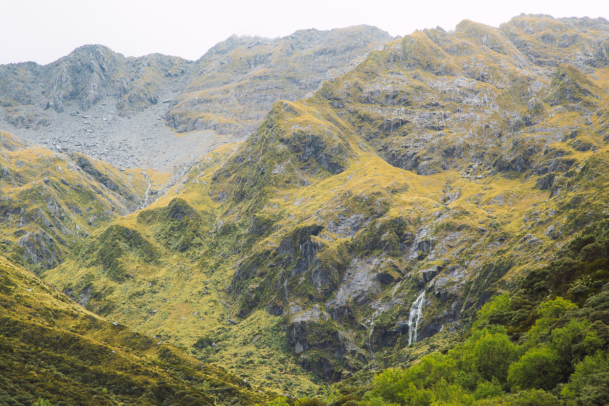
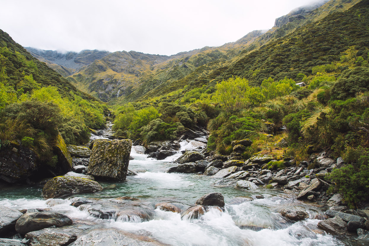
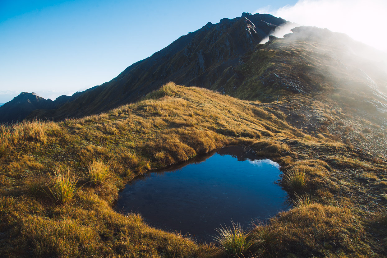
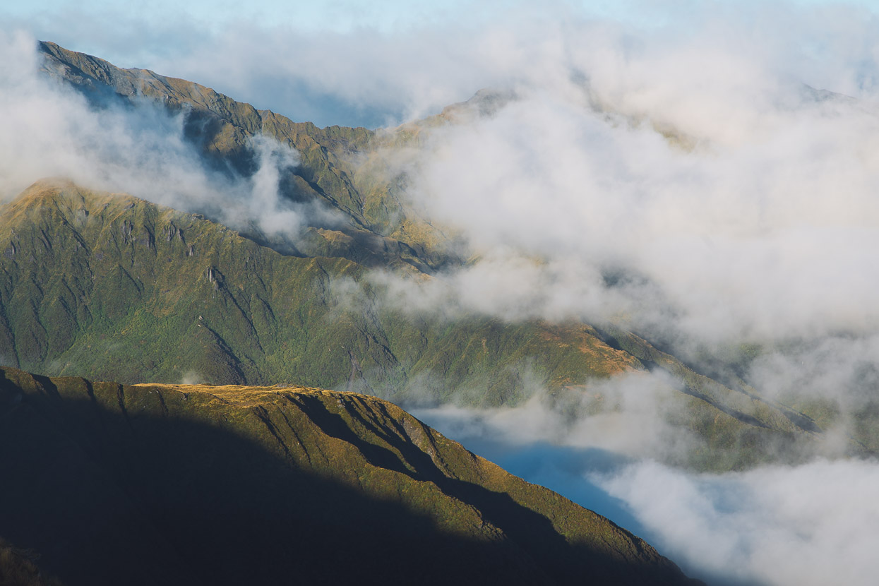
Some careful navigation and reading of the ground was required to pick the best way beneath the summit of Mt Ross and Pt 1524 without getting bluffed in the mist, but soon we were making our way along the sometimes sheer ridge towards Toaroha Saddle. This is a really stunning section of tramping, and while we did get a few peeks down into the Mungo River and towards the Main Divide, on a clear day it would be stunning.
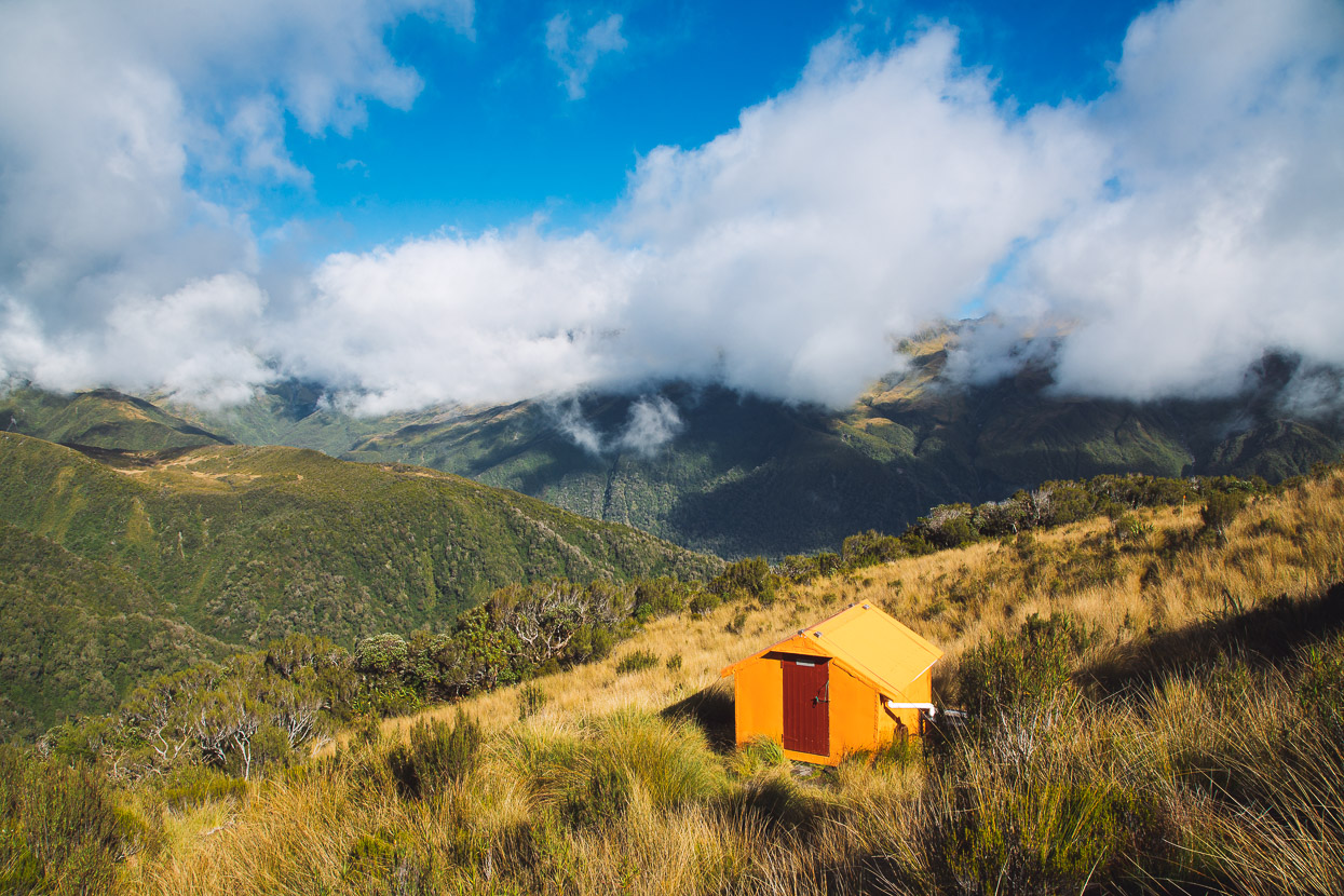
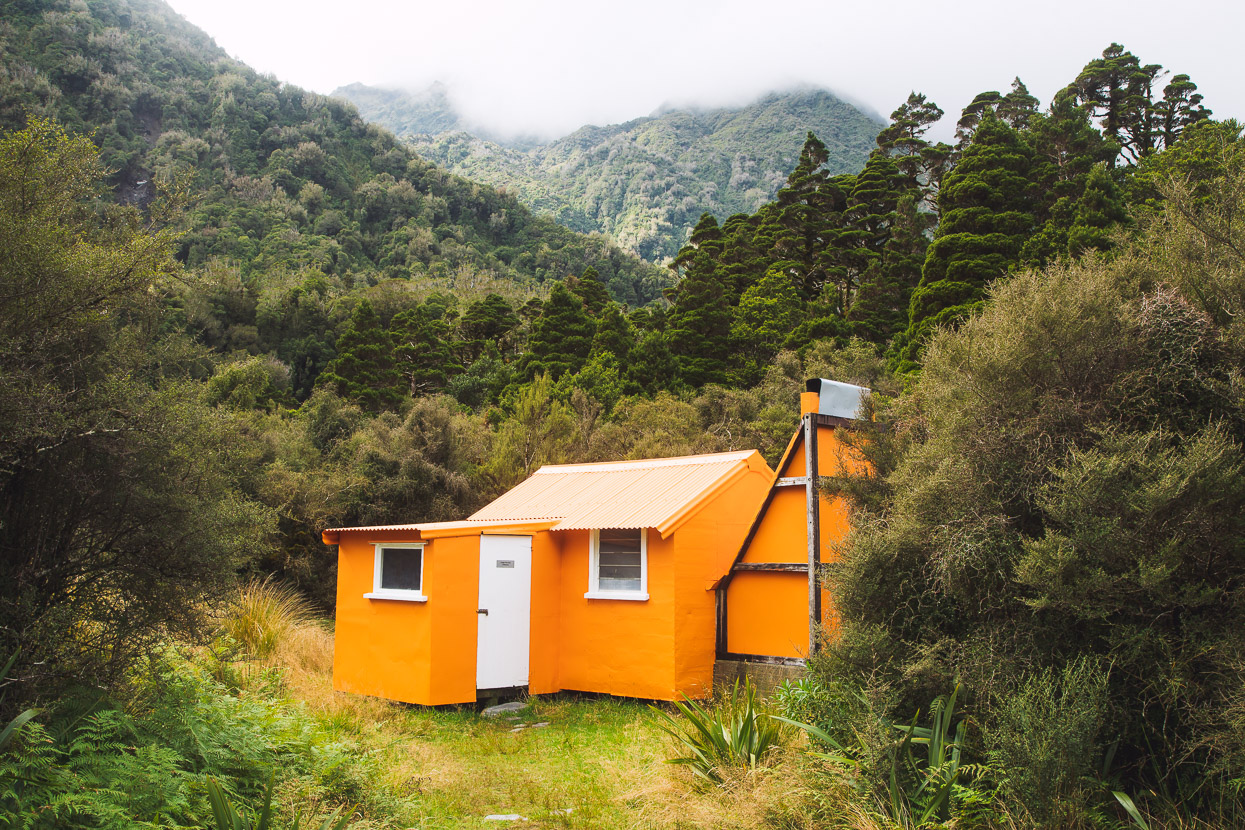
Lonely on the saddle, but beneath the cloud base, Toaroha Saddle Biv provided a sheltered spot for a late lunch. This two person stand-up biv is another NZFS classic. It was a late lunch though, as we’d all agreed we’d have gotten really cold stopping in the wind and drizzle on the exposed ridge, so we’d pushed on.
As the crow flies, it’s not far from Toaroha Saddle to Mungo Hut; only two and three quarter ‘squares’ on the map, but whichever way you go it’s a much longer and more involved effort than 2.75 straight line KMs might suggest. My understanding is that descending to the Mungo directly from the saddle (on a reasonable track) and then heading up valley used to be the best way. But landslides and severe floods have washed out the river margin enough that this is now quite a messy way to go. We chose to take the mostly untracked tops route via Topo Creek.
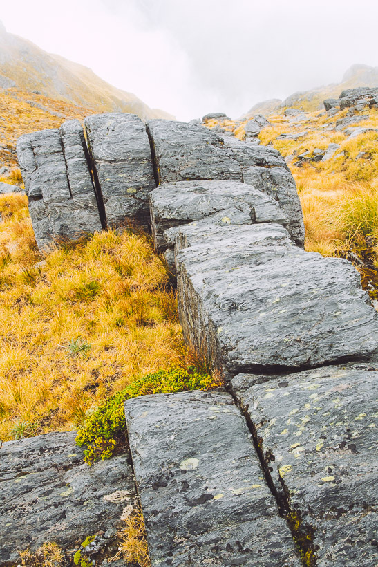
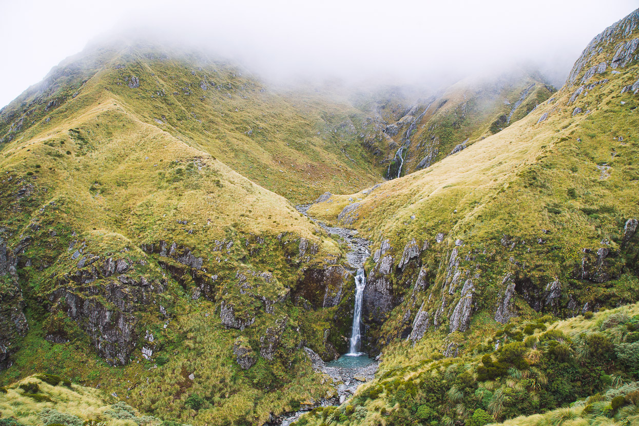
At first this route is really pleasant, as it wanders up and along easy tops, with some waterfalls, nice lumps of rock, and the range dropping away sheerly around you.
The route to descend the ridge parallel to Topo Creek is well described in the Mungo Hut notes on remotehuts.org
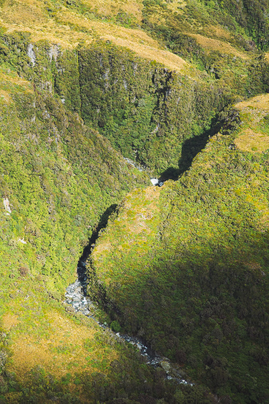
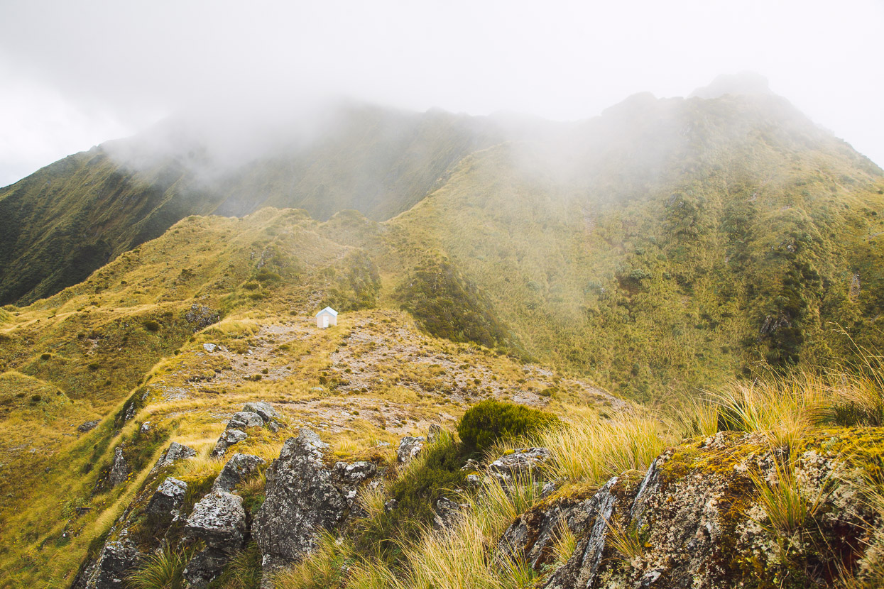
We descended the crown of the ridge at first, remarking at how impressively steeply it dropped it away on both sides. We could already see Mungo Hut, made a little more obvious by the burnt bush surrounding the hut from a recent accidental (and nearly disastrous) fire, but it was a long way down still.
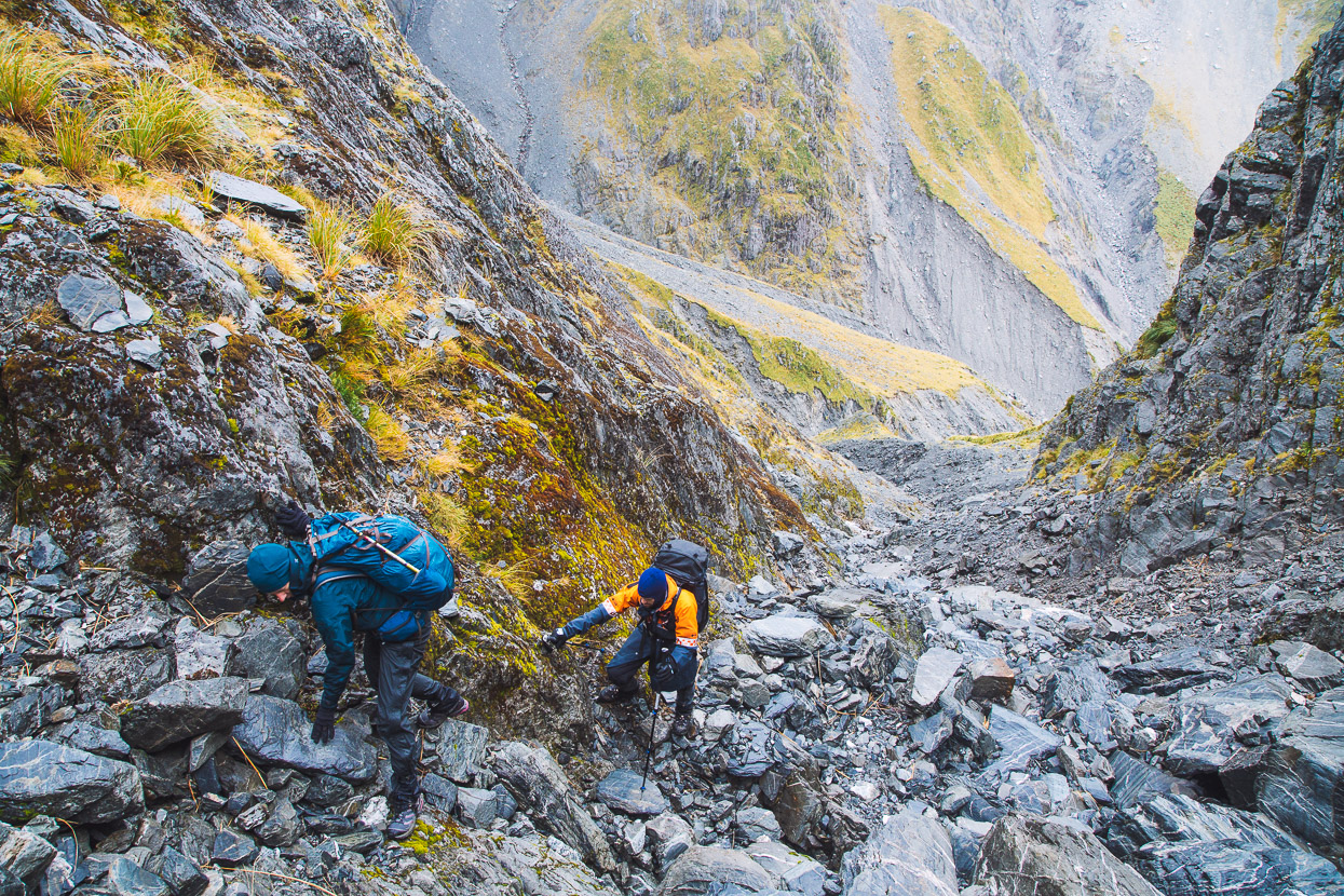
A small but very exposed rock step then forced us on to those same steep slopes to bypass it and we dropped down a gully, before sidling round to rejoin the ridge. It was one of those sections where you have to fully commit to the vegetation and climb across it, clutching handfuls of snow grass and the odd reassuring leatherwood branch. This detour is described on Remote Huts and was sparsely cruise taped.
Further down, three warratahs marked the beginning of an old cullers route that drops down through very steep scrub and bush until it emerges at the confluence of Topo Creek and Park Stream. I suspect that until this was recut recently by West Coast tramping veteran Andrew Buglass, it would have been a seriously grovelly undertaking. As it was, we still spent a fair bit of time clinging to trees as we worked our way down slowly in the fading light.
It was pitch dark by the time we reached the confluence. We turned downstream and followed the riverbed until we found the track up to Mungo that initiates at the Park/Mungo confluence. It had been a long day and we were happy to reach this cosy hut, which maintains its reputation of requiring a bit of effort to reach.
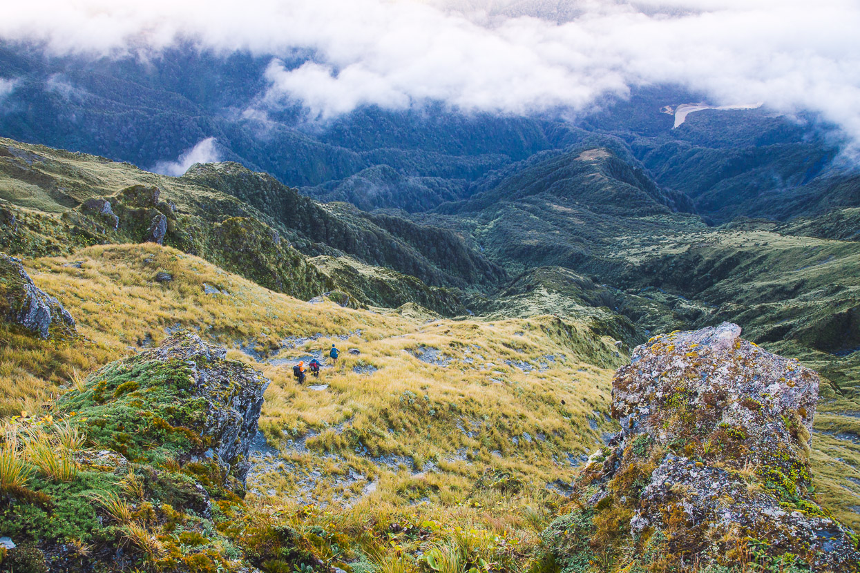
It’s a shame we didn’t have a bit more time to absorb this remote spot in daylight, but we had a long day lined up to reach Top Kokatahi Hut the next day, and were committed to continuing, with the threat of heavy rain the following day. And so we left soon after day break, following another fairly recently recut track to join Park Stream just upstream of the Topo/Park confluence.
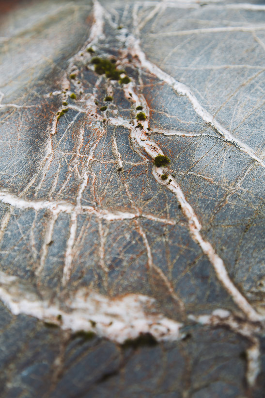
The Park has been scoured out by floods and the riverbed is a mess of boulders and gravel right across the bottom of the valley, but the travel is still quite quick. There’s lots of nice streaky schist boulders to marvel at too.
We left the Park via a steep creek and series of gullies that climb to a col just south of the summit of Mt Chamberlain. Which sounds straightforward, as does the description on Remote Huts, but it was quite a bit more involved than that.
We climbed straight up 600 vertical metres, following our noses. It was the sort of travel that requires maintaining a bigger picture view, while you micro navigate up steep and sometimes loose ground. Picking your way carefully to unlock the line of least resistance and greatest security. It’s the sort of mountain travel I really enjoy, because it calls on a bigger range of skills than just walking and requires you to decipher the land to find the best way forward. Poor visibility made it harder, so in the end reaching the col via a good line was a combination of careful route finding and good guesswork.
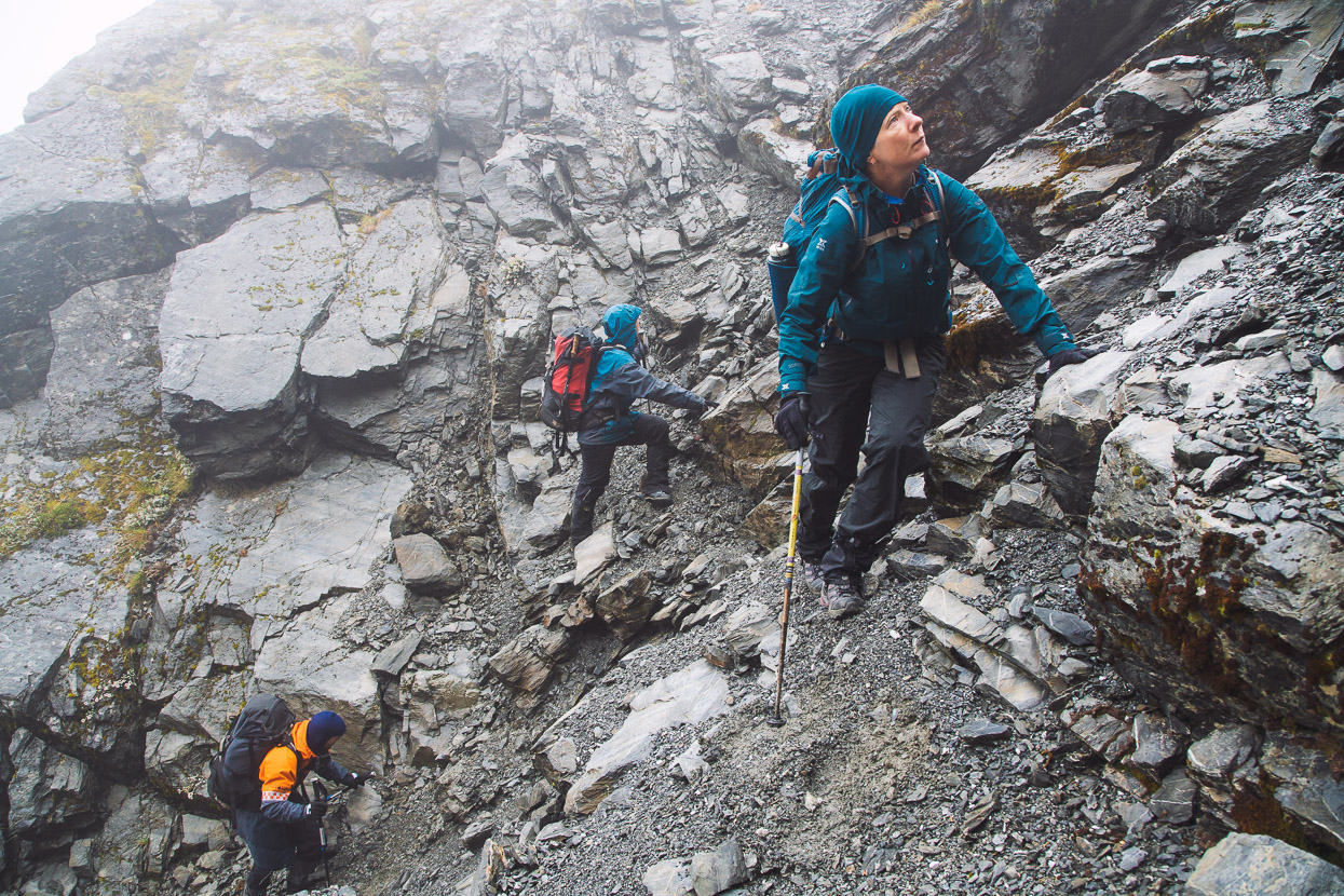
Sometimes the steepest lines are the ones that are the most secure.
After we reached the col we sidled around the southern side of Mt Chamberlain and Pt 1809. Visibility was bad and it was raining again and quite windy at times (hence the lack of photos). From the col just north of Pt 1809 we dropped into the headwaters of the Kokatahi River. This was a bit like the reverse of the morning’s climb at first, but slightly less steep. Once we got into the creek it was by no means over and in light rain the complicated riverbed travel down to Top Kokatahi Hut took us longer than expected. We crossed the river frequently and were constantly seeking the best travel as the river has quite a few small waterfalls and difficult travel over and around boulders, gravelly guts and scrub. We were all in full waterproofs and pretty soggy by the time we reached the hut.
The view above is looking up the Kokatahi from Top Kokatahi Hut.
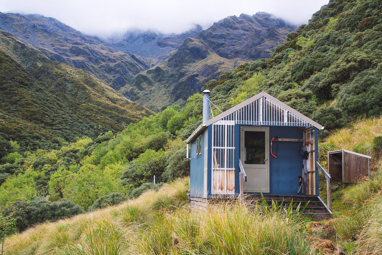
This was our second visit to Kokatahi Hut and it was nice to be back at this special location. The hut’s really well insulated and has a pot belly, so it didn’t take long to get it to t-shirt temps inside. We hung a lot of clothing up to dry and settled in for the night as the rain increased.
By morning, water was pouring down every available channel in the valley and the Kokatahi in full flood. Waterfalls poured off cliffs and down steep gullies that had been dry before and gushed in rivulets through the tussock and scrub surrounding the hut. We’d woken to thunder and lightning. It was clear we were going nowhere, so we settled into a well-earned pit morning and extra cups of tea.
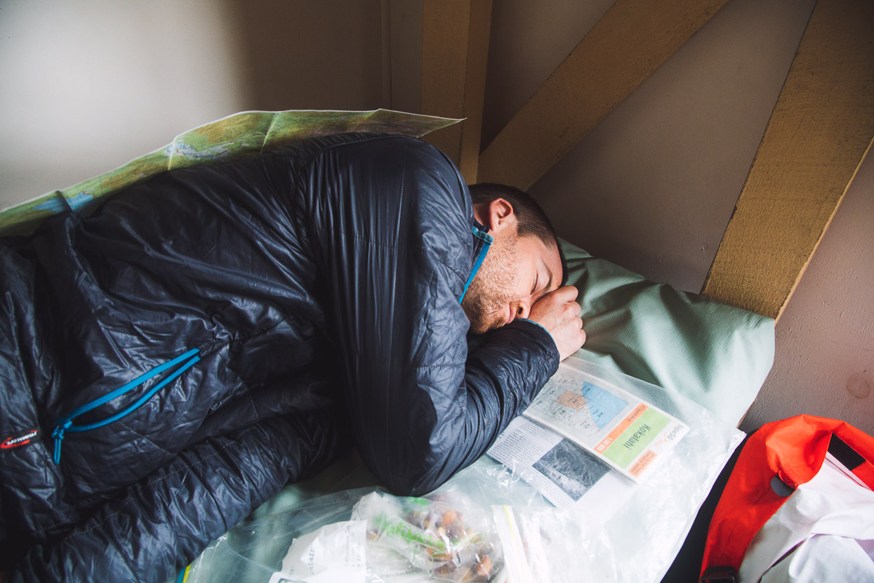
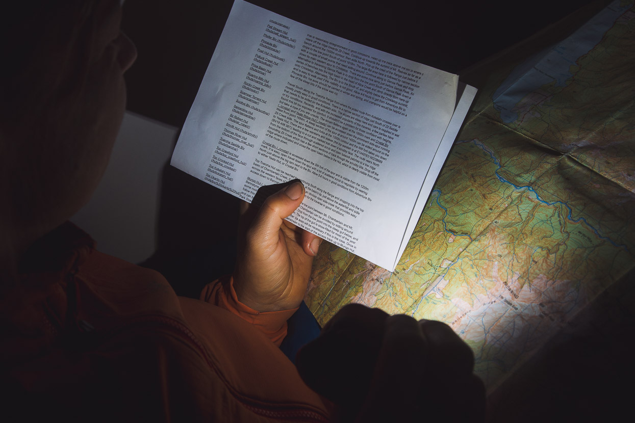
We’d anticipated this downtime, and thought perhaps we might be able to move off over Zit Saddle to Adventure Biv for the night that afternoon. 11.00 rolled around; still raining, then 12, 1, & 2. Although the heavy rain eased, the route up to Zit Saddle follows a steep creek which would have been tricky at best and impassable at worst. The rain didn’t cease until quite late in the afternoon, so by that time we’d settled into reading every word of the hut literature, including the FMC Bulletins which I’d already read cover to cover at least twice before.
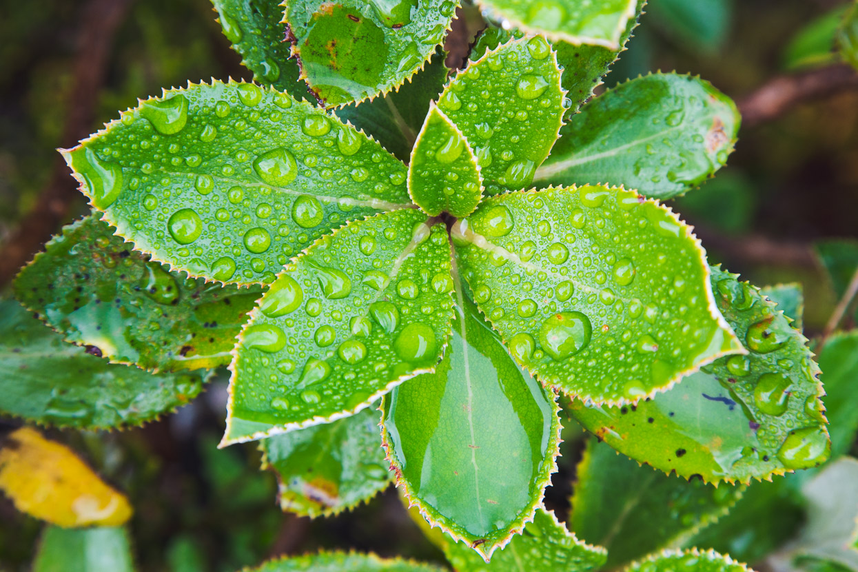
At about 5pm the rain finally stopped, and we got out and wandered around, collecting firewood and breathing fresh air after a day in the now fetid hut. The rain had renewed the vegetation and everything seemed to glow with extra luxuriance.
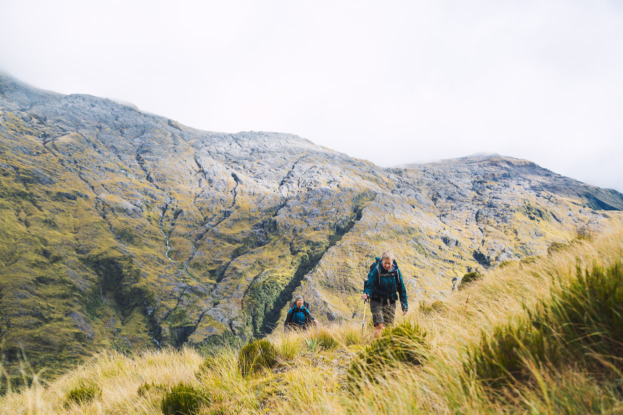
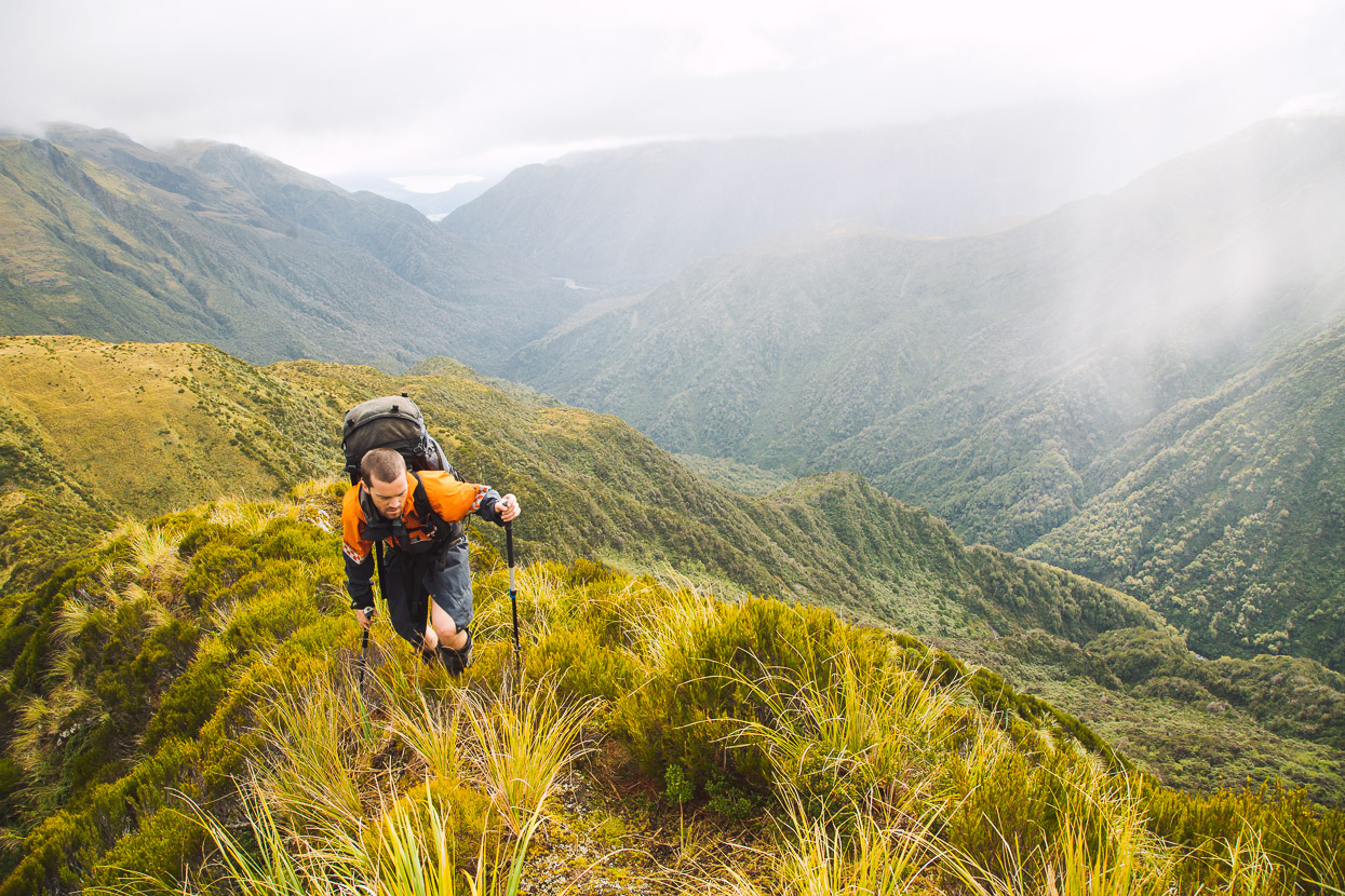
The full day at Top Kokatahi meant we were obligated to a long walk out the following day, because work called. A heavy inversion had set in overnight, so it was a gloomy first hour or so as we left the hut in the dark. Even as daylight came it remained dank until we neared the top of the steep climb to Zit Saddle. The route climbs up the creek at first and then breaks away up a gully and tussock slopes, easing off in angle as it nears the saddle.
After four days without seeing the sun we were happy to see the inversion burn off quickly as we reached the saddle. It’s a pretty stunning spot, with great views down the Toaroha and out to the coast when it’s clear.
Even though it’s marked, and relatively frequently travelled, the route down to Adventure Biv always feels adventurous. It could do with a recut really, as the fast growing West Coast scrub has choked up the track in places. Steep tussock slopes ease off eventually into a vague ground trail through the scrub, that sometimes swallows you up to your neck. It’s fun tramping though.
Adventure Biv is nicely sited on a small terrace on the lee of the ridge, and from there we could make out Yeates Ridge Hut a couple of kilometres away to the SW on the neighbouring ridge. From Adventure Biv the track enters the bush and drops steeply nearly 600m to the Toaroha. The bush was welcome again after three days of tops travel and we made good time.
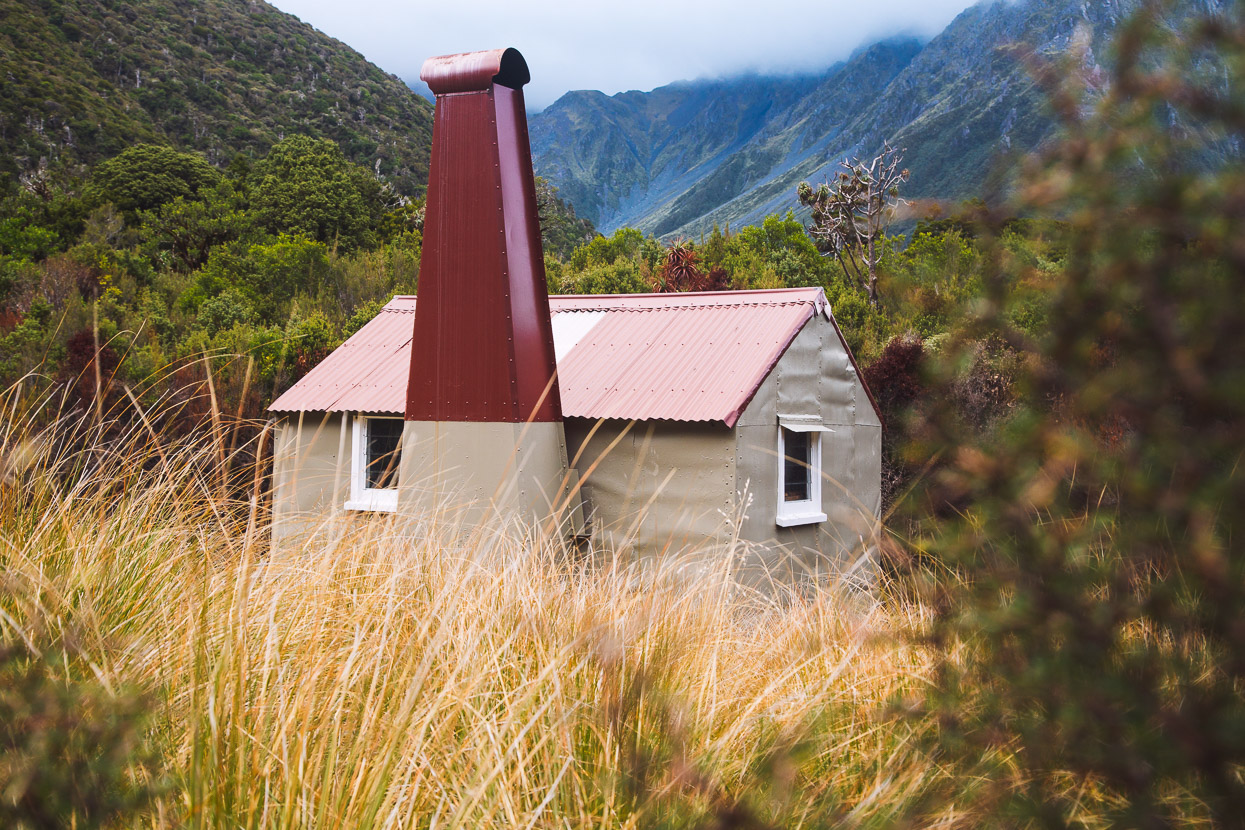
The colour had already returned to the green pools of the gorge and from there it was just a stones throw to Cedar Flat Hut, where the sandflies joined us for lunch. It’s great to see how lovingly looked after the historic Cedar Flat Hut is. Thanks to the parties involved with that.
Four hour’s walking remained between us and the road. But what had flown by with the fresh footedness and trip anticipation of day one seemed to take twice as long on the way out. I didn’t wish it over though, despite the aches of a few days tramping, because I didn’t really want to leave so soon. As the car came into sight I’d already racked up the next trip’s itinerary for when the next window of opportunity rolls around.
Note that the Cedar Flats Hut to Mullins Basin section indicated on the map below is approximate due to GPS battery failure.


A well written article and the beginnings of a trampers/adventurers/writers career perhaps.
Thank you for sharing your trop with the Google family. I am unaware who the writer is – may have missed that?
I have been a mainly track orientated tramper in the past, this leaves my adventures in the wilderness, quite dead and lifeless.
Congratulations to your crew for a safe return and a zest for more trails less travelled
I apologise Mark. Your name could not be clearer in the heading.
I’ll blame my seniority!
John
What a fantastic journey and write up accompanied by stunning pictures. Great story Mark. I’ve been to some of those places – not all though. I enjoyed the description from Mungo to Kokatahi via Mt Chamberlain. If it’s on the map, it seems you can do it. Looking forward to the next story.
Thanks Stefan, glad you enjoyed it.
What an excellent adventure.
Stunning photos as always and enjoyed the story. I think its amazing Mark, how you can describe a hike that must have been so soggy and wet – yet it sounds like a great time.
Love this bit of the West coast. Haven’t been able to get back since Covid started, but enjoying your images.
Cheers from the Yukon
A great write up thanks. Brilliant photos. I hope to get to Mungo in November and this really gets me excited about the trip.