
| Ruta del Captain José León Lemos |
We’ve now crossed the Andes between Chile and Argentine four times (via Pasos Socompa, Pircas Negras, Agua Negra and Portillo de Piuquenes), continuing the theme that has framed our journey ever since we entered South America. The longest continental mountain range in the world is complex and ever changing in its geology, climates and culture and keeps us interested as we slowly progress south.
Our latest crossing was a double pass hop from Argentina back to Chile (between the cities of Mendoza and Santiago) via the historic Paso Argentino and Portillo de Piuquenes.
These passes are famous for having been part of a massive military campaign during Chile and Argentina’s joint efforts to seek independence from Spain in the early 19th century.
The Cruce de los Andes (Crossing of the Andes) during 1817 was an attack on Santiago, but using the element of surprise (crossing via the high passes) and on multiple fronts, using large forces over several different passes. The theory was that the Spanish would not be able to tell which was the main invasion and be confused as to how to distribute their forces. The invasion force comprised nearly 6000 Argentine soldiers and Chilean exiles. To undertake such an invasion over some of the highest passes of the Andes was no mean feat. With them they had 10,600 mules, 1,200 horses, and 450 cattle, which were eaten to sustain the, up to, one month-long alpine march.
The invasion was commanded by General San Martin and he used his finest officers to lead the individual forces over their respective passes. The 266 troops and militia who crossed Pasos Argentino and Portillo de Piuquenes were led by Captain José León Lemos. The invasion was a success and the resulting battle of Chacabuco, near Santiago, was a success for the combined forces of the Army of the Andes and brought Chile under independent control.
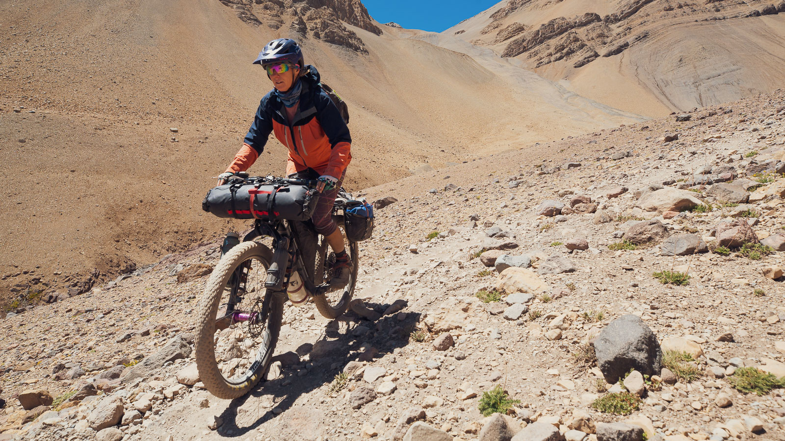
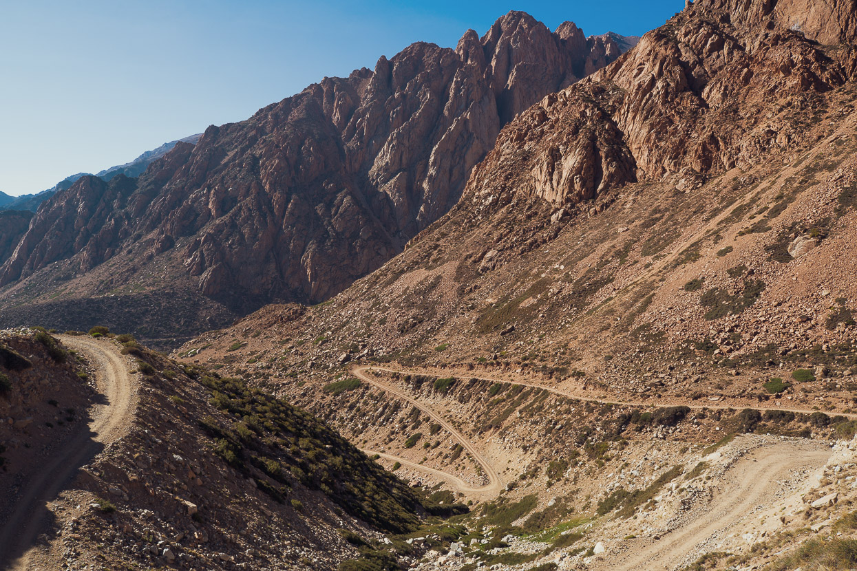
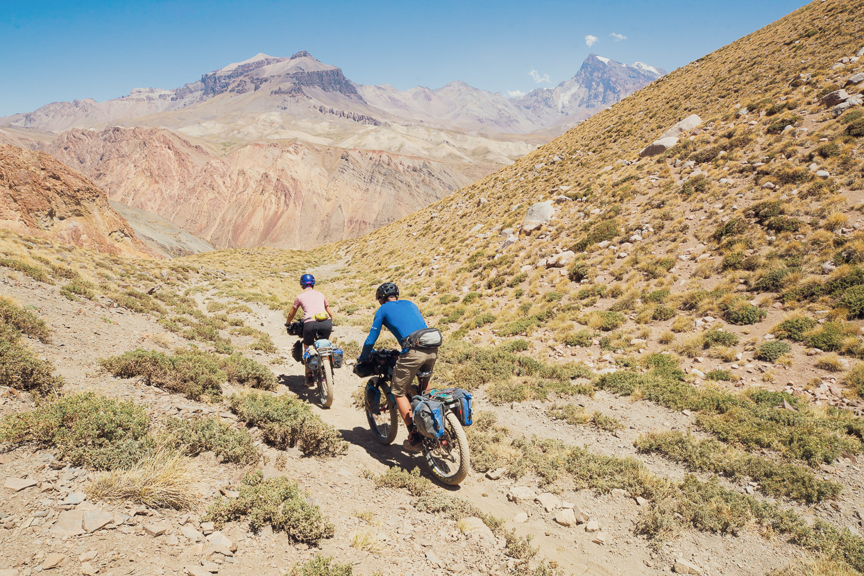
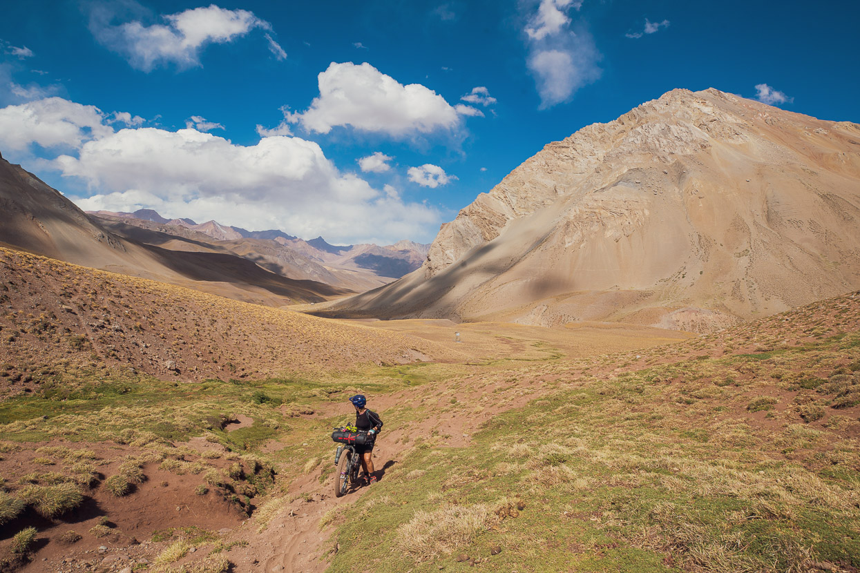
The Argentino /Portillo route is mostly sendero, used by hikers and horse trekkers, for whom this historic route is particularly popular. From our digging around in Google, it looks as if a couple of bikepacking parties do it per year, but only in recent years since plus bikes and fat bikes became popular. These bikes make a route like this, with very rough tracks and loose surfaces, more rideable and fun. That said, the route has a well-deserved reputation for being a tough hike-a-bike outing, which is of course contributed to by the high passes (4300m and 4014m).
The combination of challenge, history and seeing another remote corner of the Andes were too compelling for us to turn this one down, so we set out from Mendoza on the 13th February with 6-7 days food.
In total we spent 10 days in Mendoza, enjoying a good rest, catching up on work and blogging. We were just getting used to trees again after so long in the Dry Andes when it was time to leave.
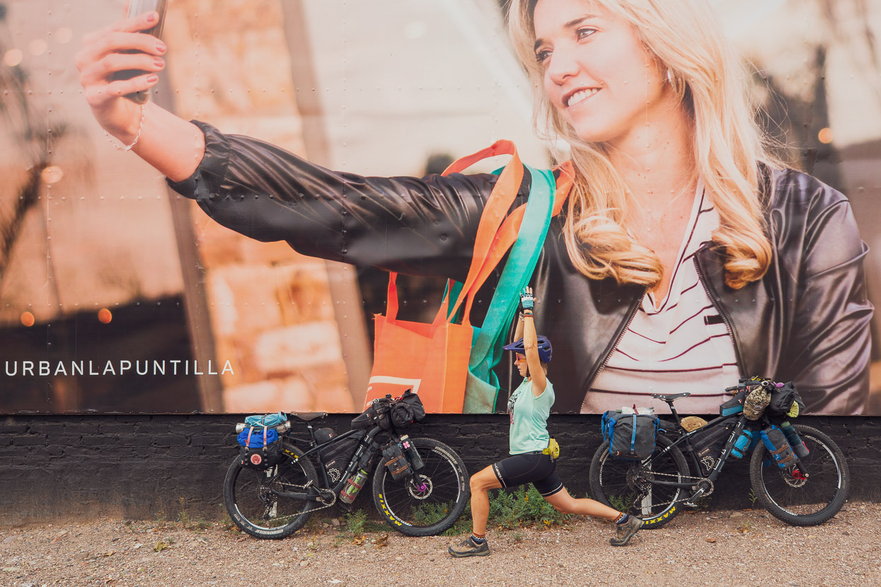
Goodbye to city life, for a few days at least…
We spent the first night out of Mendoza in the pleasant rural town of Tupungato, which is in the heart of Mendoza’s most famous vineyards. Argentinian town and city life, with its siestas and late dining, is not very compatible with our bikepacking lifestyle of early starts and long days, so we had a late start the next day. By early afternoon we reached Manzano Historico, a small village located right where the plains stop and the foothills of the Andes start. It’s also the end of the pavement.
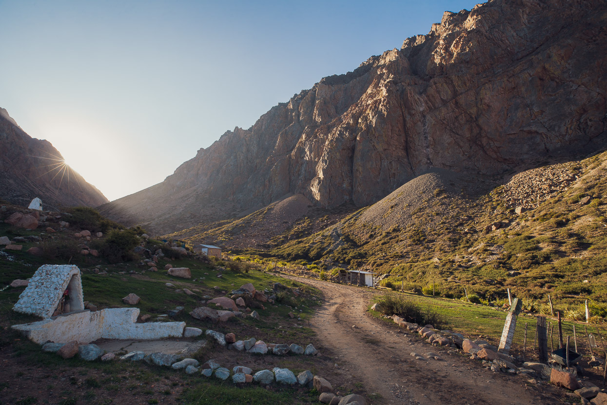
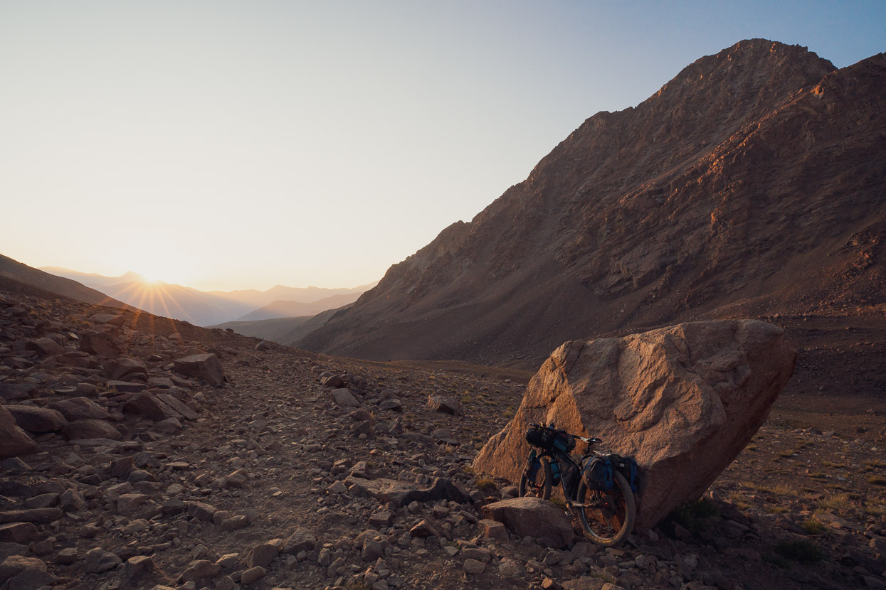
Ahead of us was a 2500m climb to reach the first pass, Paso Argentino (4300m), so we got stuck in and rode until 8pm in the evening to try and put a dent into it for the next day. The valley is steep and spectacular and contains a pretty well known (in Argentina at least) granite rock climbing area. We camped at the parking/camping area for the climbing at Cajon de Arenales at 2660m. On the way up we passed the Argentine migraciones office where we collected our exit stamp.
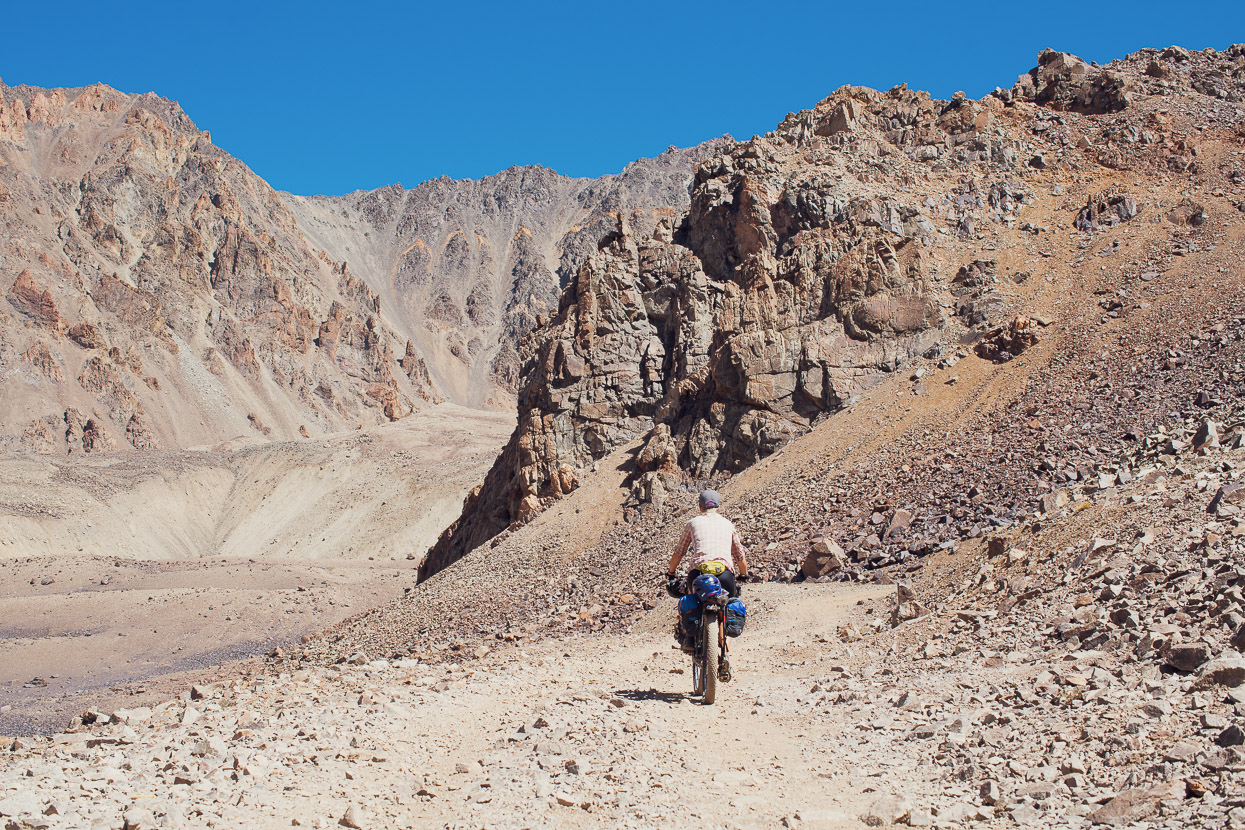
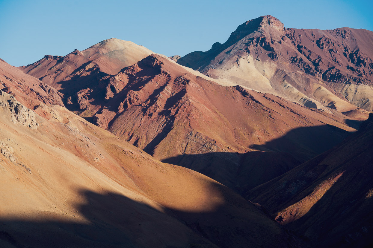
After Cajon de Arenales the road gets a little rougher and sometimes a bit steeper as it makes an unrelenting climb into the upper valley. The scenery is stunning the whole way.
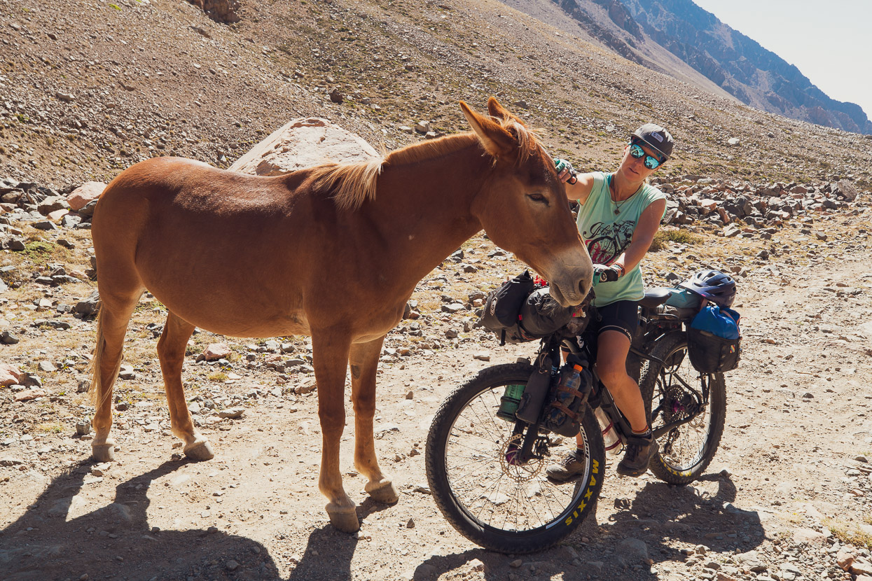
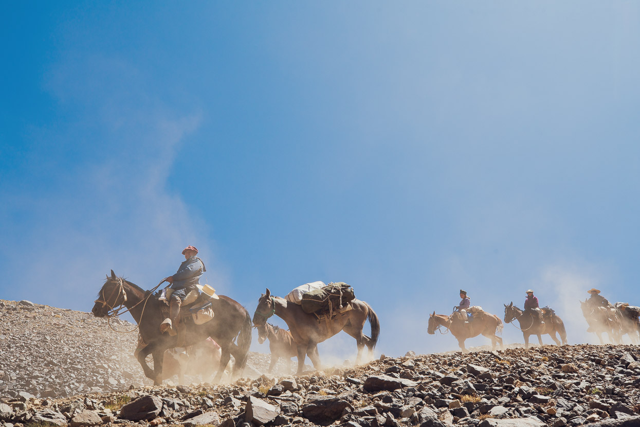
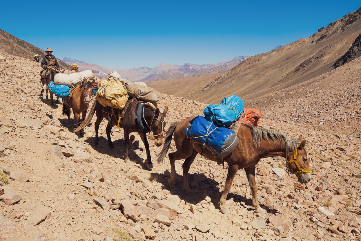
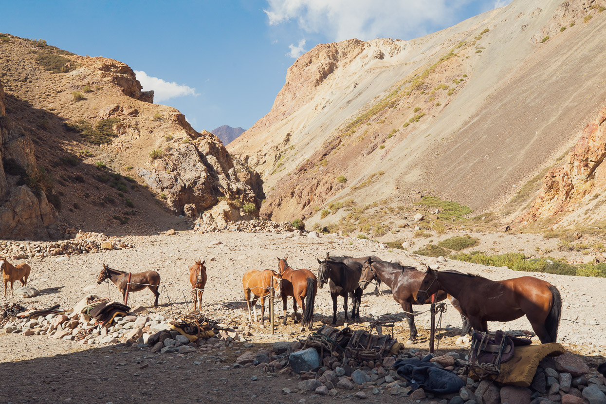
Most days we were on the ride we saw horse trekking groups. They’re led by traditional gauchos, and it was great to see some of Argentina and Chile’s mountain tradition still alive. This route is very famous in these countries, its crossing by the military having played such a big part in independence from Spain.
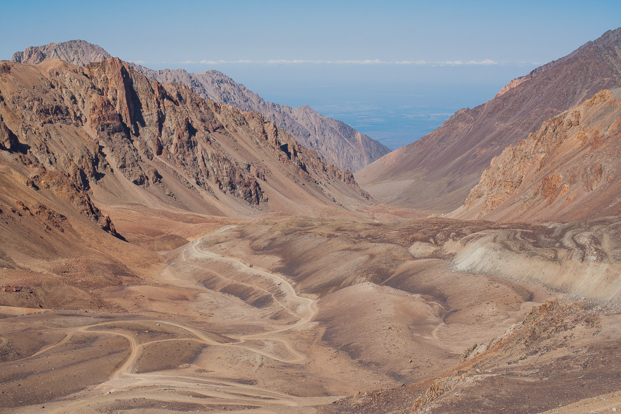
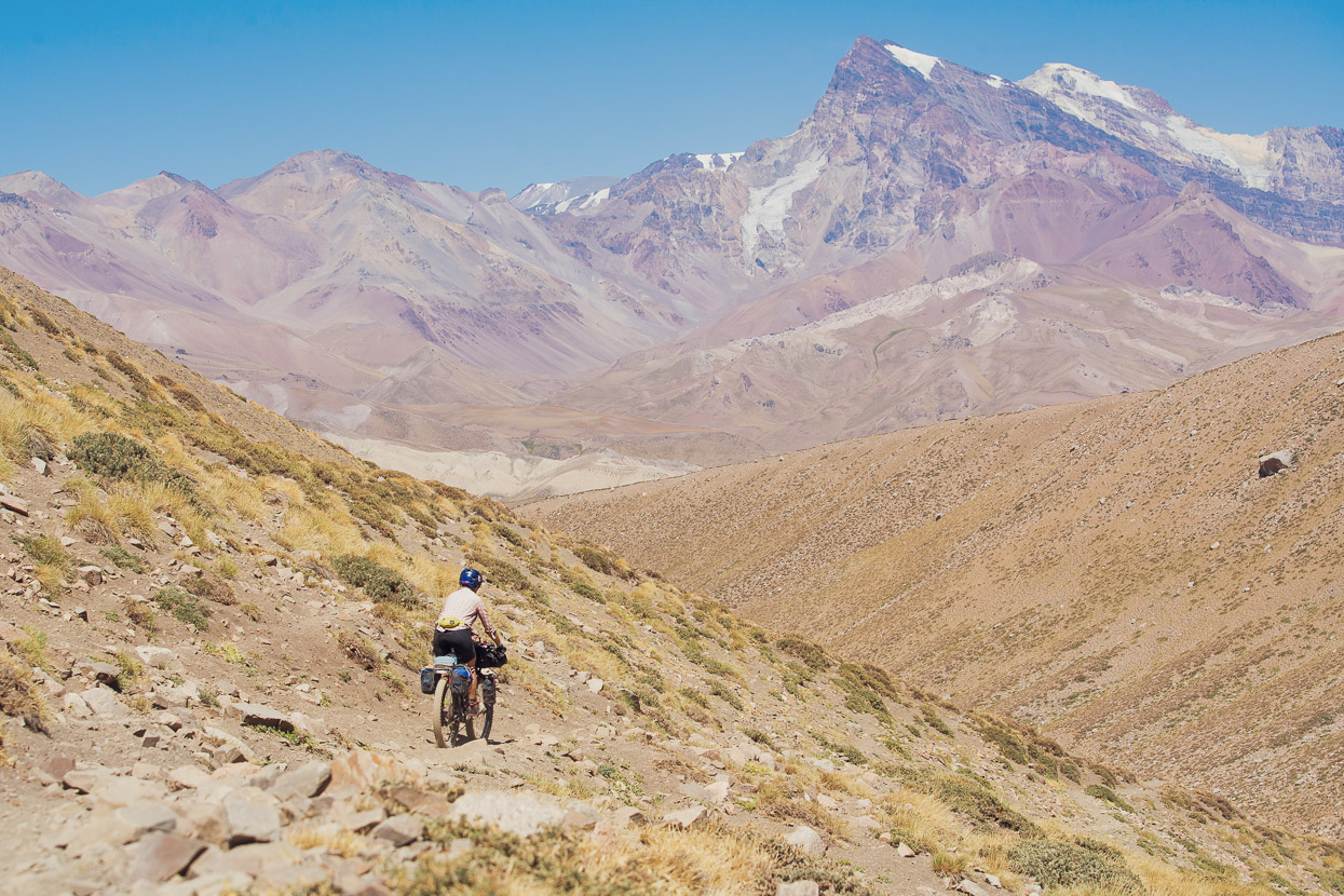
From high up the valley we had an amazing view over the moraines as well as over the Argentine plain, which stretches unbroken by mountains to the Atlantic in the east.
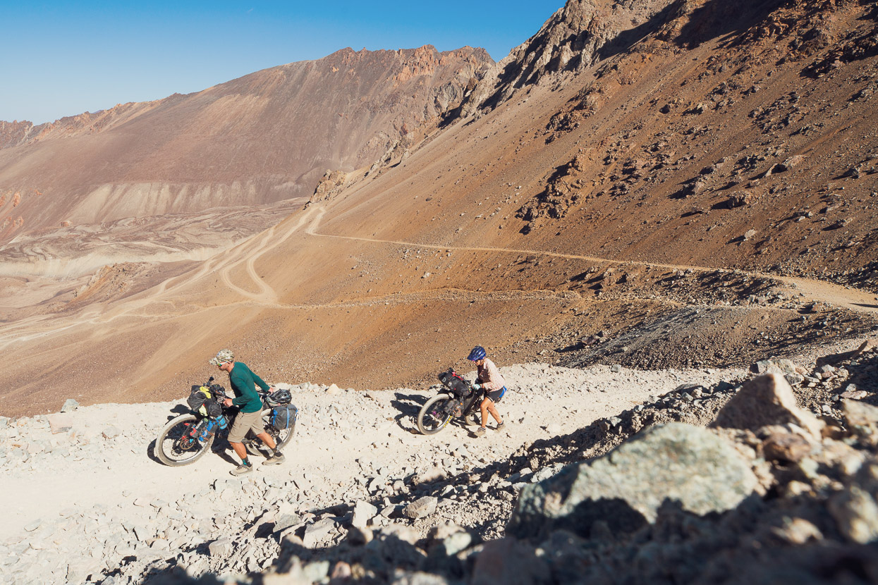
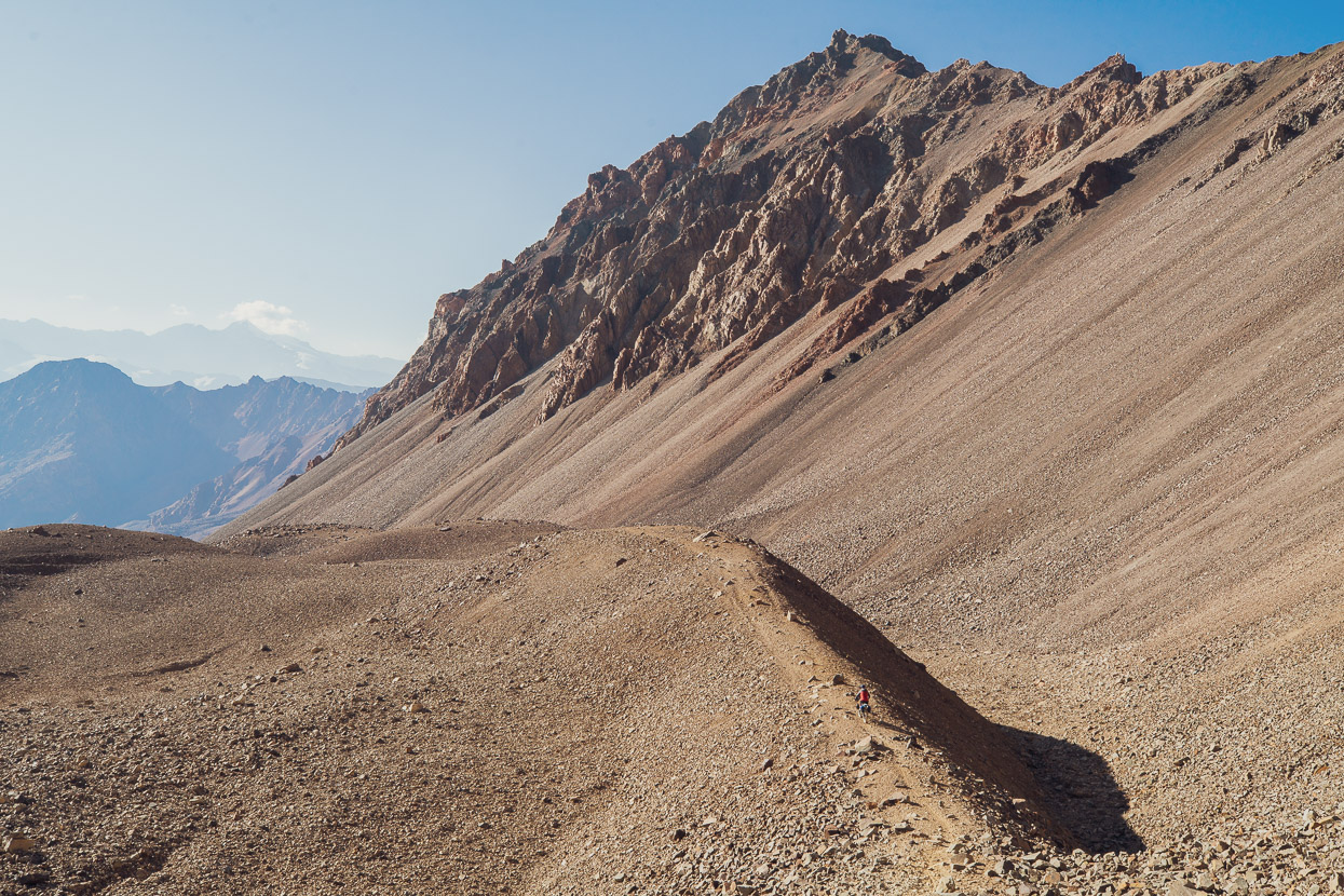
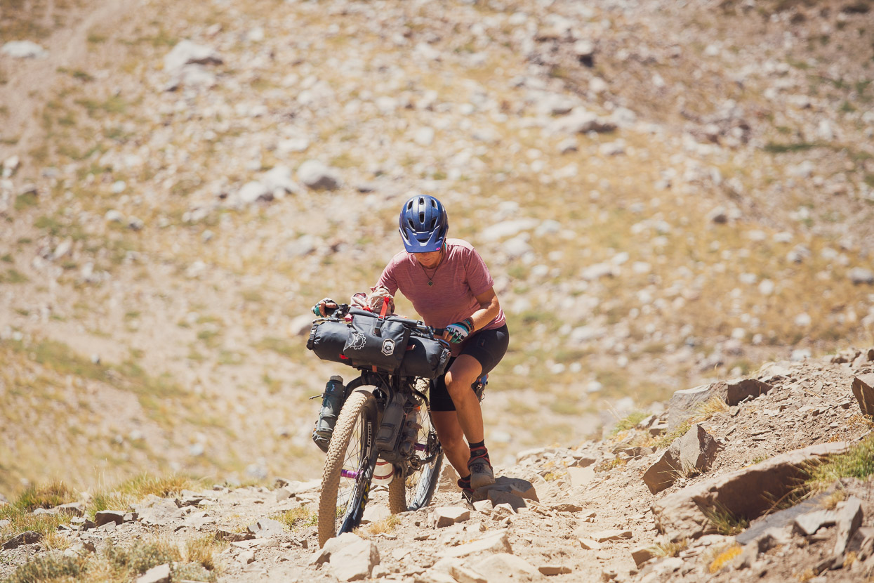
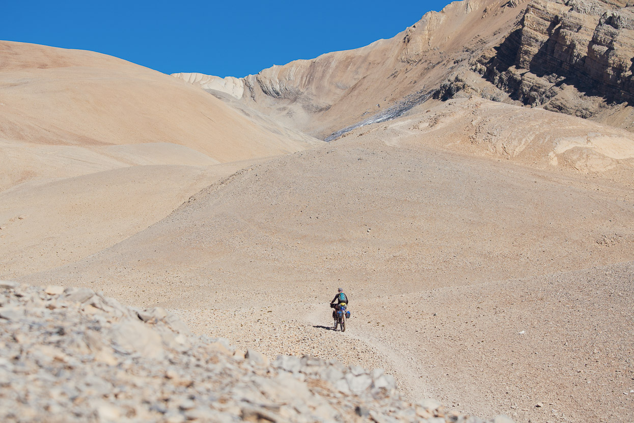
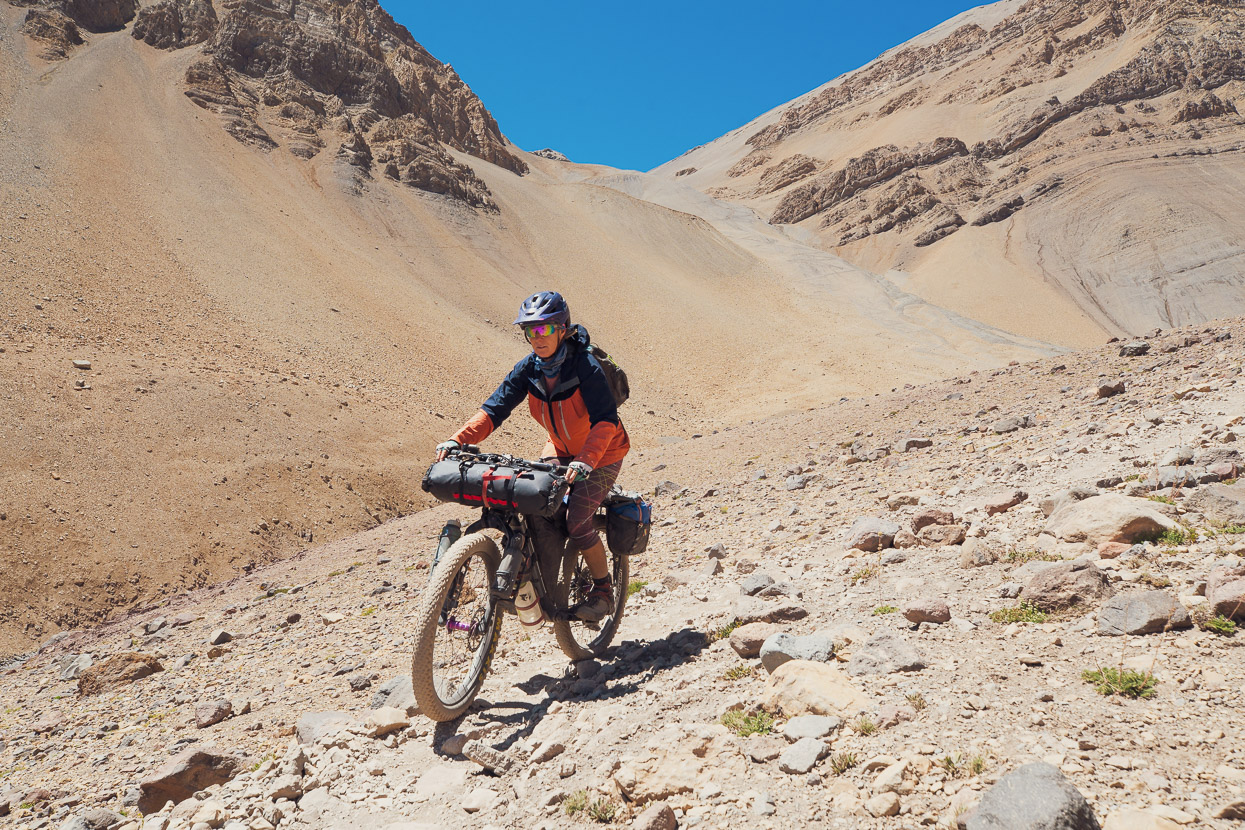
Ten days in Mendoza was enough for us to lose the ‘edge’ of our acclimatisation, so we were feeling it a bit when we neared the top of the pass. The altitude combined with a steep and very rocky road had us walking the last part. The road has disintegrated just before the pass, leaving a very steep push (we were two to a bike) to surmount the final section of sendero.
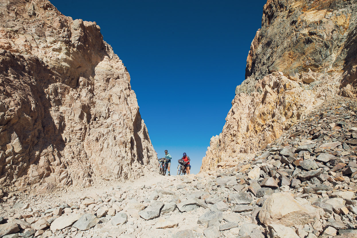
The pass itself is a spectacular notch, hewn into a very steep sided ridge.
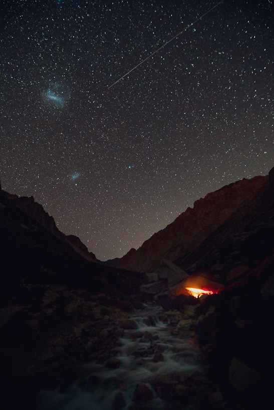
A deep inter-montane valley separates Paso Argentino from Portillo and the first part of the descent is very rocky. This turned out the be the most tedious section of the whole route though, with the rest of the single track being generally much more rideable and less rocky. From the pass we rode/walked downhill for 700 vertical metres until we reached the river and a nice campsite by a boulder.
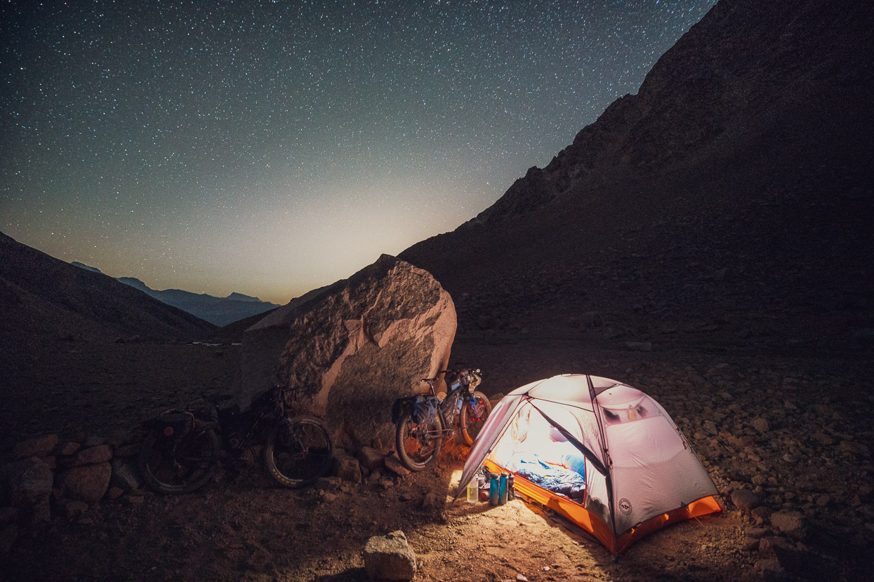
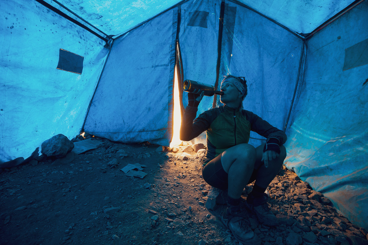
The boulder provided just enough shelter from the breeze and the night was clear and mild. We’d had a huge day – stopping just before dark – and only planned to go as far as the military refugio the next day so we woke to the sun and had a slow breakfast in the calm morning.
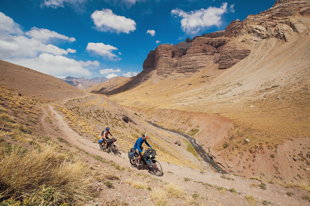
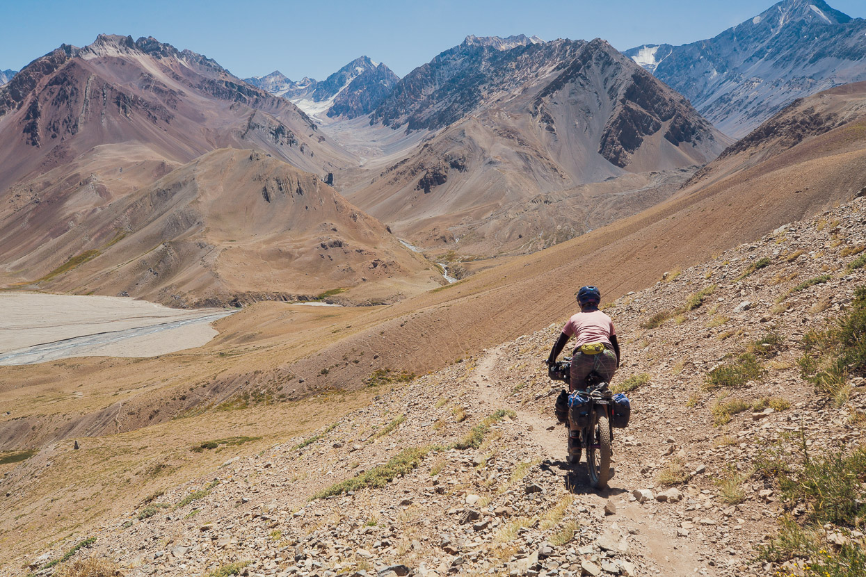
The first three or so kilometres were on/off riding again and then it became less rocky and more consistently ridable as we descended towards Refugio Real de La Cruz in the Tunuyán Valley. Overall, a really good section of riding.
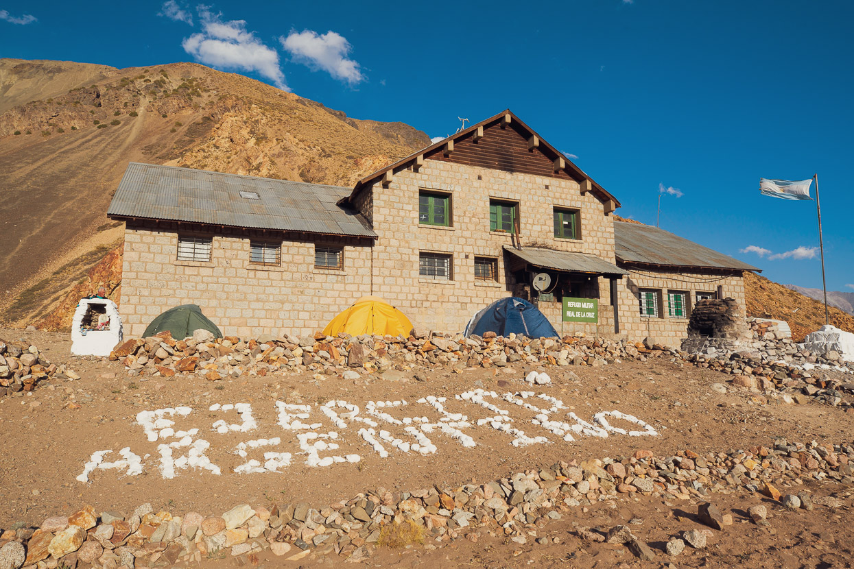
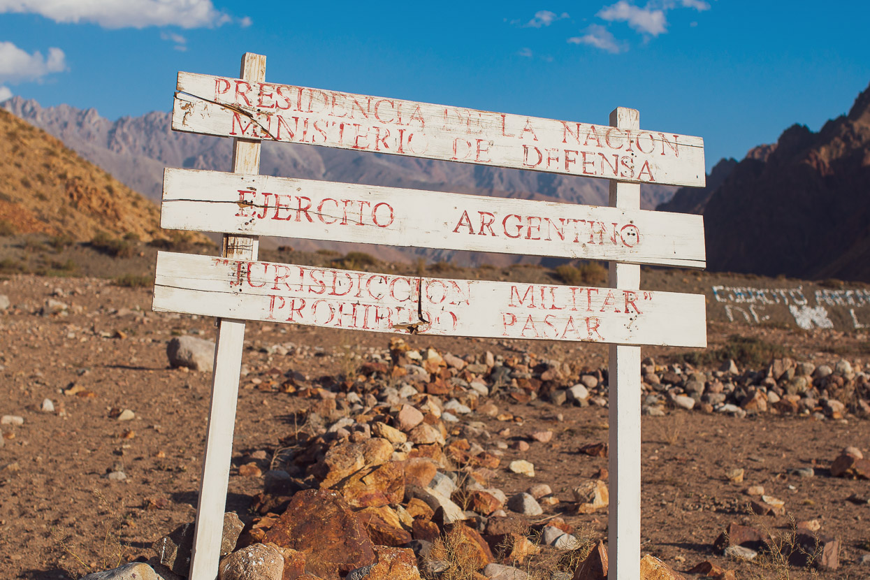
Refugio Real de La Cruz was built in the 1940s as a military outpost, but these days serves as an alpine refugio for travellers through the mountains, mostly horse trekking groups. It’s still run by the army and during the summer months they have four personnel there looking after the building and collecting fees. During winter it’s unoccupied, but part of the building is kept open for emergency shelter.
We shared our night there with a horse trekking group (on their way to Chile) and they very generously shared their beef stew and vino tinto with us.
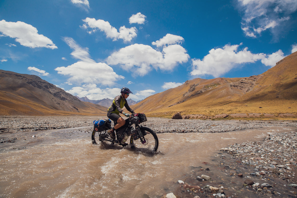
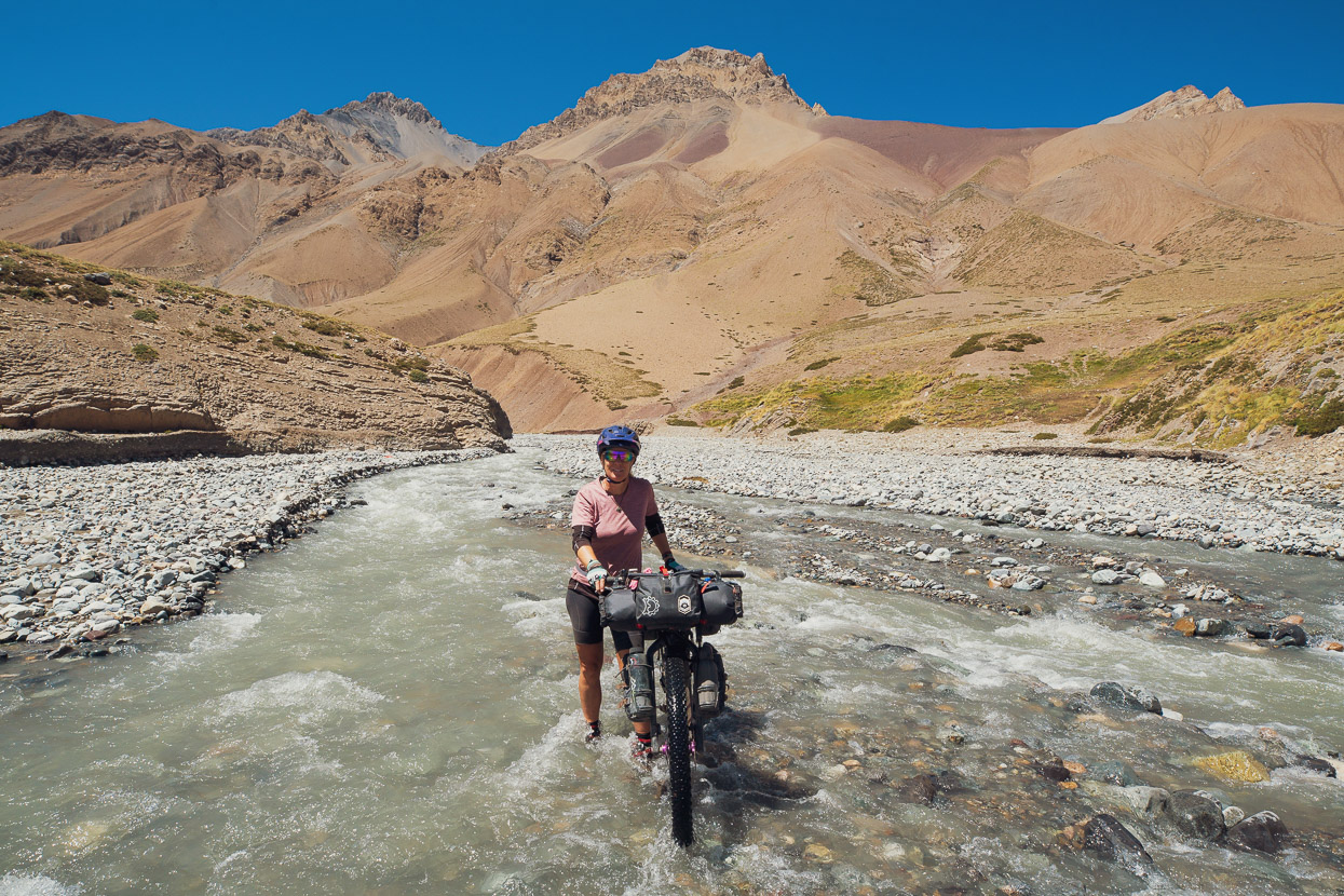
All cyclists and hikers leaving the refugio for the crossing to Chile face the challenge of the Rio Tunuyán. This very fast flowing and cold river is a serious undertaking at the best of times and at the worst of times totally uncrossable. The crossing is just over a kilometre from the hut, before you begin the long climb to Paso Portillo. At least one cyclist has completely lost their bike and equipment in the river. We tried to cross it at 8am, while the flow was it at its lowest. The river is snow-fed, so theoretically the flow eases overnight if there is a good freeze. We woke to a cloudy morning after a mild night, so there probably had not been much of a freeze.
We tried to cross at a couple of different spots, and if we’d committed, could have made it across with arms linked. But doing that with the bikes and all our equipment would have been another matter. It’s not something to trifle with: we could not risk losing a bike or our tent and sleeping bags.
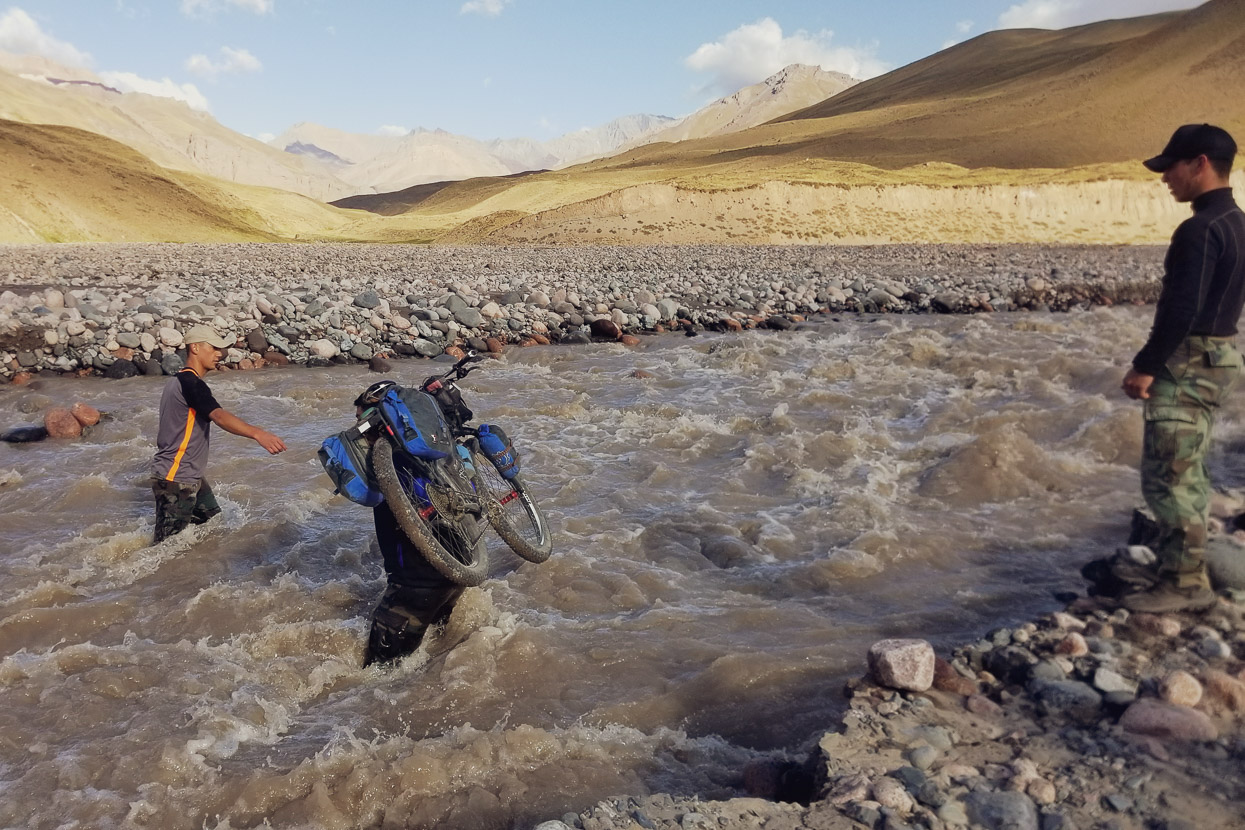
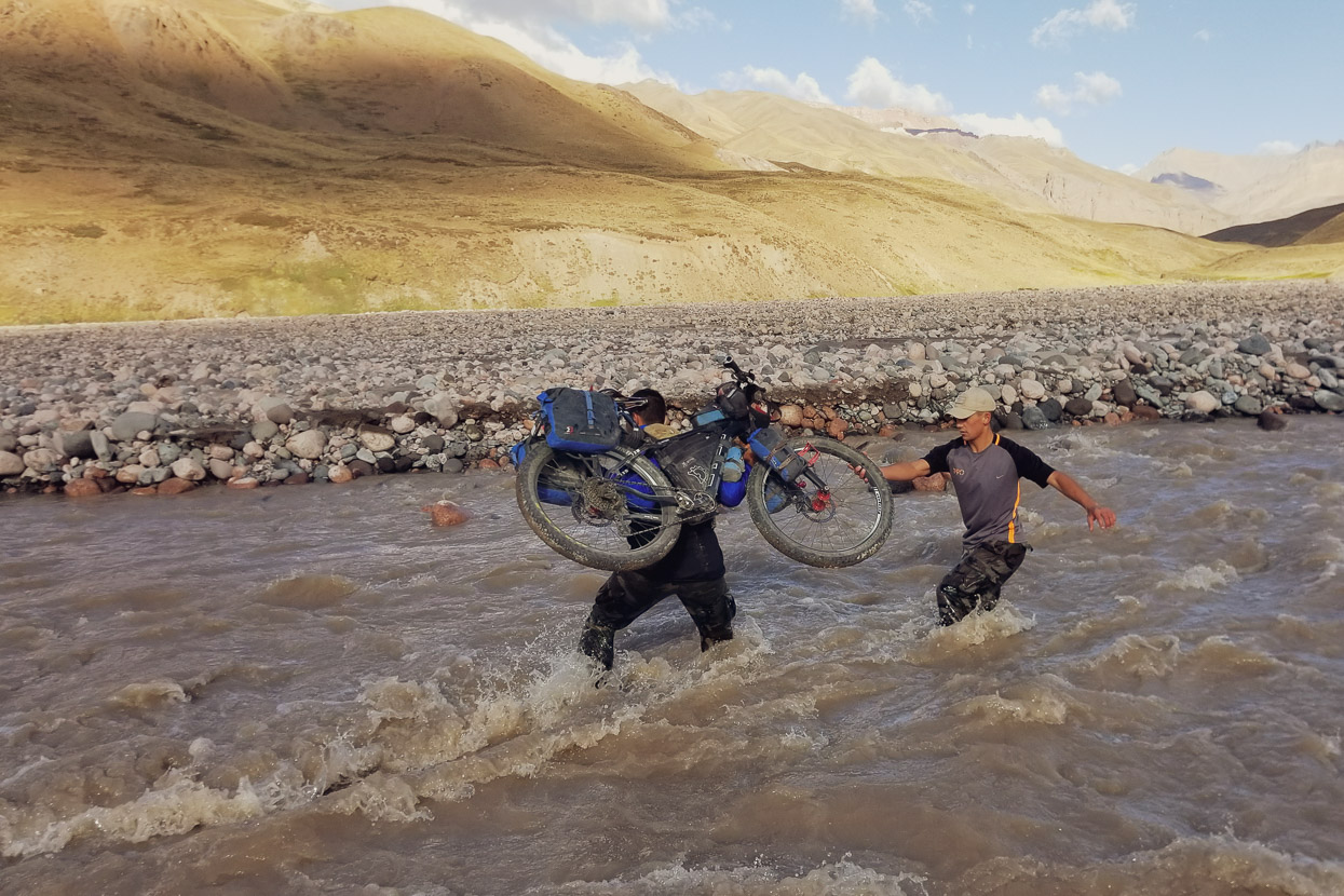
So we returned to the refugio and recruited the help of three of the soldiers who offered to give us a hand. They were all heavier than us, and one of them was 6 foot 5 and a hundred kilos – just what you need. The two smaller guys joked that he would wade across with a bike in each arm over his head. In fact the big guy could wade around at will in the river, although he did get washed off his feet a couple of times. We entrusted him with our bikes and the other two guys helped him with balance. Notably they spent quite some time finding a workable ‘line’ across where the riverbed stones were more stable and the flow slightly less strong. They then chain ganged our gear across and helped us both over. We tipped them $1000 pesos (NZ$25). We were on our way…
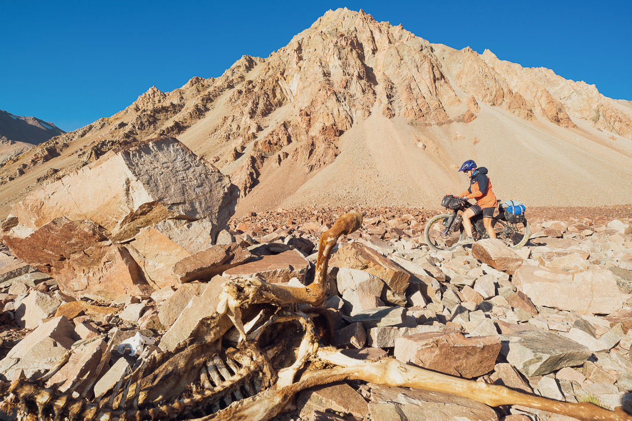
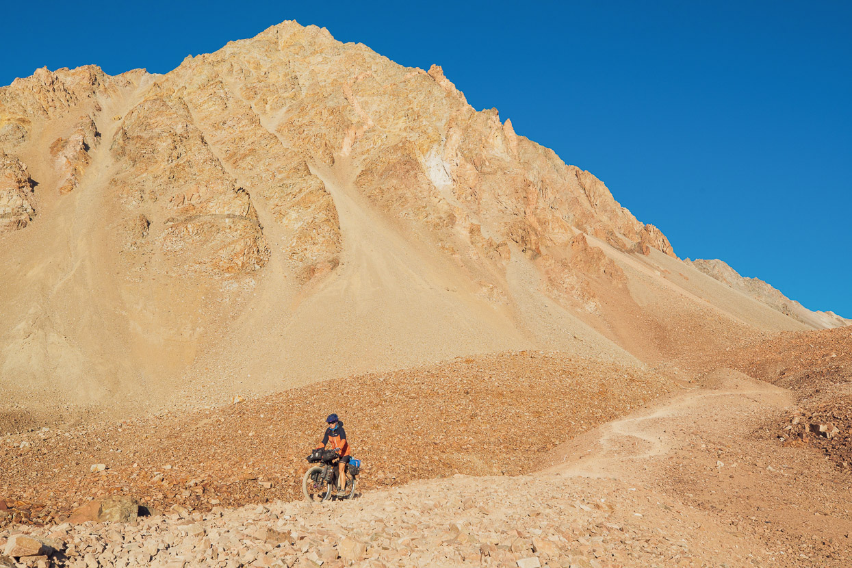
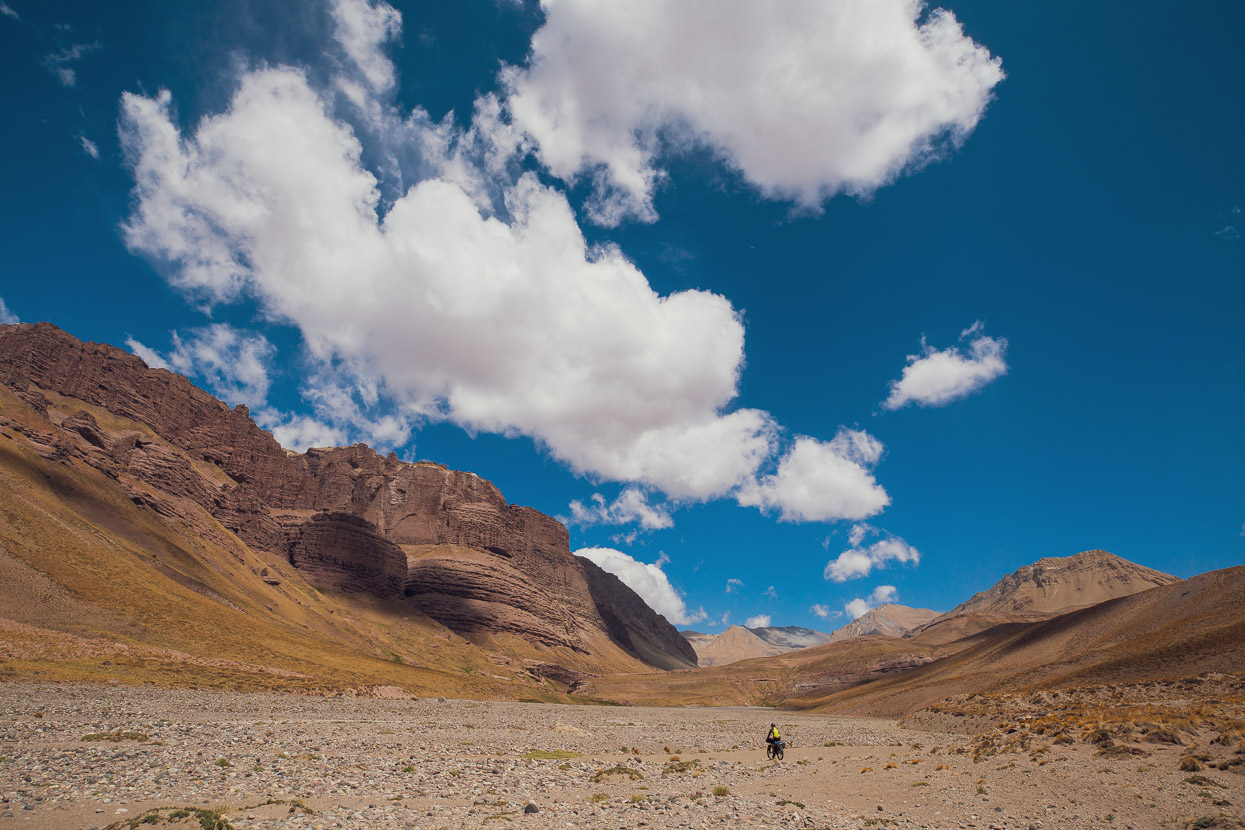
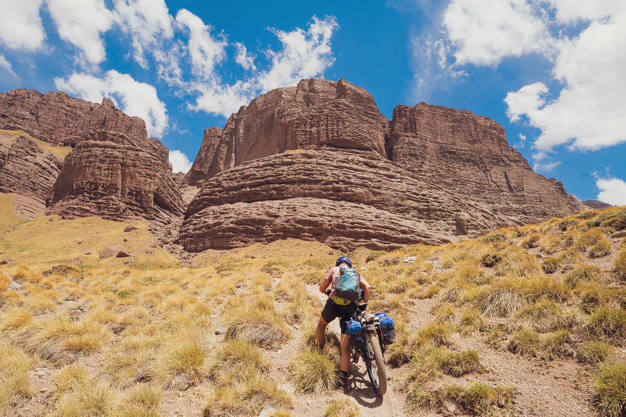
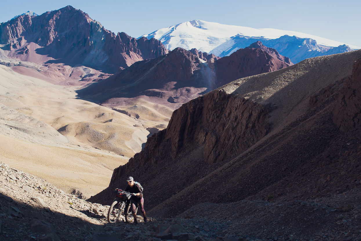
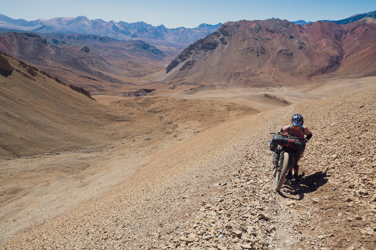
We’d feared that the climb to Paso Portillo de Piuquenes would be like the descent from Paso Argentino, but on average it’s much less steep and the riding surface much smoother. It’s a 1200m climb from the refugio to the pass and aside from a few rock scattered sections and the final steep climb to the pass itself is mostly rideable. Going the other way, it would be close on 100% rideable if you have good bike handling skills.
We thought this was the nicest section of the whole route, with consistently impressive scenery all the way to the pass, and beyond.
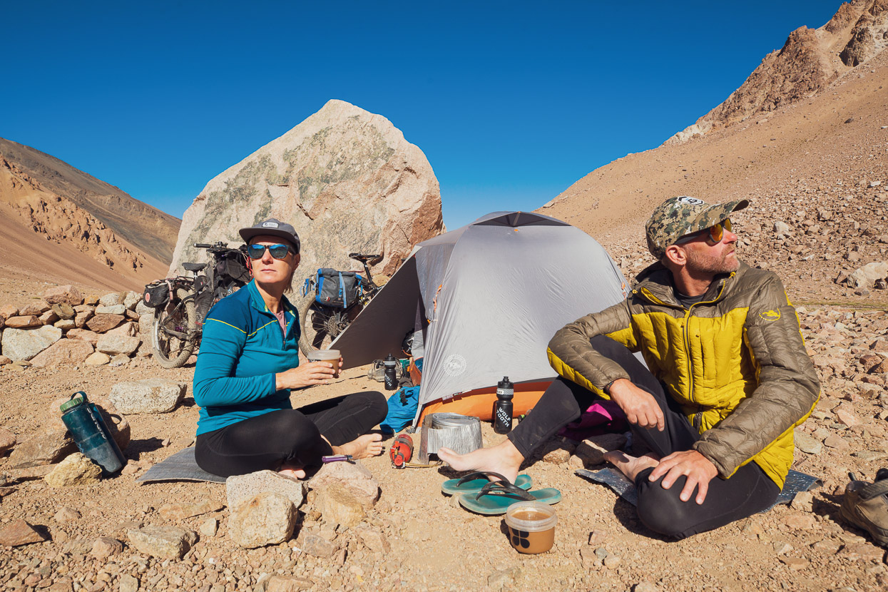
The chief guide of the trekking group at the refugio had suggested we might like to stay in his semi-permanent tent, about halfway up the climb. It was too early to stop when we got there and the site was not that nice, so we just stopped for a rest. There was nothing in the tent except half a bottle of wine, so we did as the guide probably would have wished us to and helped ourselves. When in Argentina…
The wine gave us some energy, or at least eased our aching legs. We pushed on higher, eager to shorten the following day’s final climb to the pass, which we knew would be steeper than the valley had been so far.
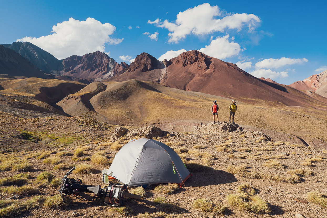
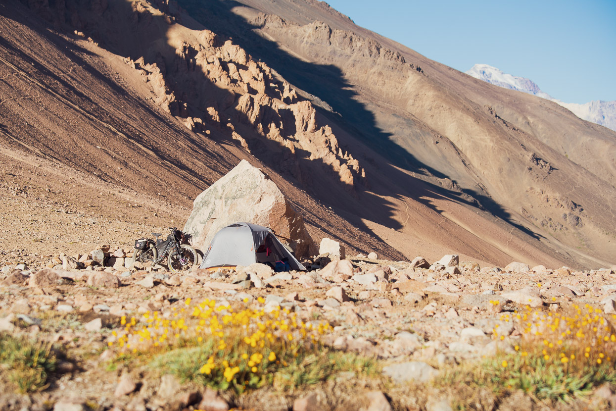
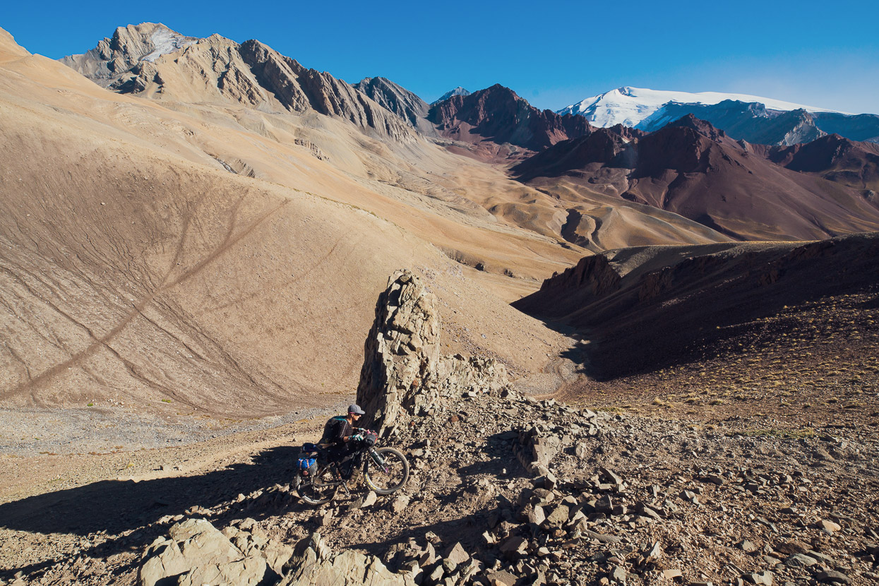
Our Colombian bikepacking friends (Monteadentro) followed this route roughly three weeks earlier and had been very helpful with a GPX track and some suggested camps. The site we spent our last night on the route was one of the best camps we’ve had since finishing Seis Miles, with big views of the upper cirque.
With no wind shelter the tent flapped all night in the wind and everything got covered in dust – a small price to pay for such a location. Standing above camp in the morning I could not see the trail we’d been following, nor a road, or anything man made at all except our camp. I looked at our two bikes by the tent and their improbable surrounding and reflected for a moment on the beauty of travel by two wheels. With a bit of determination, bikes can enable you to reach some incredible locations.
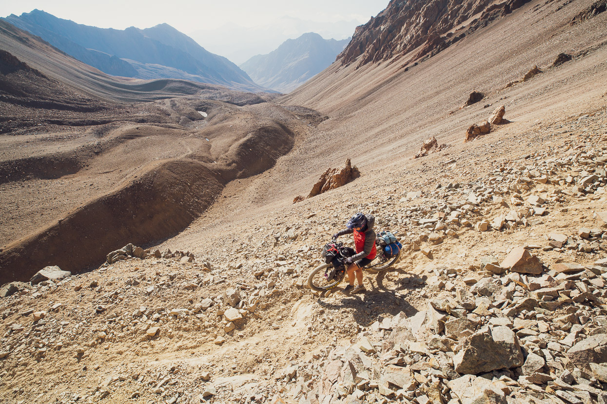
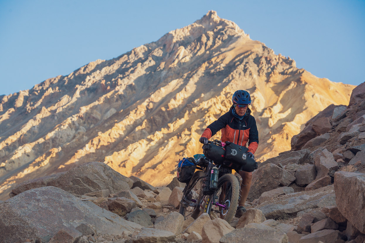
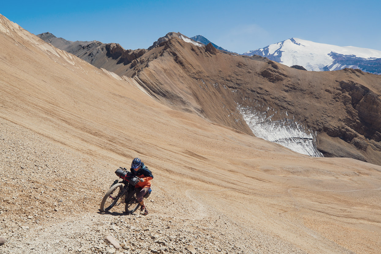
We left camp and were straight into steep pushing. A line of puma footprints followed the same sandy trail as us. We wondered how many have sat on ridge tops and among rocks, watching us while we’ve been in the Andes.
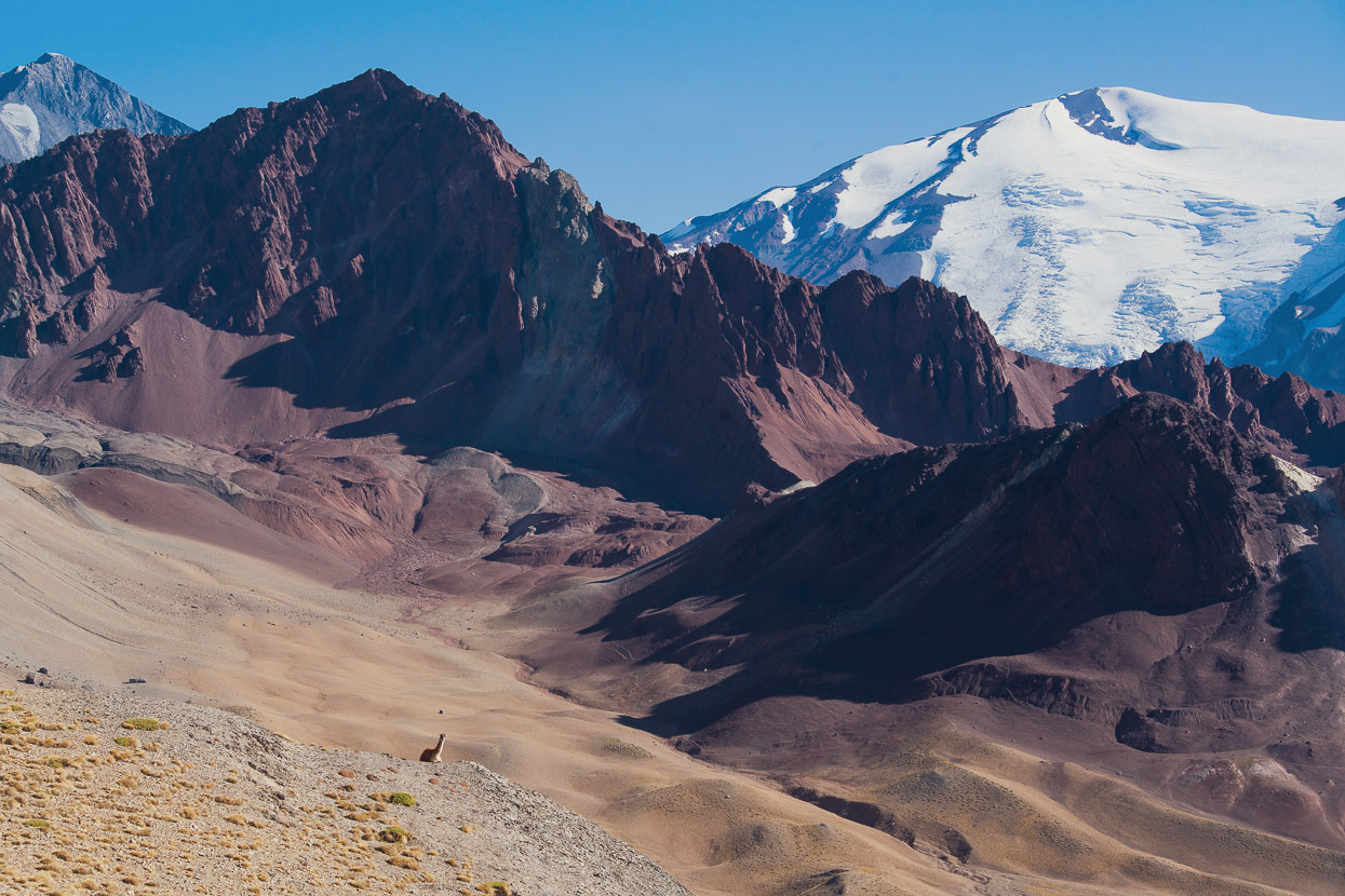
We’d seen few animals on this route though until that morning when we saw a large herd of guanaco. One – a younger male – made a loud bird like call to warn the others of our presence. They disappeared behind a ridge but the young male sat there watching us as we slowly climbed towards the pass.
It was mostly pushing, with the odd rideable part where the angle eased. But it was straightforward as far as hike-a-bike goes.
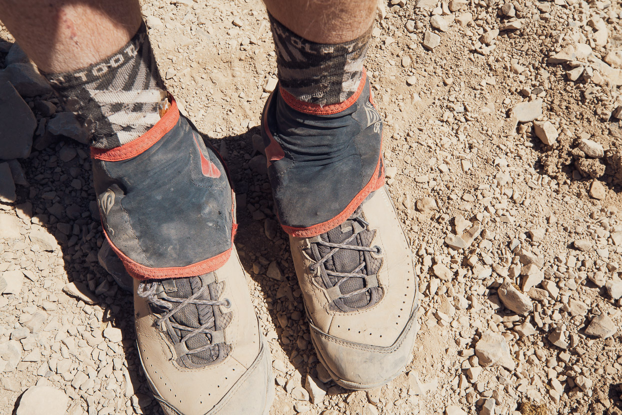
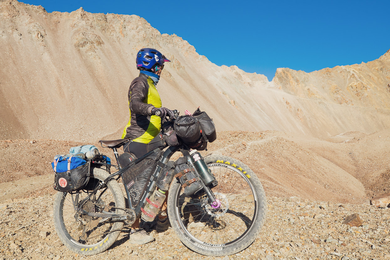
Our secret weapons for hike-a-bike are these Salomon trail running gaiters. We used them nearly everyday on Seis Miles to keep sand and stones out of our shoes and they’re great for keeping your feet a bit warmer when the weather is really miserable too.
A final steep heave to the pass.
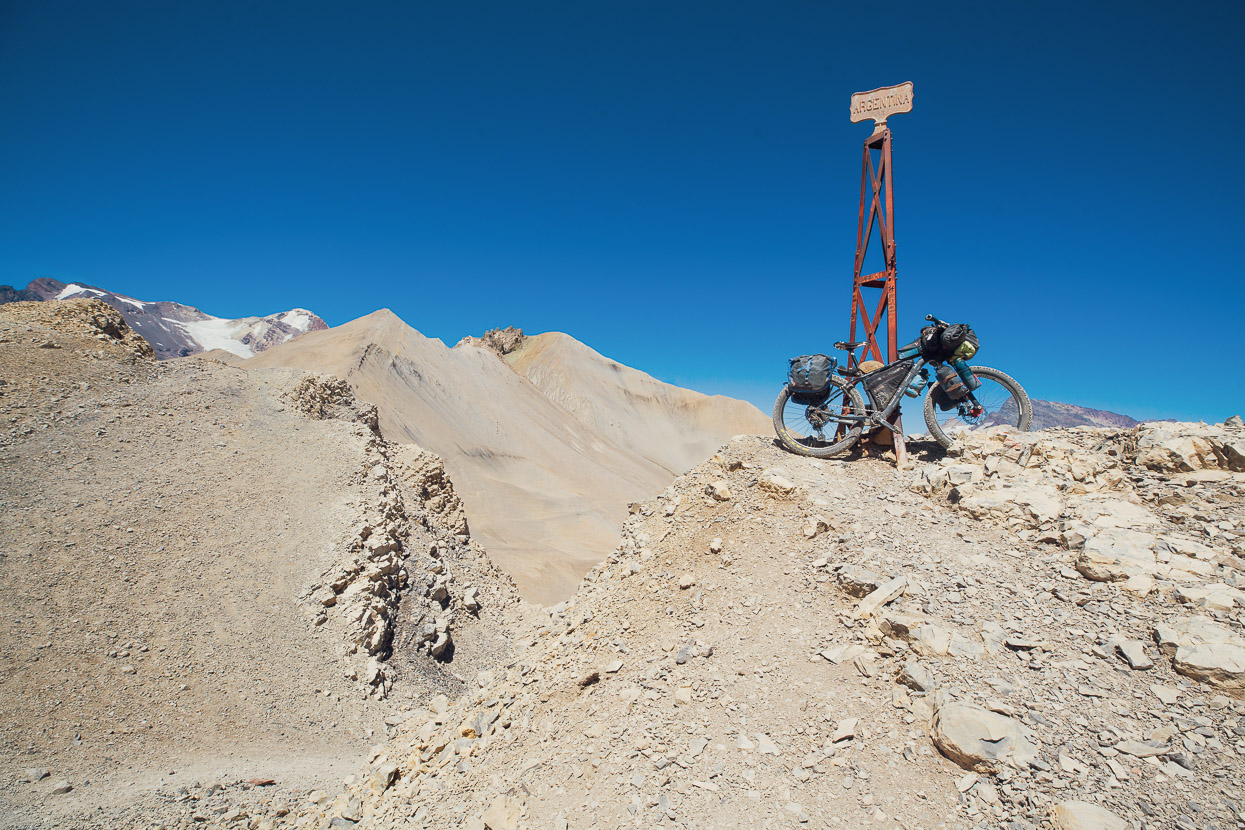
One side Argentina, the other, Chile.
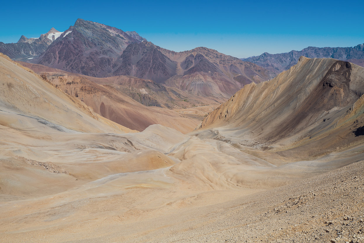
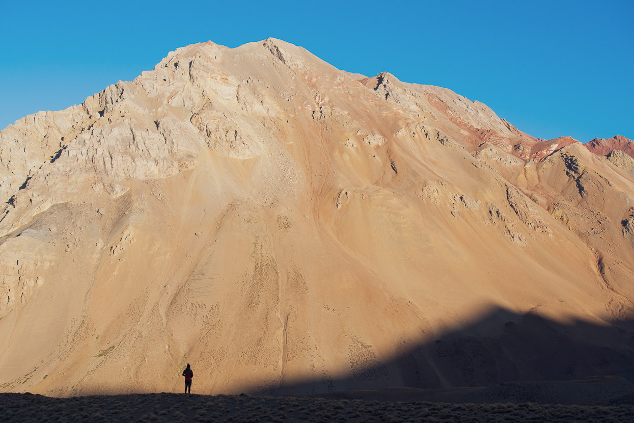
Chile was looking quite desolate. The upper valley was a huge moraine and scree field.
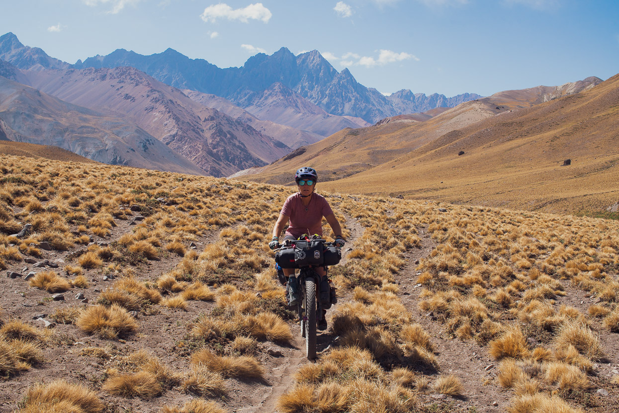
But perfectly rideable – fast and relatively smooth going.
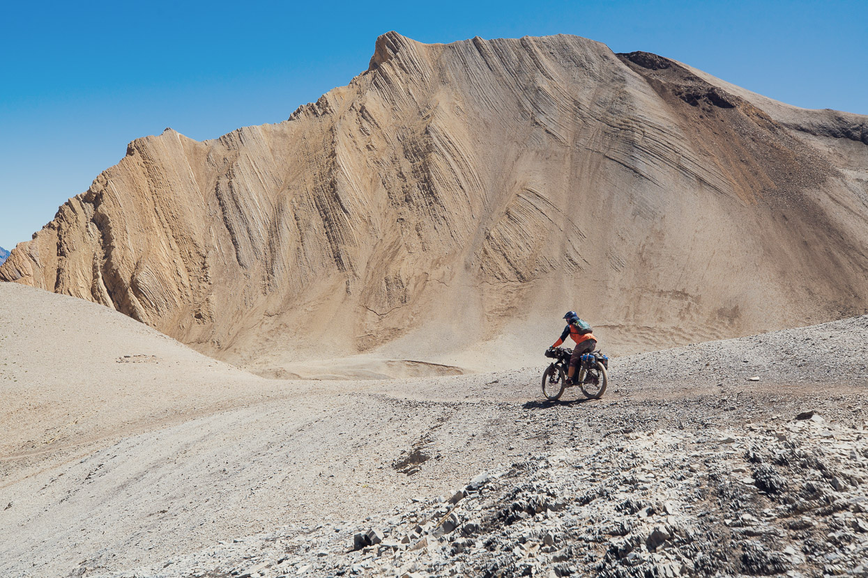
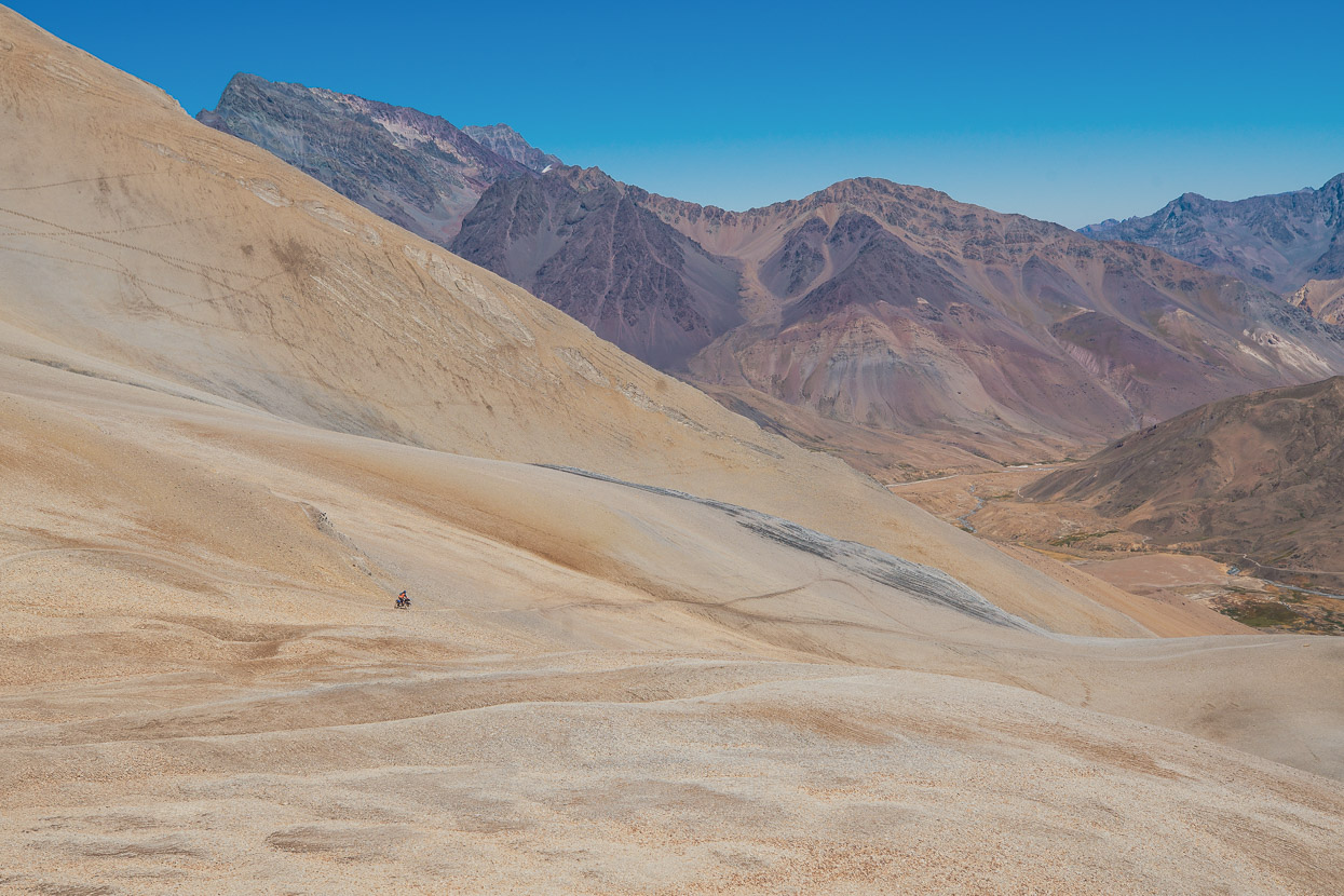
Such a reward for the long climb and push. Perfect singletrack in a remarkable location.
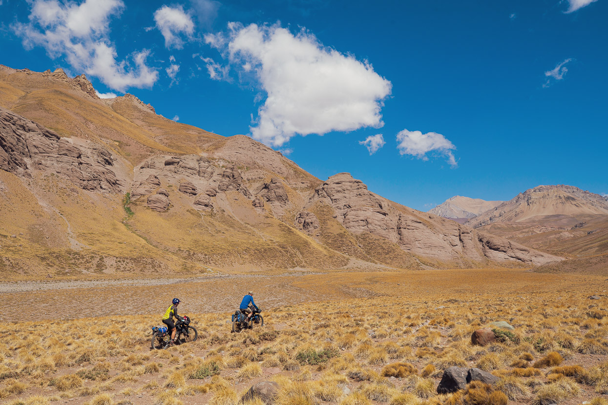
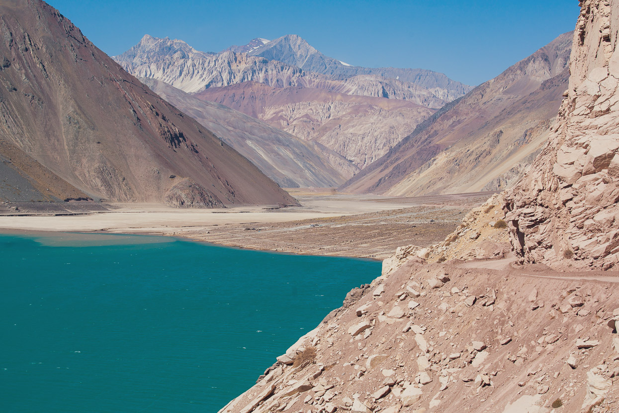
The upper valley gave way to a steep section of rockier switchbacks that required full attention, and then we hit more flow again in the lower valley.
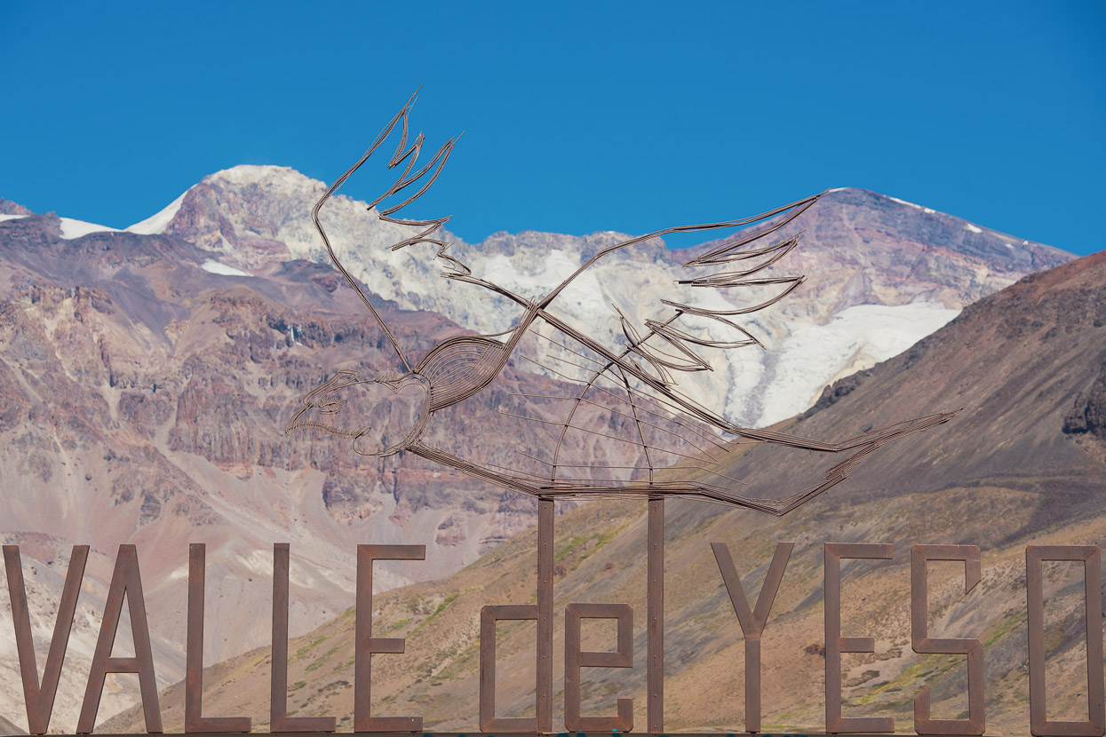
1100 vertical metres of rideable singletrack dropped us into the Valle Yeso and the small spring at Termas de Plomo.
A final wade across a river and we were back on gravel road again. A long descent to San Gabriel and Santiago followed.
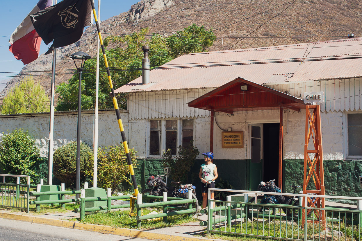
That evening we reached San Gabriel and camped for the night in one of the basic riverside campsites there. In 1817, this town was the site of the military post that Captain Lemo was tasked with capturing after his 11 day march over the mountains. All we needed to capture was an entry stamp for Chile so we reported to the carabineros office there.
Our Colombian friends had been able to report there and then ride to the PDI office in Santiago to collect their stamp, their passport credentials having been sent ahead by the carabineros. We were quickly told this was non standard though and that we’d have to wait until 5pm, when a PDI officer was coming to San Gabriel to stamp the passports of the same trekking group we’d been with at Refugio de la Cruz. It was a little frustrating as we were itching (literally) to get to Santiago and wash, relax and eat some good food. But in the end we resigned ourselves to the wait and actually spent quite a pleasant day by the riverside reading our books. We reported back to the office at 4.30, collected our stamps and hit the road, arriving in Santiago at 9pm. We’d arranged to stay with two Warmshowers hosts, Carlos and Joanna and they were very welcoming to us in our hot sweaty and dirty state. Thanks guys!
Note: if you plan to follow this route from Argentina to Chile, as we did, it’s best to call or email PDI in Santiago before you leave Mendoza or Tupungato so you can arrange a time to meet them in San Gabriel.
Do you enjoy our blog content? Find it useful?
Creating content for this site – as much as we love it – adds to travel costs. Every small donation helps, and your contributions motivate us to work on more bicycle travel-related content.
Thanks to Otso Cycles, Big Agnes, Revelate Designs, Kathmandu, Hope Technology, Biomaxa and Pureflow.


Another impressive ride by you guys. Kudos. So what happens if a rider can’t get across that river? Is there an option for LONG ride-around?
Hey Matthew, I did this path by foot this year. Actually the pass is only doable from december to march. During this period there are a couple of travel agencies doing the same itinerary by horse. So if you’re stuck and can’t make it through the river, you can pay the horse riders to cross you and your belongings for around 600 pesos argentinos (15 usd).
Congratulations and thanks for the pictures.
I found this blog because – a bit more history for you – Charles Darwin did this route from Santiago to Mendoza between 18th and 24th March 1835. There were 3 people and 11 mules, and he was concerned because, being a bit later in the season, it’s exposed to snowstorms which can trap you in the high valley between Piuquenes and Paso Argentinos.
His trip and other adventures are described in the Voyage of the Beagle, which can be downloaded from the Gutenberg project.
Very helpful. Where is the best place to find a guide when in Santiago? I’m going there/here in 1 week.