
into the atacama desert
Having finally done our last stretch of riding in the Andes Oriental (previous post) we were looking forward to a change of scene as we headed west towards the Andean Volcanic Belt and the northern reaches of the Atacama Desert.
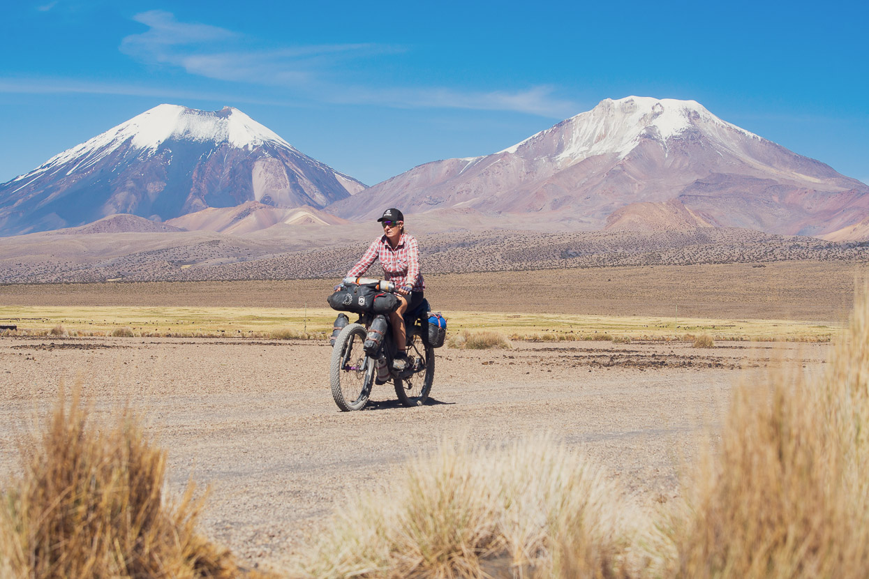
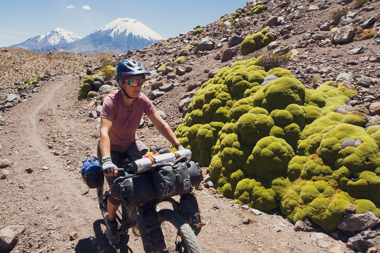
In particular we were headed towards the Central Volcanic Zone, a string of tall volcanoes – some still active – that comprises the Andes Occidental. We’d experienced some of this distinctive landscape already, on Peru’s Cones & Canyons route and also as we’d explored our own 1200km route in southern Peru which became the Camino del Puma. But this time we’d be a bit further south – dipping our toes finally into the northern Atacama Desert. The aim of this leg was to connect with the Ruta de las Vicuñas bikepacking route, which takes a southerly route towards the legendary salt lakes. On the way we’d pass Volcan Sajama, Bolivia’s highest mountain.
We left La Paz (by colectivo back to our bikes in Patacamaya) against a backdrop of unrest following the undoubtedly corrupt conclusion of the presidential elections which resulted in a win for the incumbent, Evo Morales. Friends staying in the city centre had reported being able to smell tear gas which had been used to disperse potentially aggressive protesters, while Bolivia’s other large cities were also reporting protests.
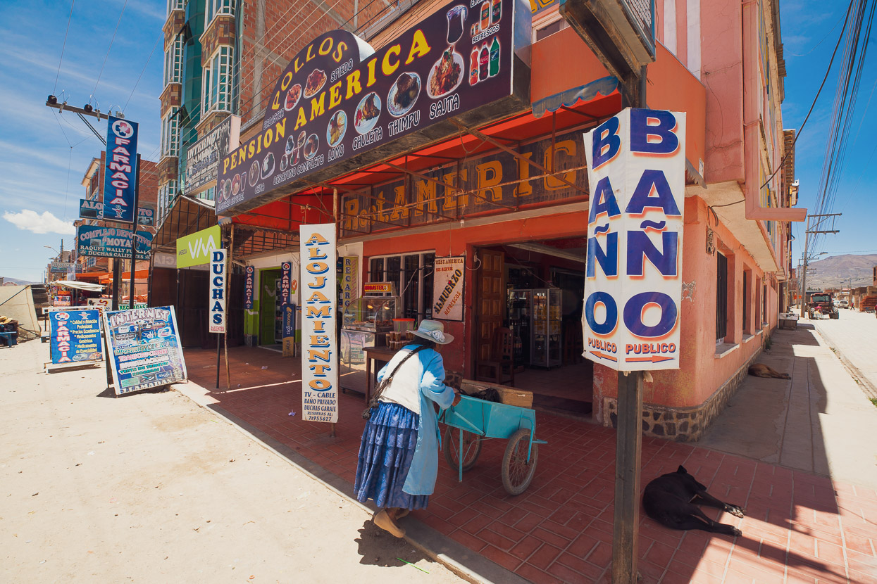
We’d left the bikes in a cheap guesthouse room in Patacamaya, so it was just a matter of repacking, buying some last minute food and hitting the road. The town has a typically rough and ready feel to it, but with the wide dirt verges, desert climate and dry heat it felt very Wild West. We ended up leaving town so late after our return from La Paz that we only rode for an hour, stopping to camp in a peaceful arroyo just a couple of hundred metres from the road.
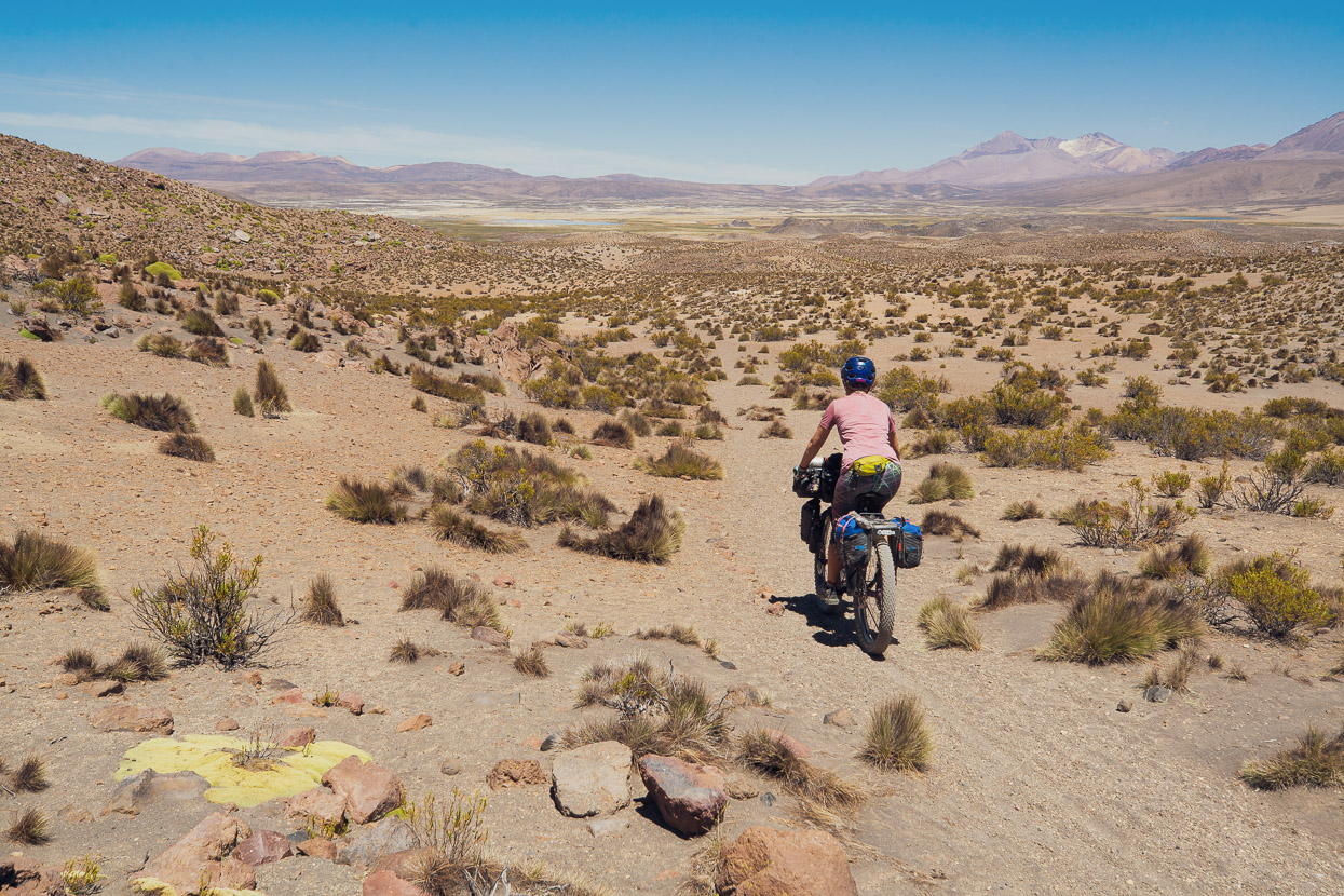
Already we were well and truly out on the altiplano, or the northern puna as it’s otherwise known. It’s dry. Your fingernails and skin crack. Nostrils dry out and the sun has an extra intensity, while the nights often drop to freezing.
This flavour of landscape and all that comes with it: the sun; the wind; the cold; the dust; the heat; the vivid light and starry skies, will be the theme of our journey for at least the next two months as we slowly ride our way out of Bolivia finally and into northern Chile and Argentina.
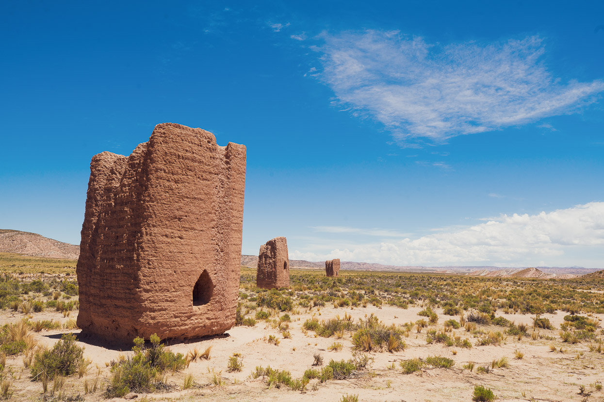
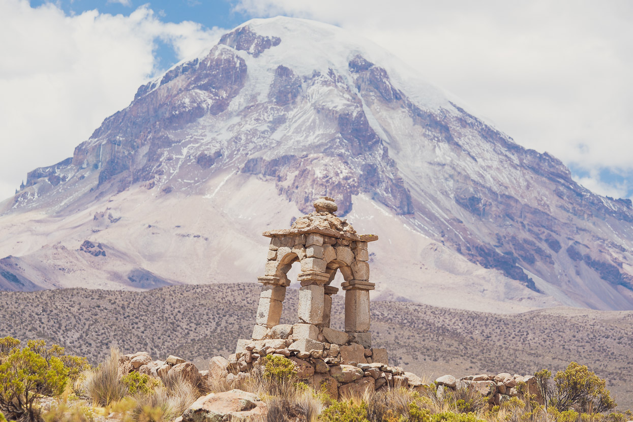
An impressive sight several times during that first day where these adobe chullpas, or tombs, which were constructed by a pre-Inca civilisation. Amazing after several hundred years they were still in robust condition.
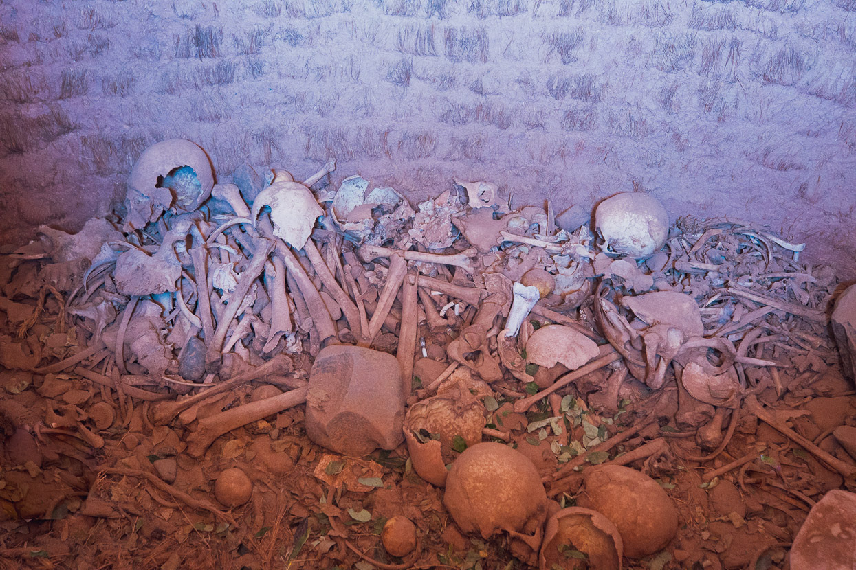
Inside some were jumbled piles of human bones, sometimes with a scattering of sacred coca leaves atop.
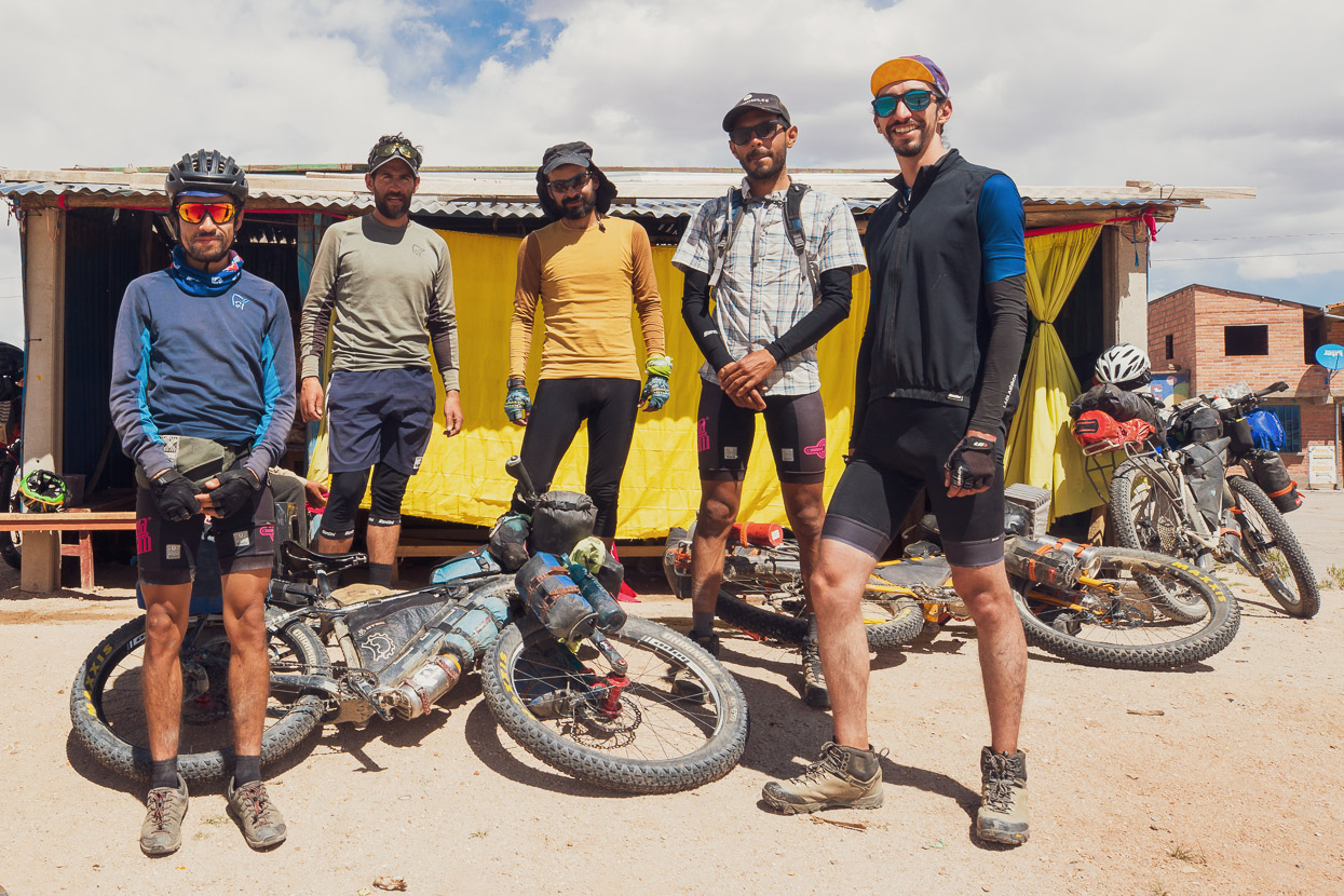
During the morning we were caught by a fast moving quintet of Colombianos, who turned out to be the MonteAdentro crew. Their ‘leader’ Jose had been in contact with us earlier in the year with some questions related to their intended bikepacking tour from Cusco, Peru to Ushuaia, Argentina. A few weeks prior to meeting us on the highway they’d started their journey with the tough Tres Cordilleras route and had faced many early challenges and lots of learning. The crew have collectively been racing road bikes for many years, but bikepacking and overnight trips is a new thing for them. It’s a very admirable journey that they are on, doing some of the toughest bikepacking routes with limited experience. You can also find them on Instagram.
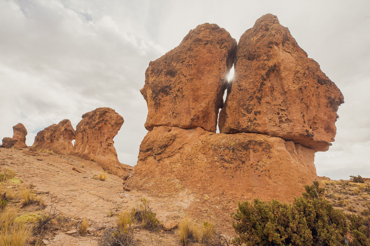
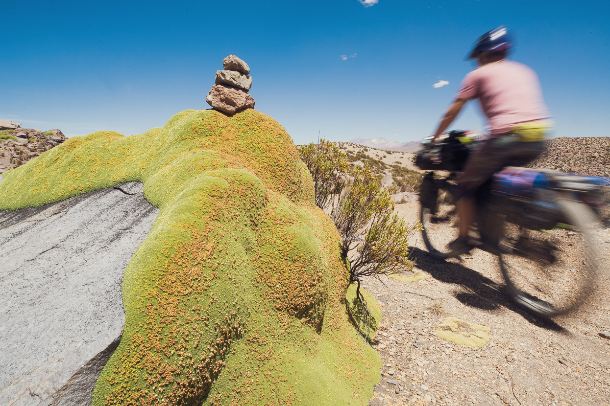
The sure signs of a volcanic zone began to become apparent, with outcrops of tuff, basalt cliffs and sandy ground.
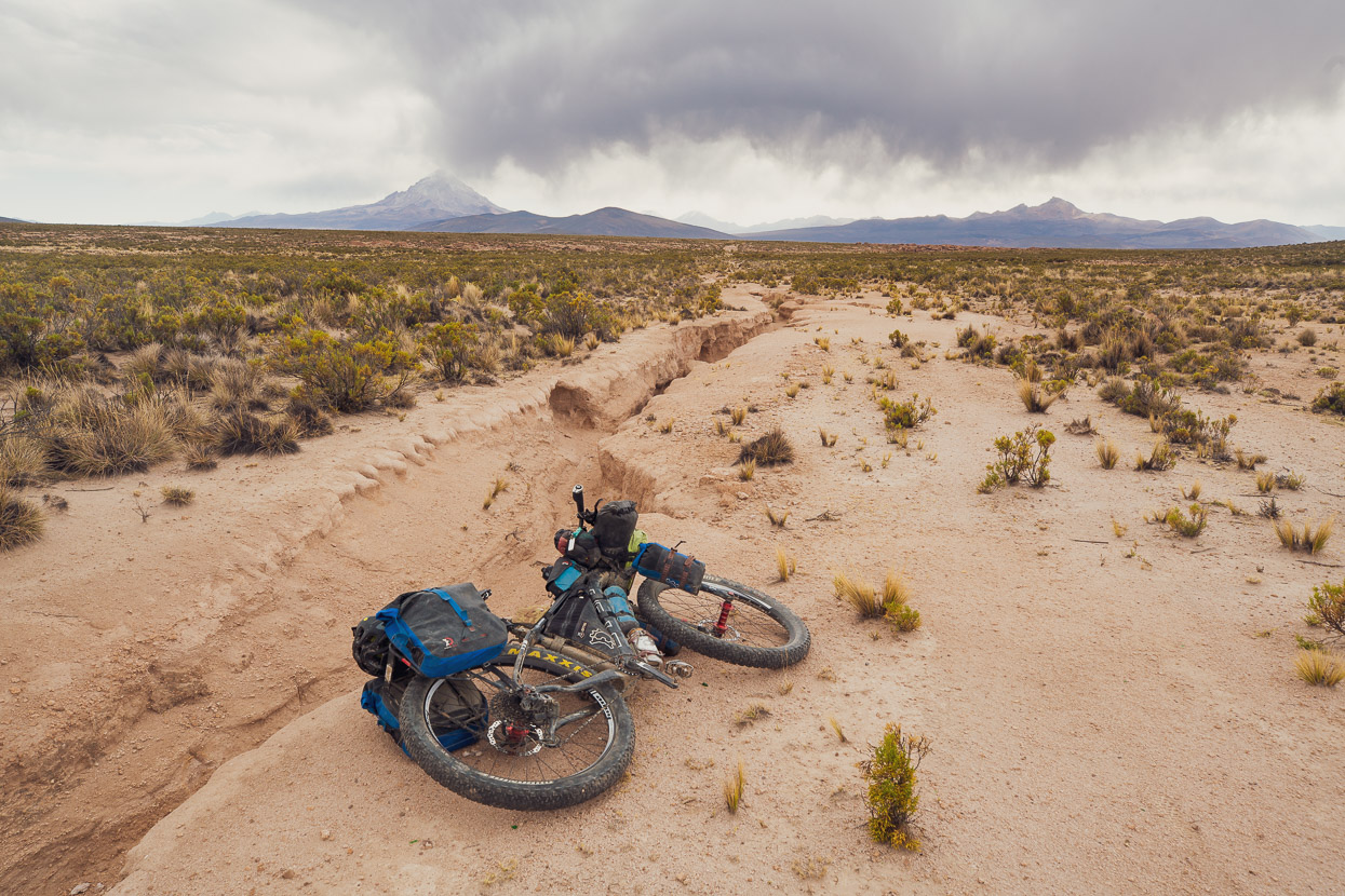
One of the challenges for us now since we are on the puna and headed towards the Atacama Desert is water. Already we are having to carry many litres at times and having to plan our days around water availability will soon become the norm.
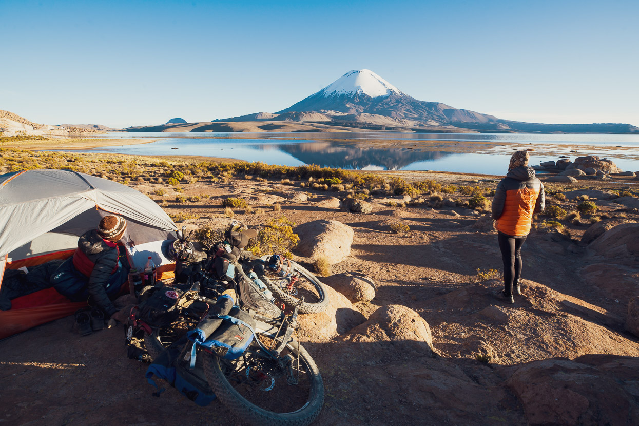
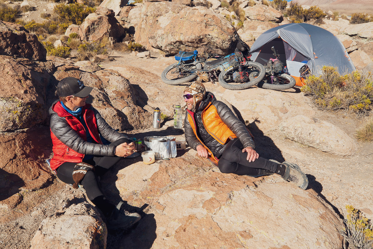
On this afternoon we hoped to fill up in a hamlet, that turned out to be abandoned, and then the ‘road’ we were planning to follow turned out to be abandoned too (or possibly never actually built in the first place!), so after a bumpy late afternoon thrash through rocks, sand and scrub we were very happy to find a fresh spring and good camping just a couple of kilometres from Khalasaya, and all just in time for an epic sunset on the edge of Sajama National Park.
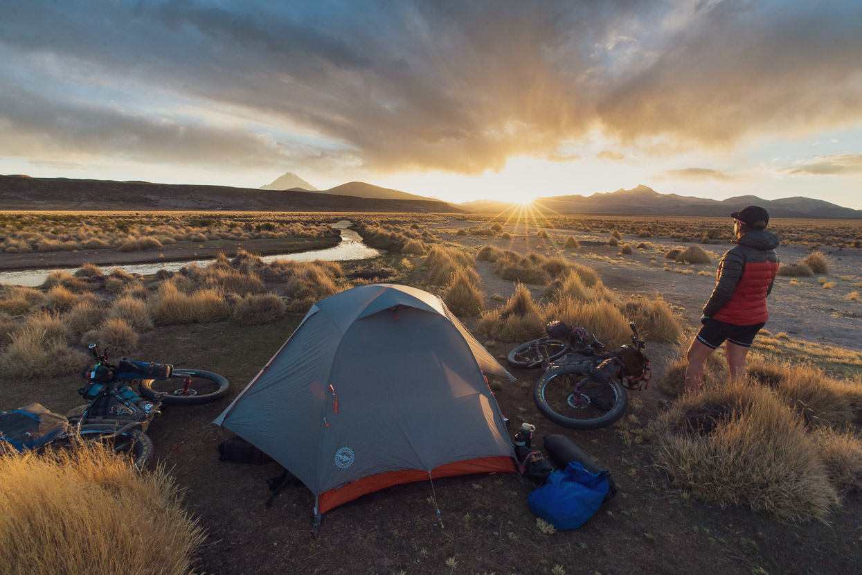
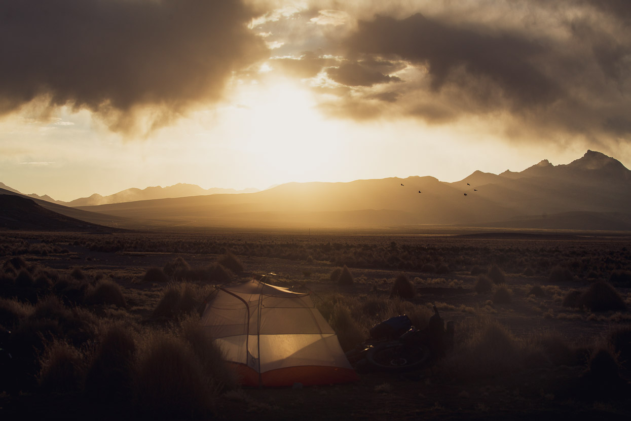
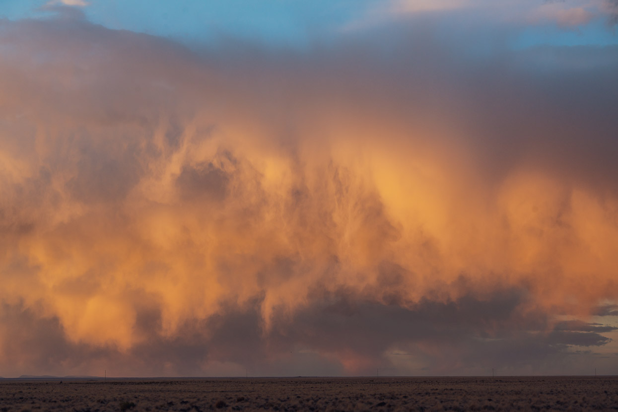
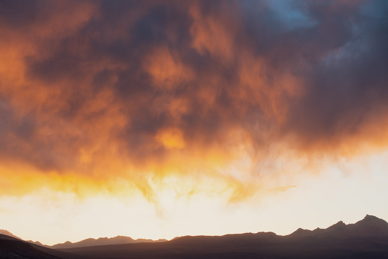
After so much time deep in mountain ranges, the wide skies of the puna are a nice change and the sunsets and light have been fantastic. Almost 360 degrees the colour of the sunset seems to swirl around the sky, picking up the grey of a distant thunderstorm and rendering every detail of the clouds.
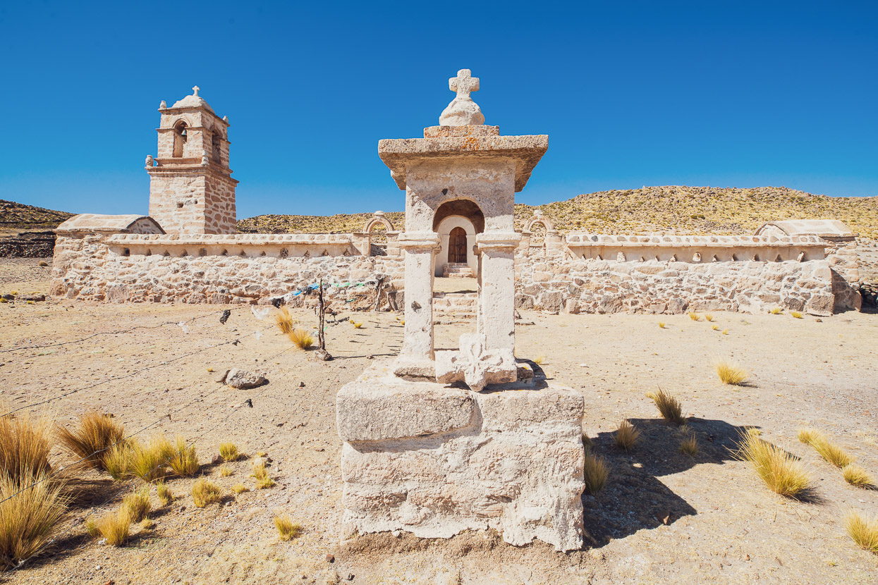
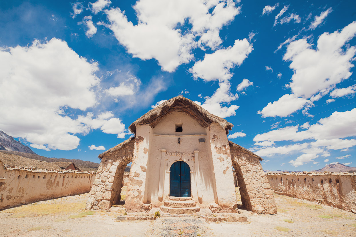
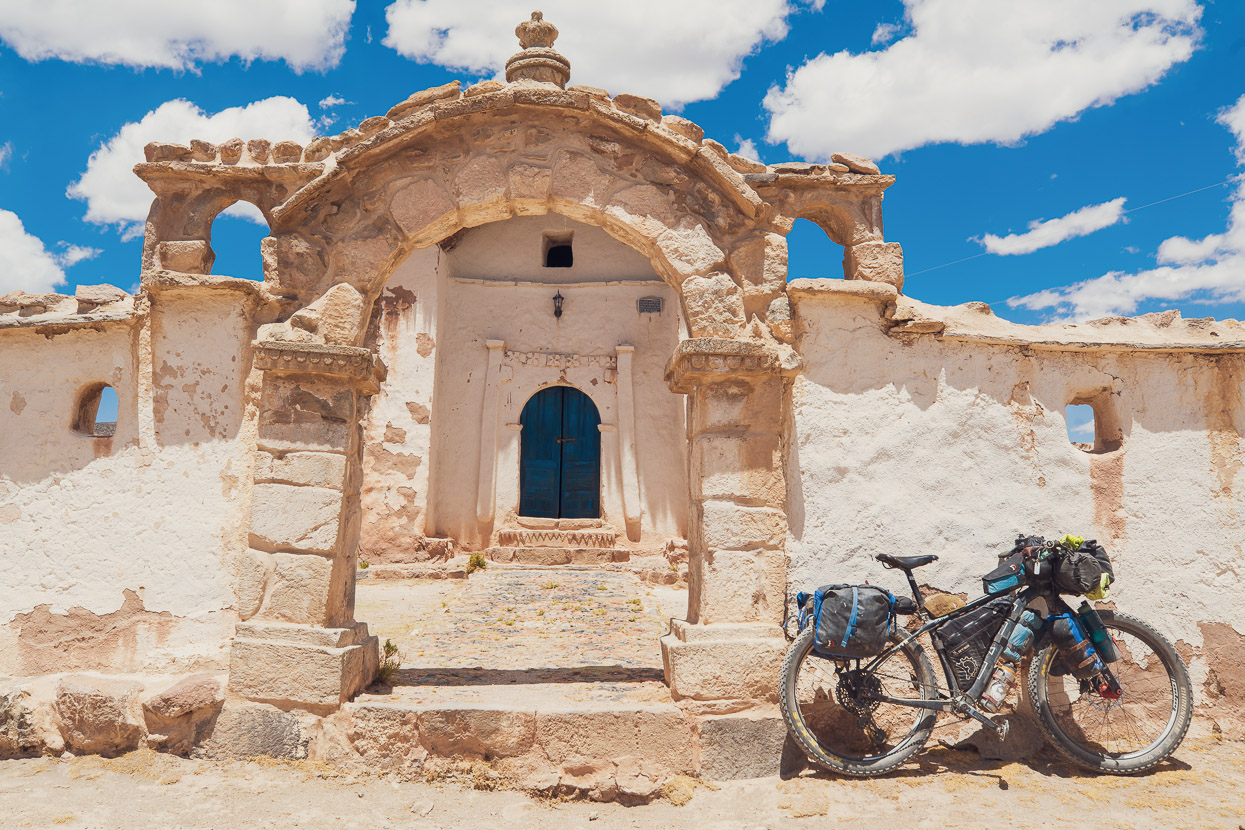
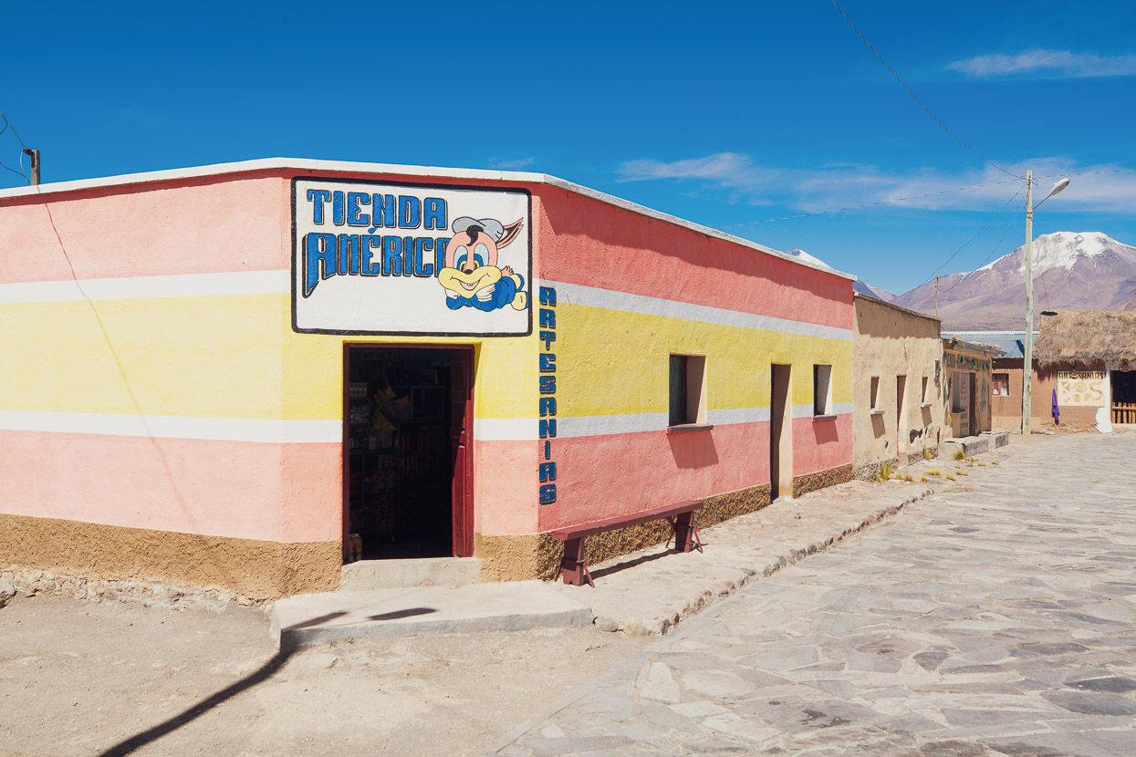
We rode the short distance into the tiny farming hamlet of Khalasaya in the morning. One of the most notable historic features of this region of Bolivia (and extending into Chile) are the ancient Jesuit Mission churches, which have a very distinctive style of stone walls, steeples and archways (more photos of these to come).
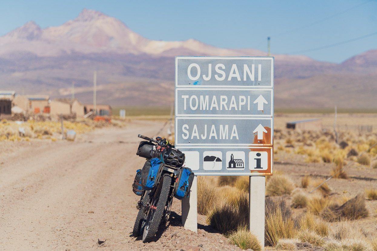
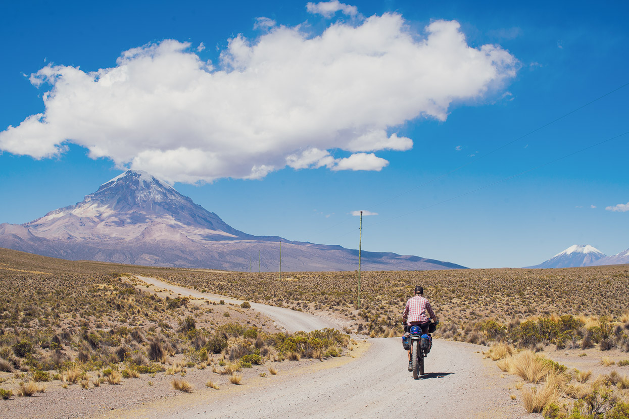
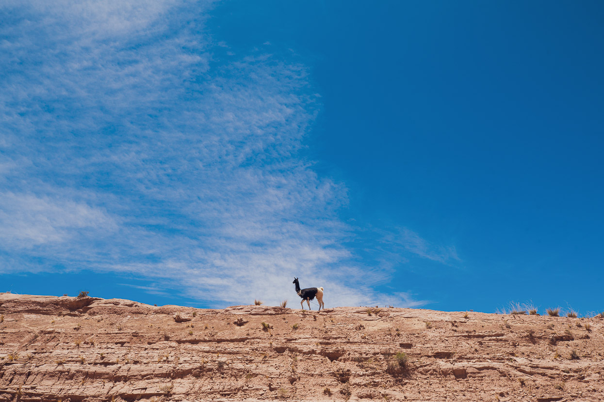
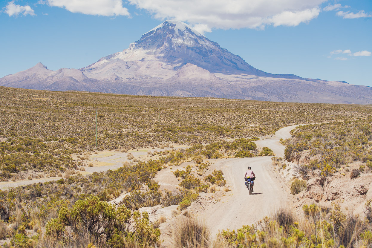
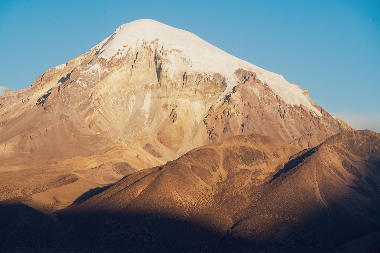
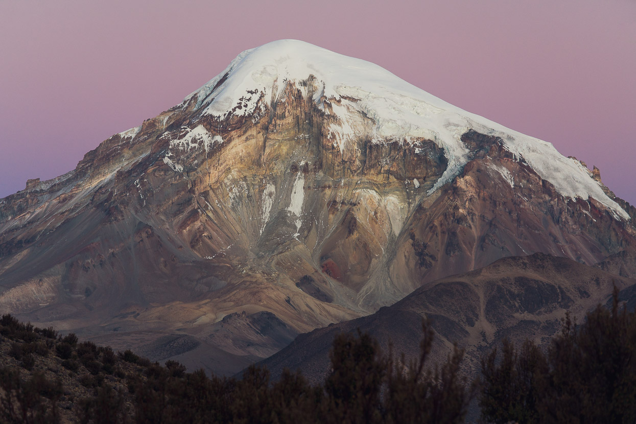
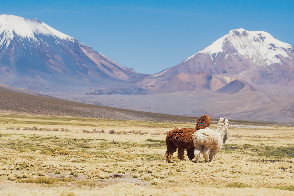
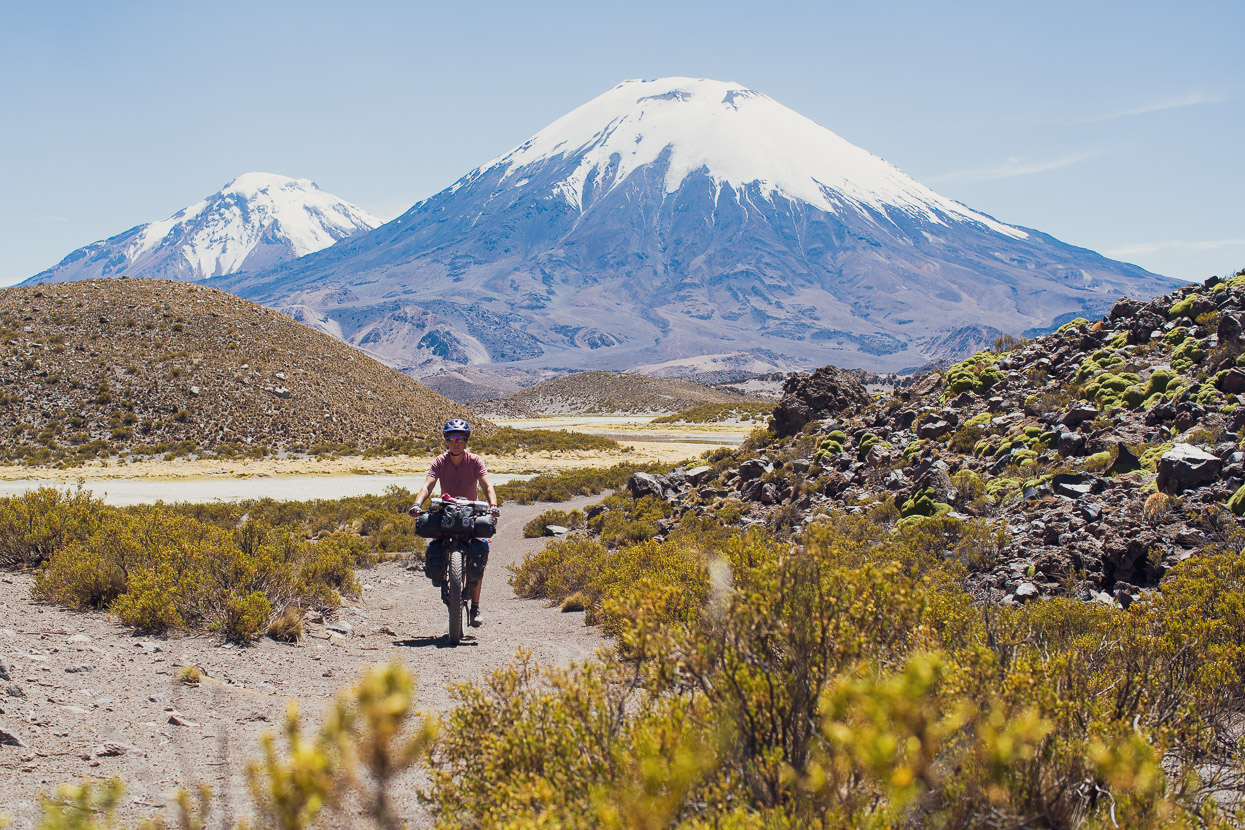
The horizon was dominated for the next couple of days by the impressive, steep cone of Nevado Sajama, Bolivia’s highest mountain at 6542m. From Khalasaya to the mountain’s namesake village we circumnavigate its boundary. An occasional sight are the flighty vicuñas who call this broad open country home. They’re the slender, uniformly tan and white coloured ancestors of domesticated alpacas, and relatives of the llama. Lots of photos of these guys coming in the next post…
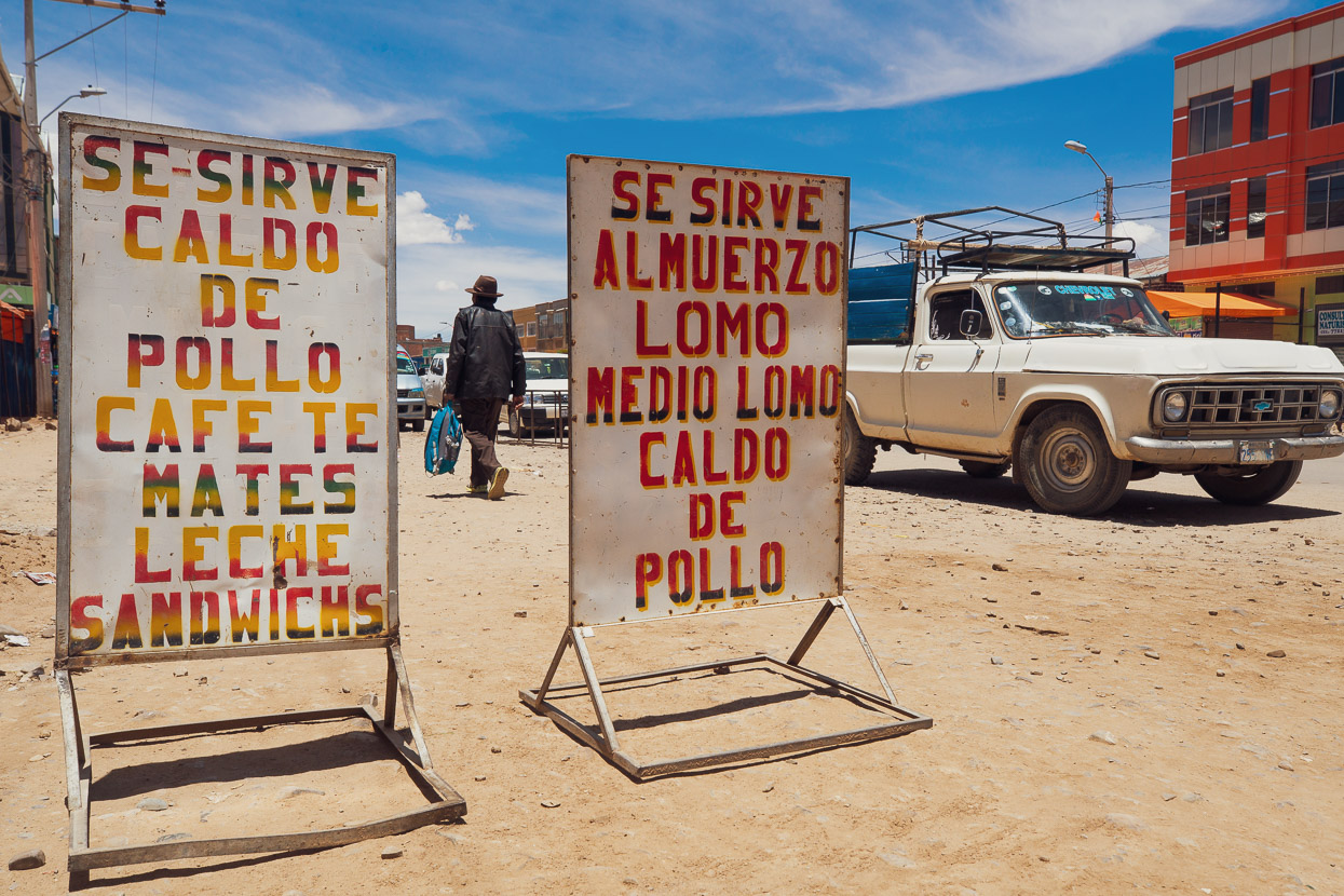
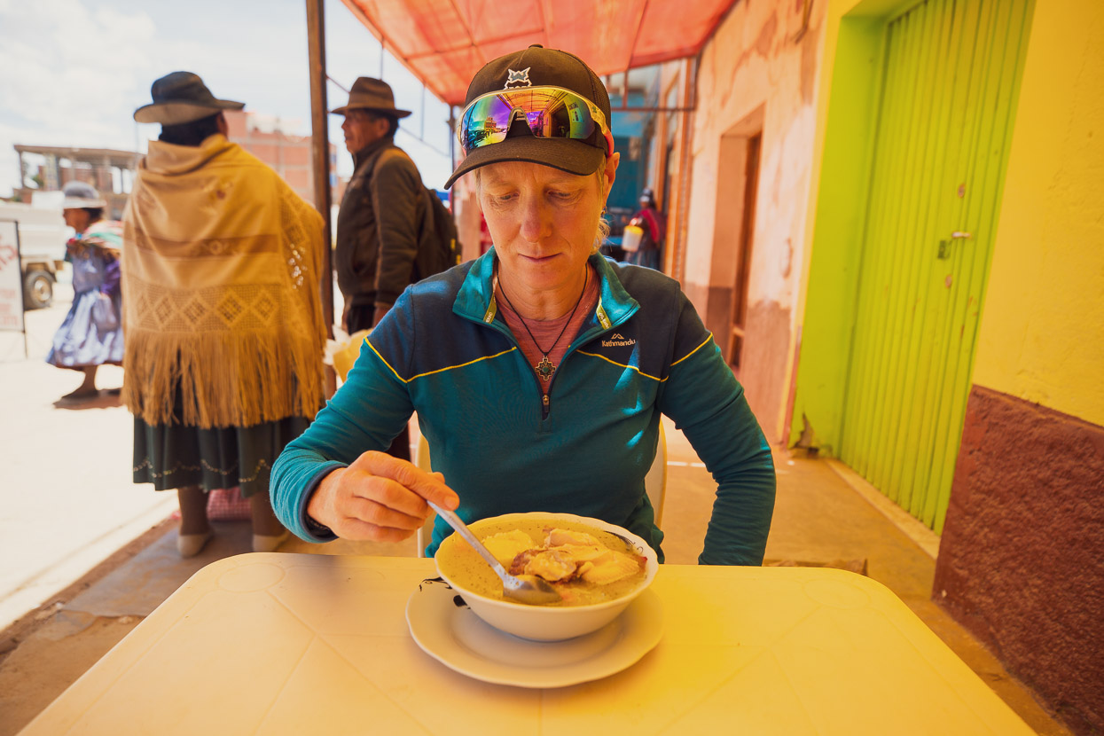
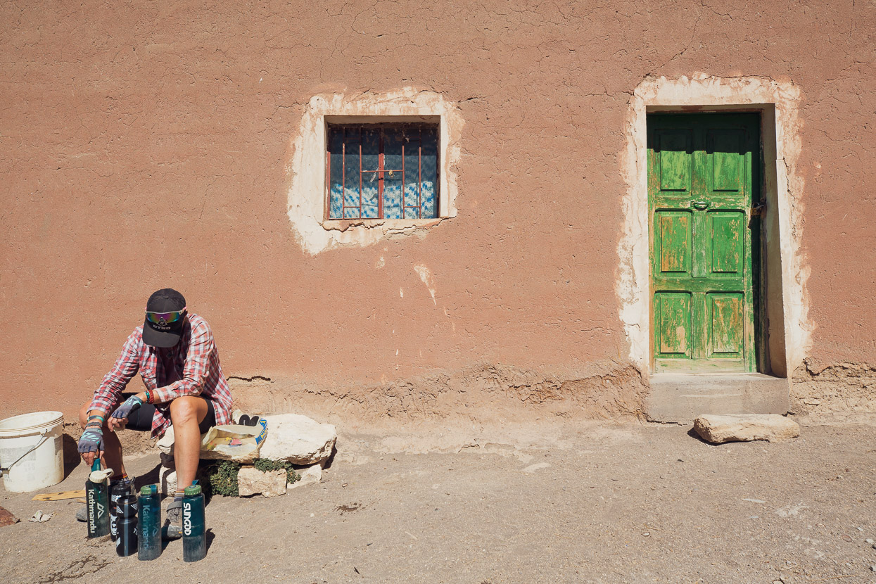
We arrived in Tomarapi a bit early for lunch but could not resist the opportunity for pan y huevo (eggs & bread) and coffee for lunch from the small guesthouse there, instead of crackers and sardines. Tomarapi would be just another wind-worn, dusty and semi-abandoned hamlet, were it not for enterprising locals who have established a small tourist hotel there that many of the tours to Sajama stay at. We didn’t stay, but it’s reportedly reasonably priced and includes meals. Cyclists (depending on your bargaining skills) might be able to negotiate a discount.
Tomarapi also features another stunning Jesuit Mission church and it’s also where you pay your park fee for Sajama National Park if you stop for long enough for the guard to find you. The fee is 30 BOB for locals, but 100 BOB for extranjeros, but with my Jedi bargaining skills we negotiated down to 130 BOB for the two of us, thanks to an accommodating ranger.
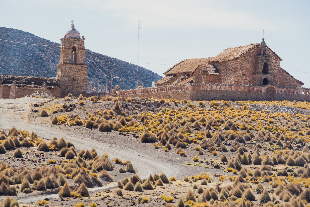
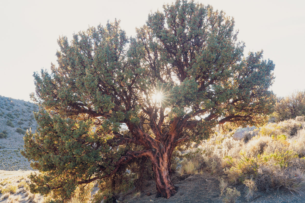
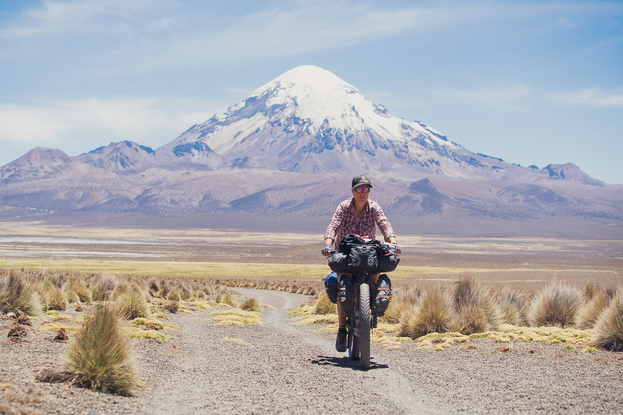
We pushed on along the sandy, corrugated road headed for Sajama village, the snowcapped cones of other smaller volcanoes framing the valley. Sajama too has a rustic stone church, and something else we’d scarcely seen outside of La Paz: other tourists. There is a pretty well established ‘gringo trail’ that heads west through this region and into Chile before dipping south to the gigantic salt flats (salars) back inside Bolivia. People come here to see the world’s highest ‘forest’ which sprawls over Sajama’s lowest SW flanks. The forest is made up polylepis trees, which define the landscape here in the same way bristlecone pines do in the western desert of the USA. Other attractions include ascents of the mountain, hiking loops and hot pools.
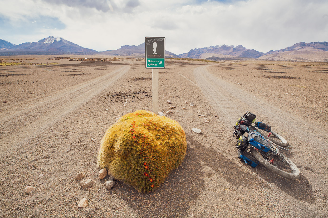
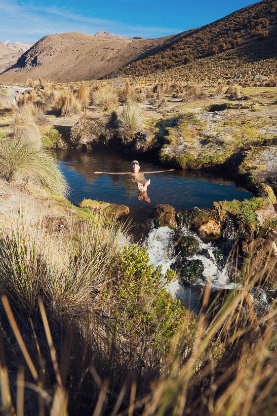
We’d heard about some really good sounding natural hot pools in a geothermal area an 8km detour from Sajama village, so we headed up there to have a soak and camp for the night.
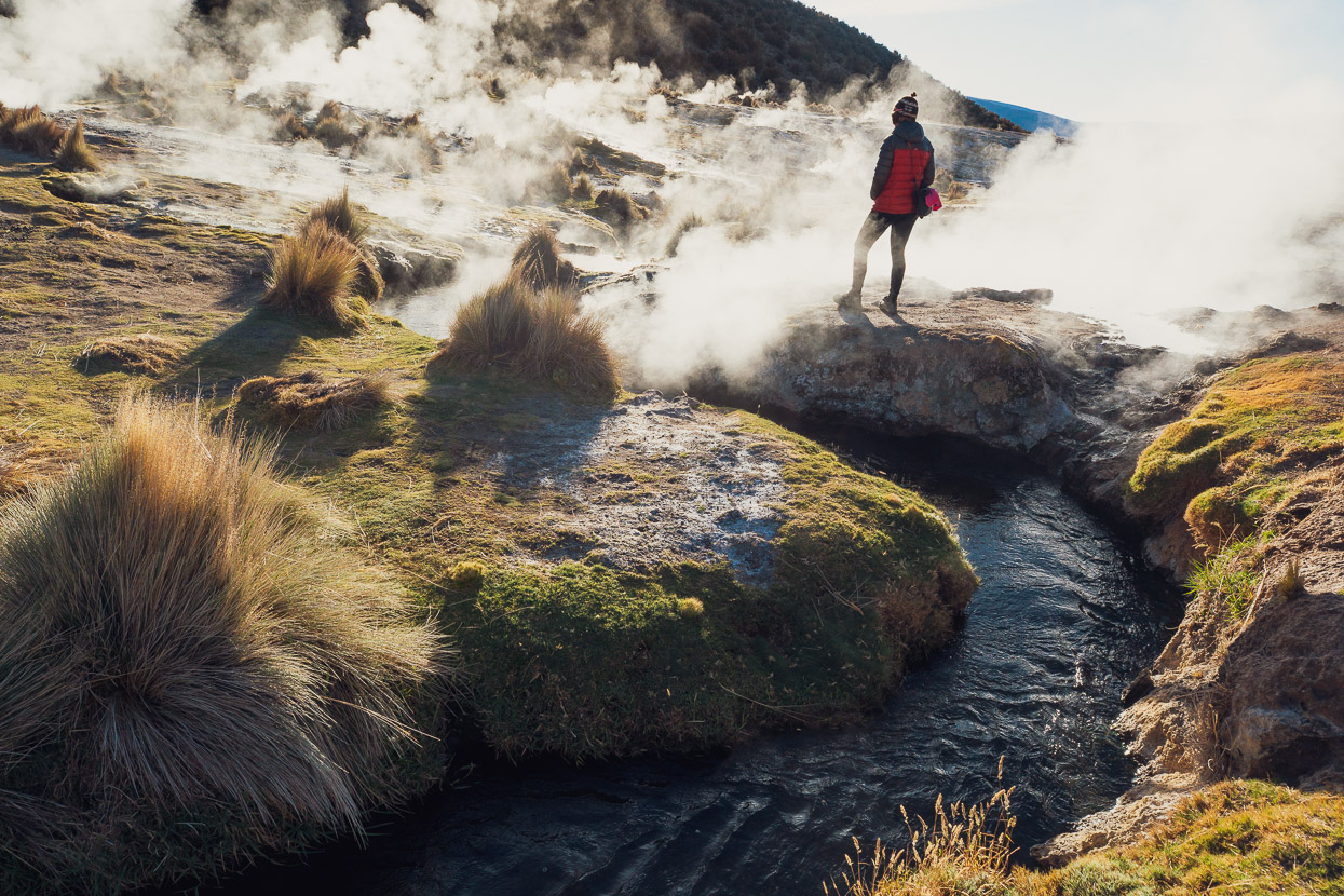
Although the site is called the Huallaqueri Geiseres (geysers), they’re really just a series of boiling pools and fumaroles that feed into a cold water creek. Two or three spots along the creek are perfect bathing temperature. We pitched our tent up near a mirador with perfect views of Nevado Sajama and then headed off for a soak under the stars. It was so good we could not resist a second dip in the morning. The best spot we found was about 200m downstream of the main thermal area and pool.
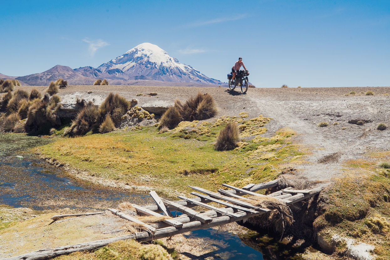
We returned to Sajama to pick up some basic supplies and then headed towards Tambo Quemado and the Chilean Border. Our friend Mike (check out his wonderful street photography on Instagram) had mapped an off-road track through this section and passed it onto us and it proved an excellent route to follow, with a combination of single track, sandy double track, rustic bridges and really nice views.
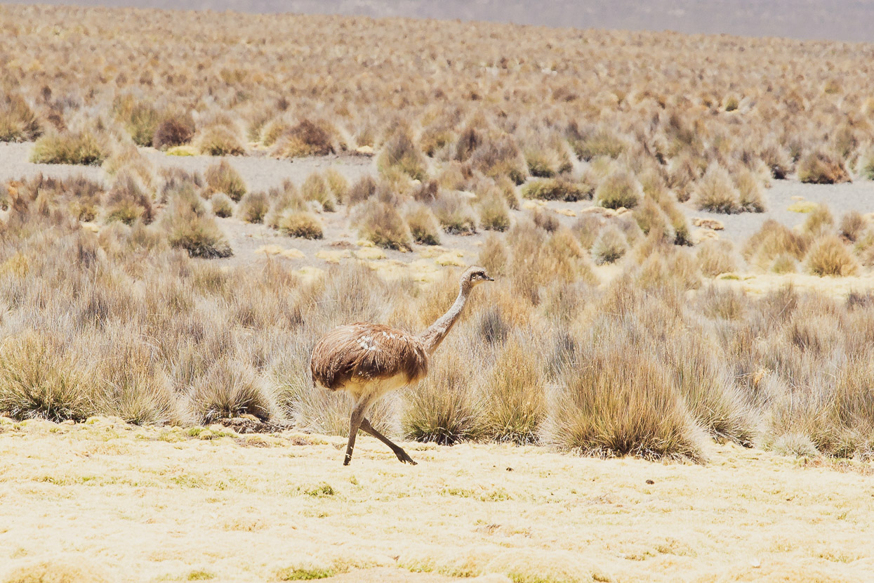
We even spotted a few elusive rhea grazing in the pampa. Called suri in Aymara & Quechua languages, these large flightless ratites are a distant relative of the emu and ostrich. They’re native to South America and considered a threatened species.
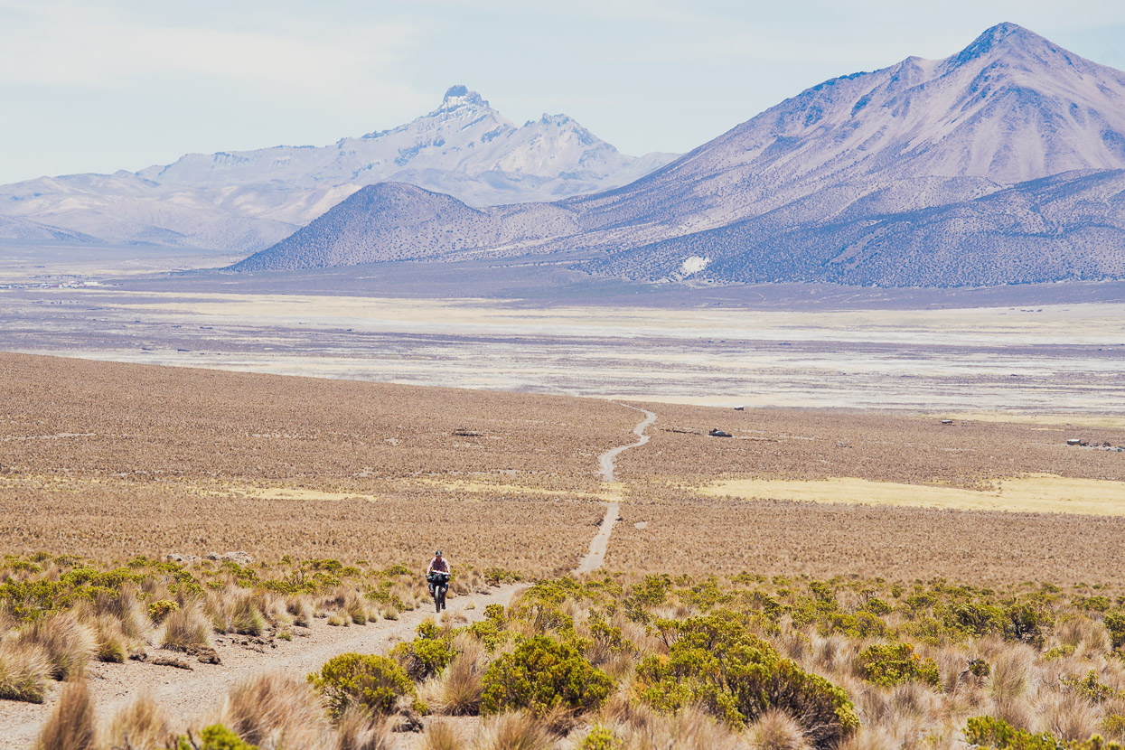
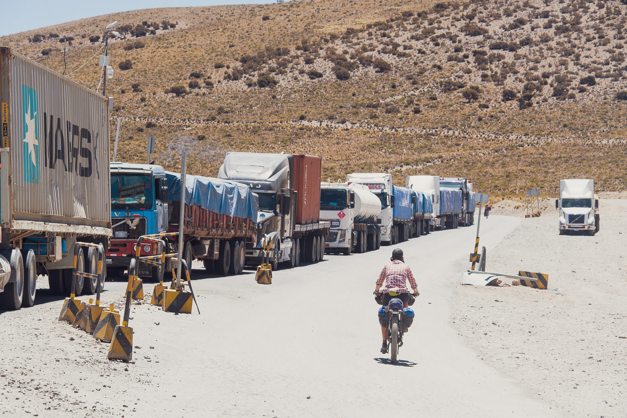
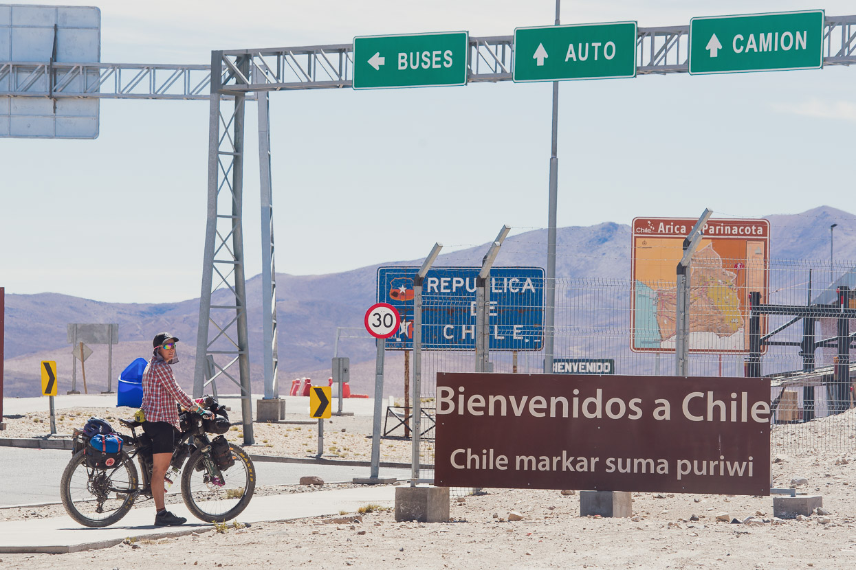
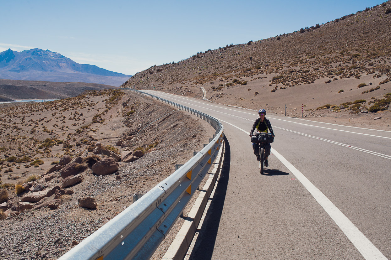
At Tambo Quemado we joined the highway and then climbed steadily up to the border, with a lot of trucks for company. The Bolivian-Chilean border lies in an otherwise remote section of alpine desert at a lofty 4680m. Chile (like NZ) is very biosecurity aware, so many foodstuffs are prohibited entry into the country, which can be a problem for cyclists travelling in remote areas. We declared our food and were subject to a fairly thorough search to check all items. Processed food is generally permissible, but we though we might lose our peanuts and oats (they were ok). The bike’s serial numbers were also noted and registered in the Chilean immigration system. The whole process took around an hour, but we were stamped in fine and allowed on our way.
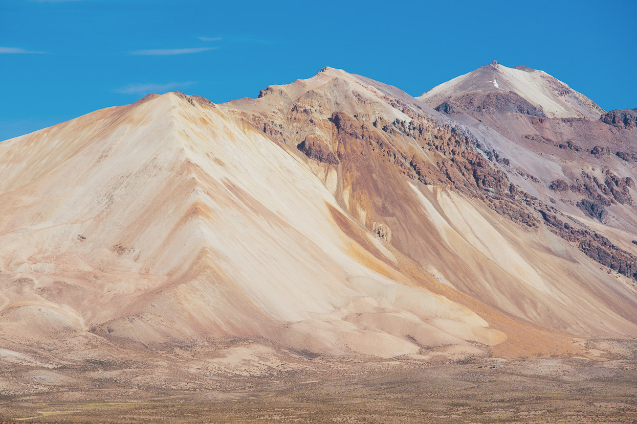
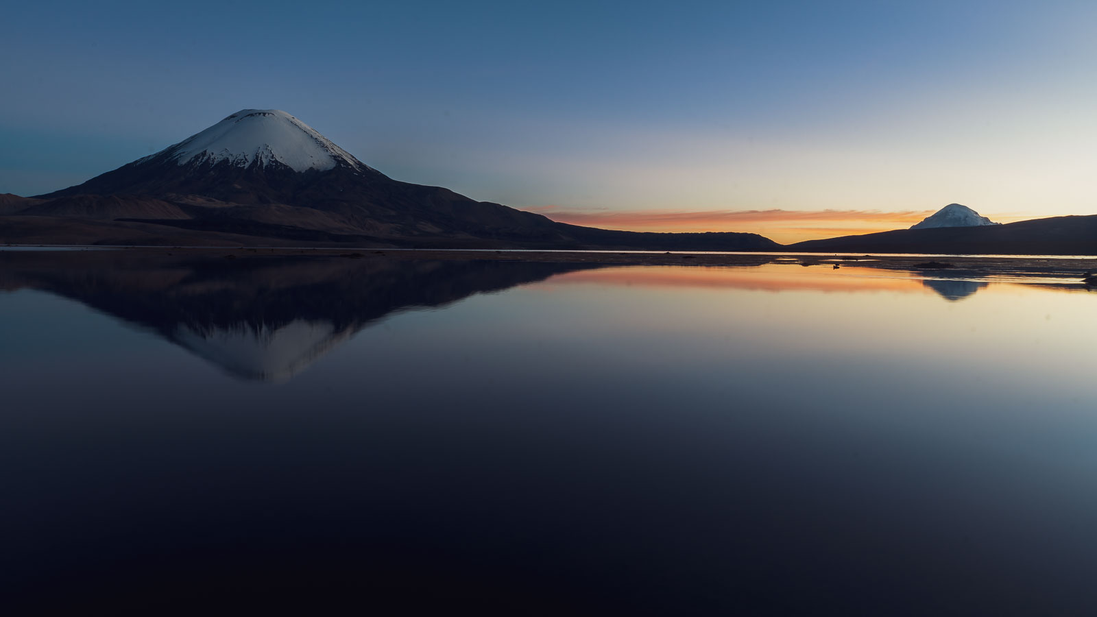
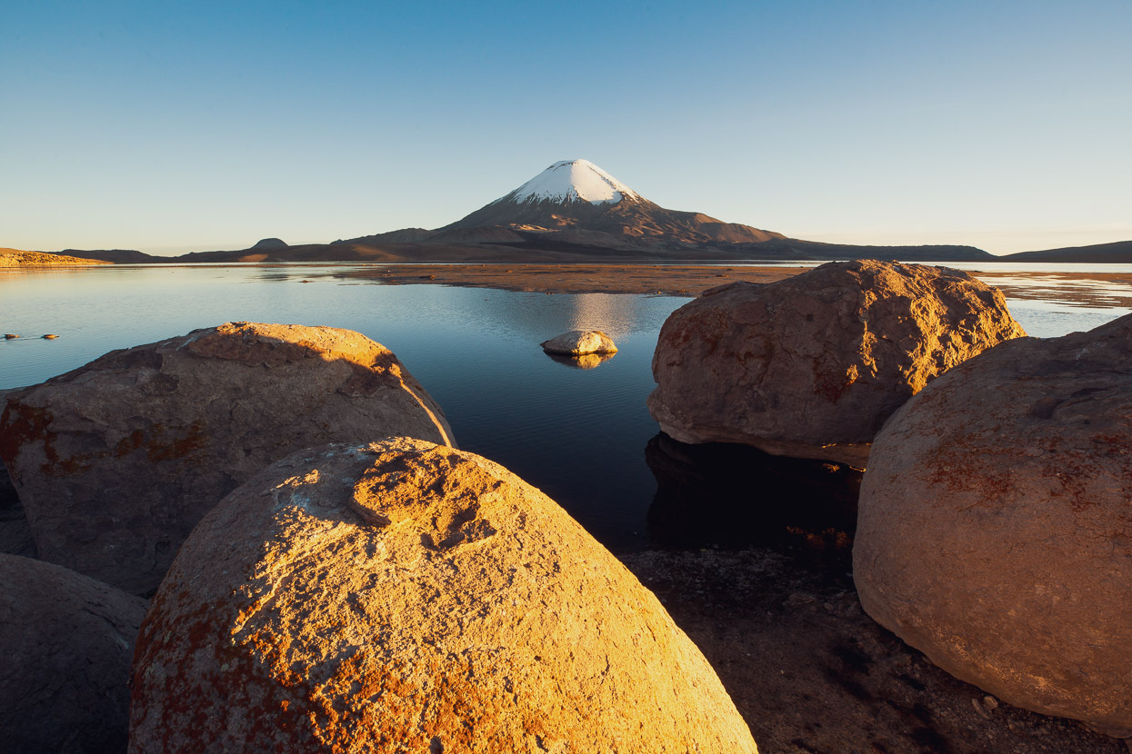
From the border it was an easy roll downhill to Lago Chungara, passing through a stunning red and orange hued volcanic landscape on the way. By now we were in the middle of the volcanic belt.
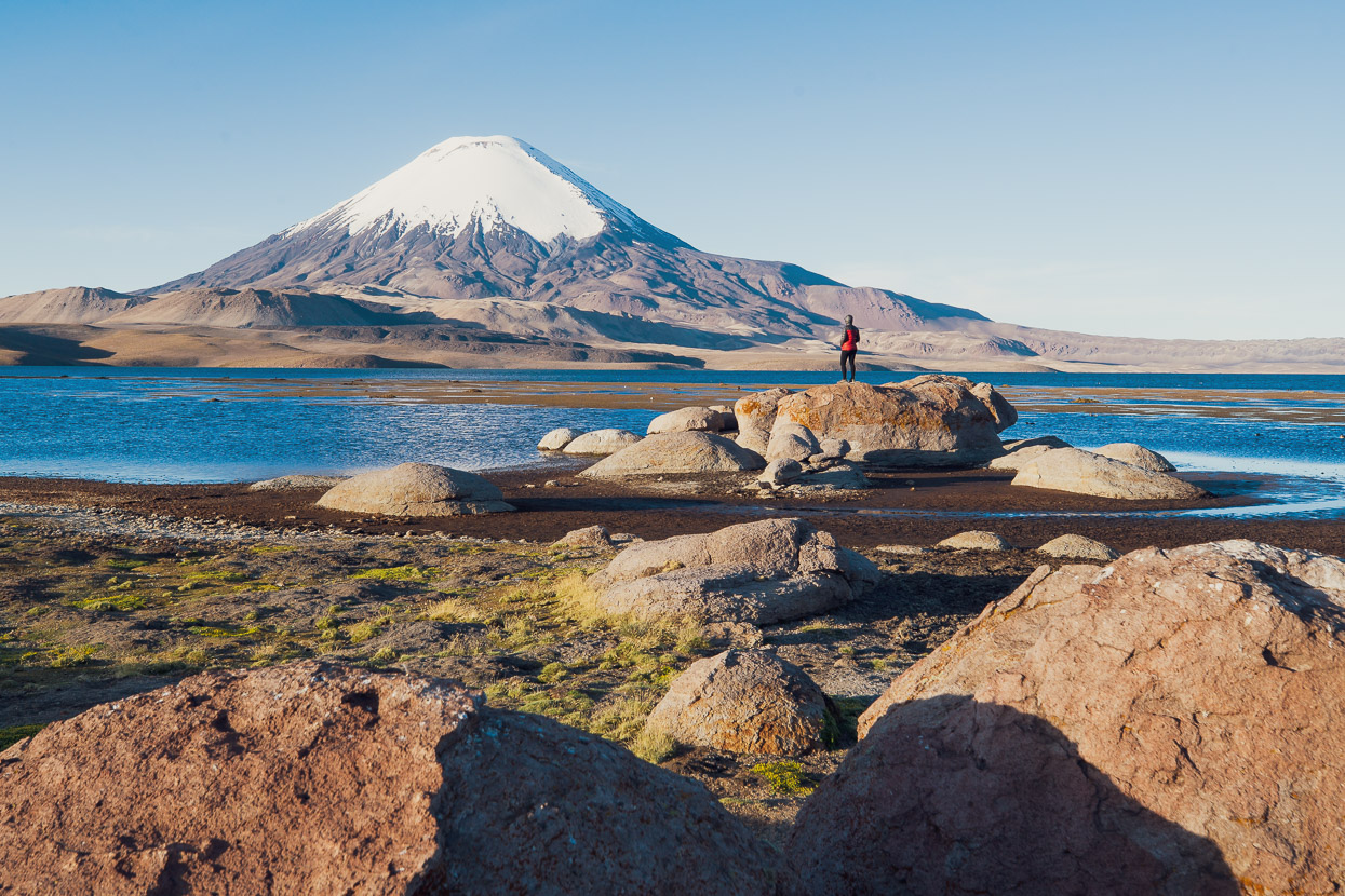
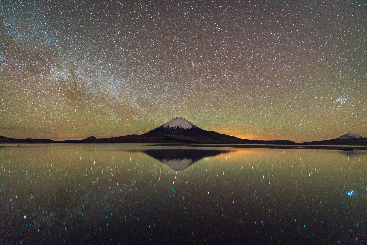
There’s a mostly disused customs and police checkpoint when you first reach the lake and there we were able to get water from the police station. They even gave us a bit of gasoline for our stove too and a 2l bottle of coke – very kind. We rode just a few kilometres further on the main highway and then found an excellent sheltered campsite among volcanic boulders near the lake shore. Chungara is a popular spot for passing tour groups, with its picture perfect volcano on the opposite shore. The most recent of its lava flows almost reach right to the lake. It’s the sort of place you just can’t ride past without stopping for the night.
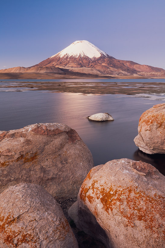
The qualities of the clear, high altitude desert light made photography a treat here with crisp golden hour, beautiful blue hour light and an intensely starry sky.
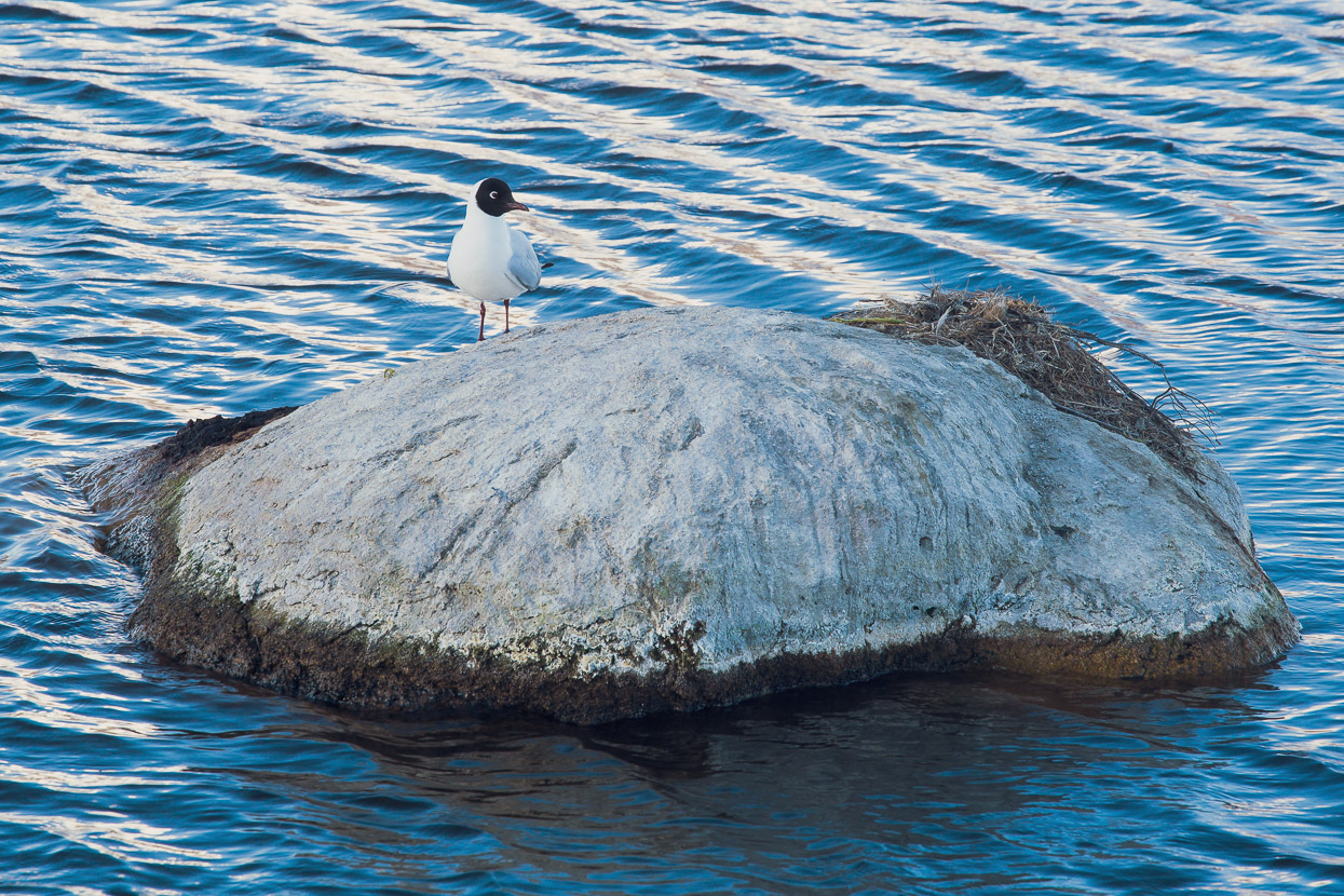
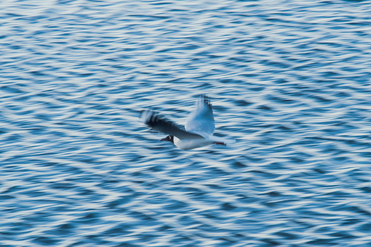
Bird life was impressive too, with several different species calling the lake home. Some living in big nest-islands made from sticks and lake weed.
After an overnight low of -7c we made the most of the warm morning sun, lingering over a long breakfast before we hit the road.
Pavement continued around the lake edge until we could drop down to Laguna de Cotacotani and join Mike’s track again (which he’d planned but not ridden).
This section was a real treat, with an abandoned double track road at first and then a sandy but pleasantly rideable single track that led us over mounds of moraine towards the village of Parinacota.
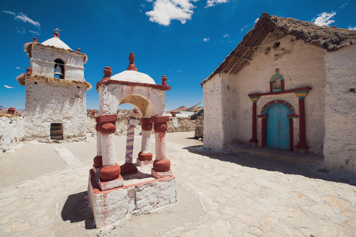
Parinacota is another historic village, with apparently the oldest church in Chile. While the village seemed to be barely populated anymore, the church was lovingly looked after.
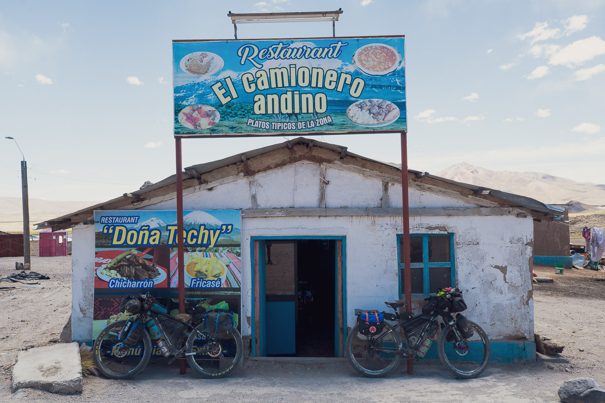
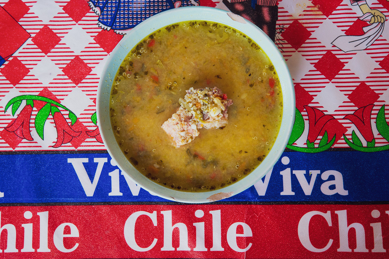
We were yet to have a meal in Chile that we hadn’t cooked ourselves, and services are extremely scarce through this region, so the first restaurant we saw we had to stop and have a meal. Some of the differences between Bolivian and Chilean restaurants were immediately apparent: firstly we were given more than one serviette, secondly the order of cafe, came with a whole flask of boiled water and the jar of coffee was left on the table, instead of just a pitiful spoonful. The meal came with a delicious quinoa soup, replete with a chunk of meat and plentiful vegetables, and the segunda was generous and tasty.
From there we followed pavement right to Putre, which while a detour from our southerly line, is an essential stop to resupply for the Ruta de las Vicuñas bikepacking route and the upcoming salars. Dropping 1000m off the edge of the altiplano to reach the town felt counterproductive but unless you carry lots of supplies from La Paz or Patacamaya, you don’t have much choice. There are supplies in Sajama but they are very basic. We took a day off in Putre – our first Chilean town. Another difference was immediately apparent: the big step up in the price of accommodation. We paid double the price for the equivalent type of basic room.
Originally we thought we’d make the 1000m climb backtrack to where the Ruta de las Vicuñas turn off the main highway by taxi, but Chilean prices put us off so we ended up riding it in the end.
Next post will cover the Ruta de las Vicuñas and the amazing salars across to Uyuni. More from us soon…
Do you enjoy our blog content? Find it useful?
Creating content for this site – as much as we love it – adds to travel costs. Every small donation helps, and your contributions motivate us to work on more bicycle travel-related content.
Thanks to Otso Cycles, Big Agnes, Revelate Designs, Kathmandu, Hope Technology, Biomaxa and Pureflow.


Nice writeup Mark. Looking forward to the Vicuñas writeup so we can snag some beta.
Thanks Chris – will probably be 10 days time… But Hana’s sick today, so maybe I’ll get time – we’ll see!
Love those hot pools, great to see you have crossed into Chile.
Wow, such amazing riding terrain. Very jealous! From what I remember Chile is definitely going to inflate your budget a bit.
Epic. You folks recorded the gps to this route? 🙂