
“because it’s there”
—George Leigh Mallory
By the time we returned from New Zealand to Sorata to resume our ride south the crisp nights and clear days of winter and the dry season had passed. Cloudier skies and hotter days of the shoulder months leading into wet season had arrived. We felt an urgency to get moving and complete the north of Bolivia before the weather changed further.
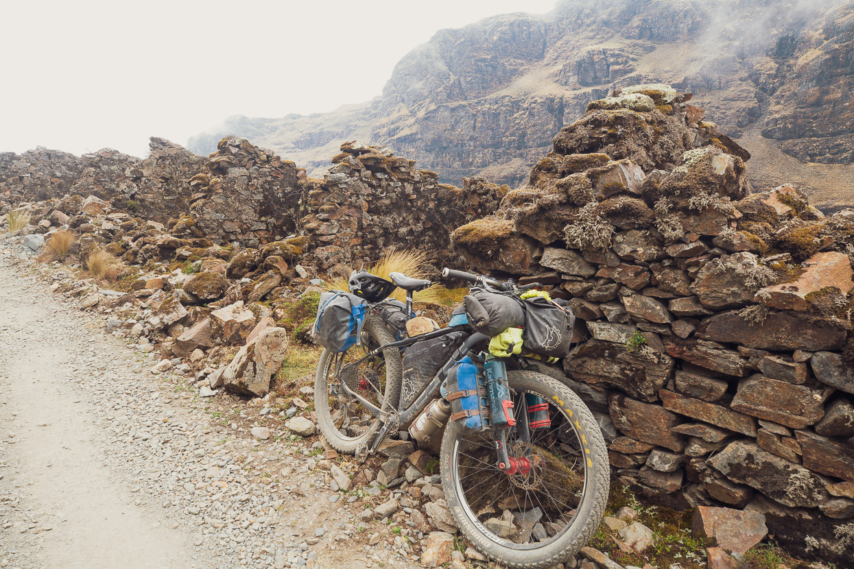
The basis of our route south for the next few weeks is to follow the Mama Coca bikepacking route which was just published earlier this year and has seen little traffic so far. This often remote route connects singletrack, mining roads, open puna and gravel to follow the western edge of the Cordilleras Real and Quimsa Cruz to south of the city of La Paz.
But before getting started on the route we decided to explore more of the spectacular Cordillera Real. Repeatedly since we left Cusco we’ve found a lot of satisfaction in crossing back and forth over the Andean divide, rather than sticking to one side, as Mama Coca does. So to spice things up a bit, and create our own ‘Mama Coca Extra’ we decided to cross to the east side of the Cordillera Real over a 4600m pass and then return to the west side of the Divide (and join the actual Mama Coca) via a 5000m pass, Abra de la Calzada, basically following a 3/4 circumnavigation of the glaciated northern peaks of the Cordillera.
With remote valleys, high passes and steep alpine terrain it sounded right up our alley, or callejon, as you’d say in Spanish.
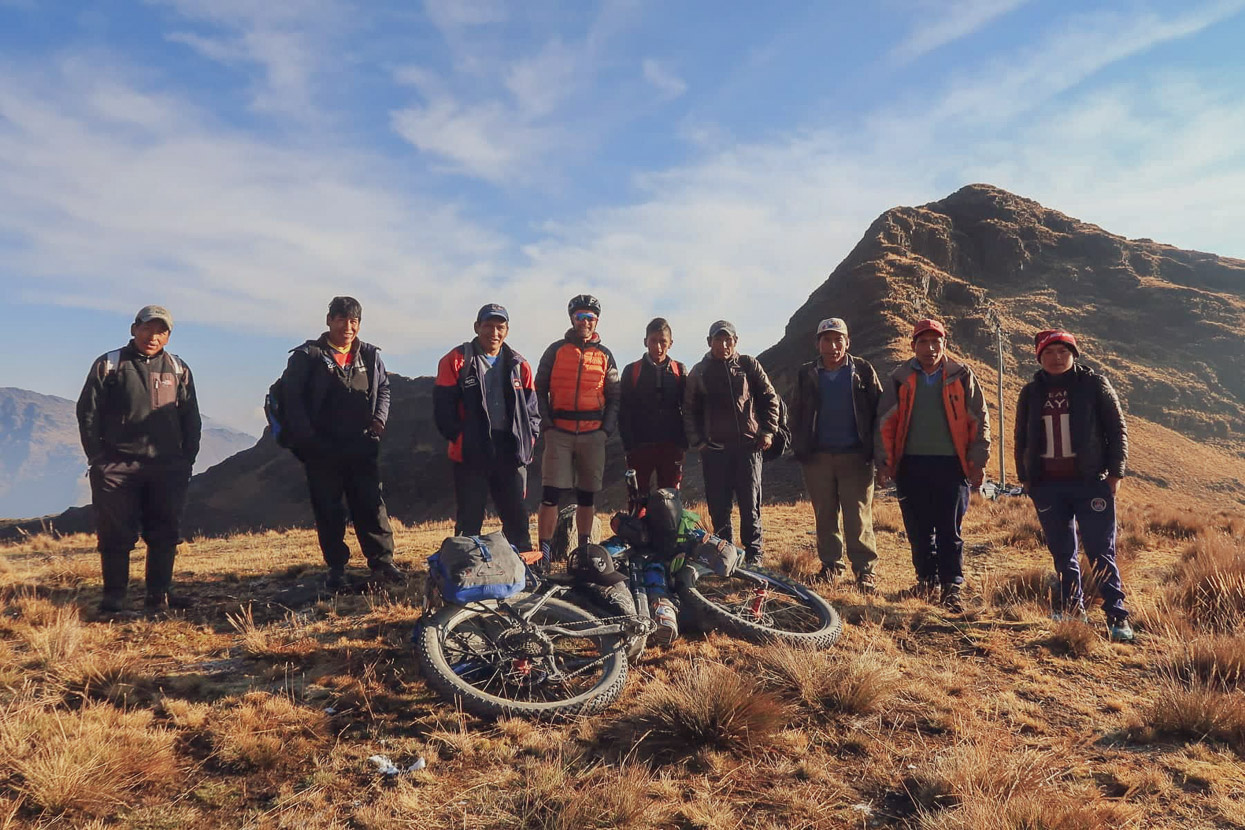
While were already planning to ride through this region, the discovery of a GPX route by bikepackers Brigitte and Ivo (IG: Bikepackground), gave us a good sounding route to follow. Click for their writeup.
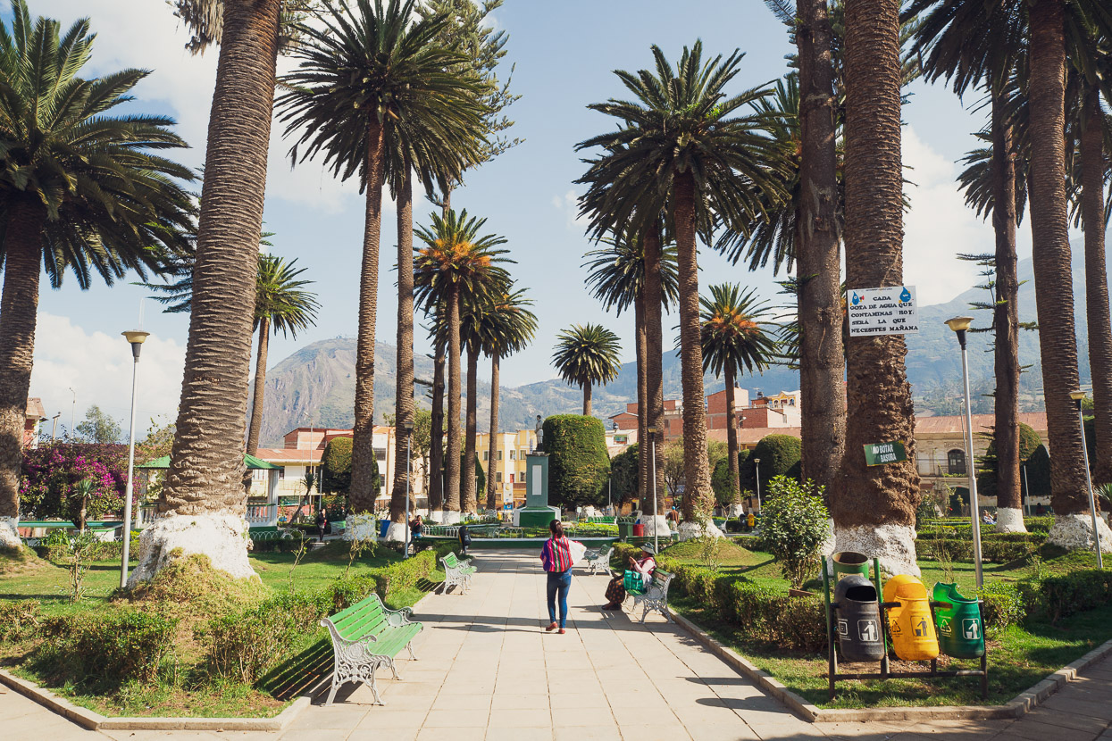
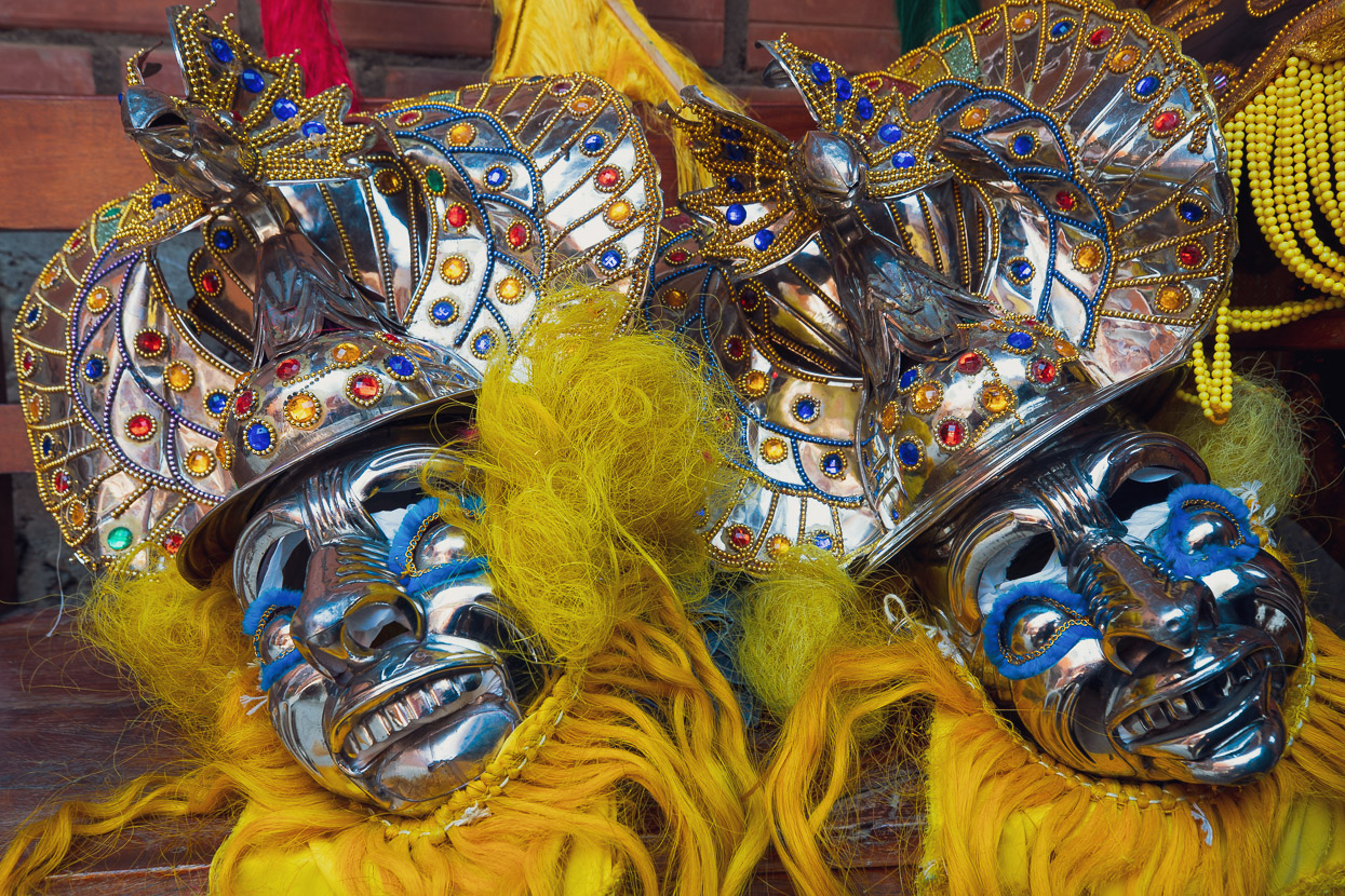
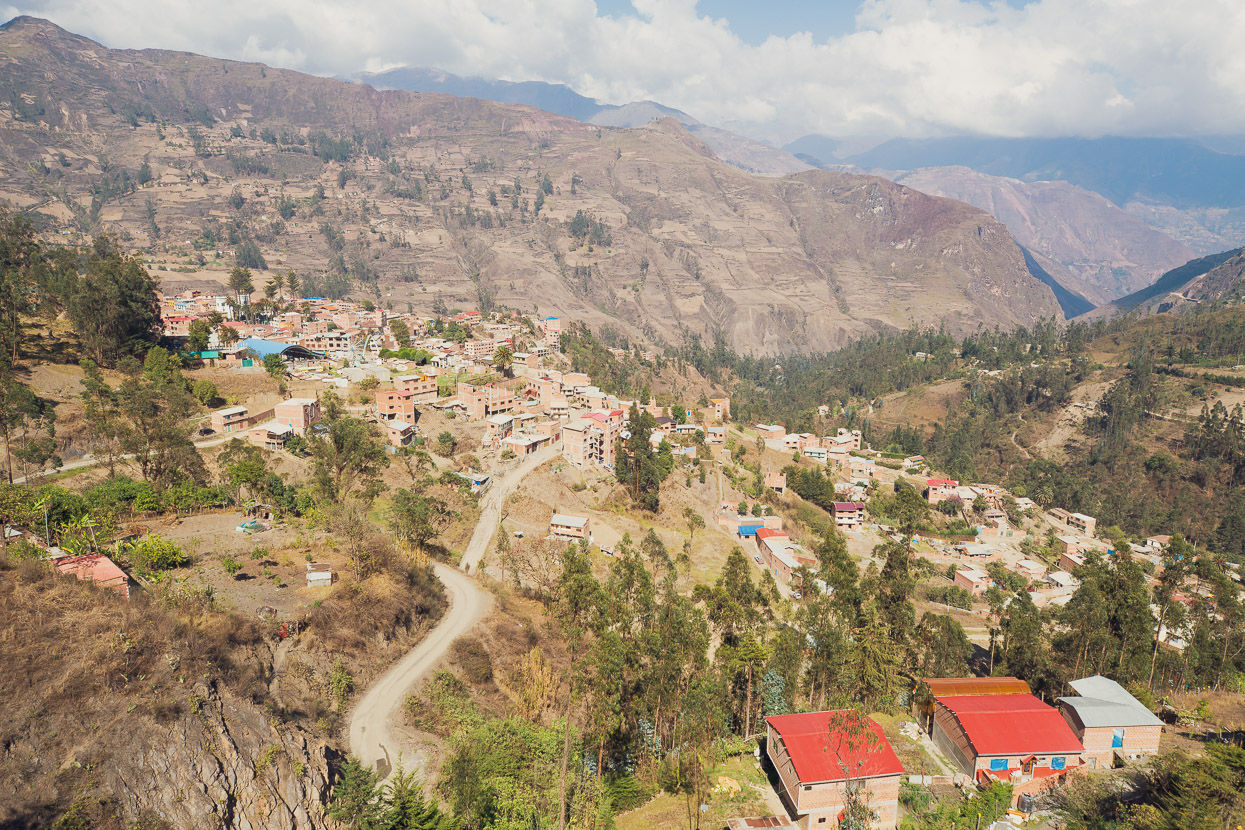
It was nice to be back in Sorata after our 5 week hiatus to Thailand and New Zealand for family catch ups. While this image looks peaceful enough the town was actually having its two-day annual festival which meant an epic level of daytime drunkenness and ridiculously loud music in the plaza at night. The streets were sticky with beer and we had to watch for broken glass just walking down to the tienda — when Bolivans party, they go hard.
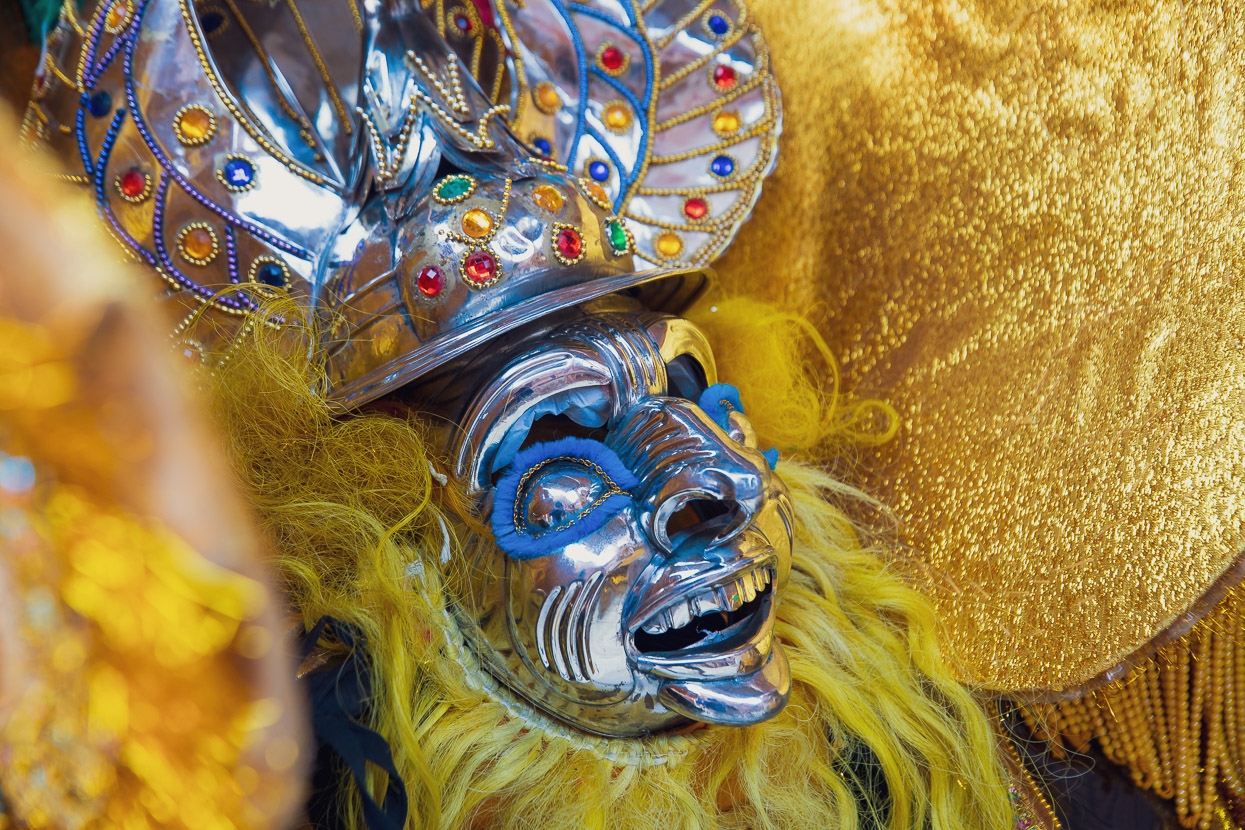
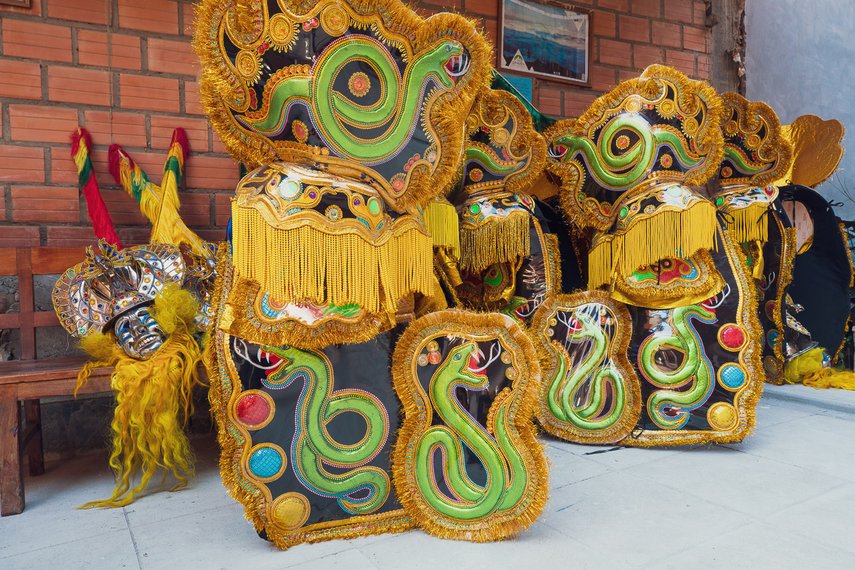
The upside of the festivities was quite a few street parades with opulent costumes. The long beards and big noses in this case representing the Spanish colonial invaders. We’ve seen costumes and dance of this type right through Latin America.
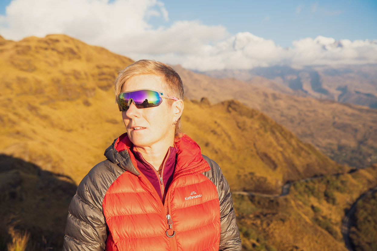
Five weeks off the bikes at our ages (48), and with little other aerobic exercise, is long enough to lose a lot of specific fitness. We have a good base after over three years full time riding of course, but with time off you lose your edge and especially your power. We had a deadline to be back in La Paz in 10 days time (this post covers the first four days) so we didn’t have a lot of time to get any fitness back before riding. Having flown from NZ sea level back to La Paz (3700m) had been a minor shock to the system, but we were surprised how much residual acclimatisation we’d retained and felt ok on the two short acclimatisation walks we made up to La Paz’s sister city, El Alto, up at 4000m.
But we needed more acclimatisation than that for what we had coming up, so the day after we arrived in Sorata we caught a taxi to 3900m and hiked the Laguna Glaciar trail in the Cordillera Real up to 5080m. Not exactly a comprehensive programme, but better than nothing and in the end it did make a difference.
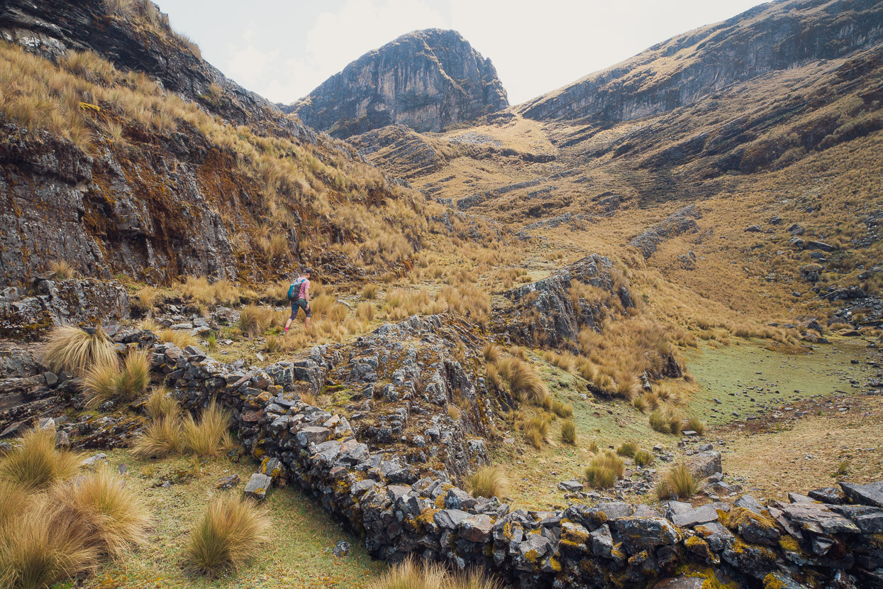
It’s a really nice walk and definitely worth doing if you have time in the area.
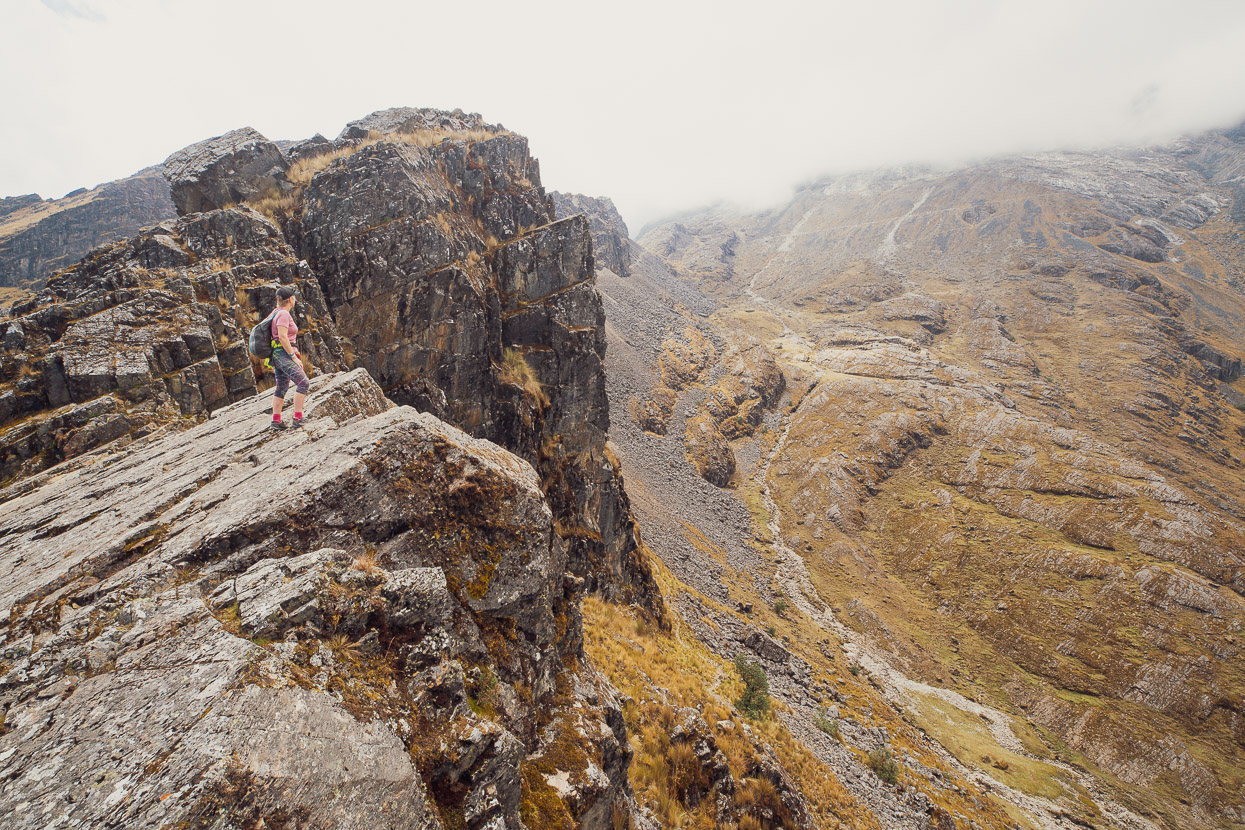
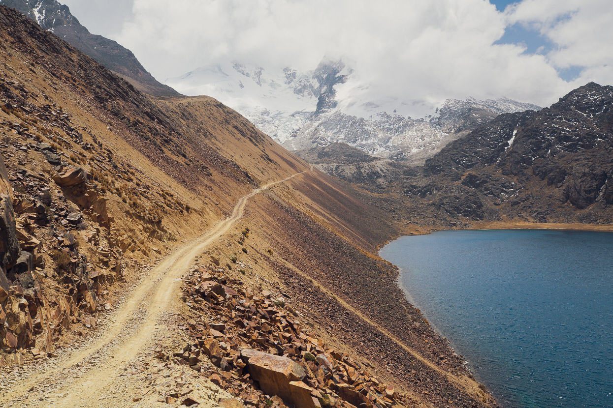
From here we dropped into the valley below and then climbed glacier-scarred slopes and moraine to reach the saddle at 5000m. Here’s the track on Strava.
There wasn’t much visibility for much of the climb and for a while we thought it might be an acclimatisation hike with no reward (apart from a gain in red blood cells).
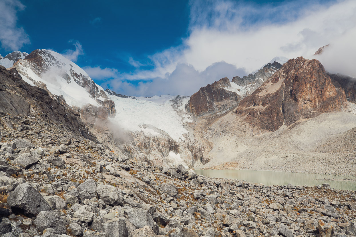
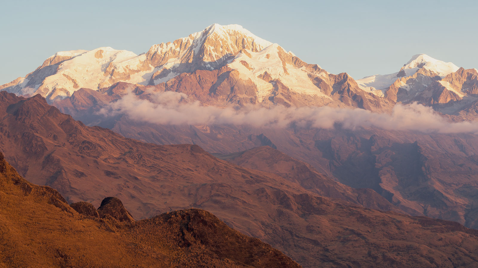
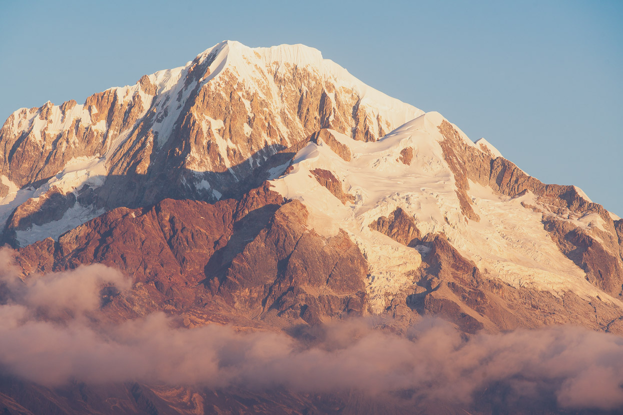
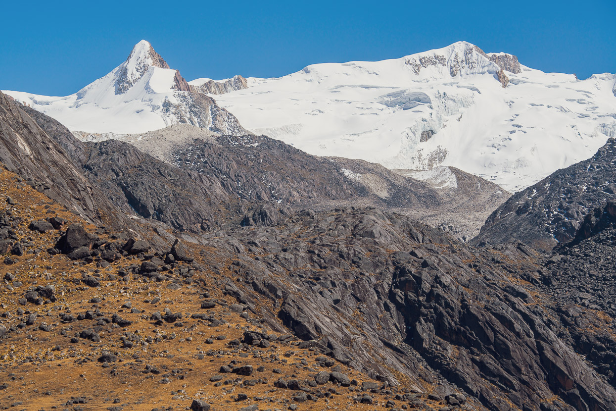
But after lingering at 5000m for a little while the cloud lifted to give us some good views of Illampu and Ancohuma.
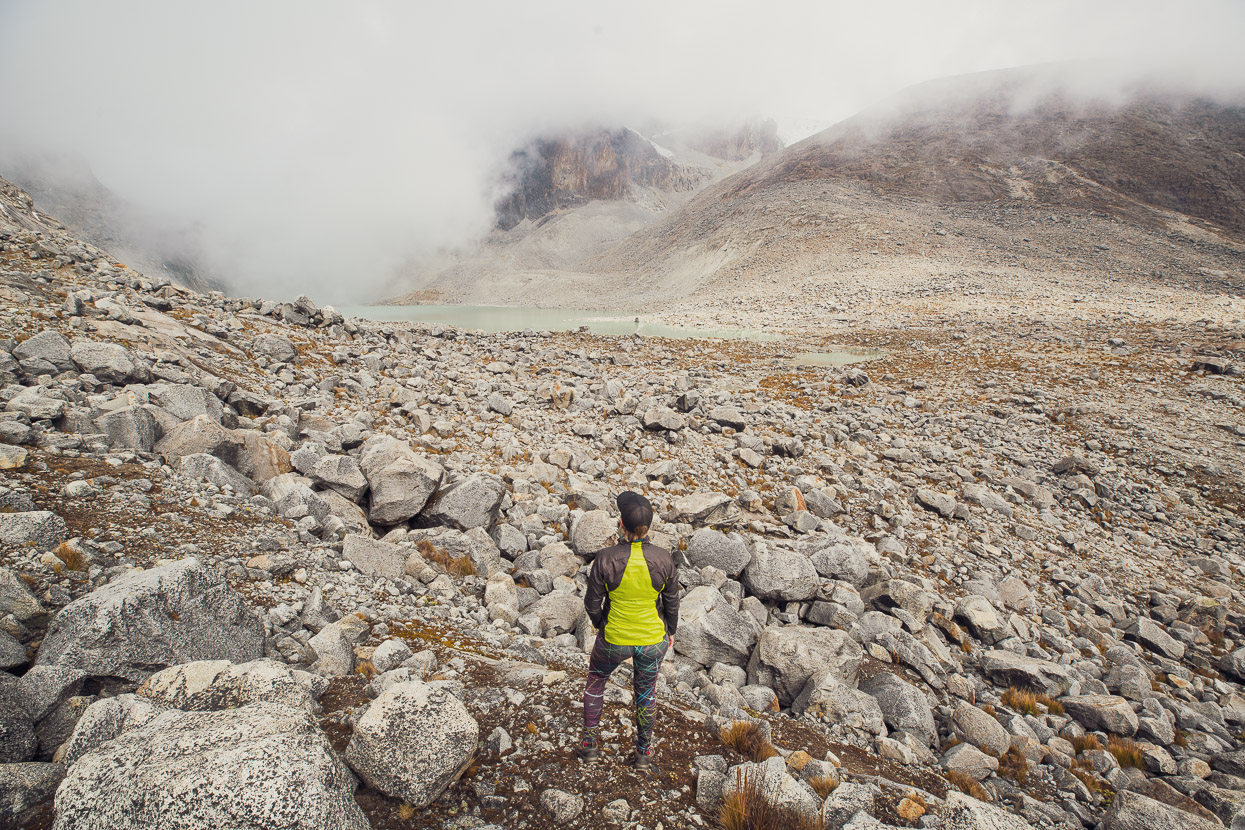
And then we made a speedy retreat back down the mountain to meet our taxi rendezvous at 6pm, which we were a little late for.
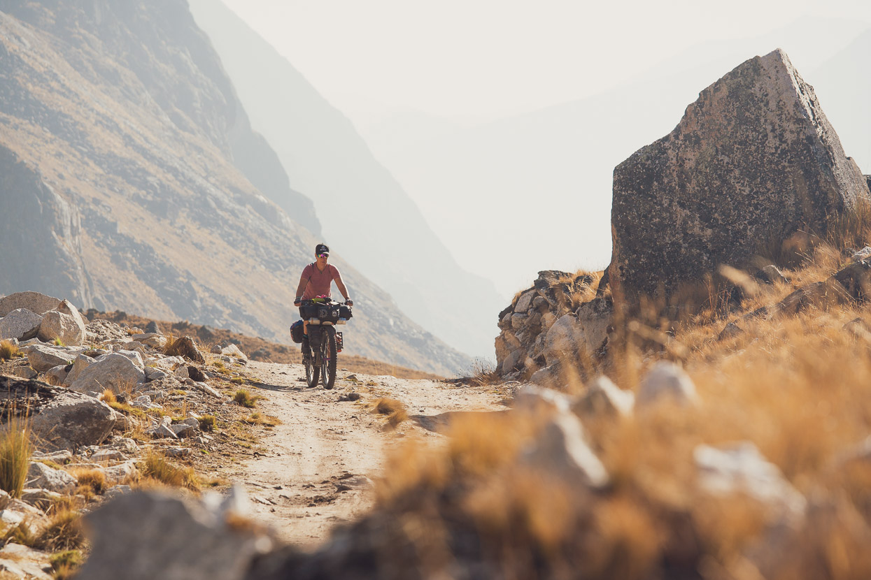
The following day was spent resting, eating and packing to finally hit the road again. There’s no mucking around leaving Sorata unfortunately and little chance to warm up. We became painfully aware on that first climb the following morning that we were no longer the omnipotent pass crushers we were used to being.
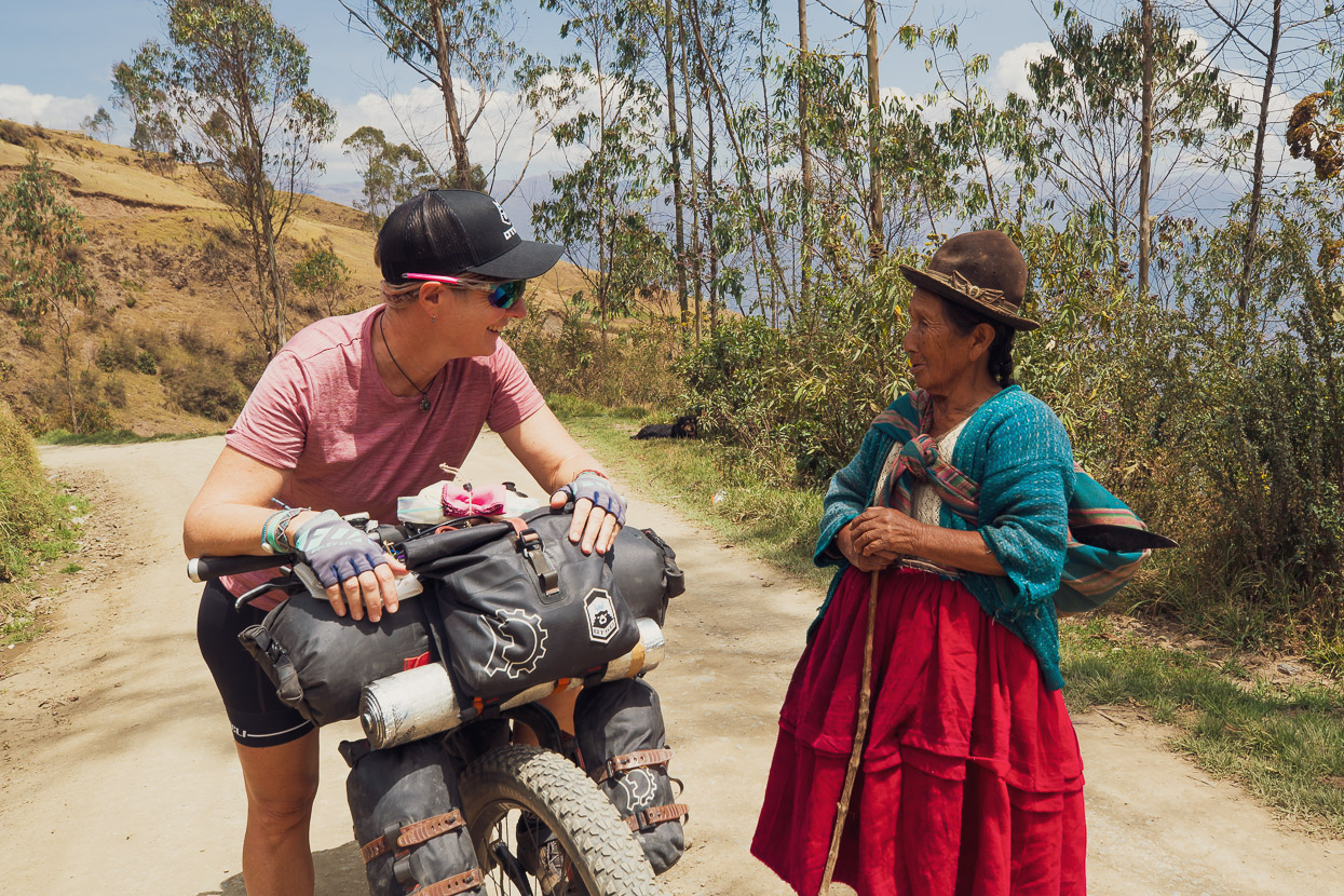
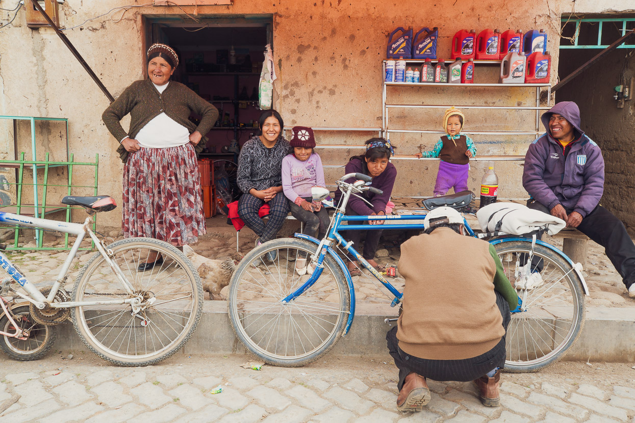
It didn’t take long for some of the things that we love about riding in Latin America to become apparent again though: from the interactions with locals, to the braying of donkeys and the simple village life that we pass by.
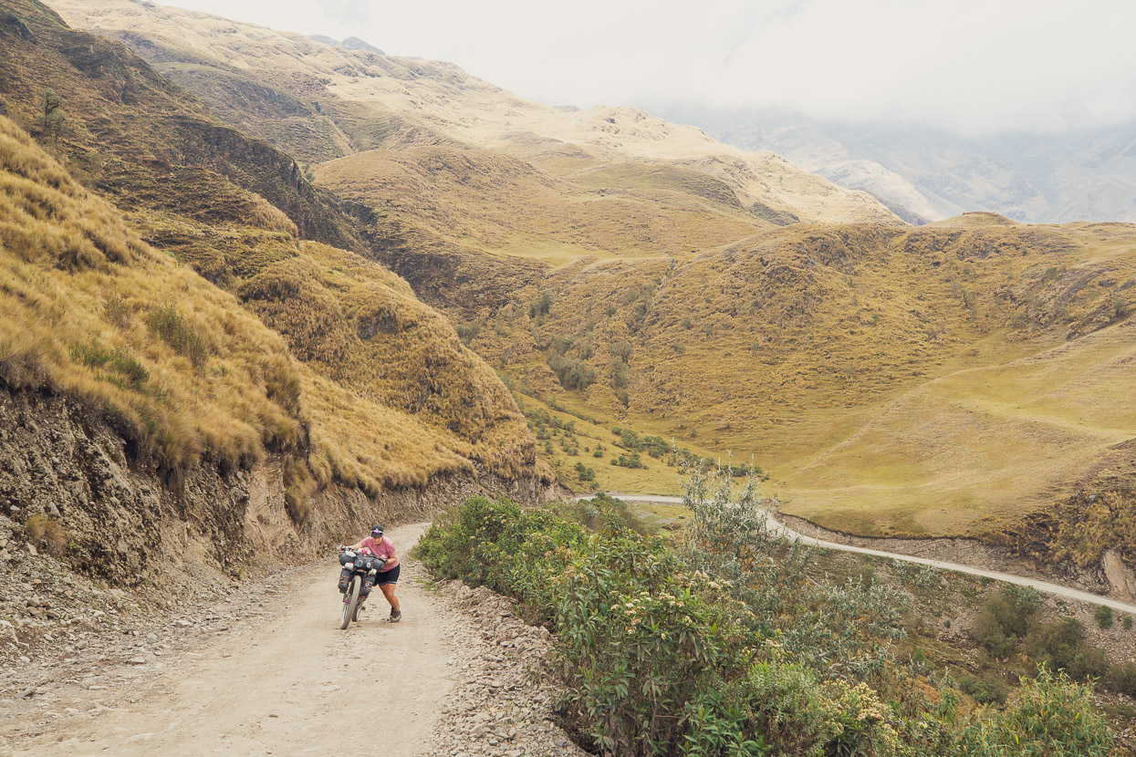
We made a conscious choice not to ride too hard on the first day, but it was still a tough one with a 1300m gain at an average of just under 10%. A shock for the legs for sure.
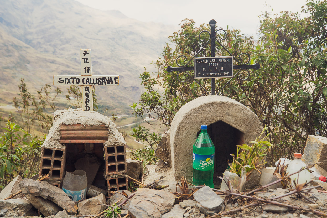
There were several memorials to drivers who had gone over the edge of this mountain road and we saw wreckage of a couple of vehicles.
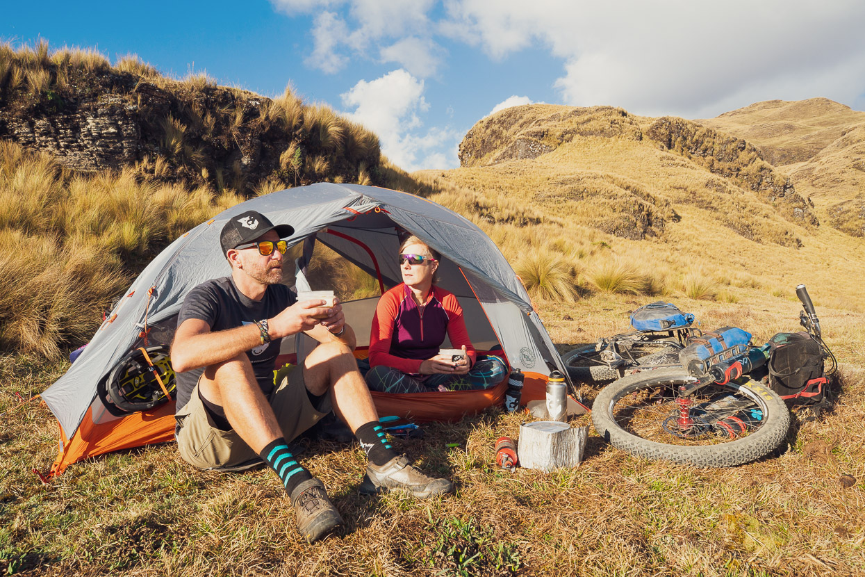
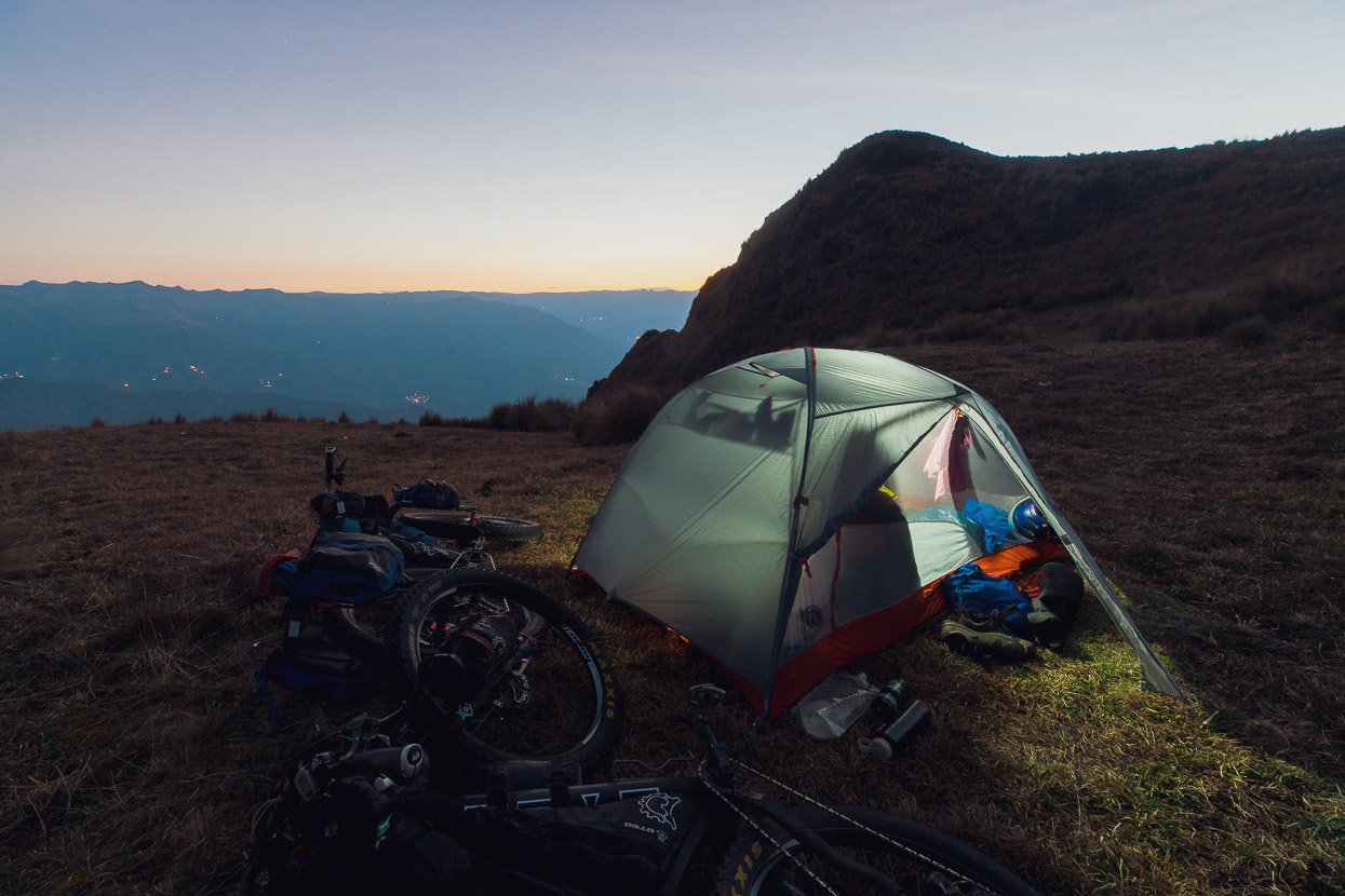
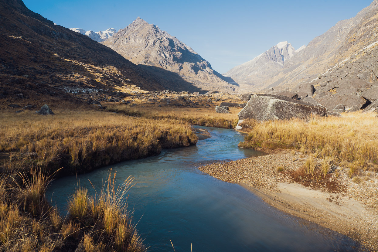
We made camp that afternoon on a grassy bench high on a ridge top with unimpeded views of the Sorata valley and the northern Cordillera Real – a perfect first night back on the road.
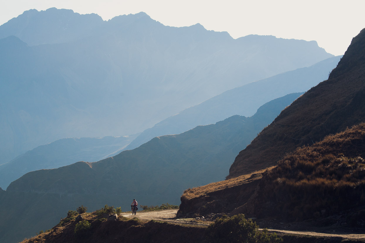
More climbing followed in the morning but thankfully at a mellower gradient, for the warm up at least. It was good to be back among the Andes.
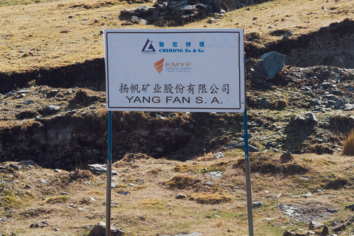
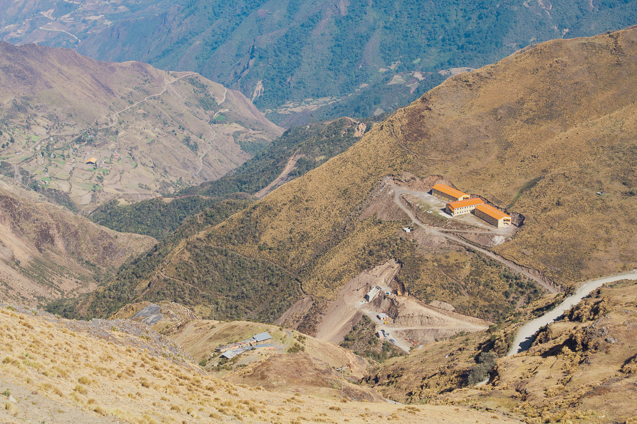
There were reminders of how the roads we were riding came to be though: in the form of mines, sometimes foreign owned. Like Peru, Bolivia is mineral-rich and its terrain is in high demand for mining, which seems to take place at all levels: from huge operations by the state and foreign corporations, through to village cooperatives and small individual digs. The scars of it are everywhere. But the paradox is that cyclists and hikers appreciate the opportunities these roads allow to get into the alpine backcountry. The roads also facilitate trade for small villages, making them better off and less poverty prone than they might otherwise be.
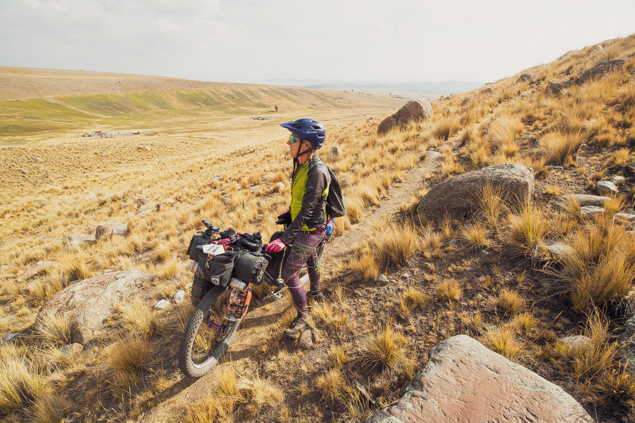
We struggled onwards through some barren country up to a pass at 4650m.
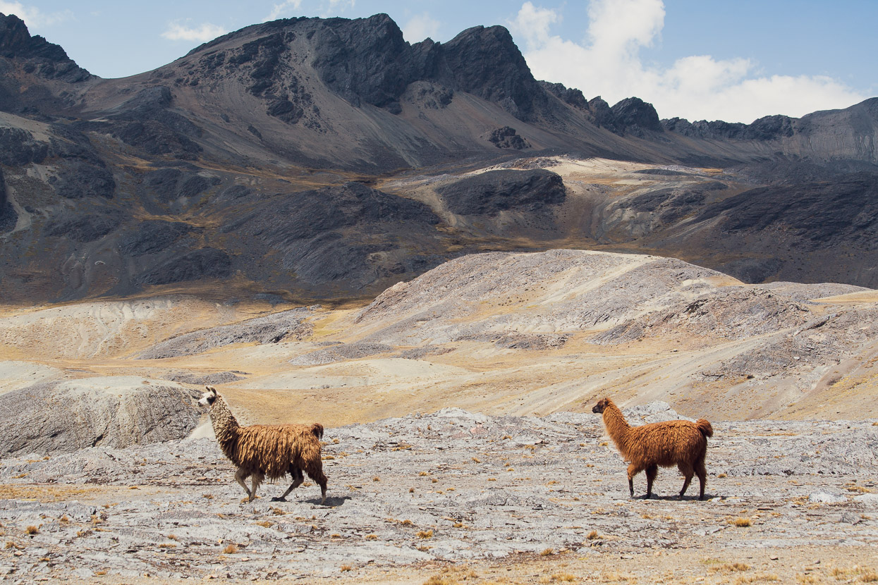
Llamas nonchalantly strolled past on the breezy pass, encircled with craggy ridges.
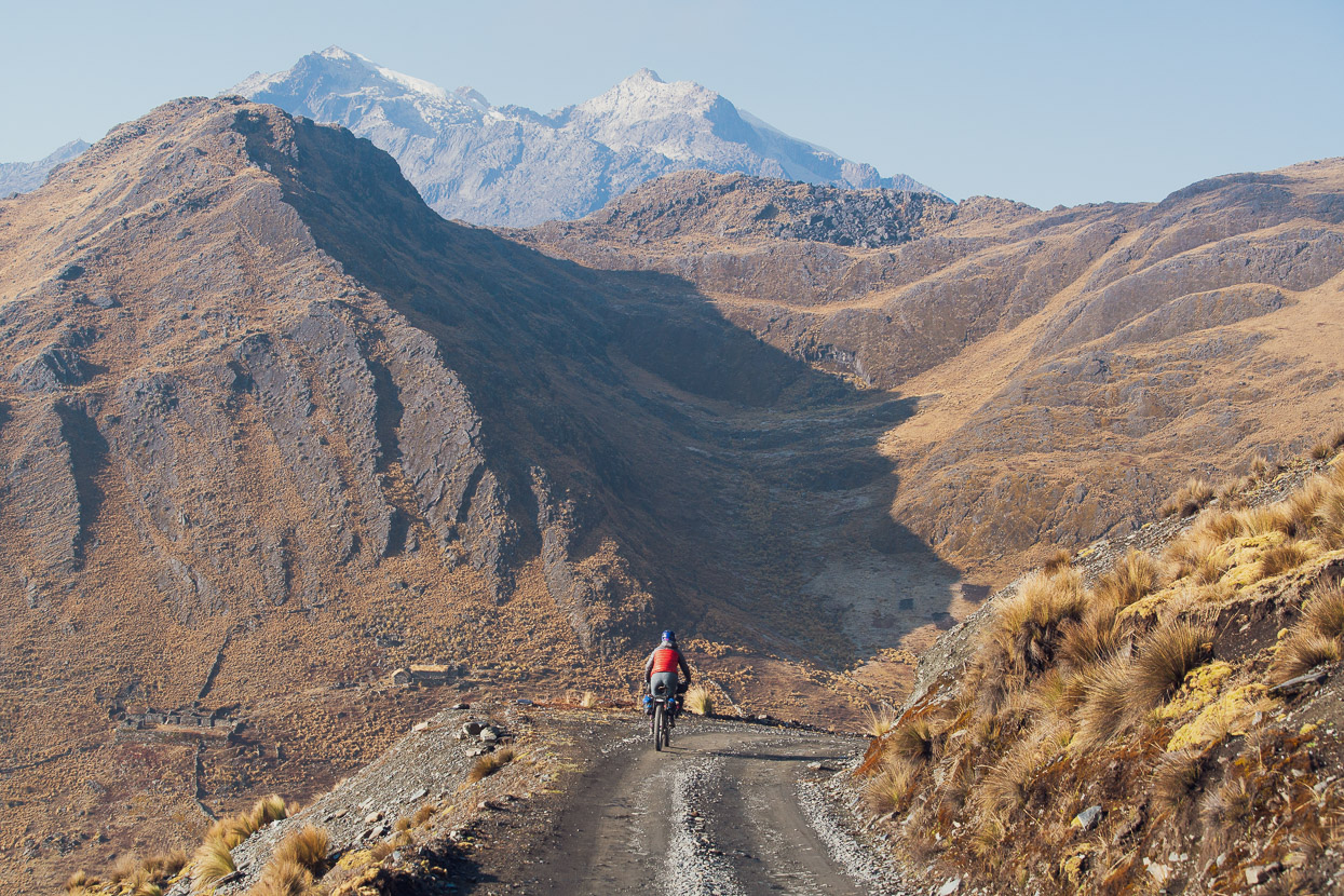
And down we sped. It was warmer than we’re accustomed to for the altitude – significantly warmer than the western Andes we’d traversed on the Peru Divide and Cone & Canyons at the same time last year, further north. It’s nice not having to put on every stitch of clothing for the long descents.
Lower down we reached parched grassland and a few surviving polylepis trees – distinctive with their curvy trunks and red papery bark. Stone walls traced ancient lines across the pampa and enclosed crude farm buildings. We coasted by, throwing a quick wave to the occasional inhabitants that we spotted sitting with their herds of animals.
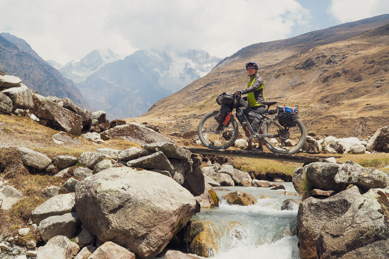
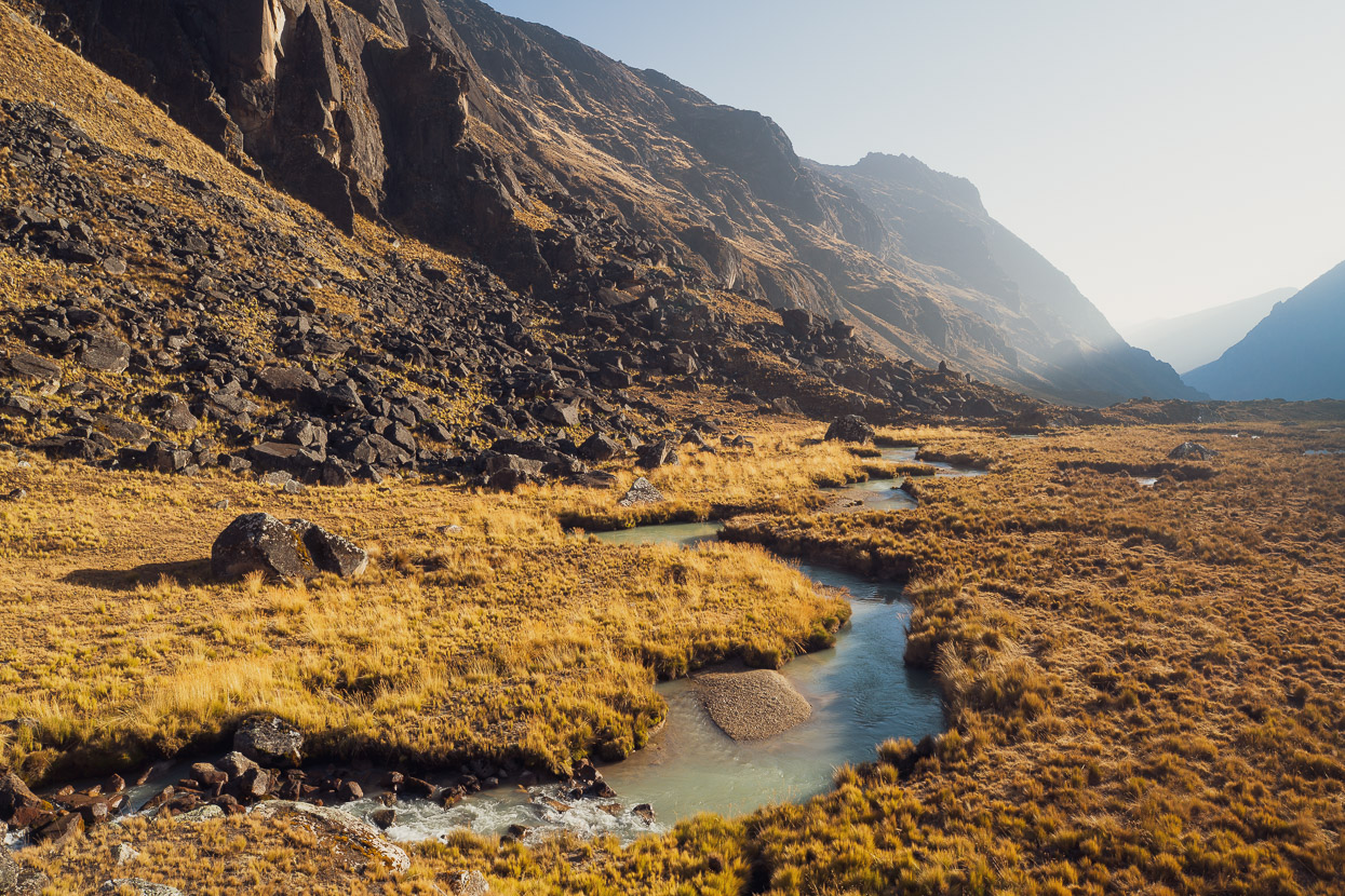
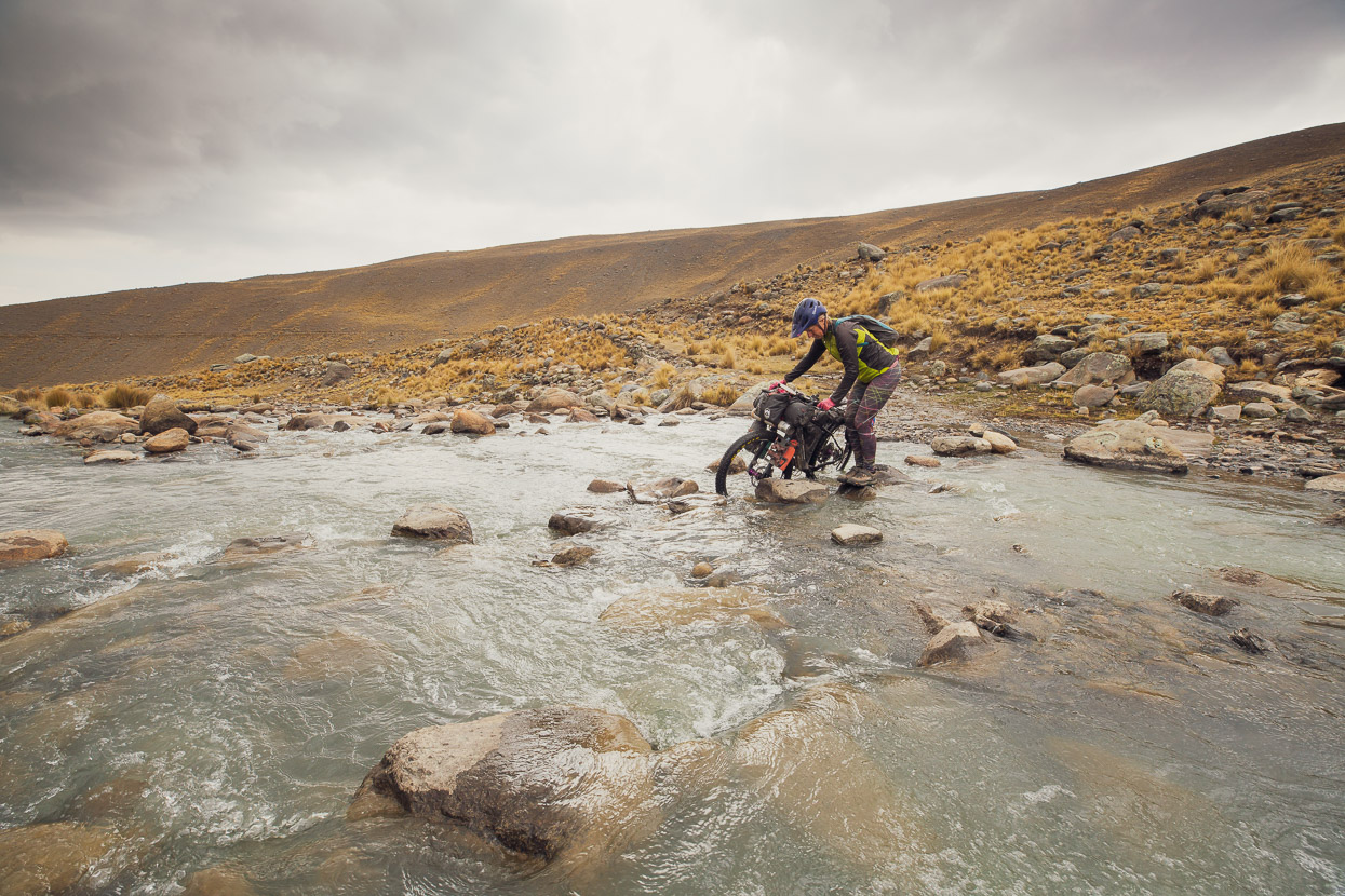
A large slab of rock made a convenient bridge over a fast-rushing alpine stream.
We continued down valley, passing a largely abandoned village, and then the road kicked up again. Pass number two for the day.
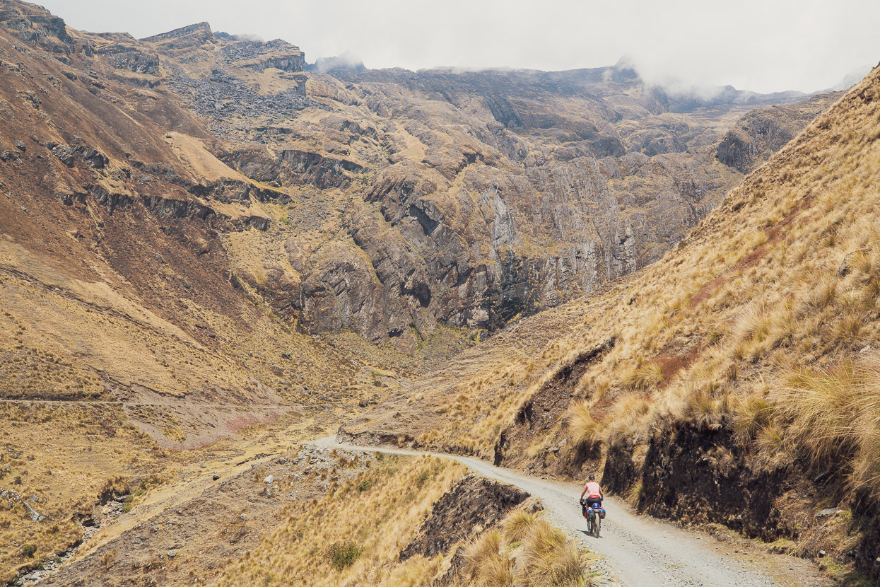
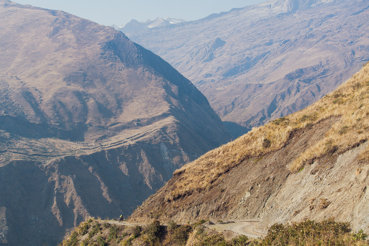
The road snaked upwards towards the cloud capped ridges, and the deep valley fell away below, down towards the cloudforest and the Amazon. We passed the ruins of ancient mines and small stone settlements. In three hours only a single motorbike passed by.
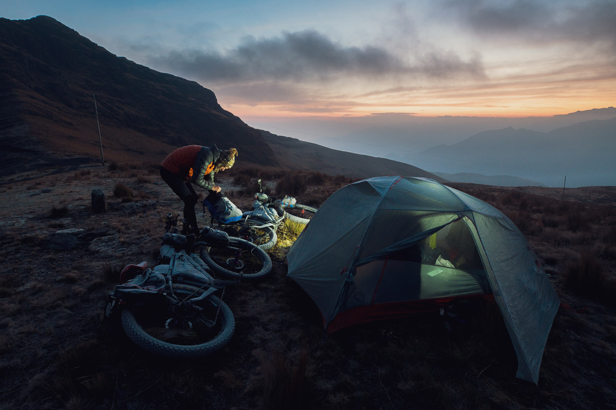
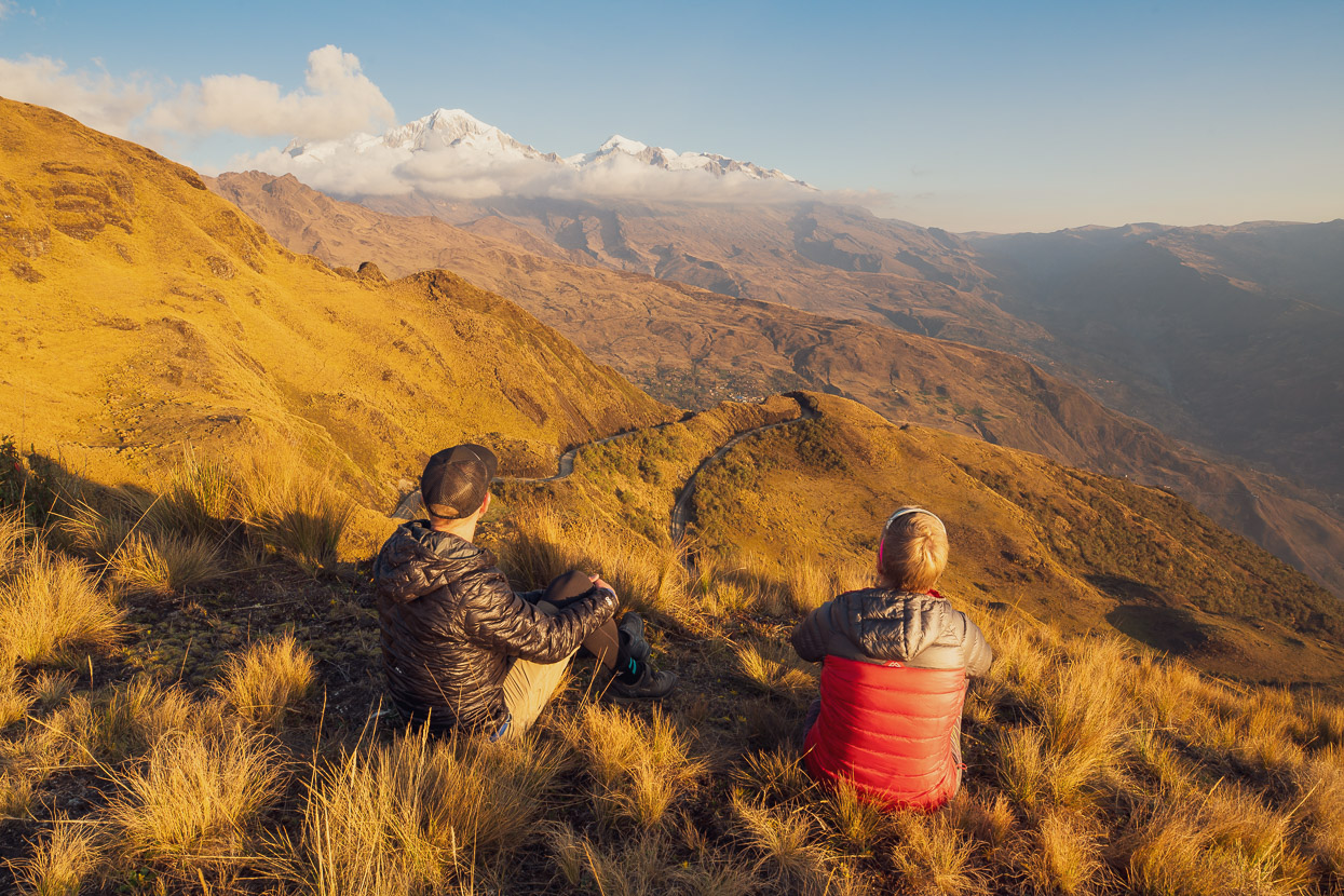
We camped that night right on the pass at 4340m. Notably the night time temperatures have warmed up a lot since we left Cusco in the depth of winter (dry season) in June. For the first two months back on the road we often experienced -5c to -15c nights, whereas now, even though we are further south, nighttime lows have been a much more reasonable 2c to -2c.
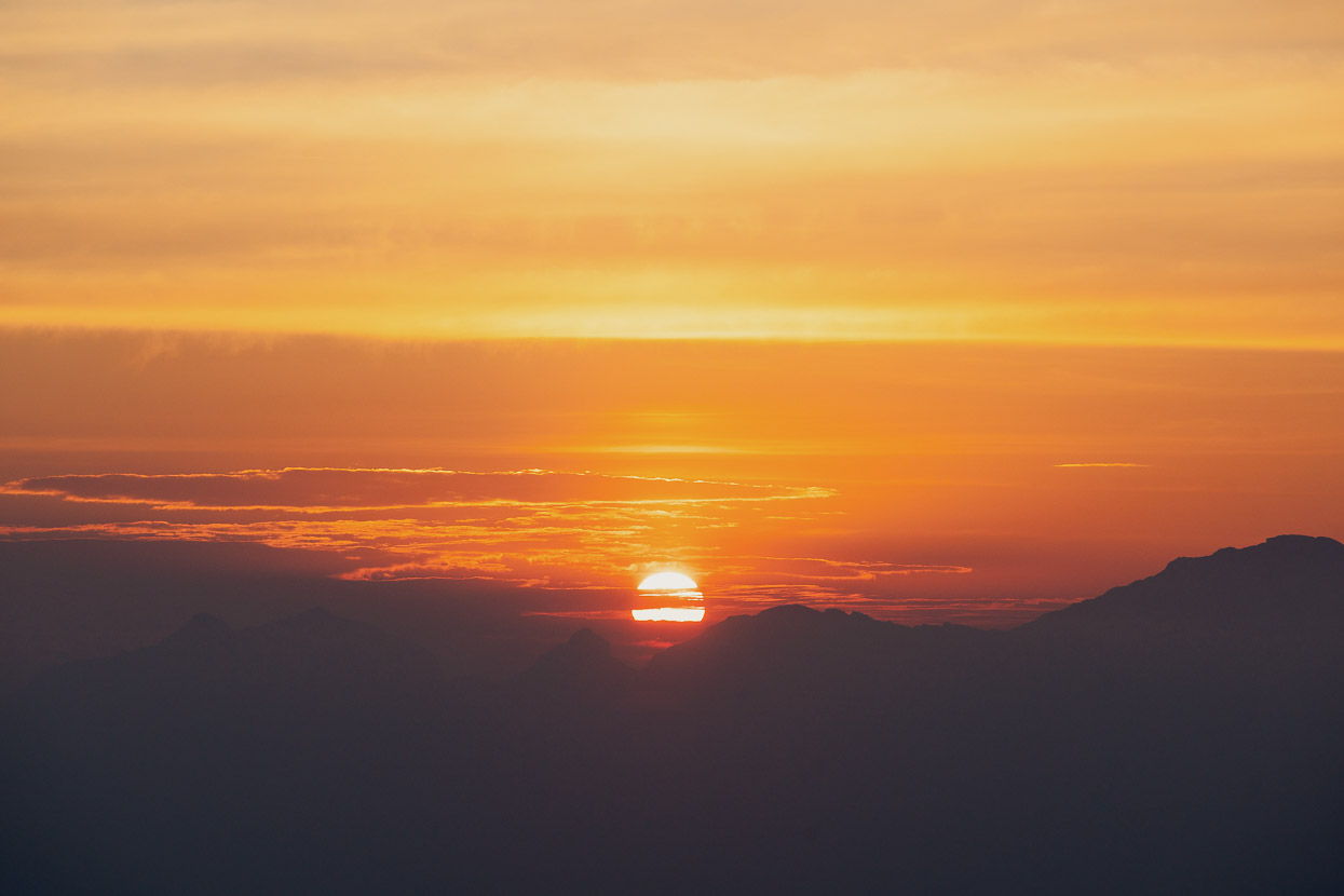
After a calm and windless night, sunrise came with a fiery glow from the east. We usually wake and begin breakfast at 5.30am, so by sunrise at 6.20 we’re beginning to pack and the warmth of the sun is always welcome.
Before we finished packing, some groups of men began to arrive on the pass by vehicle and motorbike from a village way below in the valley. They were miners, extracting what we didn’t quite catch in Spanish, but a force of about 15 of them them walked off along the ridge towards a hidden mine, which they were probably working with hand tools.
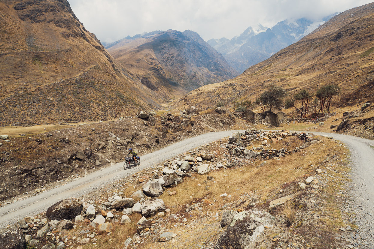
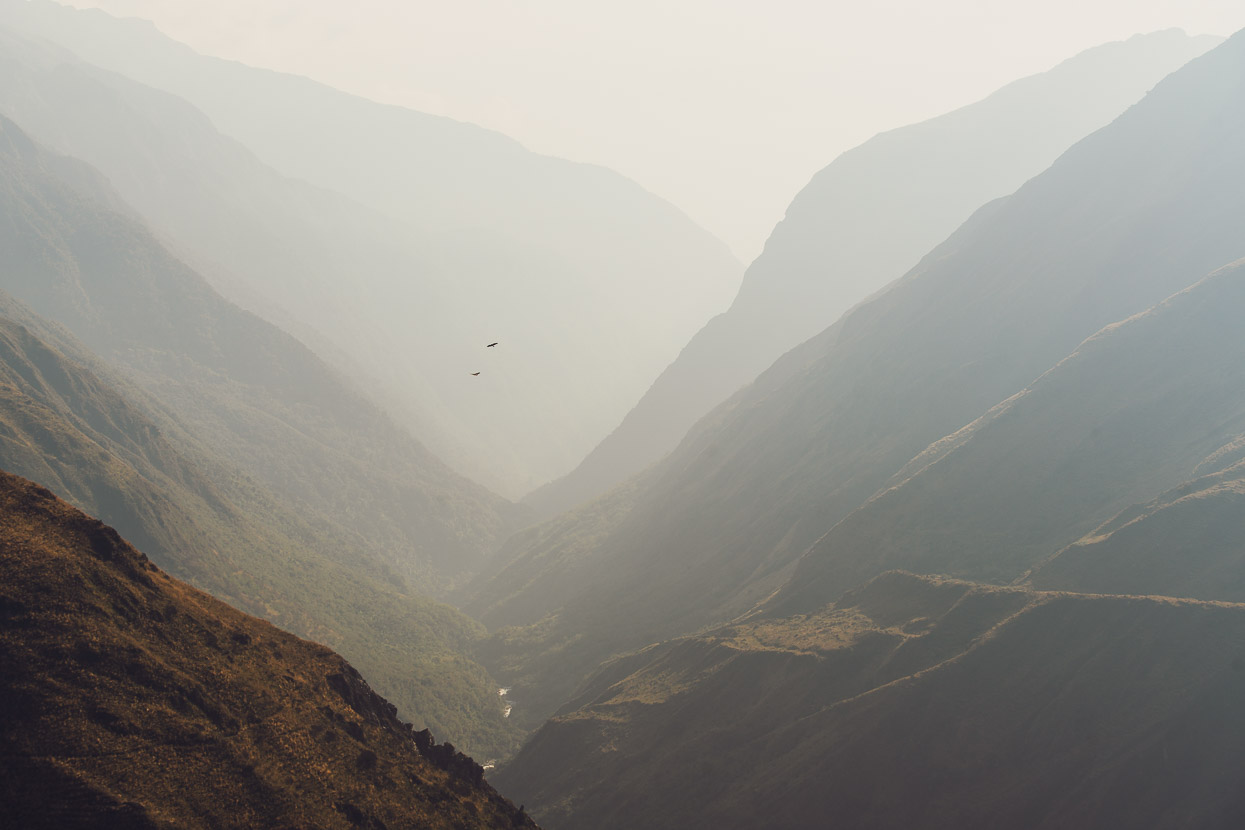
We began a long and steep descent into the valley below, headed for Cooco. The morning air was clear, and down valley birds of prey circled on thermals.
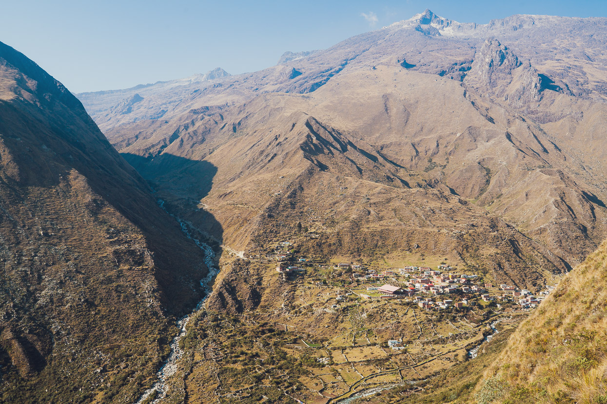
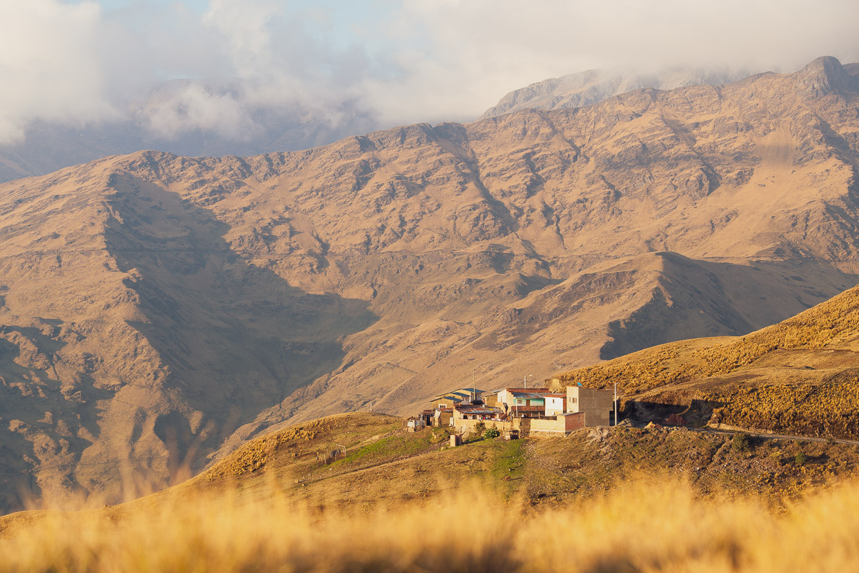
Although there is a tienda in Cooco, we were well stocked with food, so we didn’t stop there. But we did pause on the outskirts to absorb the amazing location of the village, in a deep alpine valley, under the shadow of Ancohuma. Judging by the stone walls and ruins, the site had been occupied by humans for many hundreds of years. Mining has taken place in this region since well before the Spanish arrived.
A steep climb out of the village brought us to the first pampa (valley flat), before the rough road kicked up again towards Abra Sarani (pass) at 4500m. This was a tough 1000m climb, especially with our lack of form, and took us hours.
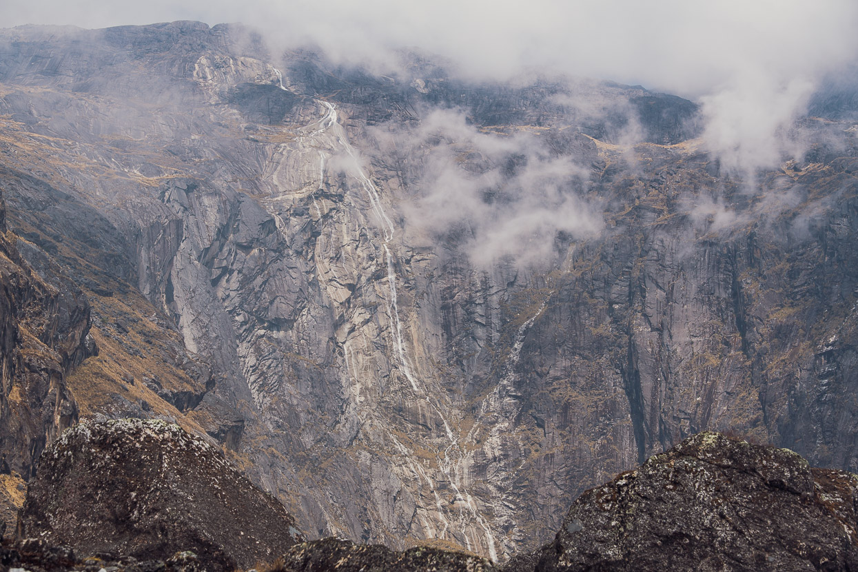
Granite walls reminiscent of NZ’s Fiordland hemmed in the upper valley, with cascades tumbling hundreds of metres to feed the valley’s streams. We saw two condors on our way up here; first spotting their massive shadows on the valley floor before tracing skyward with our eyes to pick up their huge forms crossing the valley in search of food. Even a kilometre away down valley we could still see them.
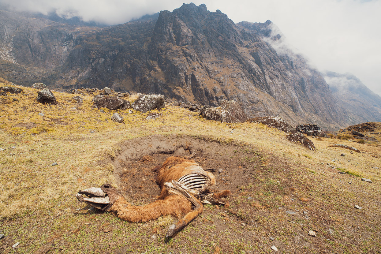
Llamas create these circular craters by repeatedly dust-bathing in the same place. How this one came to be dead there we’ll never know. But the condors probably appreciated the food source until it mummified in the dry, high altitude air.
We finally crossed the pass in a disorienting mist. It was cold and breezy so we didn’t linger, instead dropping quickly on an equally rough dirt road into the next big valley. We passed a small settlement shortly after we came out of the cloud near the valley floor. A solitary old man was just hefting a sack of potatoes from his back down onto the road. He was waiting for a collectivo (shared 4WD taxi) to take him out to Achacachi, 50km away outside the mountains on the puna, where he would sell the potatoes and then return with fresh supplies to his village.
We talked for a while and then he politely asked whether we had any medicinas for dolor de cabeza (headache). It took me a moment to process the question: he was headed to a town anyway, where he could buy paracetamol relatively cheaply. But as I thought about it I realised he probably could not afford to buy it at any rate. So we gave him a strip of tablets, for which he was extremely grateful. I was happy to help, and it’s better than being asked for money.
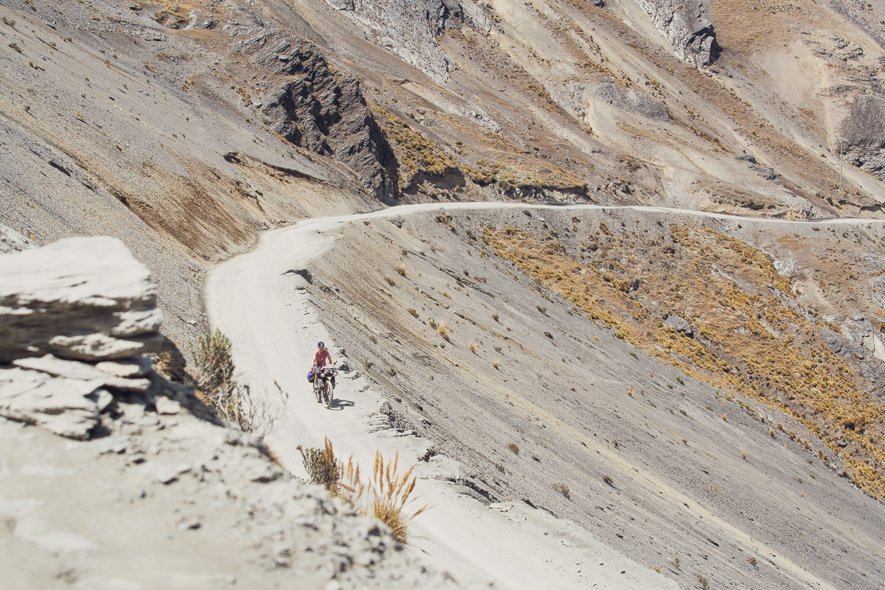
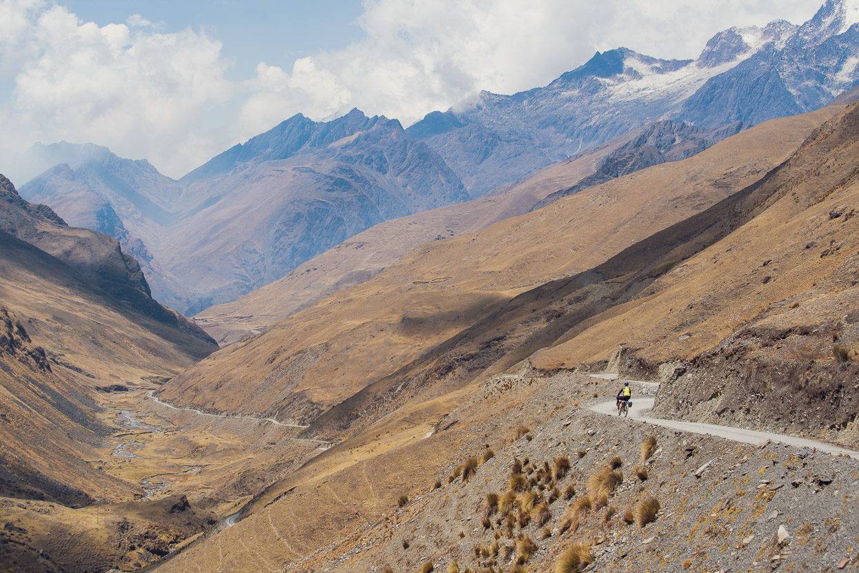
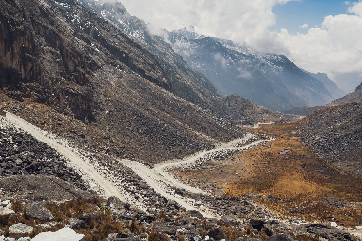
The road headed up valley towards Abra de la Calzada. Not long ago this route was simply a mule trail, but in recent years it has been bulldozed, I assume, to facilitate mining and related exploration. The improvement for the lives of locals in this valley (and bikepackers) is a side benefit. But the scars are still fresh and the road rough and it was on tired legs that we pushed on up valley; both eager to find a scenic campsite and also to reduce the amount of climbing to over 5000m we’d face the following day.
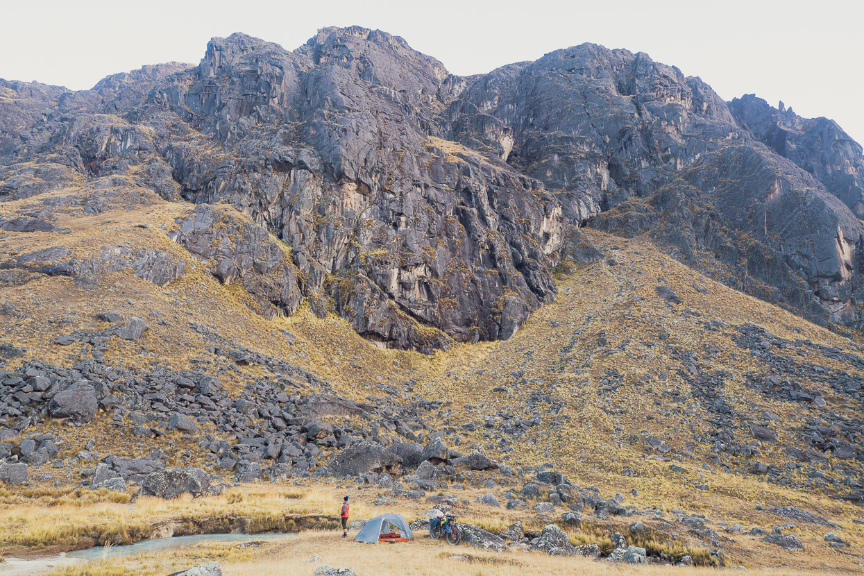
With a bit of perseverance we lucked out with a perfect sheltered streamside spot with great views up and down valley. While camping in Peru and Bolivia is very easy in principle, in the Andes and on the puna it’s not always easy to find a suitable tent site due to aggressively sharp alpine grasses and another carpet plant that issues dozens of needle-like seeds when you press down on it – enough to pretty much destroy the waterproofing of a tent floor and puncture your sleeping mat in one night.
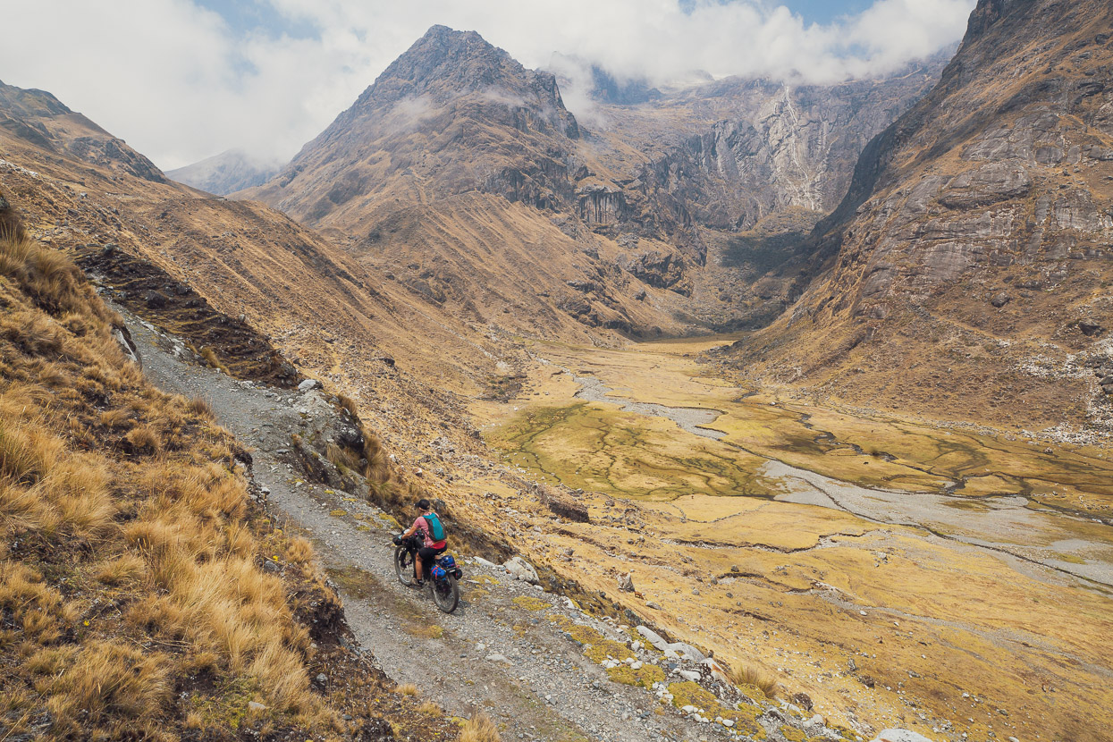
The good weather continued the next morning as we continued up valley towards the final pass that would bring us back to the puna.
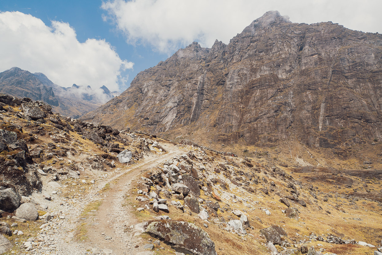
Ahead some steep switchbacks led – menacingly with our level of tiredness – towards the pass. But as we gained height the views became better and better.
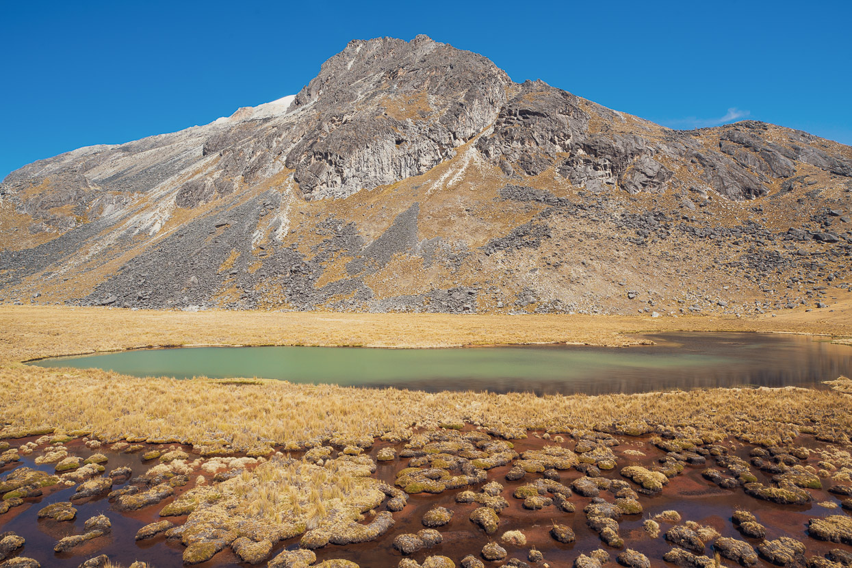
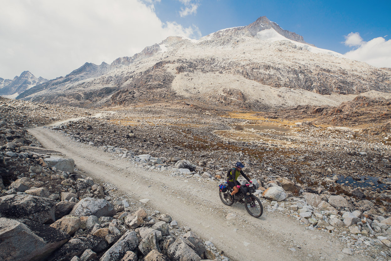
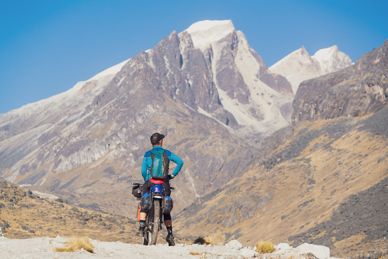
By the time we reached the 5045m heights of the pass the landscape was barren. We rode through ancient moraines dotted with hardy plants and small tarns as our legs relaxed after the effort of the climb. On the peaks above us pale bedrock indicated mountain slopes that were, until recent decades, still glacier covered. A Guardian article I recently read claimed that the Andes of Bolivia have lost nearly 50% of their ice mass during the pass 50 years. The growing lakes, skeletal glaciers, moraine piles and fresh bedrock are reminders of this we see most days on the road. It’s as equally a sad state of affairs with our glaciers back home in NZ, of which hundreds have vanished completely.
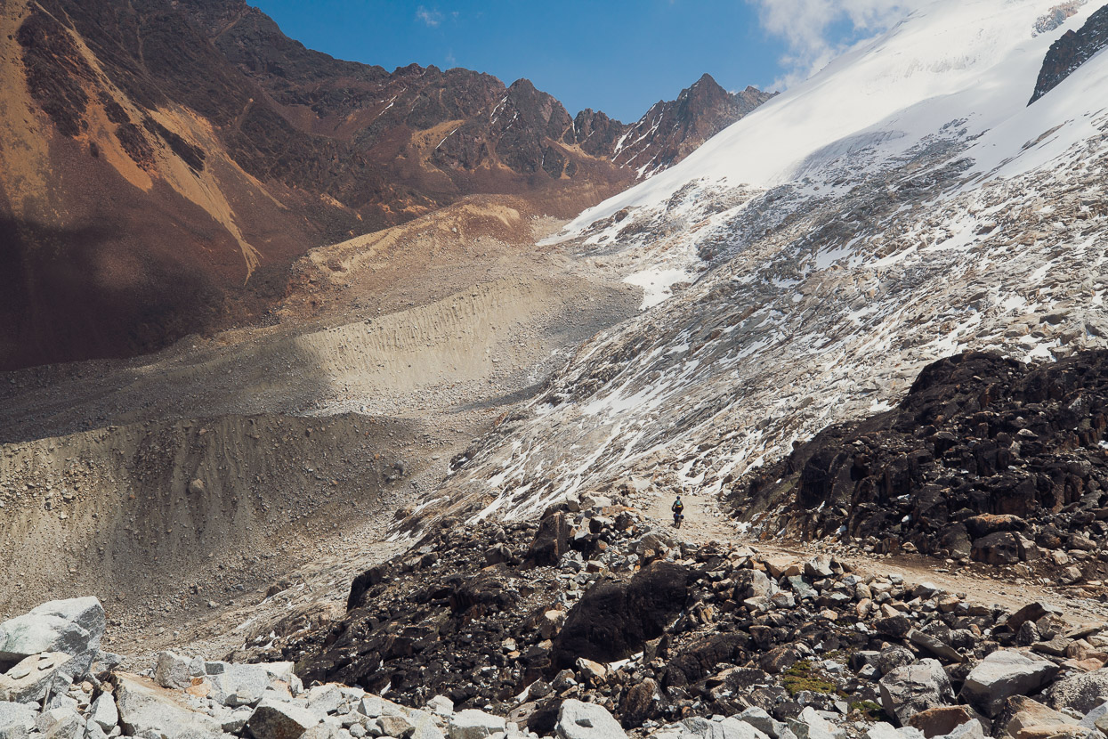
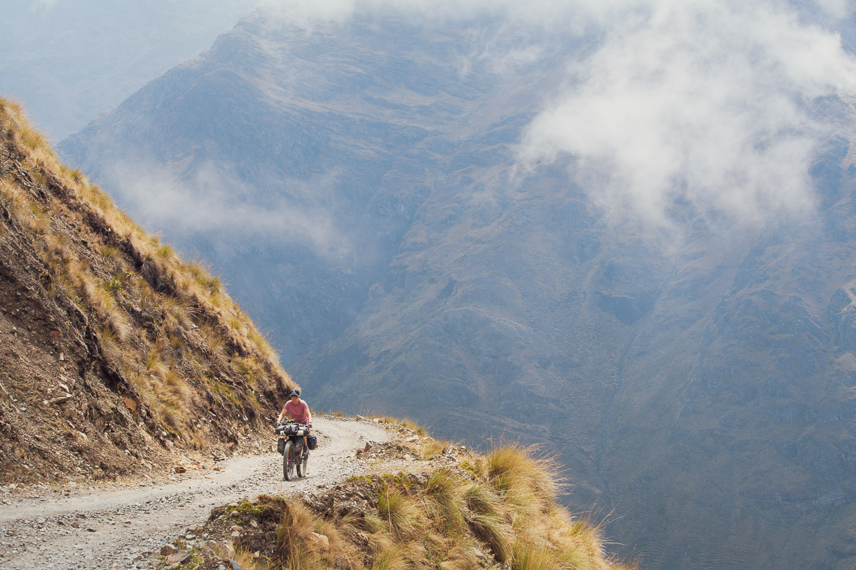
As we dropped into the descent and turned a corner the landscape took on another level of rawness. The road had been hewn through an unstable slope of moraine and led towards a mountain of red and orange rock – a fast eroding, uplifted cap of sedimentary rock that overlaid the ancient granite of the higher peaks.
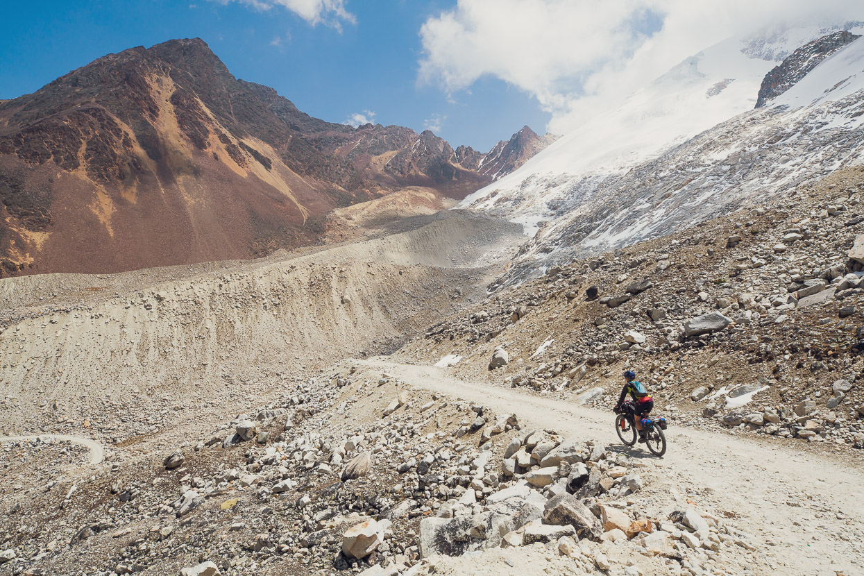
Cloud was spilling over the pass and the wind was up as we sped down a one-lane track, etched into the steep hillside of scree.
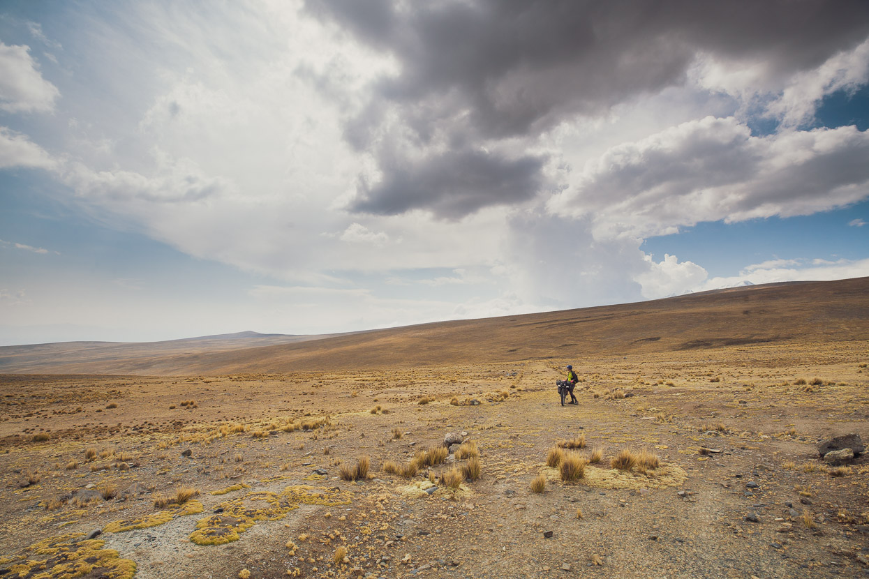
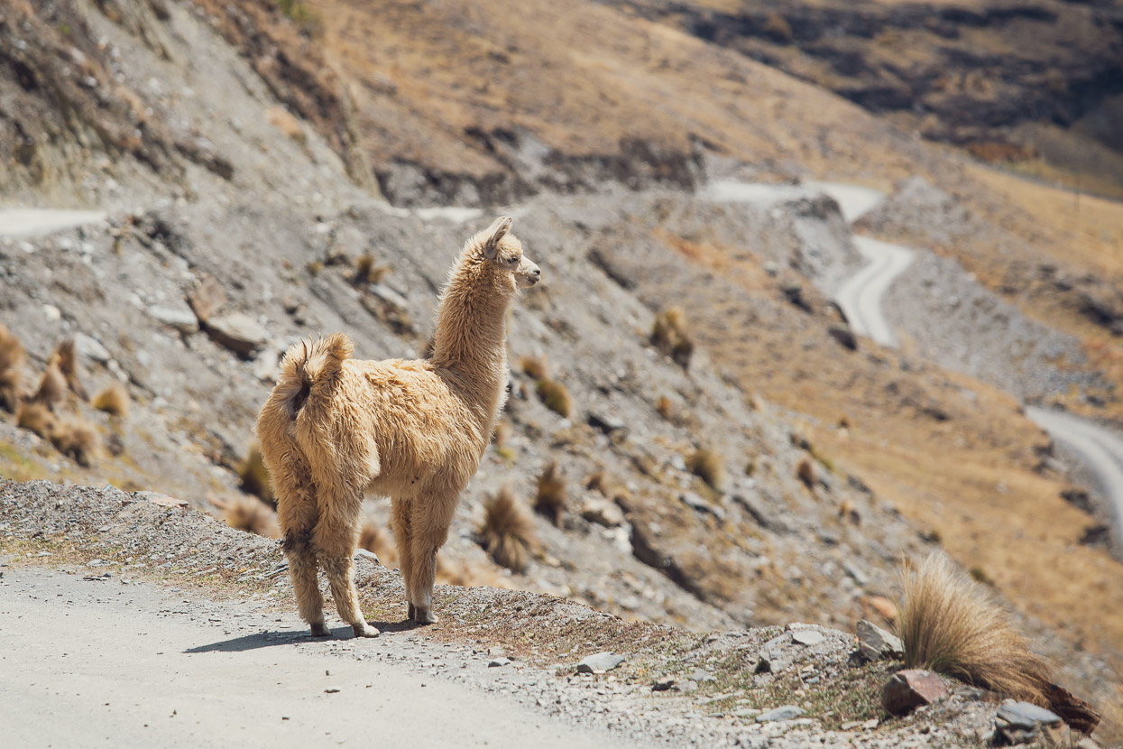
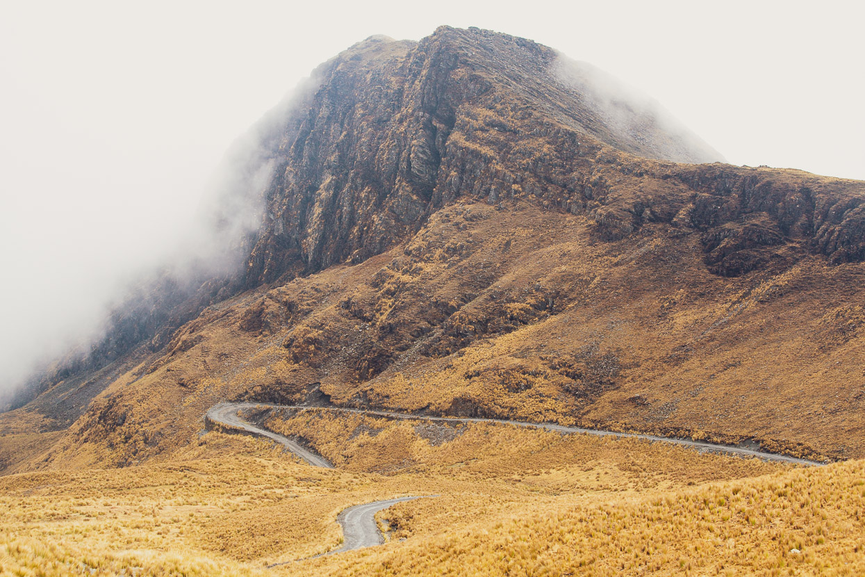
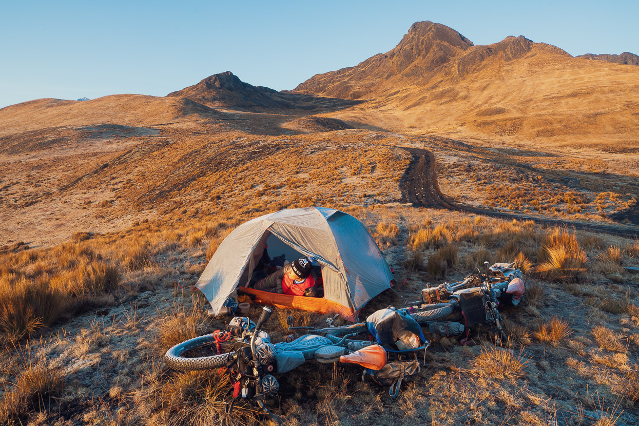
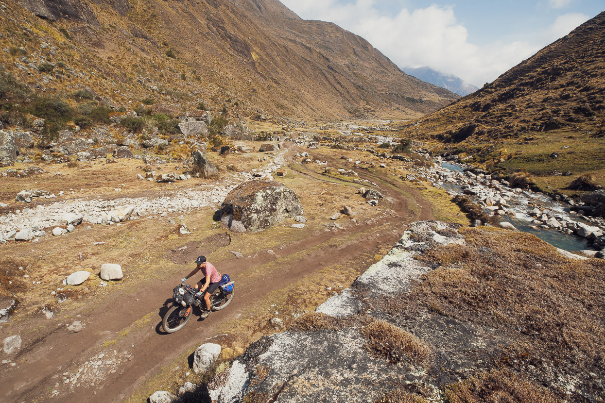
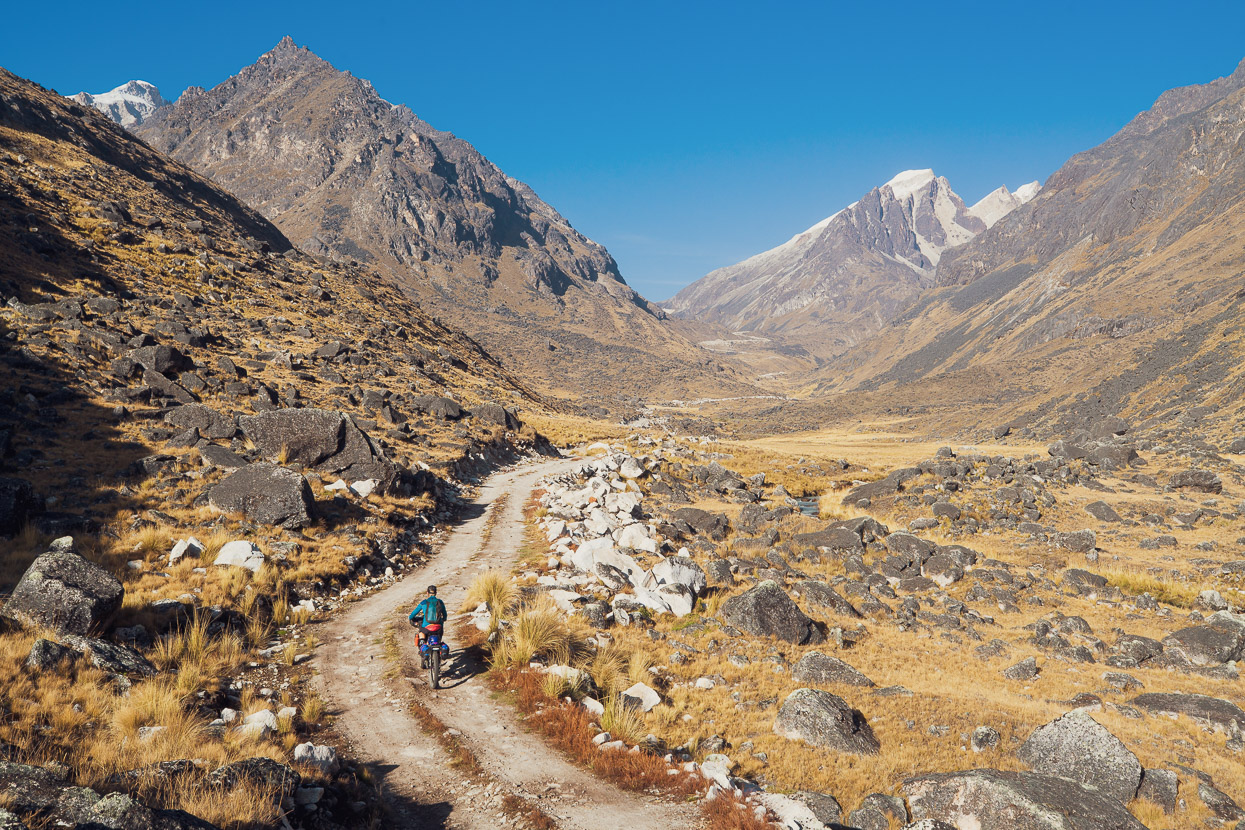
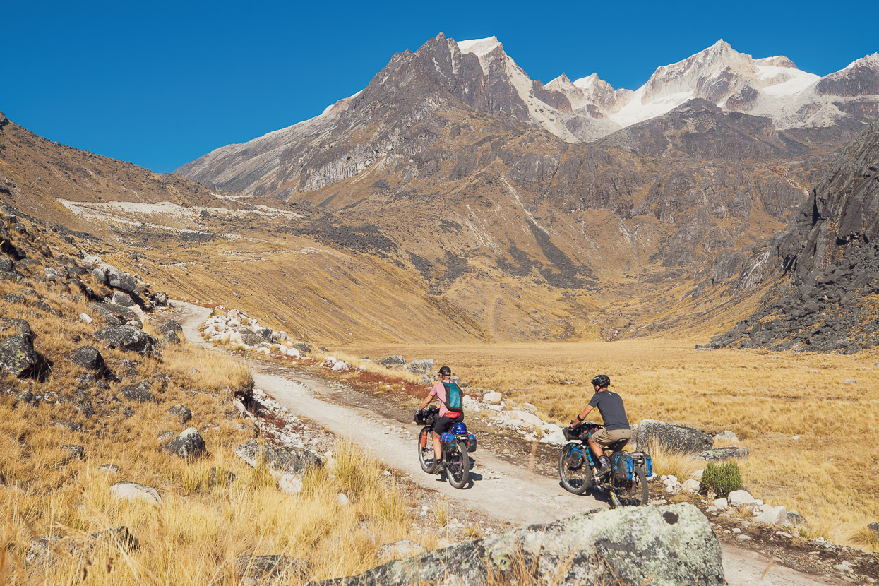
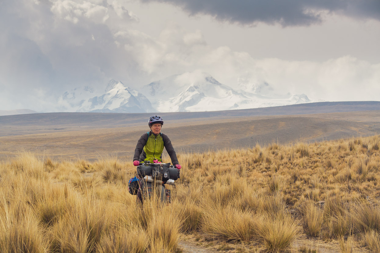
A long, slightly rollercoaster descent led us out past a series of lakes and onto the open western slopes of the mountains – the edge of the puna. Gone were the steep valleys, tumbling streams and icy peaks, replaced with wide open views of endless grasslands.
We were on the Mama Coca route now, which starts in Sorata as we did, but climbs directly out following the western edge of the mountains. This part of the route is typified by open puna riding mixed up with sections of singletrack and 4WD road, as it climbs in and out of shallow quebradas (valleys).
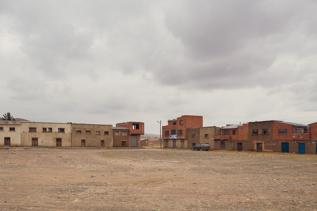
After four days out we needed to resupply with breakfast, lunch and snacks (we had enough freeze-dri dinners to get to La Paz – brought back from NZ), so we dropped 300 metres vertical off the route down to San Juan de Chachacomani to spend a night, eat a restaurant meal, have a morning’s rest and buy food. We rapidly discovered town was not much though.
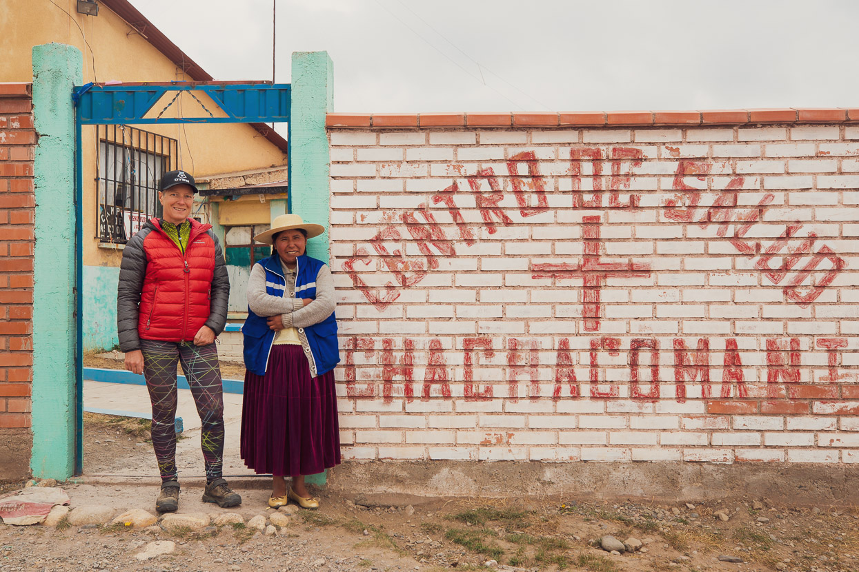
There’s no open hospedaje or even basic cuartitos in town, so we were referred to the Centro de Salud (heath centre) where there was apparently a room available for guests. We were taken in by the nurse, Justina, and given a room in an annexe that even had electricity and a hot shower, so that that was some of our needs taken care of in one go. There were no restaurants open for the evening though, only lunch the following day, so we ate our ’emergency’ bag of dried potato with some eggs from the tienda for dinner.
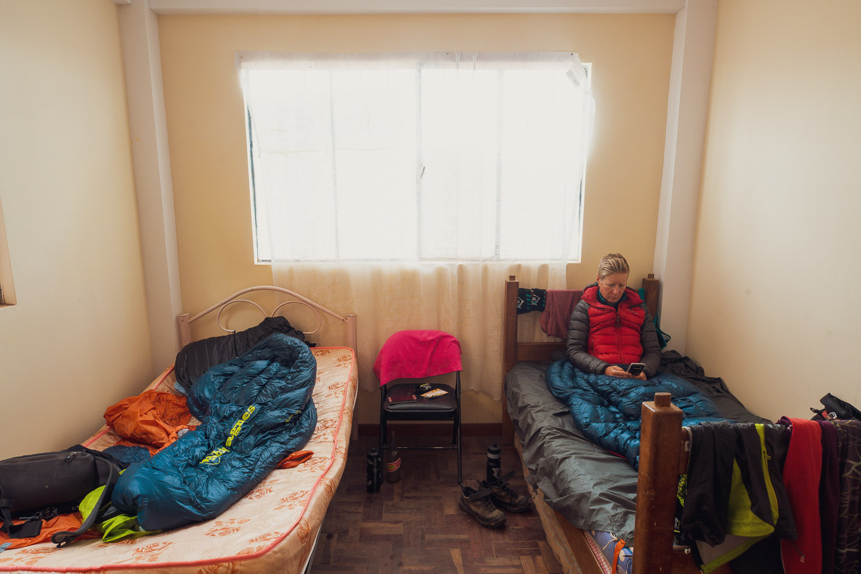
After a four hard days a sleep-in was called for, so we had a very cruisy morning before heading out to find gasoline for our stove, a meal and food for the road. We ticked all those boxes, but navigating the rudimentary nature of the village was a challenge in itself. After a lot of quiet stares from people we did manage to break the ice and share a few questions and laughs with the locals.
The previous evening the first people we spoke to as we arrived in the village were butchering a llama in the dirt on the side of the road. Guess what was for lunch?
But the crux item of our list turned out to be finding sufficient food for the next six days. There were several small tiendas, but none of them had fresh bread, oats, nuts, fruit, veg or even instant noodles. We left with some cheap crackers, biscuits, puffed rice, sardines and stale cheese empanadas, realising that we’d have to take a calorie hit and eat 50% rations to make it all the way to La Paz. We’d read there might be some food at Huayna Potosi base camp four days away – so it was fingers crossed.
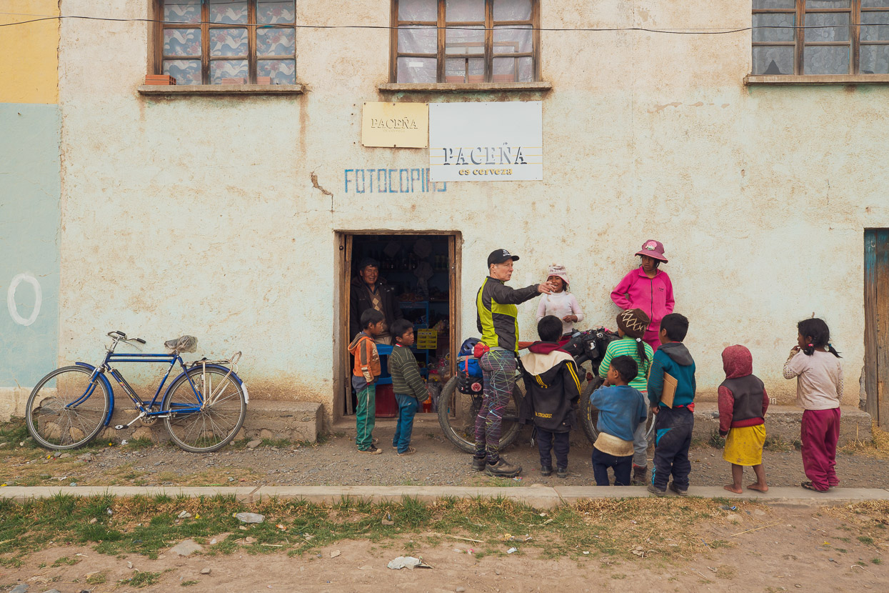
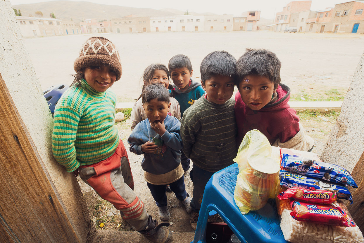
An entourage of children in filthy clothes followed us from shop to shop, asking questions, screaming with laughter and constantly asking to have another photo taken of them, so even though we were on a mission to find food it was an entertaining final hour in the village. At about 2pm we pedalled slowly away, aiming to knock out 20 easy kilometres and rejoin the Mama Coca route at Laguna Q’ara Khota.
Next instalment coming soon and as always, thanks for reading!
Do you enjoy our blog content? Find it useful?
Creating content for this site – as much as we love it – adds to travel costs. Every small donation helps, and your contributions motivate us to work on more bicycle travel-related content.
Thanks to Otso Cycles, Big Agnes, Revelate Designs, Kathmandu, Hope Technology, Biomaxa and Pureflow.


Hi Guys,
In April 2017 we trekked the Illampu Circuit.The road over Abra de la Calzada had not been linked up with the track on the Eastern side of the valley.
When the road terminated, the track was a very rough as it climbed an old vegetated moraine tongue & we expected to have a tough day of getting over the pass.
We were pleasantly surprised & simultaneously horrified , to find, after about a kilometer of this track, a 20 Tonne excavator had already formed the road all the way over the pass linking it to the road in the West. Whilst this is a boon for cycling it also destroyed the trekking route. But as you say this helps the locals to climb out of poverty. Who am I to judge? Time will tell.
Beautiful end of the world.
Safe travels
Regards
Peter
Hey Peter,
Interesting to hear for sure how recently they opened that road. It certainly looked pretty fresh in places! It’s a shame trekkers can no longer have that ‘remote’ experience there, along with Apolobamba. It’s an interesting situation because while the road does help trade etc for locals, it also means tourism is virtually wiped out. I wonder which is more beneficial for the locals?