
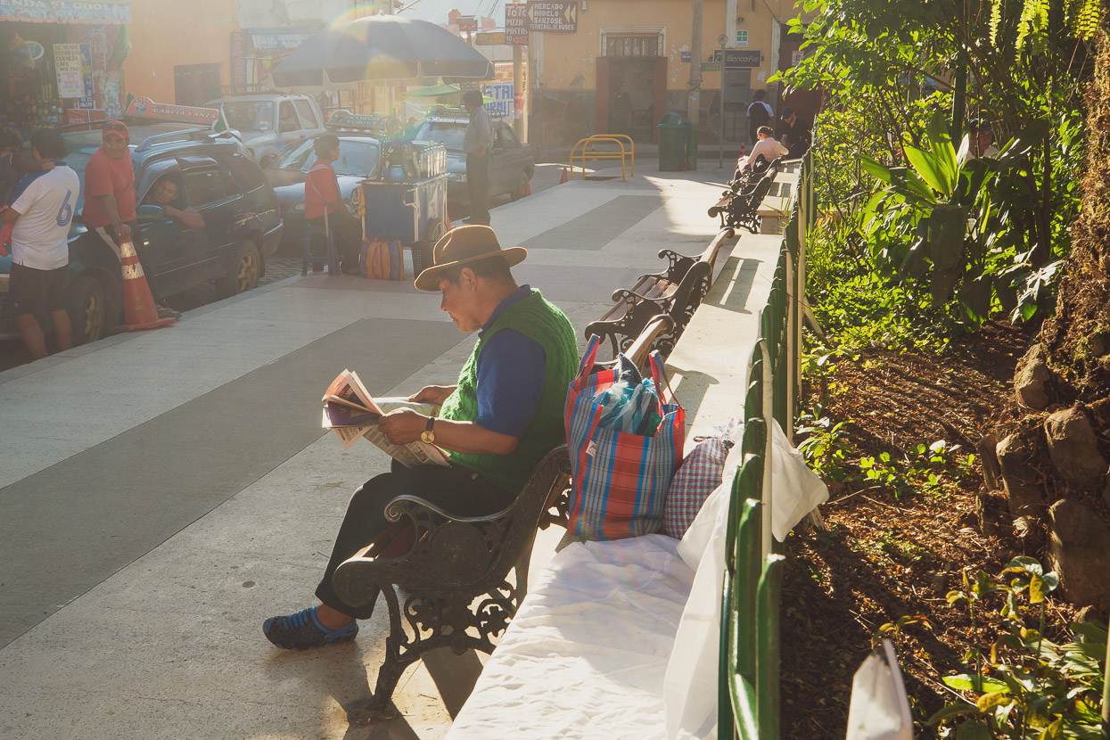
a solo ride
Exploring Bolivia’s tropical Yungas region had always been on our radar, as a probable loop out of La Paz before continuing southbound on the Mama Coca route. But with Hana held up for 12 days recovering from a minor surgery, it seemed like a good use of time for me to venture into this area alone, so I planned a loop encompassing the classic El Choro Trek, returning to La Paz via the infamous Death Road.
As mentioned at the end of the previous post, Hana was diagnosed with a basal cell carcinoma (a non-invasive skin cancer), which she was advised to have removed immediately by a highly reputable dermatology clinic in La Paz. The carcinoma is (was) between the bridge of her nose and her eye, so it’s a tricky region to excise, especially considering the 1cm carcinoma has to be removed with a 3-4mm margin. Consequently a skin graft was taken from behind her ear and deftly sutured in place to neatly fill the excised area. The procedure went very well.
Hana was out of action for 12 days while the sensitive surgery healed. The eye was completely patched over for five days, but once this healing phase was over I decided to make good use of the remaining time and go for a solo ride so that once Hana was riding again we could get straight back to the Mama Coca route. After two unanticipated forced breaks from riding already this year due to our own, and family, ill-health we’ve lost of a lot of time from the overall plan and have a lot of ground to cover to make it comfortably to Ushuaia – our final destination in South America – by autumn 2020.
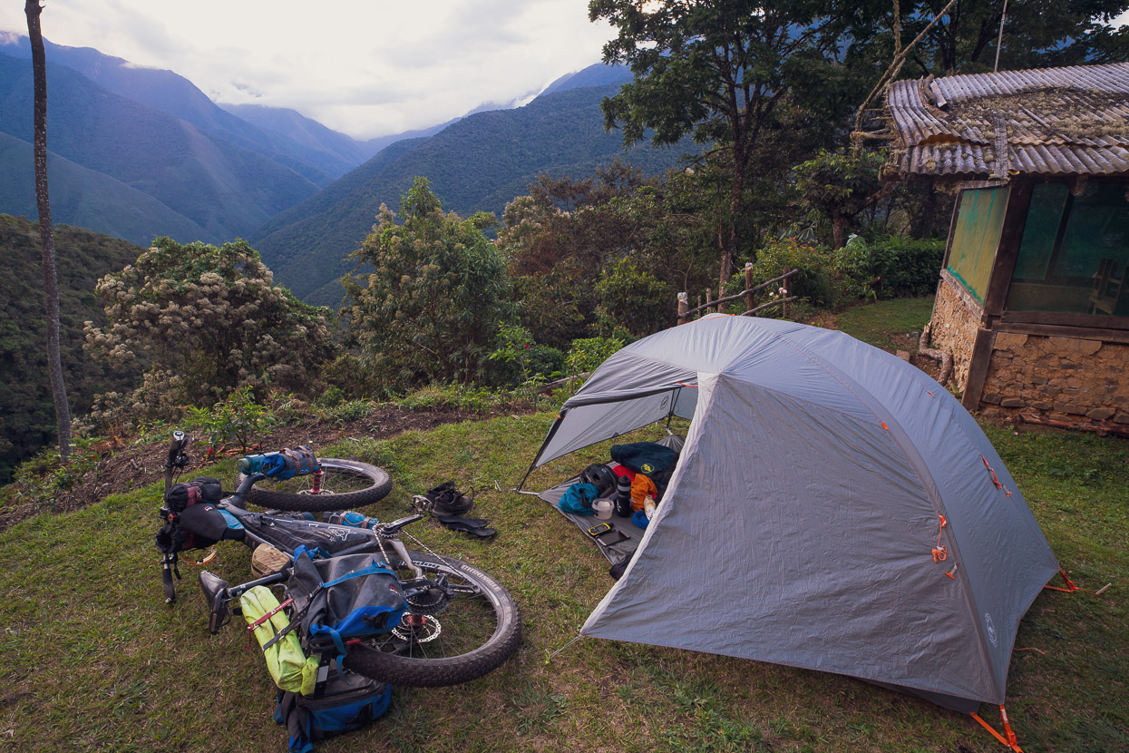
The Death Road (Camino del Muerte) is a very popular tick for cycle tourists, as well as legion regular tourists who ride it as a guided DH mountain bike ride and was something we’d both wanted to experience. Reading about the area more, I learned of a classic Inca road trek called El Choro, which descends from the oriental Andean divide thousands of metres down to the same steamy tropical valleys that the Death Road climbs out of, near Coroico. It looked like it would make a classic 4-5 day loop, so I stripped my gear down to a lightweight load, leaving the stove behind and taking just a tent fly, sleeping bag and mat, my camera kit and the bare minimum of clothing and accessories.
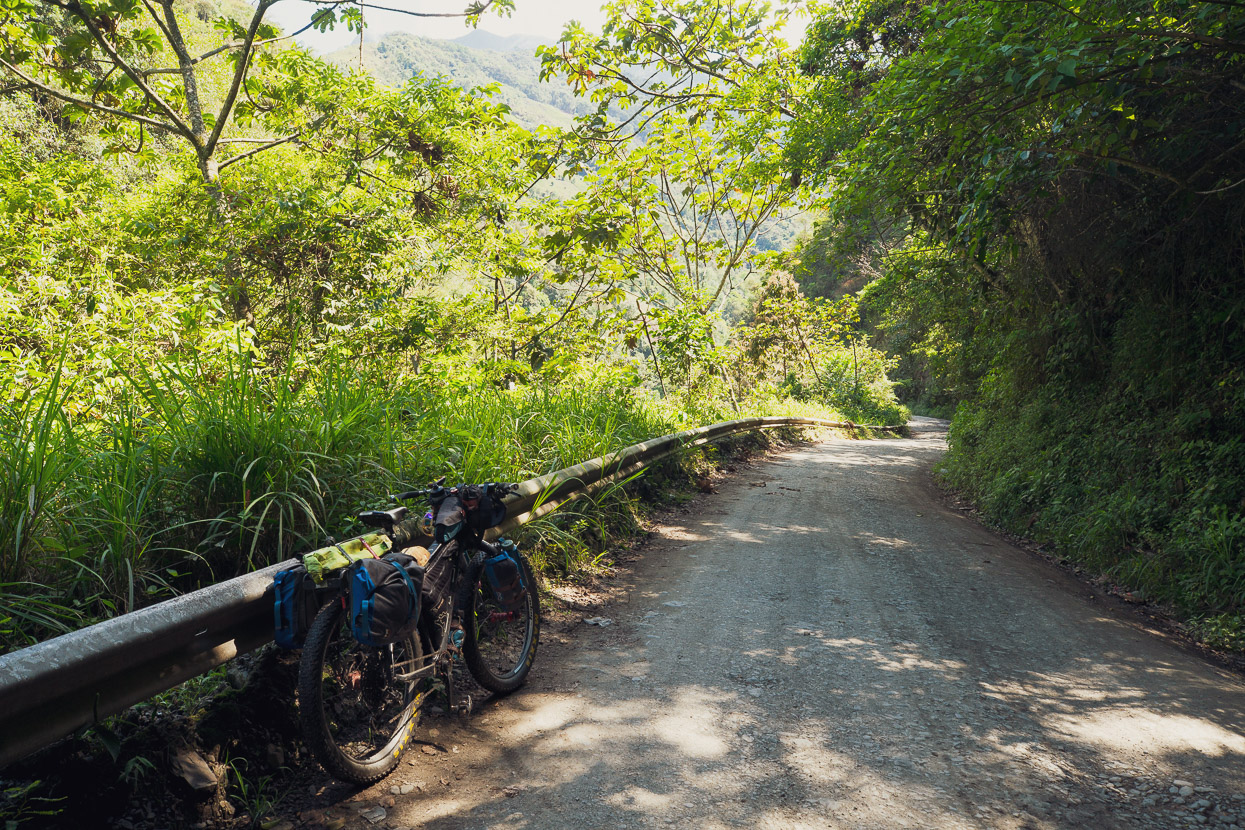
To start the ride I caught a taxi (90 BOB) from the city centre up to La Cumbre via the main highway. La Cumbre is a well known pass, right on the crest of the Andes, that marks the beginning of a long road descent to the tropics (incorporating the Death Road). But I turned left on the pass instead, following a rough dirt road to another small pass that signifies the start of the El Choro Trek.
It was immediately peaceful as I followed the road upwards towards its high point.
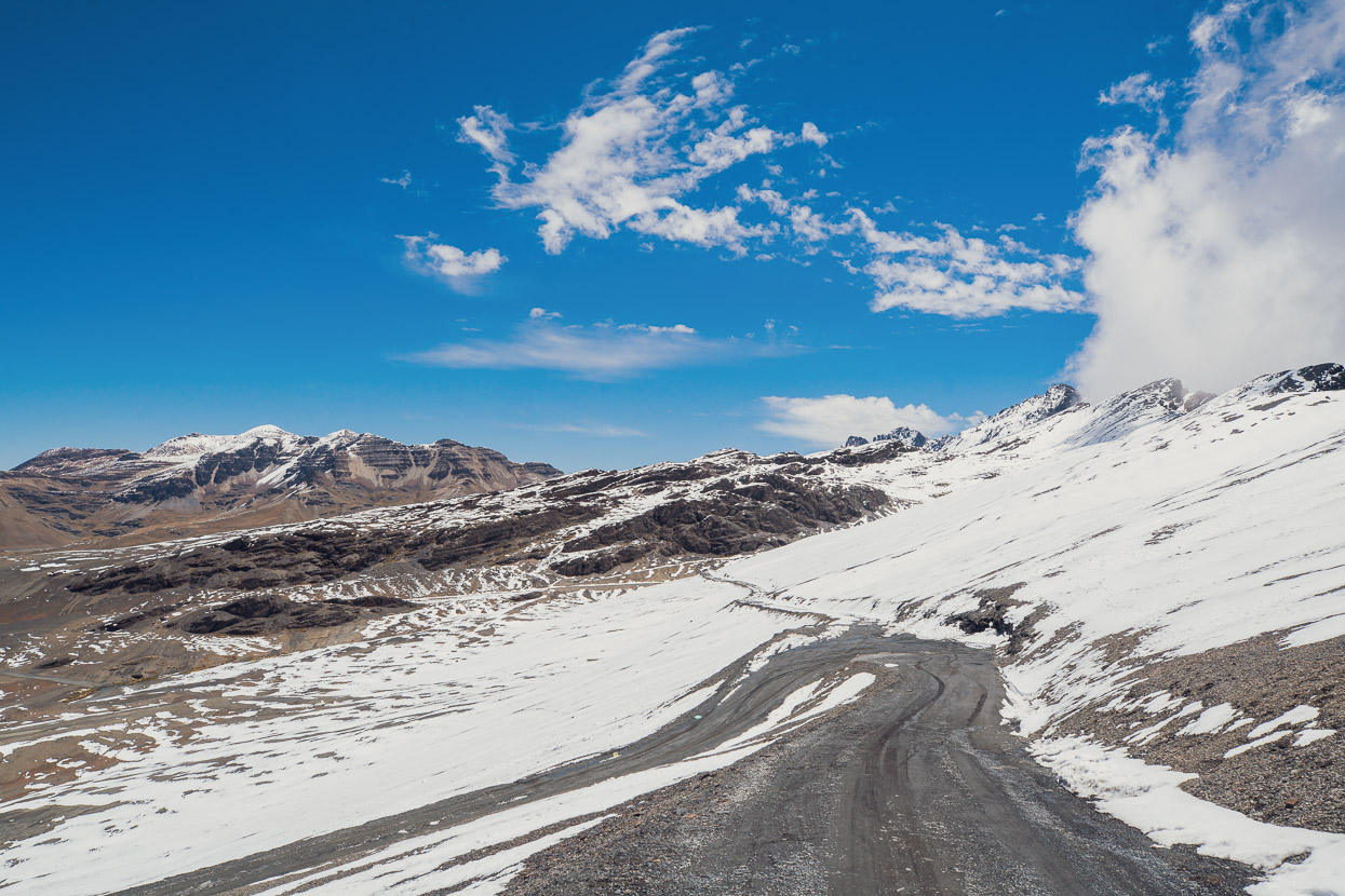
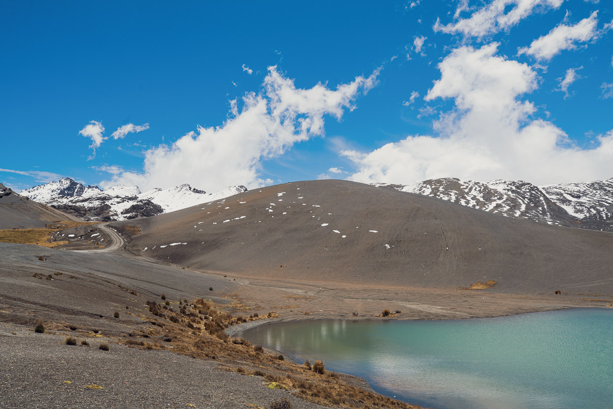
At 4800m, this part of the range tends to cop snowfall whenever there is an afternoon thunderstorm, but the road itself was clear.
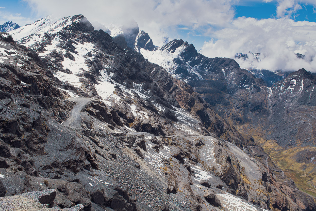
Standing right on the Andean divide I could see where the route went, diving steeply into an alpine cirque on the eastern side of the mountains.
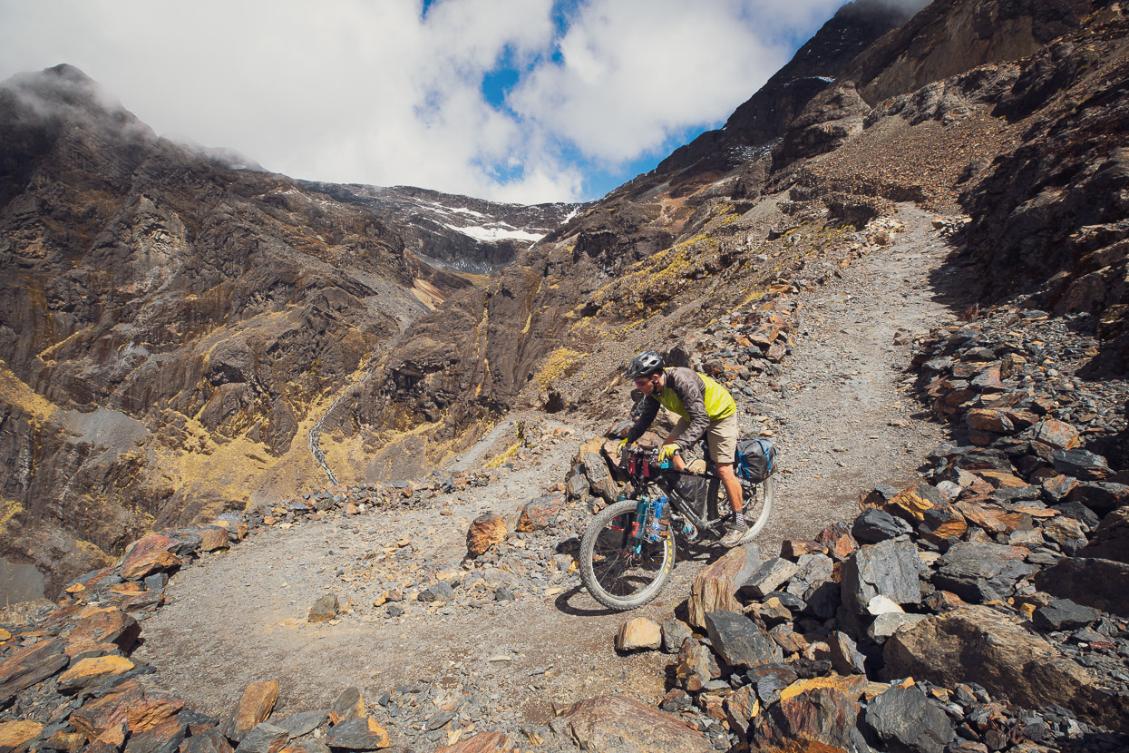
I was having so much fun riding down I had to force myself to stop and set this photo up. I now have a whole new appreciation for solo riders who consistently photograph their journeys – it’s a lot more work than having a convenient riding partner to photograph!
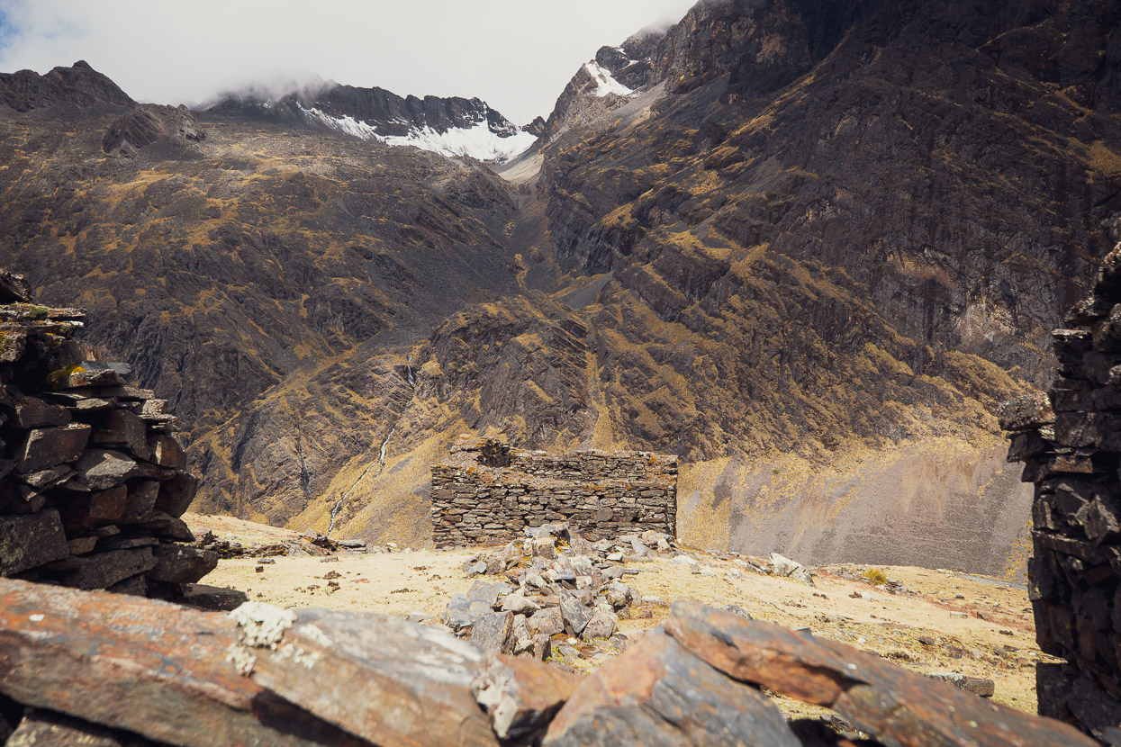
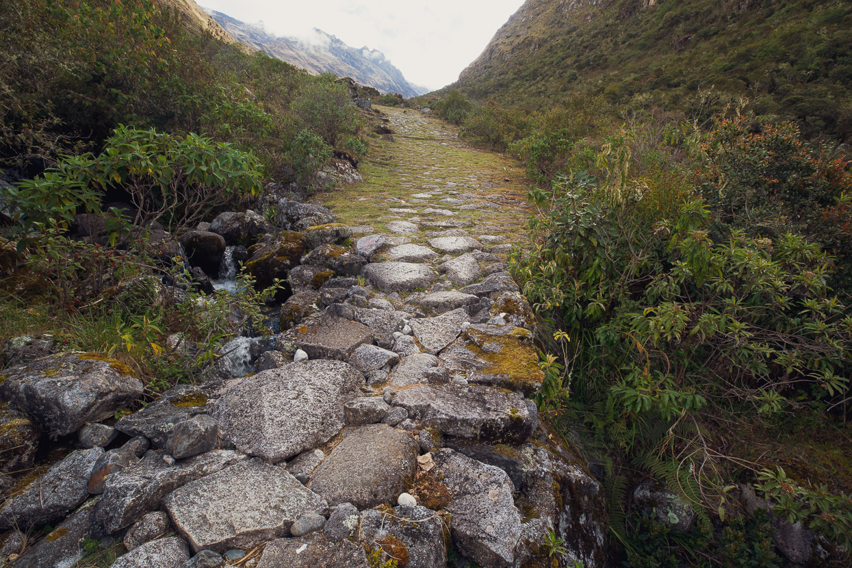
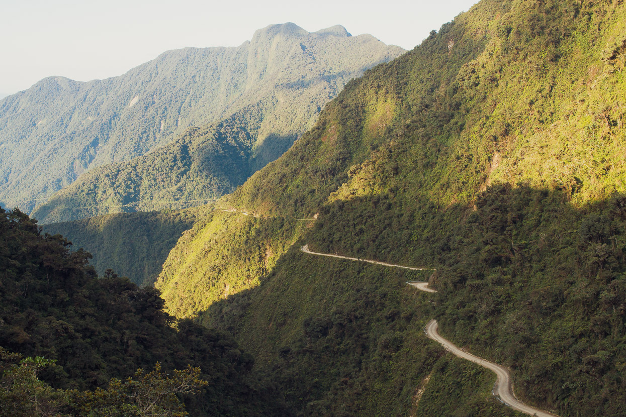
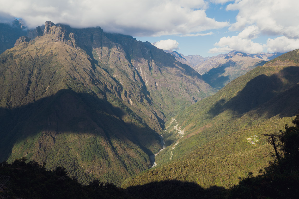
The El Choro trek follows what was once a royal Inca road. Constructed to an extremely high standard for its time, this road would have served as a vital trade link between the Inca dominated highlands and the tropical lowlands, from which the Inca would have sought coca leaves, tropical fruits, bird feathers and other luxuries unobtainable in the high country. For much of its 51km length down to Chairo the road still has its original river-stone bed, stone retaining walls, ‘guard rails’, gutters and steps. It’s the best preserved Inca road (for its length) I’ve seen in South America.
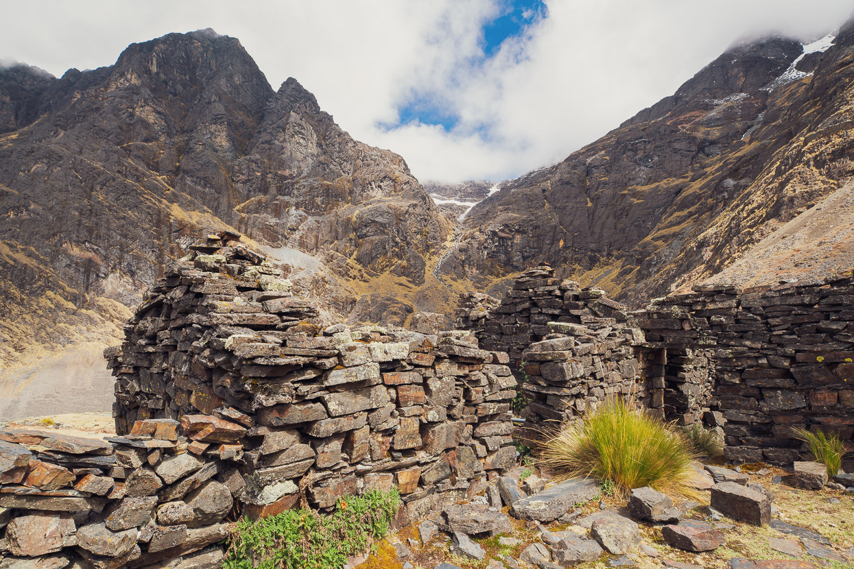
Once I reached the pampa in the floor of the cirque there were several Inca ruins.
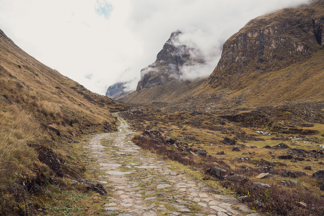
The road isn’t all easy rolling – this was one of the rough and technical sections, although this part can actually be bypassed on a more recent dirt road that follows the other side of the valley as far down as Samana Pampa.
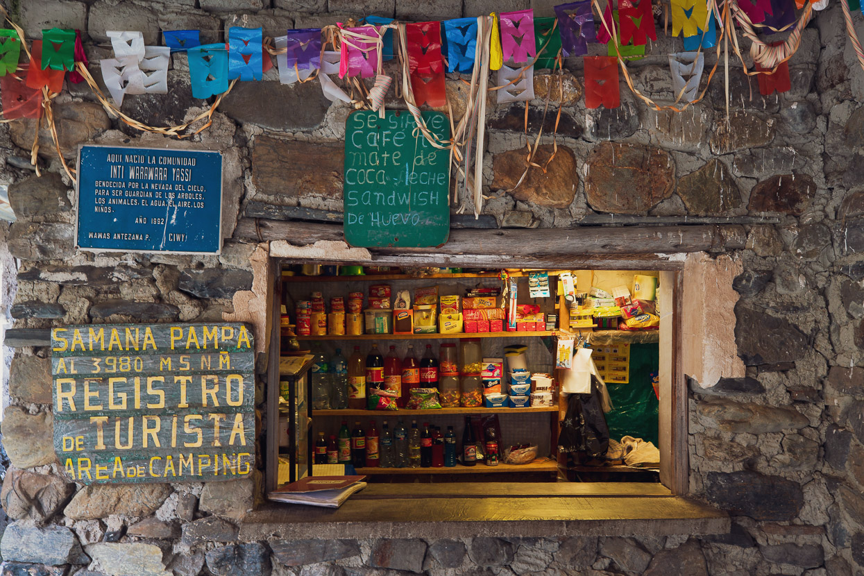
The El Choro Trek is popular enough that there is a fair bit of hiker infrastructure along the route. The first point of which you reach is Samana Pampa. You can camp here, with a sheltered sitting area and there is a small tienda. Hikers are required to sign a registration book. Limited hot food and drinks are sometimes available too.
I continued down valley, headed for Challapampa for the night. For most of this section the road is wide and in very good condition, if not a little bumpy. A suspension fork would be a desirable extra for this ride, although I managed fine with just 3 inch tyres and still rode a lot of the technical sections. The next stop after Samana Pampa is Chucura, which is a small village and the last point that can be reached by vehicle from La Cumbre. There’s another trekkers camp here with rooms, but it looked run down. I paid a 20 BOB trail fee here and signed another registration book.
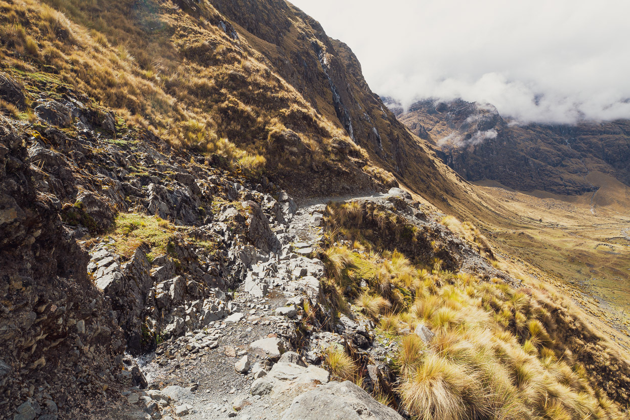
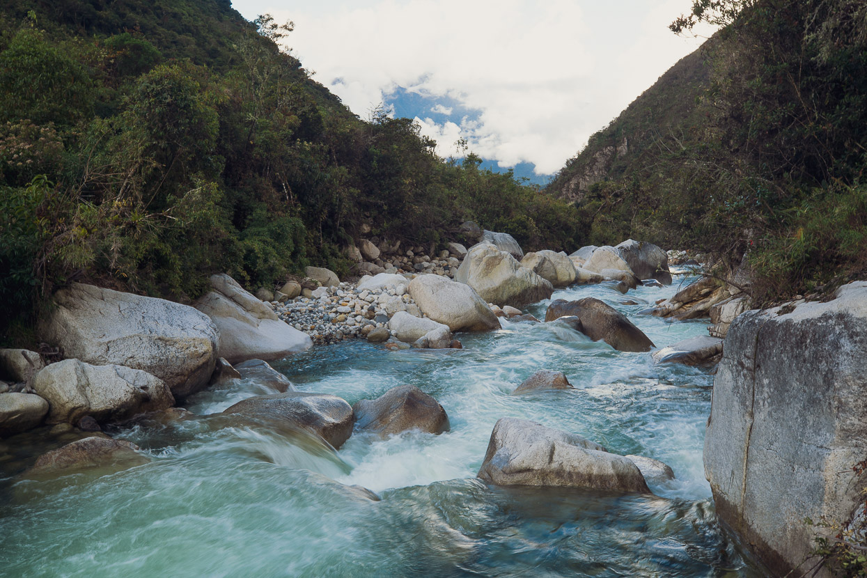
From Chucura onwards to Challapampa the trail descends more steeply and is a bit rougher in places but is overall very good and 100% rideable. By now I was leaving the grassy alpine valleys behind and starting to ride into the cloud forest.
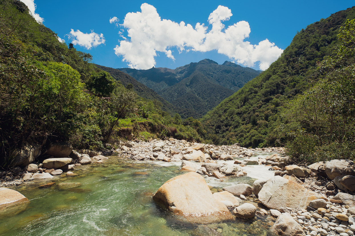
The valley narrowed into a canyon as I neared Challapampa and the final obstacle was a large slip that has destroyed the original road, but in its place was a perfect switchbacked single track that dropped me down to the hamlet.
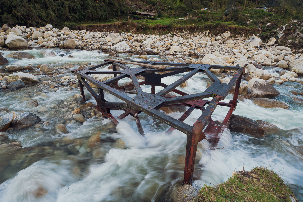
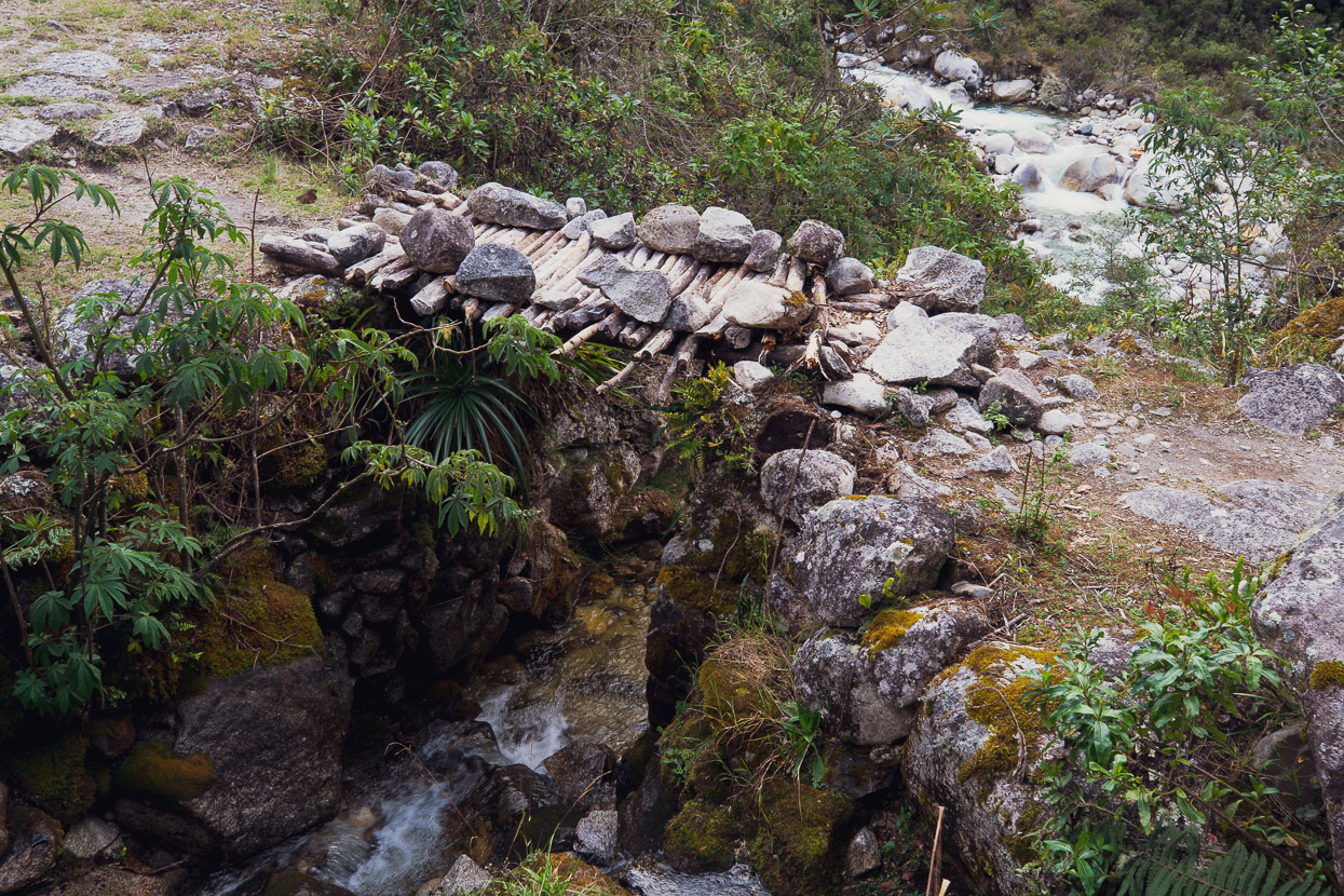
The destroyed track was not the only toll from a period of heavy rain; the bridge has been destroyed too. For how long it had been out for I didn’t accurately find out, but I was told by an old lady who ran a small campsite on the true right of the river that someone would be along at 7am in the morning to ferry myself and three hikers over the river by cableway.
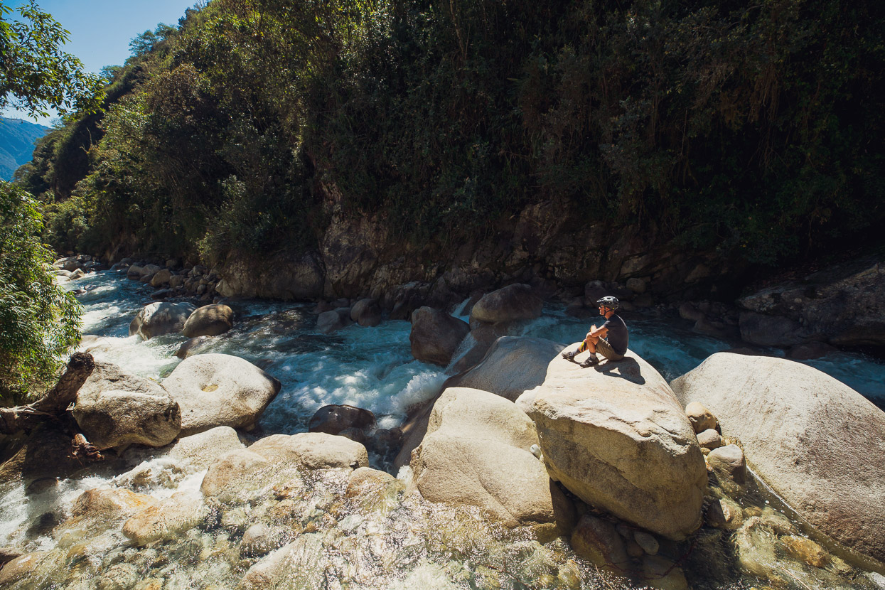
The area by the collapsed bridge didn’t look too bad for a solo crossing (I was already planning ahead in case no help arrived in the morning), but the river downstream was pretty gnarly. I camped for the night outside the old lady’s casita and spent the evening chatting with the three european hikers. Down at 2800 metres the evening was already very mild compared with the alpine temperatures I’d been used to.
By 8.30am no one had arrived to teleferic us across the river. The level had dropped a bit overnight thanks to a hard freeze up high and after some wading around I crossed comfortably on my own, but managing my bike as well would have been another story in the swift current and uneven bouldery river bed. The hikers were emboldened by my crossing, so they also crossed in a team effort and then helped me with my bike, for which I was extremely grateful.
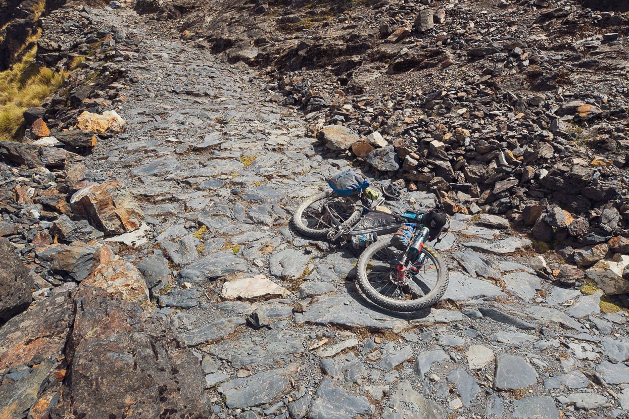
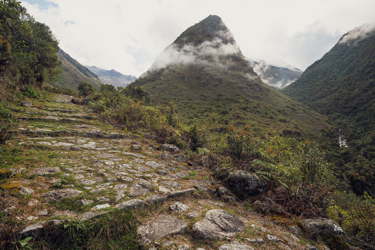
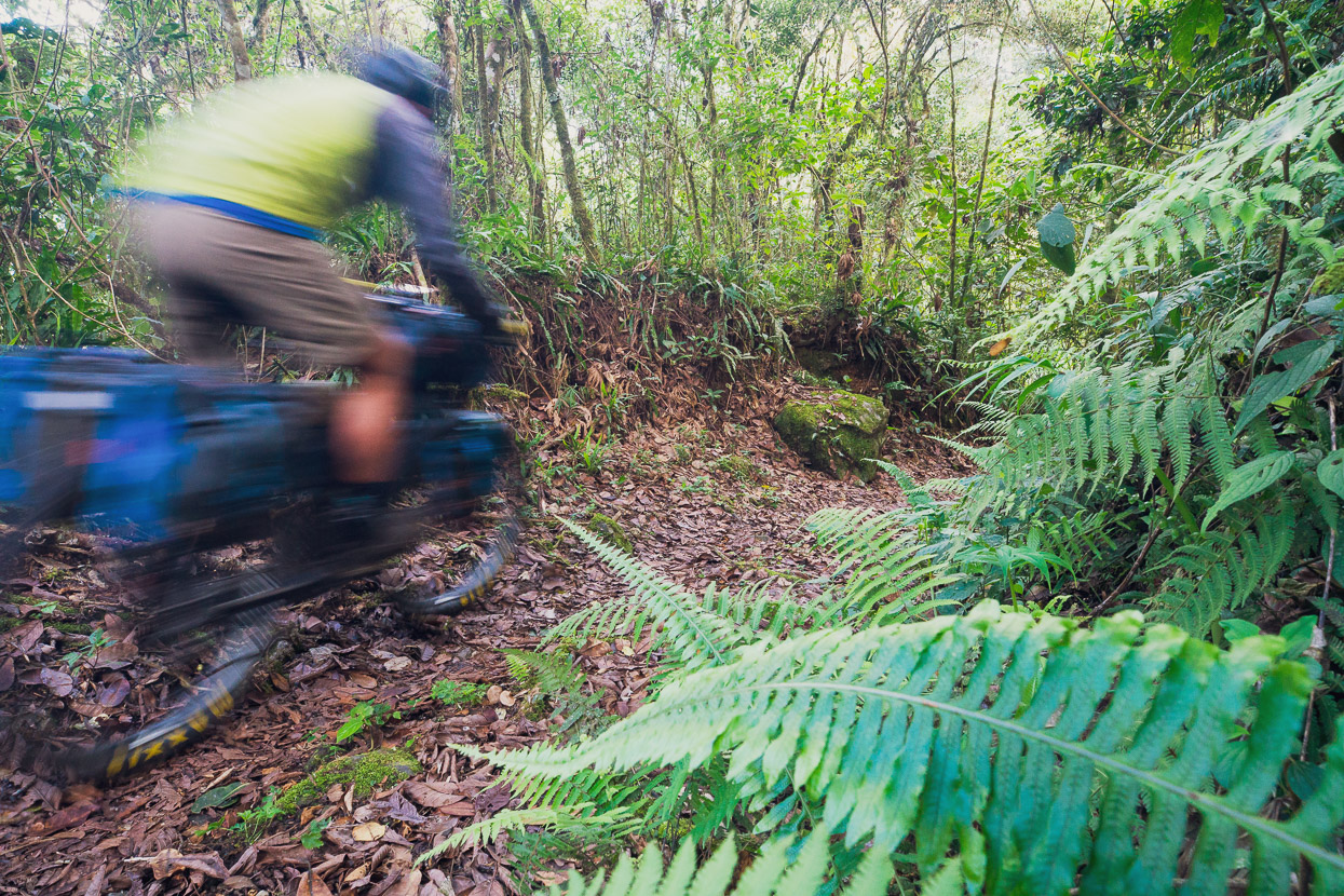
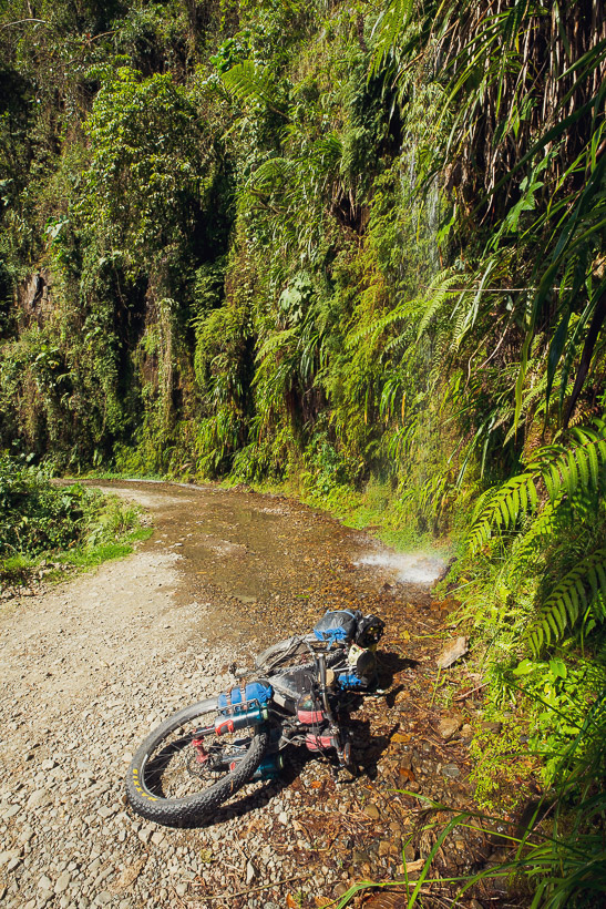
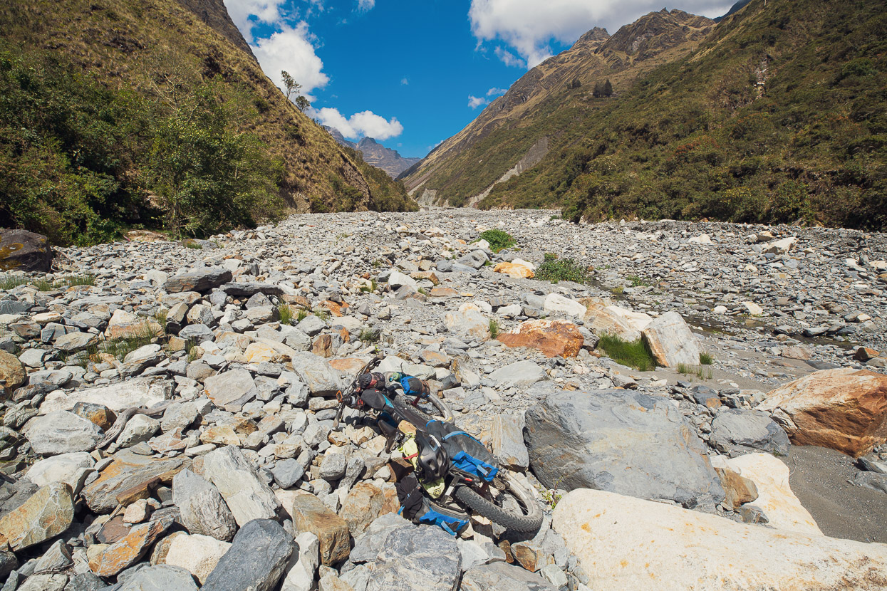
Between Challapampa and the next river crossing at El Choro is the most technical part of the ride. The trail enters a narrow, sunless gorge, so it’s damp and mossy in places, not to mention quite steep. In places the surface has broken up into a chaos of uneven blocks, so riding it all is tricky. It’s unloaded full suspension bike territory, but with determination I still managed roughly 70% of it. There’s a number of short unrideable climbs through here too. But overall I found that just as you were getting worn down by the technical riding, the trail would smooth out for a nice flowing section for a while, so it’s never hard in a sustained way.
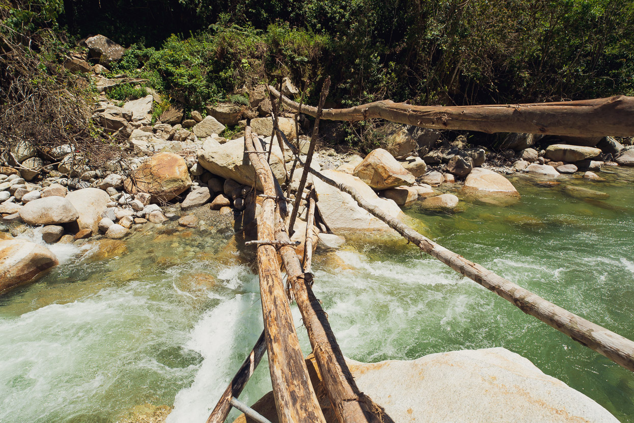
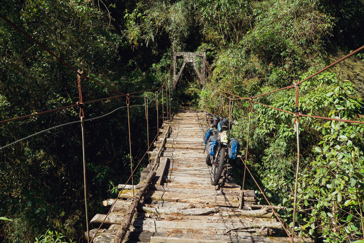
The main bridge at El Choro has also been destroyed by a flood and this dodgy temporary structure stood in place of it, a bit further upstream. I was lucky to have caught up to one of the hikers here and he helped me ease my bike across with me at the back end and him at the front. The whole arrangement flexed and buckled under our weight, but we made it.
Immediately after the crossing at El Choro came the first of two roughly 200 vertical metre hike-a-bikes, which for the most part are on good quality track surface, but they are quite steep and sapping in the lowland heat, which was into the high 20s by now.
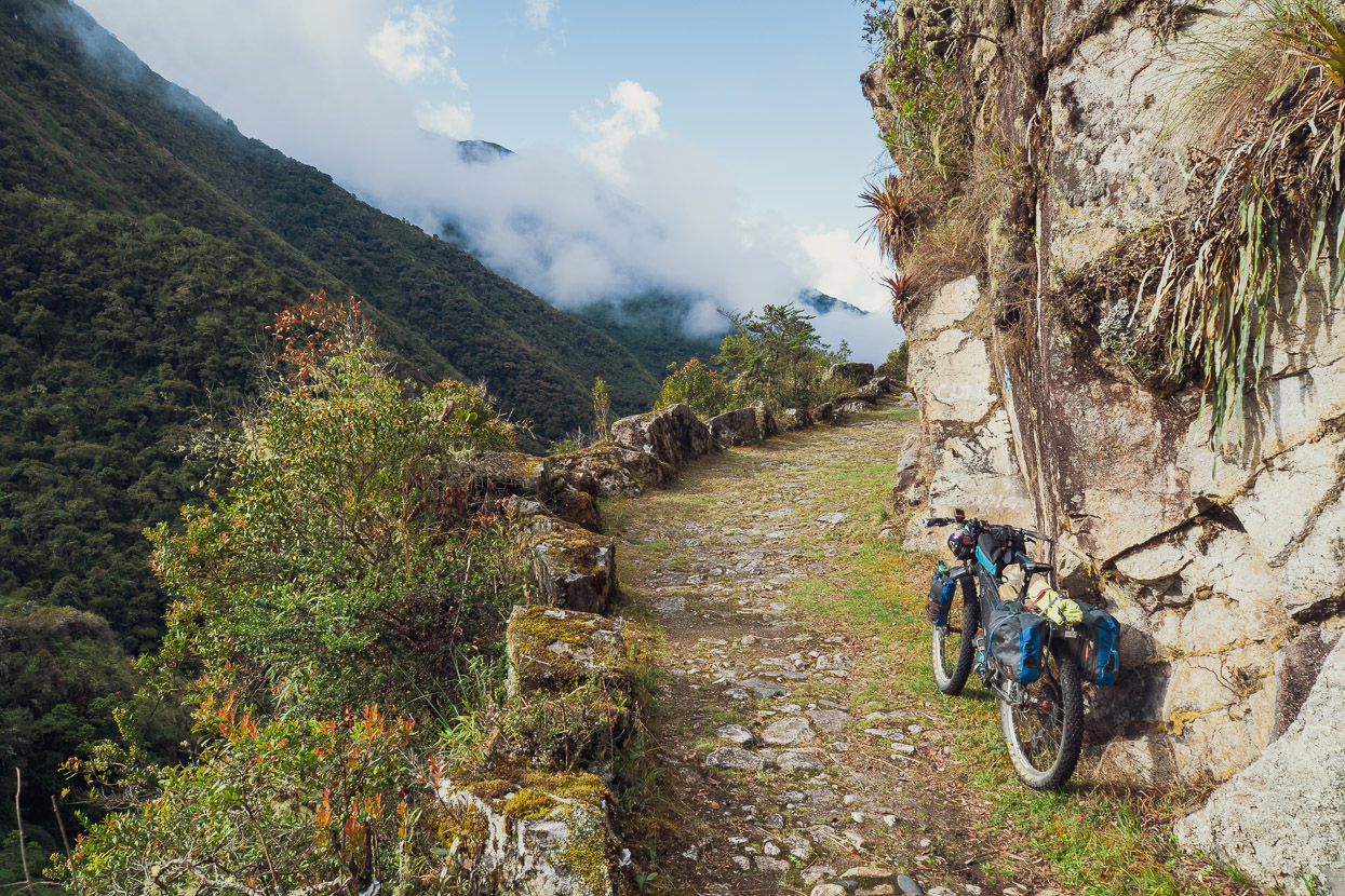
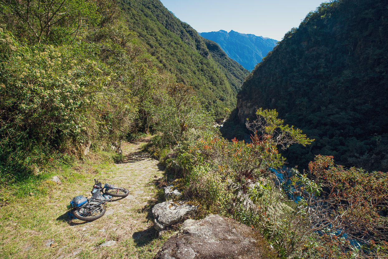
Aside from the two mandatory hike-a-bikes, this whole section out to the finish at Chairo is nearly all rideable. When the trail levels out or points downhill it’s essentially a 99% rideable surface making for a classic bikepacking route.
The route is punctuated with campsites at Buena Vista, Bella Vista, Super Vista and Sandillani. Buena Vista and Sandillani have the nicest views. There’s a very basic tienda at Buena Vista, but at Sandillani there’s a bigger tienda and basic hot meals available.
Overall the character of the route remains quite wild, with yet another washed out bridge and this dodgy one which had long since lost its original decking. The rusted cables were not confidence inspiring.
For my second night on the trail I camped at Sandillani where I was super thankful for a hot meal and a cold beer.
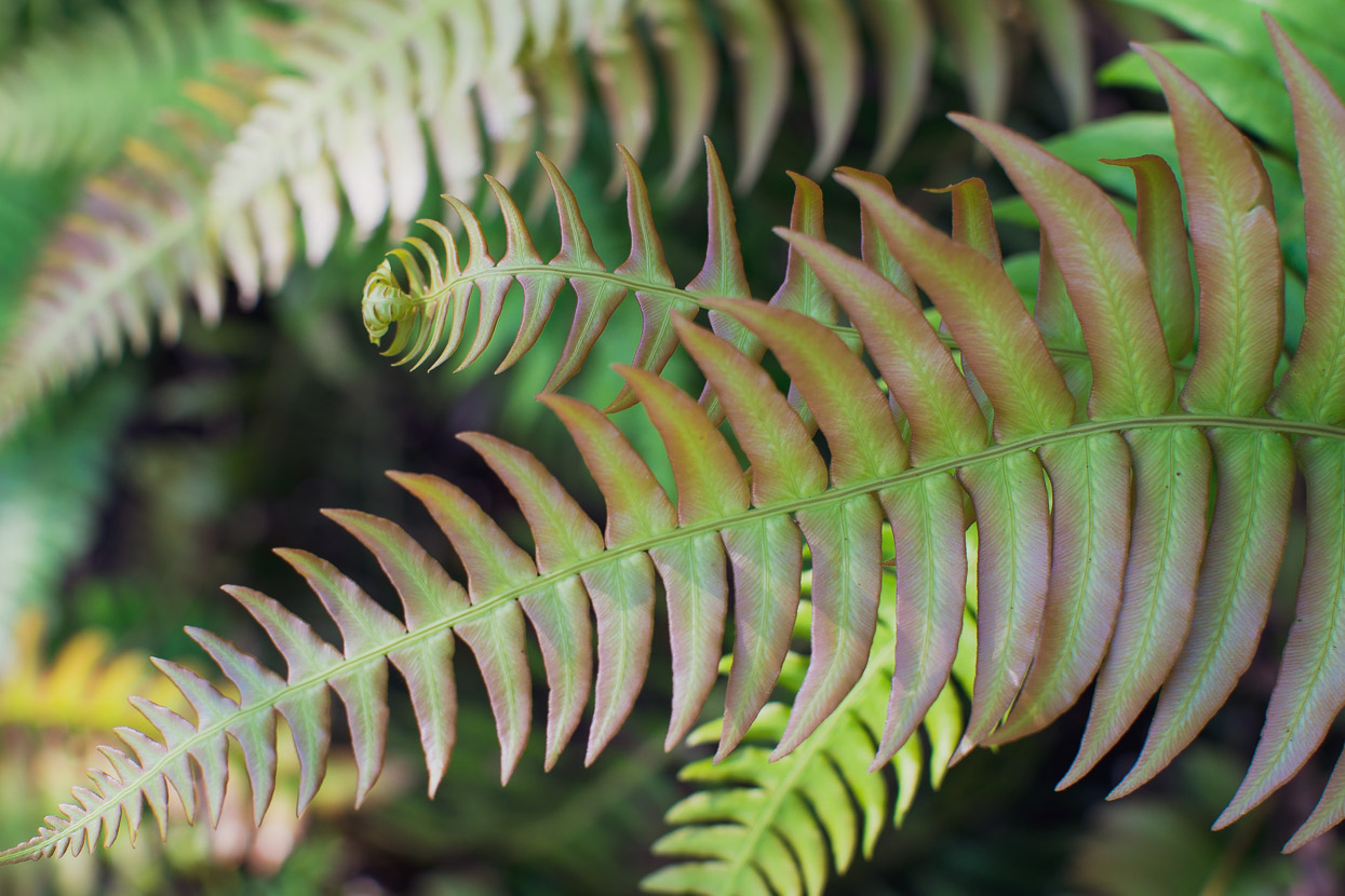
One of the best moments on the trail came the following morning, with a 100% ridable 9km downhill to the finish of the route at Chairo. The surroundings were lush, ferny and a great finish to an epic singletrack ride.
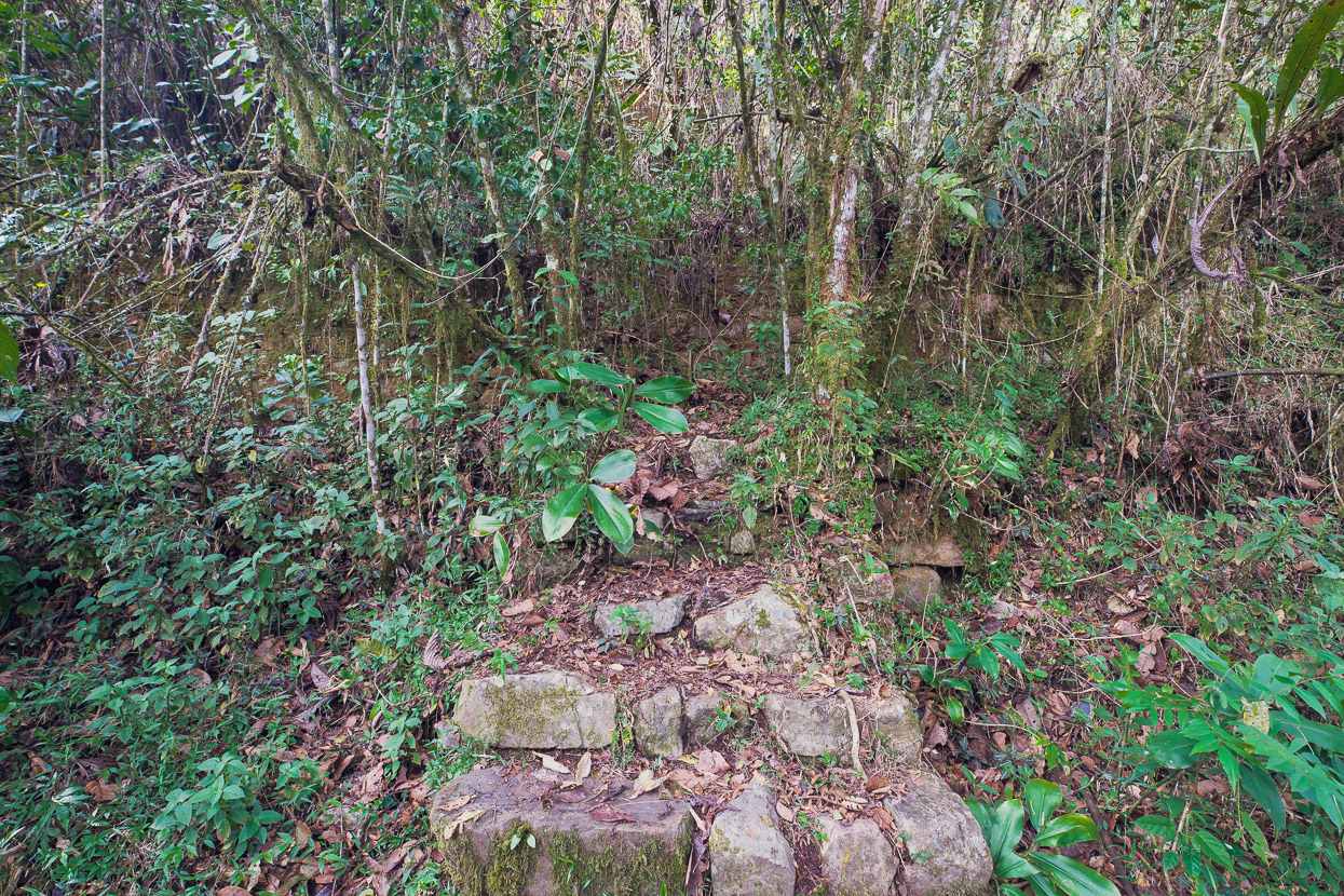
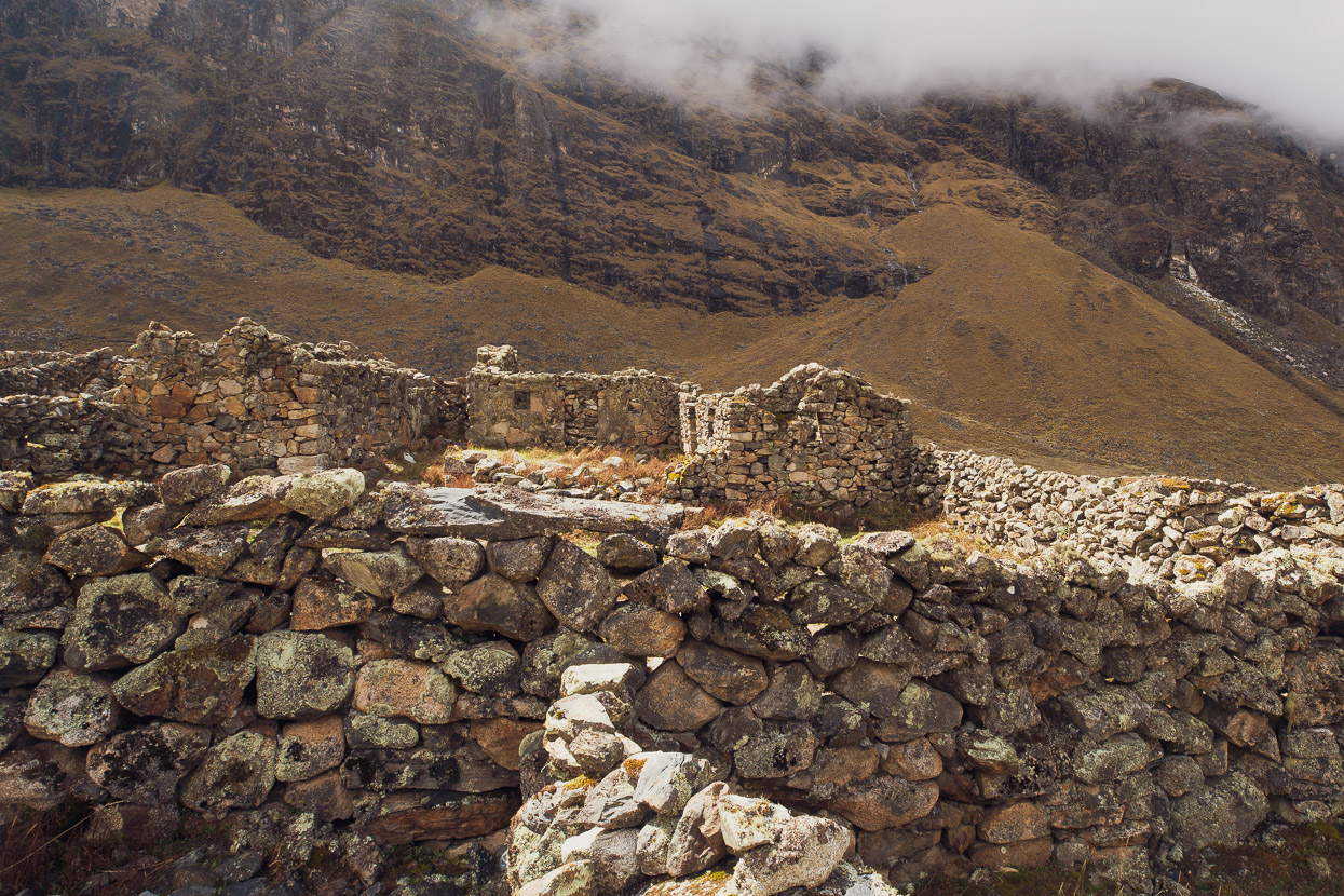
Even near the finish I was still passing the odd ruin, this stairway led to a structure with all four walls still standing.
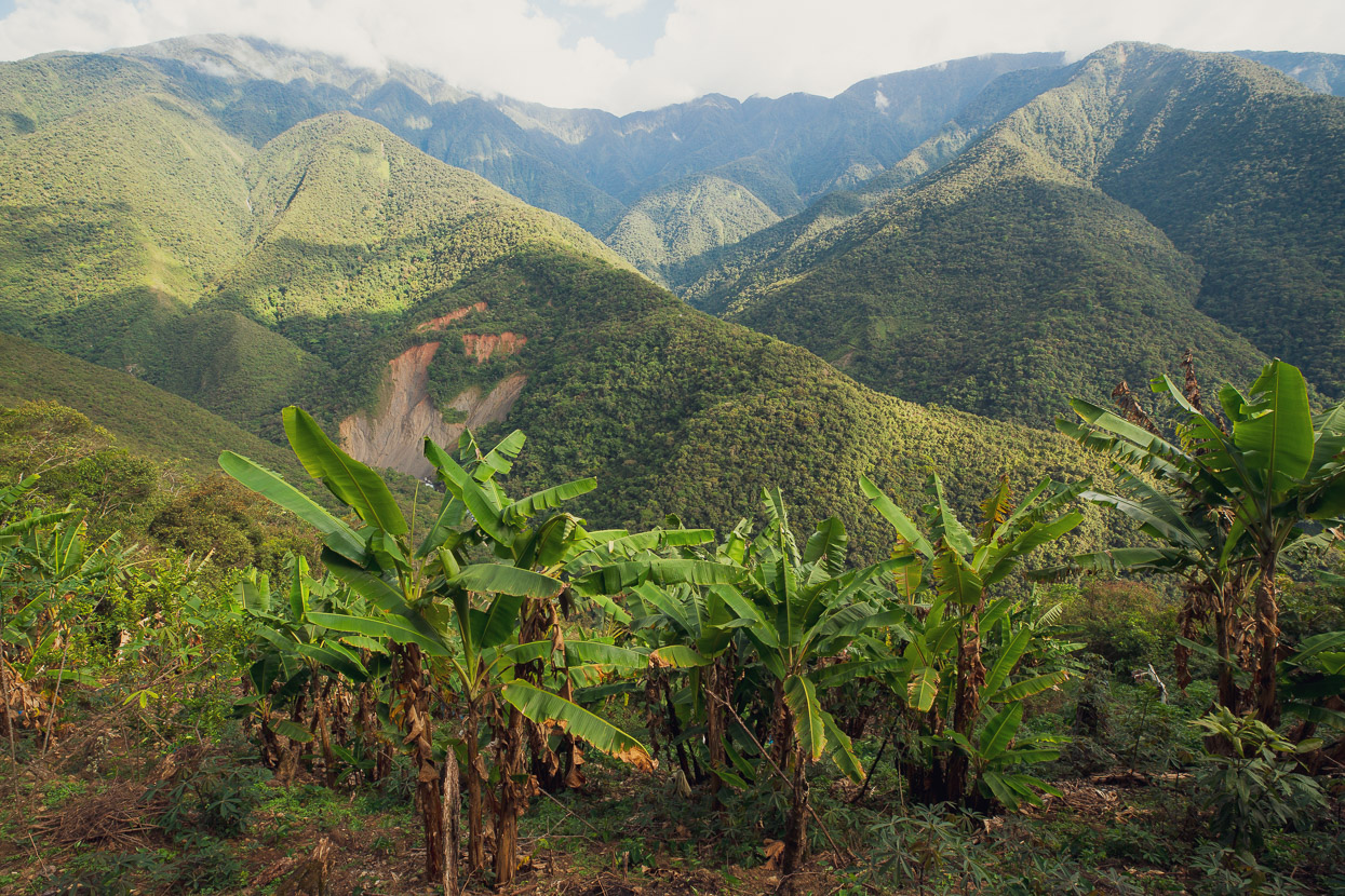
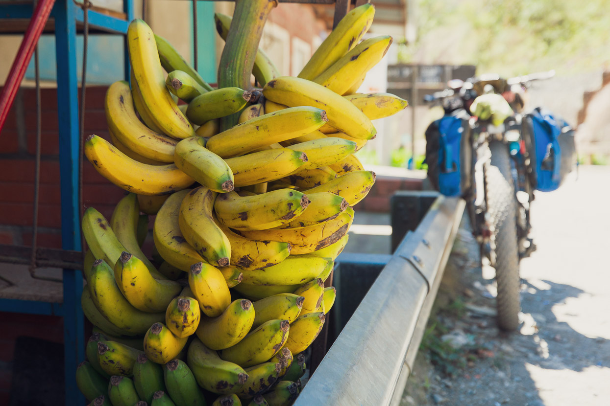
You know you’re low when you start seeing banana plantations.
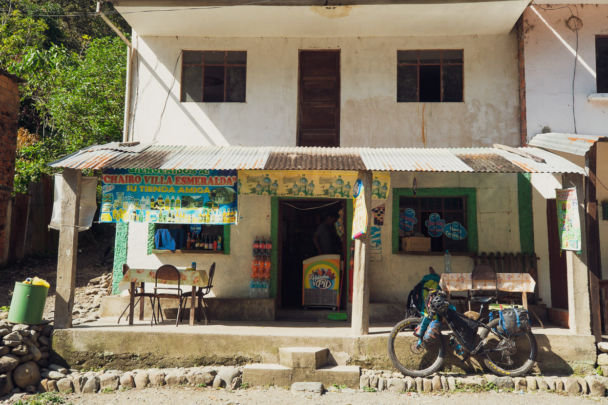
And finally the finish at Chairo. The village is nothing to write home about, but there were cold drinks, bananas and I could fill my water bottles.

A good dirt road led down valley until I met the main highway briefly and then made a 600 vertical metre climb up to Coroico, where I planned to have the rest of the afternoon off. The climb was steep and in the heat was very hard work. I was feeling pretty worked over from the effort of the previous day on the trail, with its numerous short carries and the steep hike-a-bikes.
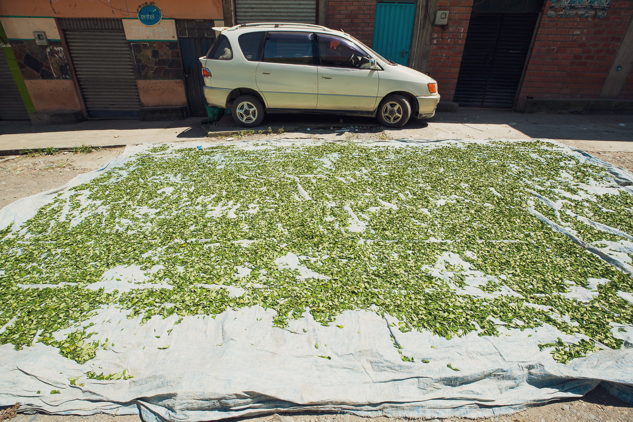
Aside from bananas, the most abundant crop seemed to be coca, which was often spread out drying on the side of the road. I saw whole hillsides covered in the crop too.
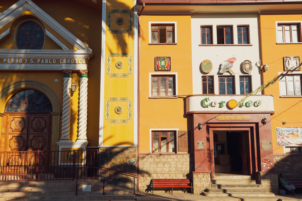
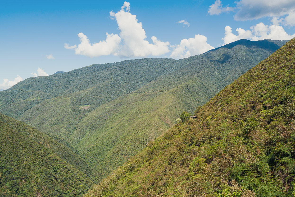
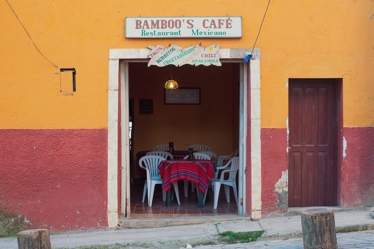
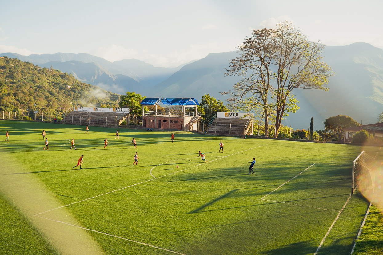
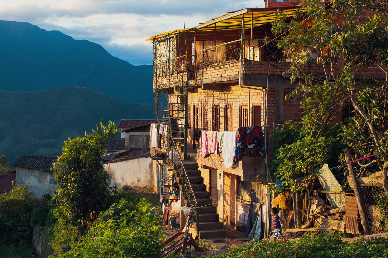
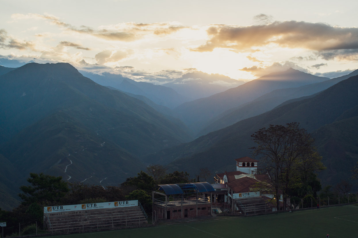
Coroico is a pleasant little town, sited on the top of a ridge that falls away steeply on three sides, so it has expansive views both up towards the Andean divide and also out to the east. Compared with Bolivian highland towns, Coroico seemed to have a much more vibrant and lively community and was a refreshing sight after so many drab and dead mud-brick villages with very little going on.
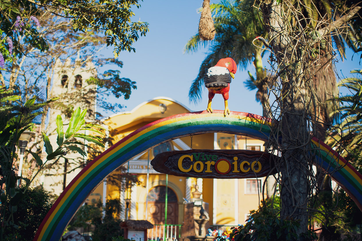
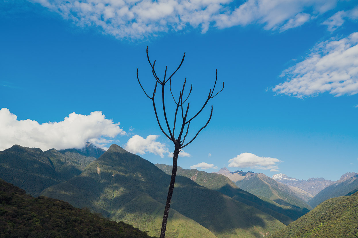
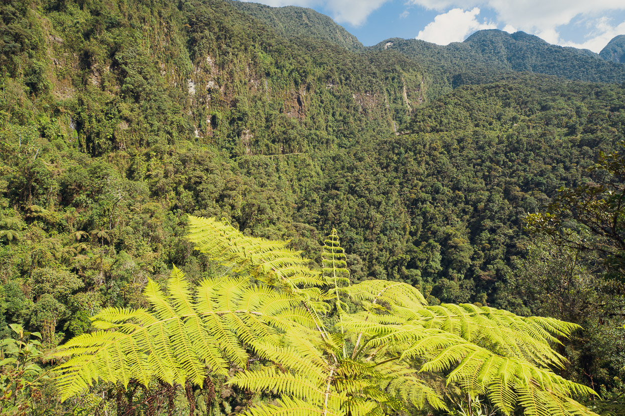
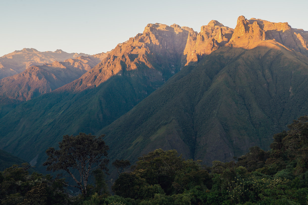
After a chilled afternoon I followed my usual modus operandi and went for a early evening wander as the sun drifted down behind the steep forest covered ranges. Looking west I could see much of the route I’d followed the past three days, as well the Death Road (the next days objective) and right up to some of the highest mountains of the Cordillera Real.
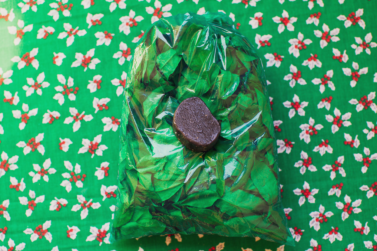
Before I left in the morning I resupplied with two days (one night) food and of course the obligatory bag of coca leaves for a bit of extra energia for the long climb ahead. Typically the locals chew their coca with a calcium based substance that helps extract the strongest alkaloids from the leaves, and the type varies region to region. Down here it was a minty flavoured thick licorice-like paste that they called menta. It’s quite a good complement to the leaves.
Even with good climbing legs, taking on the Death Road uphill is no trivial ride. To reach La Cumbre is a 3400m elevation difference, but the actual climb is longer once you include the descending sections. There’s also the oppressive heat to take into account starting from only 1200m elevation. I’d hoped to cool off as I gained height, but even at 4pm in the afternoon and 1800m higher it was still hot and windless. Admittedly I didn’t do myself any favours not leaving Coroico until an uncharacteristically late 10.30am.
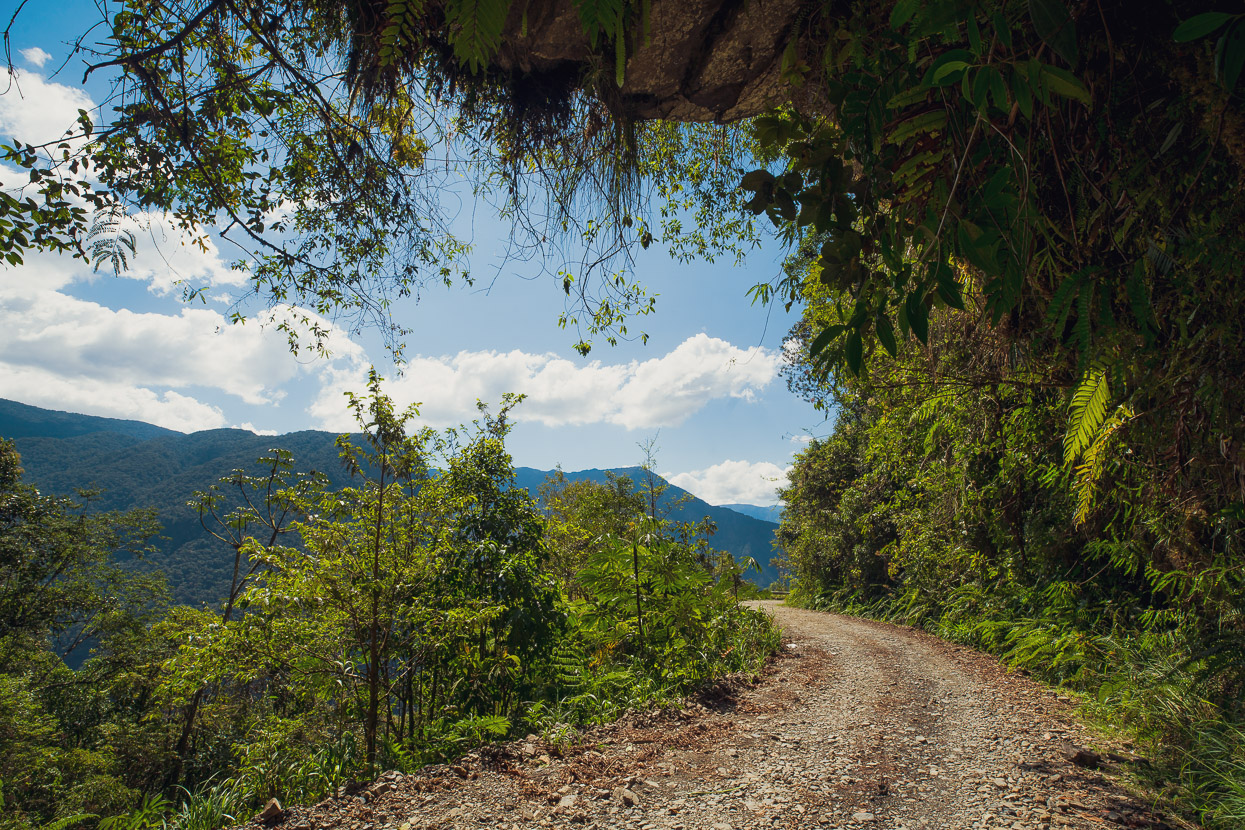
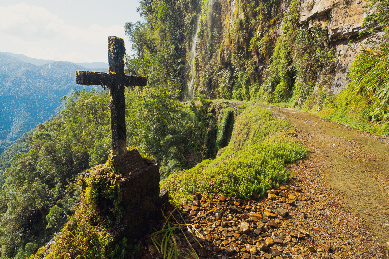
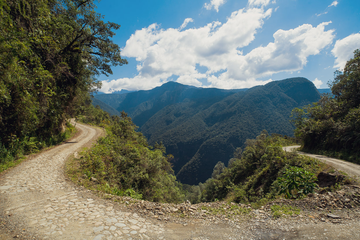
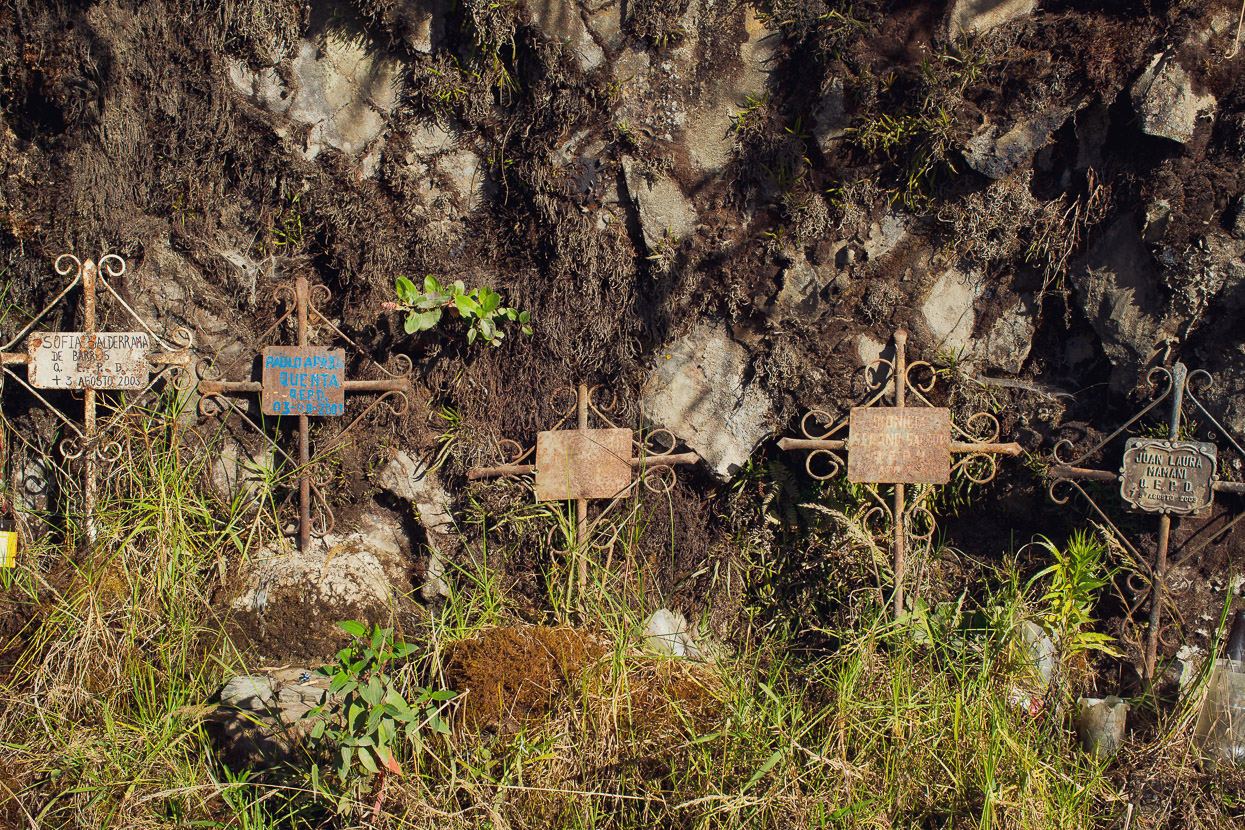
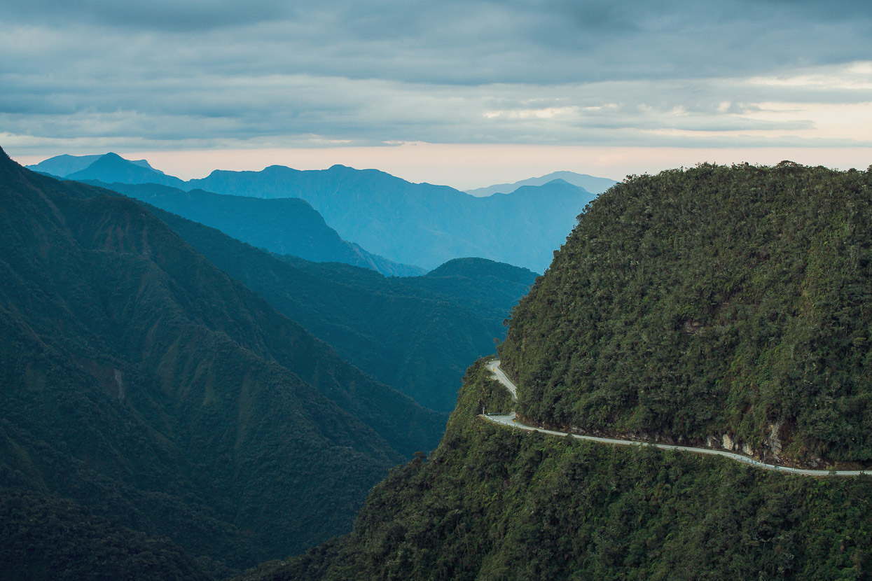
The most beautiful sections don’t come until you are quite high on the road, but for a long section of climbing it is very beautiful. The barrier-less road drops hundreds of metres into forest choked gullies below, while numerous narrow cascades sprinkle the road and cool you down a little. There are many memorials to the over 1000 people who have lost their lives on the road over the years, most of them by plunging over the edge in their vehicles.
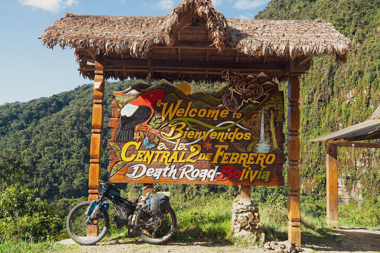
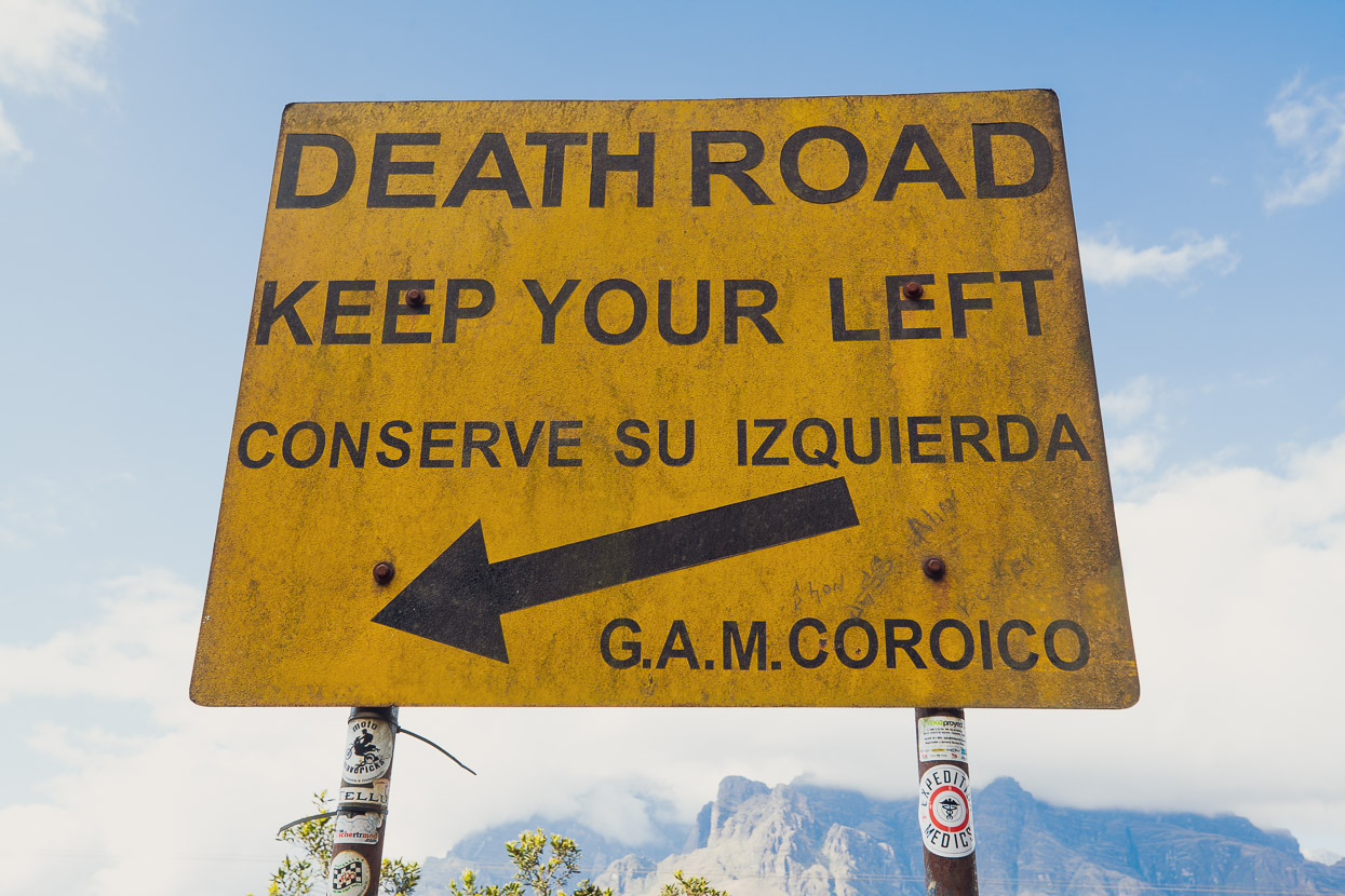
These days the road has been replaced as the main route from La Paz to the jungle with a modern highway that descends a parallel valley. It was originally constructed during the 1930s by Paraguayan prisoners of war (captured during the Chaco conflict). It’s officially called the Yungas Road, but over the years earned a deserved reputation as ‘the most dangerous highway in the world’ and hence the moniker Camino del Muerte, or Death Road. Reportedly, during the 1980s, between 200-300 people a year lost their lives on the road, due to its often hazardous driving conditions (rain and mist), unpaved surface, lack of guard rails, and narrow girth. For much of its length, there’s no coming back from a wheel over the edge and in many places a vehicle would freefall some distance before colliding with the side of the canyon. Since 1998 18 cyclists have died on the road.
In recent years the road has become a ‘must see’ for visitors to La Paz and several outfits in the city run downhill mountain bike tours of the road. I was told by a guide that during peak season 200-300 people ride down the road daily. On my way up I was passed by about five guided parties, totalling about 50-60 riders.
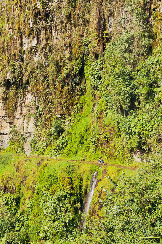
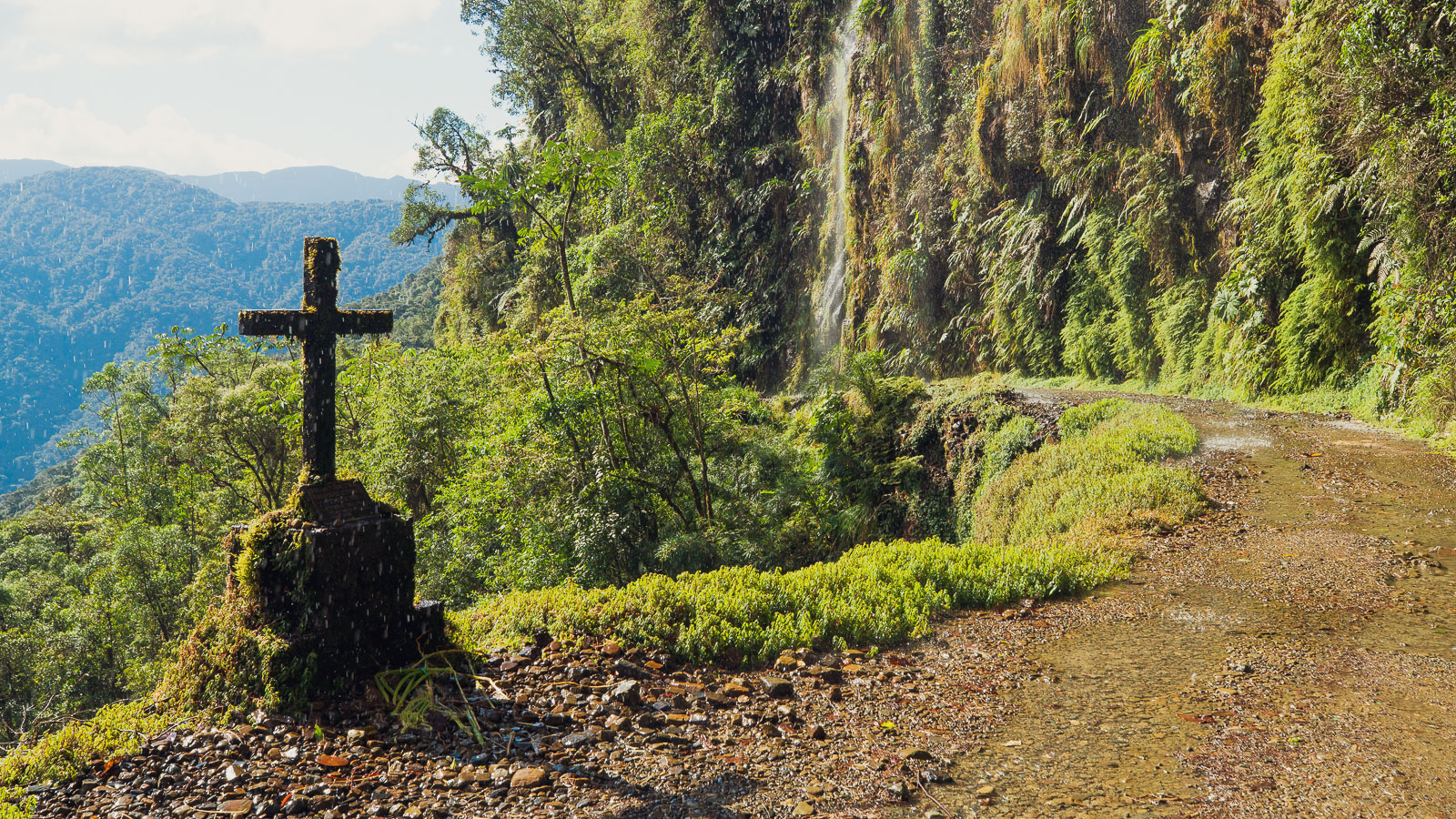
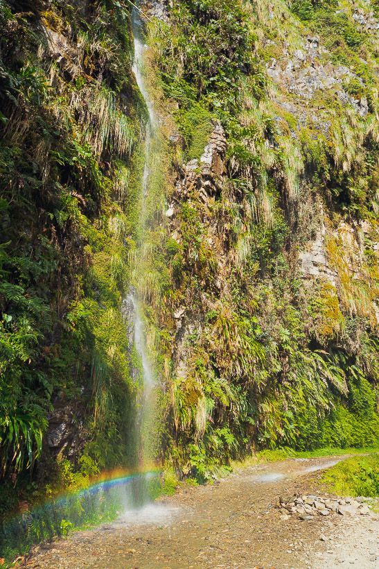
This is one of the most iconic stretches, where a series of waterfalls rain down on a particularly narrow and vertiginous section of road.
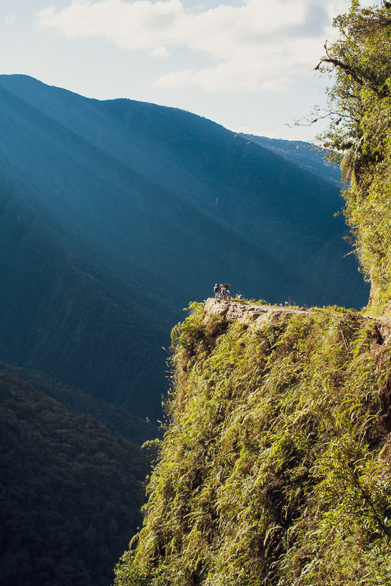
And another notorious bit. If you’ve seen a photo of the Death Road before it’s probably this famous corner, where the road drops away steeply for a toe tingling distance to the cloud forest below. That’s my bike perched carefully near the edge.
Eventually I topped out at Chuspipata, which is a small (and apparently virtually abandoned) community on a saddle near the top of the official Death Road. Shortly after there it joins the main paved highway that continues to climb up to La Cumbre. Exhausted, I camped for the night on the pass.
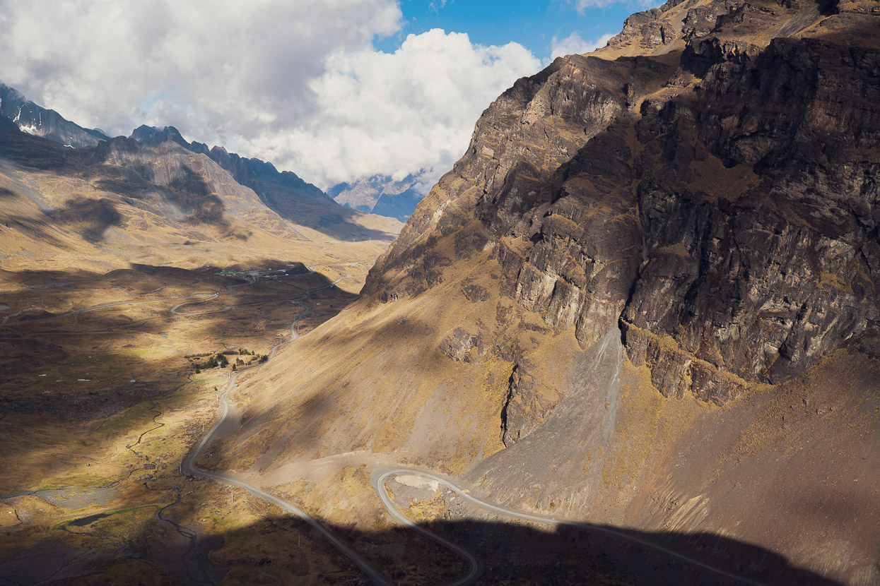
A view into the Unduavi Valley in the morning, which the highway climbs up to La Cumbre. You can just see the road top right of the photo. From the saddle at Chuspipata I joined the highway until Unduavi, where I dropped down into the valley to follow what I thought was a dirt road up to Pongo and beyond to La Cumbre.
There’s a police checkpoint and a few small restaurants at Unduavi and as I munched on a very welcome fried egg sandwich a woman said to me that there was a derrumbe (slip) on my intended route. When I probed further she told it me was not very big (pointing to a 100m wide slip that was nearby) and then gave me an affirmative when I asked if it was possible to walk it, so I didn’t consider it much of a concern.
What I discovered when I dropped into the valley though was that there was no trace of the road at all. It had been destroyed in a large flood. The only clue that there had ever been a road were the sections of rusted, dented steel culvert poking out of the riverbed in places. She’d said it was not big, so I optimistically shouldered my bike and continued upstream. But problematically the road was almost totally gone for close to three kilometres. Instead it was replaced with a hell of large river boulders, bedrock, crumbling river banks and general grovelling. It took me three hours to eventually rejoin the undamaged dirt road at Pongo, by which time I was feeling exhausted, with that effort on top of the previous four days of hard riding.
The bit in this photo was the first ‘easy’ bit, after which I was so focused on just getting through it that I stopped taking photos.
At Pongo I had a lunch of stale bread and sardines and then persisted with the dirt road, but it looked like it was destroyed with more river damage ahead, so I bailed up a small track to the paved highway and followed that for about three more hours of climbing up to La Cumbre. All that remained from there was a fast downhill to the city limits, where the ride turned into a hectic navigation of pedestrians, stray dogs and insane colectivo traffic until I eventually made it back to our Air B&B.
Overall (except for the destroyed road section) I was happy to have ridden such a classic loop from La Cumbre and back into the city. For singletrack aficionados with good technical riding skills, who aren’t afraid of a bit of hike-a-bike and the epic long climb up the Death Road, it has all the ingredients for an extremely memorable ride and adventure. It’s particularly notable for its sense of history, and also for the huge range of climate and ecology that it traverses, from the alpine to the tropics. See map below.
Hana’s surgery was well healed by the time I got back and the skin graft looking healthy, so we left two days later to ride the southern section of Mama Coca, which will be the topic of our next blog post. More soon, thanks for reading.
Do you enjoy our blog content? Find it useful?
Creating content for this site – as much as we love it – adds to travel costs. Every small donation helps, and your contributions motivate us to work on more bicycle travel-related content.
Thanks to Otso Cycles, Big Agnes, Revelate Designs, Kathmandu, Hope Technology, Biomaxa and Pureflow.


Awesome journey Mark. But with a net elevation loss this seems too easy…haha.