
Alone on the Altiplano
Here’s the story of our 570km ride from the Bolivia/Peru Border at Deasaguadero back to sunny Arequipa via some remote stretches of the departments of Puno, Tacna and Moquegua, southern Peru.
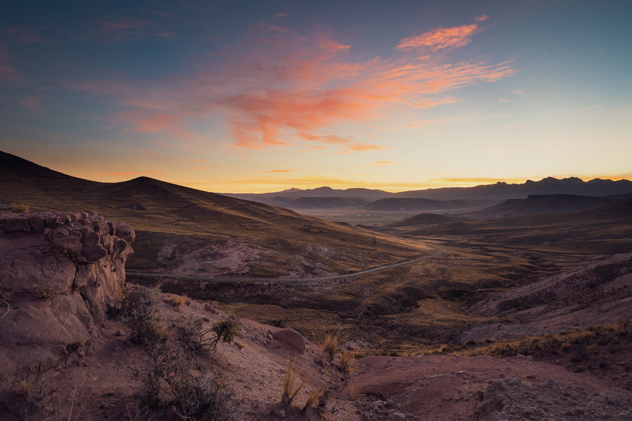
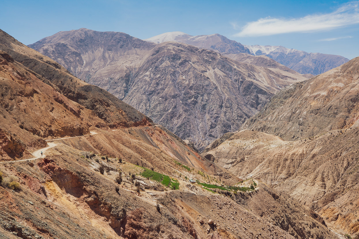
This leg of the ride turned out to be everything we’d hoped for, and more, as it traversed some of the most sparsely populated country we’ve crossed in Peru. The landscapes have been stunning, combining barren – at times seeming infinite – puna (tussocklands) and the arid northern limit of the Atacama Desert with the rawness of a land ravaged by volcanic eruptions. We climbed a 5400m volcano and then descended into one of the deepest – and most infrequently visited – canyons in Peru, only to have to inch our way back out again. But while we discover a huge satisfaction in experiencing these landscapes under our own power, some of the most rewarding moments have been the interactions with locals, most of whom have rarely, or never, seen gringos in their village or district.
In morphing our initial ride from Arequipa to Copacabana into a complete loop, we reckon we’ve mapped out quite a classic, especially for its topographic and cultural diversity. The south west of Peru has very low rainfall, compared to the mountains to the north and east, making it a great area to ride in during the wet season. And usefully, either the northern or southern ‘leg’ of this route makes a convenient connector from the Cones & Canyons bikepacking route to Bolivia’s Cordillera Real (Ruta de las Tres Cordilleras), or vice versa. Here’s the full route, or see maps at the end of the post.
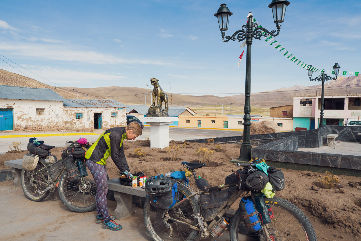
A couple of hours of quiet paved road carried us away from Desaguadero and then we turned off onto a good dirt road, headed for the Zona Reservada Aymara-Lupaca – an altiplano border region of open puna, craggy hills and scattered farming communities.
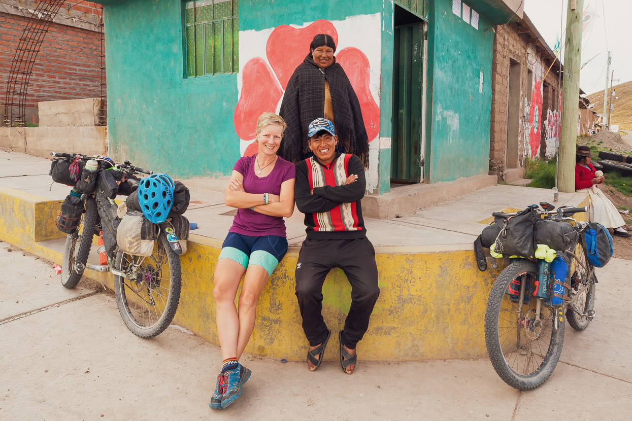
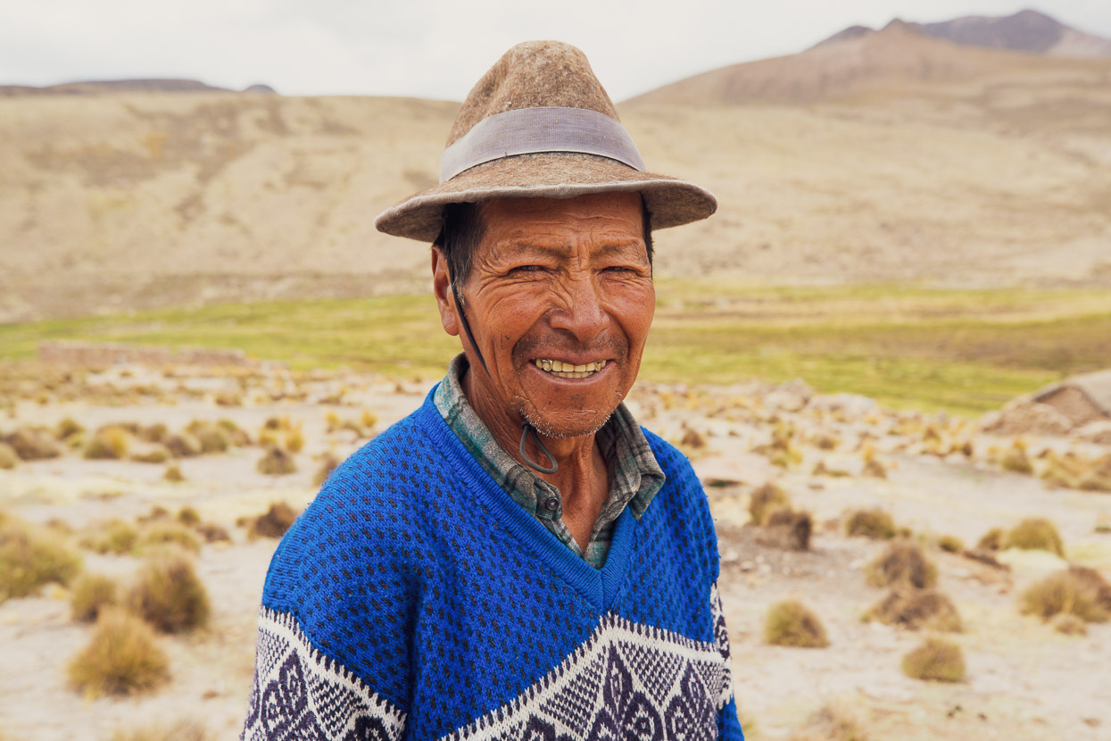
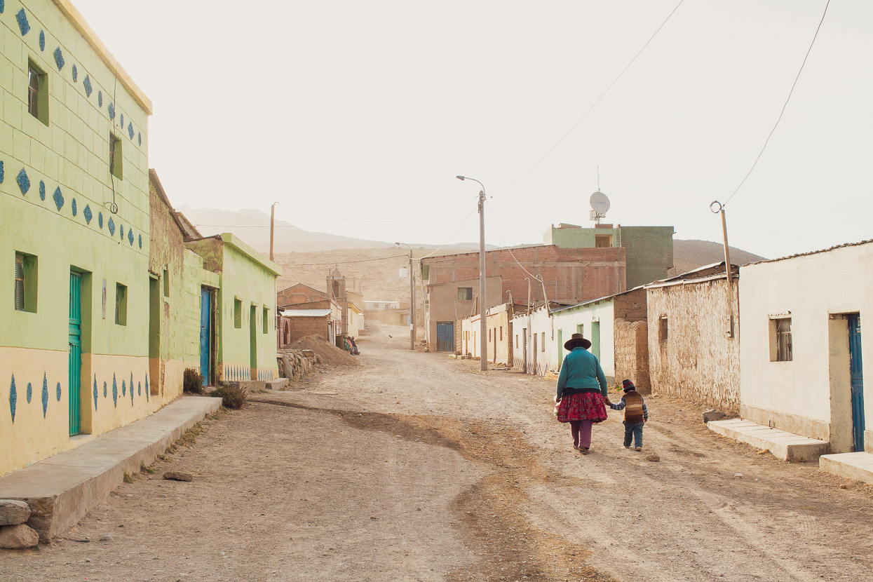
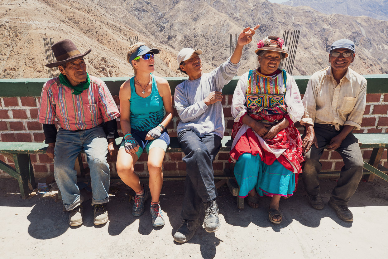
A stop in a small village to grab a few supplies from the tienda turns into a half hour of laughs with the locals, and the usual volley of questions. These people could only remember one other cyclist passing through, Chile-bound.
We camped that night on a ridge overlooking the following day’s route and cooked a basic meal of quinoa soup, with some eggs we picked up in the last village.
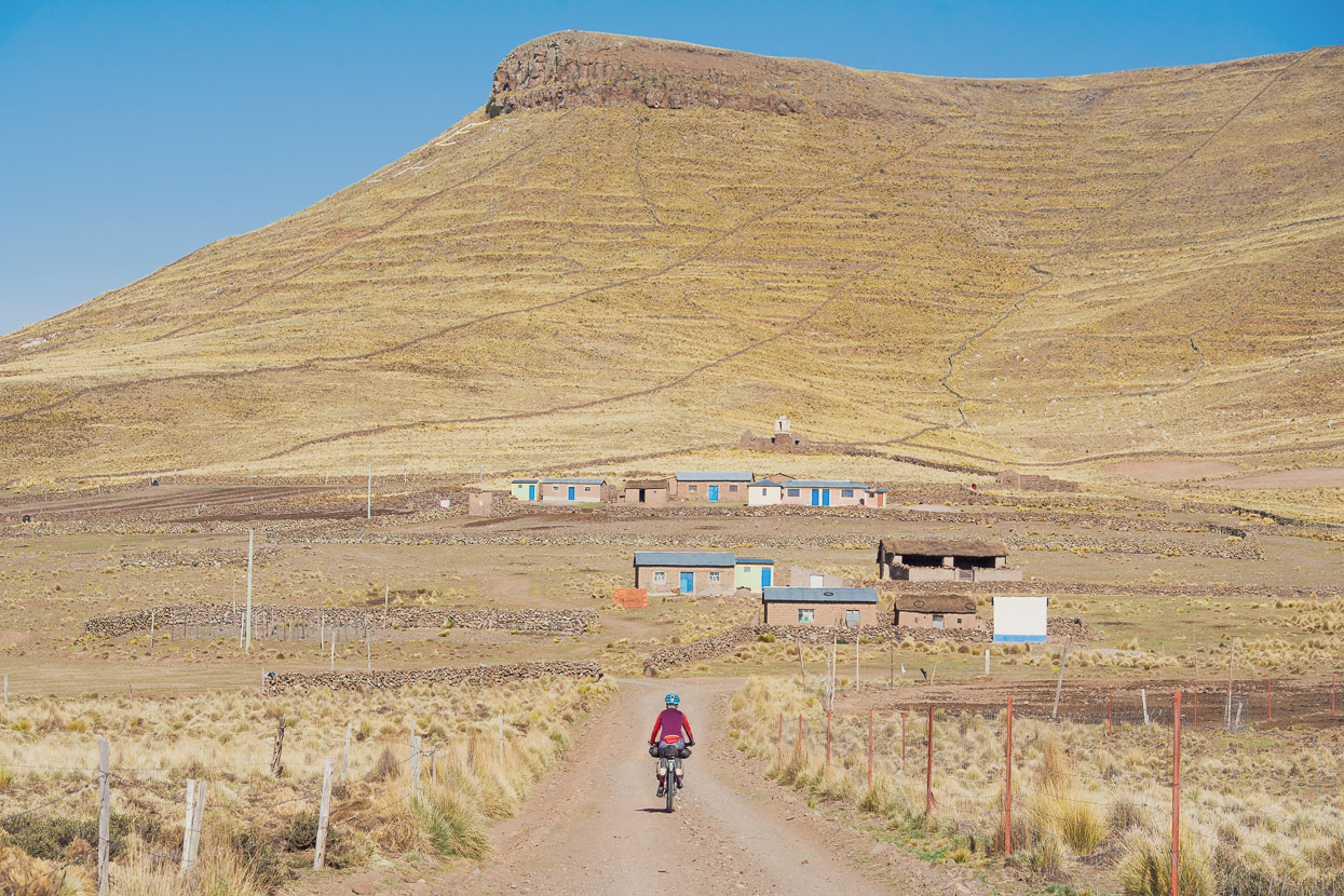
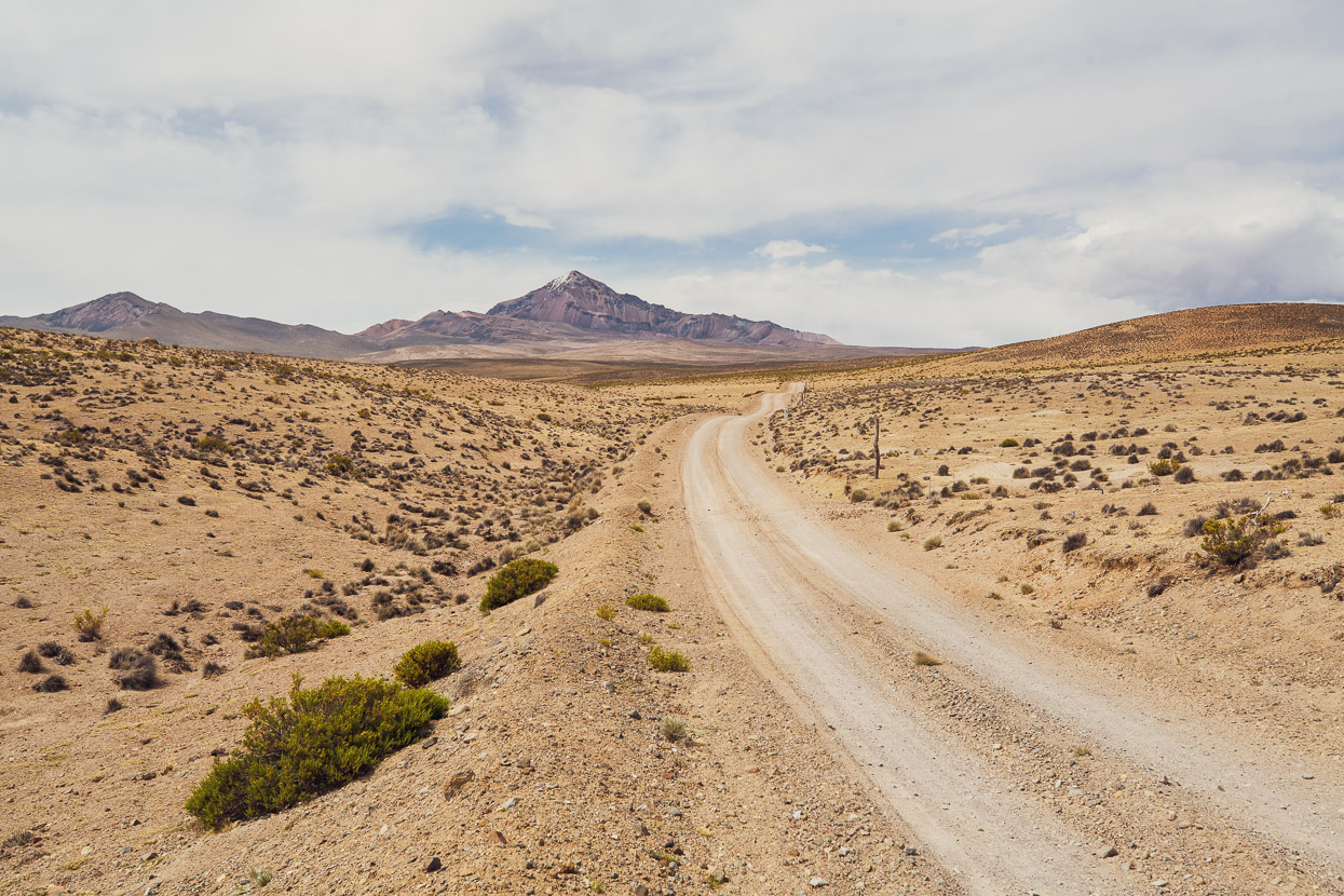
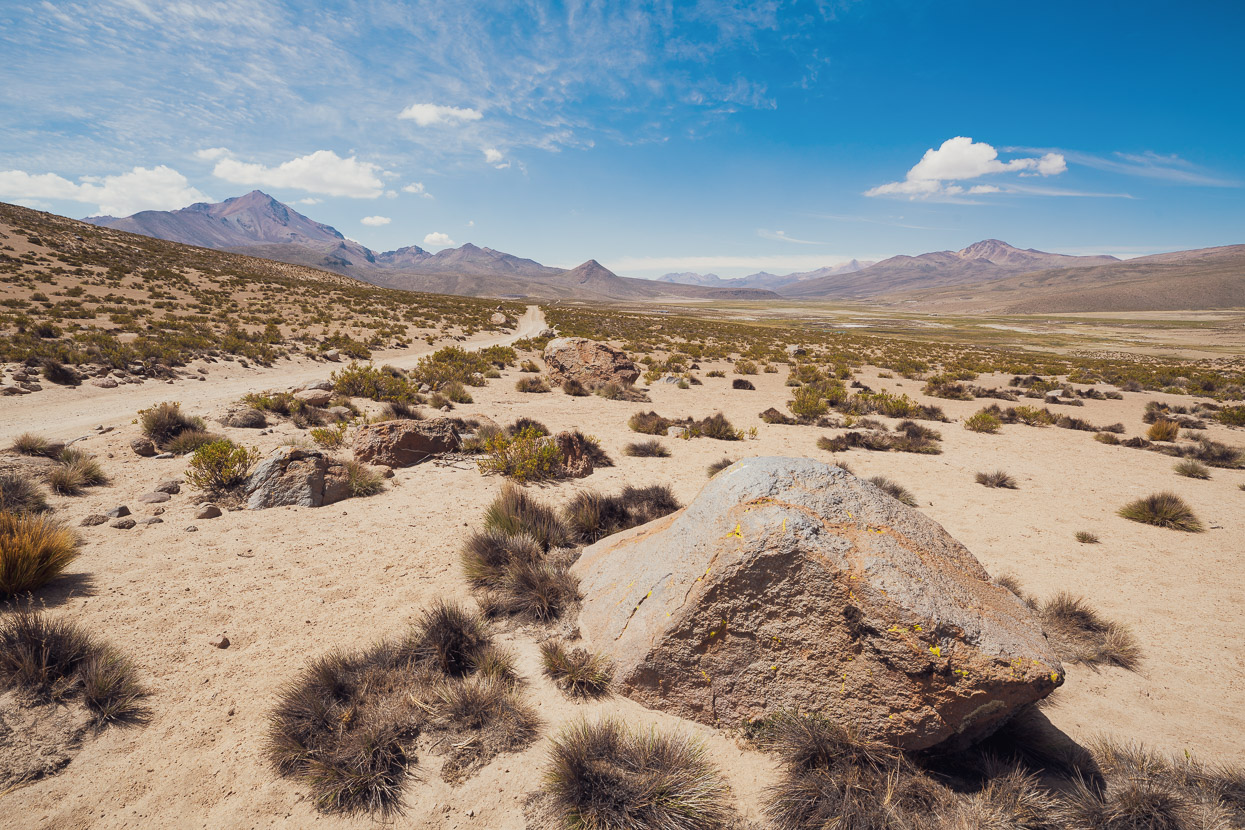
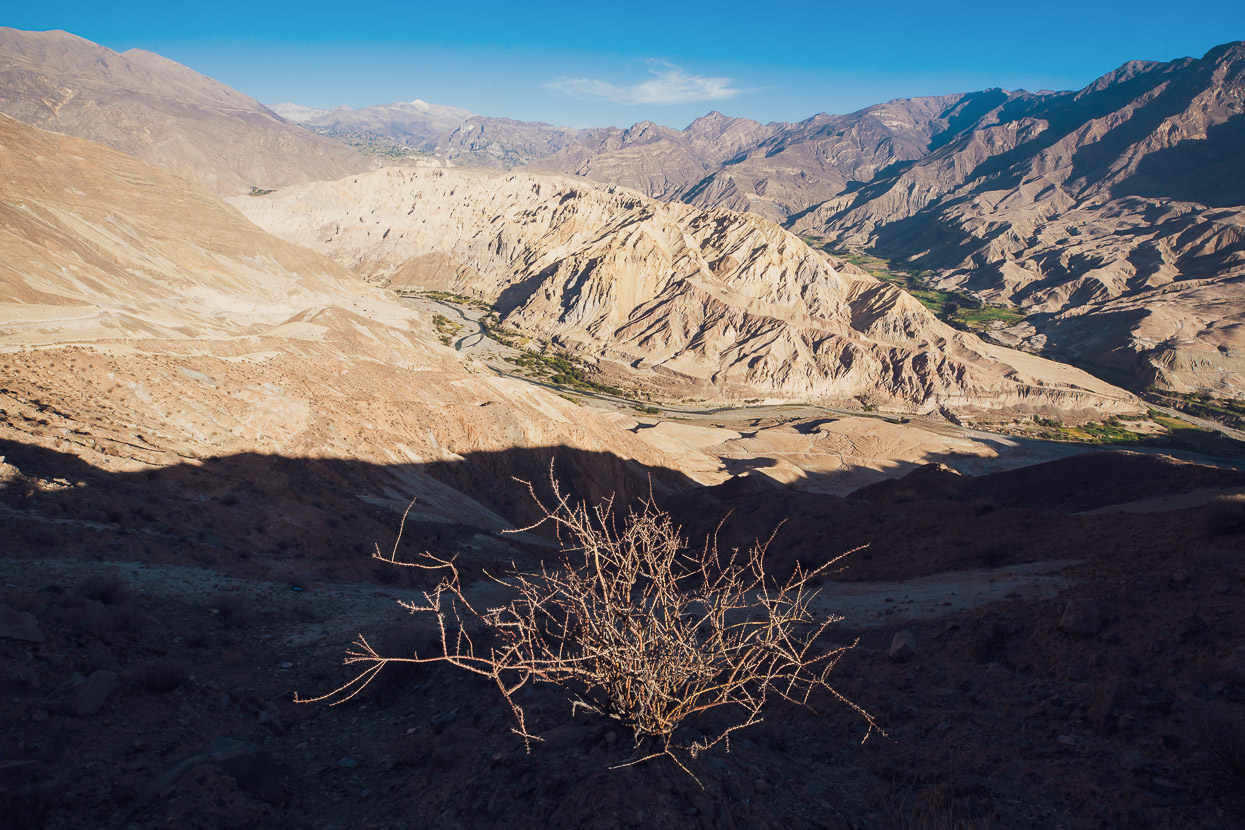
A beautiful, calm morning followed, the crunch of the gravel under our tyres interrupted only once or twice by a passing motorbike. We rarely saw any other other traffic. The surrounding hills were decorated with kilometres upon kilometres of ancient stonewalls.
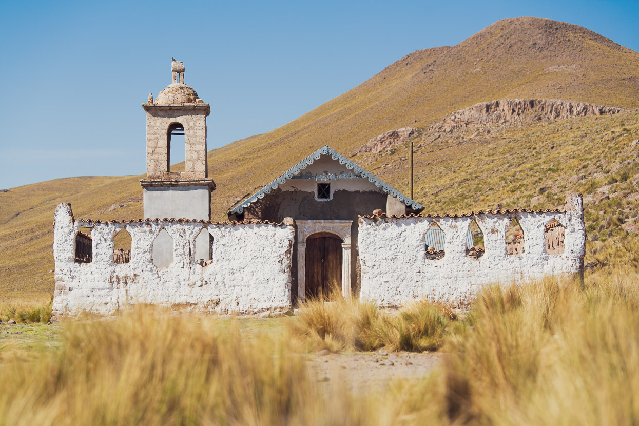
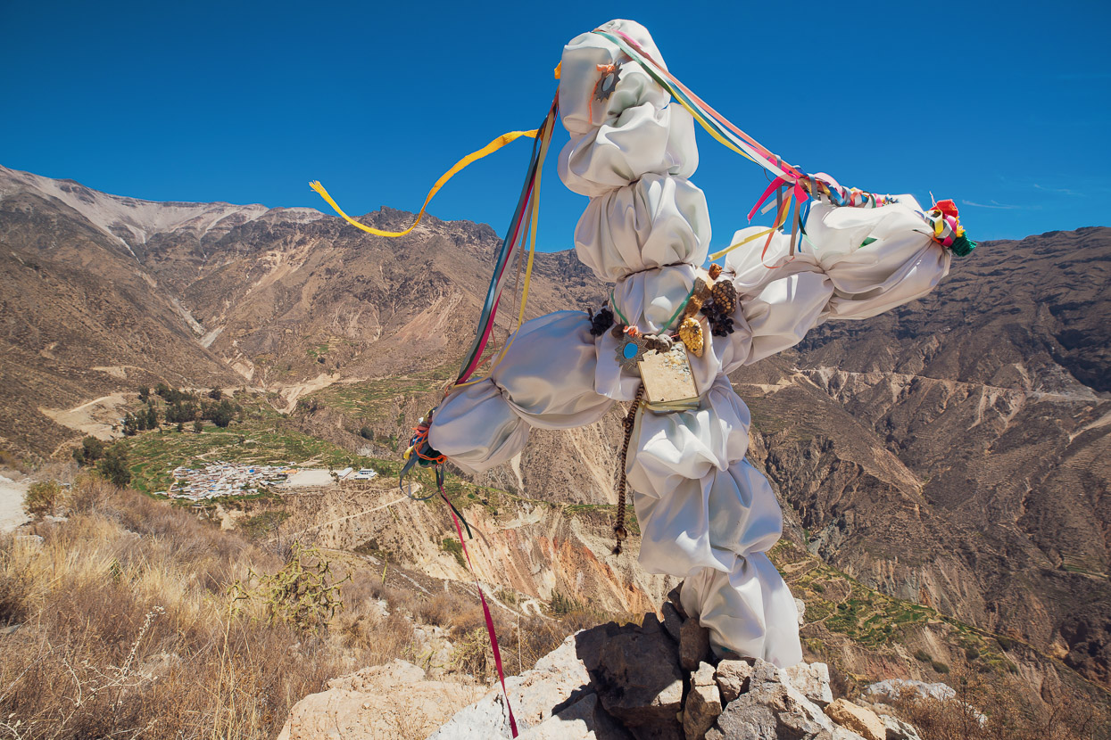
A well preserved historic church stood alone in the tussock, while over the road all that remained of the village that once stood here were a few crumbling stone buildings.
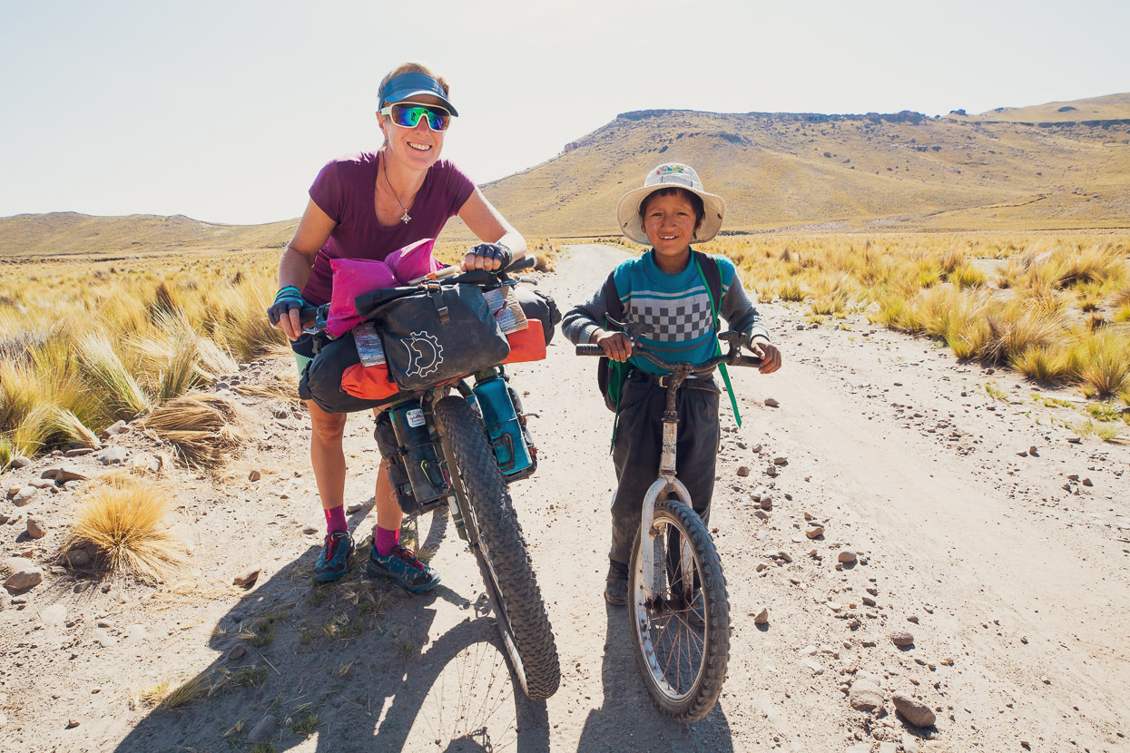
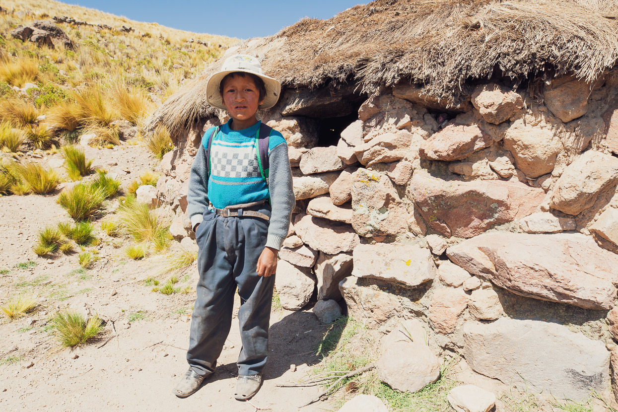
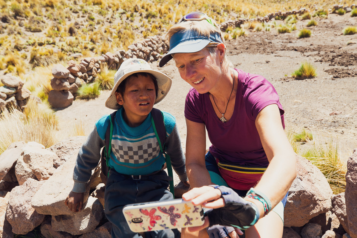
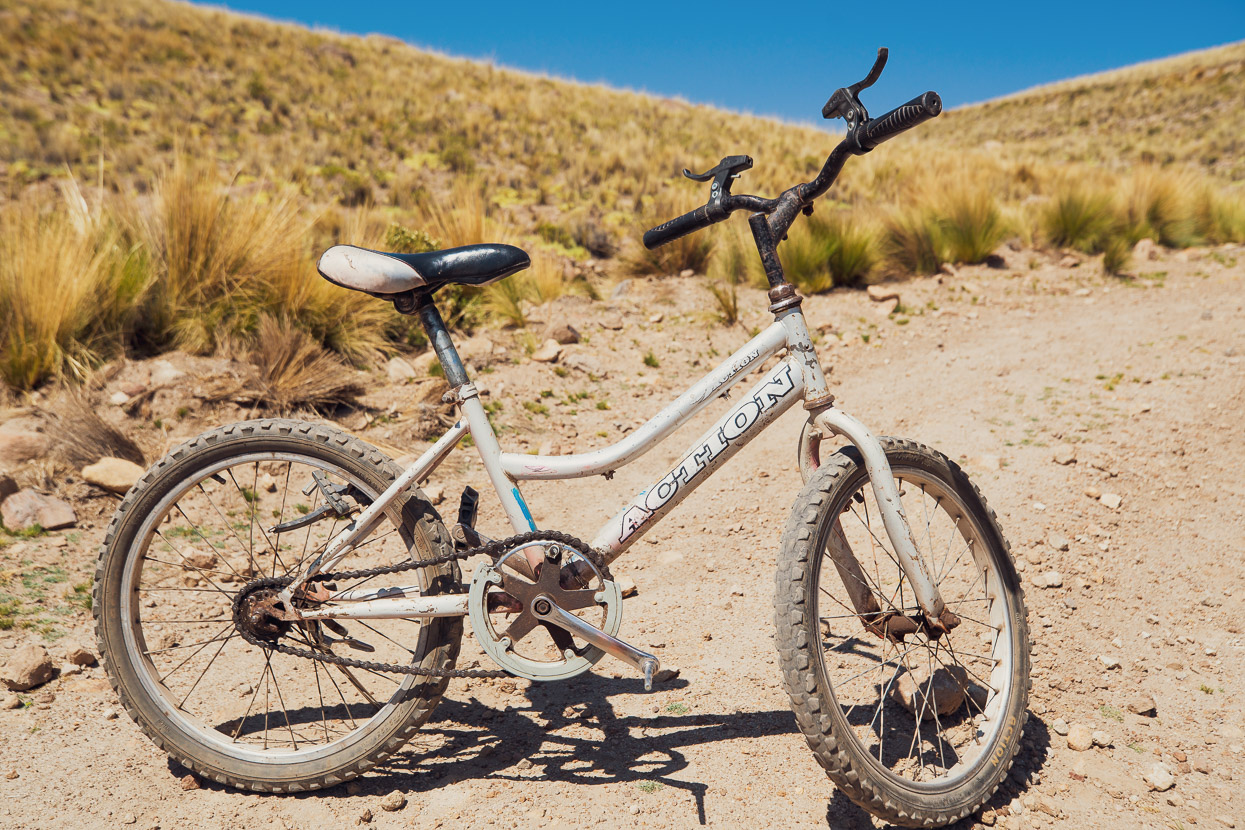
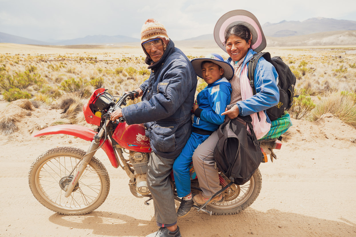
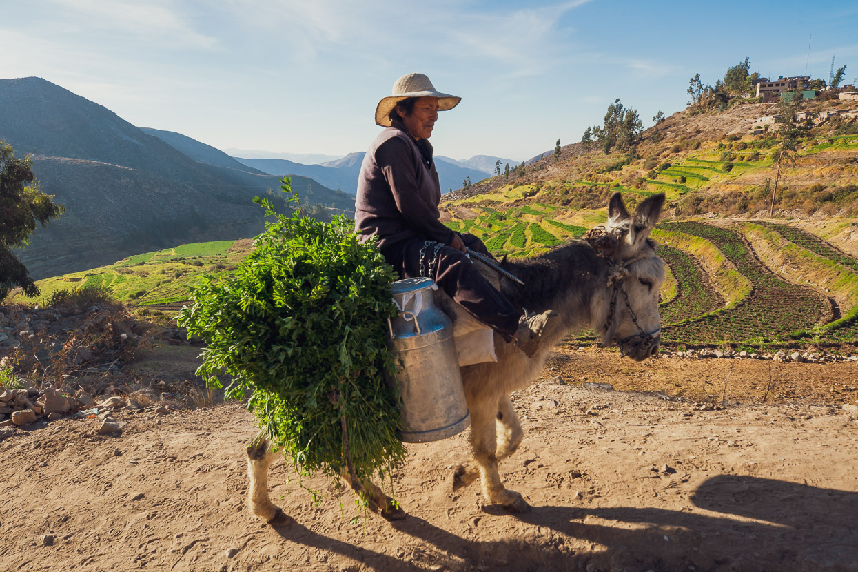
We were just getting back on our bikes when a small figure on a bicycle appeared round the corner and rode up to us. José was on his way home from a distant town to his family’s remote farming casita where he lived with his dad and grandparents. Twice a week he makes this five hour ride, alone, on a beat up old single speed bike with no brakes and a very large gear. The ride’s not flat either, with a good 400m of climbing after it leaves the plain.
José rode with us up the climb – schoolbag on his back – easily keeping pace as he turned over his massive gear, while chatting away to us. Tour de France potential there for sure!
The first real pass of our southern leg, a long and mostly gentle climb to 4590m.
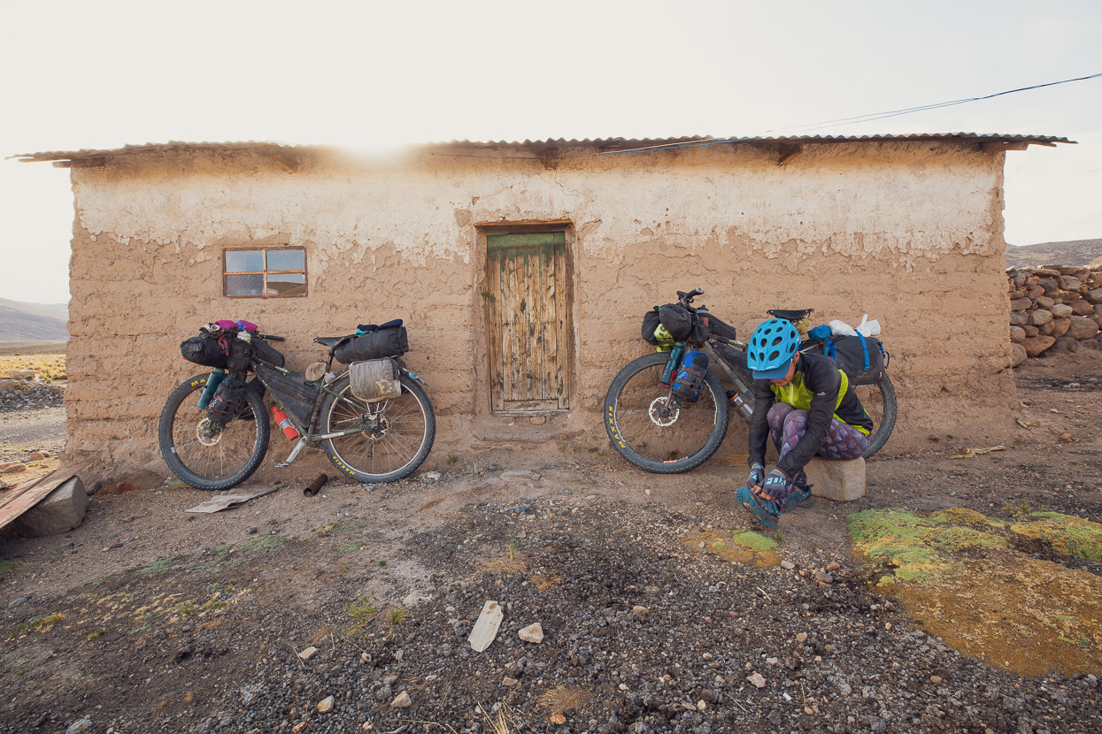
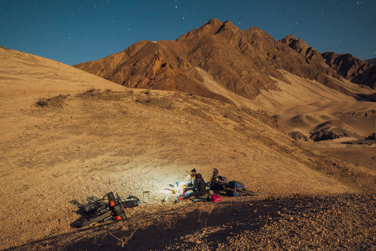
We dropped down the long and dusty descent, stopping in Tupala to pick up some snacks from the solitary tienda, and then eventually joined a paved highway that climbed gradually to the next pass. While mornings are blissfully calm and clear in this part of the world, afternoons are windy, and we battled a headwind for a couple of hours of slow progress. With a thunderstorm looming and darkness not too far off, we picked one of the bare bones settlements scattered along the road and pedalled into a compound to ask for somewhere sheltered to sleep.
The family was butchering an alpaca, and a man, hands bloodied, came out and greeted us. At first he pointed us to a corner of the compound, littered with broken glass and alpaca shit and said we could camp there. But then his mother came out and interjected – pointing up the road to a distant adobe hut.
‘You can sleep in there’, she said, ushering her boys to show us the way. On motorbike and bicycle the kids took us up the road, leading us to an empty casita, and the nearby pila, for water.
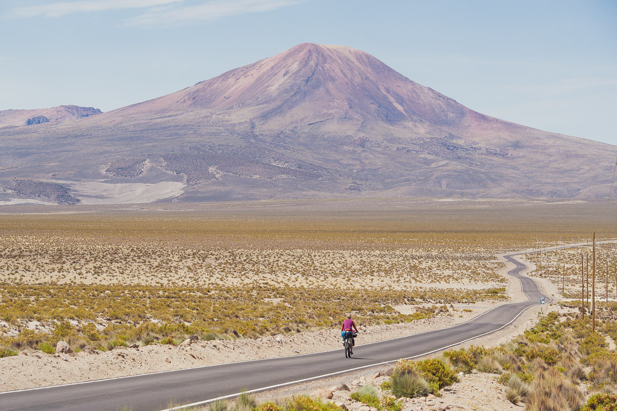
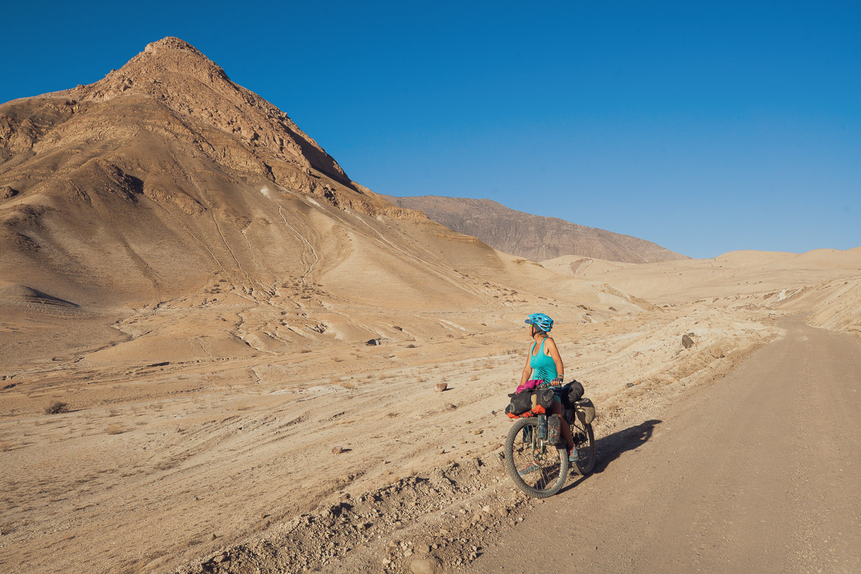
The following morning we crested the pass on the practically deserted, narrow highway, and passed through Capaso, where we found enough food in the basic tienda to resupply for two days. The road then led on, past a military base into a stunning volcano-ringed desert basin – the curvaceous cone of Antajave (5390m) dead ahead. We were alone on the road, on the calmest of mornings, warm and windless.
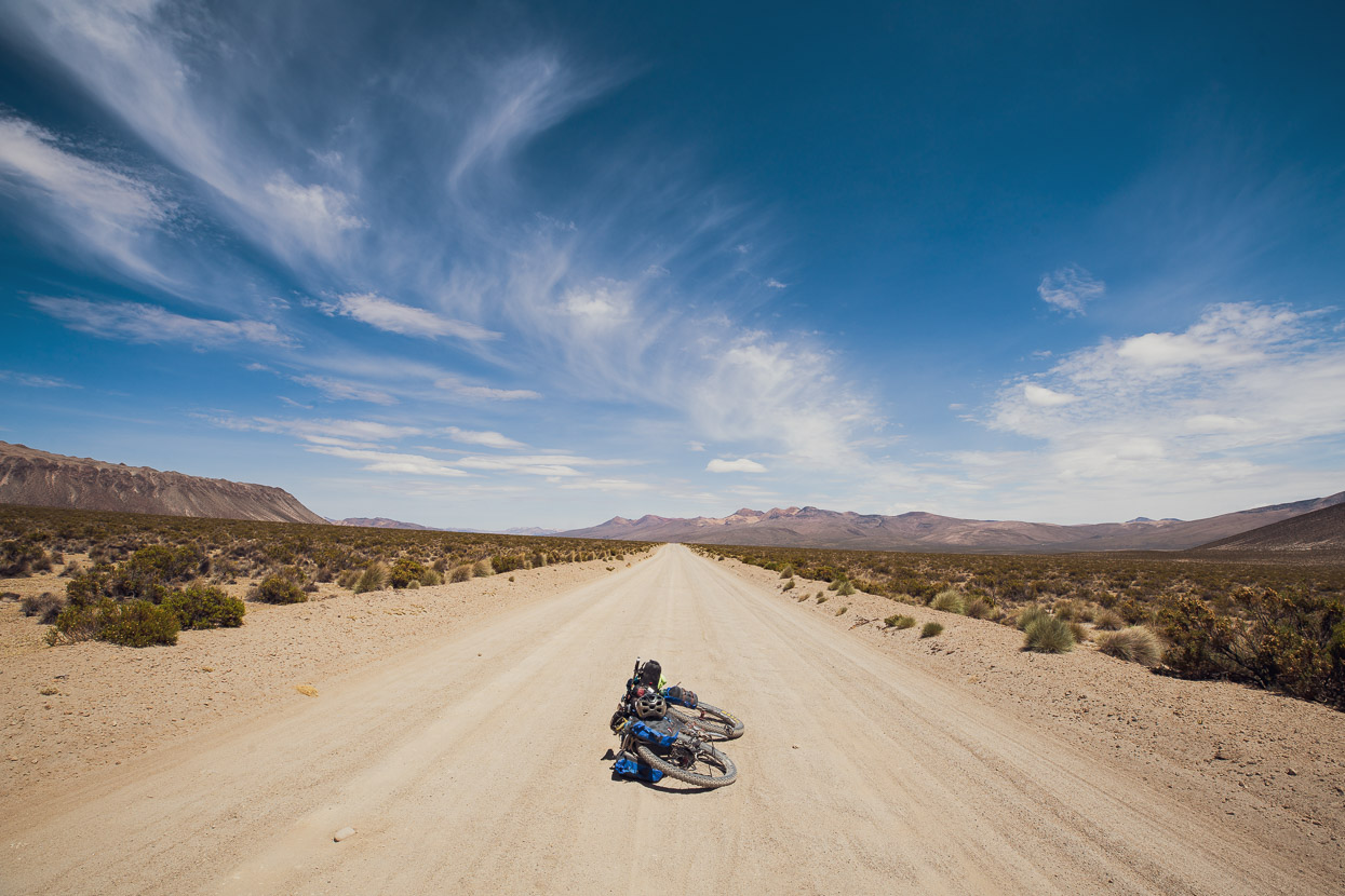
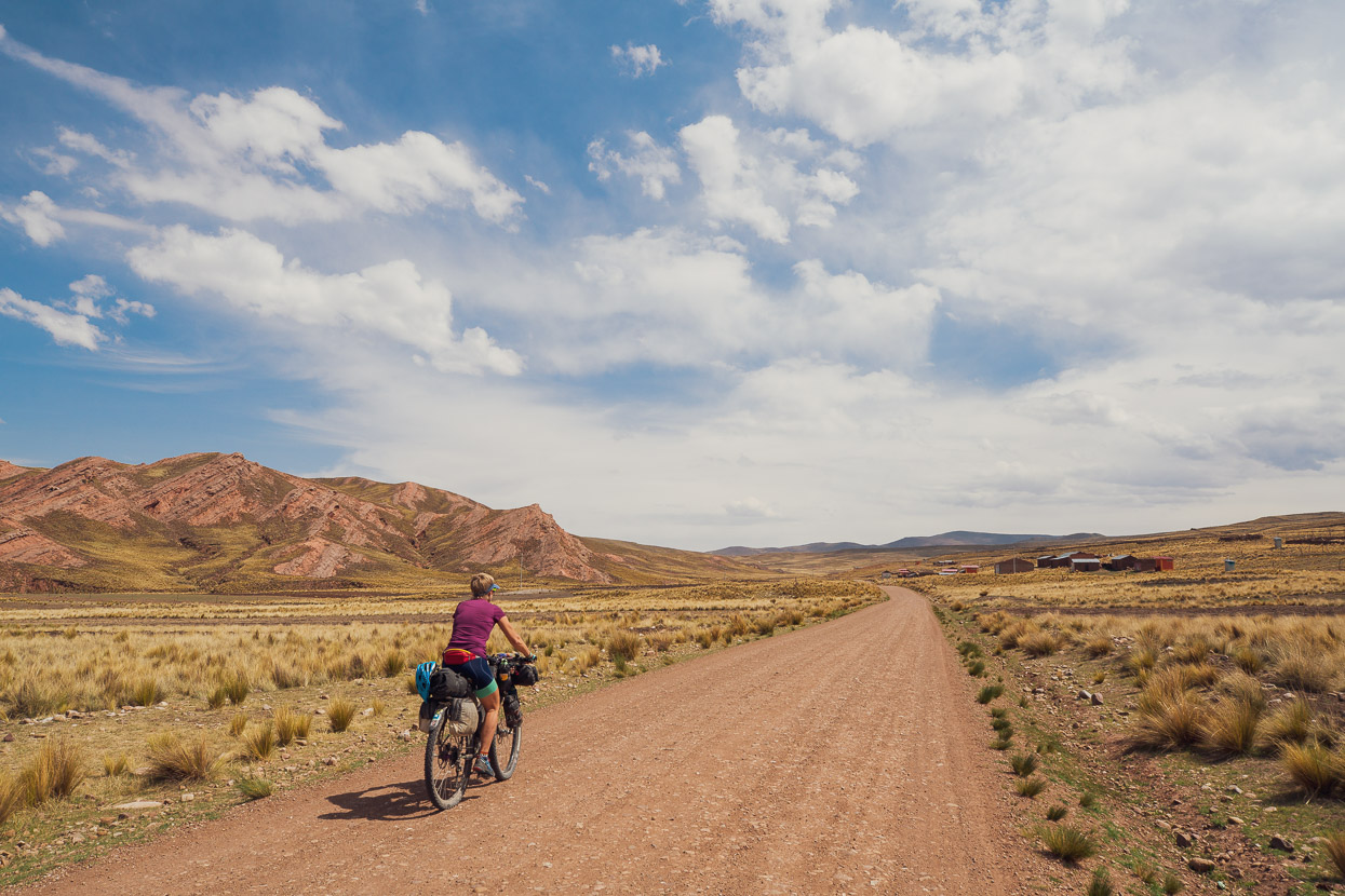
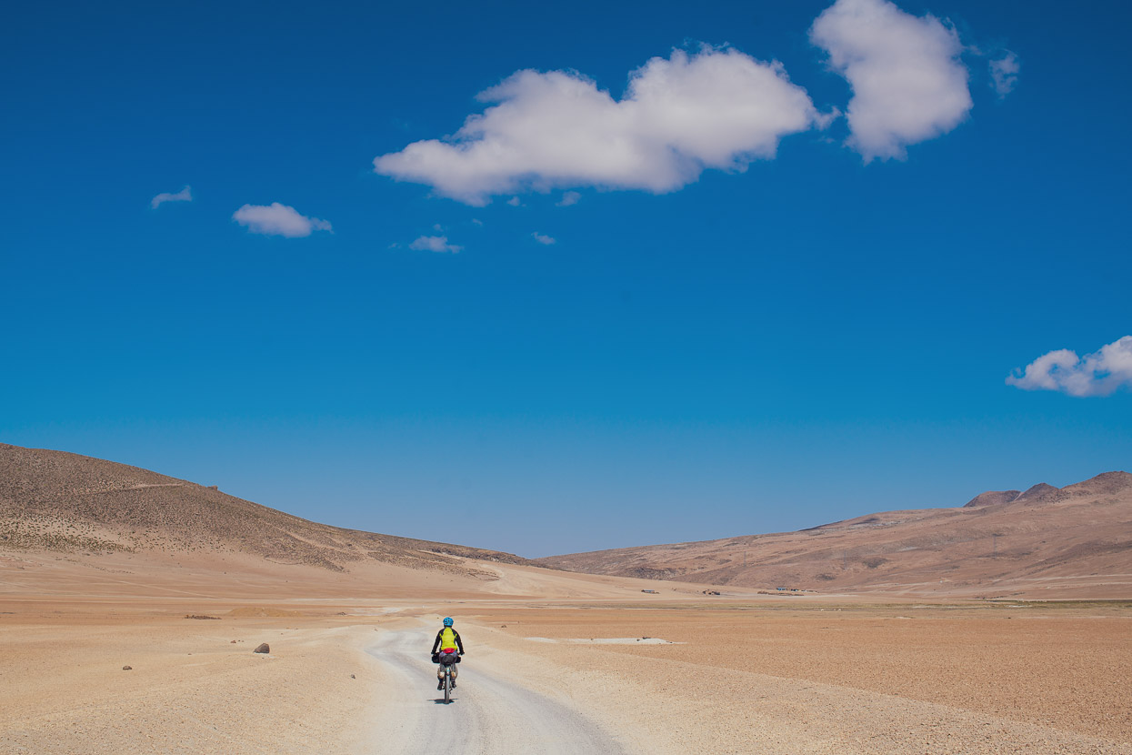
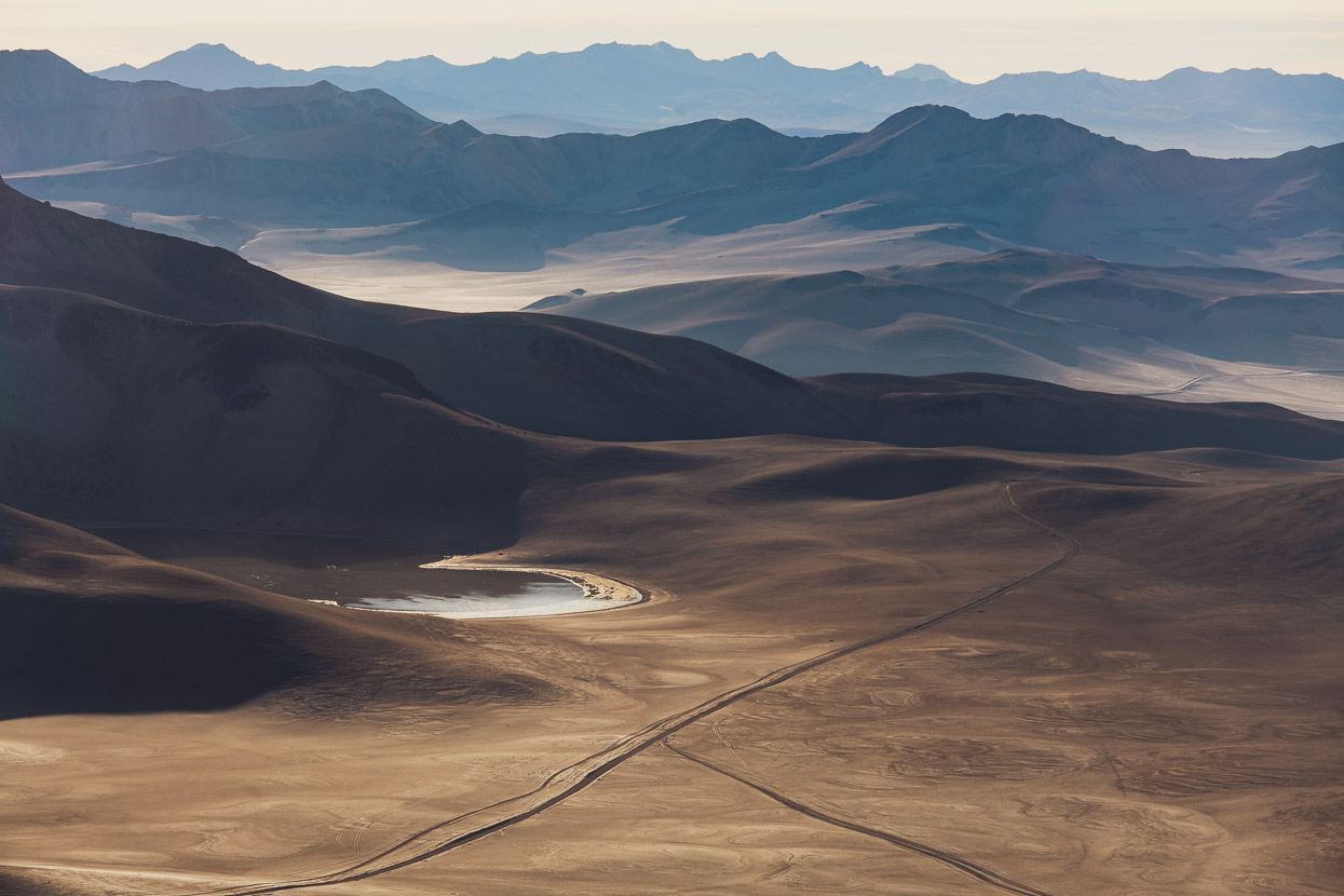
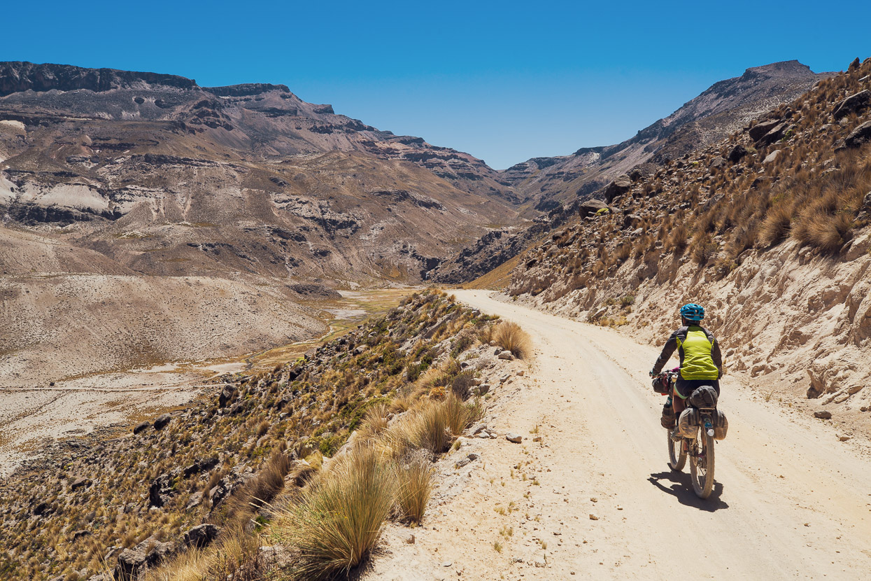
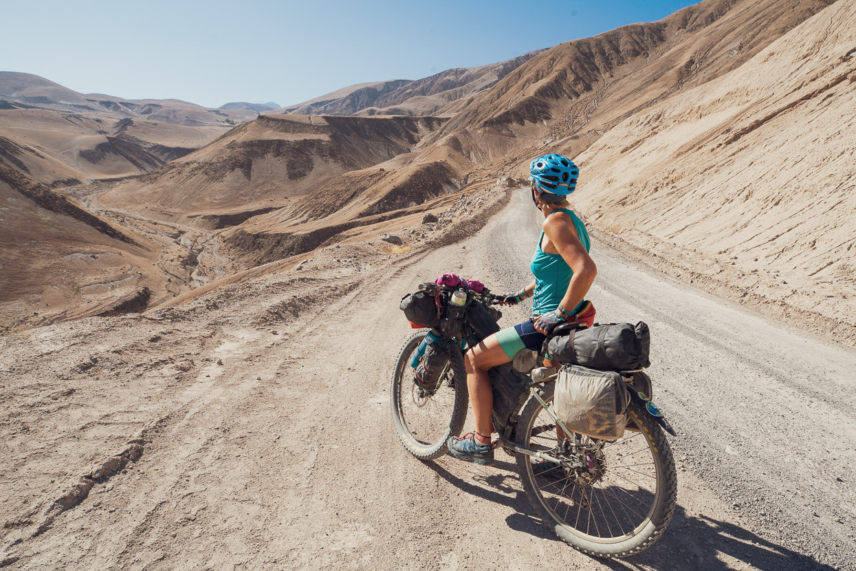
A right turn takes us into one of the remotest sections of the ride, headed towards Laguna Vilacota – an 80km section linking two paved roads. On this entire stretch we were passed by only two motorbikes. The road’s wide and well formed at first, but soon deteriorates to double track and sandy sections, making for some very nice back country riding.
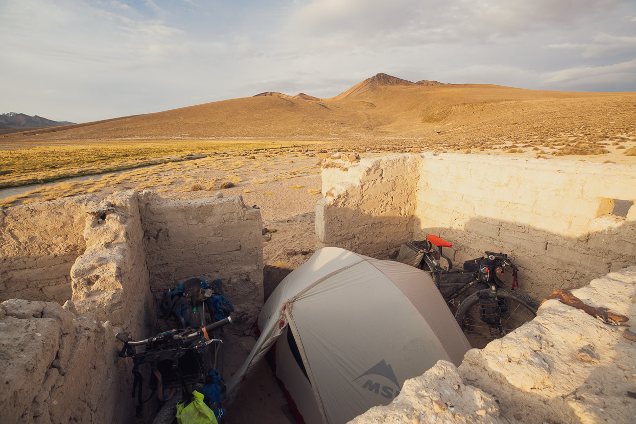
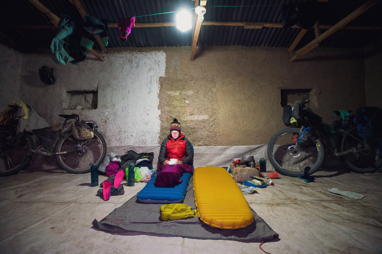
There’s scattered farming settlements along the route, but we saw few people. At Laguna Vilacota we stopped for the night and took shelter in an abandoned house, its crumbling mud brick walls making a good shelter from a vigorous wind.
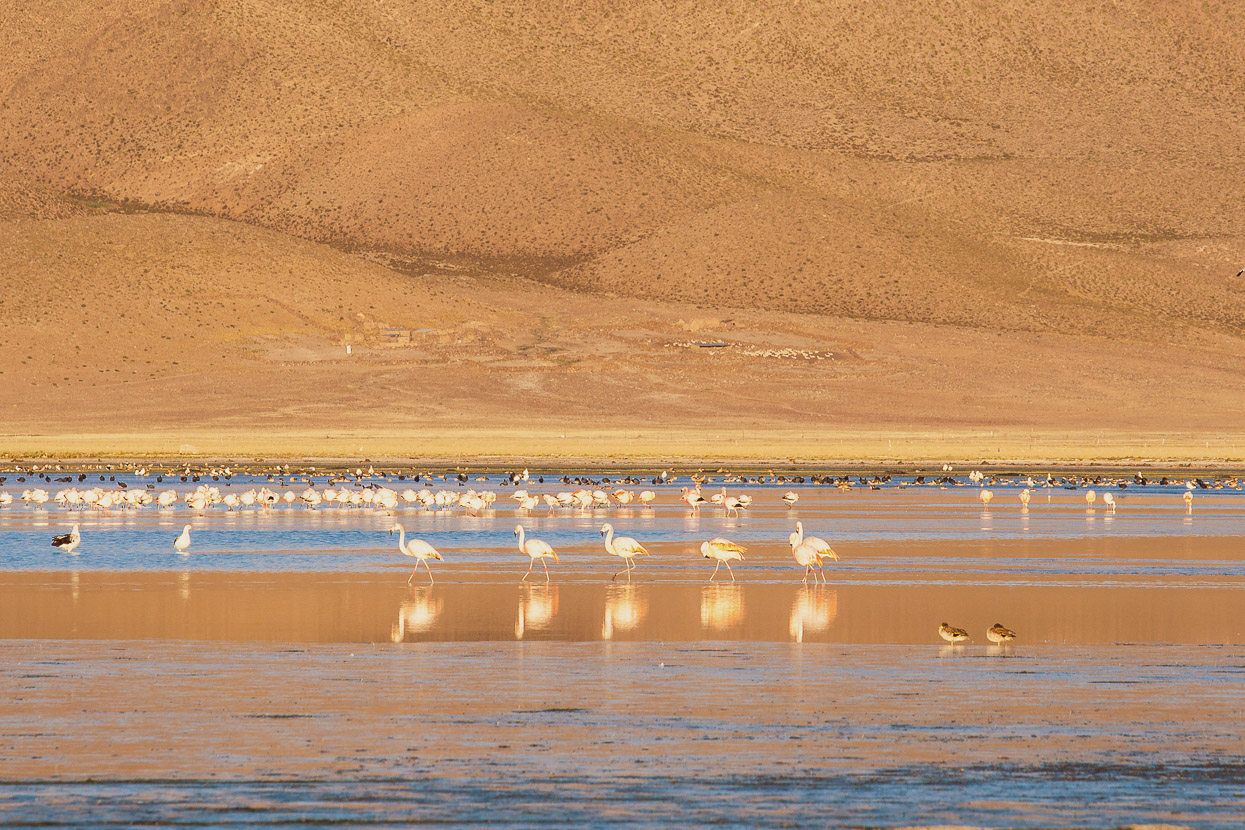
A conservation area, the laguna’s home to thousands of Andean flamingos. It’s not until these birds fly that you can catch a glimpse of the vivid pink beneath their wings.
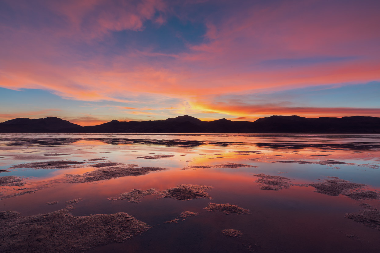
The wind dropped a little around dusk and we witnessed another mind blowing sunset. The light in this region is quite amazing.
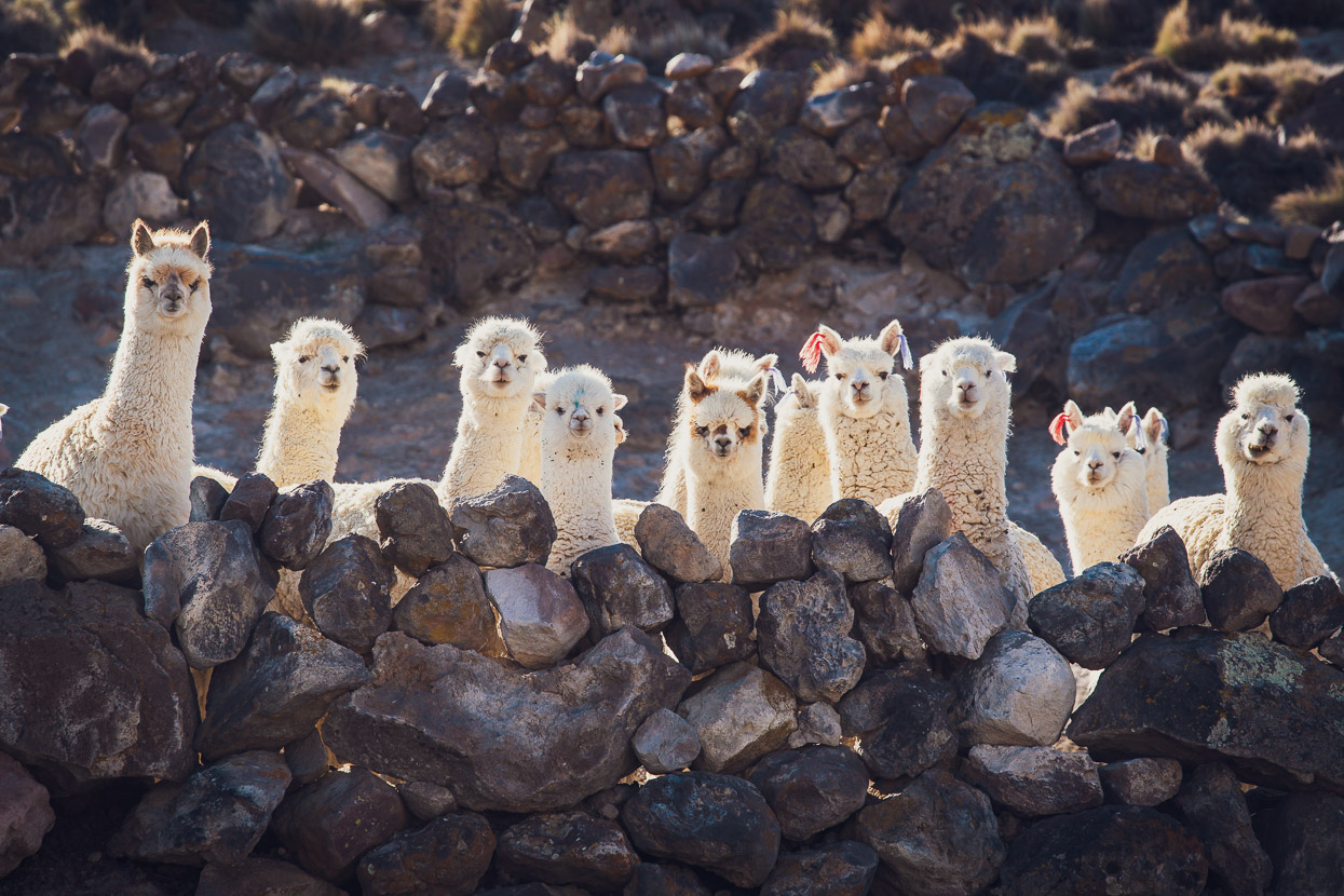
The alpacas here don’t see too many gringos.
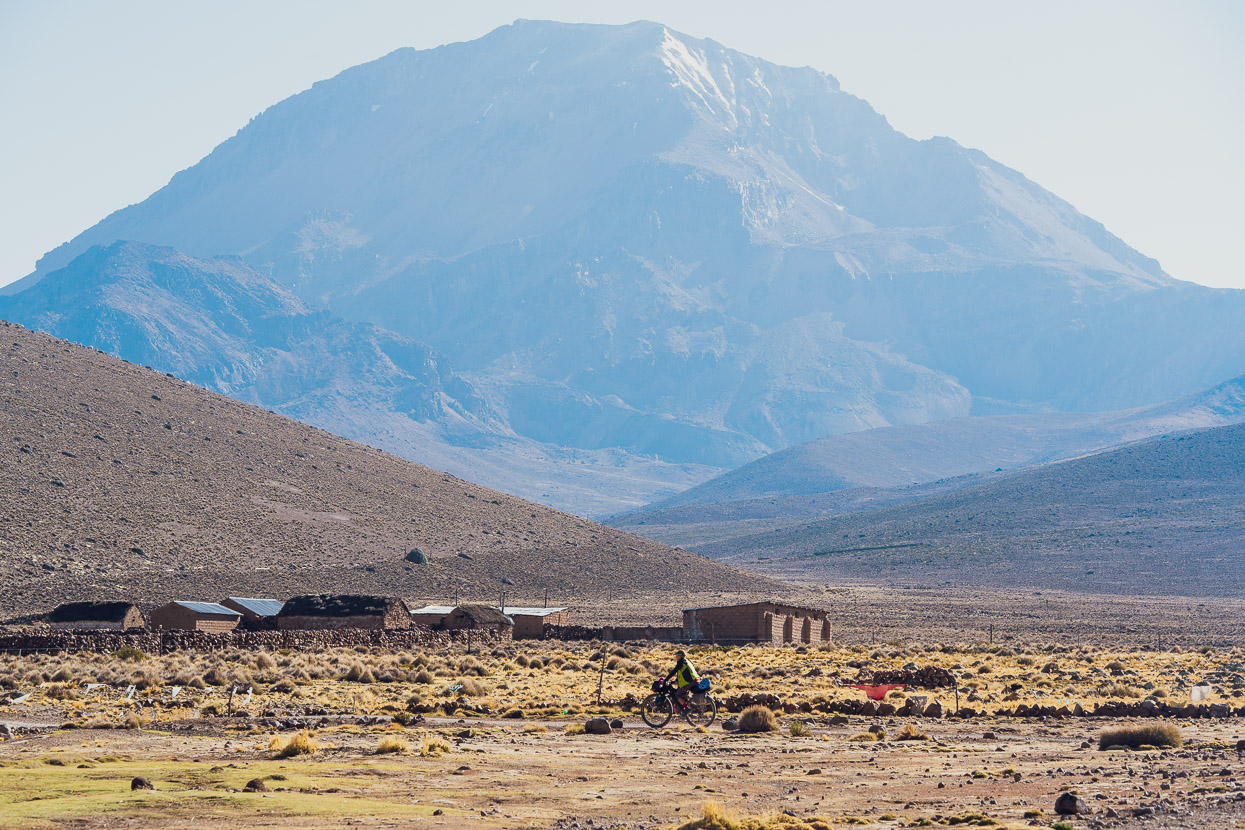
Soon after getting going in the morning we approached the pueblito of Vilacota, dwarfed by a 5580m peak in the background (unnamed on the map).
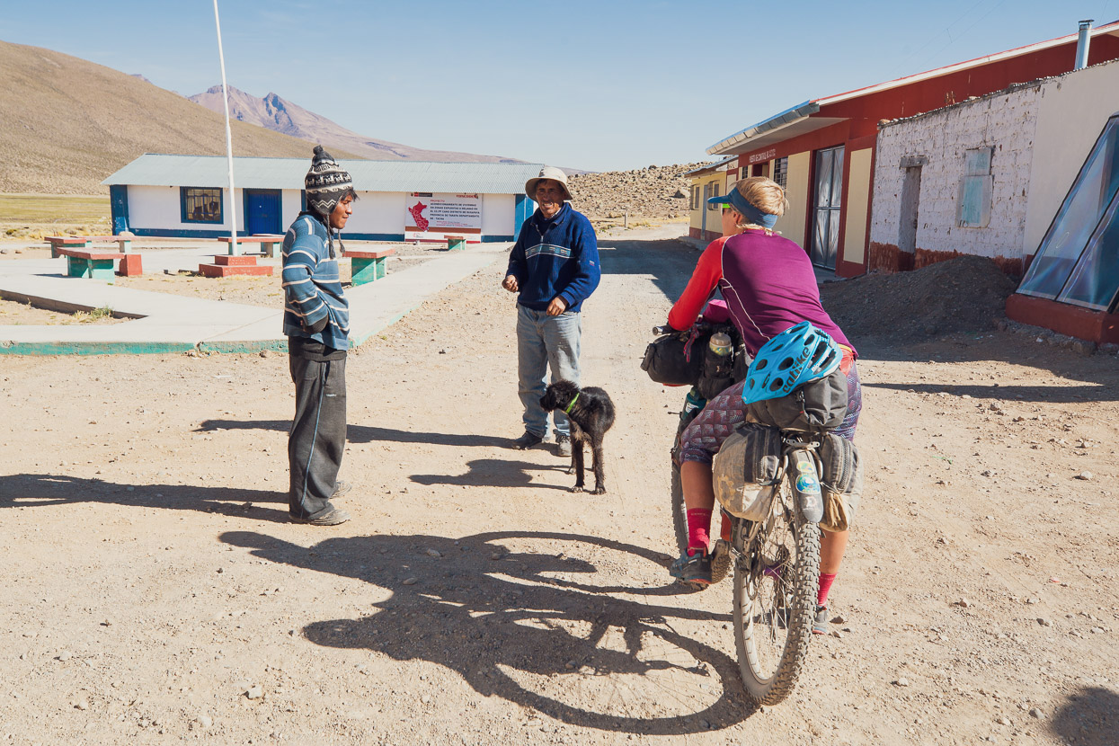
We were heard pedalling into town and some curious folk came out to say hello. We chatted for a while and they commented we were the first gringos they’d seen pass through here.
As we move on the riding and landscape just gets better and better, with narrow tracks and big views and a peacefulness worthy of the moniker given to it by the few inhabitants: El Silencio.
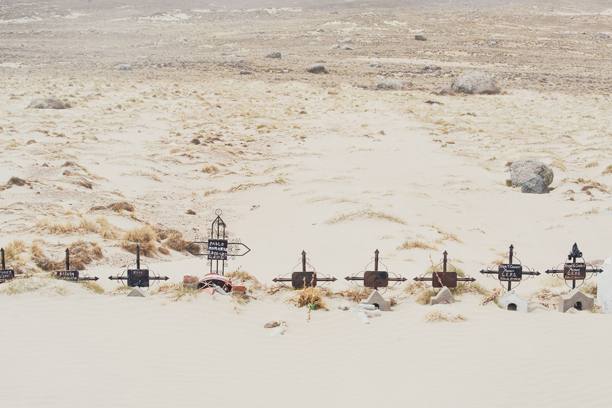
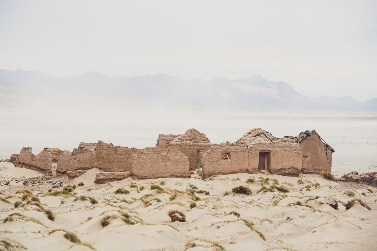
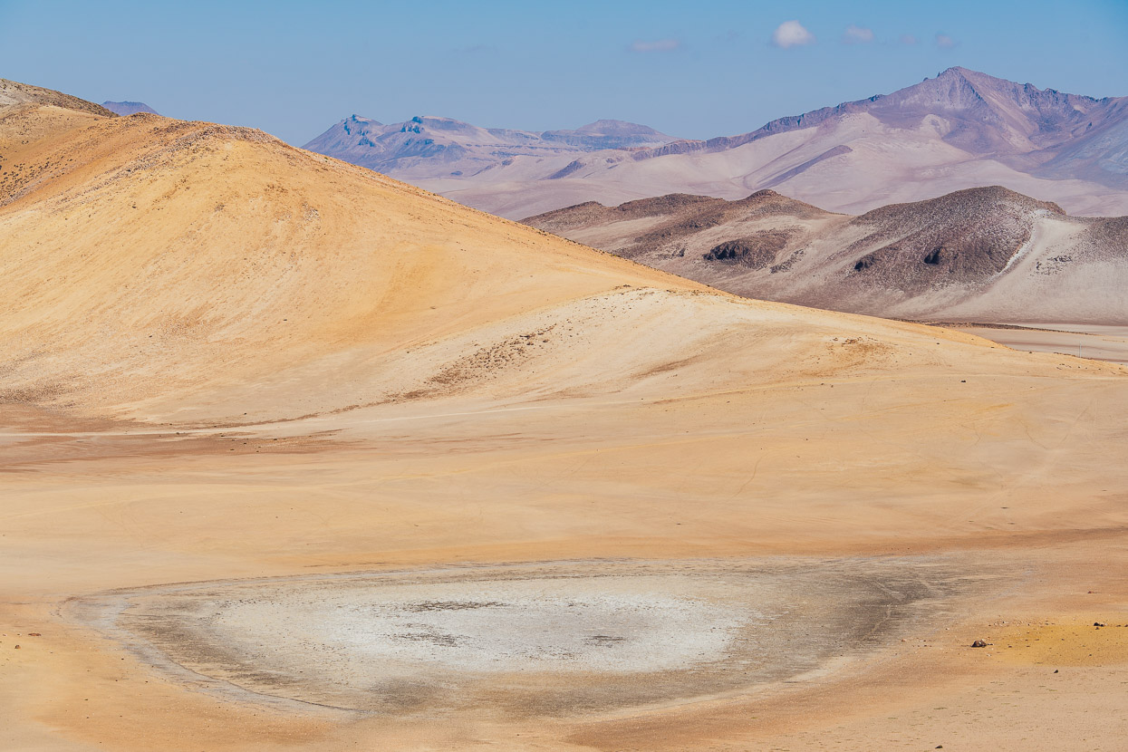
Battling a strong side- and head-wind on a lonely stretch of paved highway later in the day, we were expecting to see a laguna that was marked on the map. But in the distance all we could make out was tall waves of windborne sand being blown across the valley. The lake basin has completely desertified, and is slowly burying the remnants of a community that once farmed here.
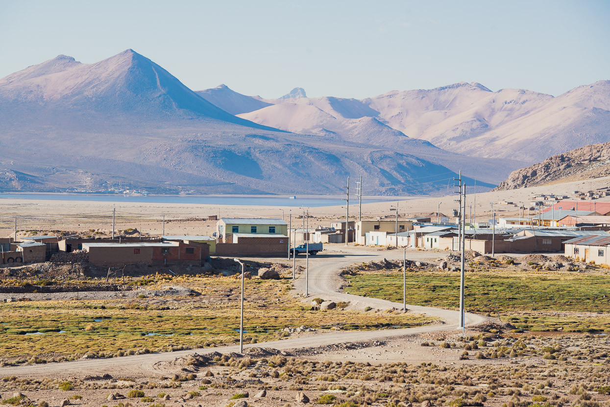
We escaped the sandstorm and rode on to the pueblito of Huaytire. People in the previous couple of villages had said there was an hospedaje and restaurant here, so we were cautiously looking forward to a bed and a feed after three nights camping.
The hospedaje was as basic as we expected, just a scruffy room with a couple of beds layered in thick blankets, and a filthy bathroom shared with the owner of the property. But we did get a hot shower. There’s no restaurant in town, but we managed to organise someone to cook us rice and eggs – although we’d faintly hoped for a meal slightly more elaborate.
You could call it a quiet sort of place.
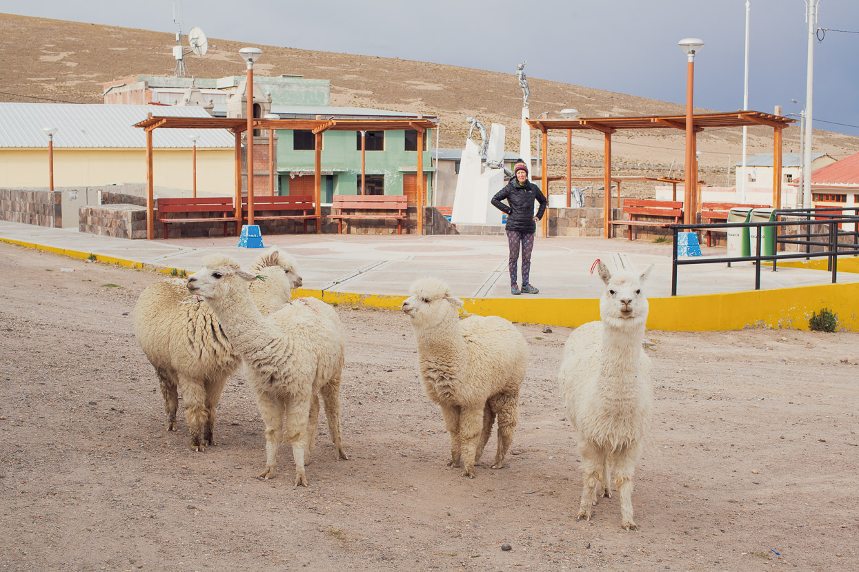
In fact there were more alpacas on the streets than people most of the time.
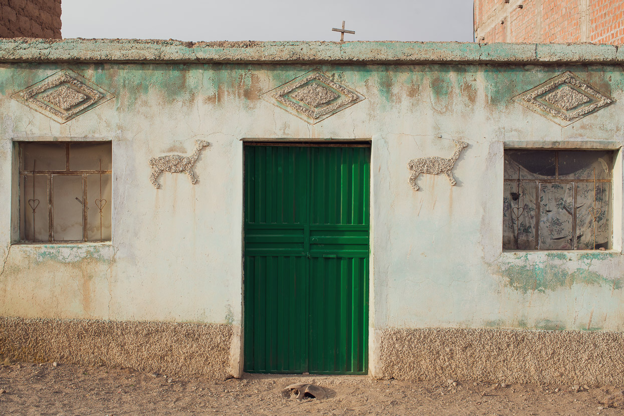
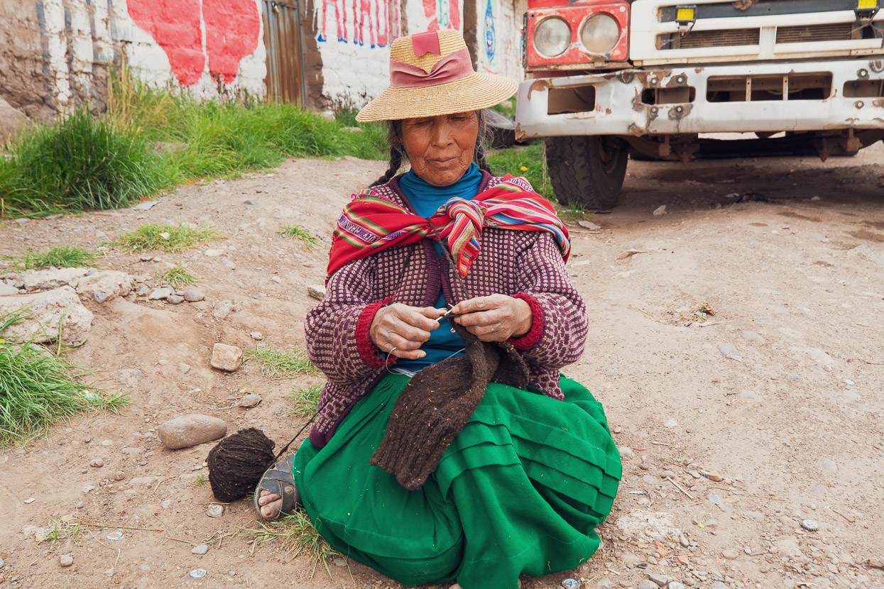
As is often the case in Peru’s villages, there seemed to be far more buildings than people to use them. Young people and some families having left for life in a city.
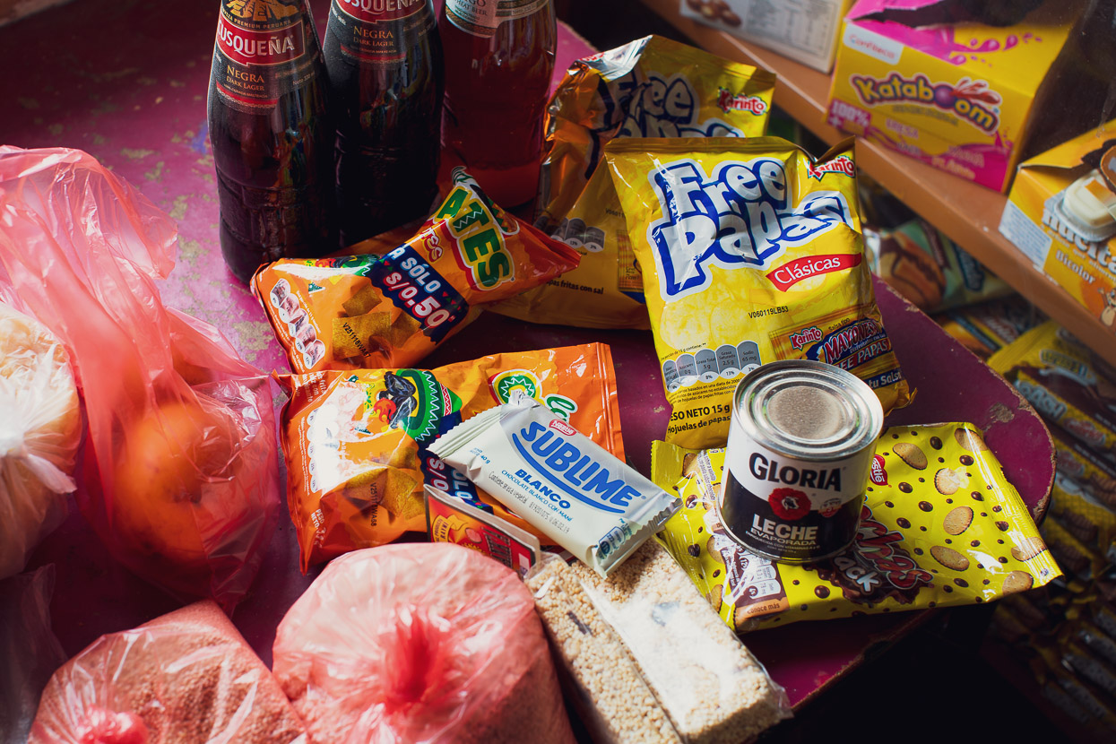
We scratched together food for a couple more days from the tienda. Quinoa for dinner, bread rolls and tuna for lunch and a host of mostly junk food for snacks.
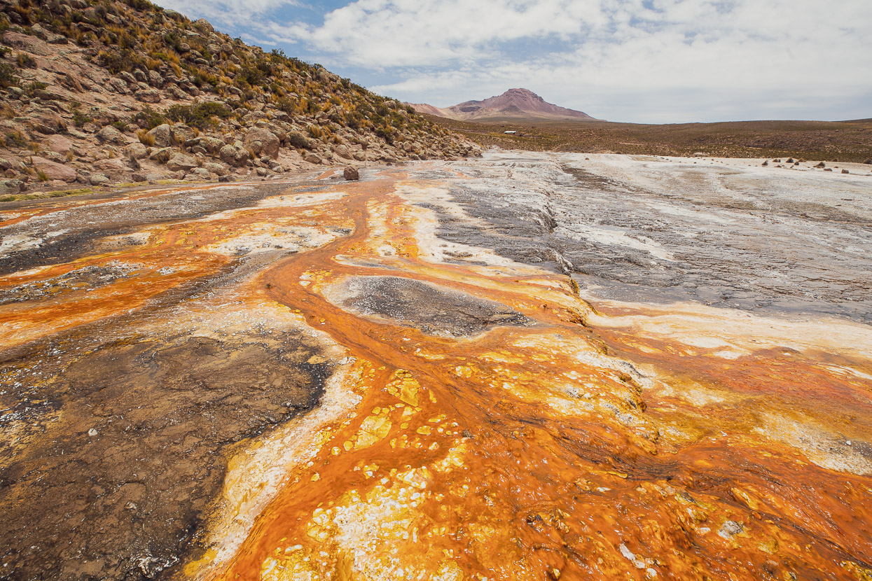
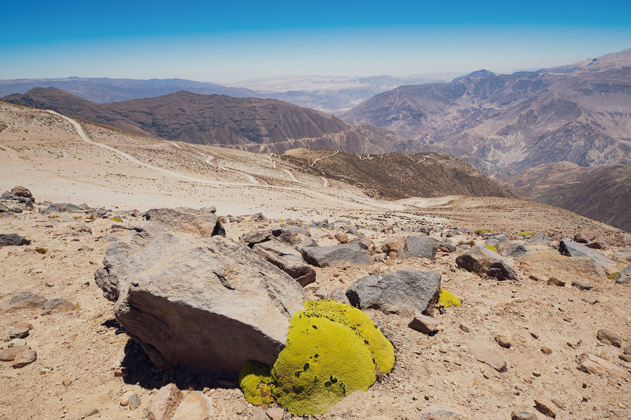
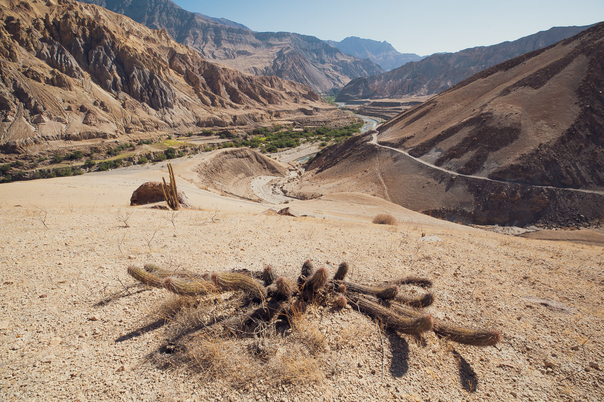
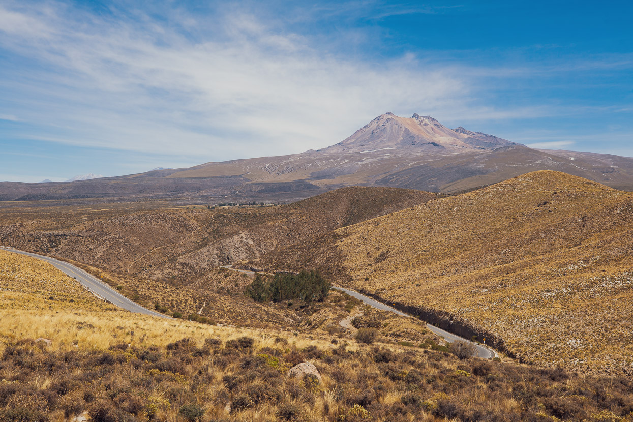
Early the next morning we crossed the Abra Huaytire (4762m) and then descended into an increasing Mars-like landscape. By now we were in the guts of Peru’s Central Volcanic zone, a long band of volcanoes that includes Volcan Ubinas which we’d passed close by on the east-bound leg. Relatively recent activity from Volcan Ticsani, to which we were headed, has covered the surrounding altiplano in a thick layer of tephra and pumice.
We descended into a big, pumice-filled basin and stopped at Umalso, a permanent camp that’s in place to monitor the city of Moquegua’s water supply (by dam and canal). We filled our bottles there with 24 hours-worth of water and headed on, climbing on dirt tracks towards Volcan Ticsani.
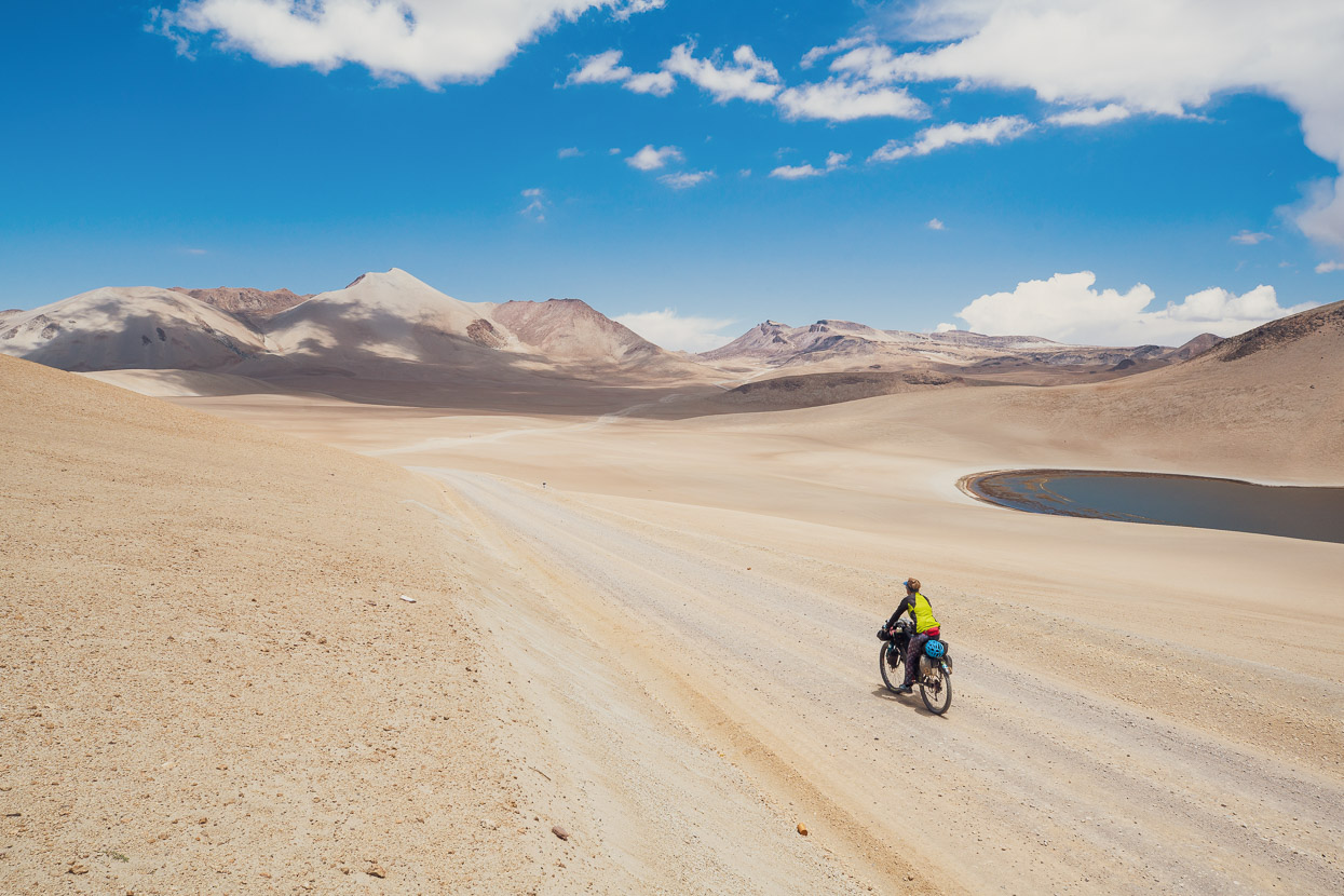
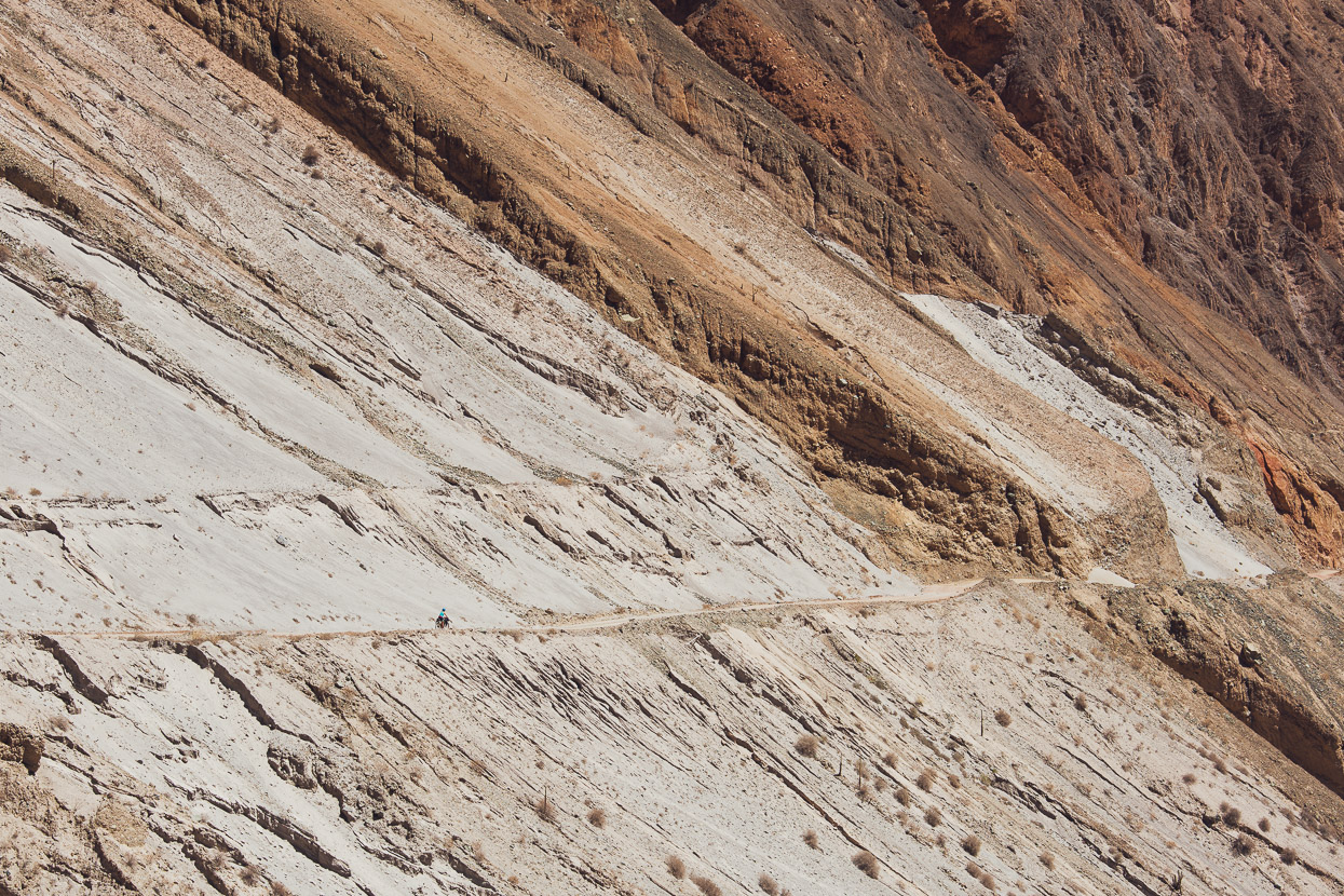
We crossed another saddle and dropped into an even more isolated, high altitude basin – our surroundings totally white with volcanic ash and pumice. A stunning place to ride.
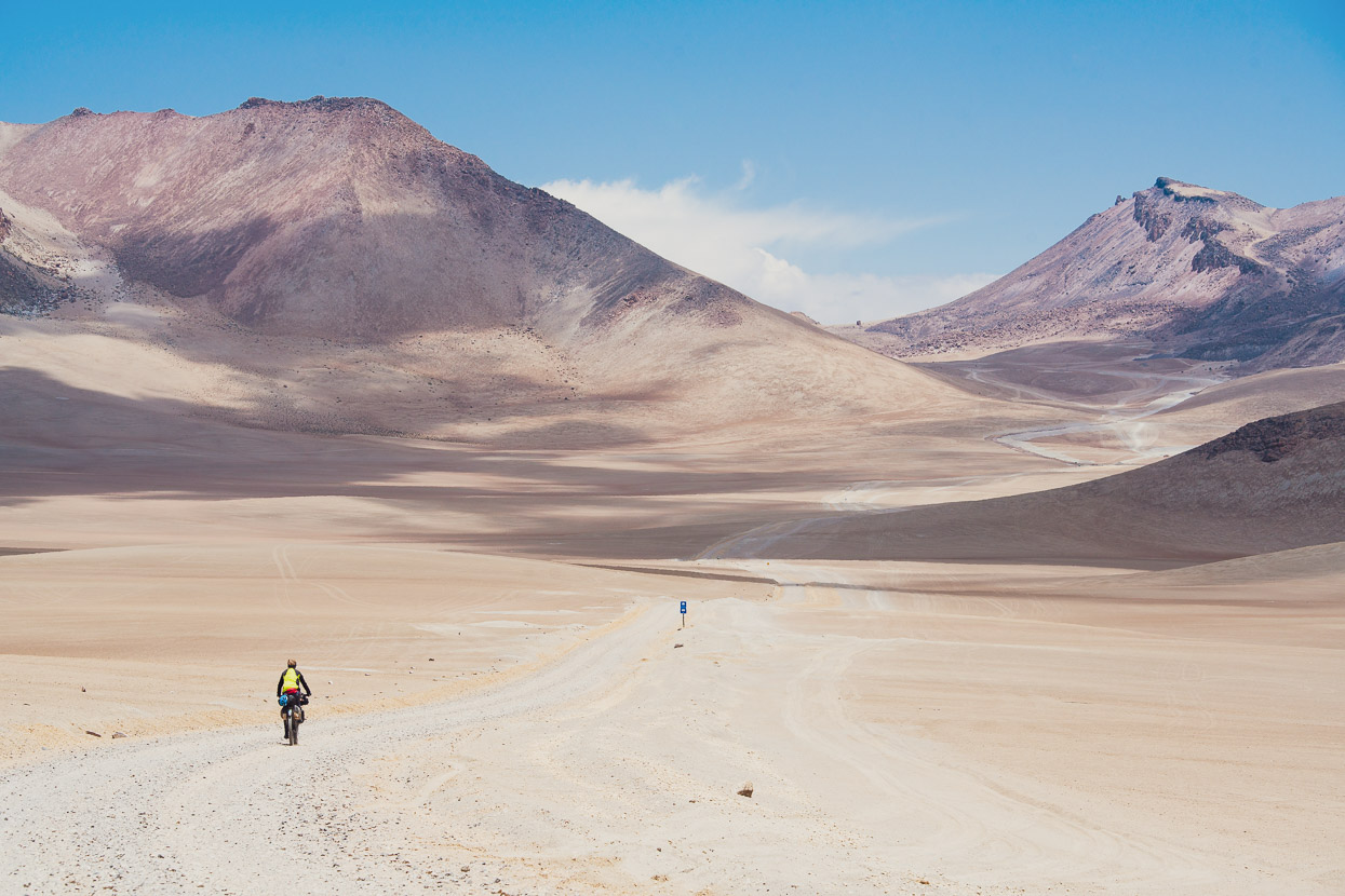
We crossed the basin and Volcan Ticsani began to loom larger in front of us. We were headed to a pass at 4857m on the northern side of the mountain, where we planned to camp for the night and explore our surroundings a little.
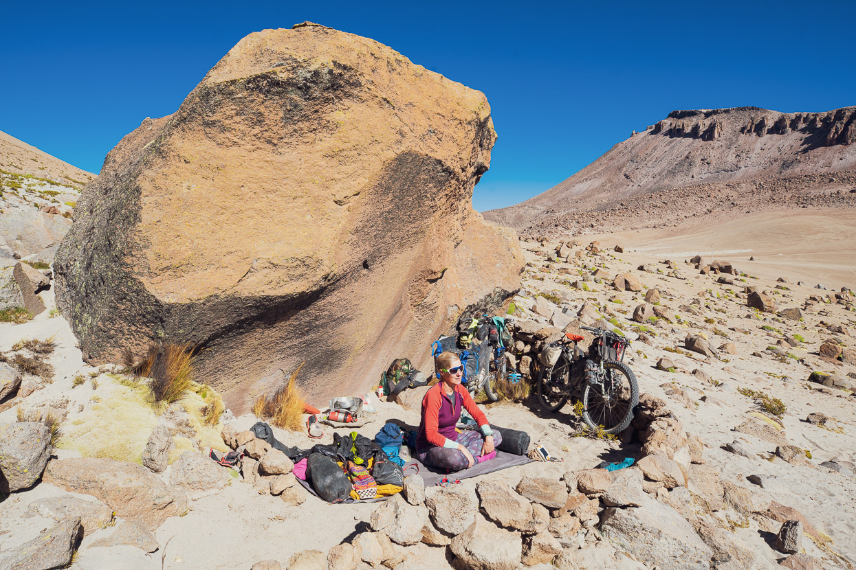
Boulders dot the slopes of the mountain around the pass, so we picked the biggest one and made ourselves at home, hidden from the afternoon wind. There had been the remains of a small wall of boulders on one side, so we began ‘improvements’ excavating a sleeping platform and building the wall further around the boulder. The result is pretty comfortable bivvy site. Just remember to bring water!
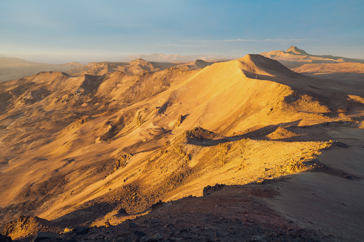
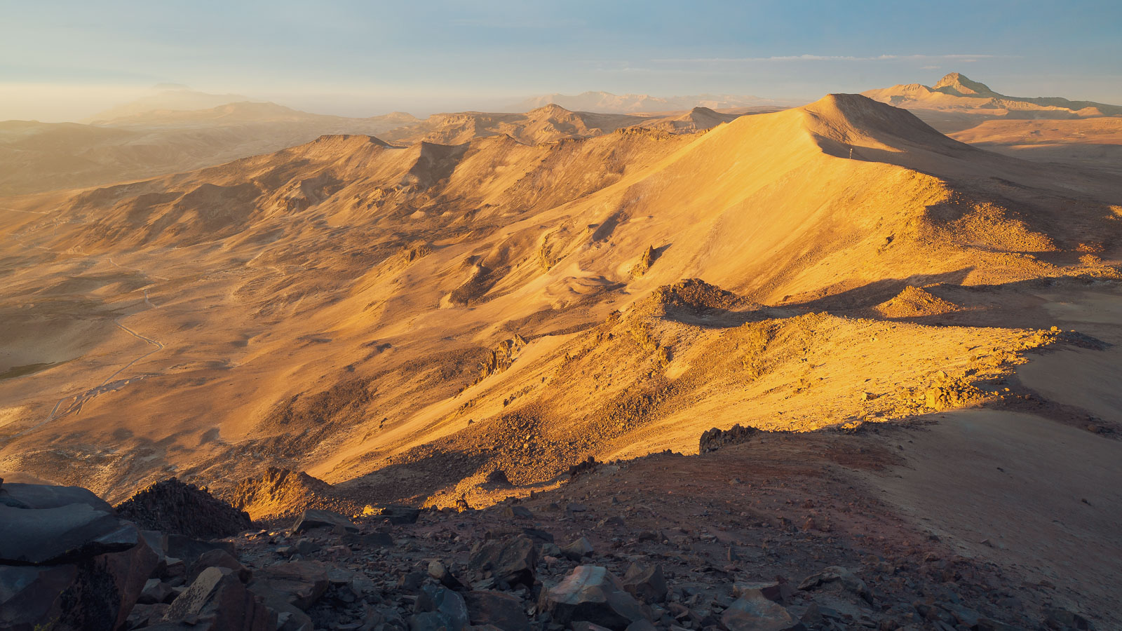
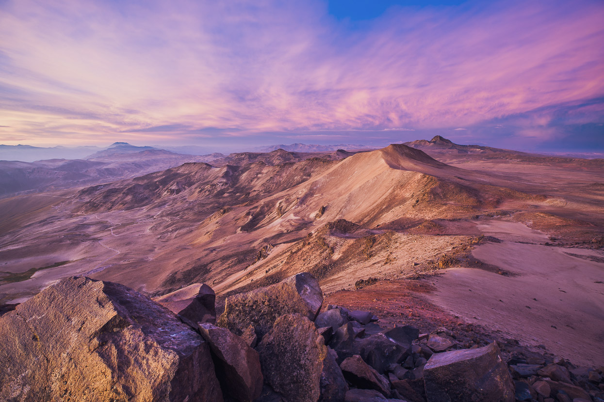
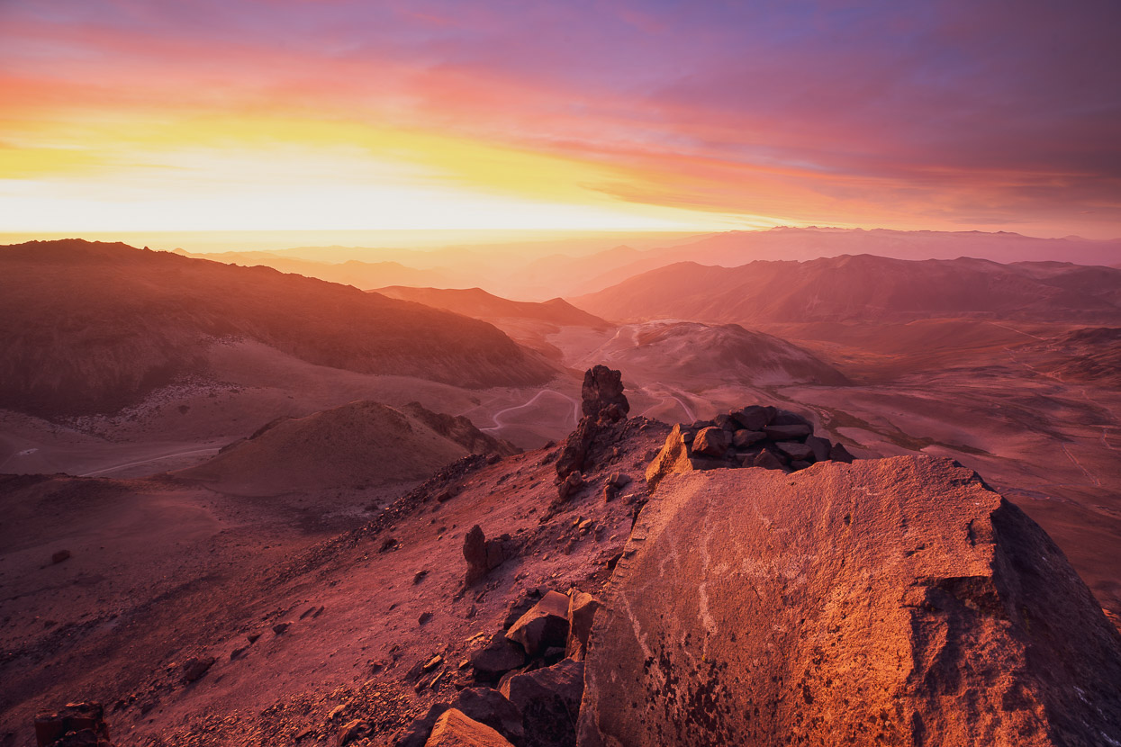
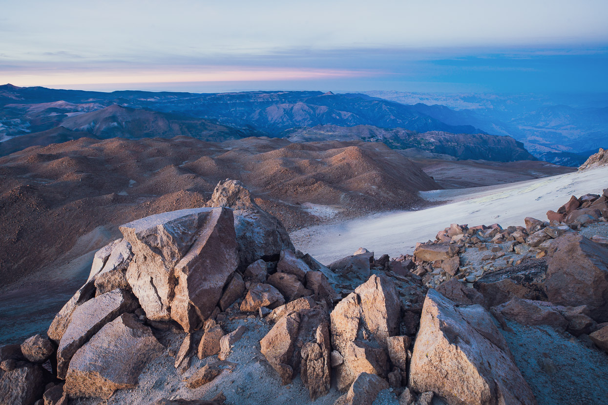
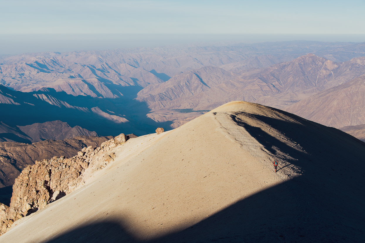
In the late afternoon I walked for about an hour and quarter up to the summit of the peak on the north side of the pass, opposite Ticsani. It was a good workout boulder hopping and walking in soft scree up to 5244m, but well worth if for the incredible sunset that followed – colour the likes of which I’ve rarely seen. Much of the landscape around here is red with volcanic toned earth or golden with tussock and that combined with clear high-elevation air seems to make for amazing light at times.
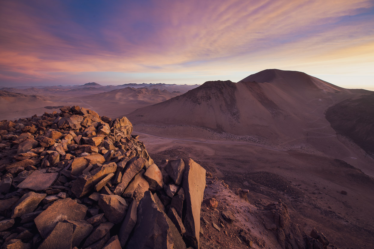
Looking back at Ticsani and the pass below, I noticed a track zig zagging its way up Ticsani’s NW slopes. Tempting. A plan for an early – madrugada – start and sunrise on the summit was soon forming in my mind.
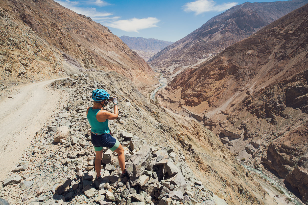
Our location, right on the western edge of the altiplano was spectacular. To one side a volcano ravaged upland stretches away as far as the eye can see. And to the other the land falls away dramatically towards the Rio Tambo Canyon and the Pacific slope.
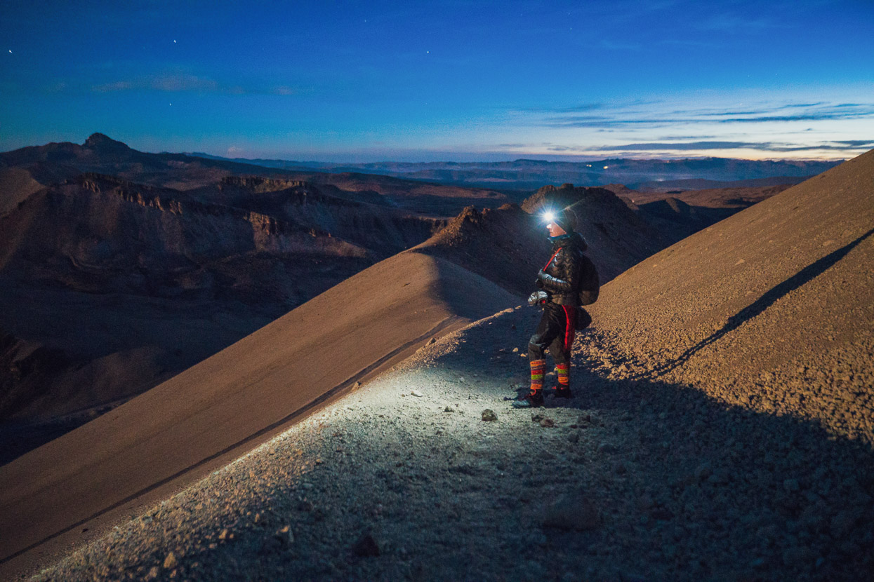
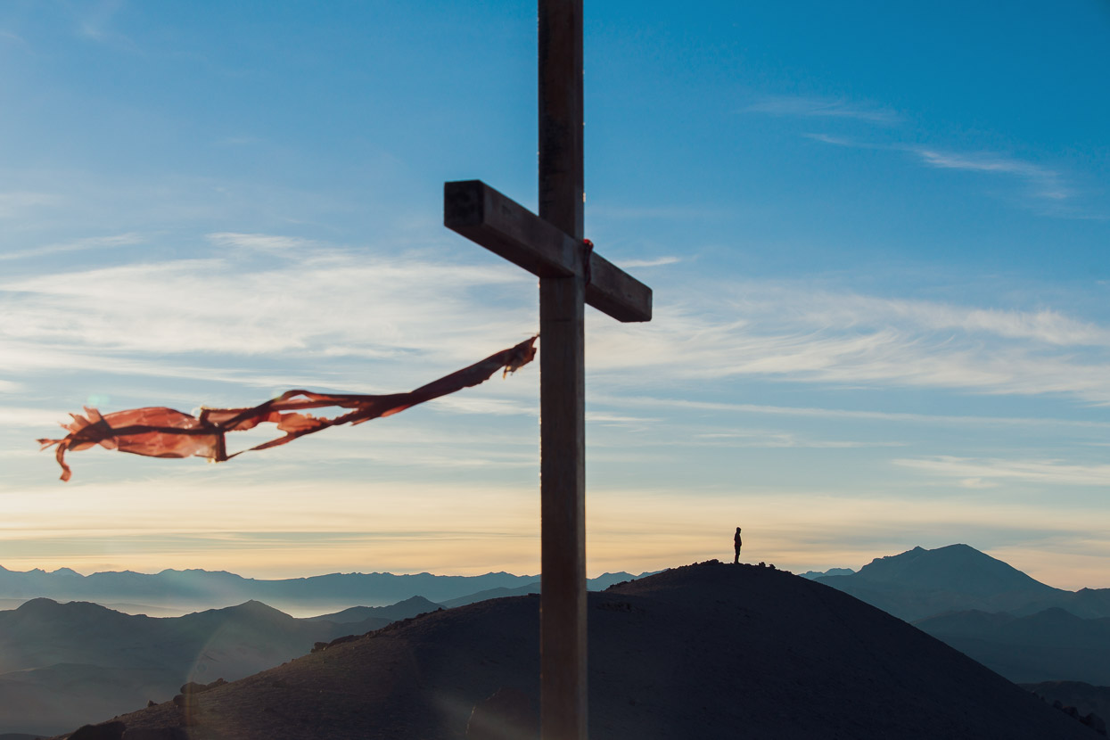
I got back to camp about 7pm and we ate and settled down to sleep under the stars. We woke at 1.30am and left camp at 2.30am, making the relatively short walk to the summit in moonlight, barely needing our torches. From camp to the summit at 5439m took two hours, and with our quickish pace we really started to notice the altitude at about the 5200m mark.
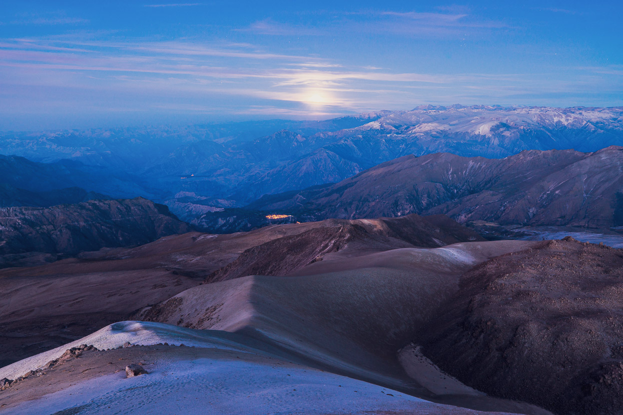
As we neared the summit the moon sank behind layers of cloud. We spied distant lights and could just make out the Rio Tambo in the canyon nearly 4000m below us.
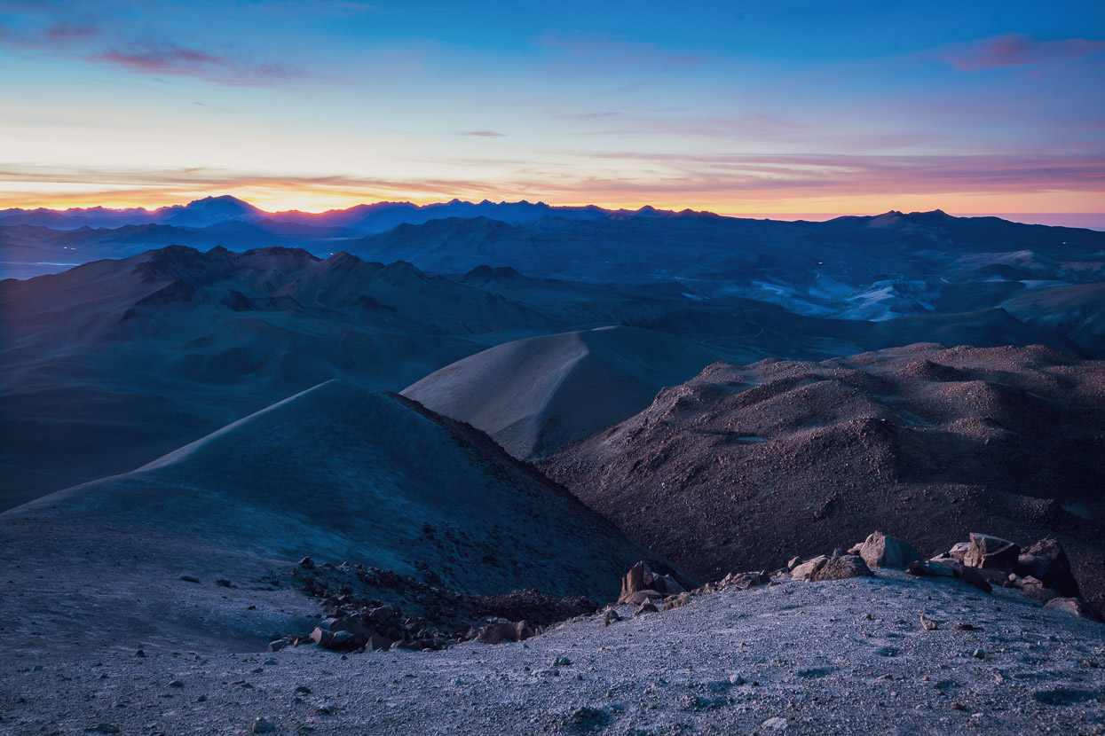
Dawn light crept over the land, bringing relief to myriad features of the landscape. The products of some colossal eruptions over thousands of years.
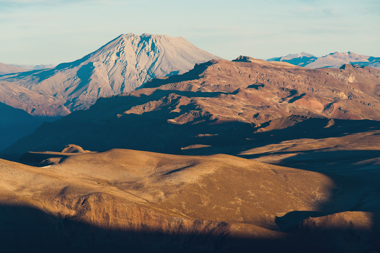
To the north west Volcan Ubinas stood clear, on the other side of the Rio Tambo.
And below, our route from the previous day traced a shadowy line across a landscape smoothed by several metres of ash and pumice.
It was -5c and windy on top, so we had a lot of clothes on. The sunshine was welcome as it crept onto the slopes, but we didn’t linger too long – with a ride ahead of us still that day.
After second breakfast in the warm sunshine of camp we packed up and were glad to drop lower, having been over 4400m continuously for three days.
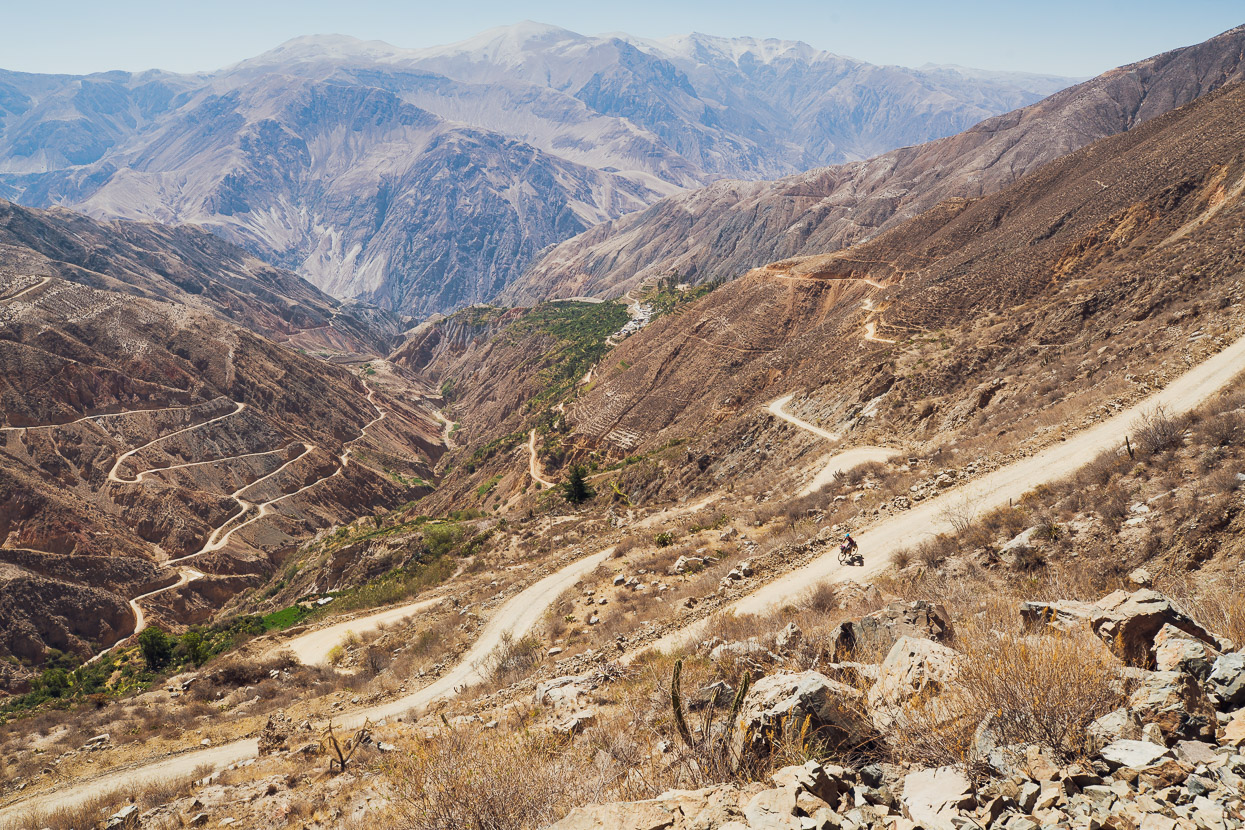
We descended, then climbed to a final high point of 4590m and found ourselves peering into the depths of the Rio Tambo and on the brink of a 3200m descent. It was quite hard to comprehend the scale, when you consider that New Zealand’s highest mountain would nearly fit in that hole, with just the top 500-odd metres poking out.
So down it was, and down, and down.
Finally, above Muylaque, 1400m below the canyon rim, we caught sight of some greenery and a big village for the first time in days.
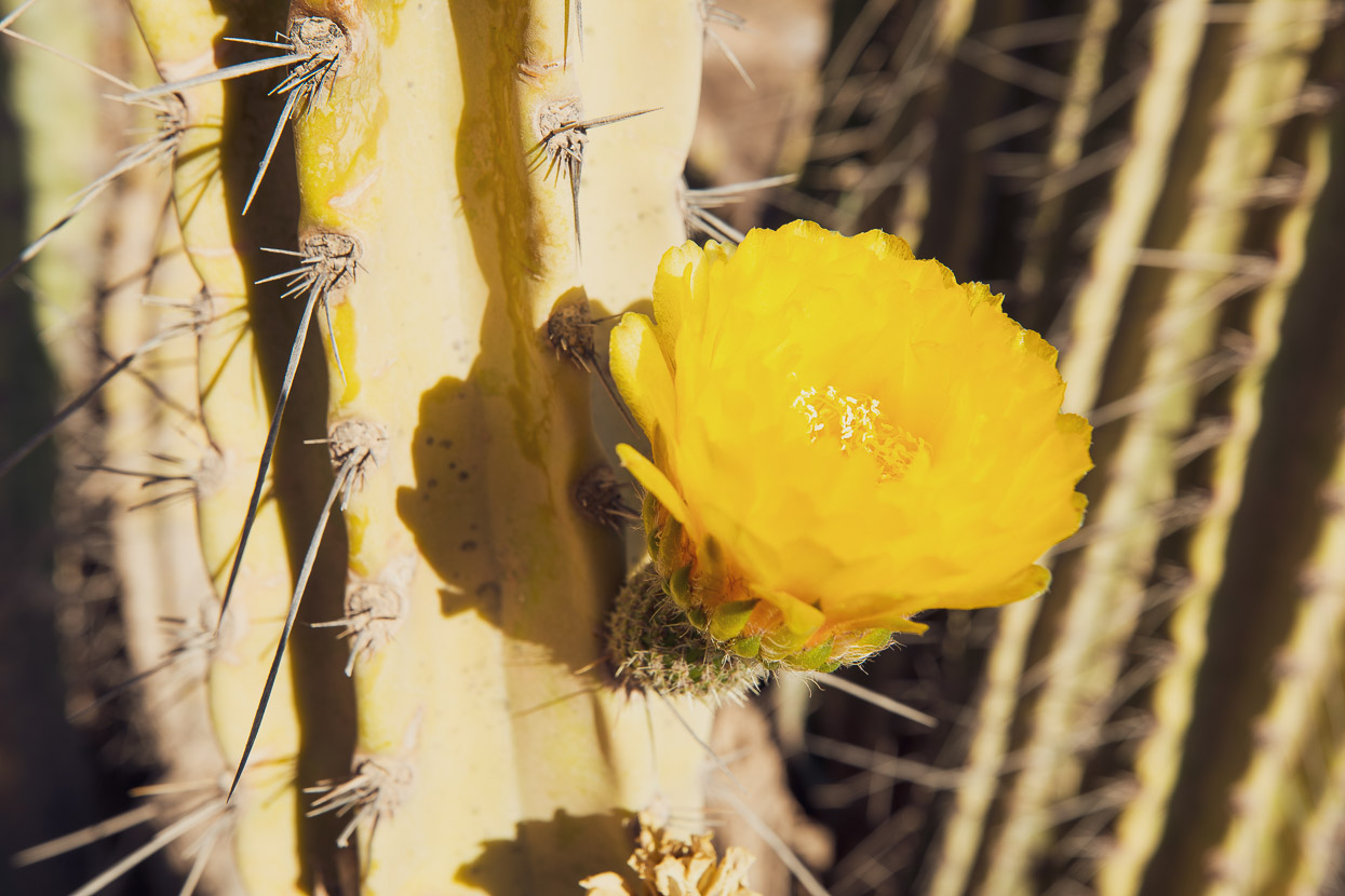
For a moment I thought the profusion of green around the village was banana trees, and then realised it was a veritable forest of cactus which is grown widely here for its tuna – a sweet and delicious fruit.
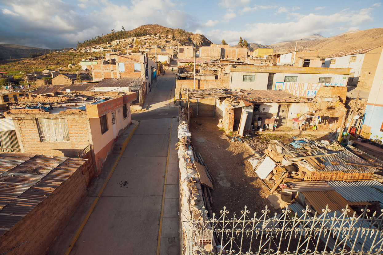
Muylaque didn’t have a whole lot to offer, except a lot of stares, a few friendly questions and a tienda with coke and chips which went down very well in hot the sunshine of the plaza. There’s no hospedaje or restaurant there, which was a shame as it’s quite an appealing little village. But the people told us we’d find one in the next town, so down we coasted further…
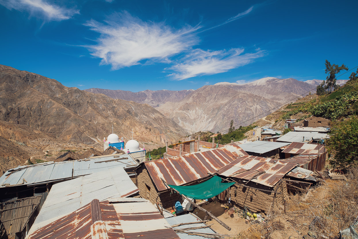
Sijuaya is a scrappy, shantytown of a place that looks as if all the roofs would blow away in the next cyclone, but it did have a very basic comedor where we could get meals and a municipal hospedaje (that we unfortunately had to wait two hours to get into). It was late afternoon by now and we’d been up since 1.30am on only 4 hours sleep the previous night so we were starting to feel a bit spaced out.
The following day we had a big sleep in, followed by eggs, bread, avocado and coffee for breakfast at the tienda, and then hit the road about mid morning.
In this part of the canyon, as we neared the river finally, it seemed as if the earth had split open. The slopes raw with loose rocks and volcanic debris. Rarely interrupted, except where enterprising farmers had directed water to nurture small patches of crops.
Already a hot wind was blowing up canyon. A dehydrating, gusty wind that covered us in dust. My thermometer read 30 degrees c.
We felt very, very small.
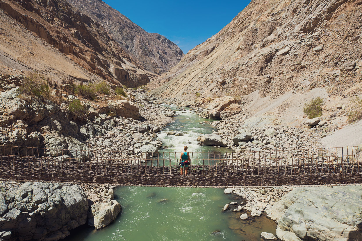
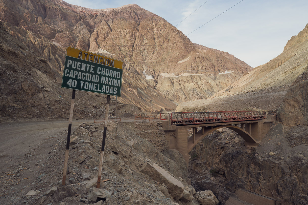
A road bridge crosses the Tambo here, but we had to check out this Indiana Jones relic of rusty cables and a few rotten boards all bound together with expertly woven vines.
We’ve ridden few places this stark.
As we descended into the canyon, we were passing beneath the south eastern side of Volcan Huaynaputina. I’d never heard of this mountain until we arrived in the region, but it’s well known to historians as the site of the largest volcanic eruption in South America in recorded history. And a relatively recent eruption at that: 1600 AD. At that time the Spanish had become well established in the region and Arequipa was already a thriving city.
The eruption went on for some days as a series of ash and pumice eruptions, lahars and pyroclastics, utterly destroying the surrounding countryside up to 30 kilometres away; filling valleys with lahar debris and smothering the ground with over two metres of tephra and pumice. Even Arequipa, 70km distant, received 25cm of ashfall. Ten villages were completely destroyed or buried and between 1500–2000 people are thought to have died.
Due to destruction of waterways, crops and agricultural sites, as far away as the cities of Arequipa and Moquegua, the carnage continued for some years in the form of famine and disease.
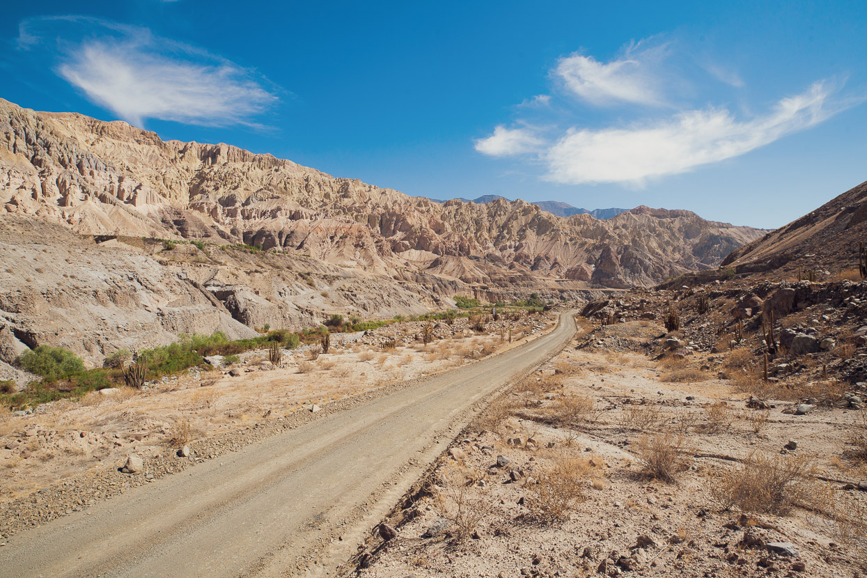
Despite having taken place over 400 years ago, the results of this eruption were still utterly tangible to us we we rode down the barren valley. The landscape has an unusually soft contour as its still covered in debris. On the steepest mountainsides, rainfall has washed the pumice into the natural drainage lines, forming ‘avalanche cones’ like you’d see in the alps during summer.
Hardly anything grows on the surface – just the odd, ill looking cactus and scattering of thorny bushes.
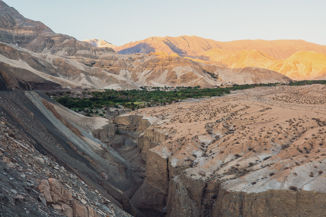
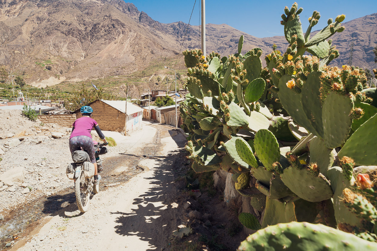
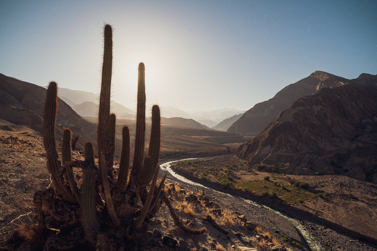
The village of Quinistaquillas was completely buried by the eruption, and a ‘modern’ village now sits at the site of the original. Where there’s water in this brutally arid place, there’s people and Quinistaquillas is a small oasis of green amid surroundings that have a beauty to their bleakness. We picked up some supplies and water there in the late afternoon and rode on, looking for a campsite.
We pushed the bikes up a small hill beside the road, on a finger of land that jutted out into the Tambo riverbed. An amazing campsite that allowed us to take in the scale of the valley and uniqueness of our surroundings. We were getting ready to lie down on our pumice bed when we saw the unmistakable flashing lights of a police vehicle approaching. It stopped on the road adjacent and three men got out and walked over the hill to our camp. I guess they’d seen our lights from the village. It was a matter of formality for them as they checked our passports, asked us if we were cold, and then left us in peace for the night.
Meanwhile the full moon was rising, throwing an eerie illumination over this weird place.
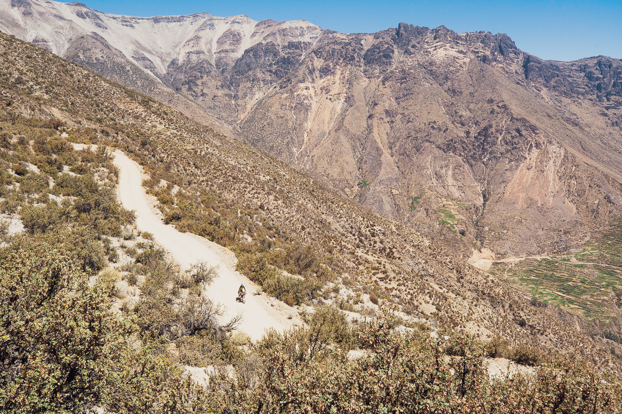
The raw landscape continued in the morning, until eventually we turned right and began a nearly 900 metre climb up a side valley to the town of Omate.
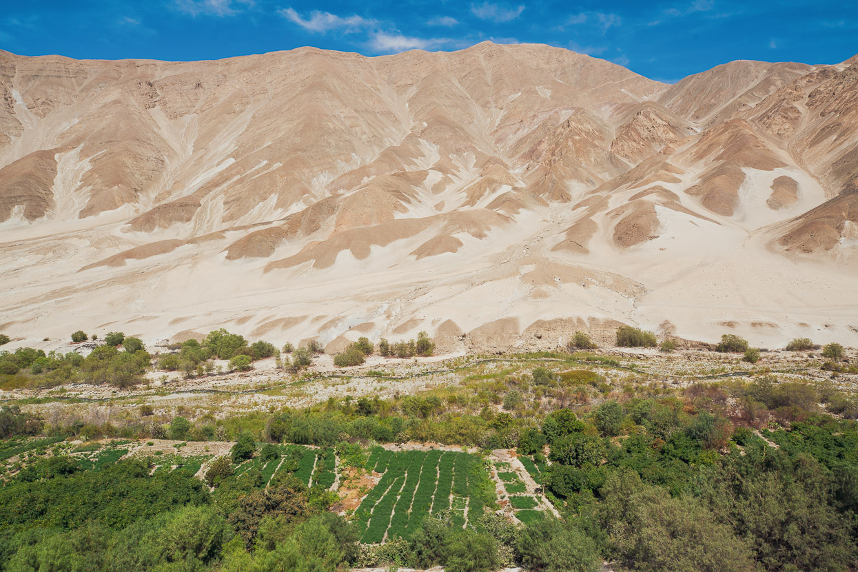
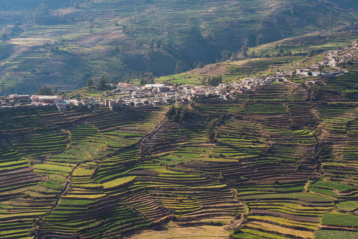
Omate’s well served with a small river of the same name, and as we gained height, the agriculture increased: avocado, papaya, mangoes, peaches, figs and grapes all grow well here. We were feel kinda wrecked by the time we got to Omate, so we took two days off, enjoying the warm days, abundant food (there’s good restaurants there) and a cruisy village atmosphere.
We spent our final night on the road in Puquina, surrounded with spectacular andenes (terraces), after a long day of climbing in the heat from Omate.
We climbed for a couple of hours on our final morning, and then dropped into the long descent down into Arequipa, passing Volcan Picchu Picchu.
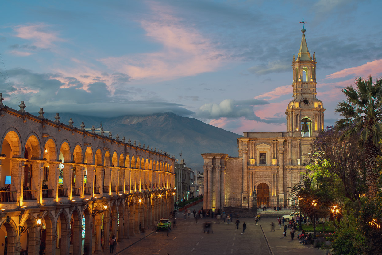
And finally into the White City, Arequipa, with its now familiar skyline of Volcanes Chachani and Misti.
This city’s going to be our home for the next few weeks, while we have a change of pace and stay static for a while. This tour’s been an incredible run, but we’re looking forward to focussing on other things for a while and exploring a bit locally.
Keep an eye on the website for some fresh content and route info for bike packing in the Americas. And if you happen to be headed to Arequipa on a bike yourself – drop us a message! We’d love to catch up with some other cyclists.
Thanks for following – more soon!
Do you enjoy our blog content? Find it useful? We love it when people shout us a beer or contribute to our ongoing expenses!
Creating content for this site – as much as we love it – is time consuming and adds to travel costs. Every little bit helps, and your contributions motivate us to work on more bicycle travel-related content. Up coming: GPX tracks.
Thanks to Biomaxa, Revelate Designs, Kathmandu, Hope Technology and Pureflow for supporting Alaska to Argentina.


I’m amazed you appear to have no fear of volcanoes, & yet not so long ago, you wrote about the town of Yungay being completely wiped out as recently as 1970. Couldn’t it happen again ? Although so sparsely populated, it’s incredible their English is so good, or maybe your Spanish has improved ? The photos are amazing – the colours incredible. But I do think you’re both slightly crazy !! Would some of the better restaurants offer alpaca steaks ? Especially when you can pluck one off the street ! Or do they not eat much meat ? Wouldn’t you have loved to ride with Josè to meet his family ? I once saw a video about a Peruvian village making coils of rope from entwined vines, & eventually a strong bridge so the families could have access across the canyon. Very ingenious. Rest up well & enjoy all that fabulous fruit. It is the ride of a lifetime & in the comfort of my lazy boy, I’m enjoying every written word & anxious for the next instalment !
Thanks Madge! Glad you’re enjoying the read still. Very little English spoken actually. In fact for a lot of people in this region Spanish (or Castellano as they call it here) is a second language. Most people speak Quechua or Aymara. Our Spanish is good enough to get by day to day and have basic conversations about what we’re doing. We definitely indulge in alpaca steak when we can find it 😉
Wow, that is an awesome loop. Do you think clockwise or counterclockwise would put the wind more at your back?
Hi Matt, Good question… the windiest section was the southern half (headwinds for us as we headed west), but the hard into-the-wind sections were never more than about a hour of buffeting, so all quite manageable. Riding the route counter-clockwise from Arequipa would mean a brutally long climb out of the Tambo canyon, but arguably easier acclimatisation. Each direction has its pros and cons, that I think even out in the end.
You appear to revel in discomfort & bedding down in the most squalid of squalor ! You have my utmost admiration. I’m sure you must occasionally dream of Canterbury roast lamb & mint sauce ?
I’m a little sad you’re taking a big break. I was so looking forward to your ride through Chile & your eventual arrival in Argentina. At 87, I may not see the day !!
Marvel at the fantastic photography & the gorgeous pale colours of the landscape. Those shifting sandscapes remind me what I’ve read of parts of China, especially around Urumchi, where villages are being “sanded over & wiped out”. Do you think the Incas built the Pyramids ? They have a similar block design. Keep up the good work & enjoy all that exotic fruit. Central Otago apricots are our staple fruit. Enjoy your welcome break & know you are giving pleasure to countless people. Travel safely !
Hi Guys,
What a circuit ! South America is amazing for offering endless remote adventures, thanks for bringing this one to my attention. Did you know in advance the likely water availability or just went for it?
Regards
Peter
Hi Peter. Thank you. We planned the route studying maps and satellite photos. What we tend to do is look for water clues (farm buildings, possible drainages etc) and mark them as POIs on our planned GPX. You do need to be onto it with planning and having the capacity to carry plenty for this one (about 5-6l). Cheers.
Full details for this route, including the northern leg, now published at Bikepacking.com: http://www.bikepacking.com/routes/el-camino-de-la-puma/
Hello you two!
I love the documentation and the photos of your tours!
My English is not very good, but I have some questions for you. Me and my wife have just decided to make a tour in Peru. We both found your tour through Bikepacking.com. And we are now considering either doing your tour Desaguadero – Arequipa or the tour Cones and Canyons. I wanted to ask which tour you liked better. We want to do either Cones and Canyons or Desaguadero – Arequipa in June.
Which of the two tours is easier to drive? What are the temperatures in June in this area? Is it very cold at night? It would be great if you write me back. Until then, I wish you a good trip.
All the best
Markus
Thank you Marcus!
You can now find more info on the complete loop at http://www.bikepacking.com/routes/el-camino-de-la-puma/
It’s difficult to answer your question as to which we liked the most as on Cones & Canyons we were following Cass Gilbert’s route whereas with Camino del Puma we were mapping and following our own route, which tends to be the most rewarding. Overall, the terrain on the two routes in similar. If you rode ALL of Camino del Puma, then overall it’s much more diverse than Cone & Canyons and with many highlights, but Cones & Canyons has pretty amazing individual sights such as Volcan Coropuna, Cotahuasi Canyon and Valle de los Volcanes. Both routes are equally difficult and have the same challenges such as rough or sandy roads in places, and of course altitude.
In June on either route, you should be prepared for lows of -10C overnight. Day time temps tend to be warm to hot, especially if there is no wind, but there are sometimes hailstorms. This part of the Andes is warmer during the day than the northern parts of the Peru Divide.
Hello you two!
I love the documentation and the photos of your tours!
My English is not very good, but I have some questions for you. Me and my wife have just decided to make a tour in Peru. We both found your tour through Bikepacking.com. And we are now considering either doing your tour Desaguadero – Arequipa or the tour Cones and Canyons. I wanted to ask which tour you liked better. We want to do either Cones and Canyons or Desaguadero – Arequipa in June.
Which of the two tours is easier to drive? What are the temperatures in June in this area? Is it very cold at night? It would be great if you write me back. Until then, I wish you a good trip.
All the best
Markus
Dear Marc,
thanks for the quick reply and the information! Yes -10 degrees is already very cold. That takes up so much energy. Me and my wife are still thinking about doing that. By the way, we can highly recommend you Madagascar, there is almost no traffic and the landscapes are very beautiful. We did the tour a couple of years ago and if you are interested there is also a description (but only in german) at the following link: https://issuu.com/gmx8834/docs/madagaskar
Cheers
Markus
Hi Hana and Mark. We just completed the southern leg from La Paz to Arequipa. Absolutely stunning scenery and incredibly kind and friendly folks along the way. Thank you so much for documenting this route – it was an absolute pleasure to follow. Certainly a ride of a lifetime.
All best,
George and Izzy, UK (currently in Arequipa)