
From Fairbanks to Cantwell and the start of the Denali Highway, our route through Alaska passed the single road entrance to Denali National Park. Mountains will always be magnets, and tempted by the chance of seeing the great icy massif of Denali/Mt McKinley up (relatively) close was enough to convince us to deviate from our main route and cycle the long dead end road into the park.
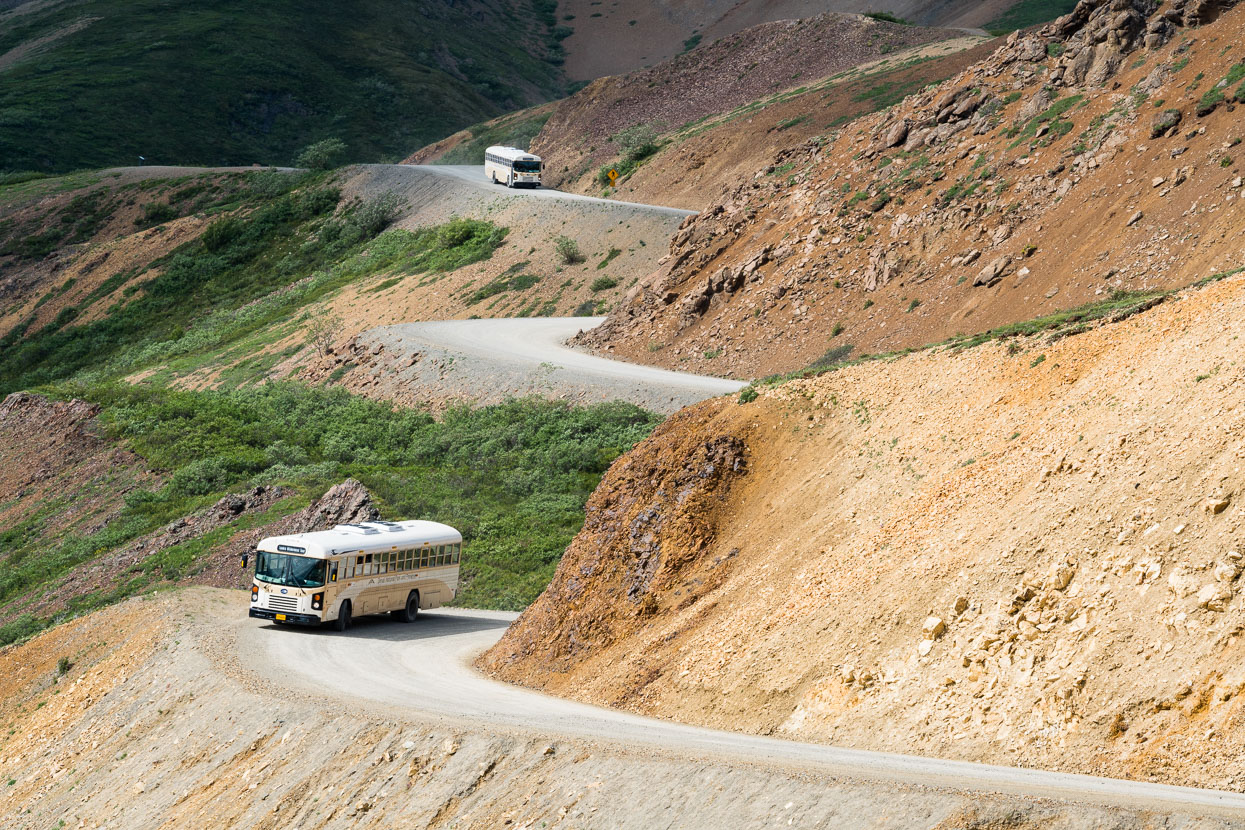
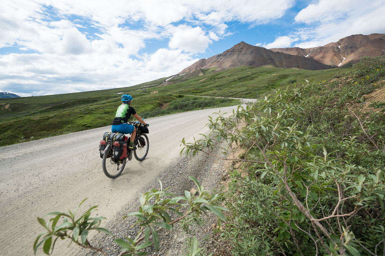
We cycled the dirt road to a National Park-operated campground at Wonder Lake, 136km in, over two days. The road continues just 7km further before ending at the tiny community of Kantishna, home to private tourist resorts. Aside from the scenery, the beauty of this ride is that the road is devoid of private vehicles. Mile 15 is as far as private vehicles can go, so the vast majority of park visitors enter this unique place by buses operated by the park. For cyclists, this gives a chance to enjoy a gravel road through a remarkable landscape without constant (and careless) traffic.
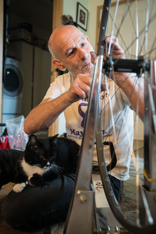
After the rigours of journey’s start from Deadhorse: the cold of the North Slope and the roasting heat of the Elliot Highway; it was good to take three days off in Fairbanks, giving my achilles tendon a chance to settle down and taking some time reviewing the publisher’s layout of my new book Photographing Aoraki Mount Cook (due soon). We were hosted by generous Warm Showers hosts Marilyn and Simon. Simon incidentally is a fat bike pioneer and uber-experienced bike mechanic. He seemed to spend a fair bit of time sitting on the lounge floor with cat Kiwi, building wheels for customers and loves to talk shop when it comes to bikes.
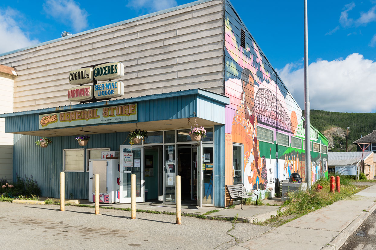
From Fairbanks it was over the hills for 84km to Nenana, a tiny town on the Tanana River. We’d been hoping for dinner, but everything bar the grocery store and the pub was closed.
At least the sun was out after a wet ride from Fairbanks.
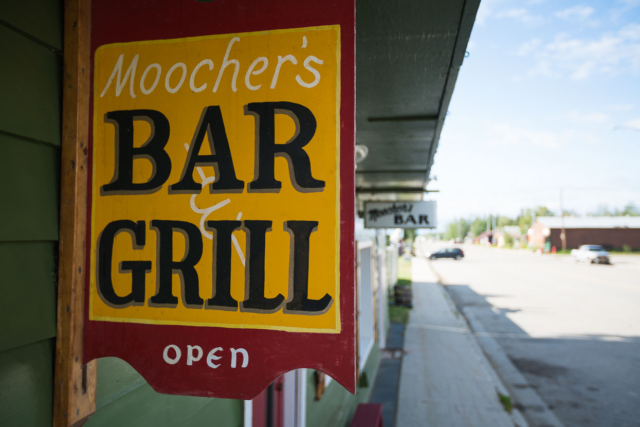
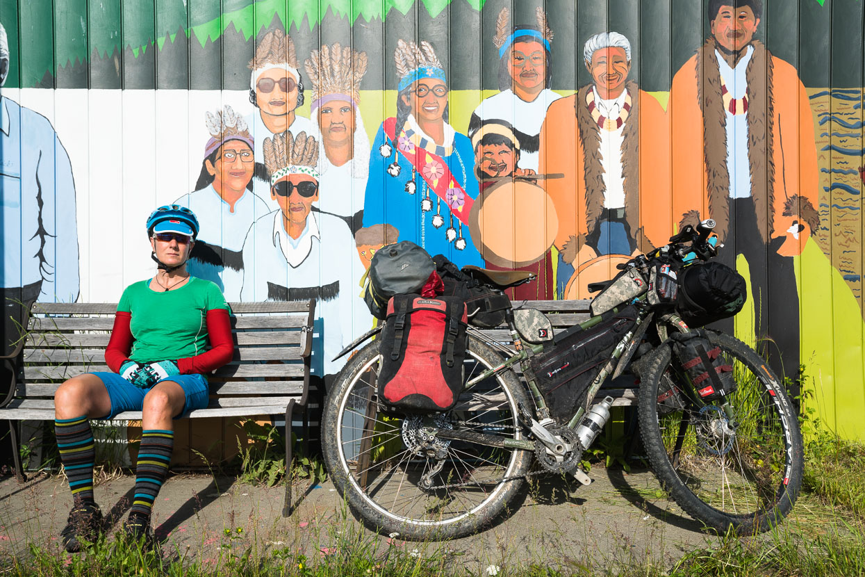
We couldn’t resist checking out the local though. Small town pubs are often interesting places to visit. We fielded a few questions from the four who were propping up the bar (a daily routine I expect) and moved on after a quiet beer and some wifi time.
The next day was mostly flat and gently rolling sealed highway – a novelty after the first two weeks of the trip.
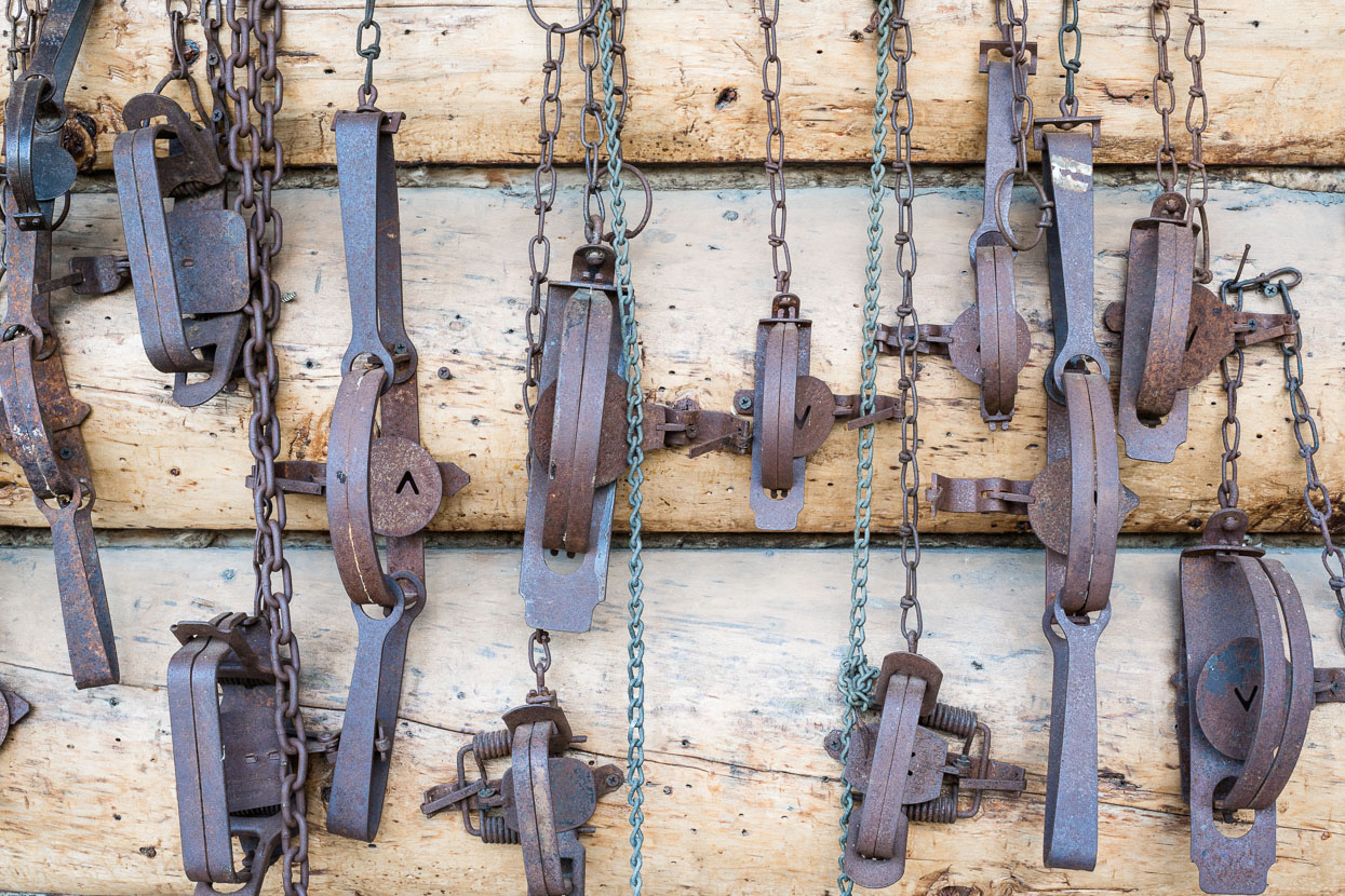
Reminders of Alaska’s pioneering, frontier legacy are everywhere: roadhouses are decorated with animal furs, traps, antlers and the tools of the trades that allowed hopefuls to forge a living in this wild land.
First the rivers and then the railroad allowed people to forge north. The first highway into Alaska was not built until during World War Two, with the construction of the Alaska Highway.
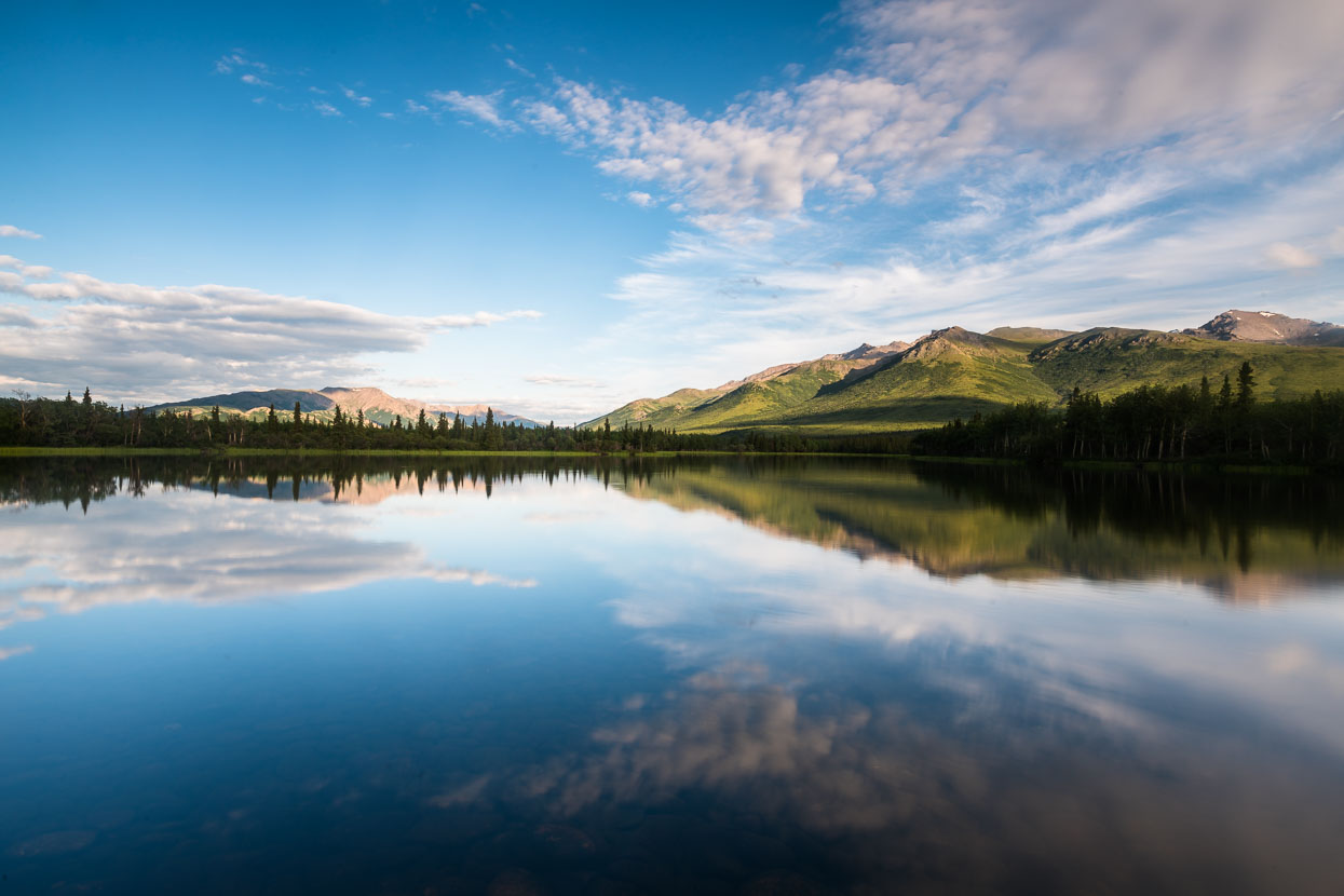
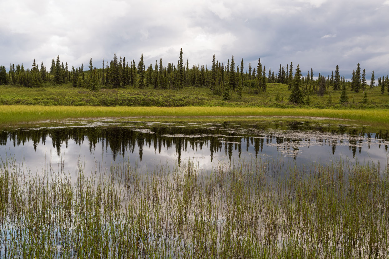
Otto Lake, near Healey, made a fine stop for the night. Only 18km from the Denali National Park entrance it’s a handy stop and there is an outdoor centre that allows camping on the lake edge.
The light, water, and clear evening were a treat.
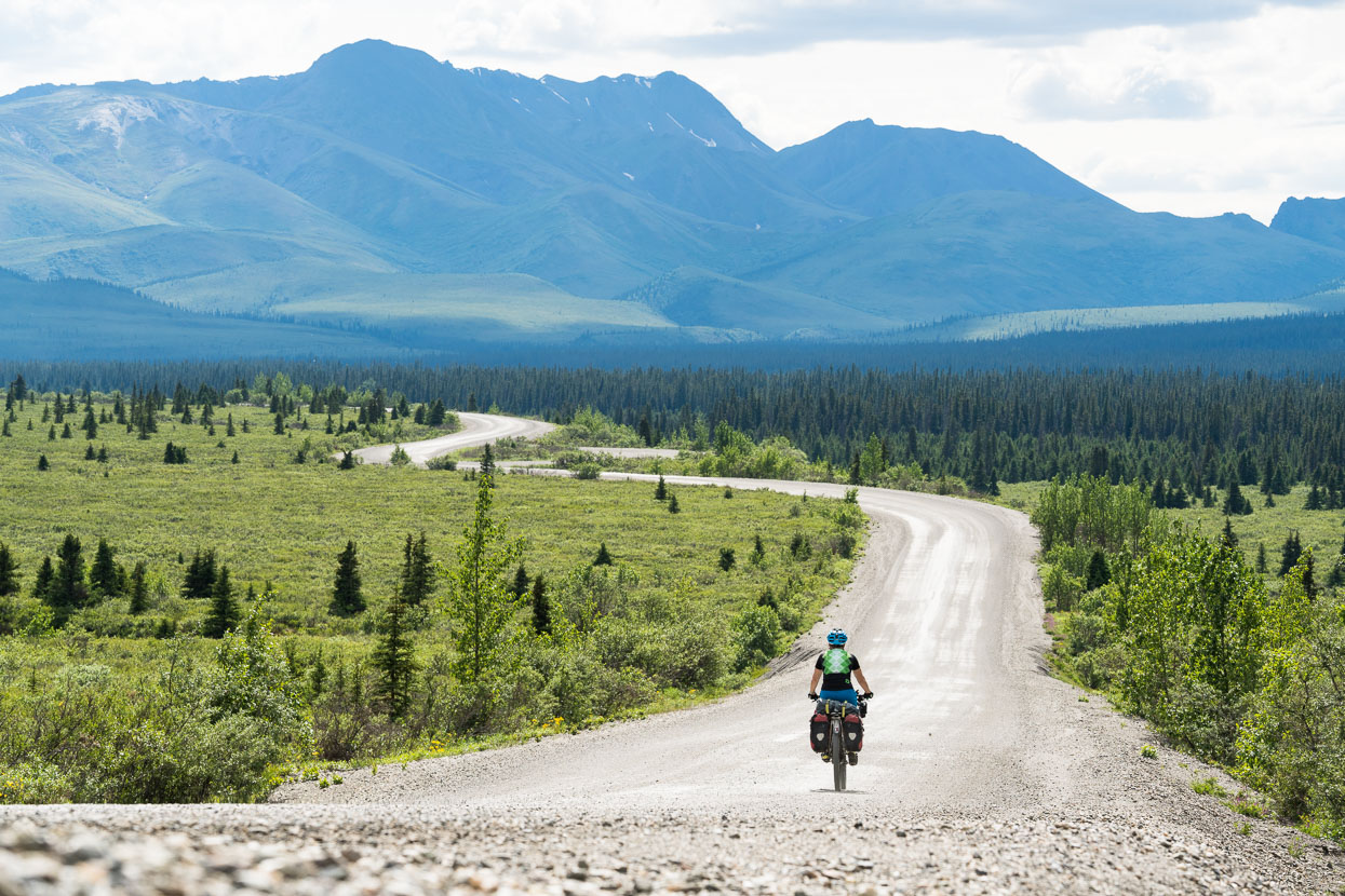
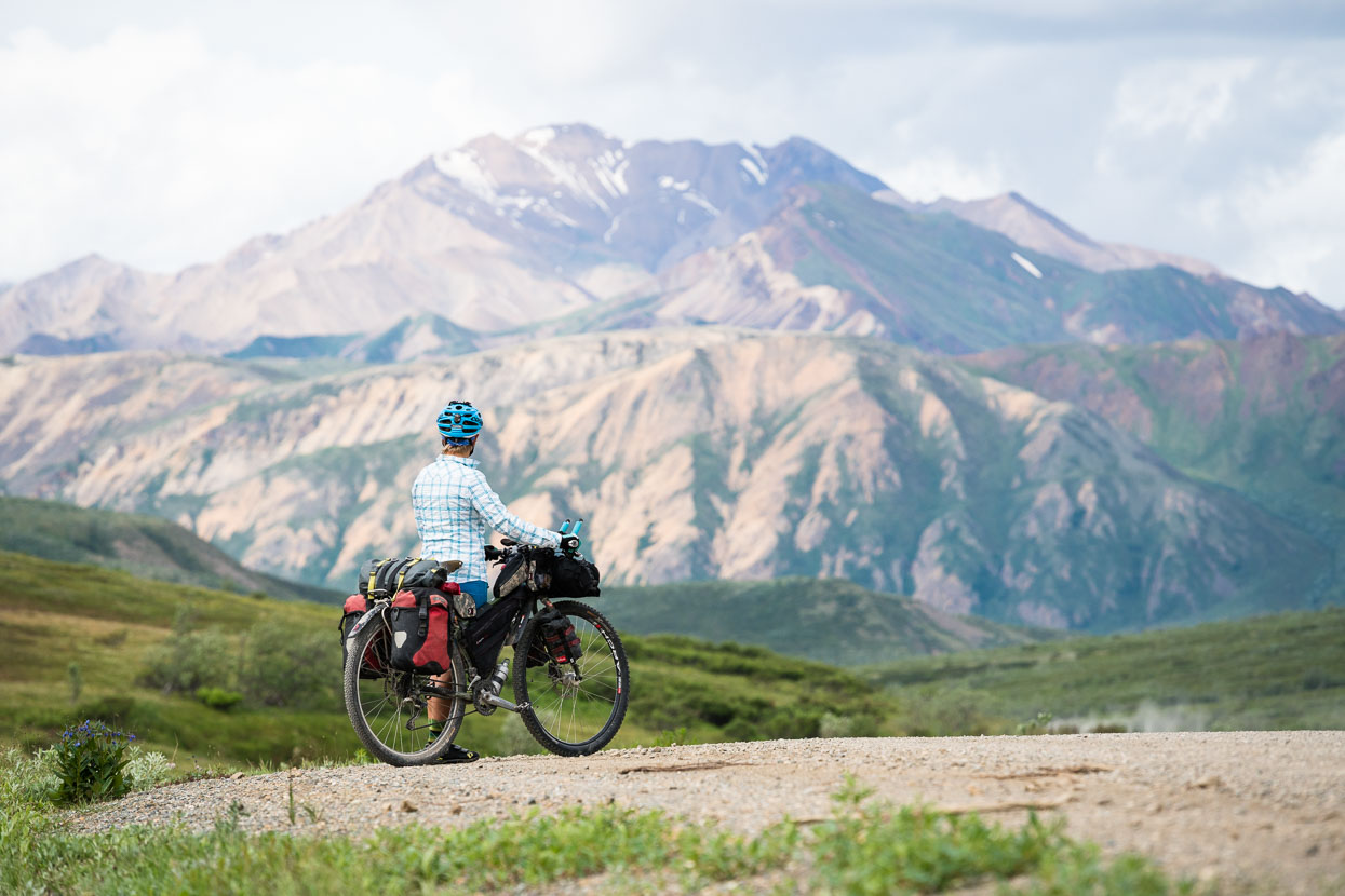
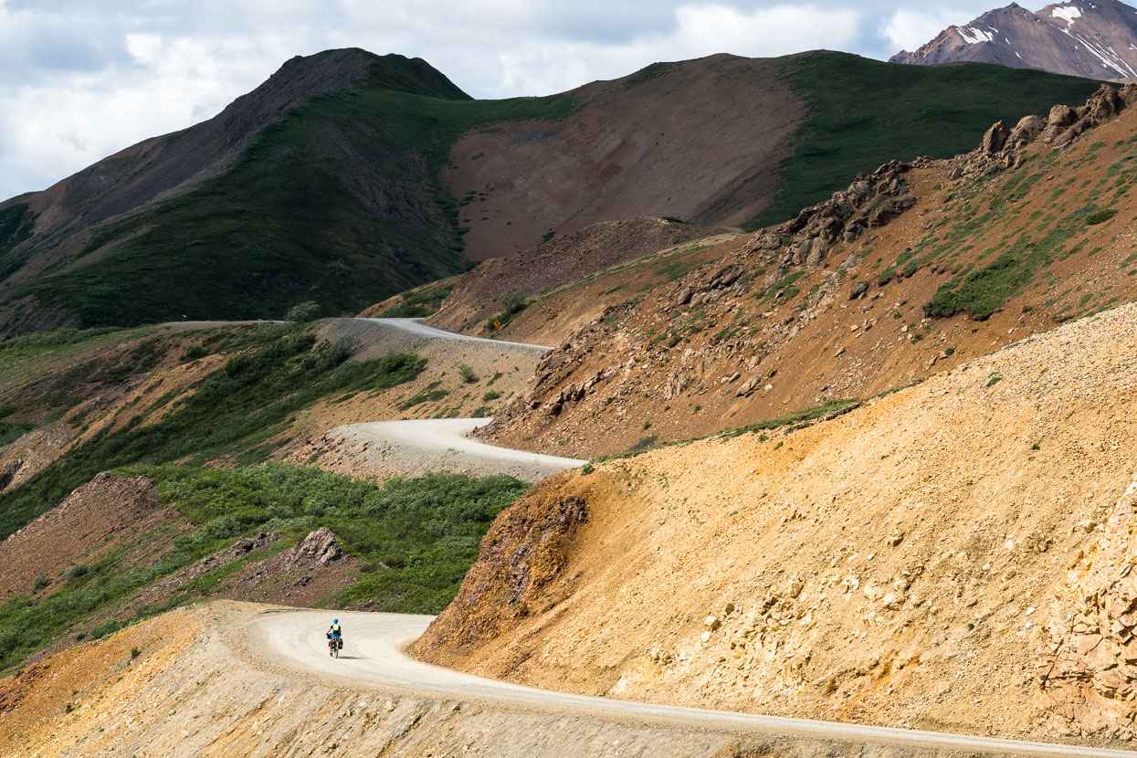
The Denali National Park road itself was a great ride: a steady climb on tarmac away from the park entrance soon gave way to the crunch of gravel beneath our tyres and the satisfaction that comes from cycling on a narrower road. After Savage River (15 miles in) it was just us and the park buses, which generally slowed down and gave us a wide berth.
Passing by Double Mountain (1798m).
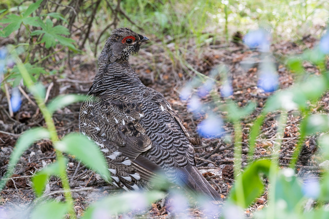
We scored a few points in the animal spotting game during the ride in, including a ptarmigan (male), also known as ‘chicken of the north’ once we got to camp for the night. He had me crawling around on my arms and knees for a while, even to get this shot.
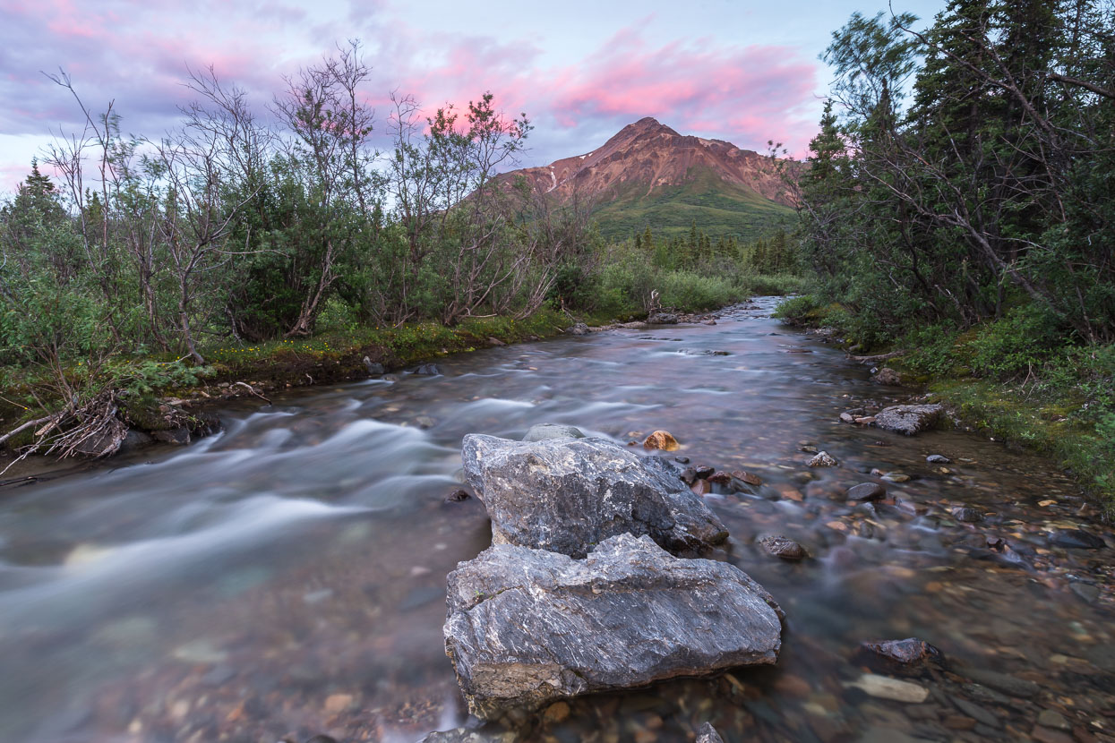
Igloo Mountain (1463m) and Igloo Creek at sunset – around 12.45am! Nearby our campsite for the first night.
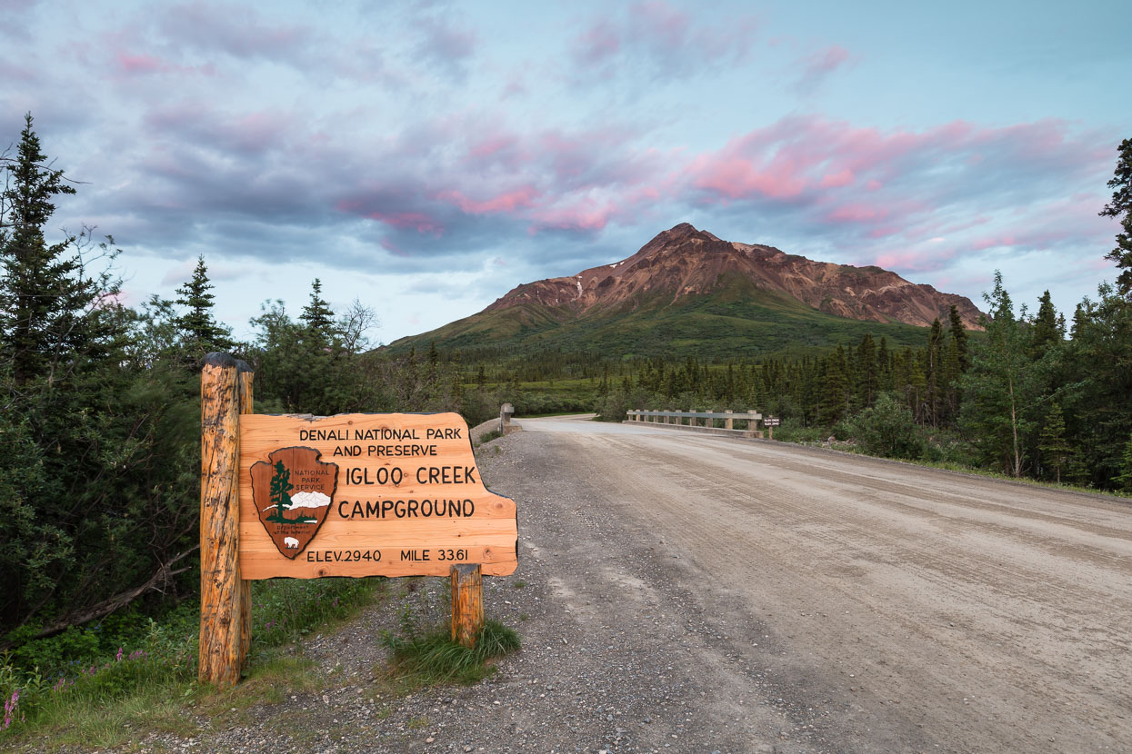
Before we got to enjoy all the road had to offer we did have to leap through a few of the park HQ’s hoops. The few official campsites alongside the road were all fully booked, so we were bounced between buildings to secure ourselves a back country camping permit (camping must be 800m from the road). Gaining the permit required watching 30 minutes of educational videos and signing our lives away, but the process did make me consider that maybe NZ would experience less river, hypothermia and avalanche deaths and better Leave No Trace practices if back country park visitors were subjected to the same rigmarole.
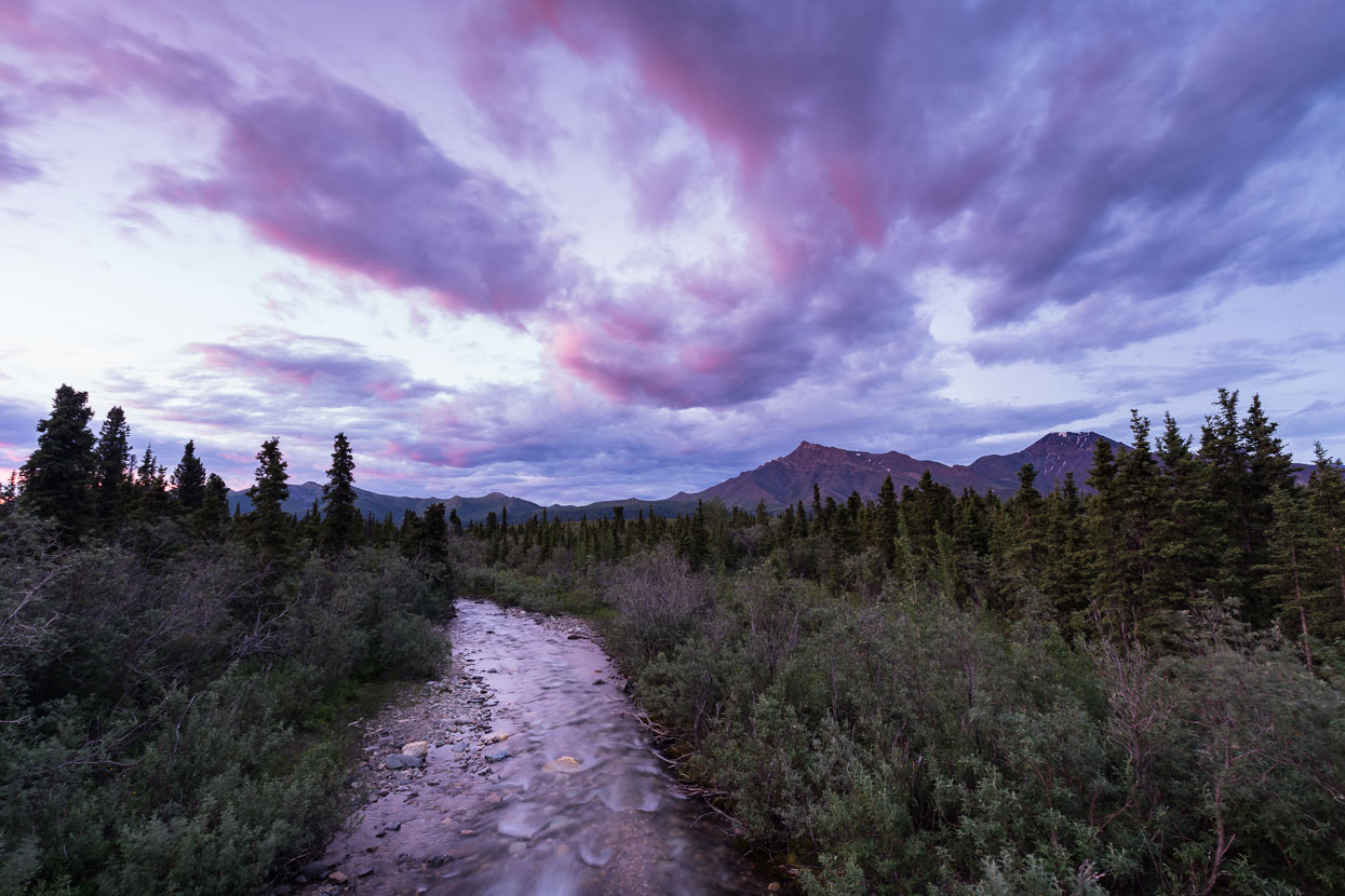
Igloo Creek, post sunset.
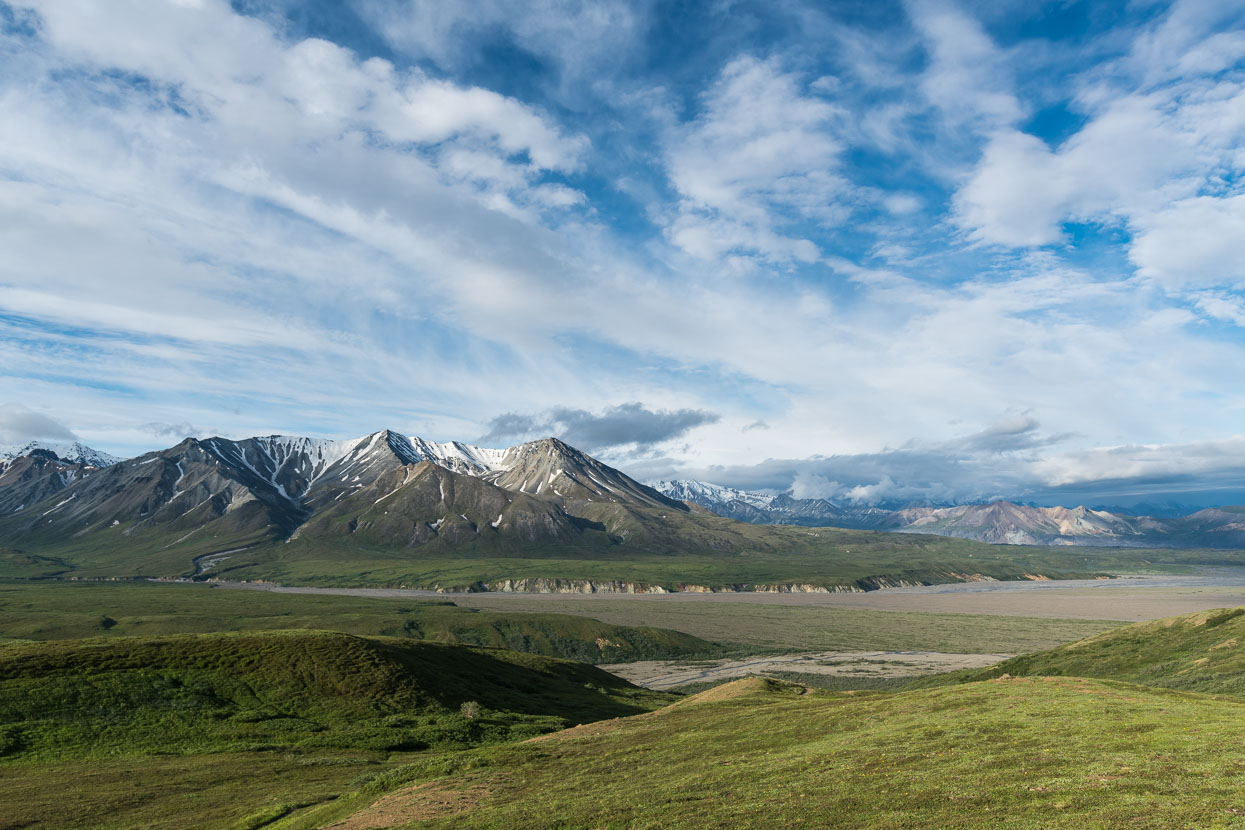
The next morning we were straight back into the climbing, this shot taken from Sable Pass looking towards Polychrome Mountain (1765m).
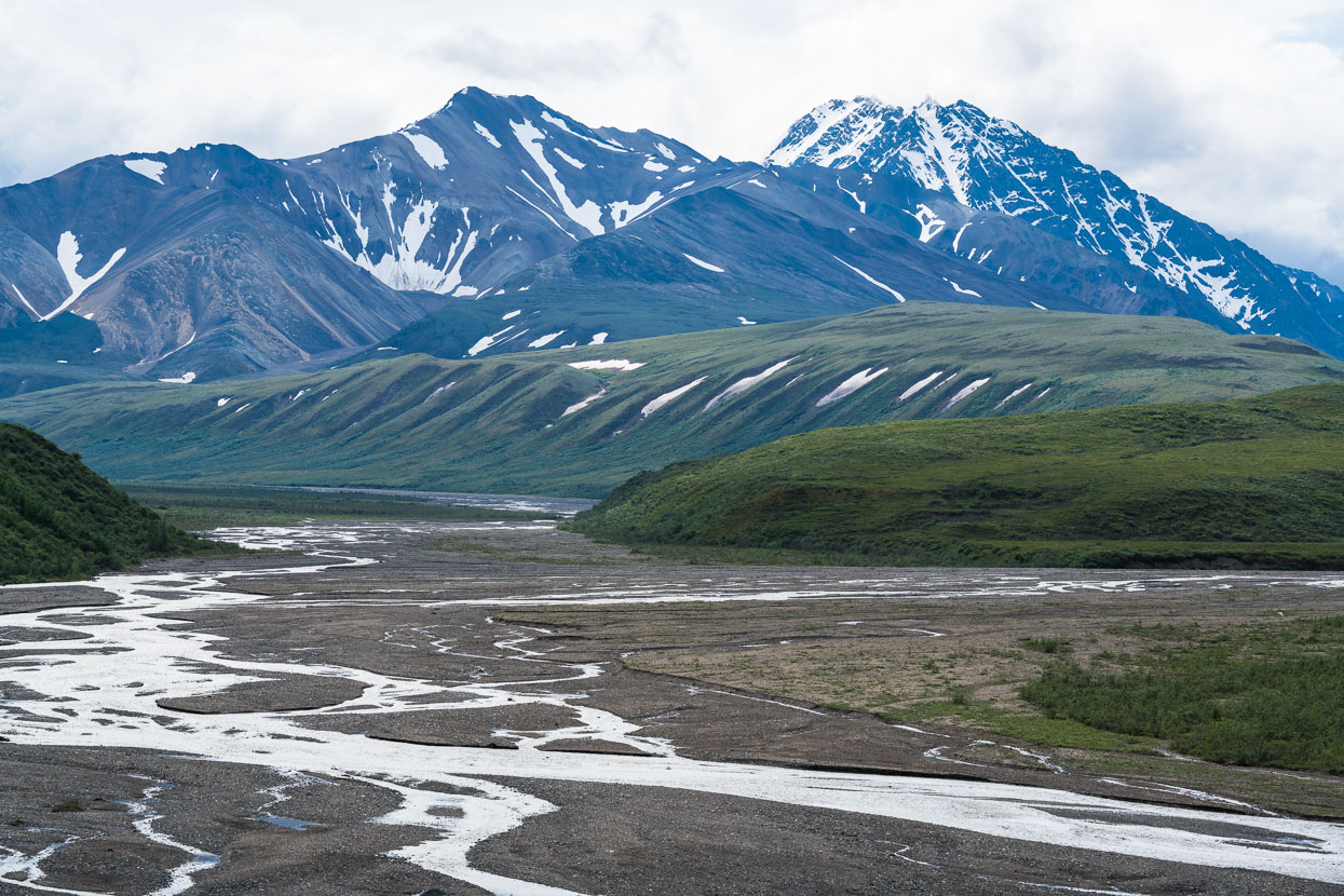
Braids of the Tokalt River East Fork seen from the descent from Sable Pass.
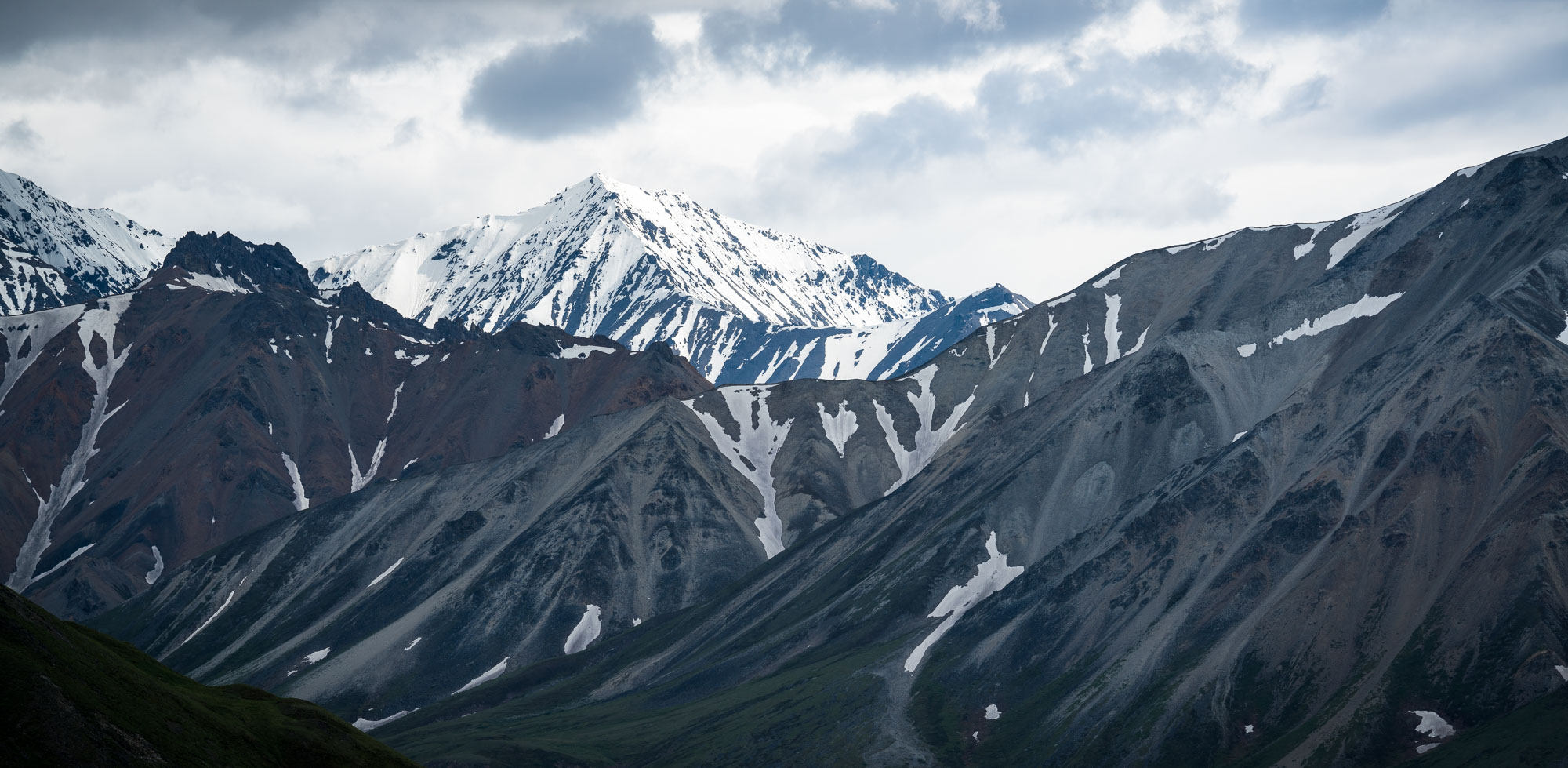
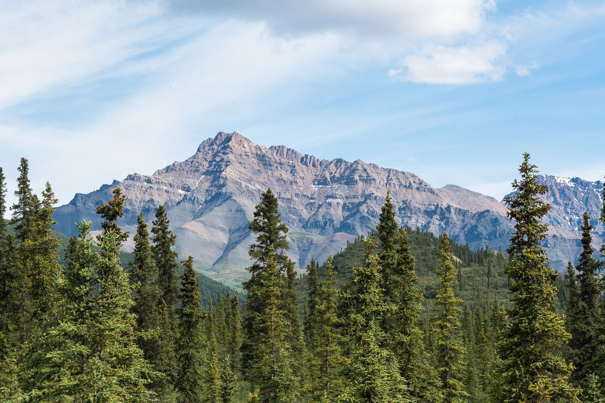
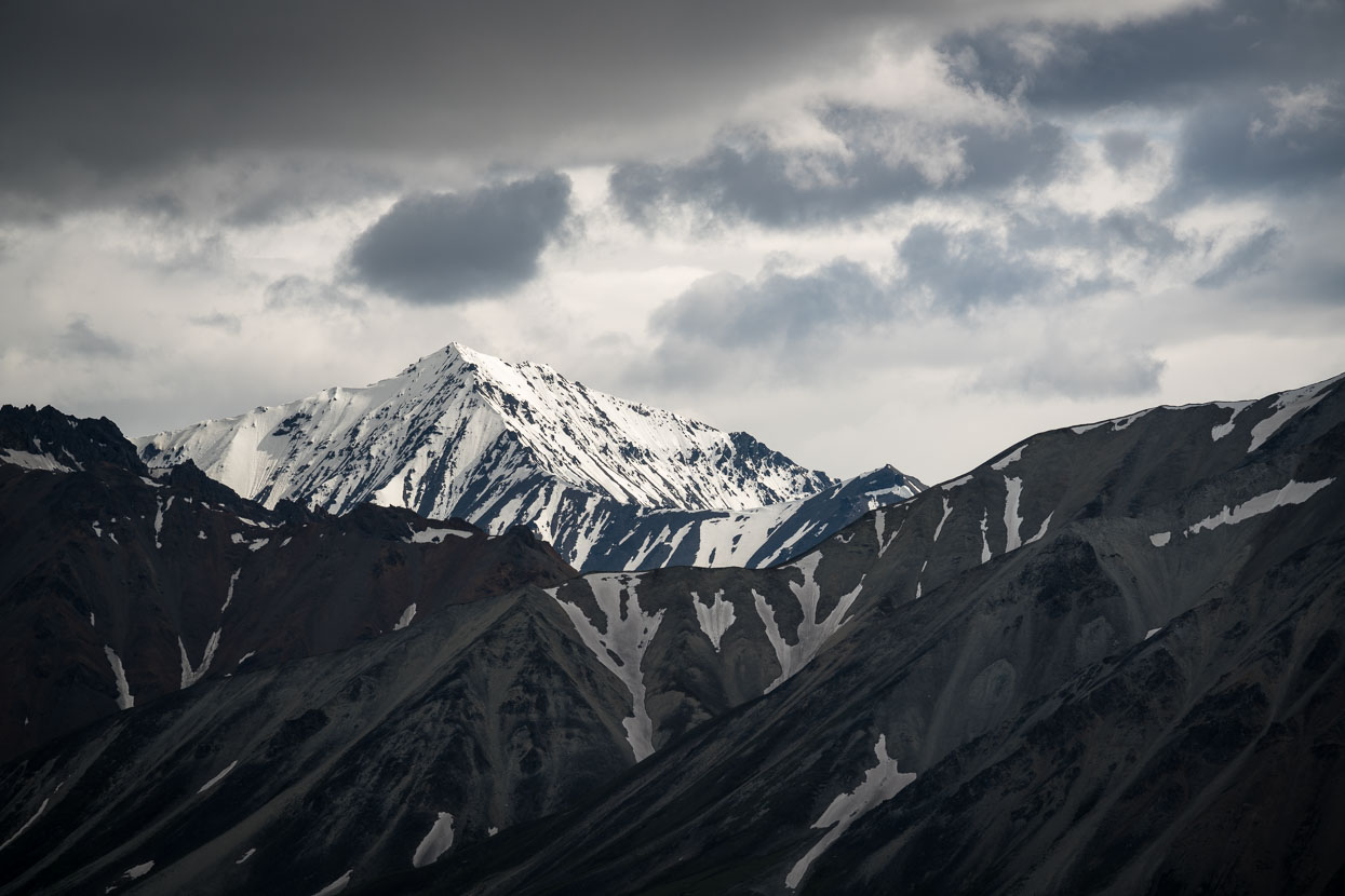
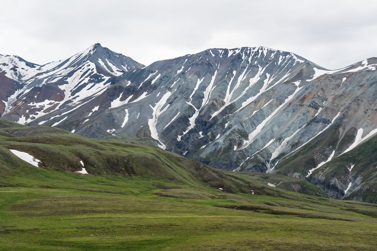
The park’s complex topography and geology becomes more apparent the further you ride in. The road crosses a number of passes through foothills and mountains as it parallels the heavily glaciated Alaska Range (unfortunately almost entirely behind cloud).
The start of the climb to Polychrome Overlook. A stunning place to be riding a bike, even without views of the bigger ranges behind.
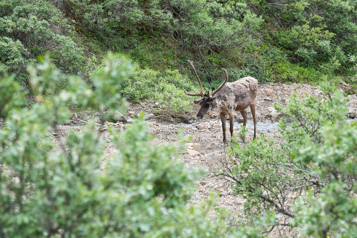
We saw a few caribou near the road and larger herds in the distance.
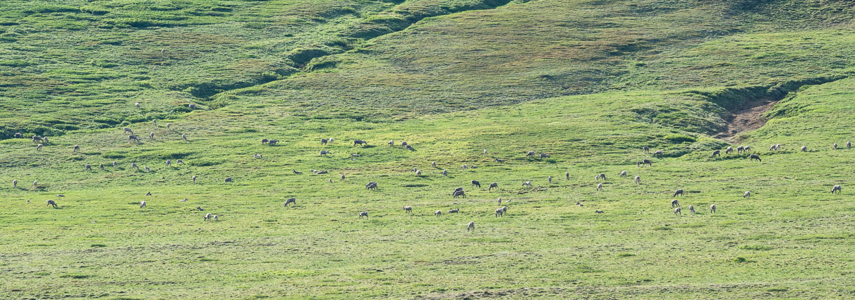
Caribou herd scattered on the mountain slopes.
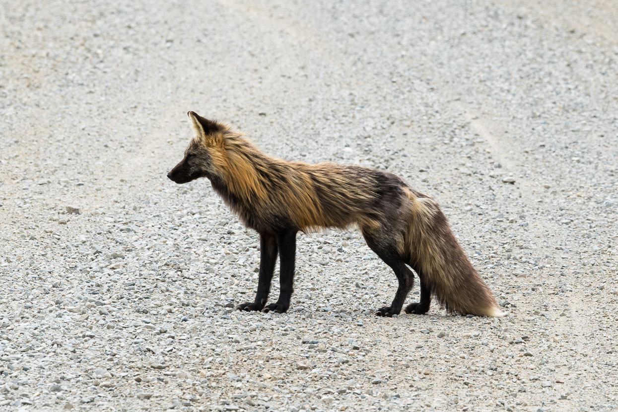
A lucky fox sighting.
Nearing Polychrome Overlook.
Our occasional company along the road.
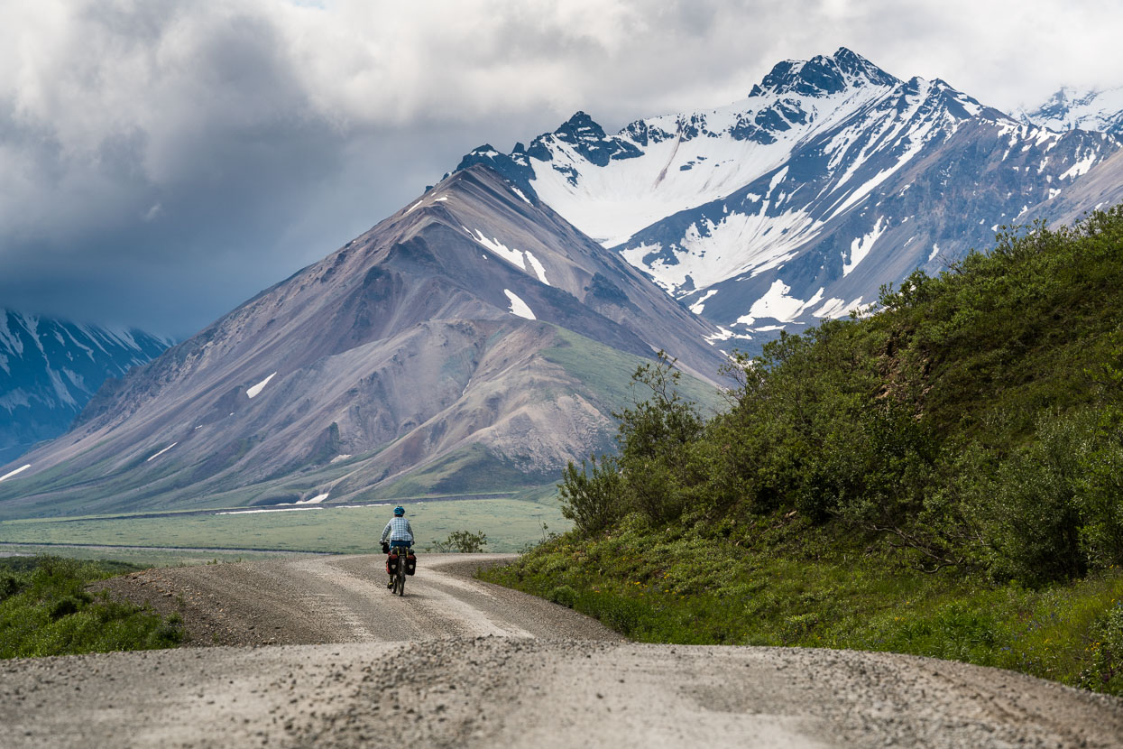
The day of many passes – climbing away from the Toklat River.
The light, mood and tone shift throughout the day.
A landscape that keeps the eye searching.
Our second day on the road entailed 85km, with three decent climbs. From Thorofare Pass, the road then drops 600m, sharply at first and then gradually with undulations for 35km down to Wonder Lake – great riding in the evening light.
Tarn near Wonder Lake campground. We didn’t see much of Wonder Lake, instead hightailing it to the campground hoping for a free site. We got lucky, but rain and cloud obscured any possible views of The High One.
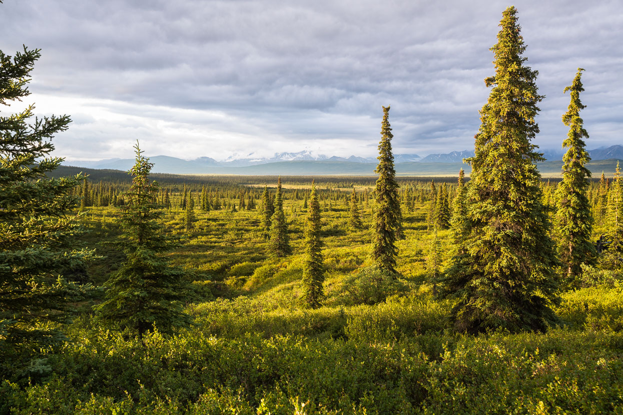
Stunted spruce trees and the distant ranges seen across the massive valley of the McKinley River.
We caught the 6.30am bus back out of the park; from Wonder Lake to the Park HQ, to resume our ride south to Cantwell and the start of the Denali Highway.
View from the Eilson Visitor Centre, near Thorofare Pass. Toklat River and Denali River valley. Throughout the three days we caught the occasional glimpse of Denali through holes in the cloud – certainly enough to get a sense of this huge mountain’s presence, but never quite enough for the full reveal.
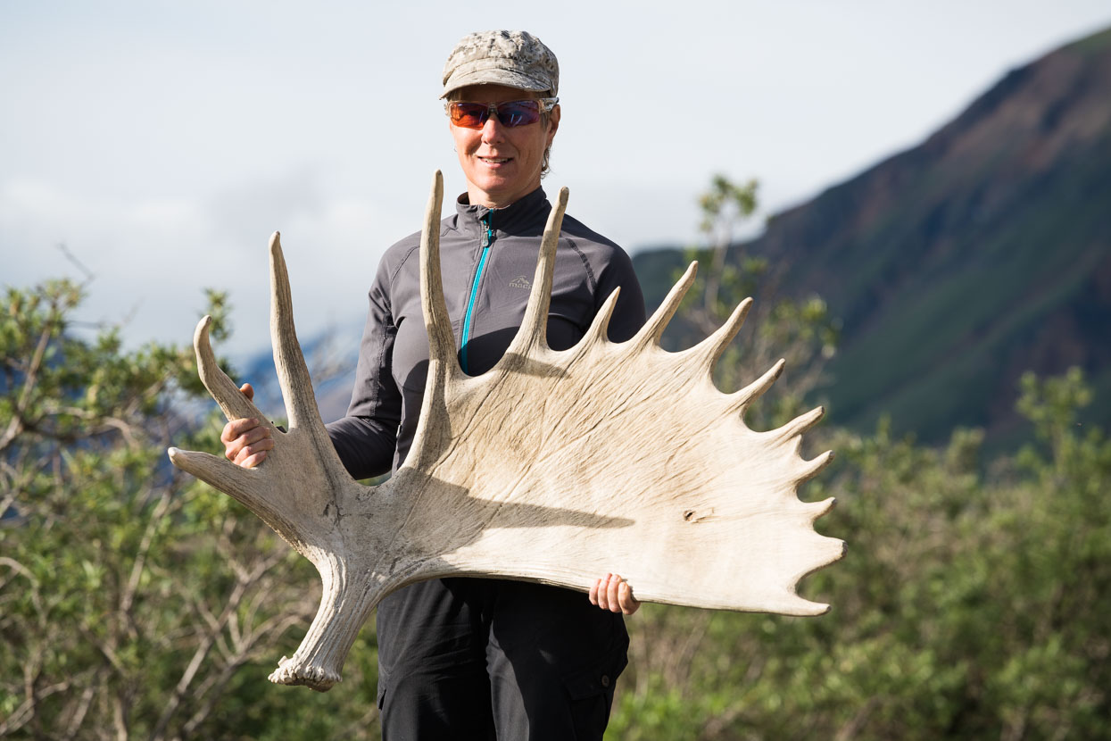
You’d need strong neck muscles to wear two of these on your head.
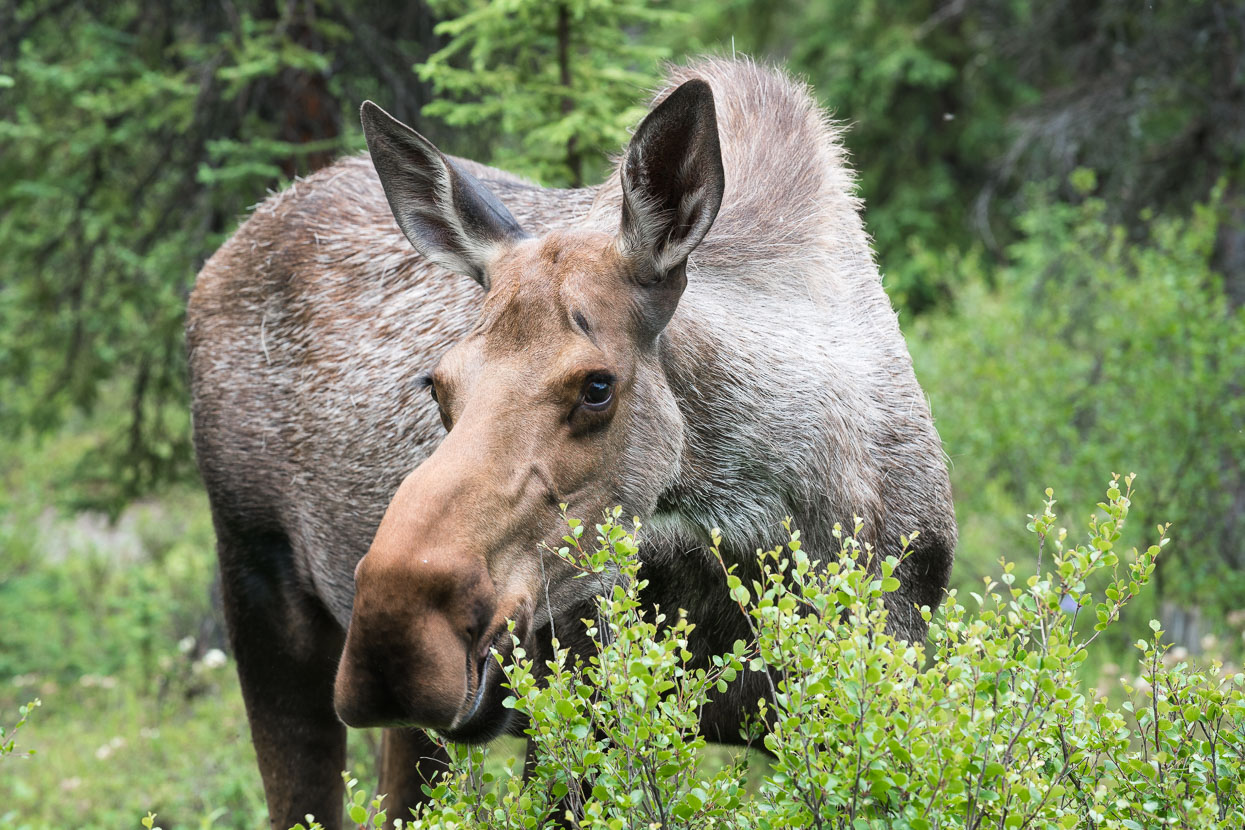
A lucky, close up female moose sighting near the park entrance.
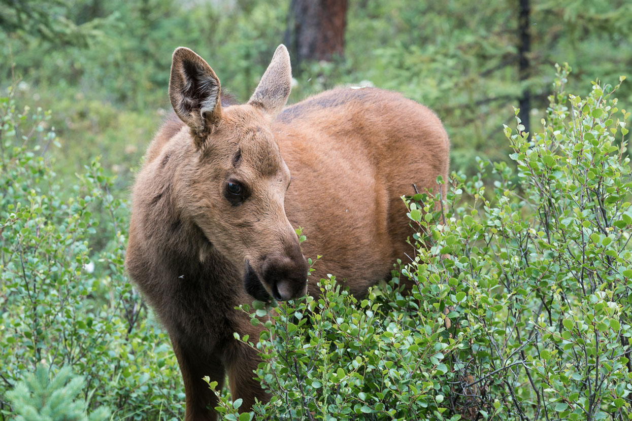
With baby in tow…
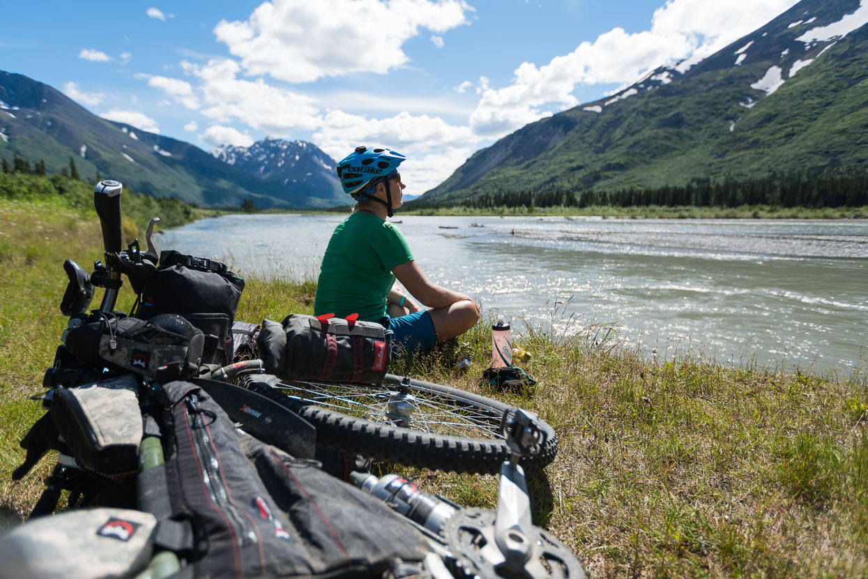
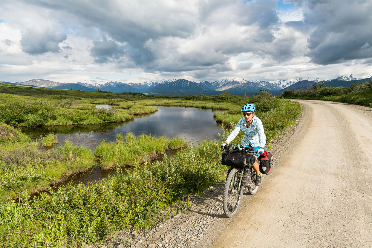
The road from Denali National Park to Cantwell was a shock to the system after the gravel and peace of the park; wide smooth seal, and endless large RVs ripping past, but we did find some peace on the banks of the Nenana River.
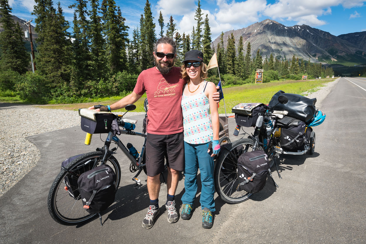
Near Cantwell we met this great French couple Mathieu and Julie. They’re on the full Americas tour too, travelling with trailers and a dog, Reblochon. Read more about their journey.
The Nuts & Bolts
⊕ The ride into the park is a classic dirt road ride and would be worth doing as a standalone ride, or a part of a tour, as we did. Many people told us that it’s best to bus in and ride out as it’s ‘easier’ but don’t be fooled – the road starts and ends at pretty much the same elevation with a bunch of passes in between, grades were generally fairly mellow. If anything it’s easier riding in as you do the first climb on a sealed road, it’s also nice seeing the scenery and scale unfold from a bike, rather than a small and dusty bus window.
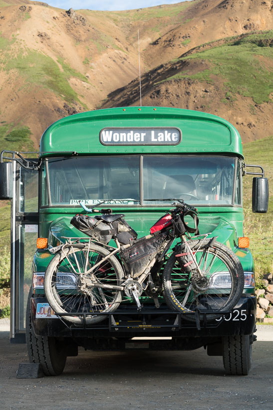
⊕ The park’s bus service can portage your bike (only two at a time on racks on the front of the bus) but not every bus has these, so check the timetable. Note that the fattest tyres that will fit in the racks are about 2.3 inch. 3 inch and fat bikes won’t fit.
⊕ Denali National Park park service information is here.
⊕ We have found the Milepost publication (available in print and as an app) essential for information on Alaskan and Canadian roads and highways. We run the app on an iPad and refer to it often – mostly to get an idea of what’s available to eat along the way and in towns for resupply, and information on campsites. It’s incredibly detailed, describing every campsite, overlook and road side pull-in.


Outstanding photography again. I love the open Alaskan landscape and I feel like I can smell and feel it through your images!
Loving the updates, keep them coming! Looking forward to watching the trip unfold as you head south 🙂
Thanks Ryan and Chris! Another post is in the pipeline of course – hard to find the editing time with long days on the bike! 😉