
On the Road to Chimborazo.
With all the back to back riding days we’ve had in the past two weeks the blog has slipped a bit, but now we’re in Cuenca for a couple of day’s rest and sightseeing I’ll try to bring it all up to date.
This chapter covers the rest of our ride to Salinas, mostly following the Los Tres Volcanes bikepacking route. It’s been another classic section of Ecuador mountain riding with everything from breezy páramo, desert-like canyons, grubby towns and colourful markets. And while we hoped the wet season here might have done its dash, it’s been rainy and cold enough for us to forget that we’re only just south of the Equator.
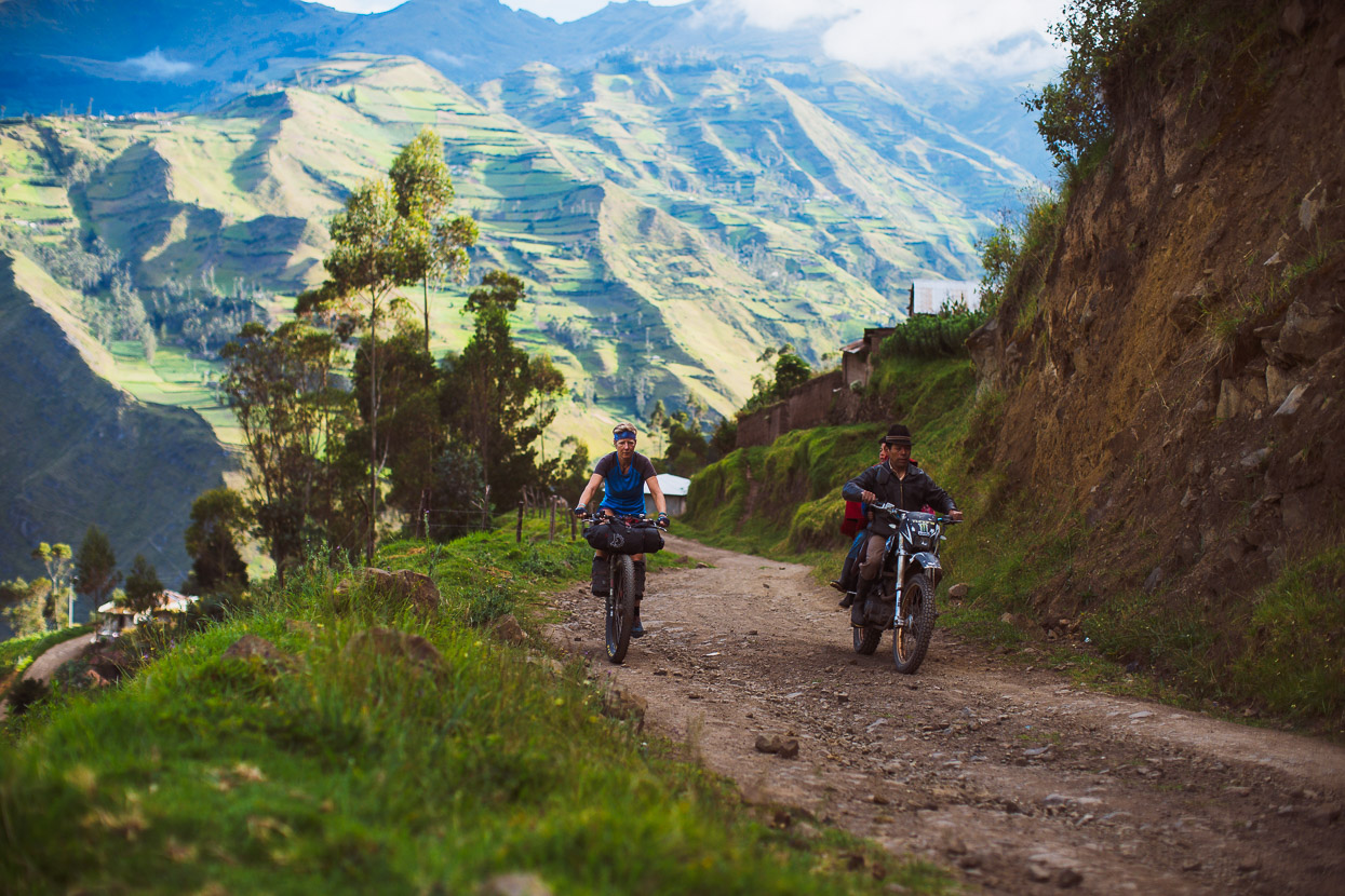
We left the junction town of Lasso, on the Pan American Highway, once again in the company of Richard we headed along the Los Tres Volcanes route towards the volcanic caldera of Quilotoa. Since we left behind Quito and also the emptiness of the remote páramo we’re starting to see a more rugged, unbridled side to life in Ecuador.
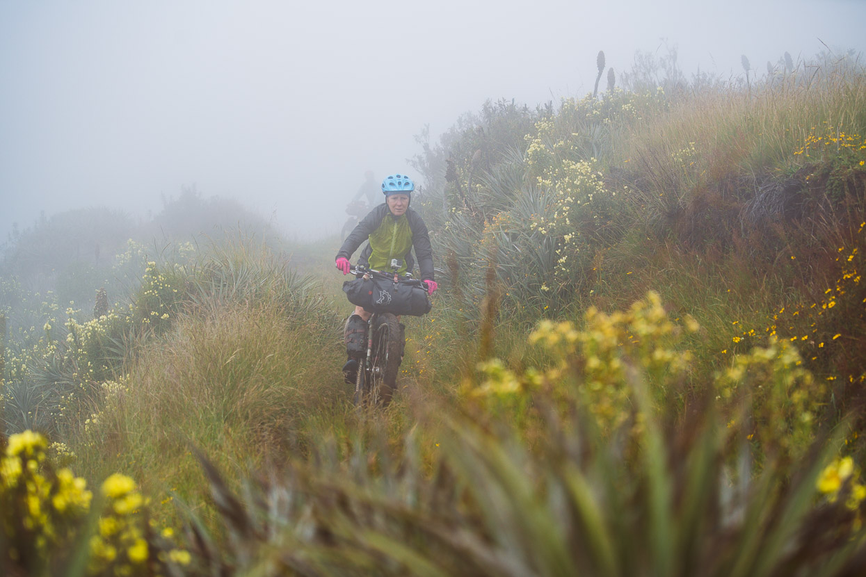
Between Toacazo and Quilotoa the route climbs steadily into the high páramo, weaving and winding its way along high ridgelines and over saddles. We were blasted with cold wind-driven rain most of this afternoon. Mid-layers, Gore-Tex and gloves kept us warm as we plugged out the miles along roads smooth with volcanic soil.

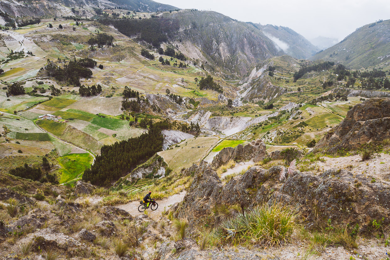
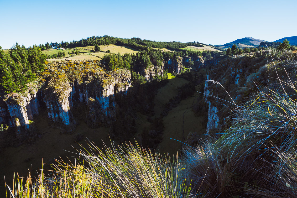
Eventually we left the exposed ridges behind and began to drop, down an increasing windy road into the canyon of the Toachi River. We passed an isolated, deserted looking village on a small plateau, stopping only to collect water and dropped down a rocky and rutted single track (mostly walking the bikes).
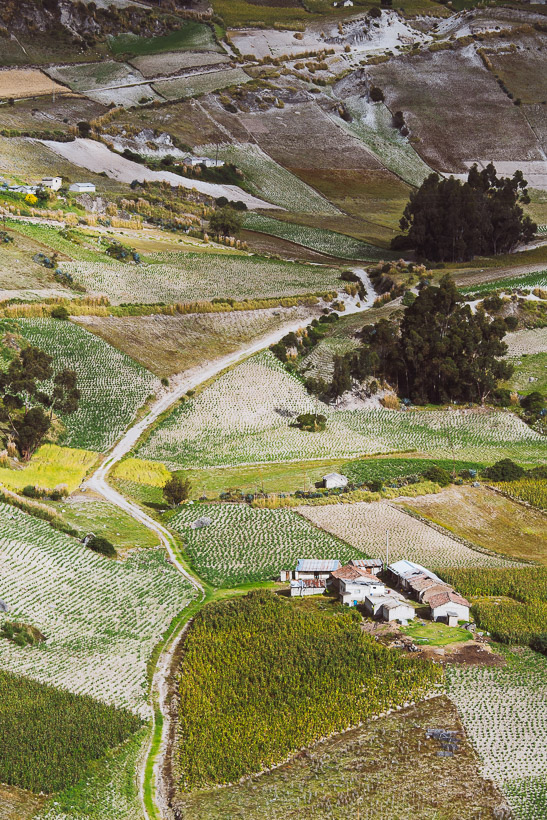
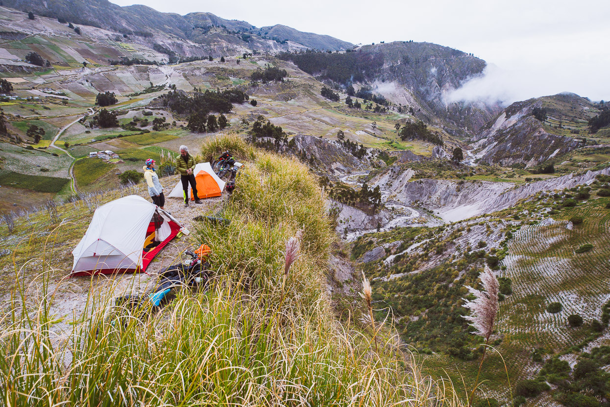
Amid a dry landscape of tussock and pampas grass we found the perfect campsite partway down the side of the canyon – right on the edge of a cliff and with a spectacular view over the river below. A good place to dry out and warm up after the cold wind and rain of the afternoon.
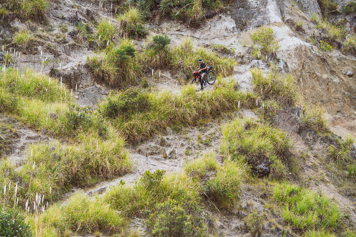
In the morning we followed the goat track to the floor of the canyon.
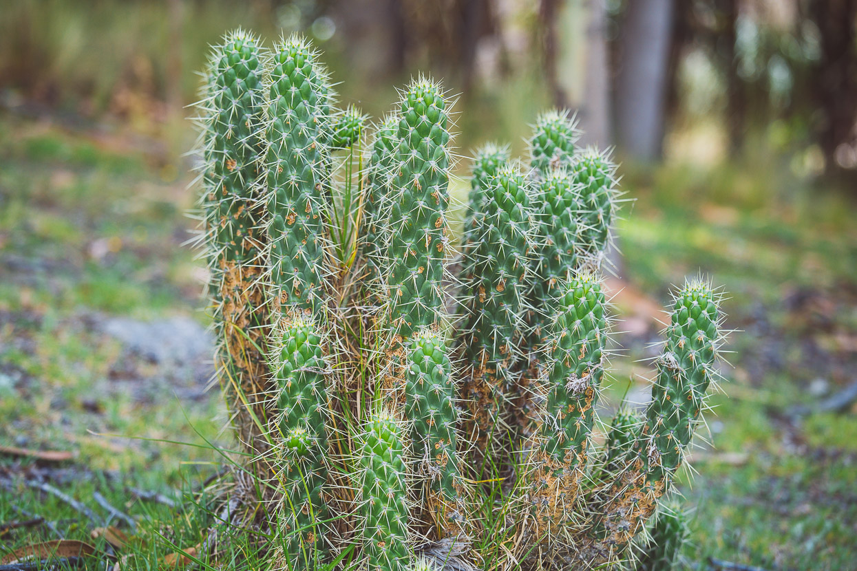
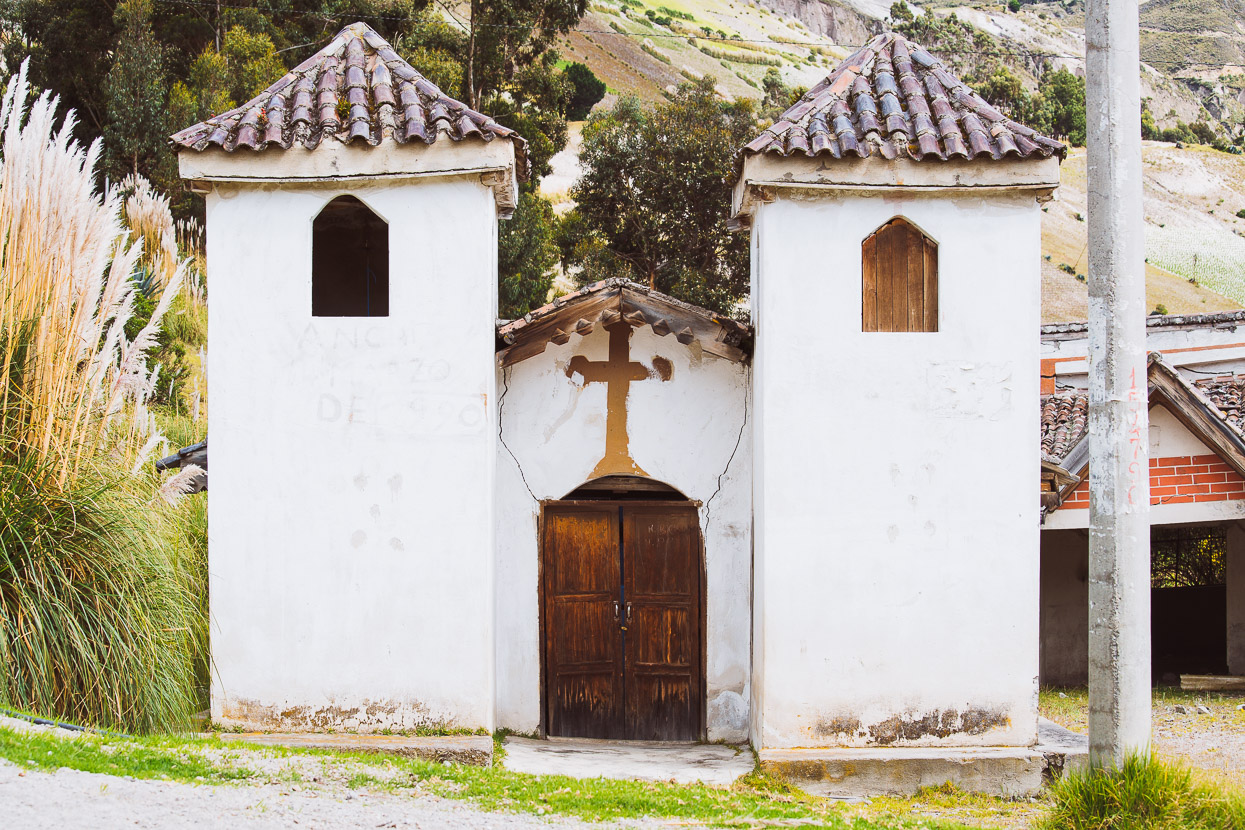
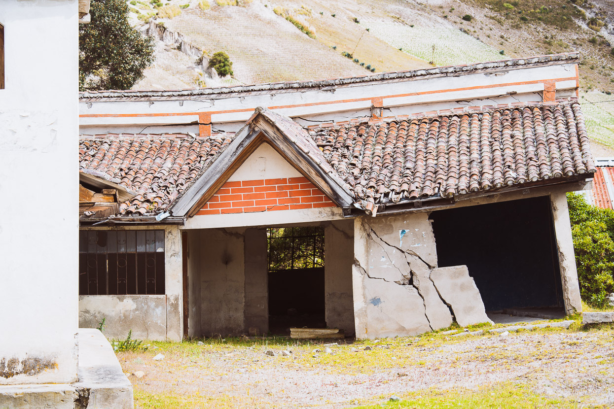
Before making a long, steady climb back up the other side. Past cactus, pine trees, quinoa fields and an abandoned, earthquake damaged village.
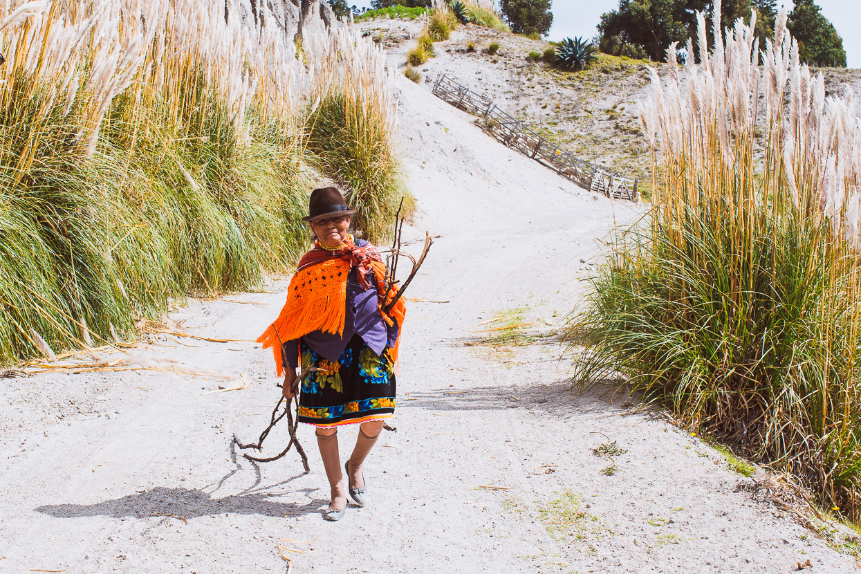
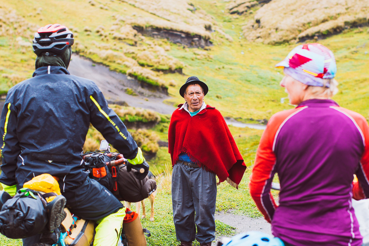
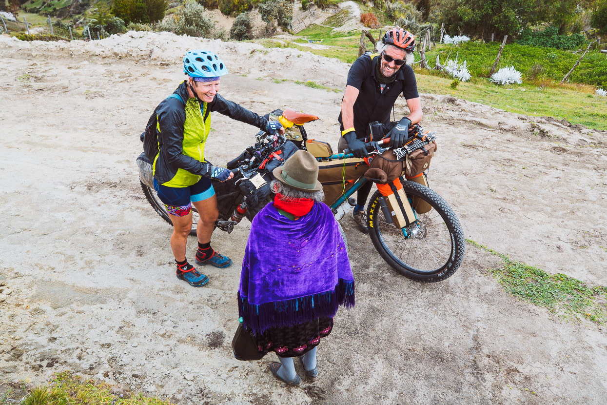
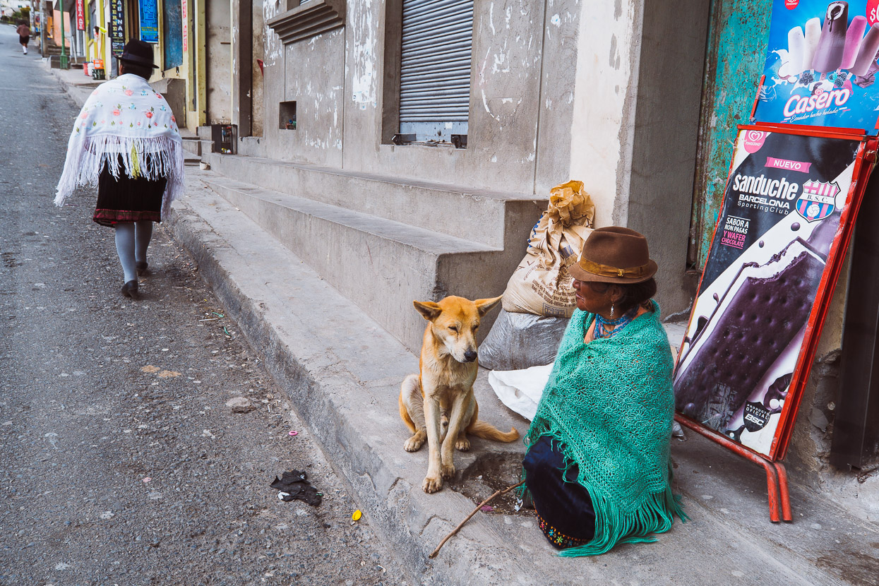
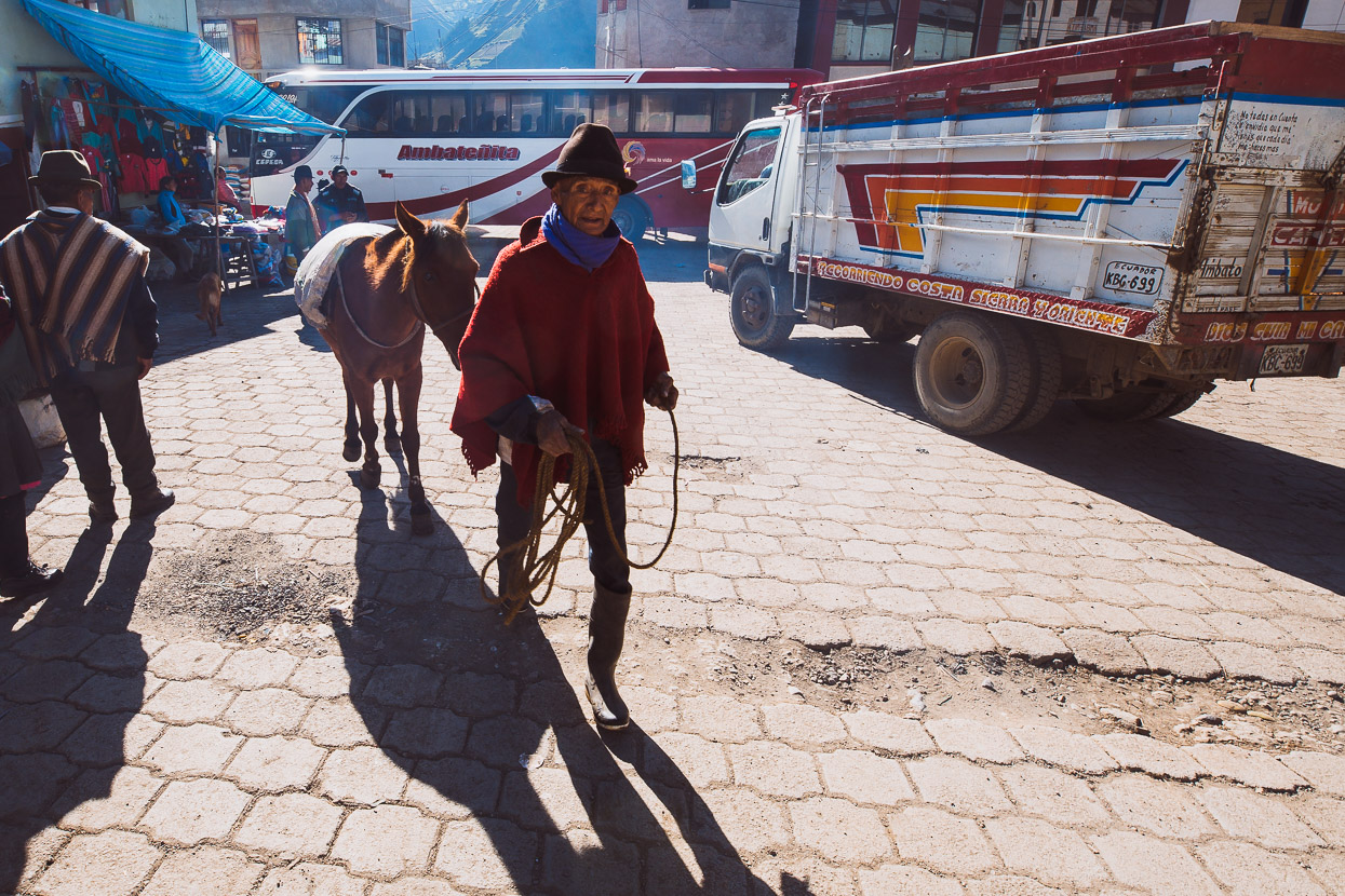
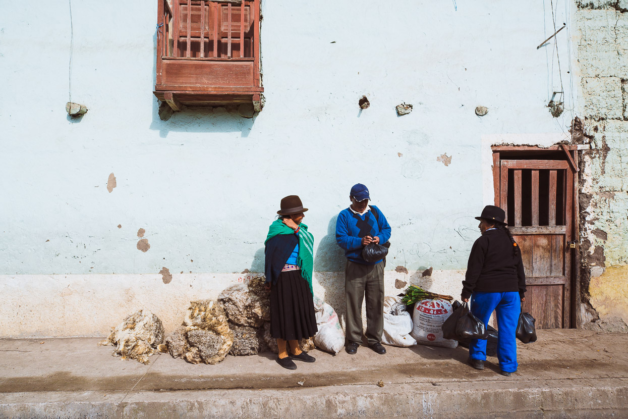
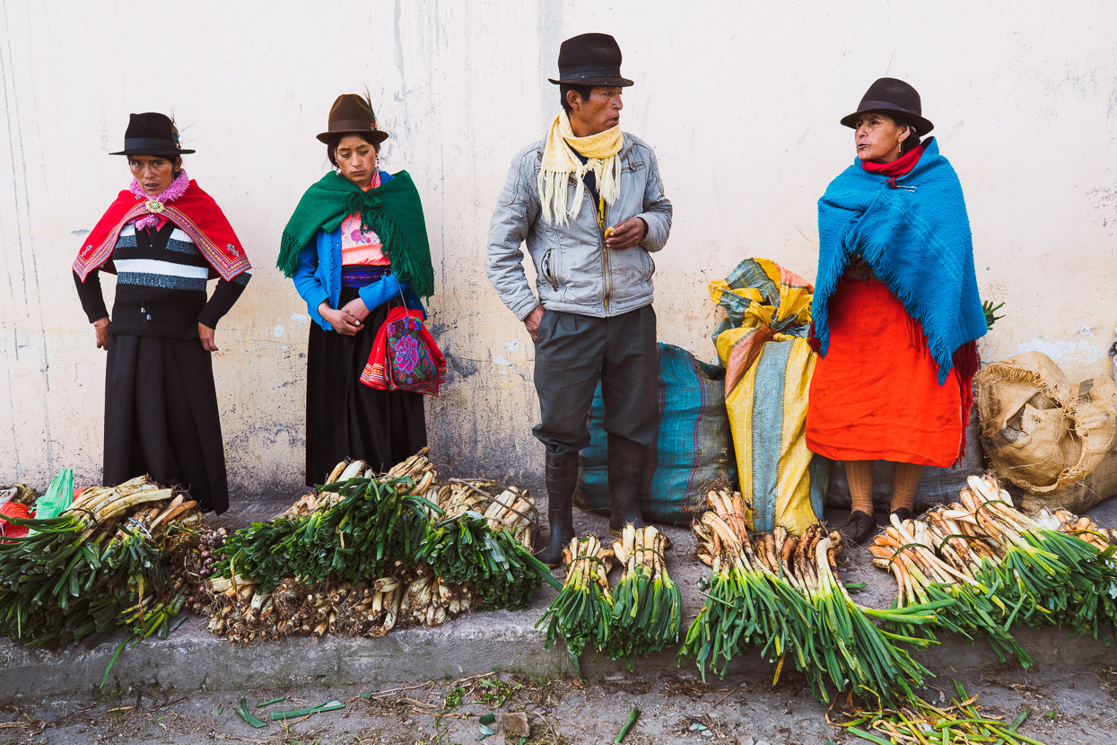
The campesinos we meet are now more traditionally dressed, but the styles differ from one valley to next. We’re in Highland Quichua country now – the indigenous group that makes up roughly 20% of Ecuador’s population.
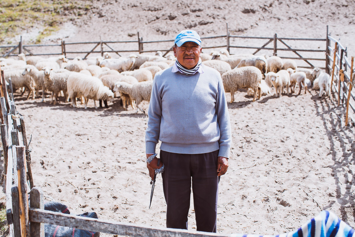
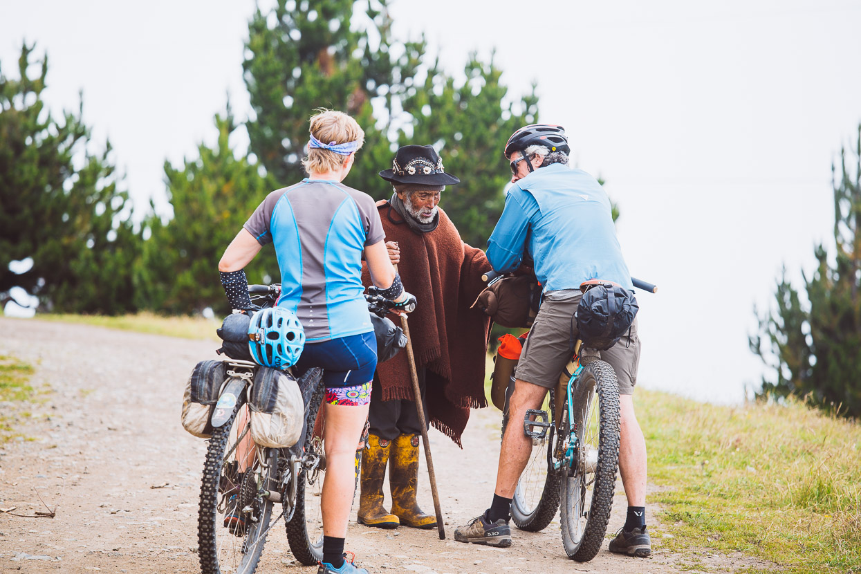
Usually we stop and make small talk, breaking the ice for an opportunity for a polite photograph, and to connect a little more deeply. People are invariably friendly.
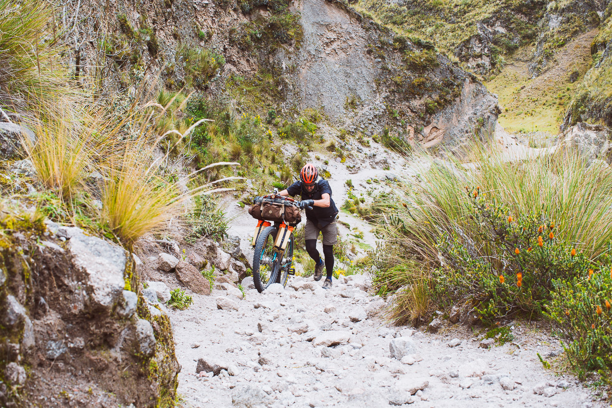
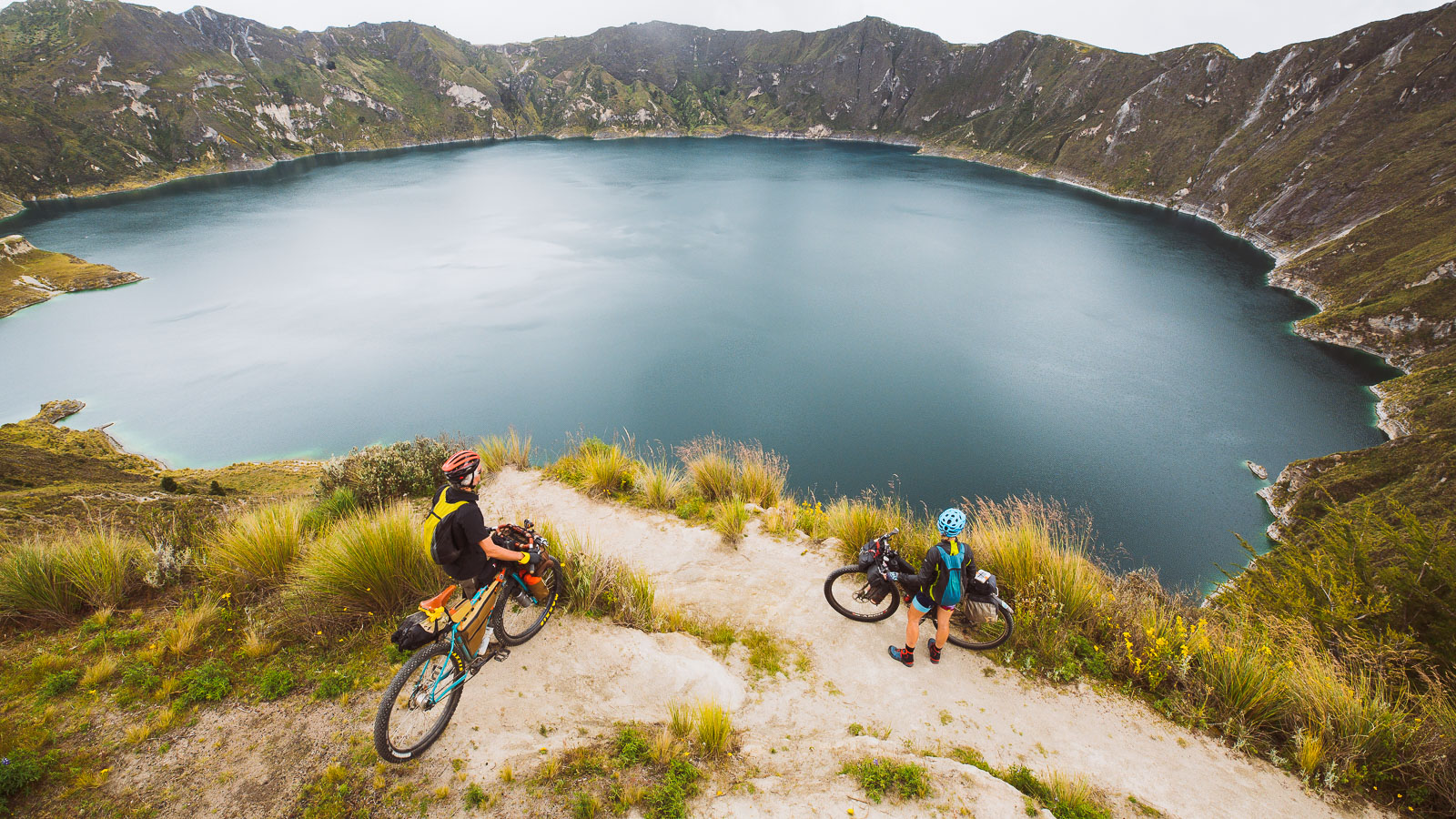
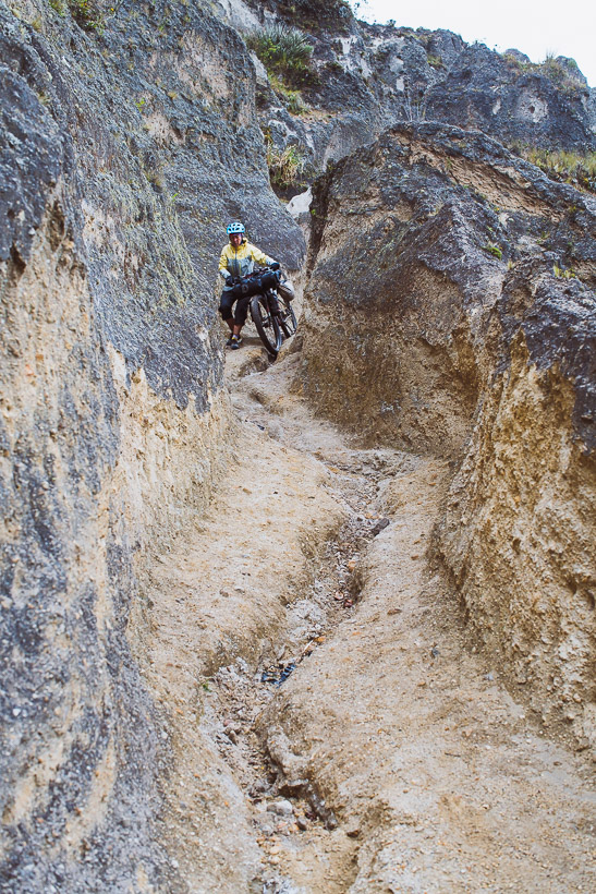
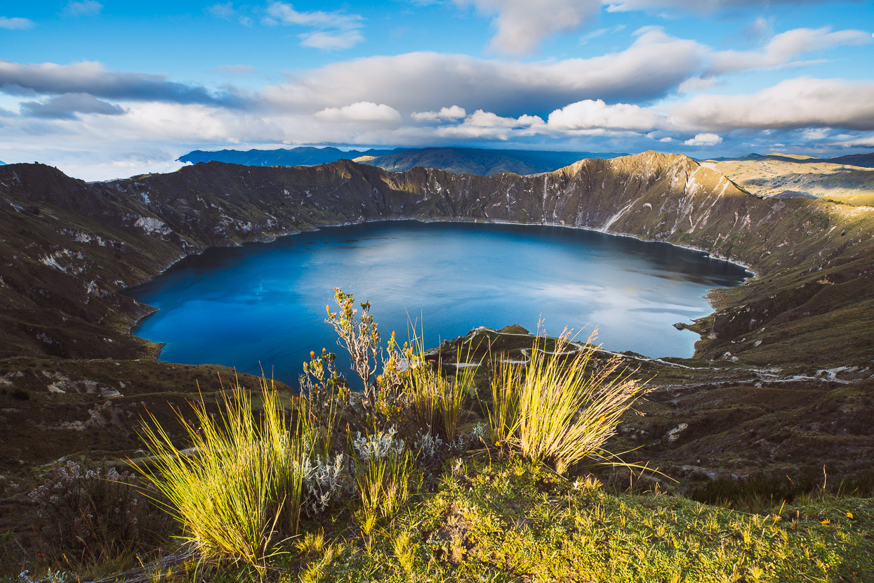
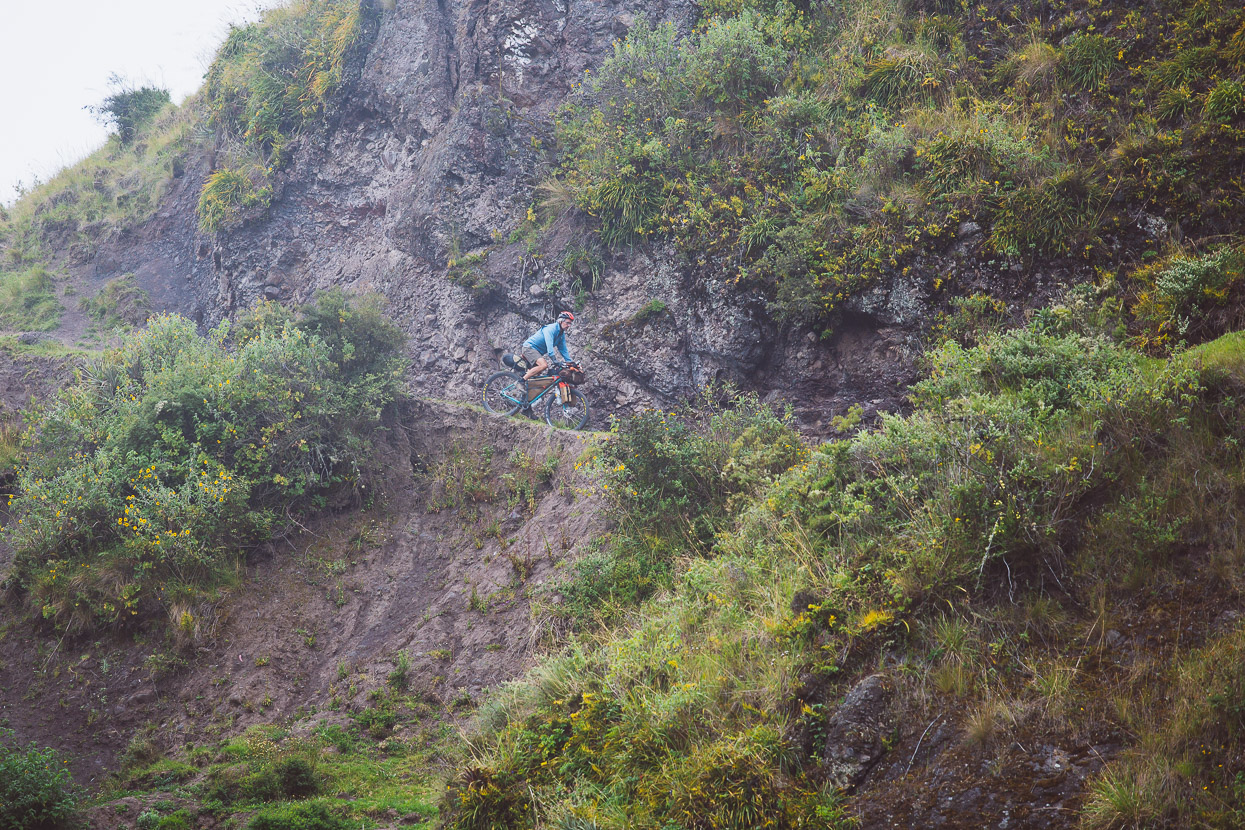
We left the sandy dirt road at small hamlet and followed a double track towards a small canyon and thence onto a rough single track, for the notorious hike-a-bike to the crater rim of Quilotoa.
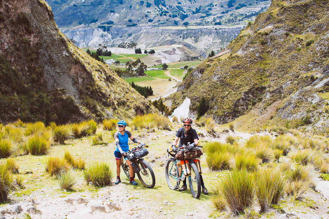
Over rocks, through tussock and forest we eased the bikes uphill. It’s a bit like doing a thousand assisted pushups, with the odd deadlift thrown in for good measure.
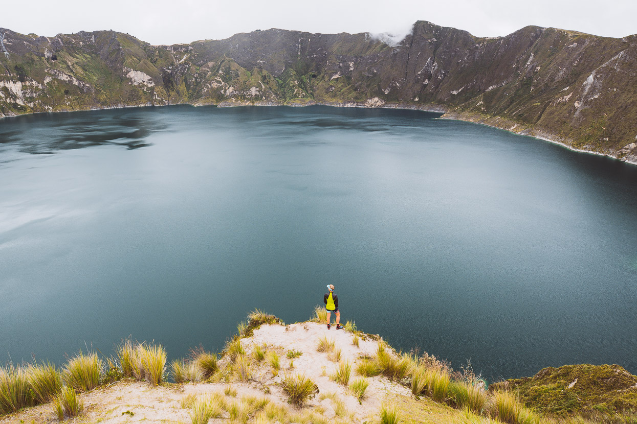
But the reward for the effort was this amazing view once we broke over the edge of the caldera.
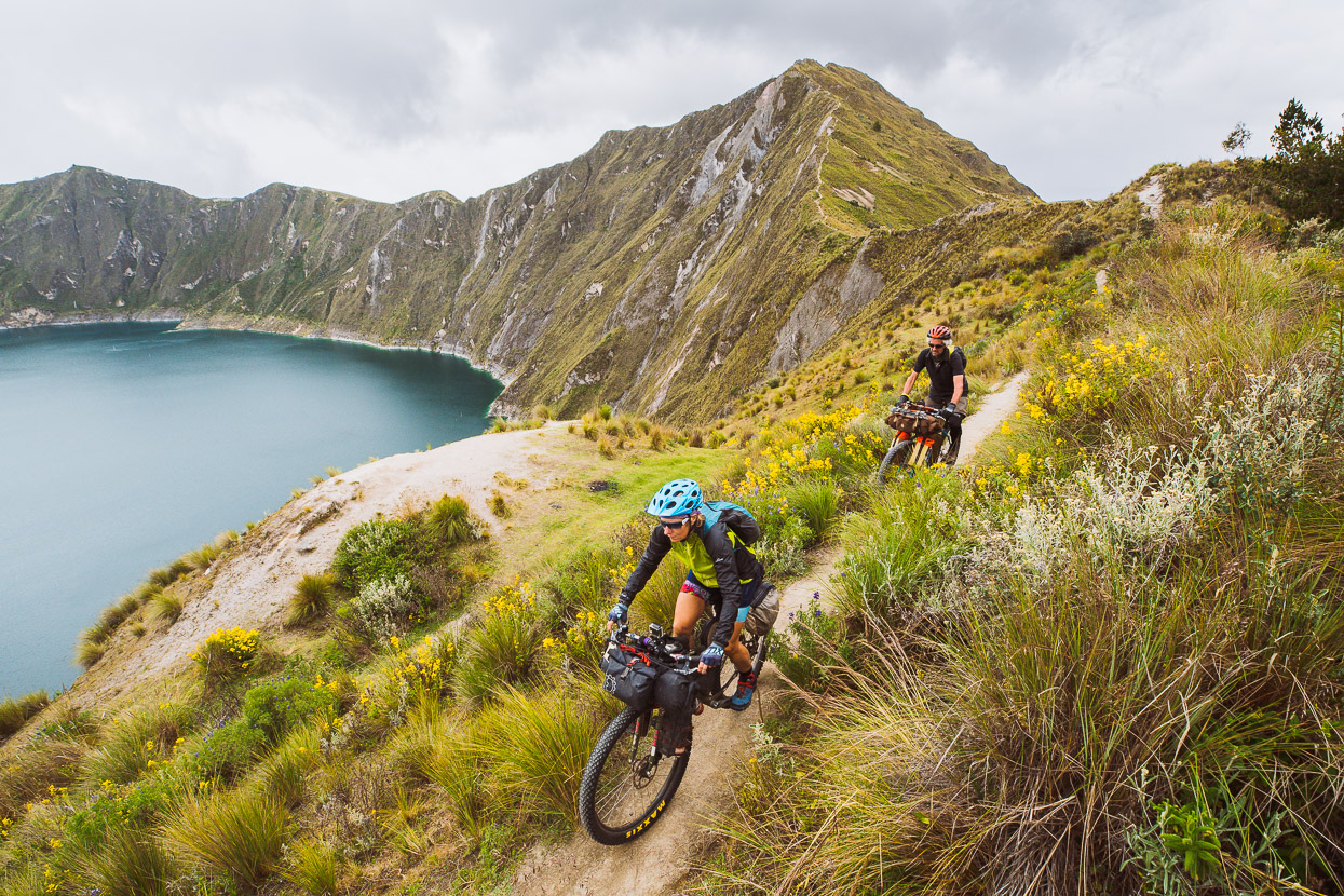
And some pretty sweet (albeit short) single track along the rim. An amazing place to drag your bike up to, that’s for sure.
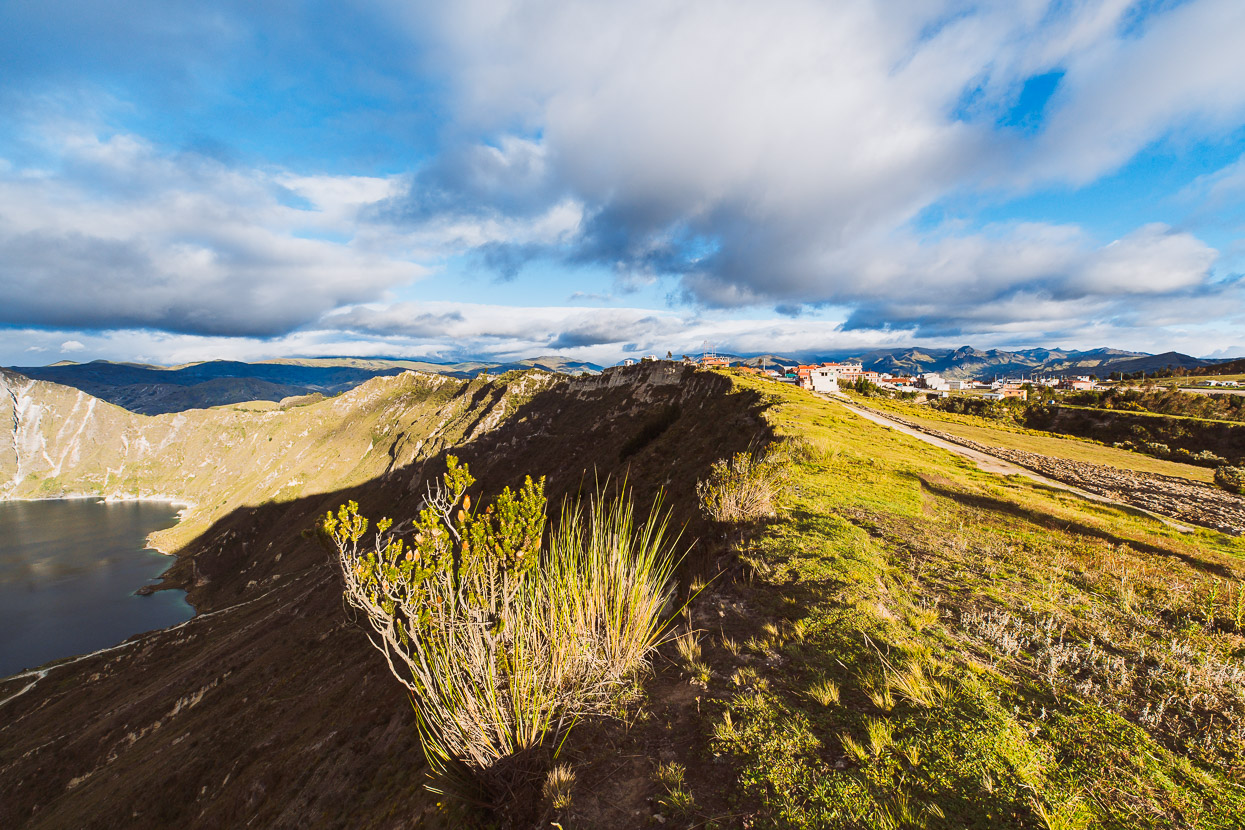
We found a guesthouse in the small village turned touristy-town of Quilotoa just a short distance from the rim – chatting to the odd local along the way.
Evening brought some nice light but a nip to the wind up here at 3700 metres.
Rugged up the next morning, we wound our way down on pavement to Zumbahua to stock up on food before climbing away back up to the tops of the ranges.
The town was barren; deserted feeling, with the only bank closed down and little to buy in the shops. It’s the kind of place where there’s more sheep and llamas on the streets than cars.
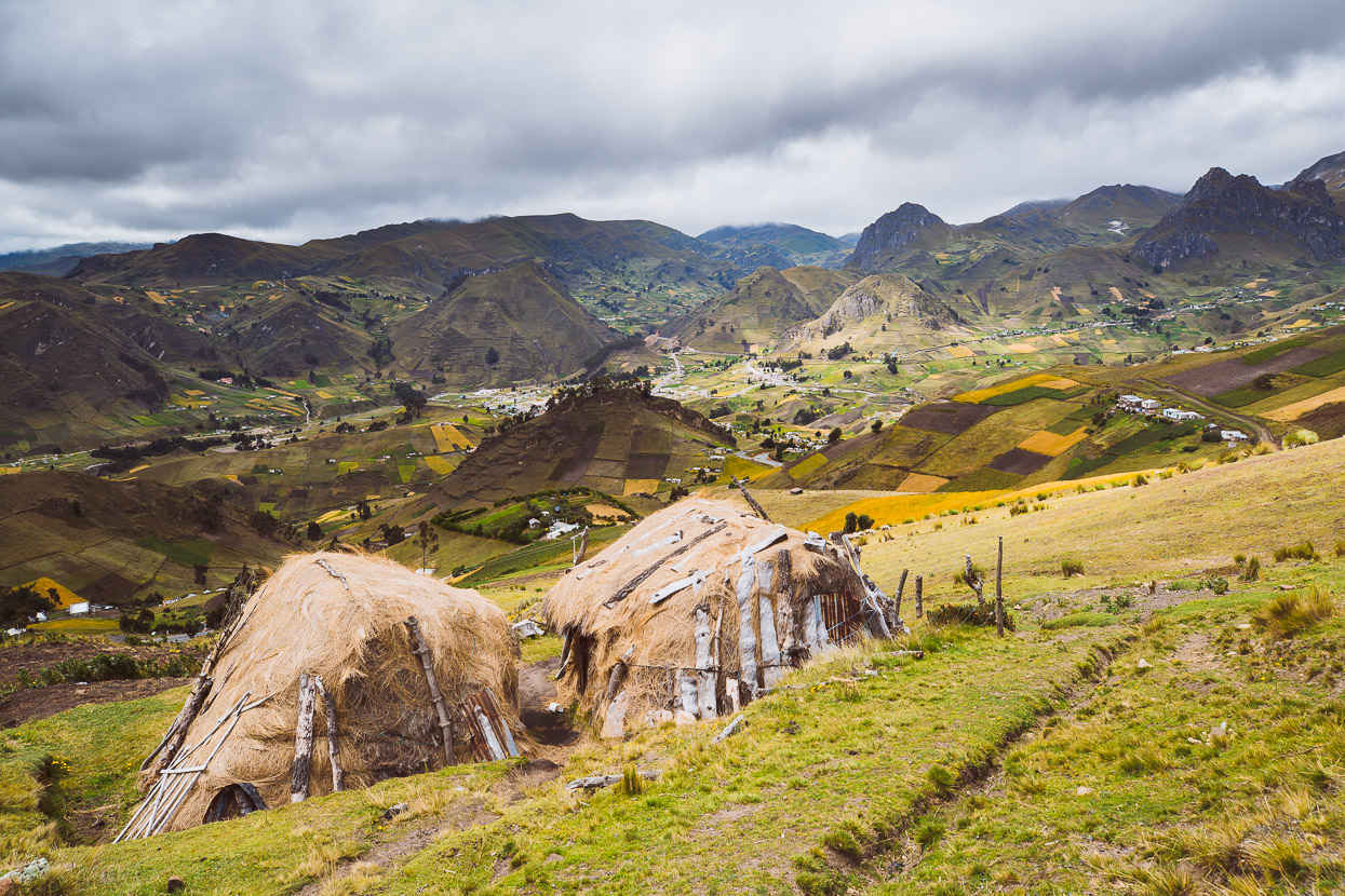
Pavement leads us into the hills above town, giving us a better appreciation of the craggy, unusual landscape. The straw-roofed huts in the foreground are chosas (shepherd’s huts).
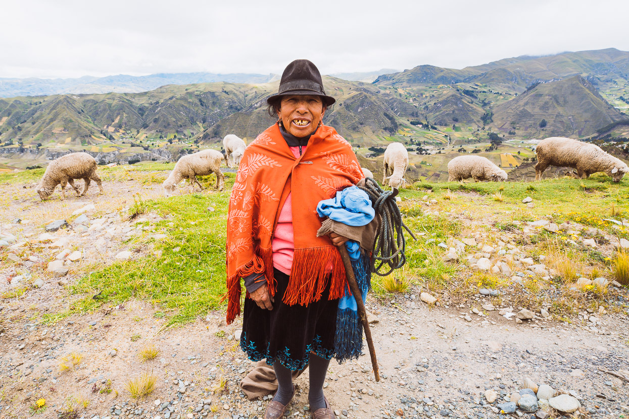
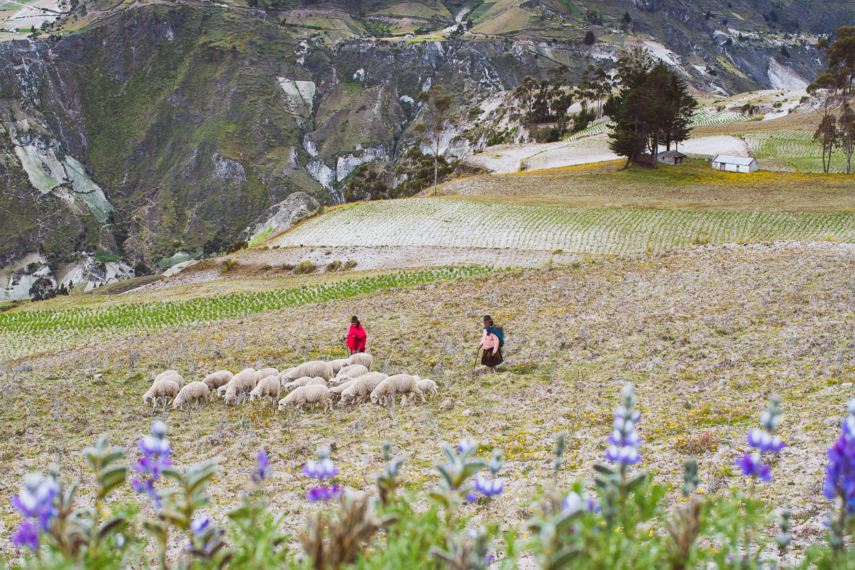
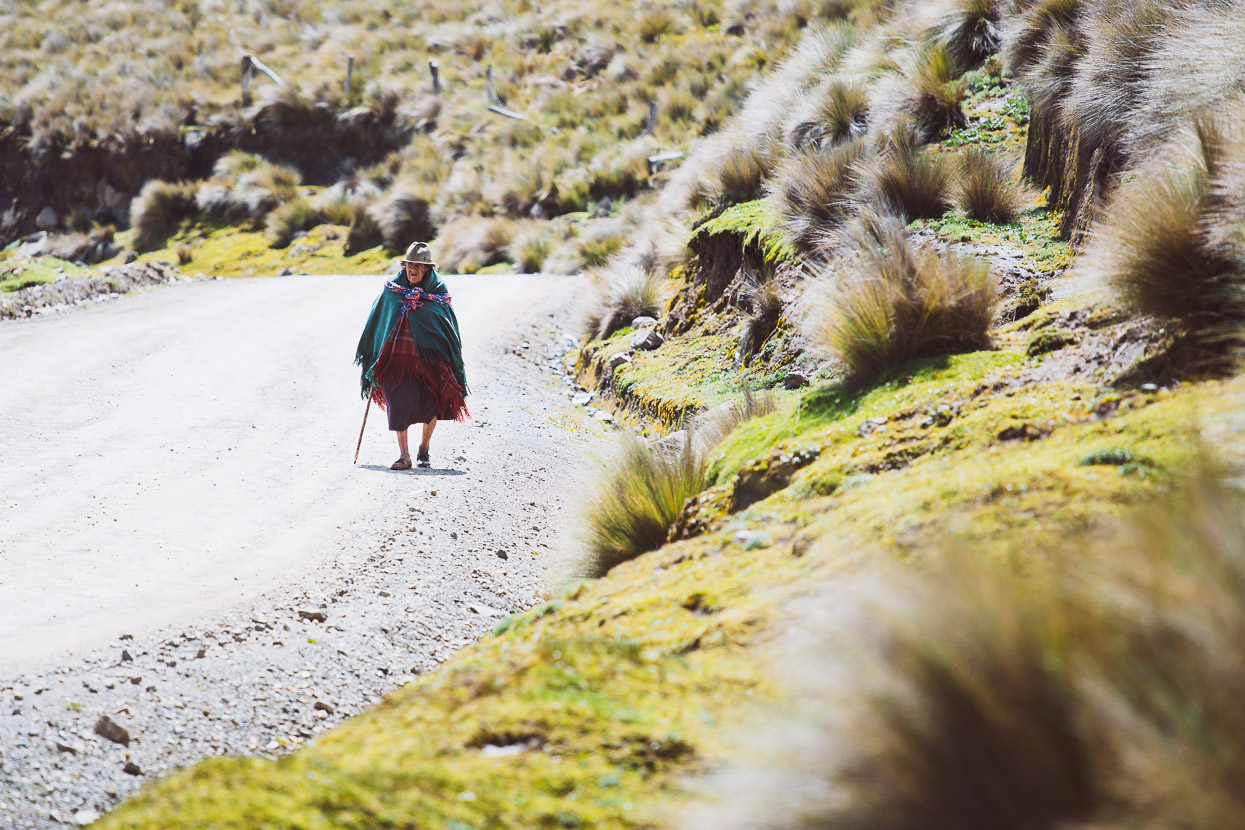
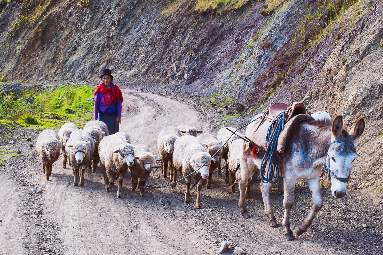
Like most shepherds we meet, this woman would spend her whole day walking her sheep to a place to graze – and then tending them high on the exposed, windy páramo before returning to home for the evening.
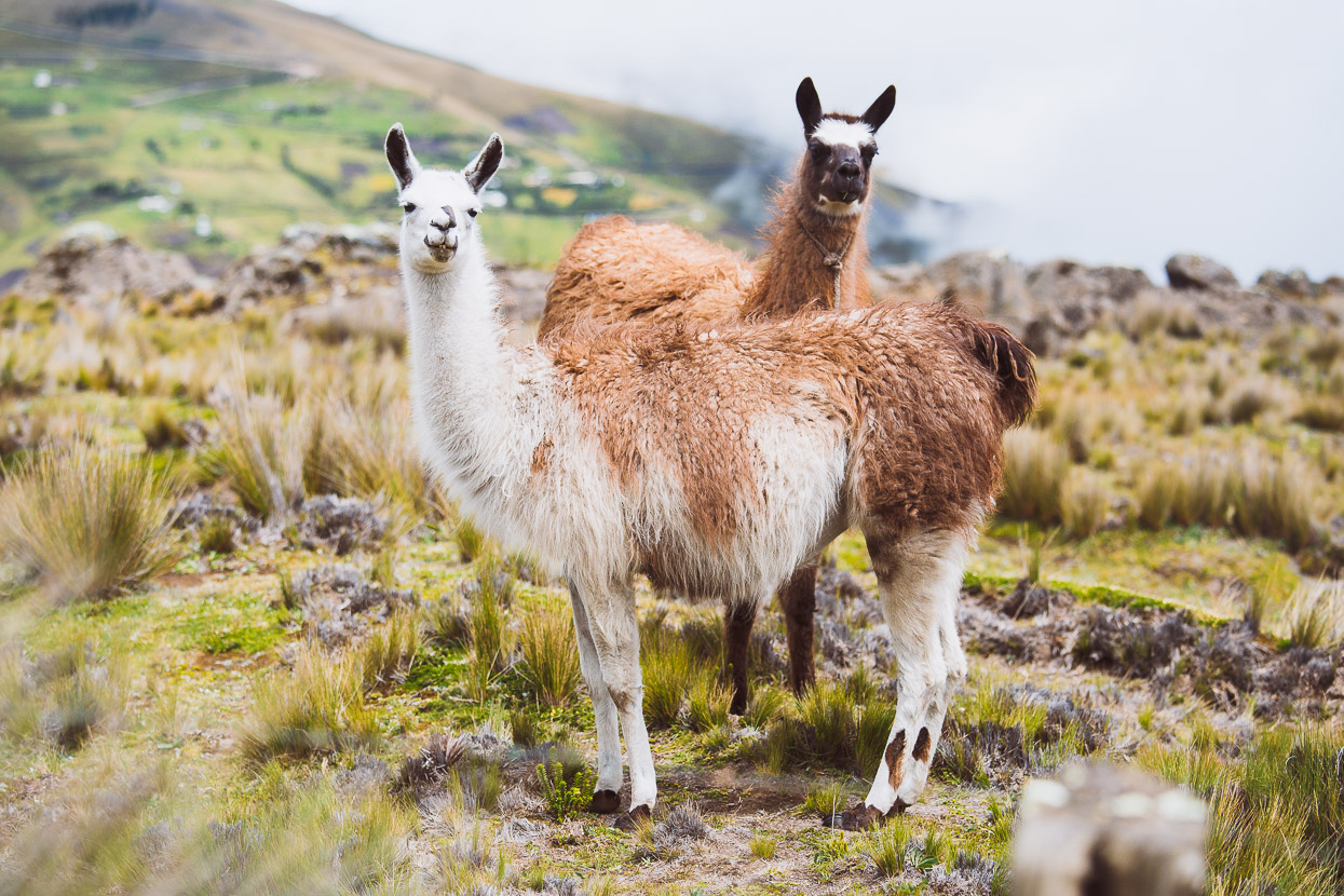
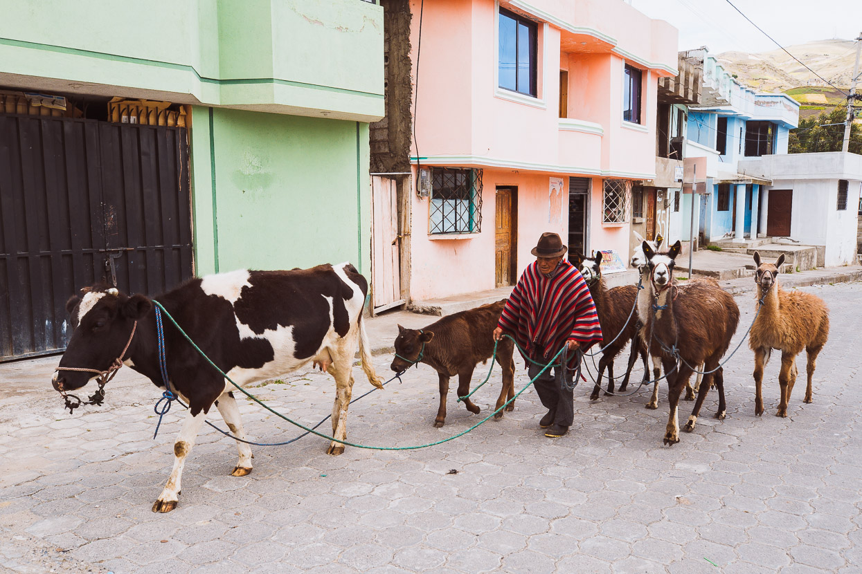
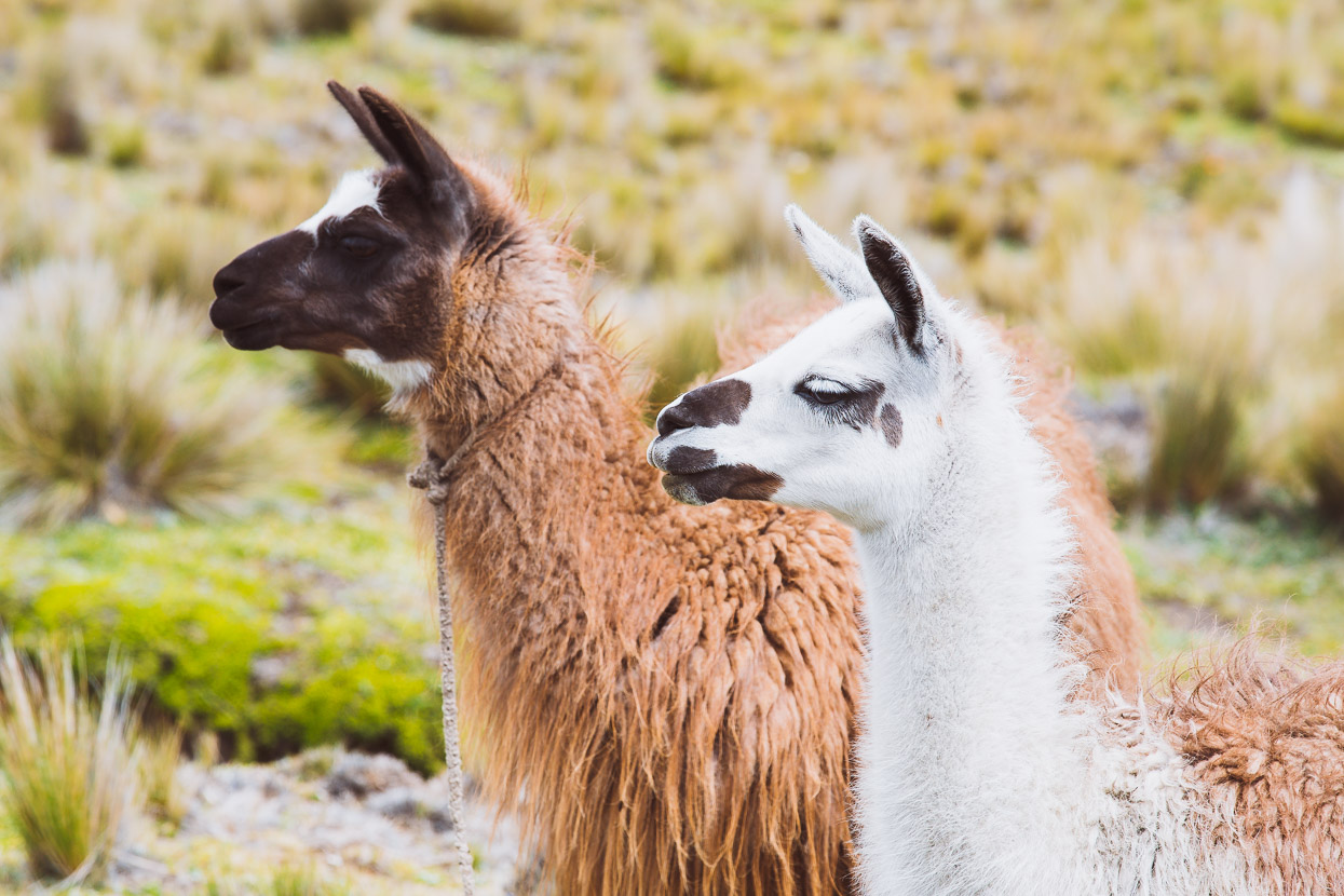
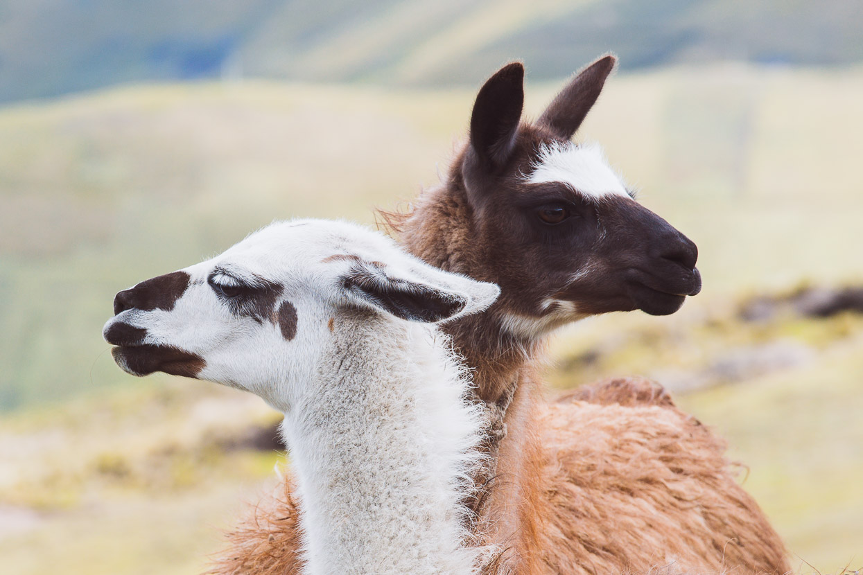
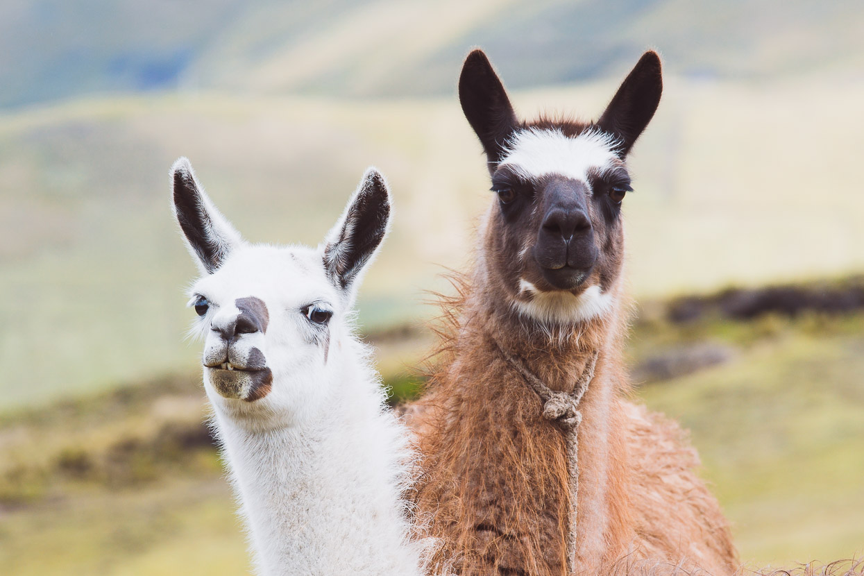
Lately, llamas, alpaca and vicuñas have been making regular appearances. Sometimes out grazing free and sometimes working as pack animals in support of a herd of sheep.
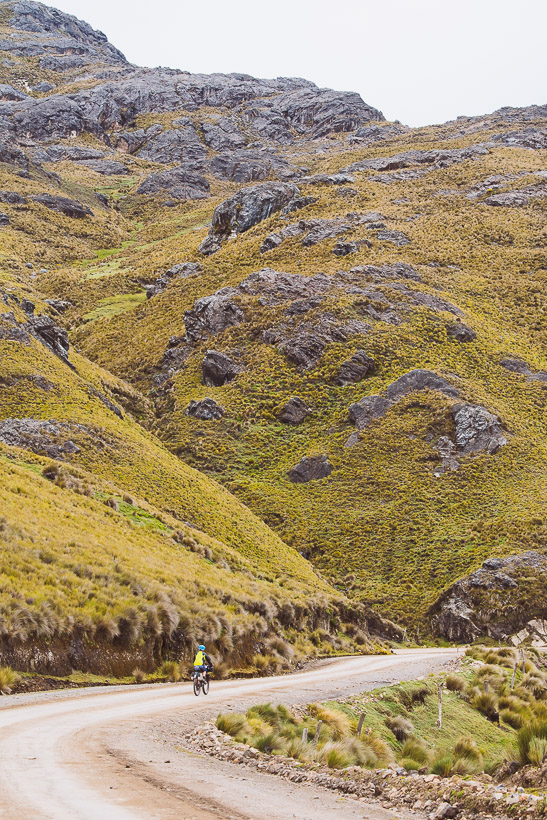
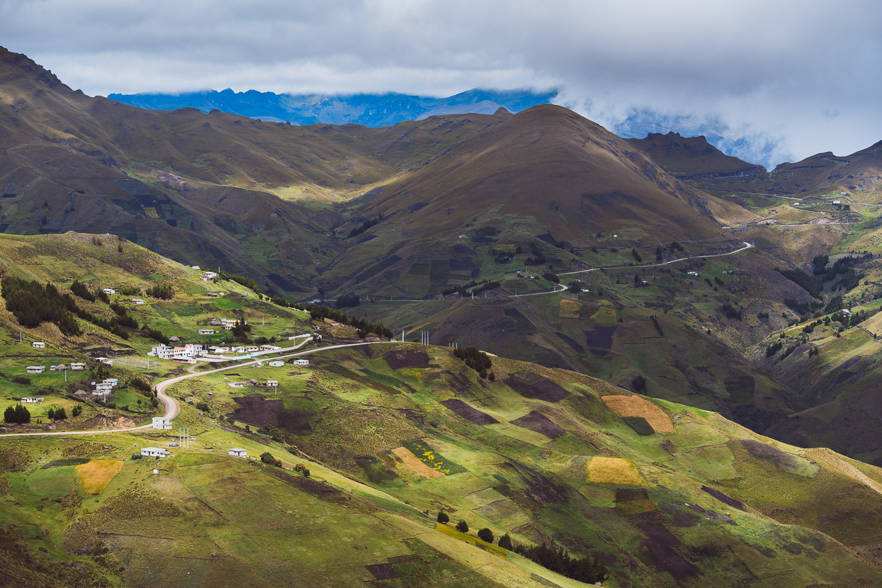
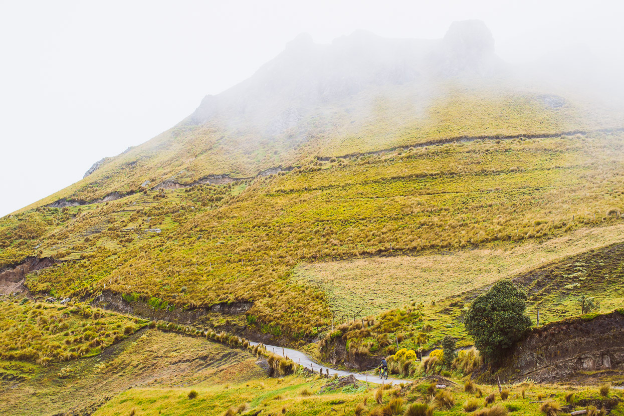
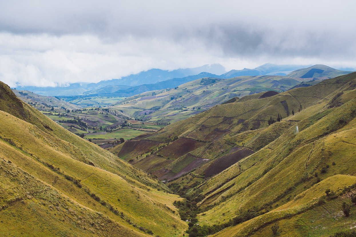
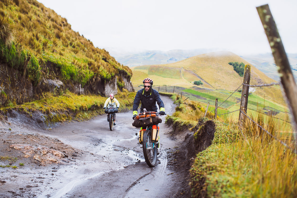
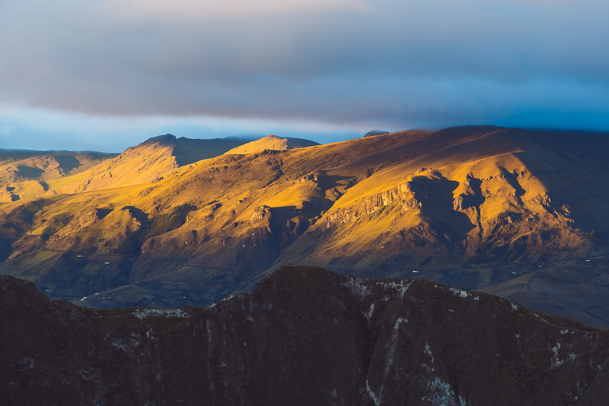
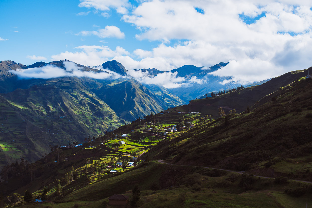
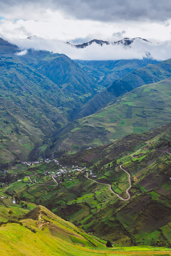
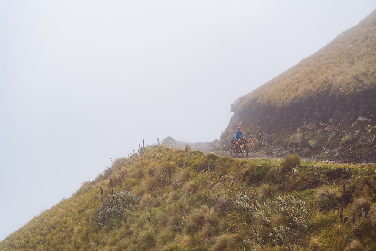
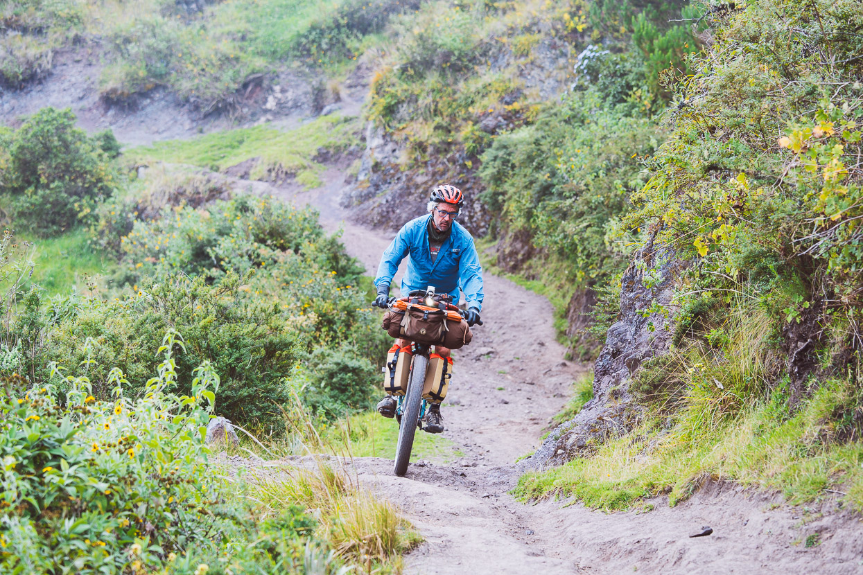
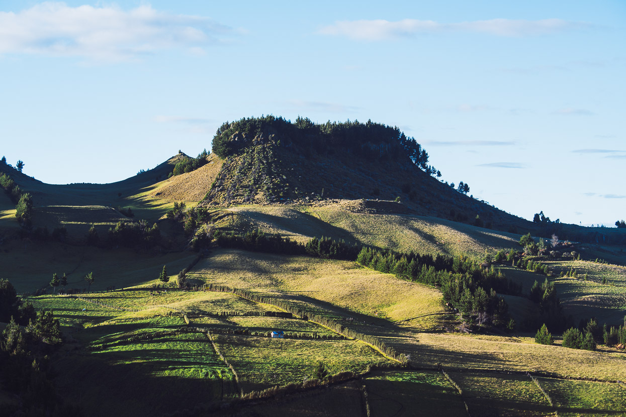
The road flows through the hills, past small communities, dipping and diving over ridges – a perfect dirt touring route.
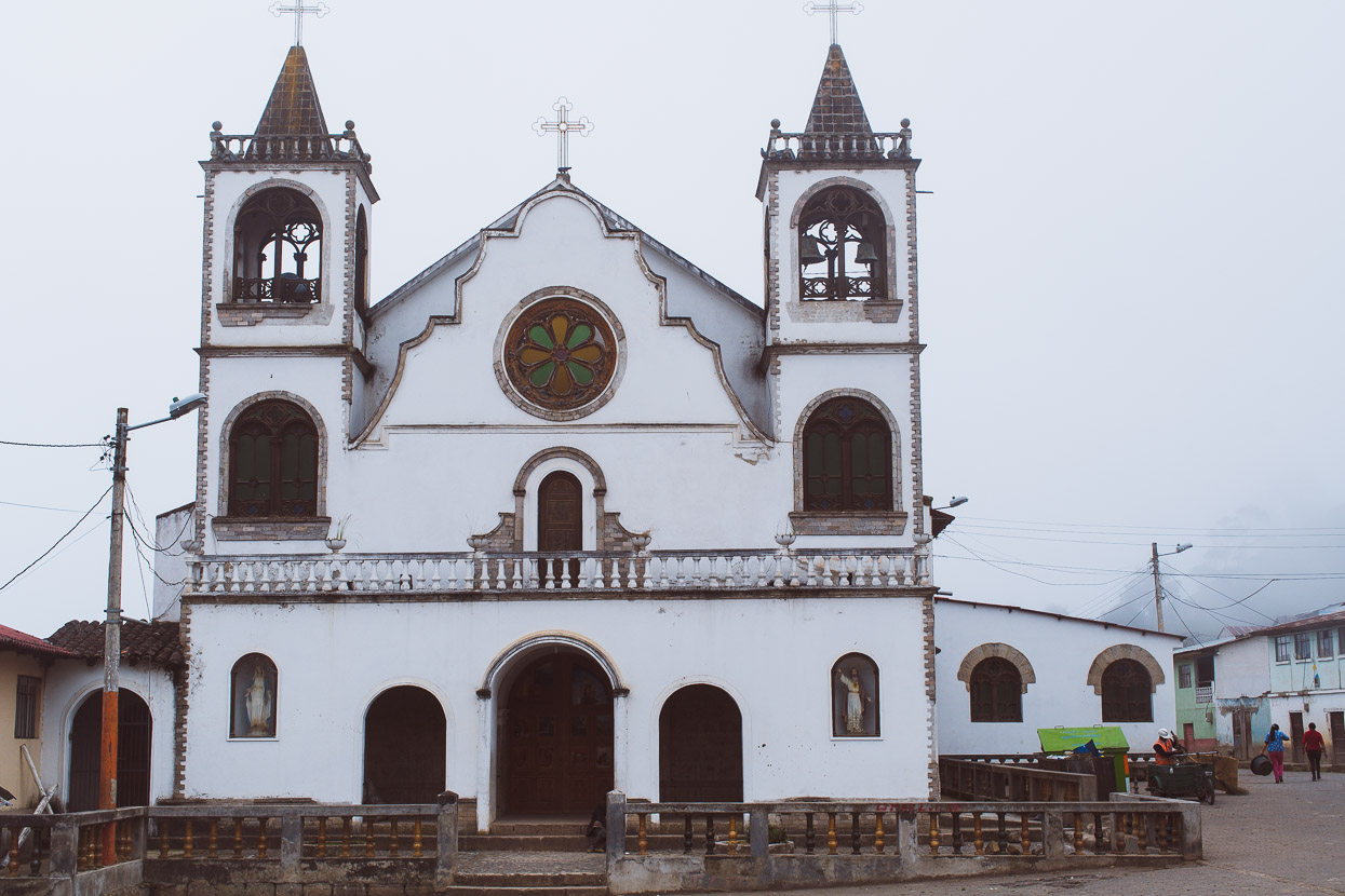
We disappeared into the cloud and then tipped downwards into a long descent, popping out of the mist just above Angamarca. Like Zumbahua, this town too seemed like it had fallen on hard times; the businesses mostly shuttered and hardly anyone on the streets.
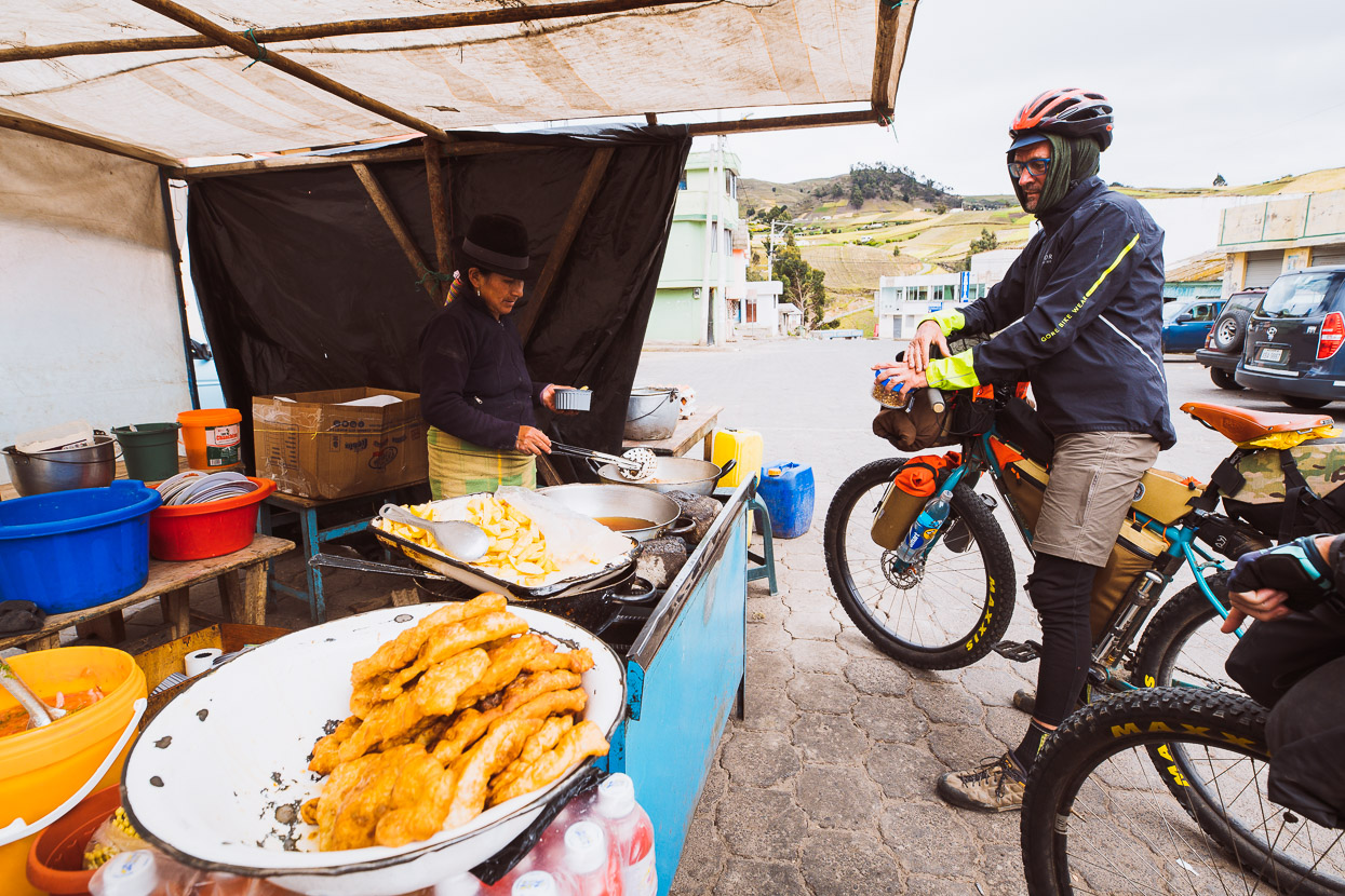
We asked around, looking for someone to cook us a meal. It was late afternoon and we planned to eat and resupply before heading further downhill to the river to camp.
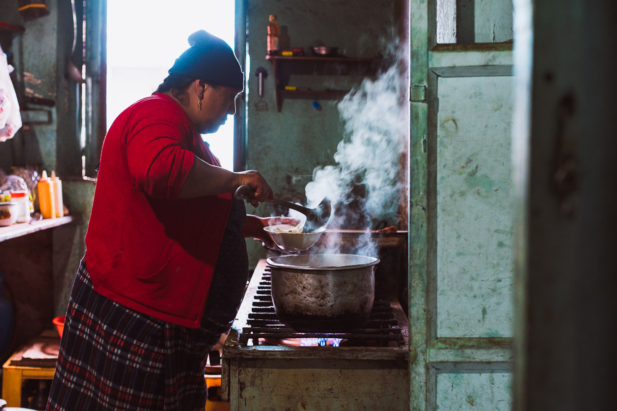
We spoke to a man, who spoke to a woman and soon enough a meal was being prepared. Chicken soup, fried chicken, chips and rice was served up, while the cook sold takeaway chips and fried chicken out of the window.
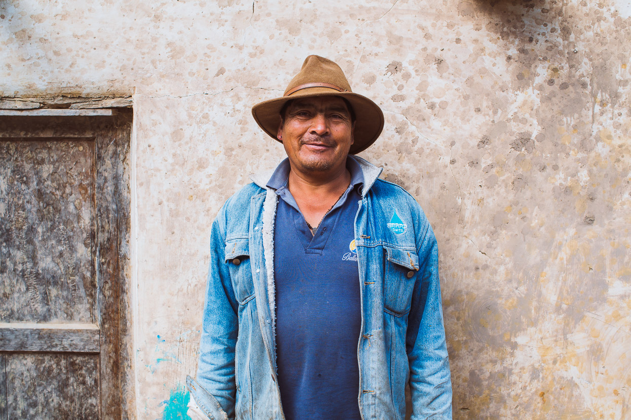
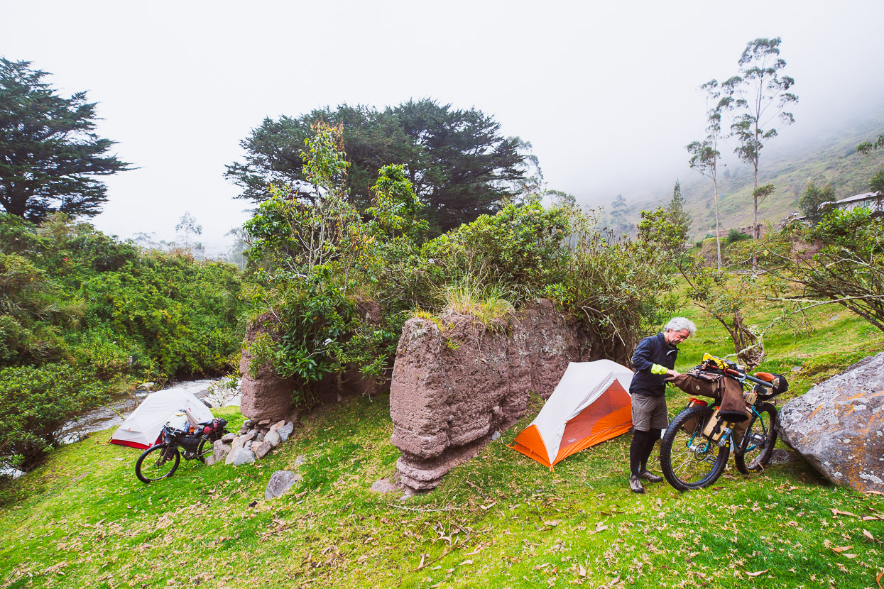
We carried on downhill to Shuyo Chico where we asked around for a spot to camp. This man (I forget his name) pointed us to a small track behind his house, which led to perfect patch of grazed grass, surrounding a ruin alongside the river.
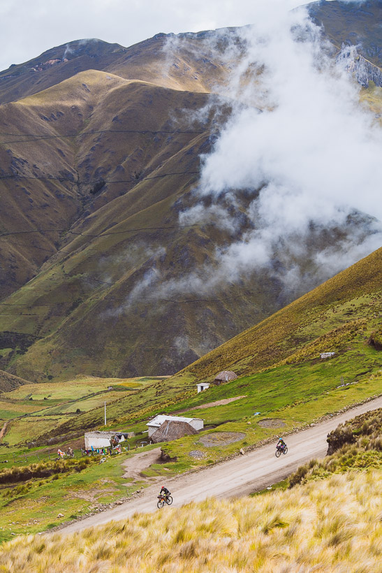
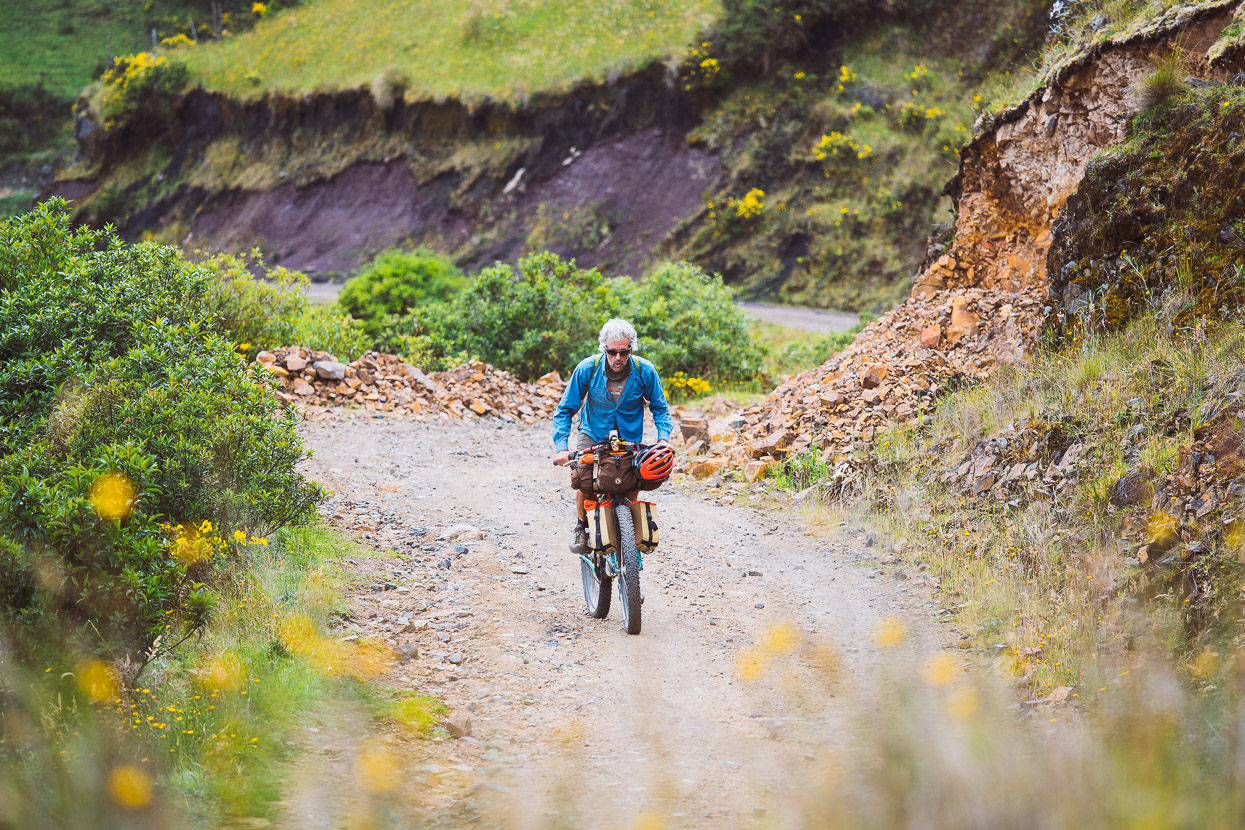
In the morning one of those climbs you can really get your teeth into followed, 1000 metres of sometimes steep ascent.
Past occasional hamlets.
And locals taking their sheep to upper pastures to graze for the day. This woman walked her sheep way up the hill for the whole day, every day.
The climb took us right back up into the tussocky, breezy hills and the mist. The view obscured, we each rode along in a world of our own. Occasionally a caballero on horseback would pass, or a noisy motorbike. The buildings we passed were mostly mud brick and straw structures with the odd bit of timber, brick or corrugated iron added on. Dwellings as rugged and weatherworn as their inhabitants.
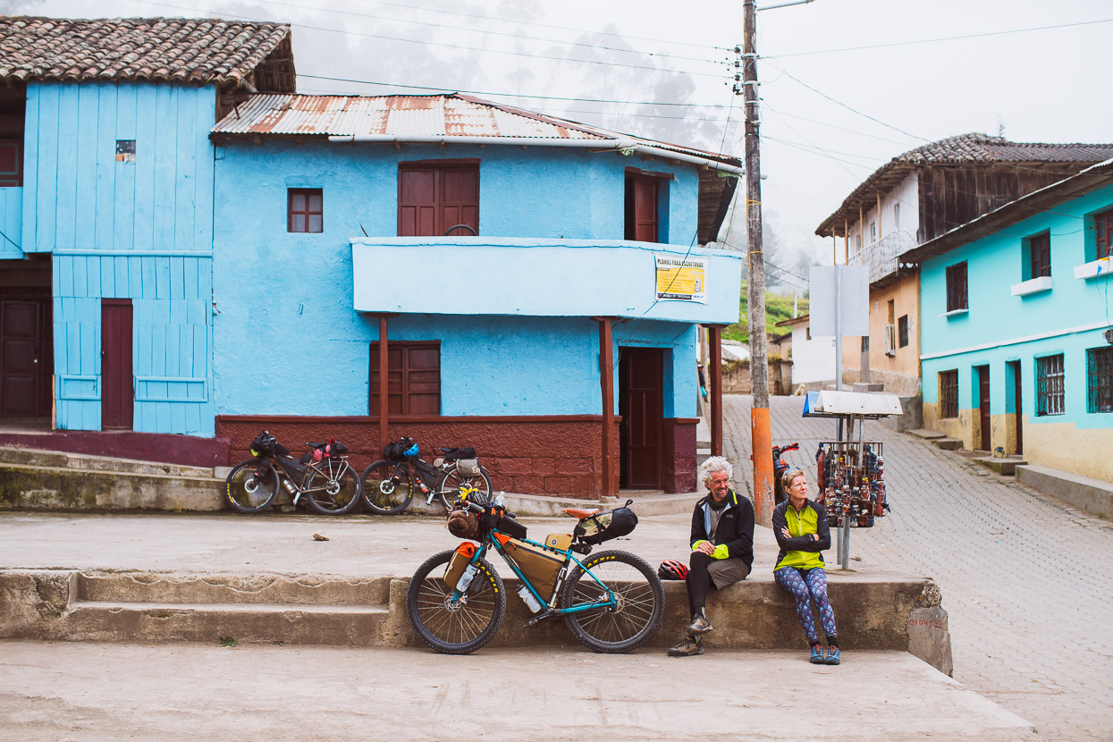
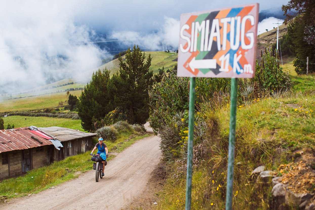
Finally we turned off the high road and dropped down a rough horse trail, which forced us to walk in places, into Simiatug.
After some searching and the confusion commonplace with half-understood conversations we found a place to sleep at an unkempt guesthouse on the edge of town. The shower fired out pulsing jets of scalding hot water and the toilet didn’t flush, but for US$6 each it was a bed for the night.
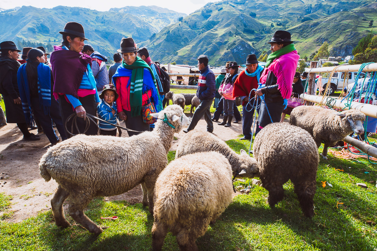
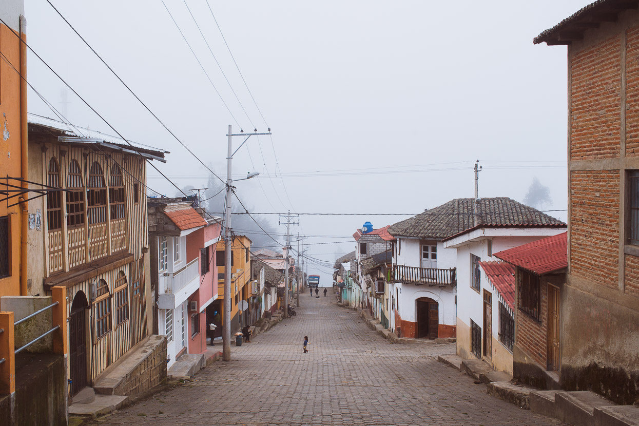
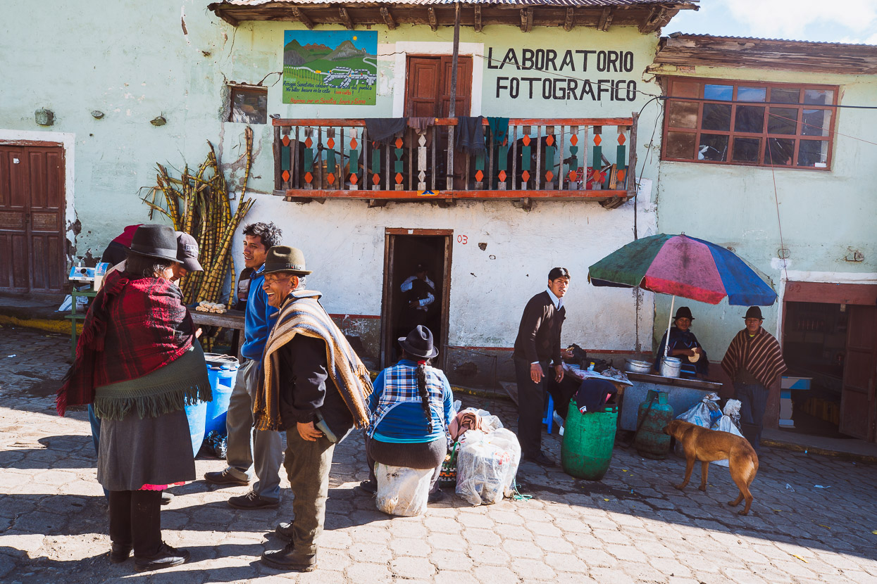
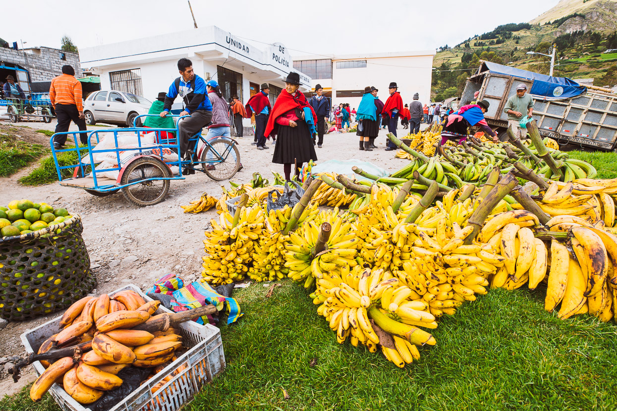
Our arrival luckily coincided with market day the following morning, so we hung out in town for the morning; finding some eggs and coffee for breakfast before checking out the bustle of town. Simiatug had been dead when we arrived, but now, at 9am in the morning people had poured in from the surrounding mountains to trade sheep, llamas and horses, buy supplies and socialise.
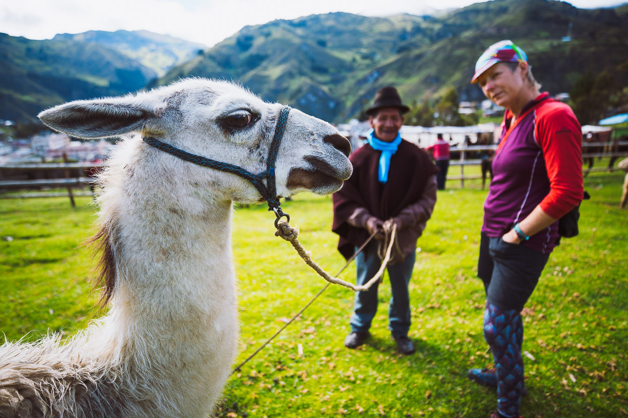
For just US$80 we could have bought this llama to carry our bags. Doubt it would keep up on the downhills though!
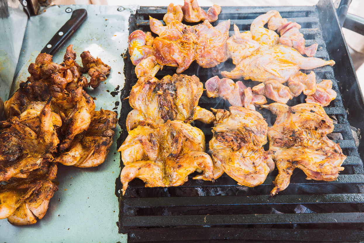
For morning tea we ate a small bird – perhaps a quail.
Served with maize and dressings. Not bad.
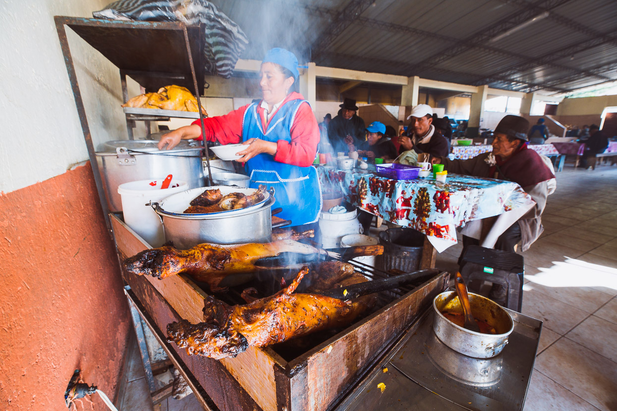
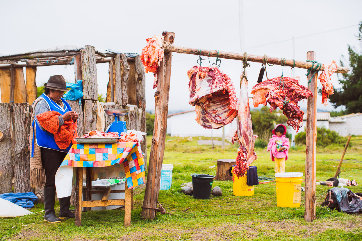
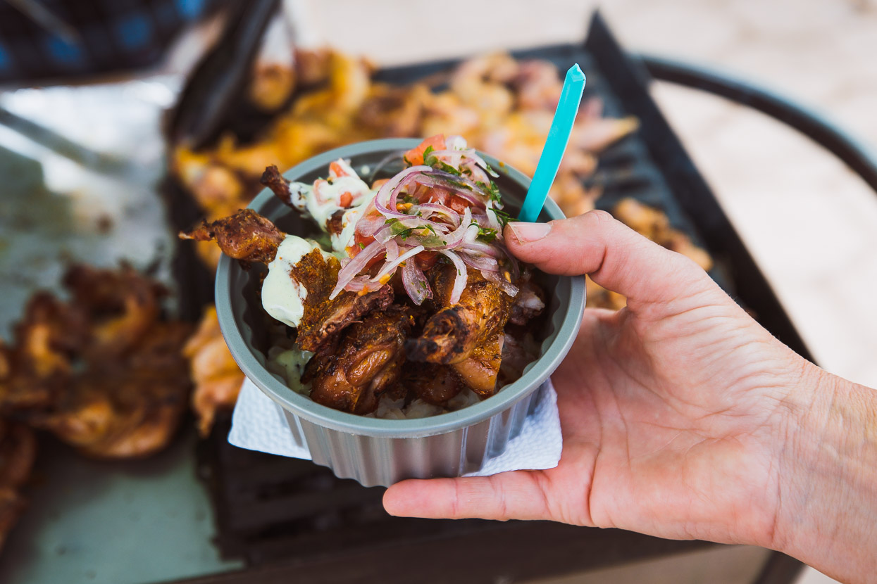
Eating cuy (guinea pig) has been on my to-do list since southern Colombia and here I got my chance. In this region it’s more a staple than a delicacy.
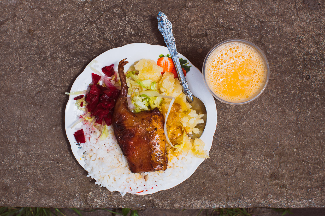
This back-quarter (complete with foot) cost around US$1.50 as a lunch meal. The cook was a little heavy handed with the salt, but all round a tasty meal – kind of like gamey chicken.
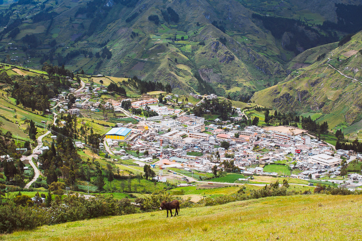
Around midday we were back in the saddle, climbing out of town for the relatively short hop over the hills to Salinas.
This wasn’t the view that greeted us though, instead we rode into town in freezing rain. But the following morning dawned clear. We stayed for two days and the pattern repeated itself with intense afternoon thunderstorms bringing cold rain and hail.
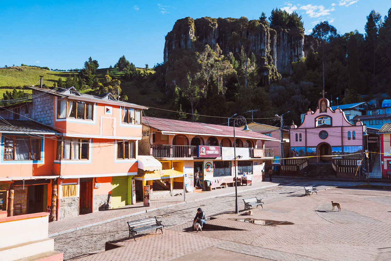
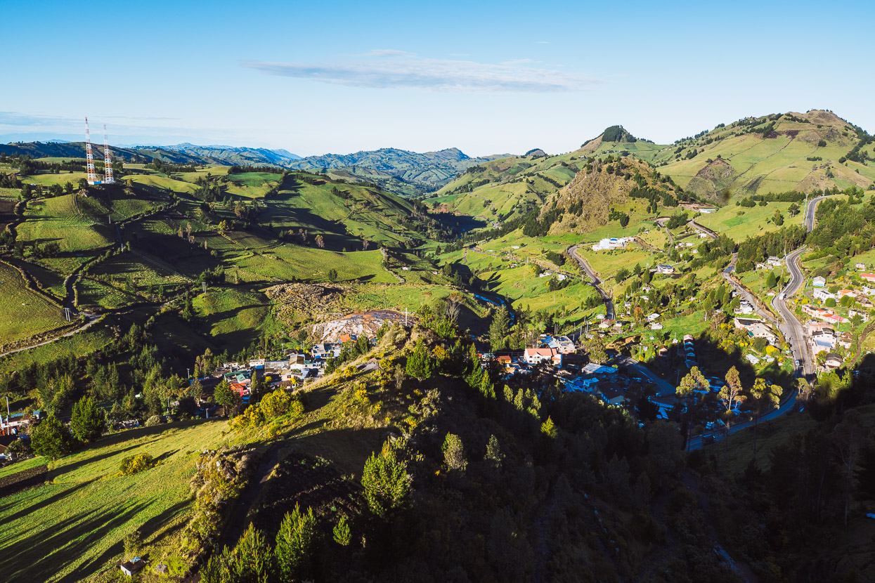
Towns don’t get much more laid back and cruisey than Salinas de Guaranda. A popular base for acclimatisation for nearby Volcan Chimborazo, Salinas is also known for its cheese and chocolate industries (both of which we sampled and took with us for the road). Prominent cliffs backdrop this town, while the surrounds are lush and green, in contrast to the raw, tan coloured landscape of the higher páramos.
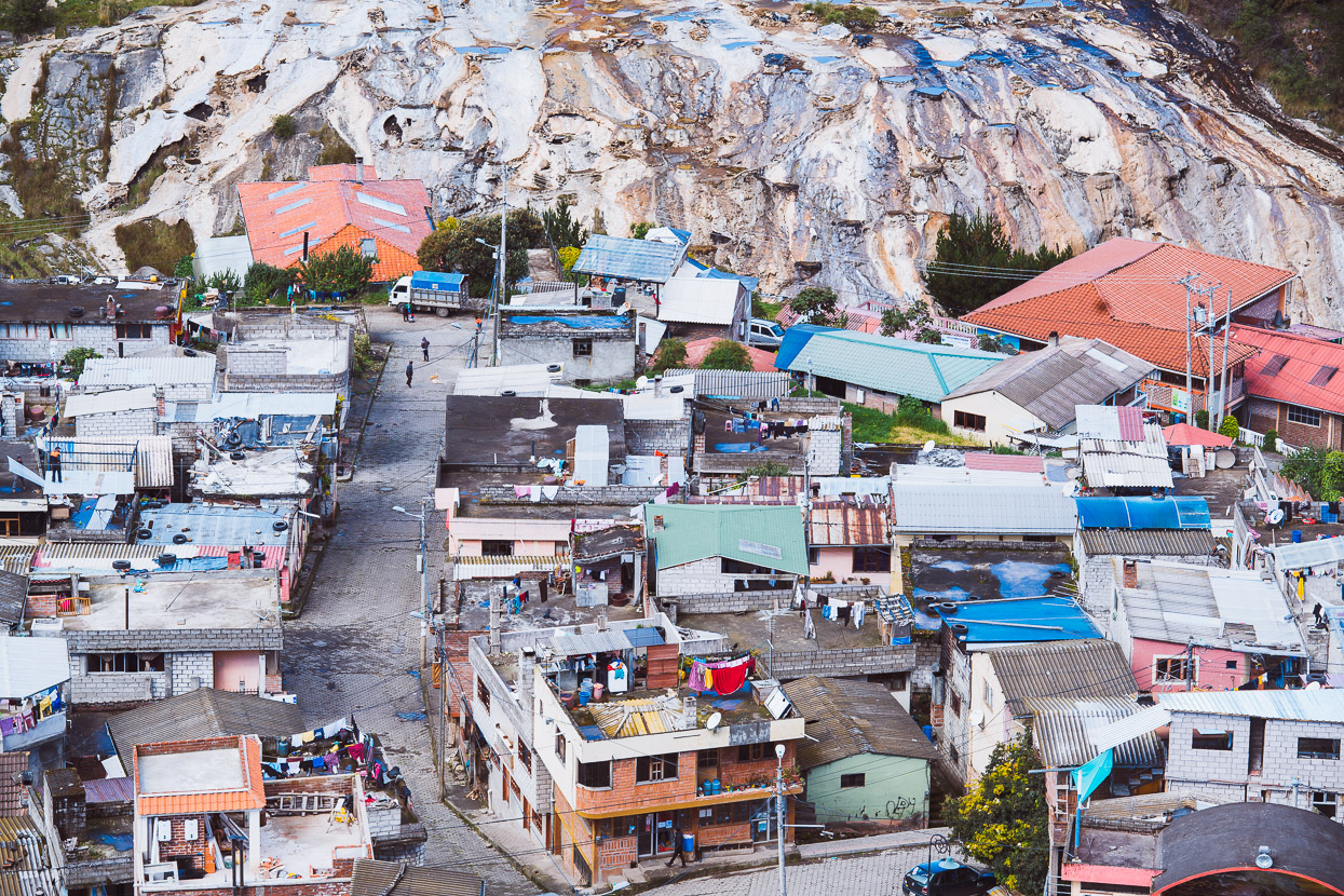
Looking down on Salinas from the mirador (a short walk above town). The mineral coloration in the background is from salt mines that date back to Inca times, which were heavily exploited from the time of the Spanish conquest up to the 1970s.
From here we’re headed up to the refugio at 4850 metres on Volcan Chimborazo, before following the Los Tres Volcanes route around the north side of the mountain. Thanks for reading!
Do you enjoy our blog content? Find it useful? We love it when people shout us a beer or contribute to our ongoing expenses!
Creating content for this site – as much as we love it – is time consuming and adds to travel costs. Every little bit helps, and your contributions motivate us to work on more bicycle travel-related content. Up coming: camera kit and photography work flow.
Thanks to Biomaxa, Revelate Designs, Kathmandu, Hope Technology and Pureflow for supporting Alaska to Argentina.


Fascinating, As always. Hannah looks to be asking “Give Me Strength” !! Love the market.