
The Prohibited Pass.
Now that we’re once more in Bogotá I finally have a chance to catch up on a couple more blog posts, covering the rest of our ride over and around the volcanic mountain region of Los Nevados and the distinctive landscapes of the zona cafetera; Colombia’s richest coffee cultivation area.
Although the legendary 4700m pass (known locally as Azufrera) that separates an outlier eruption cone from the summit of Nevado del Ruiz has been closed for several years due to the volcano’s yellow alert status, a number of cyclists have blogged about their ‘stealth’ rides to poach this most classic of dirt road bike packing rides. These have involved some riding in darkness to get past ranger stations or barriers and sometimes a telling off by national park staff when emerging on the other side of the pass.
We’d deliberated endlessly in Murillo about whether to attempt this cheeky ride or not, but in the end the temptation of a dirt track through the moonscape and páramo alpine zone of Nevado del Ruiz’s upper slopes won us over, and besides, the alternative (if we wanted to see much of the mountain’s western side) was going to involve an extra 2000-odd metres of elevation gain by the time we dropped to Manizales and climbed all the way back up one of the other access roads.
After an acclimatisation and rest day we left sleepy Murillo and climbed steadily higher on Ruiz’s slopes. Mornings were reliably clear here and we had great views up to the mountain’s summit icecap. Even at 3500 metres the fertile slopes make for productive potato growing and cattle grazing.
Looking back out to the deep valley of the Rio Magdalena; even in the early morning cumulus would boil up from the hot and humid lowlands.
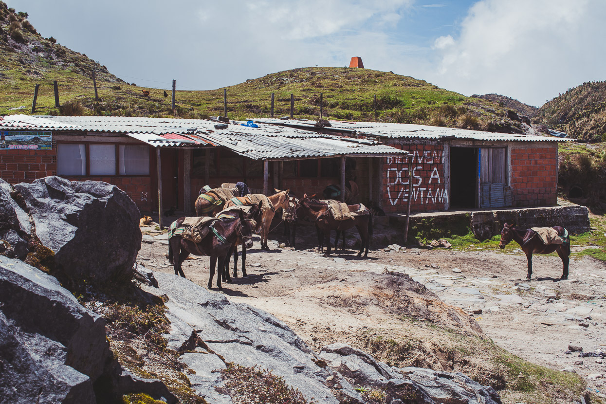
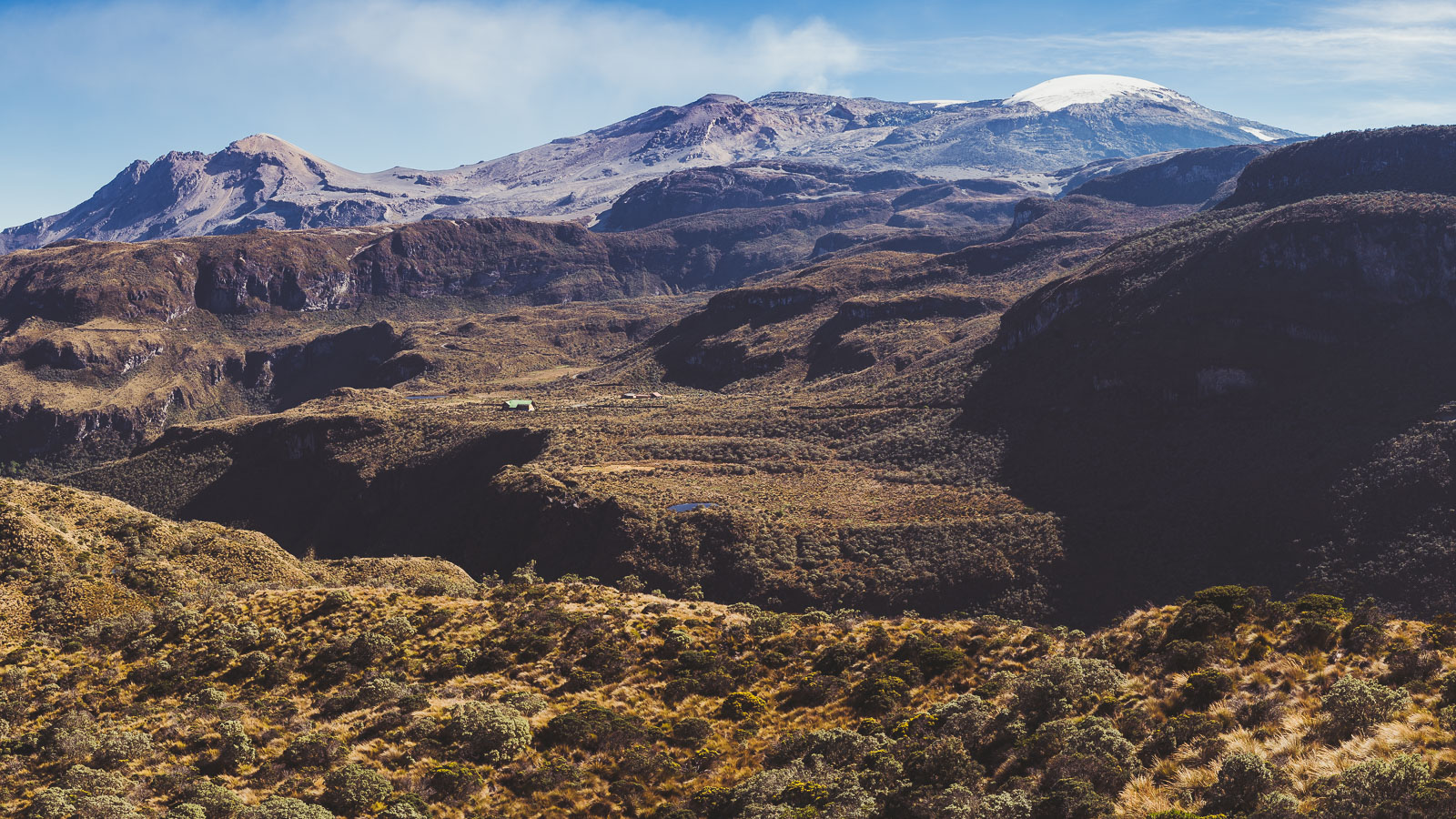
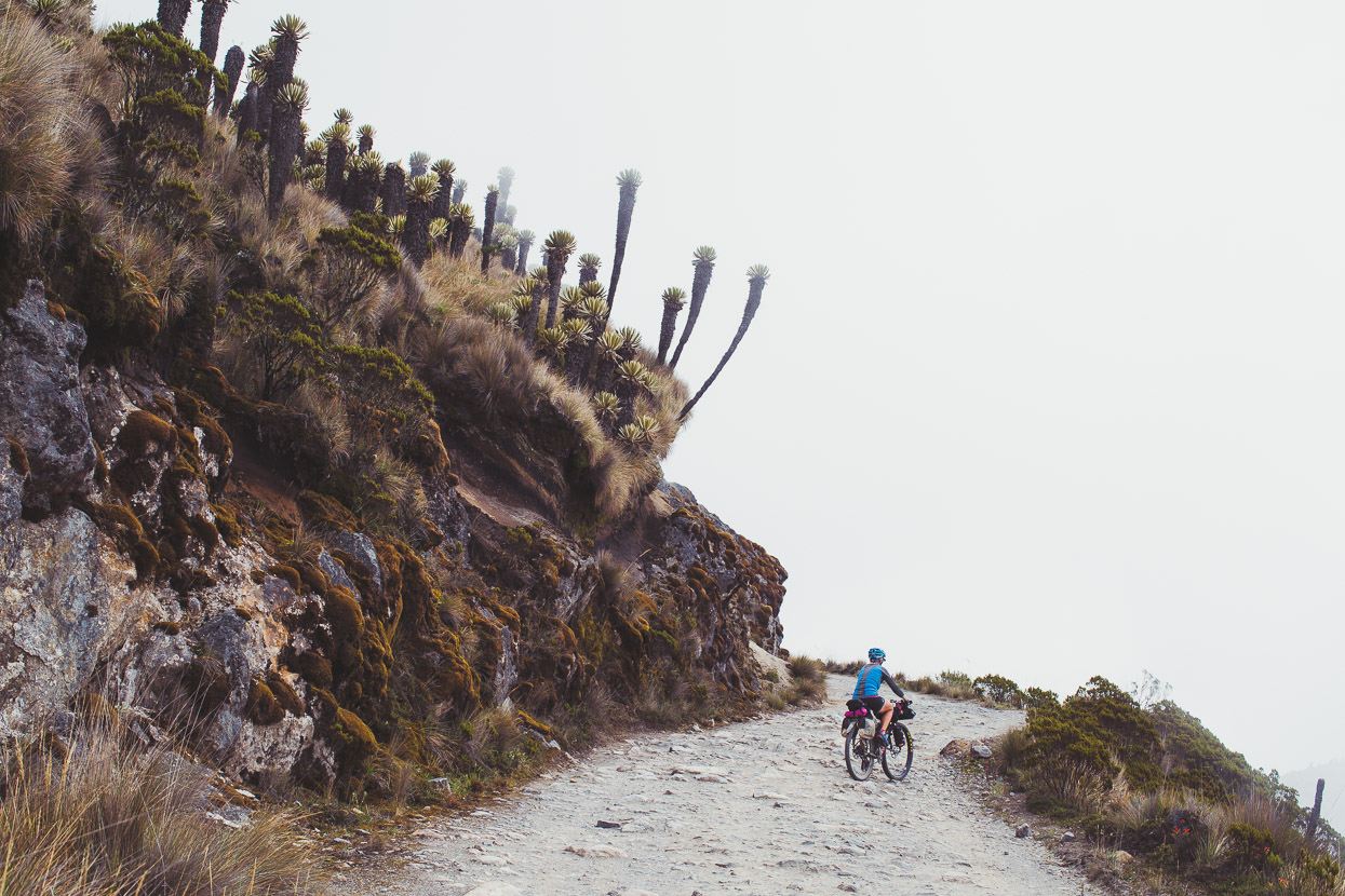
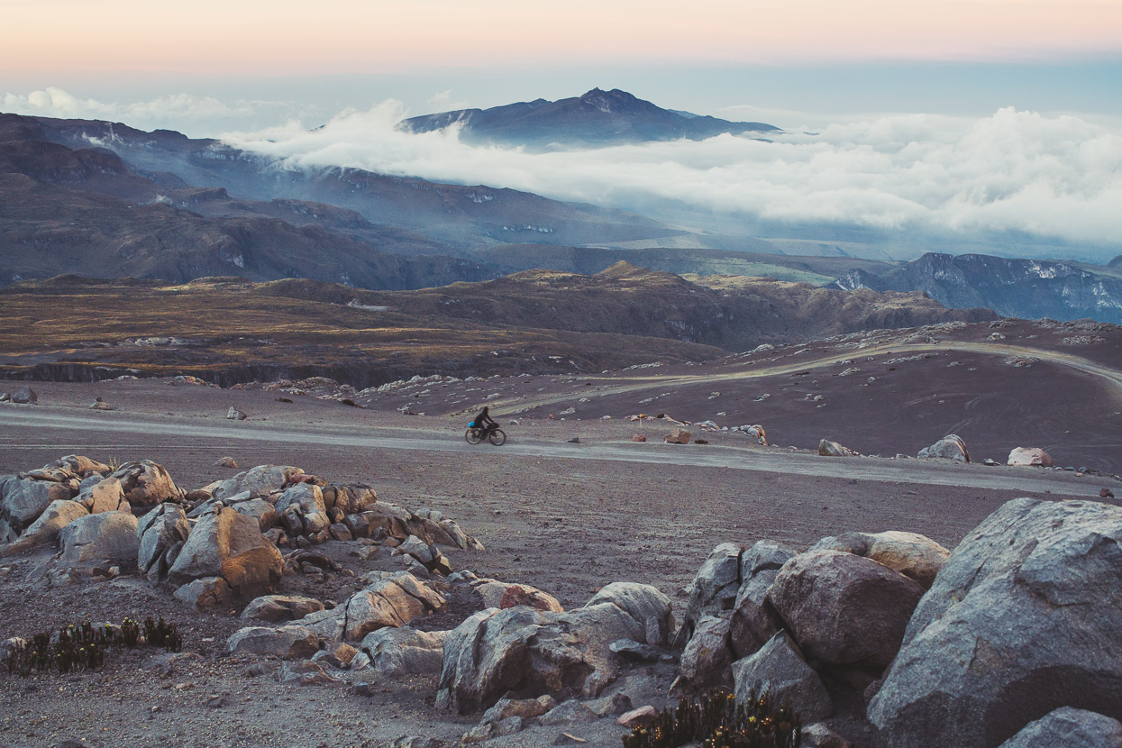
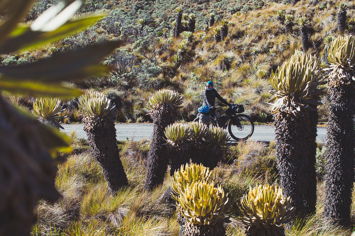
By the time we reached the páramo at around 3600 metres habitation was few and far between. This building was at 4000m, just before the ‘Ventana’ feature where the road passes through a narrow cut and enters the mountain’s spectacular north eastern slopes.
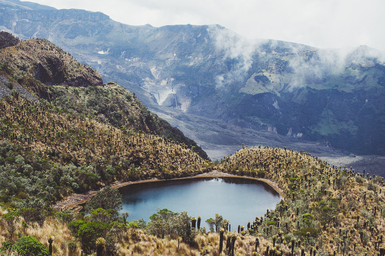
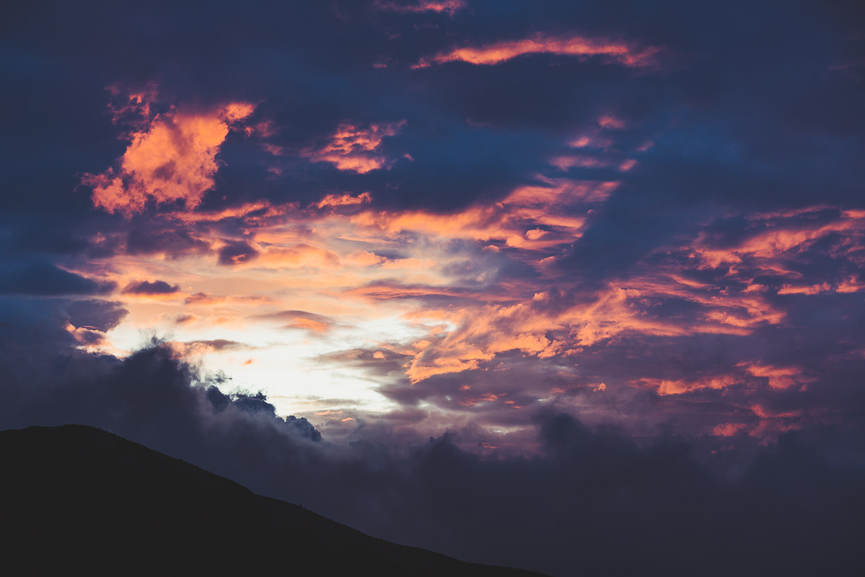
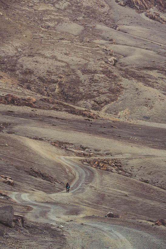
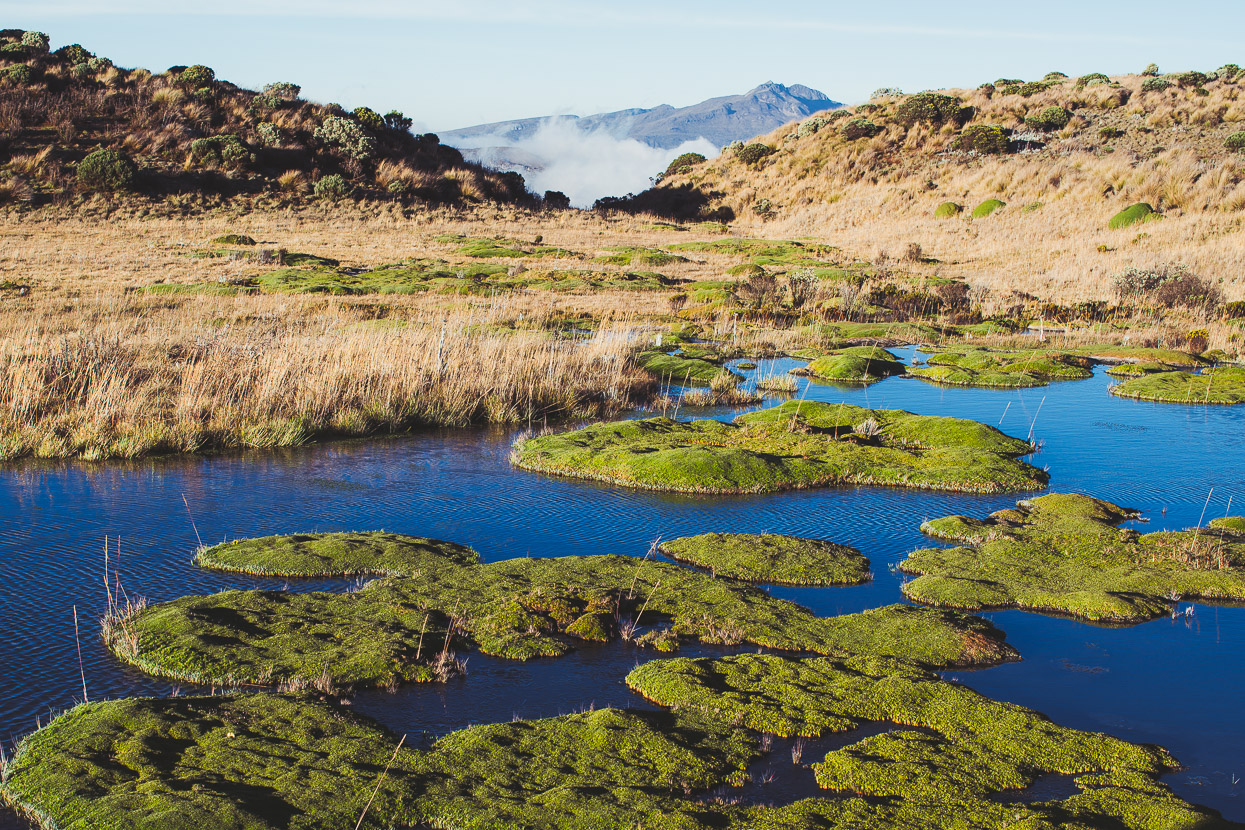
And spectacular it was, the slopes falling away steeply below the road and funnelling into deep canyons; a huge expanse of raw mountainside with a narrow dirt road etched, sinuously, into its side. Kettle lakes, waterfalls and sulphury streams adding colour and motion to the monochrome of the páramo.
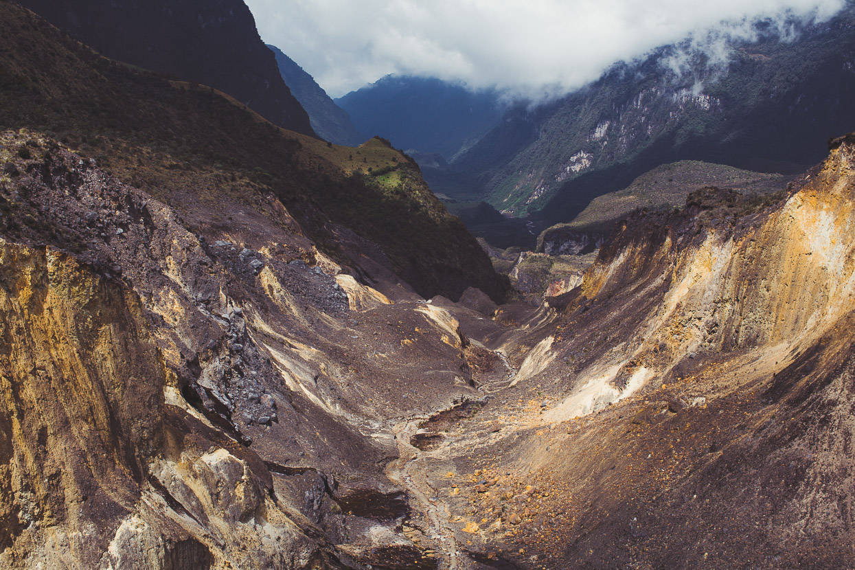
The mountain’s many eruptions and subsequent erosion has left some stark landscapes. It’s down these steep gullies that Ruiz’s destructive lahars have poured, such as the 1985 event (mentioned in my past post) that killed over 23,000 people in Armero.
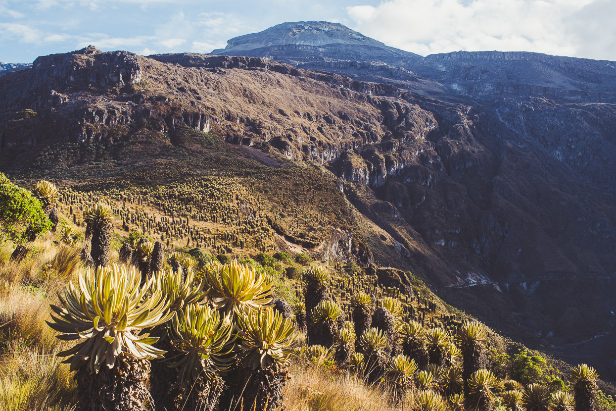
A richly coloured and raw landscape.
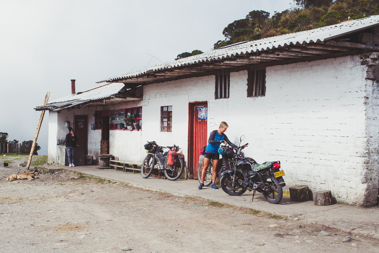
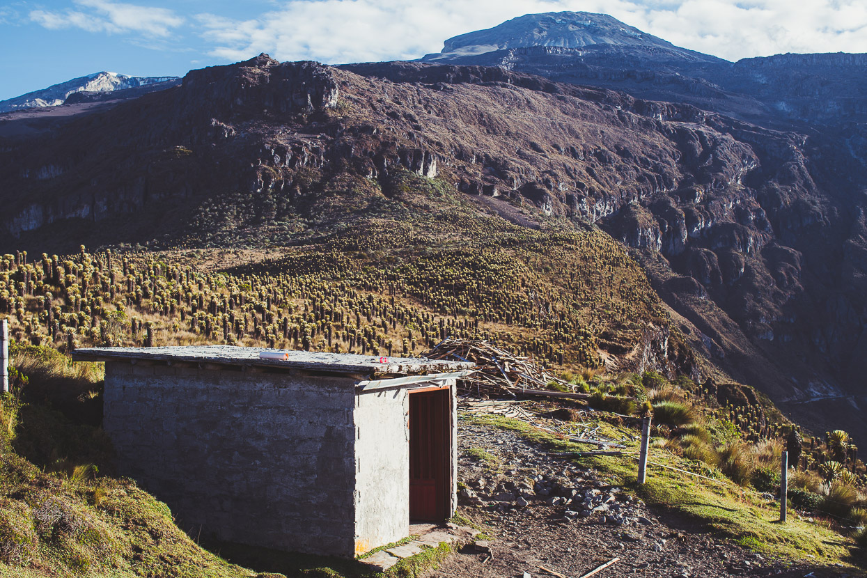
A final outpost at El Sifon before we stopped for the night. This small tienda was just above 4000 metres and had a small range of snacks, drinks and freely available water. From here another road drops down the mountain to some hot springs roughly 300 vertical metres lower, but we decided we didn’t fancy the extra climbing to come back up!
We pressed on, the cloud coming and going, swirling around. The wind sometimes carrying the smell of sulphur.
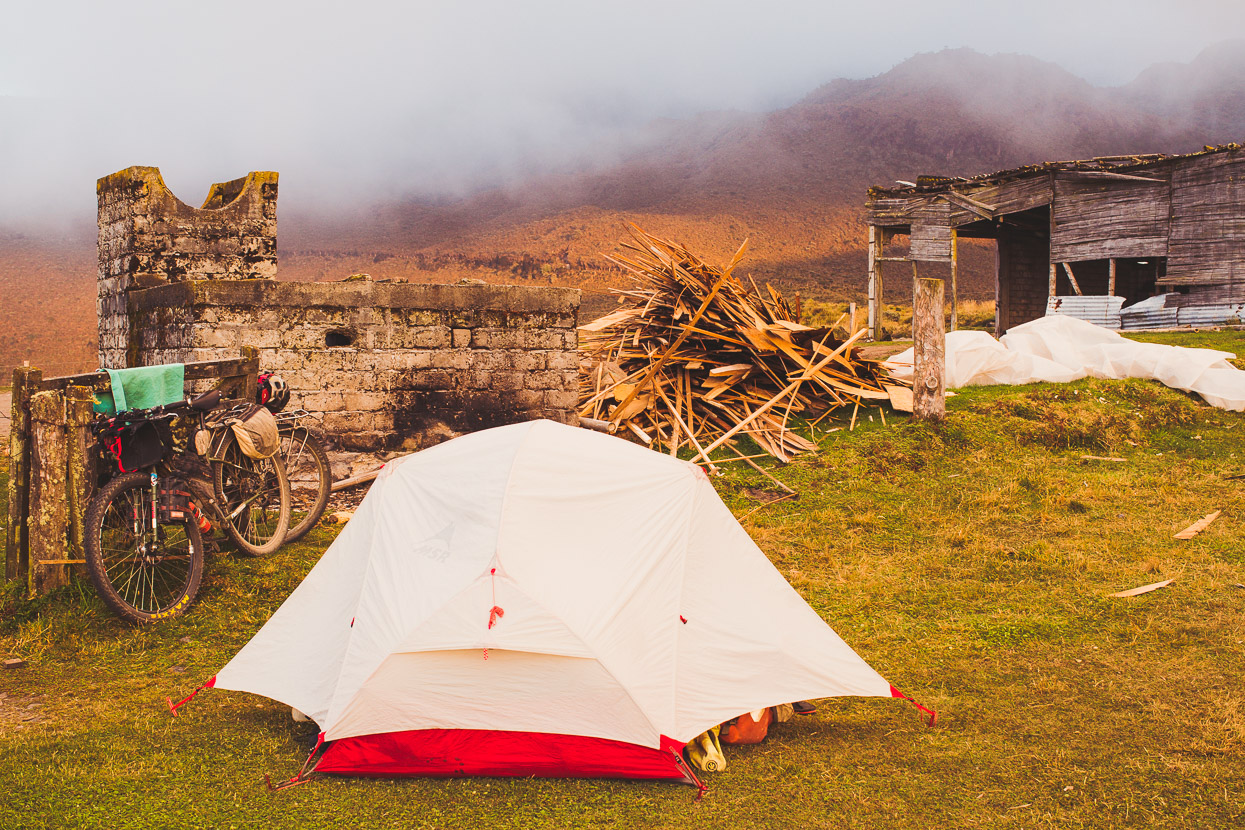
We stopped for the night at El Tubo, named for a lone steel water pipe that’s elevated over the road, carrying agua to some far off finca (ranch). We scouted around and found a small hut, the door tied shut with a piece of rope. There was nobody around, so we decided to bivvy there for the night. It was a bit breezy, but it would give us a quicker 2am getaway for our ride to the ranger post and the start of the closed pass road, 6.5 kilometres away.
It was a spectacular spot to hang out in the evening light, cooking a meal and watching the light change on the mountain. We could clearly see the summit, rising above us from the páramo belt and the craggy upper slopes.
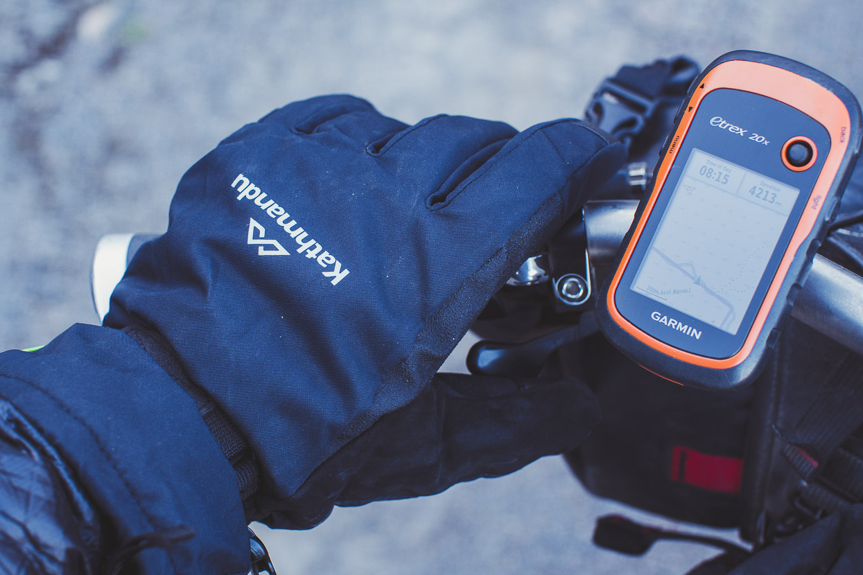
Not long after sunset we bedded down on the floor of the hut with the alarm set for 1am. By 2.15am, we’d breakfasted, packed and were riding along the road towards the Brisas ranger post and park entrance by the light of our head torches. The temperature was -1c.
We reached the post shortly before 3.30am and found a 1.5 metre high locked gate, which we were able to grovel around the side of over a smaller fence with a bit of team work with the bikes. The station was occupied (there was a motorbike parked outside), but luckily no barking dog to wake the sleeping ranger. We very nearly gave up on seeing the locked gate, but having come this far and in the middle of the night we were both feeling committed. It felt audacious, given the effort it took to get two loaded bikes up a bank, over the fence and down the bank and we were amazed we didn’t wake anyone.
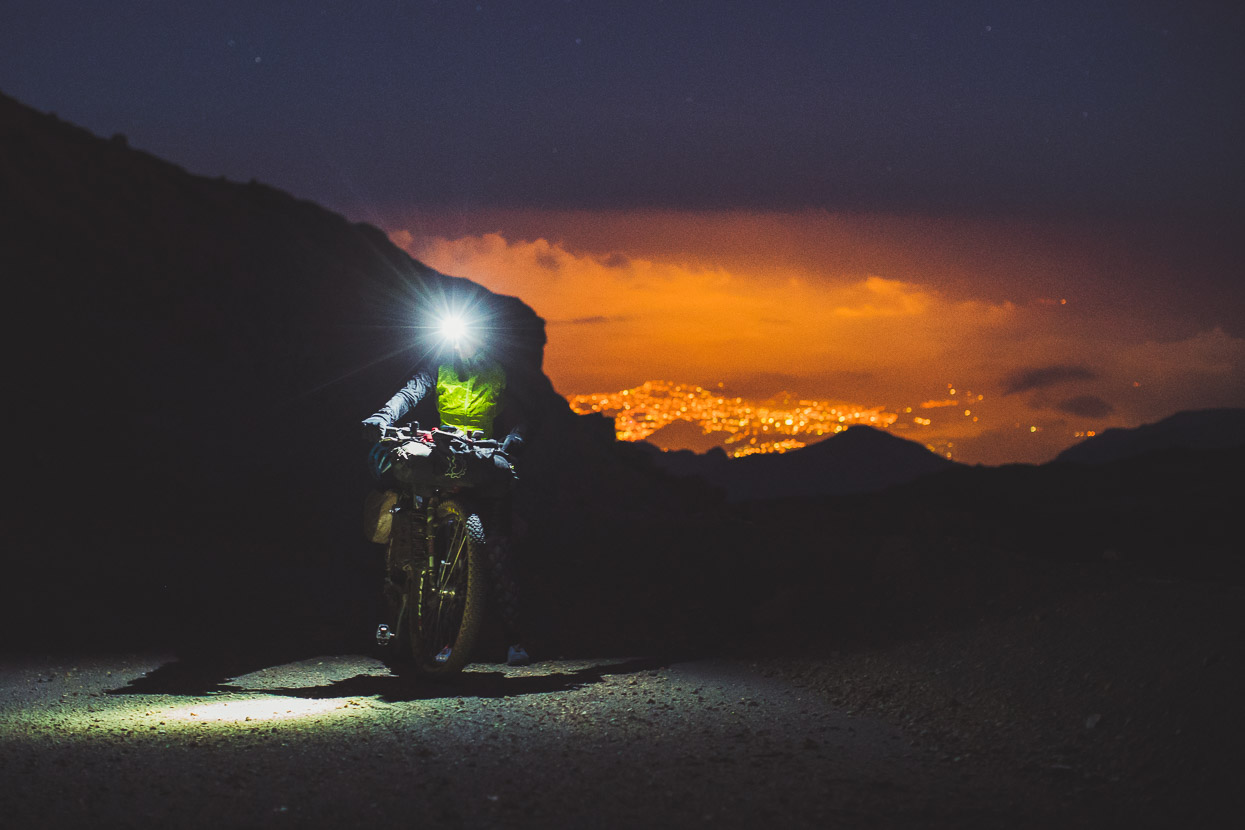
It was with a feeling of huge satisfaction (and a small amount of guilt) that we rode away from the gate and began the 600 metre climb up the road to the pass. It looked like we’d pulled it off and would be able to enjoy the unique landscape of the upper mountain. We climbed gradually through frost covered scoria slopes and rock outcrops. The mountain’s features shadowy in our torchlight and dimly lit under a clear sky and a canopy of stars.
As we gained elevation the temperature dropped, down to a low of -3c, and frost began to build up on our bikes even as we steadily climbed up the road. All was silent except for the rhythmic effort of our breath, which condensed in big white puffs, and the crunch of the scoria.
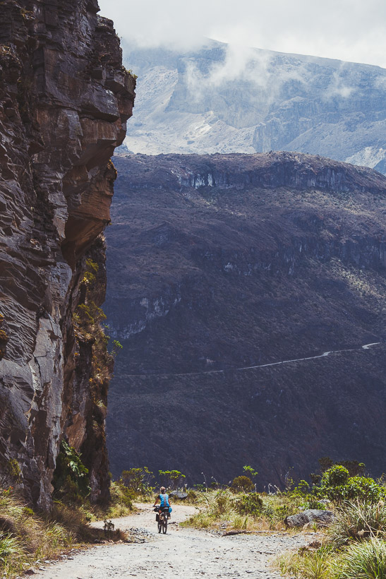
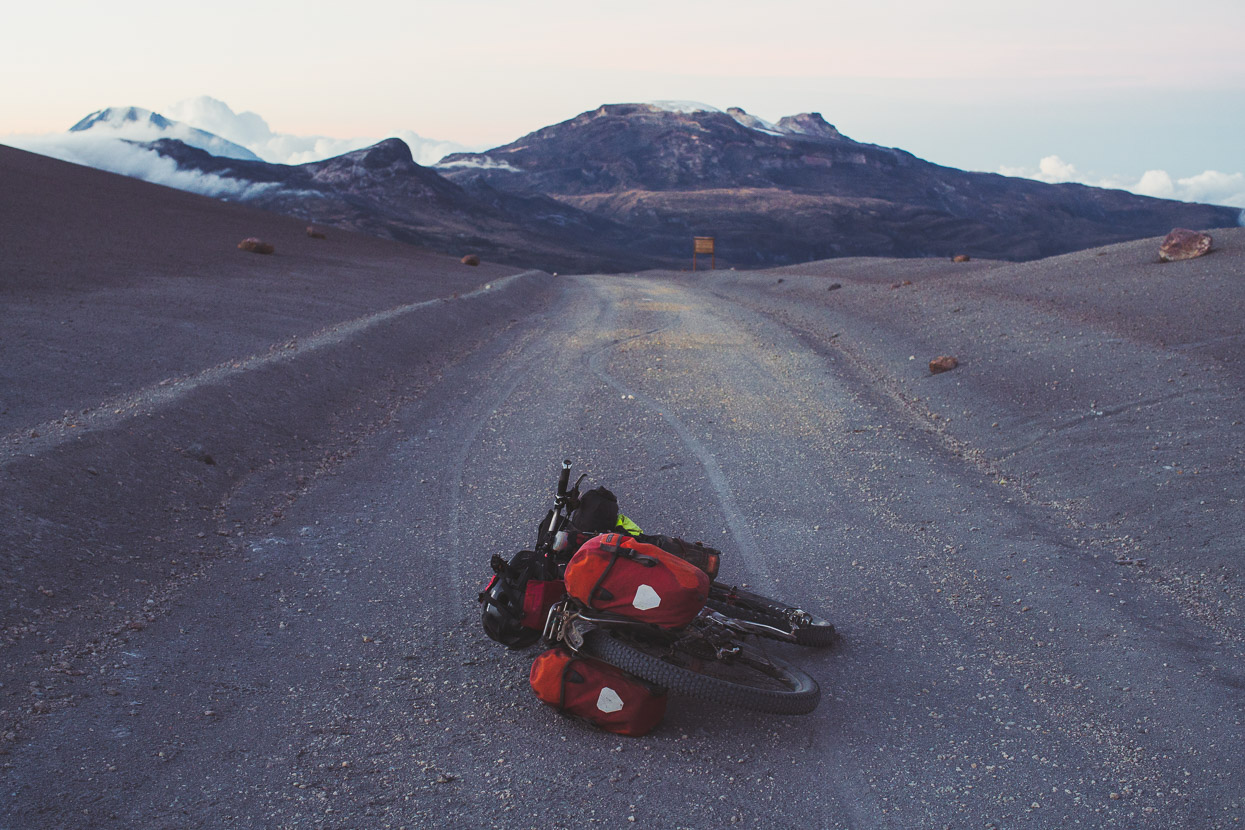
After the Valle de Las Tumbas a rope marks the actual closed section of the pass road, after which the road crosses a couple of bridged streams and then begins to climb more steeply for the final 200 vertical metres, sometimes zigzagging. We were both feeling the altitude as we rode and sometimes pushed steeper or sandy sections of the road. The lights of Manizales were a bright blanket over the landscape 2500 metres below us.
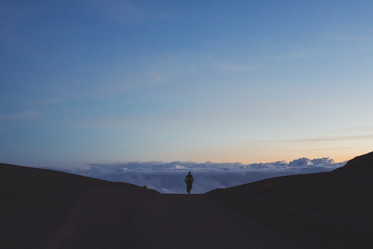
It was getting light by the time we crested the pass at 5.45am. Our surroundings were barren and open, the views big. A lonely, wind and sand scoured signpost pointed to the summit of Nevado del Ruiz only 2 kilometres away and 500 metres higher. To the north a blanket of cloud covered the land, but our descent was clear. We didn’t stop long, it was calm, but cold and we put on big gloves and down jackets for the long ride down towards the abandoned park buildings at El Cisne.
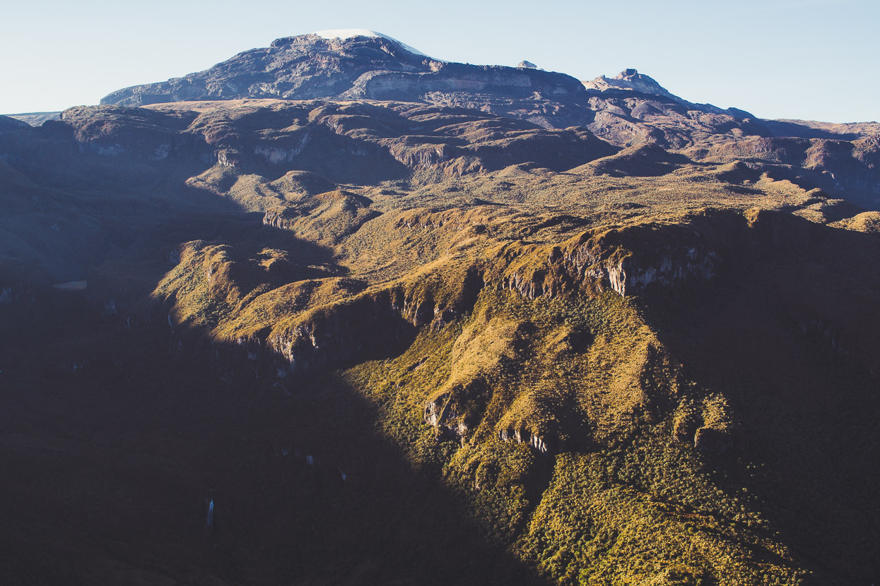
The pass, and beyond, Nevado Santa Isabel.
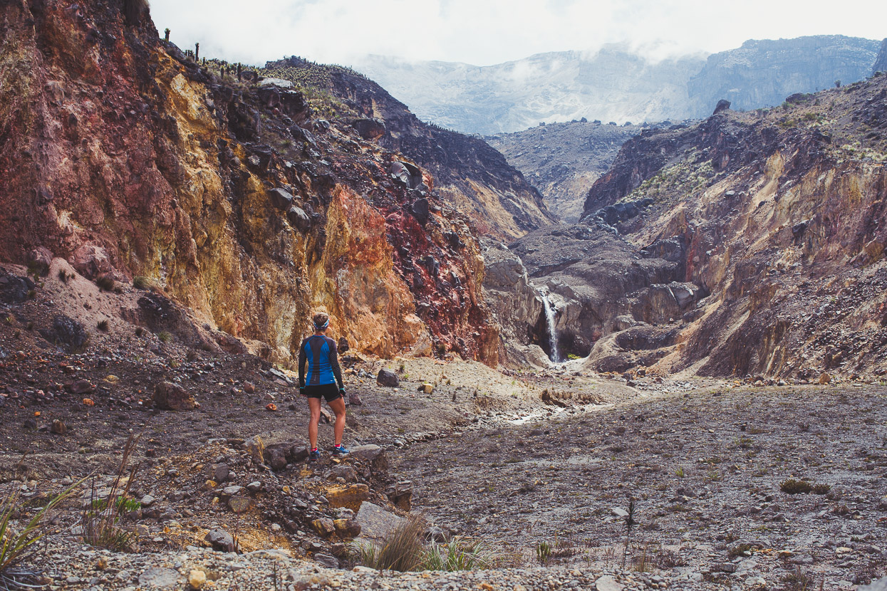
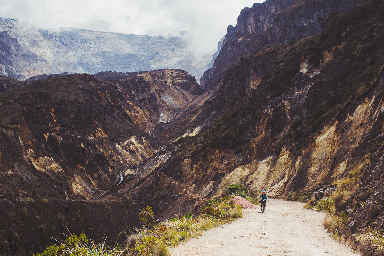
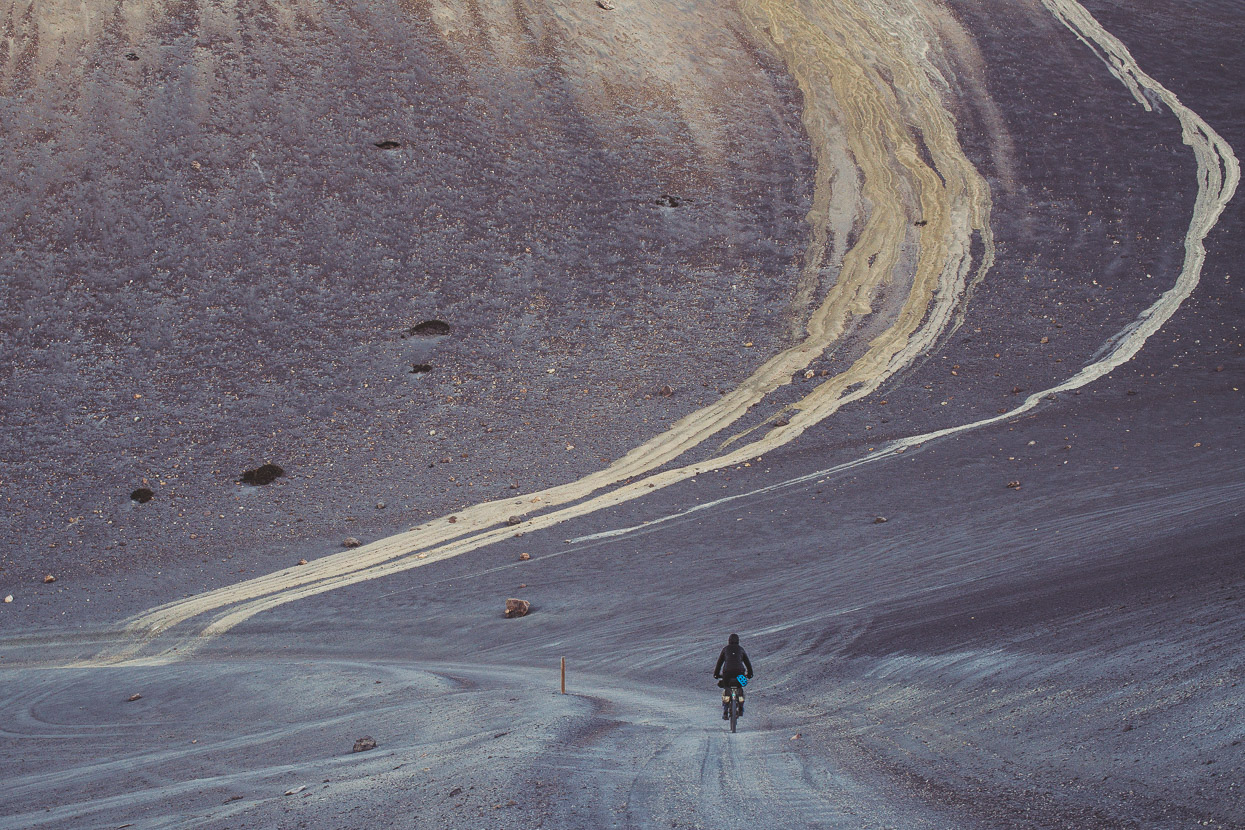
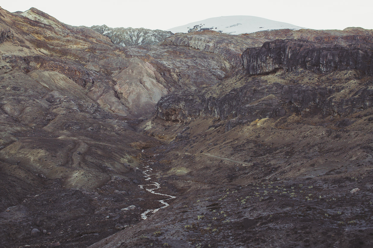
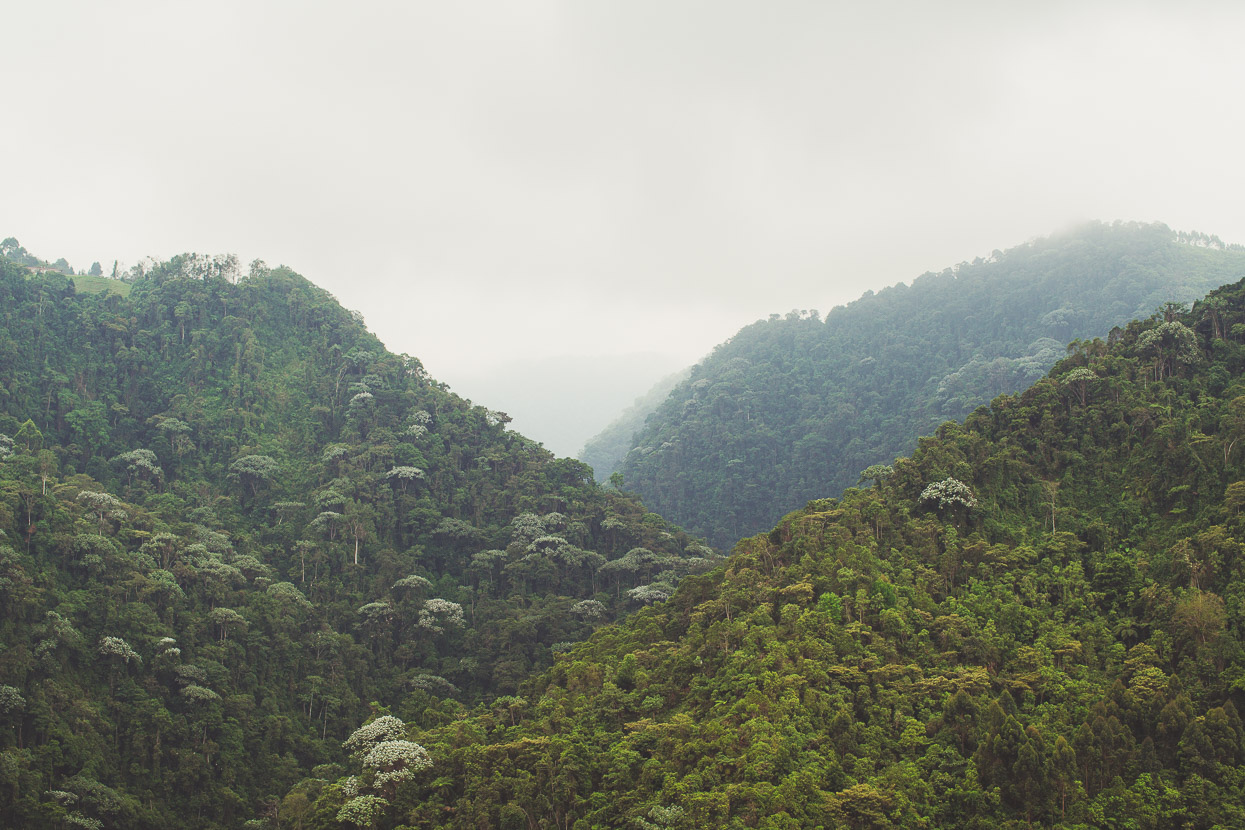
In the cold and with hazy brains from our short sleep and nocturnal exertions the descent from the pass was an almost hallucinogenic journey through an alpine landscape forged from the ravages of eruptions and the slow processes of glaciers and water. It was a dusty, rocky, stony moonscape – in places interrupted by gorges, streams and cliff bands. It was a spectacular place and one we wish we could have lingered in more, but we were under pressure to be out of the closed area of the road before any national park staff might show up for work.
As it was, the ride was incredible, the soft scoria surface of the road fun to ride on and the surroundings otherworldy as we snaked down the mountain.
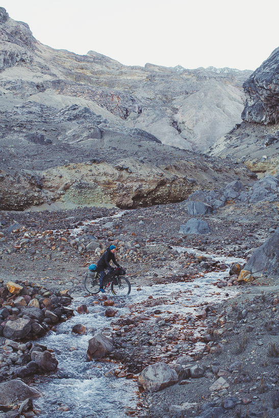
It got windier as the sun rose dropping the temp even lower and cold enough to freeze water to our bikes and tyres as we splashed across semi-frozen streams.
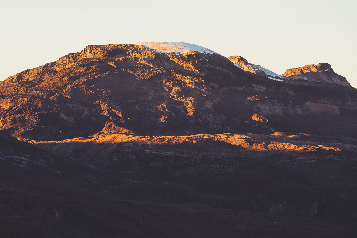
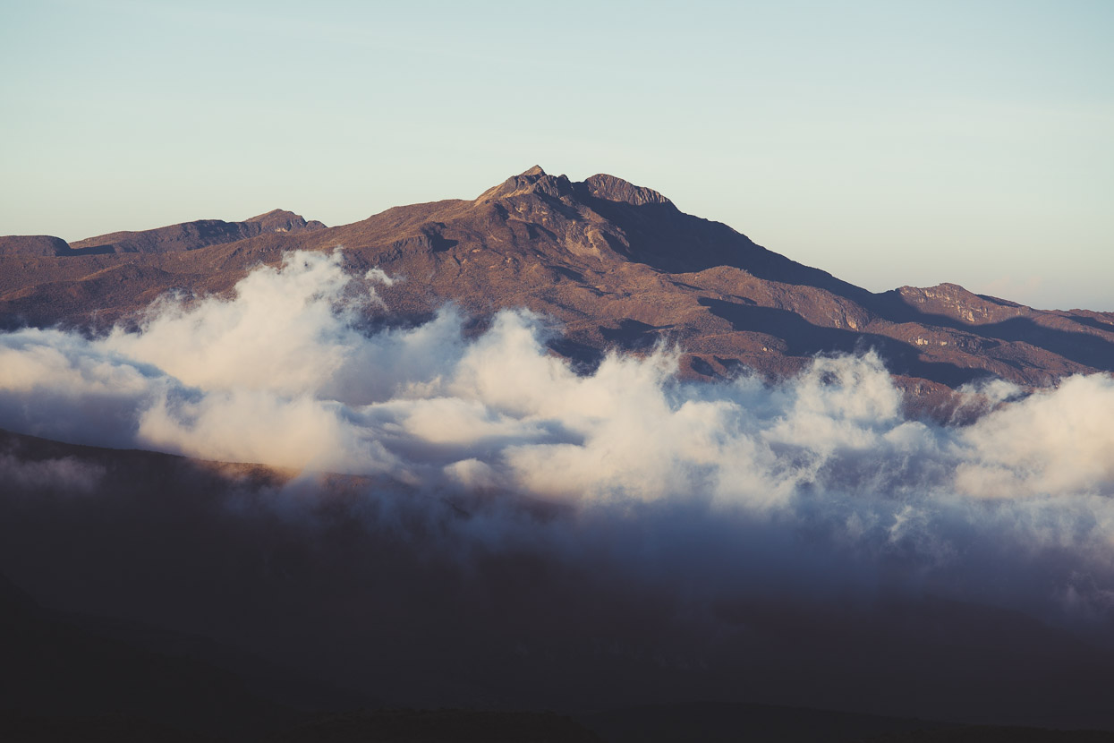
The summit of Nevado del Ruiz (5321 metres) above the road.
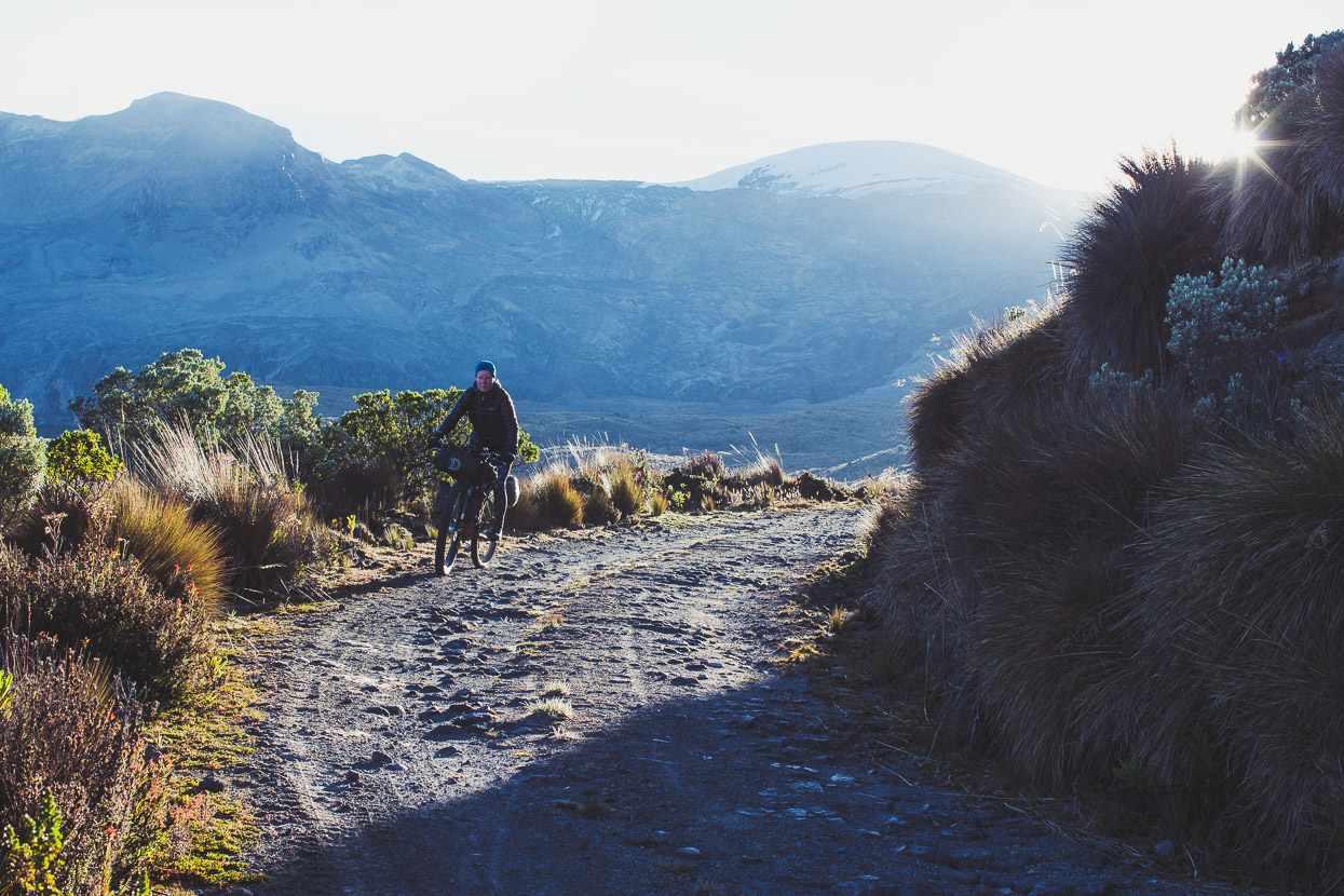
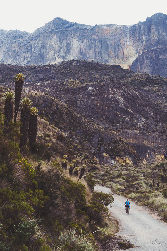
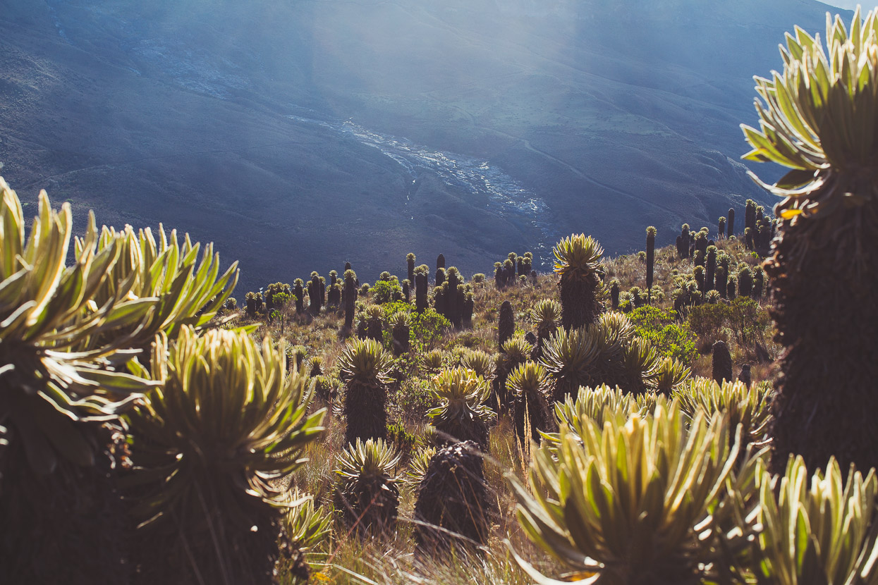
Eventually we rode back into the land of the living as first swathes of golden grassland appeared and eventually the familiar páramo.
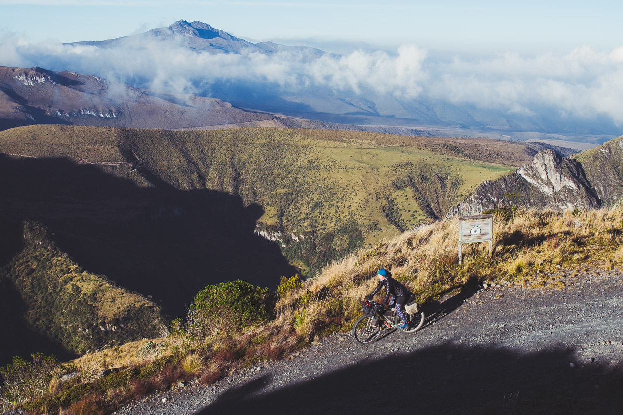
Winding down into the slopes below Nevado Santa Isabel.
We stopped briefly at the abandoned visitor centre buildings at El Cisne to have something to eat, having been on the go for five hours already, before heading onwards towards Potosí. A fresh and freezing wind propelled us through the frailejones.
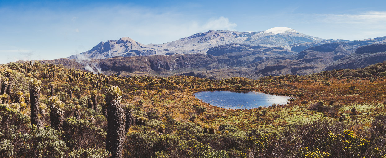
A stitched panorama looking back at one of several kettle lakes dotted about the páramo with the summit massif of Nevado del Ruiz in the background. The peak on the left is Cráter la Olleta, then the closed pass we crossed to its right, and the summit icecap of Ruiz.
As we rode towards Potosí we passed a couple of park vehicles and some guides and clients heading into the park, but when we got to a junction shortly before the Potosí ranger base (from this junction its possible to ride right down off the mountain towards Manizales or Pereira) we were met by a ranger on a motor cycle who asked us where we’d come from. He politely explained that the route we’d taken was closed and that we’d have to proceed to the Potosí ranger station a couple of kilometres further on to register.
At the ranger station (which guards the south western entry to the park), we were met by two other rangers, who again politely explained that the road we’d taken was prohibited. We were given a briefing with a map to explain how the park worked and where you can and can’t go and then they took our details, photographed our passports and we paid a park entry fee (29,500 pesos each). One of the rangers we dealt with was tasked specifically with dealing with cyclists who have illegally crossed the pass, which comprise both foreigners and Colombians and happen fairly frequently by the sound of it.
The tone of this whole encounter with the rangers was polite but serious, and culminated in us being told that our details would be forwarded to a higher park authority, who we might hear from in the future to pay a fine. We were then told that two Dutch cyclists had had their bikes confiscated and taken to Manizales. This was possibly just to freak us out, as it’s now 10 days later and we’ve heard nothing from the authorities and for all they know we could have left the country by now. As an on-the-spot punishment we were banned from walking to Laguna de Otun, which we’d hoped to visit the next day.
From the three accounts I’ve read of other cyclists making this crossing, it seems the park has escalated its response to these infringements and probably shouldn’t be messed with. We came away from the ranger station feeling thoroughly told off, which of course we deserved.
Was it worth it? Well… yes – we got off very lightly (so far) and the experience up there was amazing. It’s a special and powerful landscape. Would I recommend others ride it in the current status? No – because we got the impression the rangers were thoroughly fed up with people crossing the pass and the penalty might be unpredictable. If the road reopens in the future, then I’d highly recommend it as a bike packing route.
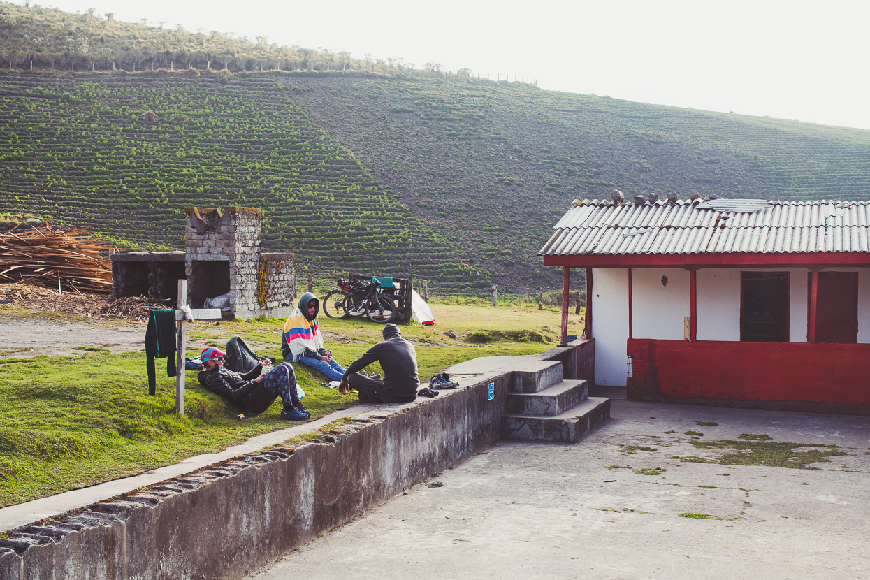
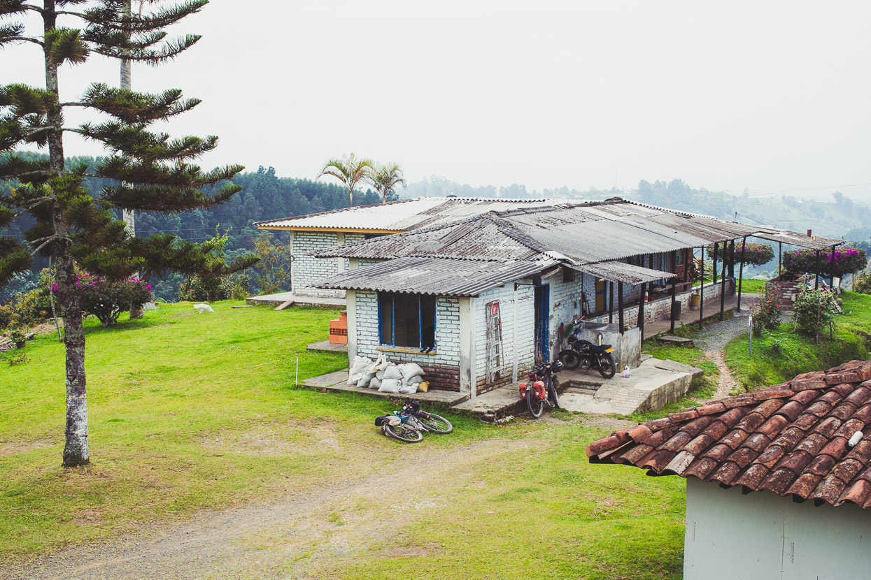
Although it was only mid morning we’d already done a day’s worth of riding by the time we’d reached Potosí, so we rolled down to an old ranch turned hospedaje about 300 meters away (it’s the only accommodation/food in the area), pitched the tent on the grass, had lunch and passed out for a couple of hours.
The rest of the afternoon was spent hanging out in the sun chatting to some other tourists on a guided trekking trip. They had seen us earlier in the morning as they headed up to do a hike to one of the glaciers, and mentioned that their guide had called the rangers to report seeing us coming down off the mountain. It was a really pleasant afternoon and we enjoyed the social contact, not having met or talked with other tourists in weeks.
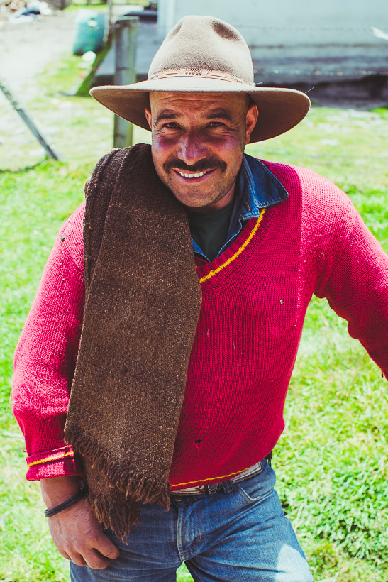
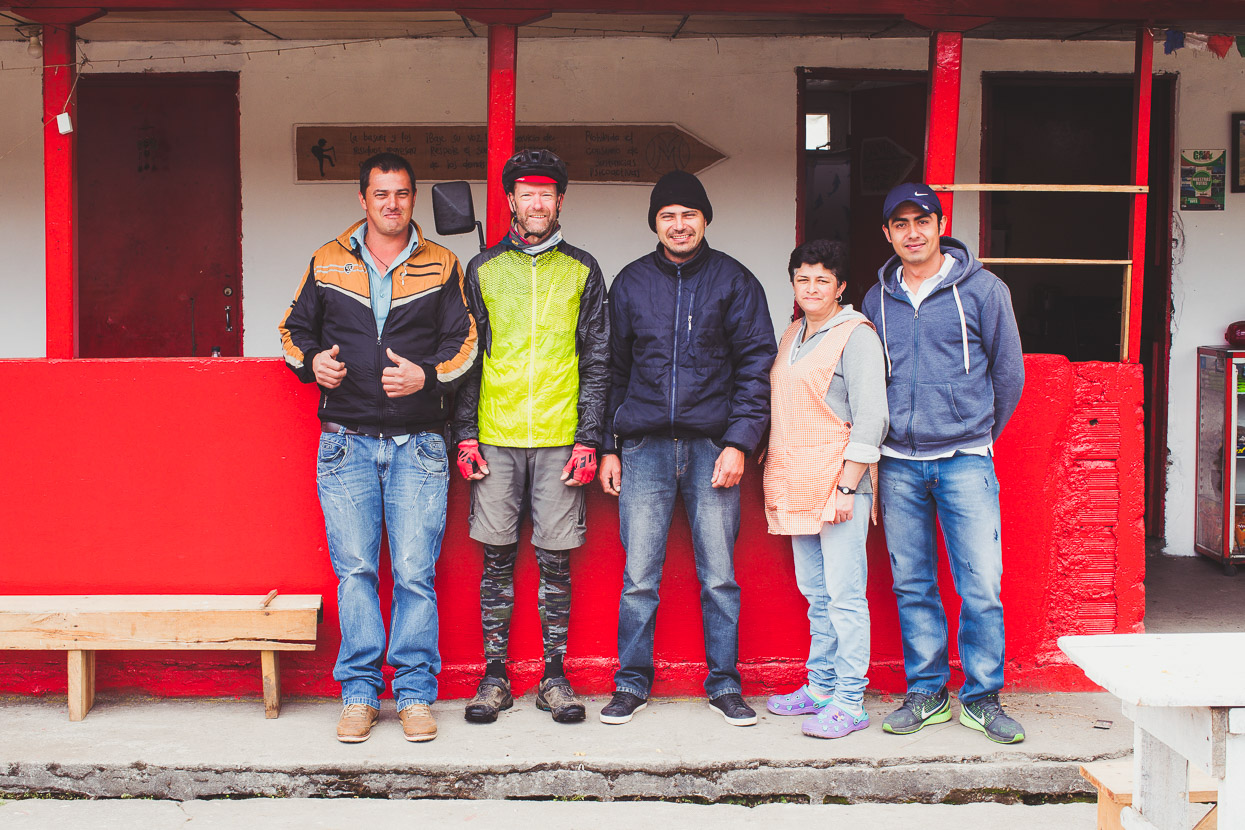
Below, me with the staff of ‘Campoalegre’, dressed for the cold upcoming descent the following morning.
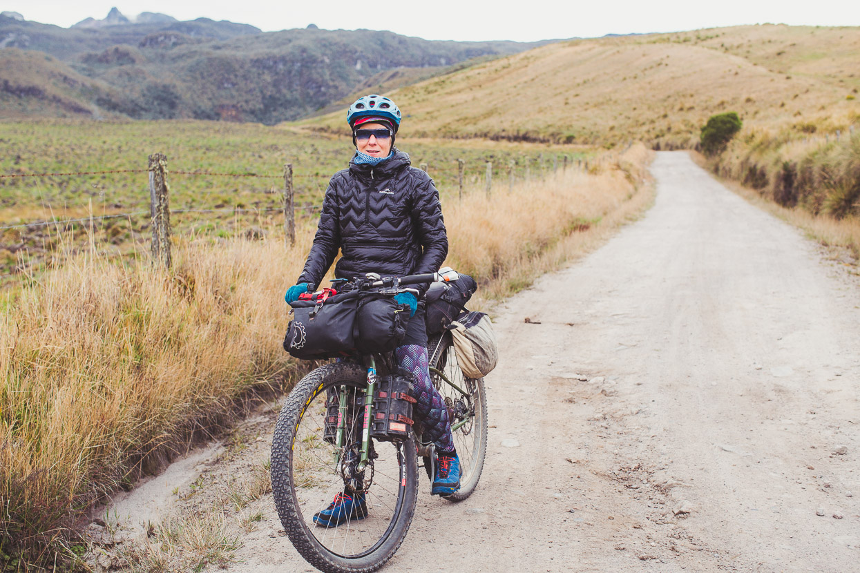
Hana modelling Kathmandu’s new hooded down pullover, an 800 fill-power lightweight jacket that’s been a lifesaver on this extra cold leg of the journey.
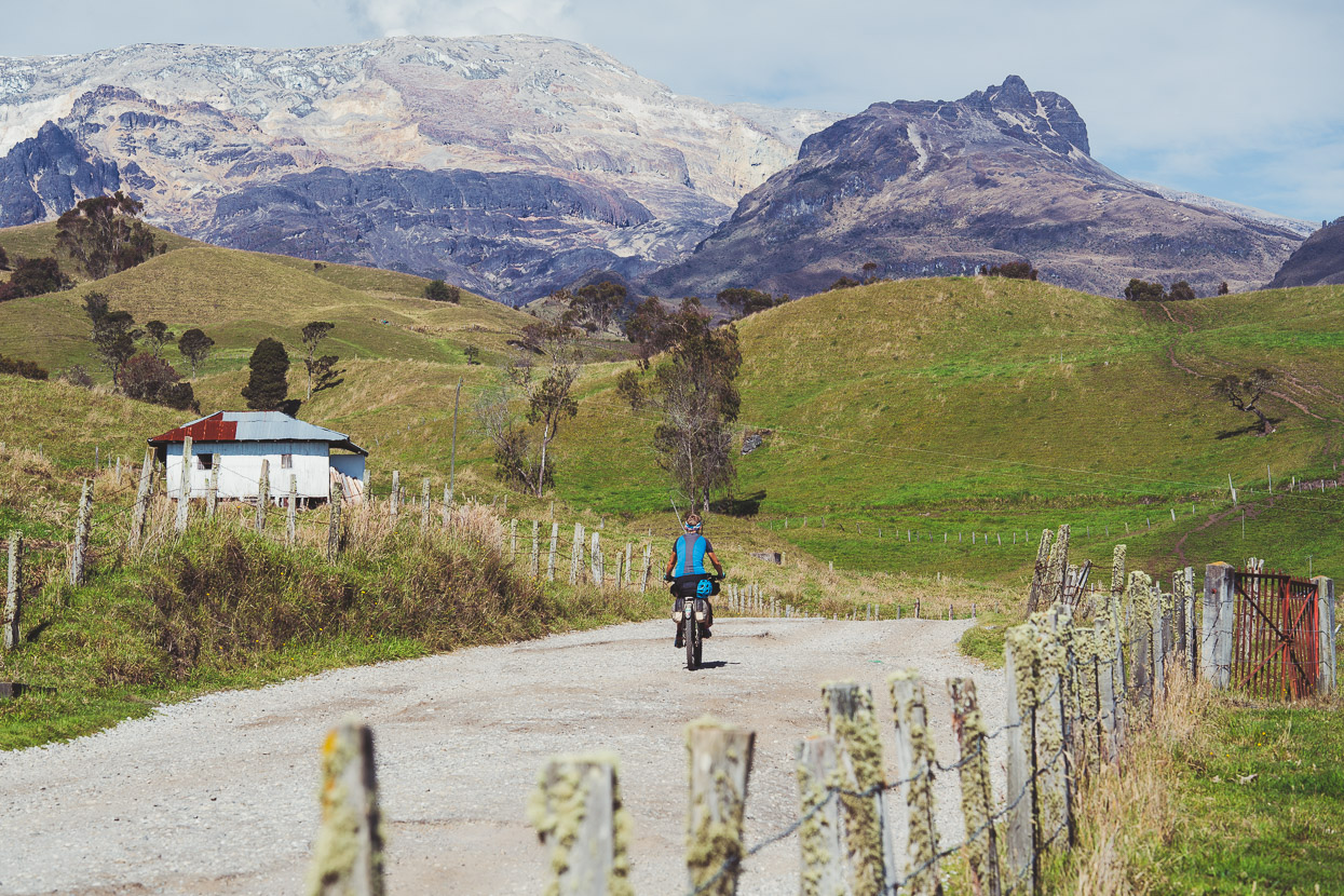
Even at 3900 metres potato fields and grazing paddocks range up the slopes of the mountain here, making the páramo at this elevation disappointing compared with the northern side of the mountain.
*A note to other visitors: if you’re not riding the (currently) closed pass, then the most spectacular scenery and best páramo to be seen by bike is on the Old Letras Pass road between Murillo and Brisas.
And also note that although you used to be able to ride to Laguna de Otun, bikes are now prohibited there. Walking only.
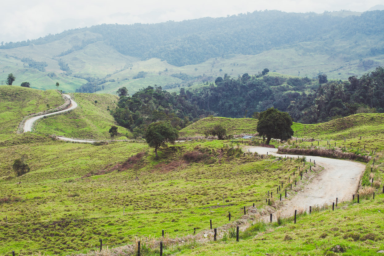
The route we took to Pereira only appears on OSM (not Google Maps) and follows a sometimes rough dirt road roughly west past Potreros towards Santa Rosa de Cabal. It was a real gem – totally deserted except for the odd farmhouse and it passes through some really nice farmland and ancient forest. It wasn’t all downhill though, with around 700m cumulative climbing from the few small hills. But by the end of the day we’d dropped from 3900 metres to 1400 metres.
Santa Rosa de Cabal – a lunch stop before pressing on the short distance to Pereira.
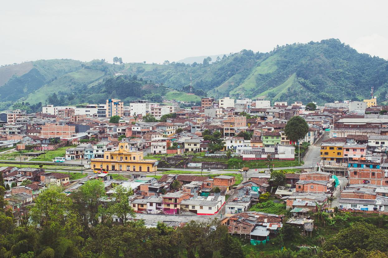
Back down in the rich, humid air of Pereira at 1400 metres. We spent a night in this busy city, enjoying the luxuries of a decent meal, a beer and bed, as well as completing our Colombian Visa renewals before heading on to Salento the next day.
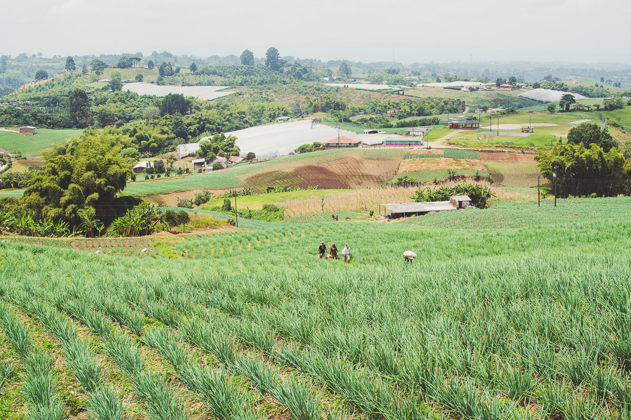
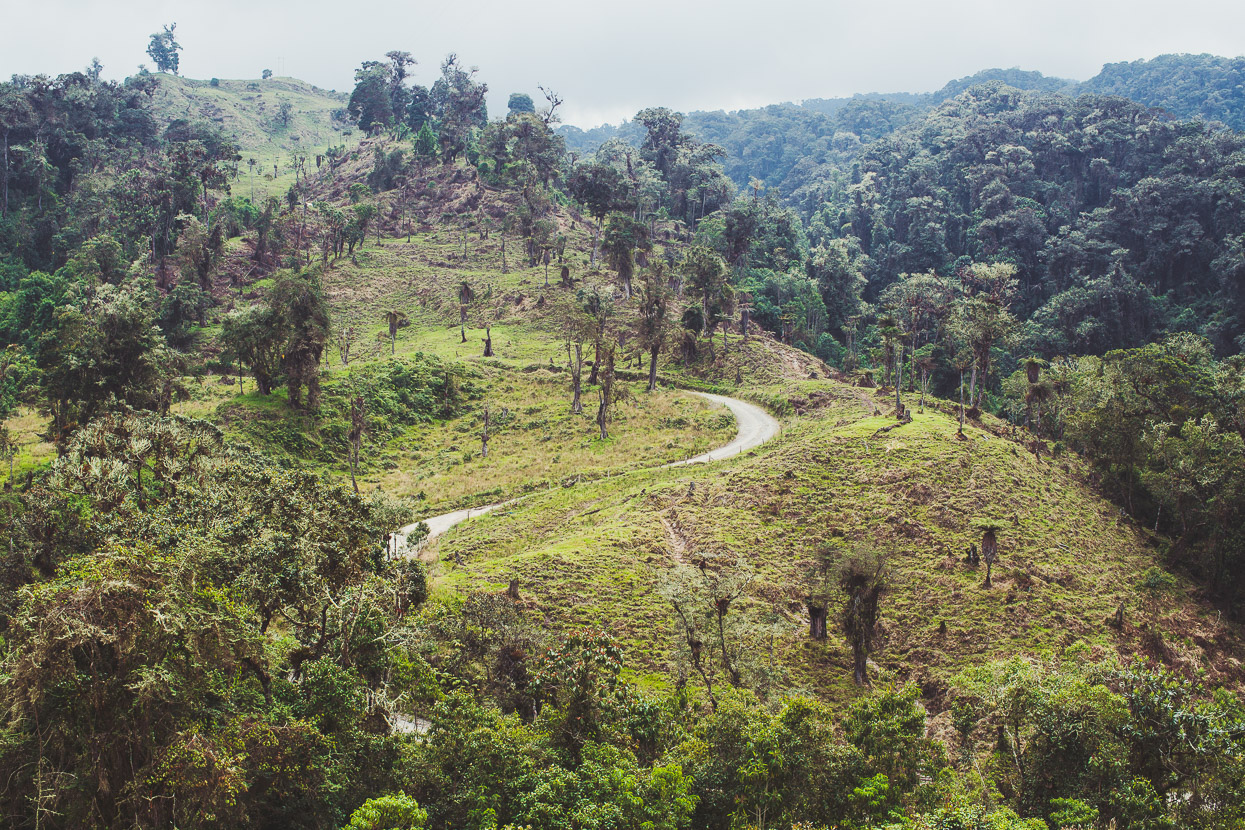
We found a good looking route that traversed hills on dirt roads well above the major highway that connects Pereira with Salento, along the way passing a lot of agriculture; here spring onions, but also coffee and avocados.
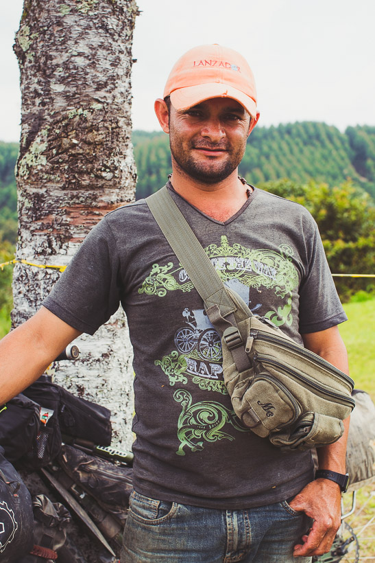
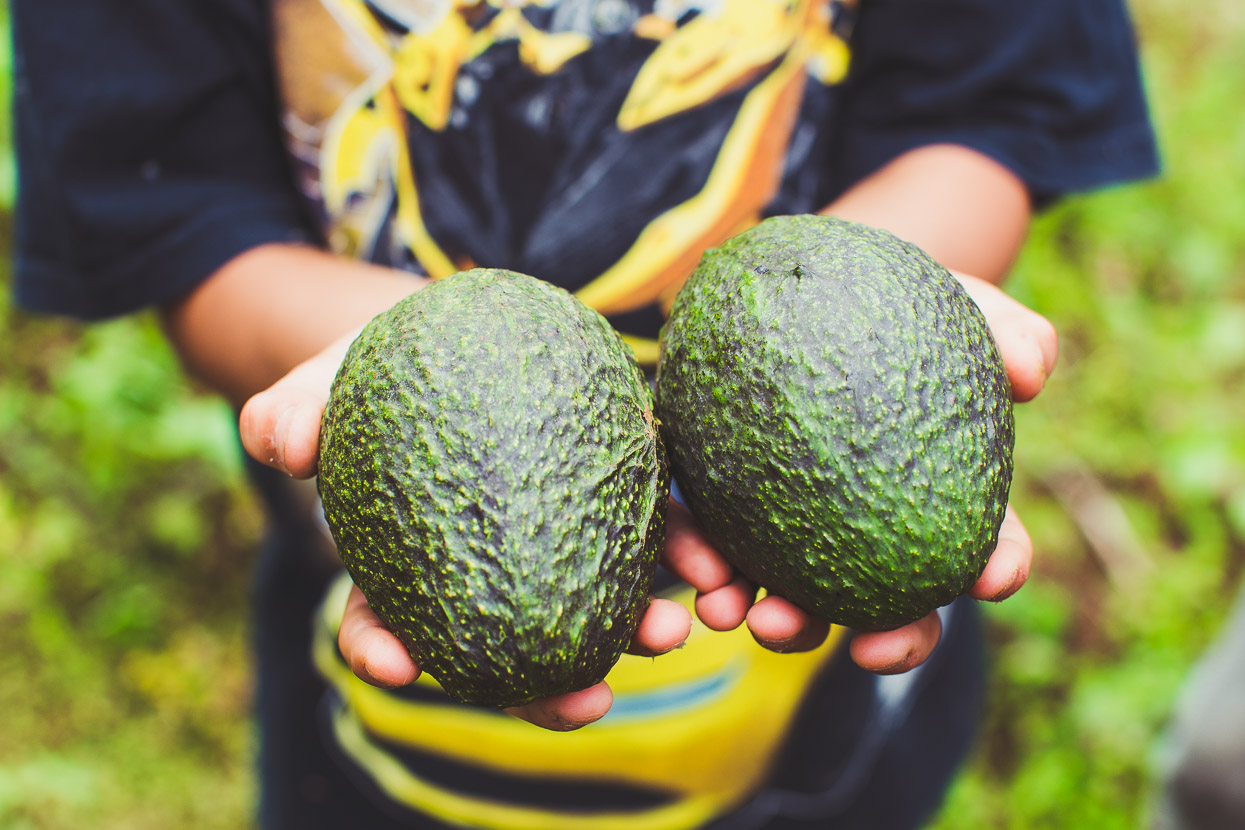
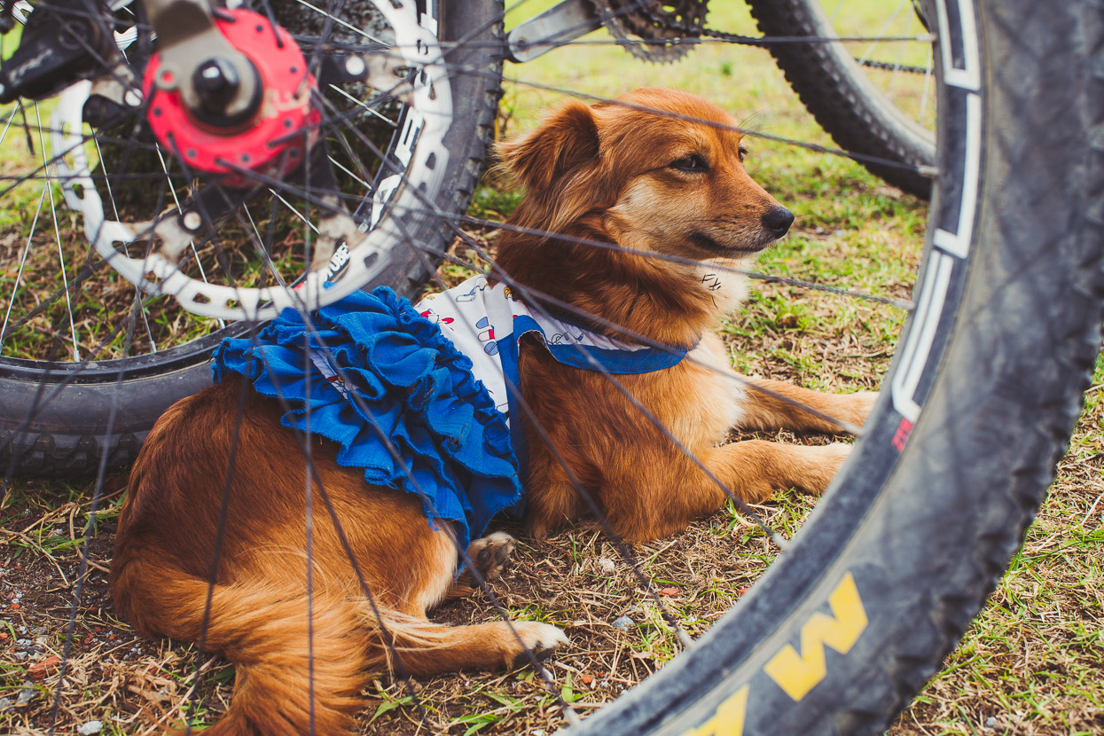
We’d stopped for lunch at a junction in the forest when Orlay (who was picking up his son from school on his motorbike) stopped to say hi and find out where we were from. Eventually he invited us back to his house for some jugo de piña and some avocados. It was a one kilometre downhill back track for us but we couldn’t really say no so we turned around and followed him to his house on top of a ridge, surrounded by avocado orchards.
We met their dress-wearing dog, got a tour of the orchards, were given some juice, six avocados and a signed out-of-circulation Colombian banknote as a gift to remember him by. It was a fun diversion for an hour from the steep hills of the dirt track we’d been on.
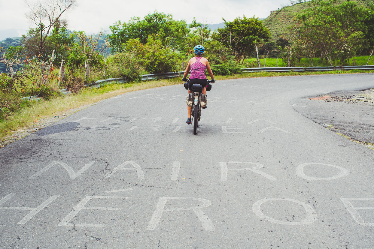
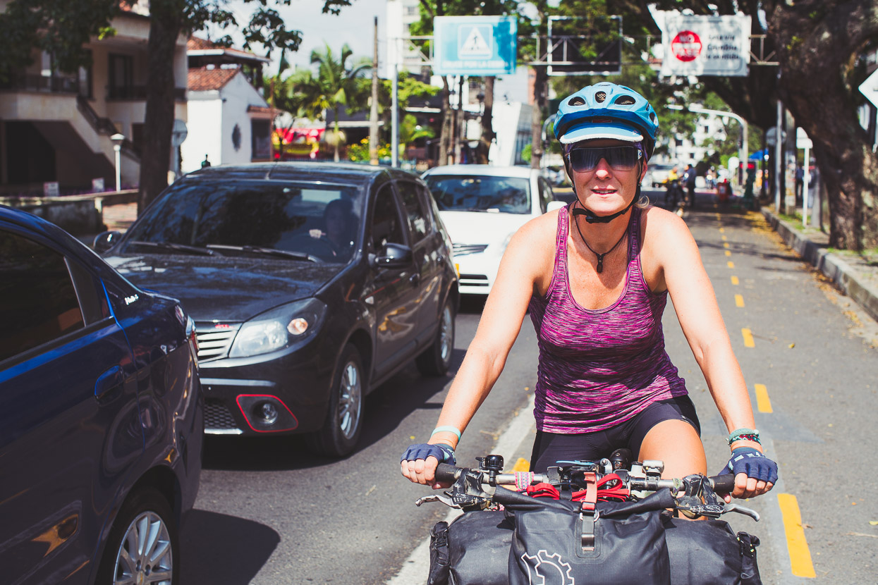
Our planned route through to Salento didn’t quite work out when we reached a large well-locked gate (not that that had stopped us on Ruiz!) across the road, guarding the entry to a coffee finca, so we dropped off the ridge down to the highway before making the turnoff to Salento. The ride to Salento culminates in a steady 250 metre climb that steepens towards the top and has been a summit finish in Colombian stage races. The names of Colombia’s superstars of cycling were painted all over the road – including Giro d’Italia winner Nairo Quintana who is a household name here.
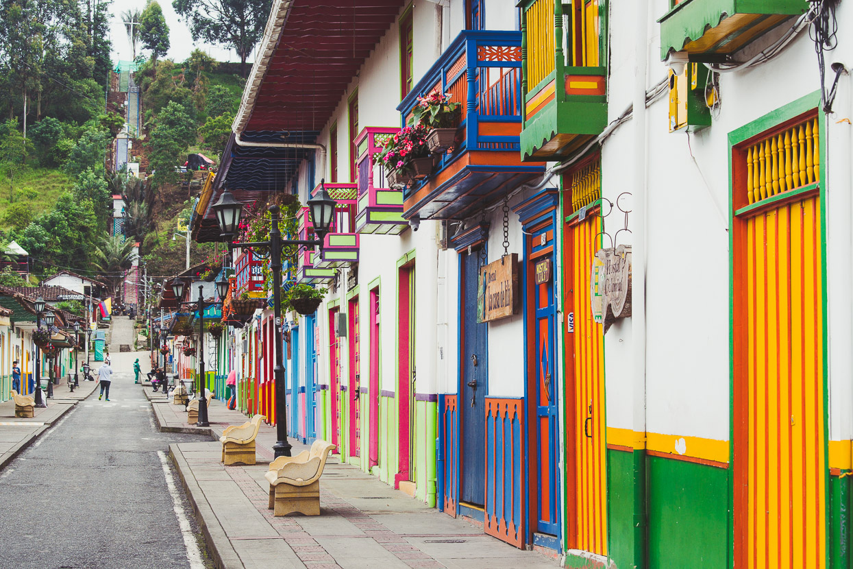
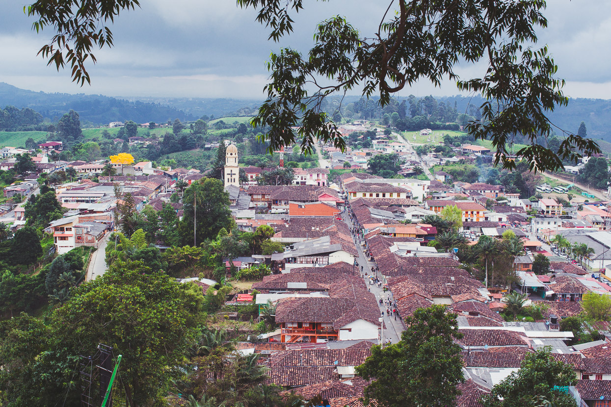
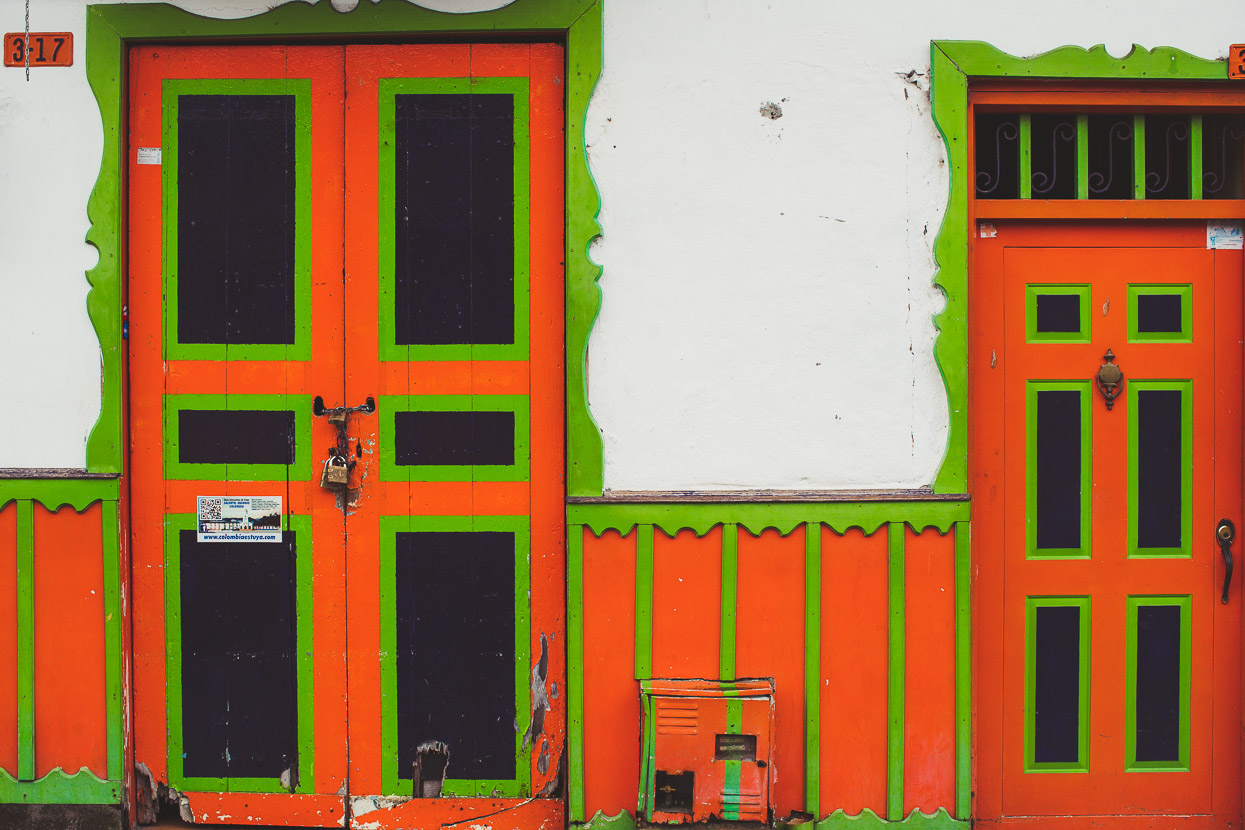
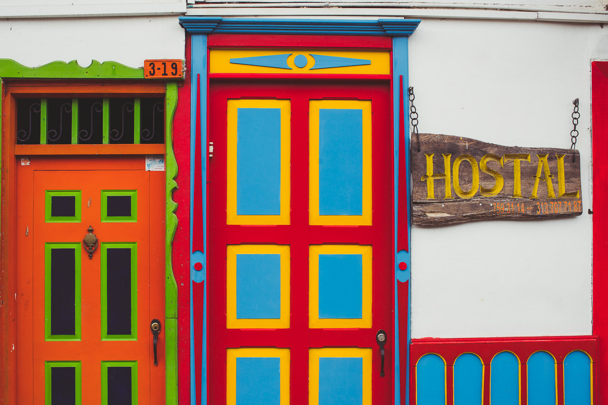
Salento was a nice place to arrive at. With its cobbled streets, gaudy colours and colonial charm it’s a popular tourist destination for Colombians and extranjeros alike and made a great spot for a couple of days off the bike. The full on tourist scene of bars, cafes and restaurants was a bit of a shock for us Gringo Trail dodgers but prices were still really reasonable so we had no trouble indulging in some meals that were a step up from the usual rural-fare.
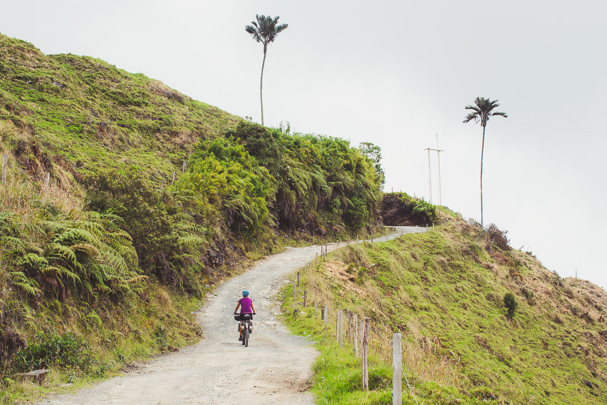
Aside from its immediate charm, Salento is the base for people visiting the famous Valle de Cocora, 12 kilometres away towards Los Nevados National Park. This valley’s famous for its distinctive tall and slender wax palms, which I’ll cover in the next post…
Do you enjoy our blog content? Find it useful? We love it when people shout us a beer or contribute to our ongoing expenses!
Creating content for this site – as much as we love it – is time consuming and adds to travel costs. Every little bit helps, and your contributions motivate us to work on more bicycle travel-related content. Up coming: camera kit and photography work flow.
Thanks to Biomaxa, Revelate Designs, Kathmandu, Hope Technology and Pureflow for supporting Alaska to Argentina.


Great reading. You’re an inspiration for we folks who would love to do something like that – but just dream about it ! Goodness imagine the headlines in the N. Z. papers & the furore if we had to bail you out of a Colombian jail ! Reading Te Araroa & loving it. Travel safely.