
Where Next?
We decided on a joint New Year’s Resolution for 2018.
We’ve been 19 months on the road since our June 2016 start in the cold expanses of the Alaskan Arctic – hard to believe really. Each major section of the ride: Alaska, Canada, the Great Divide, the Baja Divide, Mexico, Central America and Cuba is filed away in our memories, each defined by a myriad of recollections; of the landscapes, the people, the weather, the temperatures, the food, the smells or the riding.
Something that’s been more or less constant for ourselves has been our approach to each riding day, which due to some kind of pre-programmed work ethic – or at least a desire to pack in as much as we can – has tended to be one of long days in the saddle and solid blocks of riding (5-9 days) between rest days. It’s meant we’ve seen an incredible amount – looking at our tracks in Guatemala and Honduras for example – but it’s also meant that we have often felt half exhausted a lot of the time. Especially by the time the next rest day rolls around.
There’s a huge amount of satisfaction in riding from sun up til sun down; the hazy endorphin buzz when you step off the bike at the end of the day, the endless appetite for food and the feeling of accomplishment from looking back over the ground you’ve covered in a day and list of villages whose names you can’t even recall. The smiles, the waves, the dead legs at the bottom of an afternoon climb or the second wind you didn’t think could possibly be there. For various reasons this seems to be our default for cycle touring.
But for 2018 we’ve agreed we’re going to try and tweak our approach to one that’s more sustainable – aiming for slightly shorter days that give us time to do a bit more exploring, enjoying our location at the end of the day, or catching up with the blog and hopefully leaving us with slightly fresher legs for satisfying days in the saddle, and rest days where we’re not carbo-craving zombies.
For now, we’ve got the time to do this, as we’re trying to avoid hitting the high country of Ecuador in the middle of wet season. So we’ve devoted a lot of time to explore Colombia while we wait til late April before hitting the Trans Ecuador Mountain Bike Route. Still not ideal timing, but it means we’ll be in Peru for the optimal season (June/July/August) and have a peak season run the rest of the way down the Andes (hopefully!). At the moment we’re anticipating an April or May 2019 finish in Ushuaia. Poco a poco as they say here (little by little).
So with nearly four months in Colombia, how best to spend it? We deliberated about heading north east, towards the northern tip of South America, close to the Venezuelan border, but after reading several accounts of robberies of cyclists, some at gun point, we decided not to push our luck. It also sounded brutally hot and dry. So we decided to head somewhere brutally hot and wet instead.
1528 kilometres long and running nearly the entire length of the country, fed by the giant catchments of the Central and Occidental Cordilleras of the Andes, the Magdalena River is Colombia’s longest.
Since Pre-Colombian times the river has been a route to the interior of Colombia and Ecuador, and was utilised by the Spanish conquistadors who used it to venture into the wild and mountainous interior. During the Spanish colonisation of the Americas, the river was the only transport link communicating Bogotá with the Caribbean port of Cartagena de Indias and thus with Europe.
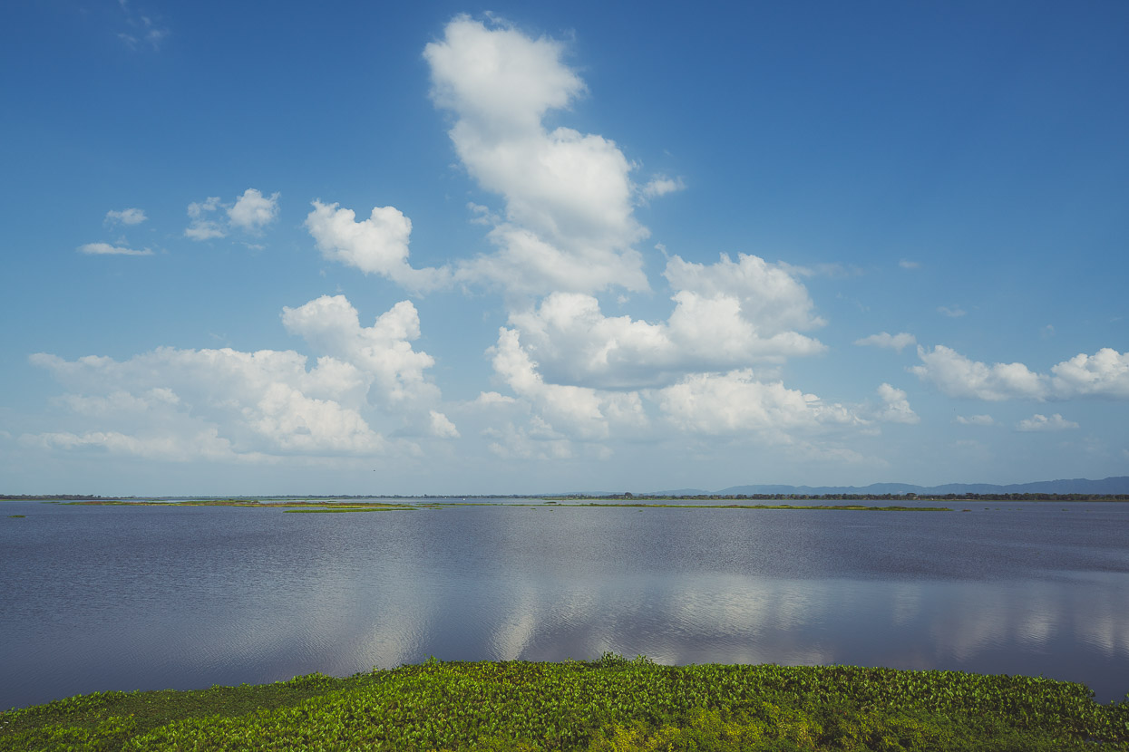
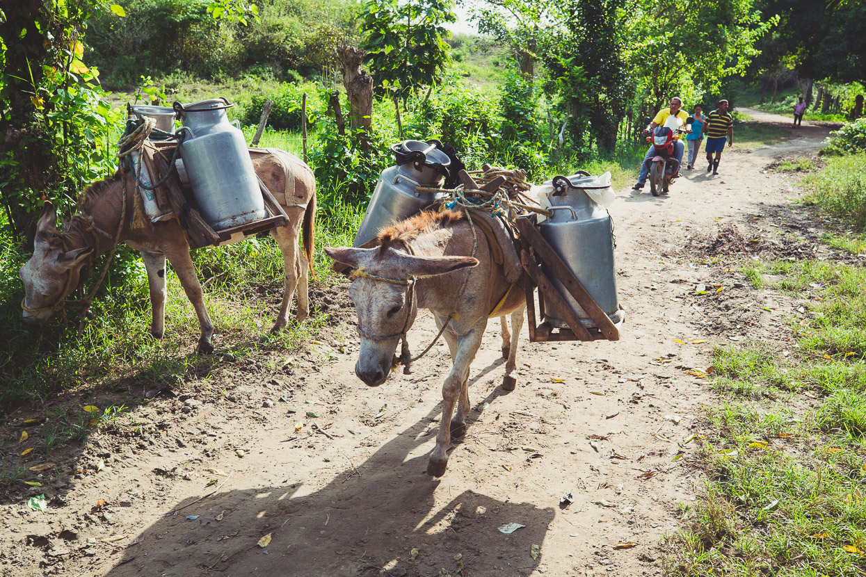
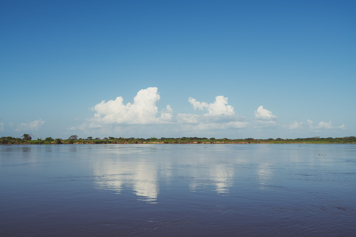
In the north of the country the river flows broadly and languidly through a huge lowland basin, separating into myriad arms, lakes and lagoons and supporting the existence of hundreds of small villages and towns that rely on it for commerce, food and transport.
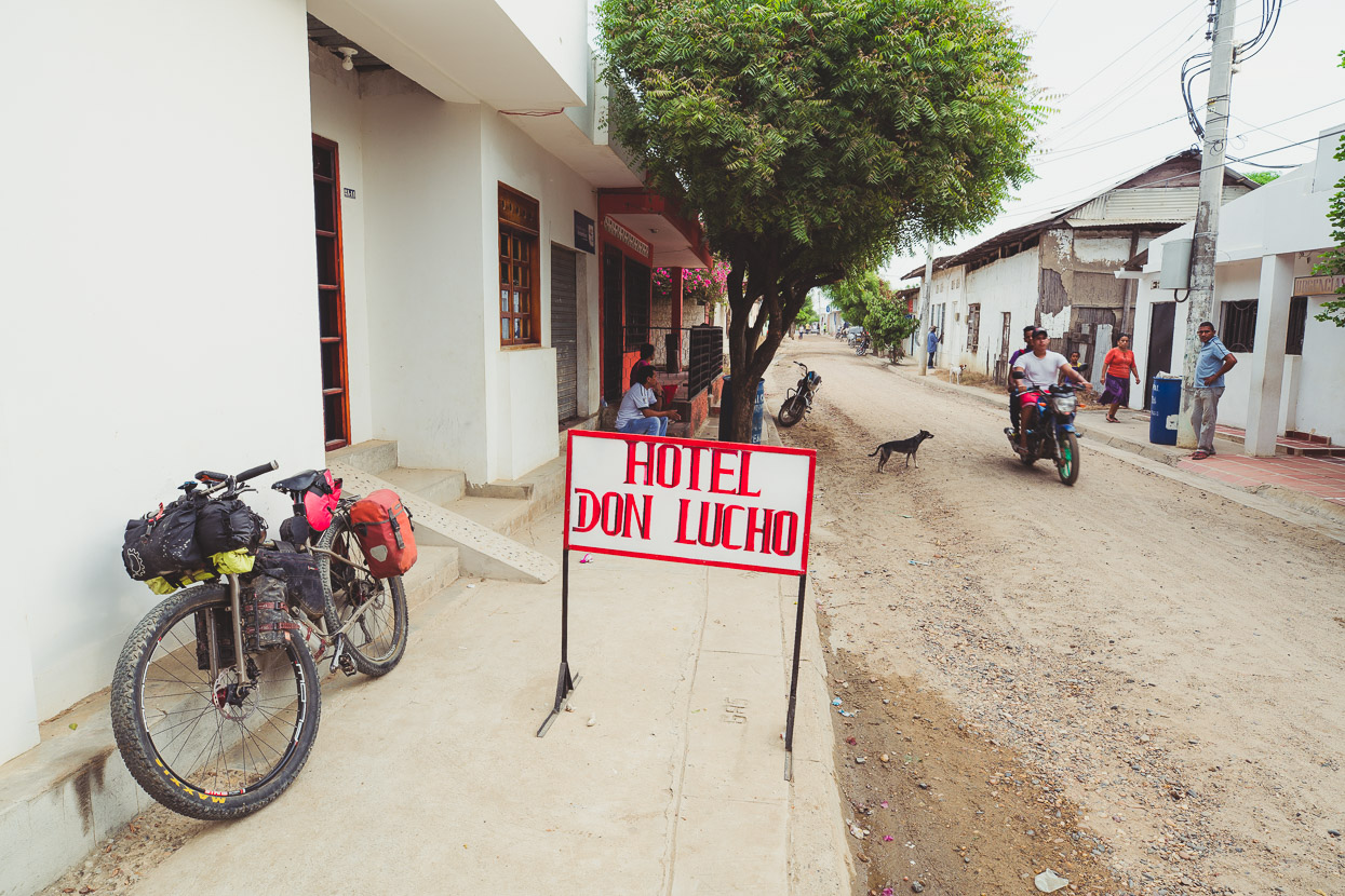
We decided to head into this lowland region and aim for the almost mythical town of Santa Cruz de Mompox, alongside the Rio Magdalena. A place where time is said to have stood still, preserving the colonial aesthetic of this town, which was once an important trade centre.
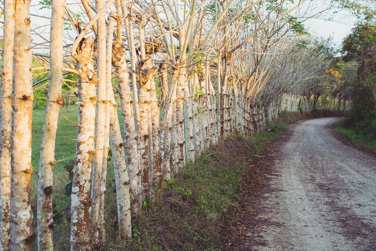
For the first day and a half we followed the highway out of Cartagena towards El Carmen de Bolivar. It was great to get out of the city finally and be back on the road, seeing some of what we knew was the ‘real Colombia’. After we left the initial flats it was quite a nice ride through rolling hill country but the fume-belching highway traffic was unpleasant and we were glad to finally turn off into remoter country.
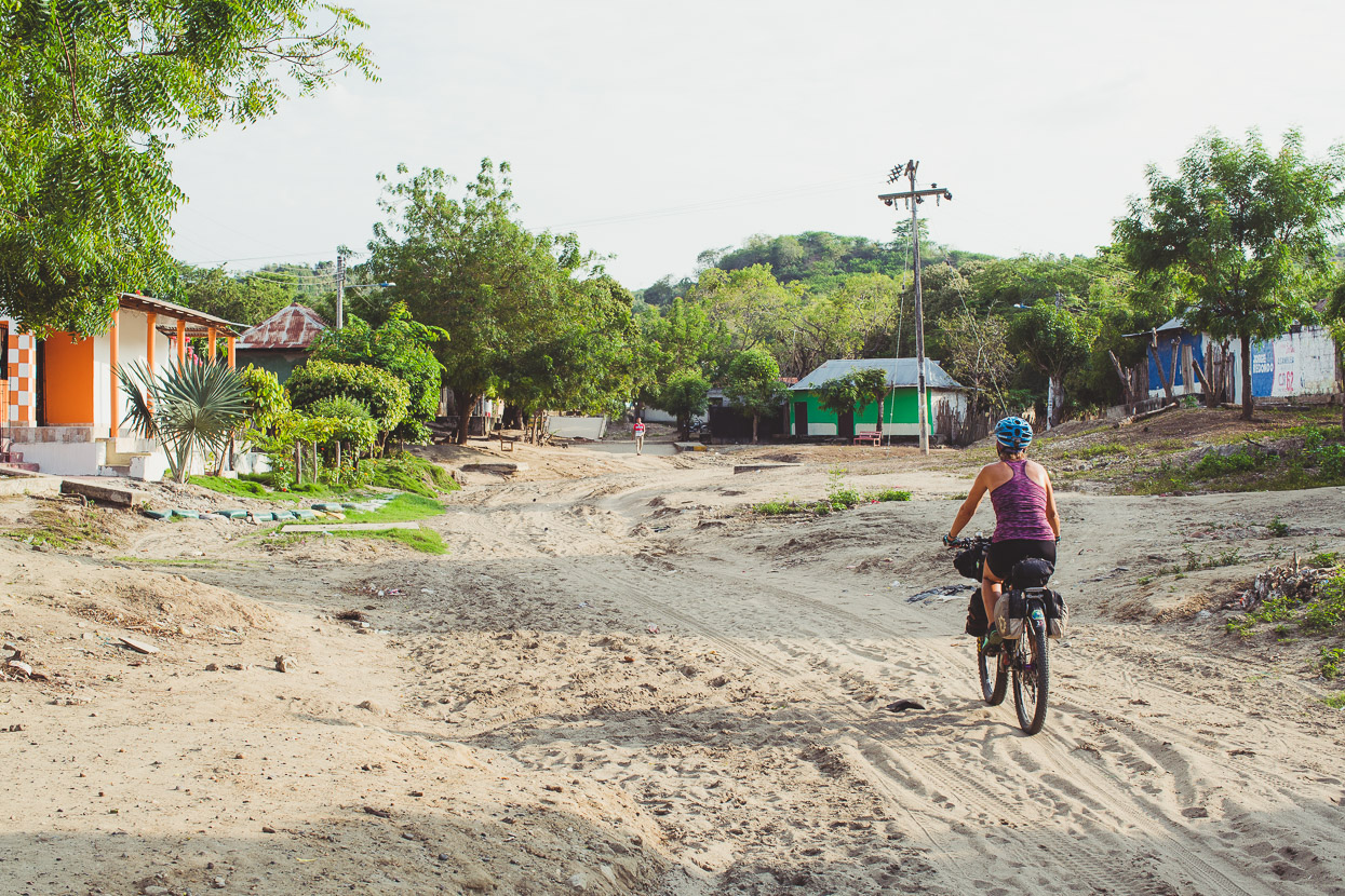
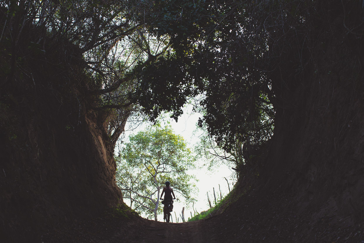
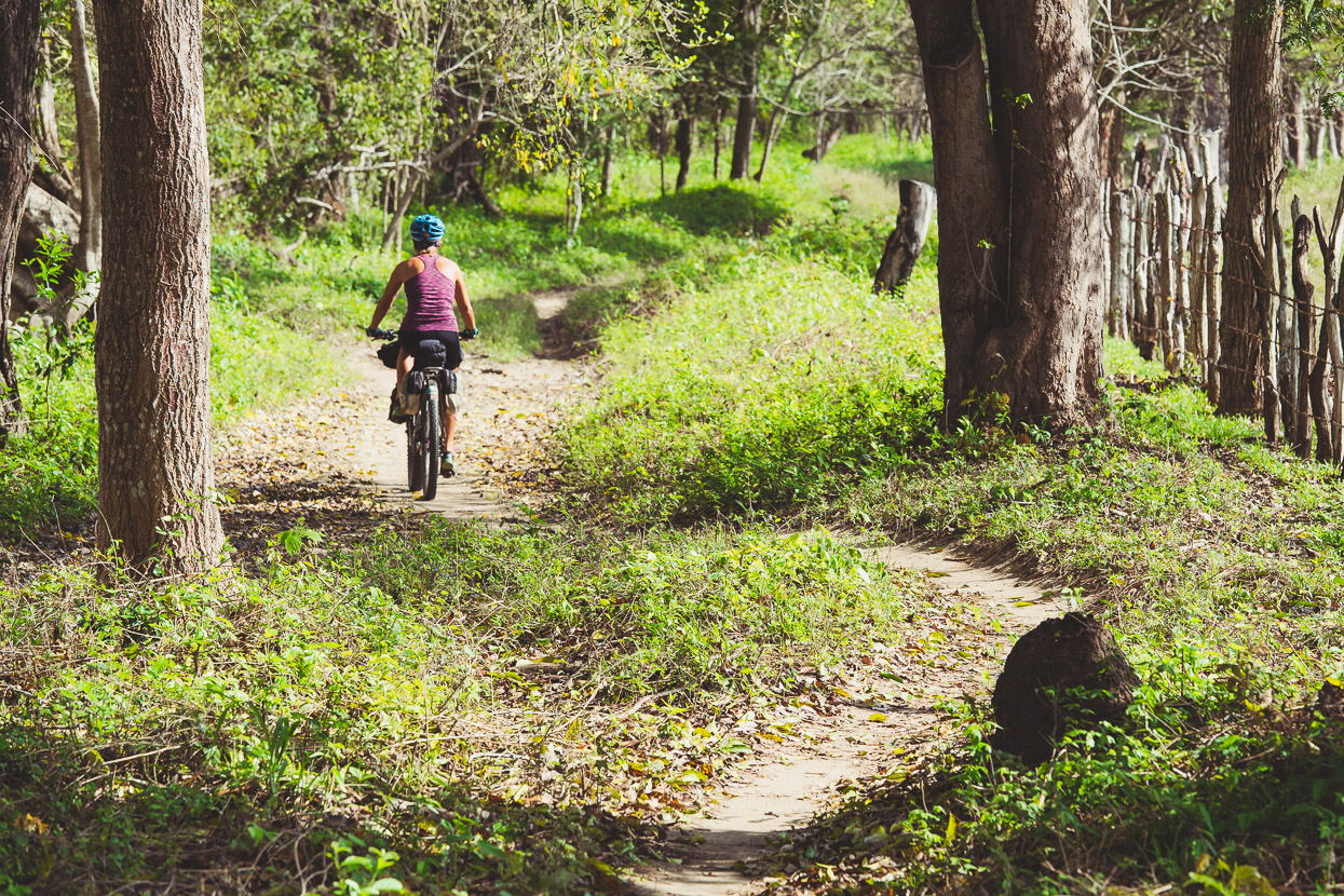
At first the route followed a narrow concrete road through steeply rolling hills and small cattle fincas, before bizarrely ending just on the edge of the village of El Salado, where the roads became small, sandy arroyos between the buildings.
Beyond there it was beautiful riding on smooth, sandy tracks, with just the mooing of cows and the odd motorbike to break the silence.
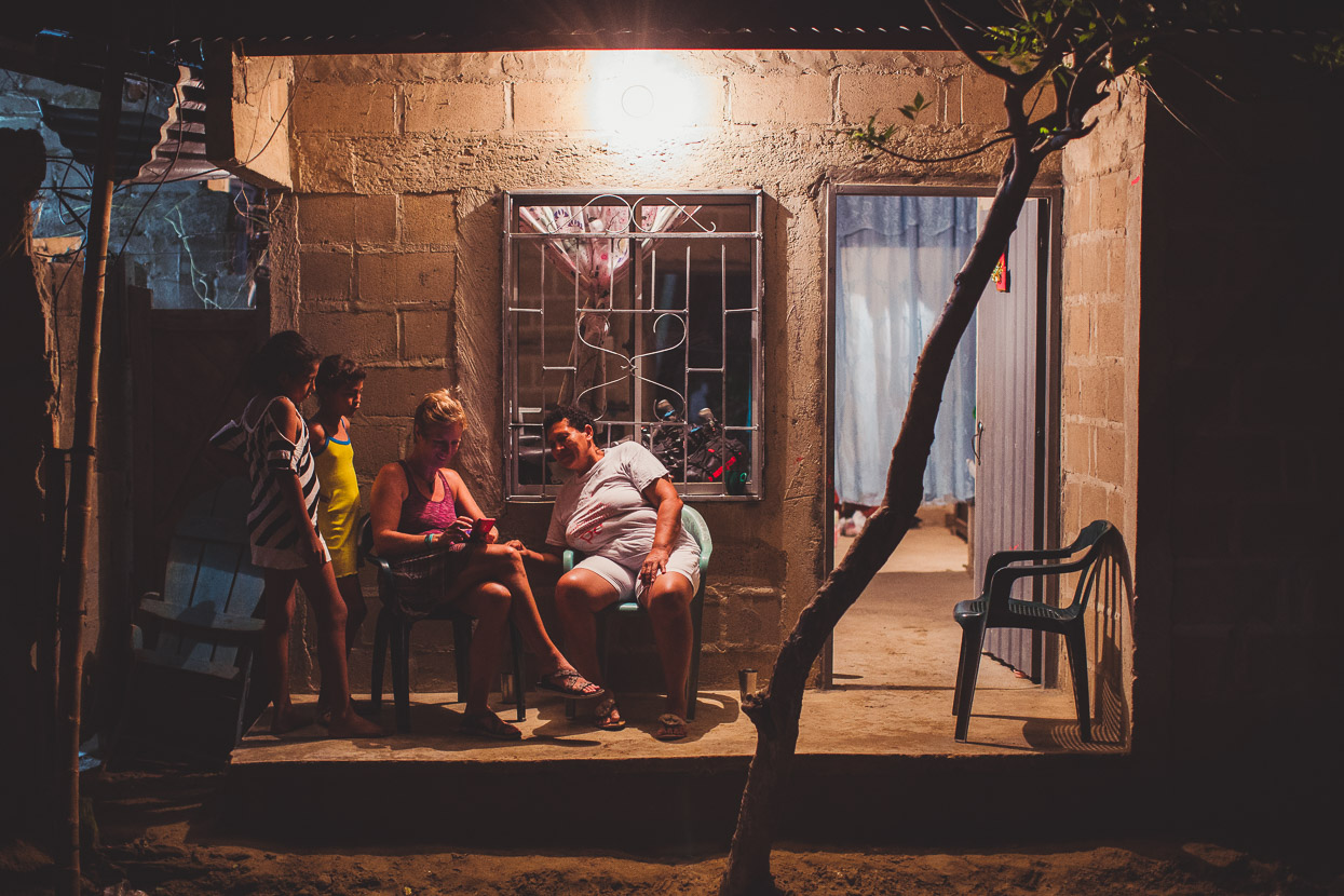
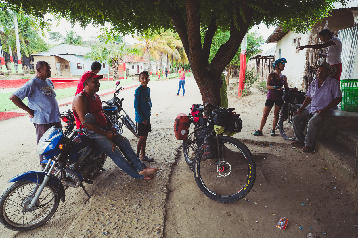
As we rode into Canutalito at the end of the day we noticed a football field that looked like a good camping spot, but we entered the village anyway to ask first. We stopped to ask a woman sitting outside a house, and she replied with ‘Yes, you can sleep there, but why not sleep in my house instead.’ The rumours of Colombian hospitality were true.
Elise and her family were great hosts, giving us a bed to sleep in, a shower and cooking us a meal, while we talked about where we were from and showed photos of our travels.
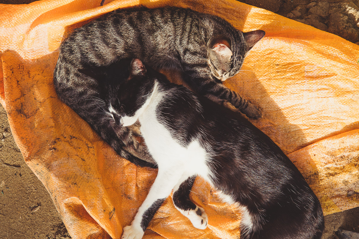
Along with several kids there were twelve cats (including a fresh litter).
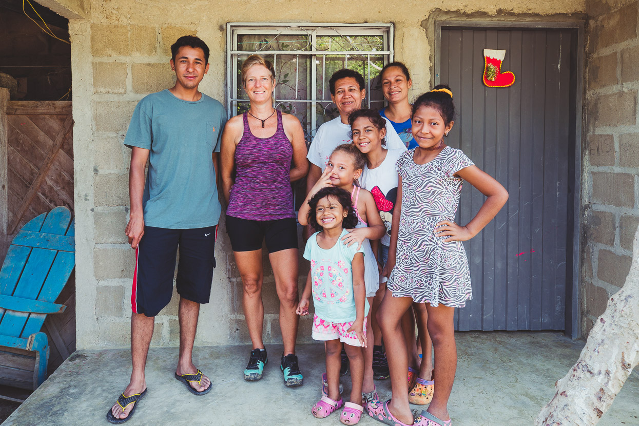
Elise’s son, Leonardo, worked as a security guard in Bogota for the US Embassy. It’s an 18-hour motorbike ride away, but he was in the village on vacation from work. He spoke a few words of English and like many people here was a bit embarrassed to use it, but the more we talked the more he opened up.
In the end Leonardo gave us some great beta for a route onwards that headed to Mompox more directly than we’d planned and avoided pavement completely. He seemed to totally ‘get’ the bikepacking concept and the desire to avoid main roads, when most people we meet can’t understand why we’d possibly want to make work for ourselves. Most people live hardworking, physical lives in this region, so making something require a greater effort than necessary is counterintuitive to them.
He escorted us to the edge of the village on his motorbike to get us on the right track out of town.
First we had to deal with rush hour.
But it turned out it was just that – a track – and a single one at that. Perfect!
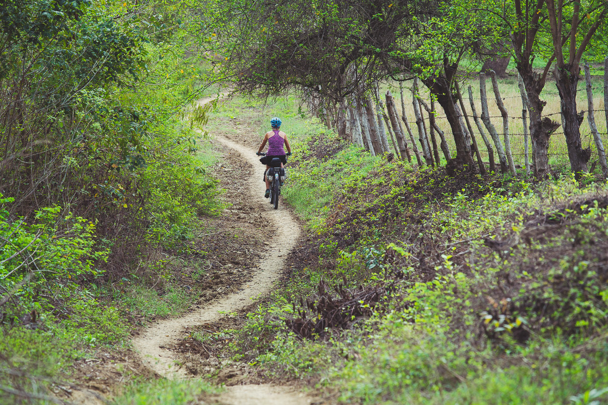
Interestingly this route between Canutalito and Guimaral is shown as a ‘yellow road’ in Open Street Maps, but is single track the whole way. Smooth and non-technical, it’s the perfect touring route.
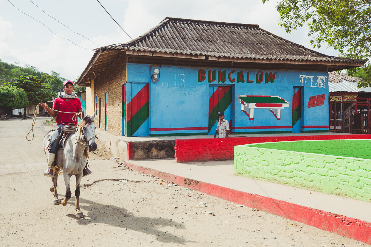
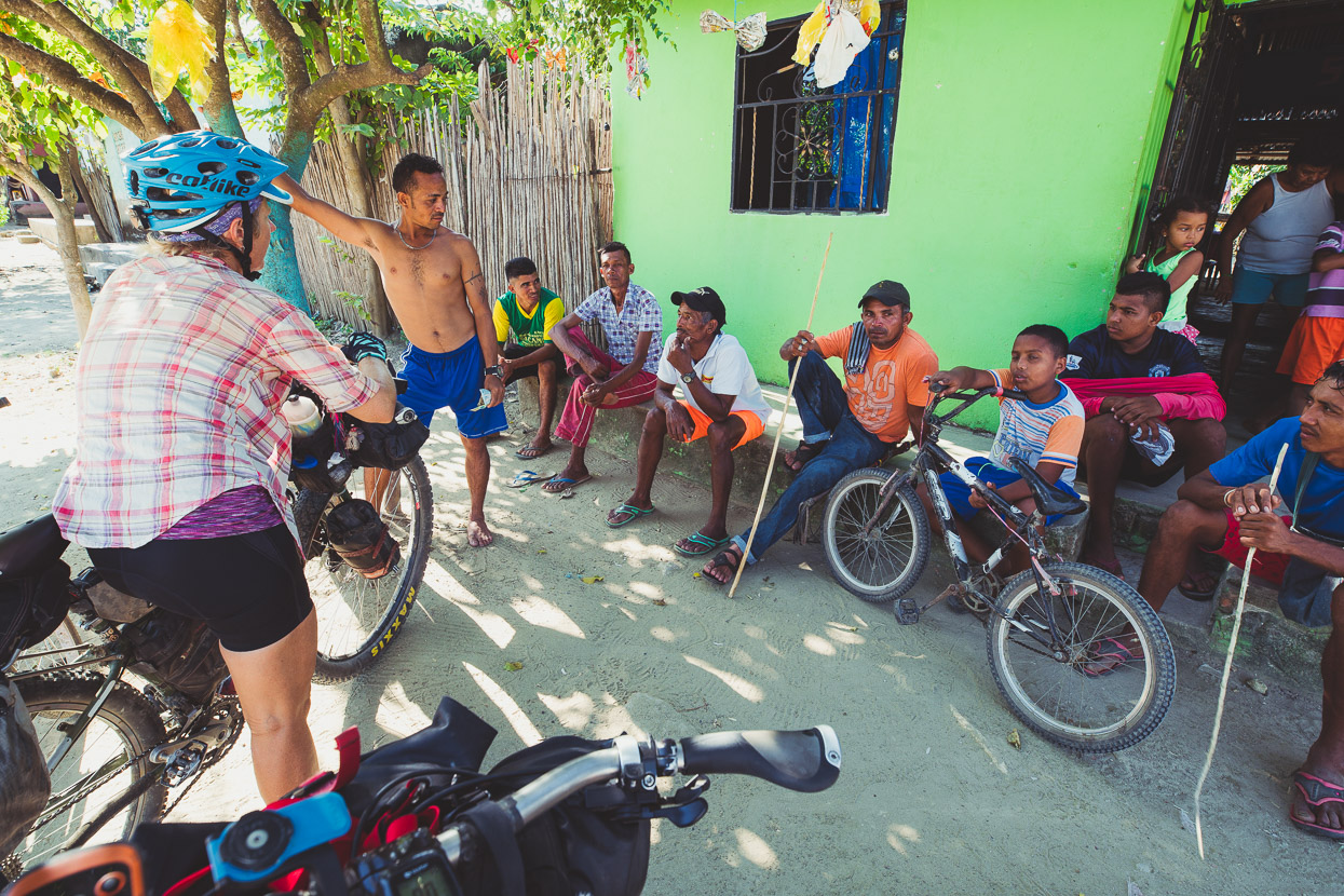
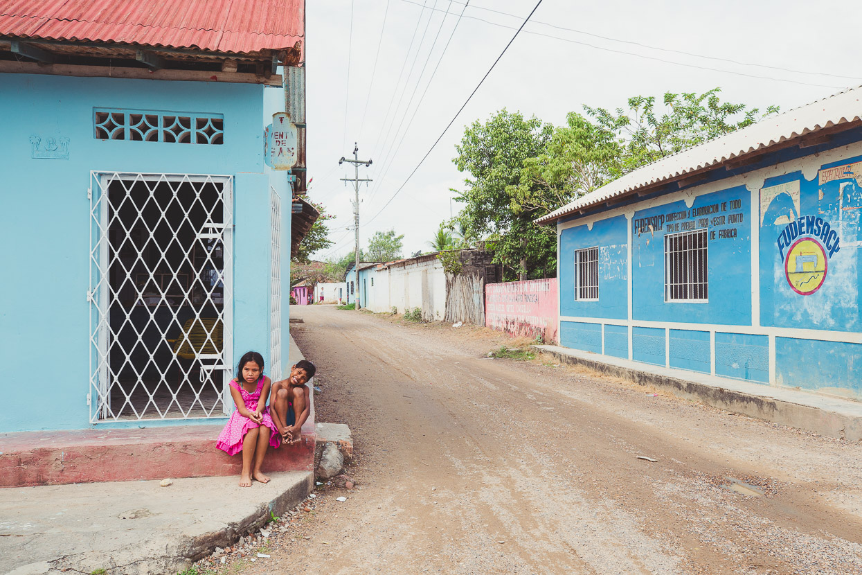
Guimaral was a pleasant little village where having a couple of gringos pass through was the news of the week. We attracted a crowd everytime we stopped, and always the same volley of questions: where have you come from, where are you going, where are you from, how much does the bike weigh, how much does the bike cost? Colombians are not shy and we love how forward people are here about chatting to us.
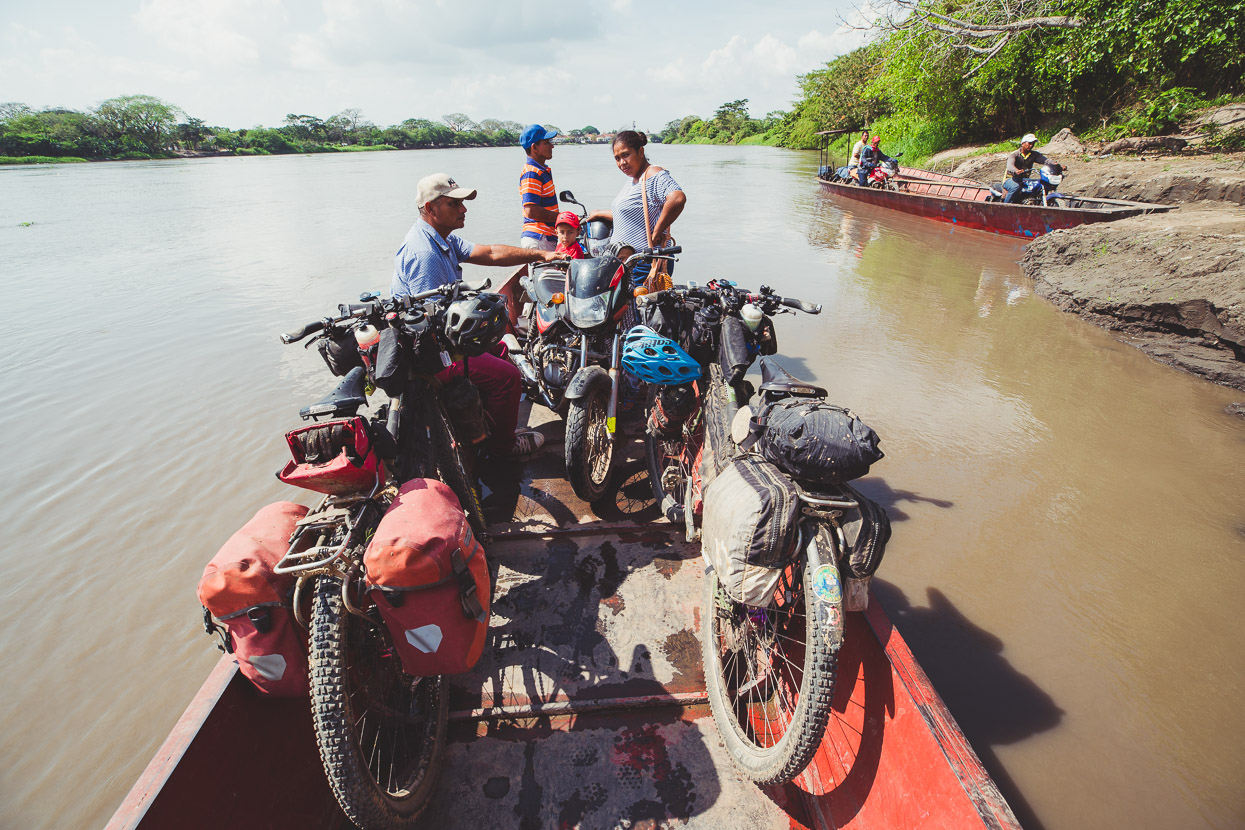
From Guimaral we rode small dirt roads and tracks to San Andres, Santa Lucía, Tachamochito and Tachamocha. From Tachamocha, alongside the Rio Magdalena, Leonardo had said we could take a ferry to Pinto, where we could get back on dirt roads towards Mompox.
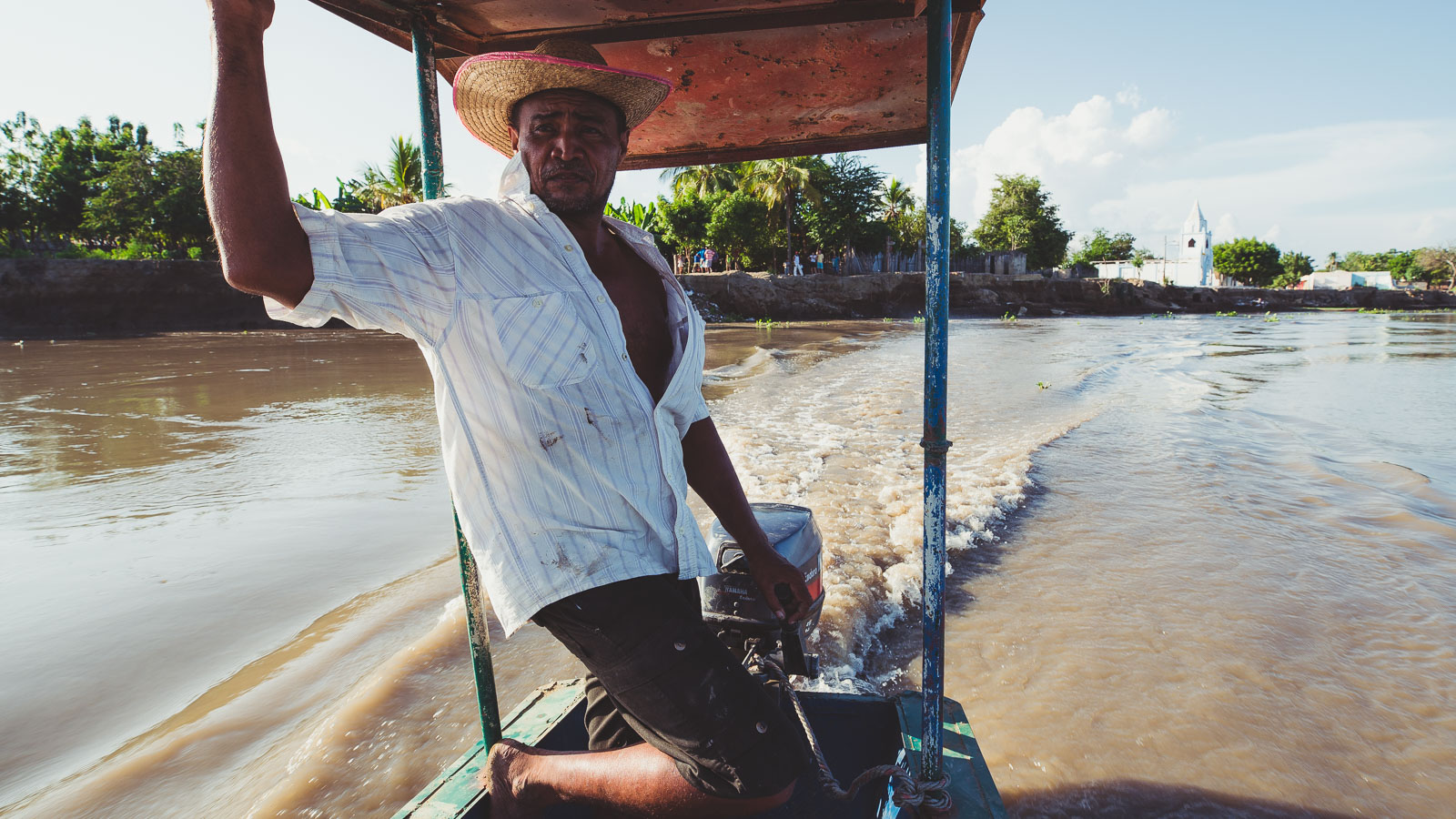
As bicycle travel is prone in developing countries where you don’t fluently speak the language, we ran into some confusion about where the boat(s) departed from, when it departed and what it cost, but eventually after riding to Tachamocha, then back to Tachamochito and back to Tachamocha in 35 degree heat we gleaned enough information to ask for Armando Palencia, who organised us a boat for the sum of COP 80,000 (NZ$40), which seemed expensive – although it was an hour long ride. Apparently there is a scheduled service early in the morning, but Tachamocha wasn’t a particularly appealing place to hang out for the rest of the afternoon and evening, so we decided to go for it.
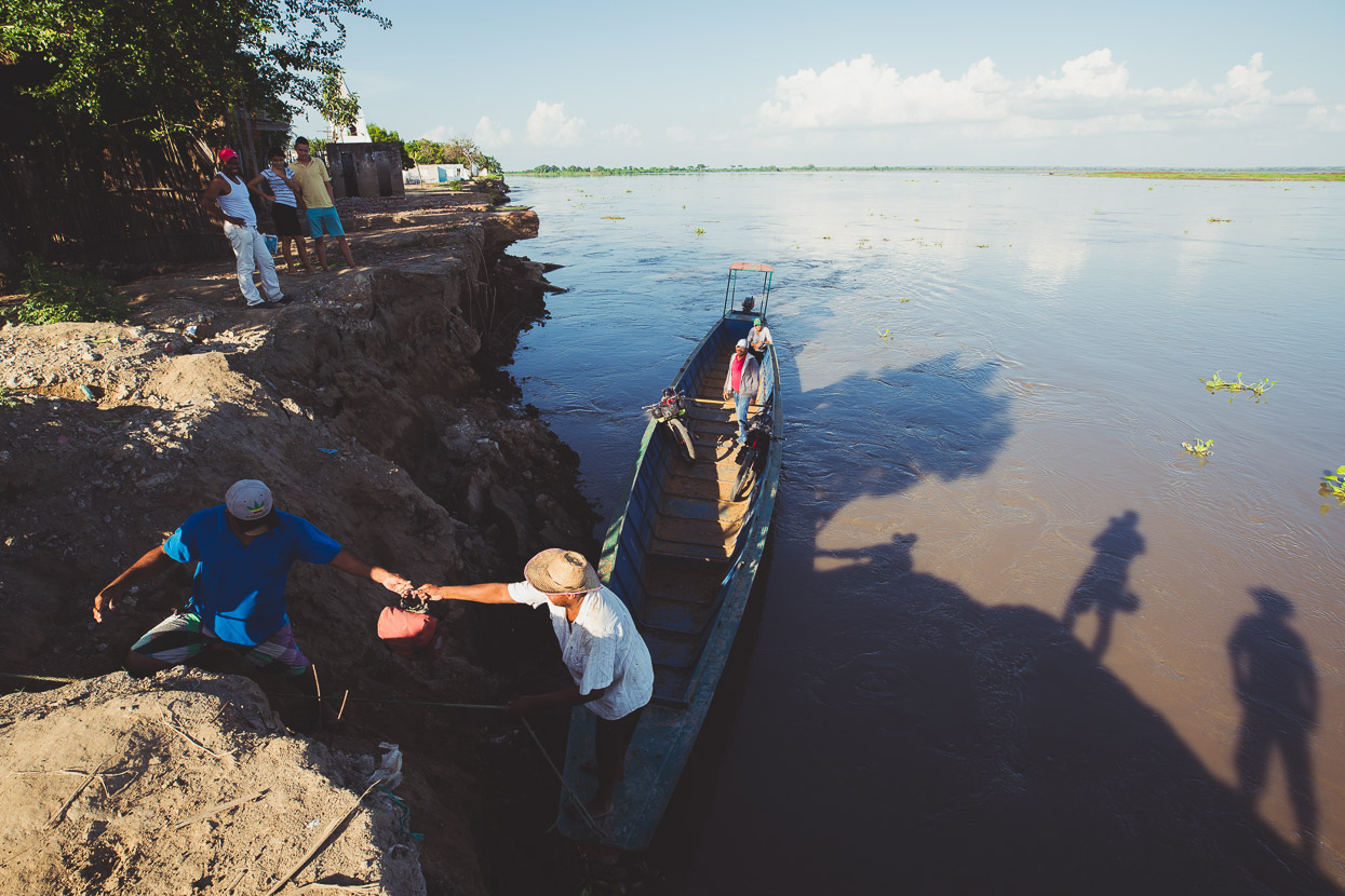
The Rio Magdalena is a relentless force of water, that swells to flood the surrounding country during the wet season. In Tachamocha it had eroded the riverbank to the extent that several buildings had fallen into the river and many more were threatened. We loaded the boat by clambering down a dirt bank.
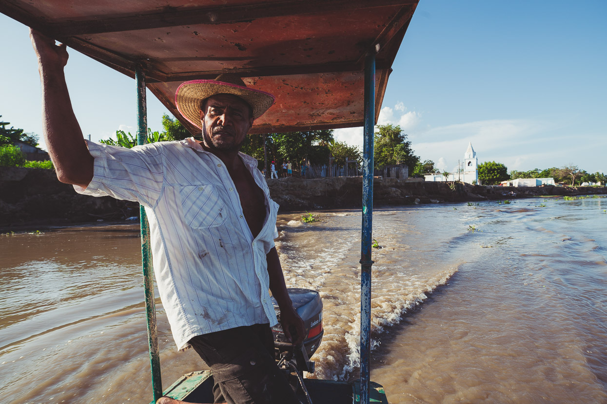
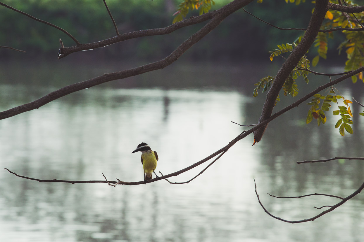
This was the view for the next hour, as clumps of river weed floated past. We passed a couple of seasonal fishing camps and spotted lots of birdlife, which this region – being an absolutely gigantic wetland – is renown for.
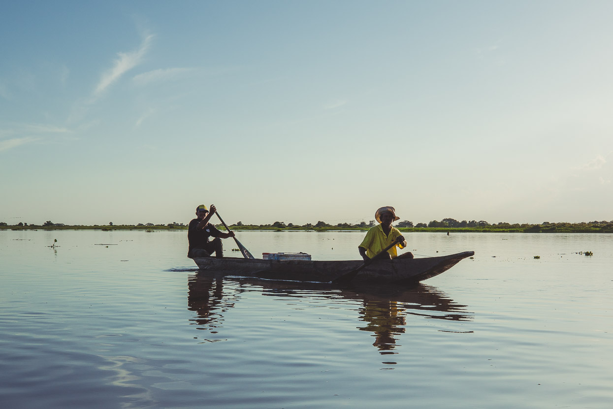
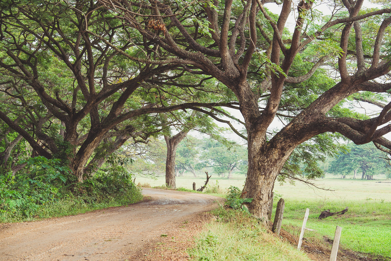
The next morning we were back on quiet dirt roads, shared with just the odd motorbike or local bus. It was a really nice place to ride – following a web of roads, tracks and narrow river branches that interlace isolated farming villages.
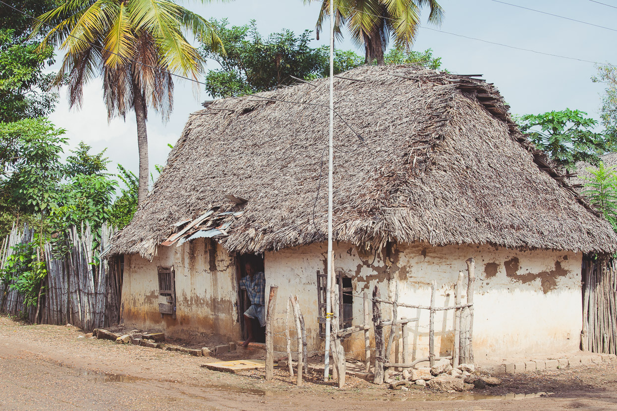
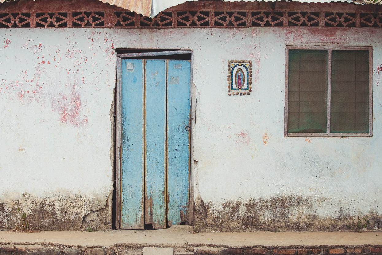
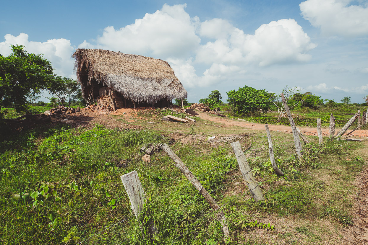
Lots of mudbrick and thatch housing.
A brick making factory.
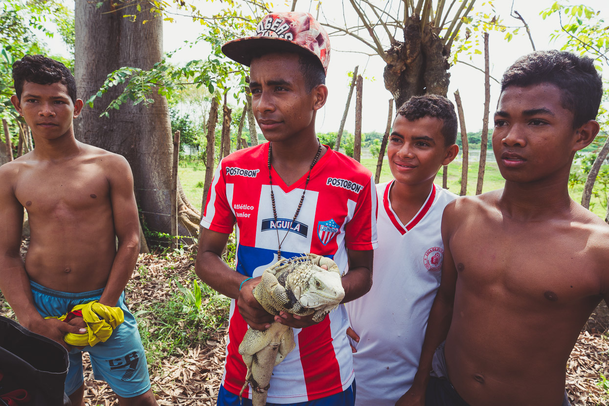
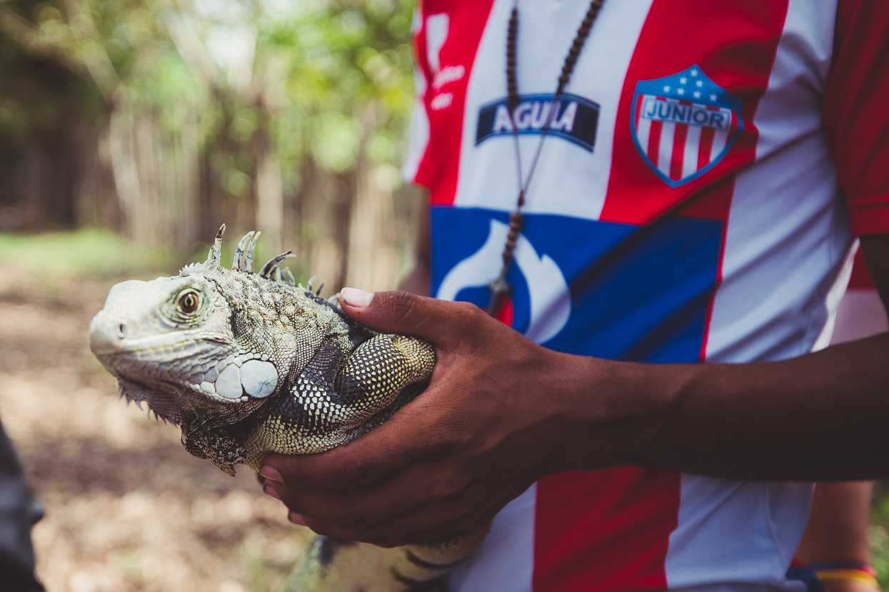
We passed these lads walking down the road and stopped to see their iguana, wondering if it might be a pet. Unfortunately, with its feet and mouth all bound, its fate was sealed. The boys politely explained to us that it was for food, and that they catch a lot of them to sell. Particularly the pregnant females, as the eggs are considered a delicacy.
They could see our fascination (but possibly not our sadness) and invited us to see more at a nearby house.
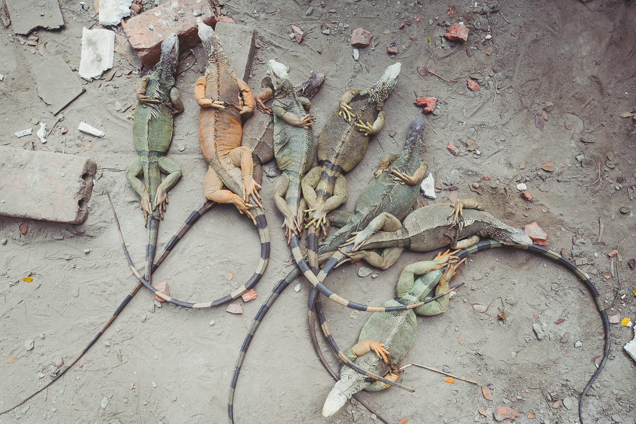
Right beside the river, the yard of the house was alive with pigs, chicken and ducks and in the corner was a pen, where the boys threw their latest catch to join several other bound iguanas. The poor iguana threw a fit of struggling when it landed hard on its belly, setting off the others into a thrashing pile of reptiles. We were amazed. It’s one thing to catch another animal and eat it, but to treat them with such contempt and cruelty seemed so unnatural to our instincts.
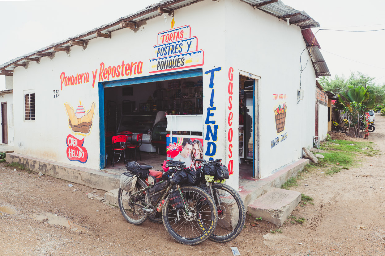
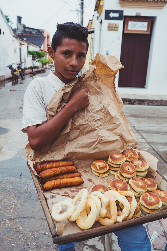
We’re pleased to see that panaderías (bakeries) are common here. The goods are usually fresh and super cheap.
Another short boat trip took us across an arm of the Magdalena to Mompox finally. These small, narrow river ferries are known in the region as ‘Johnsons’, for the brand of outboard motor that they are usually powered with. The crossings usually cost around COP 3,000 (NZ$1.50)
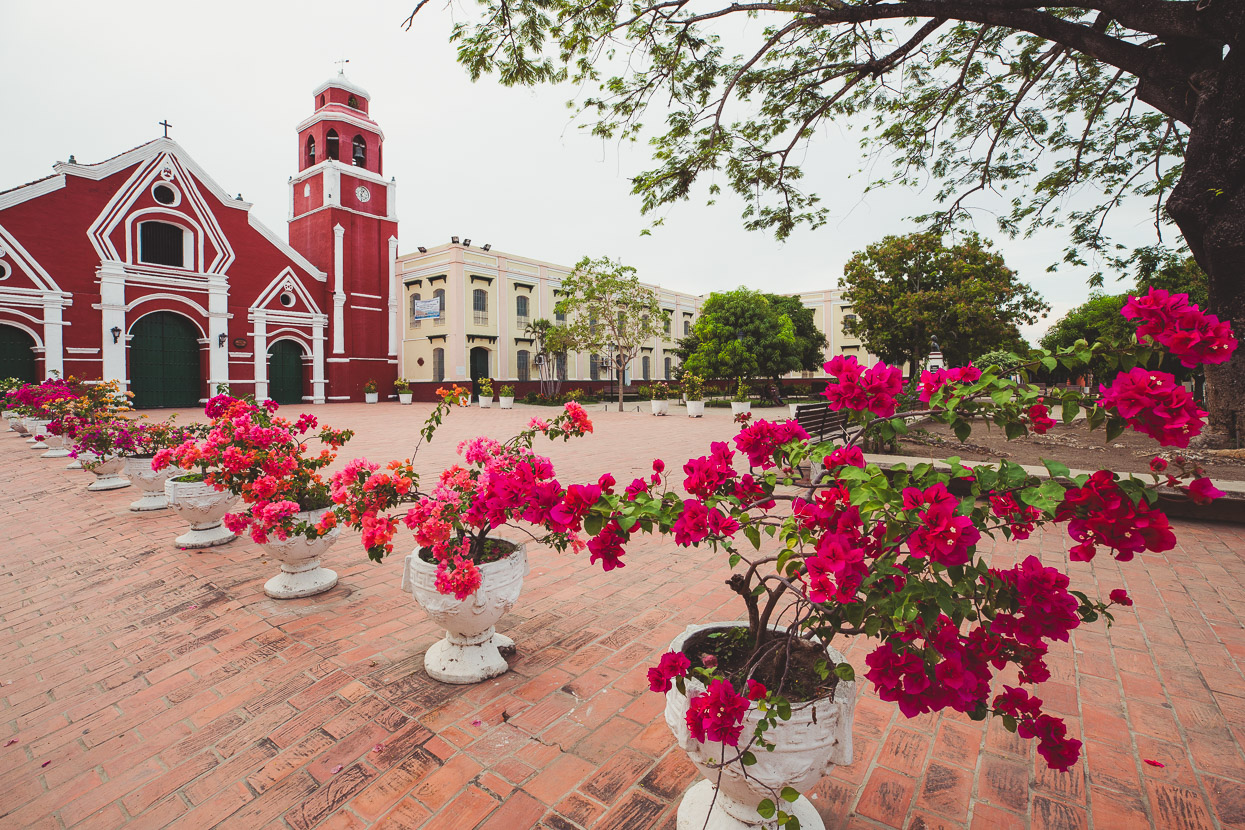
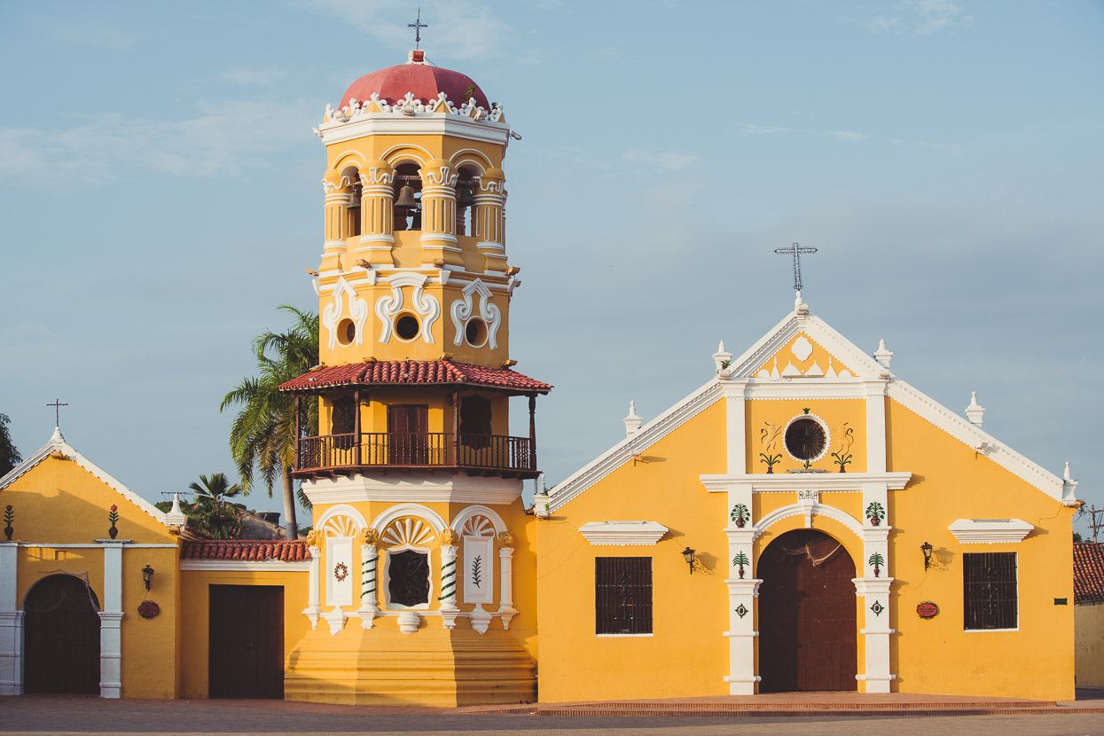
Mompox didn’t disappoint, in fact we liked its cruisy atmosphere so much we took two days off there to relax, wander and catch up with things of an internet nature.
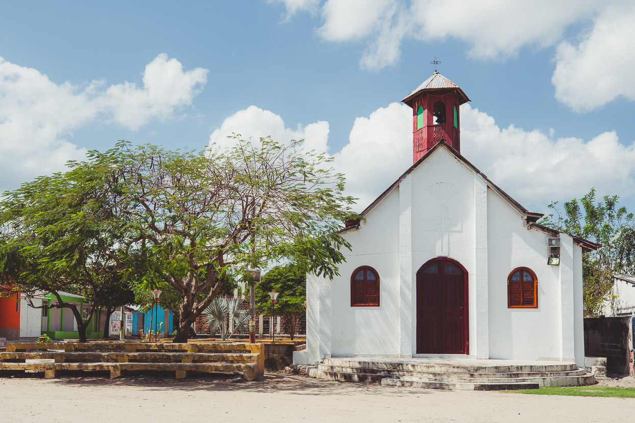
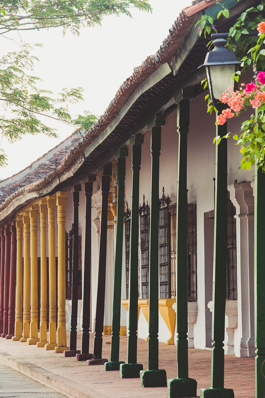
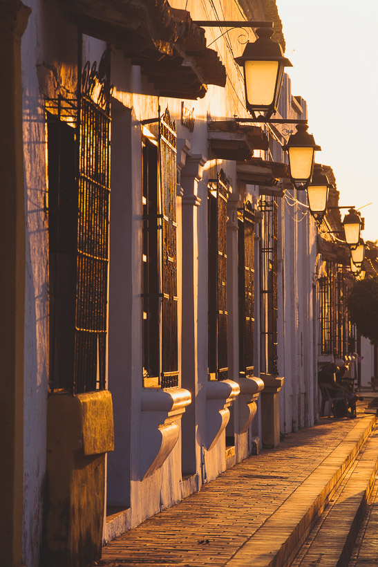
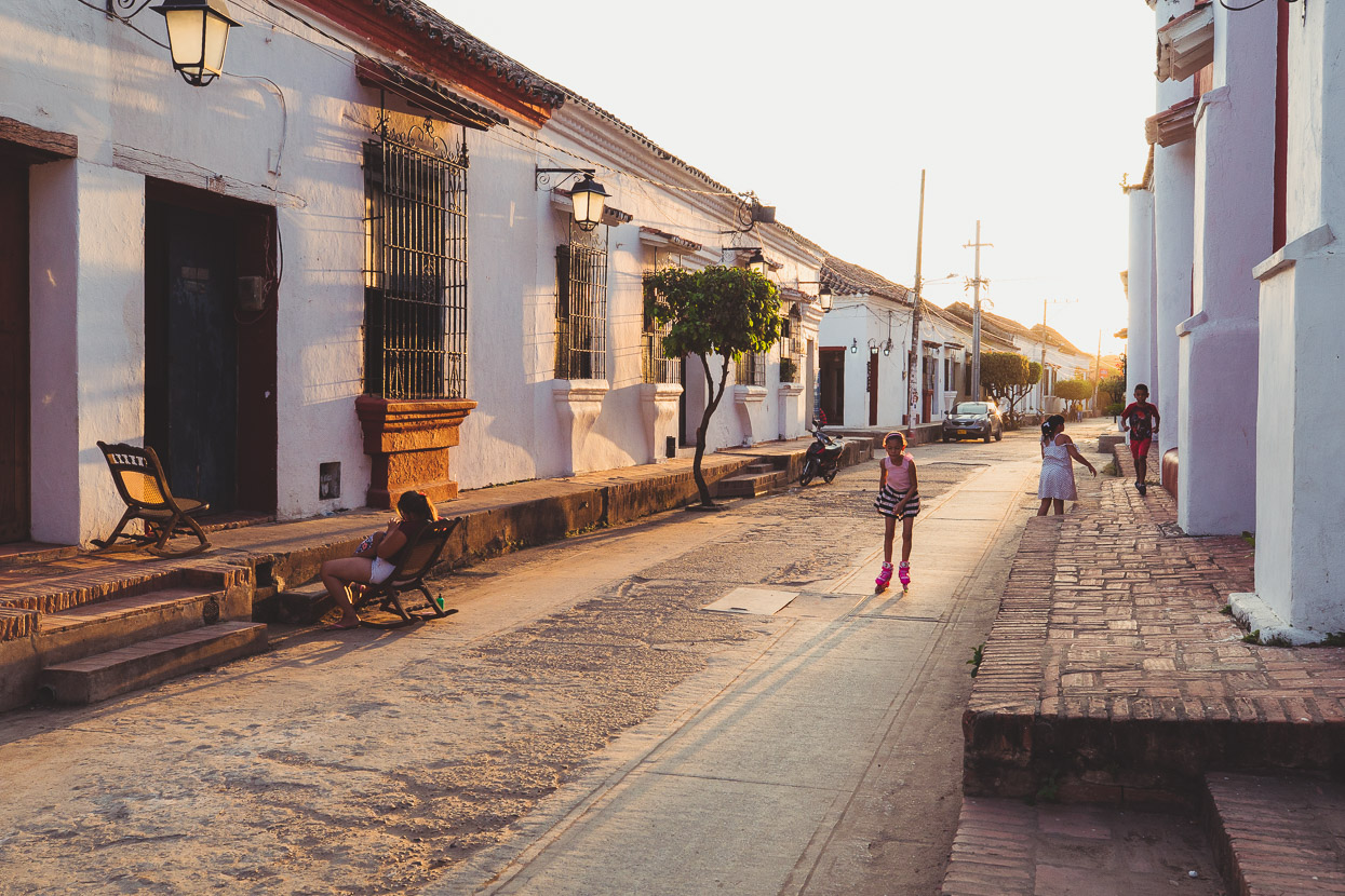
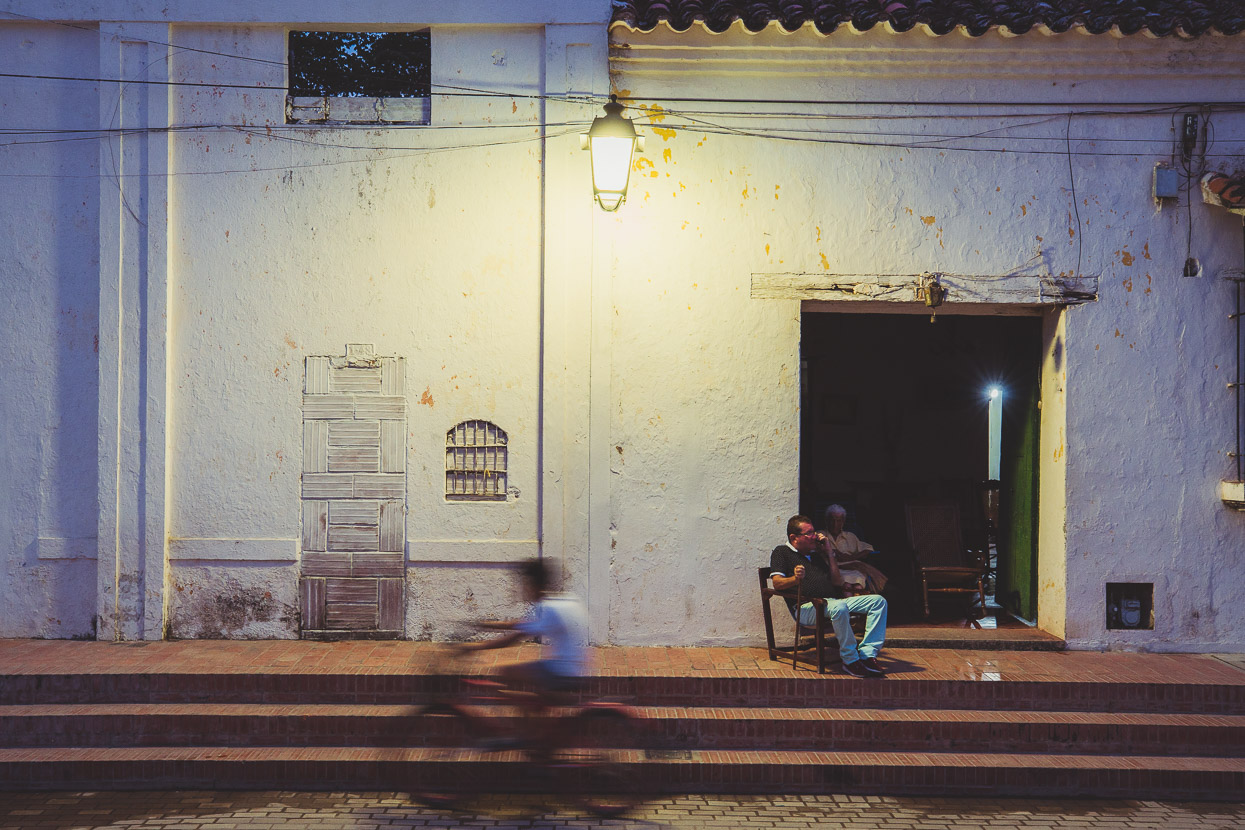
While the churches are the most striking aspect, there is much subtle and interesting to see as you walk the streets. The town for a long time was in a state of decay, but increased Colombian tourism (local and international) since the country has started to emerge from its decades of instability, narco-crime and political violence, has meant quite a lot of restoration.
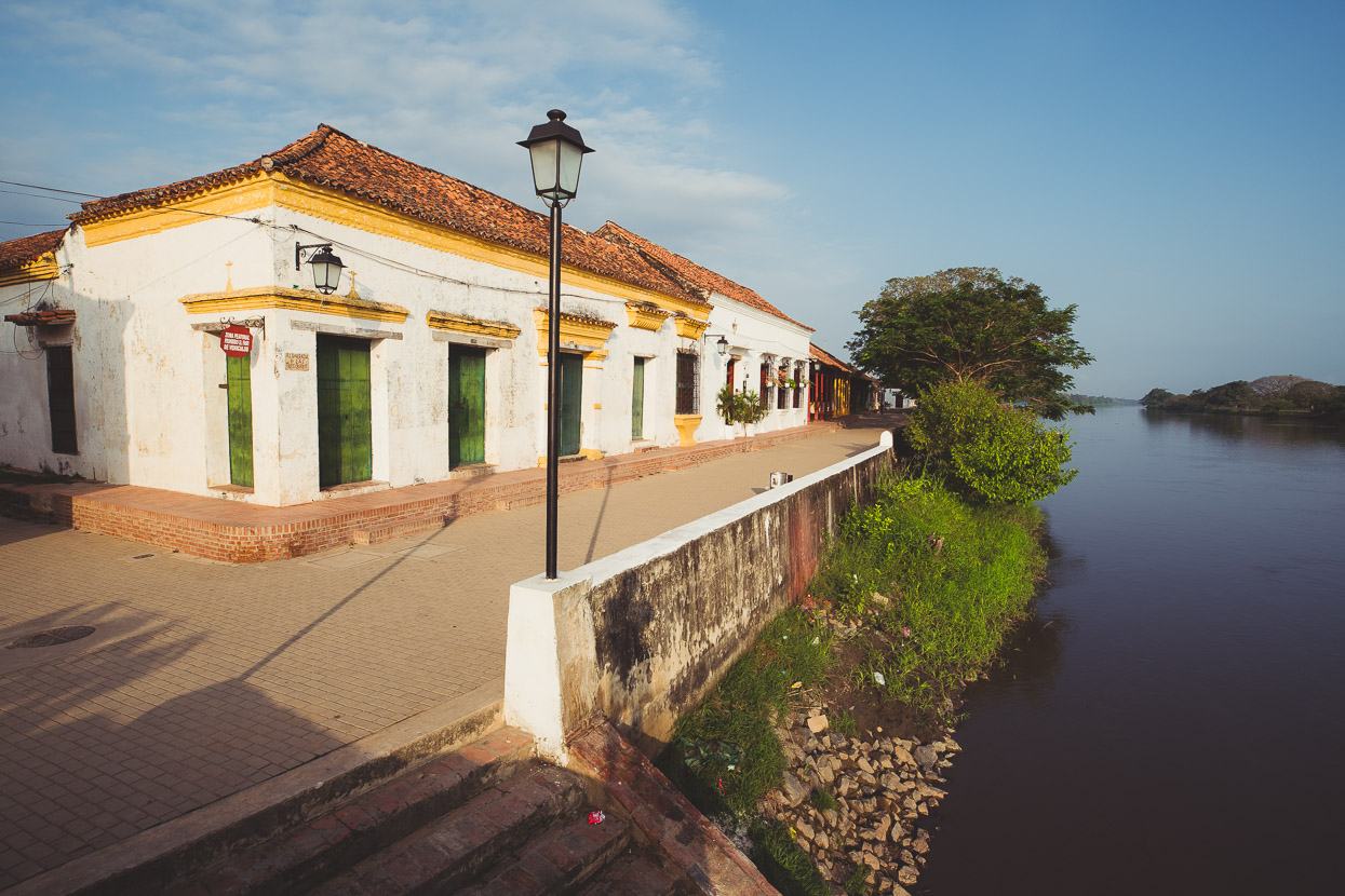
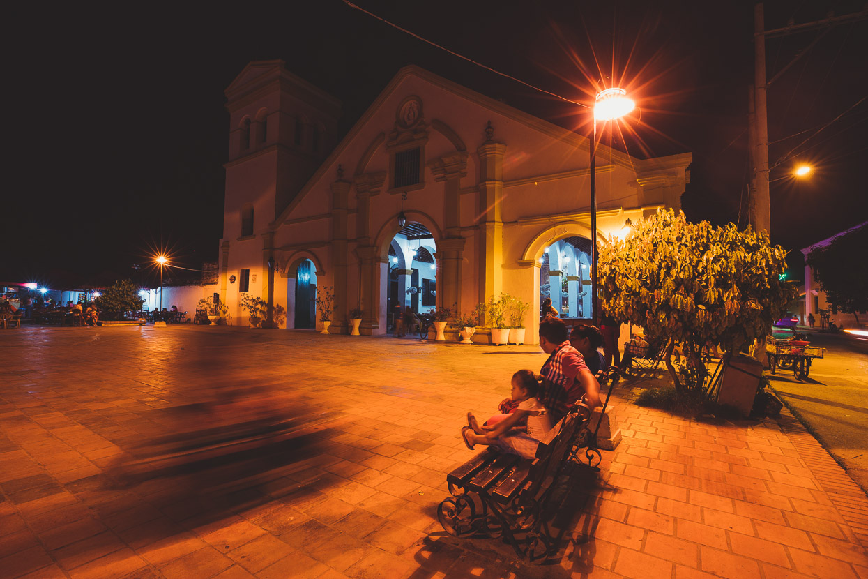
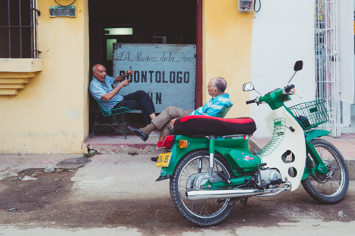
But despite this increase in popularity, Mompox was hardly what you’d call busy. In the early morning and most of the day, the streets are virtually deserted in the old town. It’s too hot to do much, so most locals siesta, or stay indoors and tend to come outside and socialise and eat in the evenings.
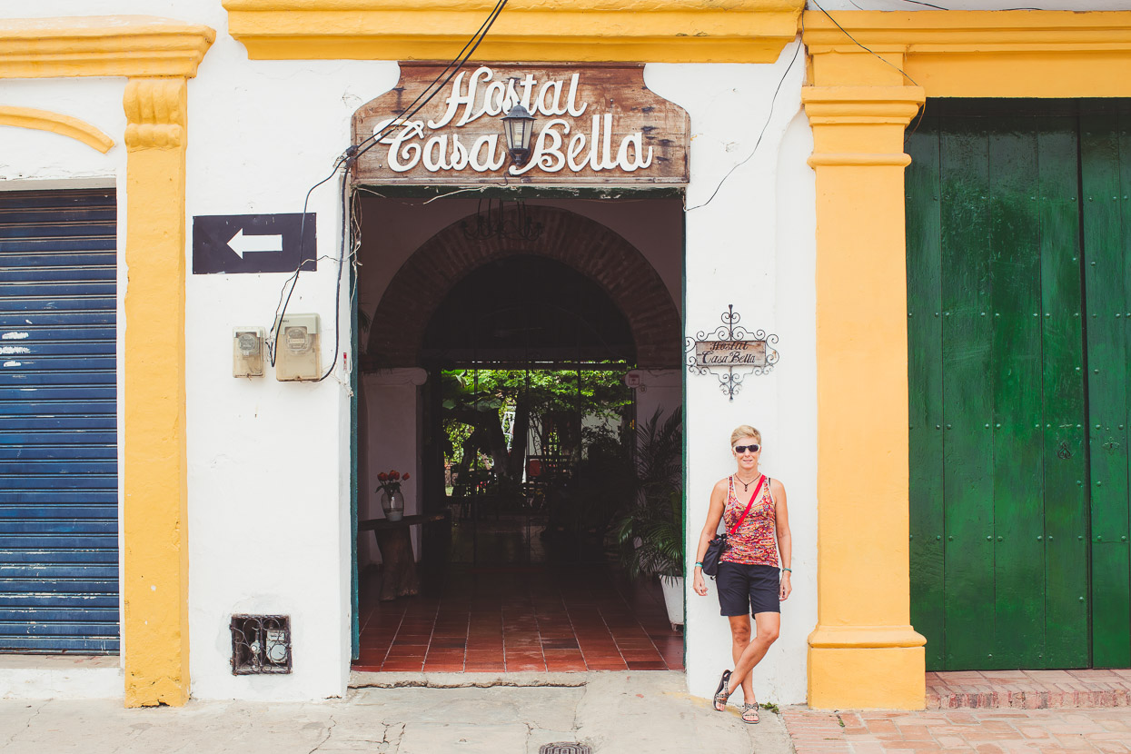
Hostal Casa Bella was a good find. Cheap, cool rooms in a several hundred year old building, surrounding a shady courtyard and with endless coffee. The hammocks would have been occupied 24/7 by us if it weren’t for the mosquitoes ravaging our backsides.

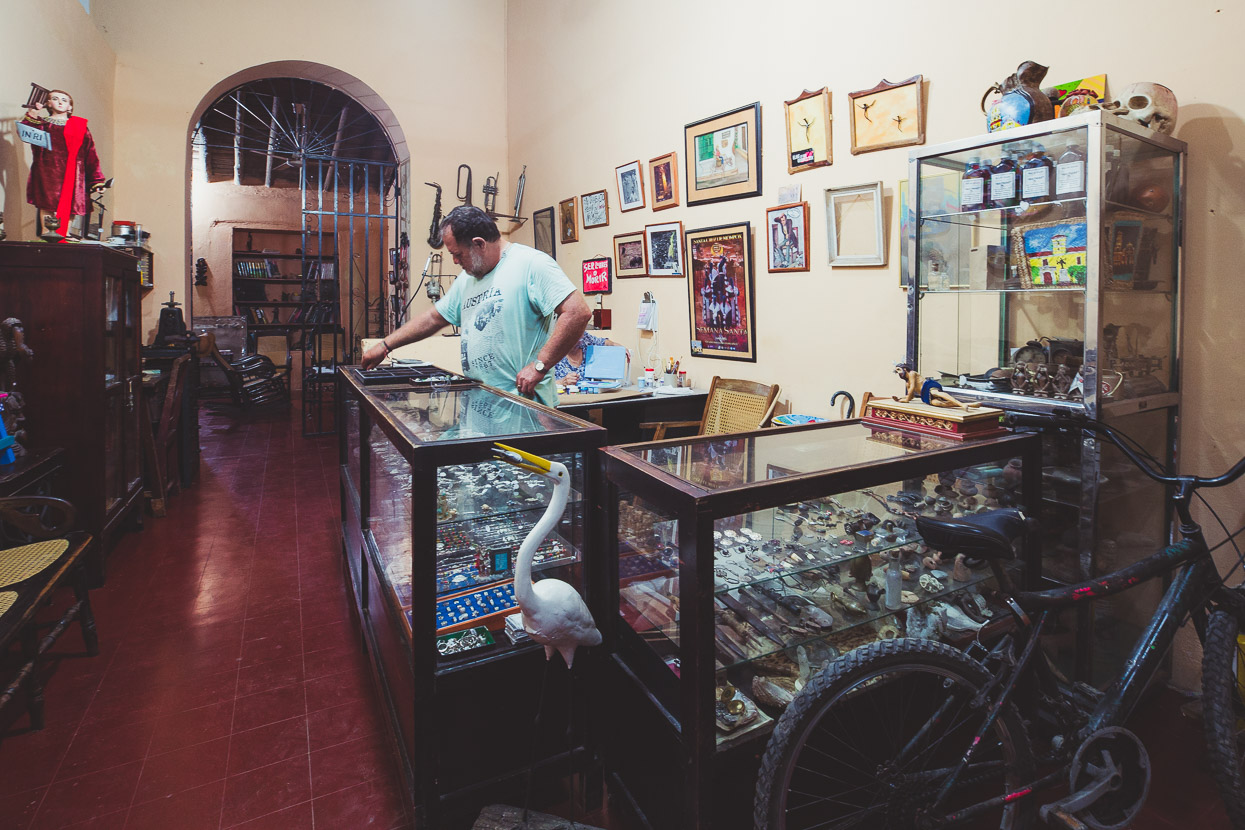
This shop had a display cabinet full of artefacts, both pre-Columbian and Spanish-colonial dredged from the river when its level drops well below normal. At times, the river’s been so high it’s flooded the town.
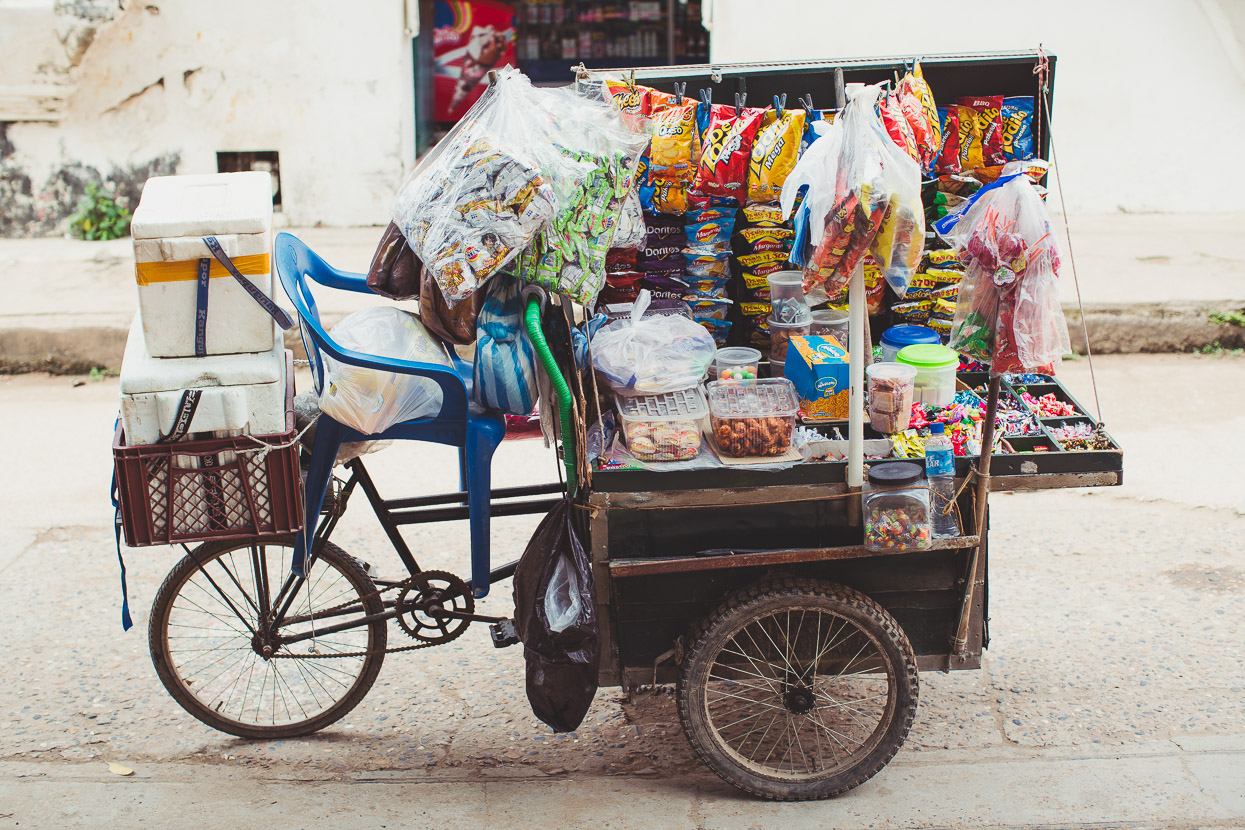
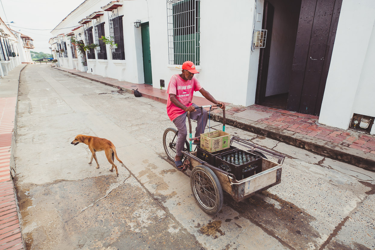
Mobile tienda.
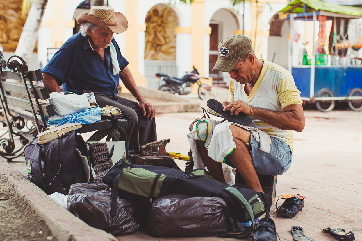
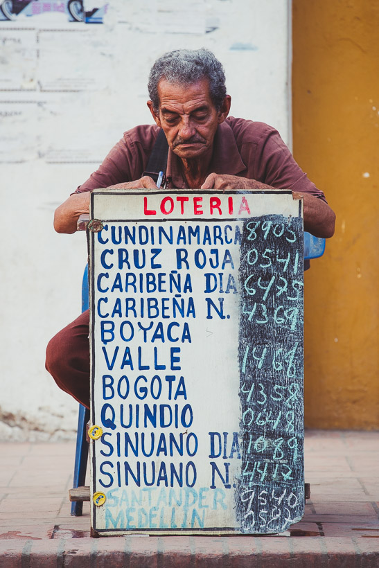
The central plaza is the place to go if you want your shoes fixed…
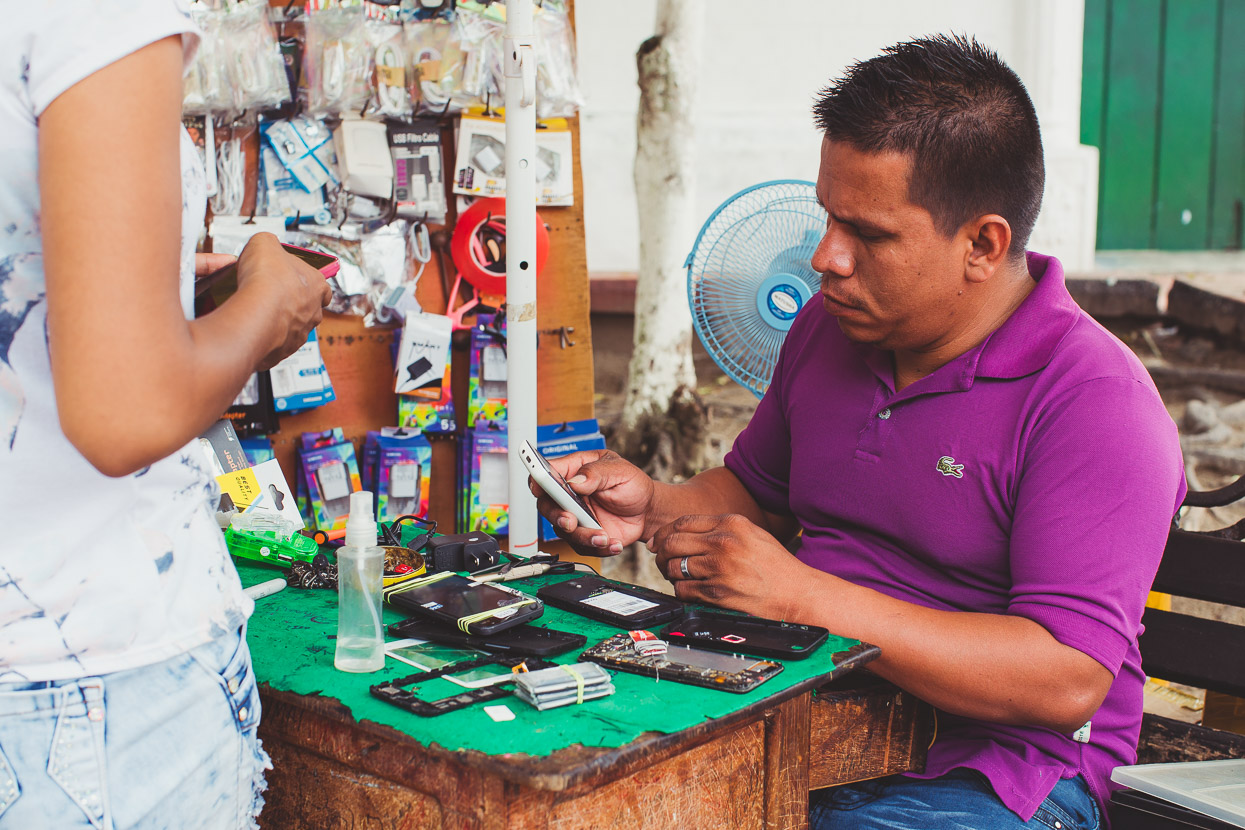
…or your mobile phone.
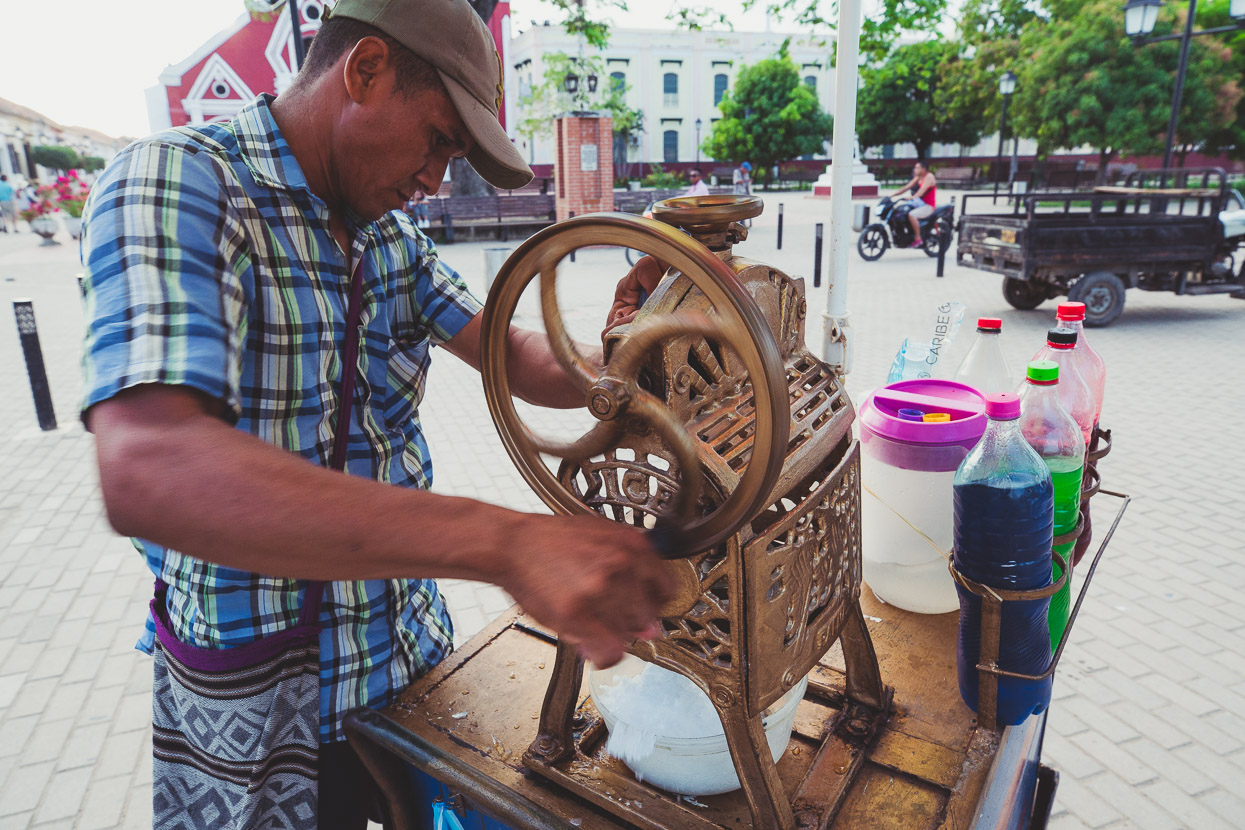
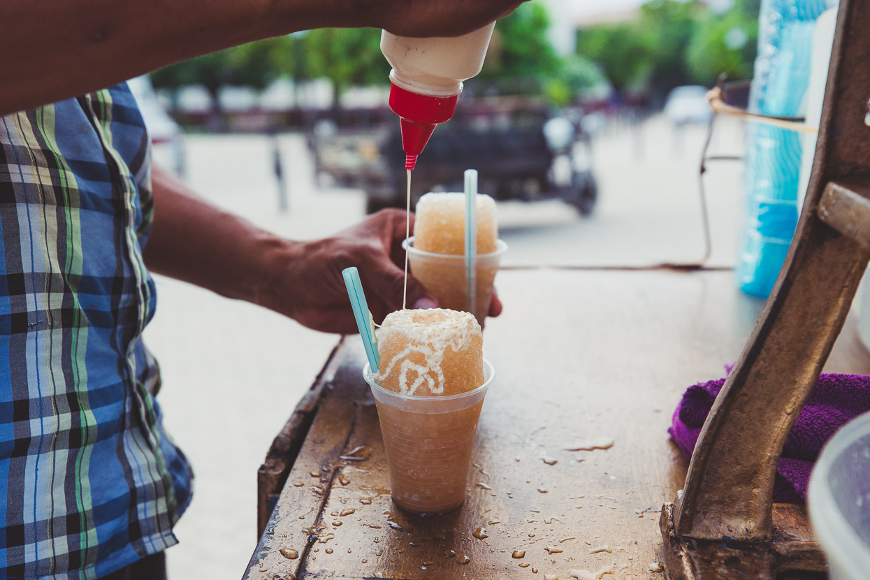
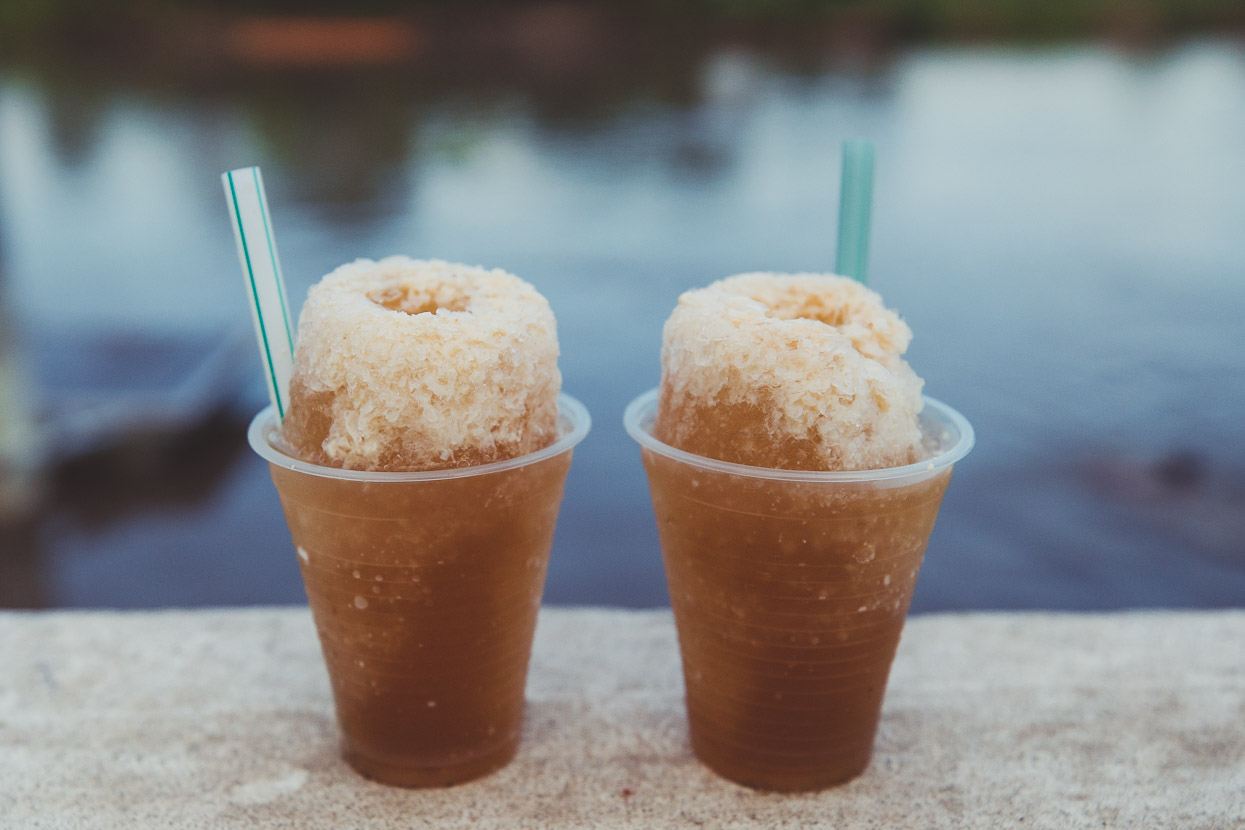
This guys makes Colombian-style slushies, first grinding shards of ice off a solid block with his hand operated machine and then adding flavouring and condensed milk.
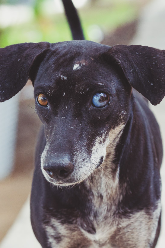
As usual random dogs attached themselves to me while I wandered around on my photo walks. I felt sorry for this cute fellow below with the bung eye. After getting really badly flea bitten in Cuba I try to keep my distance a bit more now!
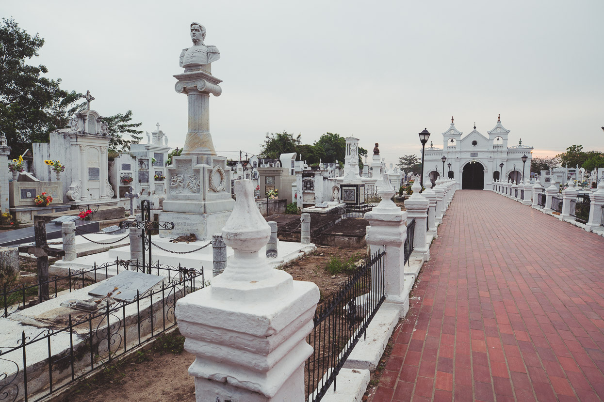
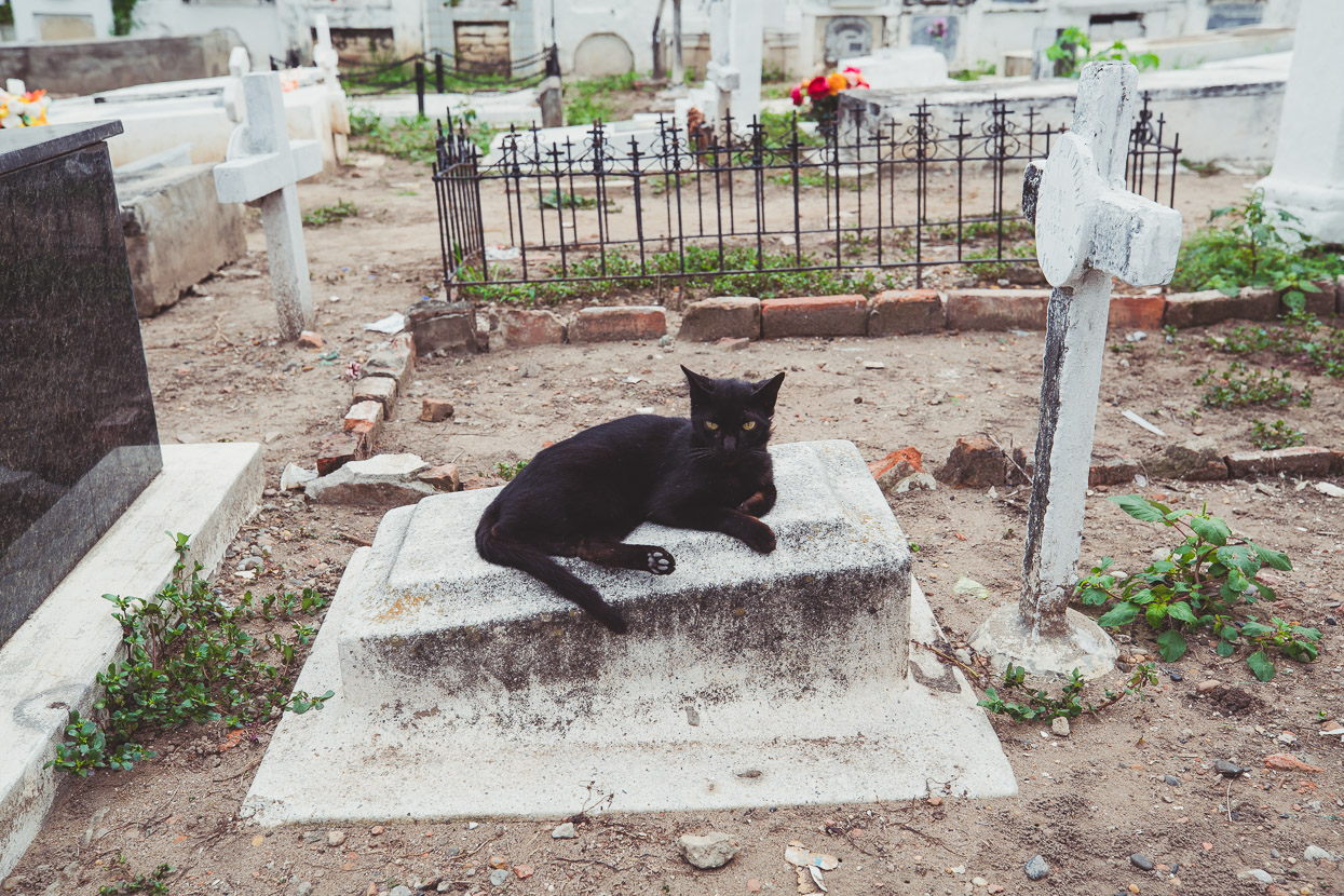
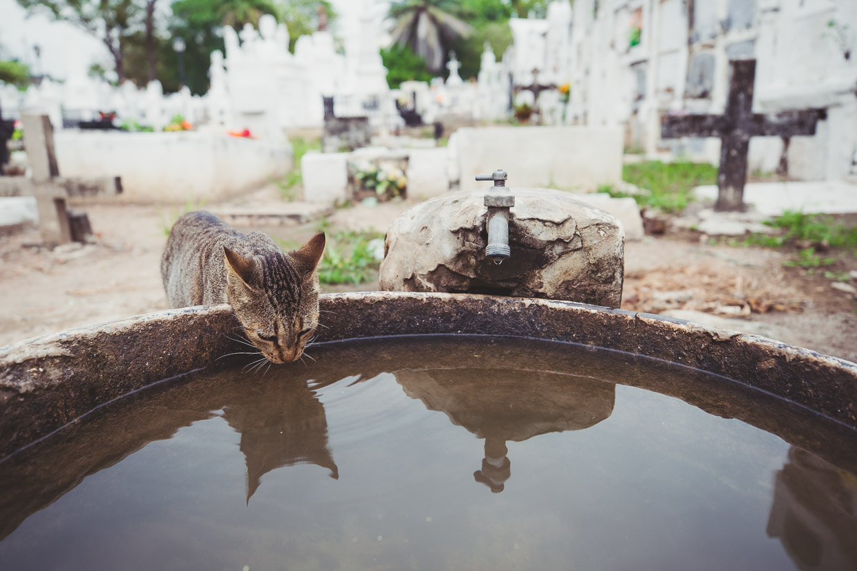
We’d heard the cemetery was worth checking out, but the cats were an unexpected bonus… quite a large population call the cemetery home, lounging by day on the warm gravestones. Quite entertaining in an otherwise sombre place.
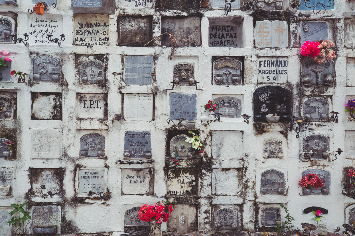
For economy, as is common in some Latin American cemeteries, ‘tower blocks’ hold the remains of many people, each ‘door’ decorated as finances or imagination of the family allows.
Do you enjoy our blog content? Find it useful? We love it when people shout us a beer or contribute to our ongoing expenses!
Creating content for this site – as much as we love it – is time consuming and adds to travel costs. Every little bit helps, and your contributions motivate us to work on more bicycle travel-related content. Up coming: camera kit and photography work flow.
Thanks to Biomaxa, Revelate Designs, Kathmandu, Hope Technology and Pureflow for supporting Alaska to Argentina.


Awesome post, you guys are amazing! Love it.
Thanks Maree and for the donation also 🙂
Great all around. I’m astounded at the progress Colombia has made since I first visited in 1992. Back then the guerillas were a pervasive threat, and even in Bogota there was a soldier posted at virtually every corner.
I can’t tell you how much I enjoy these travelogues, & admire you – it is a wonderful day when one comes through – you are itching from the dogs & I’m itching to read more ! A great geography lesson for me as I try to follow you on google maps. Have you lost weight ? Please stay safe & keep up the writing. My utmost admiration of you both – you’re truly amazing !
Thanks so much Madge – really glad you are enjoying the posts. I’m trying to get us up to date 😉 It’s about 3 posts behind at the moment! Plenty more reading for you!
Adios, Mark and Hana.
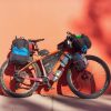
Thanks for fantastic photos. I have a question: what is the blue thing you have on your handlebar next to your GPS?
Hi Stefan – it’s a Quadlock mount for mobile phone. We used them everyday from Alaska to Guatemala but then realised the sun was starting to destroy the phone screens and the glue that holds them on. We always use our Garmin for day-to-day use now and only put the phone on the bars now and then (navigating in a city for example).
Amazing ride/story. Love reading about it.